One Last Fall Gore Traverse

Welp, I think we all knew the snow was coming, so in an attempt to get up in the Gores one last time without dealing with the snow, I wrangled together Dylan, Chris, & J for one last day. The one last area of the Gores I had really not visited was the Peaks X, Y, & Z area to the northwest of the North Boulder Creek drainage. There was also Peak W between Peak X and East Partner, but that would wait for another day.

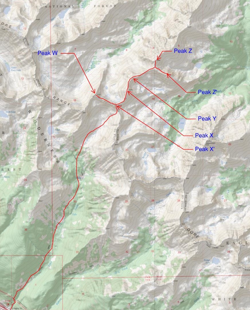
Map of the approach up Pitkin Creek to access Peaks X, Y, Z, & friends

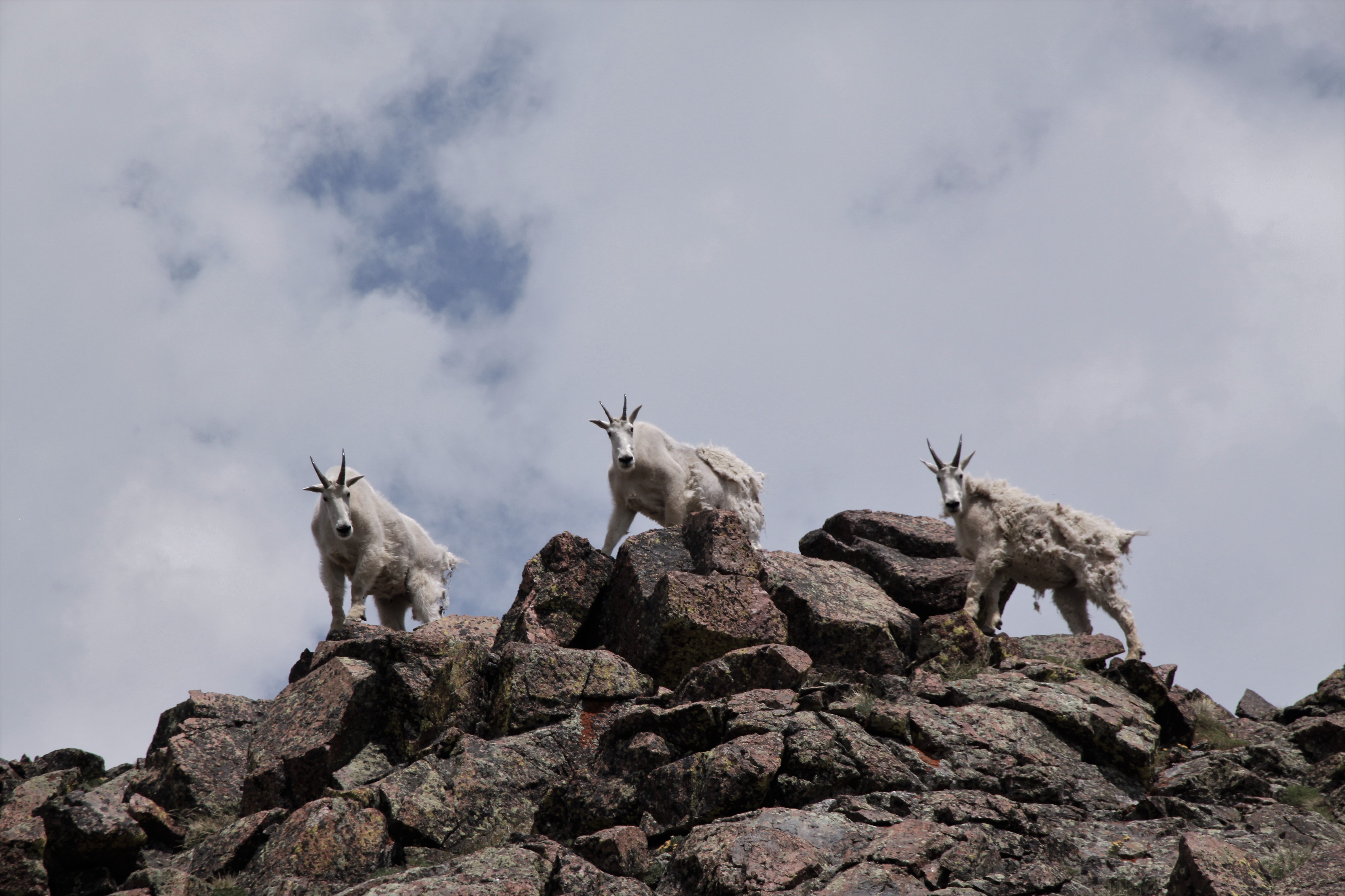
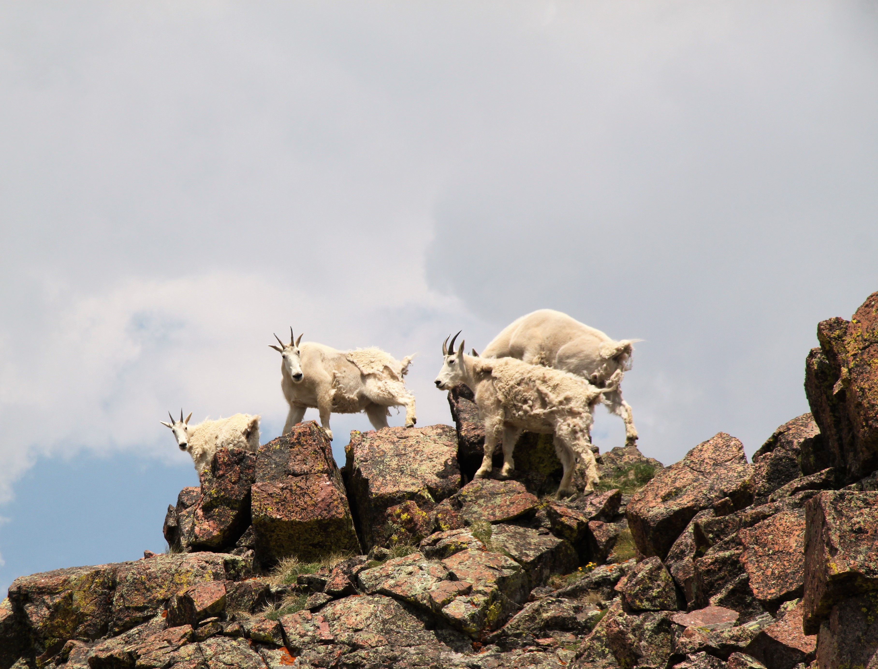
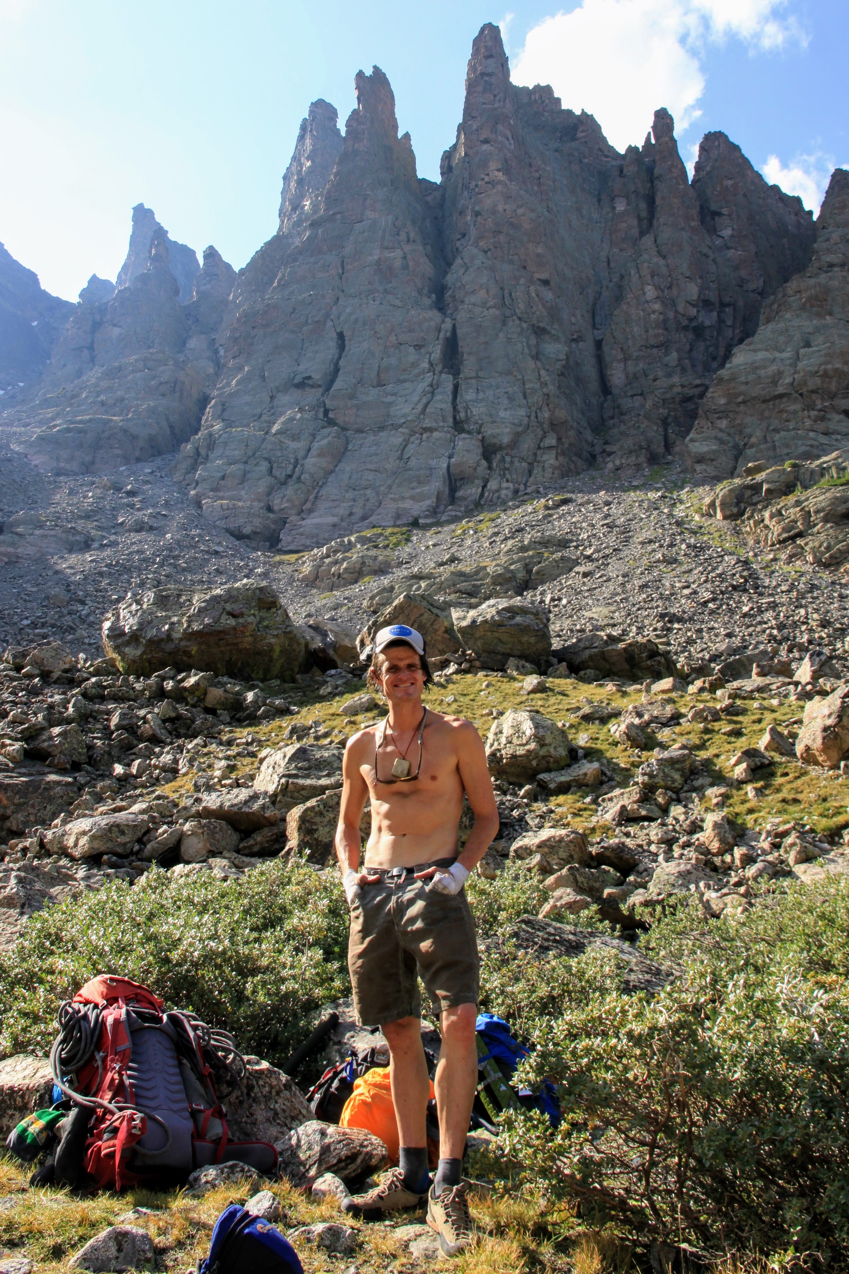
J, Dylan, & I had actually never ventured off the Pitkin Creek trail to the northeast to access Usable Pass, so this was all a real treat. Chris overslept his alarm and missed our departure at the TH, but I told him to just catch up as we were just steadily meandering up the trail (partially due to Dylan’s super late night of a substantial quantity of beer and Taco Bell – ah, 25 year olds). After a semi-close encounter with a black bear on the turn-off, we made our way up into the beautiful basin below East Partner’s east slopes and up to Usable Pass in the steadily increasing wind.

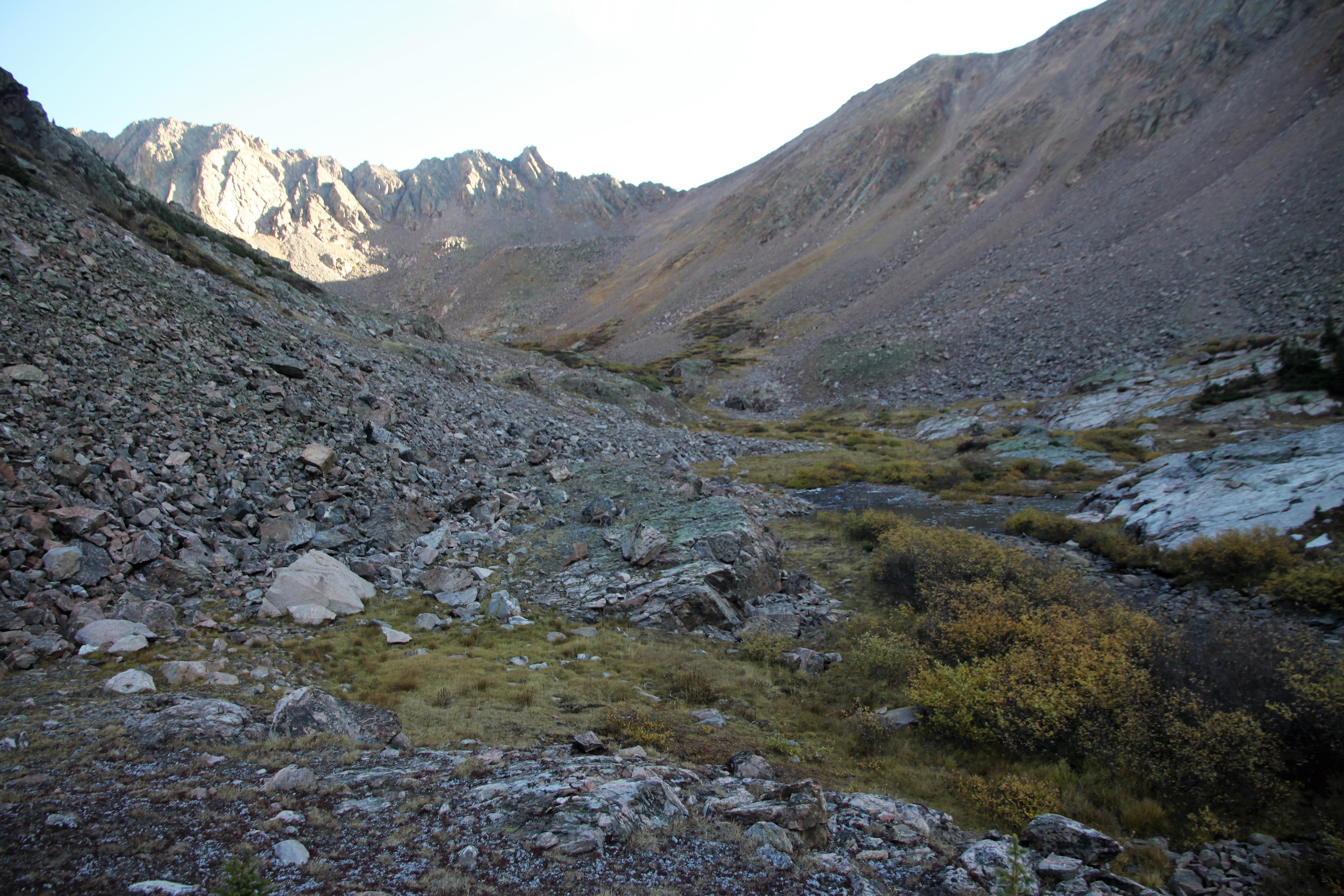
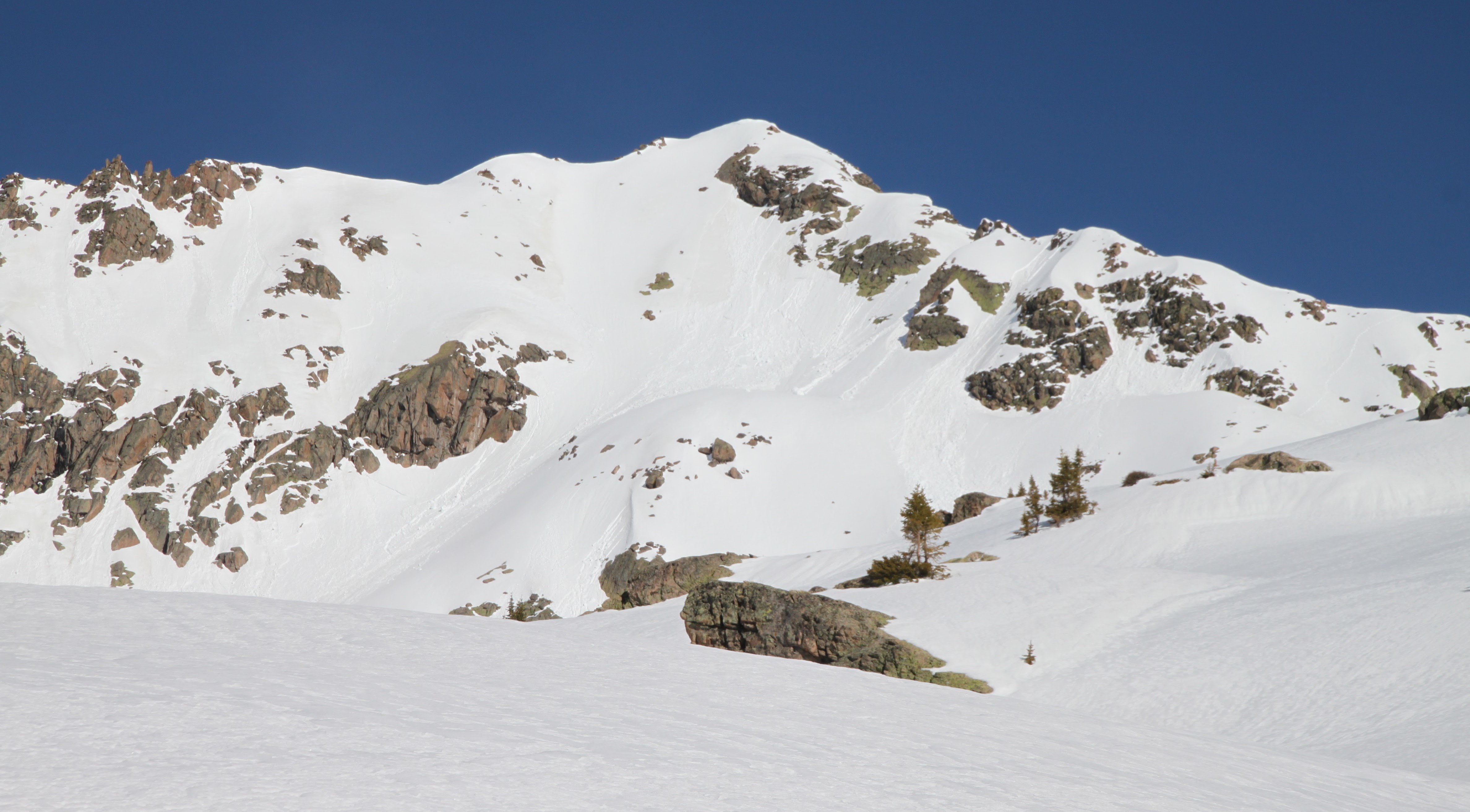
Looking up the basin to Usable Pass and Peak X’

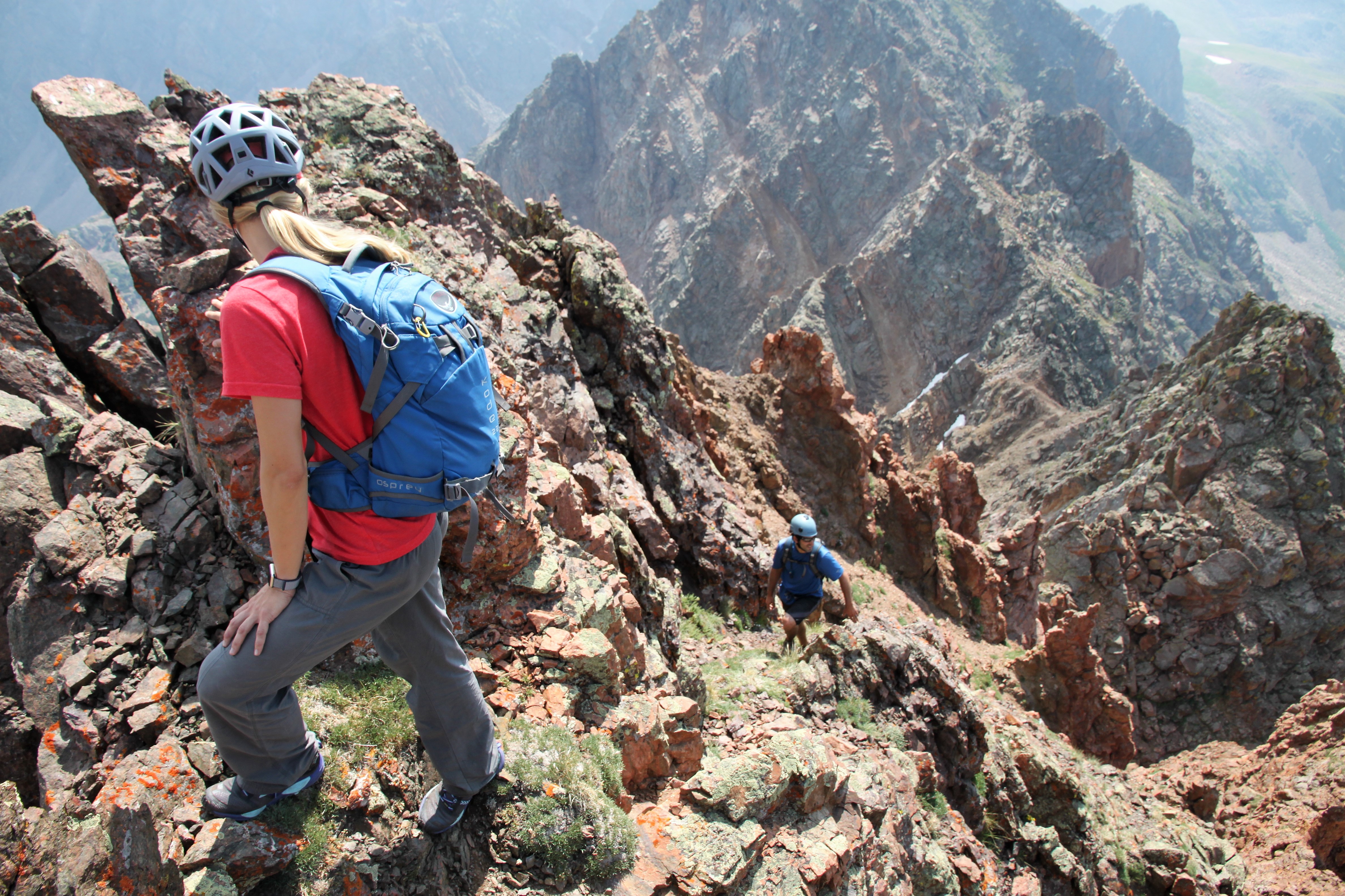
The wind was whipping and chilly at Usable Pass, but the sun was warming things up and we pressed on up the southeast ridge of Peak X’.

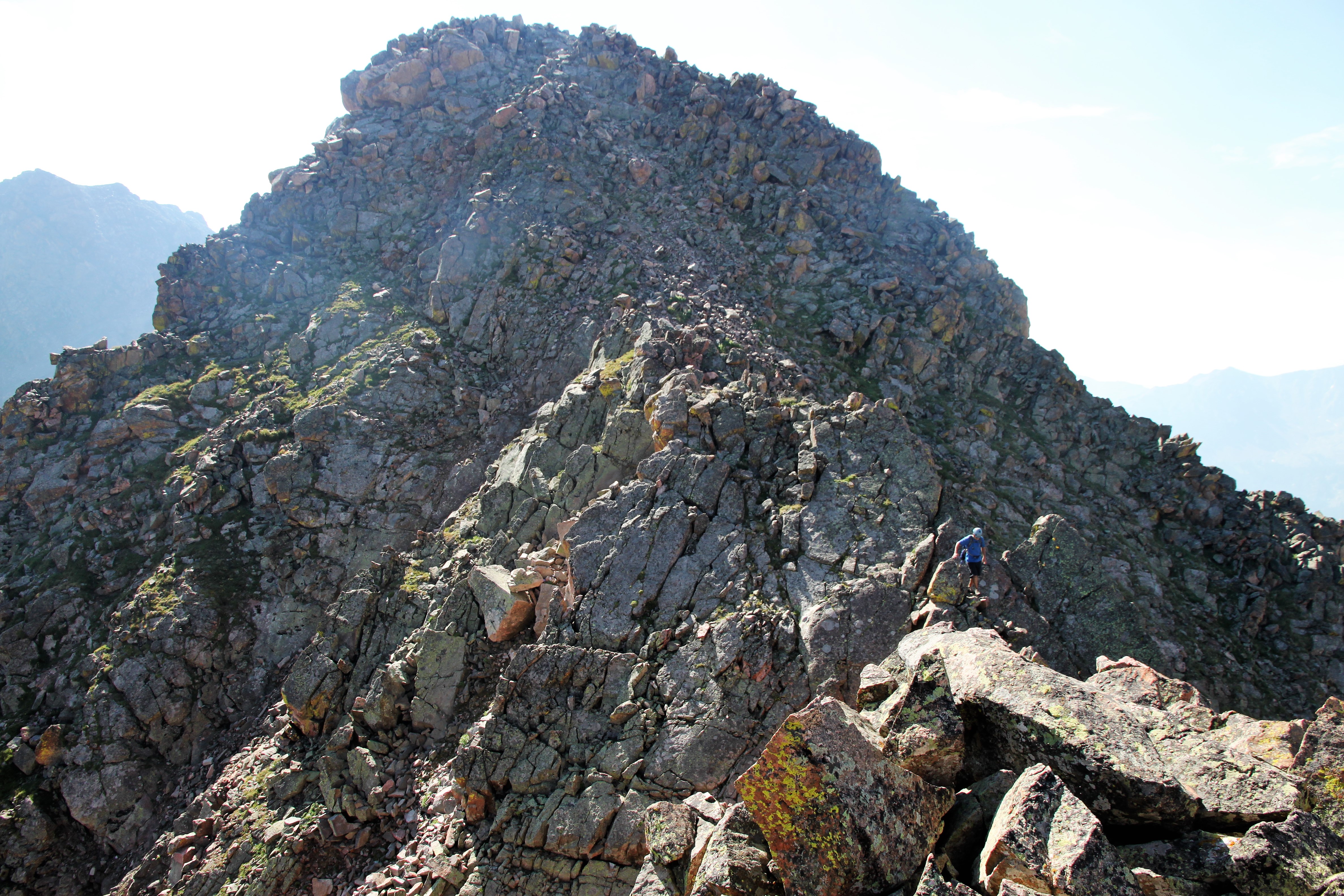
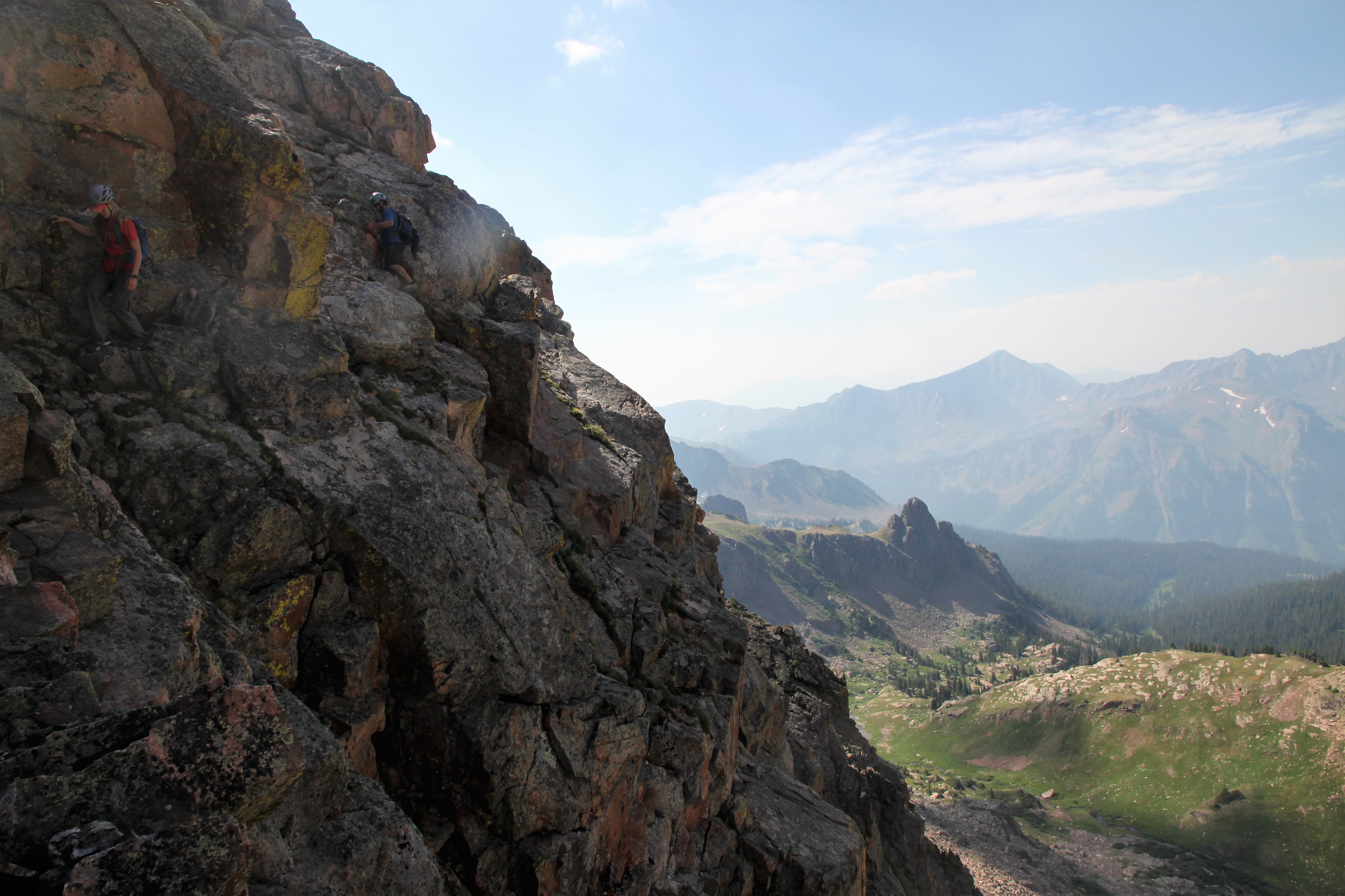
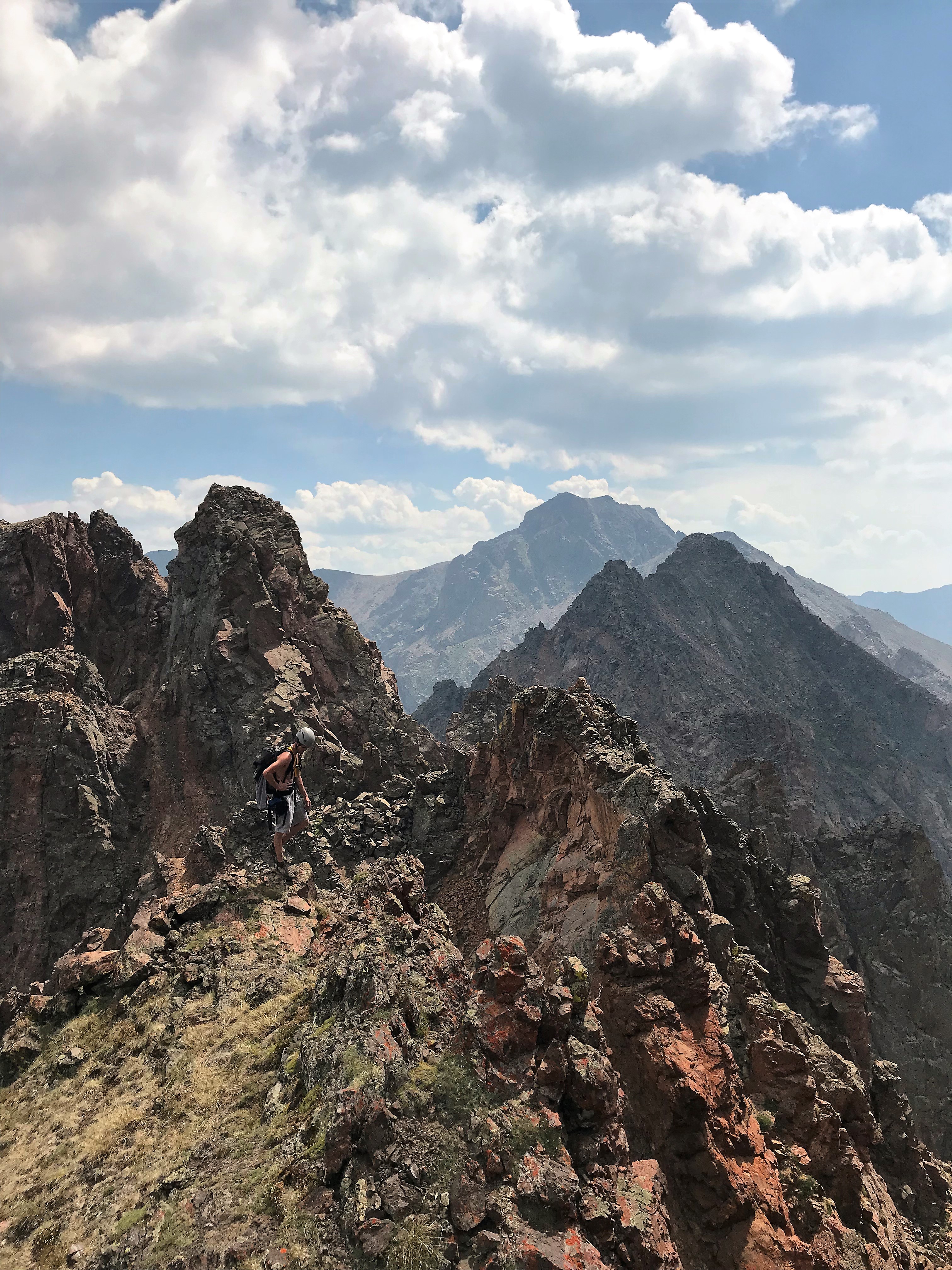
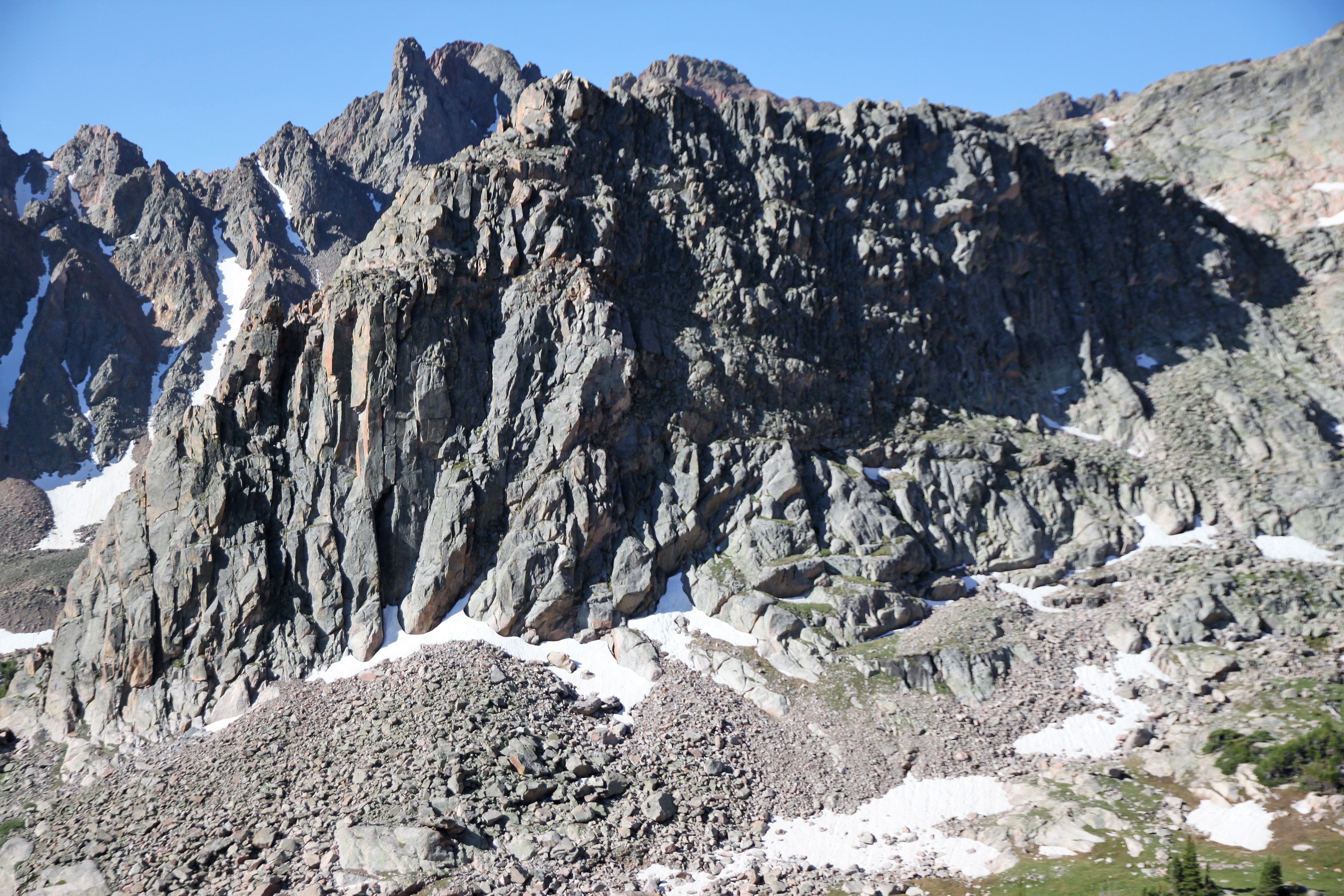
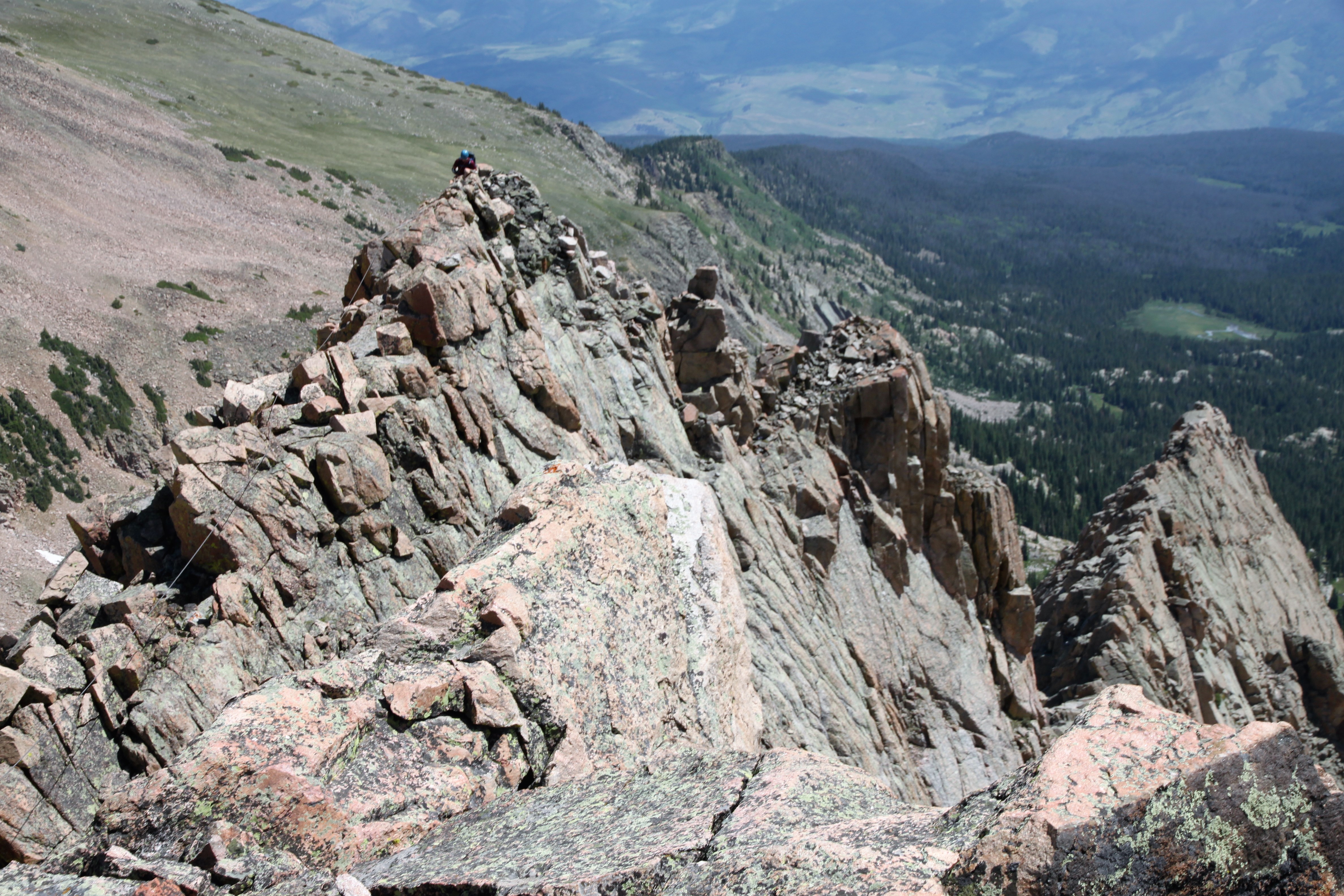
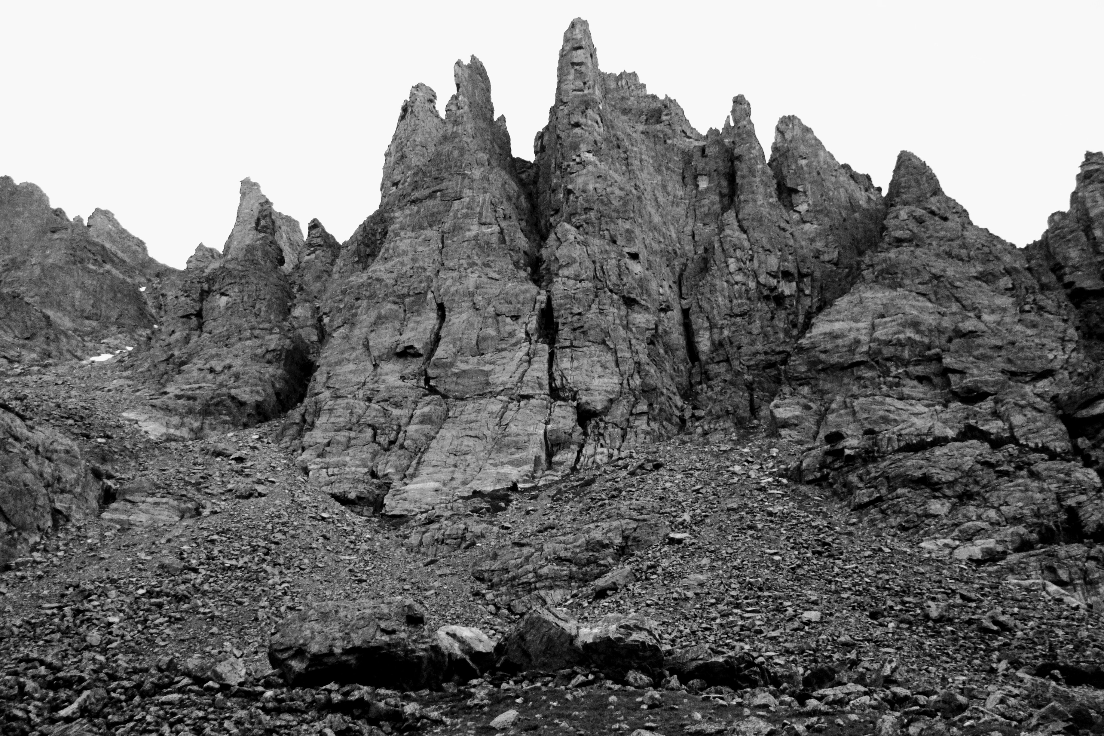
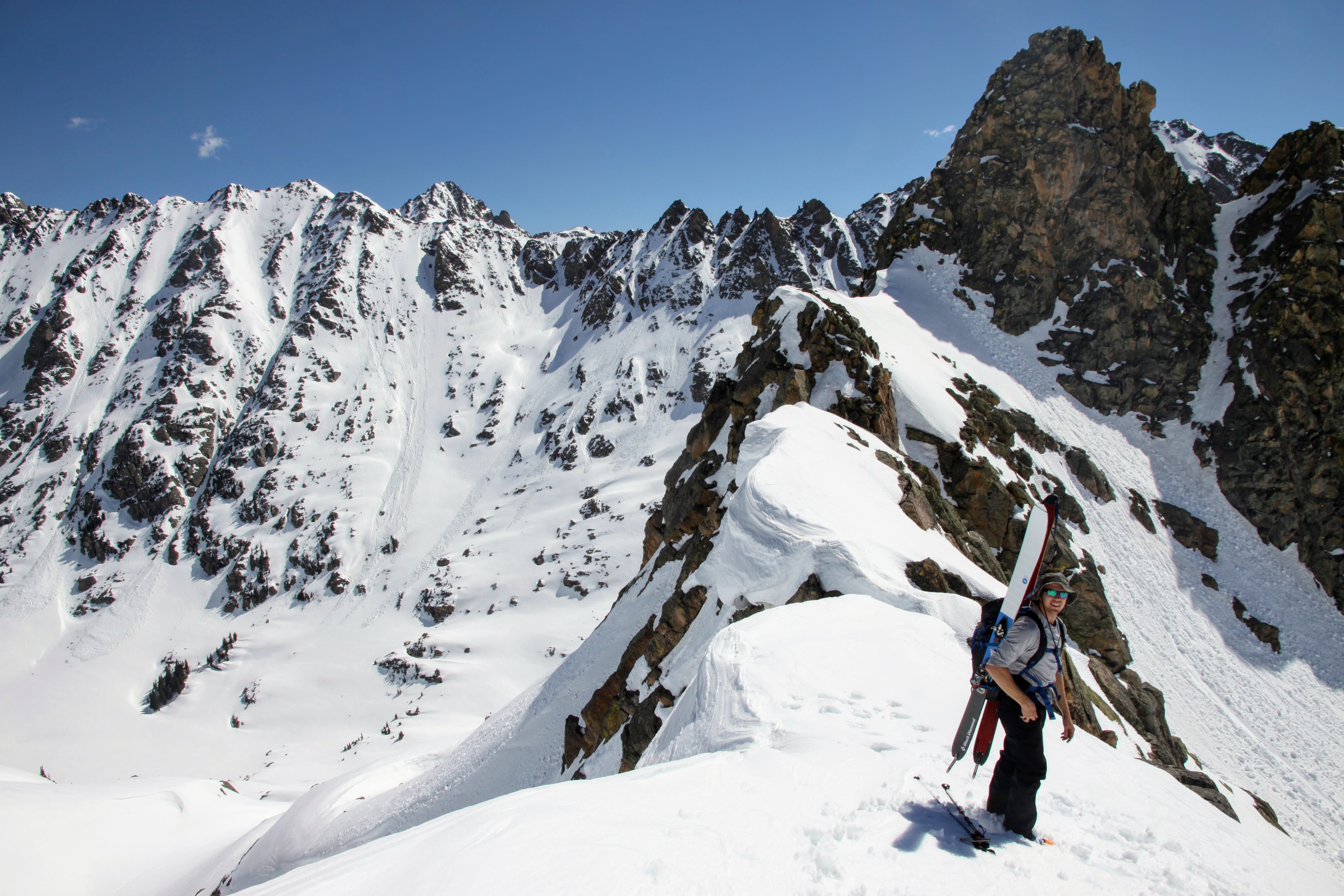
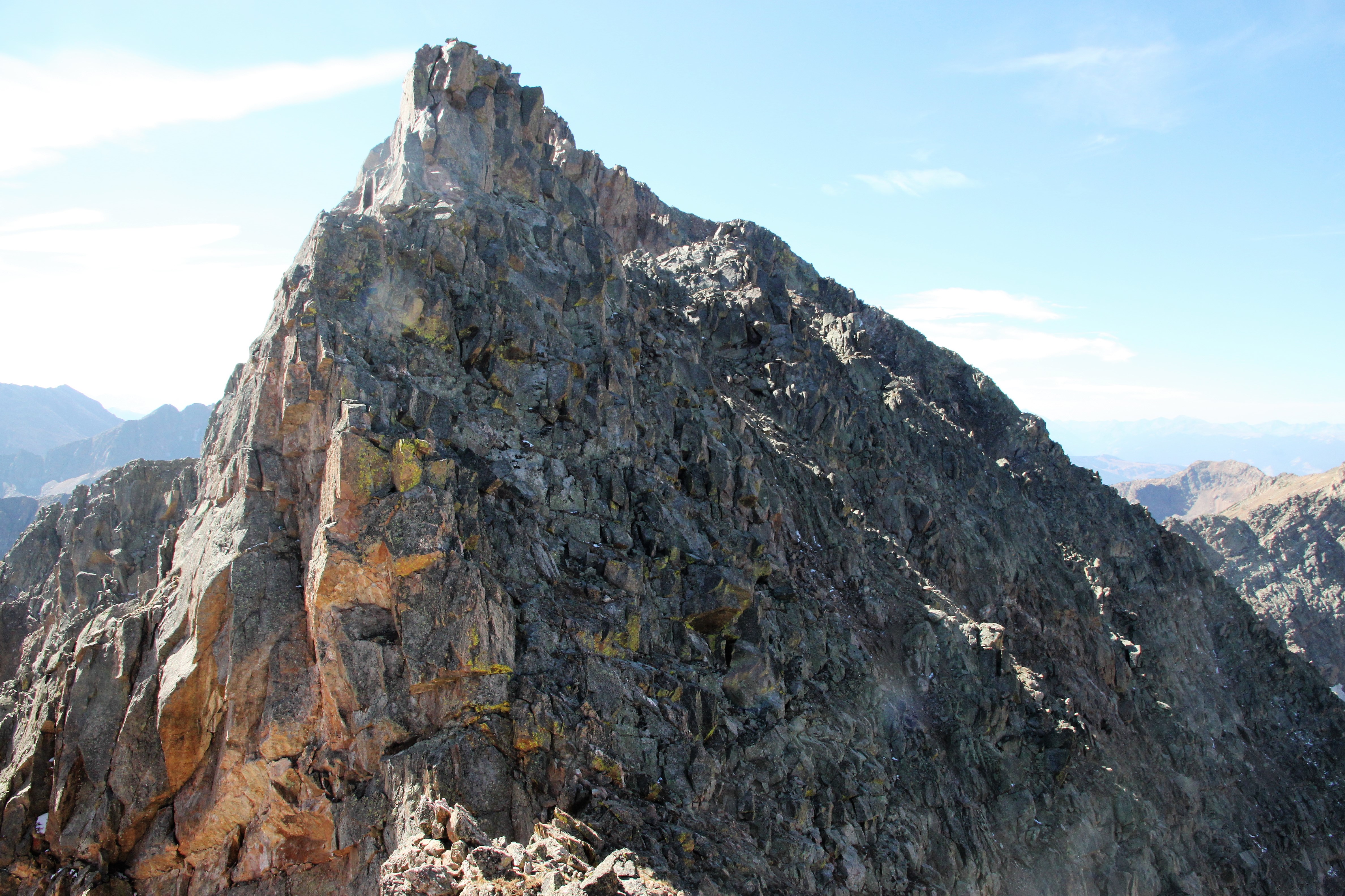
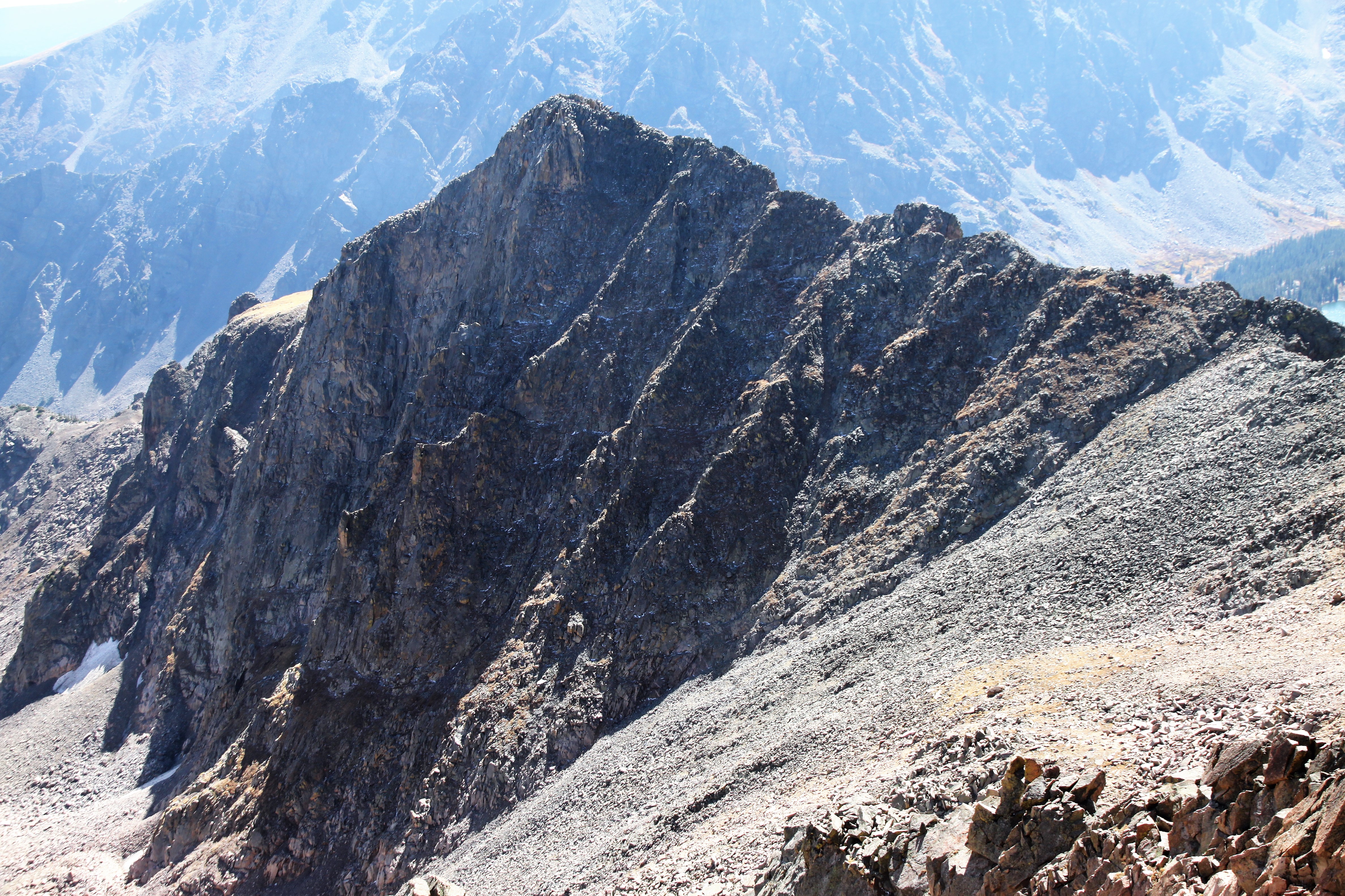
Scrambling up the southeast ridge of Peak X’ with Vista Peak in the background
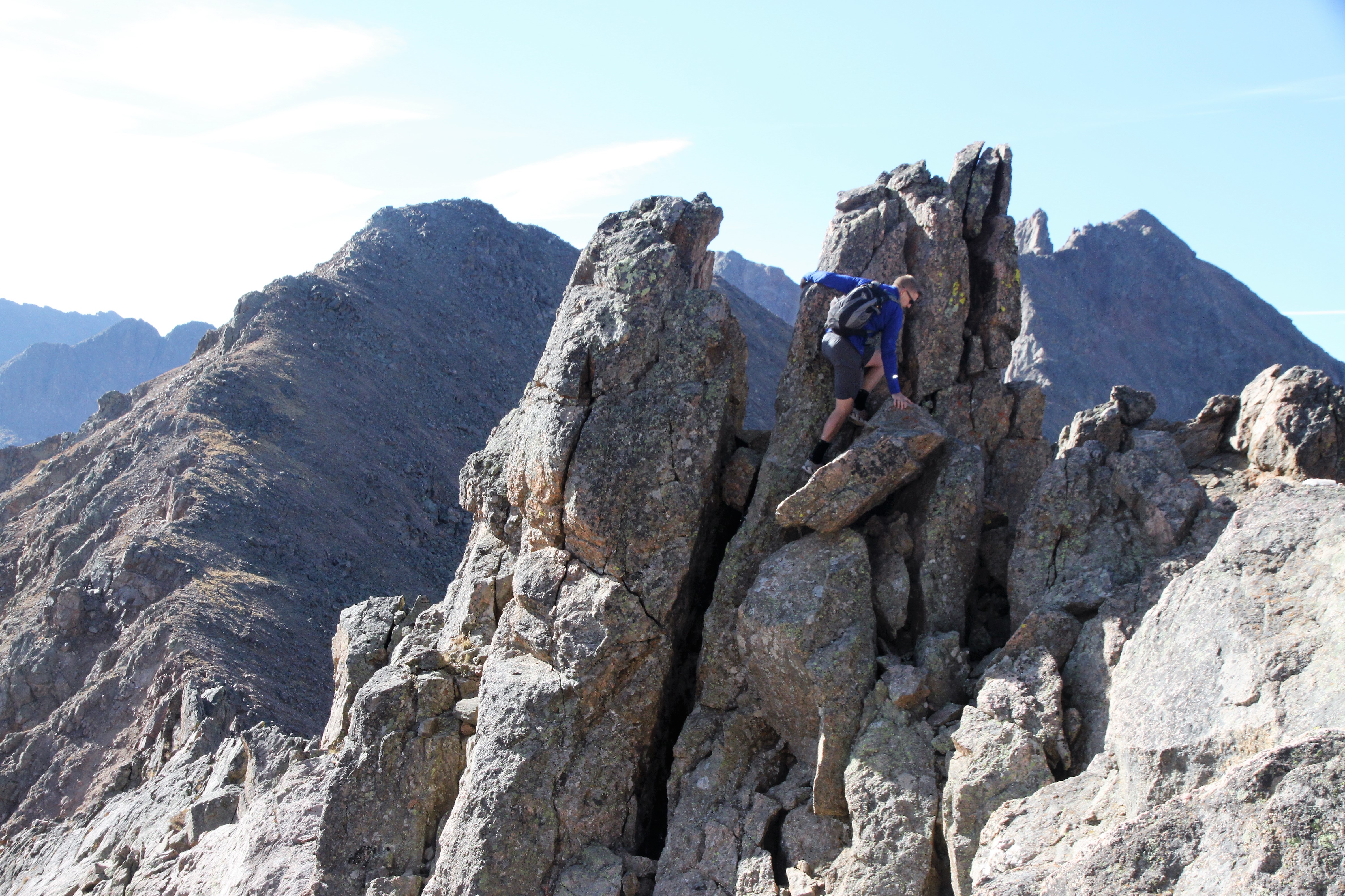
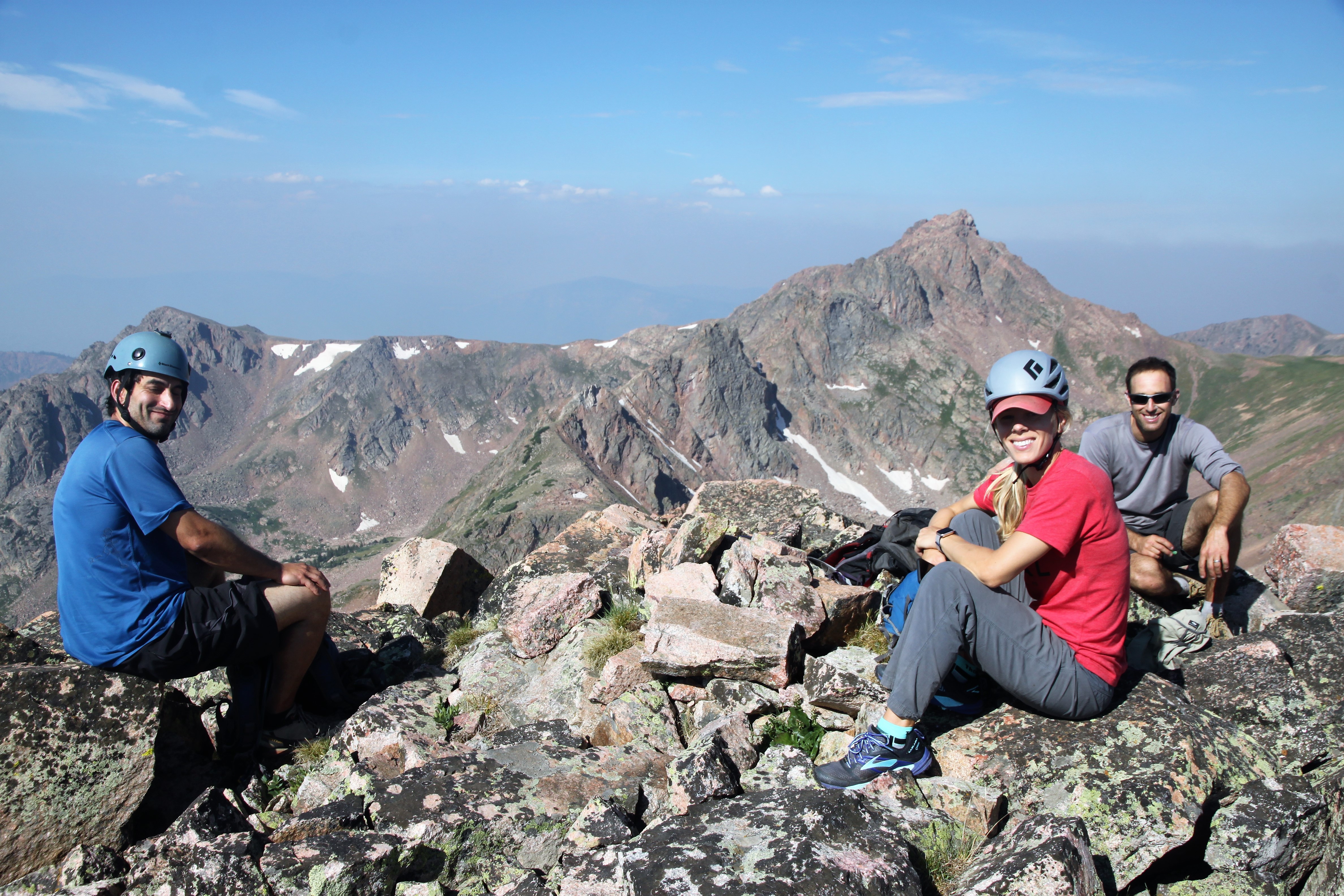
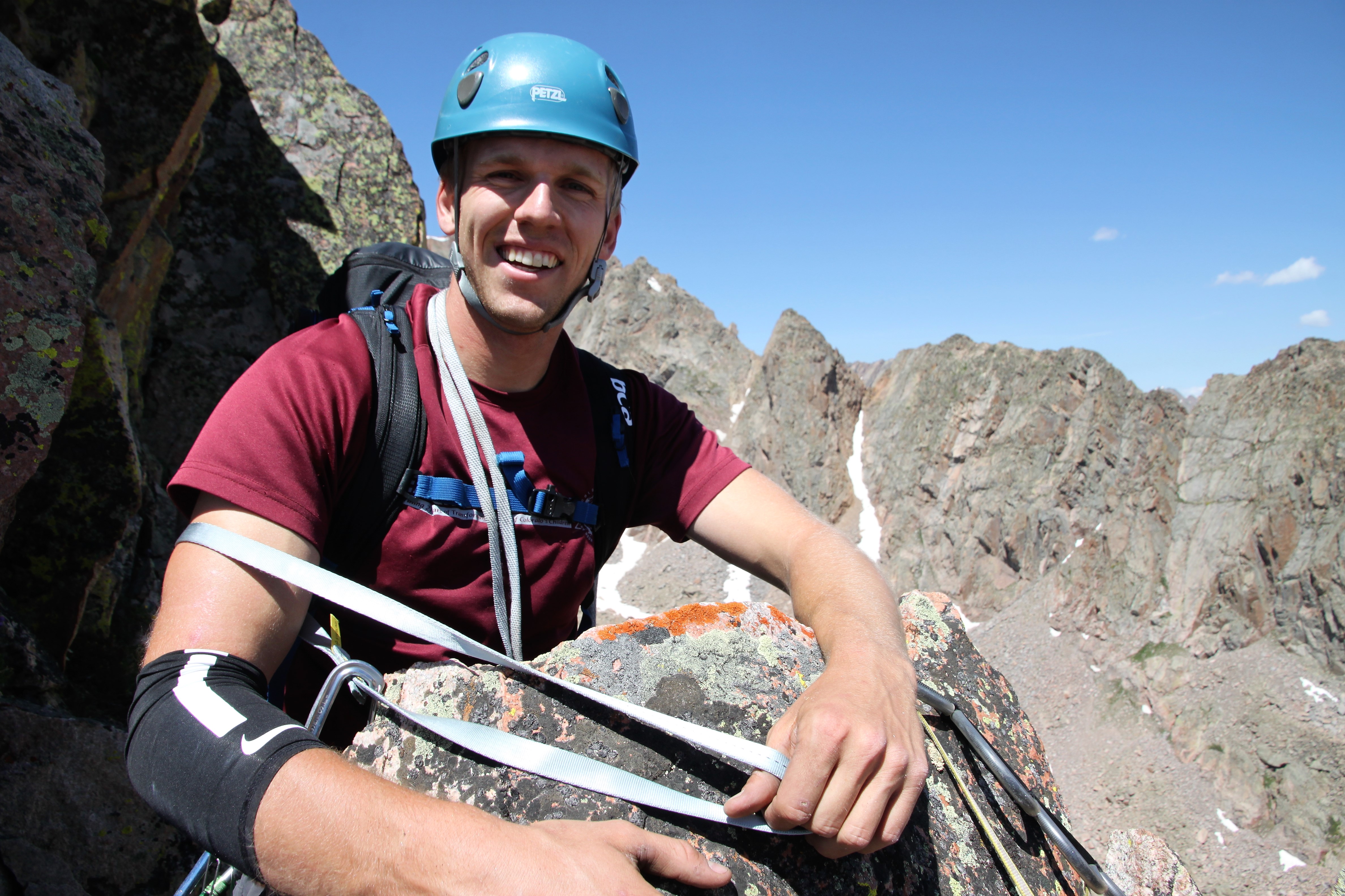
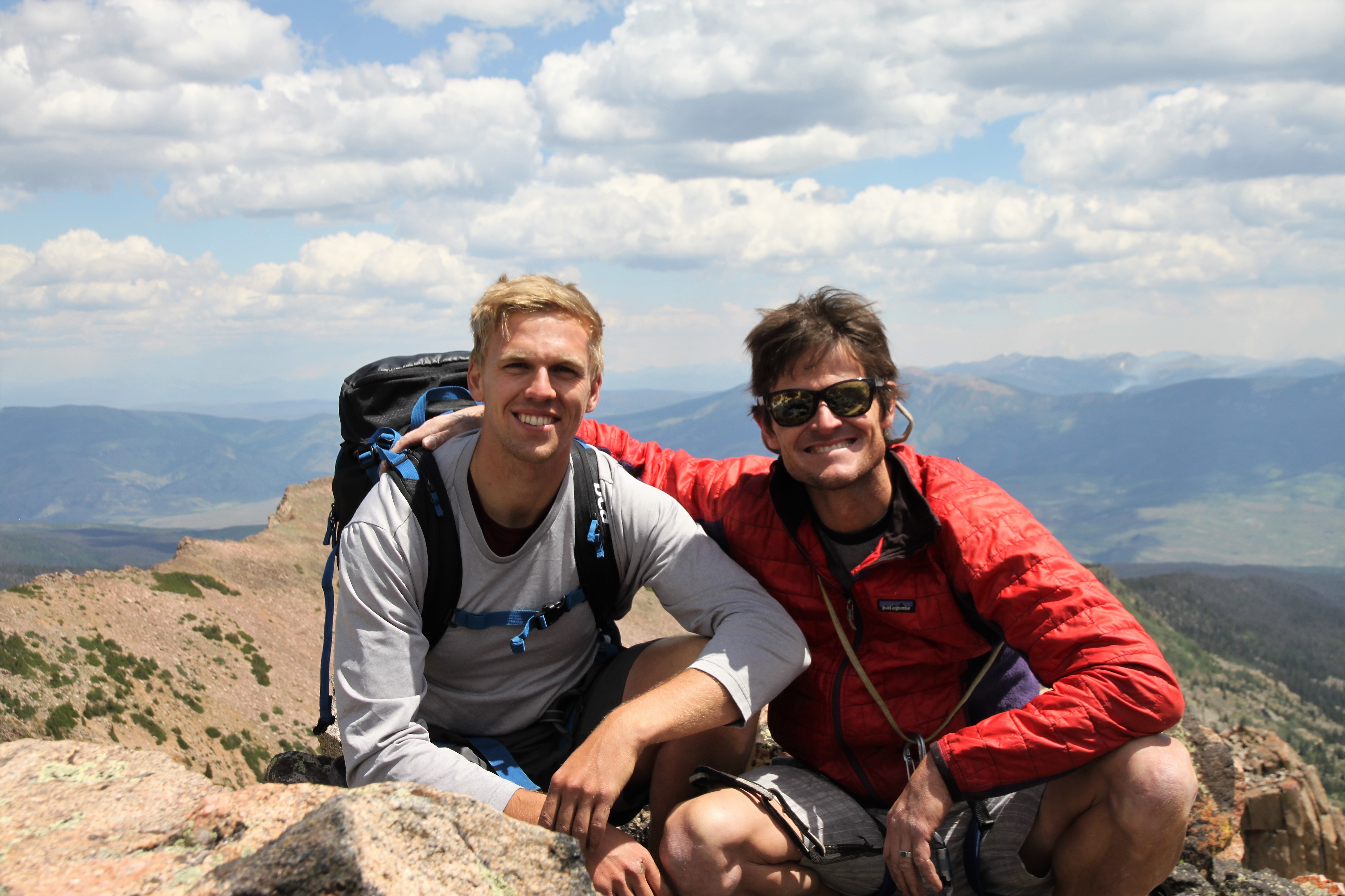
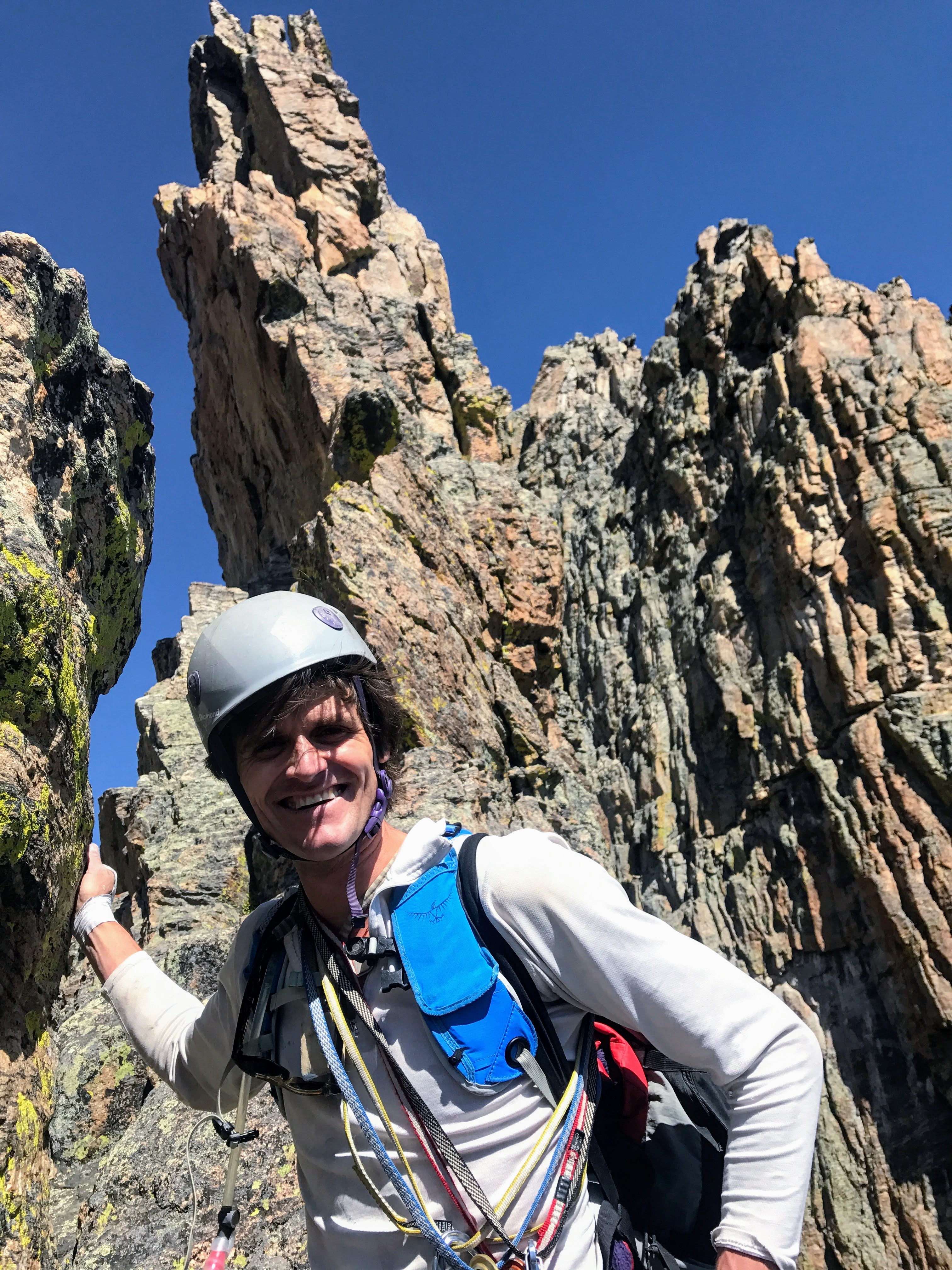
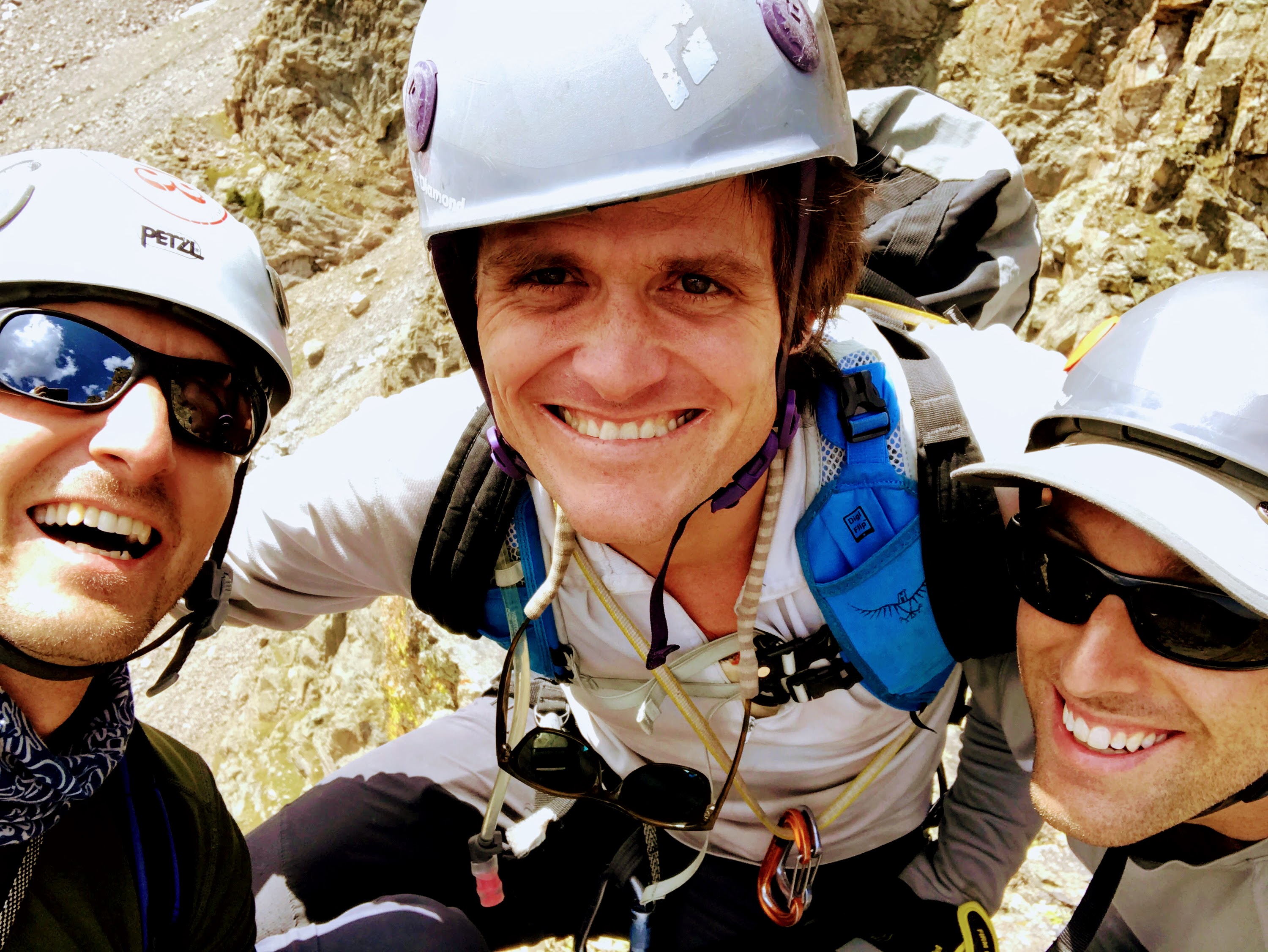
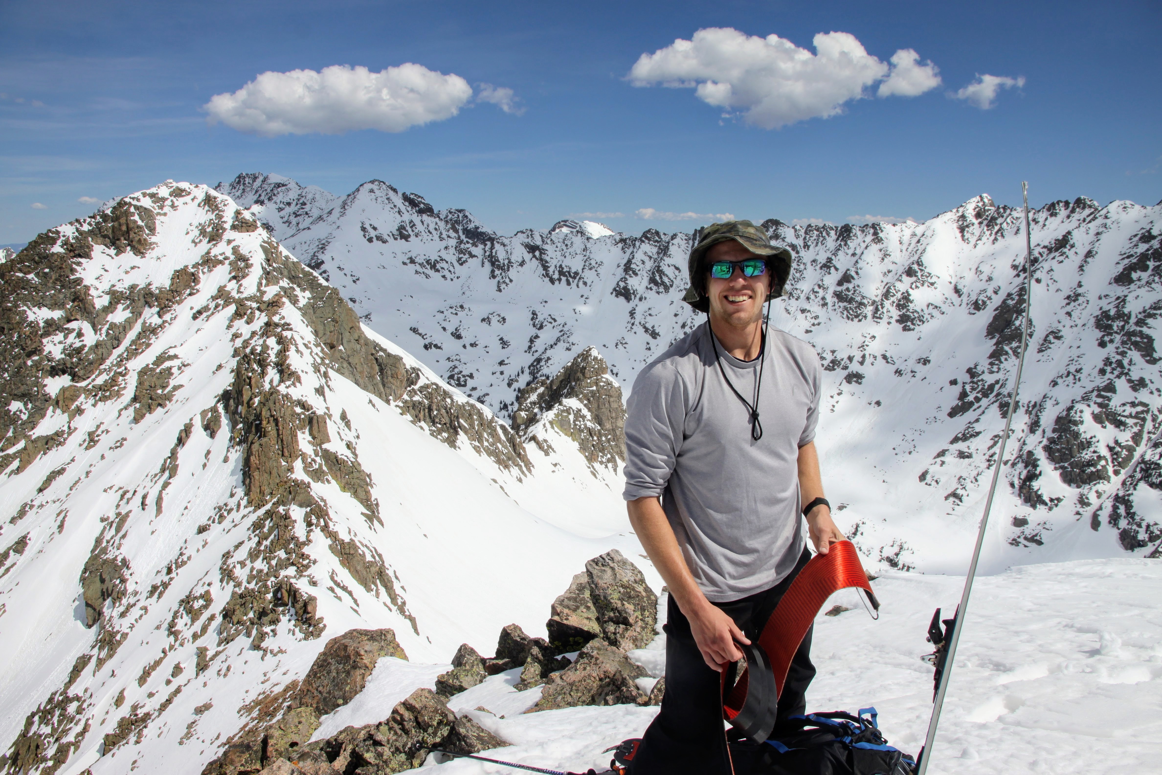
Dylan

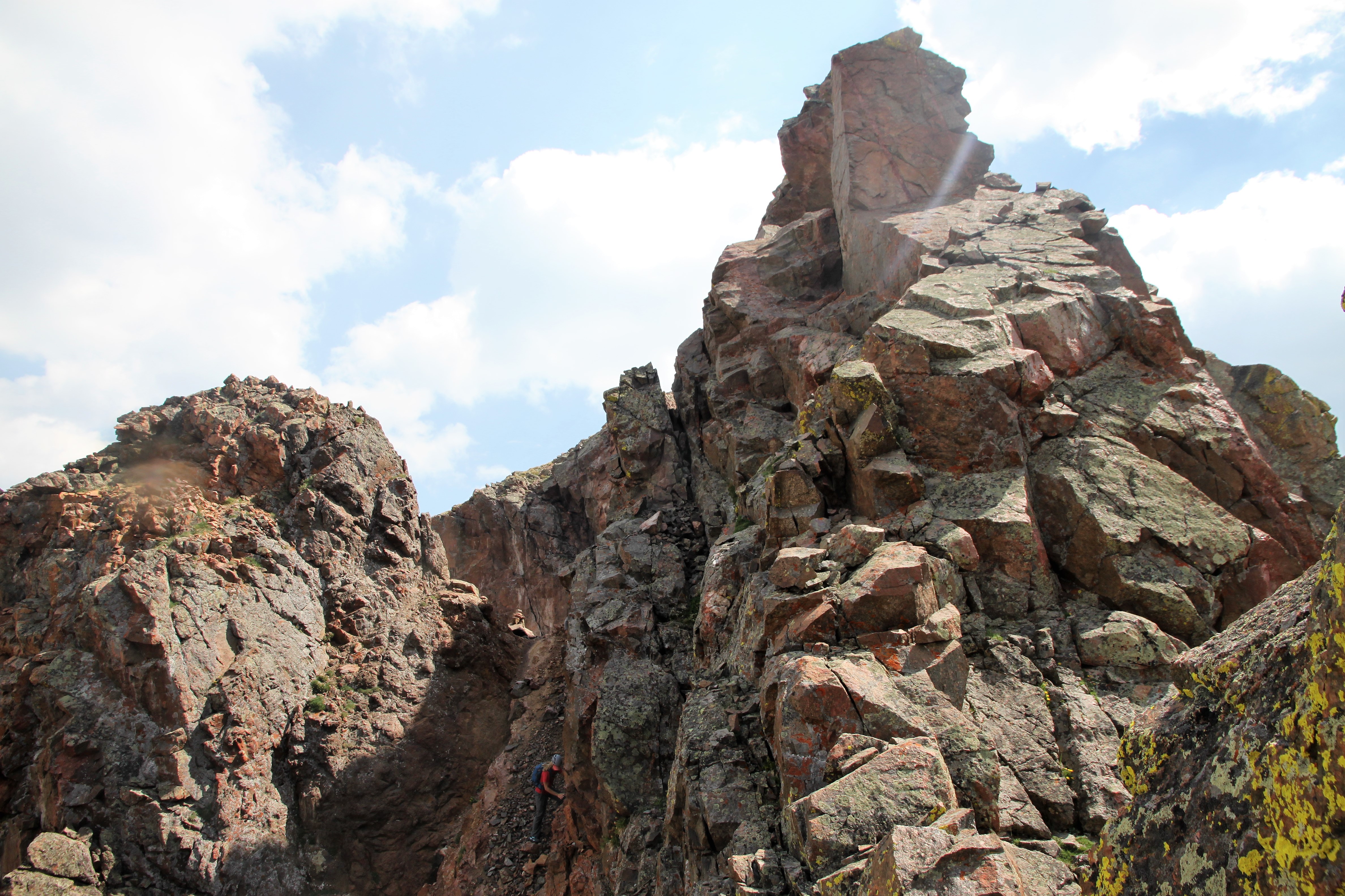
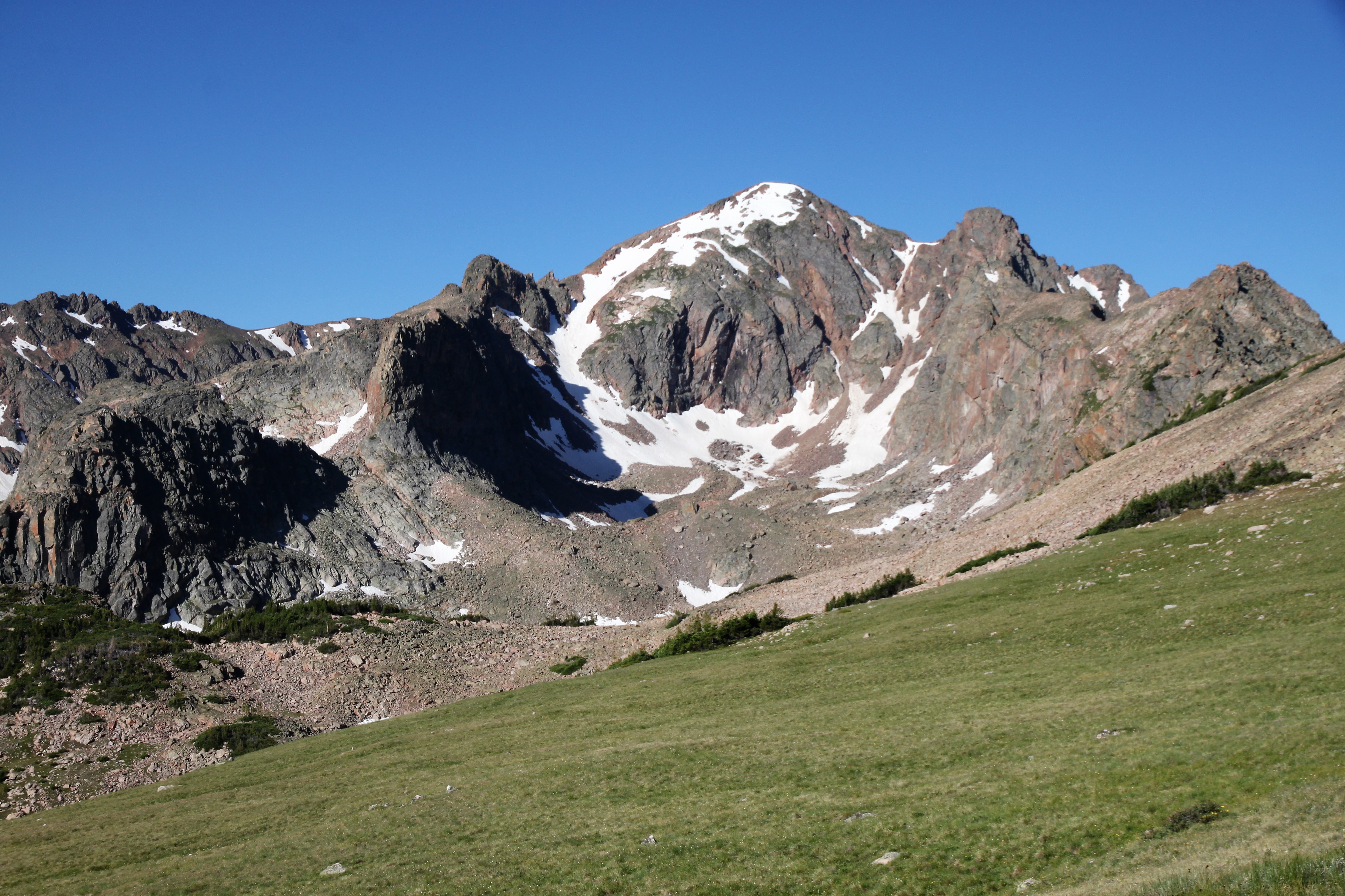
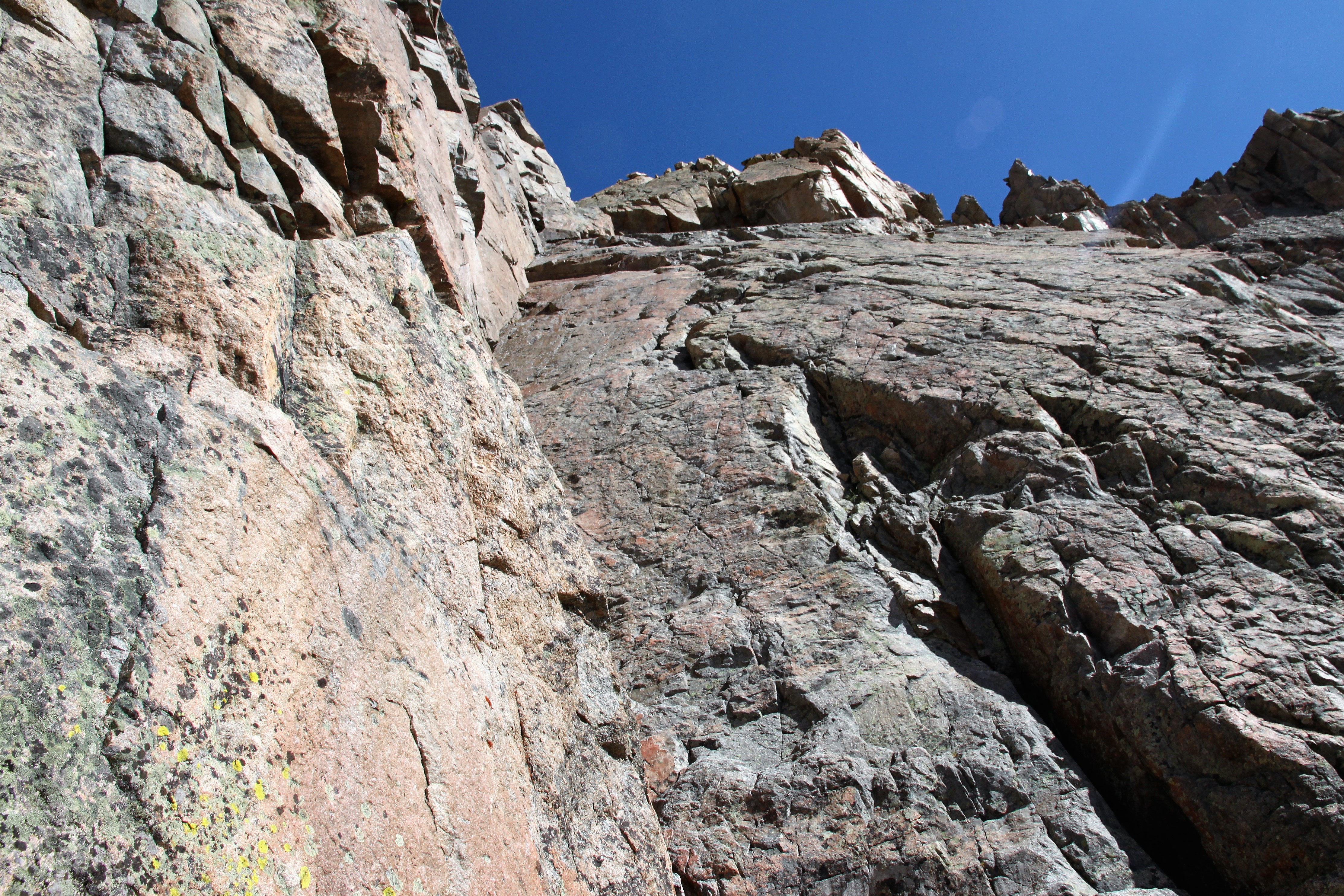
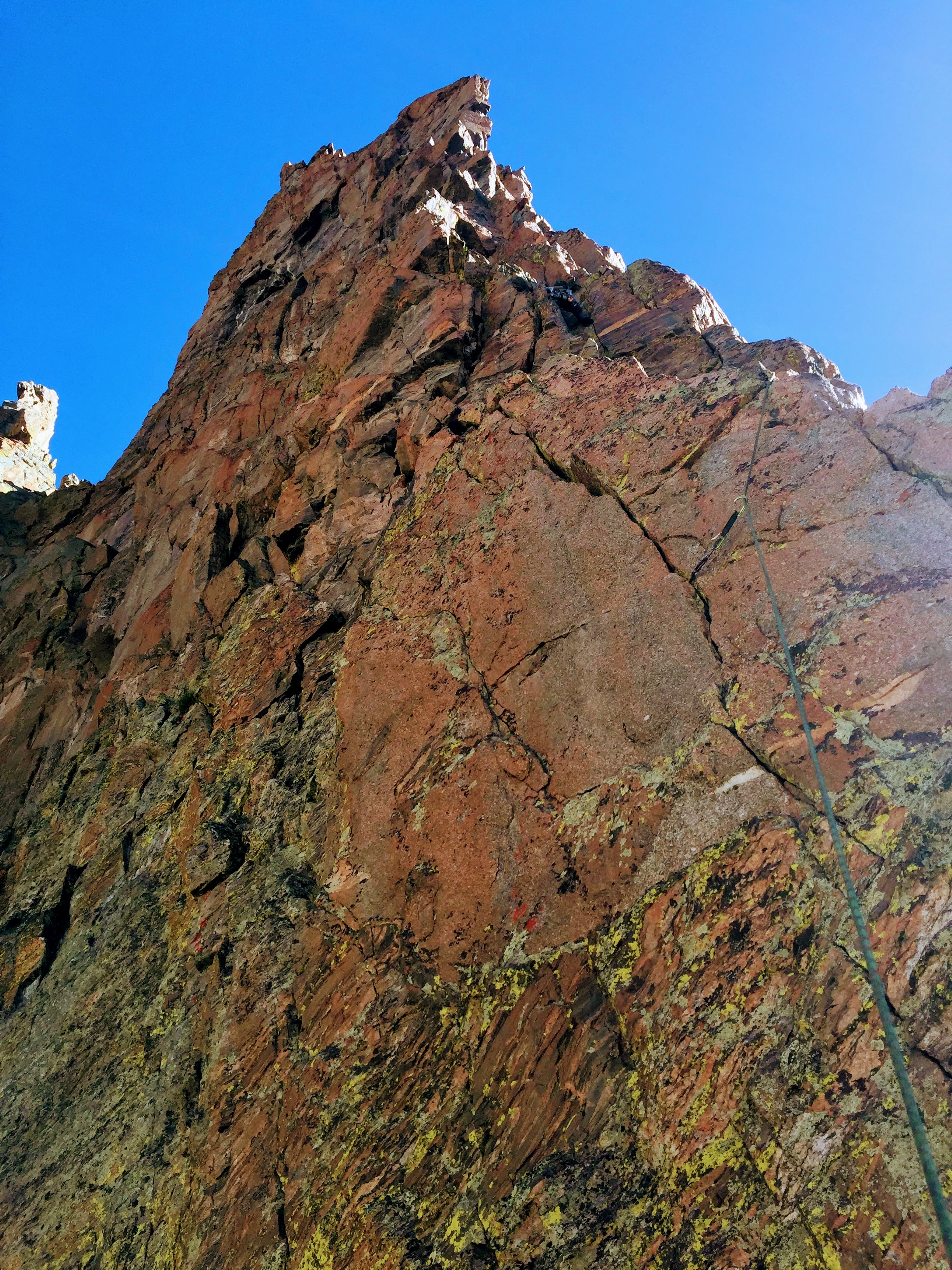
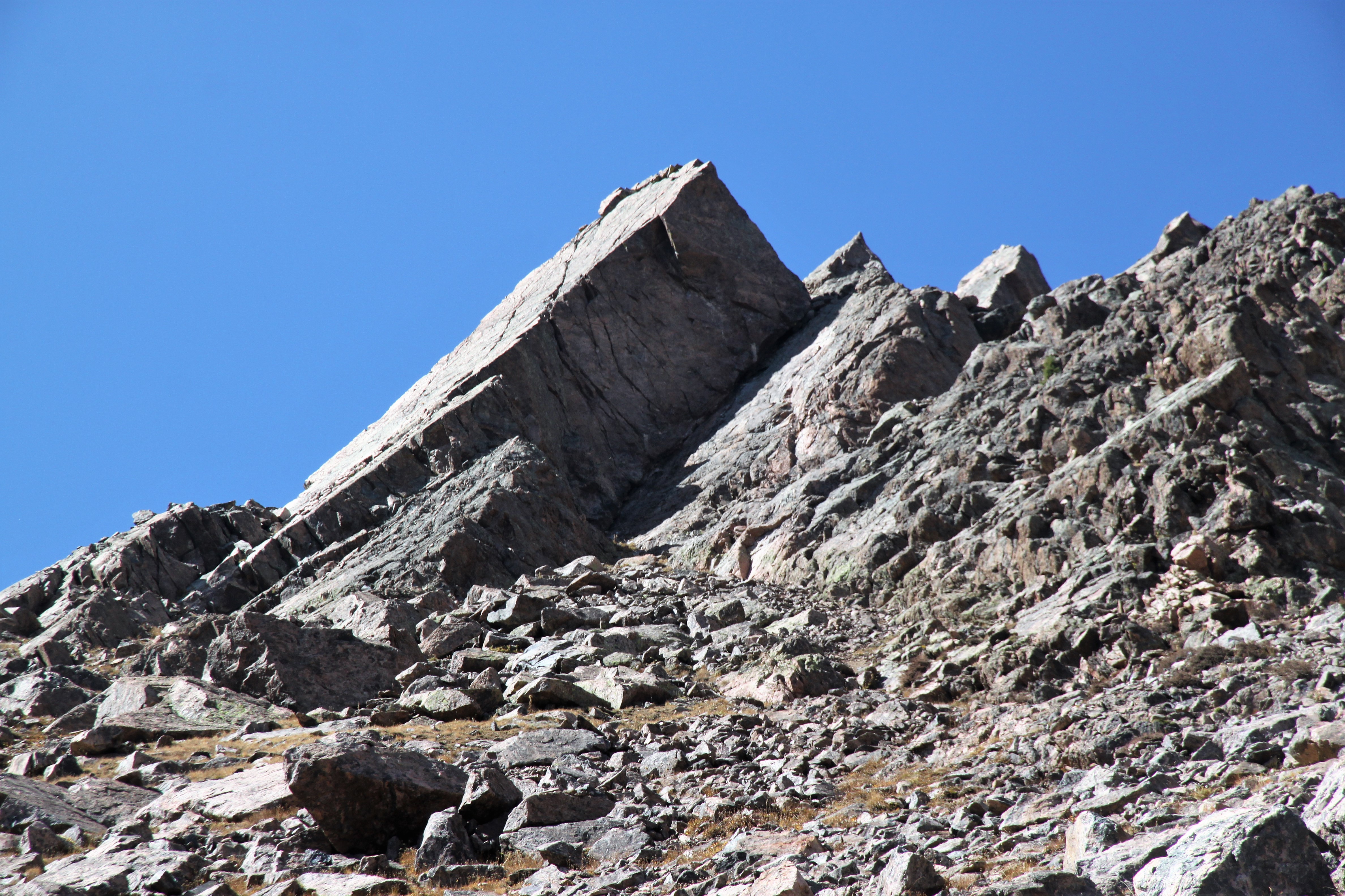
We came up to the large south-facing slab up Peak X’ which looked amazing. However, with old Hokas on and no traction, we decided to skip this scramble (low 5th class?) and curve around to the right of it.

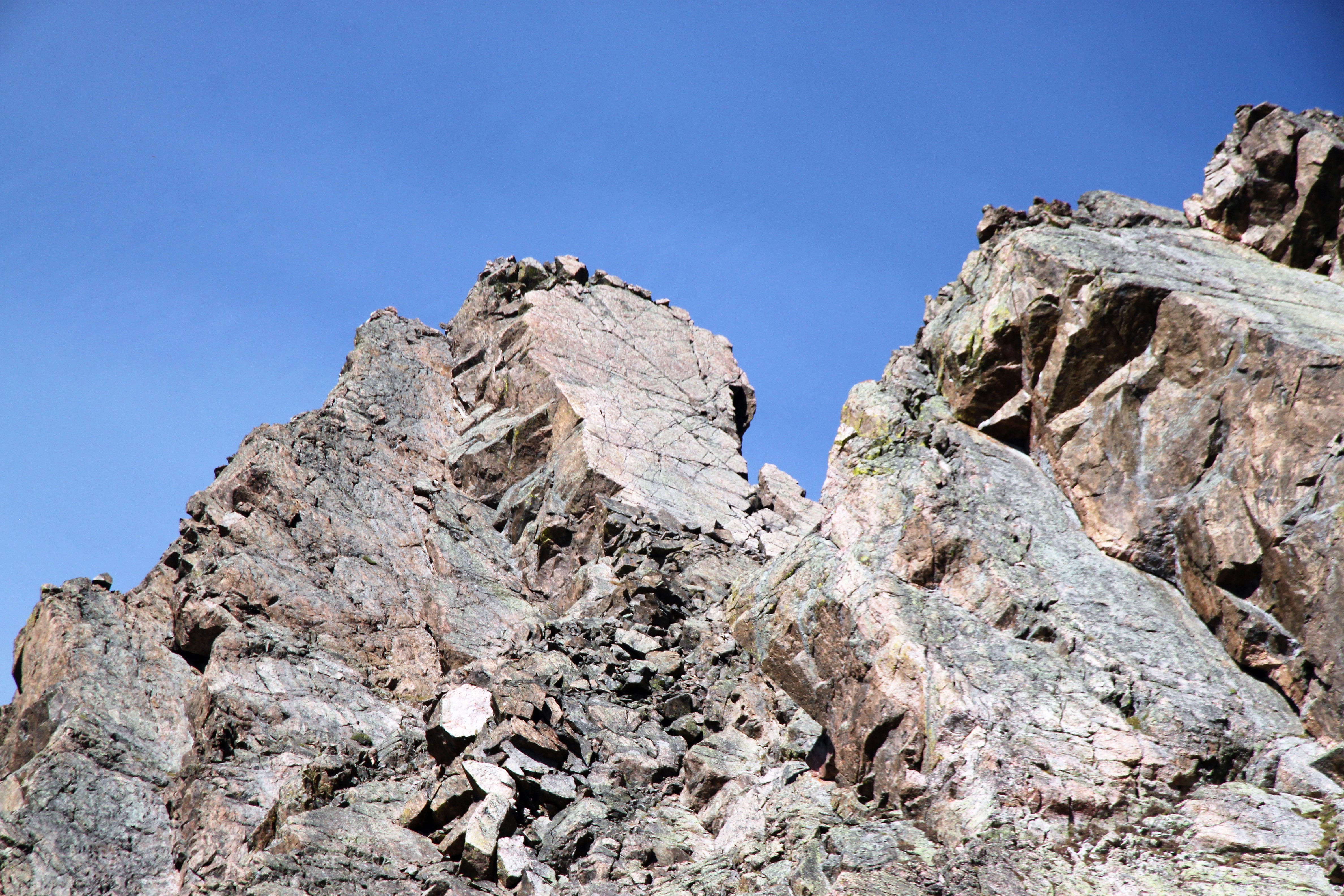
The south-facing slab of Peak X’ as seen on the descent later in the day

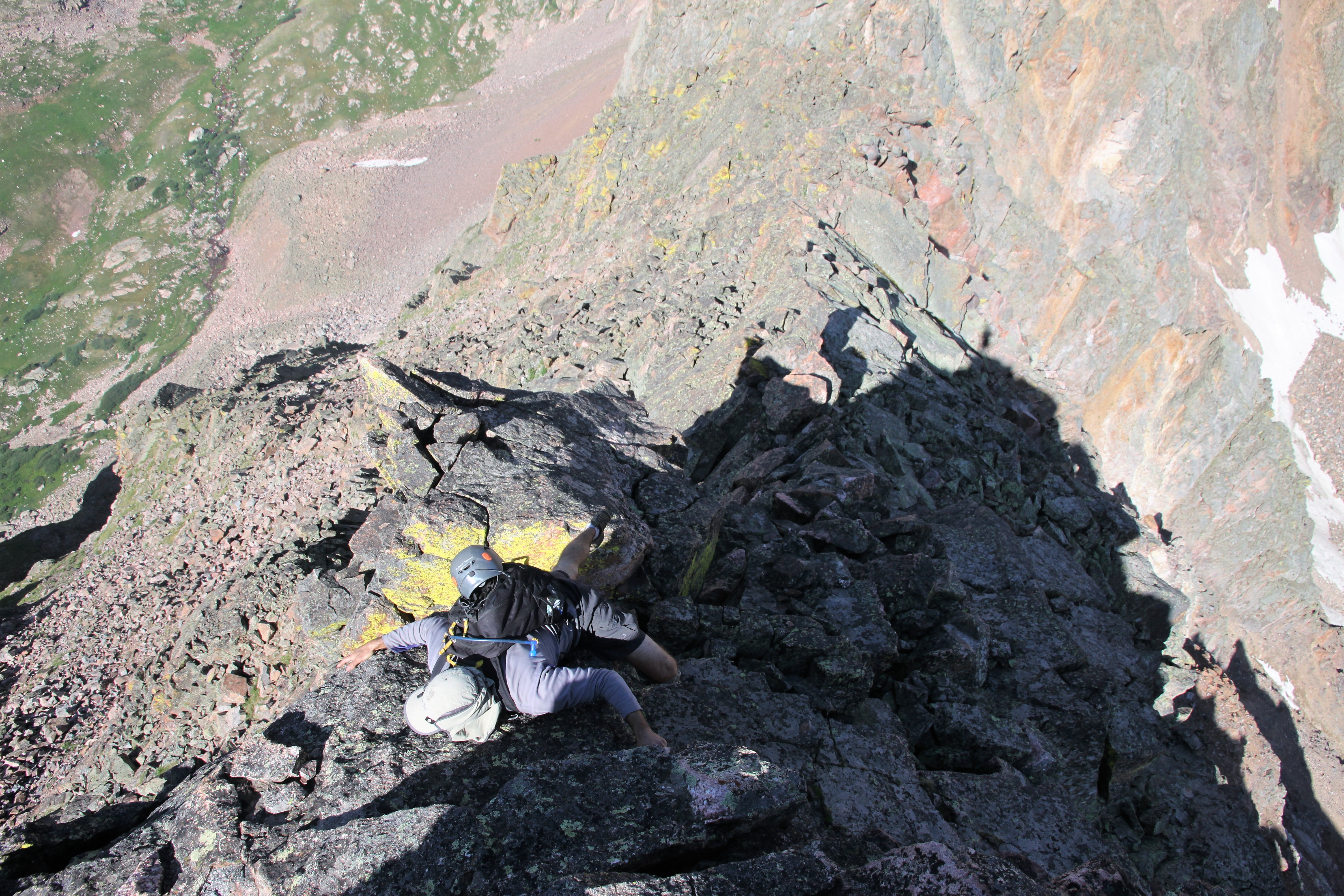
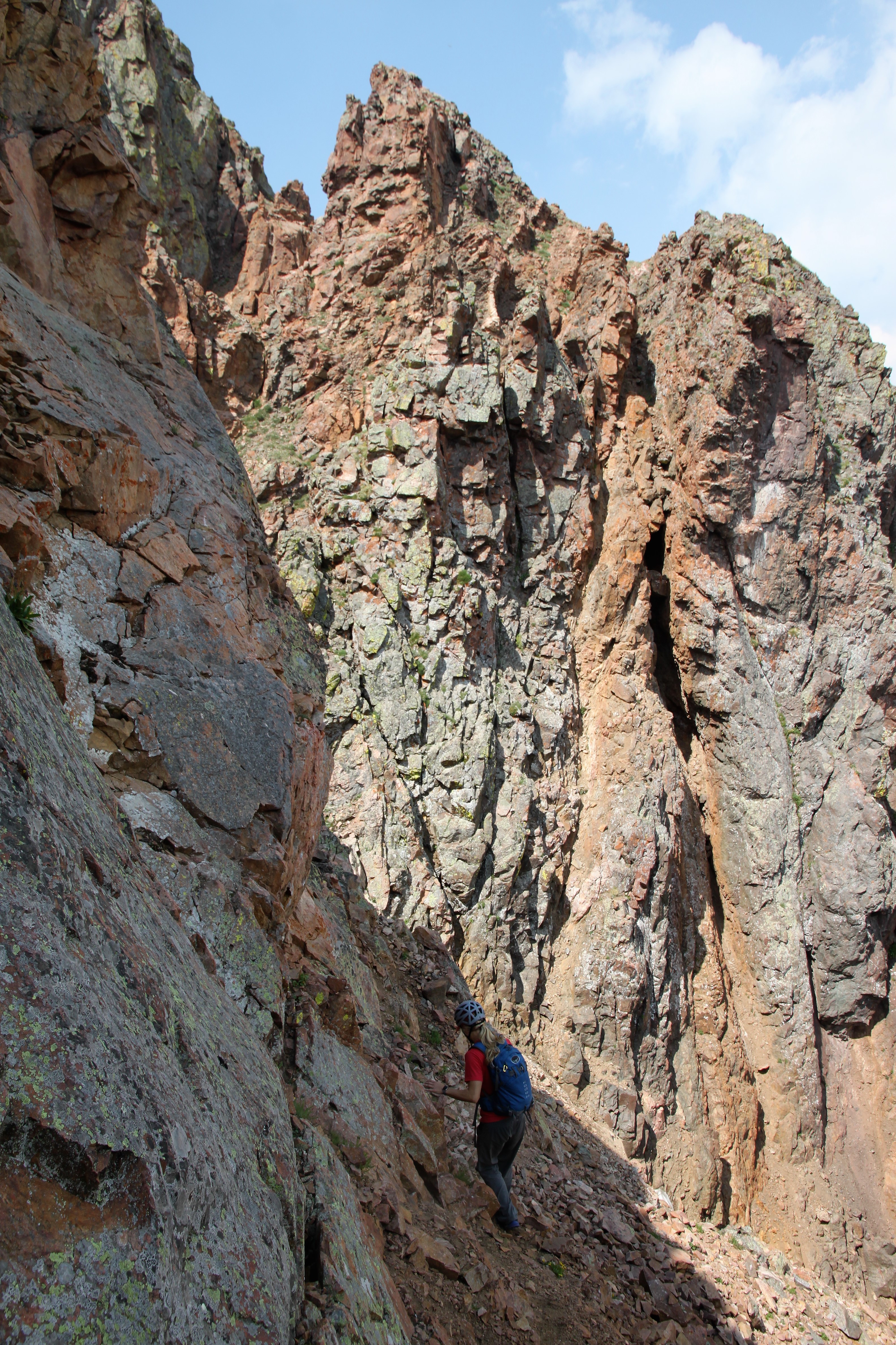
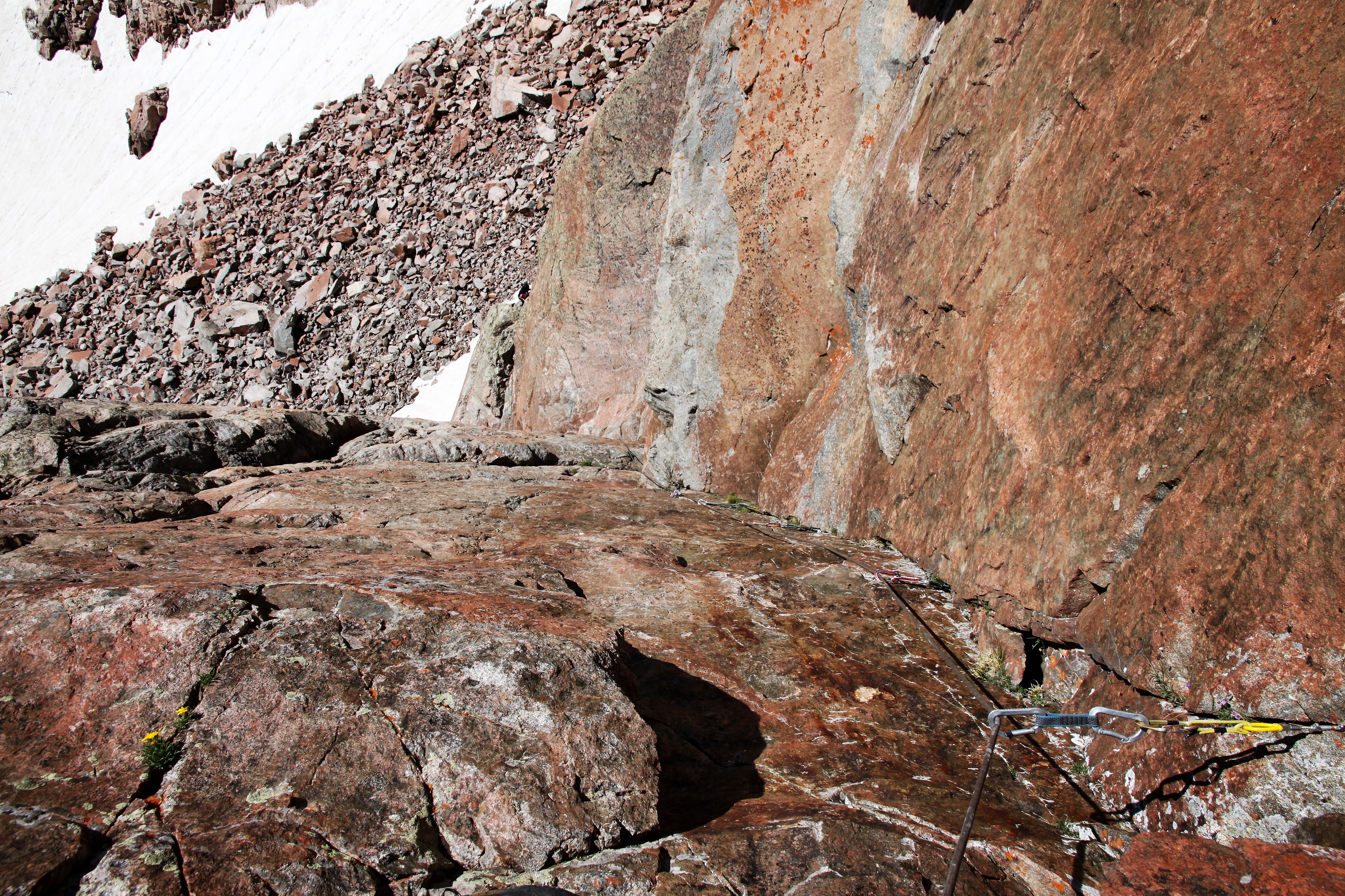
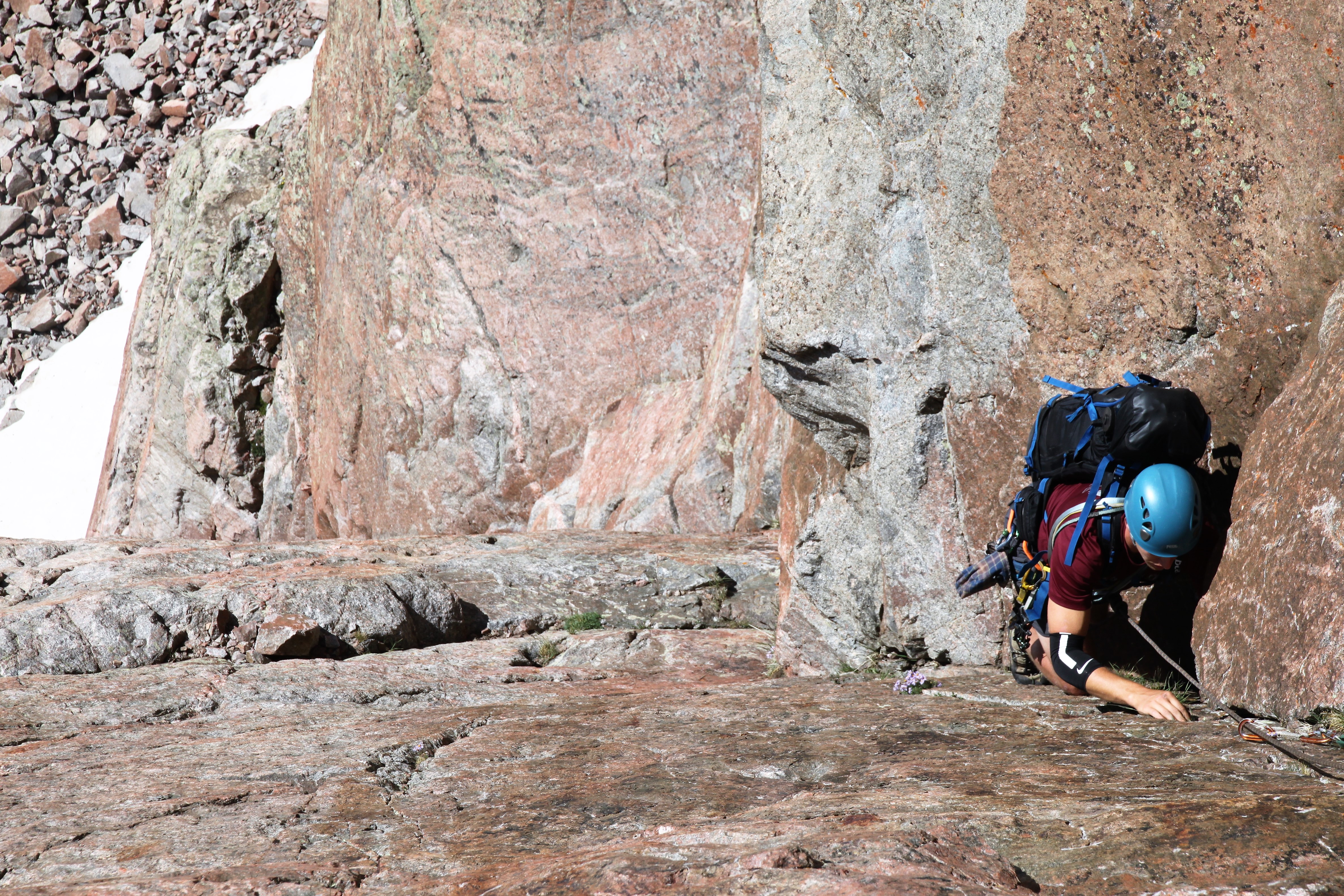
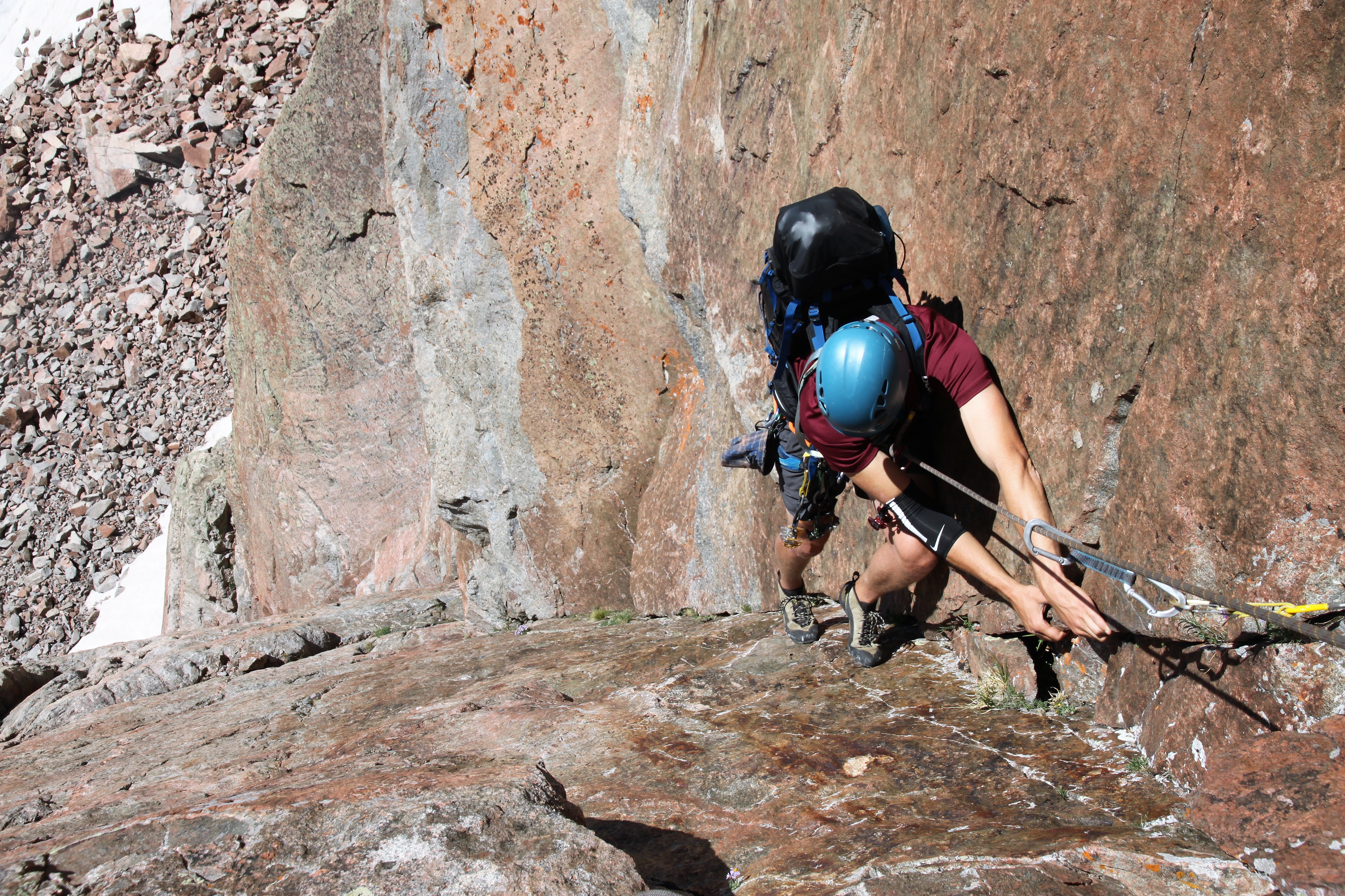
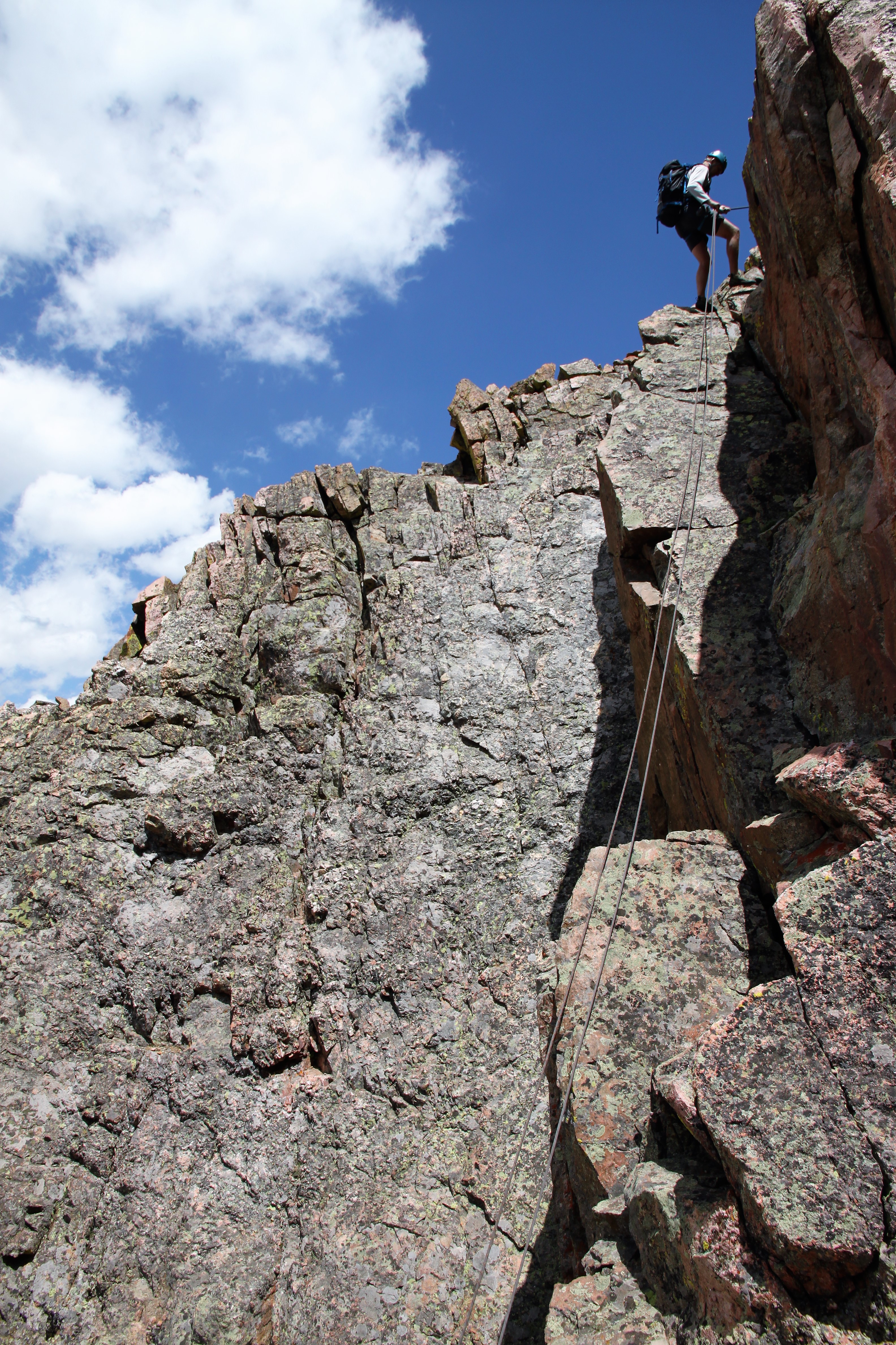
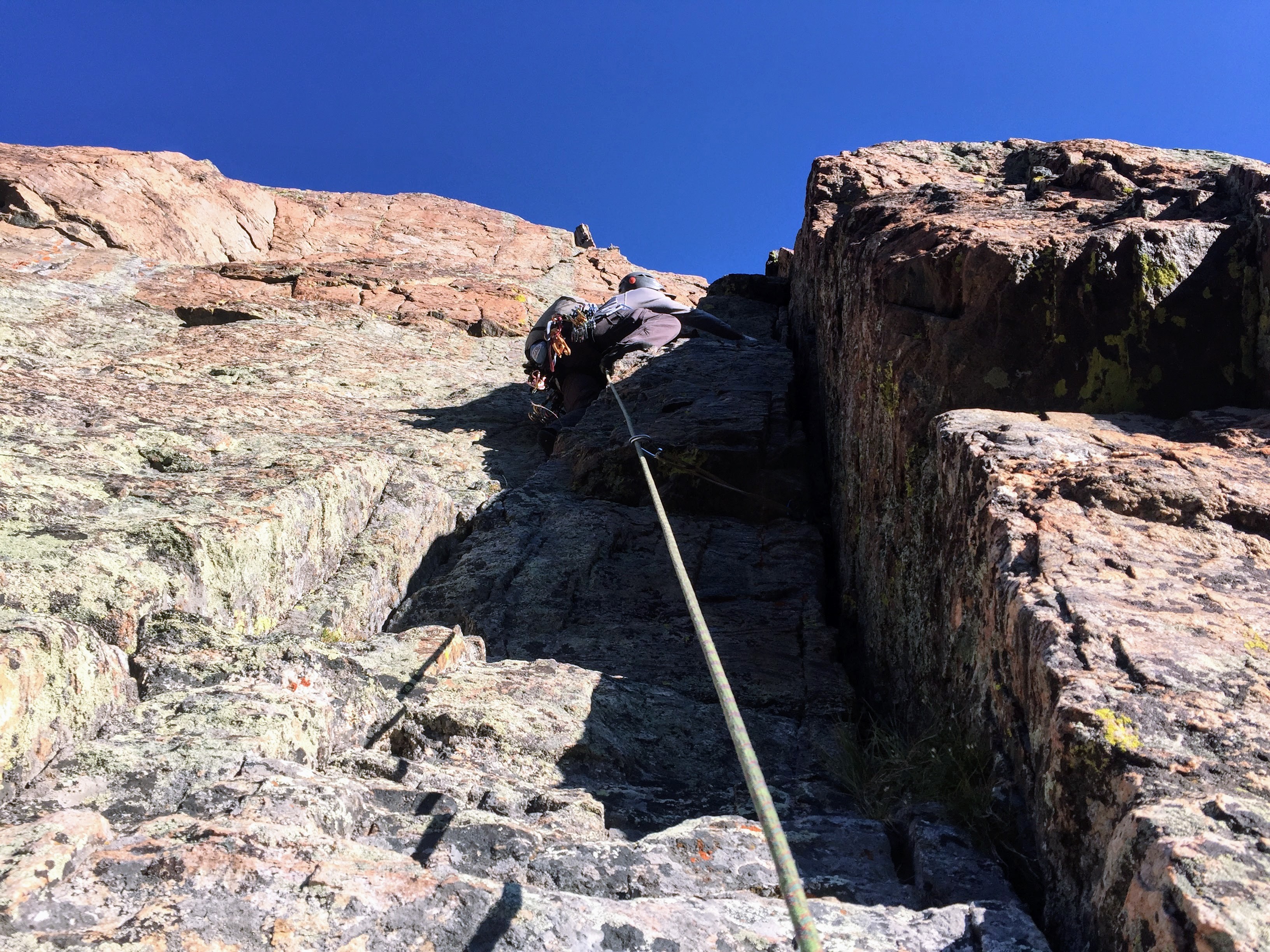
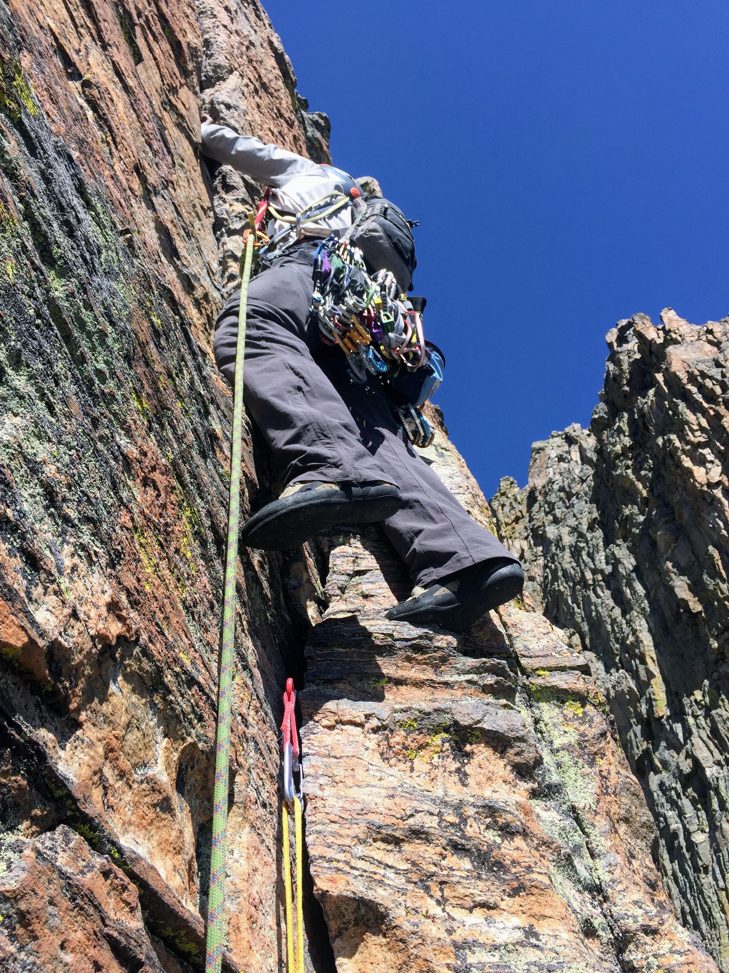
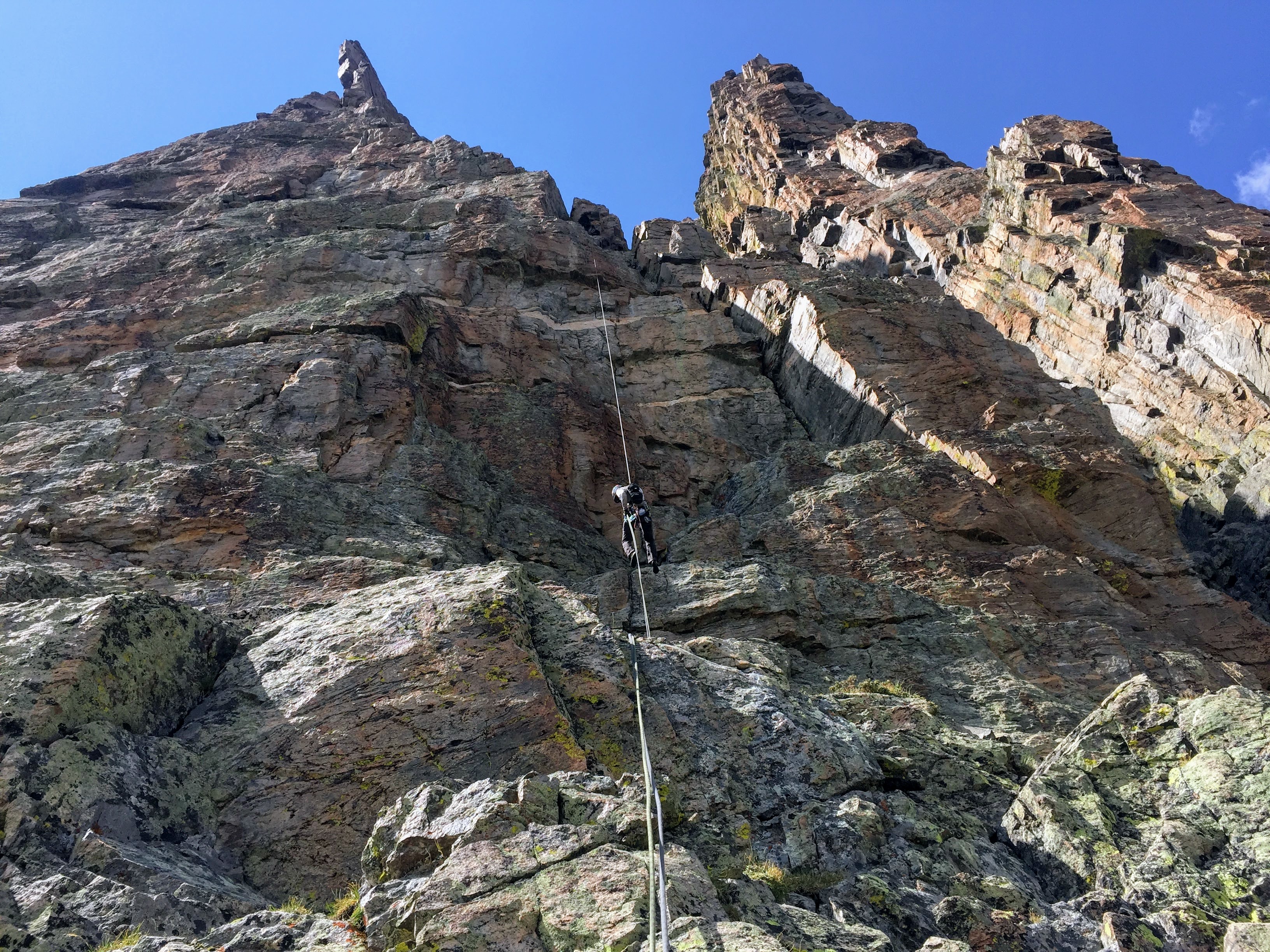
Nonetheless, I chose to climb this dihedral around the corner which was probably tougher than the slab itself. J and Dylan took a line further east of the dihedral.

The dihedral I climbed with the large south-facing slab to the left

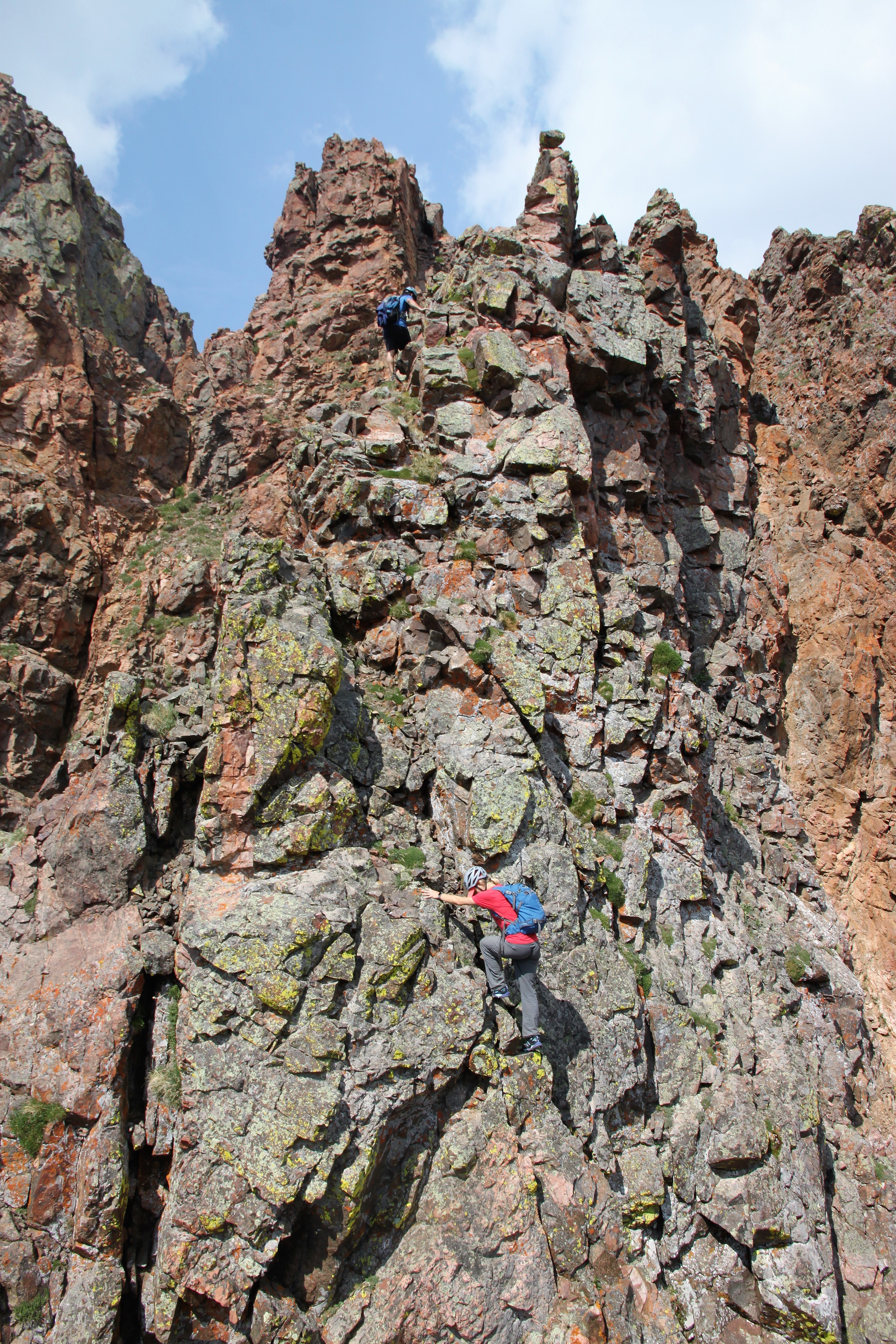
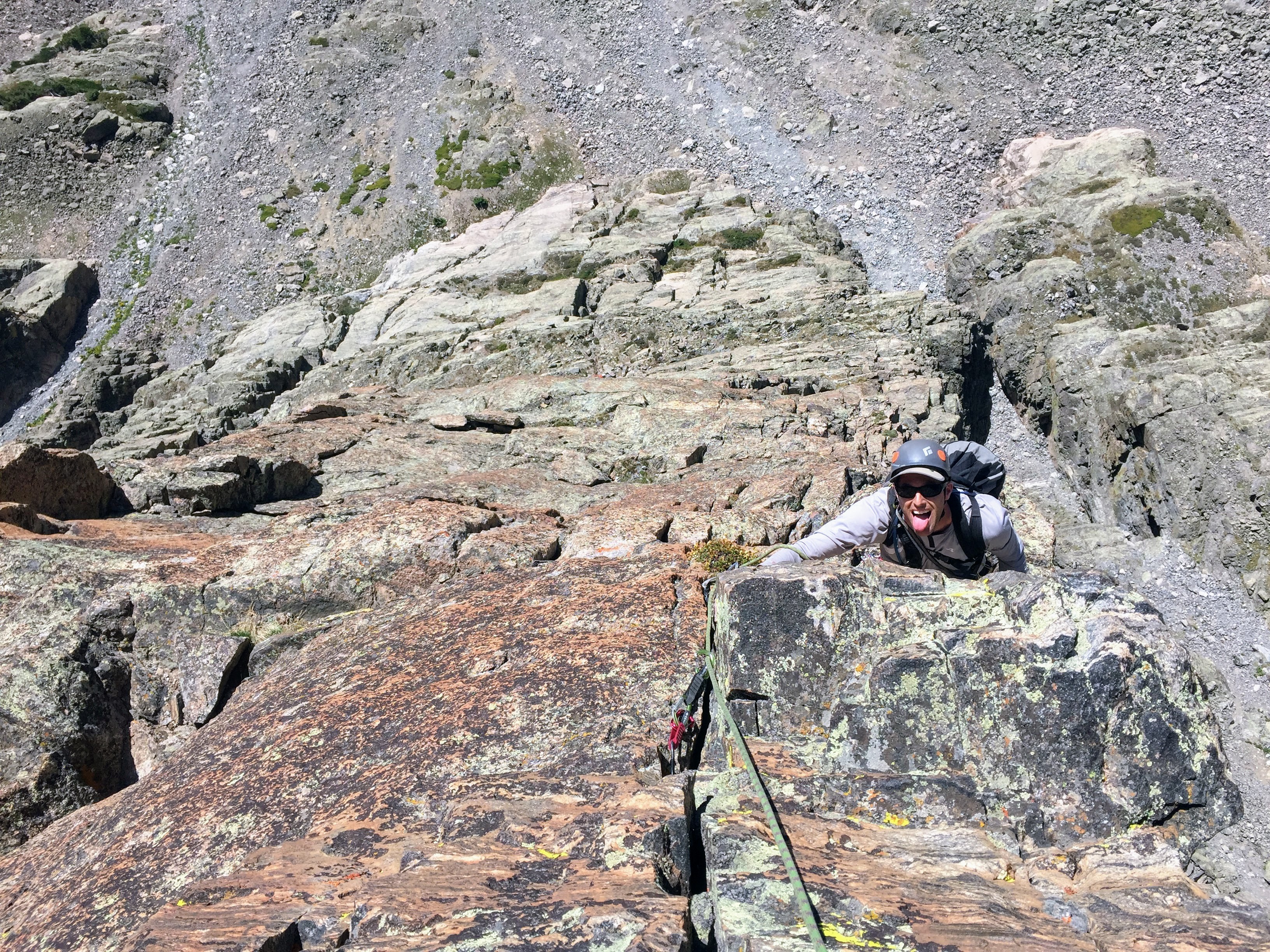
Dylan took this of me half-way up the dihedral

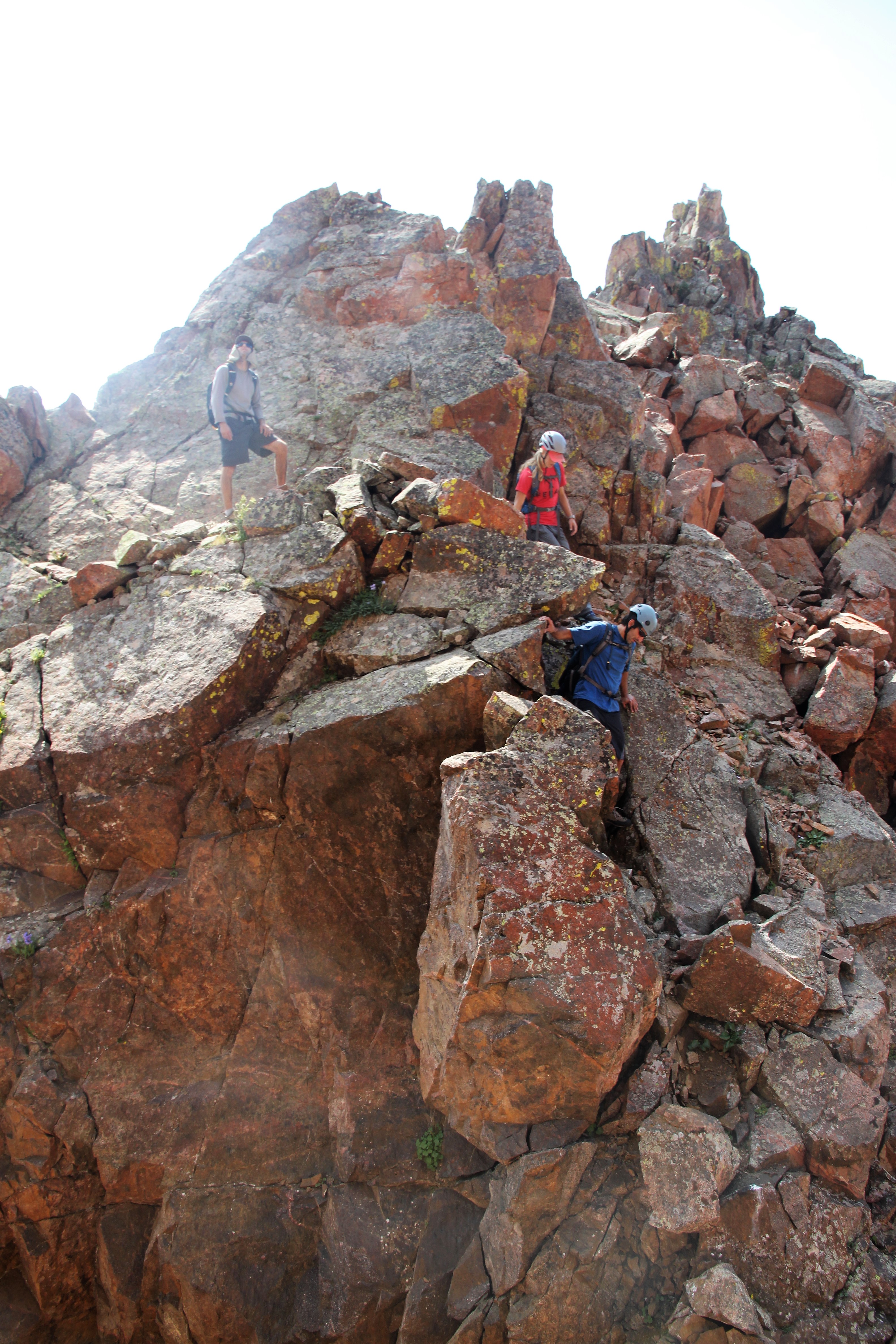
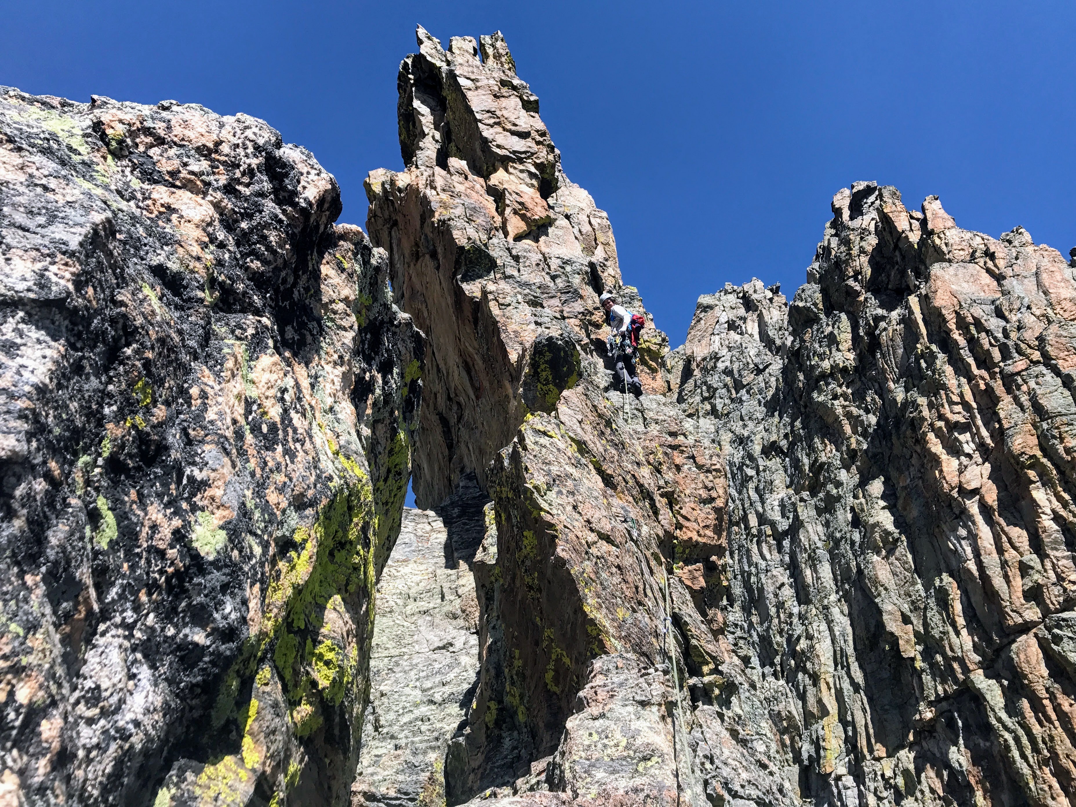
After these completely unnecessary climbing lines, we scrambled our way to the fun little summit of Peak X’.

Dylan and J working their way to the summit of Peak X’ (12,710′)

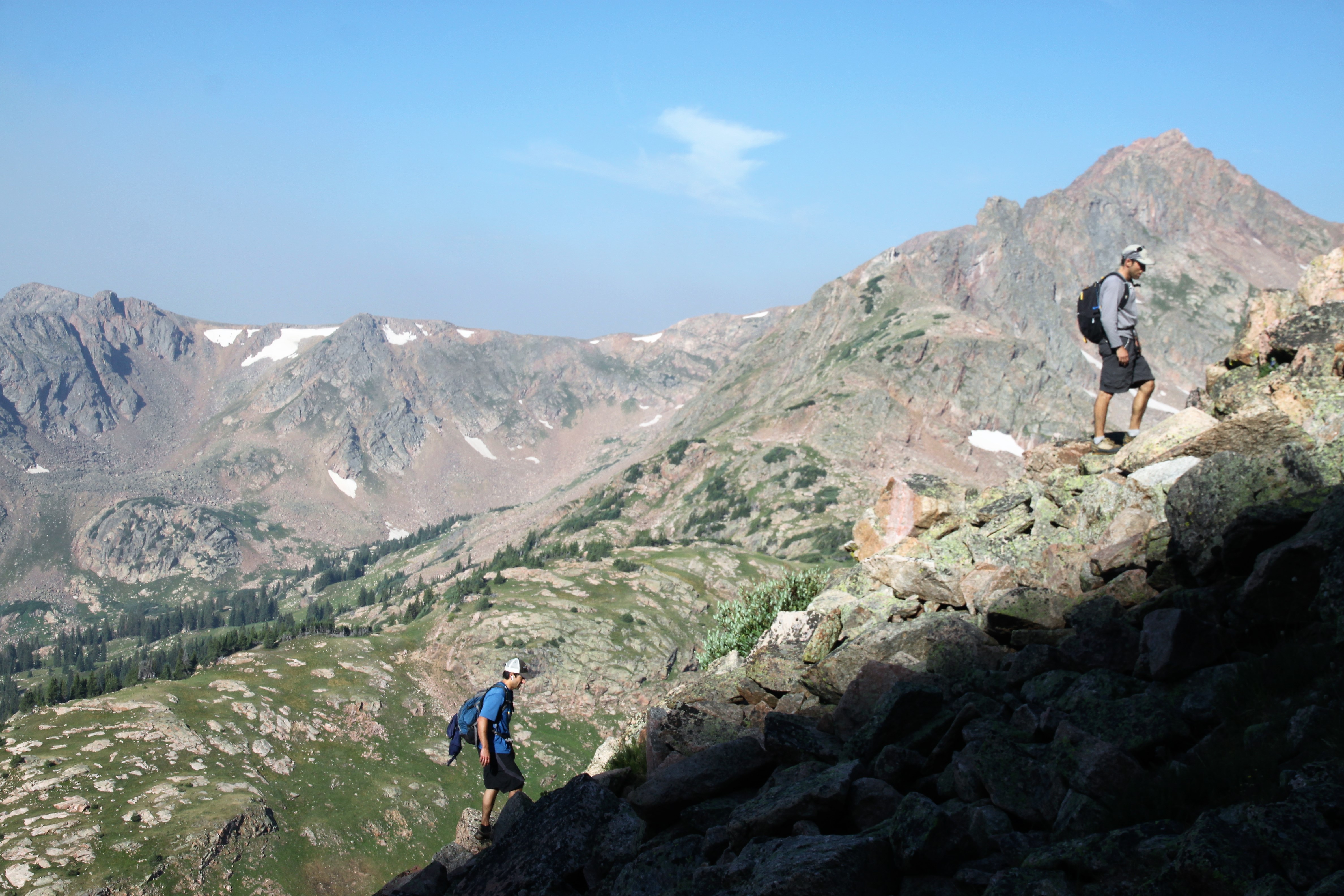
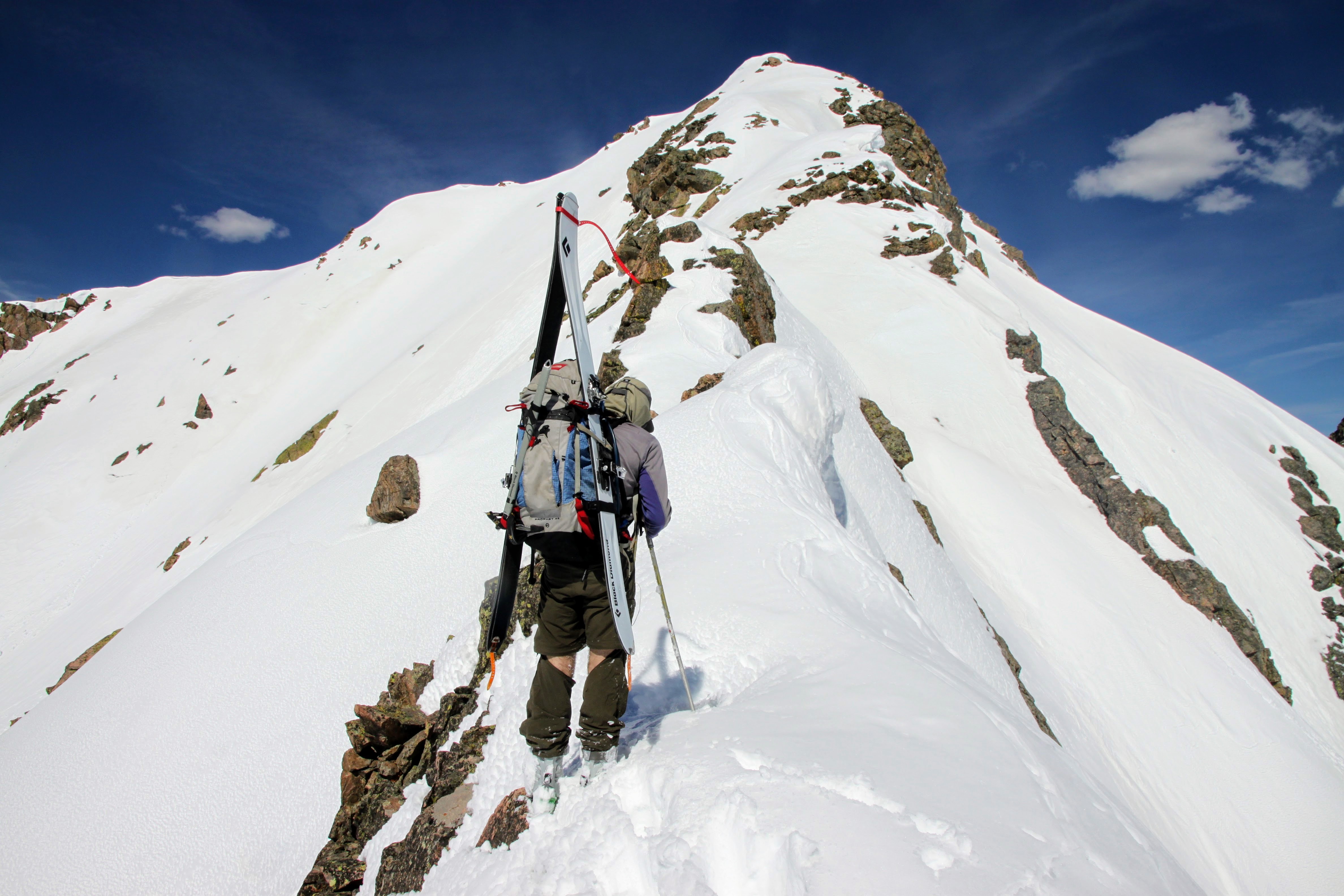
We descended the much mellow class 3 terrain down the east ridge en route to Peak X. At this point, we looked back to Usable Pass and saw Chris! He had made it after all and was at Usable Pass. I motioned for him to just contour over to Peak X’s west ridge and skip X’ altogether. We meandered up Peak X and relaxed on the summit waiting for Chris to join us.
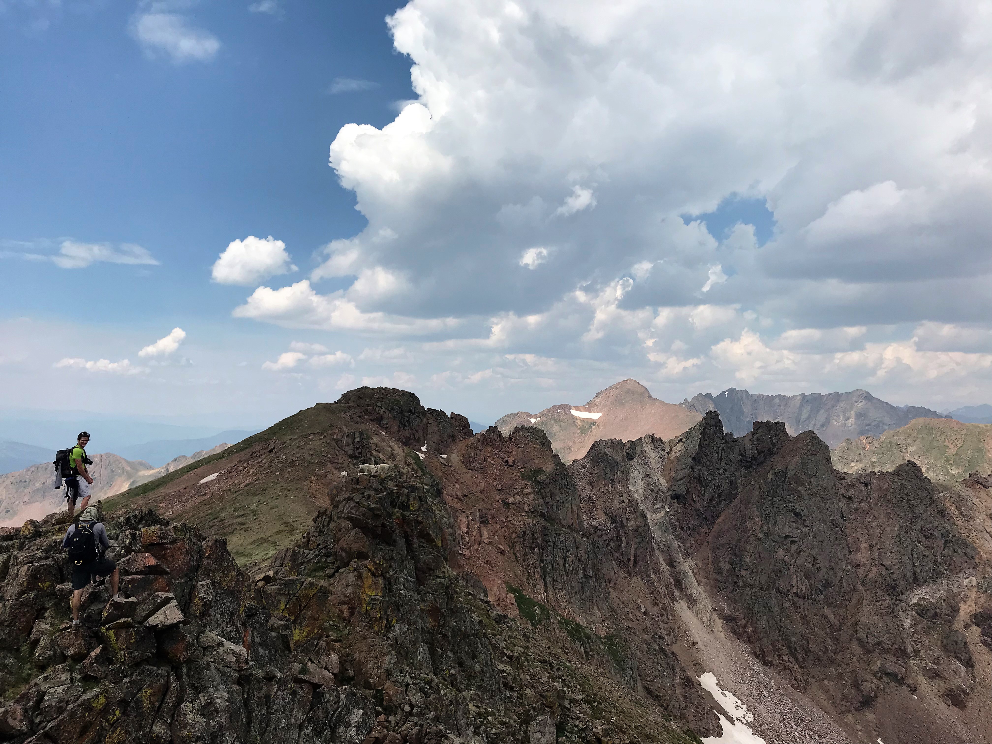
J and Peak X ahead

I descended a bit down Peak X’s northeast ridge to scope the traverse over to Peak Y and it looked fairly straightforward. By the time I came back up to the summit of X, speedy Chris Baldwin had arrived.

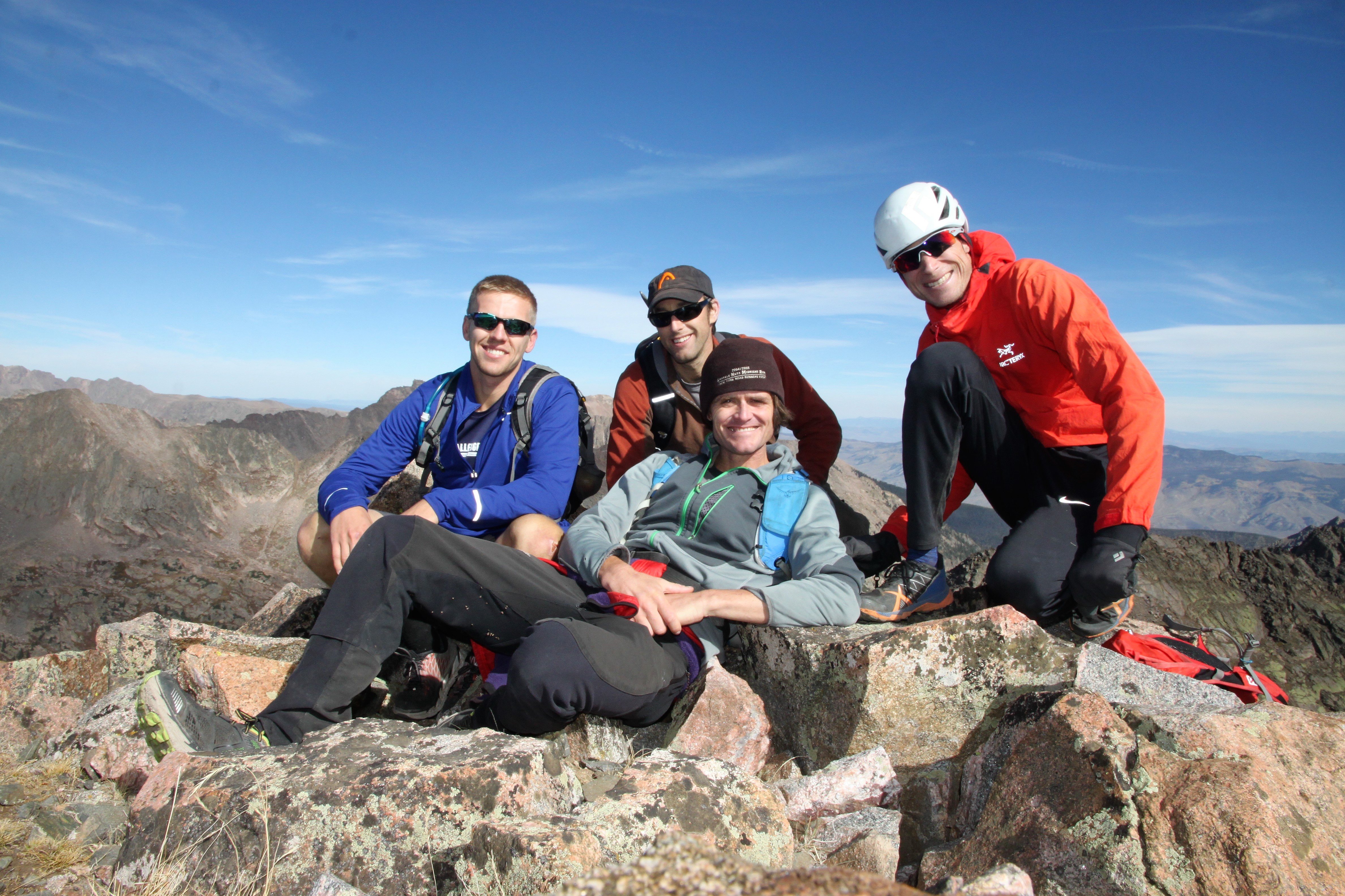
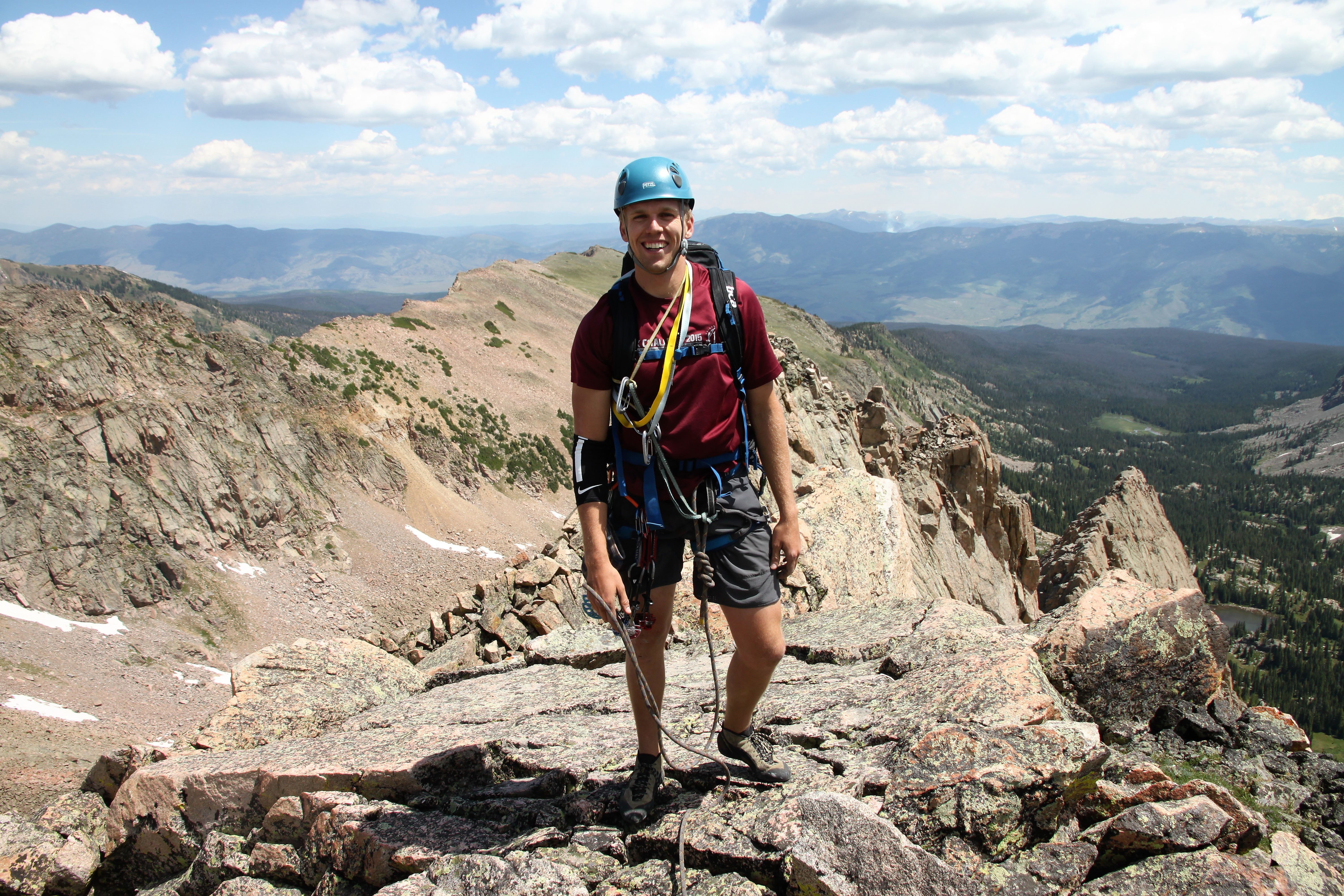
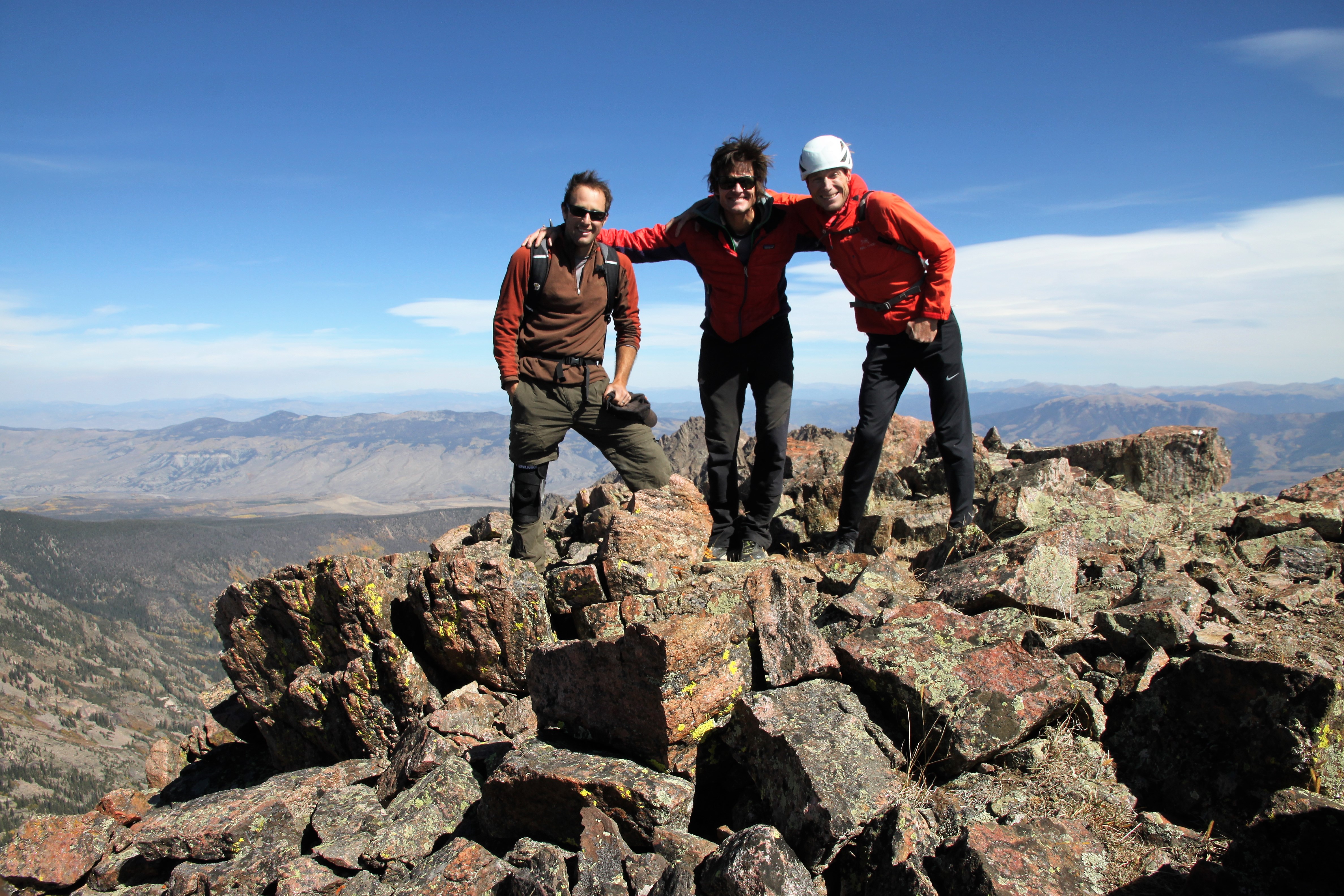
Peak X summit (13,085′)

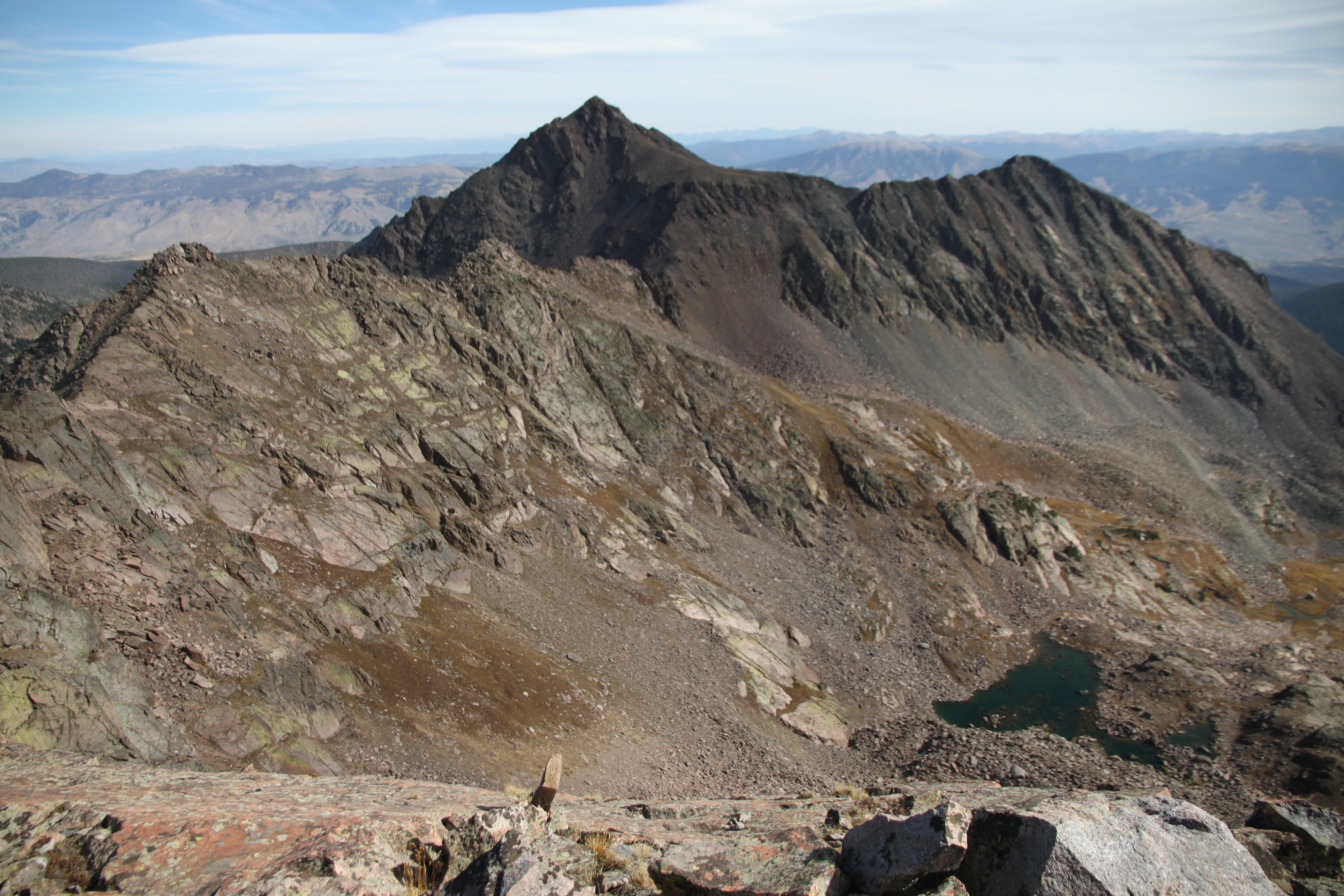
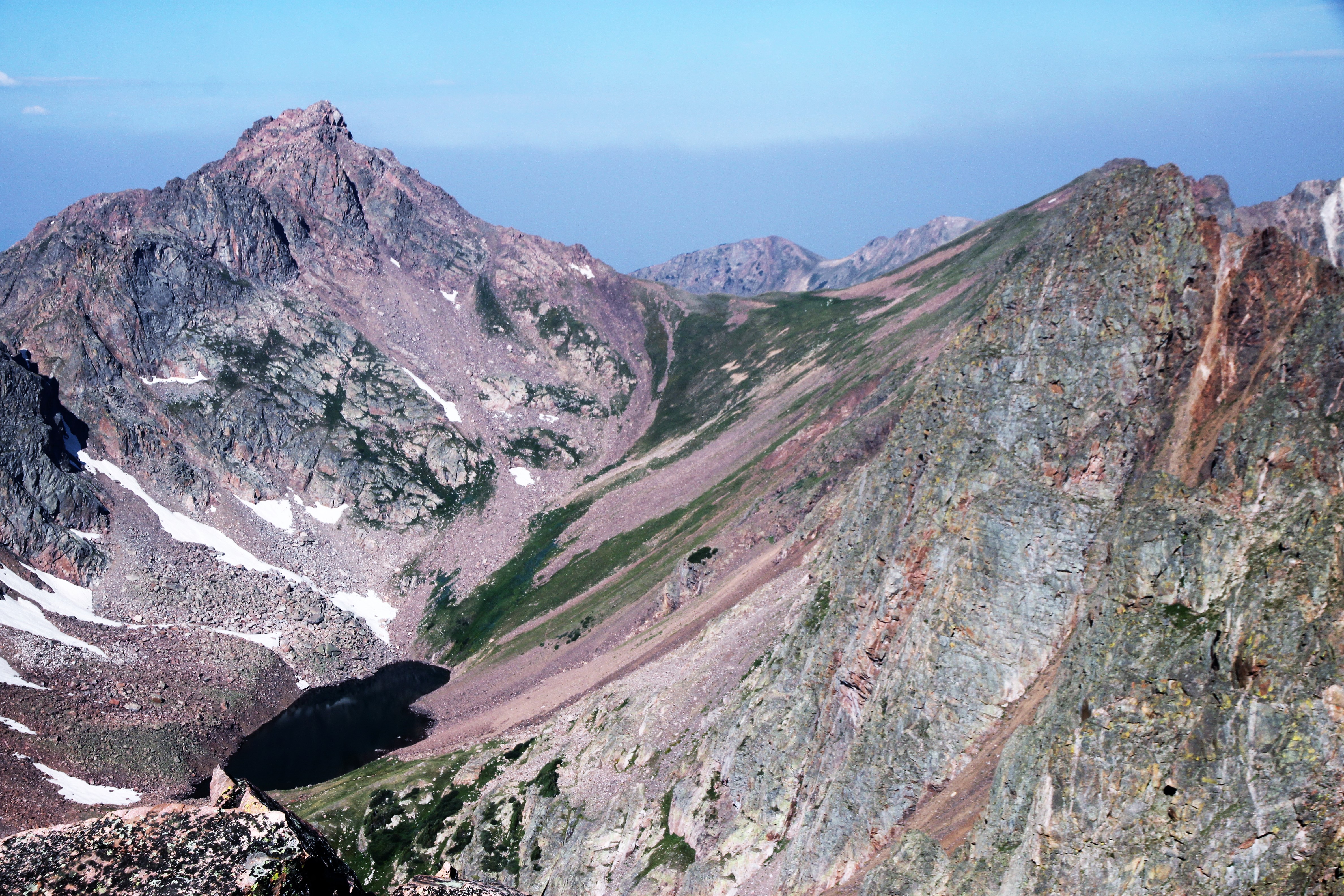
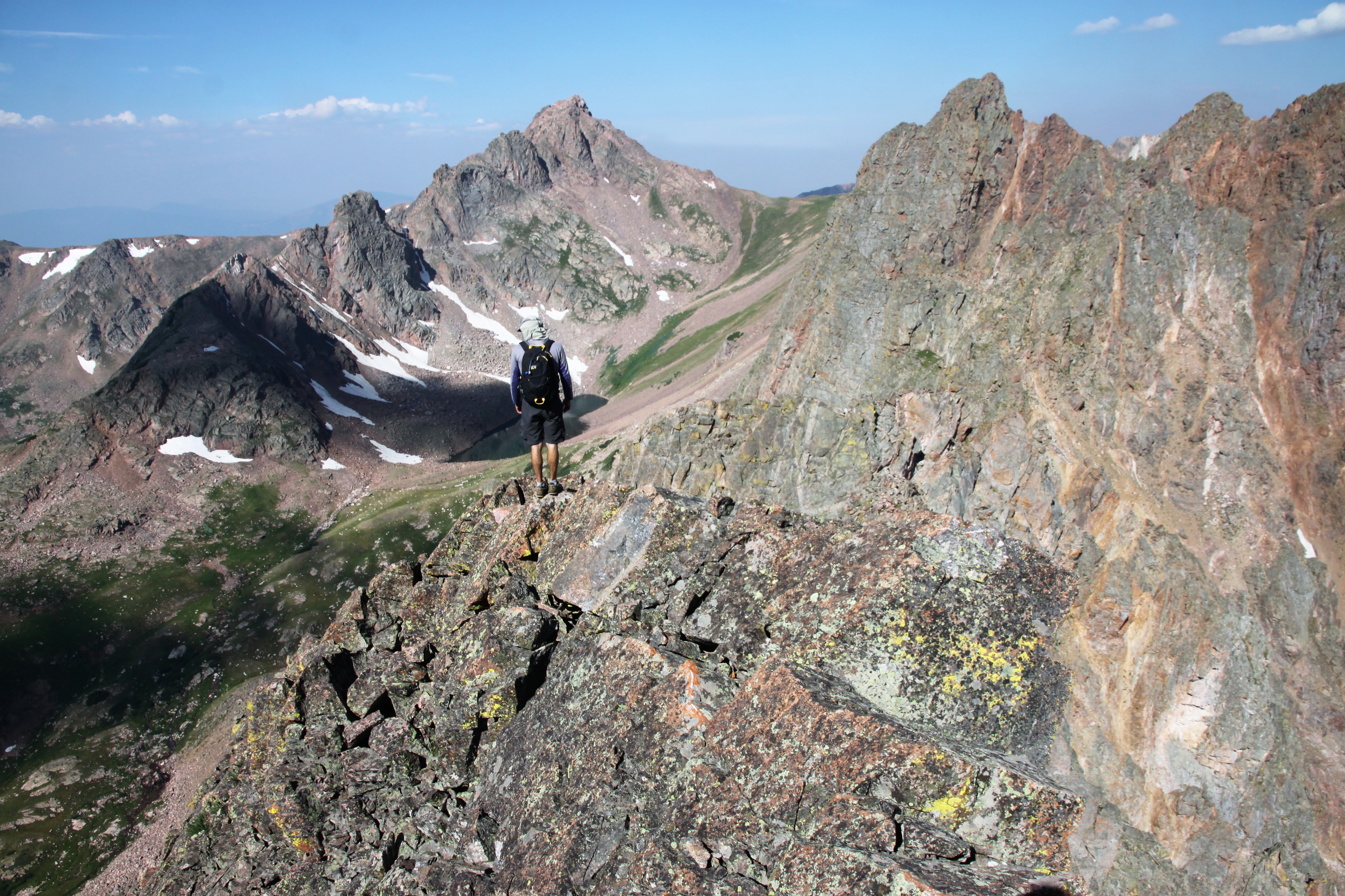
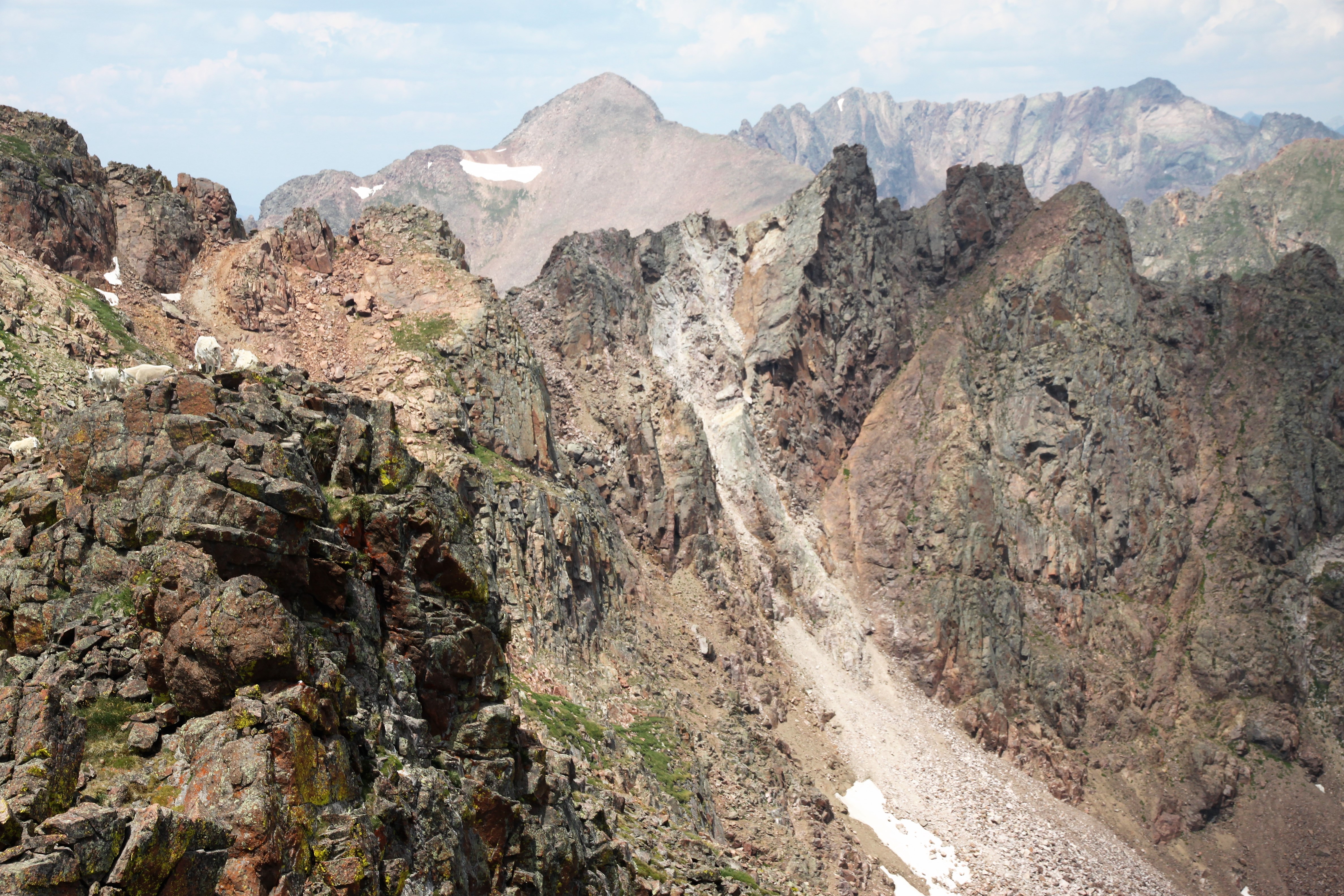
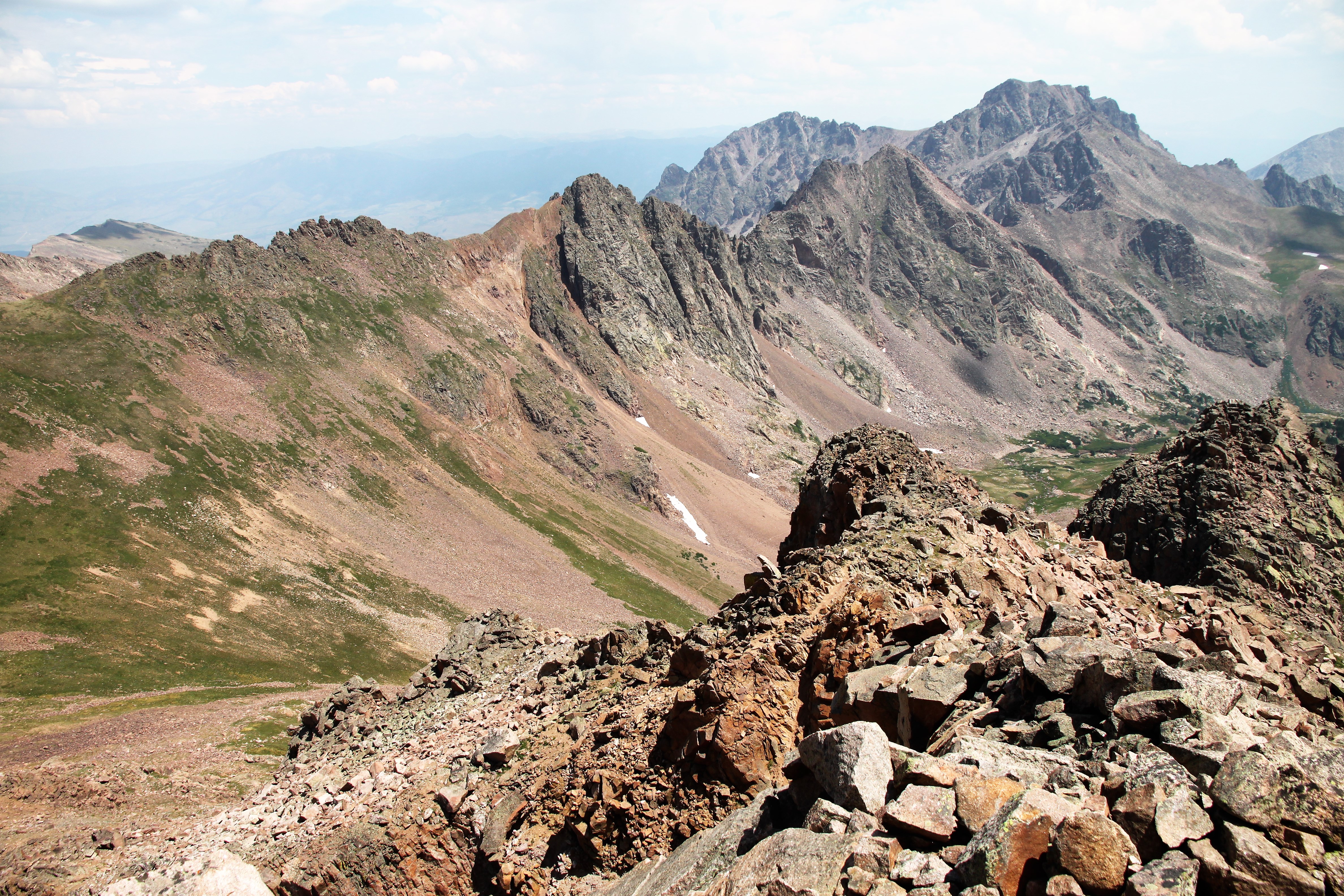
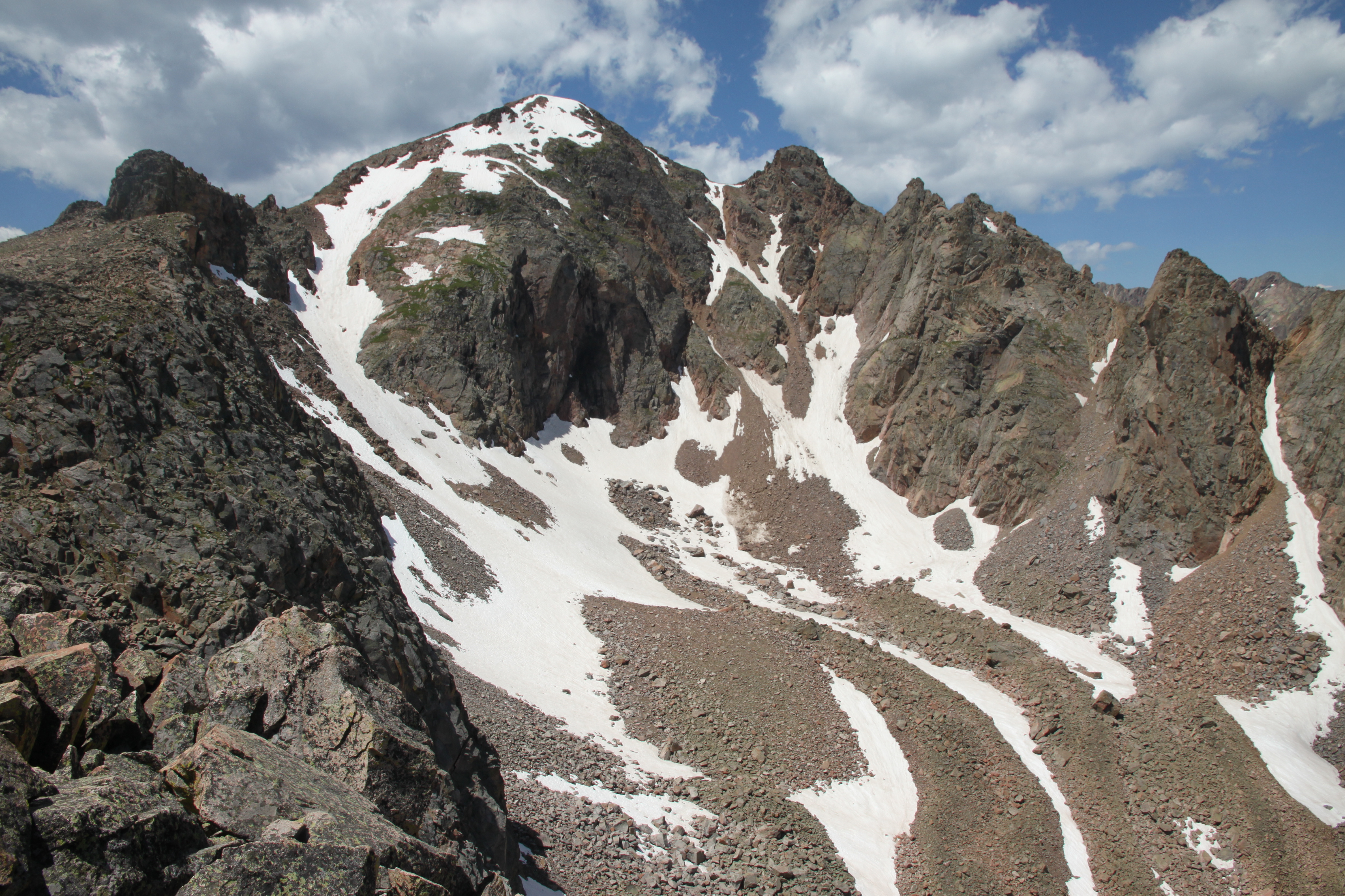
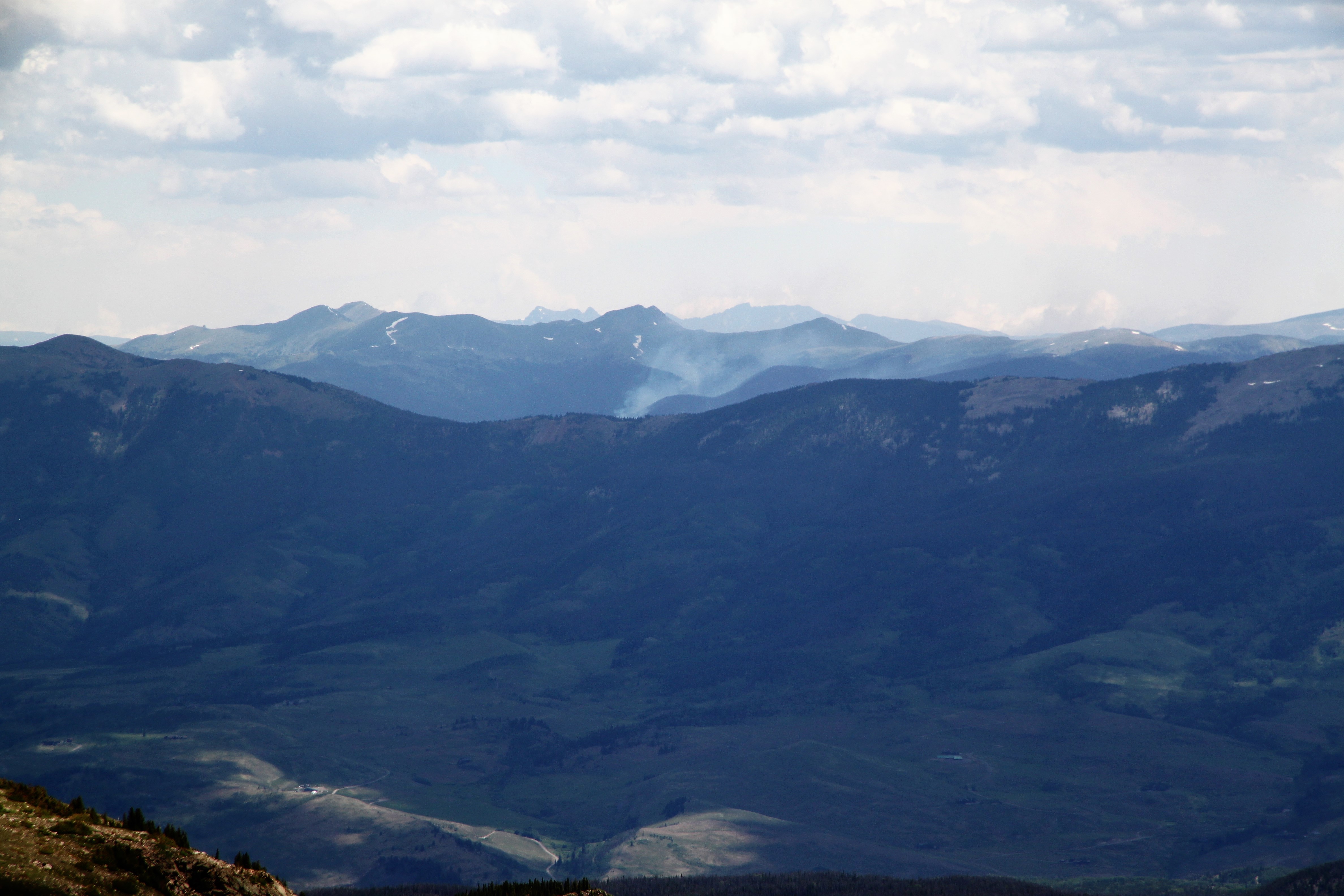
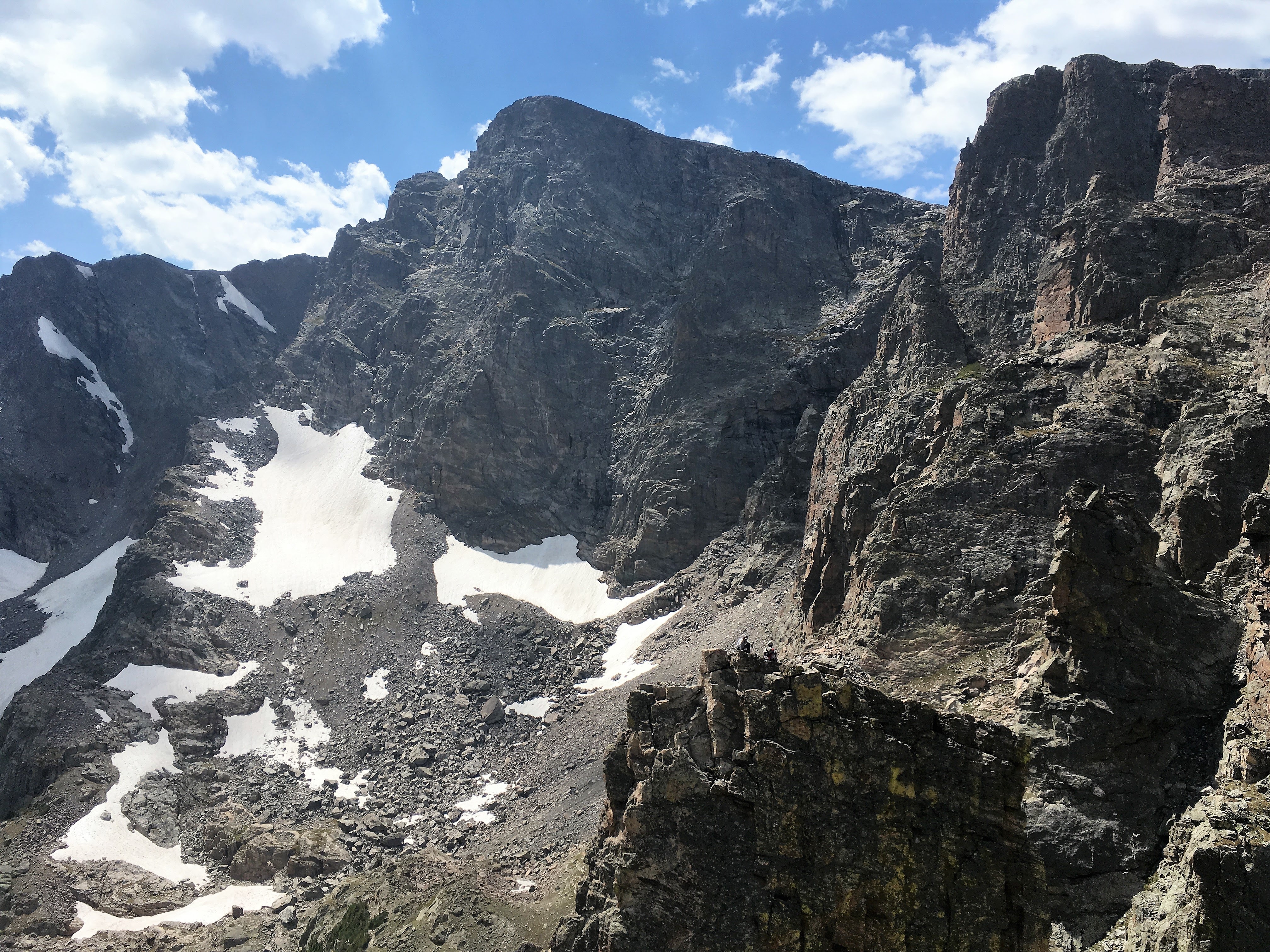
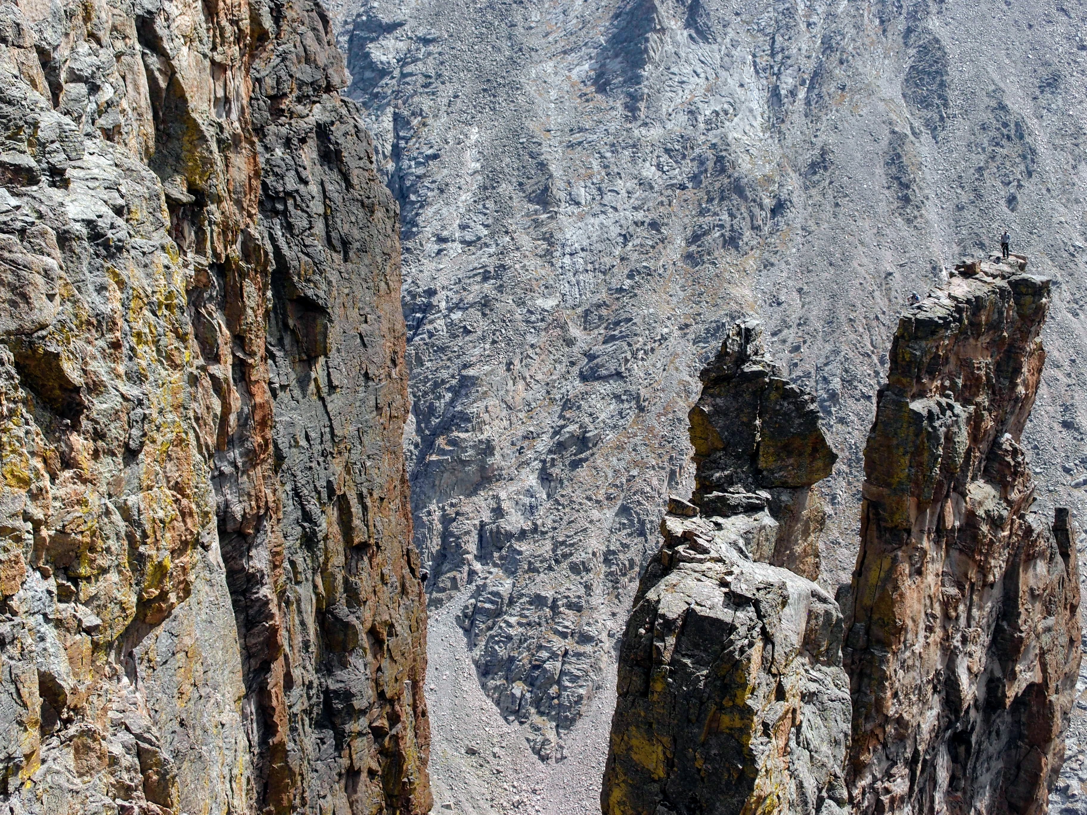
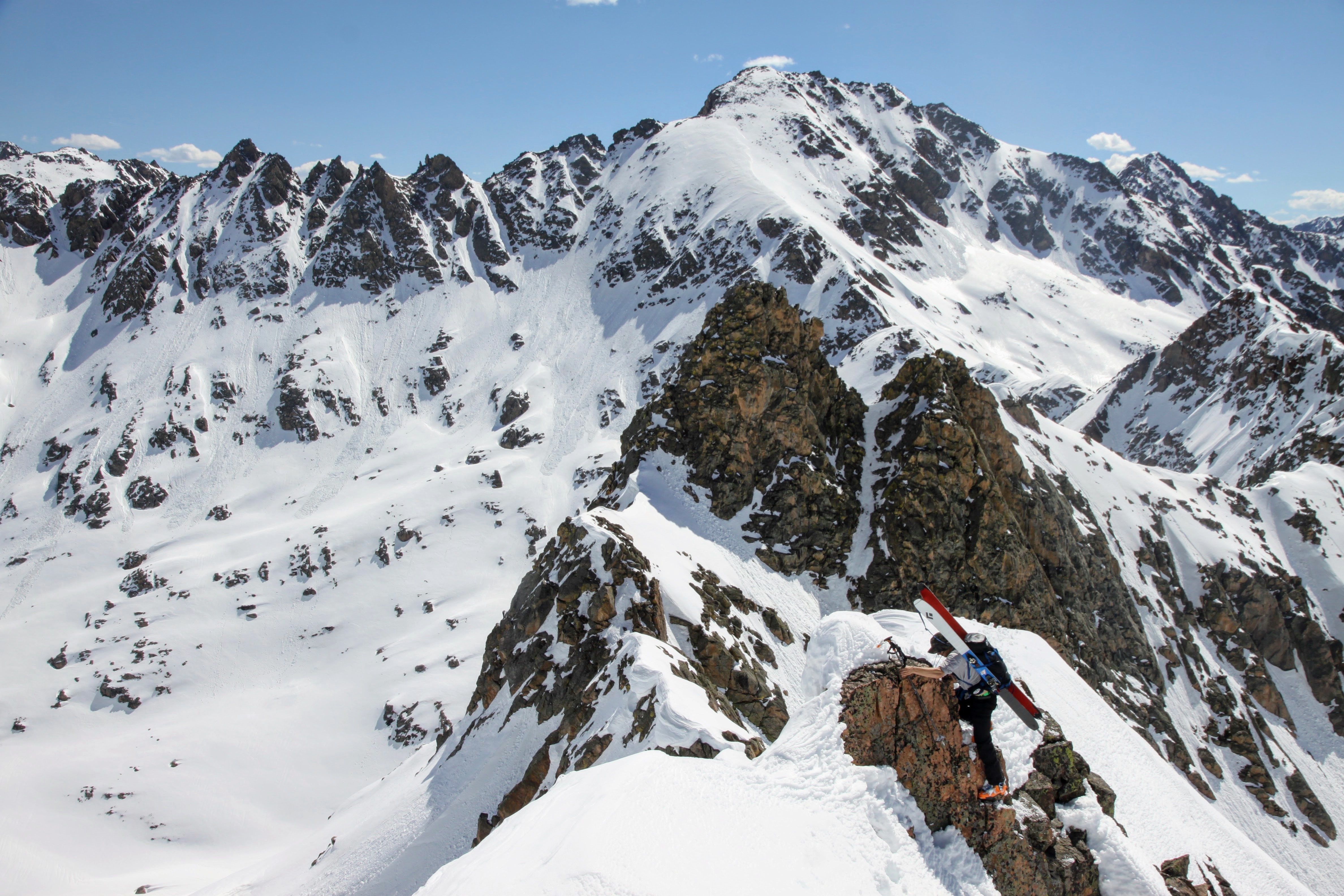
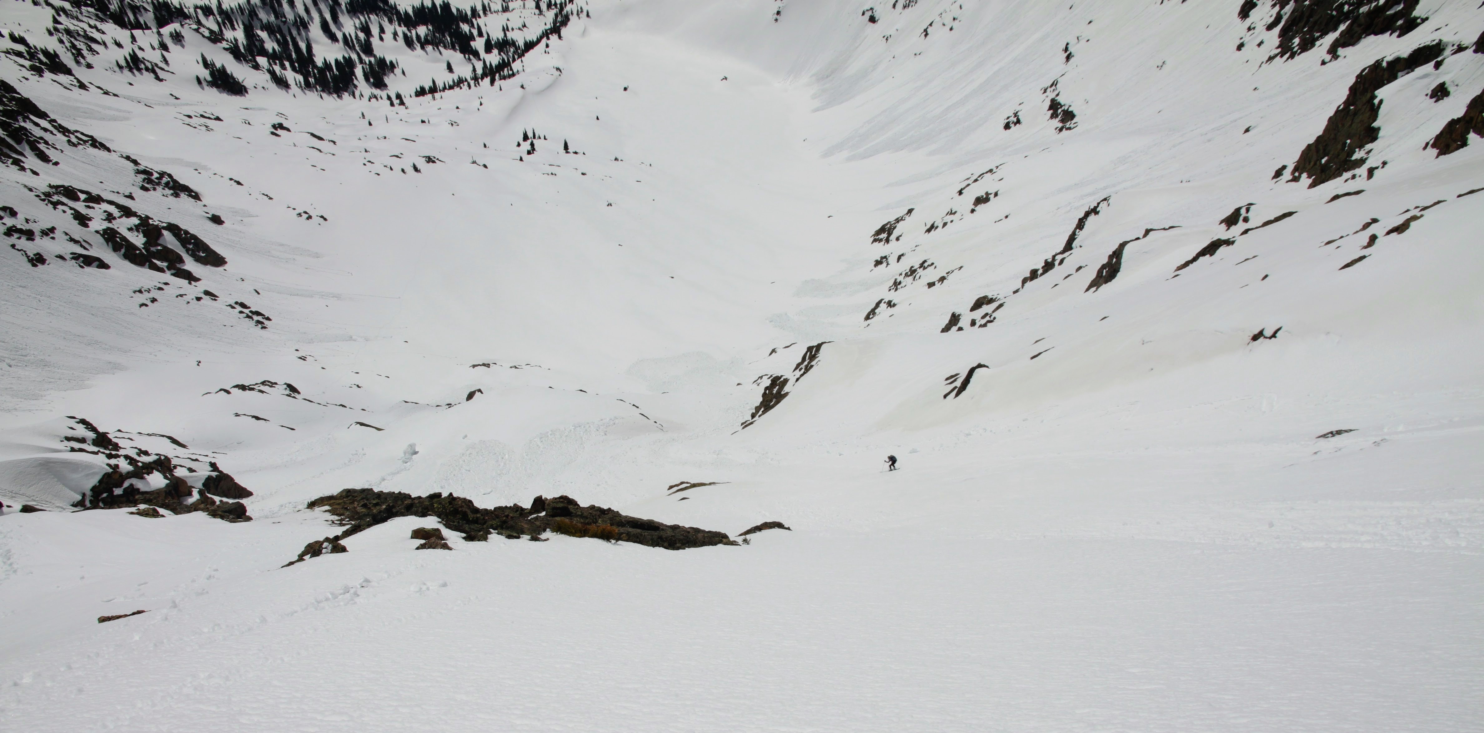
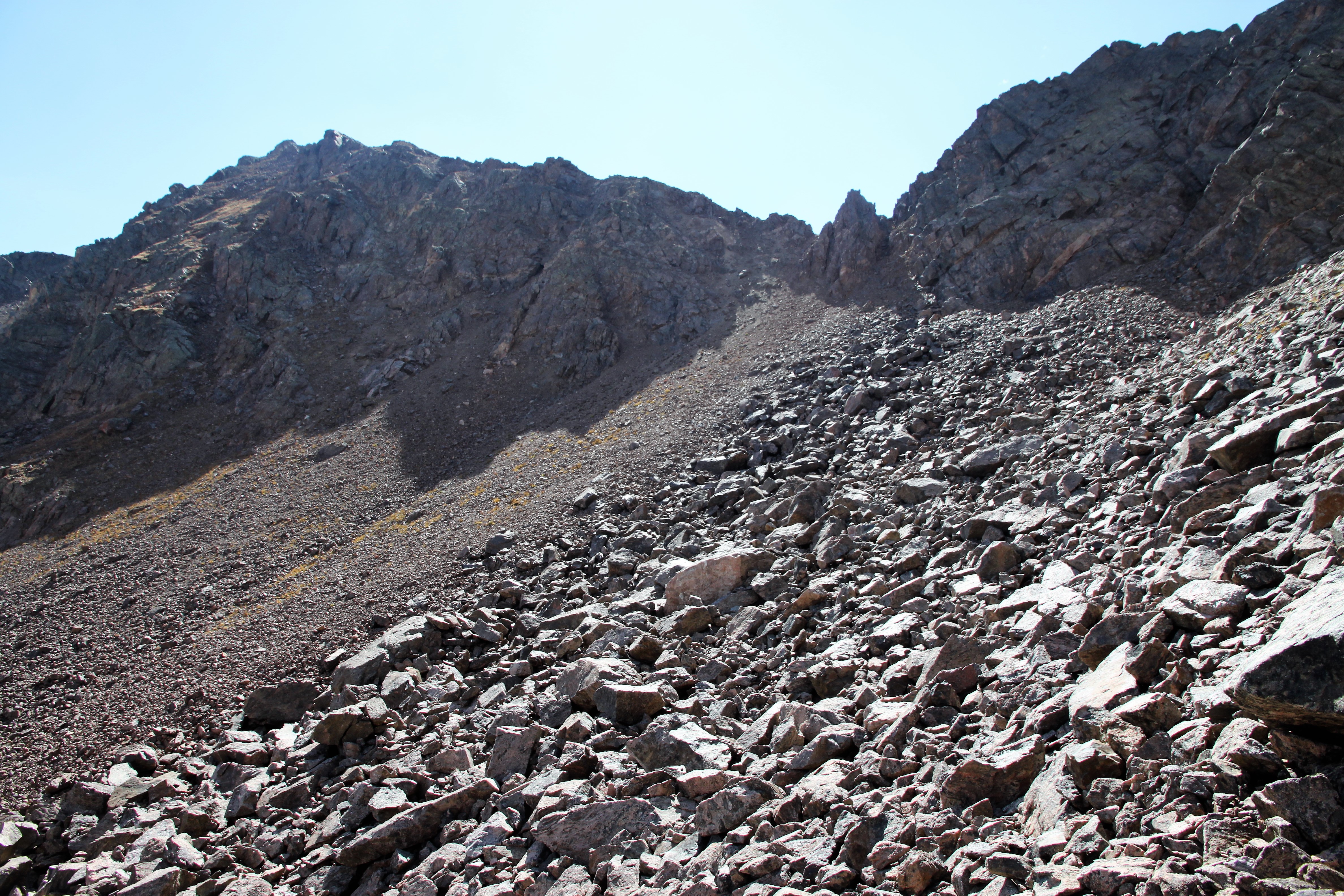
Looking forward to Peak Z and Z’ to the east. Still some distance to cover

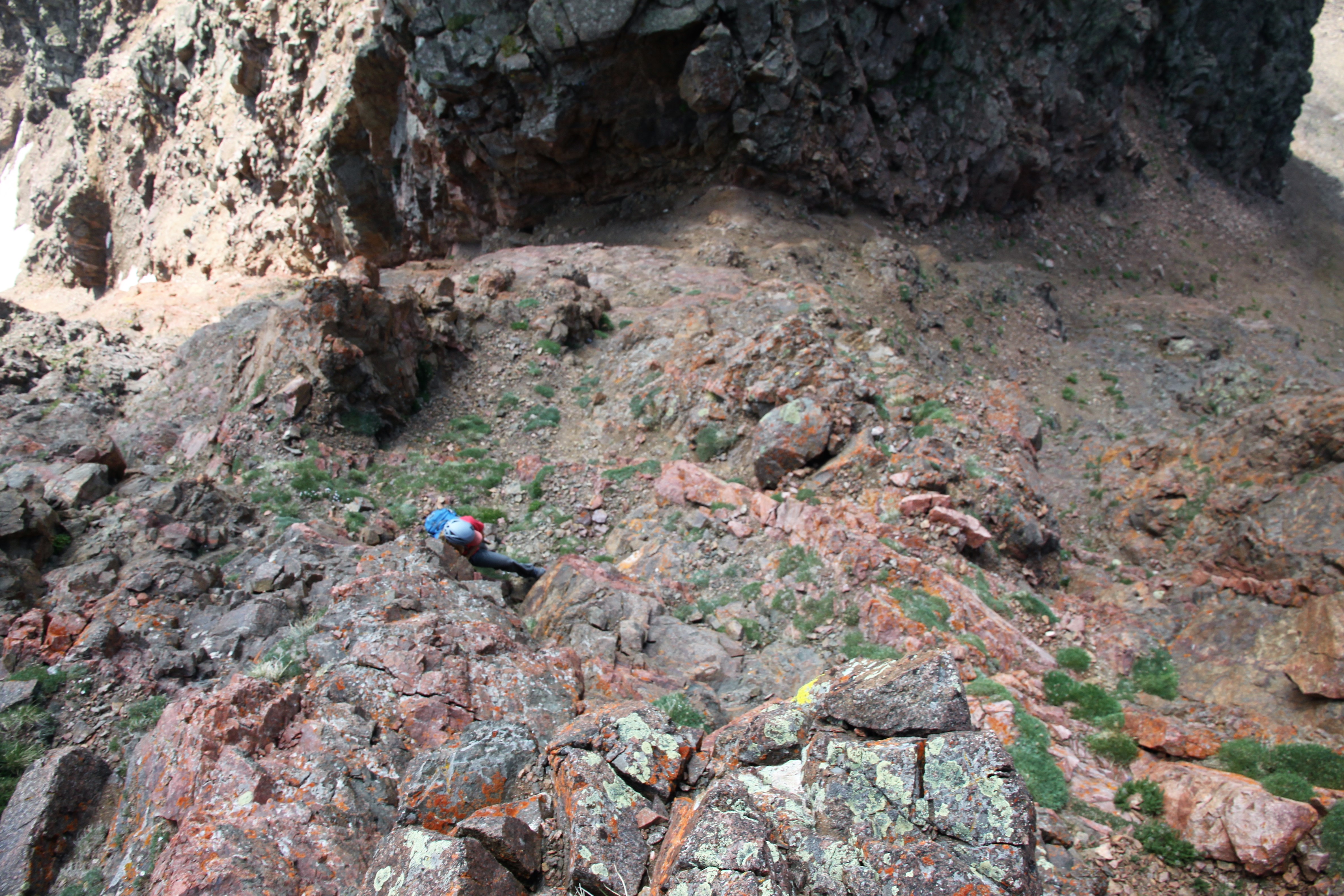
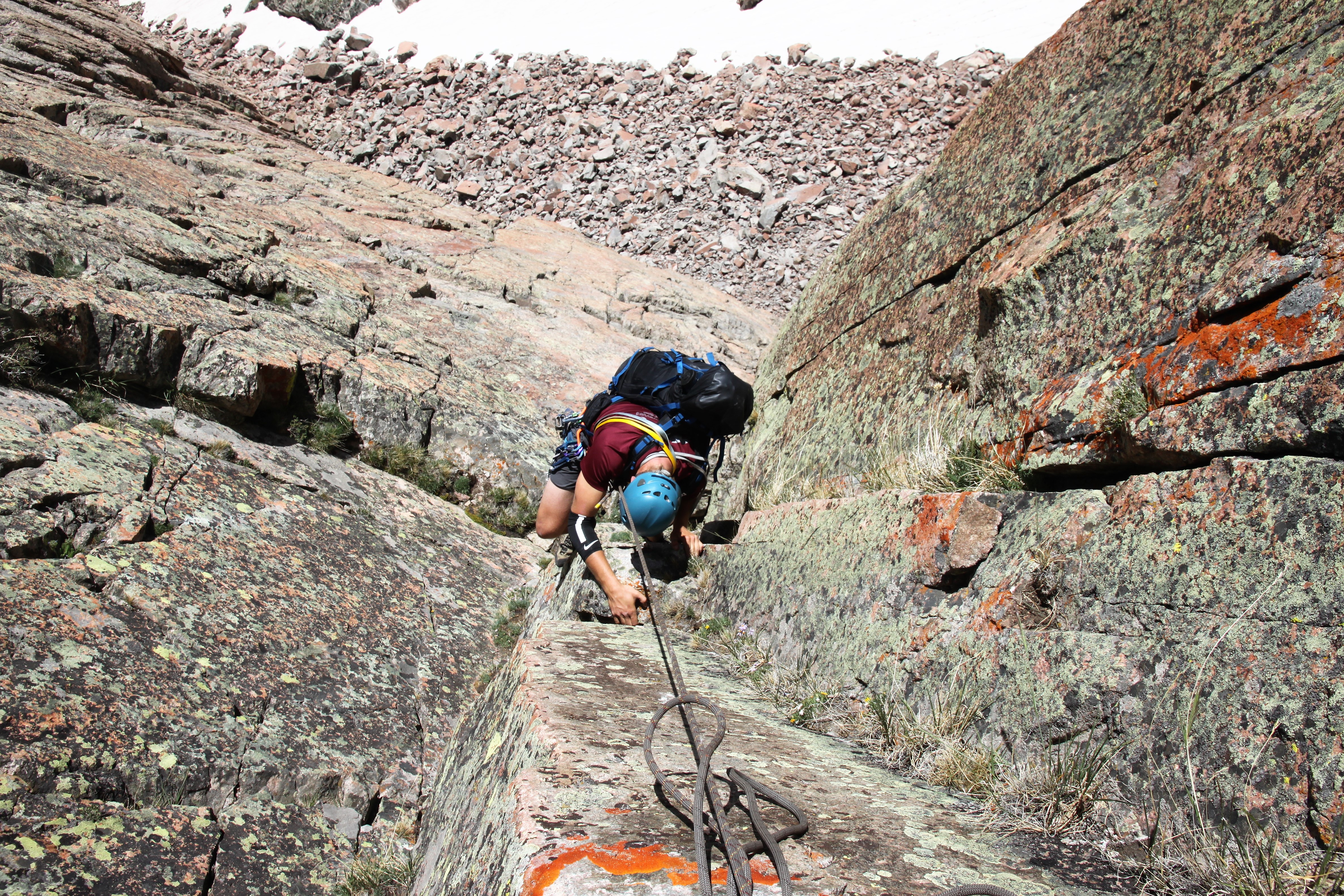
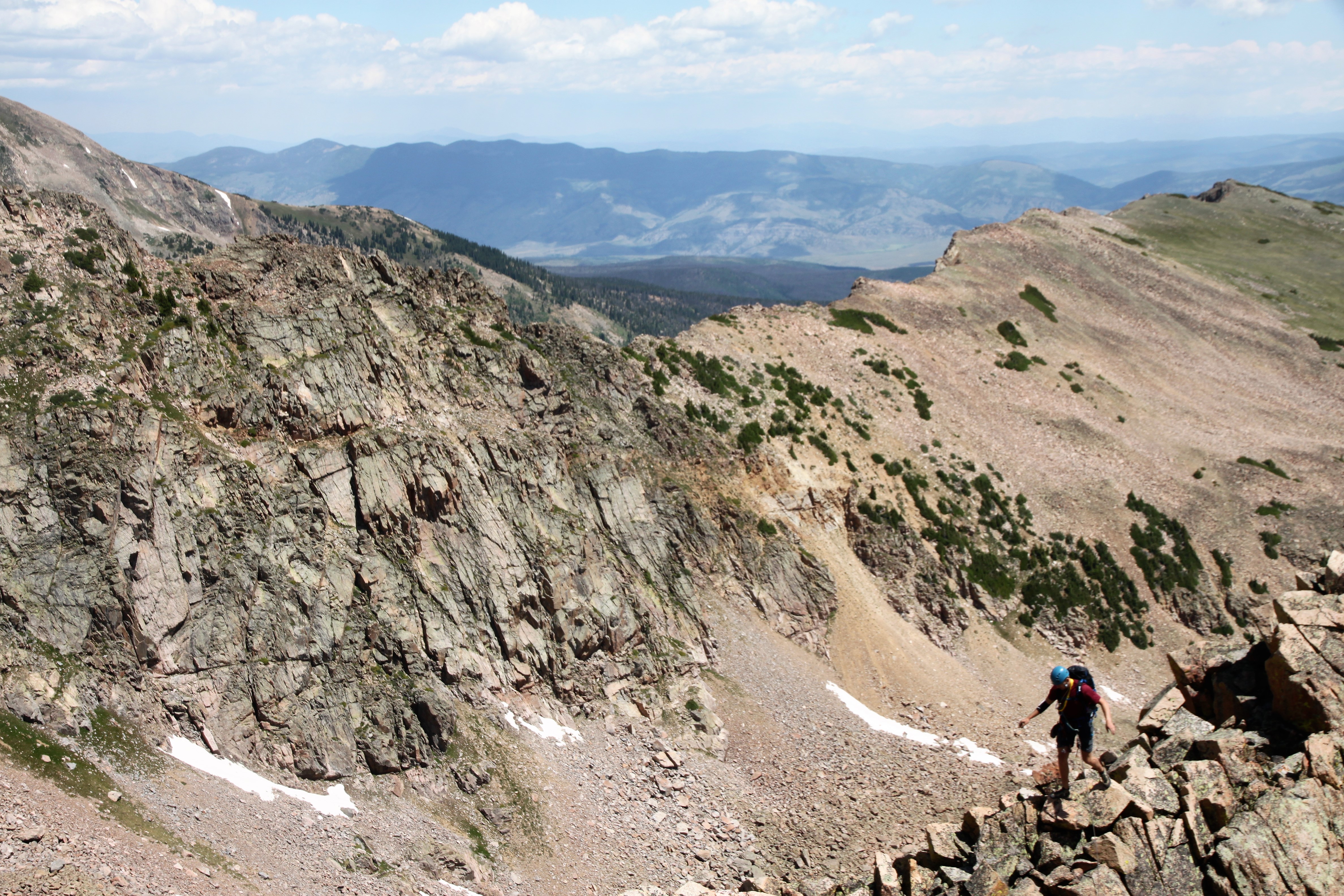
Poor Dylan was really feeling the activities of the previous night and wanted to get down. I told him to follow us a bit down to the low point with Peak Y and we can find him a gully to descend down to the basin below.

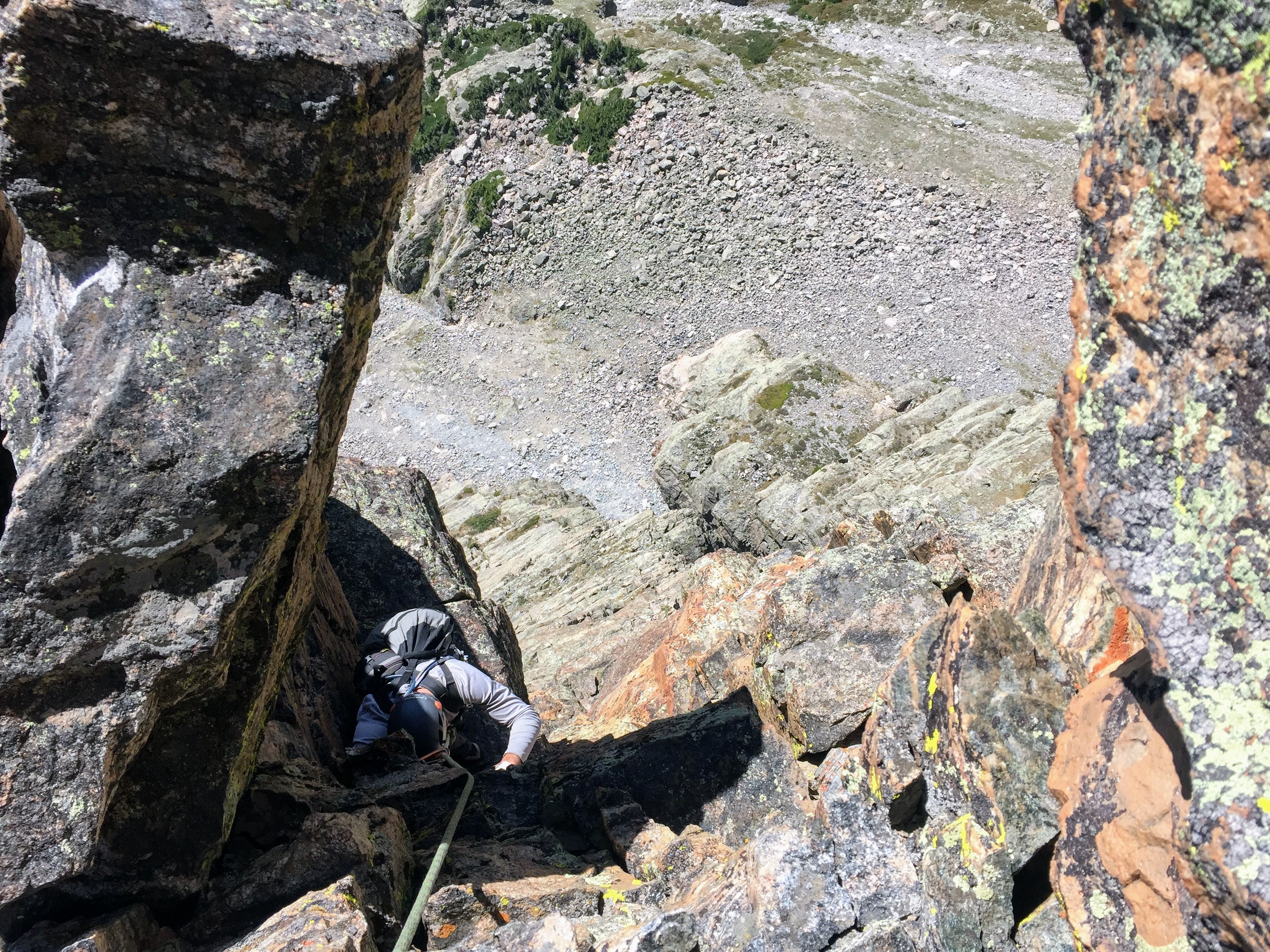
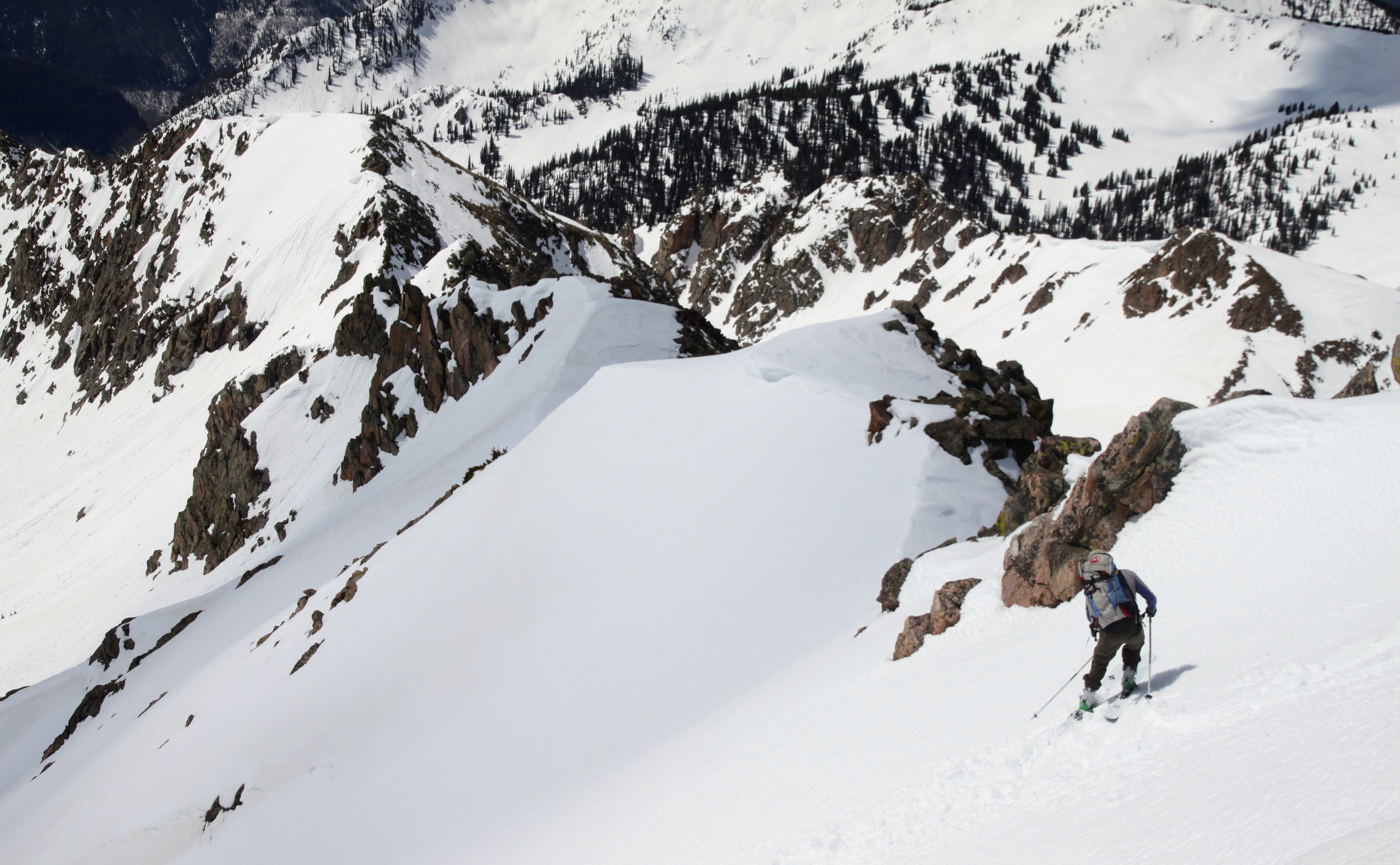
Descending Peak X’s northeast ridge

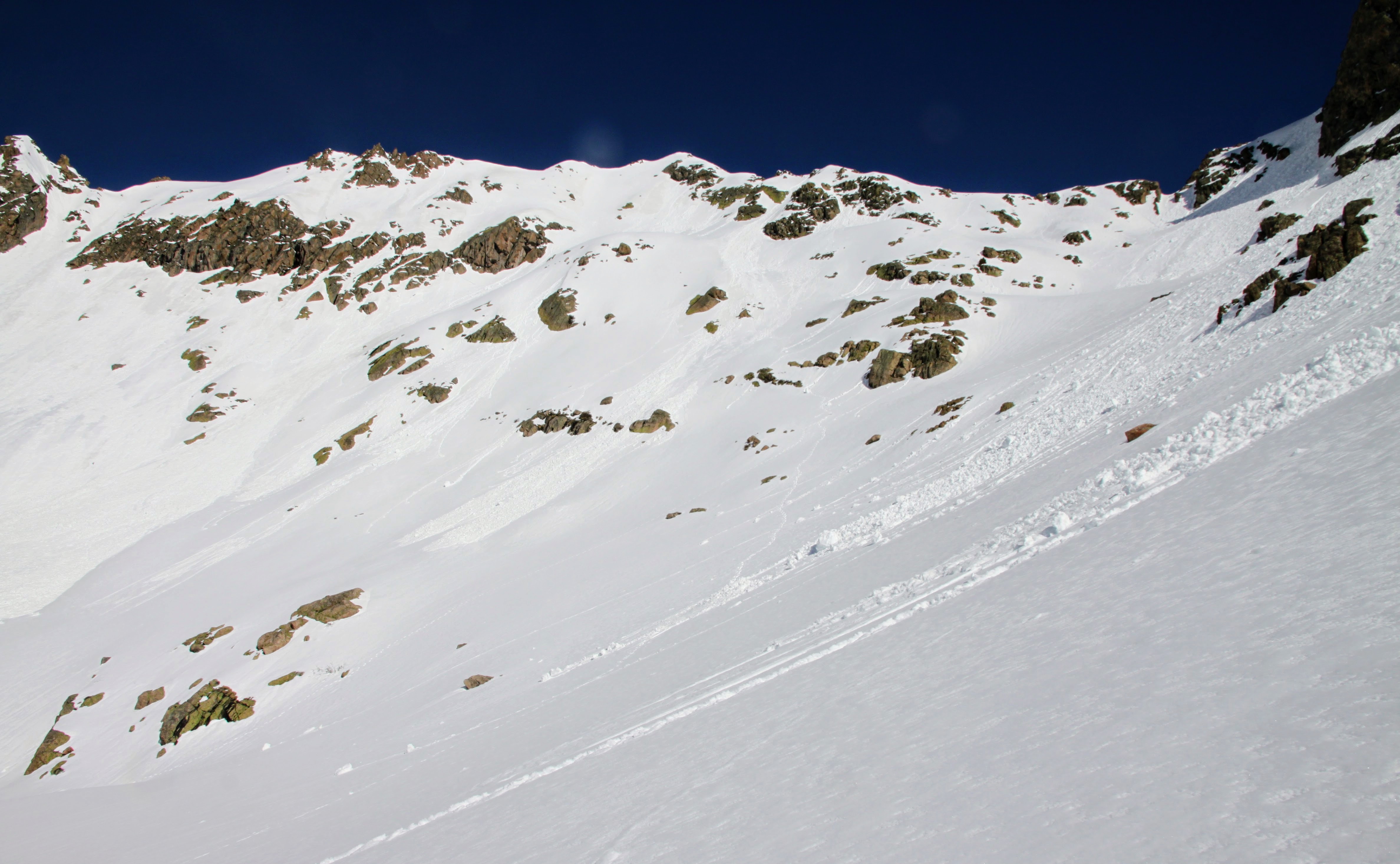
We did find a decent class 3/4 gully for young Dylan to descend and we said our farewells. Chris gave Dylan the keys to his car and he ended up rolling all the way back to the TH solo and getting on home. Chris, J, and I continued on to Peak Y.

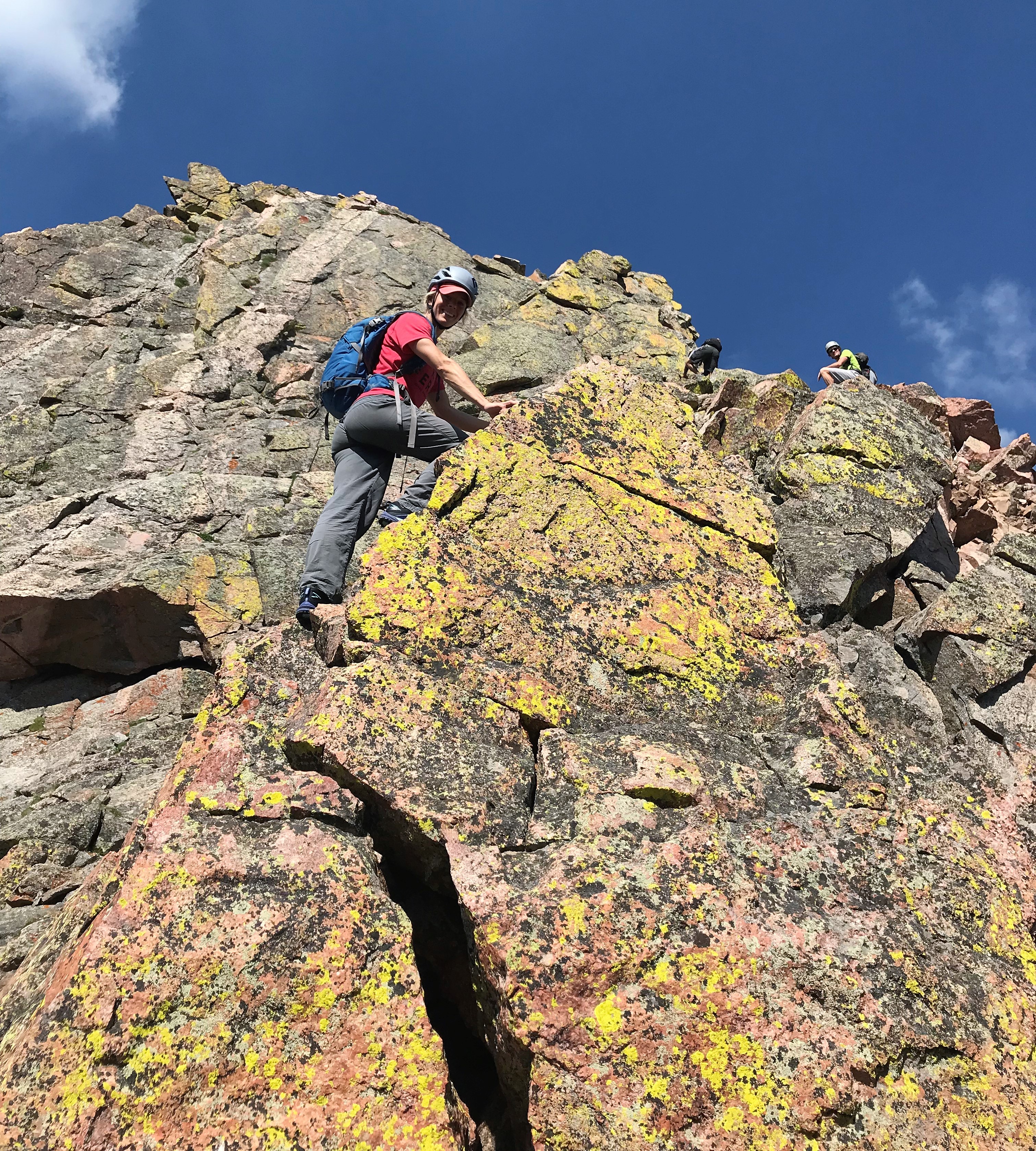
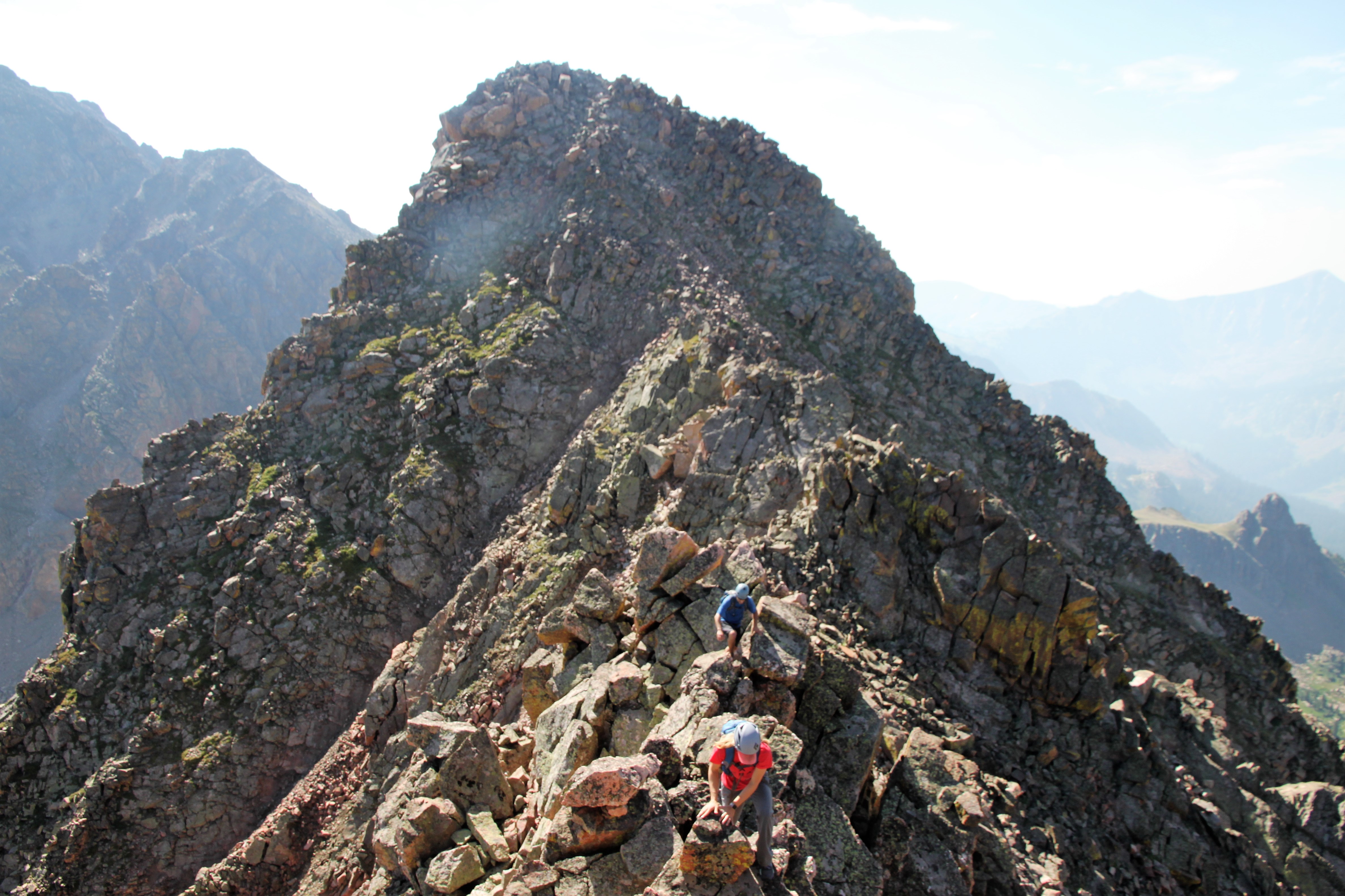
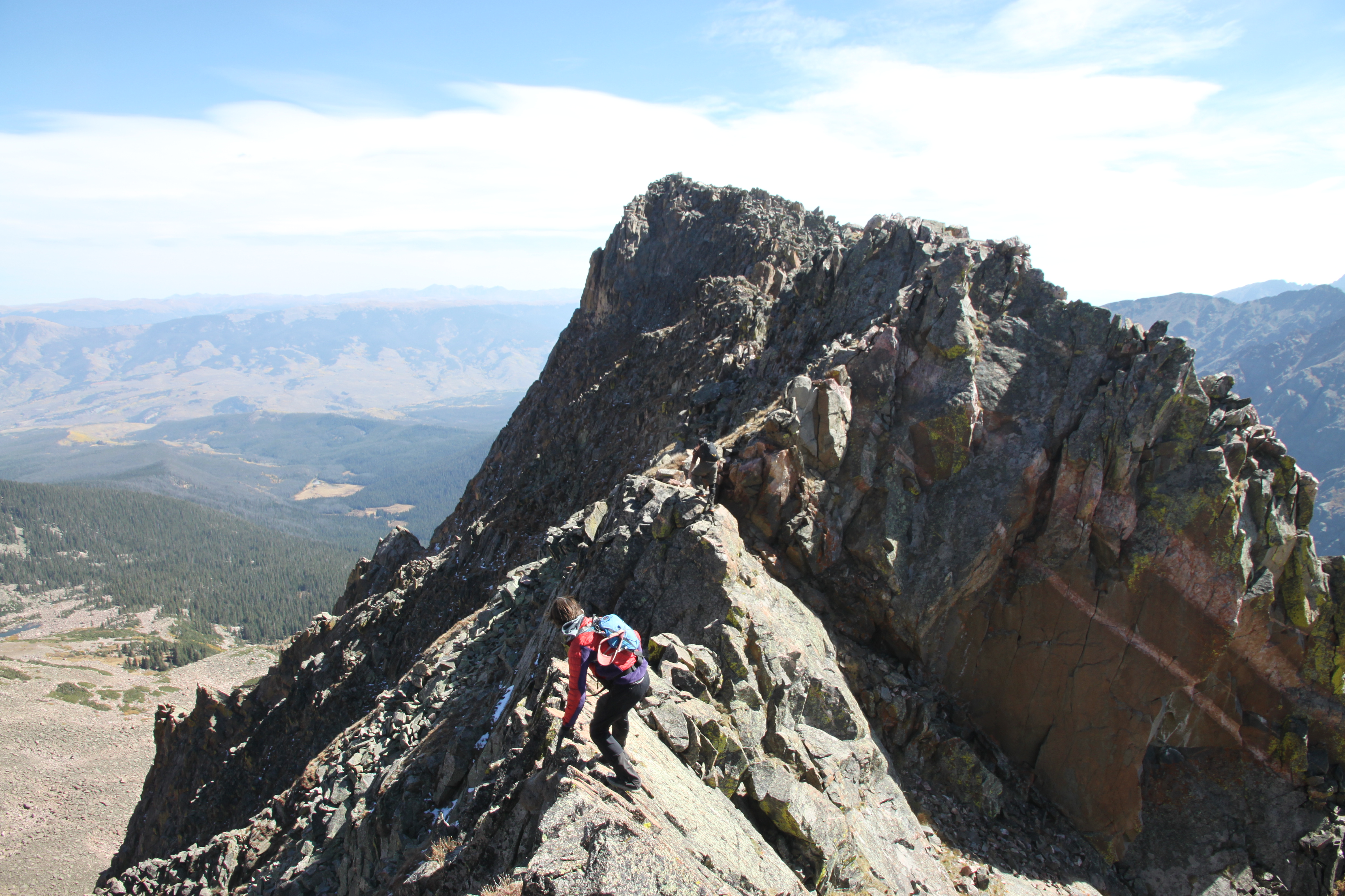
J on a mini knife-edge

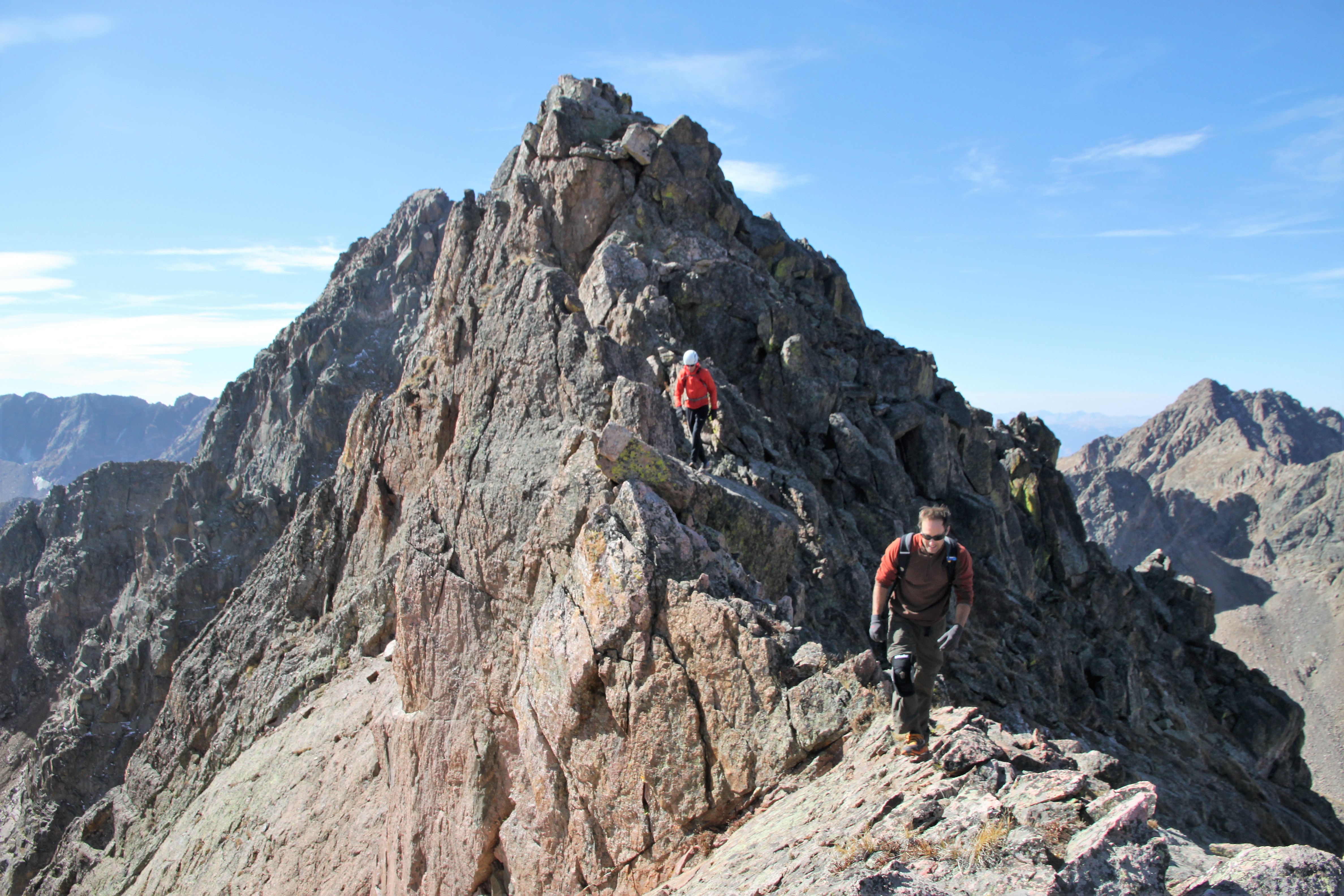
En route to Peak Y with Peak X behind

Peak X from the summit of Peak Y (12,939′)

J on the summit of Peak Y with Peaks Z and Z’ still yet to come

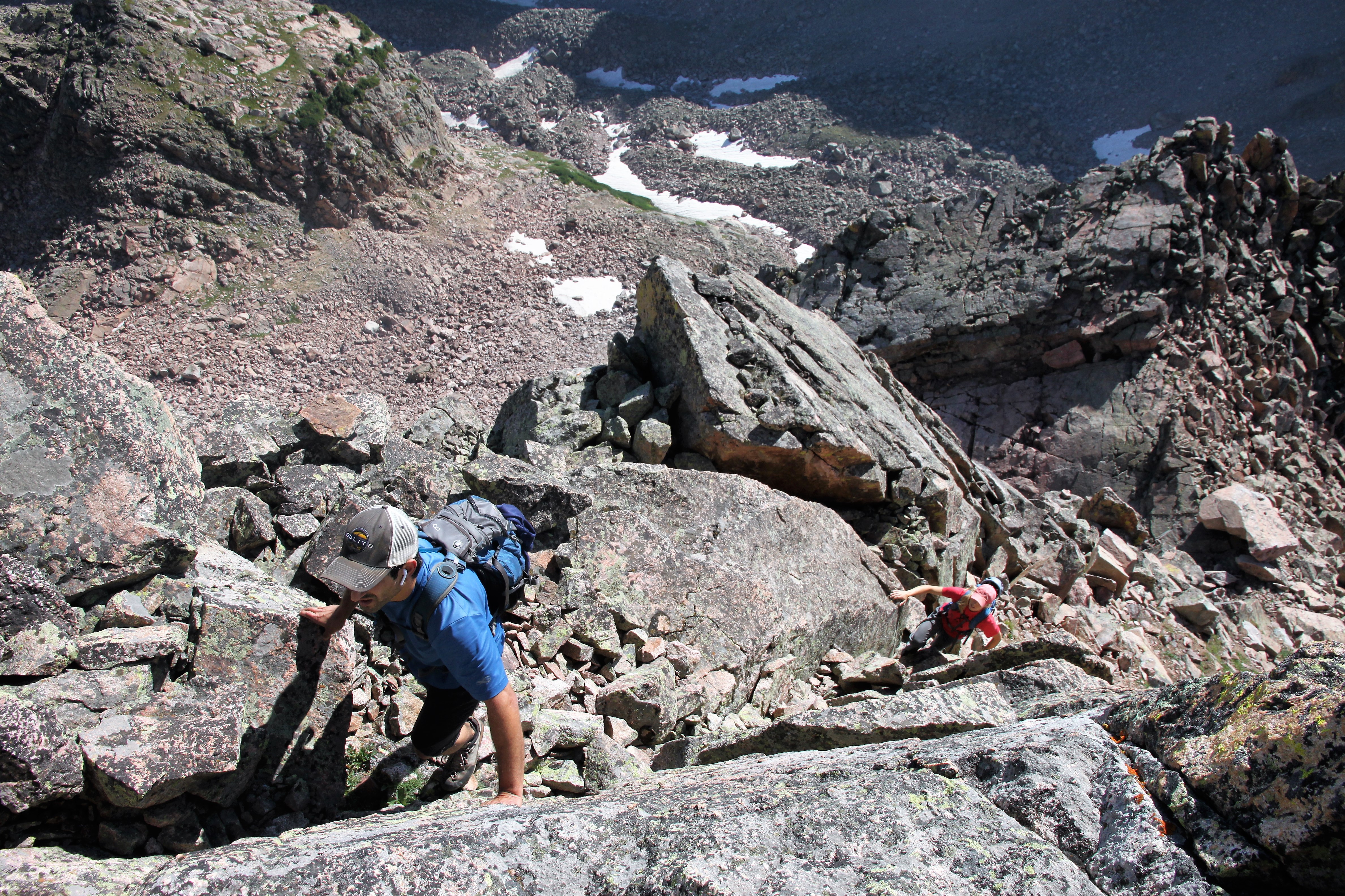
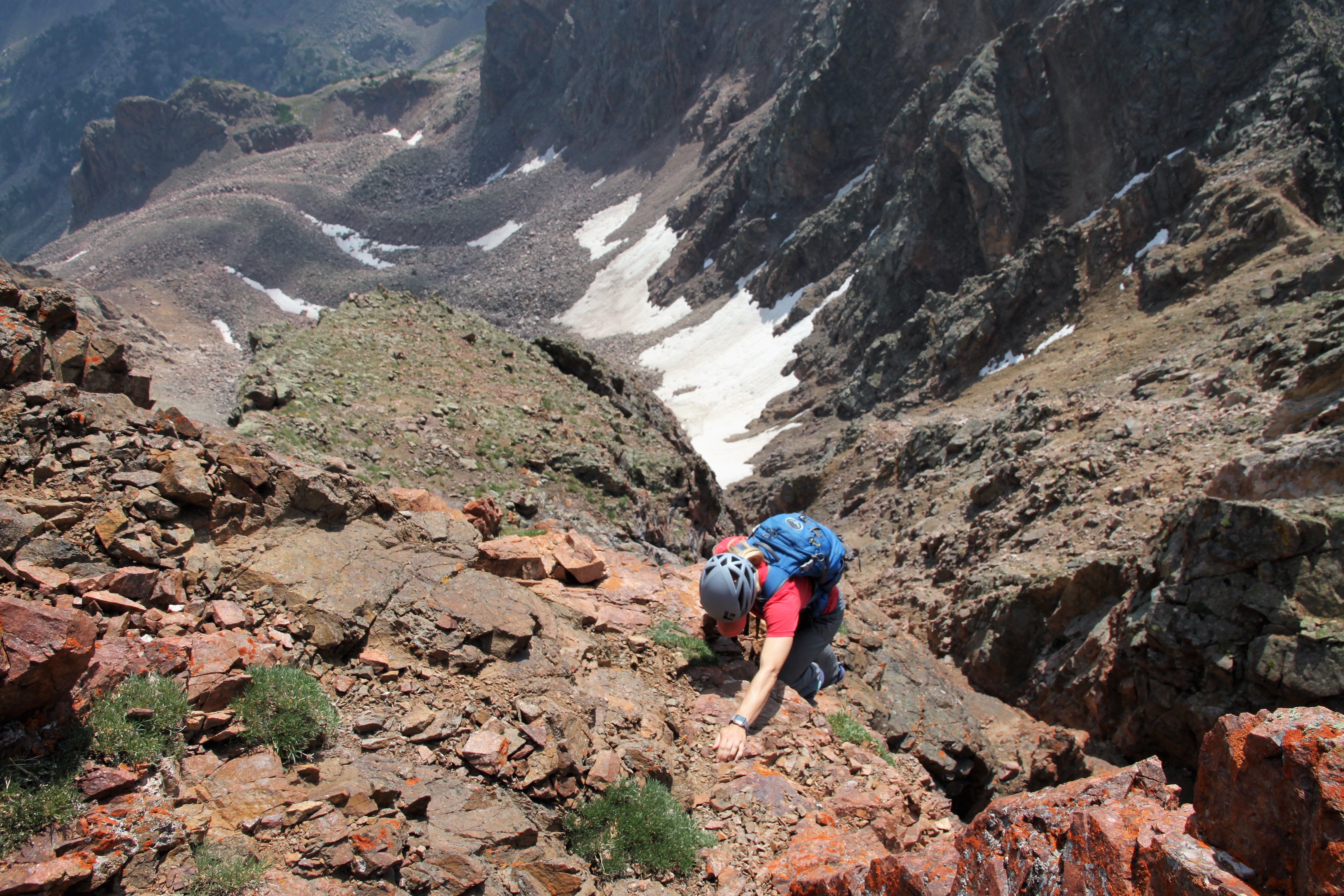
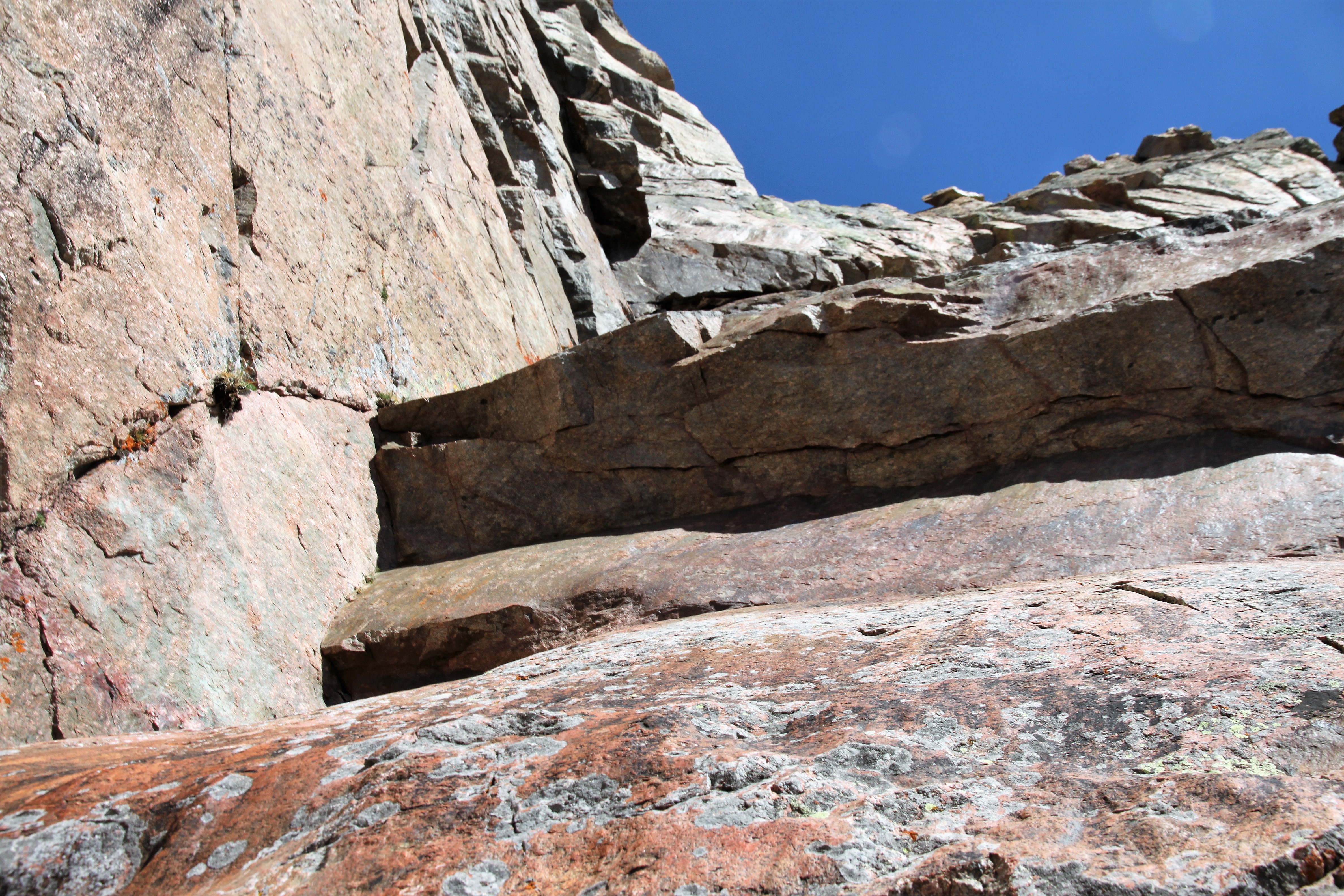
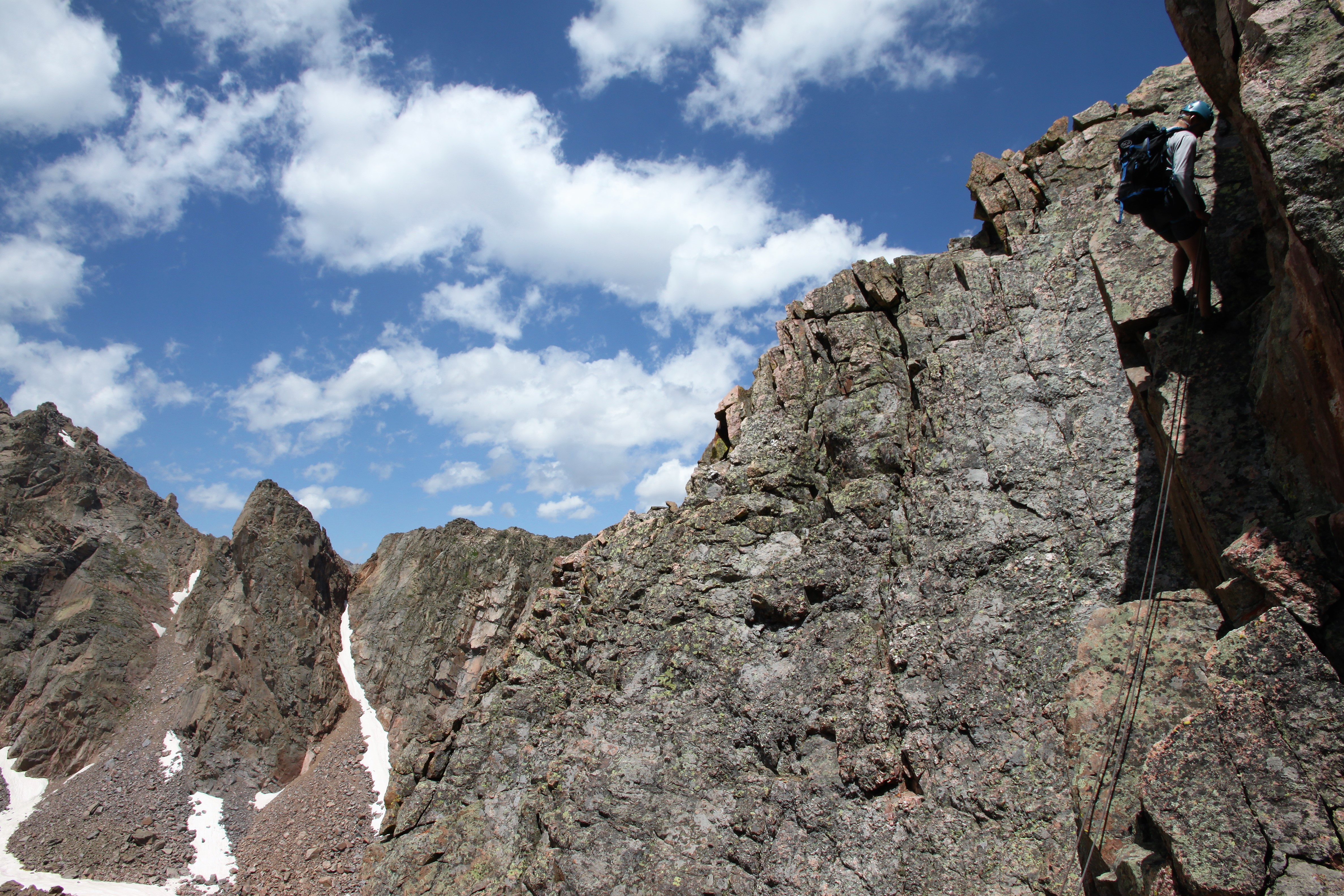
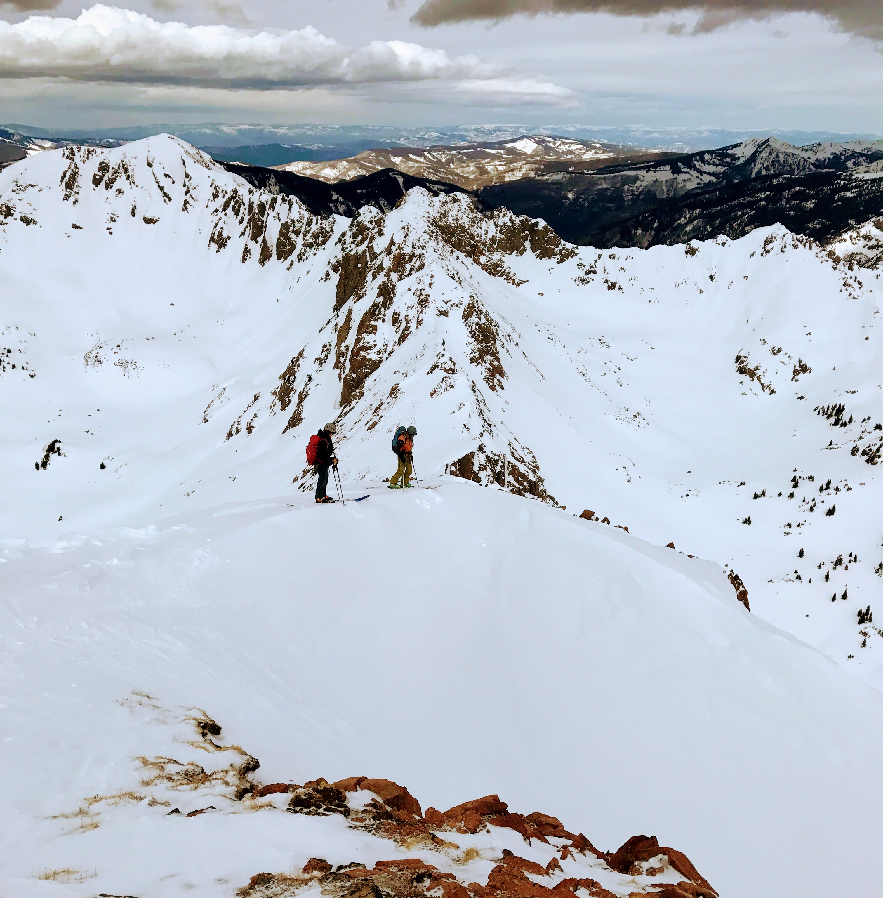
Staying on the ridge crest, we traversed east from Peak Y’s summit. Fairly mellow scrambling led to a drop-off down to a small col hundreds of feet down (would require a rappel). Darn! I guess we would have to descend to the south on steep ledges to bypass this notch. J remained low and contoured up to Peak Z’s west ridge. Baldwin and I ascended back to the small notch and scrambled the remaining ridge down to the low point saddle between Peaks Y & Z. Peak Z’s west ridge was simple enough and soon we were on Peak Z’s summit.

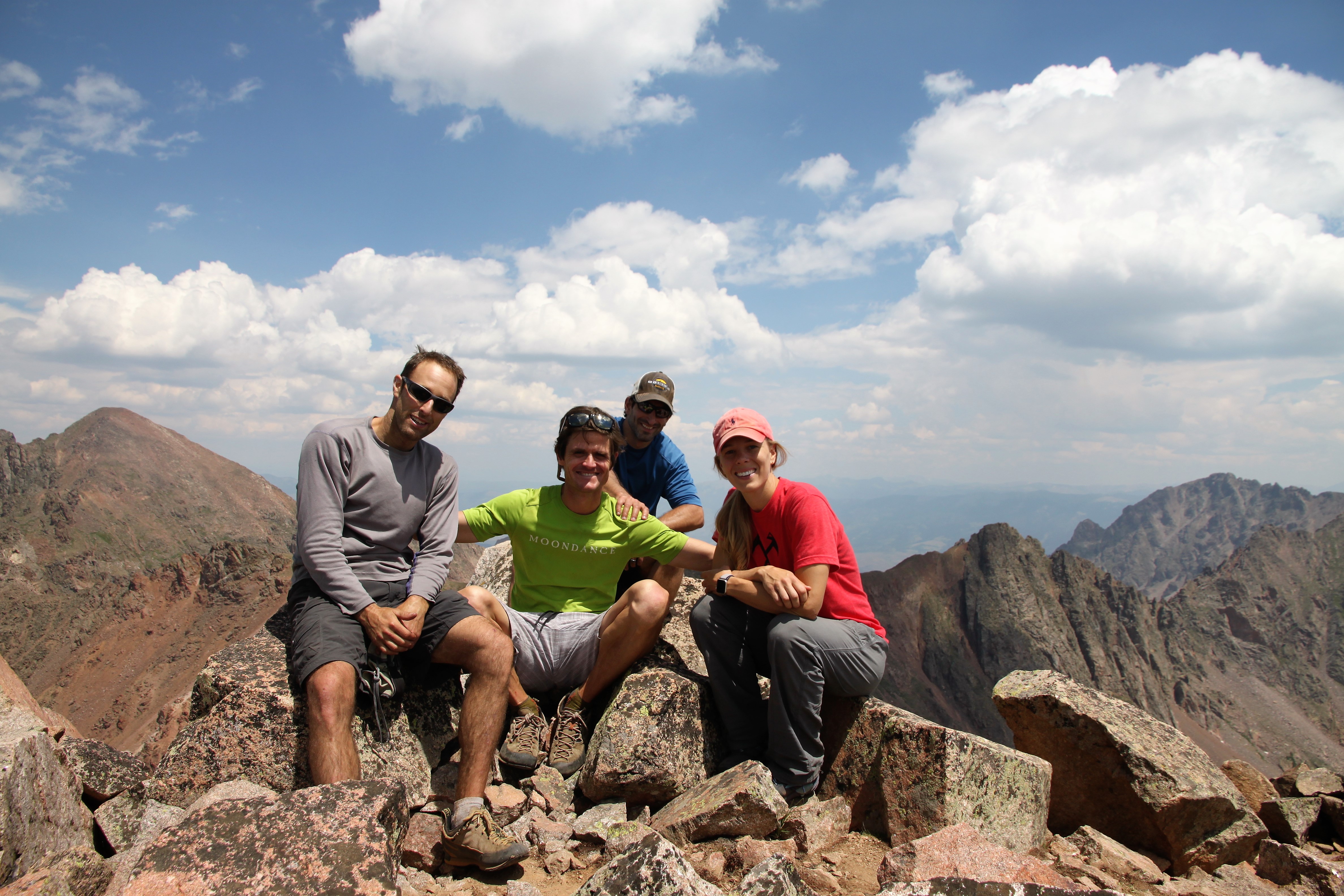
Peak Z summit (13,245′)

Peak Z’ from Peak Z’s summit

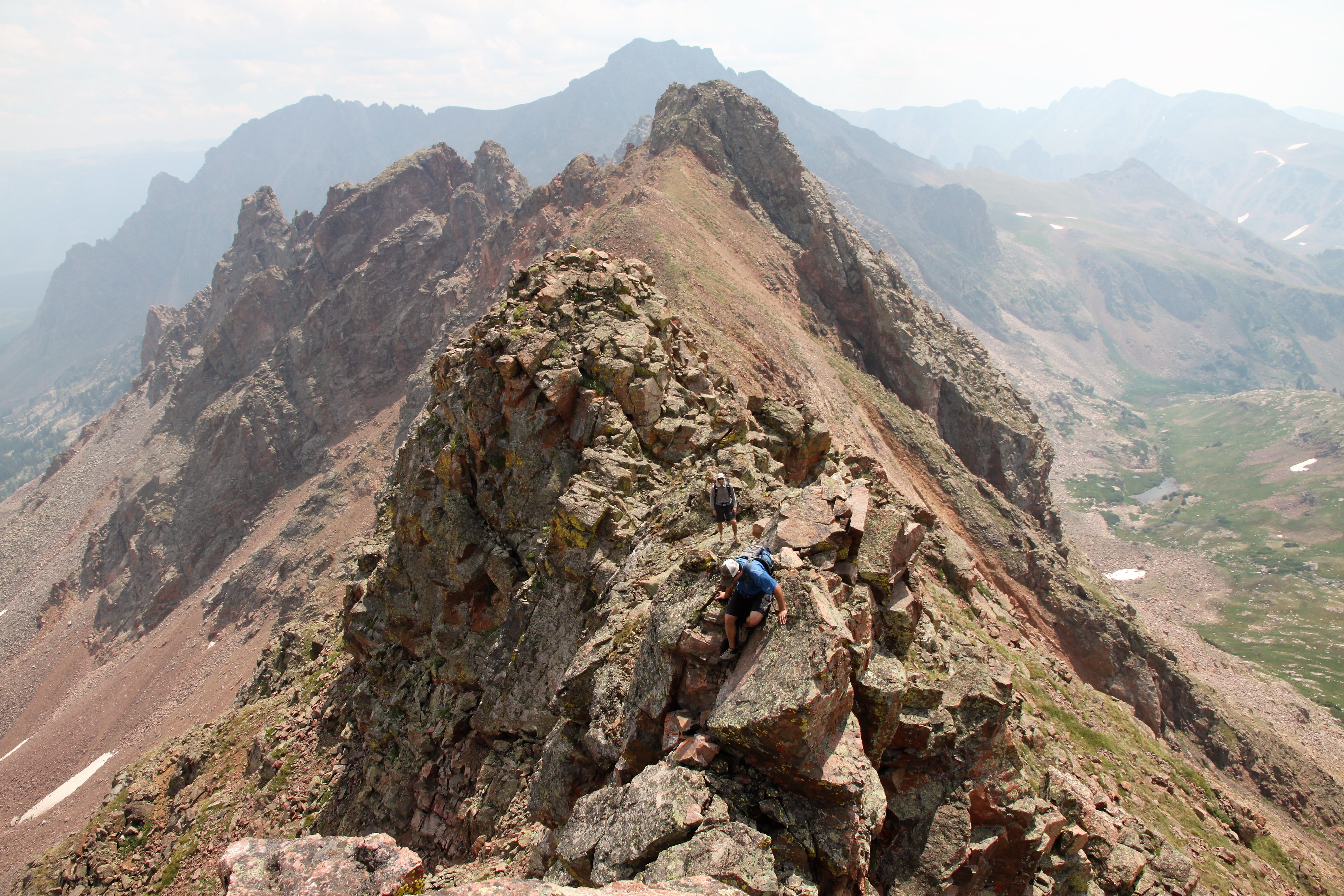
We relaxed for a bit and soaked in the views and made our way down to the very cool northwest ridge of Peak Z’.

Ridge to Peak Z’

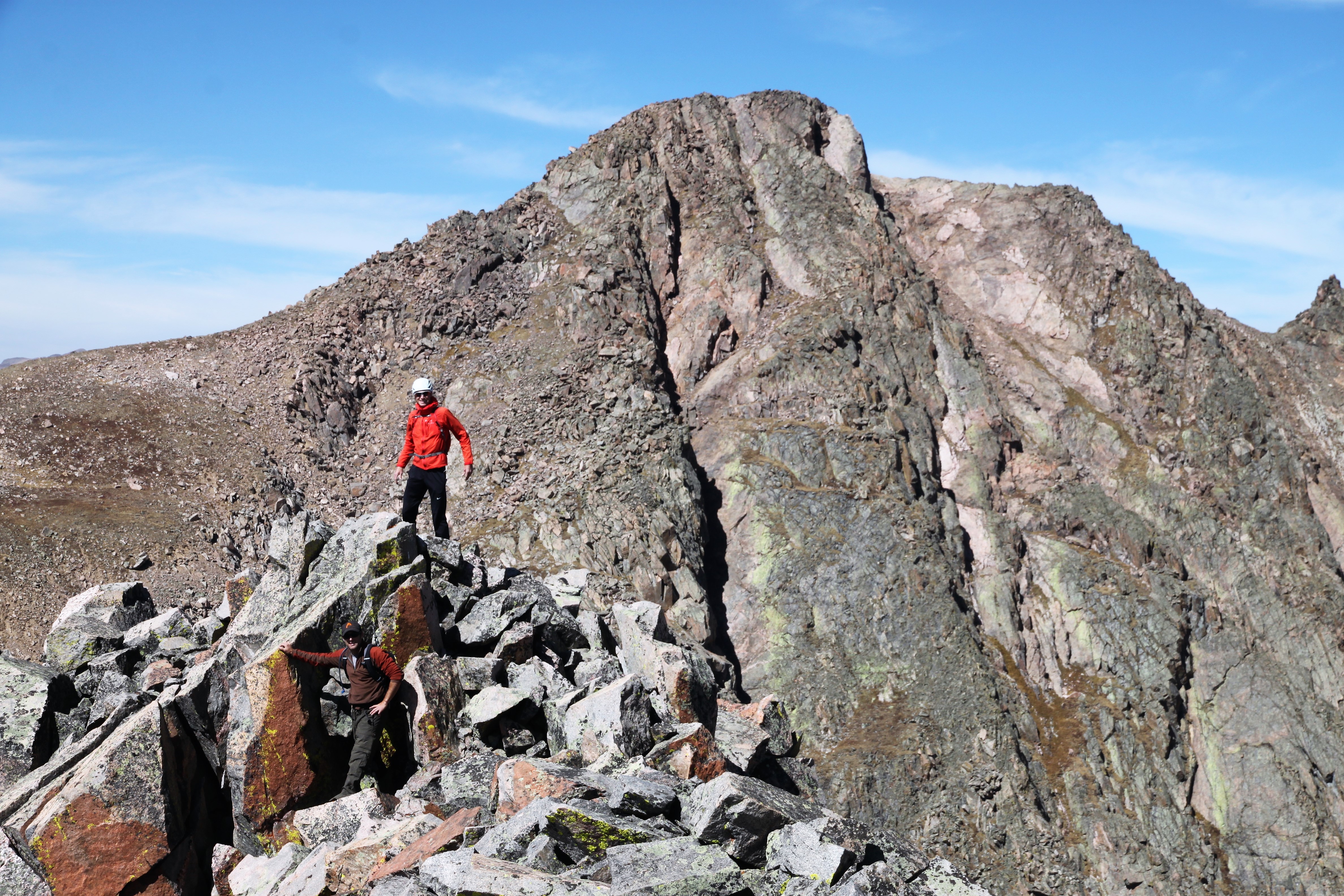
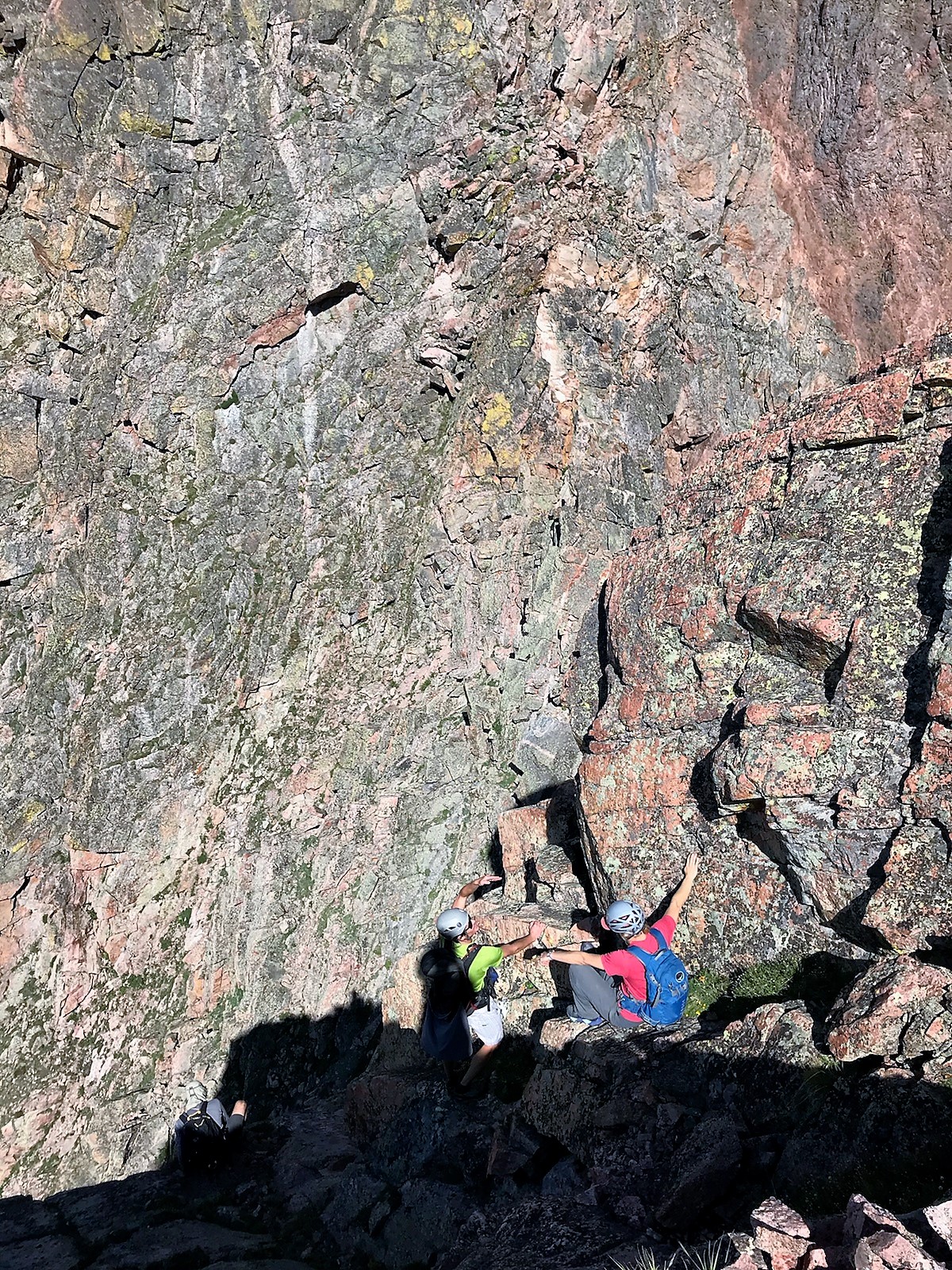
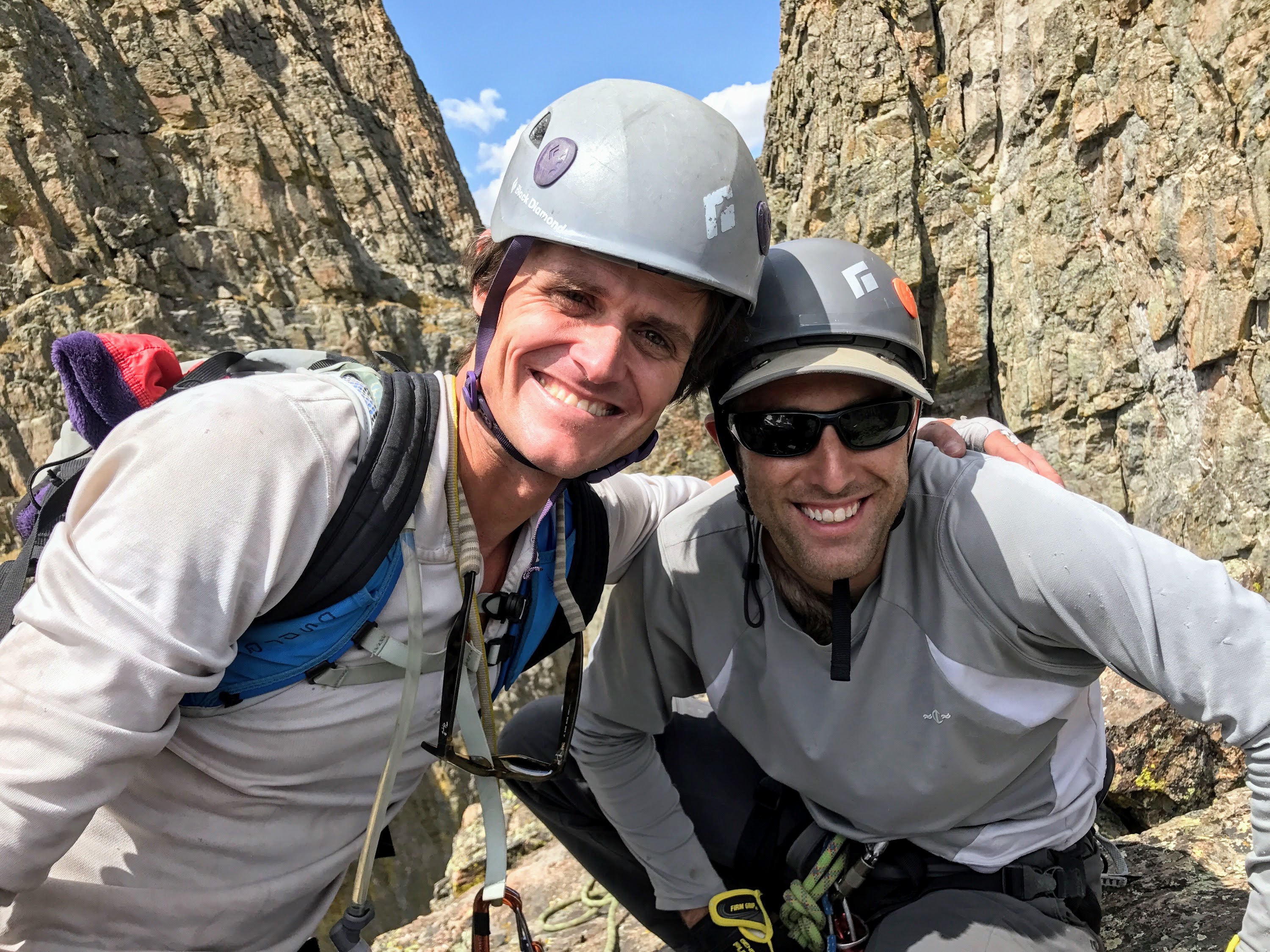
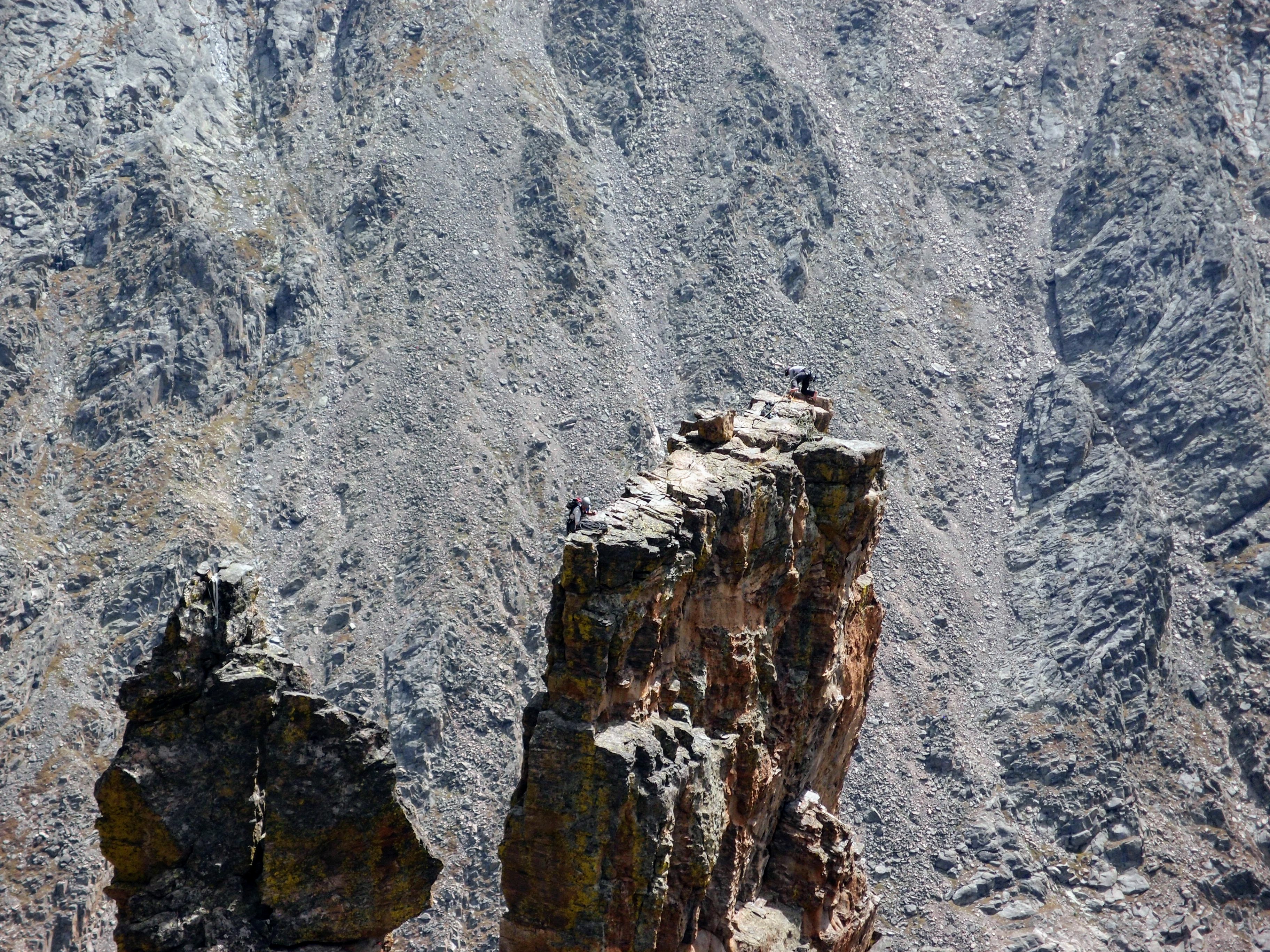
Chris & J on the summit of Peak Z’ with Peak Z behind

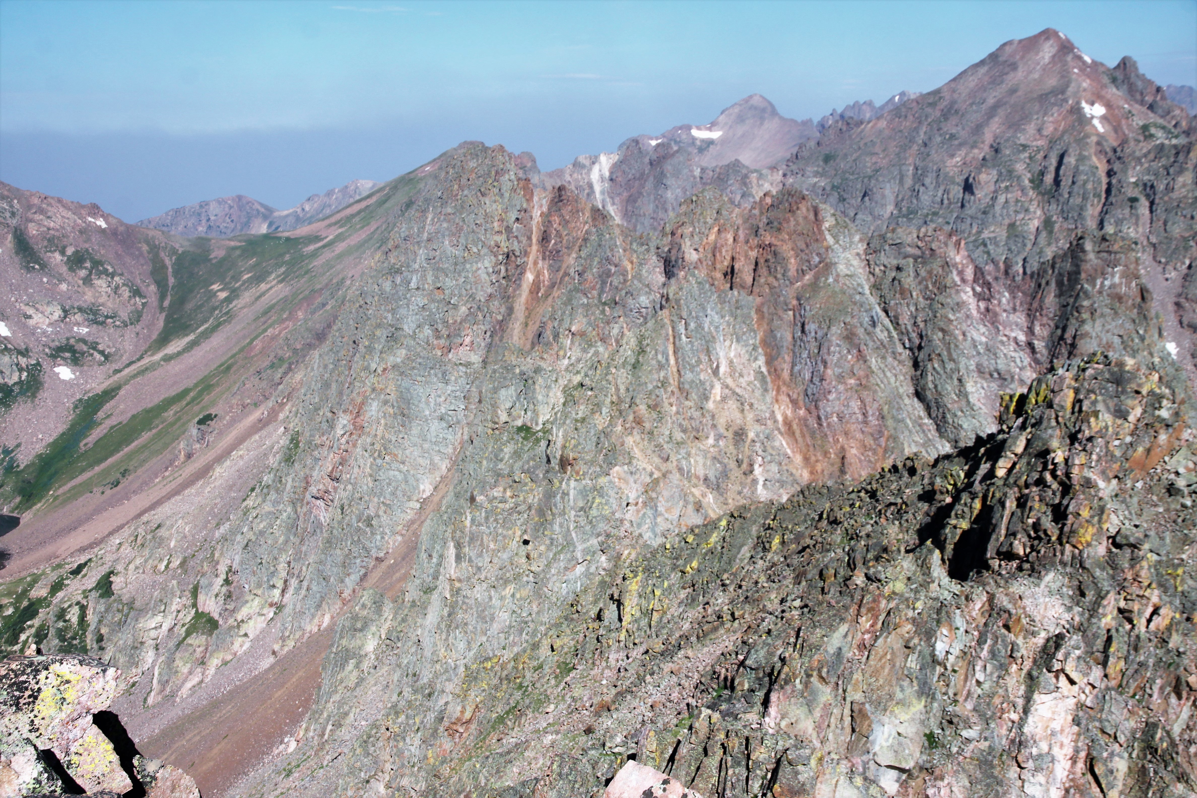
Looking back to Peak X (right) and Usable Pass (center) from Peak Z’

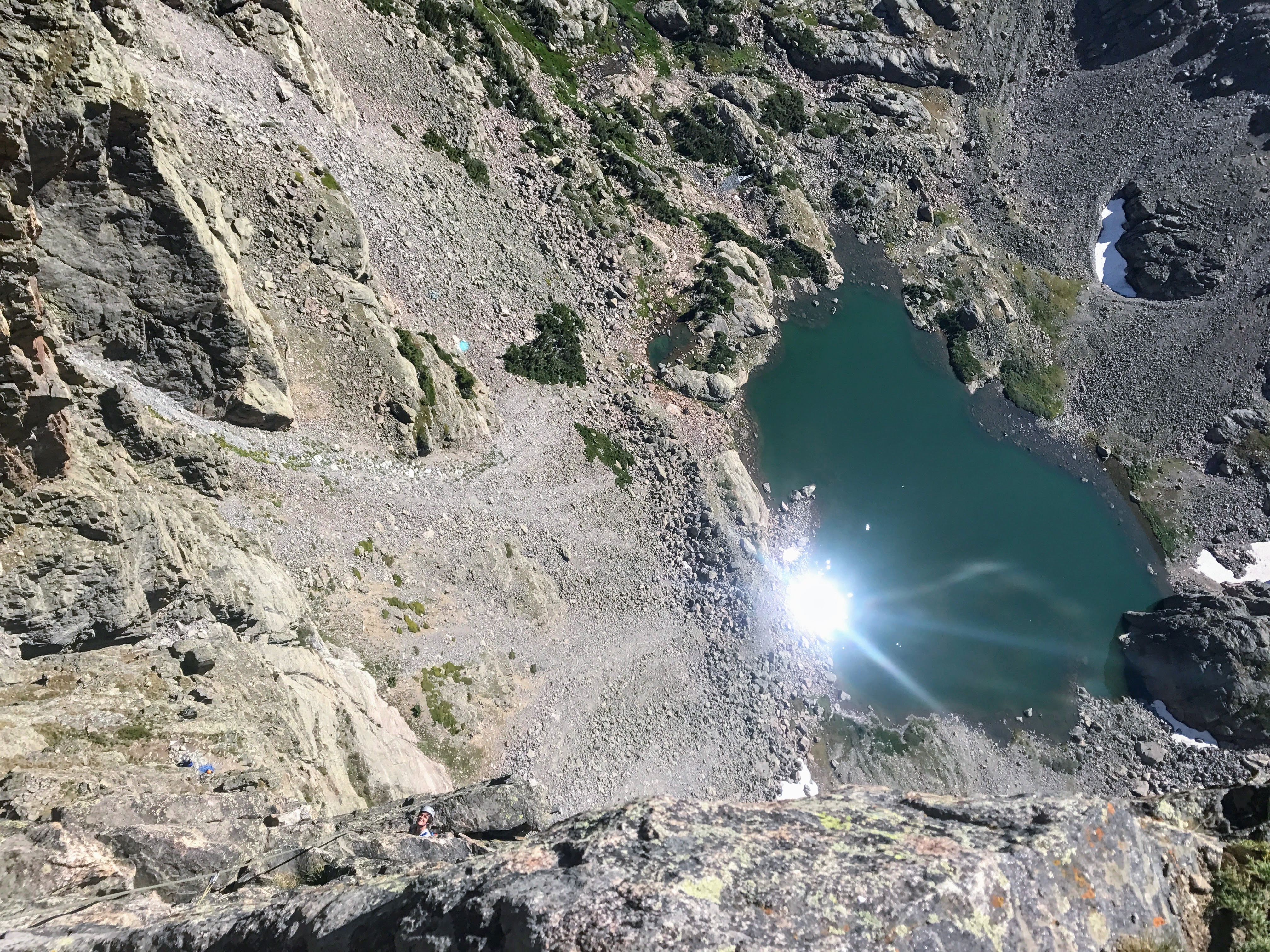
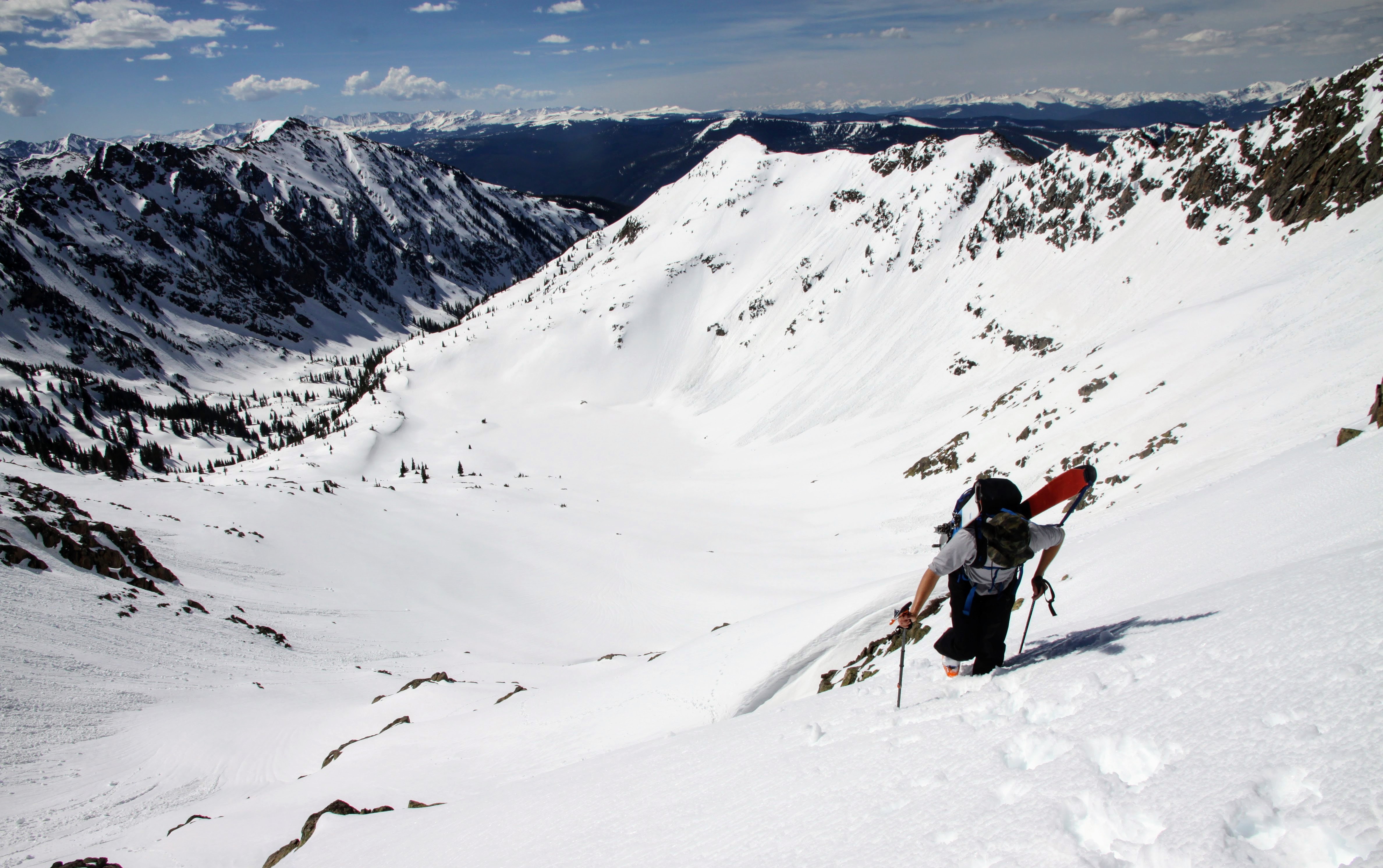
We then reversed the northwest ridge of Peak Z’ and made our way down into the upper North Boulder Creek basin visiting several of the small lakes.

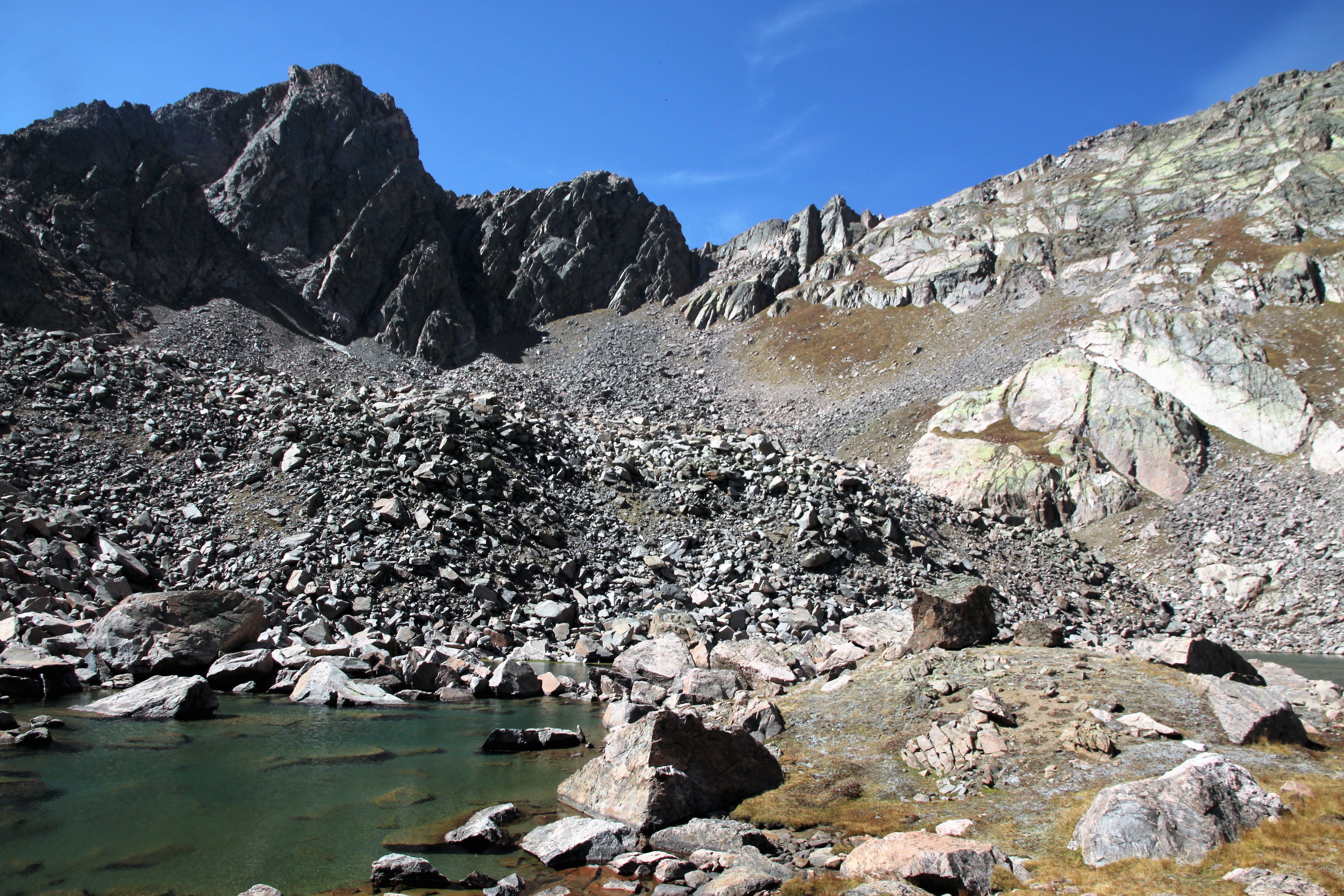
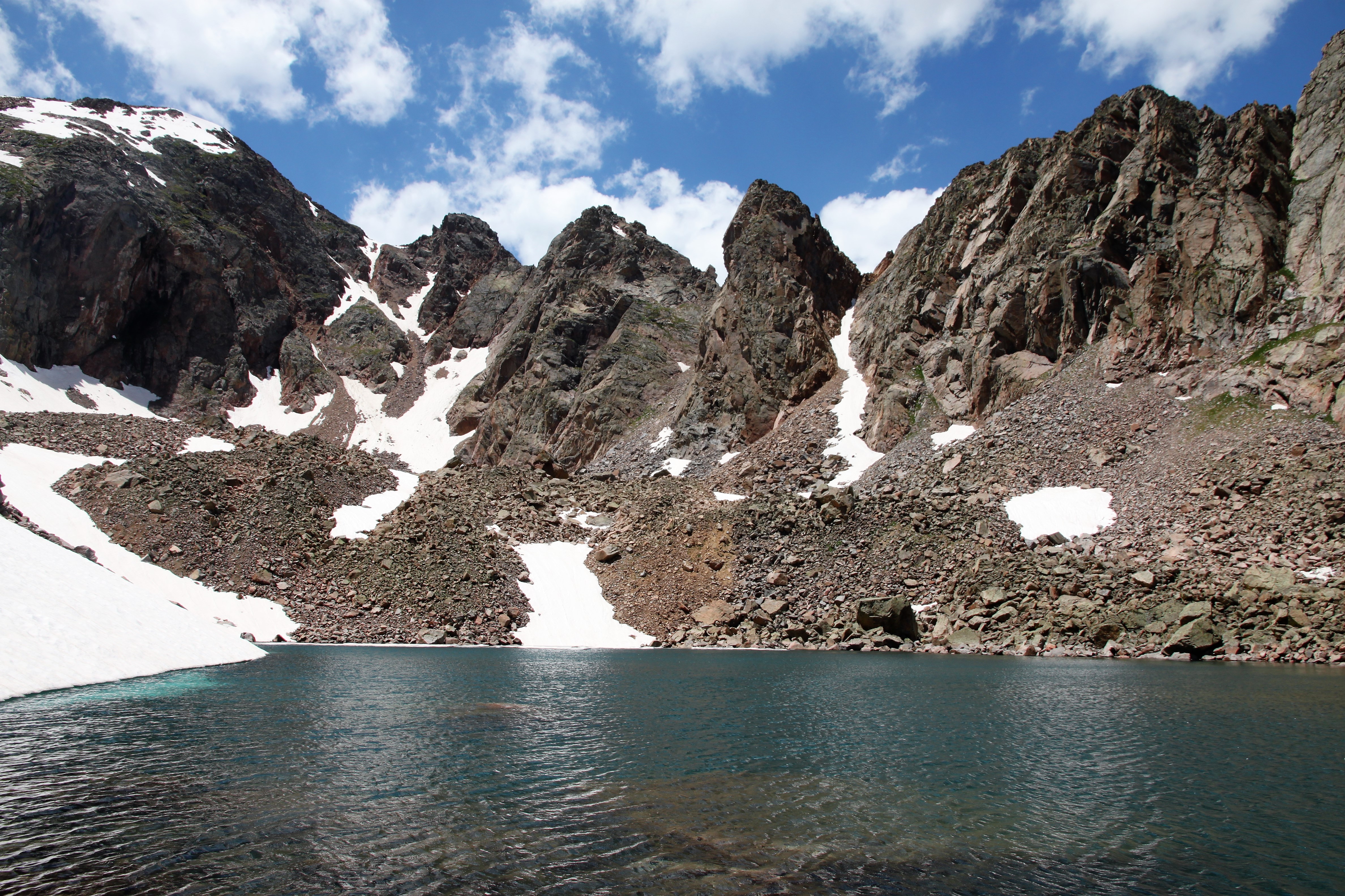
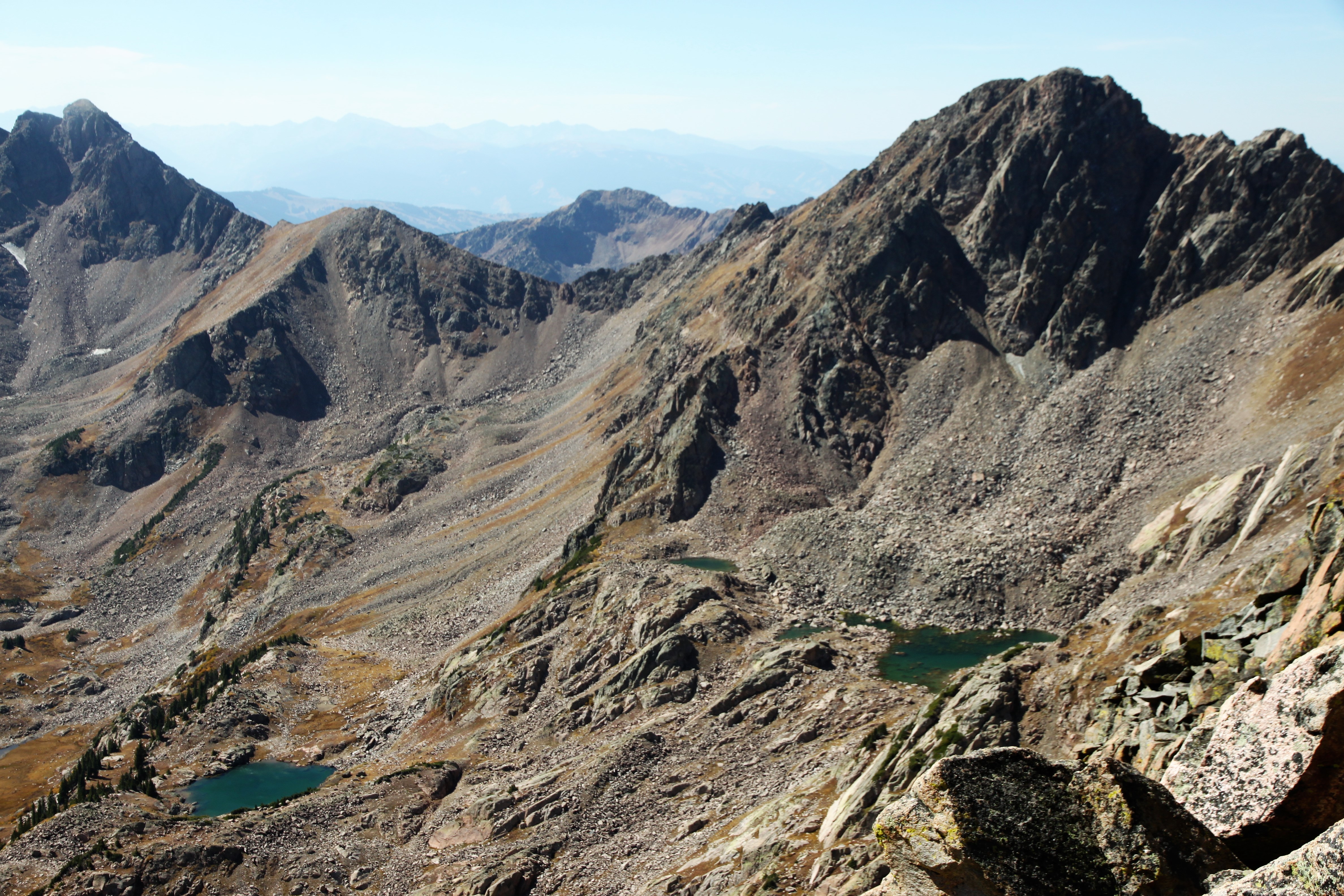
Looking up at Peak X (left) and the traverse to Peak Y from one of the high alpine North Boulder Creek lakes

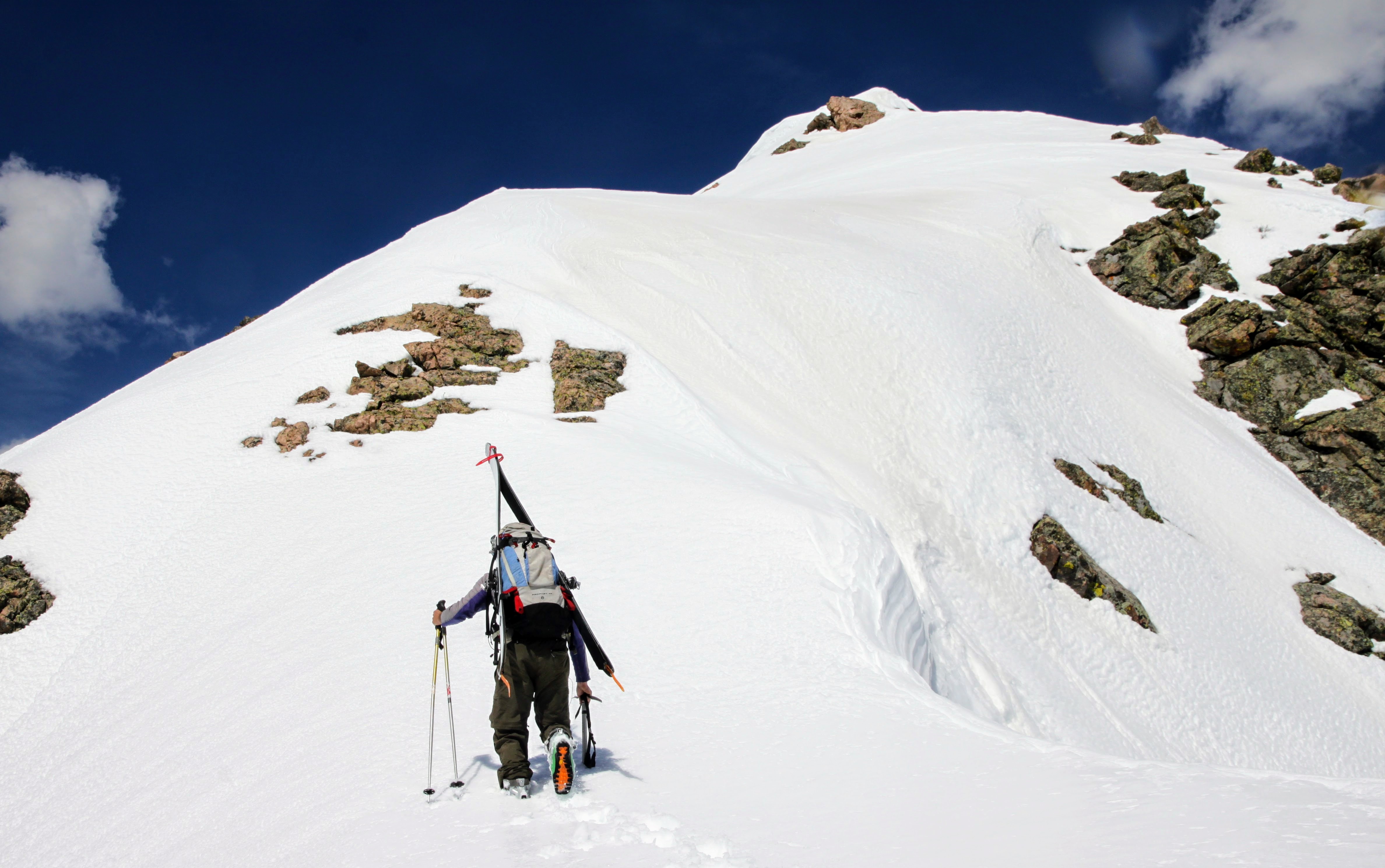
After some liquids and a PB&J, we made our way uphill across minor cliffs and boulder fields back to Usable Pass.

Peak X’ again and its large south-facing slab en route to Usable Pass

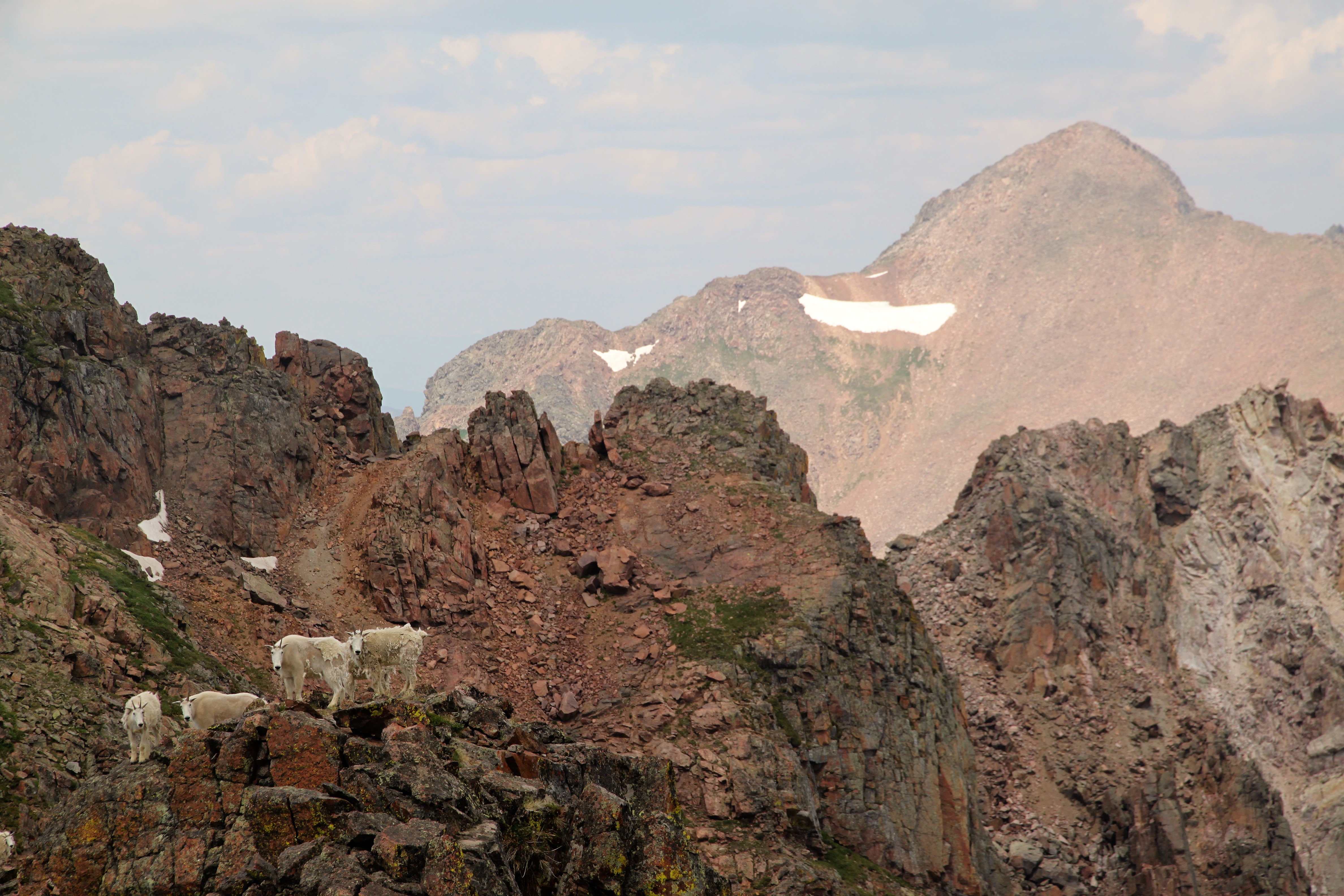
Usable Pass from the east

Once at the pass again, we made our way further west into the basin below East Partner’s southeast face and admired a ski line we would like to try as well as potential rock climbing of its southeast buttress.

This couloir is now on our radar 🙂

And this buttress :)\

I think we made it back to the Pitkin Creek TH by 4pm and motored home considering J had a week old baby girl at home. Dylan was there and seemed to be doing better and was refraining from beer for the evening for obvious reasons. Fun to get another few Gore peaks in before the snow really started to fly. And, fly it did the very next week.

Hail, Sleet, then Snow!

In an effort to get back to some blogging, here is one on a pretty cool and new traverse we did in the Gore a few Saturdays ago. Having done many of the ridge traverses down the central spine of the Gore Range, there was still one spicy section of ridge that I always wondered about. It was a gnarly looking section of seemingly rotten towers interspersed with some sections of good Gore granite between Hail Peak and a minor summit called “Sleet”, a name coined by Stan Wagon. I had gazed upon this small section of ridge for years from all different angles and wondered if it would go through. I inquired with Stan about possible  completed traverses of this section of ridge which he knew of none. Finally the weekend before, I decided to trail run the same loop in which I would attempt the ridge, but just remained in the small basin containing Snow Lake immediately to the south of the ridge. I did some decent recon on this ridge from below and from up higher on Snow Pass and Snow Peak all the while having a great run of a loop I’ve always wanted to run. I even met a Great Dane named Merlin on the summit of Snow Peak, quite the treat as I didn’t know 160lb+ dogs climbed obscure Gore 13ers. It made me miss my numerous Gore summits with Rainie and Kona.

Merlin and I atop Snow Peak with the Hail to Sleet Traverse above our heads in the picture

It turned out that J and good pal Marc Barella could join me. Also, Caroline Kurio, a friend of Marc, would also be joining us as I met her skiing Torreys Peak back in June. We departed the Gore Creek TH maybe around 5:45am and motored the almost 5 miles east up the Gore Creek Trail to the junction with the Gore Lake trail at the familiar Recen Brothers grave sites. We then set off north up the Gore Lake trail past the unmarked turnoff to what we call “Zodiac Pond” and eventually left the Gore Lake trail and bushwhacked up into the Snow Lake basin and up Hail Peak’s boulder-strewn southeast face. I had climbed Hail Peak before a few years ago with Reid Jennings running the trails and hiking the off-trail boulders, so I knew the ascent to Hail at least.

J and Marc on Hail’s southeast face with Snow Peak above J’s head in the picture

Caroline ascending the steep eastern ridge of Hail with me up above. Photo by Marc

Marc and Caroline doing some fun, but unnecessary scrambling up Hail towards the summit

Hail Peak summit (12,904′)

The Traverse to Sleet and then Snow Peak at far left as seen from Hail’s summit. Snow Lake is below

The traverse to Sleet with Mt. Vahalla in the background to the right

I believe we arrived on Hail’s summit around 9am or so. Only staying up top for maybe 15-20 minutes, long enough to get a snack and water, we descended Hail’s west ridge for some nice, moderate scrambling on pretty solid rock.

Descending Hail’s west ridge

More of the fun west ridge of Hail Peak

Caroline with Deming Mountain and West Deming in the distance

J on some nice, exposed downclimbing

A nice perch

We reached what appeared to be the last crux to get to the low point of the traverse. We sought out a few different downclimbs but wanted to keep the rope and webbing in my pack. We finally decided on a low 5th class, decently exposed downclimb which worked out quite nice.

Descending down to the crux downclimb. Photo by Marc

Marc descending the short, low 5th section with Caroline out left

Some nice scrambling ensured up and over a few towers and everything was going pretty smoothly.

Looking ahead to the seeminlgy cruxy, rotten towers

Easy downclimbing to a higher saddle before the final few towers

Caroline and I took a direct route up this rotten tower while J and Marc went to the right in this pic up a gully

Caroline topping out on the on the rotten rock

Marc coming up after the rottenness

Looking ahead at the top of the rotten tower

We saw a sliver of a ridge lead to the next tower and decided to take it. Otherwise, it would have been some nasty rappel into a deep slot.

Caroline almost to the top of the next tower on which we saw a cairn on top! Marc and J seen behind on the narrow ridge

I traversed on over to the summit of the next tower trying to find a downclimb, but it was a no-go. I backtracked and found a nice little bypass under the tower on the ridge’s north side.

Looking back at the non-downclimable north side of that tower

There was one more tower that I went up to and beyond to find a downclimb but again would have needed to rappel it. Instead of wasting webbing on a rap anchor, I just went back down and continued on the north side ledge traverse

Looking head to Caroline on the nice traverse over to the final upclimb out of this rotten tower/gully system

Caroline & Marc on the final upclimb

Me out of the cobwebs of the Hail to Sleet Traverse

We then hiked up to the ridge proper west of Sleet’s summit and then back east to the summit.

Sleet summit

We still had some distance to cover over to Snow Pass, so we got moving.

Setting off again to the west

Most of the remaining ridge over to Snow Pass was some pretty cool and very solid class 3/4 scrambling. Super fun.

Scrambling to the west on the west ridge of Sleet. The minor summit of Sleet is behind

One of the small downclimbs along this section of ridge

We had seen a herd of goats far off near Snow Pass earlier in the morning only to find them on the last tower of the scrambly portion of this ridge. This was such a treat.

Goats and Grand Traverse Peak

Zoomed-out to show the whole Grand Traverse

I always love running into these guys up high in the alpine

One more

We made it over to Snow Pass, dropped the packs and gear, and jetted up Snow Peak since Caroline and Marc had not been up it. It was a good way to finish up the day.

Snow Peak summit (13,024′)

Looking back at the ridge to Sleet and then onto Hail

A sunlit Zodiac View in the foreground, a shady Zodiac Ridge behind, and a sunlit East East Red to East Red and then Red Diamond Ridge in the back all as seen from Snow Pass

We quickly descended back to Snow Pass and then down to Deluge Lake for a nice dunk in the cold, refreshing water with a  sandy bottom for the toes. Man, that felt nice! the walk down from Deluge was hot and smoky, but we arrived at the Gore Creek TH by 3:15pm.

Our approach in red, traverse in blue, descent in green

It was a good day out with a great crew. Always feels good when you have no previous knowledge of a section of ridge yet it all goes through and works out nicely. There have been a few of these types of adventures for me over the last 15 years in the Gore and I do cherish them.

Book of Thor

Its been forever since I have posted something due to various reasons – buying and selling homes, moving, settling-in, work, no notable trips, and just life in general 🙂 However, I need and want to get back to some blogging. I need to play catch-up a bit. Last weekend I finally got back into my beloved Gore and climbed a line I had spied 2 years ago while deep in the remote South Rock Creek drainage below Valhalla Peak’s east face. This is the location of the beautiful Asgard Meadows flanked by Vahalla’s two eastern ridges: the north being the infamous Asgard Ridge and the southern being the locations of Loki, Thor, & Freya Towers.

Hiking along the southern flank of Asgard Ridge into Asgard Meadows with our destination being Thor Tower

I got a close-up of this guy and its web with a blurred Valhalla Peak and Thor Tower (with its shaded north face) in the background

I recruited my super strong, young, triathlete buddy, Dylan Friday to go with me and he was excited as well. Dylan hasn’t led anything in his life (yet), but he would follow me up anything and is a great partner. We left the North Rock Creek TH around 6:15am and did the normal approach via the southern flank of Asgard Ridge into Asgard Meadows in about 2-1/2 hours with loaded packs of climbing gear.

Looking down on Asgard Meadows

Profile of Freya Tower

Looking up at the mighty Thor Tower from Asgard Meadows

So, close to 2 years ago, after Ryan Marsters, Mike Santoro, & myself made the first ascent of Freya’s east ridge, we contoured around to the south of Thor Tower to head up and climb Stan Wagon’s western 5.6 route up Thor. Upon our contouring, I spied a nifty, clean-looking dihedral on Thor’s south face that grabbed my attention. I knew I had to go back and try and climb this line.

The dihedral

This picture is borrowed from Stan Wagon and is taken from Rain Peak to the south. It shows well the southern faces of the towers and our line up Thor is drawn in red

Dylan and I scrambled our way up to the Freya/Thor col and then scrambled around to the south to the base of the dihedral. The base of the dihedral was full of snow, so we decided to scramble up some 4th class/low 5th solid rock to the left to gain a small ledge 40′ up to begin the actual climbing.

Dylan climbing the fun 4th/low 5th rock to the left of the dihedral proper to avoid the snow at its base

We reached a small ledge and racked up. Dylan, being the strong ox he is, put my backpack in his backpack on his back to lighten my load significantly. I took off up our 1st pitch on some fun 5.7 climbing for the first 50′ or so placing two pieces. One thing I do look for in lines to climb is always the objective danger, i.e. falling rocks, and one of the alluring aspects of this dihedral was the apparent absence of potential rockfall. There were a few 5.8 moves and then a nice section of 20-30′ of 5.9 climbing towards the end of our first pitch involving some finger layback moves. I was running out of rope and looked up ahead, but there were no obvious belay spots with the upcoming roof crux. I wasn’t on a great ledge or anything, but figured it would do since I had a good crack to build my anchor to the left and at least a few tiny ledges to put my feet on.

Looking up the dihedral from our small belay ledge for pitch 1

Looking down our pitch 1

My anchor at the top of pitch 1

I put Dylan on belay and he followed up pitch 1 cleaning my gear. He really climbed well especially given his loaded backpack.

Dylan on pitch 1

Dylan on the 5.9 portion of pitch 1

Dylan reached me, swapped the cleaned gear back over to me, and he put me on belay for the seemingly harder pitch 2. I was hoping and pretty sure I could reach the ridge crest of Thor and set up a belay.

Looking up at the crux roof of pitch 2 above from the top of pitch 1

The first 30′ off the belay was some interesting and thought-provoking 5.10 climbing. Especially getting into the dihedral and stemming below the roof and pulling the roof into a super thin seam where I could only get a nut to protect the moves. The right face was slick, lichen-filled granite, which didn’t inspire confidence when laybacking. All in all, I did it clean and made my way onto easier climbing above and moved right to the base of a pillar. I placed a small 0.5 cam at the base of the pillar, slung it, and climbed up maybe 5.7 rock for a good 25′ feet before getting another cam in a solid crack to the left. I reached the ridge after another 10′ of climbing and set up a belay. Dylan climbed it well and reached me at the ridge.

Dylan on the final moves of pitch 2 below the ridge crest

Dylan excited to be at the ridge crest and close to the summit of the elusive Thor Tower

The terrain from the top of pitch 2 to the east looked a bit spicy, so I kept the rope on and led out and up to the east across some 5th class terrain. I didn’t place any gear, but soon reached much easier terrain on the ridge crest and belayed Dylan up to me. Just not wanting to de-rope and all I just continued onto the summit and Dylan followed me.

Dylan beginning the traverse over to the summit

Dylan ridge walking

Dylan on the summit of Thor! And via a new route at that!

Once on the summit, we took in the views and opened the small summit cannister where Stan’s business card and a patch from father’s and my made-up “Chalk Hill Expeditions”. I would highly doubt anyone had been up here in the 2 years since I was last here – at least there was no evidence that I could find.

Valhalla Peak from Thor Tower’s summit

Thor Tower summit (12,500′ or thereabouts)

One of the fires near Winter Park to the east was noticeable

We then descended a bit down to Stan’s rappel webbing and I threw our rope down to rappel.

Dylan on the short rap

Dylan rappelling with a portion of Asgard Ridge as a backdrop

We then stowed the rope and our climbing gear and traded our TC pros for Hokas. The descent down the north from the small col was loose as always but relatively short-lived until we reached what I have come to call “Asgard Lake”. Its a beautiful, completely clear, glacial blue lake.

Asgard Lake with Valhalla Peak on the far left and Asgard Ridge trending down to the right

Making our way down the boulderfields and back through Asgard Meadows was a treat and then we ascended back up to the southern flank of Asgard Ridge. We made it back to my car by 3:30pm for a roundtrip time of 9 hrs and 15 minutes. This was a great day and I’m so grateful that it worked out. Always nice when things come together. Special thanks to Dylan for partnering up with me for this adventure. On the way out, Dylan was asking me what a “dihedral’ really stood for and I explained essentially it was a rock feature in the shape of an “open book”. Then, he suggested “why don’t we call the route ‘Book of Thor’?” Perfect. Book of Thor (5.10) it is.

Petit Grepon

One of the most famous alpine rock climbs in Rocky Mountain National Park (RMNP) happens to be also considered one of the fifty classic climbs in North America. This climb is of the standard South Face (5.8) up the Petit Grepon. My good buddy Steve Cizik does something every year for his birthday and this year he wanted the Petit. J and I really never go to RMNP at all or to the front range in general for that matter, but we had to make an exception for this. It looked like a solid climb and any chance to hang with Steve, Nico Cizik, and Matt Reigner in the mountains was a bonus for us. Plus, the weather looked really good and I researched the harder Southwest Corner (5.9) up the Petit which could be an option for J and I. Matt also suggested we do the Southwest Corner as he had done it 15 years ago.

The Petit Grepon (center tower left of the tallest tower visible) above Sky Pond.

The Petit Grepon (center tower left of the tallest tower visible) above Sky Pond

J and I drove down in his car, got our bivy permits at the ranger station, and hit the normal Trail Ridge Road tourist traffic. The crowds and tourists and traffic reminded me why I never come down here, but by the end of the trip with the alpine rock climbing available, man this place is pretty awesome. I  ended the trip with a newfound respect for RMNP. J and I left the Glacier Gorge trailhead at 5pm and rolled into our bivy camp at 7pm with the other boys fishing in Sky Pond. Its such an easy 5 mile approach that the climb totally makes sense to day trip this tower as well. We met two college kids from UT Austin and invited them to hang out with our rowdy bunch. They were gunning for the South Face as well.

Hanging out at dusk on our large bivy rock with the Petit behind

Hanging out at dusk on our large bivy rock with the Petit behind

I slept horribly for whatever reason, but woke up at 5am ready to put the night behind me. However, it sure was fun to sleep out under the stars in my sleeping bag without a tent. We all downed some coffee and oatmeal, got water, and racked up. The college kids left before us and went on up to the start of the South Face.

Hiking up to the tower's base

Hiking up to the tower’s base. The Saber is the tall tower right of center and the Sharkstooth is to the left of the Petit seemingly lower in elevation in the picture when in reality its higher

Matt and the Cizik brothers started up the low 5th class pitch 1 of the South Face ahead of the college kids while J and I scrambled up pitch 1 of the Southwest Corner to the base of pitch 2.

1st pitch up the standard South Face

1st pitch up the standard South Face

Me leading up the easy 5.6 pitch 2 of the Southwest Corner

Me leading up the easy 5.6 pitch 2 of the Southwest Corner

J led the equally as easy pitch 3 up to the upper terrace ledge and belayed me up. We had a 2nd rope with us for the descent and the follower always carried that rope on his back.

J up and away on pitch 3

J up and away on pitch 3

I think we missed the proper 5.7 pitch 4, but I took a line closer to the actual southwest arete itself, which was definitely a bit harder than 5.7. The airiness and exposure of the route definitely heightened the higher and higher we climbed.

Me leading our pitch 4

Me leading our pitch 4

J finishing up pitch 4

J finishing up pitch 4

The top of pitch 4 was a large belay ledge on the southwest arete proper with some old slings around a rock. We then swapped leads and J took off up the lengthy 5.8 pitch 5. J rocked this pitch and brought me up to a tiny belay corner with some slings and rap rings around a chockstone.

J leading the pitch 5 corner

J leading the pitch 5 corner now on the well-defined southwest arete proper

Then, came the crux 5.9 roof pitch. J gave me the gear and I took off. It was definitely a bit exhausting at almost 12,000′, but I led the pitch clean and pulled the fun roof placing a #1 cam under the roof. I managed to gather myself at a stance and then led up an additional 15′ hand/finger crack to a 12″ wide belay ledge. J cruised the roof pitch very well and got up to me pretty quick.

J after pulling the 5.9 roof on pitch 6

J after pulling the 5.9 roof on pitch 6

Now, per the route beta, we could have done a traverse pitch right (east) to meet up with the standard South Face route at the so-called “pizza pan” belay or we could do another 5.9 pitch and meet up for the last two pitches of the standard route. I chose the 5.9 pitch and away I went up a nice double hand/finger crack. The middle of the pitch was more easy 5th class and then a nice top out to the belay ledge for the 2nd to last pitch of the standard South Face route.

J finishing up the 5.9 pitch 7

J finishing up the 5.9 pitch 7

At this point we could see team Reigner/Cizik about 250′ below us around 2 pitches behind.

J taking off up the fun 5.7 2nd to last pitch

J taking off up the fun 5.7 2nd to last pitch

J took this while on the 2nd to last pitch. You can see my head at the belay and Matt and the Ciziks well below me

J took this while on the 2nd to last pitch. You can see my head at the belay and Matt and the Ciziks well below me

J belayed me up to an amazing belay ledge and I took off for the final easy 5th class summit pitch.

Me ready to top out on this tower

Me ready to top out on this tower

The final pitch

The final pitch

J on his exposed belay ledge. What an airy position, though!

J on his exposed belay ledge. What an airy position, though!

J and I topped out around 11:45am and lounged for awhile. Like an hour and a half while 🙂 But, we got an amazing view of two rockstars crushing the Southwest Corner (5.10a/b) of The Saber next door.

Stephen Schilling and his partner climb The Saber's Southwest Corner as see from the summit of the Petit

Stephen Schilling and his partner climb The Saber’s Southwest Corner as see from the summit of the Petit

Stephen also got a pic of Steve belaying Nico up to the “pizza pan” belay as seen from The Saber.

Steve & Nico

Steve & Nico

Steve topped out about an hour and 15 minutes after we did and we welcomed him. I had already set up the rappel and J and I boogied after we got a picture with the birthday boy.

Steve, me, and J on the Petit's summit

Steve, me, and J on the Petit’s summit

J and myself

J and myself

Stephen shot this pic of J and I on the summit of the Petit Grepon as well from The Saber

Stephen shot this pic of J and I on the summit of the Petit Grepon from The Saber

Also, a nice fellow named Reid Gurnee took a few dramatic pics of J and I on the Petit’s summit from their descent of the Sharkstooth.

Me & J on the summit

Me & J on the summit

And, a more zoomed out pic

And, a more zoomed-out pic

We then did 6 double rope rappels fairly smoothly straight to the base of the route and grabbed our approach shoes.

Me on rappel 3

Me on rappel 3

J on the 5th rappel

J on the 5th rappel

Back down at Sky Pond around 3pm, we swam and packed up. Minus our hour and a half stay on the summit, we were moving for about 6.5 hours RT to climb the Petit and descend back to the base. We wanted to wait around for the other boys, but we needed to get going having a 3.5 hour drive back home.

Zoomed-in pic of the college kids from UT Austin rappelling off the summit as seen from Sky Pond

Zoomed-in pic of the college kids from UT Austin rappelling off the summit as seen from Sky Pond

Happy to have climbed this tower in a new area for me

Happy to have climbed this tower in a new area for me. I’d love to come back for that Southwest Corner route on The Saber now!

After some subpar grub from some pizza/sub shop outside of Estes Park, J and I arrived back home around 10pm. Fortunately, we didn’t get sick from the food, but we didn’t feel so hot. Nonetheless, this trip opened our eyes to the alpine rock climbing world of RMNP and I think we’ll venture down there more than once every few years from now on.

Skiing Mt. Sopris & The Fly

Spring ski-mountaineering for the Chalks & friends continues to be a favorite springtime hobby. Kristine and Mikey Santoro drove over to the Mt. Sopris trailhead on a Saturday evening, camped out under the stars, and skinned and skied this classic 12,953′ behometh outside of Carbondale on Sunday, April 30. Kristine, myself, and numerous friends over the years (really since 2004) used to climb and ski this awesome ski-mountaineering mountain every spring. I still remember Rainie and my first time up Sopris in the spring of 2004. However, we hadn’t skied the peak for a few years now and Kristine wanted to go back. Mikey hadn’t done it and wanted to go so their plan was set. It was a beautiful, albeit windy, day up in the hills. I thought they made good time up the approximate 12 mile roundtrip with 4,400′ vertical gain route as they were back mid-afternoon.

Mt. Sopris. The Thomas Lakes Bowl is left of center

Mt. Sopris. Our usual ascent/descent route, the Thomas Lakes Bowl, is left of center

Mikey above Thomas Lakes

Mikey above Thomas Lakes

The Thomas Lakes Bowl. Windy up on the ridge!

The Thomas Lakes Bowl. Windy up on the ridge!

Mikey making his way up the summit ridge with Capitol Peak behind

Mikey making his way up the summit ridge with Capitol Peak behind

Mikey & Kristine on top of Sopris (12,953')

Mikey & Kristine on top of Sopris (12,953′)

Mikey boarding the fun Thomas Lakes Bowl

Mikey boarding the fun Thomas Lakes Bowl

All smiles back at the trailhead

All smiles back at the trailhead

The next weekend on Saturday, May 6, Dylan, J, and I ventured back into the Gores up the familiar Booth Creek drainage. Our goal was to ski The Fly’s southeast face. A few of us had climbed The Fly several times in past years (linking it with The Spider to the north), but never skied it.

Kristine & I on the summit of The Fly in October 2011

Kristine & I on the summit of The Fly in October 2011 with West Partner Peak behind

Me, Rainie, Kona, & Khumbu at Booth Lake (July 2012)

Me, Rainie, Kona, & Khumbu at Booth Lake (July 2012)

Rainie, Kona, & Khumbu on The Fly's summit

Rainie, Kona, & Khumbu on The Fly’s summit

Baba, Khumbu, Rainie, & Kona on the summit of The Fly (12,550')

Baba, Khumbu, Rainie, & Kona on the summit of The Fly (12,550′) with The Spider (far left) and Peak H (center) behind

I couldn’t get J to start any earlier than 6am (I wanted to get going pretty early because it was gonna be a super warm day), but we made decent time up into the upper Booth Creek drainage trying to make up some time.

Mt. of the Holy Cross from the upper Booth Creek drainage

Mt. of the Holy Cross and Vail from the upper Booth Creek drainage

Dylan & J skinning

Dylan & J skinning

After maybe 3 hours in, we rounded the corner and approached Booth Lake and The Fly.

The Fly's southeast face with the east ridge on the right

The Fly’s southeast face with the east ridge on the right

Skinning with Outpost Peak behind to the right

Skinning with Outpost Peak behind to the right

We then came upon some strange tracks that at first we thought were human. They went all the way up to about 12,000′ on the east ridge of The Fly. Well, we decided to follow them as a broken booter was better than breaking it ourselves. However, they just weren’t normal steps at all. I found myself breaking trail anyway as I could not figure out the pattern of the footsteps. Eventually, we learned that these were bear tracks! We were wondering what in the world the bear was doing going all the way up steep snow to The Fly’s east ridge.

Bear track

Bear track

Following the bear tracks to the east ridge

Following the bear tracks to the east ridge

Dylan making his way up to the east ridge

Dylan making his way up to the east ridge

Once on the east ridge, the climbing and views were really fantastic, though the snow was getting way too warm for my taste. It was stifling hot out!

Dylan on the east ridge with Rockinghorse Ridge and Peak Q behind

Dylan on the east ridge with Rockinghorse Ridge and Peak Q behind

J and the Fly's east ridge

J and the Fly’s east ridge

Dylan making an airy maneuver

Dylan making an airy maneuver

After a knife-edge of snow and a downclimb around a small tower, we pushed onto the summit.

J on the final push

J on the final push

Dylan loving his first time in the Gore

Dylan loving his first time in the Gore

Looking over at the southeast face we would ski

Looking over at the southeast face we would ski

We topped out maybe around 10:45am and started to ski pretty immediately. It was pretty warm and expectedly J knocked off a few minor wet slides and let them roll below him before he skied down.

Looking down the line from the summit

Looking down the line from the summit

Dylan with the Spider behind

Dylan with the Spider behind

The Fly summit (12,550')

The Fly summit (12,550′)

J taking off down the southeast face

J taking off down the southeast face

J way down there

J way down there

Dylan carving some nice turns

Dylan carving some nice turns

It was pretty darn heavy, wet snowy from my perspective, but fun nonetheless. Would have been certainly nice to hit it 2 hour earlier. We managed all our slough just fine and regrouped and hung out for a bit back at Booth Lake.

Hanging out back at Booth Lake

Hanging out back at Booth Lake

The ski out was pretty fun yet sloppy. We put our skis back on our packs around the top of Booth Falls and hiked the remaining 2 miles back to the car on the dry trail. It was only about a 7 hr RT day, so really not all that long. The Fly was a fun climb & ski and I look forward to hopefully doing it again next spring.

The Deming Drop

Well, after an unsuccessful attempt to ski the so-called “Deming Drop” on Deming Mountain (12,902′) in the southern Gore last June, we decided to give it another go this April despite a not so ideal forecast for a Saturday. It looked sunny in the morning, but the winds were forecasted to be pretty gusty and a storm was a brewing that afternoon and evening. Last June 2016, Derek, Mikey, and I (along with K9 companions Kona and Maude) waited almost an hour and a half for the north couloir of Deming Mountain, aka the “Deming Drop”, to soften up, but it really wouldn’t have till high noon or after. Plus, we decided it wasn’t a good line for the dogs either. So, we decided to play it safe and ski the fun east slopes.

Leaving Kona and Maude at home this time, J and I met Derek at the Meadowcreek Trailhead in Frisco around 5am. He kept our trail shoes on for maybe a mile before we switched to skinning mode and had an enjoyable skin up through treeline to the beautiful, mellow basin below Eccles Pass. However, the wind was gusting pretty substantially when we got into the open blowing us back a bit. J and I were sort of thinking if it were this windy down here, we may not be making the summit today 🙂 Nonetheless, we skinned our way up Deming’s familiar east slopes and the wind seemed to settle down a bit the higher we ascended. We topped out around 4 hours after leaving the trailhead at 9:15am.

J and Derek starting the steeper skin up Deming's east slopes

J and Derek starting the steeper skin up Deming’s east slopes

Looking over at the Red Peak massif and Red Diamond Ridge from Deming's east slopes

Looking over at the Silvrthorne massif (left) and Red Peak massif with Red Diamond Ridge (right) from Deming’s east slopes

J topping out on Deming

J topping out on Deming

We couldn’t believe the wind allowed us fairly easy passage to the summit. After maybe 15min on top, the wind, however, picked up and we decided to move.

Looking over at West Deming and the Vail Valley beyond from Deming's summit

Looking over at West Deming and the Vail Valley beyond from Deming’s summit

Deming Mountain summit (12,902')

Deming Mountain summit (12,902′)

We skied north over the flat summit plateau to the couloir’s steep 50 degree entrance. The steep entrance was definitely bulging out convexly indicating some definite wind loading. This was surely intimidating and gave us pause.

J and I scoping out the couloir's entrance. photo by Derek

J and I scoping out the couloir’s entrance. photo by Derek

However, J noticed we could avoid this convex entrance to the couloir by skiing down the small ridge to skier’s left and then traverse under the loaded slope very fast to the couloir’s much safer right side. Yes, we would be under the bulging, upper slope, but only for a brief second and individually.

J and I making our way down the ridge to avoid skiing over the steep, bulging slope

J and I making our way down the ridge to avoid skiing over the steep, bulging slope. Photo by Derek

Then, J crossed the couloir over to the right side, followed by me, and then Derek. With no signs of any snow instability, we continued to ski the now mellower 40 degree couloir in very variable wind-affected snow.

Derek traversing the steep, upper slope over to J and I on the couloir's right side

Derek traversing the steep, upper slope over to J and I on the couloir’s right side

Well, I guess I can say I skied the Deming Drop, but it sure wasn’t pretty 🙂 This was some of the hardest skiing I’ve ever done in terms of physical exertion. Of course, I made zero telemark turns because of how so variable the snow in the couloir was. It was all I could do to make a normal alpine turn! And, I had a hunch it would be spring north-facing, creamy powder. Haha…yeah right! J and Derek were patient with me. So, to show how variable the snow was, J lost one of his skis in the upper portion of the couloir (though he obviously recovered it) and J can ski anything, anywhere with anyone. The snow basically just ripped the ski off his boot. Nonetheless, we made it down the belly of the beast to the apron about an hour after leaving the summit.

Derek skiing the Drop

Derek skiing the Drop

Close-up of Derek working for those turns

Close-up of Derek working for those turns

J skiing the Deming Drop

J skiing the Deming Drop

J about a third of the way down

J about a third of the way down

Derek

Derek

Looking up at Derek through the couloir's choke

Looking up at Derek through the couloir’s choke

Me doing my best in the tough snow. Photo by J

Me doing my best in the tough snow. Photo by J

J finishing out the bottom section of the Drop

J finishing out the bottom section of the Drop

Derek making the last little bit looking pretty powdery

Derek making the last little bit looking pretty powdery

Derek making the snow conditions look smooth

Derek making the snow conditions look smooth

Upon reaching the apron, we traversed northeast towards Red Buffalo Pass and found the steep slope we were to climb up to reach Deming’s northeast ridge.

J traversing on out to where we would climb up around 700' to Deming's northeast ridge as our escape from this basin

J traversing on out to where we would climb up around 700′ to Deming’s northeast ridge as our preferred escape from this basin

We packed our skis on our backs and J and I broke trail straight up through some really deep and tiring snow. We leapfrogged setting the booter and an hour later when we reached the ridge, we were pretty exhausted.

J climbing up the slope

J climbing up the slope

Derek making his way up the booter with West Deming behind

Derek making his way up the booter with West Deming behind on the left

J and Derek near the ridge where we could ski back down into the Meadowcreek drainage from where we came

J and Derek near the ridge where we could ski back down into the Meadowcreek drainage from where we came

A look at our route from the summit of Red Peak to the north in July 2015 after J and I traversed Red Diamond Ridge. Green indicates the skin up Deming's east sopes, red indicates the ski down the Deming Drop, and blue indicates our climb back up to Deming's northeast risde after the ski

A look at our route from the summit of Red Peak to the north in July 2015 after J and I traversed Red Diamond Ridge. Green indicates the skin up Deming’s east slopes, red indicates the ski down the Deming Drop, and blue indicates our climb back up to Deming’s northeast ridge after the ski

After a snack and some hydration in the ever-increasing wind on the exposed ridge, we decided to ski down the utterly horrific breakable crust into the Meadowcreek drainage. This was the worst part of the day for me. The snow was just plain “break your leg” snow as the sun had since went away behind the increasing clouds and what corn snow was trying to surface froze up quickly. We saw a huge 17 person crew skinning up to Eccles Pass and beyond up the west ridge of the small bump that eventually leads towards Buffalo Mountain. We were all curious if this was a backcountry ski course or what. Who knows – maybe just a large gathering of friends. All said and done, we finally reached corn snow lower down in the drainage and skied it out to within a half mile of the car making for a 7.5 hour RT day. I believe this route is around 12 miles RT with between 4,500 – 5,000′ vertical gain. Definitely a fun adventure and happy to have skied the Deming Drop, but boy those snow conditions – I do not miss that. However, that’s spring skiing for ya. You never know what you are gonna get. You can guess and have a good hunch, but until you feel it out and experience the snow conditions in real time, you don’t know for sure.