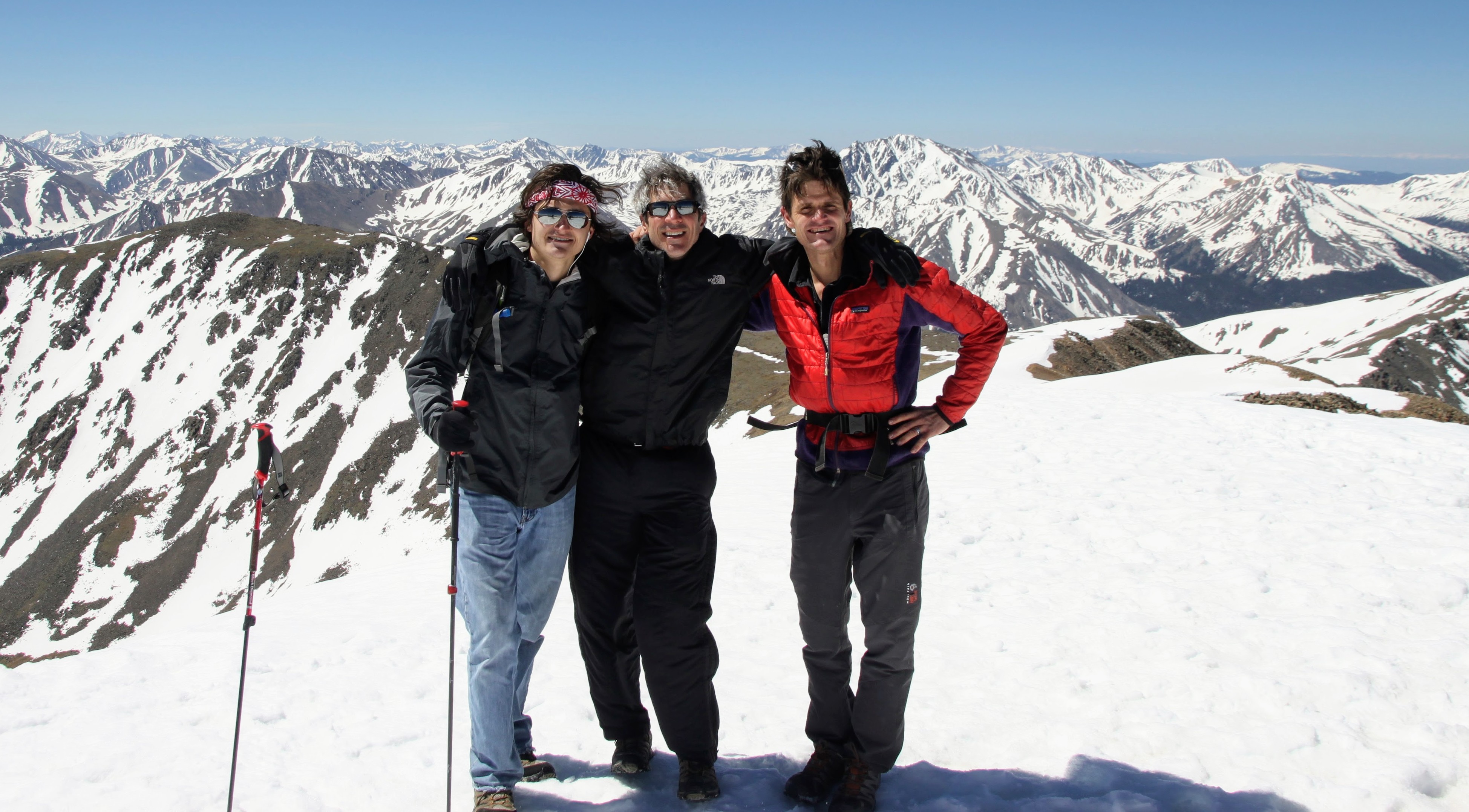
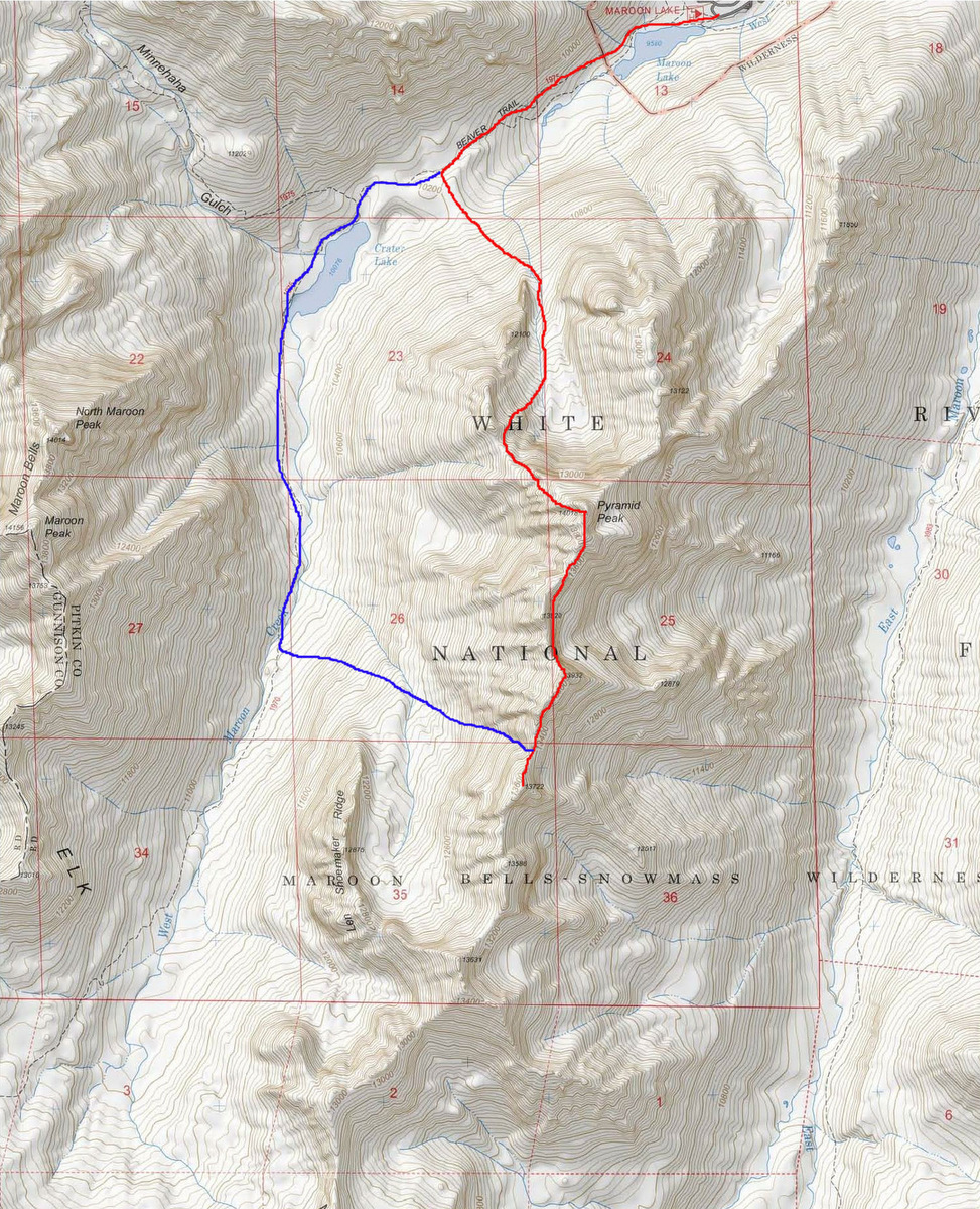
Capitol’s Northwest Buttress via Early Times

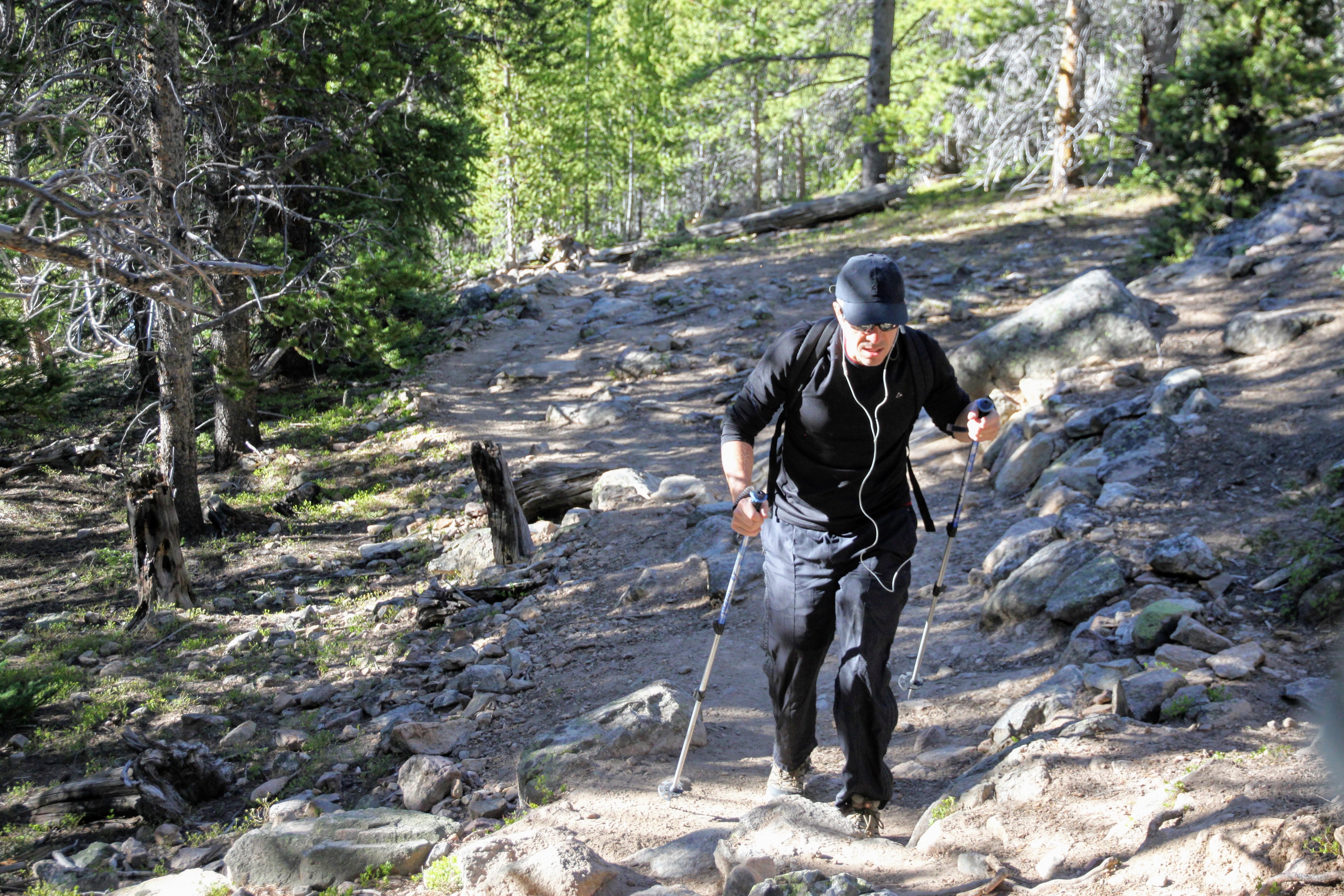
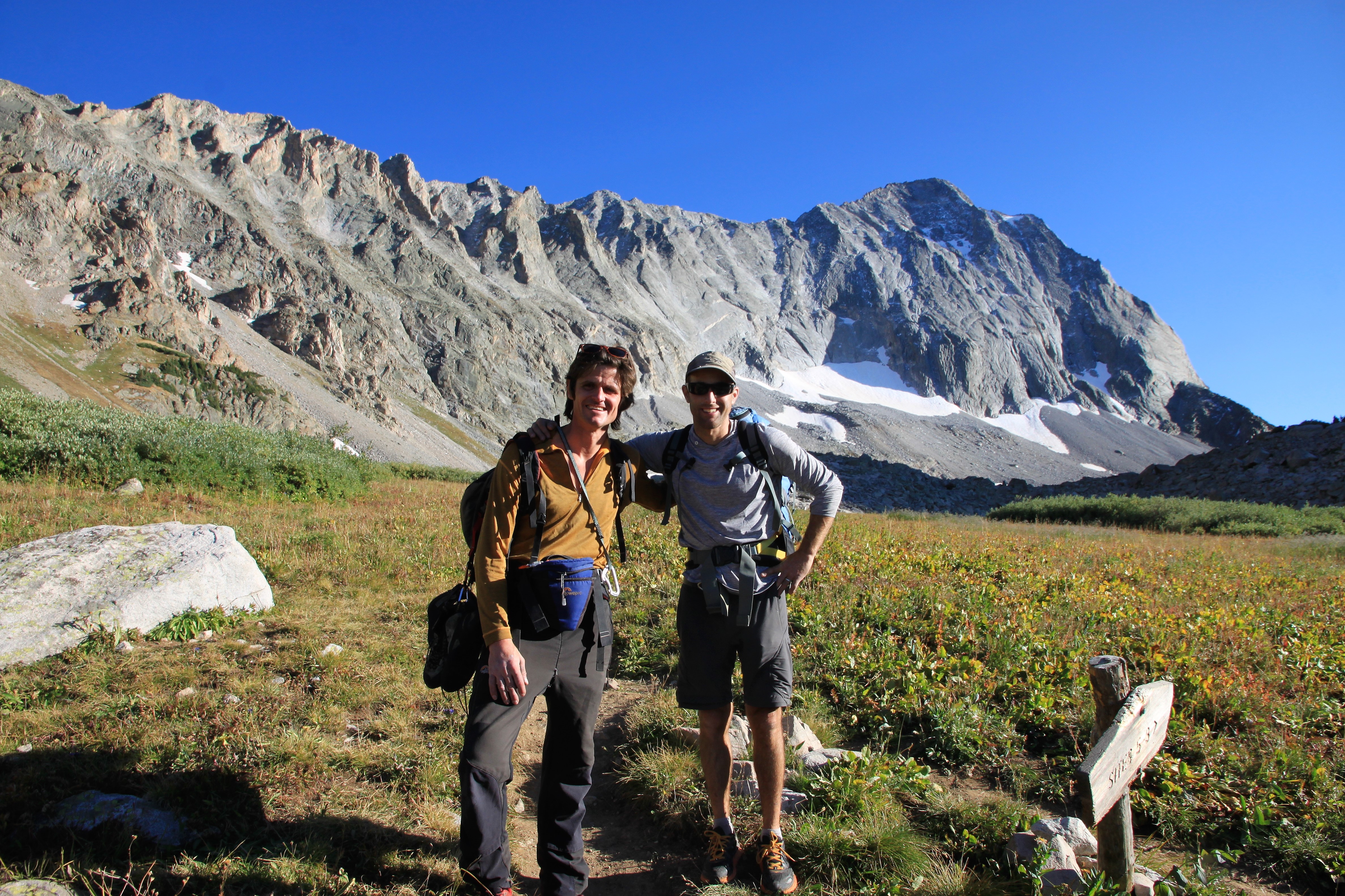
After last September’s successful climb of the original line up Capitol’s Northwest Buttress with Chris Baldwin, I really wanted to go back and try the harder 5.10 variation called Early Times established by Jeff Jackson & company circa 2010, which ascends climber’s right of the original route’s 5.9 pitch in four awesome pitches up the initial steep headwall. I had promised J I would go with him as he wanted to visit Capitol’s summit again after not having been on the mountain in 15+ years. After weeks of trying to get a perfect fall weather window and shifting schedules within our busy lives, we targeted the same date that Chris and I had climbed the route the previous year, September 14. Now having 2 kids each, the less time away the better and easier on our spouses. So, I picked J up at 2am on a Saturday morning and made the drive over to Capitol with very heavy eyelids. After some coffee, oatmeal, & bananas on the drive to pep us up (well, J doesn’t drink coffee for whatever crazy reason and never has), we left the trailhead around 4:30am making our way up the familiar Capitol Ditch Trail under headlamps. We cruised the 6 miles to Capitol Lake in maybe 2 hours and 20 minutes and got our pre-dawn glimpses of old Capitol Peak’s north face and northwest buttress.

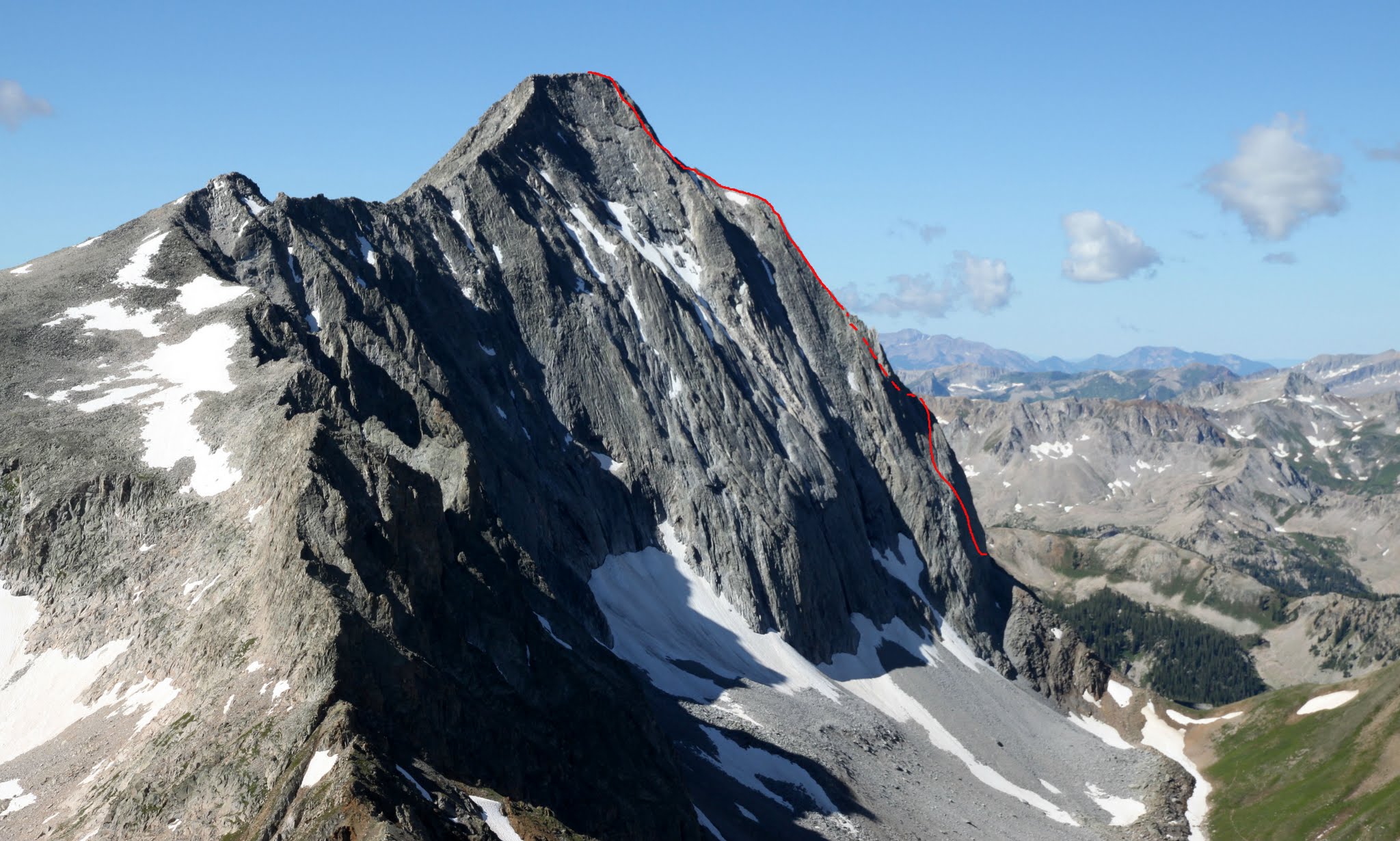
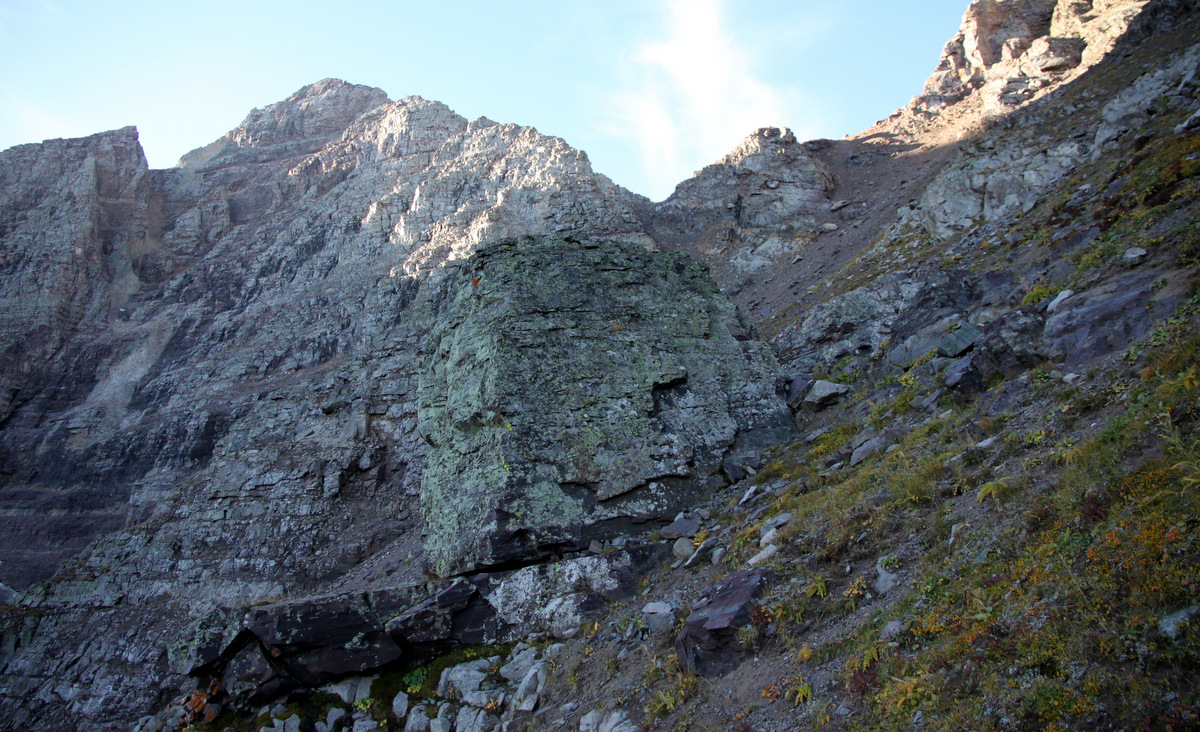
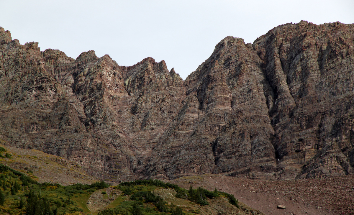
Capitol’s northwest buttress is the right skyline

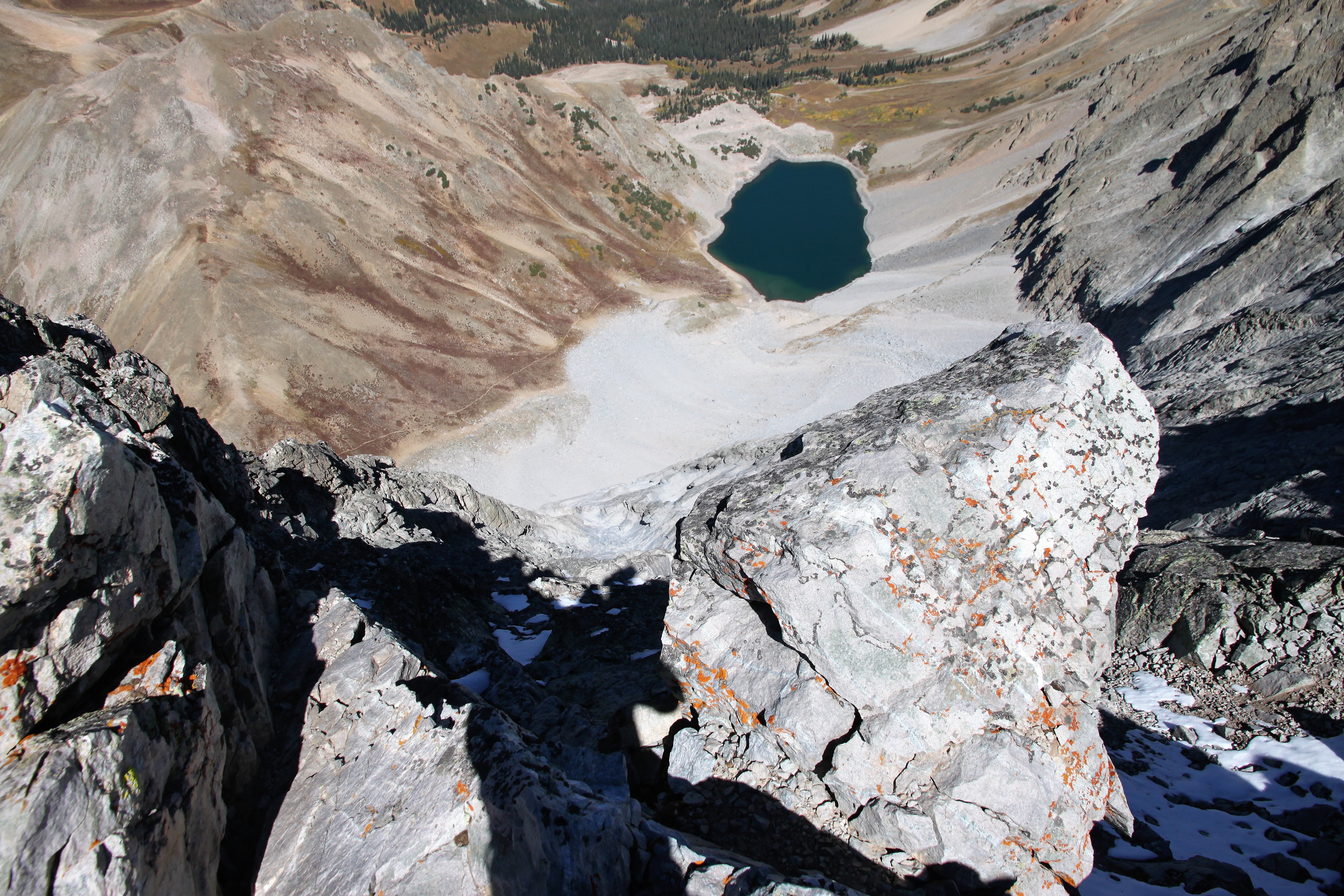
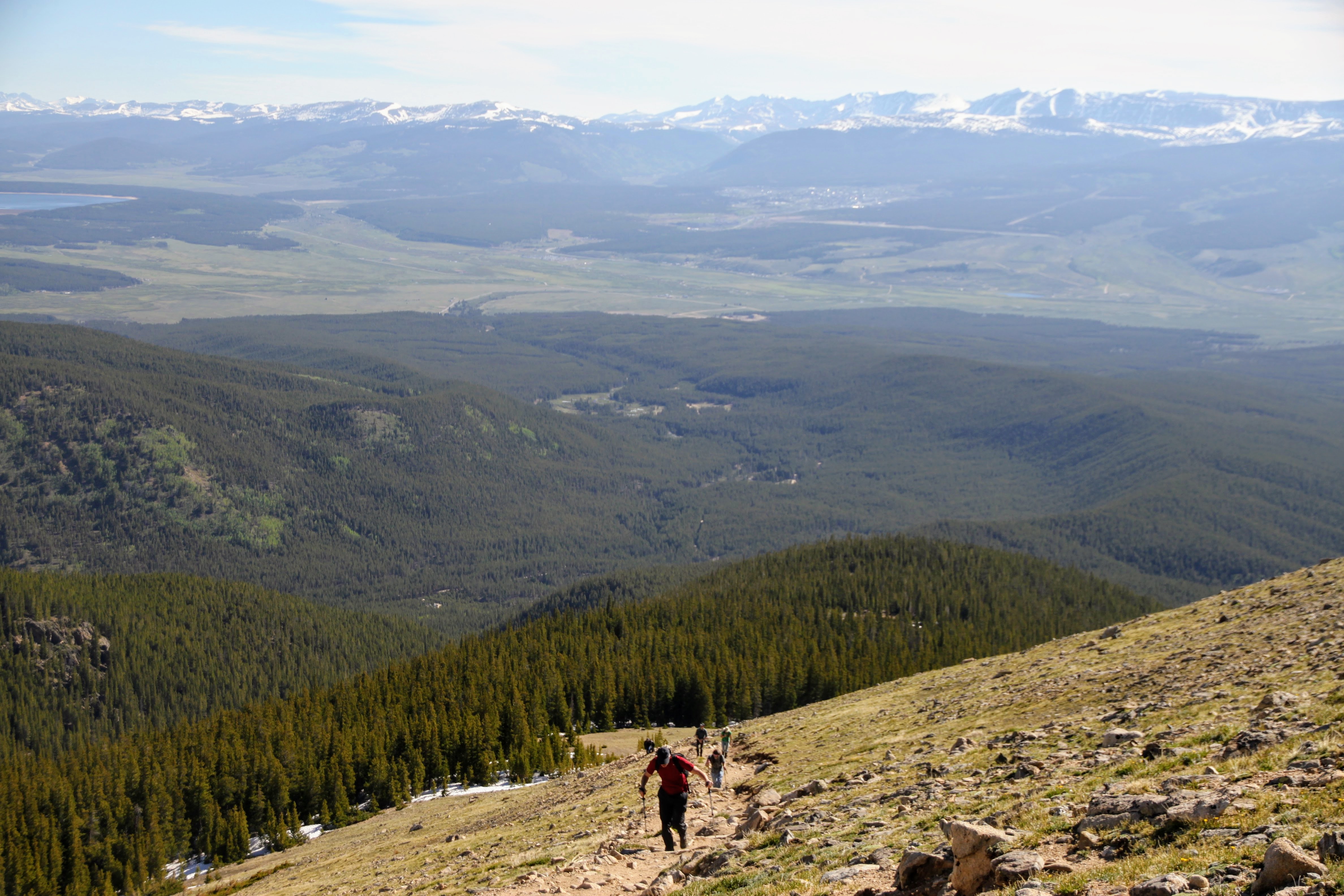
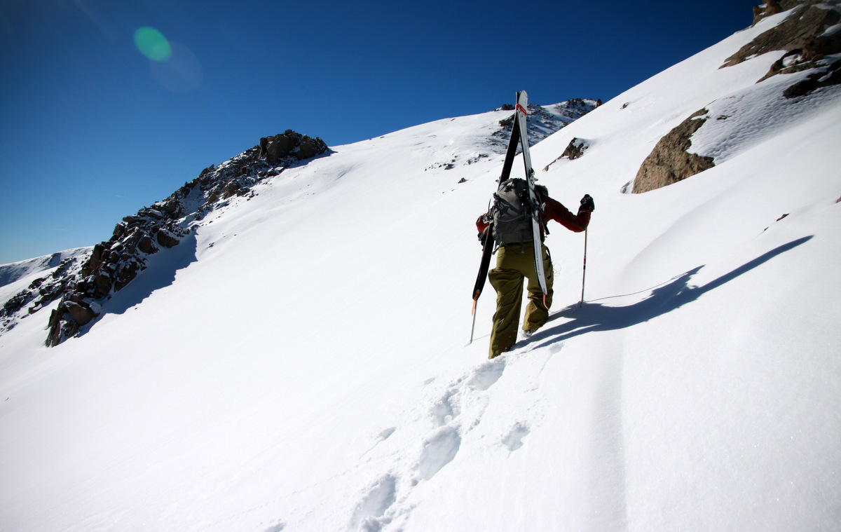
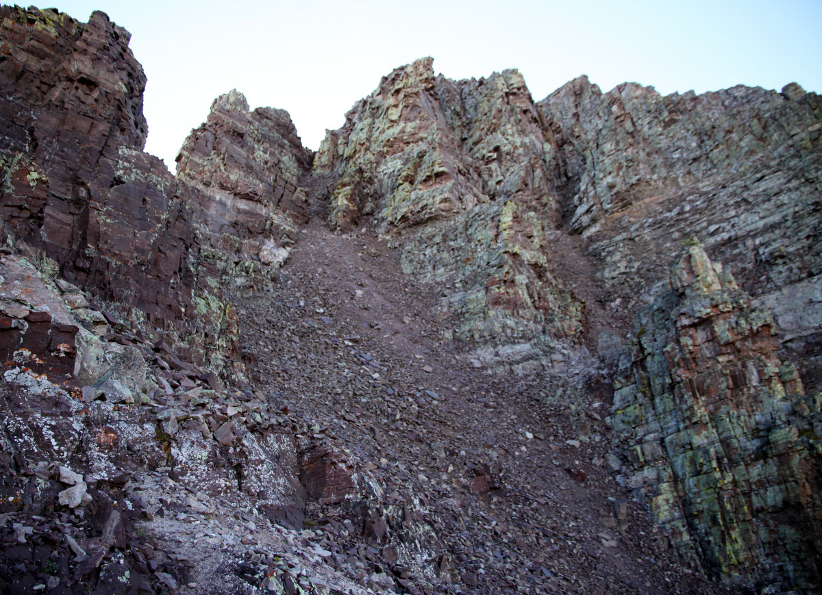
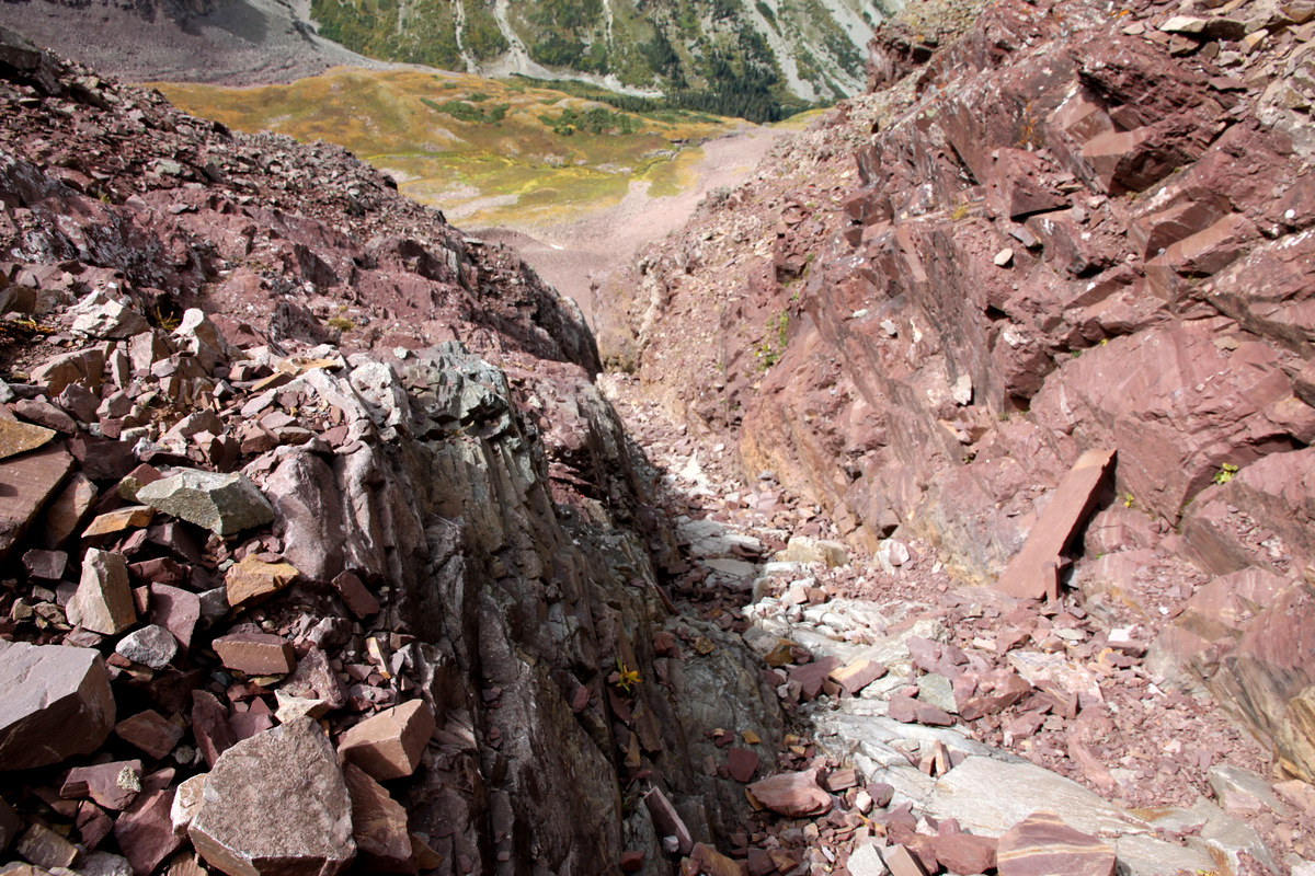
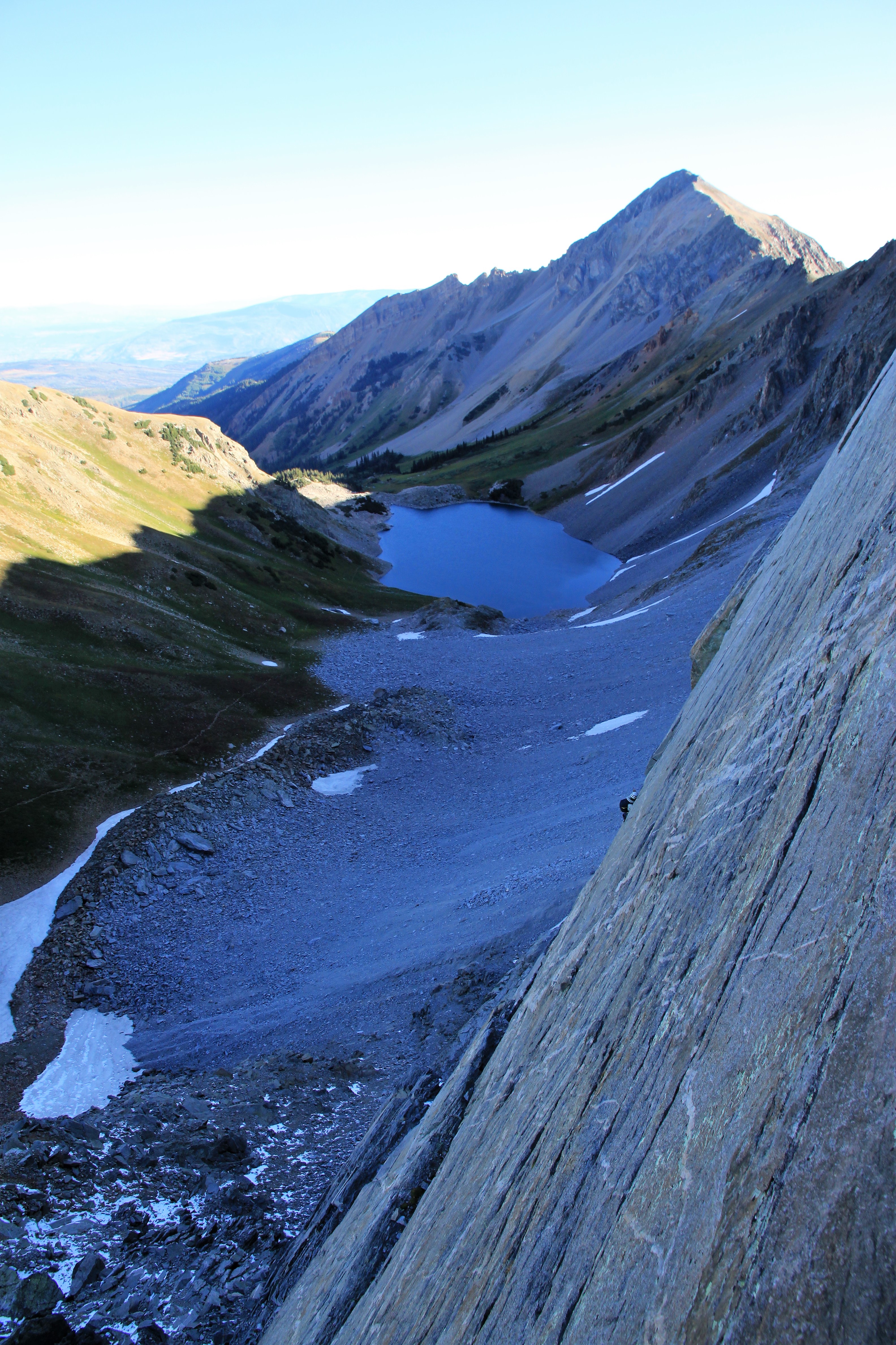
I was a bit disappointed to see the fresh dusting of snow on the north face and what seemed to go close to the northwest ridge itself as well as the shallow 4th class bowl below Unicorn Spire. However, we were still confident we could mostly avoid the snow. We refilled a bit of water in Capitol Lake and made our way up to Capitol Pass at around 12,000′. It was then a grunt up the final few hundred feet to the top of the talus cone to the base of the initial headwall and our intended route.

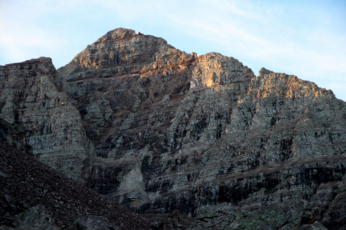
The route is sure intimidating from the talus cone here, but excitement was high!

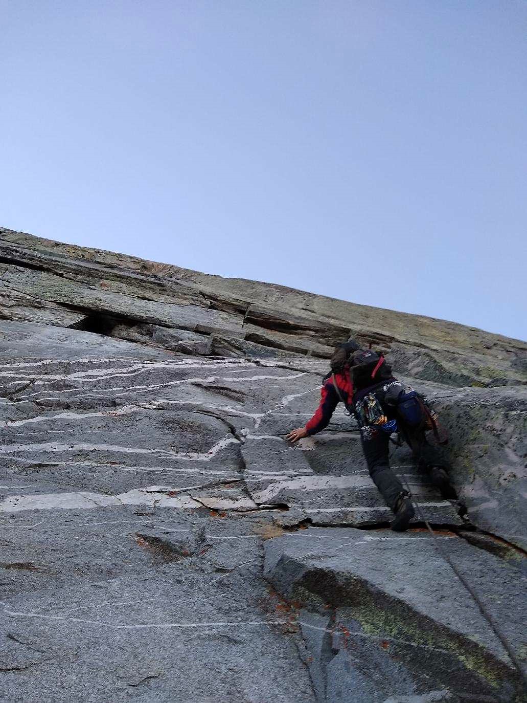
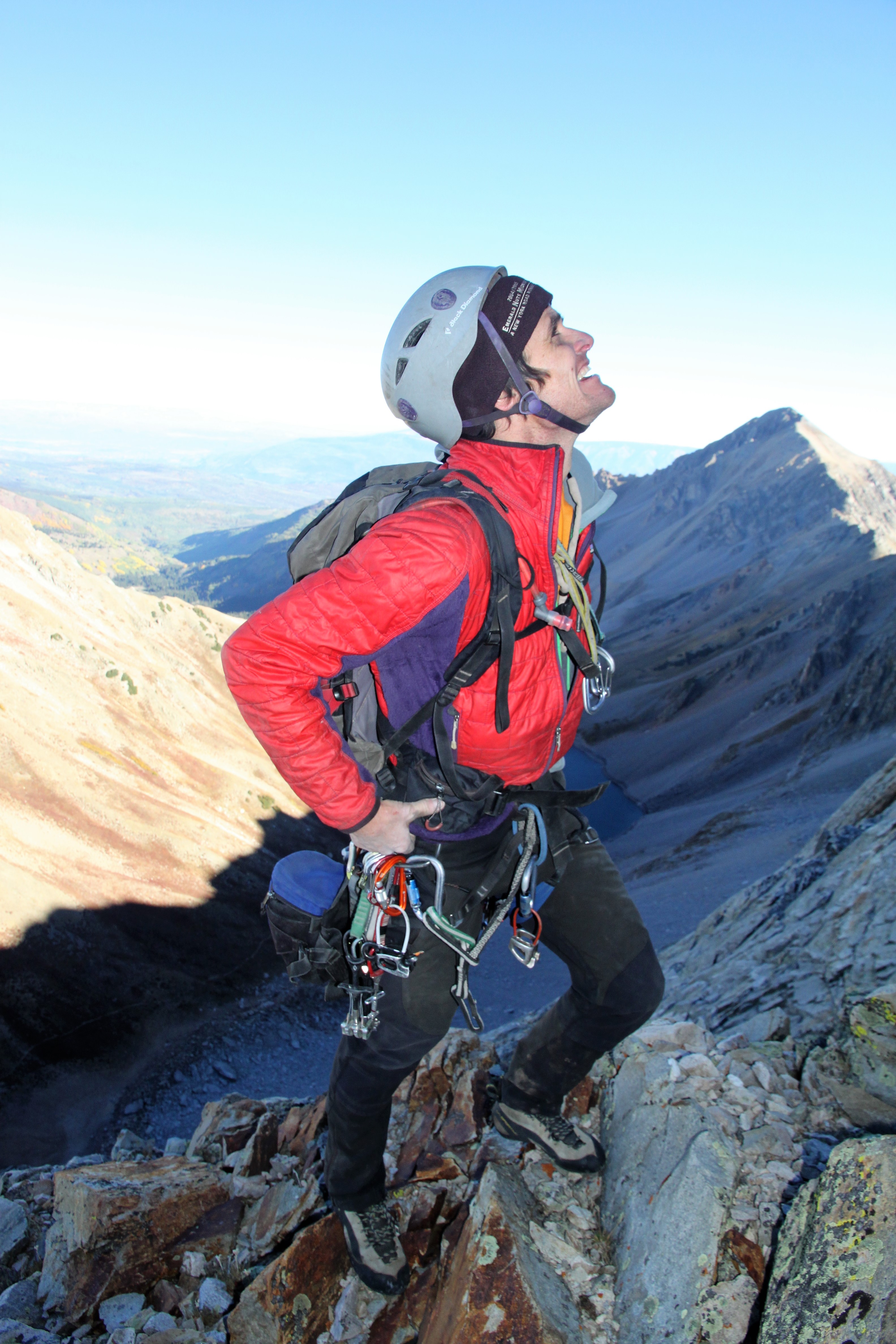
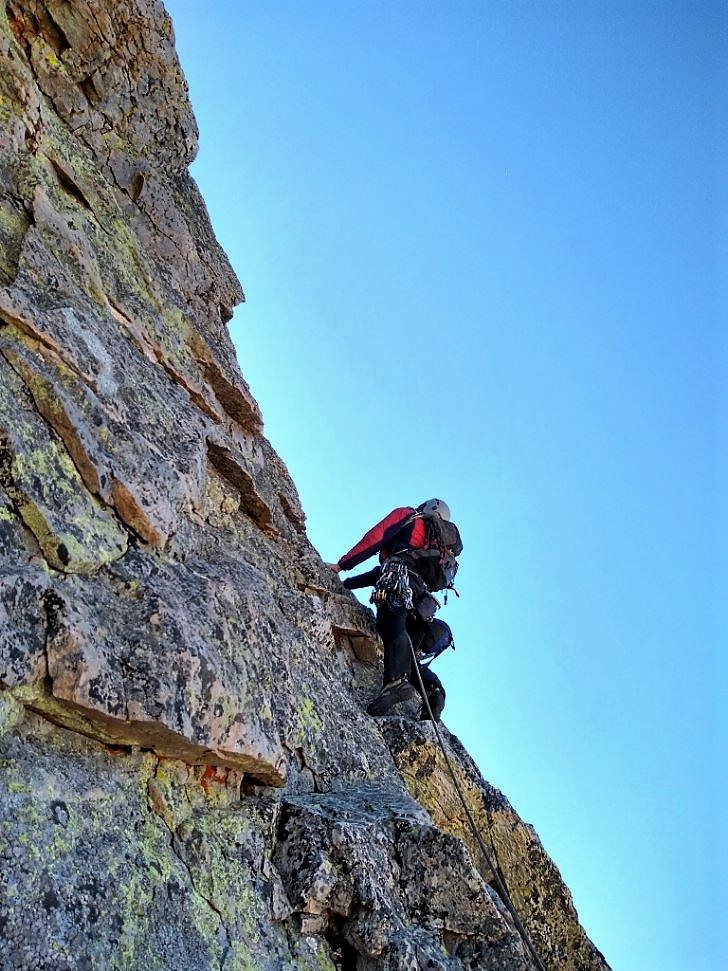
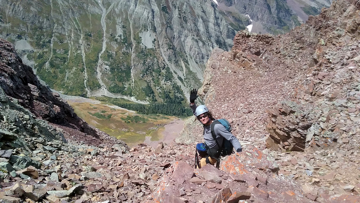
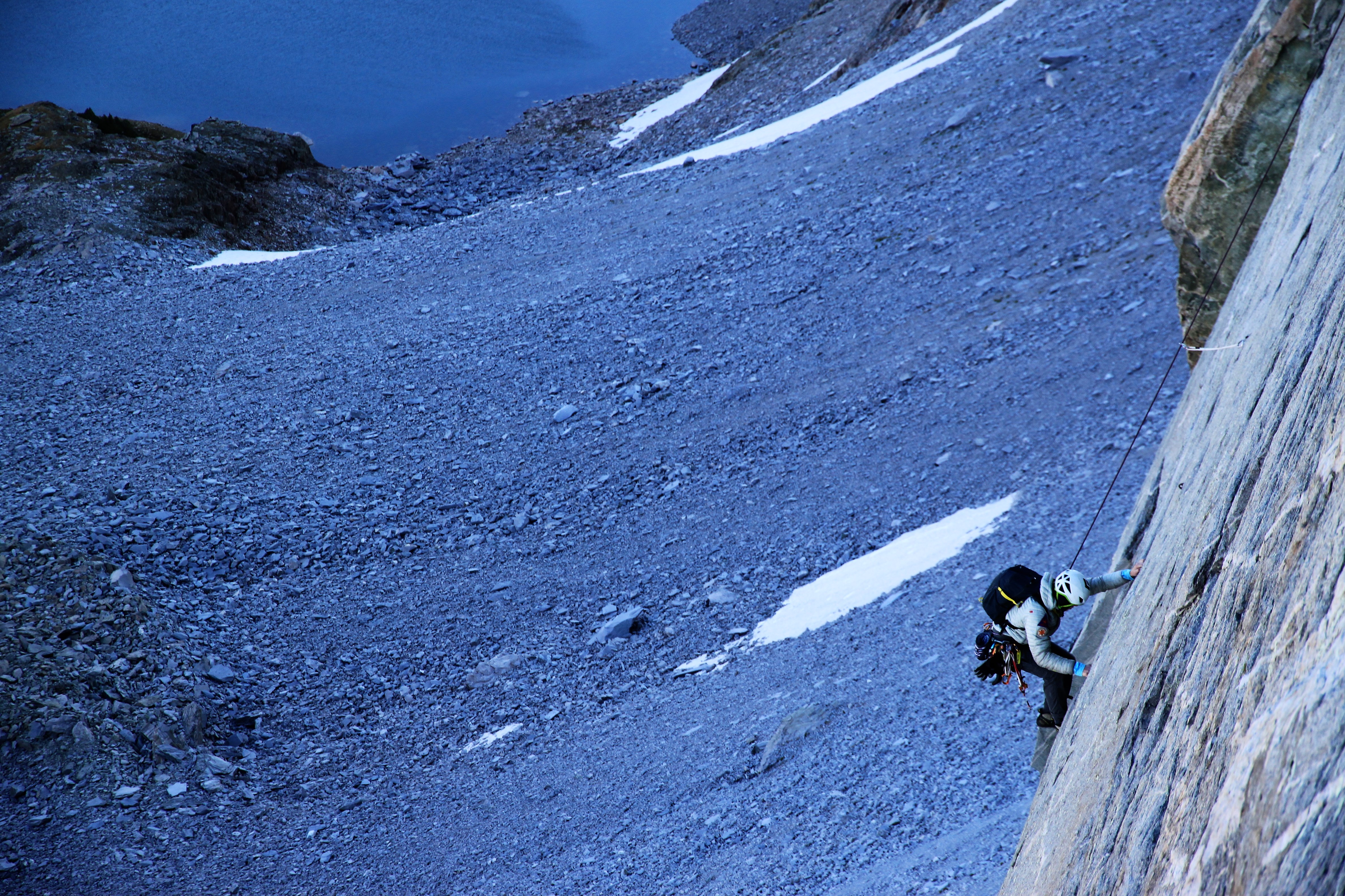
We caught up with another party of two who were attempting the original line to the left of Early Times. I gave them what beta I had on the initial 5.9 pitch and route-finding up the route itself above the headwall. It was pretty chilly no doubt and the wind was whipping a bit. Climbing hard 5.10 in these types of conditions plus being in the shade at over 12,000′ is a far cry from cragging in warm sunshine at 7,000′. We racked up and I led on up the 1st 5.10c crux pitch maybe around 8-8:30am. The cold was tough to deal with, but got better the higher I went. There were several distinct cruxes in my opinion and some tricky moves protected by only a nut in some places, but I made it to the anchors after 100′ of climbing or so and set up to belay J.

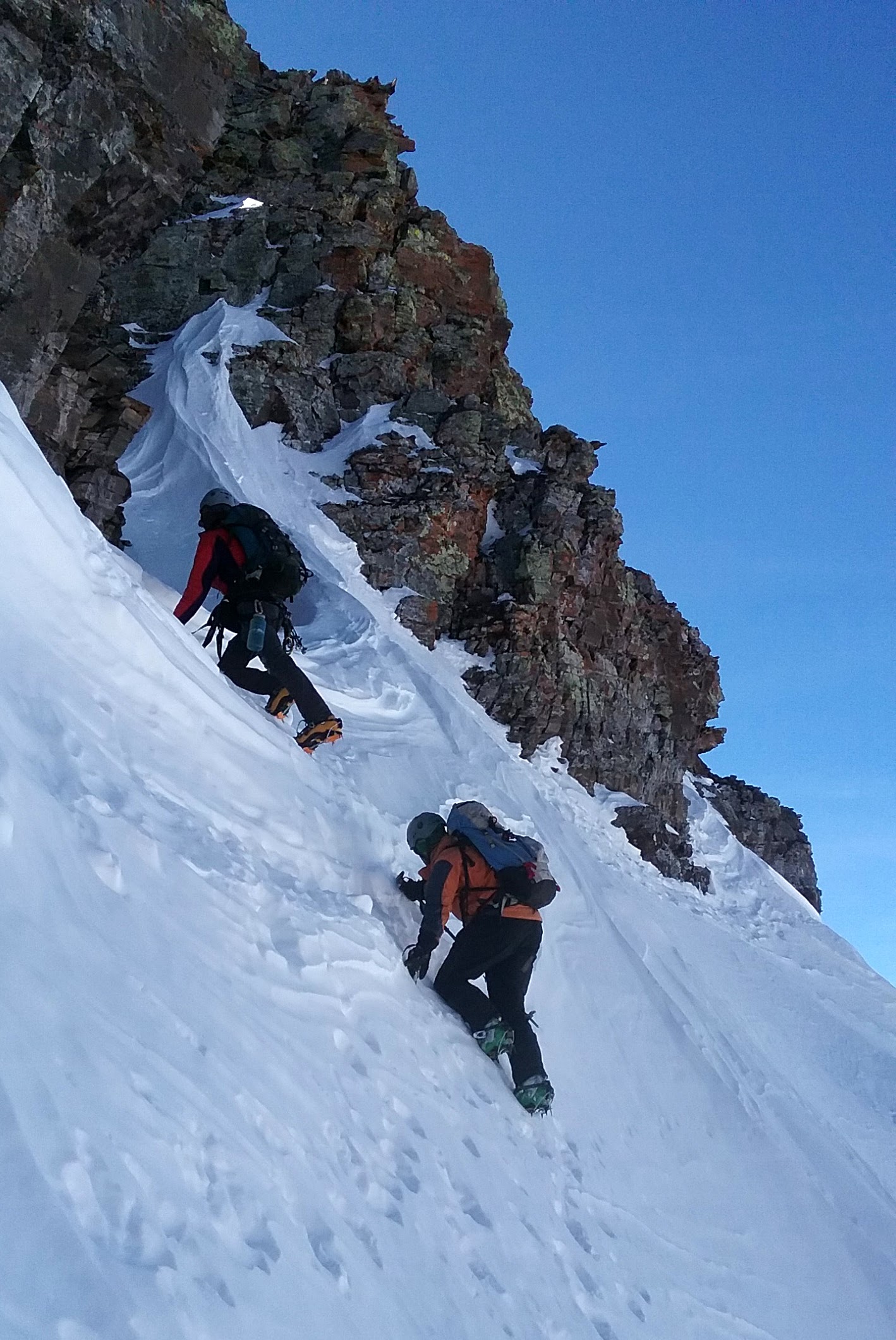
The initial crux headwall. The 1st pitch of Early Times goes up the center dihedral

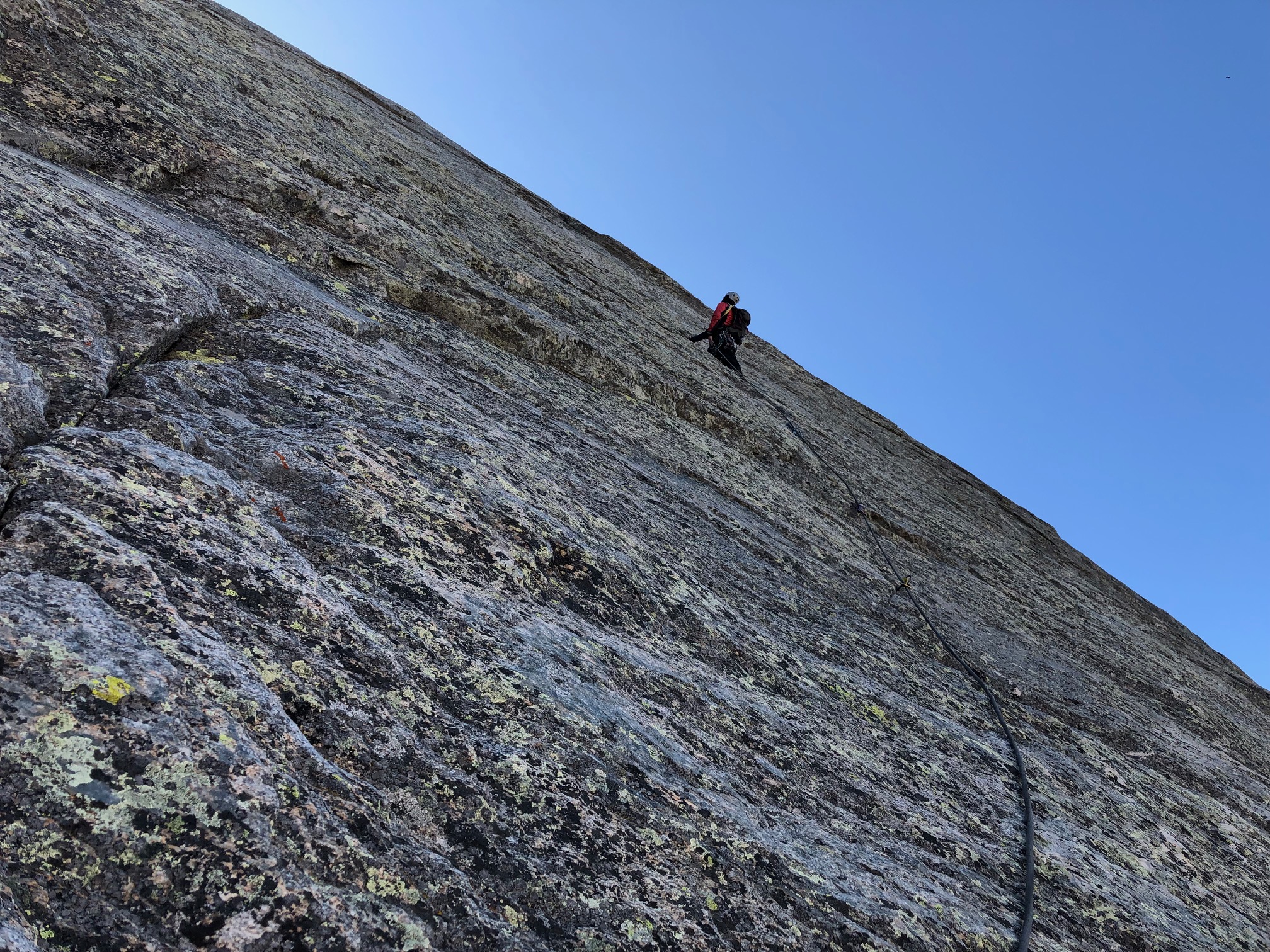
Me on the initial, easier climbing of pitch 1

J in the thick of it on pitch 1

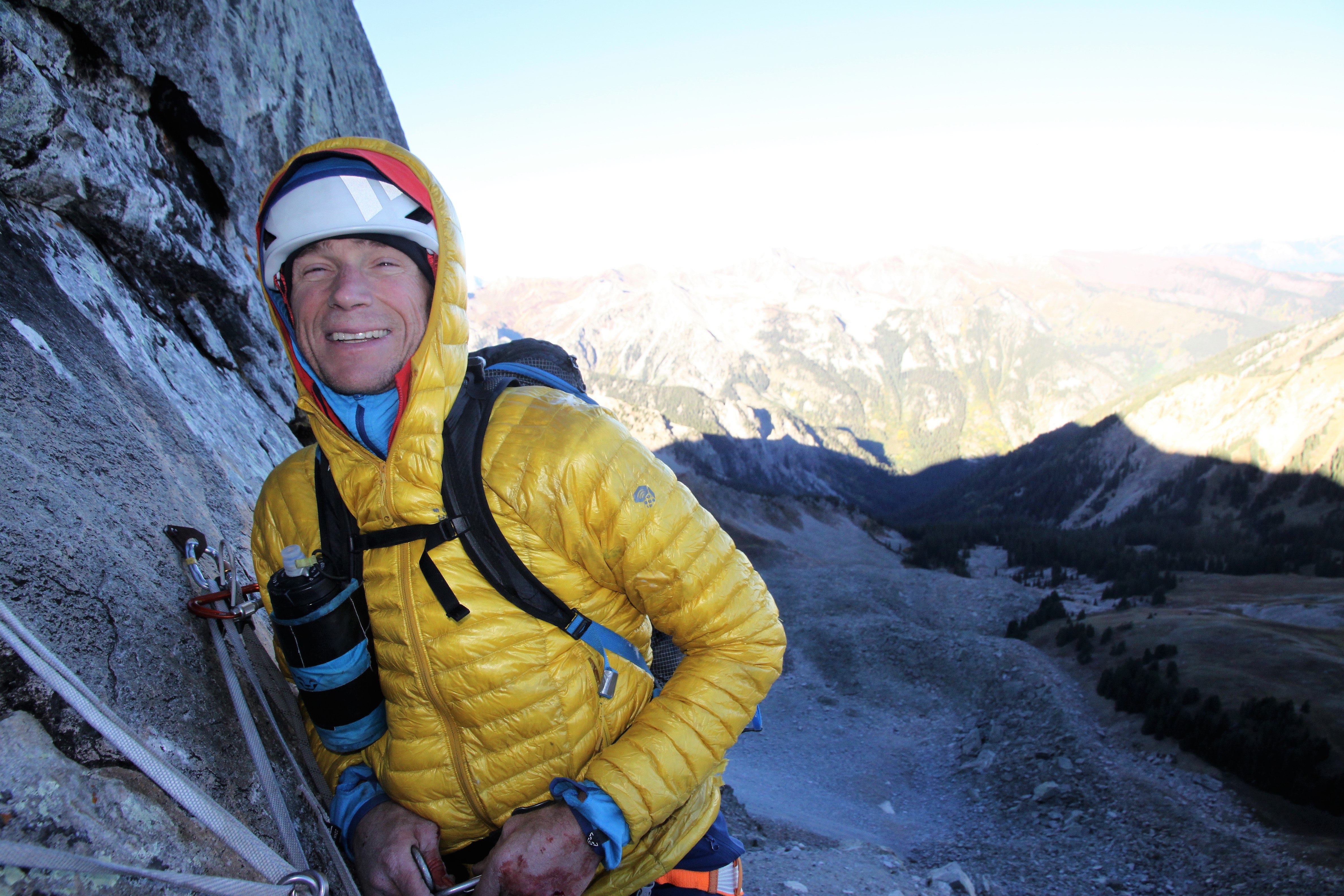
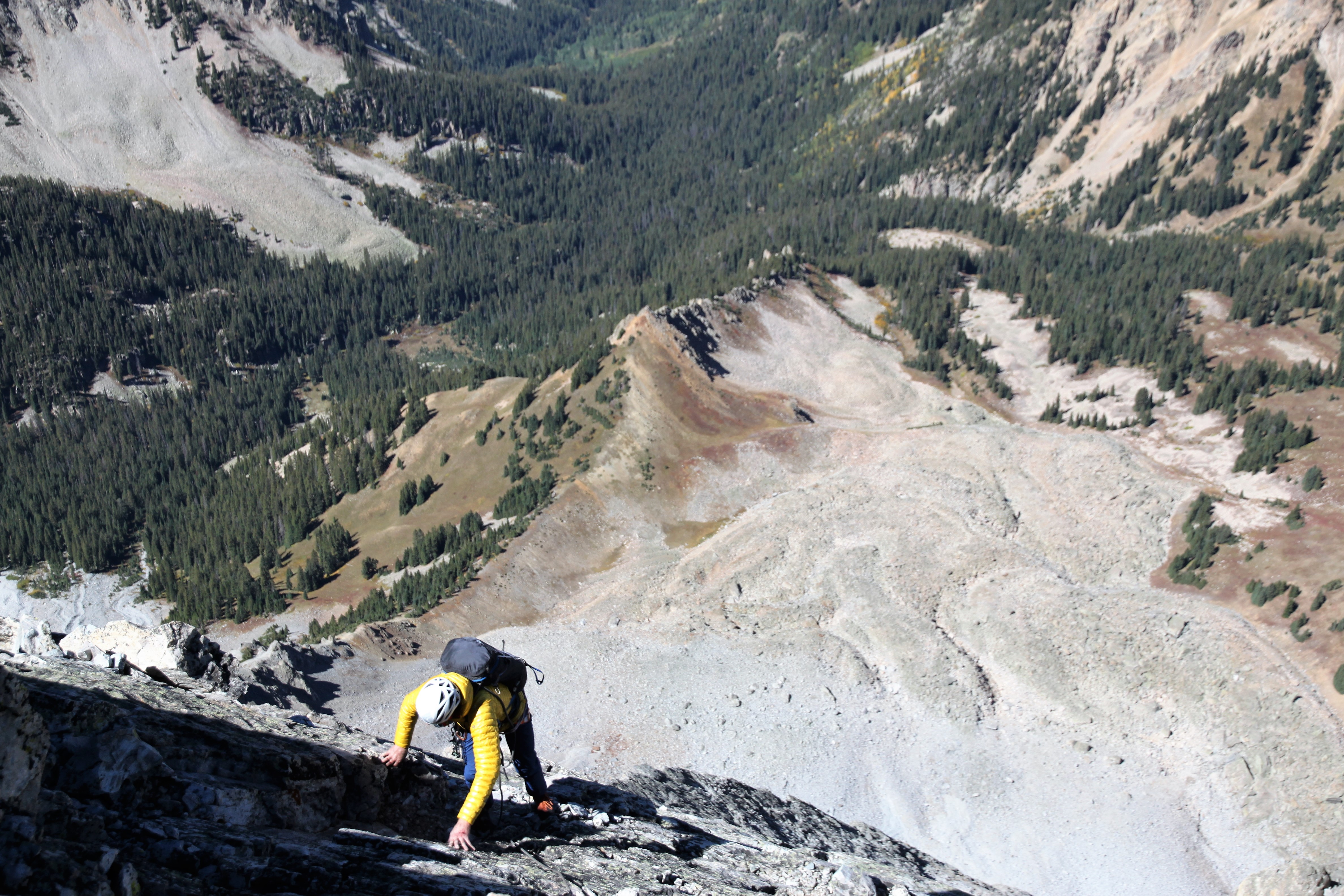
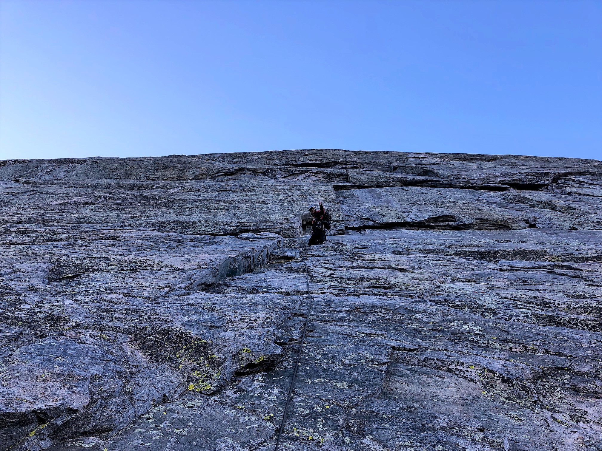
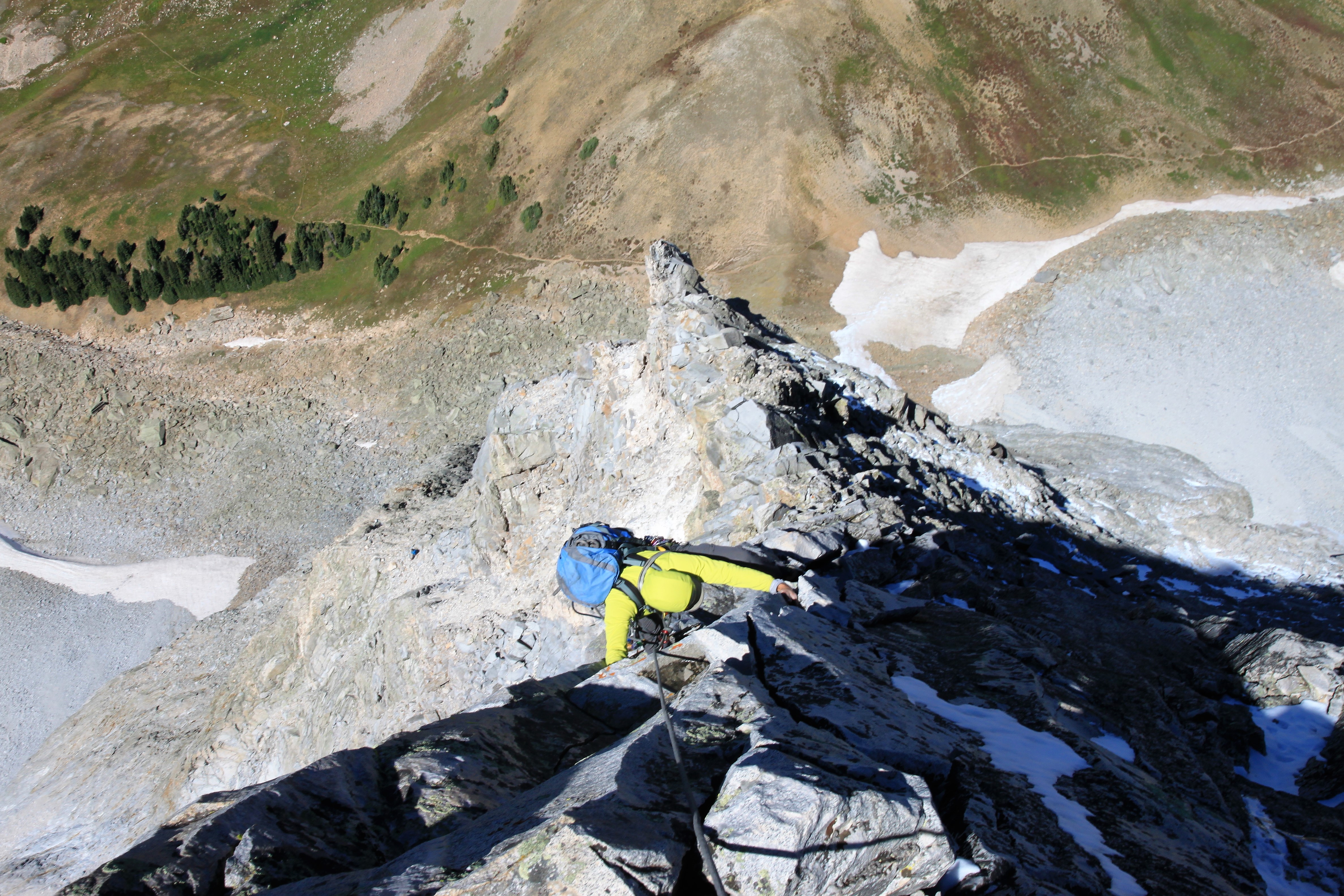
I don’t know how J climbing this pitch wearing gloves

J getting close to the belay approaching the upper crux of pitch 1

The other team of two were heading up the 5.9 pitch on the original route and actually were trying to dislodge the #0.5 purple cam Chris and I had lost exactly a year ago on that route. We could communicate with them and had a good laugh at the fact that it was mine.

The follower on the original 5.9 pitch to our east

A more scenic shot of the climber on the original 5.9 pitch as seen from the top of the 1st pitch on Early Times

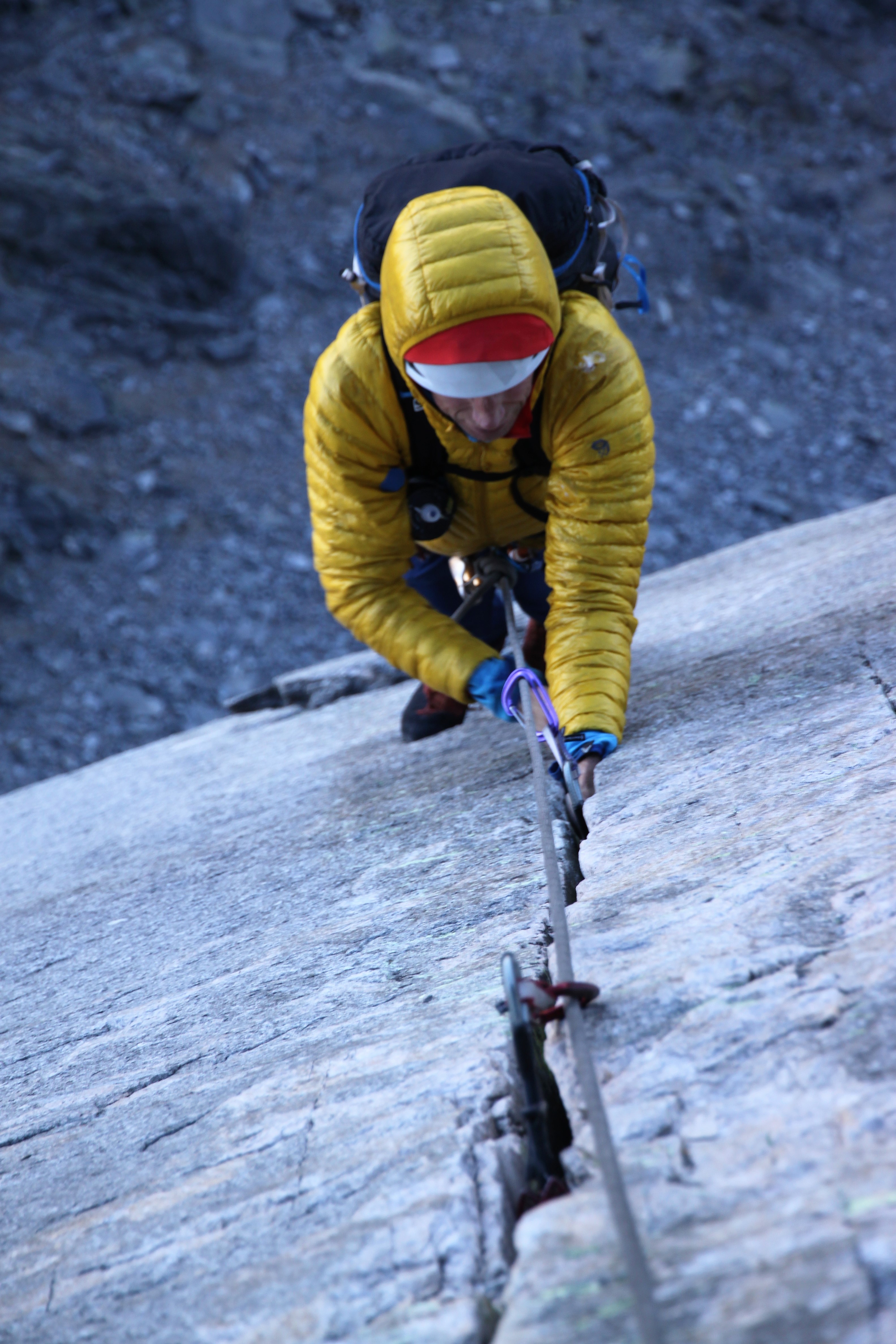
We swapped the rack and I belayed J as he led off up the mentally taxing 5.9+ pitch 2. The climbing initially surmounted a small roof protected by a bolt and then angled up and right following discontinuous cracks.

J on lead up pitch 2

The crux came near the anchors at the top of pitch 2 where J was making the moves first and then placing gear below him. A scary way of leading. He really persevered and did so well and made the onsight.

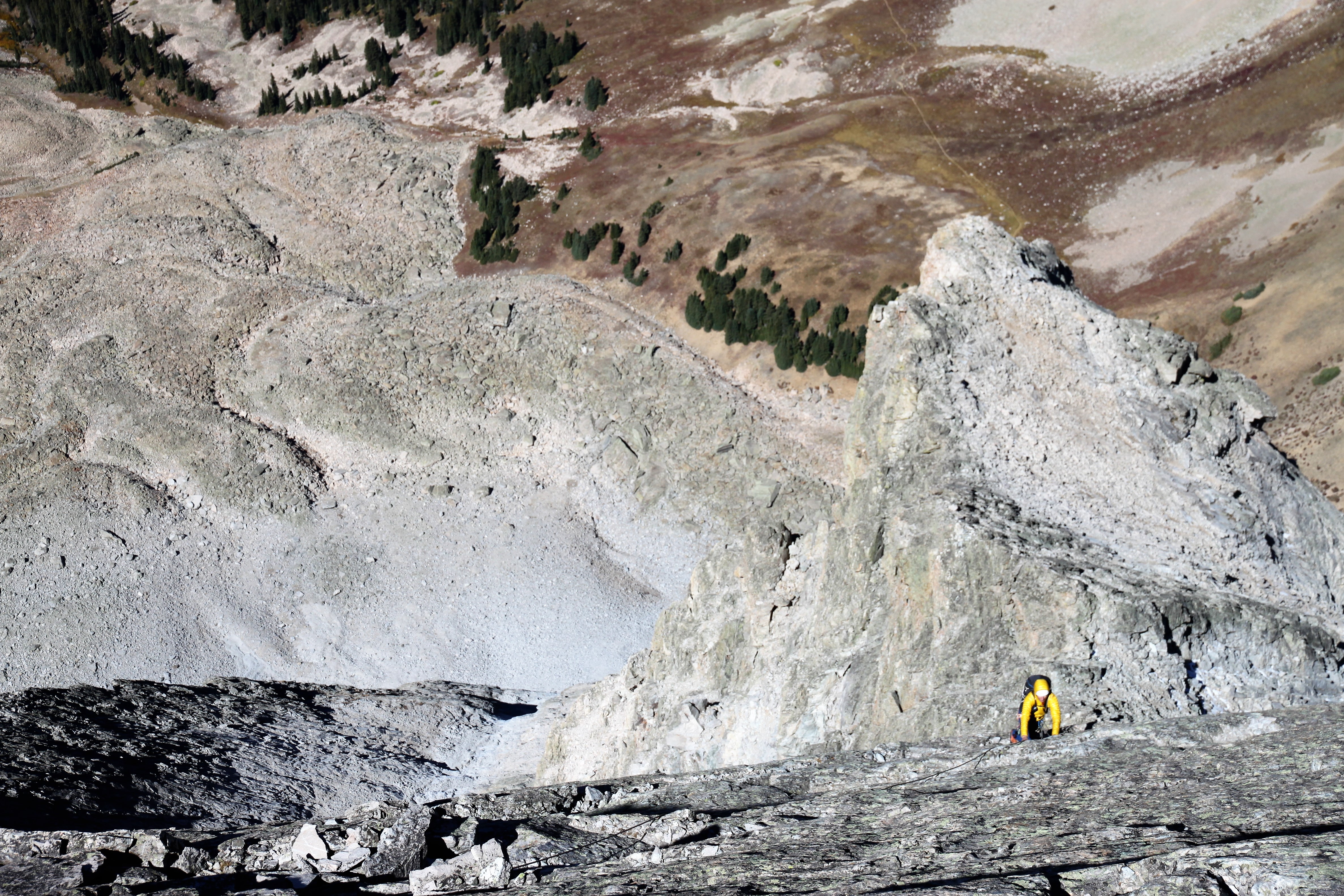
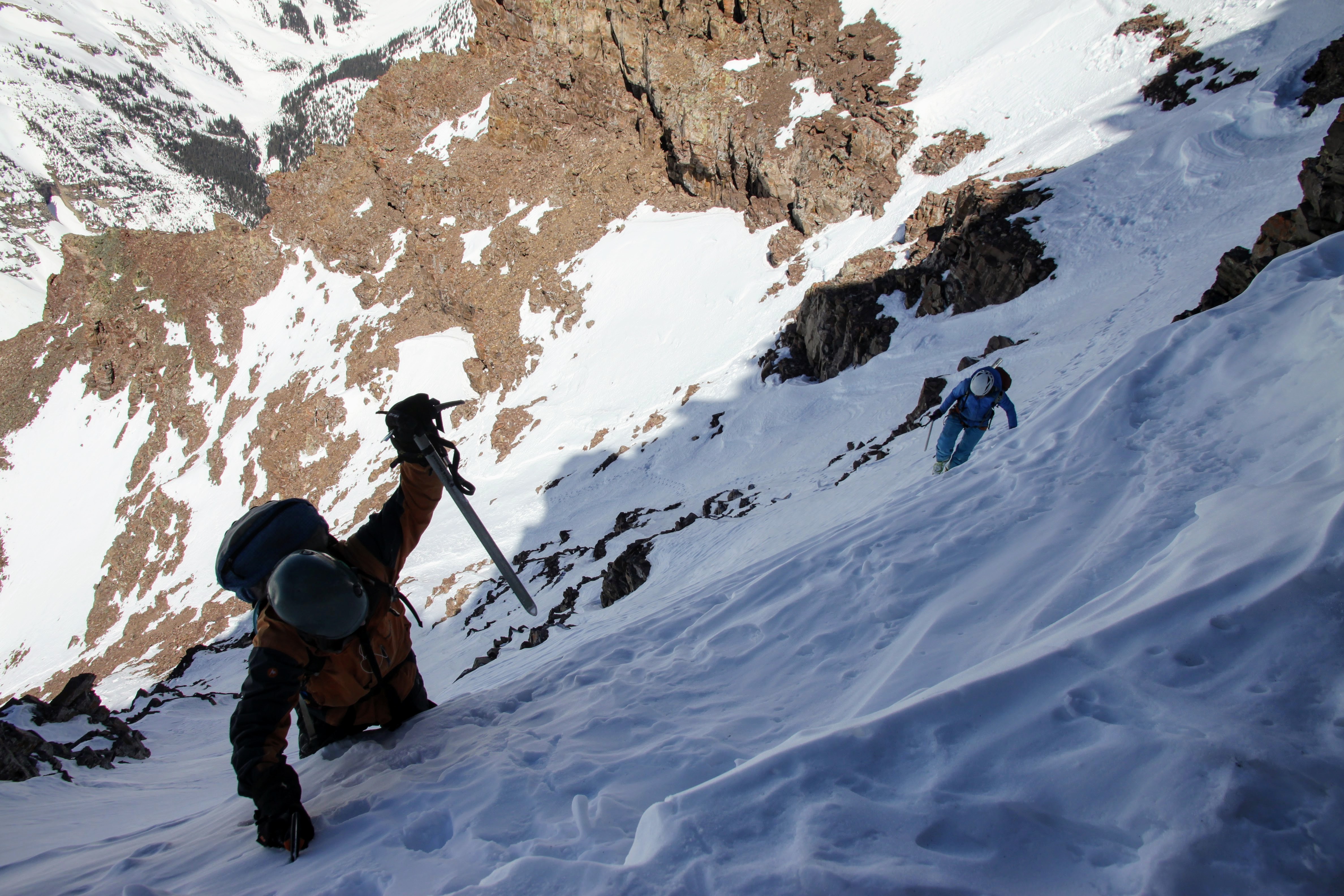
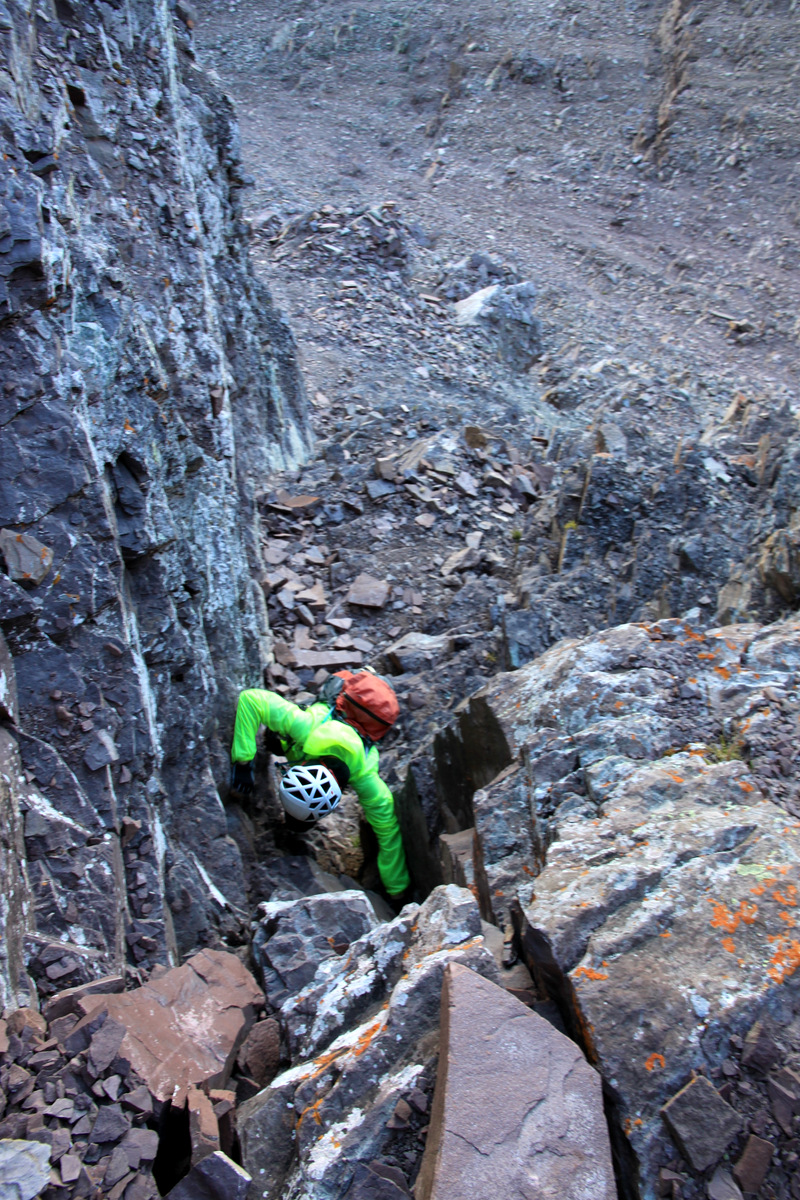
I’m down there somewhere following and cleaning pitch 2 as seen from the pitch 2 belay

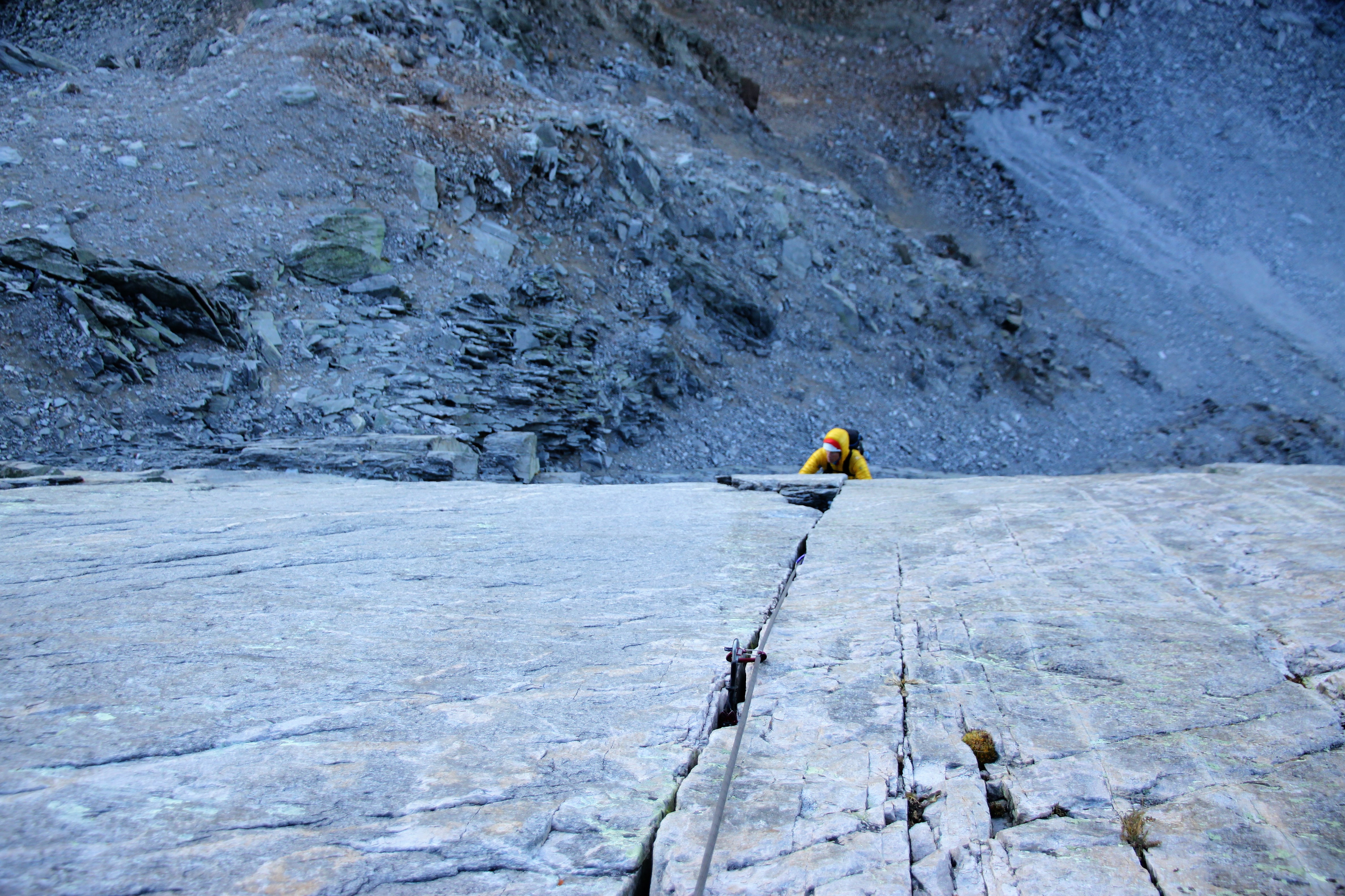
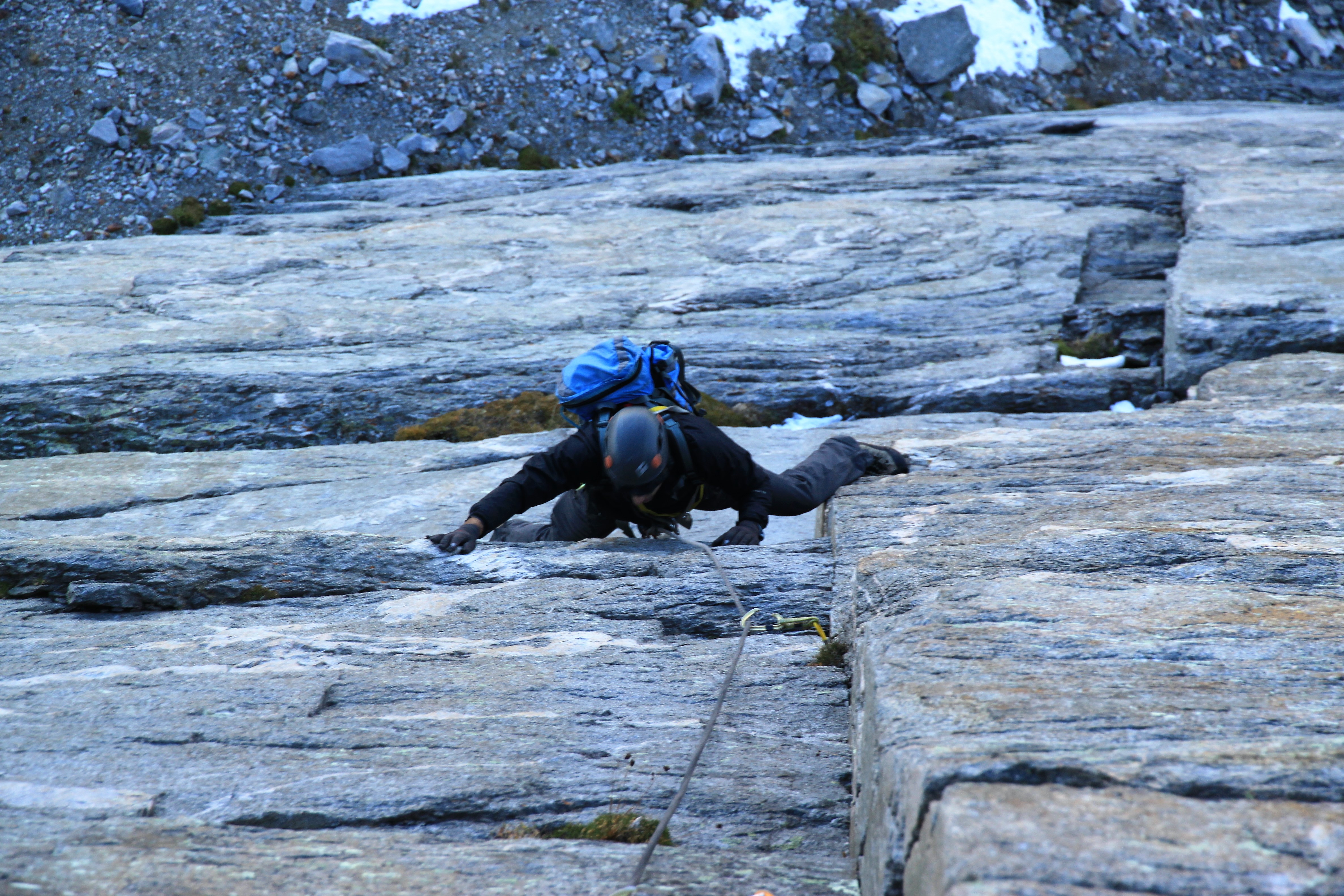
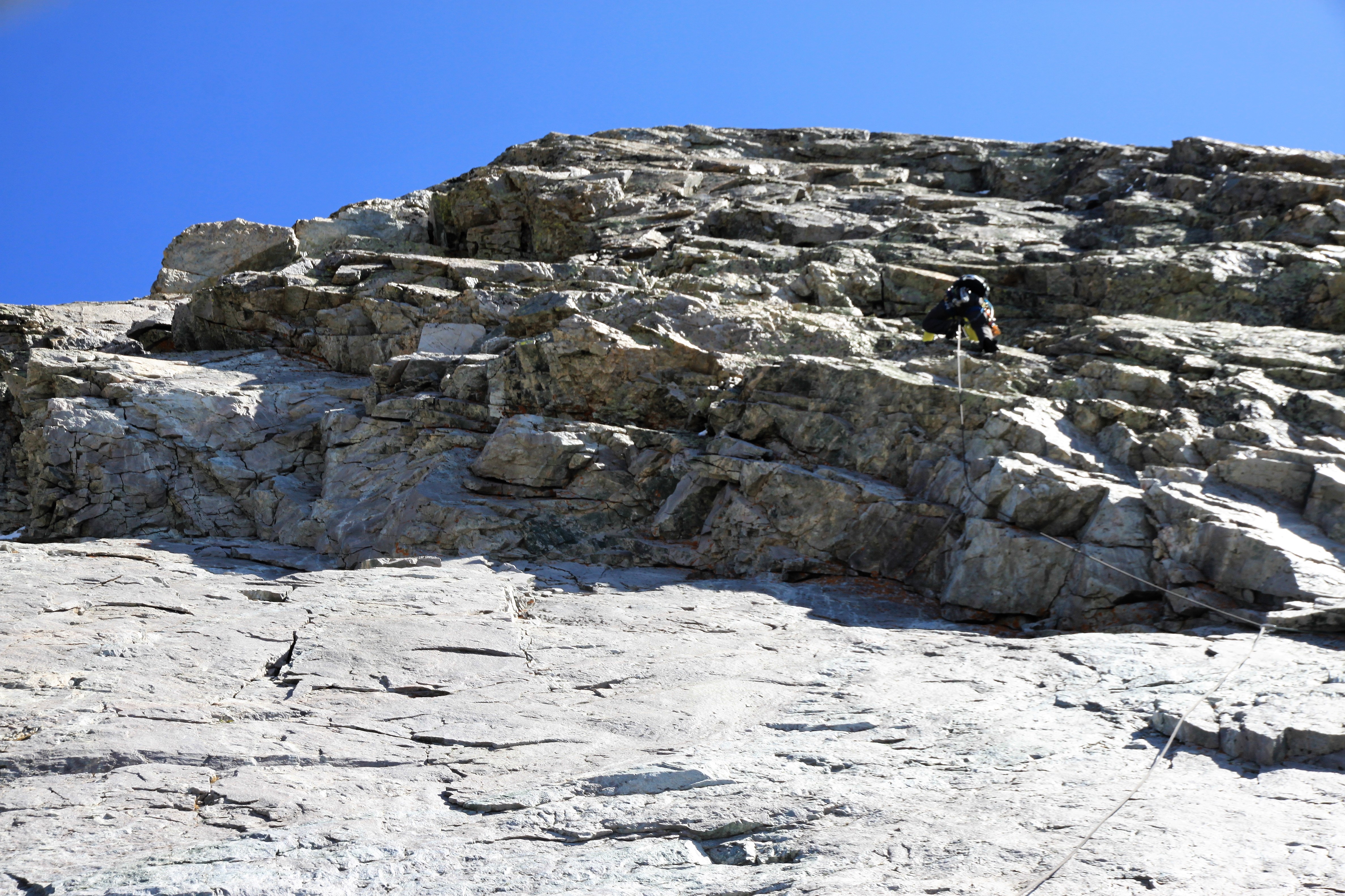
Pitch 3 was 5.8ish and after an airy, no-pro traverse west to a small crack, I led on up this short pitch to a decent belay.

Me leading up pitch 3

J back down at the pitch 2 belay

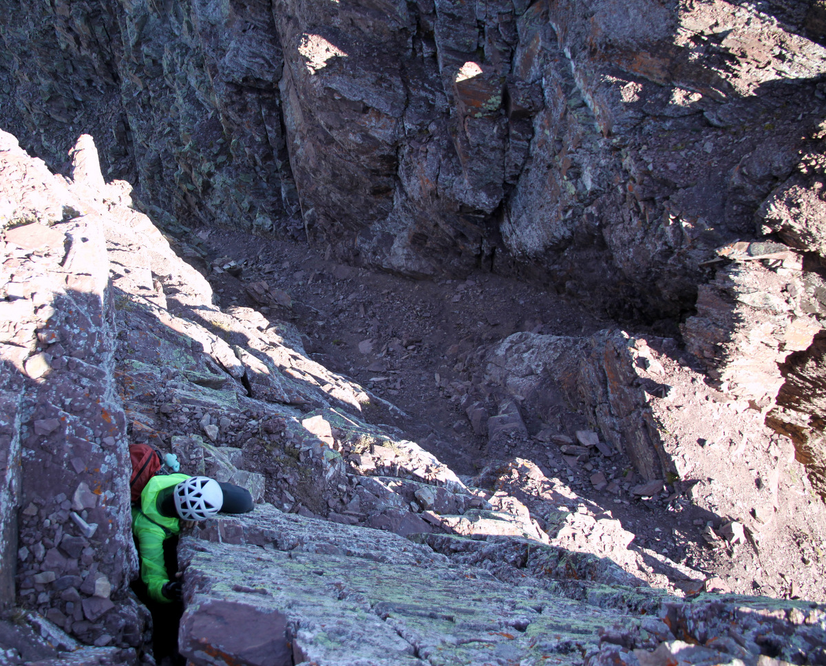
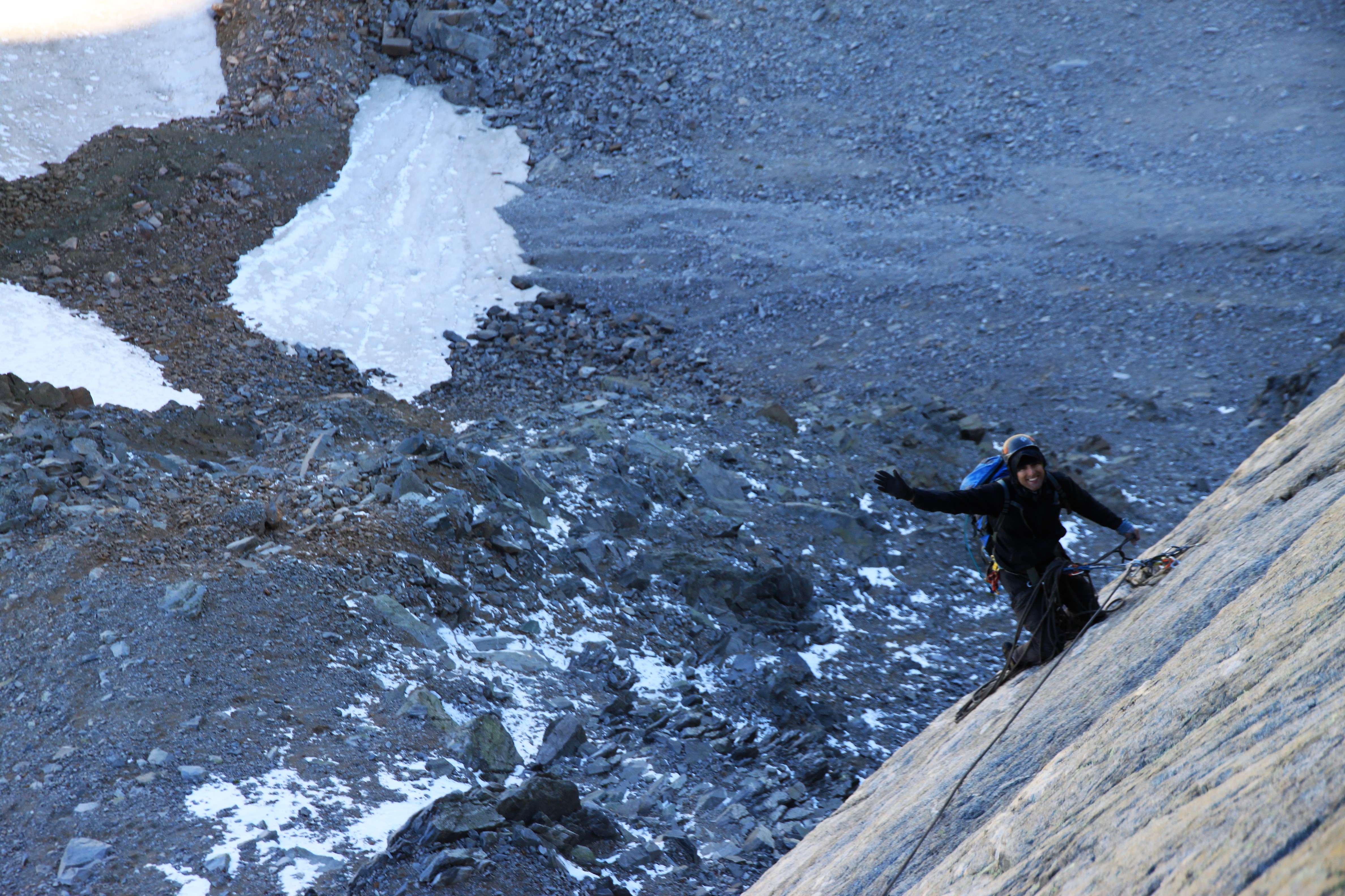
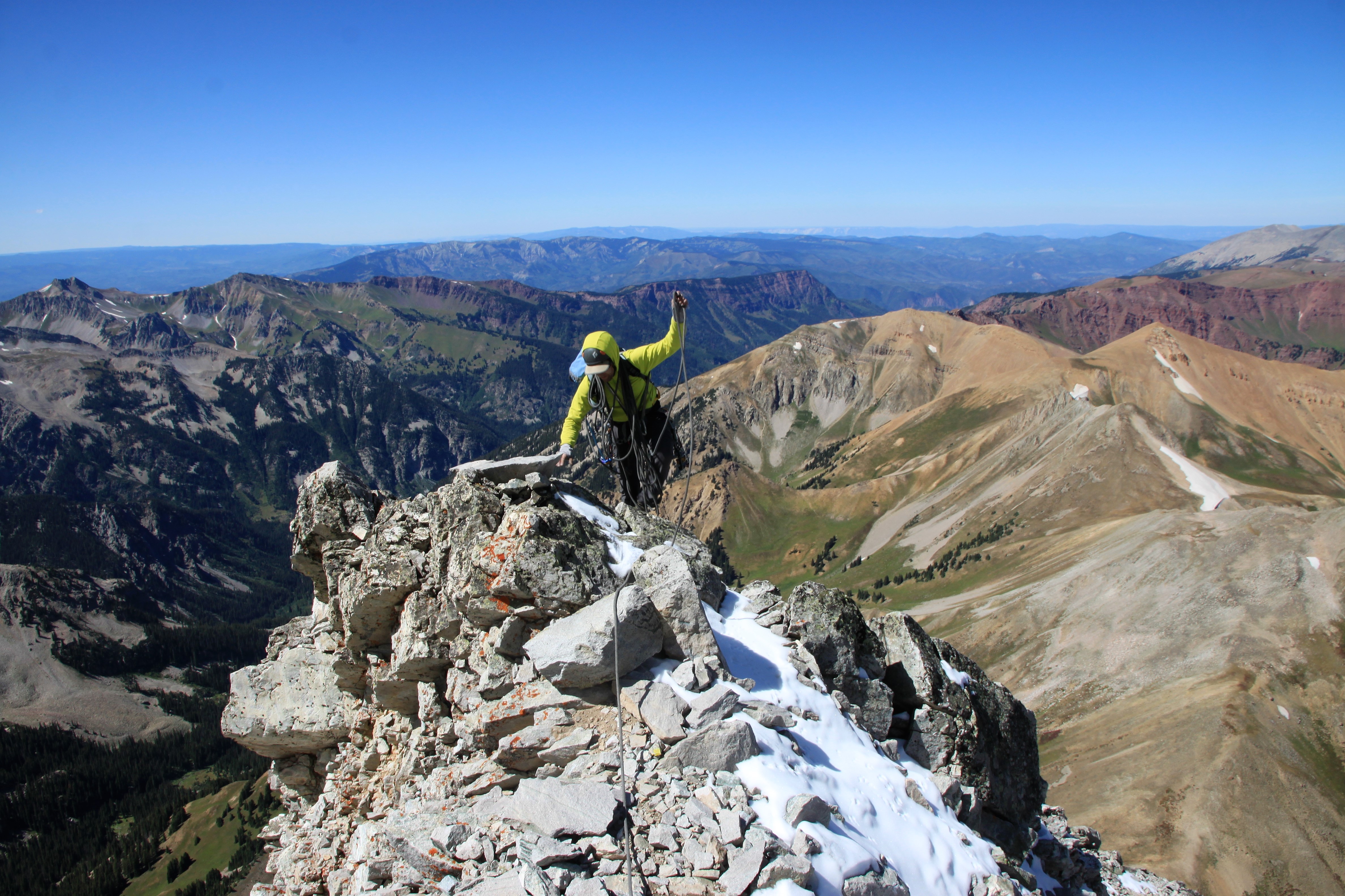
We then did the final swap of the rack and J took us home up the 5.8 pitch 4 to the anchors at the top of the headwall. The moves at the top of pitch 4, or at least the moves we did, were certainly not 5.8 in the least. Maybe we were off route, but they were much harder than 5.8, that is for sure!

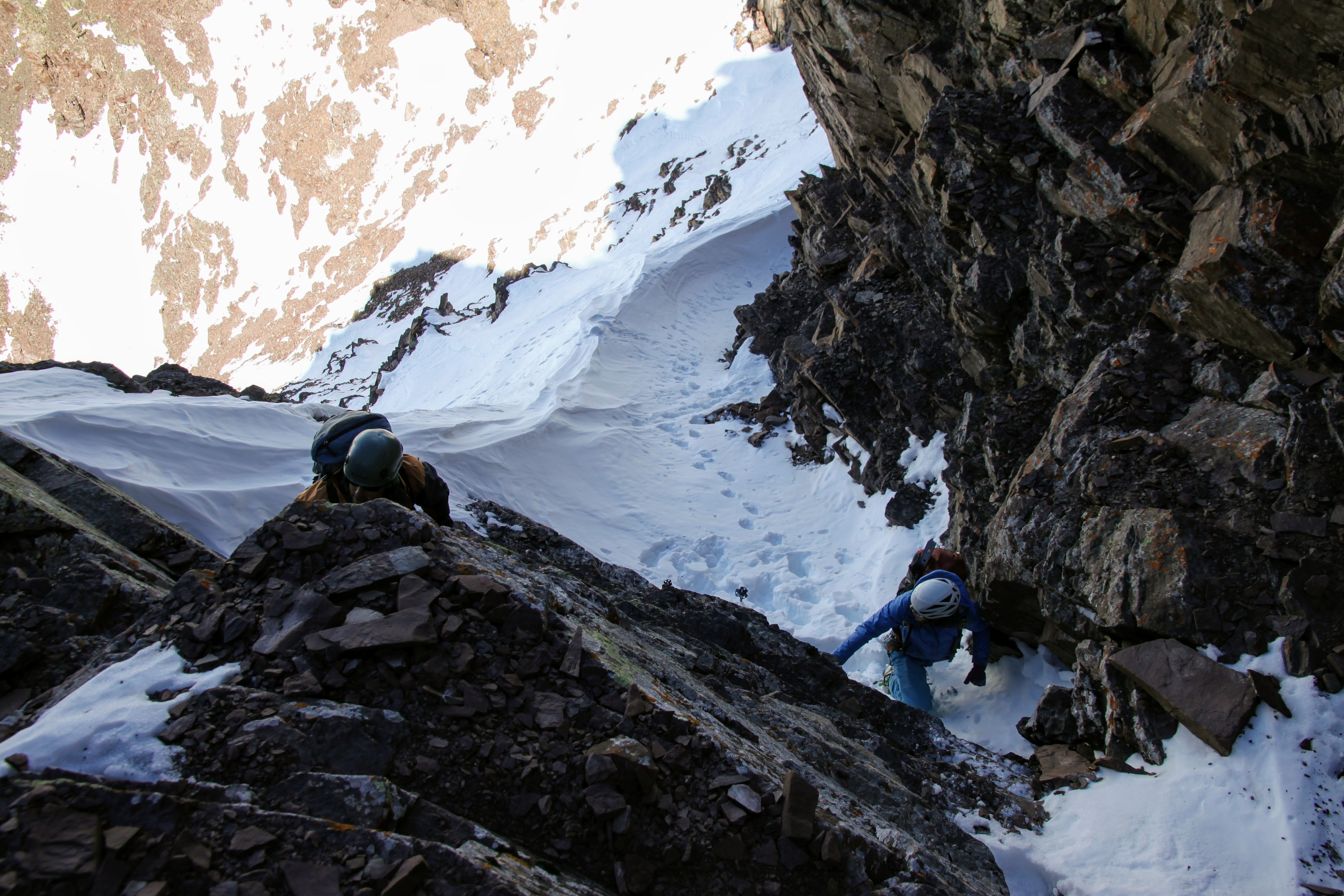
J doing the initial traverse east on pitch 4 before heading straight up past an old piton

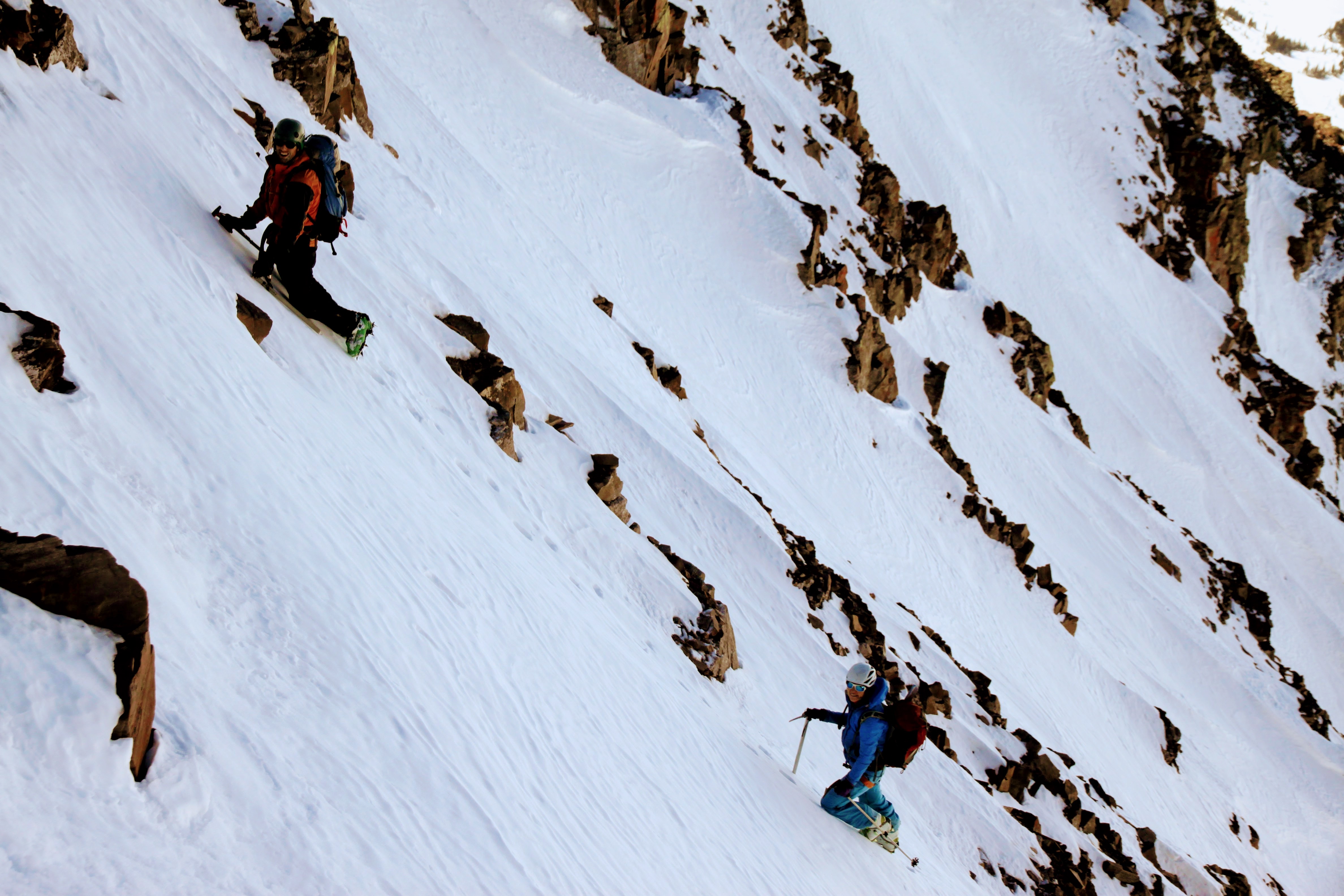
As J brought me up to him, the other team of two was finishing up their 2nd 5.8 chimney pitch down below us to climber’s left. Another team of two had started up the original 5.9 route as well below them. We stowed the rope and began the really fun class 4 climbing up and right avoid the snow in the easiest terrain which Chris Baldwin and I climbed in last time.

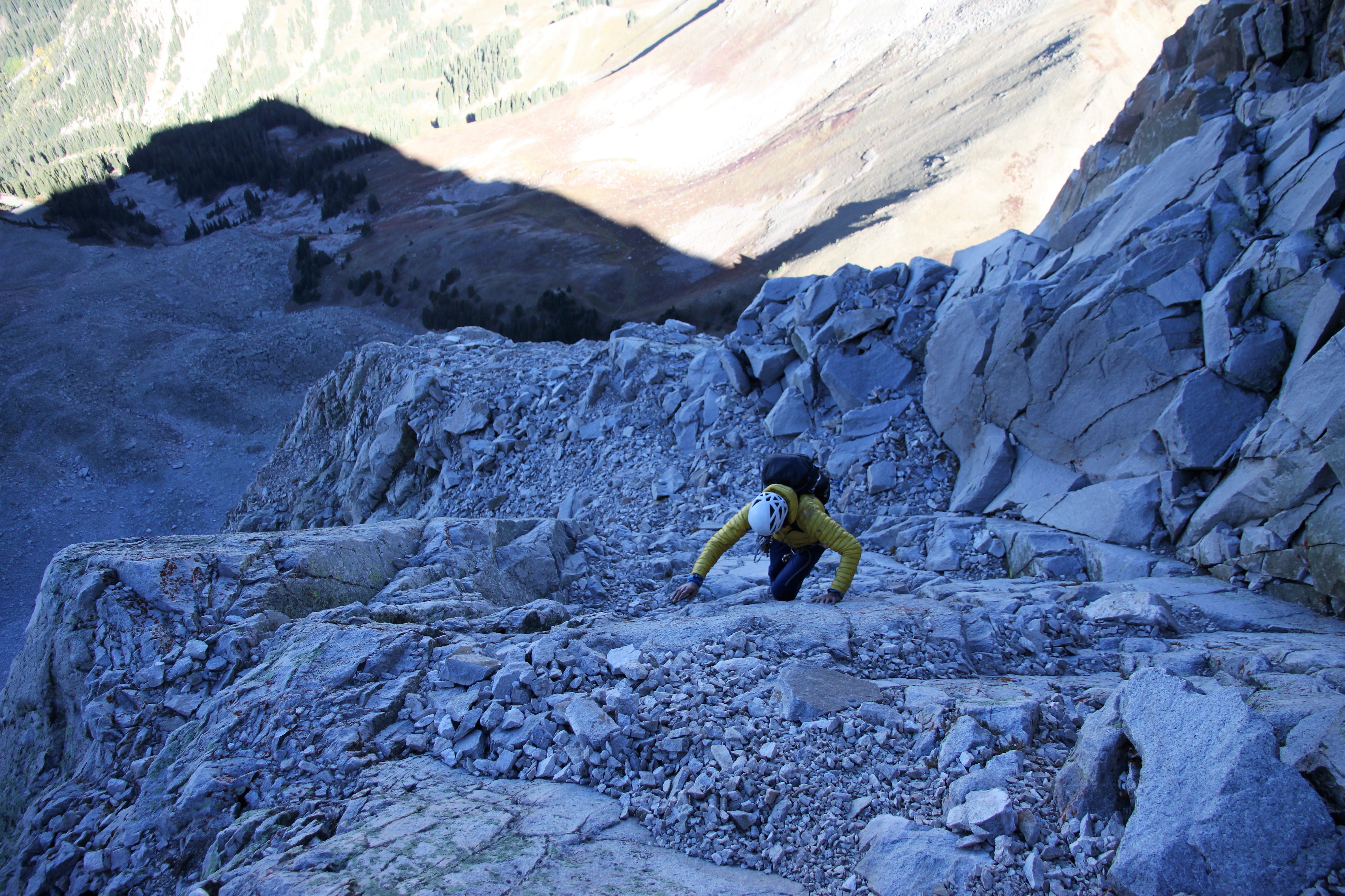
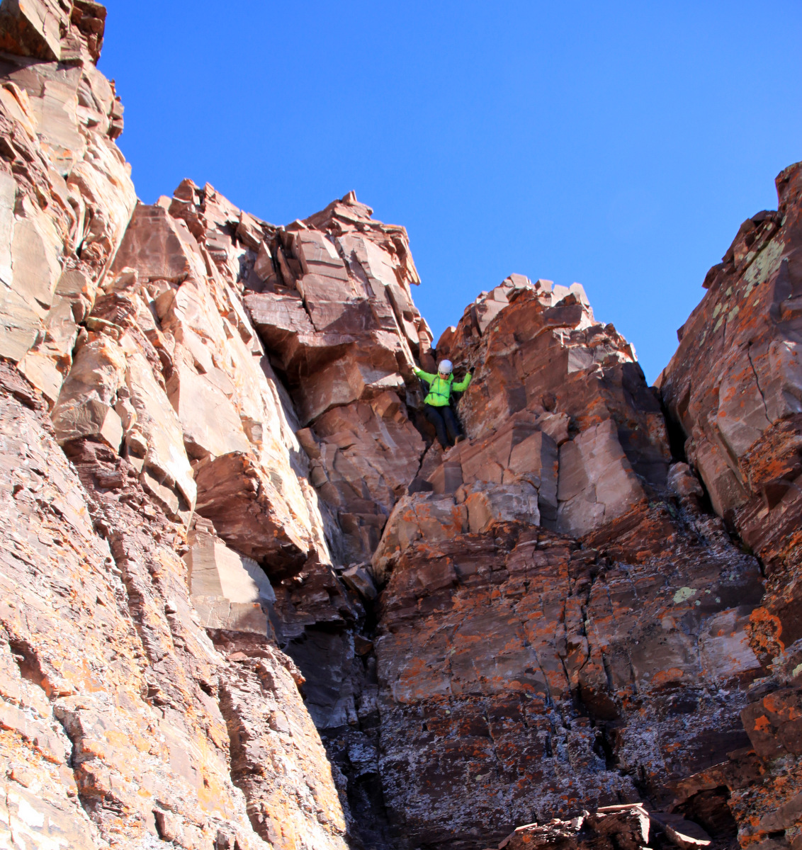
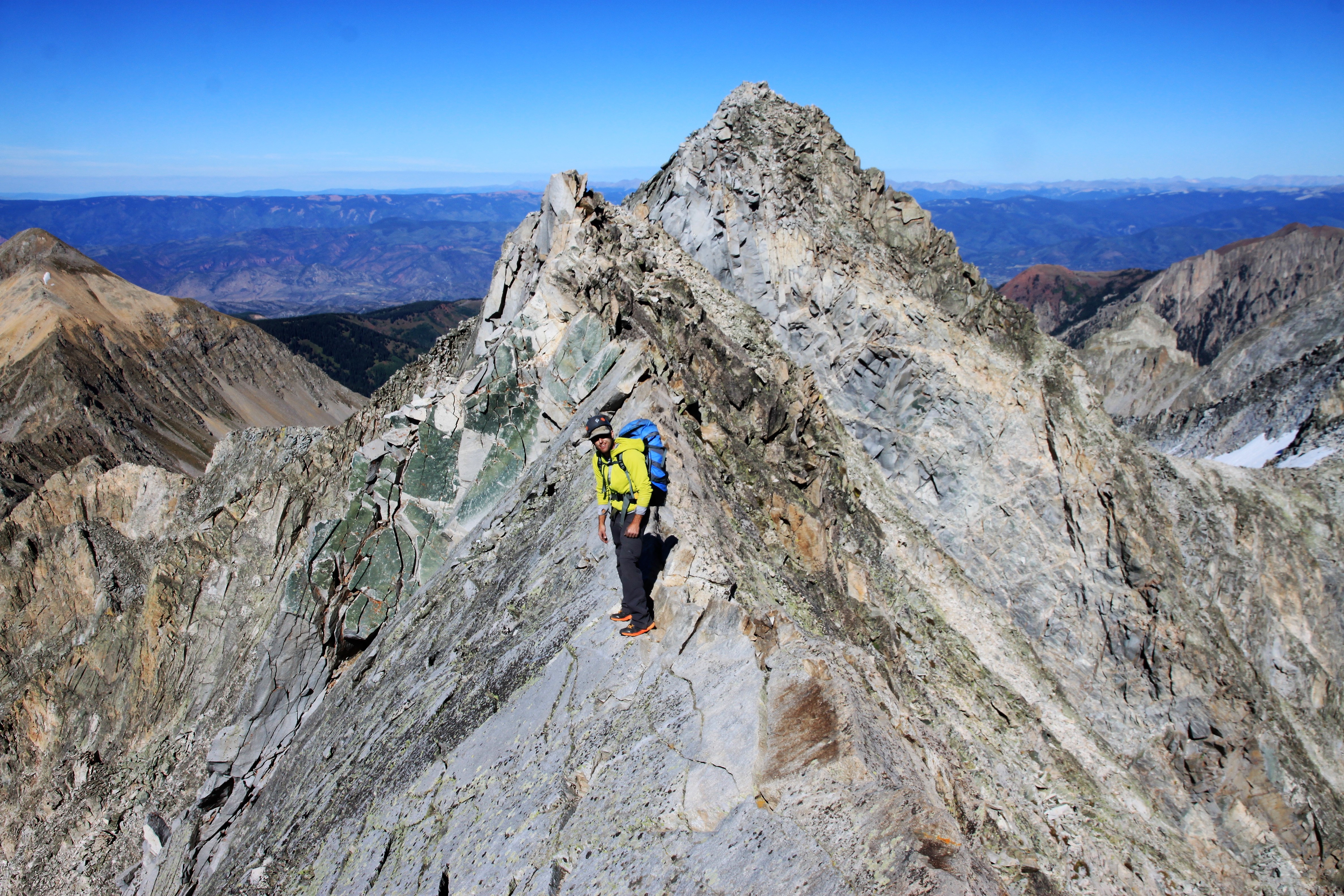
J on the class 4 climbing up and around Unicorn Spire to its west

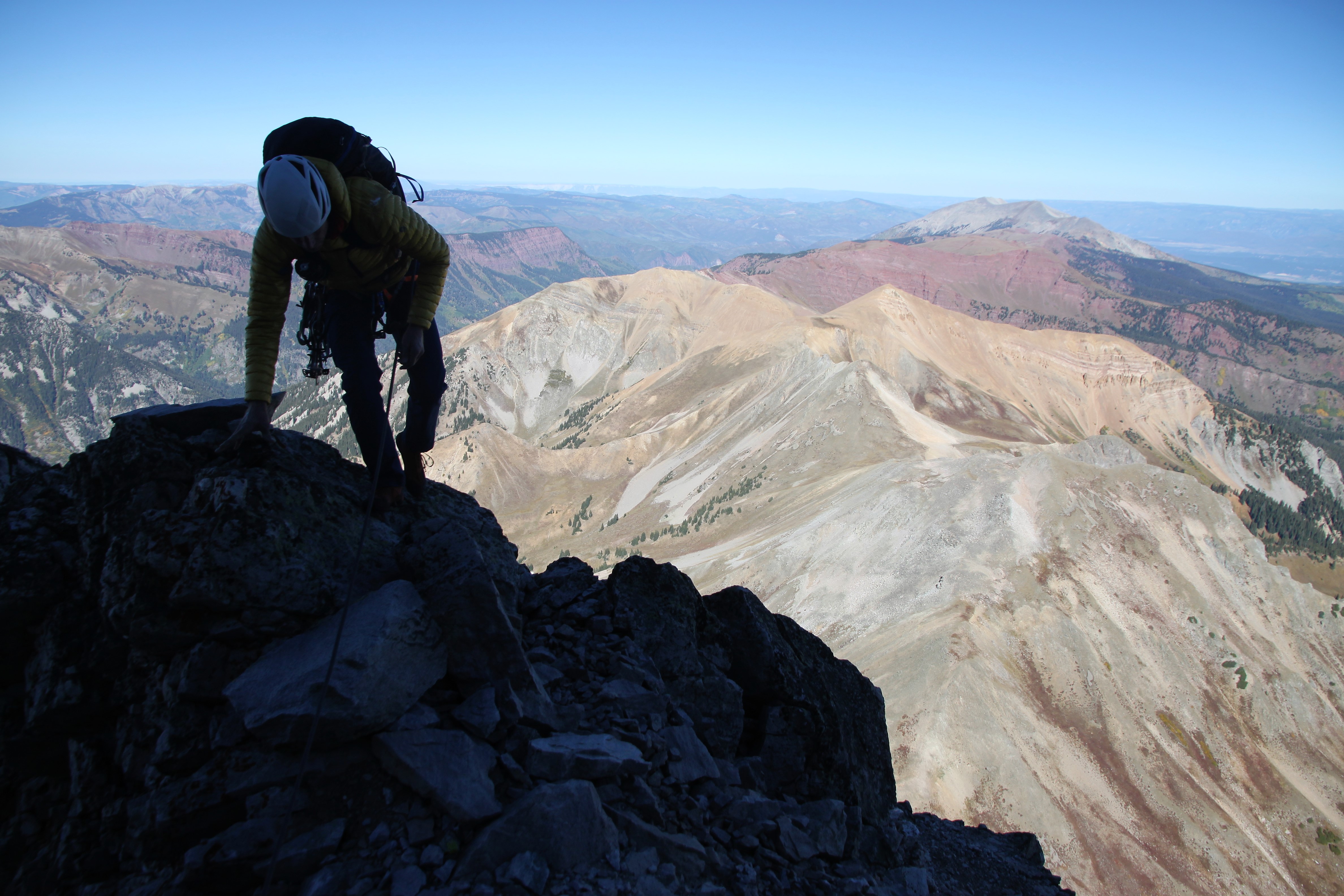
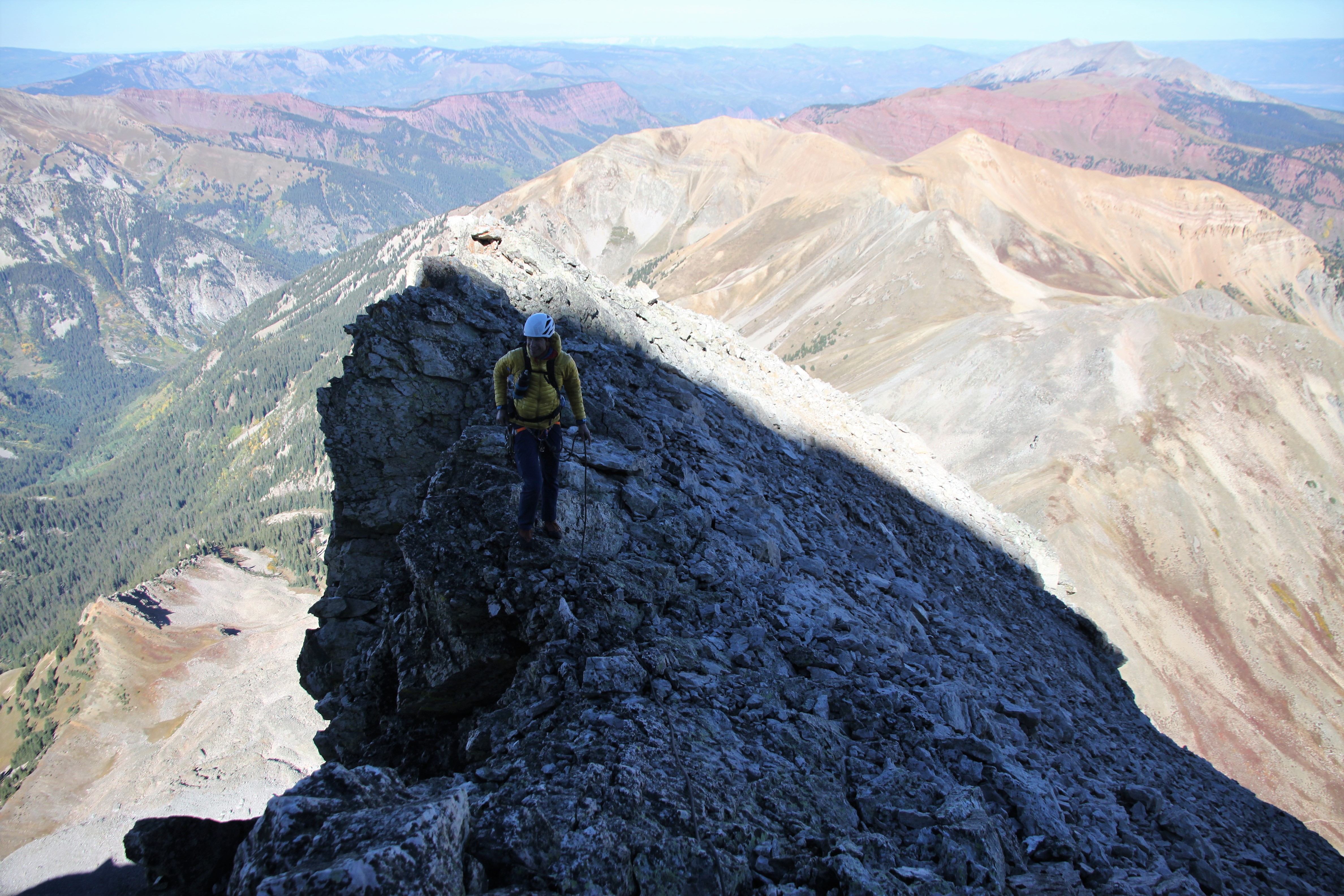
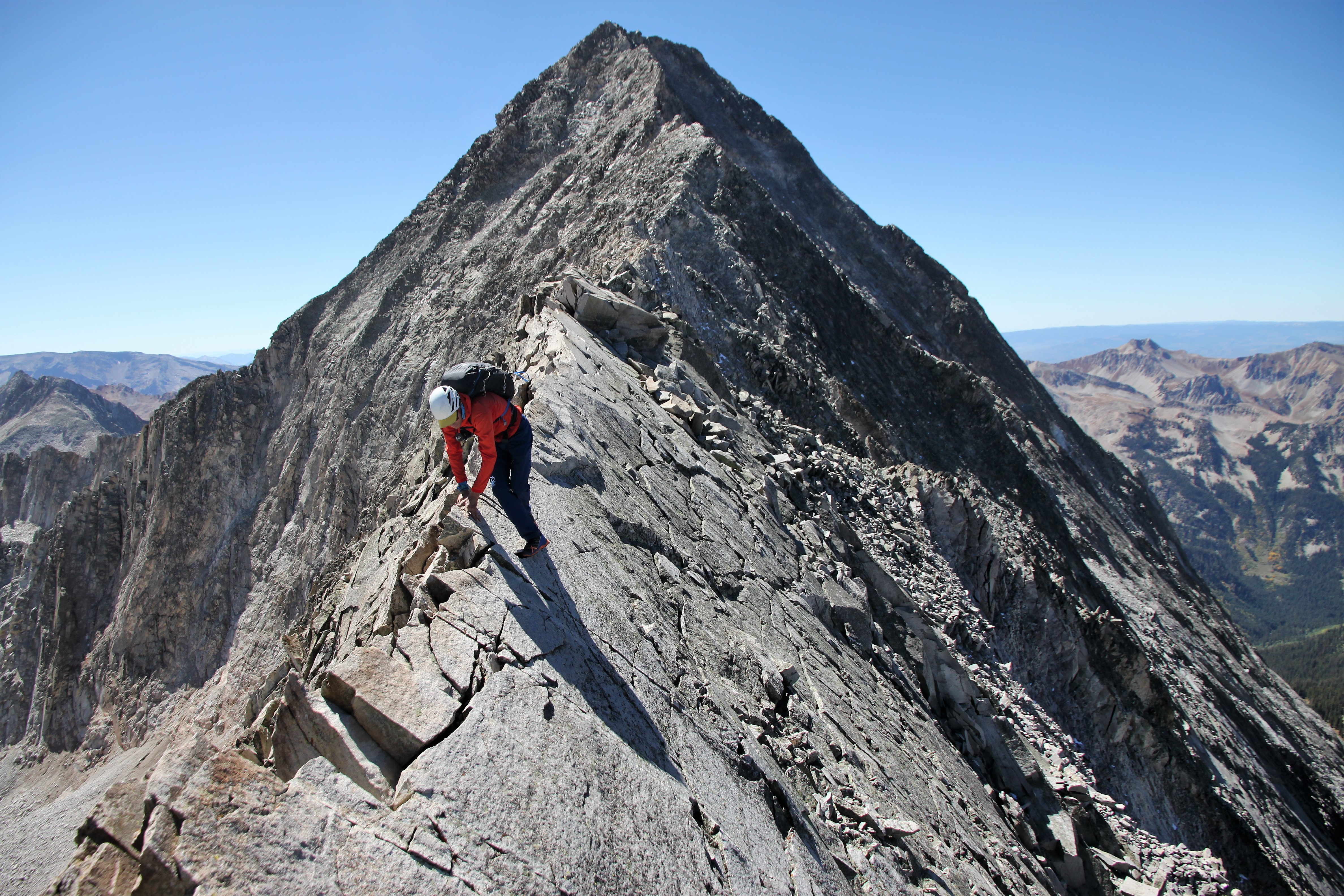
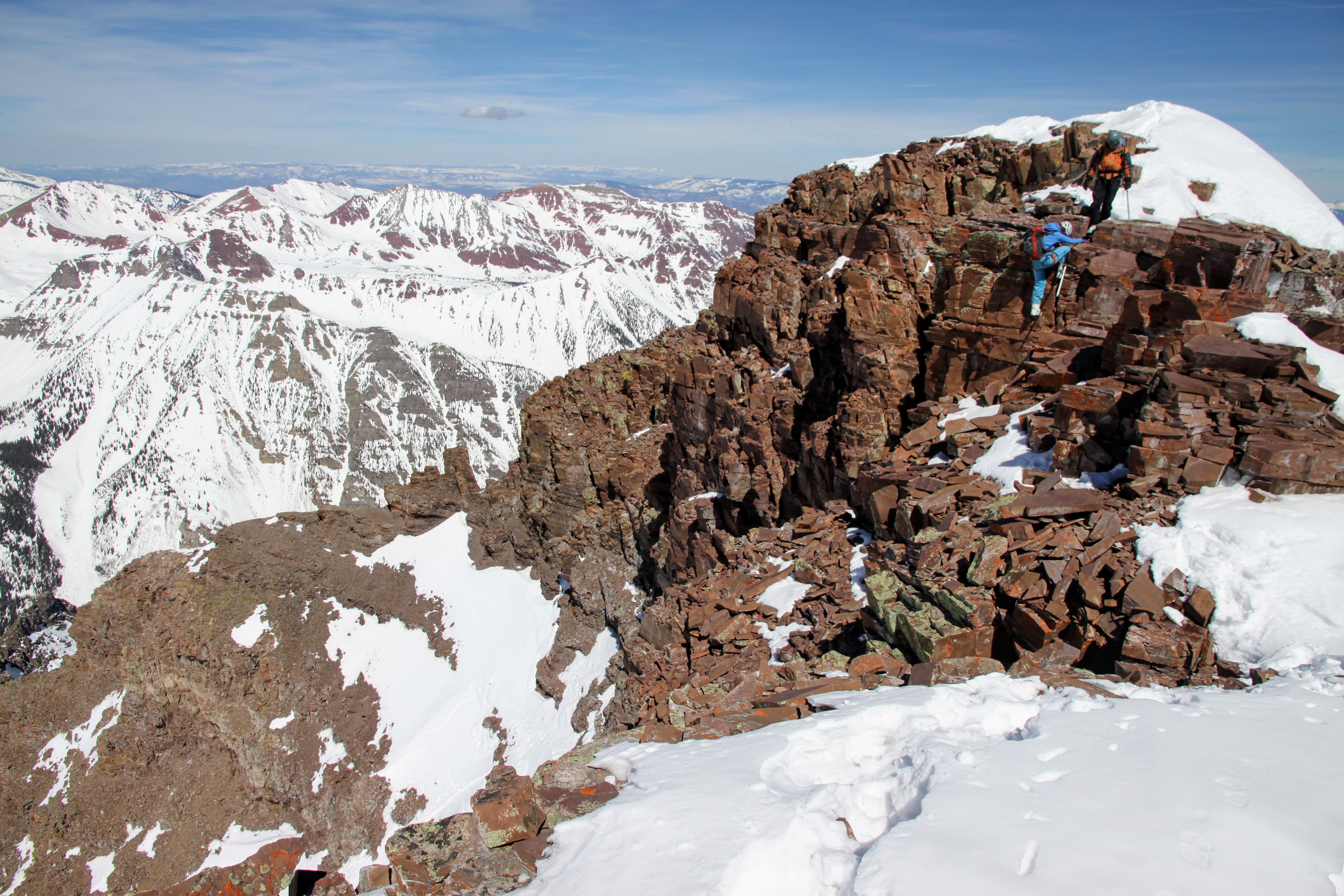
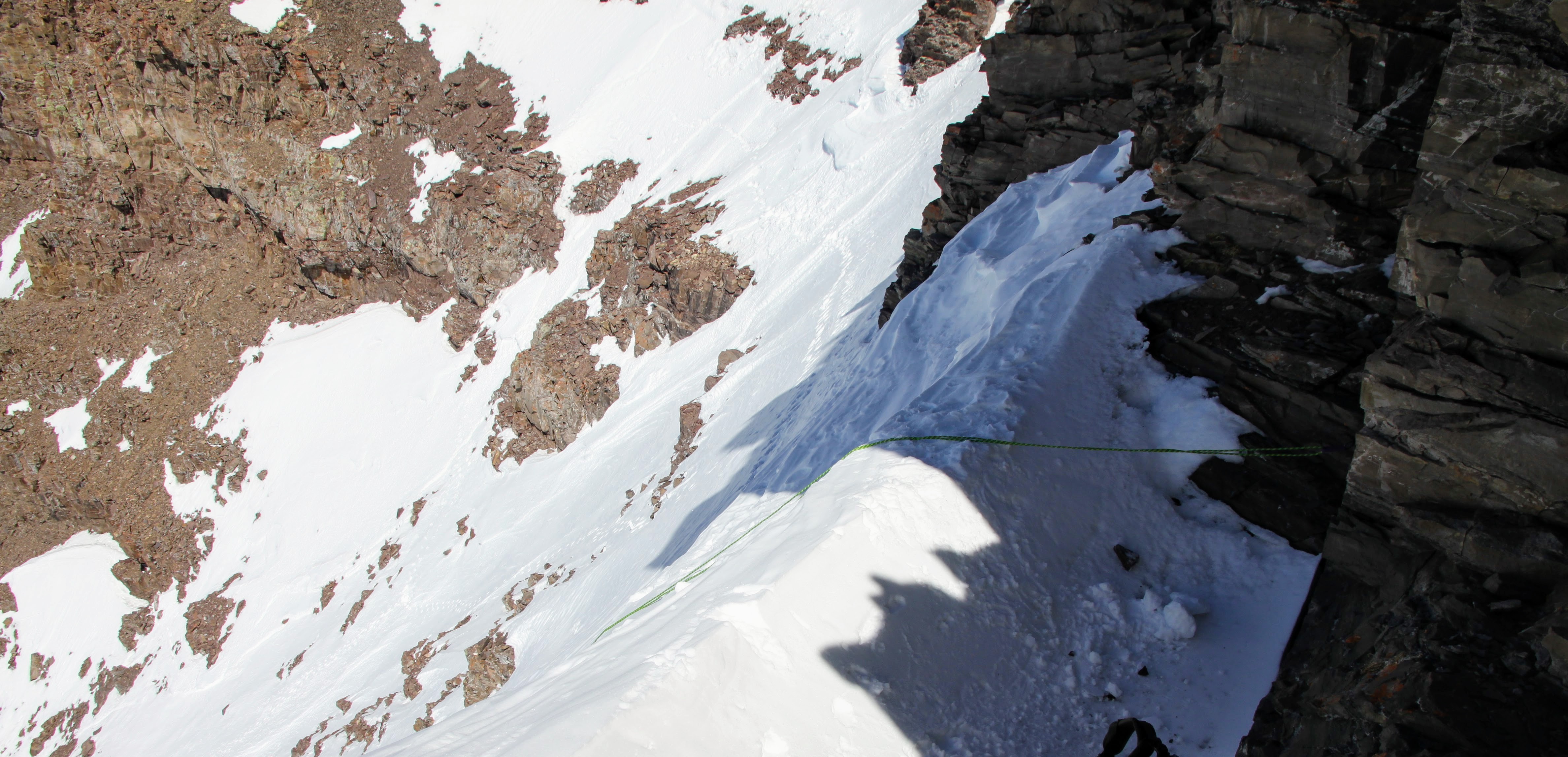
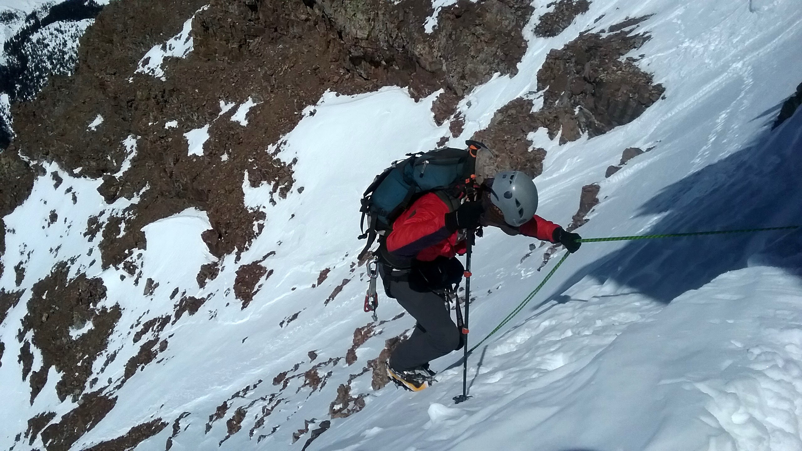
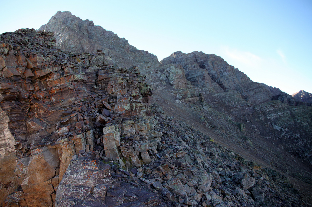
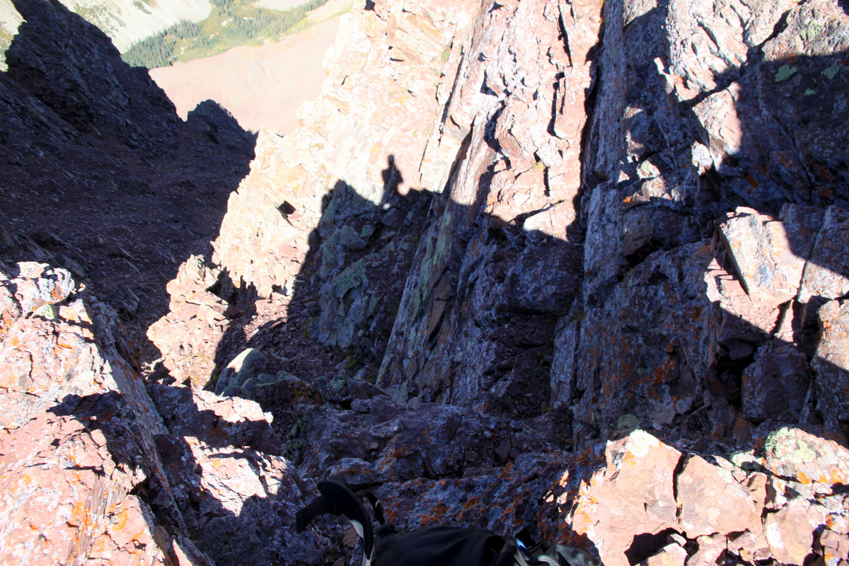
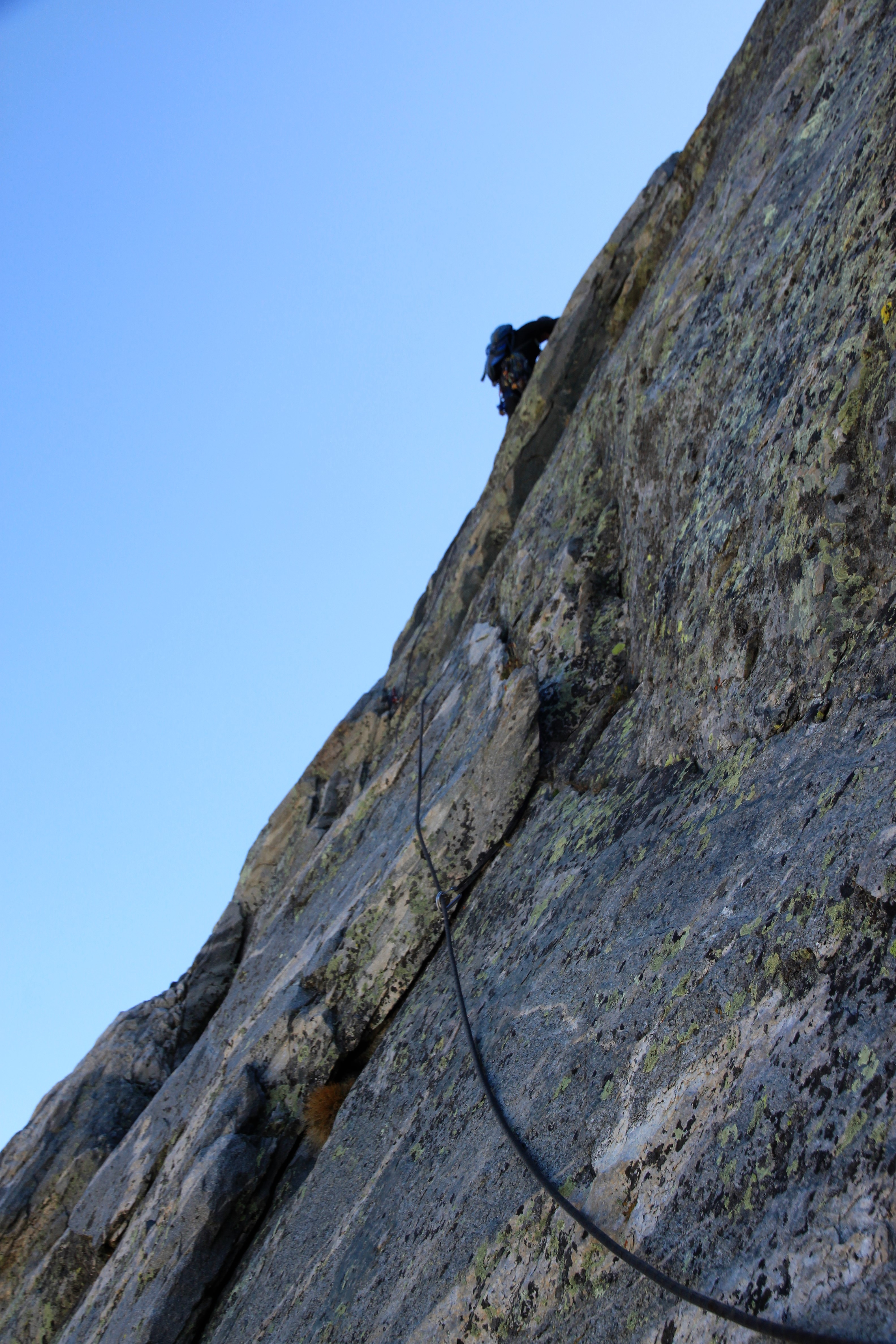
After climbing the scariest, loosest, & blockiest pitch (in my opinion) below the actual arete from the west, we crested out on the arete itself slightly above Unicorn Spire. We roped up and began the 500′ or so of awesome simul-climbing. The climbing on the arete really ranges anywhere between 5.0 and 5.7.

Me leading up some 5.7 terrain on the arete

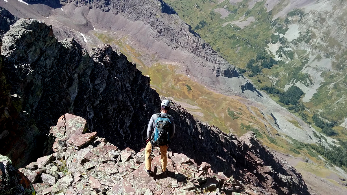
J climbing the awesomely exposed arete with Unicorn Spire now seen far below

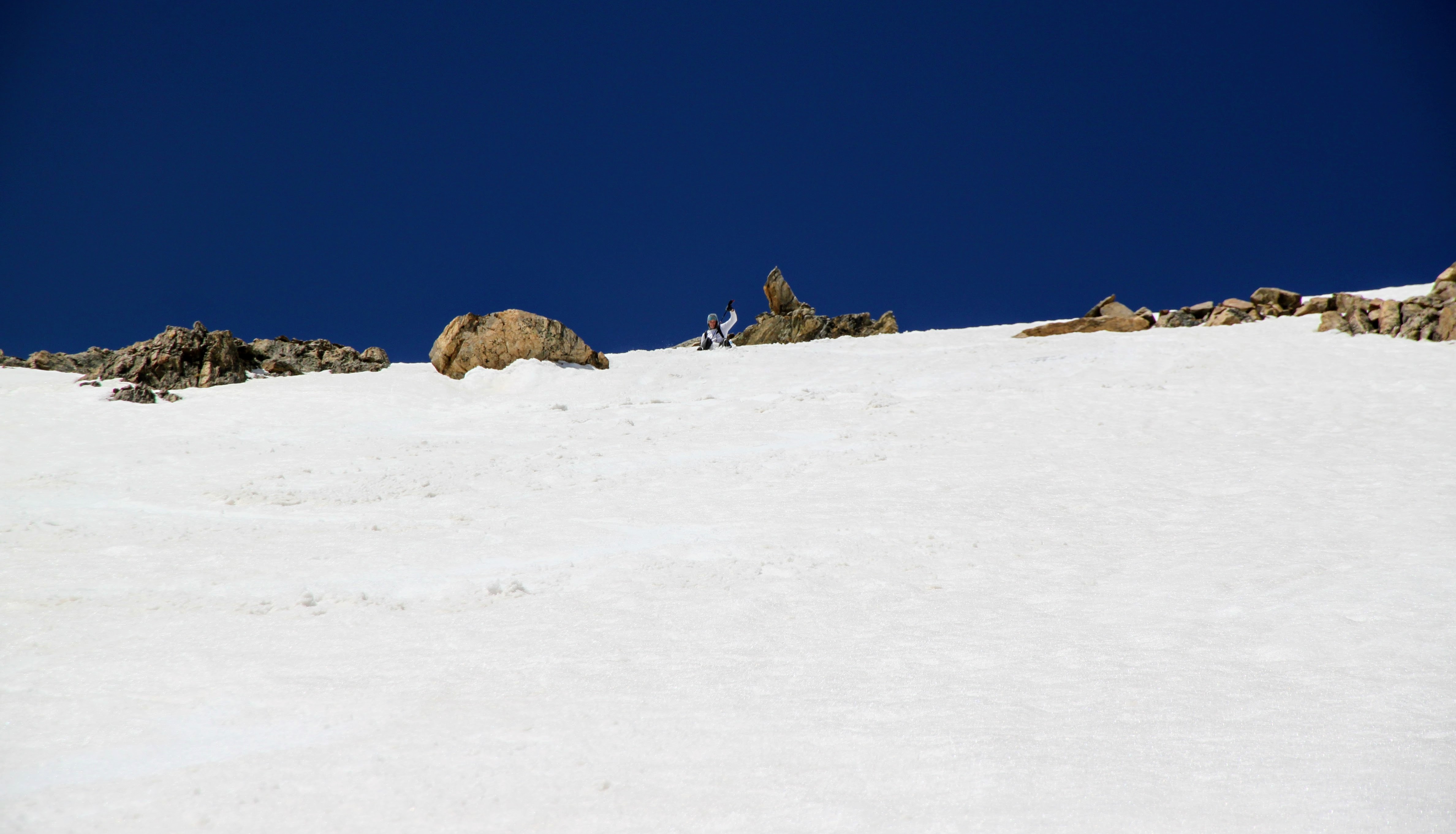
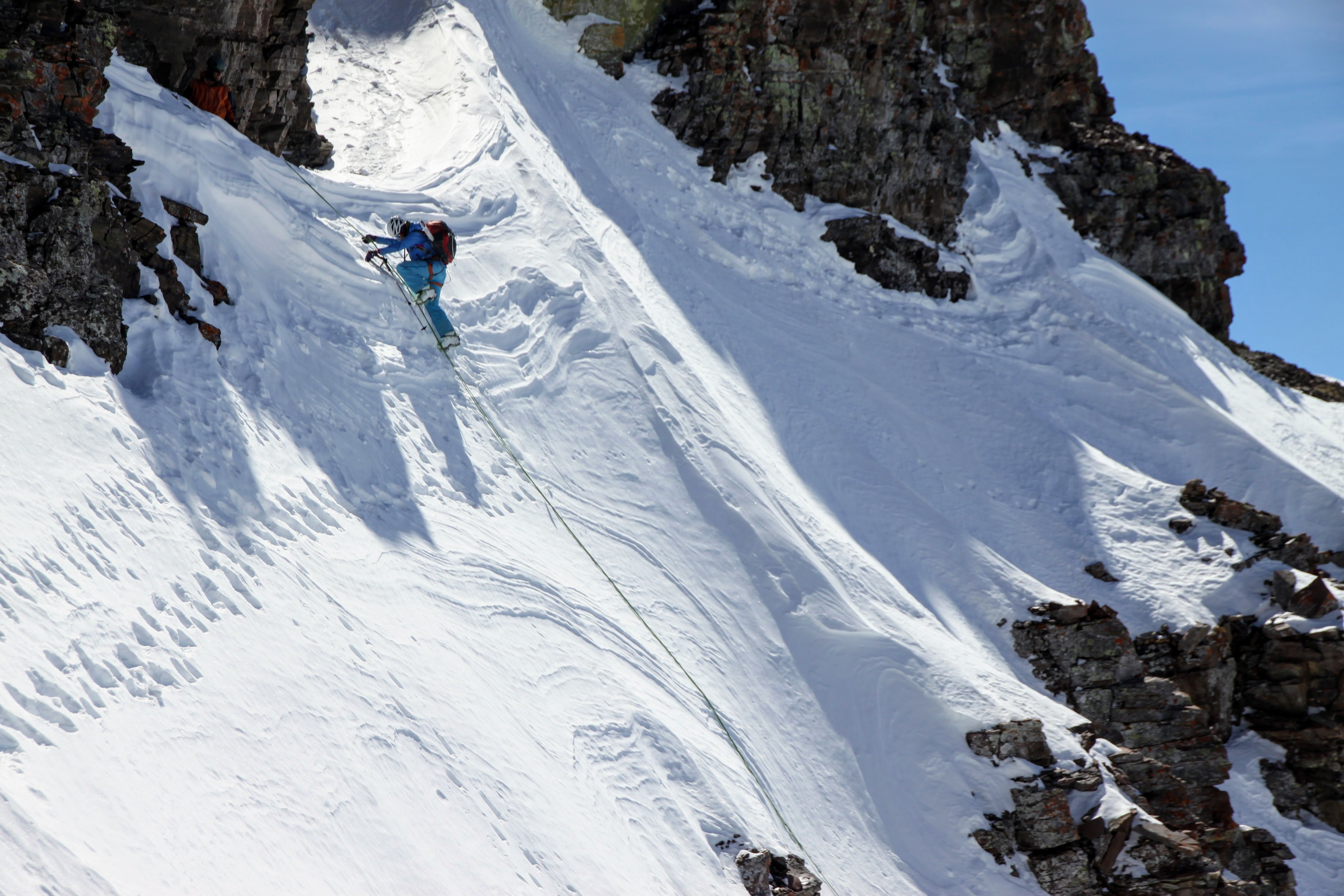
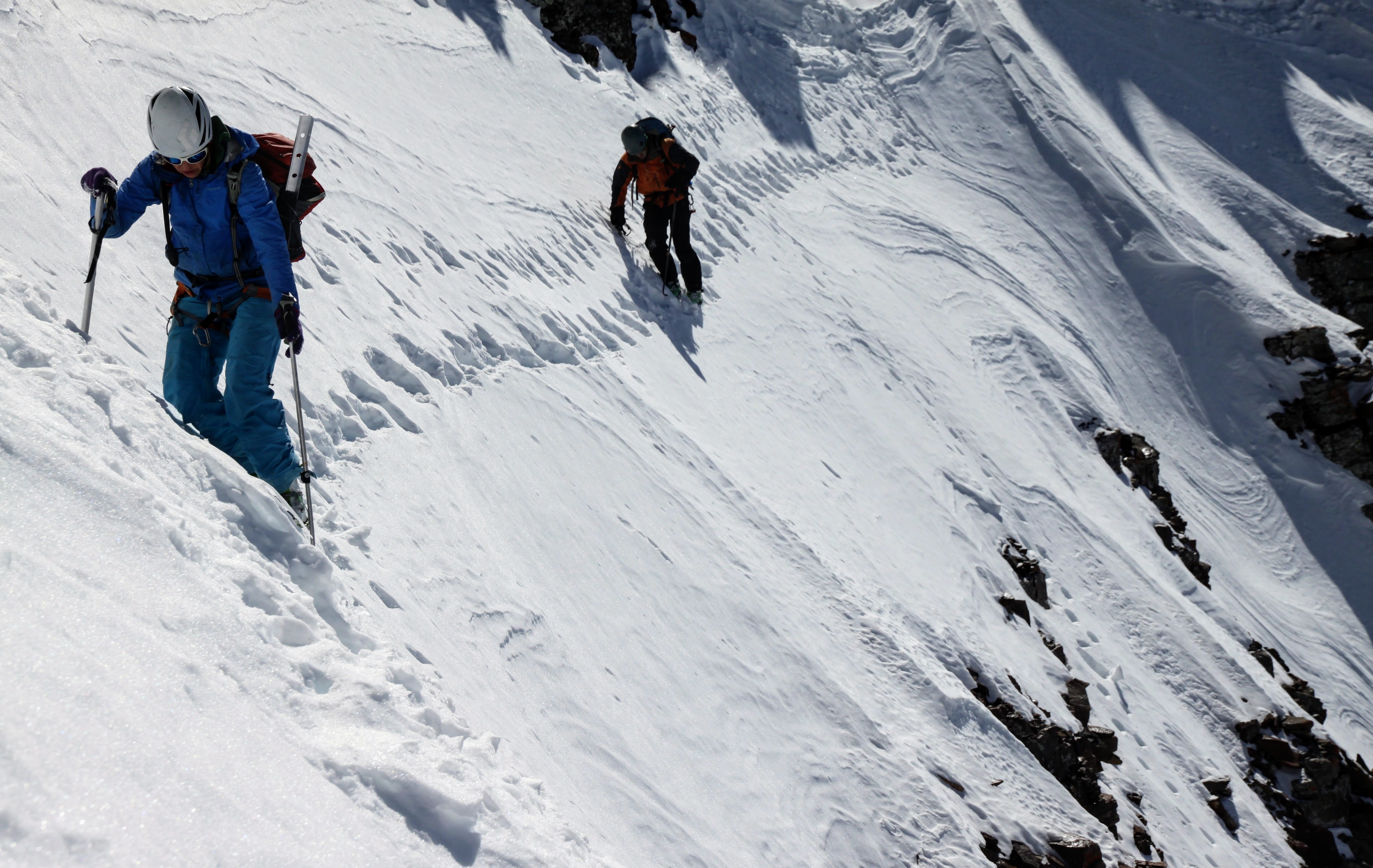
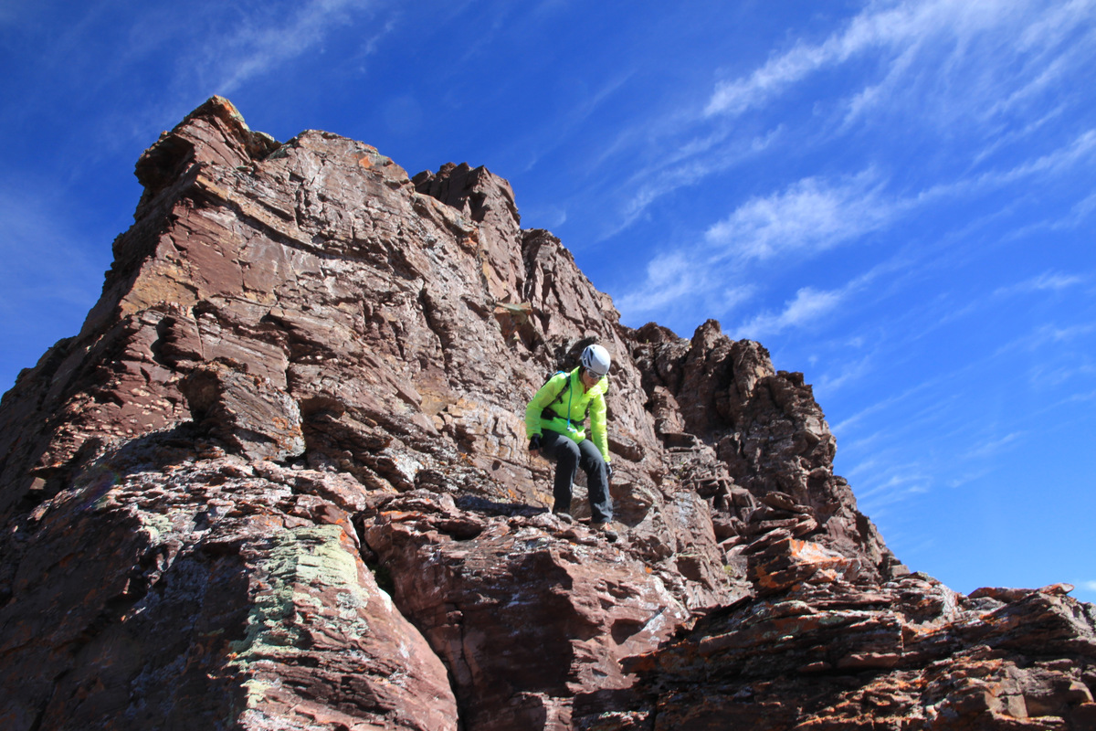
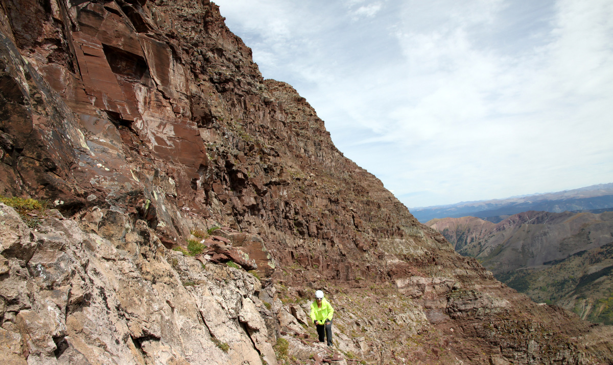
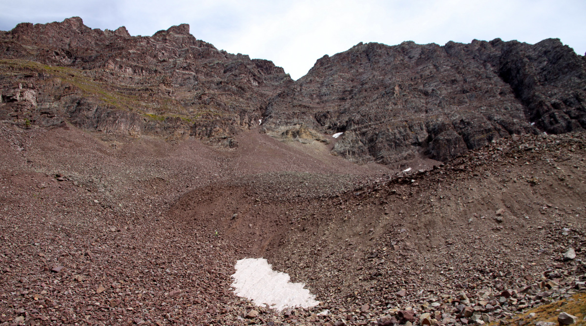
What made the upper part of the arete a little more sketchy than last time was the fresh snow. The snow was a little more covered and deeper towards the top of the arete bypassing the small tower to its left (east) when the angle eased up a bit. I was essentially tip-toeing on the dry exposed rock, brushing off small ledges, etc on 5.4 terrain. J did not enjoy this part one bit. His feet being blocks of ice didn’t help either. Nonetheless, we topped out at the small saddle above the heart-shaped snowfield and took a sigh of relief. What was next was the 5.7 upper headwall pitch, which I told J he should do since I led it last time.

J managing (or not managing) the rope as we walked the 4th class terrain saddle above the heart-shaped snowfield

J leading over the mini-roof on the 5.7 upper headwall pitch

Me on this same pitch enjoying the sun

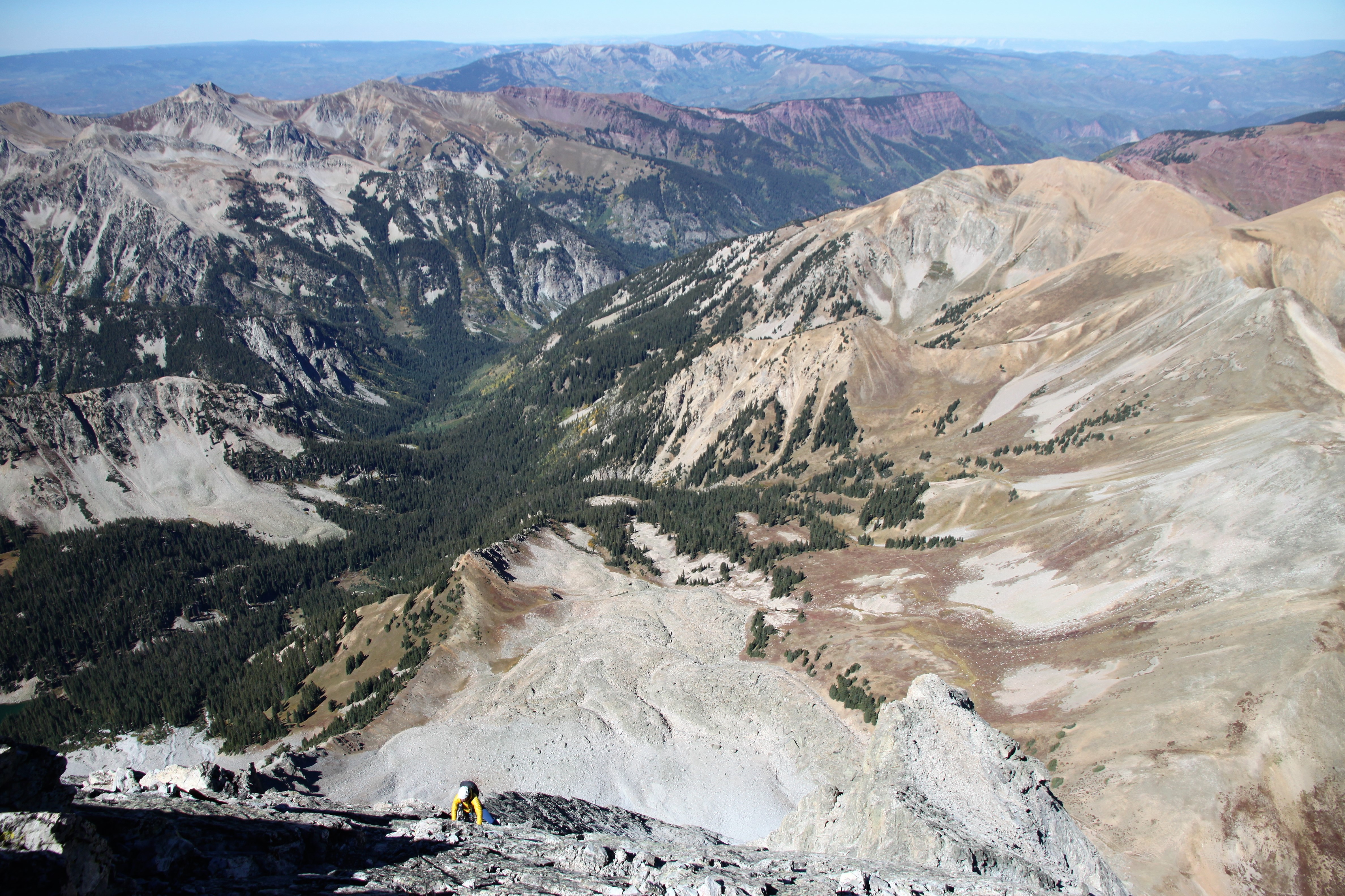
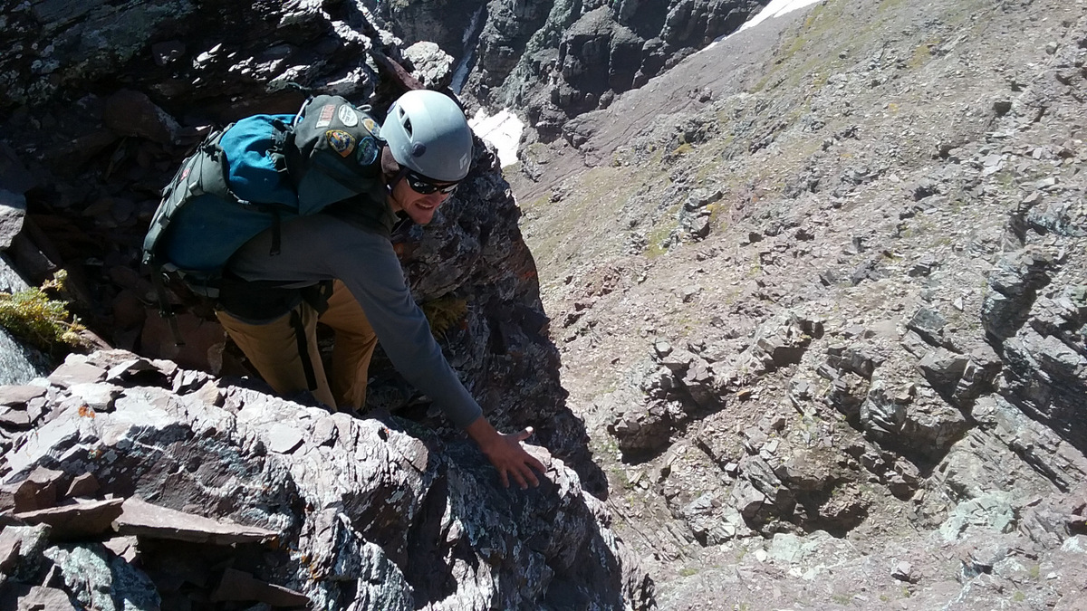
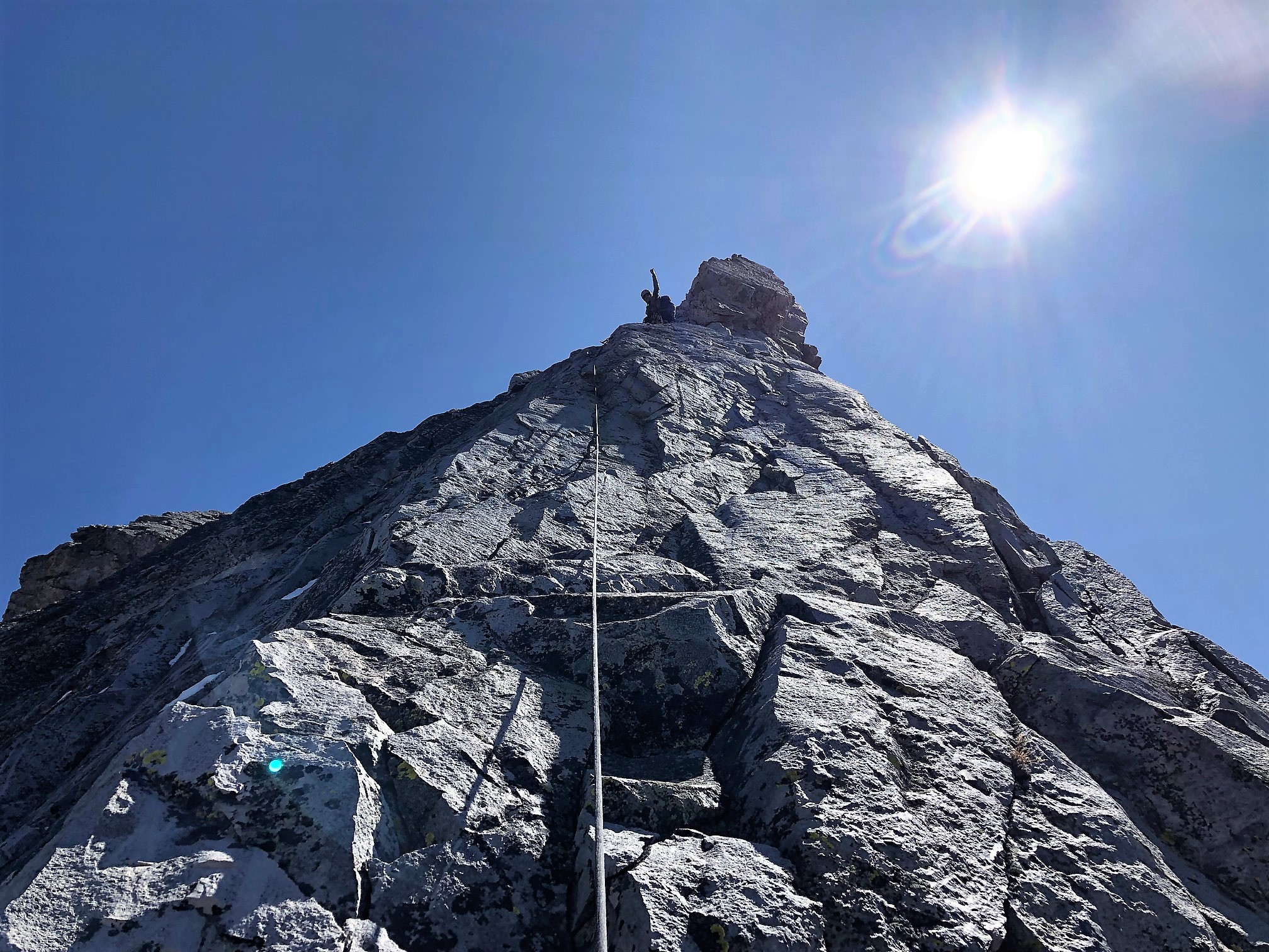
At the belay, I told J we were really close – just a few hundred feet below the summit – and that we should just simul-climb from here. I led on away, but belayed J up to me briefly to protect a few exposed moves and not risk them in a simul-climb.

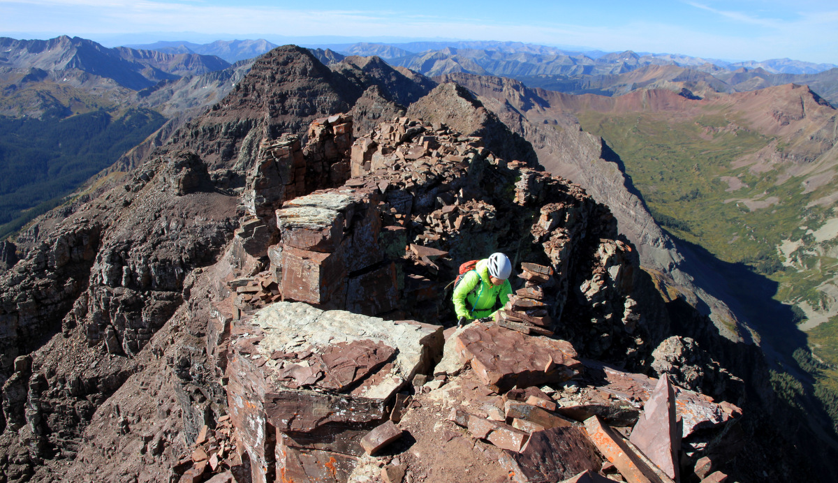
J almost to me on the upper headwall. The heart-shaped snowfield and 4th class saddle can be seen below

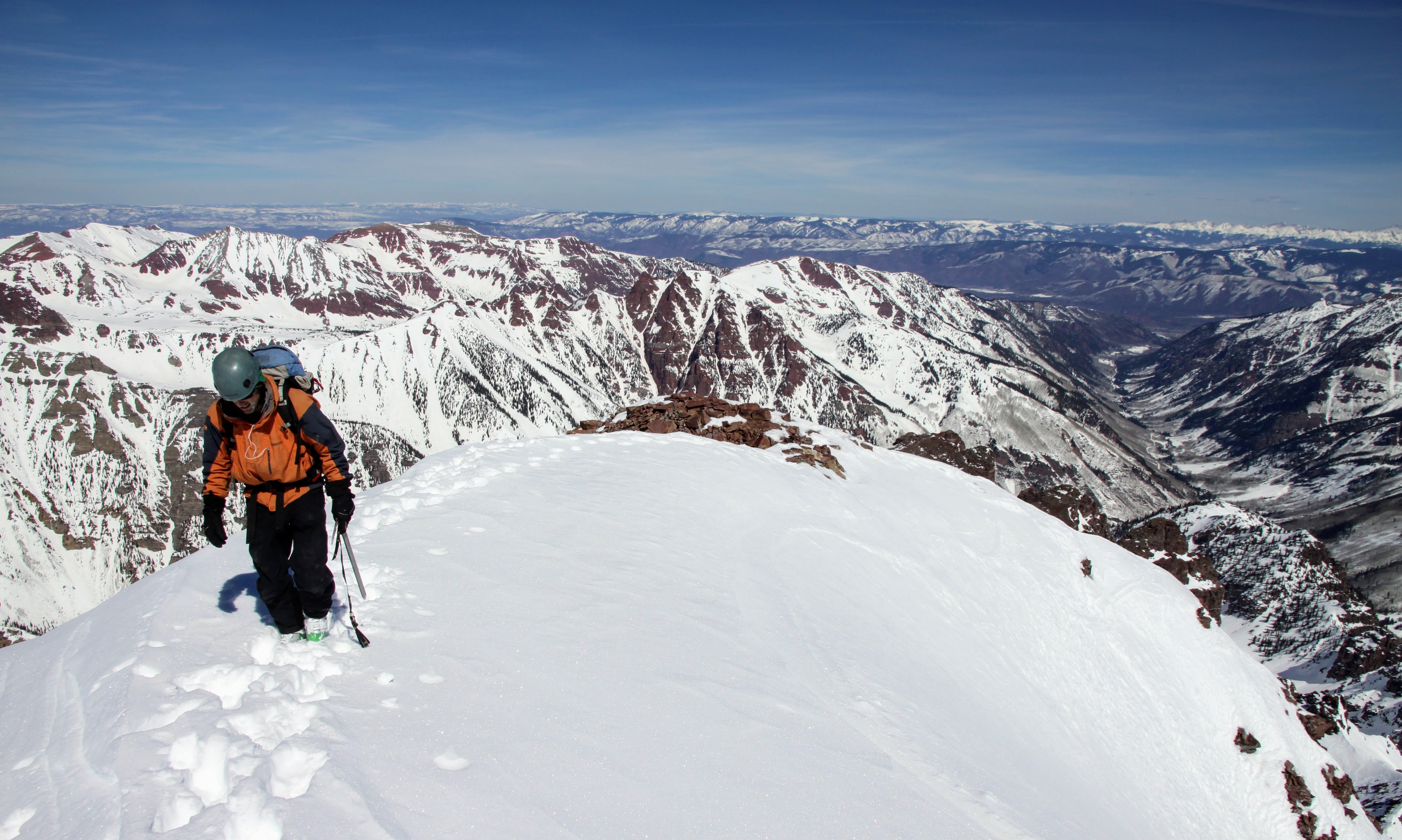
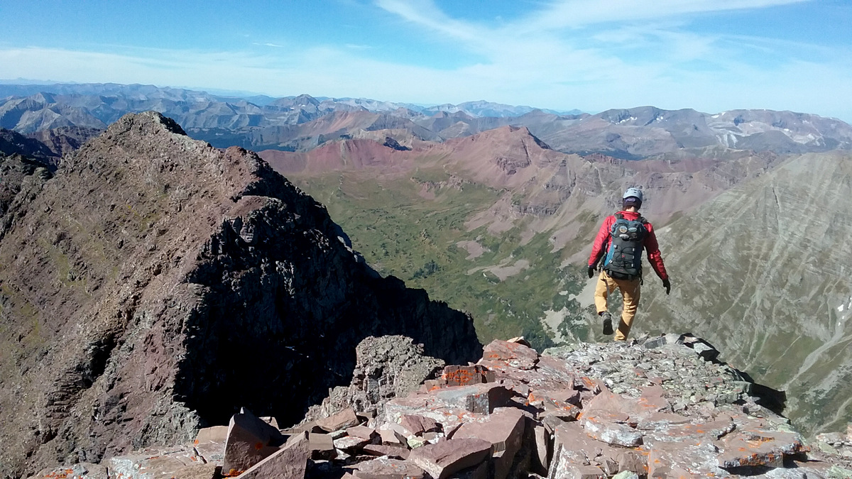
I then told J to take us home to the top and he led the final few hundred feet of mid 5th class terrain in the sun to the summit ridge.

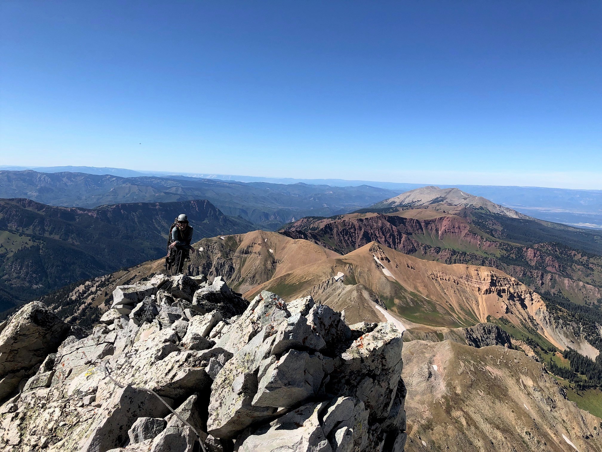
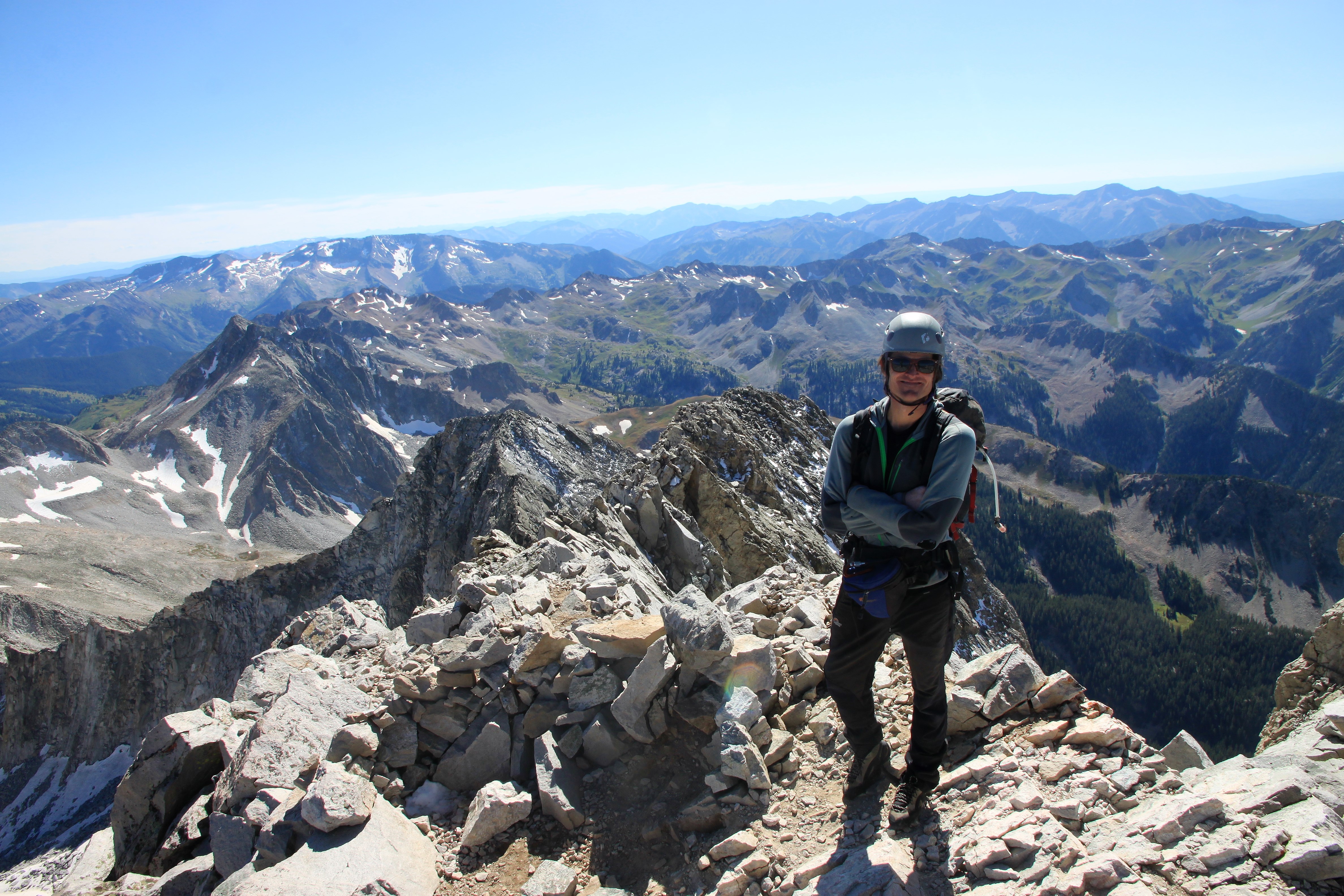
Me on the summit ridge with Mt. Sopris in the distance

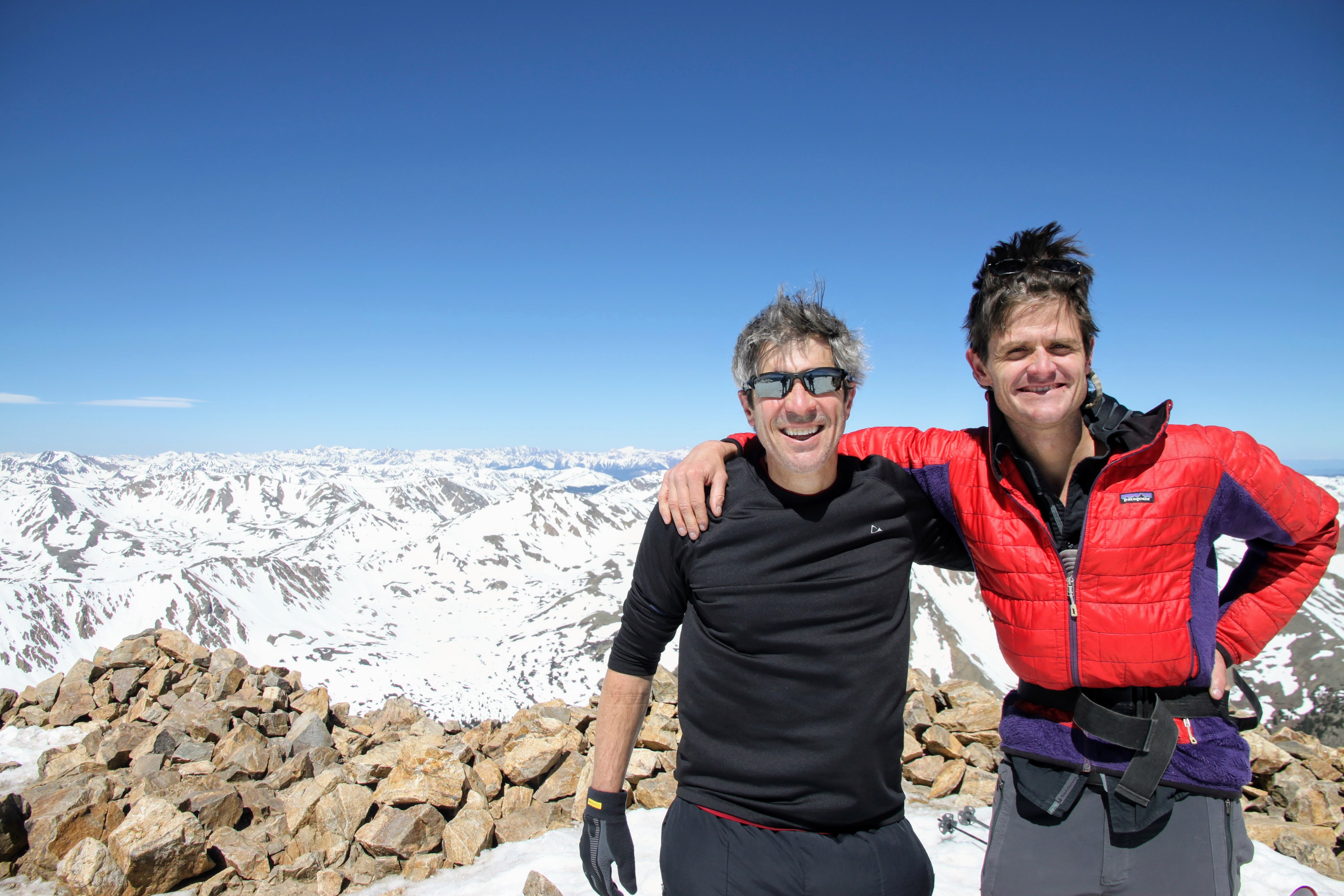
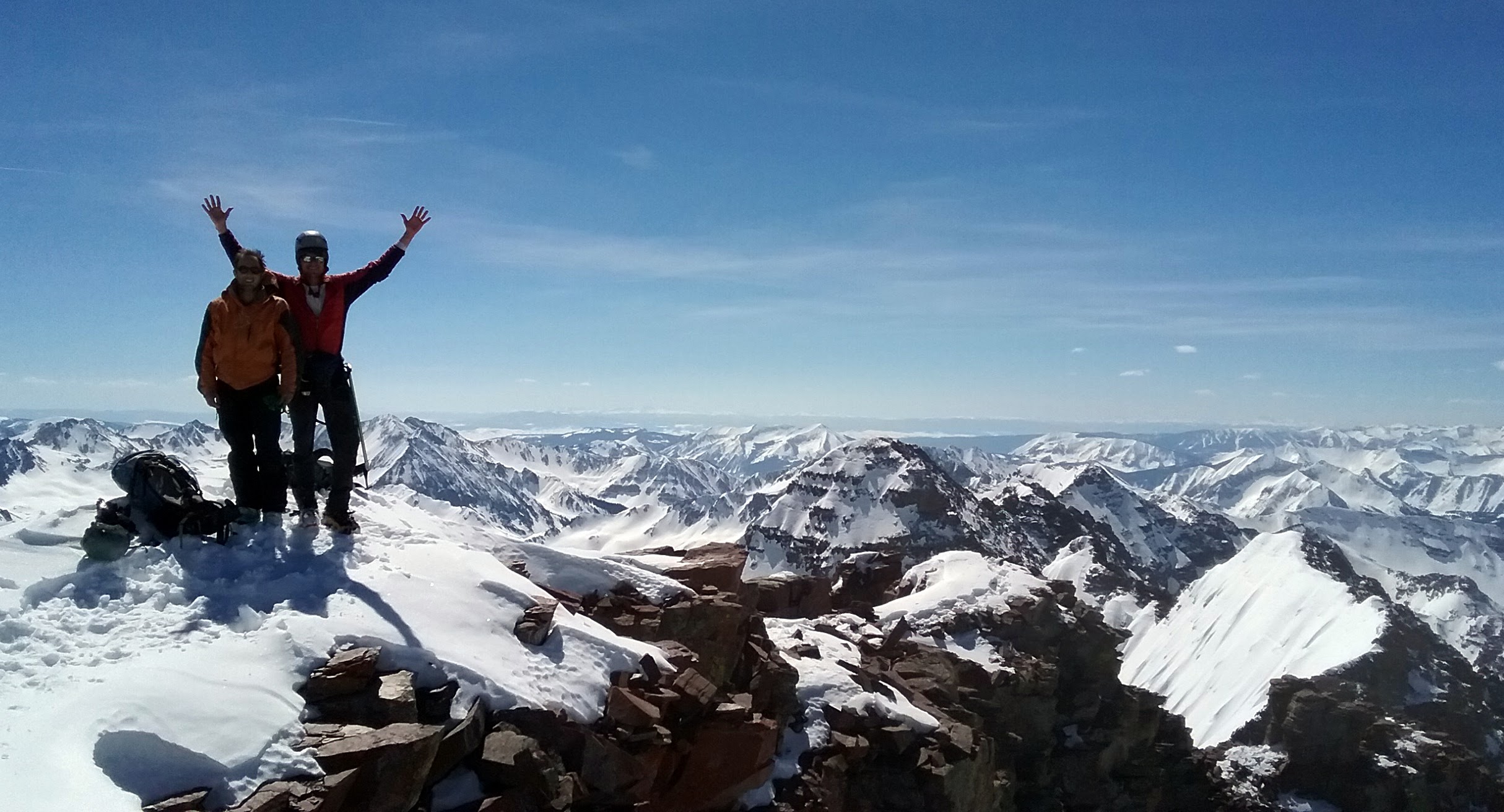
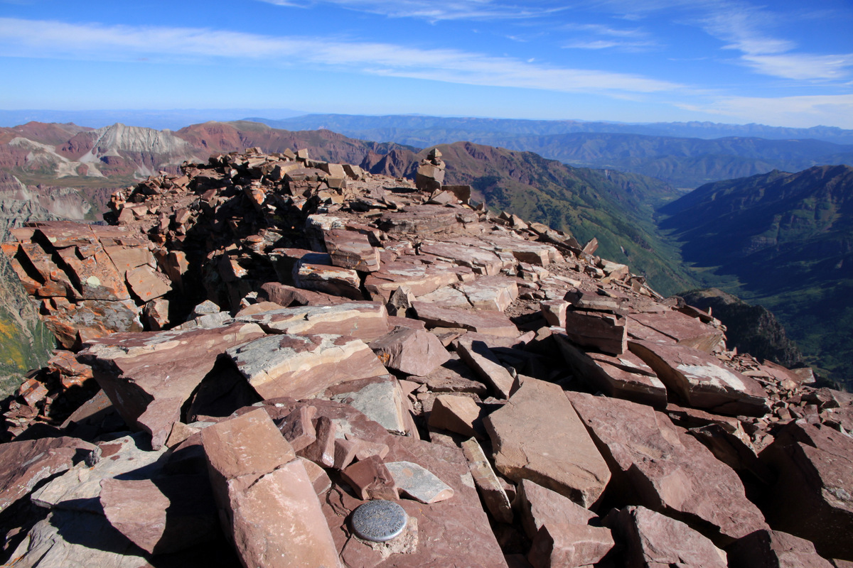
Capitol Peak summit (14,130′)

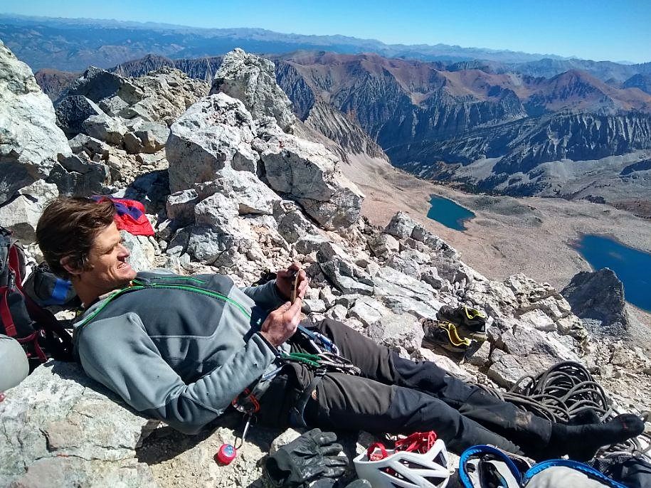
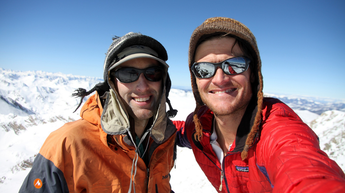
What a gorgeous summit it was. We arrived maybe around 2:30pm though I cannot really remember. The weather couldn’t be better – my favorite weather of the year. Warm sunshine with a tint of cool, crisp fall air. We probably spent 30 minutes on top texting Kristine & Megan that we were just fine and may be late getting home.

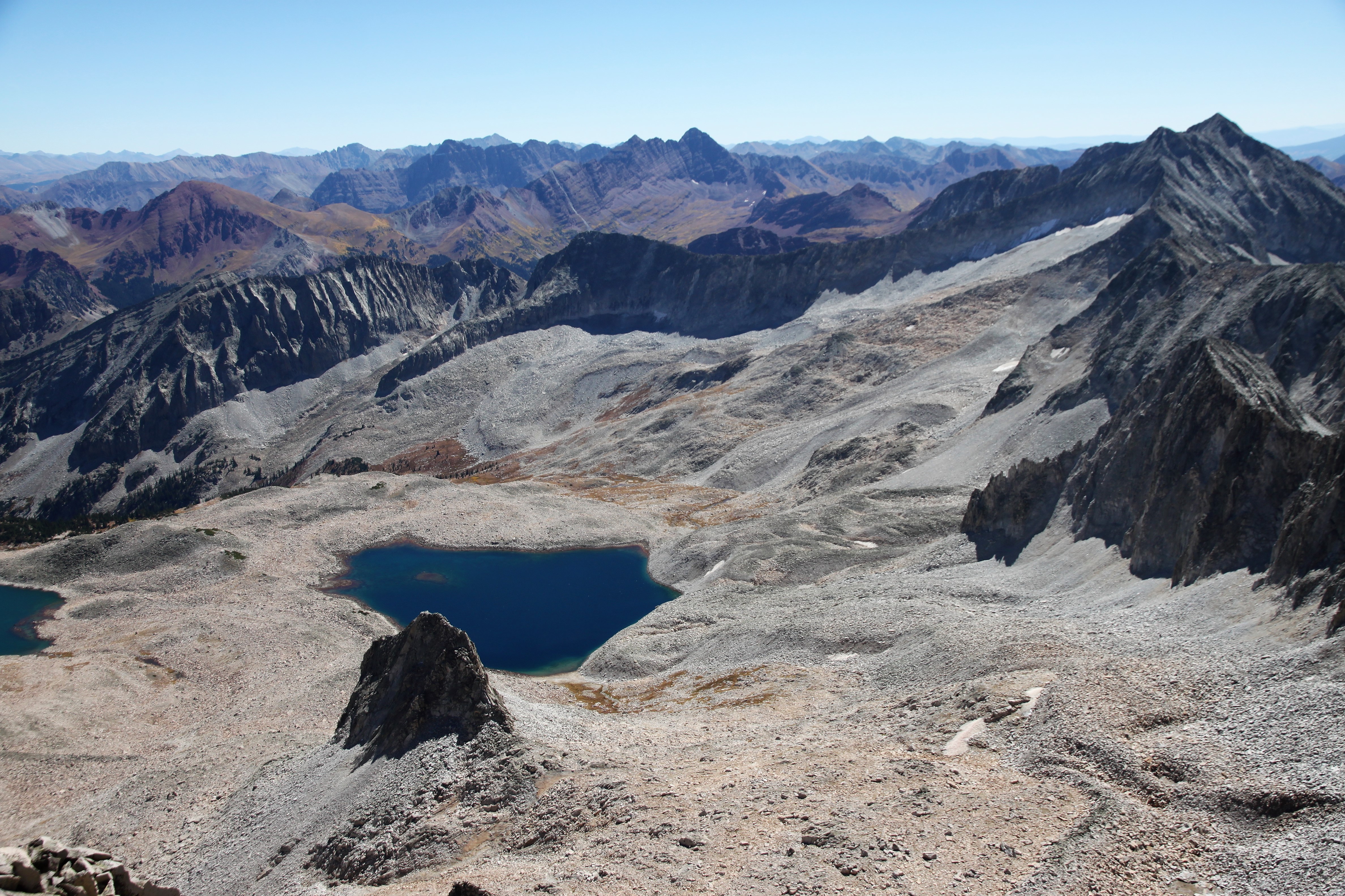
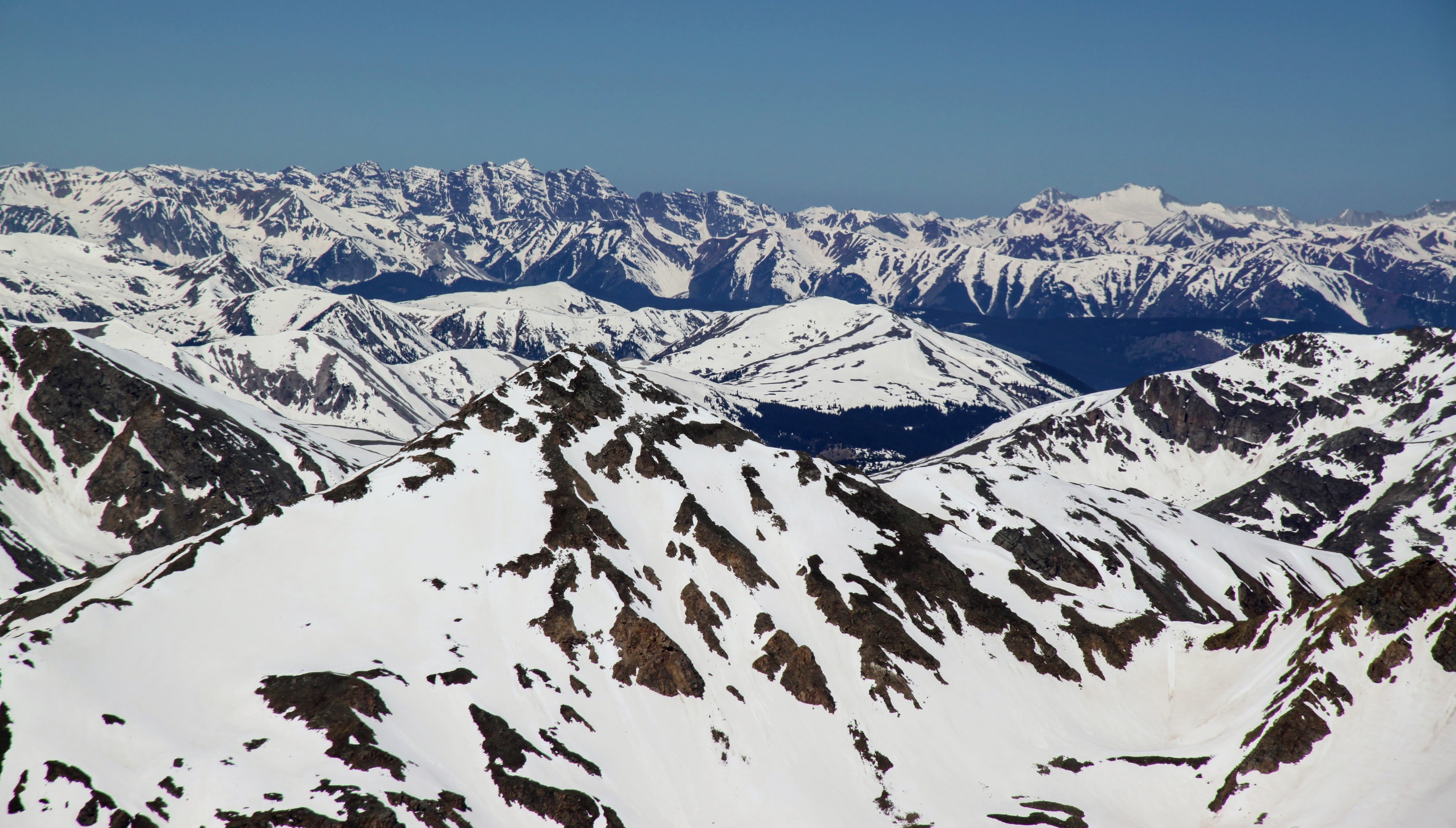
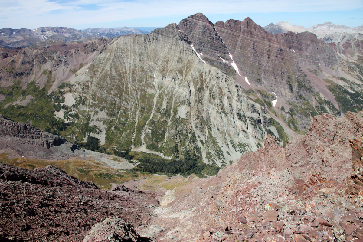
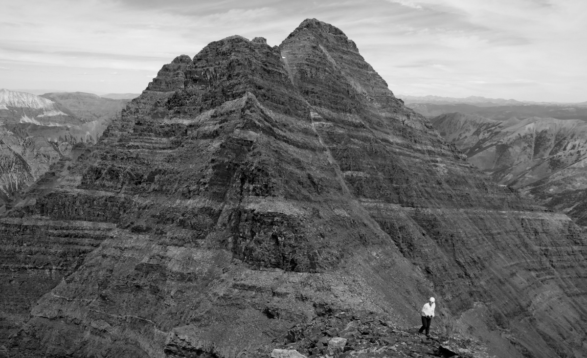
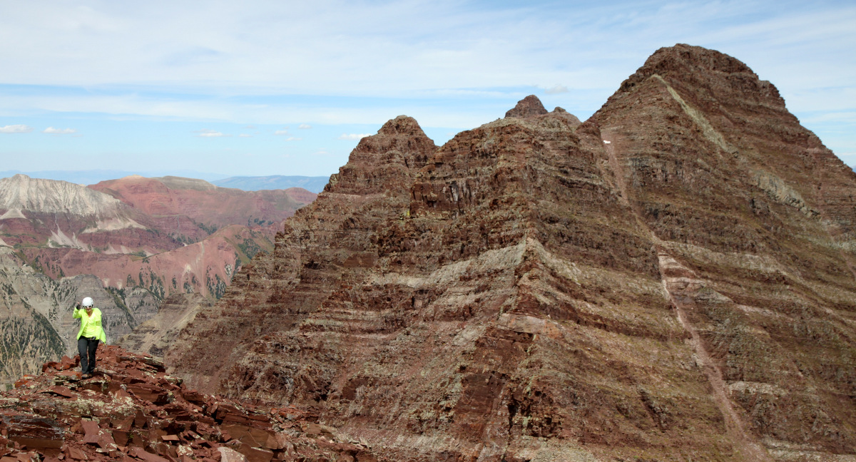
Looking southeast from Capitol’s summit to Pyramid, the Bells, and the wildfire near Salida

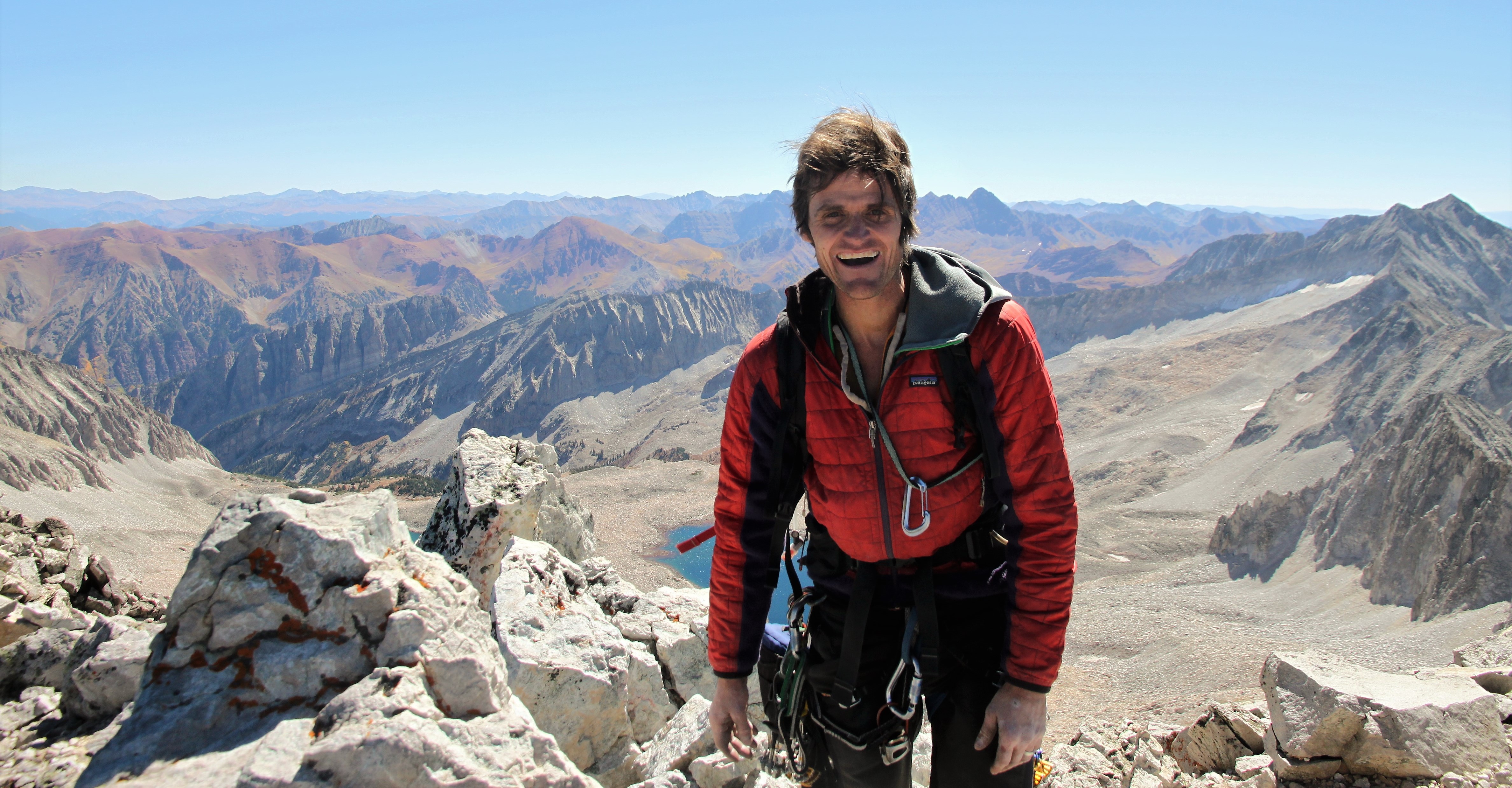
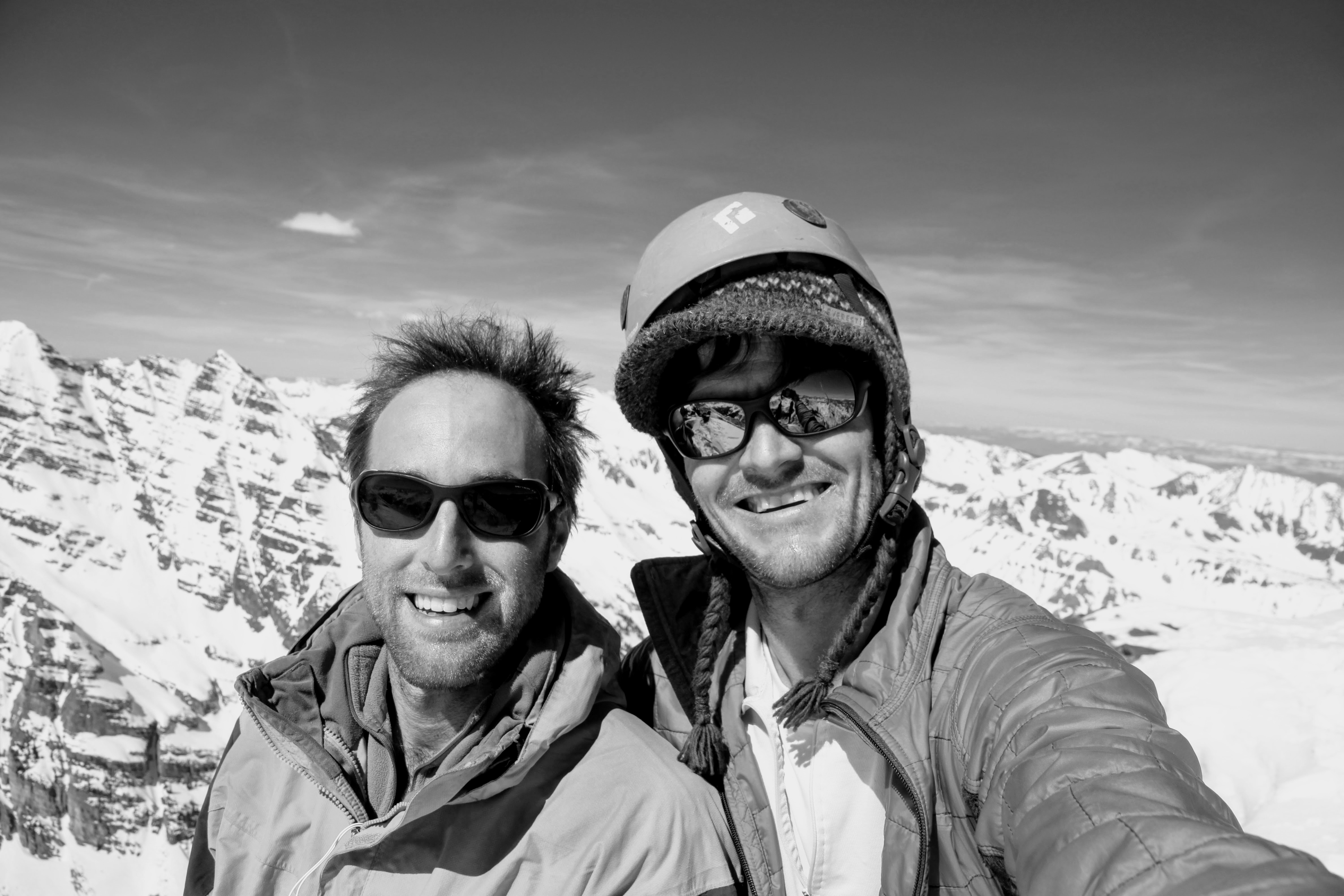
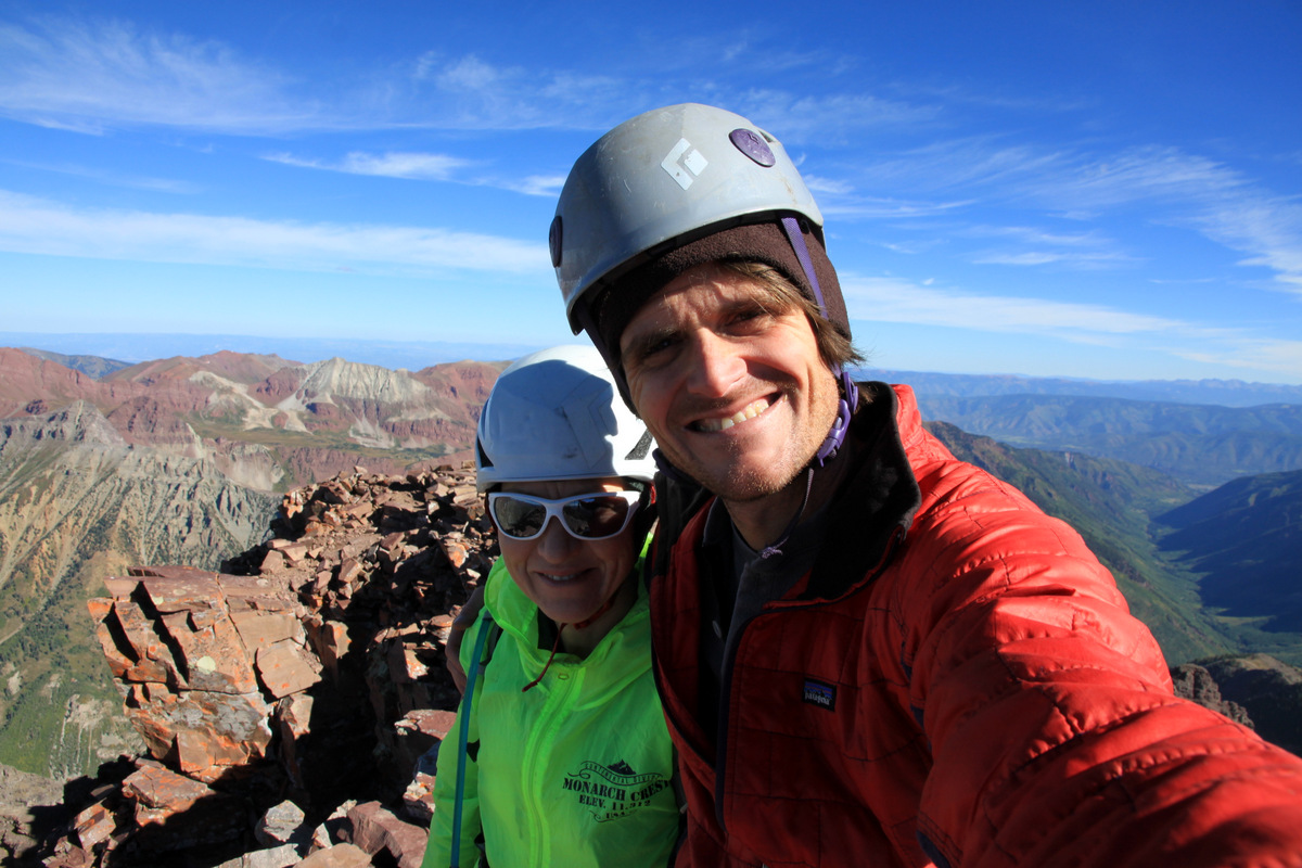
Me on Capitol’s summit – my favorite in Colorado, by far. I think this was my 6th visit to its summit

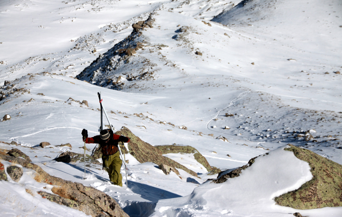
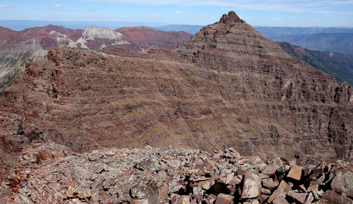
J and I descended the standard northeast ridge pretty quickly and had fun across the knife-edge ridge one more time. J had not crossed that ridge in over 15 years and really didn’t remember it at all.

J walking the ridge with K2 beyond

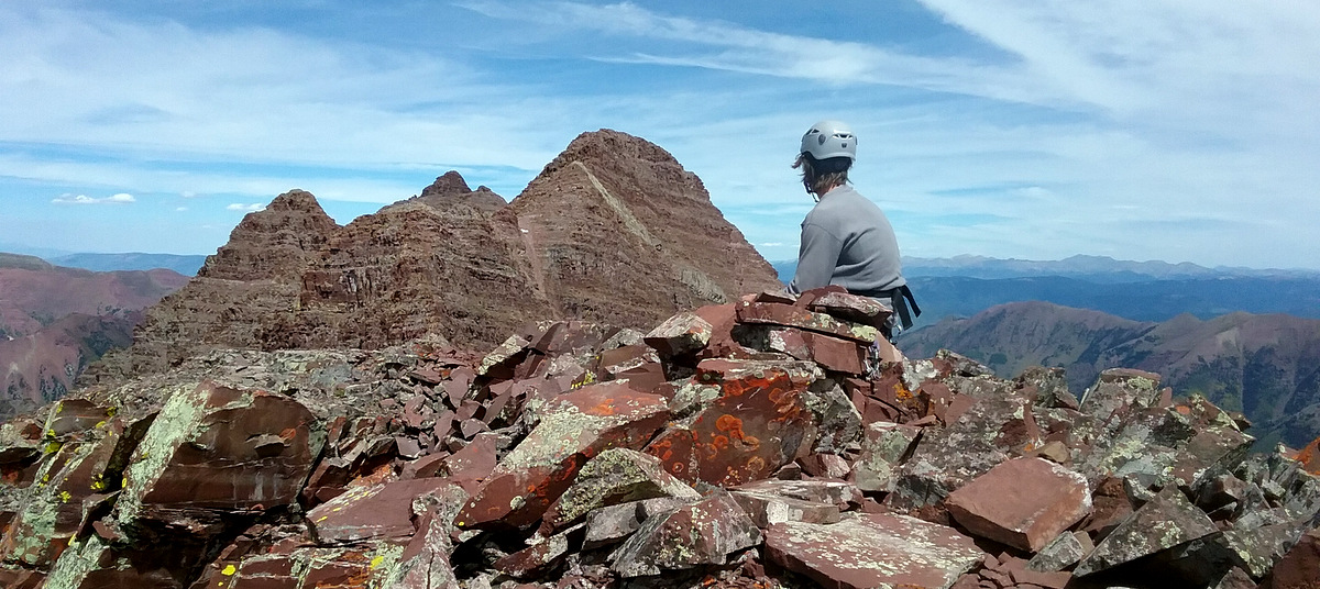
Me just taking a sit and enjoying the view from the knife-edge ridge

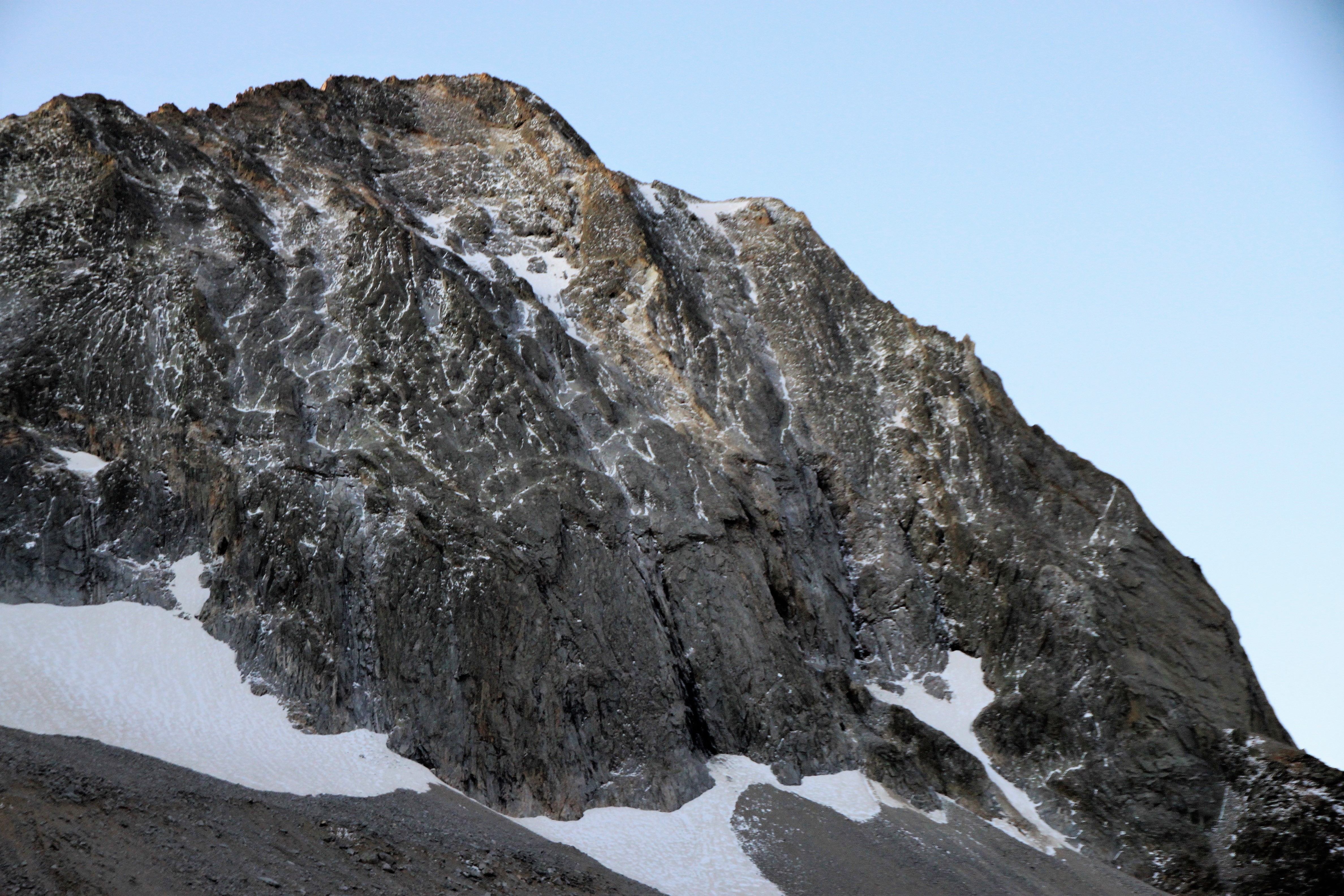
I always forget how long the descent from K2 back to the Capitol-Daly saddle can be and just hard on the body, especially a torn meniscus (me), with all of the boulder-hopping. No matter though as J and I just took our time and chatted about past climbs, future climbs, and life in general. It was a beautiful sight seeing the sun actually beginning to shine on the lower crux headwall of Capitol’s northwest buttress at around 4:30-5pm. Maybe that’s the time to actually climb the lower headwall!

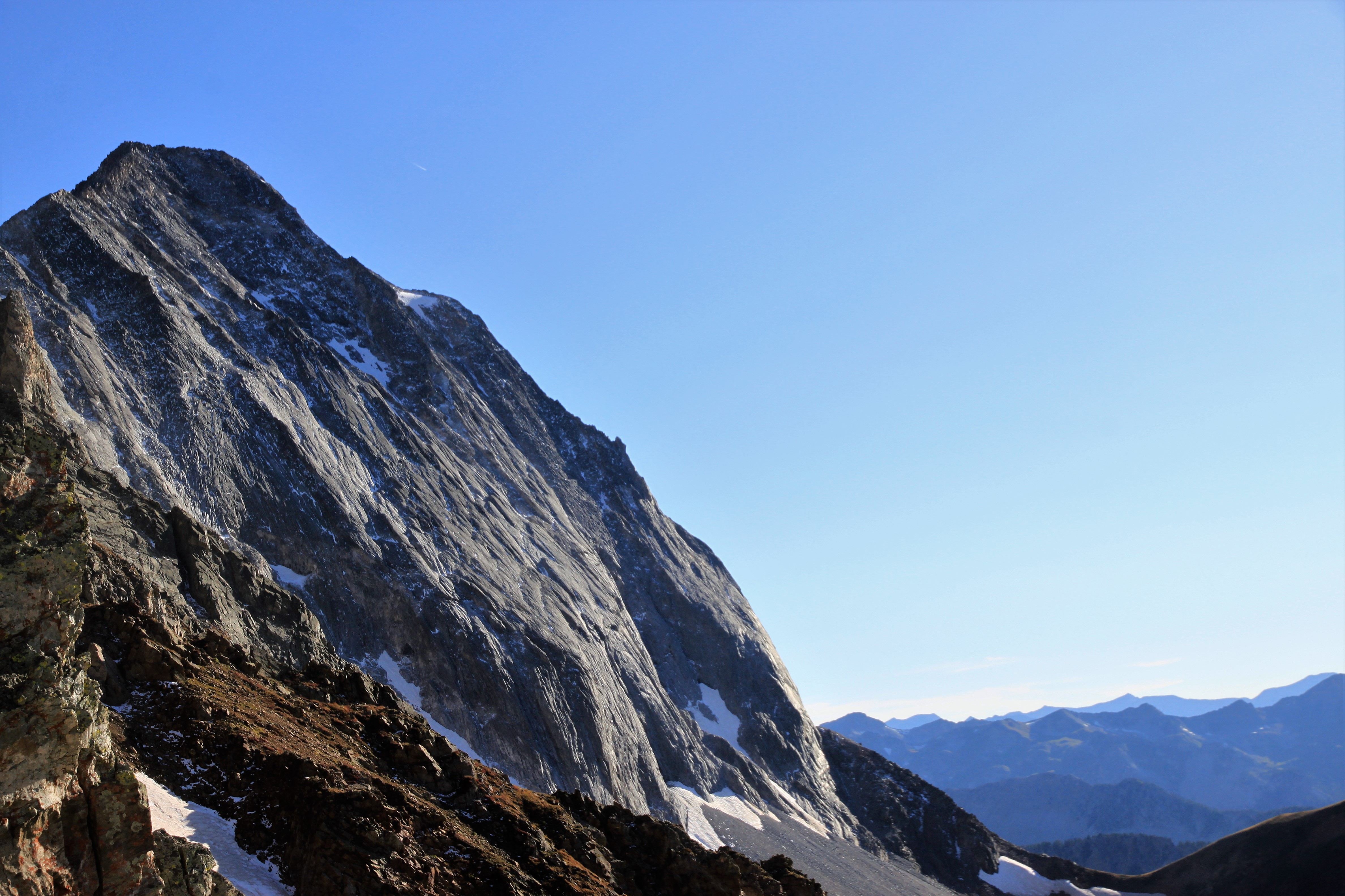
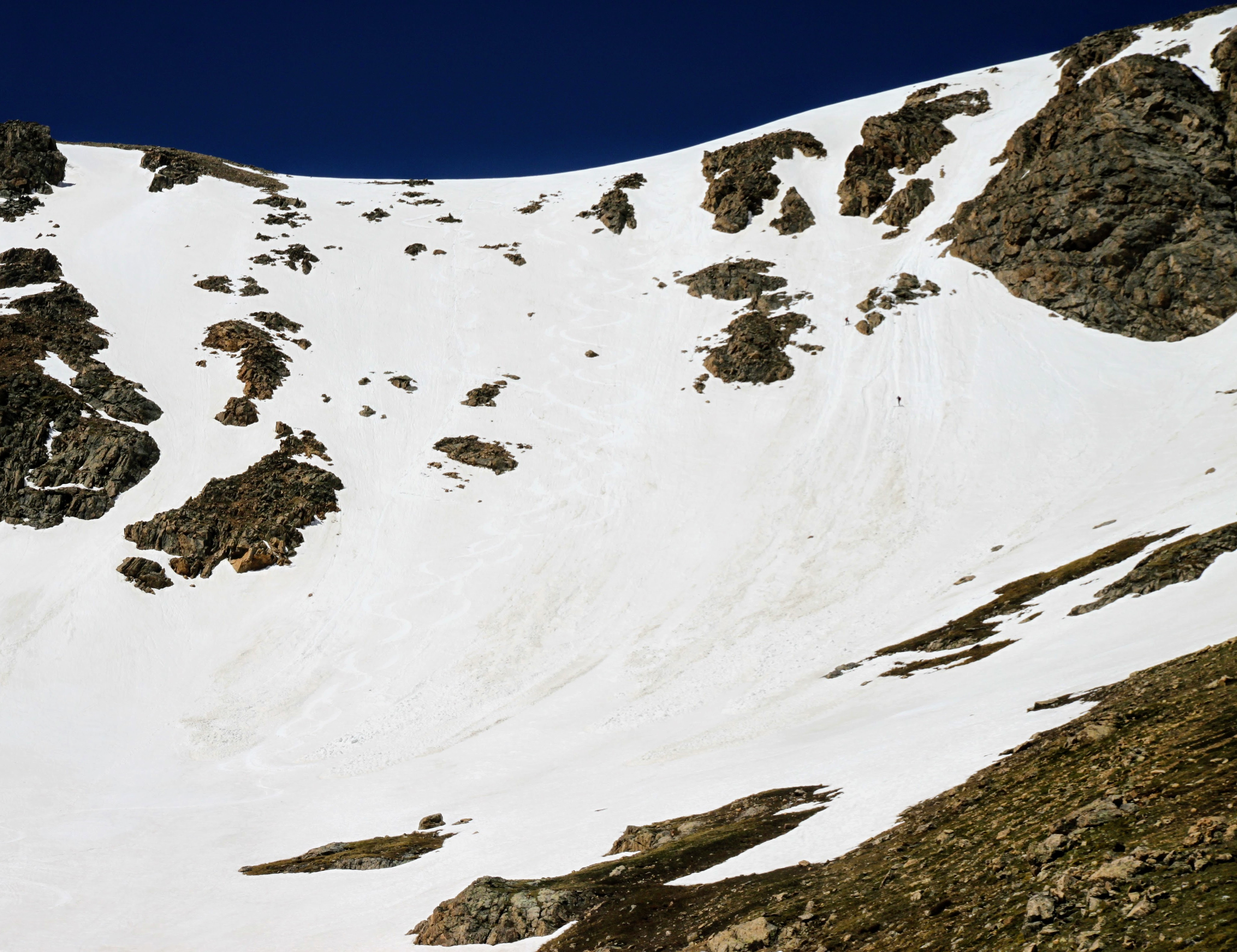
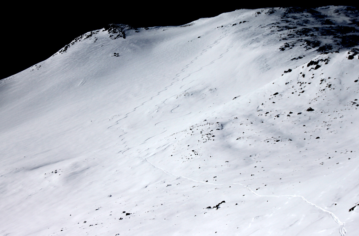
Cap’s northwest ridge in profile with the sun beginning to shine on the lower crux headwall

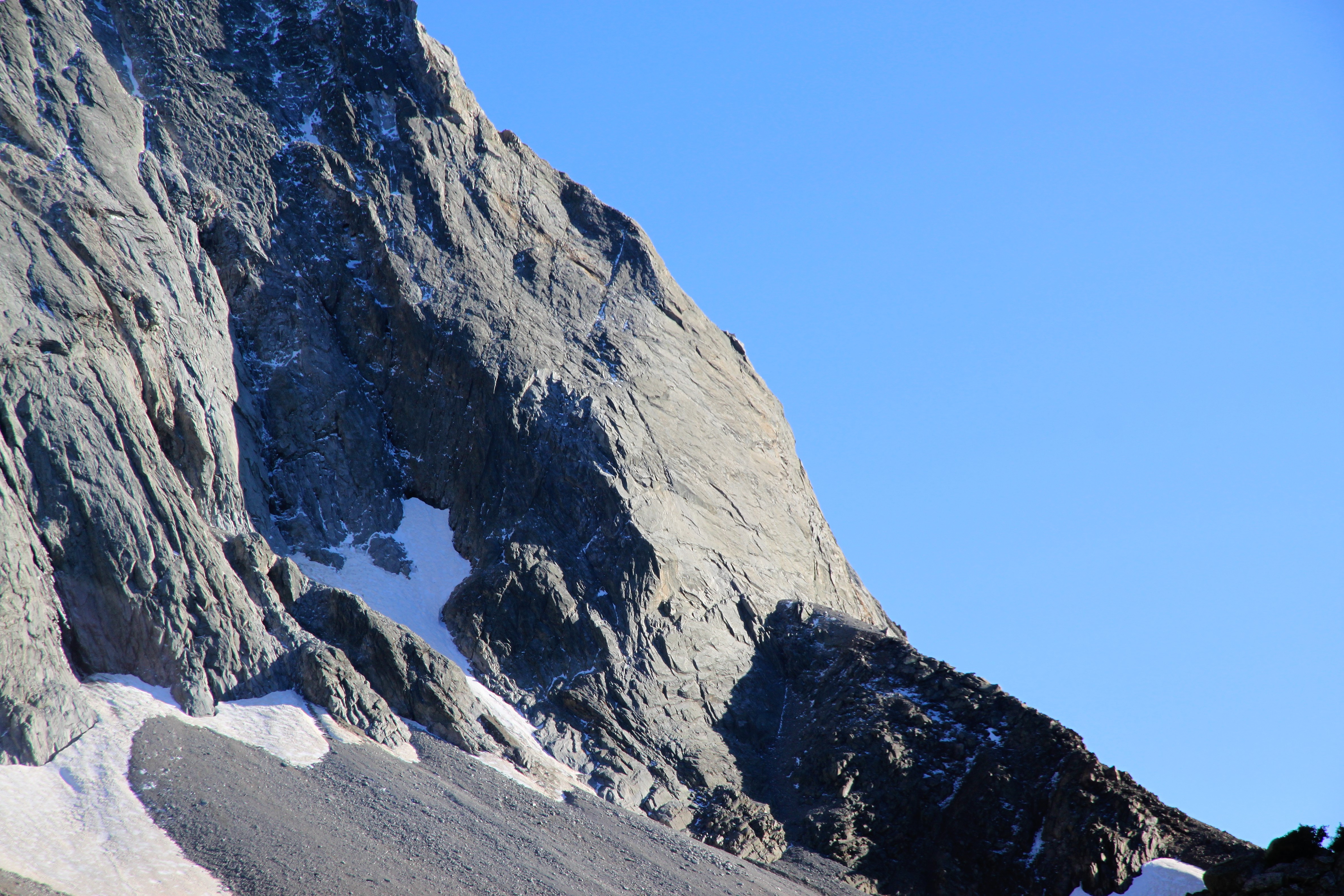
The lower crux headwall in the sun as seen from the Capitol Lake area all zoomed-in

Happy to be on the way out and have an easy 6 mile stroll back to the car, but the weather was so unbelievable I sort of wanted to stay out all night!

It was a nice hike out and we just made it back to the car around 8pm having just turned on our phone lights making for about a 15.5 hour RT day. Definitely longer than Chris and I took exactly one year before, but more technical pitches take time! It was a phenomenal day. One for the books. A big burger at the Glenwood Springs brewery was just what the doctor ordered and we finally arrived home about 11pm. I’m so happy my meniscus did well on a long day like this. I guess we’ll just continue to see how it goes and if it gives me further problems. Maybe it will just lie dormant for awhile. The older I get the more physical ailments will come about, but as long as I can continue to enjoy days like this, I’m a happy man.

Capitol’s Northwest Buttress

Where to start with this one. This route has been on my radar for years. My good pal Jesse Hill and I attempted this route in late July 2015, but little did we realize what late afternoon downpours would do to the first 2 pitches the following day. We got shut down, but I salvaged the day by taking a run up neighboring 13er Mt. Daly. That whole account can be readĀ here.

Capitol’s Northwest Buttress Route shown in red as seen from Mt. Daly’s south ridge in late July of 2015

Anyway, I had heard the Northwest Buttress up Capitol was a bit “loose” and objectively dangerous because of rockfall, but honestly now having climbed it I can say only one small 100′ section gave me any pause with regard to loose rockfall potential. I think any climber who may think this a “death route” probably spends most of their time in climbing gyms, at crags, and not in the alpine. If you are a rock climber and regularly climb peaks, especially in the Elk Range, and are used to loose rock being just a part of climbing mountains, then this route likely wouldn’t feel too objectively dangerous. I extremely enjoyed this route and think it is potentially the best alpine adventure I have done. I would definitely do it again and plan to do the Early Times (5.10) initial headwall variation next time.

J and I were trying to make this happen all summer, but schedules and weather forecasts kept getting in the way. I knew we needed a great forecast within a dry spell so as to not repeat my previous mistake. I kept thinking we needed to wait until the fall and the bluebird days of September. However, this is when J and Megan were expecting their second daughter, so it may not work out timing-wise. Fortunately, good pal Chris Baldwin was taking on this whole climbing activity full-throttle like he did everything else and said he would love to go with me. I’m so happy Chris and my paths crossed earlier this summer as he has been a super friend and climbing buddy. I have so enjoyed “showing him the ropes” so to speak. Anyway, unfortunately for J, we targeted Friday, September 14, which was Megan’s due date. He understood, but was obviously bummed. However, I promised him we’d go back and do the 5.10 variation. Chris and I would attempt the original 5.9 Northwest Buttress.

After a 4 year old birthday party at the park with Sawyer and a lost key incident in the Baldwin family, Chris and I were on our way in my Tahoe to the Capitol Creek TH late Thursday night. We arrived at the TH around 11pm and promptly got some shut-eye. Up at 2:50am, we had some awesome glazed croissants and Nescafe instant coffee courtesy of Mr. Baldwin and set out up the Capitol Ditch trail around 3:35am. I had my 60m/9.8mm rope in my pack while Chris had my alpine rack in his. We cruised to Capitol Lake in about 2 hours via headlamp under the still night sky. We took a pit stop at the shore of Capitol Lake en route up to Capitol Pass for a quick water refill and a bathroom break. It was chilly out for sure and a bit breezy, but we reached Capitol Pass maybe 7-7.5 miles in around 6:30am. The wind was really making things rather chilly and after scrambling up 400′ to the base of the initial headwall we took shelter on the leeward side among some rocks. We racked up, flaked the rope out, and had some PB&J again courtesy of Chris’s chef skills. We probably waited until 7:30am before we started climbing just to see if the wind would die down and for the outside air temperature to rise a few degrees. It was still chilly. We made our way out the ledge and I set off up the 1st pitch.

Me setting off up the 1st pitch. Photo by Chris

After 50′ of climbing I came to a nice stance on a ledge and the old pin I bailed off of 3 years ago when the route was essentially a waterfall. I slung the pin and moved off across the wide horizontal crack, which I basically laid back and really ran it out as the crack was too large for any gear I had with me. I then plugged a #3 cam and moved vertically into the crux “off-finger’ crack which went for 30′ to the anchors. This remaining crux felt harder than 5.9 to me. I’d give it a 5.9+. Usually, an “off-finger” crack is not 5.9 and the cold and wind only further sandbagged the rating. Nonetheless, there are a few facial features for the toes especially on the left side of the crack, which helped, but it was so slick given how chilly it was out. There is a small “thin hands” pod that is a nice hold, but other than that its poor face features for your feet and finger holds. I led it cleanly to the anchors (only one pin, really) and had a good stance where I set up my self-equalizing anchor with the help of two #2 cams. I shouted down to Chris and he was ready to climb. He really really did well having not much experience at this. The crux finger crack section gave him pause and a few issues, but he pulled the moved and made it to me just fine. He was a bit frustrated because he hung on the rope thinking he wasn’t ready for this, but I did my best to settle the good lad down by saying that the pitch was a lot tougher than the 5.9 rating.

Chris down low on the 1st 5.9 pitch

Chris making the tricky moves before the final rest stance below the finger crack

Chris in the thick of it!

Chris stoked to be with me at the pitch 1 anchor

I gathered my gear and slings from Chris, he put me on belay, and I set off up pitch 2 (5.8). It was a fun 5.8 move to get into the chimney and then it was cruiser climbing for a good 90′ to where the angle eased off and I set up an anchor to bring Chris up.

Chris climbing pitch 2

Nearing the top

I think Chris felt much better about things after pitch 2. He goes “see Brandon, now that’s much more in my wheel-house.” He is a funny one. Anyway, we stowed the rope in Chris’ pack and set off up the super fun and enjoyable class 4 scrambling for 600′ up and around to the right of the base of Unicorn Spire.

Good scrambling!

Me making my way on the 4th class rock. Photo by Chris

Chris moving around on looser rock to the right (west) of Unicorn Spire

The nastiness of the route really only reared its head in the final 100′ or so of climbing to get to the ridge crest above Unicorn Spire from the west. It was definitely low 5th class climbing on boulders seemingly held to the mountain only by sand. Chris took one line and I took another. Each of us securely tested each hold and came out alright up top on the ridge proper. What lay before us was probably the best and most fun climbing of the entire route. About 700′ of 5.0-5.7 simul-climbing up an exhilarating and airy arete that can be seen from the Capitol Creek TH!

Ready to take-off up the arete! Photo by Chris

Making my way up. Photo by Chris

Airy exposure looking down

Chris doing his thing. What amazing climbing

We reached the top of the 2nd tower and got our first sunshine of the day which felt oh so nice and rejuvenating. We de-roped and scrambled across the ridge above what was left of the heart-shaped snowfield over to the base of the 5.7 upper headwall pitch.

Chris on the 4th class ridge

A short walk/scramble to the base of the final headwall

There was a pin at the base of the headwall likely to protect the belayer because the first 50′ of the pitch is pretty run-out with no gear. I believe I climbed the small roof more to the right (west) than other folks have noted in their pics, but it felt more solid to me. I set up a belay about 30′ above the roof where I could still see Chris.

Chris on the upper headwall 5.7 pitch

We then decided to simul-climb the rest of the headwall above us. I set off and finally got into the glorious sunshine again.

Setting off on our simul-climb of the remaining upper headwall. Photo by Chris

Chris simul-climbing the upper headwall on mostly solid rock

Its a long way down

Chris said he really loved this climbing

Chris almost to me on the ridge

Chris reached me on the ridge and we literally only had 30′ to the summit. We were both pretty ecstatic with everything (the weather included) and we de-roped and scrambled the rest of the way to Cap’s summit.

Chris shot this of me on Capitol’s summit

So happy to have climbed the Northwest Buttress – finally!

We summitted around 11:30am so it took us close to 4 hours to climb the route. We saw no one on the summit or for that matter on the entire mountain this day. Unbelievable to me, really. We spent close to an hour on the summit relaxing and taking in the sunshine and the moment.

Relaxing and texting Kristine we are all good. Photo by Chris

Capitol summit (14,130′)! This was Chris’ first time up Capitol, which was extra special

Looking out towards Snowmass Mountain, the Bells, and Pyramid

Capitol Lake about 2,500′ below

The fire north of us near Steamboat

We figured it was time to roll around 12:30pm and so reluctantly we departed the summit down the familiar knife-edge standard route. It was super fun cruising down the standard route with no one else on the mountain.

Me taking the ridge-proper down the northeast ridge. Photo by Chris

Chris descending the standard route

And out across the knife-edge. I think he really enjoyed the standard route as well as he wants to go back at some point

We took a sigh of relief on top of K2, stowed our helmets, and let Kristine and Kimberly know we just had the slog out now. We made our way down the never-ending boulder field that I hadn’t been on in years and over to the Capitol-Daly saddle to reach the most welcomed trail. After a refill of water and a snack/sandwich at Capitol Creek just below Capitol Lake in the warm sunshine, I guess we had to motivate to hike the 6 miles out. It was pretty darn hot and my Lowe Alpine pants were heavyweight. So, I decided to take em off and hike out in my boxers. I mean my Patagonia silkweight boxers look like shorts, right? Hopefully, I didn’t embarrass Chris, but this wasn’t my first rodeo in just my boxers. He just had to get used to it. We arrived back at Capitol Creek TH around 4:30pm for a total time of 14 hours, but we did take several breaks on the way down and a good hour on top. So, maybe not all that shabby. We packed up, stretched out our backs (we ain’t so spring chickens anymore, that’s for sure) and made the trip back to Edwards. We met up with Kimberly and the Baldwins’ friend Patrick as well as Kristine, Sawyer, & Kona at the Craftsman around 7pm in Edwards for some celebratory beers and dinner. This was a fun day.

All in all, I just plain loved this route. I can’t wait to go back with J and climb Early Times (5.10). Maybe next September. I’m just so glad it finally worked out before our second child (yep, Sawyer will have a baby brother) enters this world come Halloween. Thanks again to Chris for a fantastic climb.

Top of the Rockies with the Horvaths

After 6 months of planning, our good family friends from Charlotte, the Horvaths, came to the valley. Their main objective was to climb their very first 14er. I chose Mt. Elbert because why not! Its the highest in Colorado and the 2nd tallest mountain in the contiguous USA. This trip was initially a surprise from Steve & Kathy Horvath to their sons, Stephen & Charlie, for their birthdays. Steve, Stephen, & Charlie rented a cool little home in Minturn for the weekend. They hiked up to Lionshead Rock for their first acclimitization hike and I took Stephen & Charlie climbing at Homestake that afternoon while Steve went and got a massage and hit the Westin spa.

Stephen climbing the awesome 5.9+ at Homestake

Stephen climbing the awesome 5.9+ at Homestake

And, Charlie. These guys did so well having not climbed outside for a long time

And, Charlie. These guys did so well having not climbed outside for a long time

Then, I picked them up at 5:30am on a Saturday morning and we headed south to the North Halfmoon Creek trailhead for Mt. Elbert’s standard northeast ridge route. I brought my skis along on my pack hoping to ski the Box Creek Chutes on the descent while the boys hiked down the trail. We had a great hike and it was exciting watching Steve, Stephen, & Charlie hike to the highest elevation to which they had ever been.

The Horvaths

The Horvaths

Steve motoring long below treeline

Steve motoring long below tree line

Steve getting above tree line and the views opening up

Steve getting above tree line and the views opening up

Mt. Massive (14,421'), Colorado's 2nd highest, to the north

Mt. Massive (14,421′), Colorado’s 2nd highest, to the north

Steve & Charlie around 13,000'

Steve & Charlie around 13,000′

Steve making great time up Elbert on the final couple hundred vertical feet

Steve making great time up Elbert on the final couple hundred vertical feet

We probably reached the summit only 3 1/2 hours after we left the trailhead, which is incredible for these lowlanders. A brisk west wind greeted us at the top, so we didn’t dilly-dally too long. However, it was an absolutely gorgeous day.

The boys relaxing below the summit on the leeward side of the mountain

The boys relaxing below the summit on the leeward side of the mountain

Steve reaching Mt. Elbert's summit!

Steve reaching Mt. Elbert’s summit!

All four of us on the summit of Mt. Elbert (14,433')

All four of us on the summit of Mt. Elbert (14,433′)

The Horvaths on top of the Rockies

The Horvaths on top of the Rockies

Steve & I

Steve & I

Looking west to the Elk Range

Looking west to the Elk Range

And, one more summit pic

And, one more summit pic

We then headed down and Stephen wanted to follow me down the Box Creek Cirque. He had an extra pole to help him control his glissade down the roughly 40 degree bowl. He did well and had a blast.

Looking down the upper east slopes, which was a stellar ski, leading into the steeper Box Creek Chutes

Looking down the upper east slopes, which was a stellar ski, leading into the steeper Box Creek Chutes

Reaching the rollover point where it gets steep

Reaching the rollover point where it gets steep

Stephen glissading the Box Creek Chutes

Stephen glissading the Box Creek Chutes

Looking back at our tracks down the Box Creek Chutes

Looking back at our tracks down the Box Creek Chutes

Stephen and I visited the small lake at the bottom of the Cirque and then hiked back up to the trail, took a small nap, and waited for Steve & Charlie to reach us. The rest of the descent was uneventful yet very hot. We reached the trailhead around maybe 1:30-2pm and headed into Leadville to eat some good lunch at the Tennessee Pass Cafe.

Our crew back at the trailhead

Our crew back at the trailhead

Celebratory lunch

Celebratory lunch

This fitting canvas was on the wall above our table

This fitting canvas was on the wall above our table

And, we had a nice view out the door

And, we had a nice view out the door

Steve and the boys took Kristine & I out to dinner that evening to cap off a great weekend. Congratulations on your 1st 14er, Horvaths. Hopefully, we can do it again!

Old Man Pyramid

Natalie and I had been planning a climb of Pyramid at some point this winter if weather and conditions would allow for relatively safe passage. We had climbed Pyramid’s NW ridge back in the fall in order to get a feel for the route finding challenges. We went on to traverse to Thunder Pyramid and then Lightning Pyramid, which raised the excitement level a bit. I’m always wanting to get back to Pyramid in whatever condition – definitely one of my most favorite 14ers.Ā Even though I have many more responsibilities these days (a young wonderful daughter, a 14+ year old golden retriever), I still love to get a few 14ers in the winter each year. Its sort of the only season I still like getting on the 14ers unless its some technical route in the summer. Kristine and I still regularly do our trail running, skinning, and rock climbing these days, but just much closer to home. We certainly are not the weekend warriors climbing and skiing all over the stateĀ like we were a decade ago. But, that’s quite ok with us. Natalie has certainly been getting after it all winter with summits of Wilson Peak, Holy Cross, Snowmass Mountain, just to name a few. She is narrowing in on the winter 14er list. Pretty impressive.

Now, to the trip report, a plan was set for the last weekend of winter especially given the amazing spring-like weather that was forecasted. I recruited J to come with Natalie and myself as well as our young buck, Dylan. J has serious FOMO (fear of missing out) so there was no way he was going to miss this climb even if he said he was out of shape. Kristine had a plan to drive to Aspen Saturday night to ski a peak with Christy Mahon that Sunday, so my goal was to be back home by 8pm that evening. Natalie backpacked in the Maroon Creek Road from the T-Lazy-7 Ranch all the way to the other side of Crater Lake that Friday evening. J, Dylan, and I drove over late Friday night arriving around 11pm for a quick 2+ hour sleep in our sleeping bags on the pavement. After some coffee and oatmeal, we started skinning up the road at 2:15am for the 6 mile slog to Maroon Lake. I would typically use my telemark setup for this climb, but sort of wanted to climb in my older Koflach plastic boots and thus used my really old Silvretta 404 binding/ski setup I used on Denali in 2007. This was a mistake as the boots gave me some mega blisters in the skinning mode with these bindings/skis. Oh well. Live and learn. We ran into Mad (Dad) Mike Silvestro fat biking in on the road to climb Thunder Pyramid and Lightning Pyramid. Good to briefly chat with that guy for sure. We reached Natalie’s tent just before 6am, which was around 8 miles and 2,000′ vertical gain into the day. Natalie gave me the 30m/8mm rope she hauled in to her camp to pack and after some snacks and water, we skinned the rest of the way to the apron of the west couloir leading up Pyramid’s west face. Dylan was not feeling very well (unusually nauseous), so elected to stay behind and return to Natalie’s tent for some shuteye. J and Natalie and I then began the 2,600′ boot up the awesome west couloir to the saddle on the northwest ridge. I left my ski setup at the base of the couloir because there was no way I was skiing a 40-45 degree couloir on those skis! J and Natalie, however, packed the skis on their packs.

First light on the Bells to our west

First light on the Bells to our west

Beginning the long ascent up the west couloir. Photo by Natalie

Beginning the long ascent up the west couloir. Photo by Natalie

A steep section. Photo by Natalie

A steeper section. Photo by Natalie

Middle of the couloir. Photo by Natalie

Middle of the couloir. Photo by Natalie

J & Natalie

J & Natalie

Me in the upper couloir. Photo by Natalie

Me in the upper couloir. Photo by Natalie

I think it maybe took us 2-1/2 to 3 hours or so to climb the 2,600′ from the valley floor to 12,900′ on the NW ridge. I am not quite totally sure. Nevertheless, the top out where the snow ended had a great view of the Bells.

J in the foreground and Natalie behind topping out at the end of the snow

J in the foreground and Natalie behind topping out at the end of the snow

J and Natalie left their skis, we stowed the crampons, and we started up familiar terrain to the Keyhole Couloir.

The Keyhole Couloir was dry and loose

The Keyhole Couloir was dry and loose

J climbing the loose couloir

J climbing the loose couloir

Then, we abruptly arrived at the edge of the north face and took a right to take on the class 4 headwall. J and I climbed it and I trailed a rope to belay Natalie up.

J having fun on the short headwall

J having fun on the short headwall

Me trailing the rope. Photo by Natalie

Me trailing the rope. Photo by Natalie

After some fun scrambling and route finding, we came upon the final crux bowl to access the summit cliff. By the way, the weather was spectacular. A little wind, but jeez I was scrambling in just glove liners. It was so nice. The upper bowl looked to be in great condition with safe and stable snow.

Rounding a corner...it looks as if we are both having to relieve ourselves, but of course we are not :) Photo by Natalie

Rounding a corner…it looks as if we are both having to relieve ourselves, but of course we are not šŸ™‚ Photo by Natalie

Natalie and J on a nice perch

Natalie and J on a nice perch

The upper bowl and summit cliff

The upper bowl and summit cliff

I led off and went up some previous tracks to the steep horizontalĀ traverse, which leads over to the familiar JP Sneak gully. It was really fun and steep snow climbing with decent exposure.

J and Natalie

J and Natalie

Up close in the upper bowl

Up close in the upper bowl

Traversing towards the JP Sneak was a very steep snow bulge in solid snow. This was the steepest snow of the day though only maybe 10′ in height.

J and I on the steep part to the JP Sneak. Photo by Natalie

J and I on the steep part to access the JP Sneak. Photo by Natalie

J climbing the steep snow pitch with good exposure

J climbing the steep snow pitch with good exposure

The snow really went pretty high up into the JP Sneak gully making for fairly smooth climbing.

J and Natalie climbing the JP Sneak gully

J and Natalie climbing the JP Sneak gully

The summit ridge was a mix of snow and dry rock, but was gorgeous all around. What a day we had to top out on ole man Pyramid. I believe we all summitted around noon or shortly after. Warm temperatures, endless views to all the ranges, and zero wind greeted us.

Pyramid winter summit (14,018'). Photo by Natalie

Pyramid winter summit (14,018′). Photo by Natalie

J coming back to the summit from checking out the Landry Line down the east face

J coming back to the summit from checking out the Landry Line down the east face

J and myself

J and myself

The three of us on top of Pyramid

The three of us on top of Pyramid

I hated to leave the summit, but I had a long way to go to be back in Edwards by 8pm. I think we started down by 12:45pm.

J and Natalie downclimbing the summit ridge

J and Natalie downclimbing the summit ridge.

Once we got down to the bottom of the JP Sneak, the 10′ section of steep snow gave us a brief pause. I then just decided to throw the rope down for a handle as we downclimbed this section. It worked well. I joked with Natalie that this is grade A typical fixed rope Himalayan stuff here.

The rope over the steep snow section

The rope over the steep snow section

Me lowering myself

Me lowering myself. Photo by Natalie

Natalie lowering herself over the steep part

Natalie lowering herself over the steep part

Descending the horizontal traverse in the upper bowl

Descending the horizontal traverse in the upper bowl

Careful stepping

Careful stepping

And then some facing in downclimbing

And then some downclimbing to the dry ledge

Back on dry rock, we de-cramponed and made our way back down to the short class 4 headwall and had a nice rappel.

Leaving the upper bowl

Leaving the upper bowl

At a nice perch looking at the awesome north face of Pyramid

At a nice perch looking at the awesome north face of Pyramid

And, that's a rap

And, that’s a rap

The Keyhole Couloir went fast and loose and we were back down at the top of the west couloir in no time. Much to our surprise, Dylan had showed up and was relaxing in the sun! I was so glad he rested and felt good enough to climb the 2,600′ couloir and brought his skis to boot! Now, he would get to enjoy the fantastic ski down. Since my awful silvretta/ski setup was down in the valley, I left to try and plunge step/couloir run down the couloir as fast as I could and stopped lower down to get some pics of the skiers.

J skiing the upper west couloir. Photo by Natalie

J skiing the upper west couloir. Photo by Natalie

Dylan and J skiing the upper west couloir. Photo by Natalie

Dylan and J skiing the upper west couloir. Photo by Natalie

J slashing with Len Shoemaker Peak behind

J slashing with Len Shoemaker Peak behind

Dylan

Dylan

Dylan felt better at this point

Dylan felt better at this point

And, of course, Natalie

And, of course, Natalie

Me doing my best to keep up on foot

Me doing my best to keep up on foot

I clicked into my ski setup and hobbled my way thru the trees back to Natalie’s camp. A tree well ate me for 5 minutes, but I managed to right myself and ski out. Back at the tent, we delayered, ate, drank, chatted for maybe 30 minute, and said our goodbyes to Natalie as she would stay another night and climb South Maroon Peak the next morning. It was now close to 4pm and we had 8 miles out. The descent to Maroon Lake was rough for me on my ancient setup, but once we got to Maroon Creek Road, things went faster and easier. We met up with three ski mountaineering dudes who we had seen off and on all day near Crater Lake and chatted. They had climbed South Maroon’s Y-couloir, skied South Maroon’s east face into the Bell Cord Couloir and wrapped around to climb North Maroon’s north face and ski it. They finished up as we were crossing Crater Lake. Nothing really surprises me anymore with folks in Colorado. Anything in the mountains seems possible. Super nice fellas and we chatted back at the cars for awhile as well.

J slowly skiing out the Maroon Creek Road with Pyramid in the distance

J slowly skiing out the Maroon Creek Road with Pyramid in the distance

We packed up and actually got on the road a bit after 6pm for the drive back to Edwards. After a stop at Whole Foods and Starbucks, we Ā cruised home rehashing the memories of the 15.5 hour day finally arriving at the house a few minutes after 8pm. Not bad timing. Sawyer had just gone to bed, Kristine and I saw each other for 15 minutes, and then she was off to Aspen to stay with the Mahons. We hated we saw each other so little all weekend, but hey its the last weekend of winter and the weather was unbelievably spectacular. We had to make the most of it. Kristine and Christy had a nice 6-7 hour day skinning and skiing the 13er Pearl Mountain at the head of Pearl Basin on Sunday.

Views of Castle's east face and Cathedral from Pearl Mountain

Views of Castle’s east face and Cathedral from Pearl Mountain

Kristine booting

Kristine booting

The gals on top

The gals on top

Kristine on top of Pearl Mountain

Kristine on top of Pearl Mountain

Kristine skiing

Kristine skiing

Sawyer, Rainie, & Kona, and myself relaxed most of the day watching March Madness off and on and going to the park. It was much needed for my almost 40 year old body after Pyramid on Saturday. A great way to cap off a nice winter for both Kristine and myself. We’re now so looking forward to spring ski-mountaineering and rock climbing. Bring on the warm weather!

Mt. Massive in Winter

I at least wanted to get one winter 14er in this year and always had my eye on our 2nd tallest peak in Colorado, Mt. Massive (14,421′). It has a nice winter route up the east ridge at about 15 miles roundtrip and 5,000′ of vertical gain that has little avalanche danger. I had always thought the broad east face would be a nice ski descent after a climb of the east ridge, but honestly the chance of having skiable snow that is fun in the middle of winter on a 14er above treeline is not usually very high. The snow high up on 14ers in winter is typically hard, windblasted sastrugiĀ to the point of being “break your leg” snow. I recruited Reid and J to go for an attempt on Superbowl Sunday, February 5. J and I met Reid at the Leadville Fish Hatchery trailhead around 7am and we were skinning by 7:30am. We had a great broken trail to follow really all the way to the Highline Trail / CO Trail intersection and then we followed a lone snowhshoer’s tracks for another 2 miles to the east ridge at treeline. The weather forecast had not called for much wind, but it sure was whipping by the time we reached treeline. We could tell it was getting stronger and more sustained as the day progressed. We skinned across the large plateau east of the significant false summit (13,500′) along the prominent east ridge. Reid and I left our skis at around 13,200′ as we felt it was pointless (at least for us) to carry them any further since the skiing would be pretty horrific on the way down. We all topped out on the false summit with still the east ridge to traverse and 900′ of elevation gain to the summit and we were almost literally getting blown over. It was not very pleasant especially with us trying to climb into the sustained west wind. We called it, turned around, and tried to somewhat enjoy a horrible ski back down to treeline.

Near our highpoint that Superbowl Sunday around 13,500' along Massive's east ridge

Near our highpoint that Superbowl Sunday around 13,500′ along Massive’s east ridge

Reid on the descent into treeline. The wind can be seen blowing snow all around and above

Reid on the descent into treeline. The wind can be seen blowing snow all around and above

Once we hit the trail system below, it was a “luge-type” ski out a few miles back to the trailhead. I was definitely a bit disappointed mainly because it was such a sunny day otherwise! But, a day in the hills beats just about anything else and it was good to get out. We were back in Edwards by 2:30pm.

I bugged J to go back with me the following week (unfortunately, Reid, could not go) and with a bluebird spectacular day forecasted for February 15, I picked J up at 5am at the Active Energies office in Minturn and we beelined for the Fish Hatchery trailhead. Ā Moving around 6:30am in about -5 F air temperature, we skinned along a snowshoe track for 3 miles to the Highline Trail / CO Trail intersection as before. From then on, we’d be breaking trail and navigating another few miles to treeline at the start of the east ridge because of the big storm the previous weekend. J and I moved pretty fast with me breaking trail to treeline and doing the best navigating I could do and we took more of a direct line off the Highline Trail straight to the east ridge proper. It was so nice to hear absolutely no wind and feel the sun’s radiance. It warmed up pretty fast and we were getting hot by the time we were skinning across the open plateau, which this time around was a pleasant skin in nice powder above all of the wind blown tundra below.

J skinning up above treeline

J skinning up above treeline

We skinned as far as we could to about 13,400′ and then put the skis on our packs and started booting up in the new snow. I broke trail up to a notch in the larger rock formation along the east ridge and then J took over.

J booting with our skin track visible on the large plateau below

J booting with our skin track visible on the large plateau below

J making progress up to the top of the 13,500' false summit

J making progress up to the top of the 13,500′ false summit

Once we hit the now well-defined east ridge, we made our way up and over some minor bumps and then up the final 600′ headwall to the summit.

J along the well-defined east ridge with the summit ahead

J along the well-defined east ridge with the summit ahead

J making the final steps to the summit

J making the final steps to the summit

We topped out 10 minutes to noon and enjoyed a completely windless Colorado 14er winter summit. It was wonderful. We were now certainly glad we came back to do this peak this day for sure and not the previous week.

Mt. Massive summit (14,421')

Mt. Massive summit (14,421′)

View east to the Elks (Maroon Bells and Pyramid Peak visible)

View east to the Elks (Maroon Bells and Pyramid Peak visible)

We stayed up top for 20 minutes or so and then decided to ski the east face directly from the summit as it looked pretty darn good. From a week and a half earlier, we knew it was a good 8″ of fun snow on top of hard, wind compacted glacier ice. After unthawing my NTN tele bindings on my skis so they would accept my boots, J took off and then me after him. They were some awesome turns. Best I’ve had on a 14er outside of spring ski season, but this time in powder!

J carving his first few turns

J carving his first few turns

Me carving some tele turns on the wide open face

Me carving some tele turns on the wide open face. Photo by J

Our turns on the upper face from the summit

Our turns on the upper face from the summit

We traversed back over to the top of the false summit on the east ridge itself at 13,500′ and skied what J had skied a week and a half prior. Only then, what he skied was awful wind-affected ice. Now, it was powder.

J

J

J lower down on the east face heading onto the large pleateau

J lower down on the east face heading onto the large plateau

Our tracks down from the 13,500' false summit

Our tracks down from the 13,500′ false summit

Our turns lower down heading into treeline. Such great snow

Our turns lower down heading into treeline. Such great snow

We skied great snow back into treeline and then because of the warm snow down low combined with our very cold skis, the snow was sticking to the bottoms of our skis and we couldn’t move. J had wax and after we waxed the bottom of our skis, we glided along just fine. We were back at my car by 2pm for less than 2 hours down. What a great 7.5 hrs up on Massive it was.

J took a short video of me skiing the upper east face of Massive:

Pyramidal Traverse

I have always had a few of the red, rugged, and rotten traverses in the Elks in the back of my mind to hopefully climb one day (other than the Maroon Bells Traverse, which I have done a few times) and when my friend Natalie suggested she wanted to do the Pyramidal Traverse, I was interested. A huge plus would also be to get into the Elk Range on a gorgeous fall day. But, mainly I just wanted a new ridge traverse.Ā The Pyramidal Traverse traverses the 14er Pyramid Peak (14,018′), the centennial Thunder Pyramid (13,932′), and the bicentennial Lightning Pyramid (13,722′). Natalie wanted to scope out the non-standard northwest ridge route up Pyramid in preparation for a winter ascent. This sounded fun as well as I had never been up the NW ridge route. I had been up and down the standard NE ridge route 4 times in the past, the last one being with Rainier and Caleb & Jennie Wray in August 2009. While the loose rock of the Bells, Pyramid, and surrounding peaks is not my favorite rock to scramble on and doesn’t instill much comfort or confidence, it is still very unique rock and offers challenging scrambling even if only low 5th class, especially on the downclimbing aspects. Several climbing buddies had suggested we traverse south to north as we could climb up most of the low 5th class crux sections, but we wanted to climb Pyramid’s NW ridge route for a recon of the winter route, so it looked like we would be downclimbing all of the cruxes. And, it was a lot of downclimbing. I brought my 30m/8mm rope, webbing, harness, slings, biners, nuts, and a few cams in hopes to set up a rappel if needed, but it turned out everything just stayed in my pack. I always believe its better to have it and not use it than to not have it and need it. So, after Sawyer was in bed and Kristine & I had dinner, I zipped over in the Subaru to the Maroon Lake TH parking lot and got a few hours sleep in the back of the car with the tailgate open. Natalie showed up around 5am and we departed the TH around 5:30am. It was to be just about a perfect fall weather day except for the fairly stiff west wind that was supposed to subside by around 9am, which it fortunately did. We made quick work of the approach up into the amphitheater below Pyramid’s north face and then veered off south west on steep grassy slopes and loose scree to the northwest ridge at around 12,700′.

Pyramid's north face

Pyramid’s north face

The steep slopes leading up to Pyramid's NW ridge

The steep slopes leading up to Pyramid’s NW ridge

First view of the Maroon Bells from the small saddle at 12,700' on Pyramid's NW ridge

First view of the Maroon Bells from the small col at 12,700′ on Pyramid’s NW ridge

Looking up Pyramid's NW ridge from the small col at 12,700'

Looking up Pyramid’s NW ridge from the small col at 12,700′

We followed the northwest ridge route pretty much “to a T” up through the Keyhole Couloir and then further up the fun class 4 slab/chimney above. It was a gorgeous morning except that we were climbing in the shade and the wind was pretty stiff. I was chilled as I normally get considering my hefty plethora of body fat šŸ™‚

Natalie on the easy portion of the NW ridge

Natalie on the easy portion of the NW ridge

The Keyhole Couloir

The Keyhole Couloir

Natalie climbing up the Keyhole Couloir

Natalie climbing up the Keyhole Couloir

Natalie at the top of the Keyhole Couloir/base of the fun class 4 pitch

Natalie at the top of the Keyhole Couloir/base of the fun class 4 pitch

Me starting up the class 4 pitch. Photo by Natalie

Me starting up the class 4 pitch. Photo by Natalie

I think I may have taken a stiffer variation up the class 4 pitch, but it was all good low 5th offwidth :)

I think I may have taken a stiffer variation up the class 4 pitch, but it was all good low 5th offwidth šŸ™‚

We then just sort of traversed ledges and slight aretes until we both found ourselves into the upper bowl/amphitheater below the summit block.

Into the upper bowl below the summit block

Into the upper bowl below the summit block

We climbed this fun little chimney which Ntalaie said is dubbed the "JP Sneak"

We climbed this fun little chimney which NatalieĀ said was dubbed the “JP Sneak”

Natalie climbing the "JP Sneak"

Natalie climbing the “JP Sneak”

Once on the summit ridge, it was a short scramble to Pyramid’s summit arriving around 9:15am.

Natalie almost to Pyramid's summiut

Natalie almost to Pyramid’s summit

Pyramid Peak summit (14,018')

Pyramid Peak summit (14,018′)

A nice little morning and wonderful to finally be in the sun!

A nice little morning and wonderful to finally be in the sun!

I was a little worried about my timing as I needed to be home by 7pm (back to car by 5pm), nut Natalie convinced me we would be ok with timing. So, we began the traverse south to the centennial Thunder Pyramid in what would be the “meat & potatoes” of the day. Ā The downclimb of the class 4 pitch on Pyramid’s south ridge was lots of fun and then it was pretty cruiser class 2 walking for several hundred yards until we started doing some pretty mellow class3/4 downclimbing with not much exposure on the ridge crest.

Descending Pyramid's south ridge

Descending Pyramid’s south ridge

Me descending the class 4 dihedral on Pyramid's south ridge. Photo by Natalie

Me descending the class 4 dihedral on Pyramid’s south ridge. Photo by Natalie

Natalie on the same dihedral

Natalie on the same dihedral

Making our way down to the lowpoint between Pyramid & Thunder Pyramid. Photo by Natalie

Making our way down to the lowpoint between Pyramid & Thunder Pyramid. Photo by Natalie

Looking back at Pyramid on the traverse thus far

Looking back at Pyramid on the traverse thus far

We tried the west side of the ridge to actually get down to the lowpoint several hundred feet below, but it didn’t go anywhere. We backtracked slightly and headed on the ridge top or just slightly east and found the top of the crux low 5th class downclimb with some big exposure that we had heard about. Well, there was only one way down. I was considering setting up a rappel, but there was just no good place to set up an anchor.

The crux downclimb to the lowpoint between Pyramid & Thunder Pyramid

The crux downclimb to the lowpoint between Pyramid & Thunder Pyramid

Me beginning the downclimb

Me beginning the downclimb. Photo by Natalie

Yep, a bit of exposure on loose rock. Photo by Natalie

Yep, a bit of exposure on loose rock. Photo by Natalie

On the climb down. Definitely, complete focus is a must on this crux section. Photo by Natalie

On the climb down. Definitely, complete focus is a must on this crux section. Photo by Natalie

Natalie after the hairiest crux sections of the downclimb

Natalie after the hairiest crux sections of the downclimb

The last bit down to the lowpoint

The last bit down to the lowpoint

I had gotten down to the lowpoint and was scouting the next portion of the traverse when Natalie thought she could just drop her pack the remaining 10 ft down into the top of a steep, loose couloir down the west side. While it looked like the pack would just plop down and not roll from Natalie’s perspective, it indeed took off down the couloir. We both looked and thought it would stop, but just went over a steep crux and into oblivion. Natalie went down after it, but triggered a small rockslide, which didn’t make either of us very comfortable. She searched for a good 20-30min, but to no avail. She came back up to the lowpoint and we would both have to get by with my half nalgene of water and half liter of Gatorade for the rest of the traverse and the descent down to West Maroon Creek. I felt awful for Natalie as she had some valuable gear in there including her Delorme. I mean that pack could have been close to her lowpoint or rolled to the couloir’s bottom. Who knows. She would later get in touch with Delorme and they would track it to be resting at 13,300′ or just below her lowpoint. And, Natalie would go back 2 days later, ascend Thunder Pyamid via the standard White Gully, and traverse over to retrieve her pack. Very admirable and impressive determination, Natalie!

Anyway, we continued along the traverse south from the lowpoint, which was now significantly easier with some class 3/4 and nothing all that exposed.

The remaining traverse to Thunder Pyramid

The remaining traverse to Thunder Pyramid

Me on a nice perch with Len Shoemaker Ridge & Basin below

Me on a nice perch with Len Shoemaker Ridge & Basin below. Photo by Natalie

Looking down the standard White Gully route up Thunder Pyramid

Looking down the standard White Gully route up Thunder Pyramid

Even with the delay for the dropped pack, we still made the traverse in just under 2 hours. It was my first summit of Thunder Pyramid and another centennial for myself. It was a nice summit.

Looking back at the traverse to Pyramid from Thunder Pyramid's summit

Looking back at the traverse to Pyramid from Thunder Pyramid’s summit

Thunder Pyramid summit (13,932')

Thunder Pyramid summit (13,932′)

Soaking it in. Photo by Natalie

Soaking it in. Photo by Natalie

I believe it was around 12:15pm when we left Thunder Pyramid’s summit for Lightning Pyramid. Easy class 2+/3 downclimbing at first quickly yielded class 4 downclimbing to get down to the lowpoint between Thunder & Lightning Pyramid.

On the traverse south to Lightning Pyramid

On the traverse south to Lightning Pyramid

Lightning Pyramid in the distance

Lightning Pyramid in the distance

We descended the ridge proper until a very airy downclimb when we elected to head east of the ridge proper and downclimb class 4 ledges to where we could get over to the lowpoint saddle

We descended the ridge proper until a very airy downclimb when we elected to head east of the ridge proper and downclimb class 4 ledges to where we could get over to the lowpoint saddle

I dropped my pack with all the gear at the lowpoint saddle between Thunder & Lightning Pyramid and in 15 minutes over easy terrain we were on Lightning Pyramid’s summit at approximately 1pm.

Natalie hiking up Lightning Pyramid's north ridge with Thunder Pyramid behind

Natalie hiking up Lightning Pyramid’s north ridge with Thunder Pyramid behind

Almost there

Almost there

Lightning Pyramid summit (13,722')

Lightning Pyramid summit (13,722′)

Our descent off this ridge was via the awfully steep and loose west side couloir between Thunder & Lightning Pyramid accessed from the lowpoint saddle. Not looking forward to it, we navigated it pretty well going one at a time for several pitches ensuring we don’t knock rocks down on one another. It could have been the worst couloir I’ve descended. I don’t know. However, I do know I will never touch it again.

Ready to descend. Photo by Natalie

Ready to descend. Photo by Natalie

The disgustingly narrower middle portion of the gully

The disgustingly narrower middle portion of the gully

More steep nastiness

More steep nastiness

Navigating some frozen snow which acted as nice hand holds

Navigating some frozen snow which acted as nice hand holds

Light at the end of the tunnel - the apron

Light at the end of the tunnel – the apron

Natalie coming out of the gully

Natalie coming out of the gully

The steep gully and the large rock apron below

The steep gully and the large rock apron below

It was wonderful to get down into the grassy Len Shoemaker Basin and take a break and guzzle our remaining fluids. We then made our way on grassy ledges and rock gullies to get down another 1,200′ to the West Maroon Creek trail.

The gorgeous Maroon Bells from Len Shoemaker Basin

The gorgeous Maroon Bells from Len Shoemaker Basin

The standard White Gully route up Thunder Pyramid

The standard White Gully route up Thunder Pyramid

We finally hit the West Maroon Creek trail, filled up with water and iodined our nalgenes, and cruised out the remaining few miles back to the Maroon Lake TH arriving just at 5pm. Natalie’s car keys were in her lost pack, so we hurried quickly down to 82 in the Subaru to get cell service so Natalie could call Geico and get some roadside assistance. After everything was settled, I was drove back to Edwards just in time to see Sawyer before bed, which was my goal all along. I later learned that Natalie’s spare keys were not in her locked car, so someone drove them up from Denver apparently and she finally got into her car later that night. But, my hat is certainly off to her for going back up Thunder and over to the couloir to retrieve her pack 24 hrs later. So happy it all worked out.

A zoomed-in pic from the West Maroon Creek trail of the steep couloir Natalie's pack fell down in the center of the picture trending up and right

A zoomed-in pic from the West Maroon Creek trail of the steep couloir Natalie’s pack fell down in the center of the picture trending up and right to the lowpoint saddle between Pyramid & Thunder Pyramid

Lastly, thanks to Natalie for a great day and a solid idea for an Elks traverseĀ in the fall. Its exactly what I needed having not been in the area in years. I don’t get on 14ers too often anymore, but Pyramid will always be one of my favorites. I guess total stats are something like 5,500′ vertical gain in 12.5 miles and 11.5 hrs RT. Our little Pyramid loop is shown below:

Pyramidal Traverse via Pyramid's NW Ridge up and the Thunder/Lightning Pyramid west side couloir down

Pyramidal Traverse via Pyramid’s NW Ridge up and the Thunder/Lightning Pyramid west side couloir down