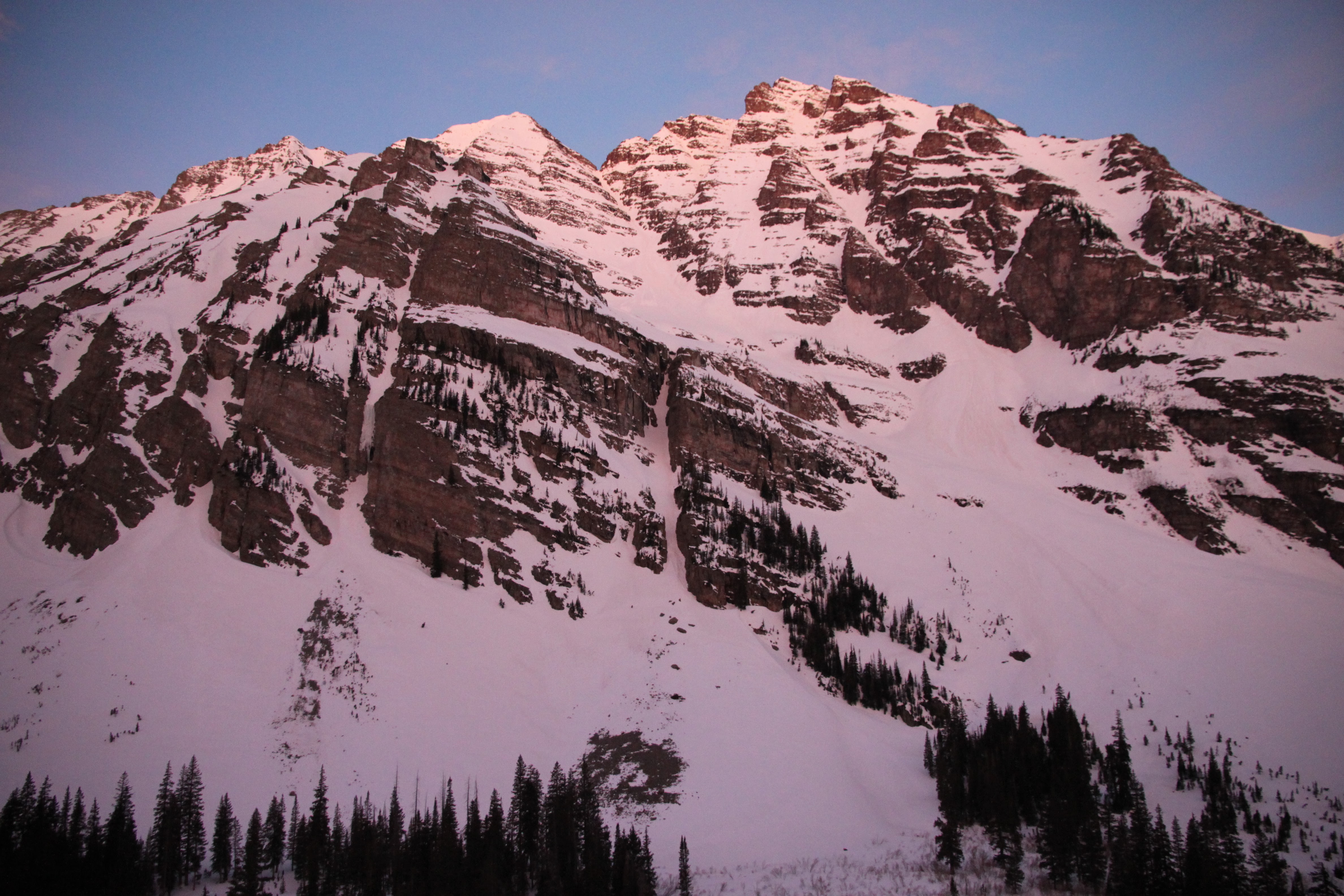
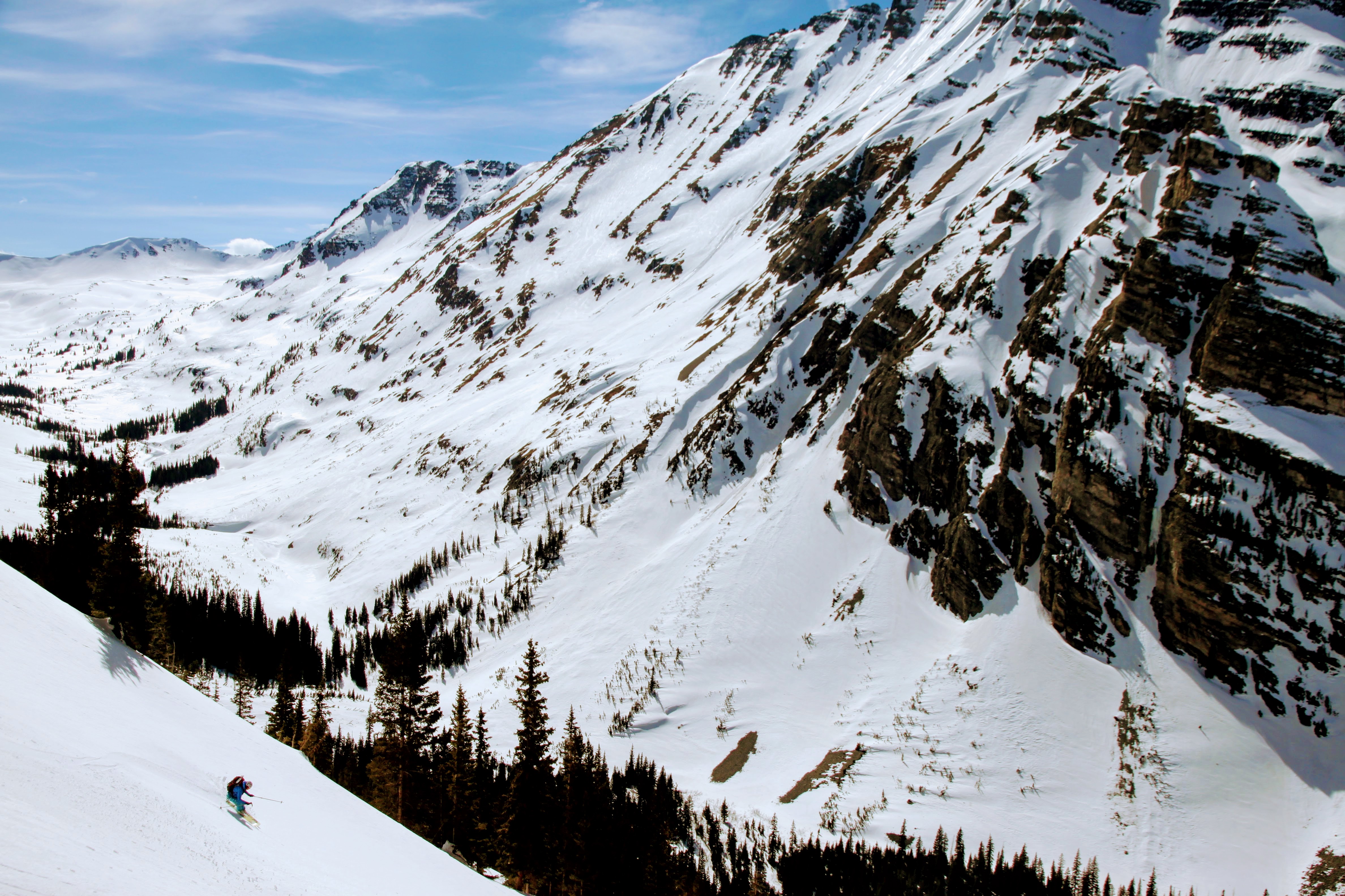
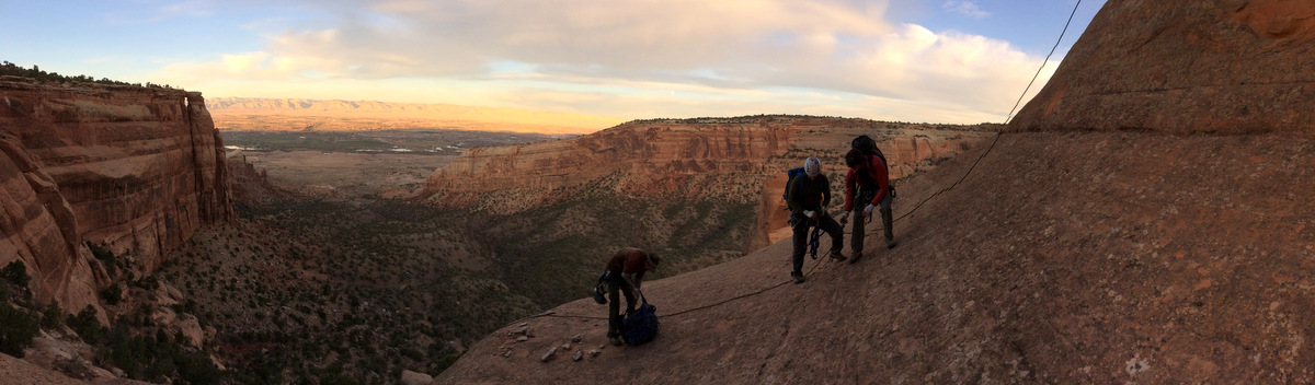
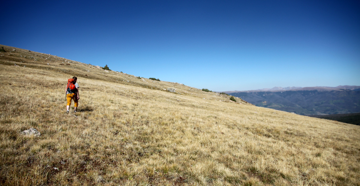
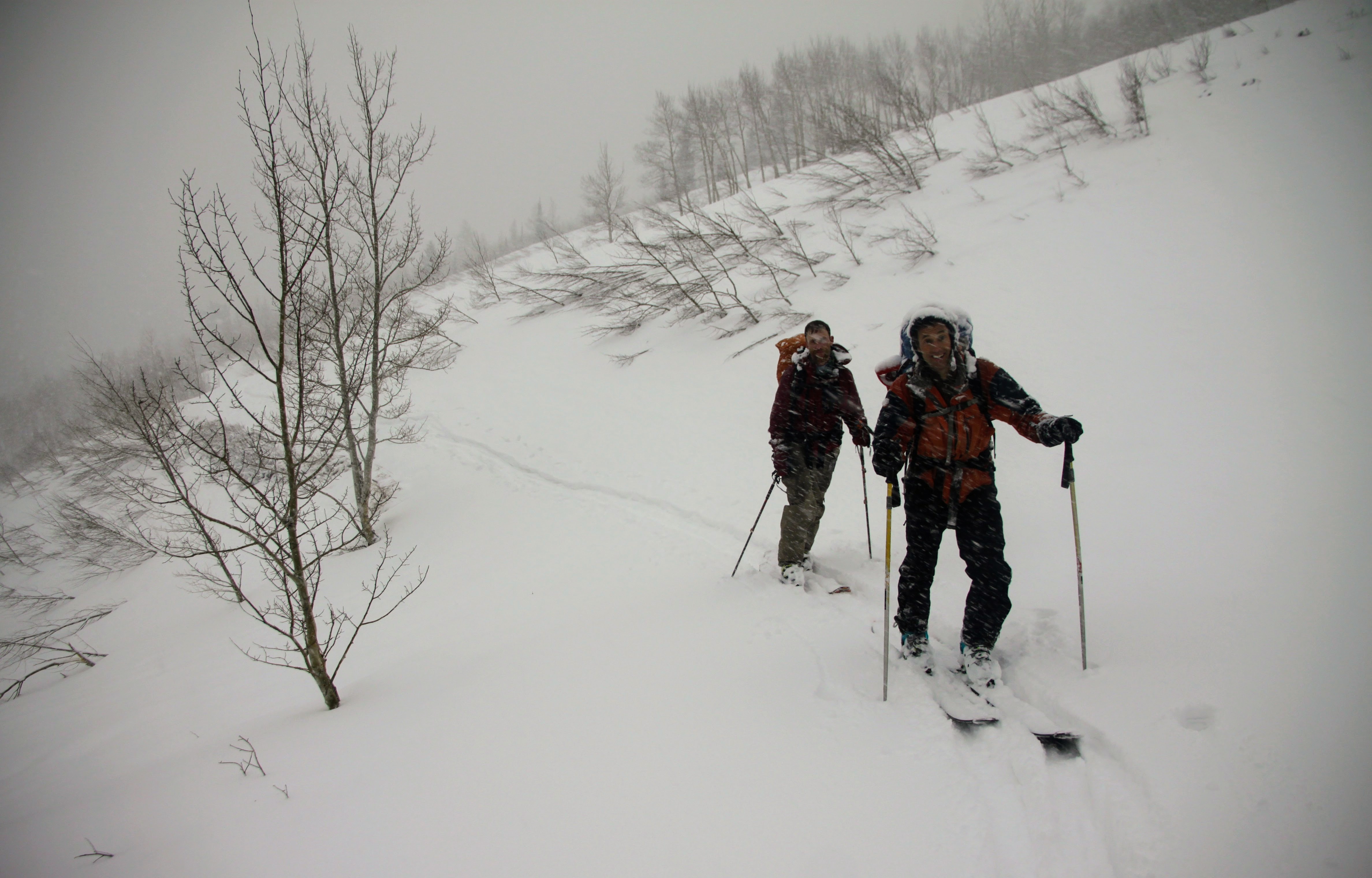
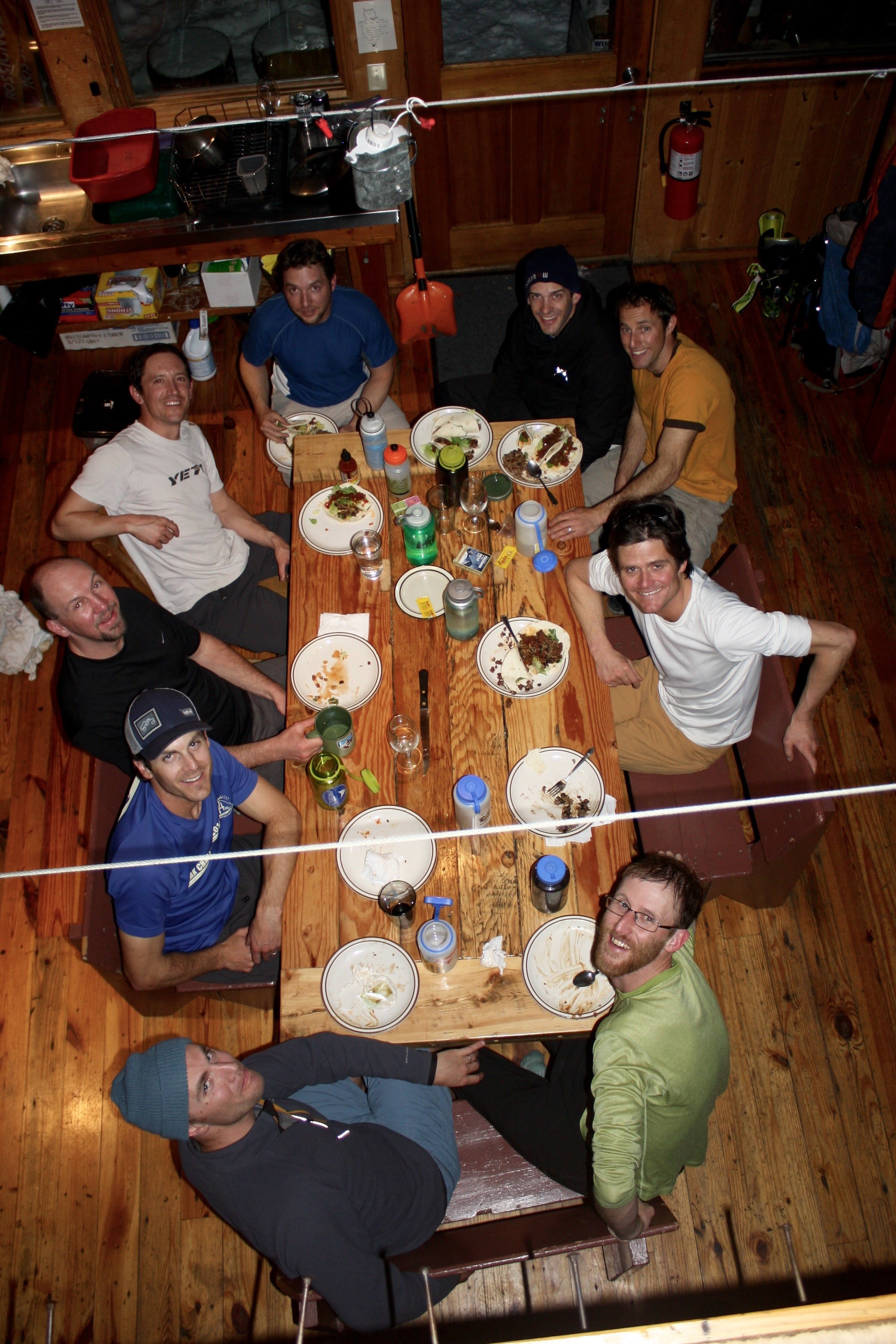
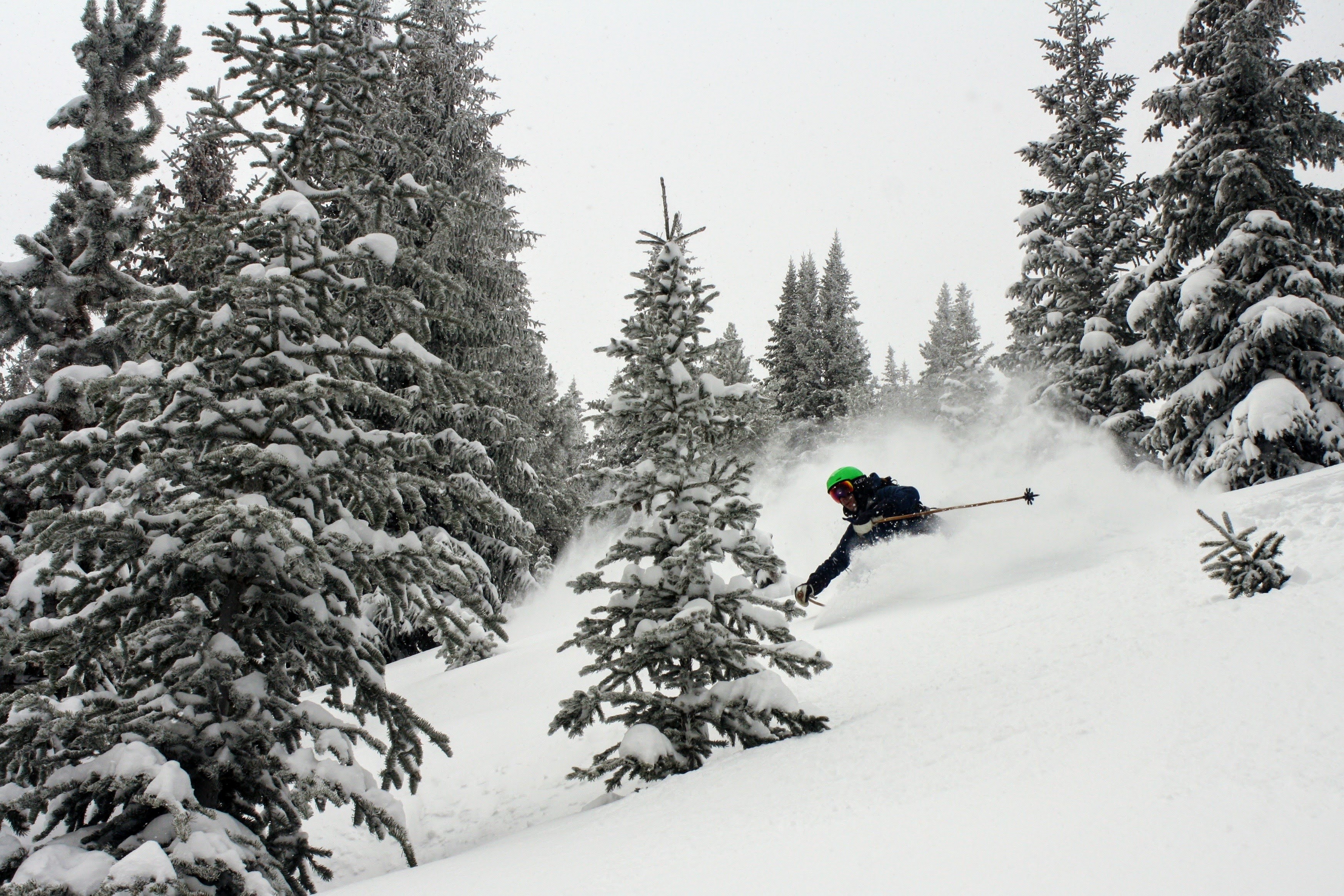
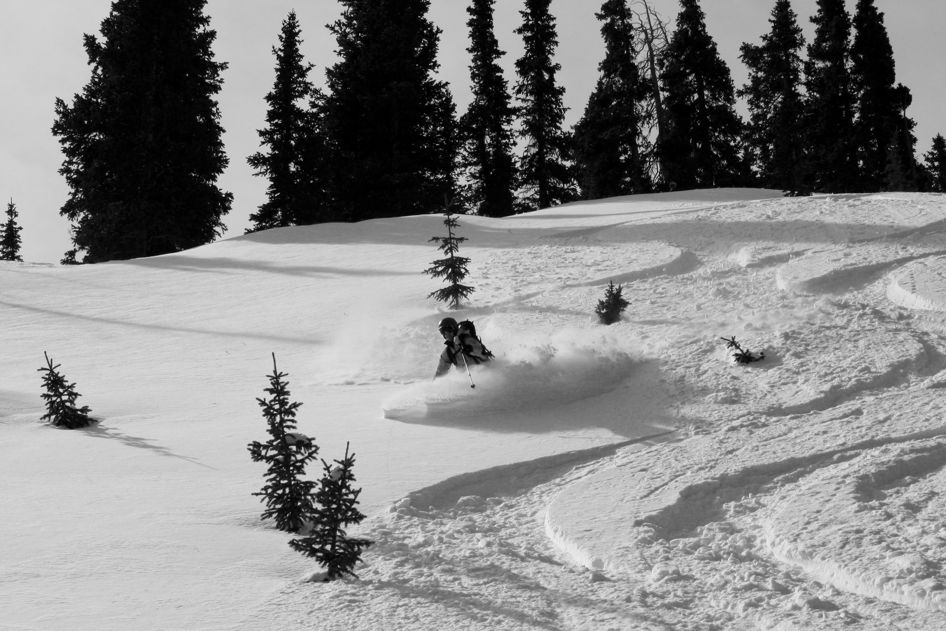
Our 2017 Hardman Hut trip wasn’t as “hard” as the previous year’s Hardman 2016 (maybe more of a “Softman” hut trip), but was loads of fun all the same. Jesse Hill booked and organized the huts and meals as he did last year and yet again outdid himself. This year’s Hardman was in the beautiful Elk Range. Most of the gents skinned in the short 2.5 miles to the Markley Hut from Ashcroft Thursday afternoon. J, Brett, and I skinned in around 6pm arriving just in time for taco dinner at 7pm after a few inches of fresh snow had fell.
J and Brett on the approach to the Markley Hut
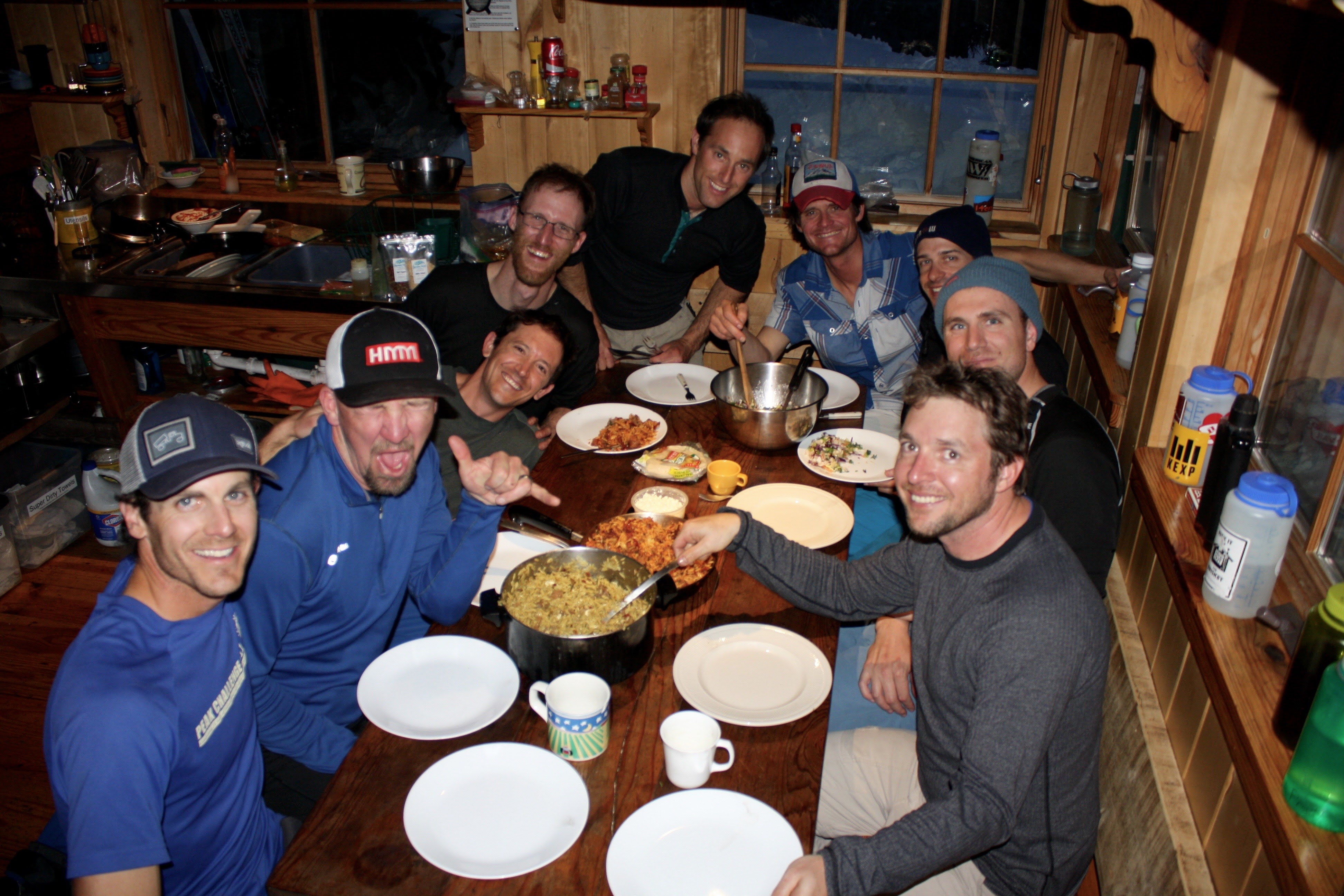
Taco dinner at Markley. Photo by Derek
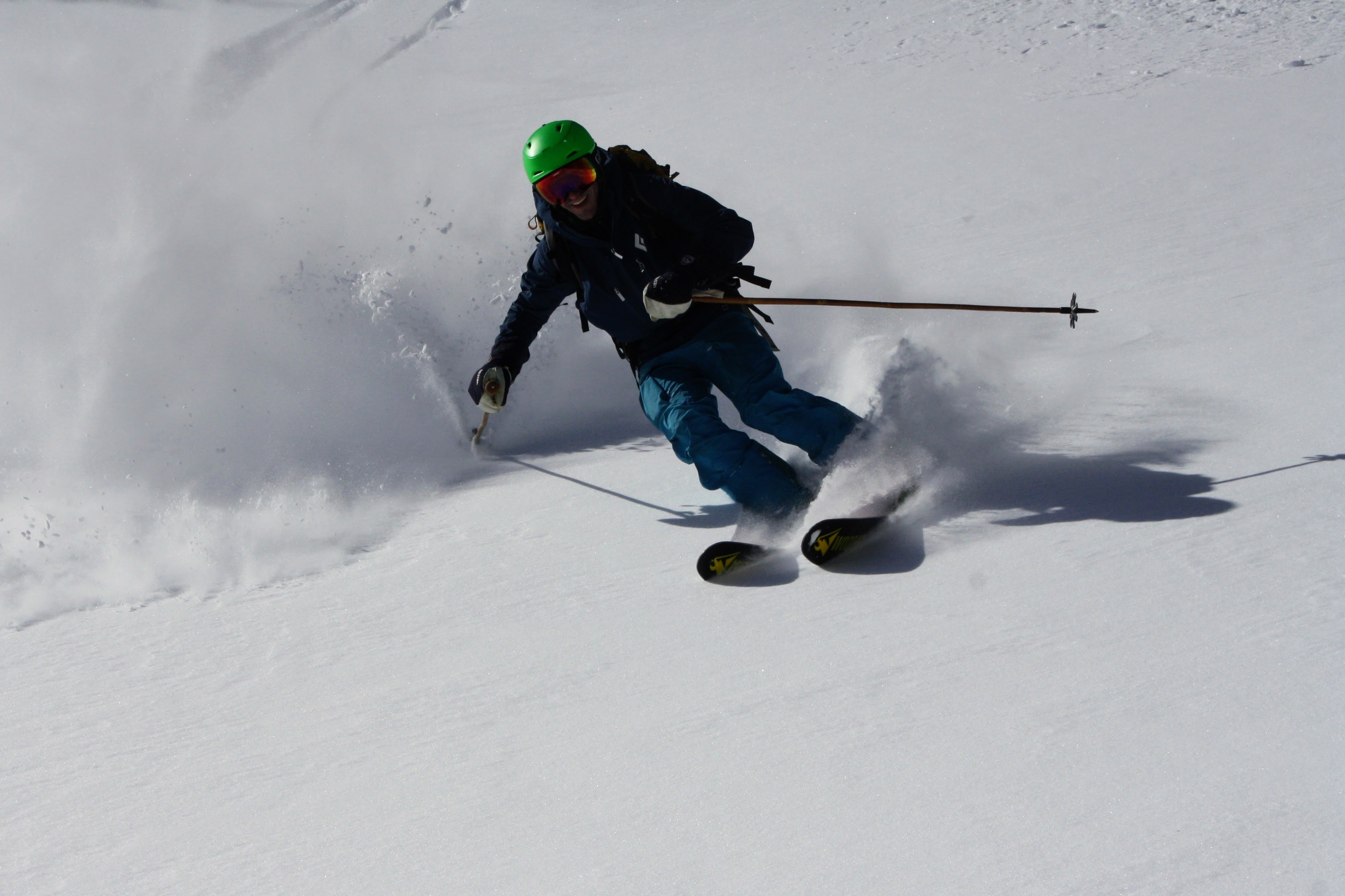
Joel, Derek, Jesse, & Mikey made some early morning runs on the other side of Express Creek in about 9″ of fresh powder while the rest of us made breakfast and drank coffee.
Early morning powder harvested by Mr. Gratz. Photo by Derek
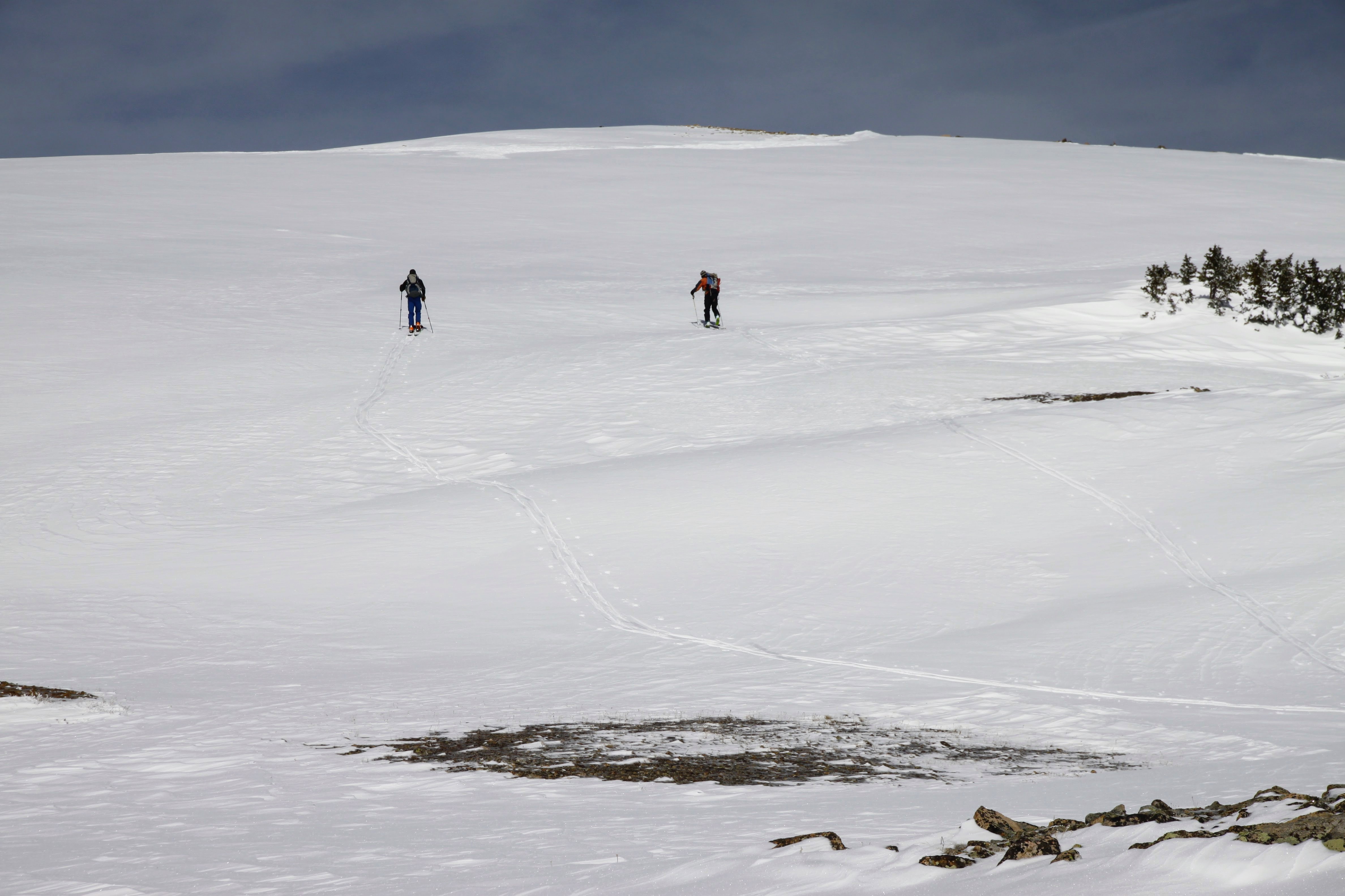
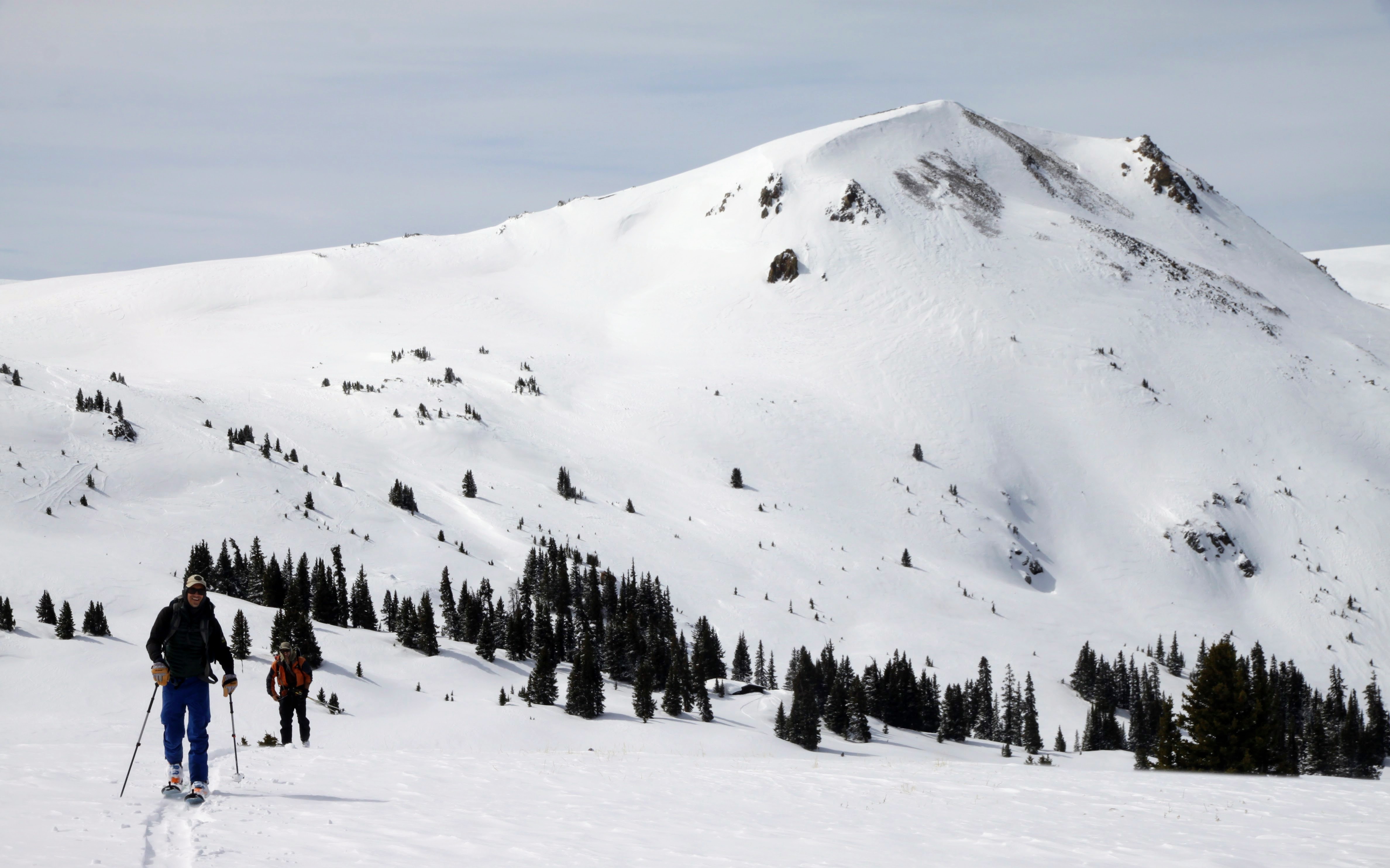
The next morning before departing to the Goodwin Greene Hut
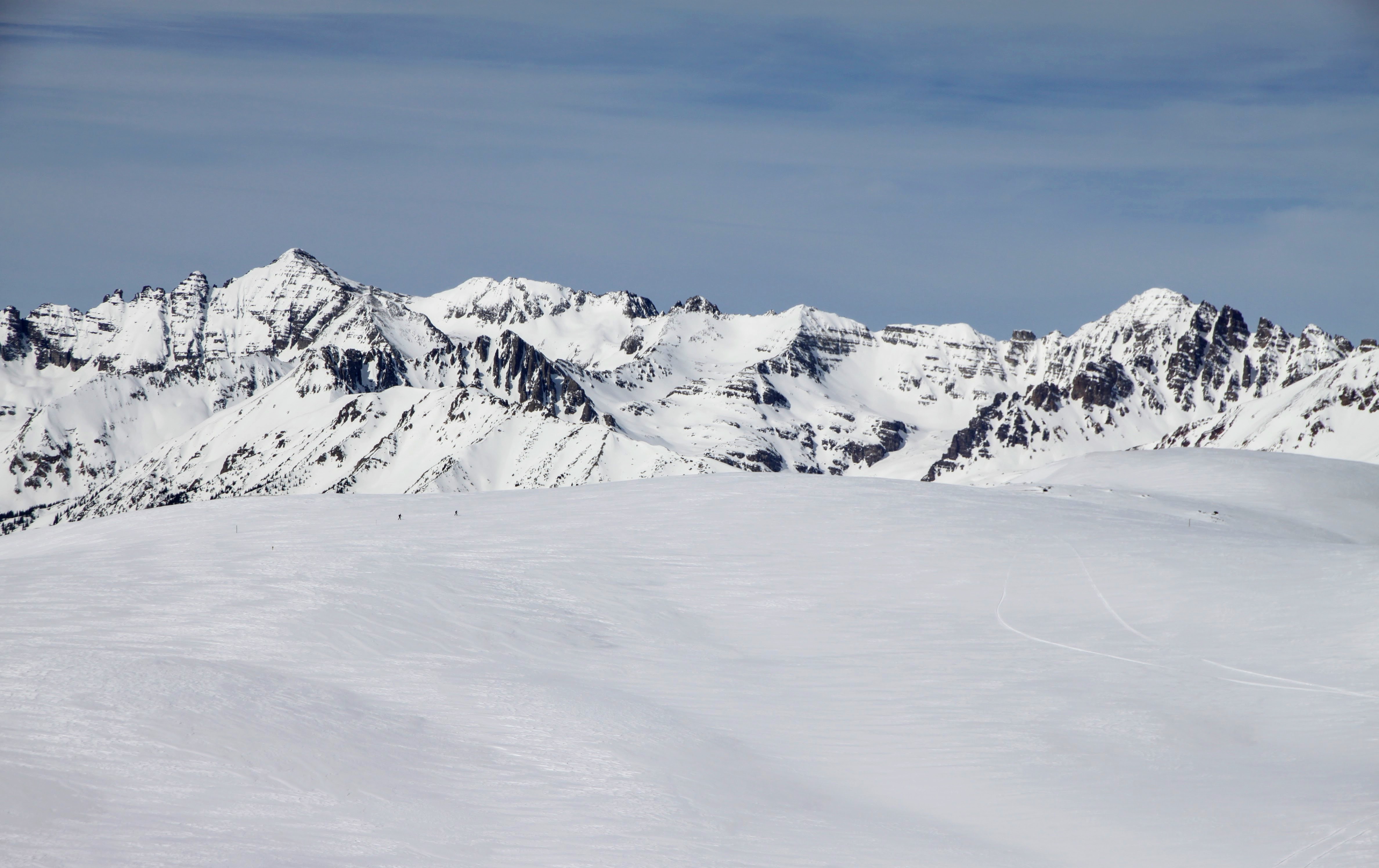
On Friday around noon we departed for the Goodwin Greene Hut. It was a nice skin up the road breaking trail a few miles before heading north of a drainage and over the Richmond Ridge plateau.
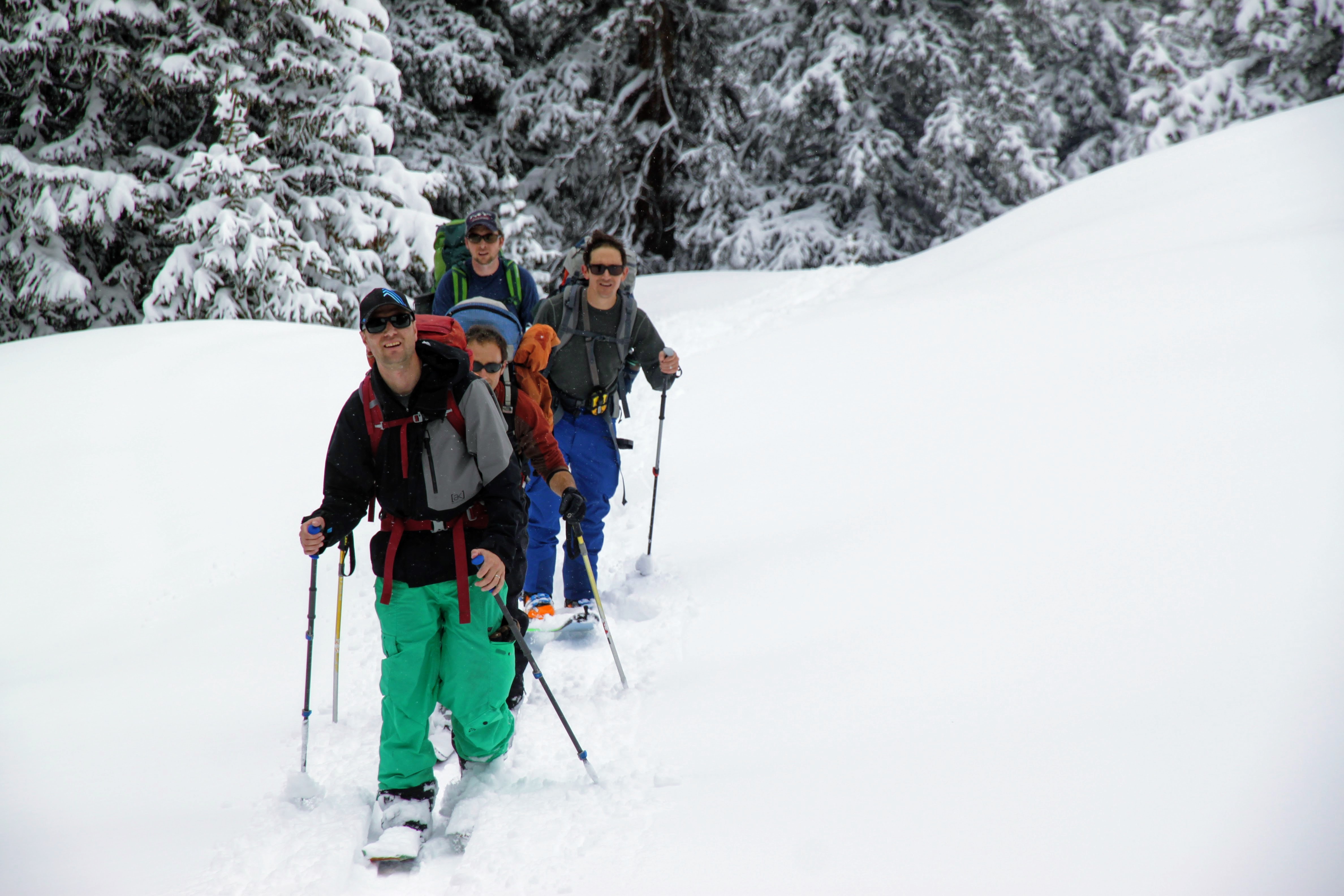
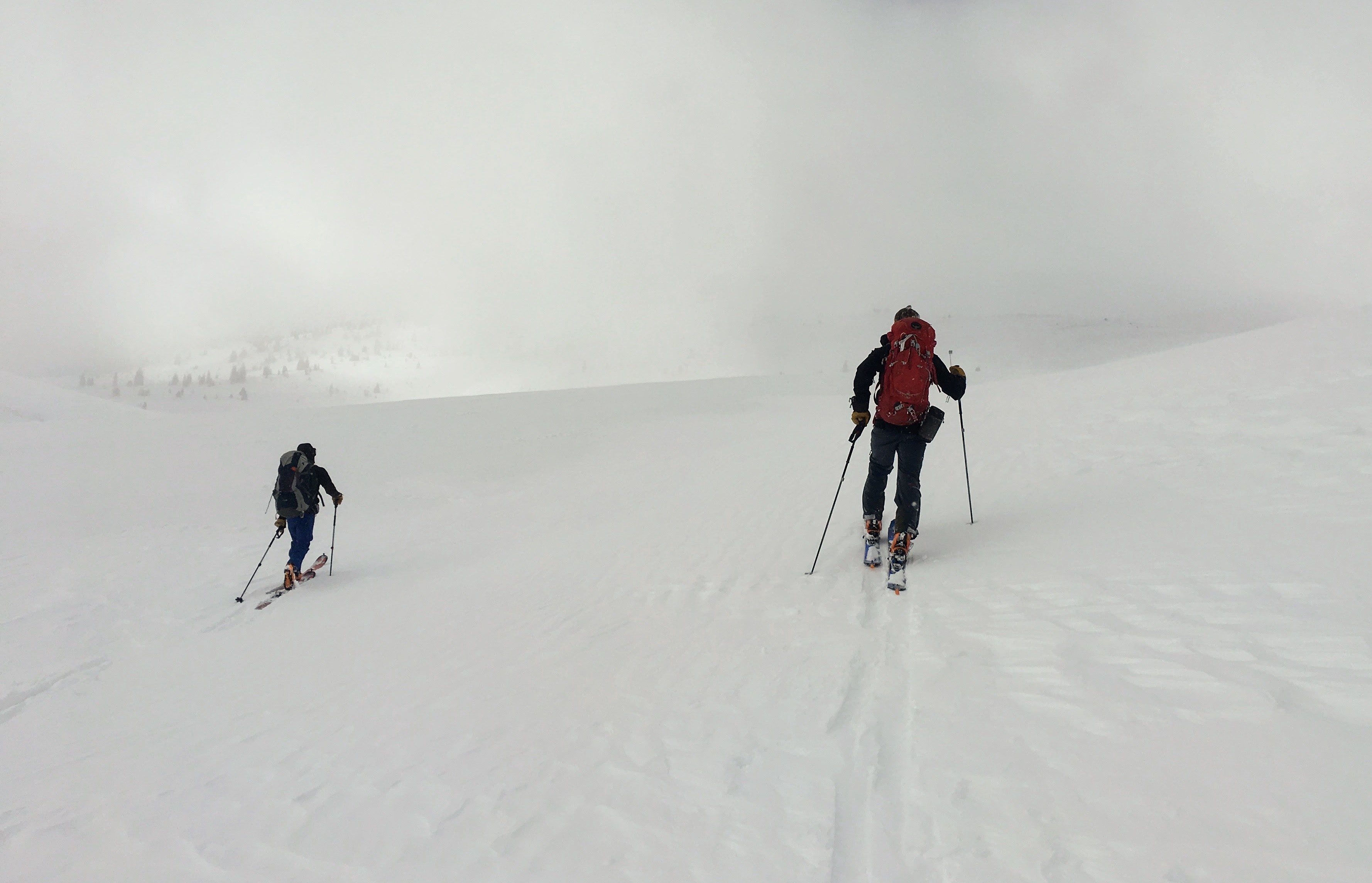
Joel and crew skinning up the Express Creek drainage
Nico plowing ahead in front of me here in this pic. Photo by Joel
Mikey leading the pack
The crew at the 12,000′ pass
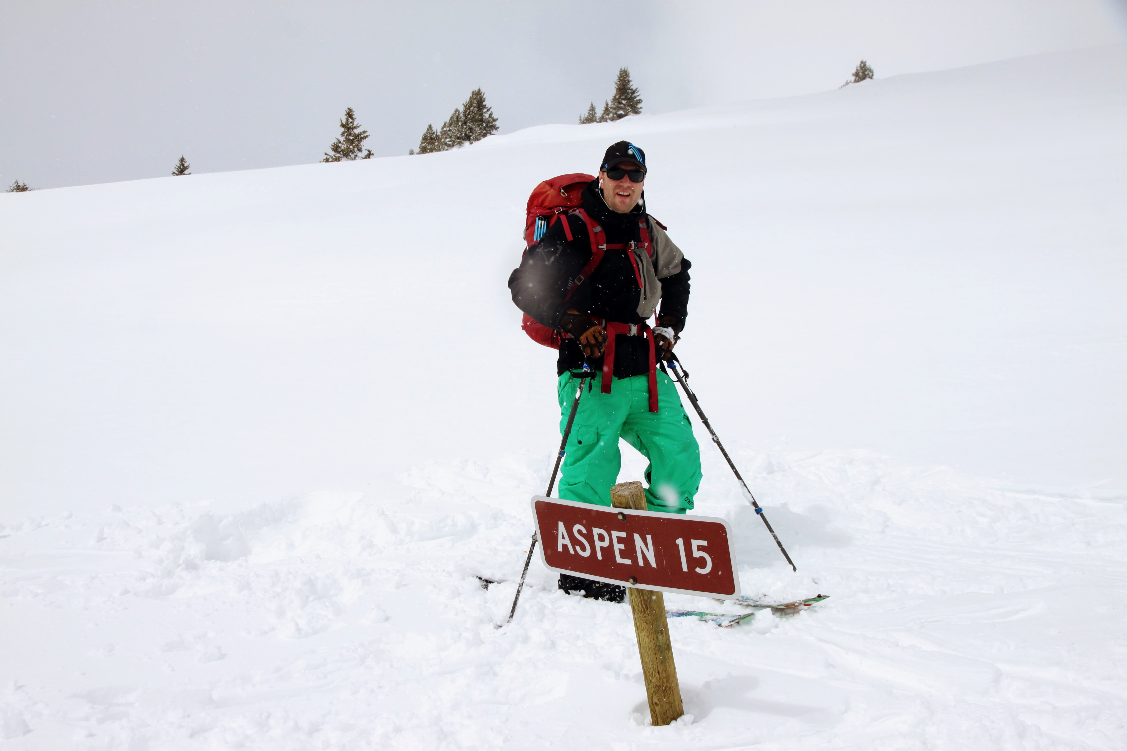
Long ways to Aspen via Richmond Ridge
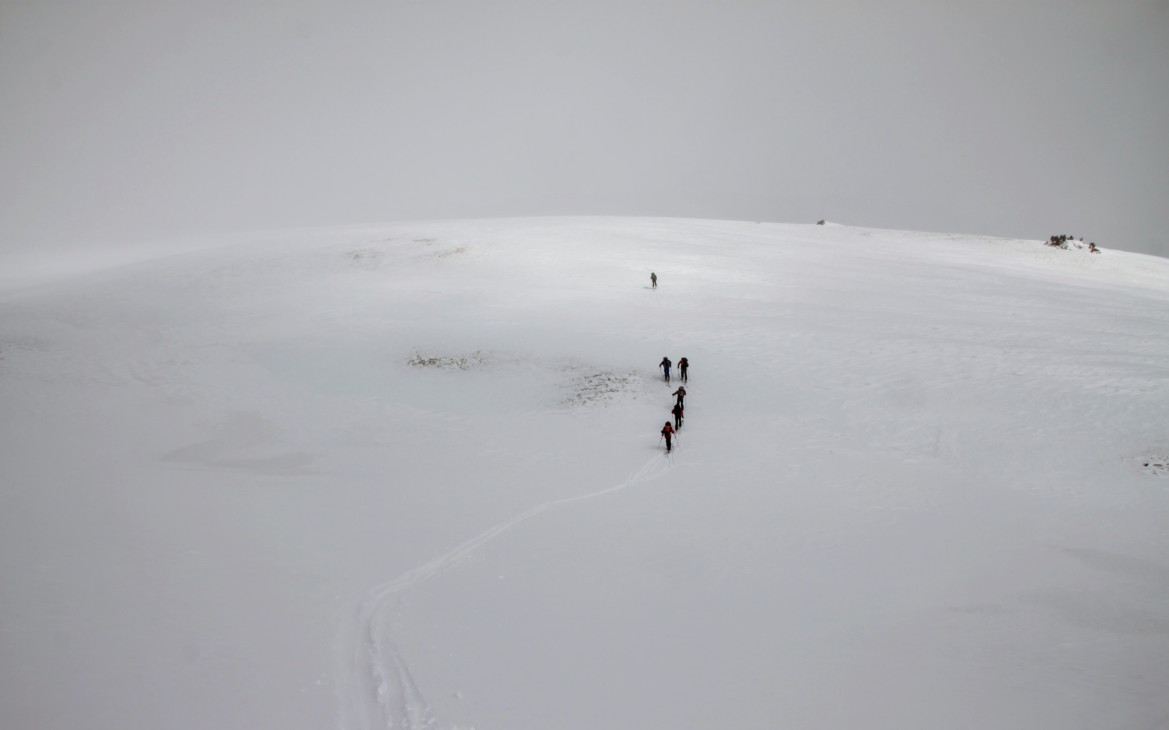
A little bit of navigating over the broad, treeless plateau was necessary until we dropped a few hundred vertical down into the Difficult Creek drainage on the northeast side of Gold Hill to the hut.
The boys heading across the alpine plateau
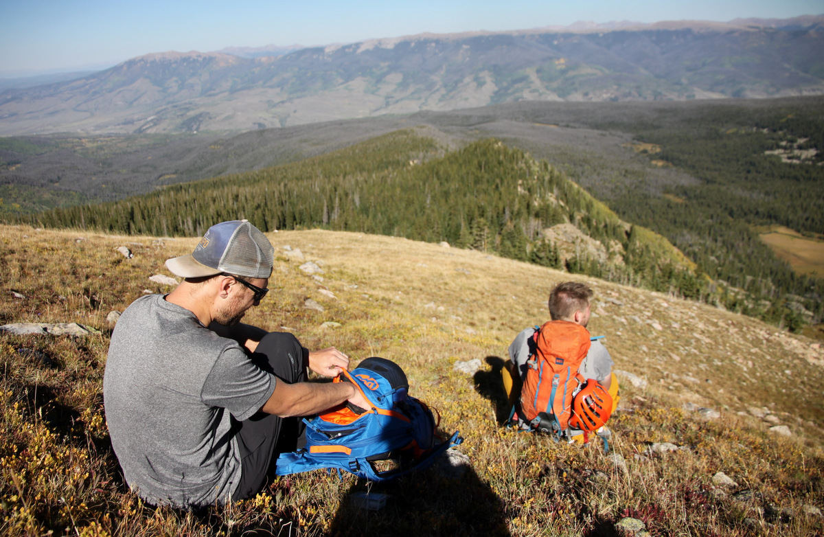
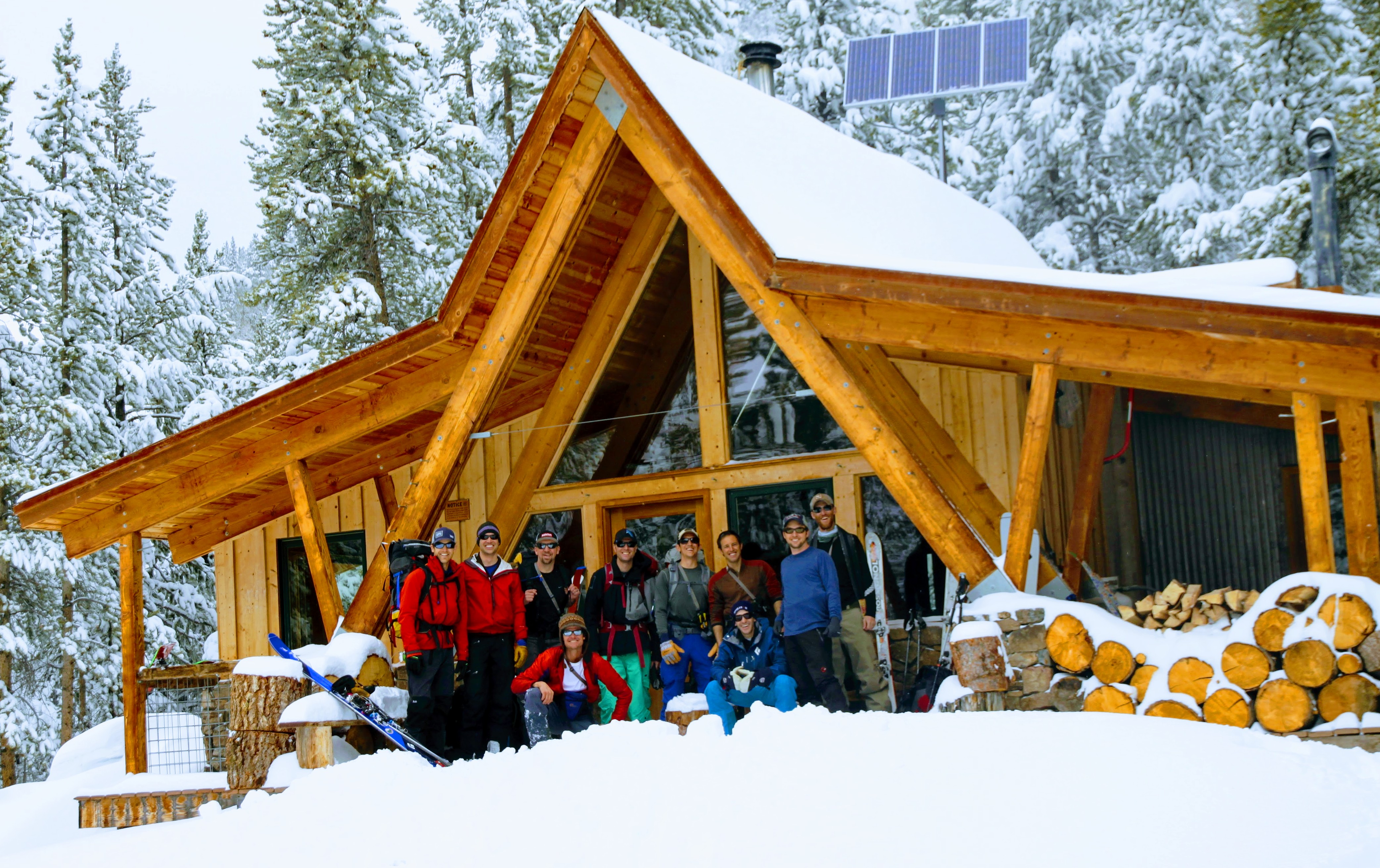
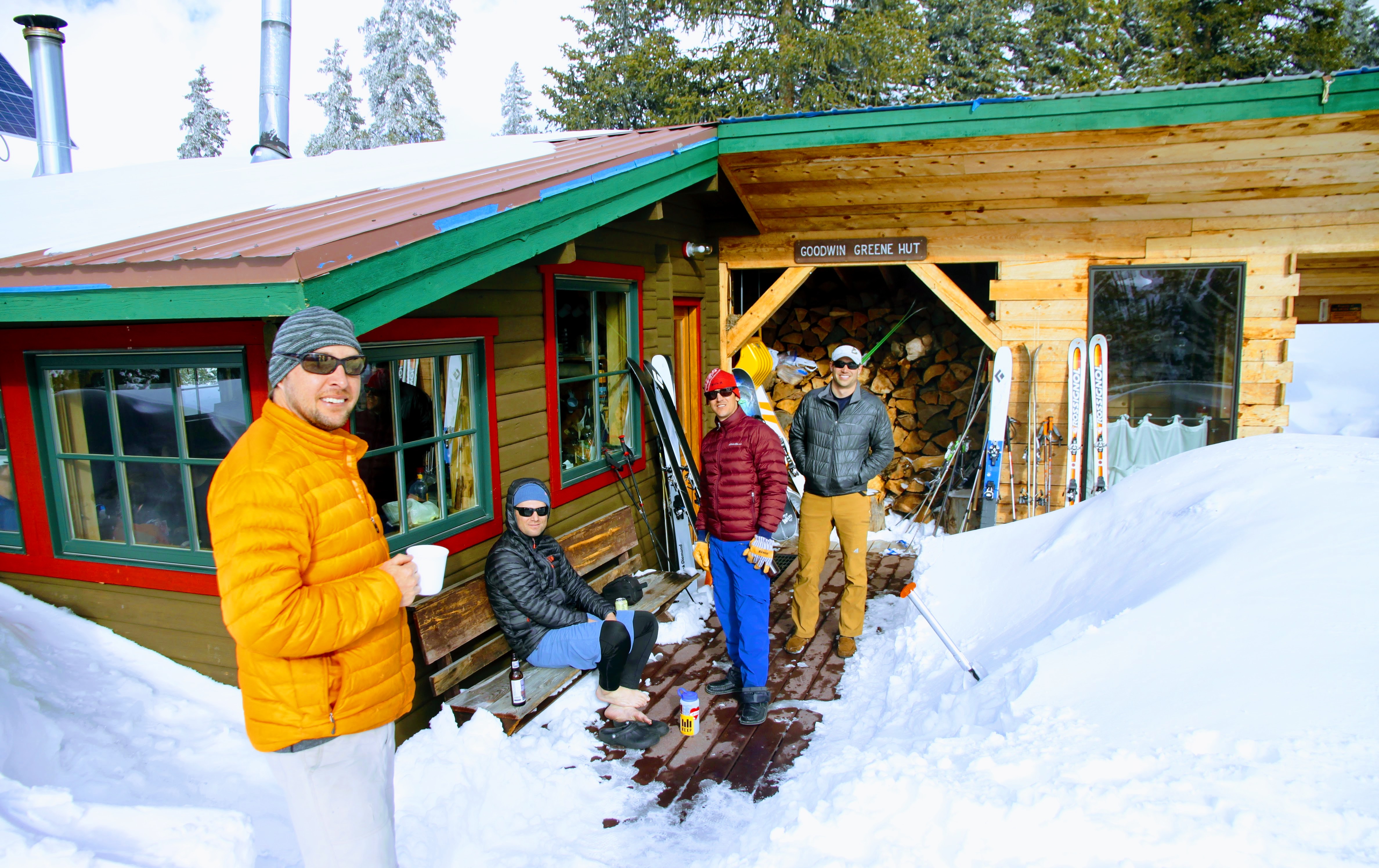
Jesse, Mikey, Chuck, & Derek outside the Goodwin Greene hut
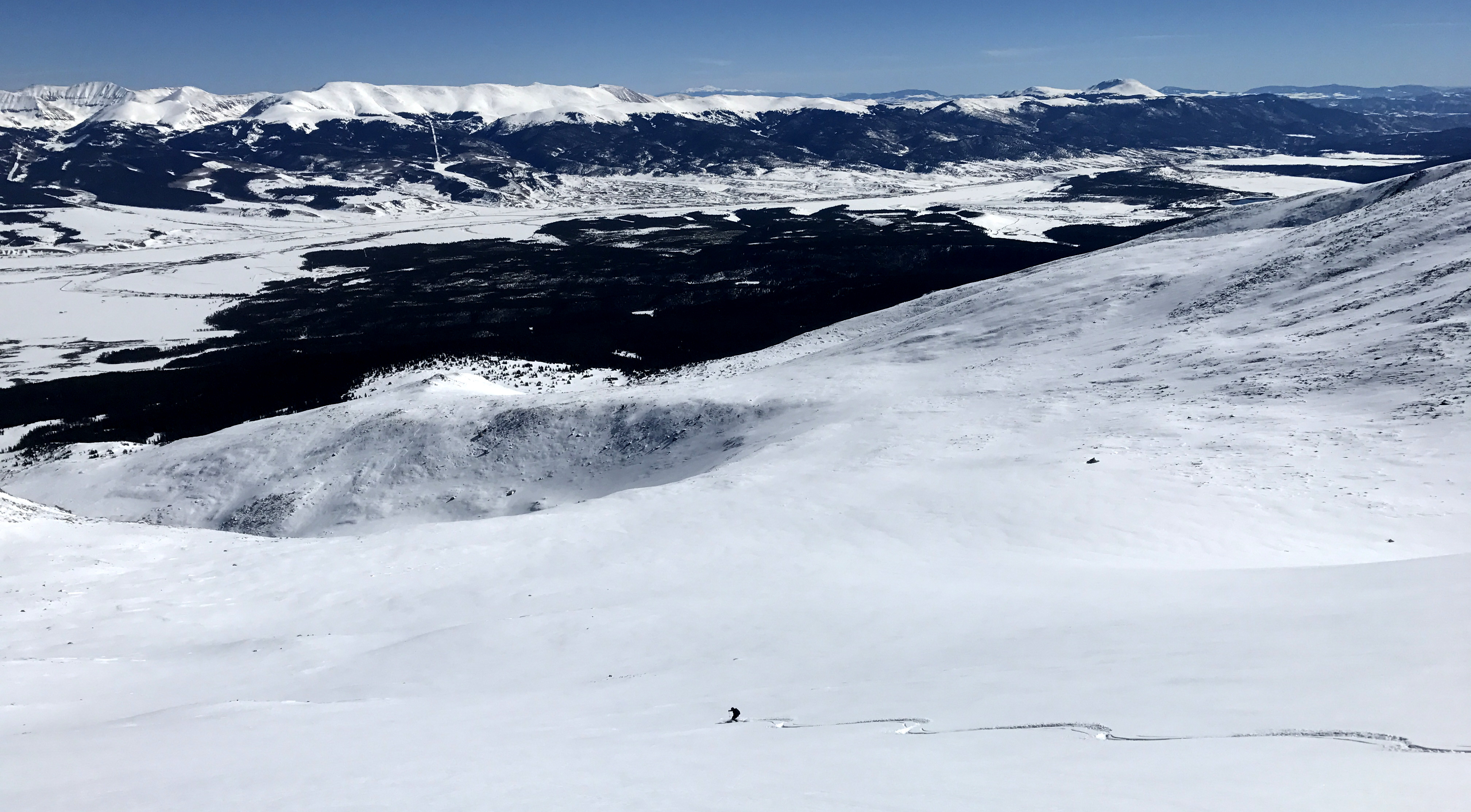
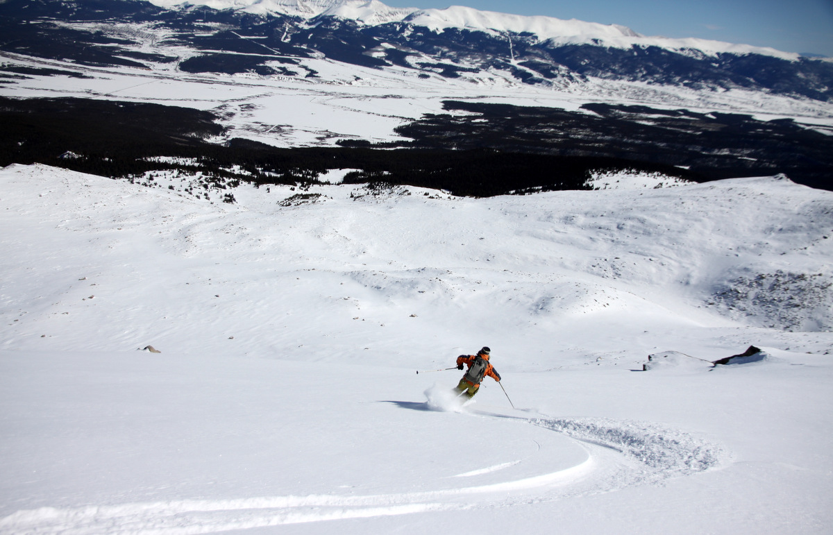
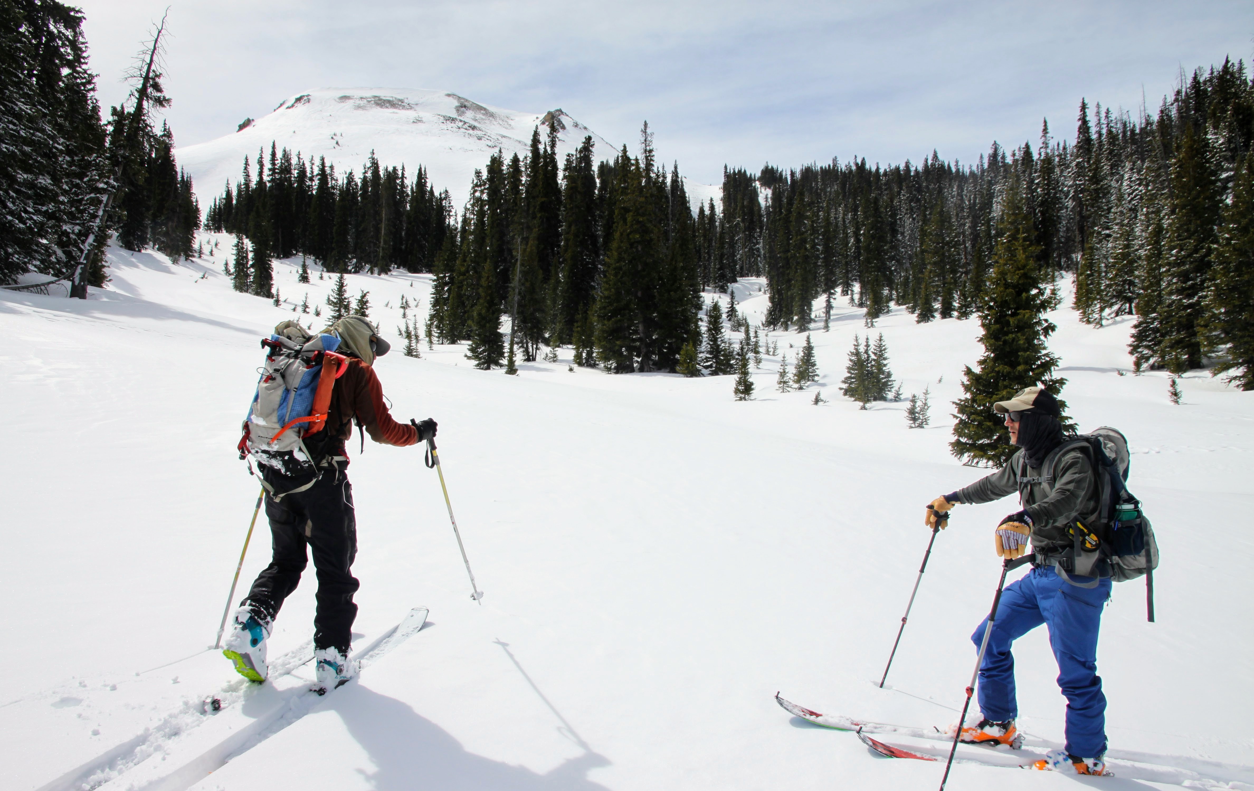
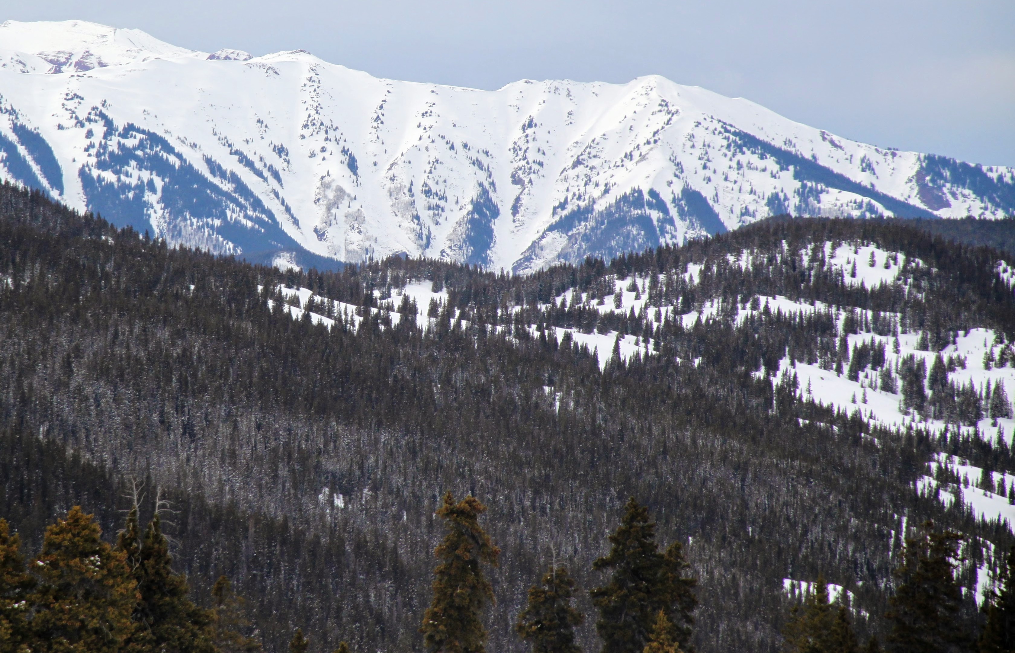
It took us about 3 hours from the Markley to the Goodwin Greene hut, so not too bad. We had two nights at the Goodwin Greene hut, which was extra nice since we could ski tour all around the hut the following day (Saturday). I slept right next to the wood stove and with Mikey stoking it all night, it was an oven in there 🙂 J and I were sweating going to sleep. Anyway, a crew (Nico, Mikey, Brett, Derek, & Joel) went out around 8am to ski the northeast facing glades at the head of the Difficult Creek drainage. The rest of us drank coffee and made breakfast and then we set out to summit Gold Hill and ski down to meet the early crew. The 700′ skin up Gold Hill was fun and we could see the Grand Traverse racers on Richmond Ridge going from Crested Butte to Aspen.
J and Chuck skinning up Gold Hill
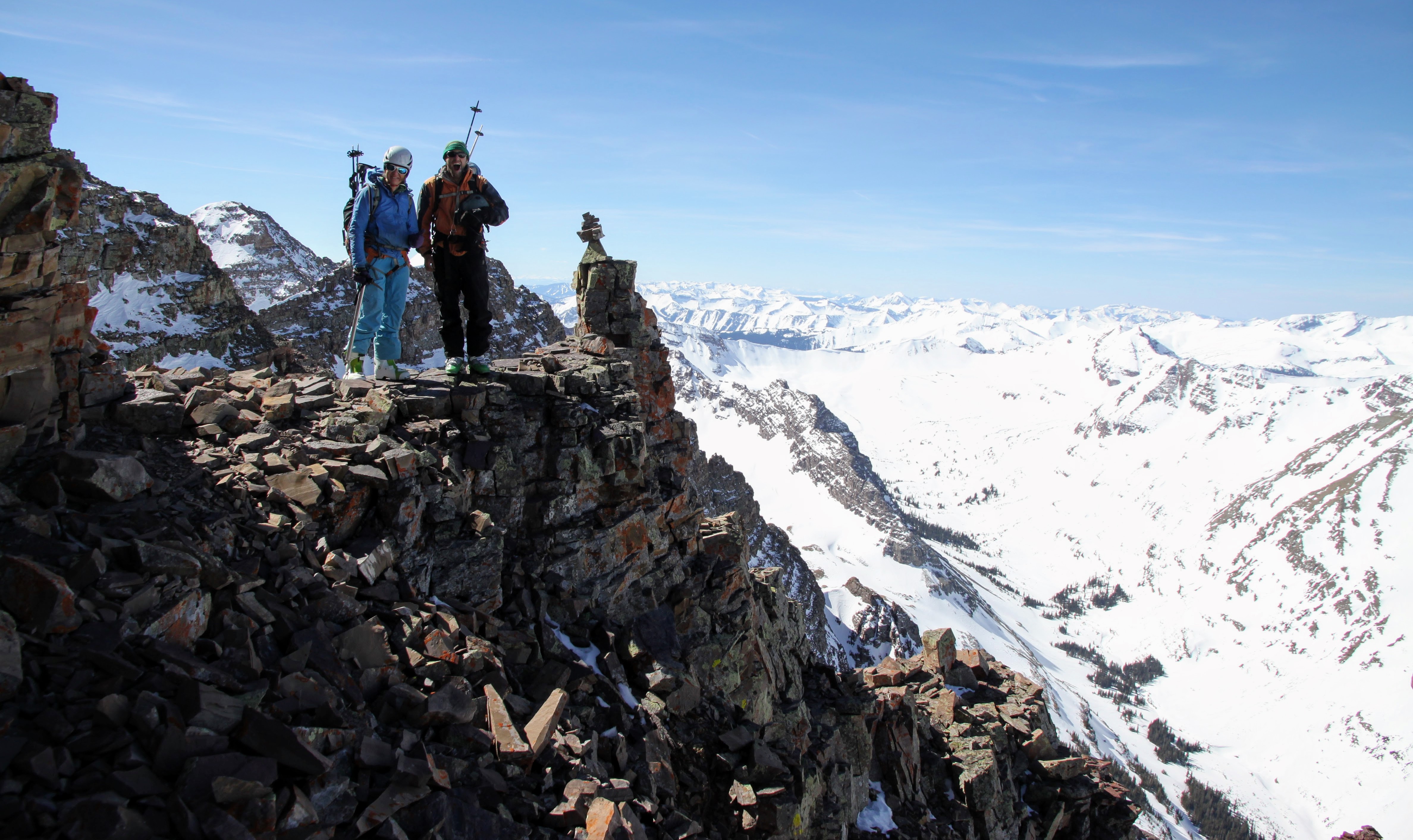
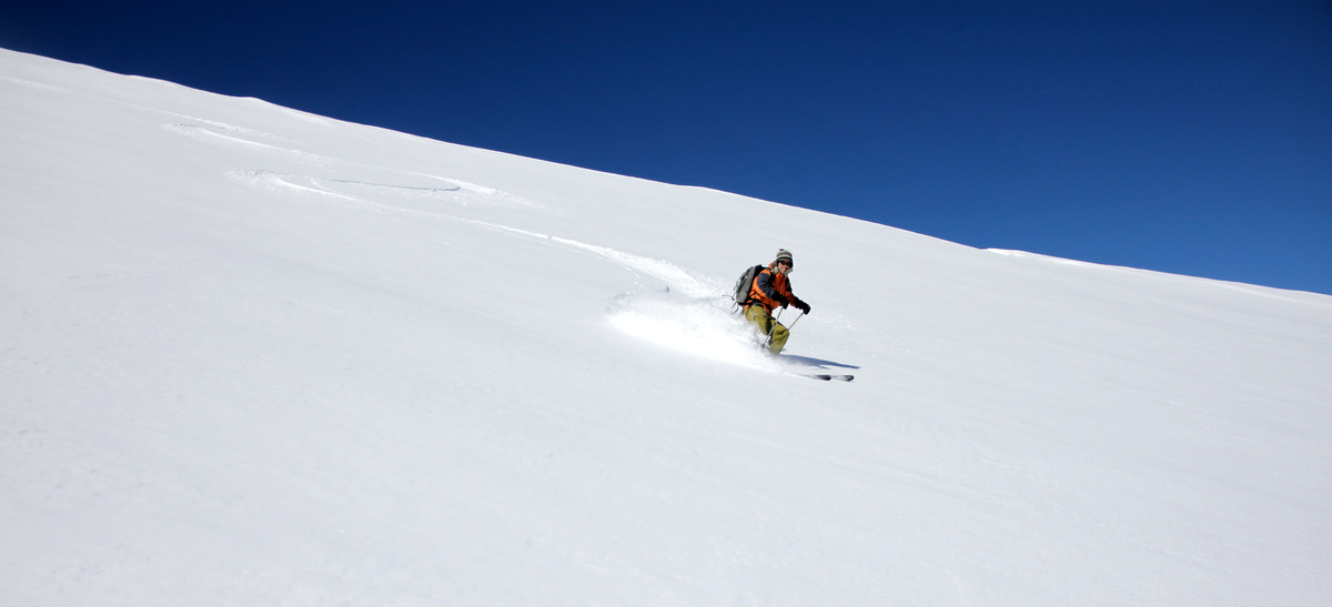
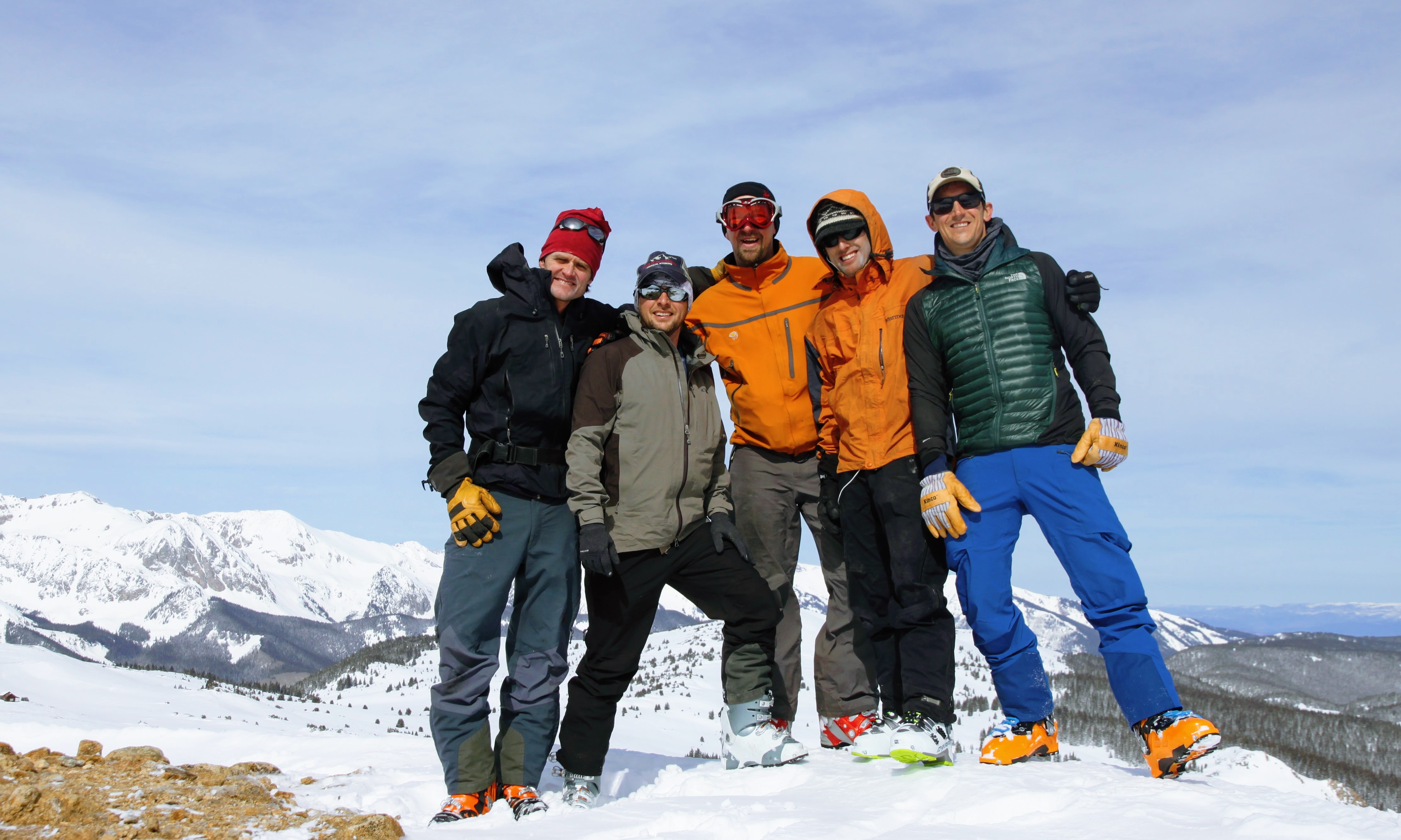
Gold Hill summit (12,361′). Left to Right: Me, Jesse, Matt, J, & Chuck
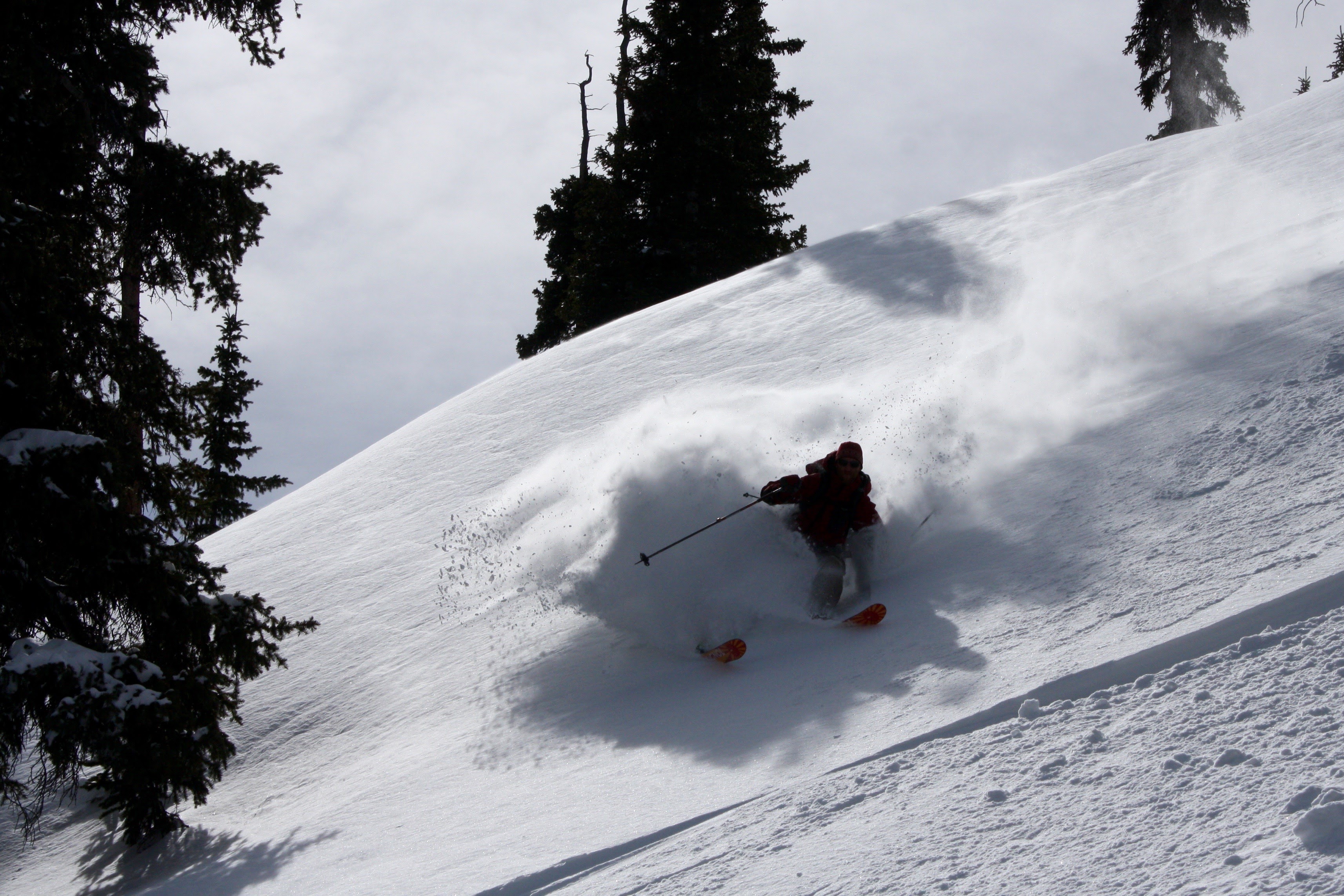
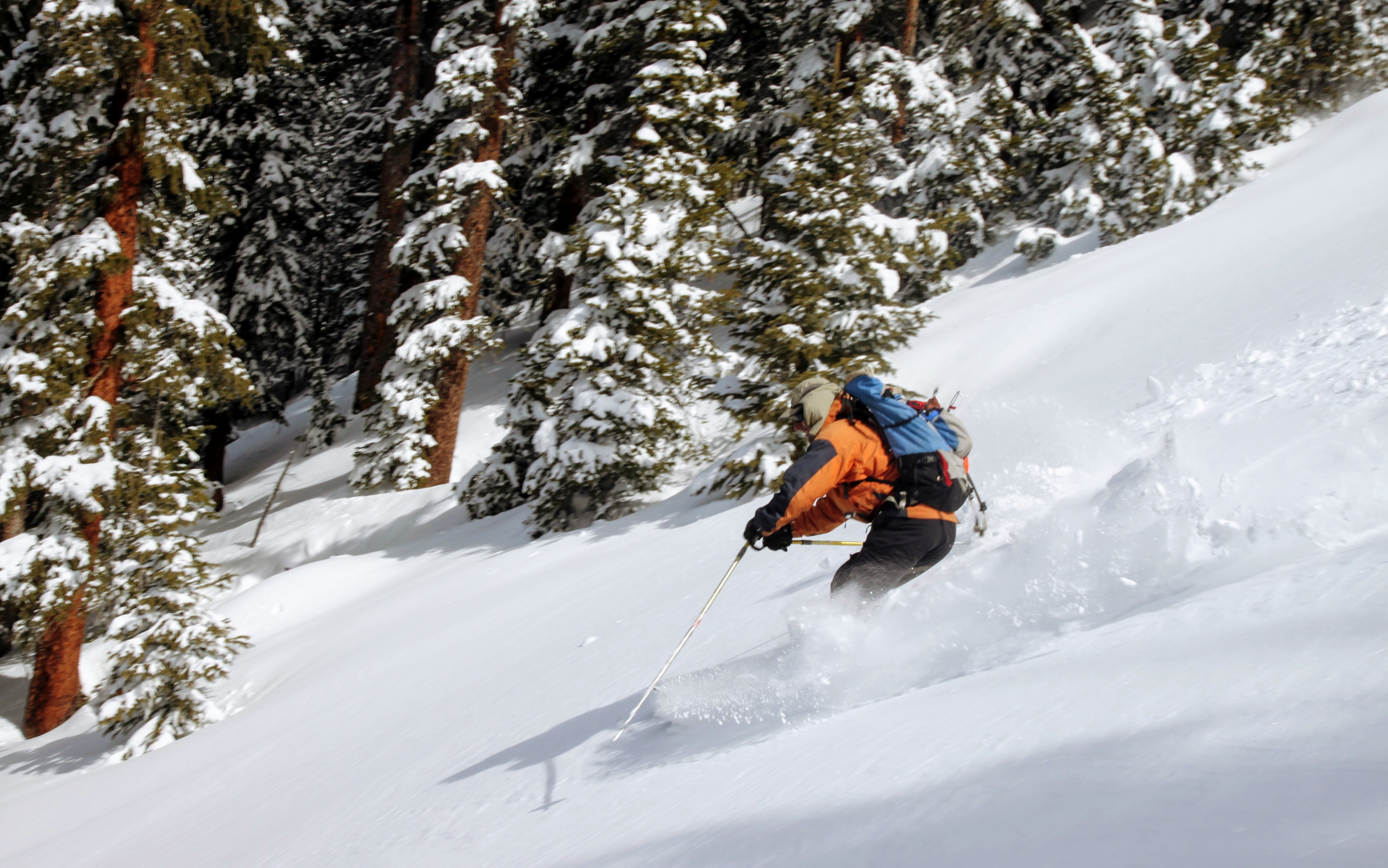
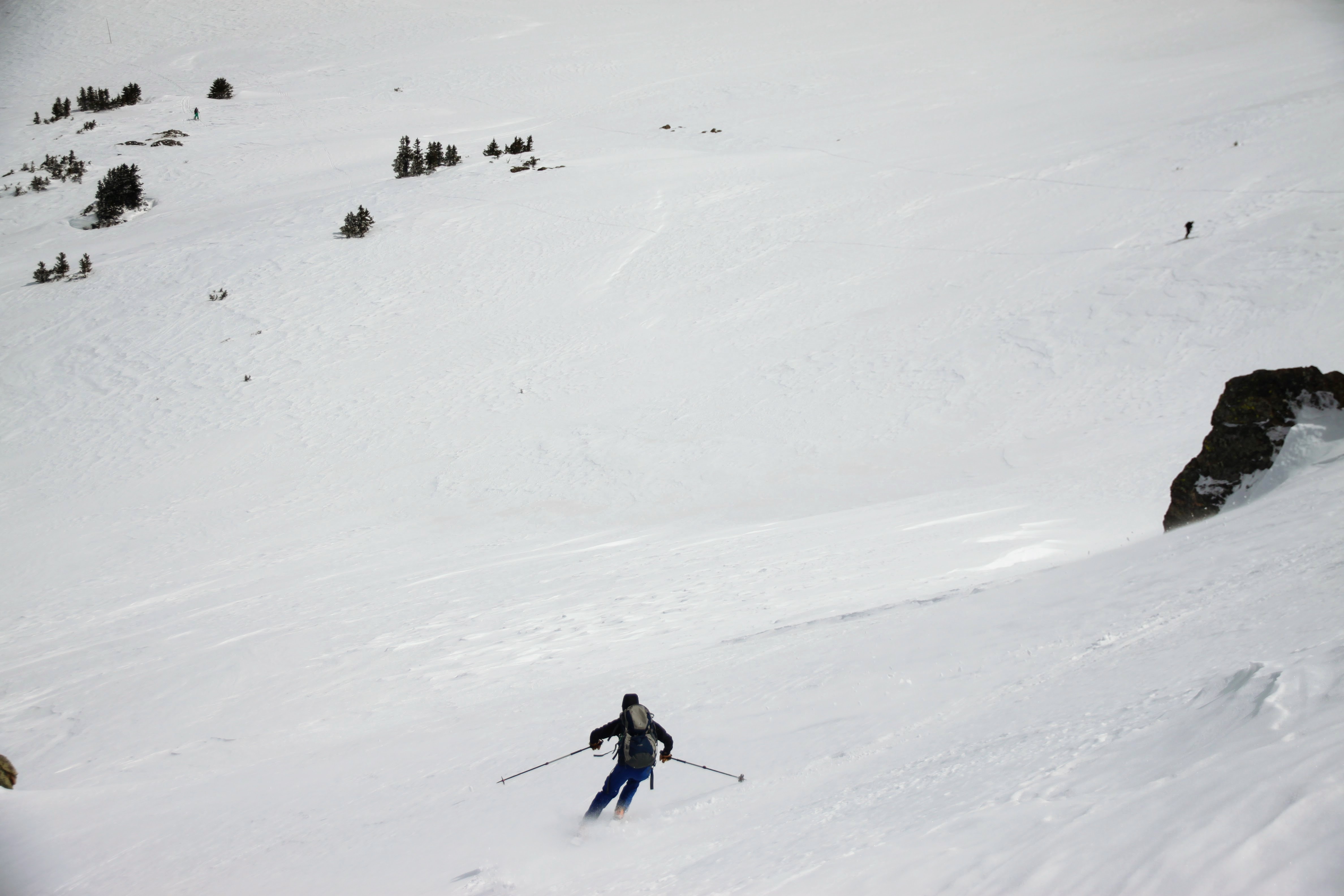
Chuck, J, & I skied a pretty cool north-facing couloir line off the summit ridge down to the early crew while Matt and Jesse skied around.
Chuck skiing the Gold Hill north couloir
Chuck a bit lower down
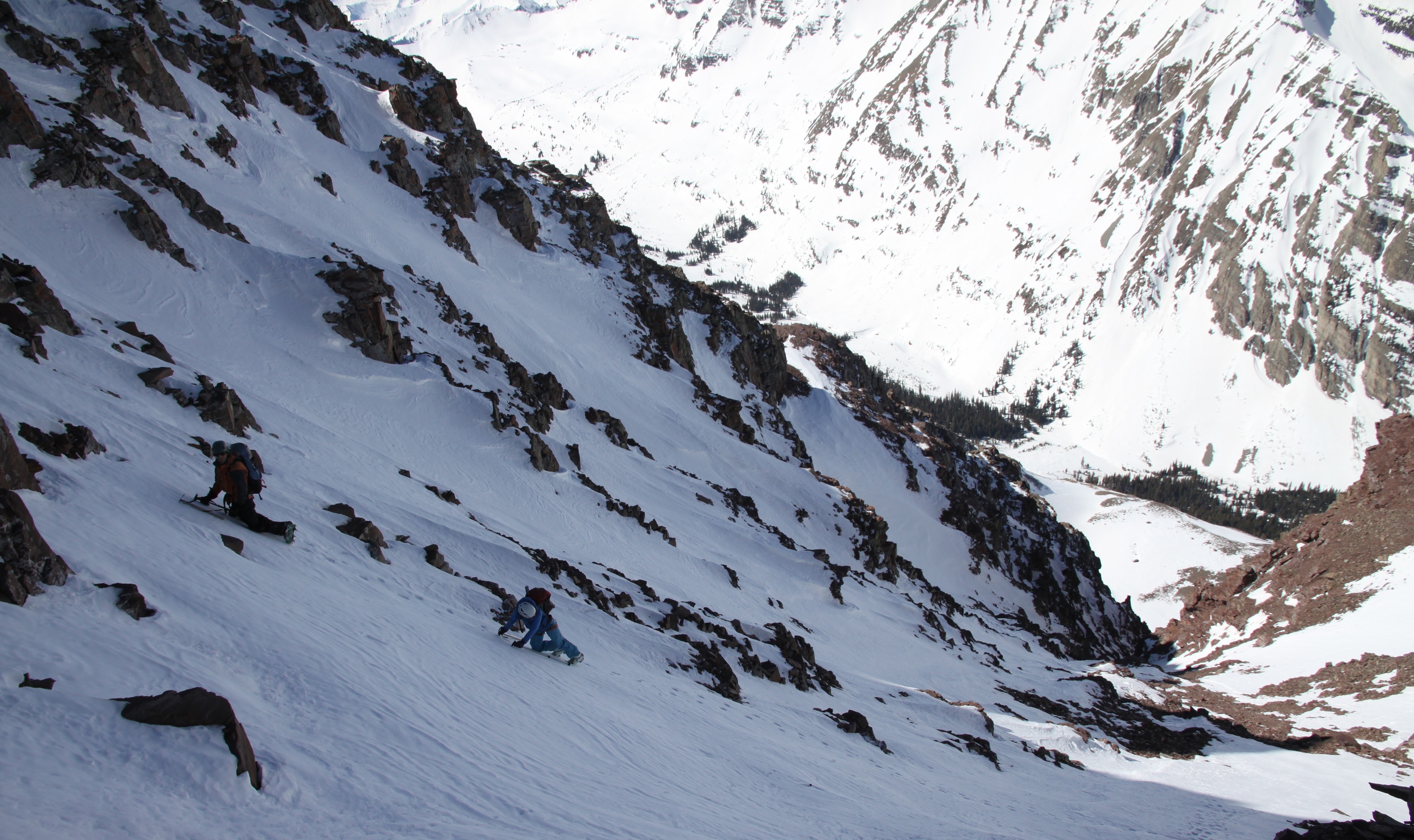
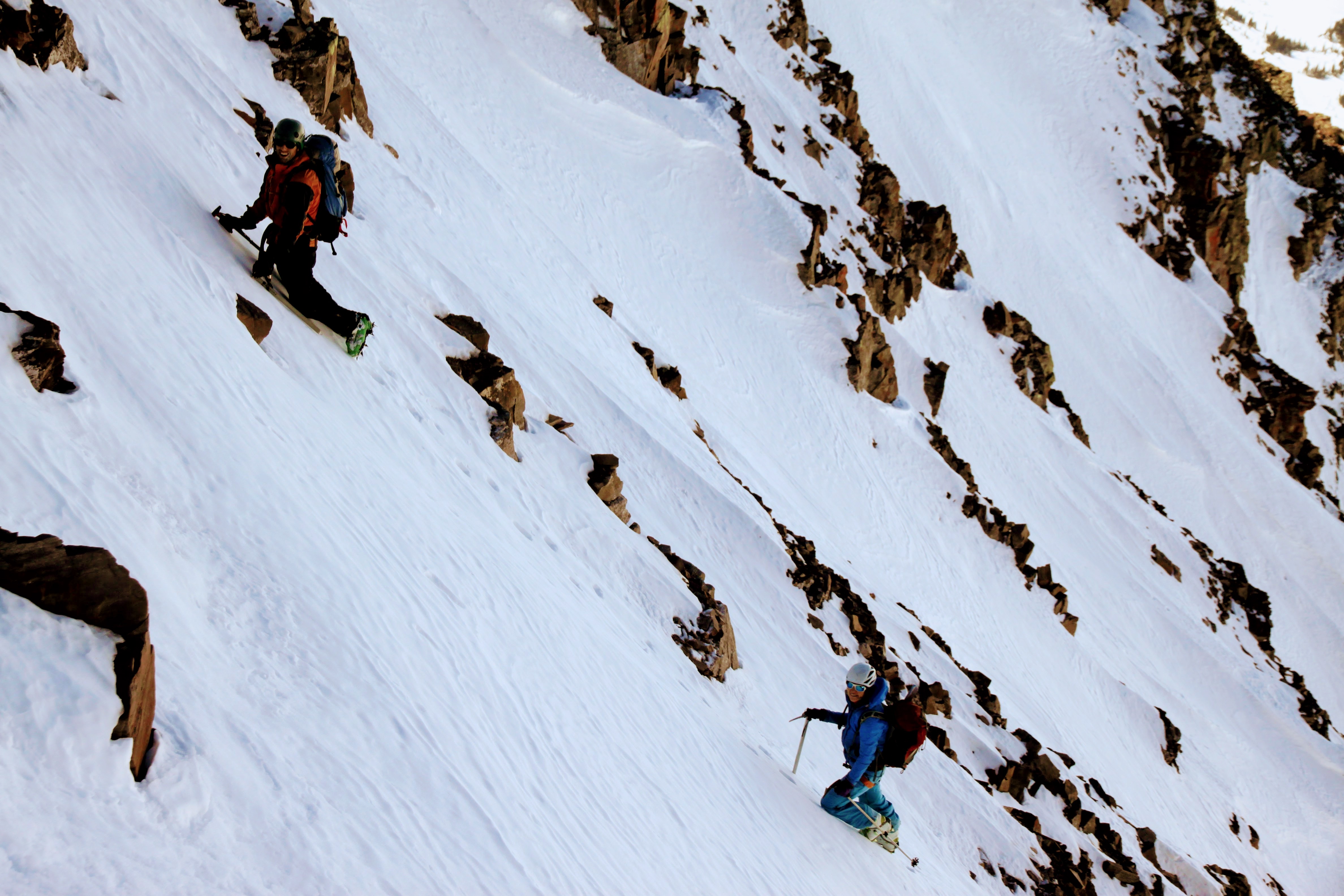
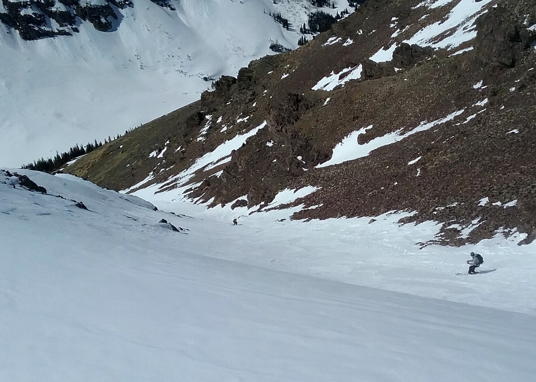
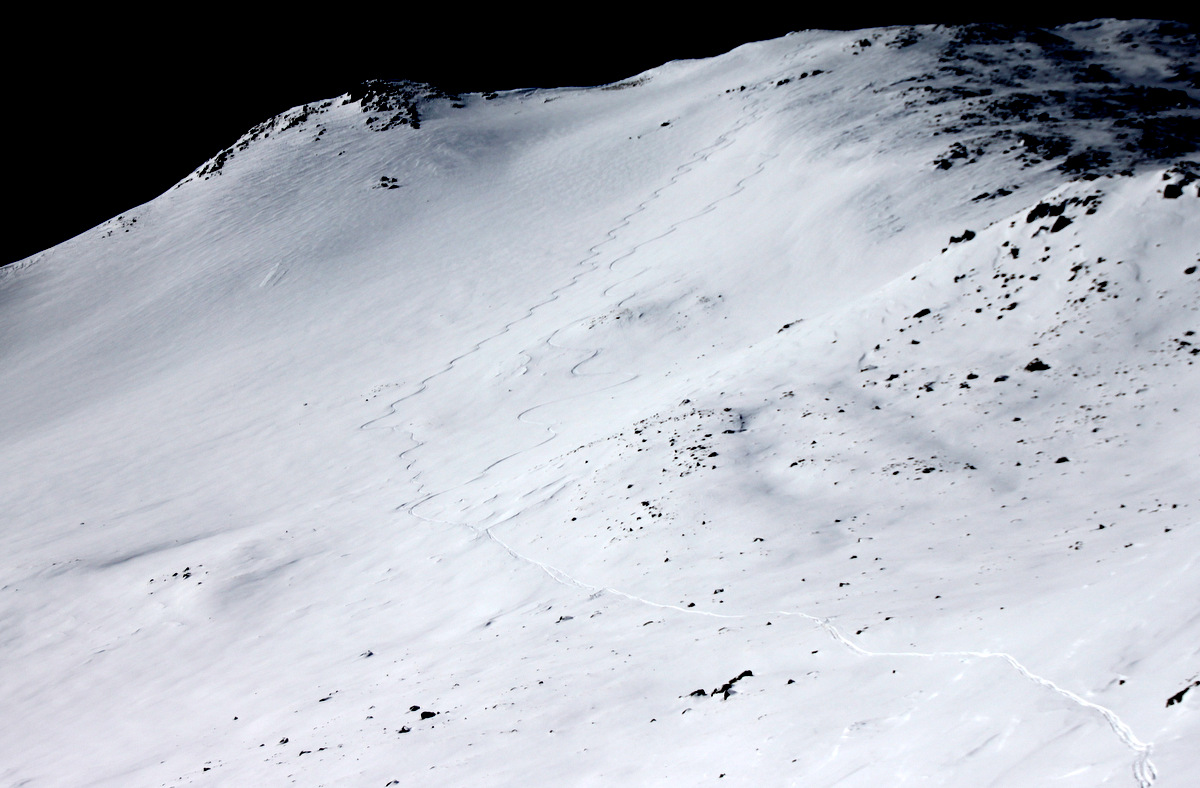
We all skied down to the earlier group learning that after 3 laps they were heading back to the hut. Nonetheless, they beat us to the untracked powder on these lower glades.
Nico dropping the knee. Photo by Derek
Mr. Gratz testing the snow. Photo by Derek
Brett slashing as usual. Photo by Derek
Derek stacking turns. Photo by Joel
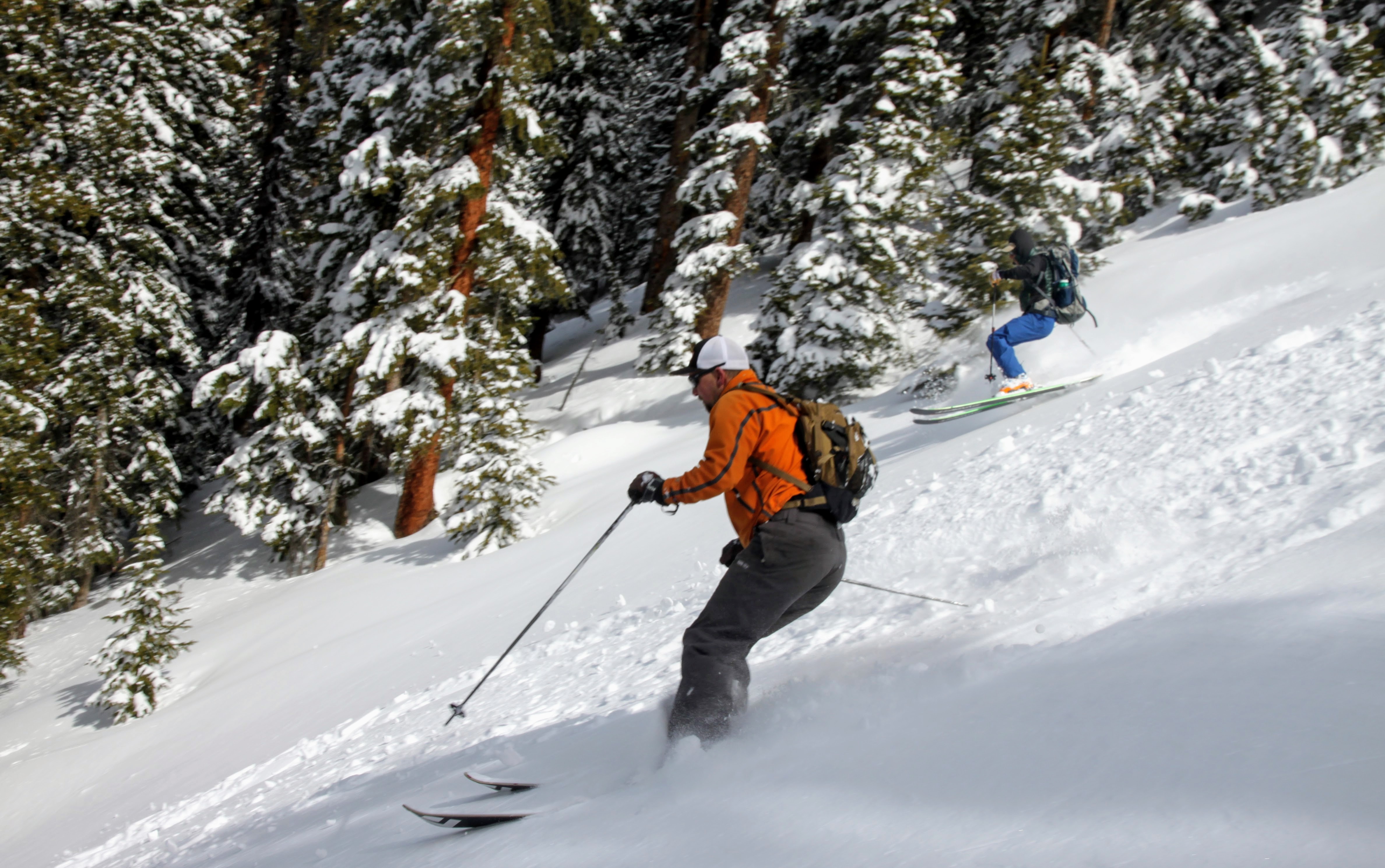
Matt, J, Chuck, and I decided to skin up to another ridge to ski a steeper line through the trees that Chuck spied from Gold Hill.
Skinning up to the ridge with Gold Hill behind. The hut can also be seen in the lower center portion of the photo.
J skling the fun trees back down to Difficult Creek
Matt & Chuck
Once back down at Difficult Creek, Matt decided to head back to the hut while J, Chuck, & I decided to skin up another 1,000′ to the summit of Gold Hill again and ski back to the hut.
Back at the bottom of the Difficult Creek drainage with Gold Hill in front of us
J and Chuck reaching Gold Hill’s summit for the 2nd time
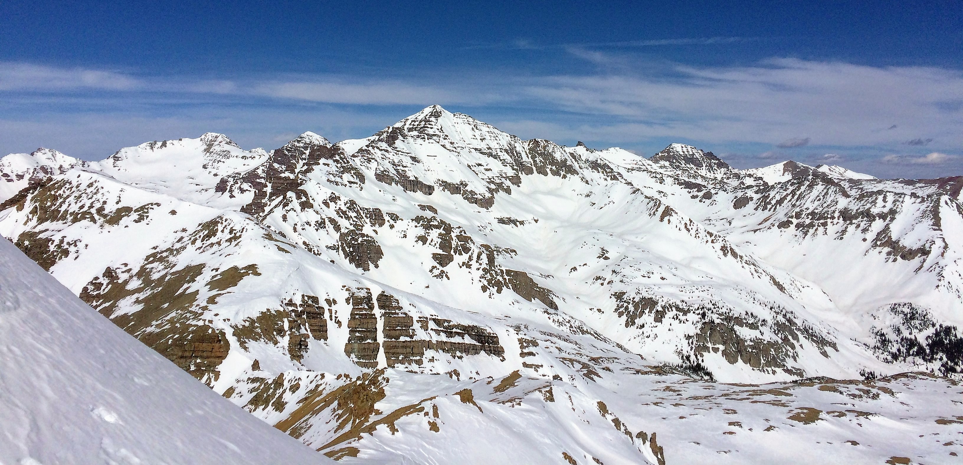
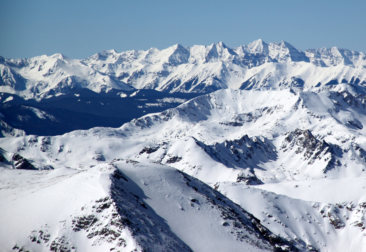
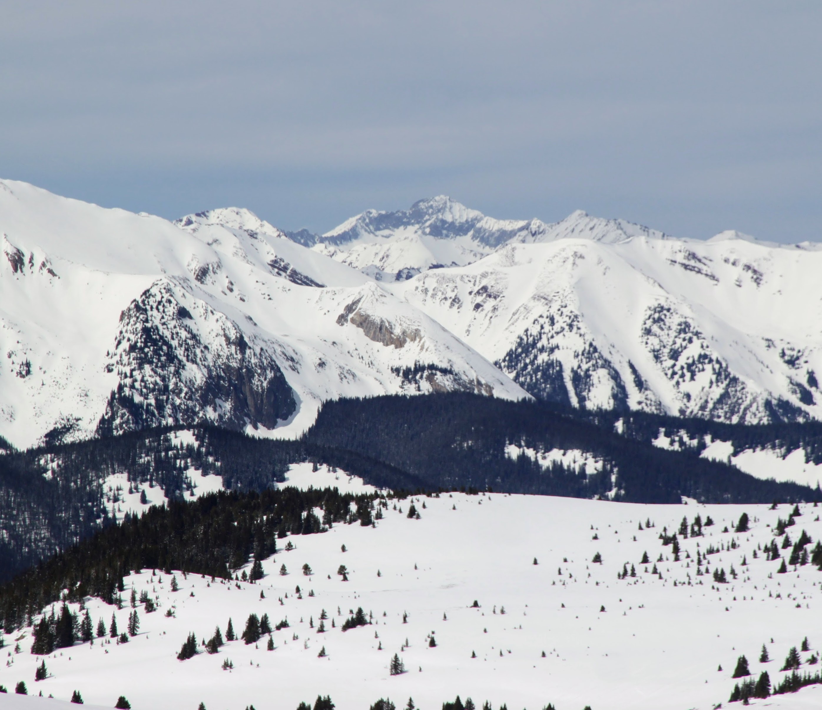
Looking over to 14ers Castle & Conundrum Peaks on the left and high 13er Cathedral Peak on the right from the summit of Gold Hill. Racers can be seen below on Richmond Ridge
14er Capitol Peak in the distance
Highland Ridge and Highland Bowl on the far right
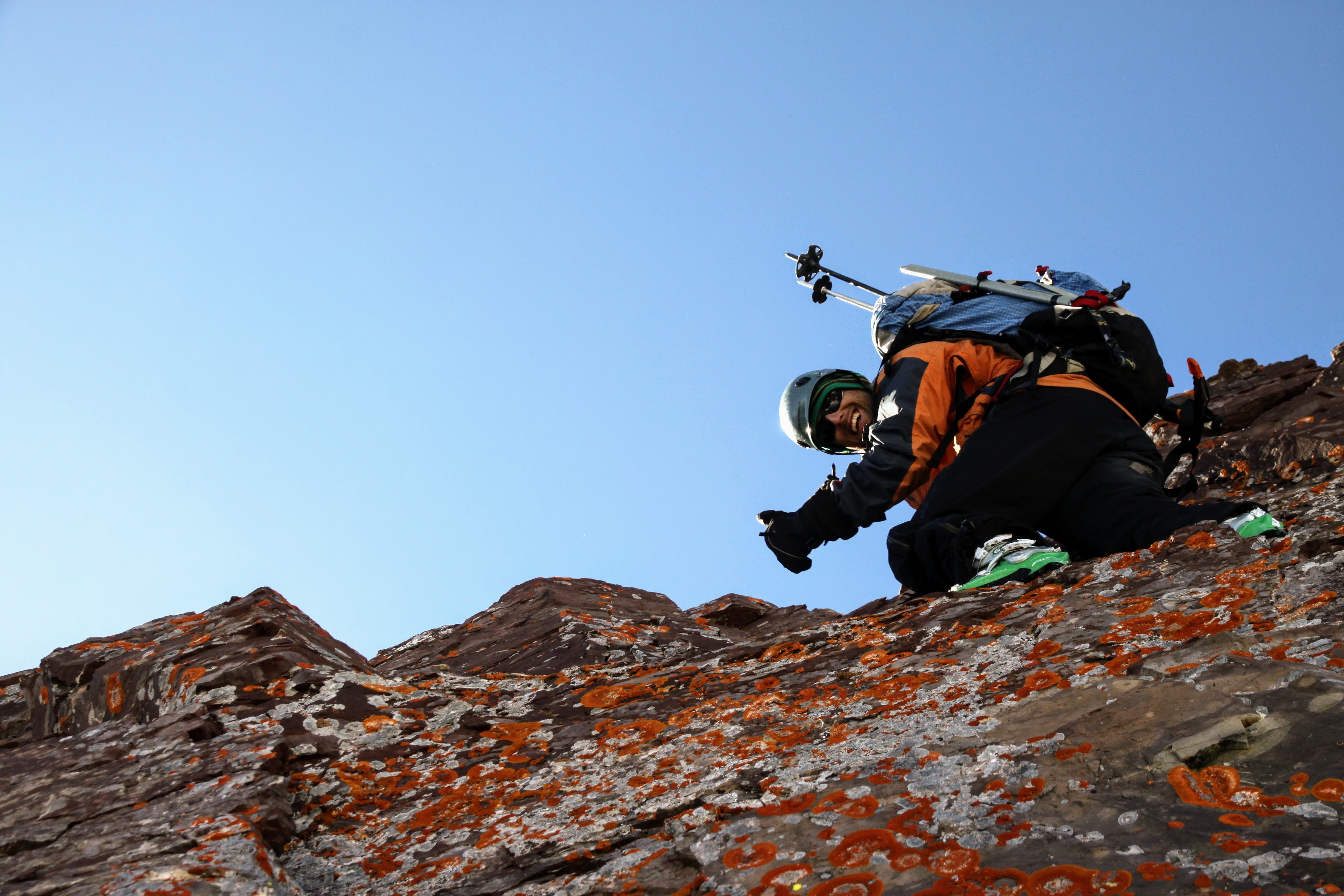
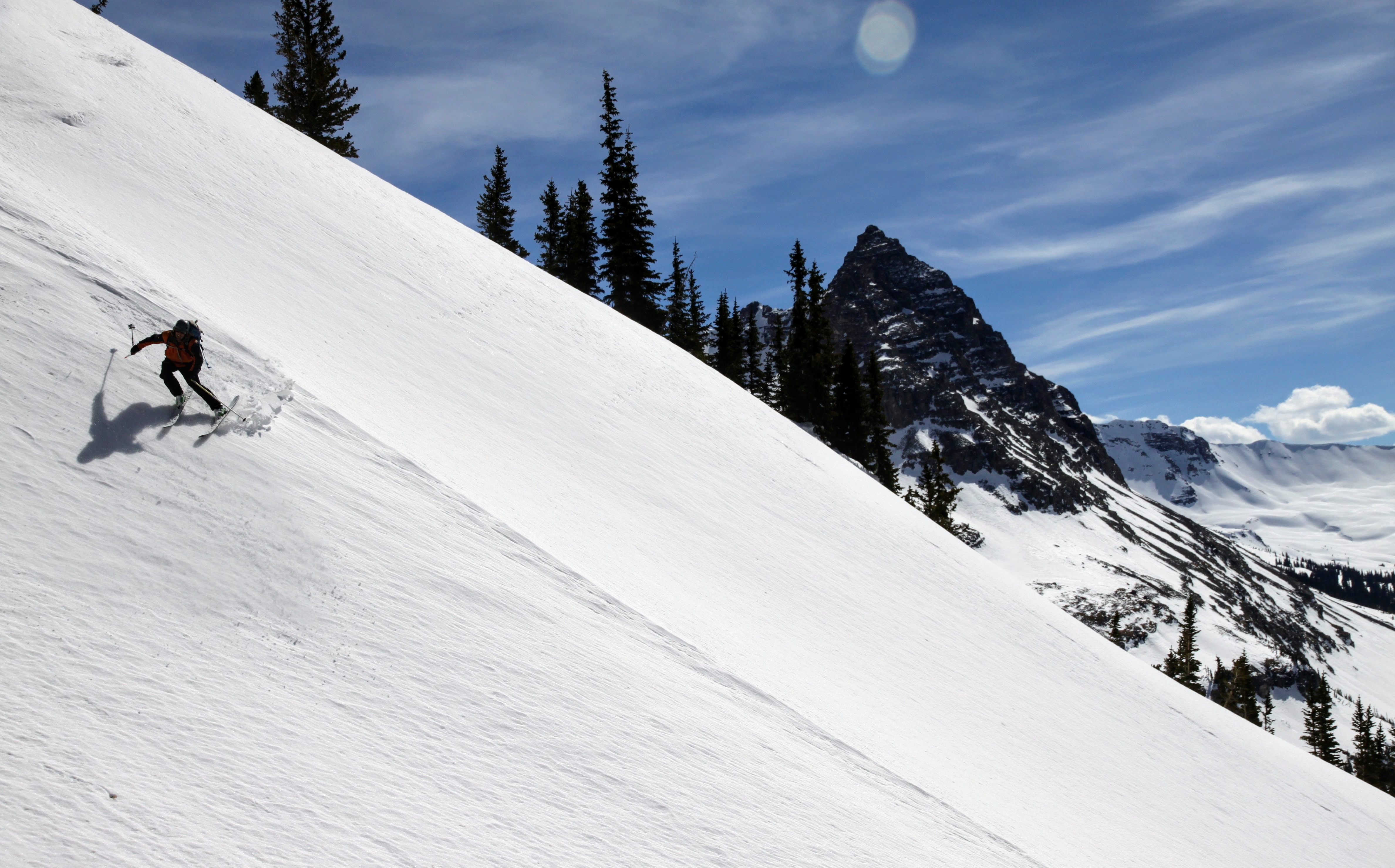
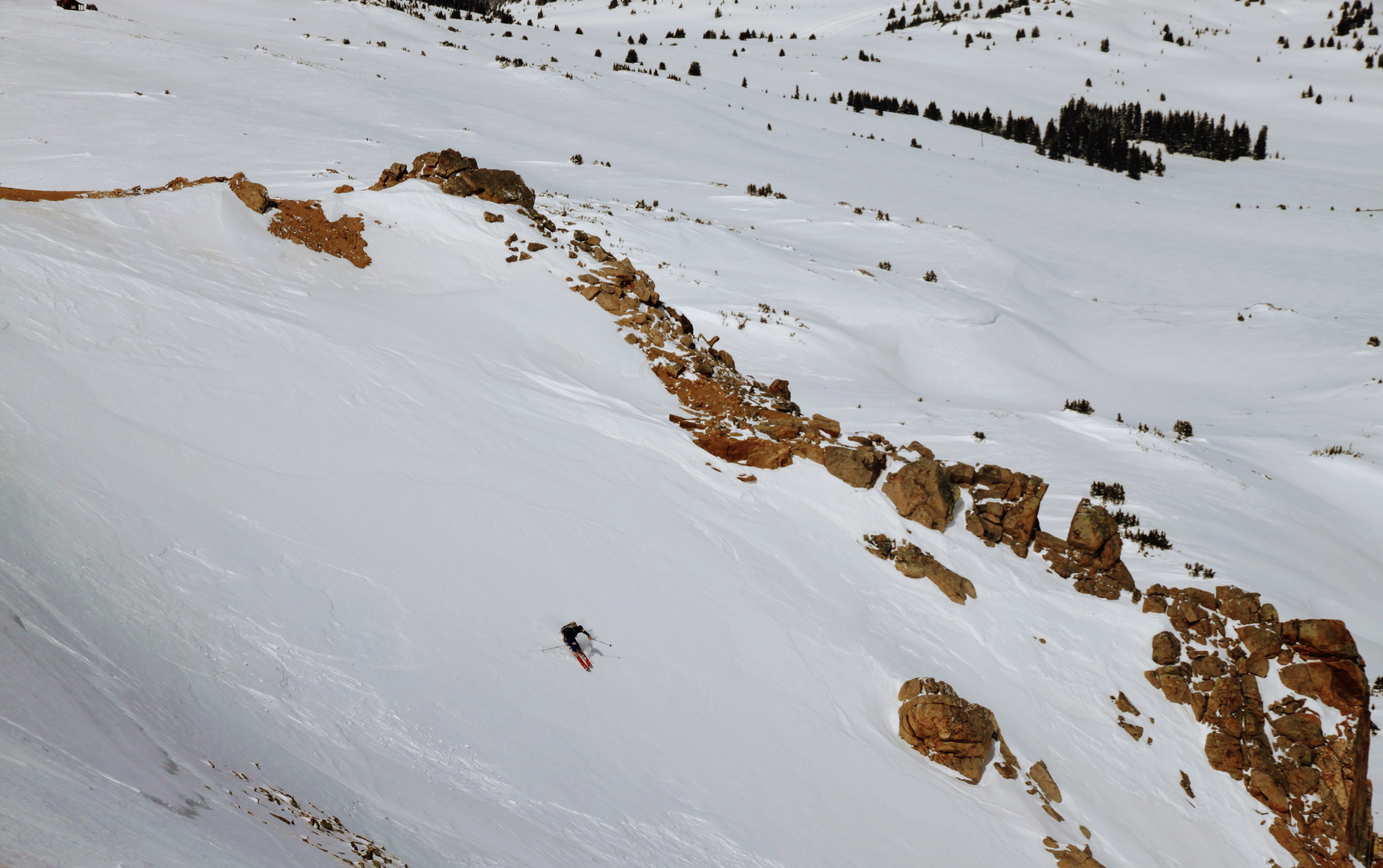
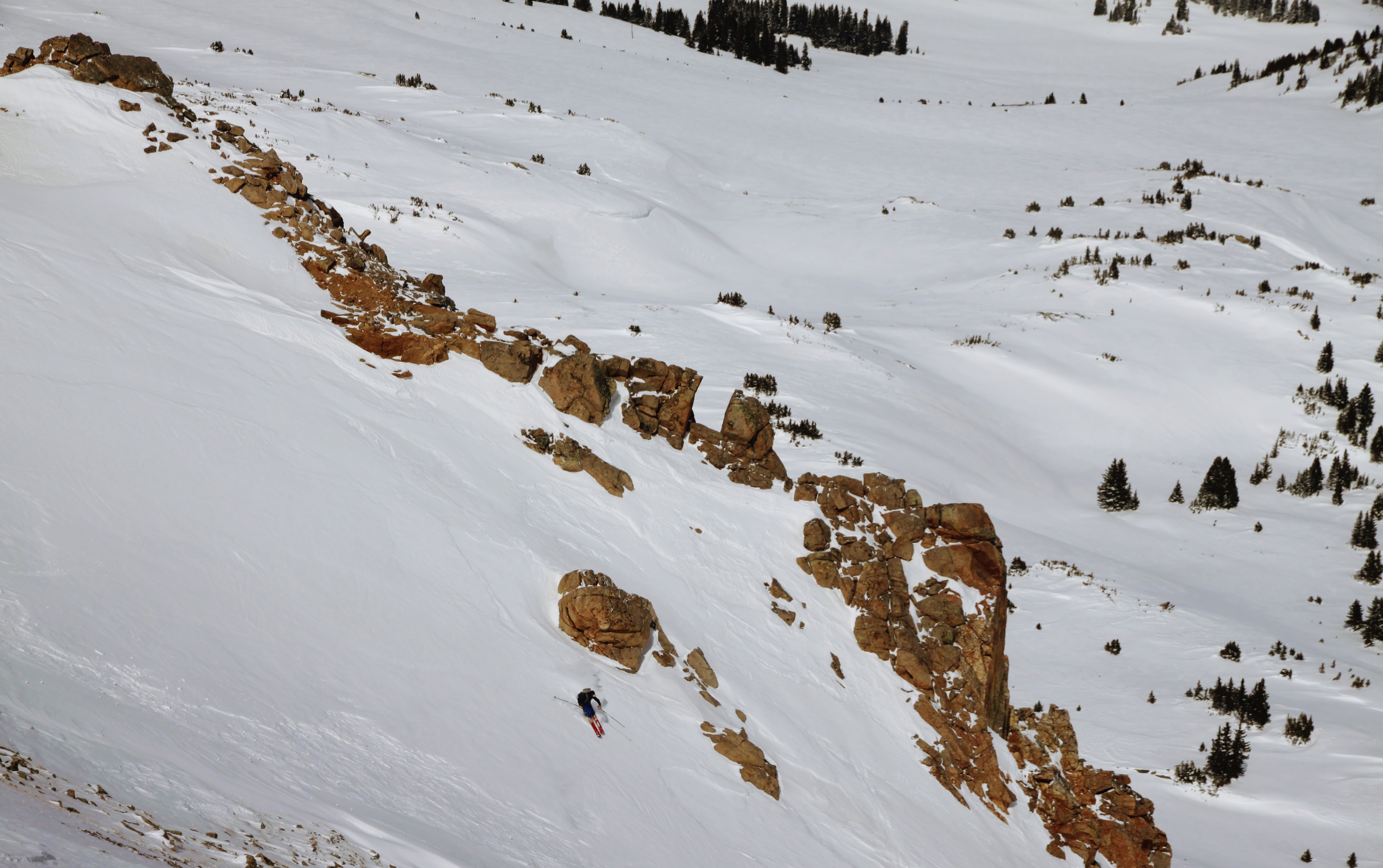
In order to ski to the hut, we had to ski the extremely steep & firm northeast face. “Oh well, I will just follow J and Chuck”, I thought. There was one short section of 50 degree snow, but eased to the 40s soon after. Even though the snow was very firm and a bit icy, I’m glad we did it.
Chuck skiing the northeast face of Gold Hill
Once back at the hut, we relaxed, I took a snooze, some played cards, etc. I went out later on that afternoon and did one more loop with Derek, Mikey, and Joel of the ridge/tree run to Difficult Creek to cap off the day.
The last supper at Goodwin Greene
A storm came in Saturday late afternoon/evening and visibility was to a minimum on Sunday morning when we were to depart. It was windy and low visibility for sure, but navigation was pretty easy especially since a few of us surveyed the terrain from the Gold Hill summit the previous day. Back to the car in just over 2 hours, we made our way on home.
Chuck and I making our way across the Richmond Ridge plateau on Sunday morning. Photo by Joel
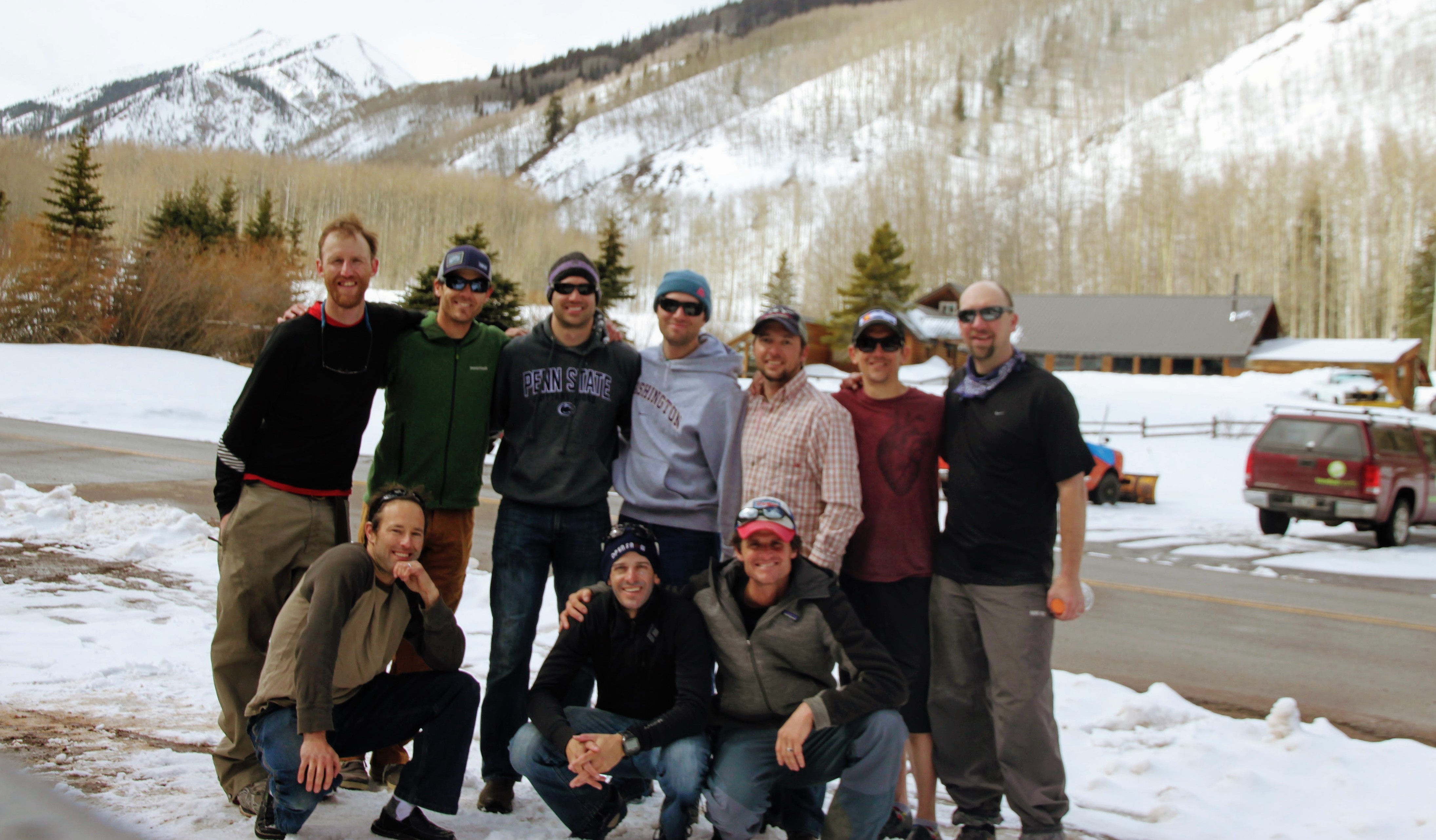
Our crew one year older and wiser, but just as giddy to all be together on another Hardman in the mountains
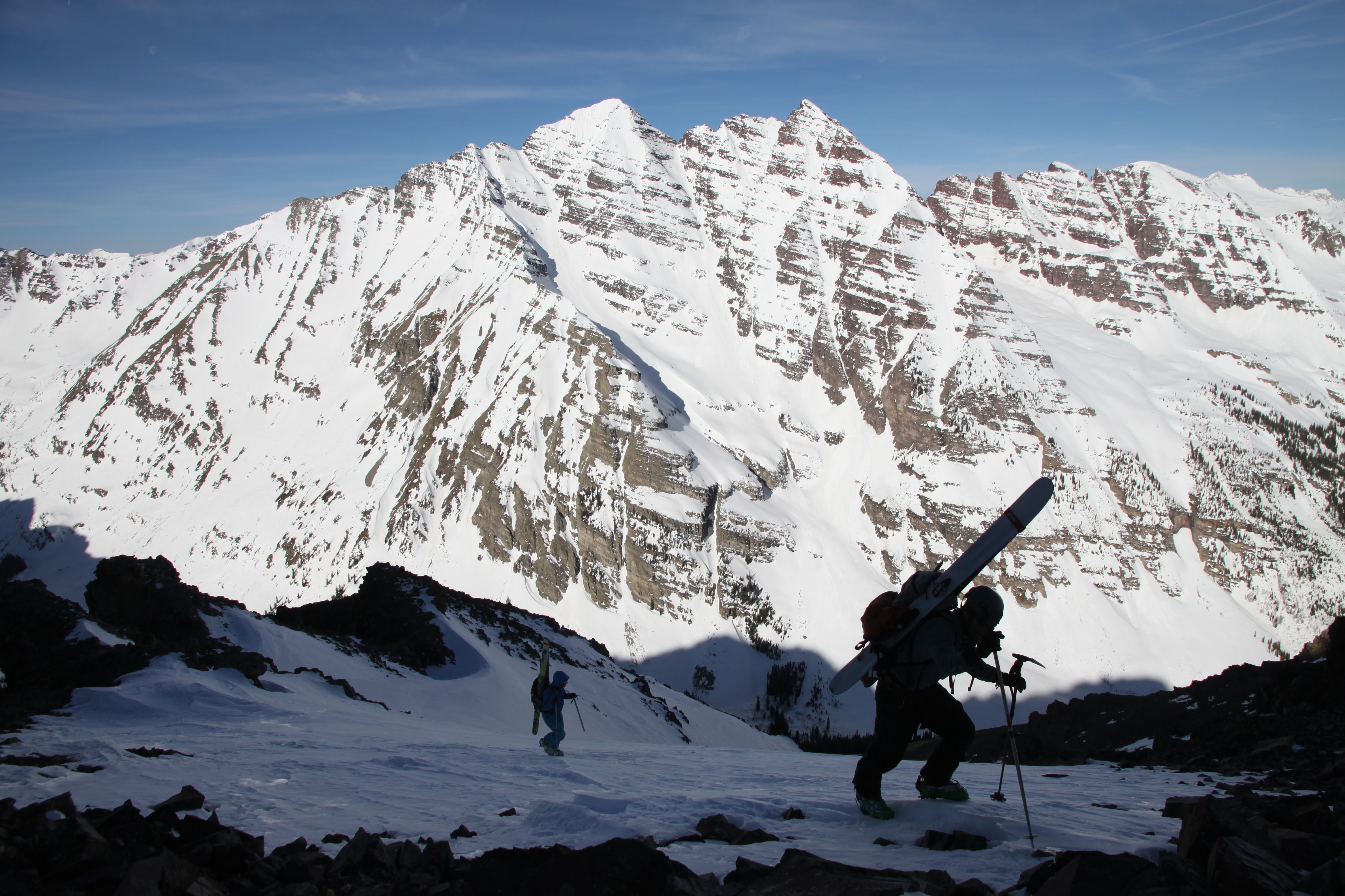
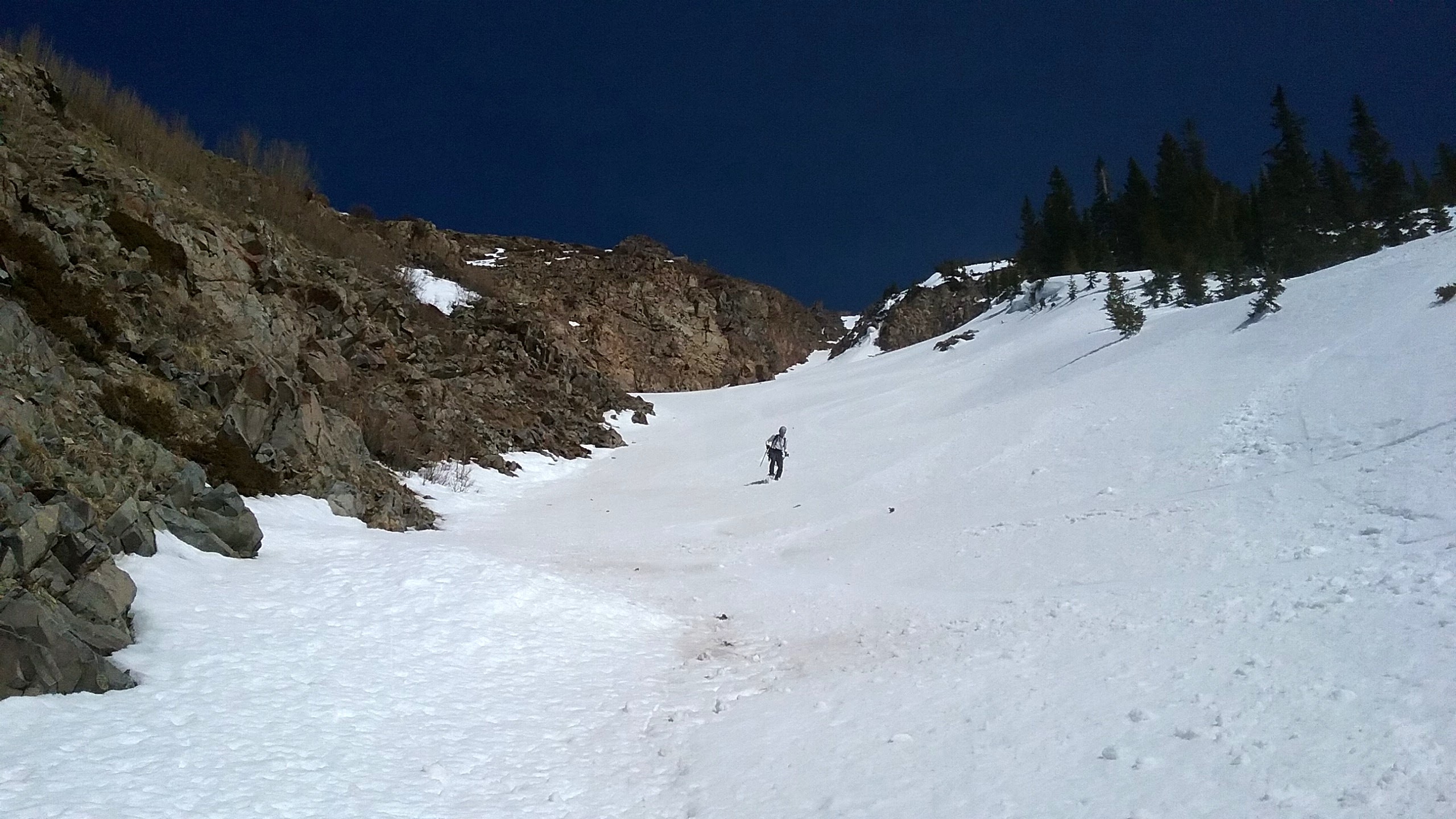
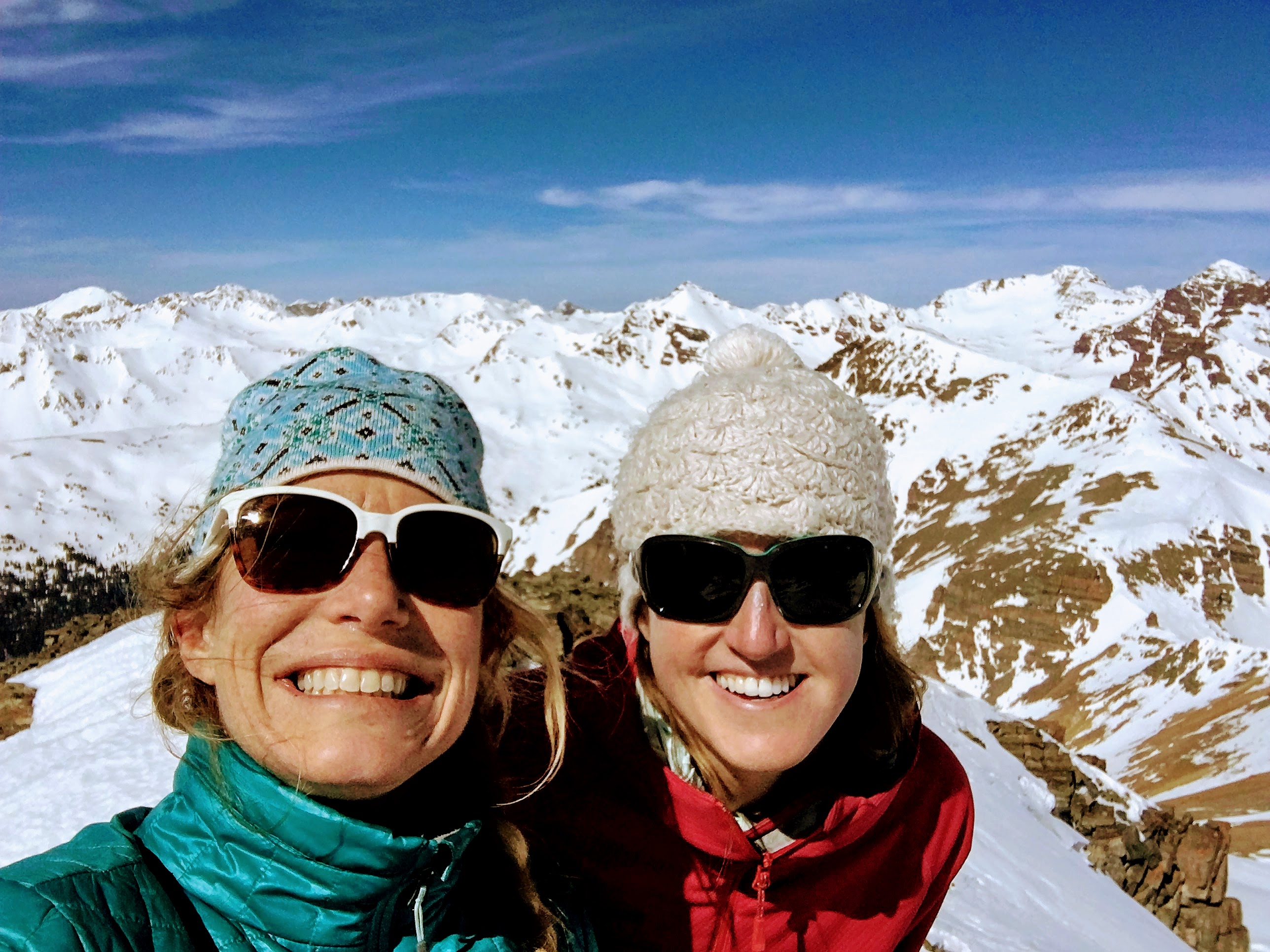
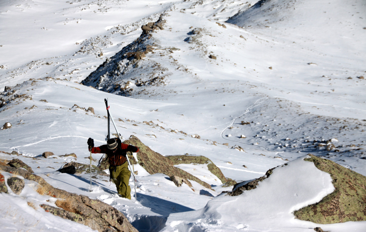
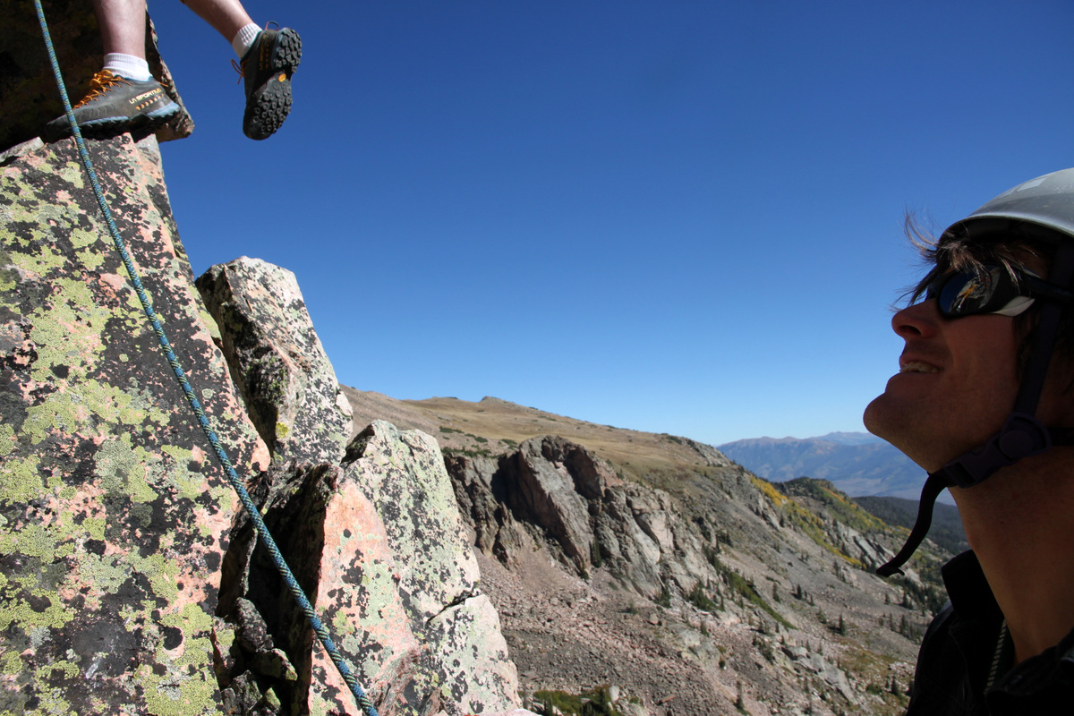
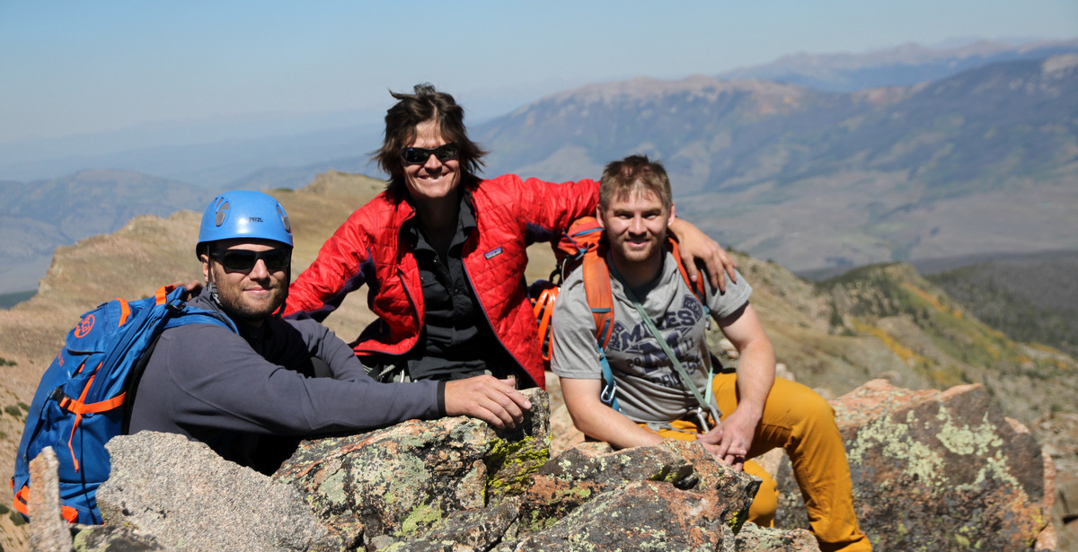
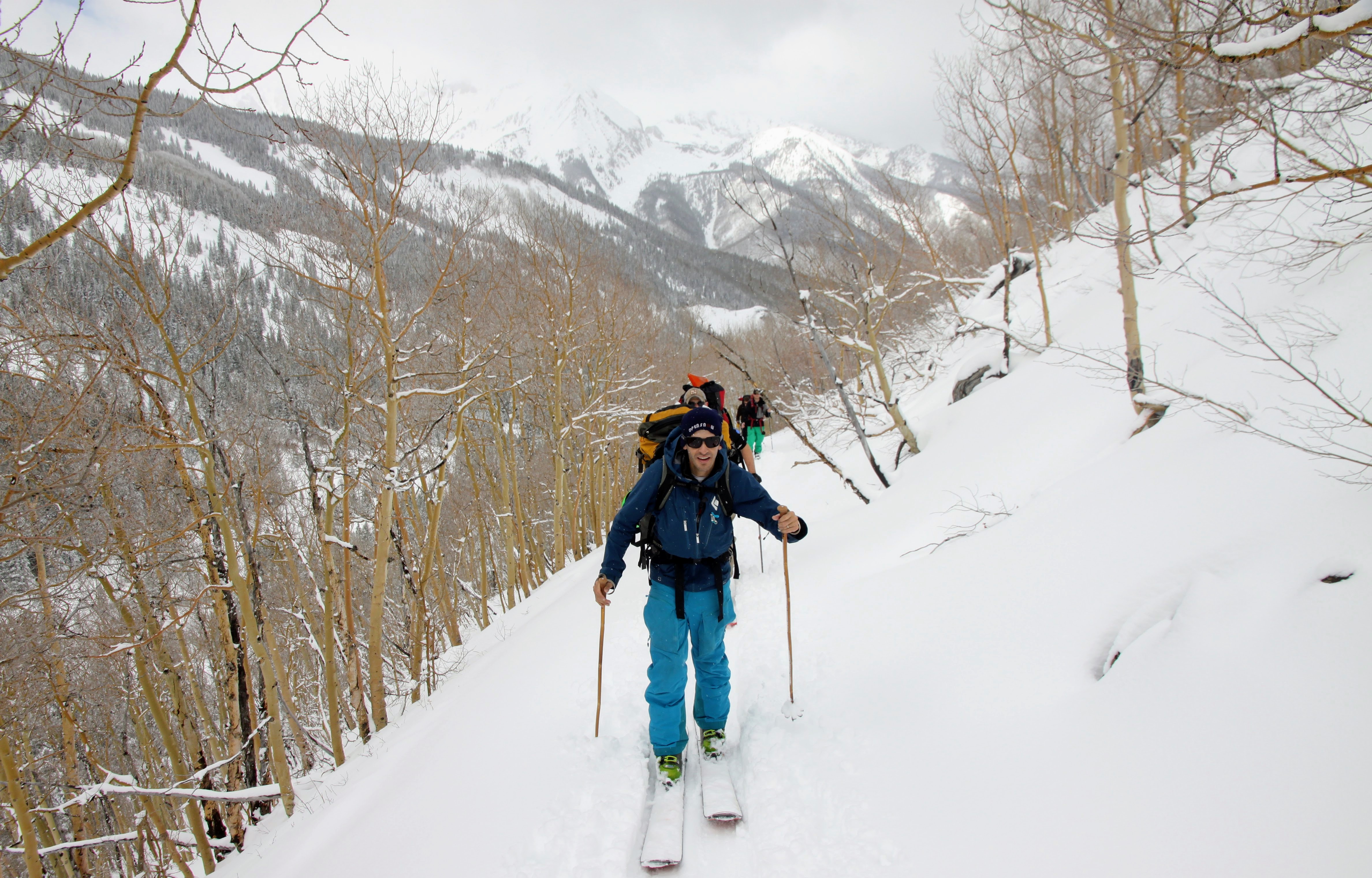
Natalie and I had been planning a climb of Pyramid at some point this winter if weather and conditions would allow for relatively safe passage. We had climbed Pyramid’s NW ridge back in the fall in order to get a feel for the route finding challenges. We went on to traverse to Thunder Pyramid and then Lightning Pyramid, which raised the excitement level a bit. I’m always wanting to get back to Pyramid in whatever condition – definitely one of my most favorite 14ers. Even though I have many more responsibilities these days (a young wonderful daughter, a 14+ year old golden retriever), I still love to get a few 14ers in the winter each year. Its sort of the only season I still like getting on the 14ers unless its some technical route in the summer. Kristine and I still regularly do our trail running, skinning, and rock climbing these days, but just much closer to home. We certainly are not the weekend warriors climbing and skiing all over the state like we were a decade ago. But, that’s quite ok with us. Natalie has certainly been getting after it all winter with summits of Wilson Peak, Holy Cross, Snowmass Mountain, just to name a few. She is narrowing in on the winter 14er list. Pretty impressive.
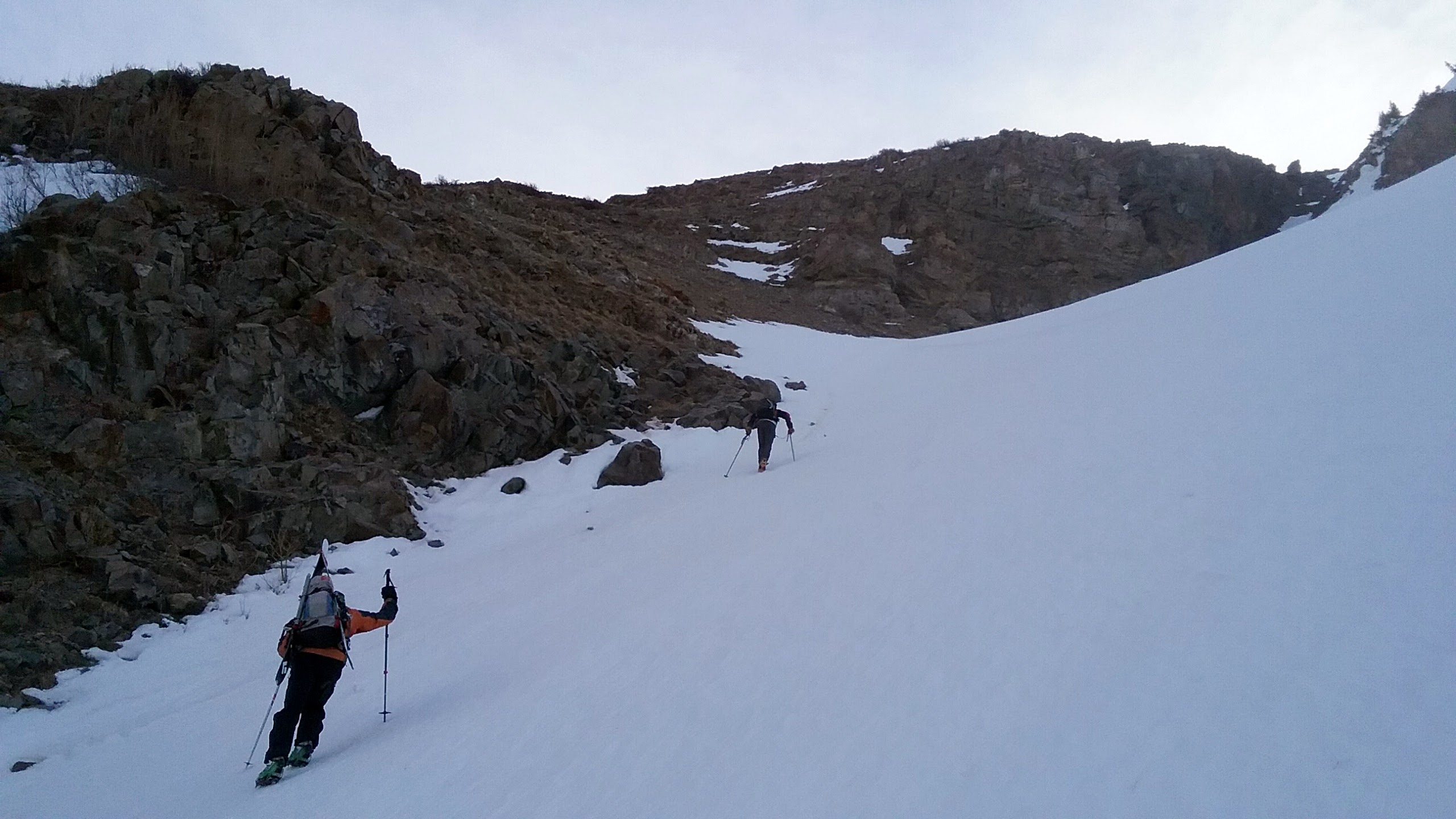
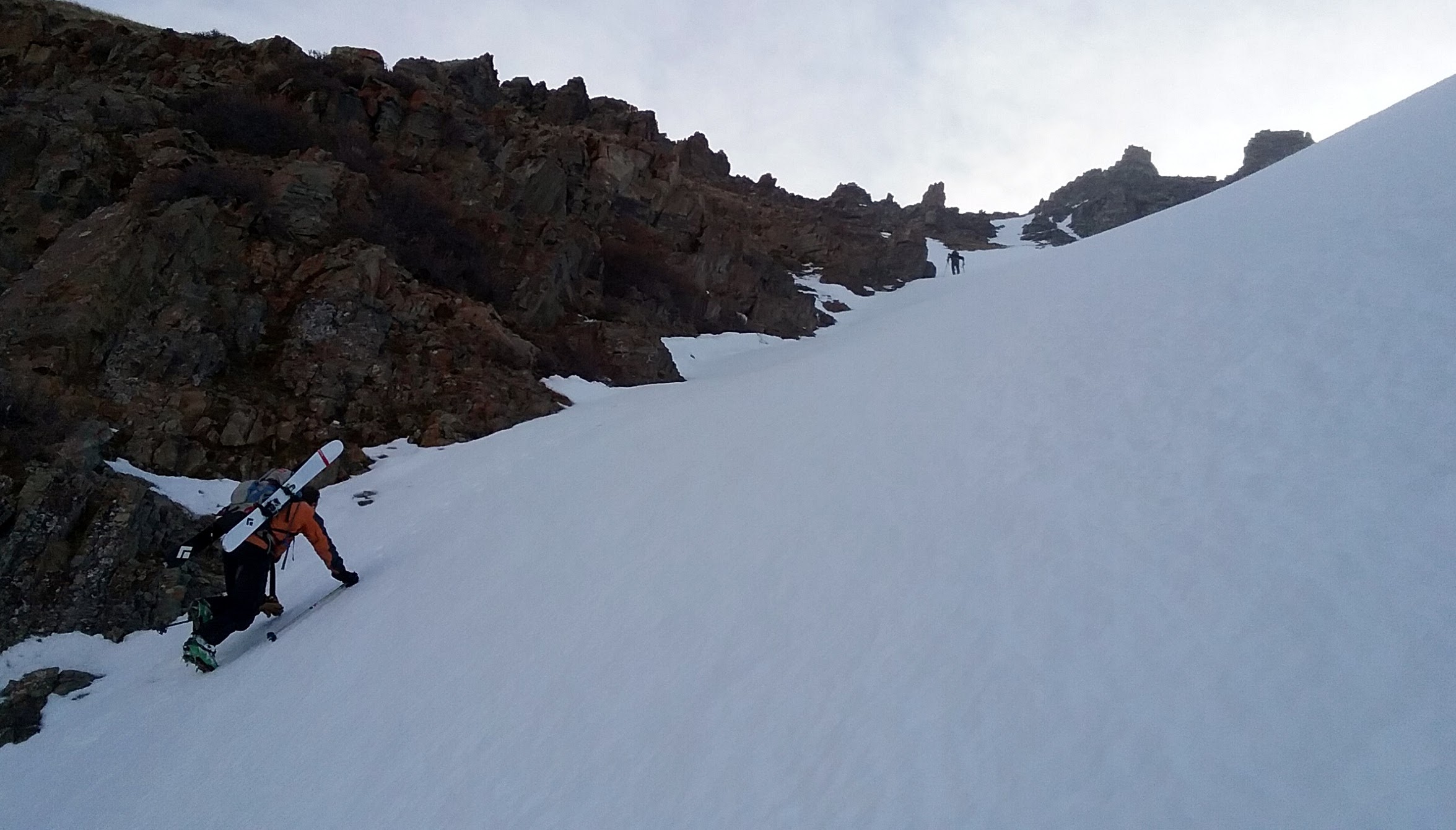
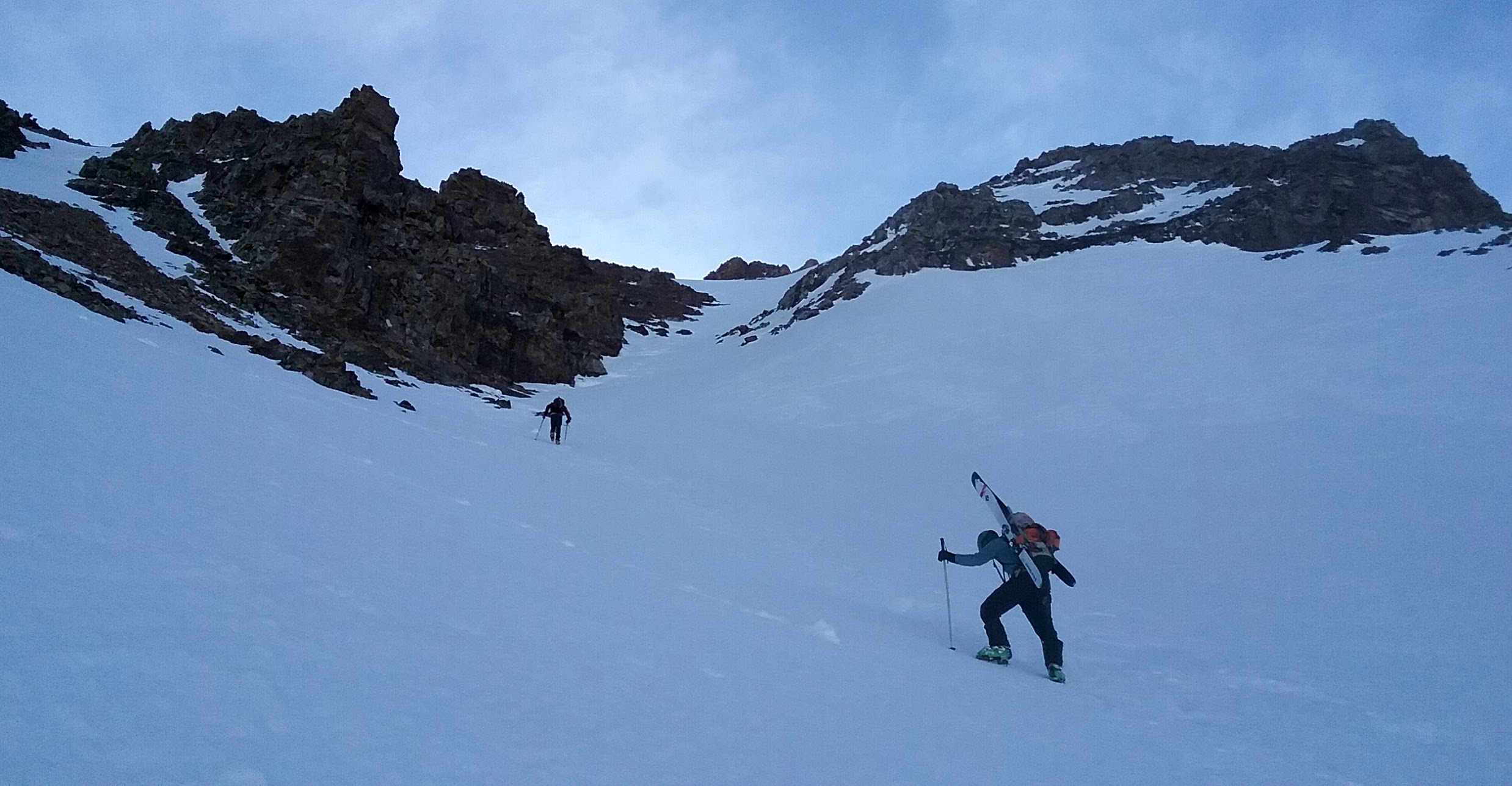
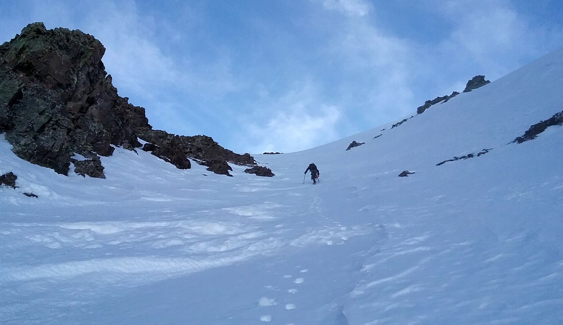
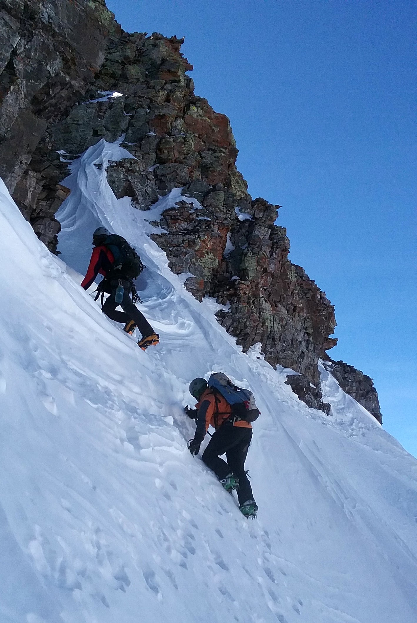
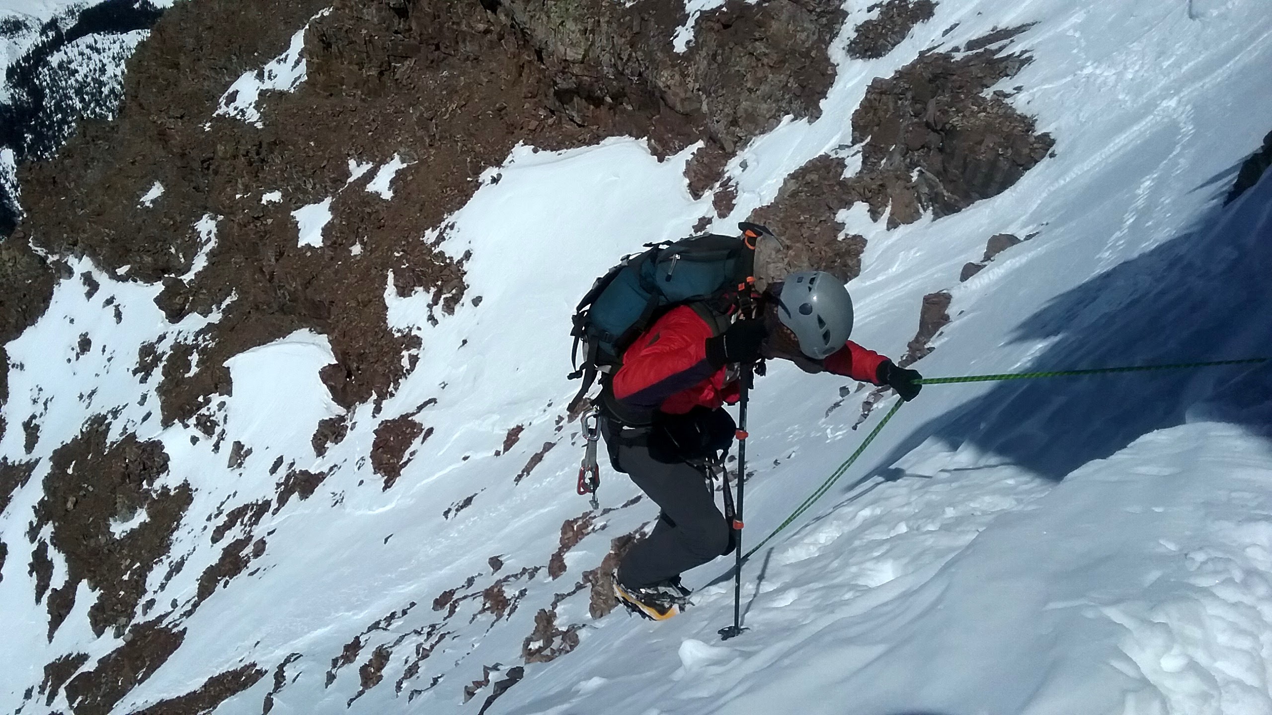
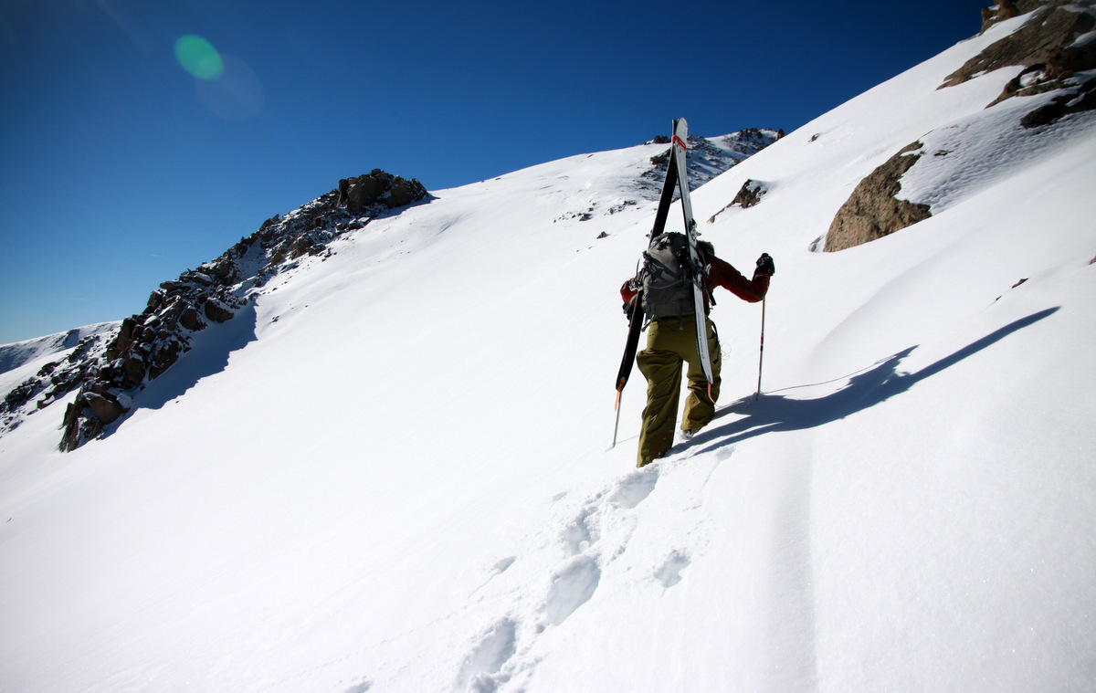
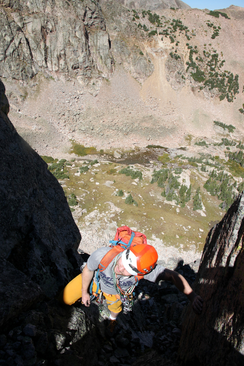
Now, to the trip report, a plan was set for the last weekend of winter especially given the amazing spring-like weather that was forecasted. I recruited J to come with Natalie and myself as well as our young buck, Dylan. J has serious FOMO (fear of missing out) so there was no way he was going to miss this climb even if he said he was out of shape. Kristine had a plan to drive to Aspen Saturday night to ski a peak with Christy Mahon that Sunday, so my goal was to be back home by 8pm that evening. Natalie backpacked in the Maroon Creek Road from the T-Lazy-7 Ranch all the way to the other side of Crater Lake that Friday evening. J, Dylan, and I drove over late Friday night arriving around 11pm for a quick 2+ hour sleep in our sleeping bags on the pavement. After some coffee and oatmeal, we started skinning up the road at 2:15am for the 6 mile slog to Maroon Lake. I would typically use my telemark setup for this climb, but sort of wanted to climb in my older Koflach plastic boots and thus used my really old Silvretta 404 binding/ski setup I used on Denali in 2007. This was a mistake as the boots gave me some mega blisters in the skinning mode with these bindings/skis. Oh well. Live and learn. We ran into Mad (Dad) Mike Silvestro fat biking in on the road to climb Thunder Pyramid and Lightning Pyramid. Good to briefly chat with that guy for sure. We reached Natalie’s tent just before 6am, which was around 8 miles and 2,000′ vertical gain into the day. Natalie gave me the 30m/8mm rope she hauled in to her camp to pack and after some snacks and water, we skinned the rest of the way to the apron of the west couloir leading up Pyramid’s west face. Dylan was not feeling very well (unusually nauseous), so elected to stay behind and return to Natalie’s tent for some shuteye. J and Natalie and I then began the 2,600′ boot up the awesome west couloir to the saddle on the northwest ridge. I left my ski setup at the base of the couloir because there was no way I was skiing a 40-45 degree couloir on those skis! J and Natalie, however, packed the skis on their packs.
First light on the Bells to our west
Beginning the long ascent up the west couloir. Photo by Natalie
A steeper section. Photo by Natalie
Middle of the couloir. Photo by Natalie
J & Natalie
Me in the upper couloir. Photo by Natalie
I think it maybe took us 2-1/2 to 3 hours or so to climb the 2,600′ from the valley floor to 12,900′ on the NW ridge. I am not quite totally sure. Nevertheless, the top out where the snow ended had a great view of the Bells.
J in the foreground and Natalie behind topping out at the end of the snow
J and Natalie left their skis, we stowed the crampons, and we started up familiar terrain to the Keyhole Couloir.
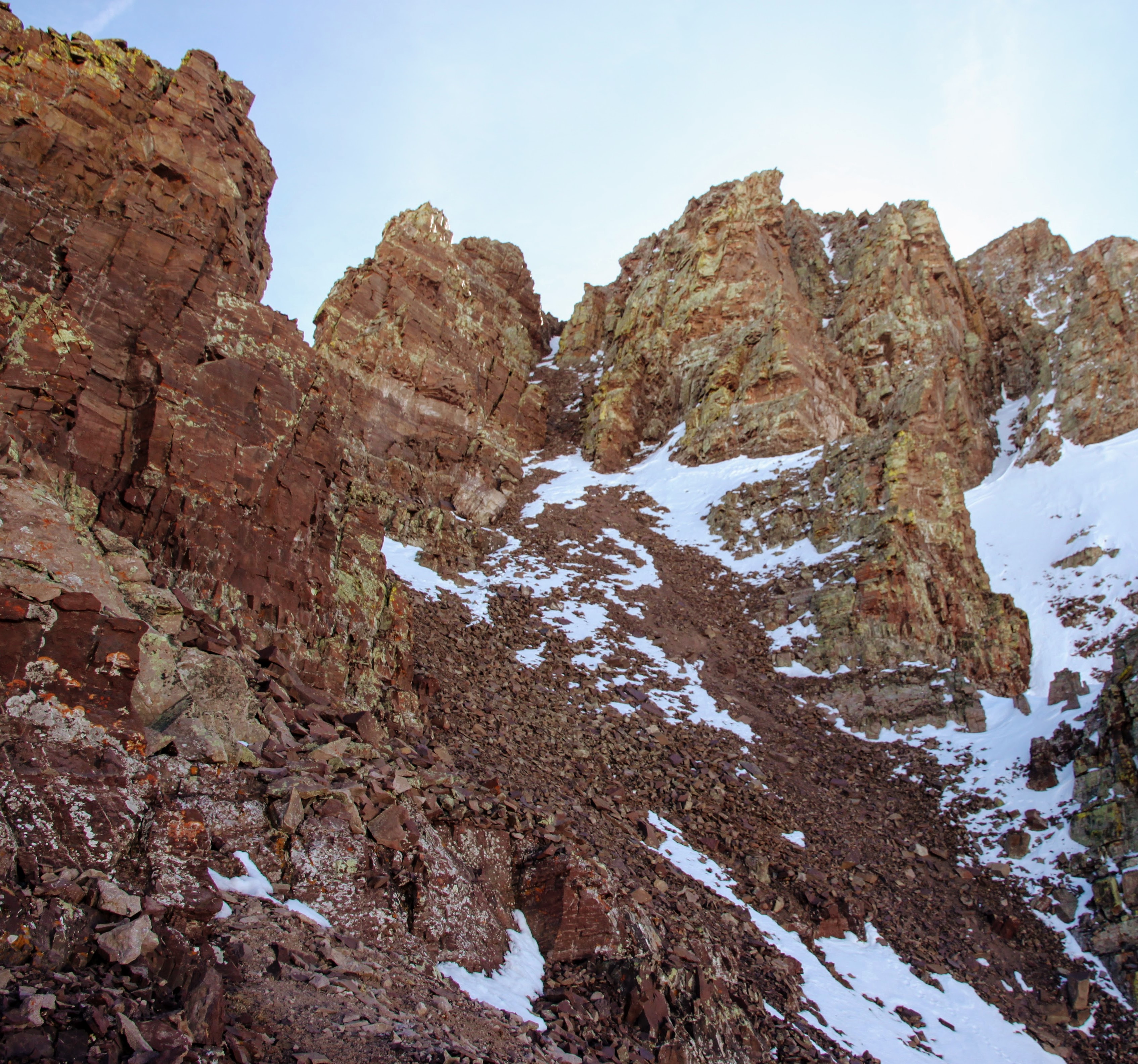
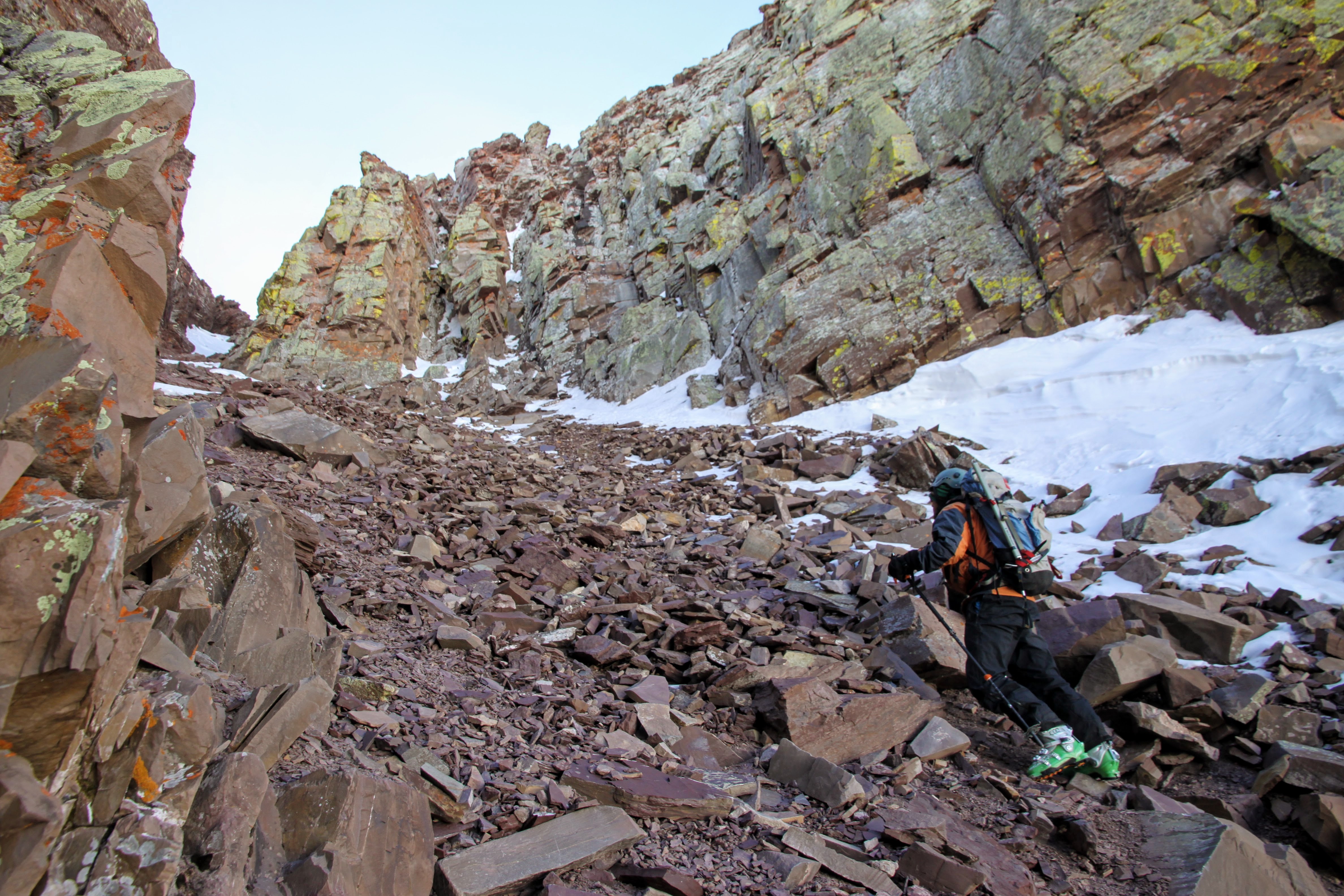
The Keyhole Couloir was dry and loose
J climbing the loose couloir
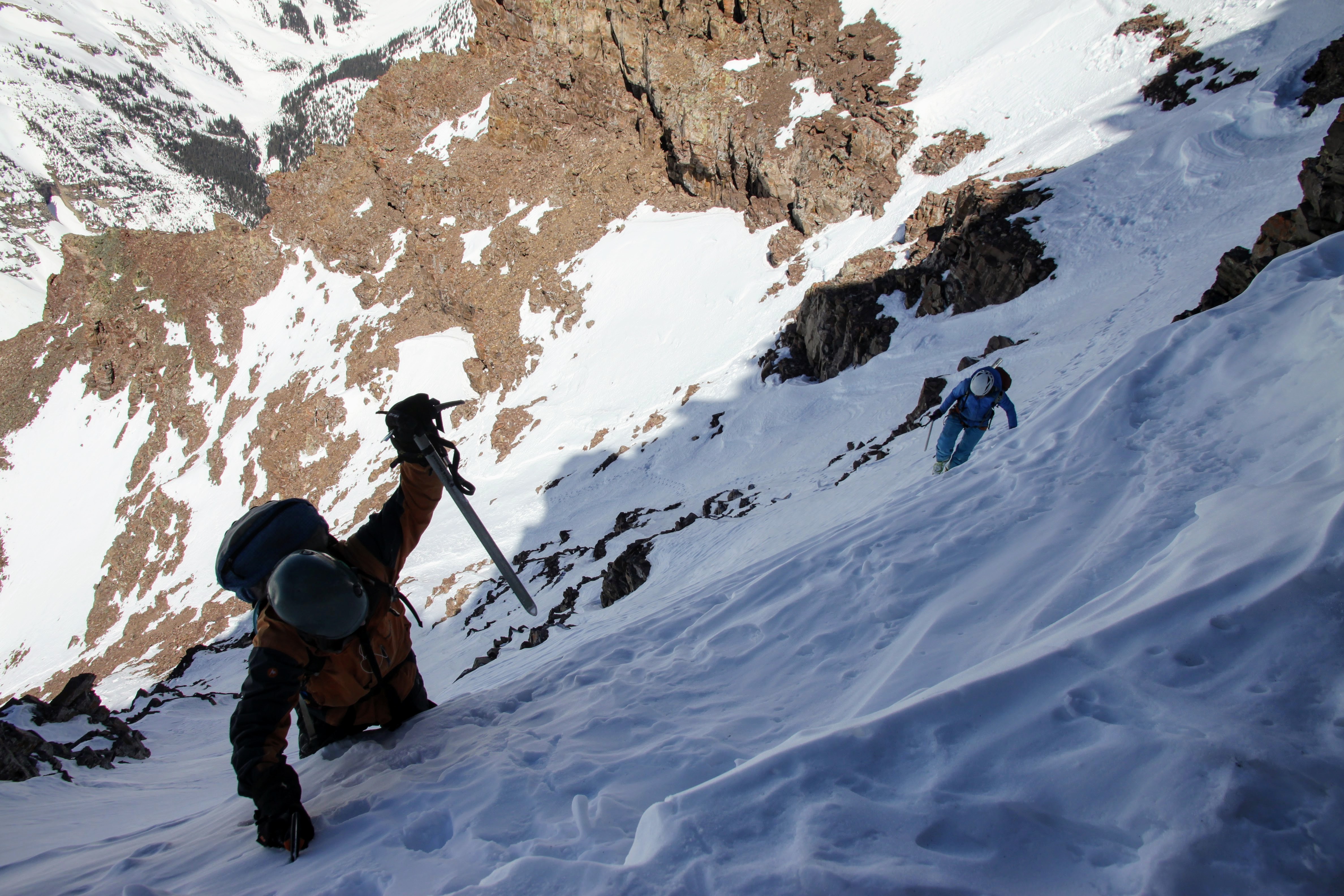
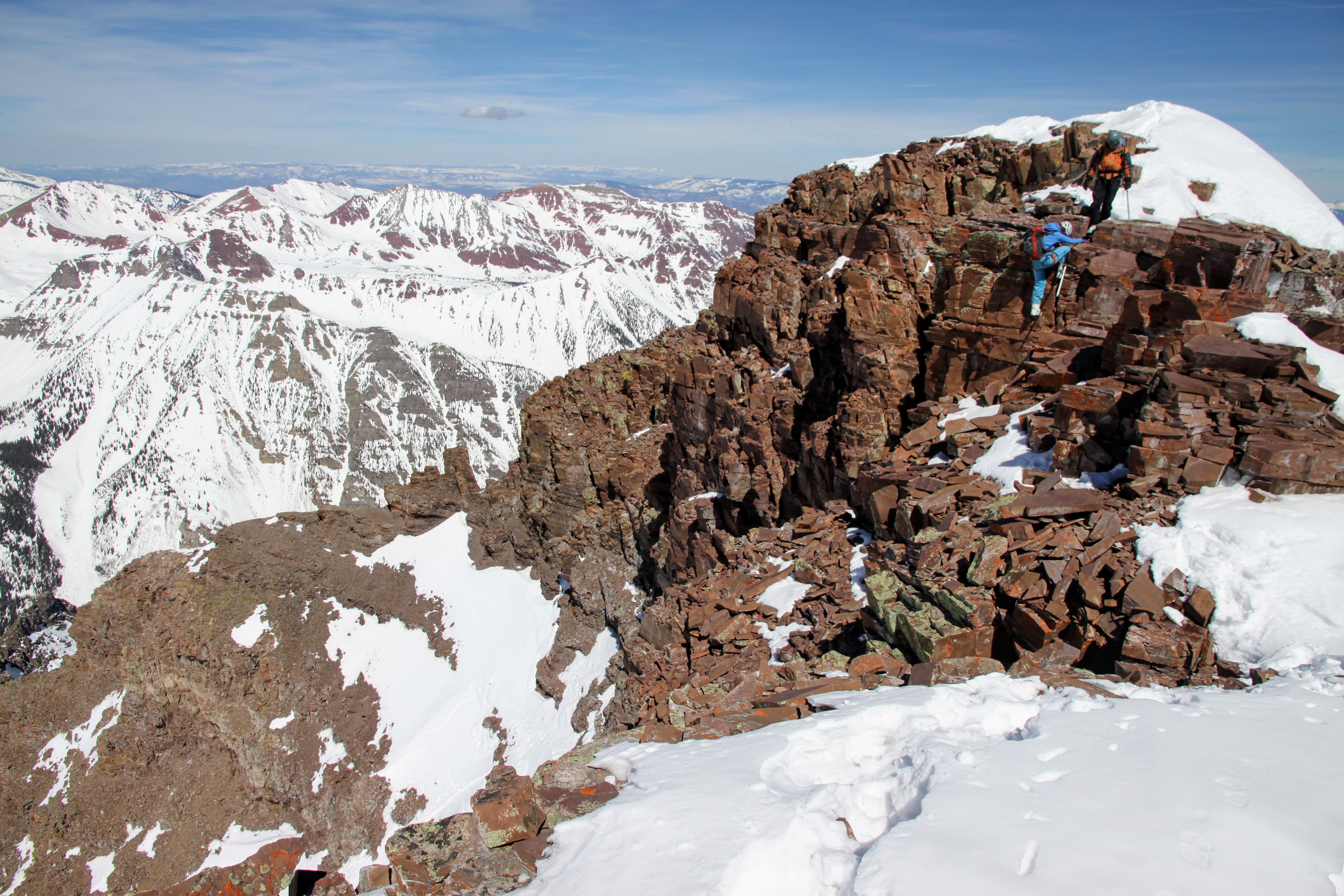
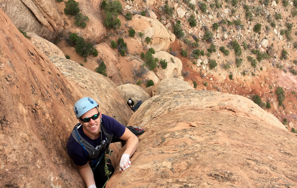
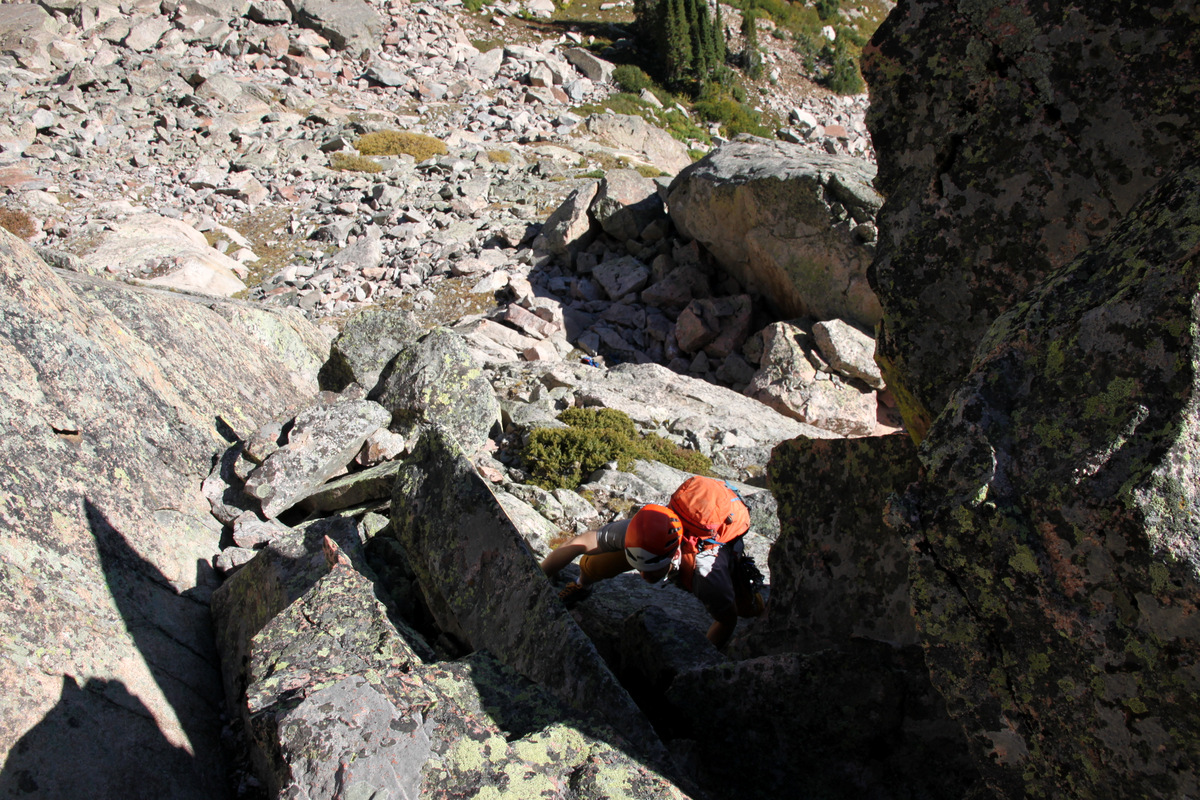
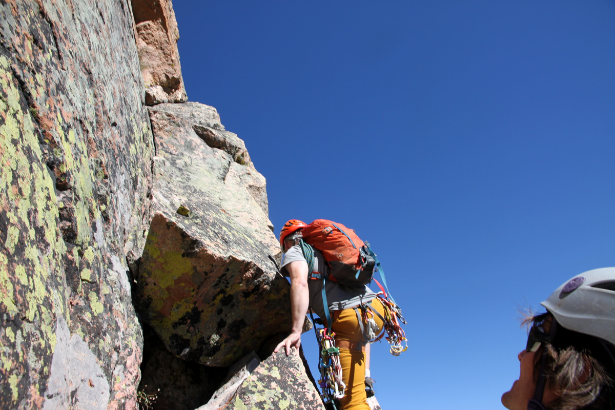
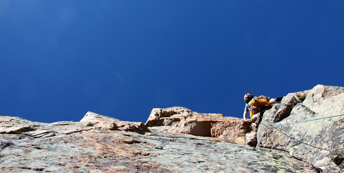
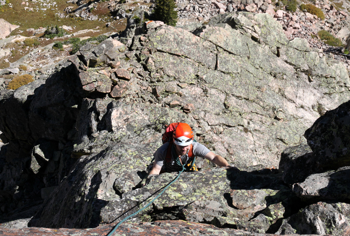
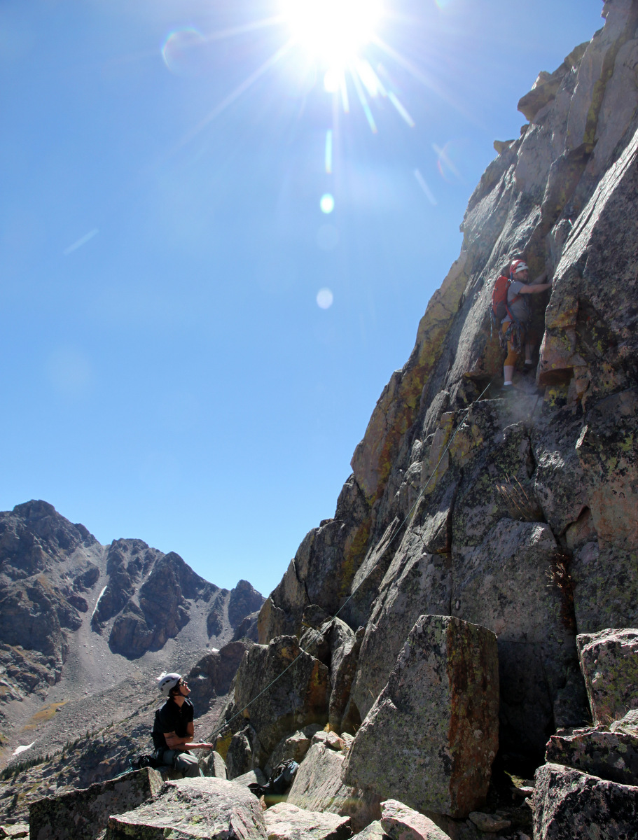
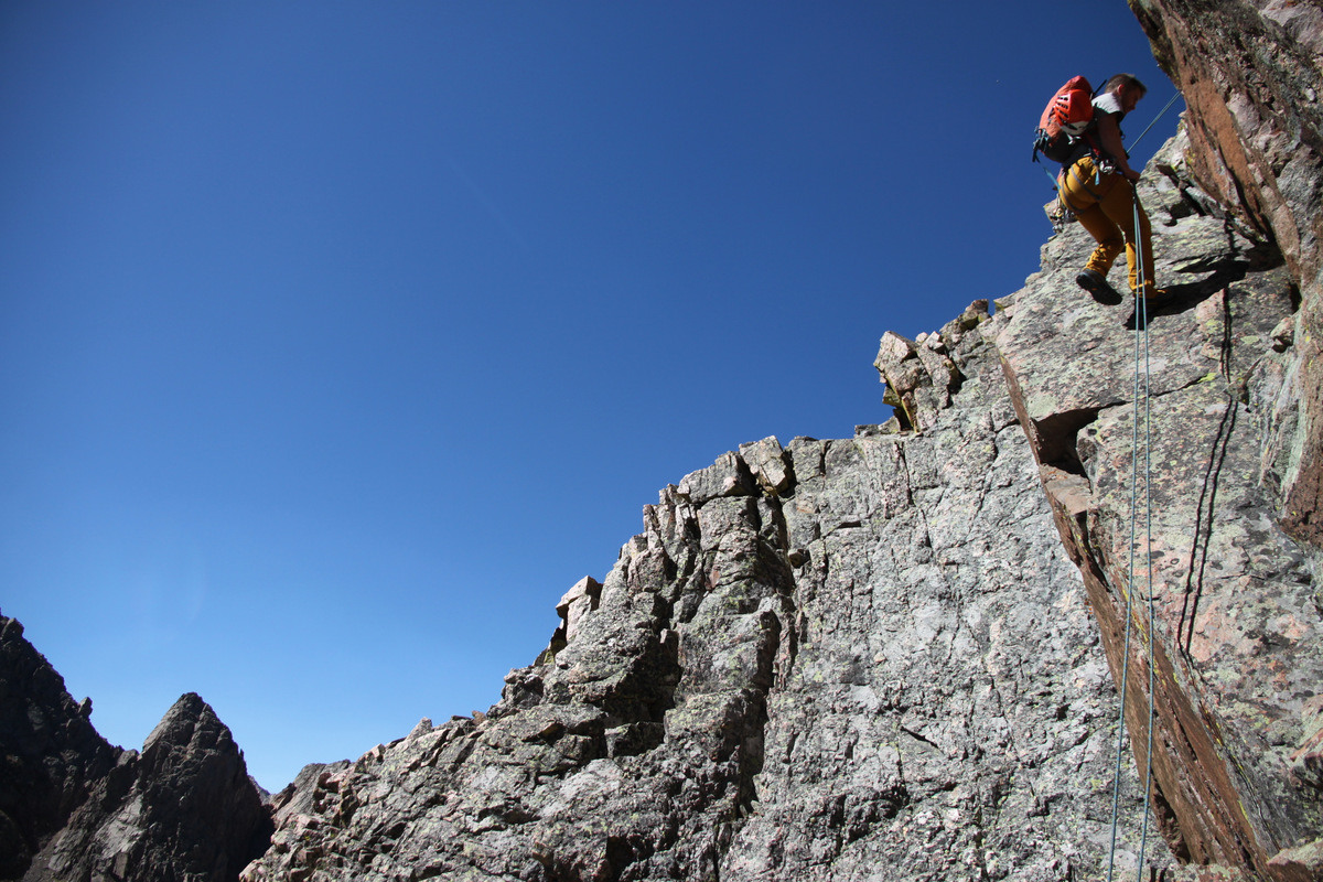
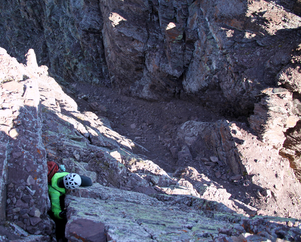
Then, we abruptly arrived at the edge of the north face and took a right to take on the class 4 headwall. J and I climbed it and I trailed a rope to belay Natalie up.
J having fun on the short headwall
Me trailing the rope. Photo by Natalie
After some fun scrambling and route finding, we came upon the final crux bowl to access the summit cliff. By the way, the weather was spectacular. A little wind, but jeez I was scrambling in just glove liners. It was so nice. The upper bowl looked to be in great condition with safe and stable snow.
Rounding a corner…it looks as if we are both having to relieve ourselves, but of course we are not 🙂 Photo by Natalie
Natalie and J on a nice perch
The upper bowl and summit cliff
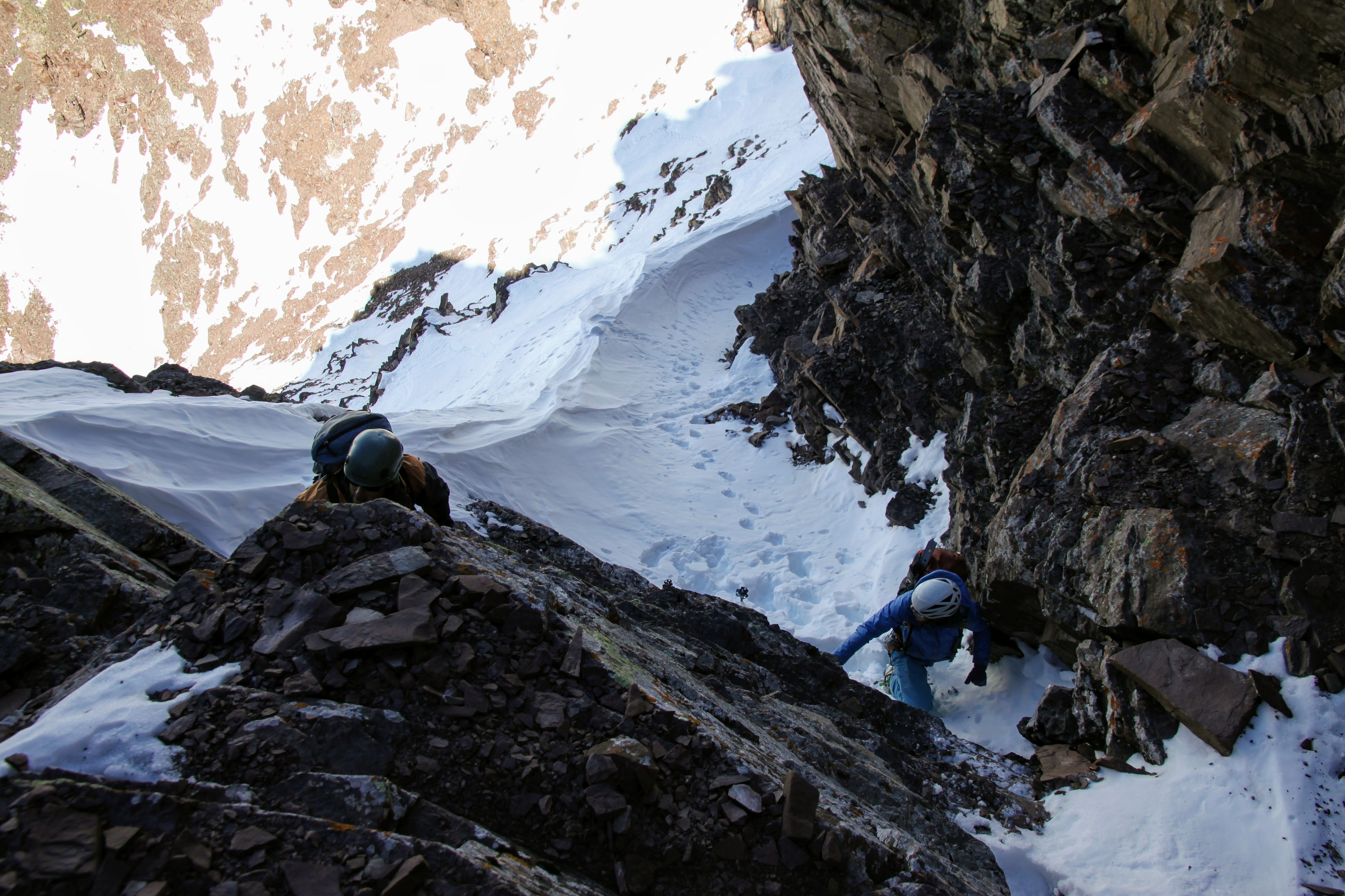
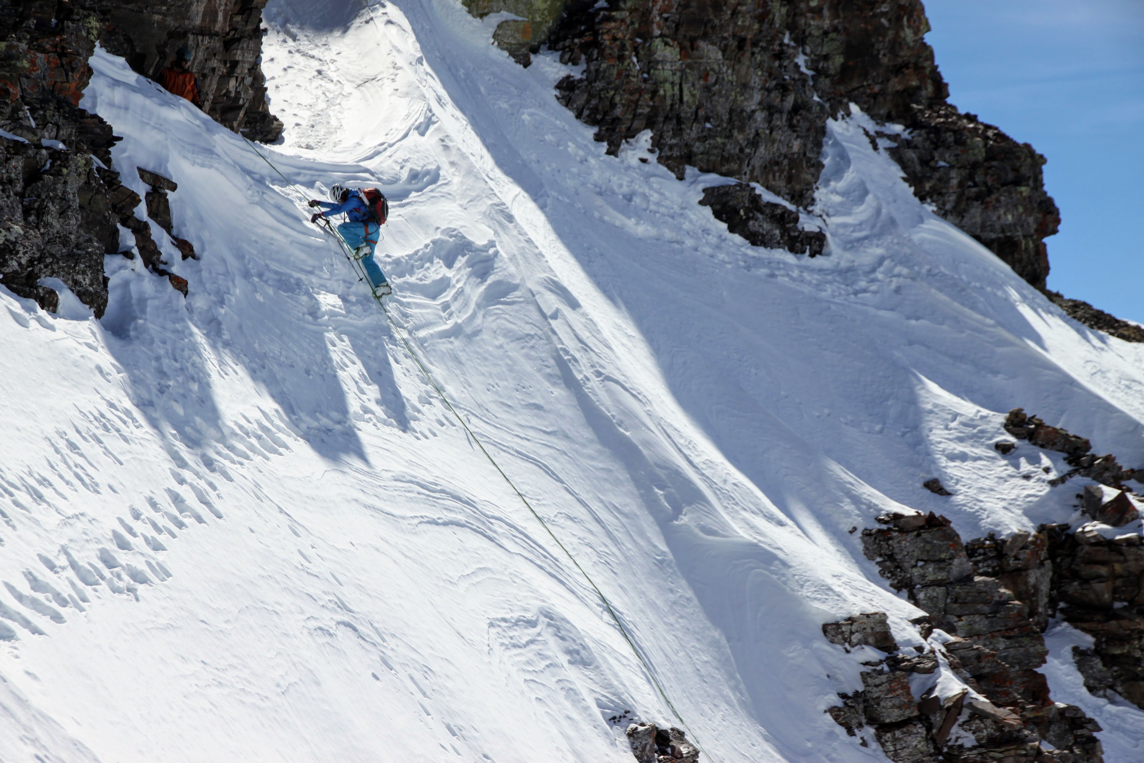
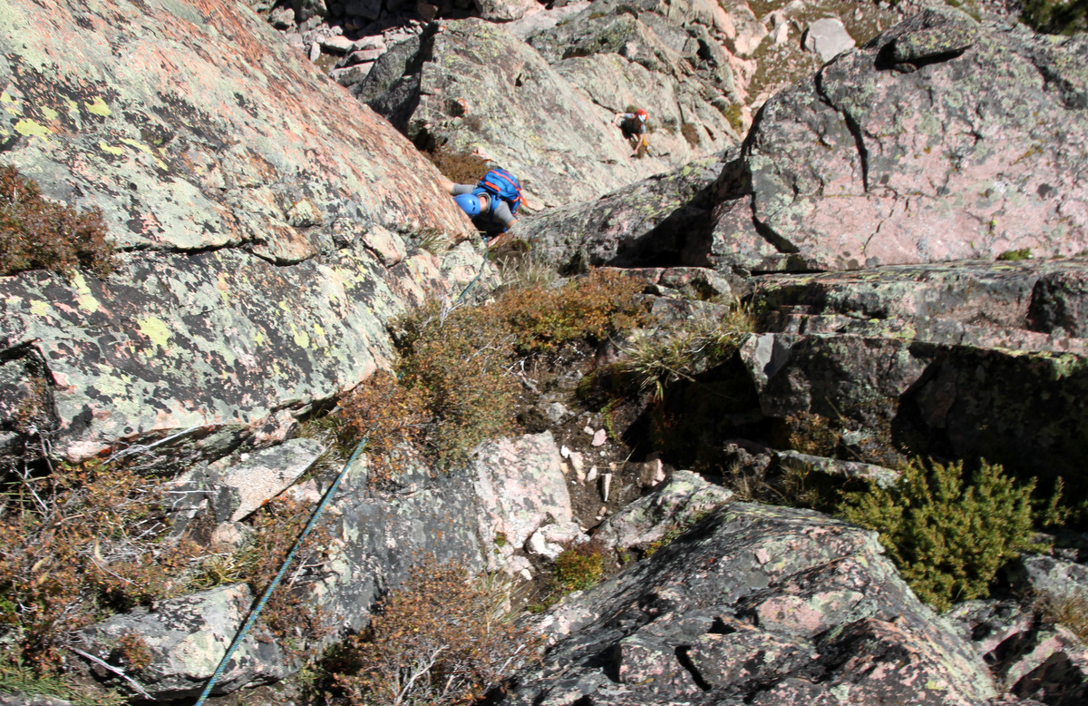
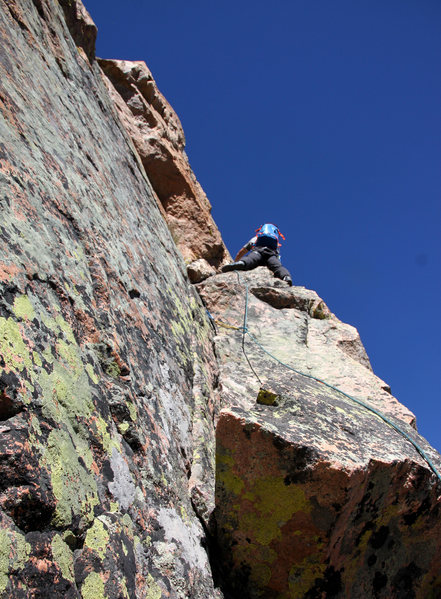
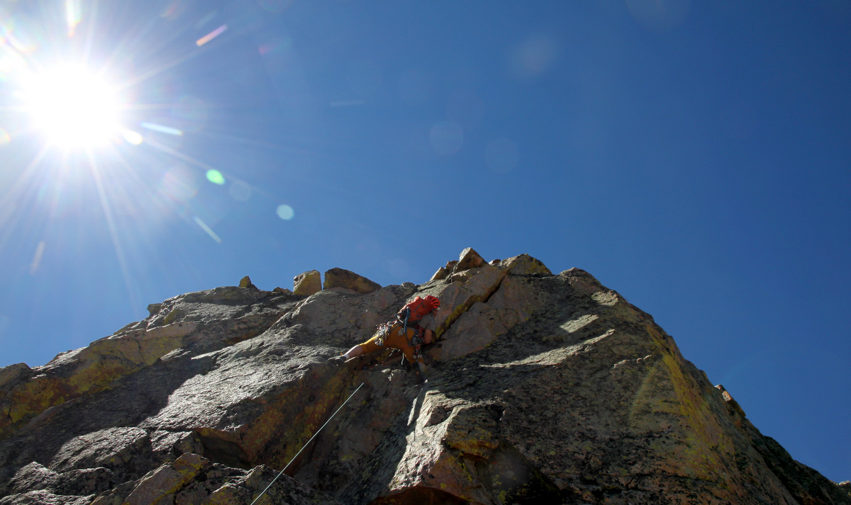
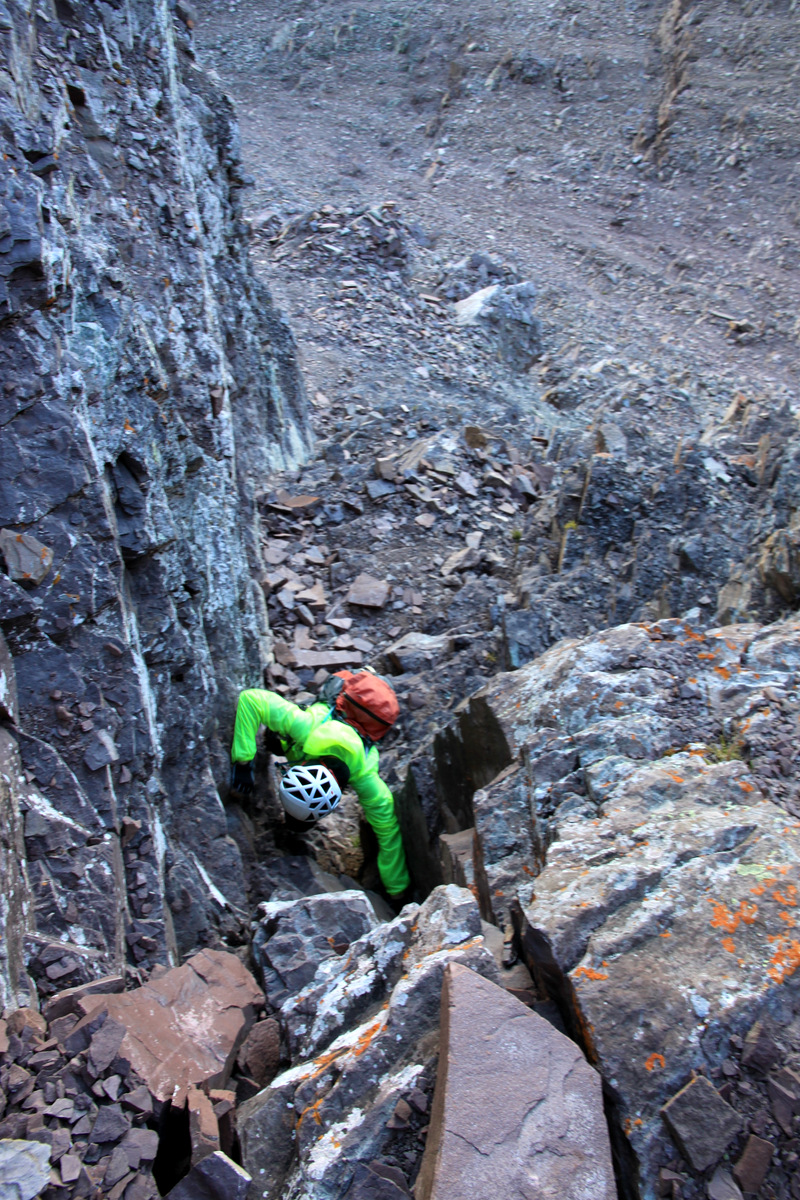
I led off and went up some previous tracks to the steep horizontal traverse, which leads over to the familiar JP Sneak gully. It was really fun and steep snow climbing with decent exposure.
J and Natalie
Up close in the upper bowl
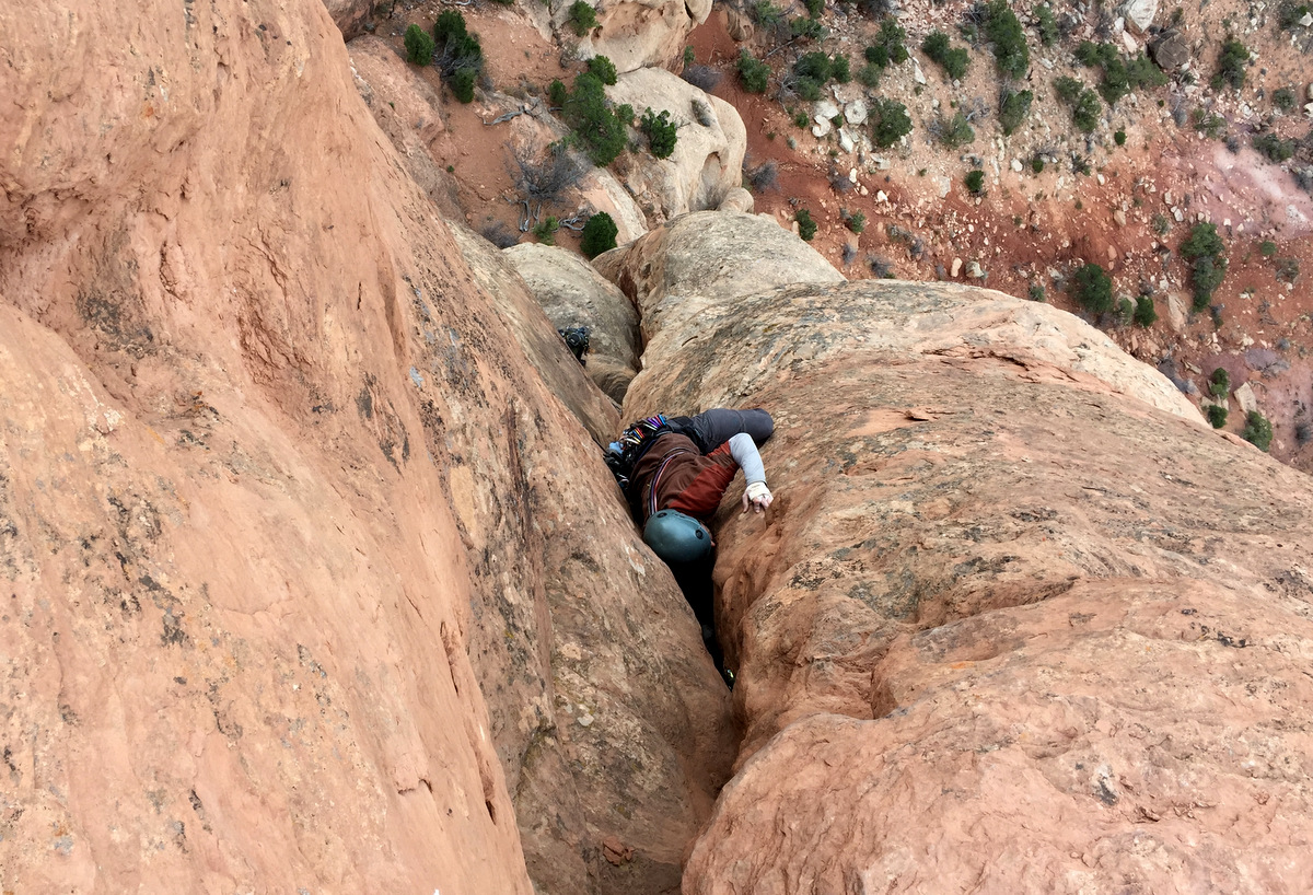
Traversing towards the JP Sneak was a very steep snow bulge in solid snow. This was the steepest snow of the day though only maybe 10′ in height.
J and I on the steep part to access the JP Sneak. Photo by Natalie
J climbing the steep snow pitch with good exposure
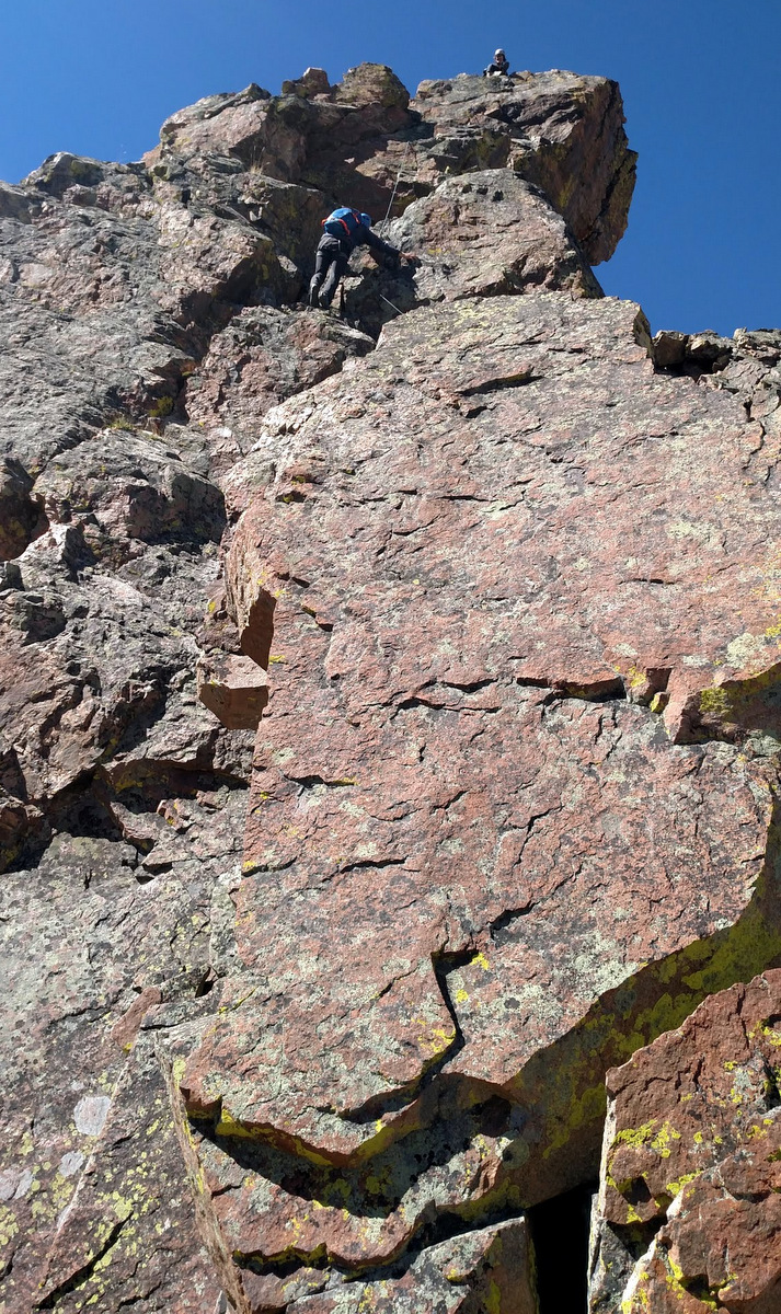
The snow really went pretty high up into the JP Sneak gully making for fairly smooth climbing.
J and Natalie climbing the JP Sneak gully
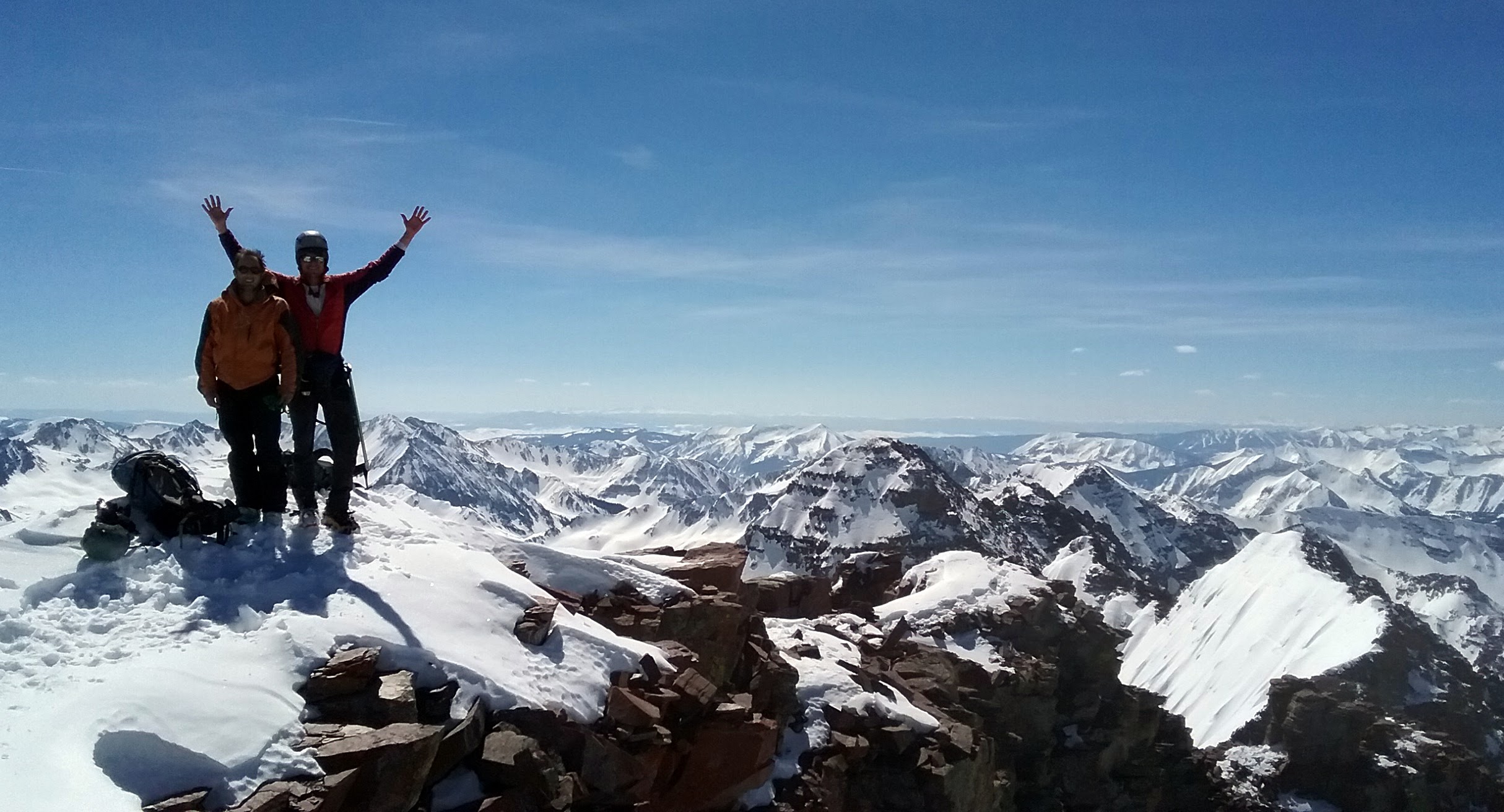
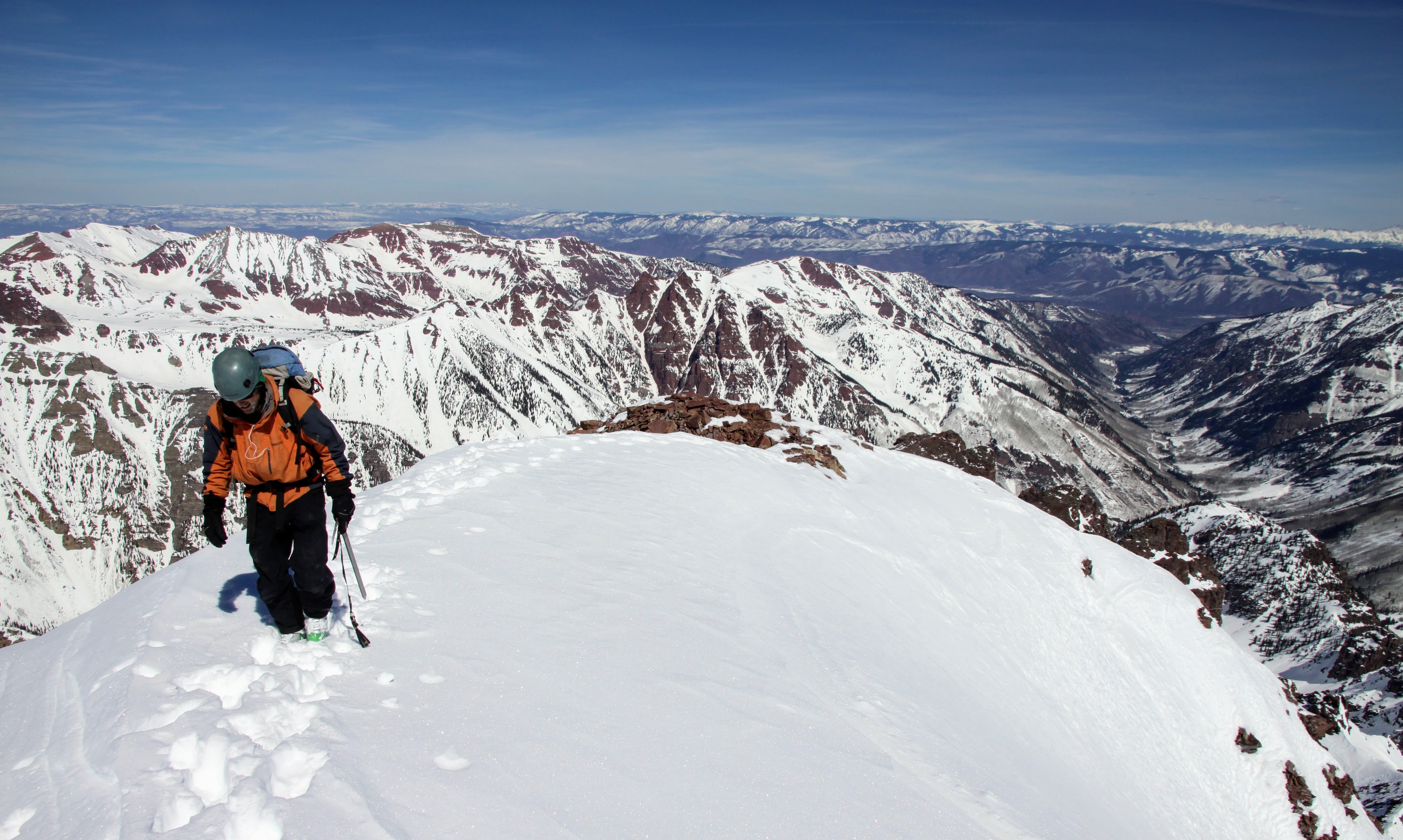
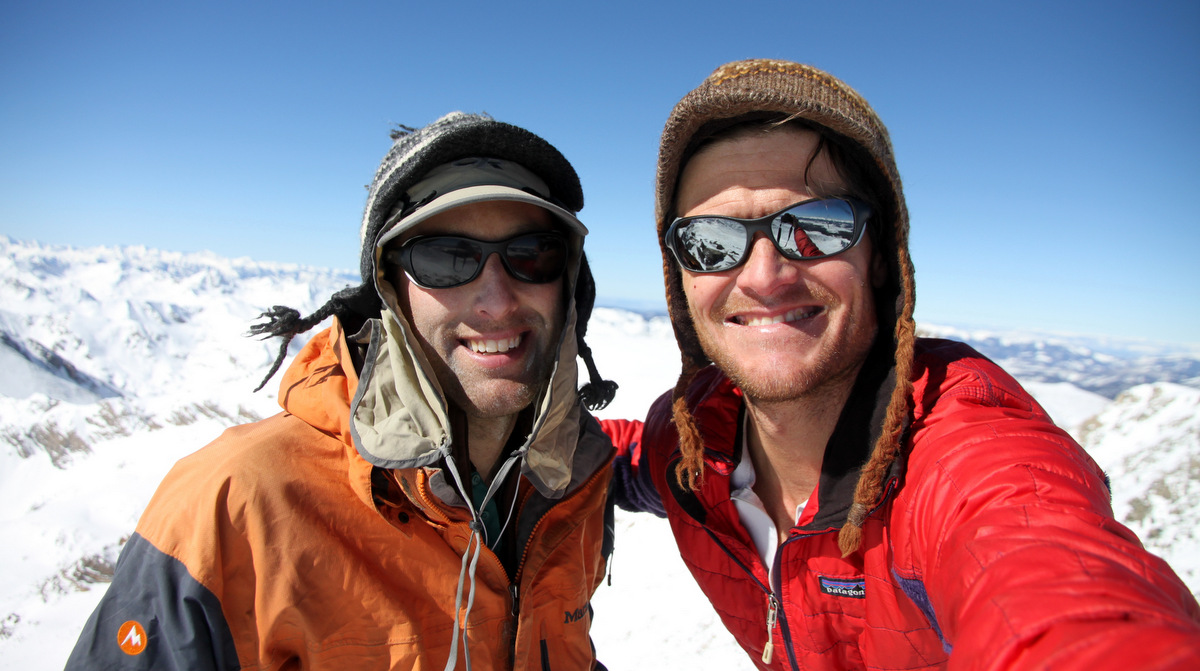
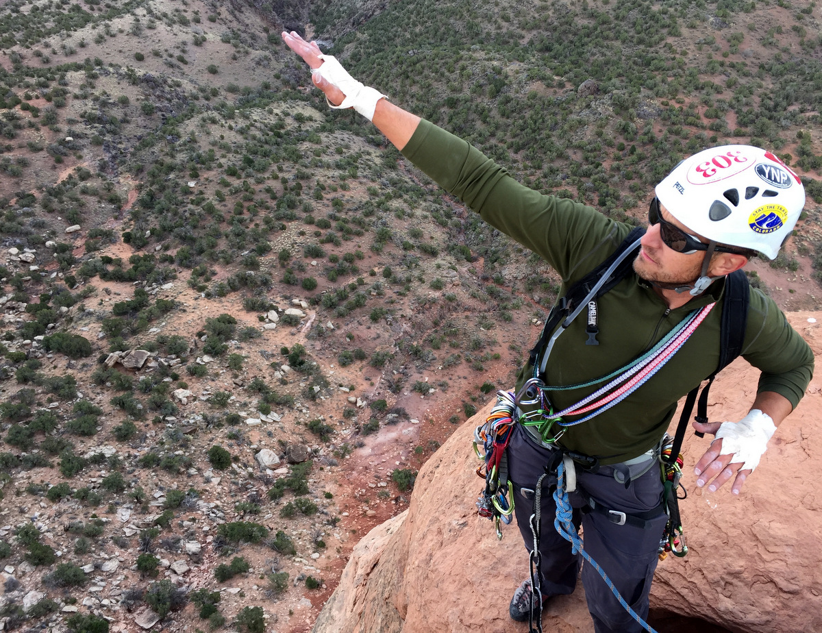
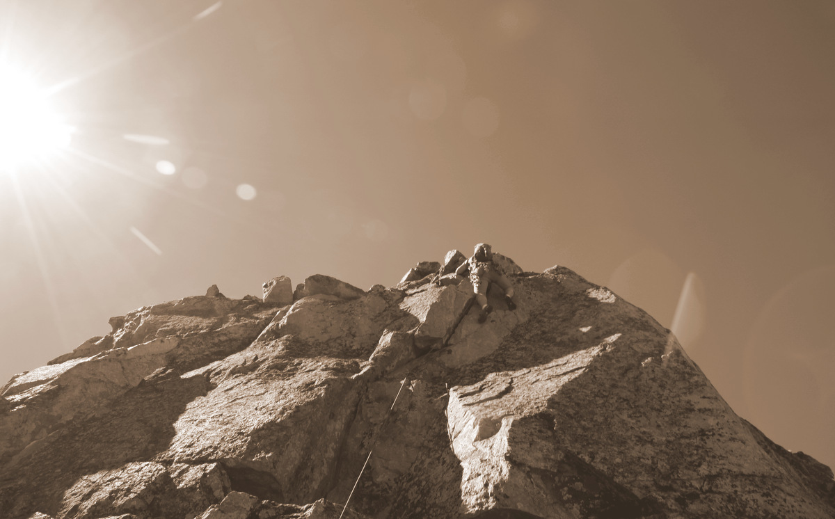
The summit ridge was a mix of snow and dry rock, but was gorgeous all around. What a day we had to top out on ole man Pyramid. I believe we all summitted around noon or shortly after. Warm temperatures, endless views to all the ranges, and zero wind greeted us.
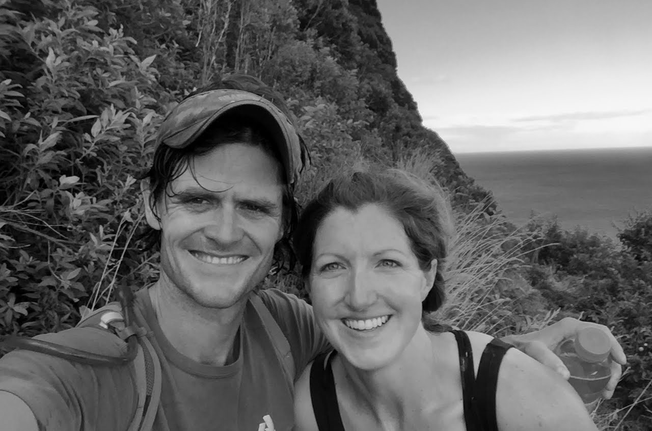
Pyramid winter summit (14,018′). Photo by Natalie
J coming back to the summit from checking out the Landry Line down the east face
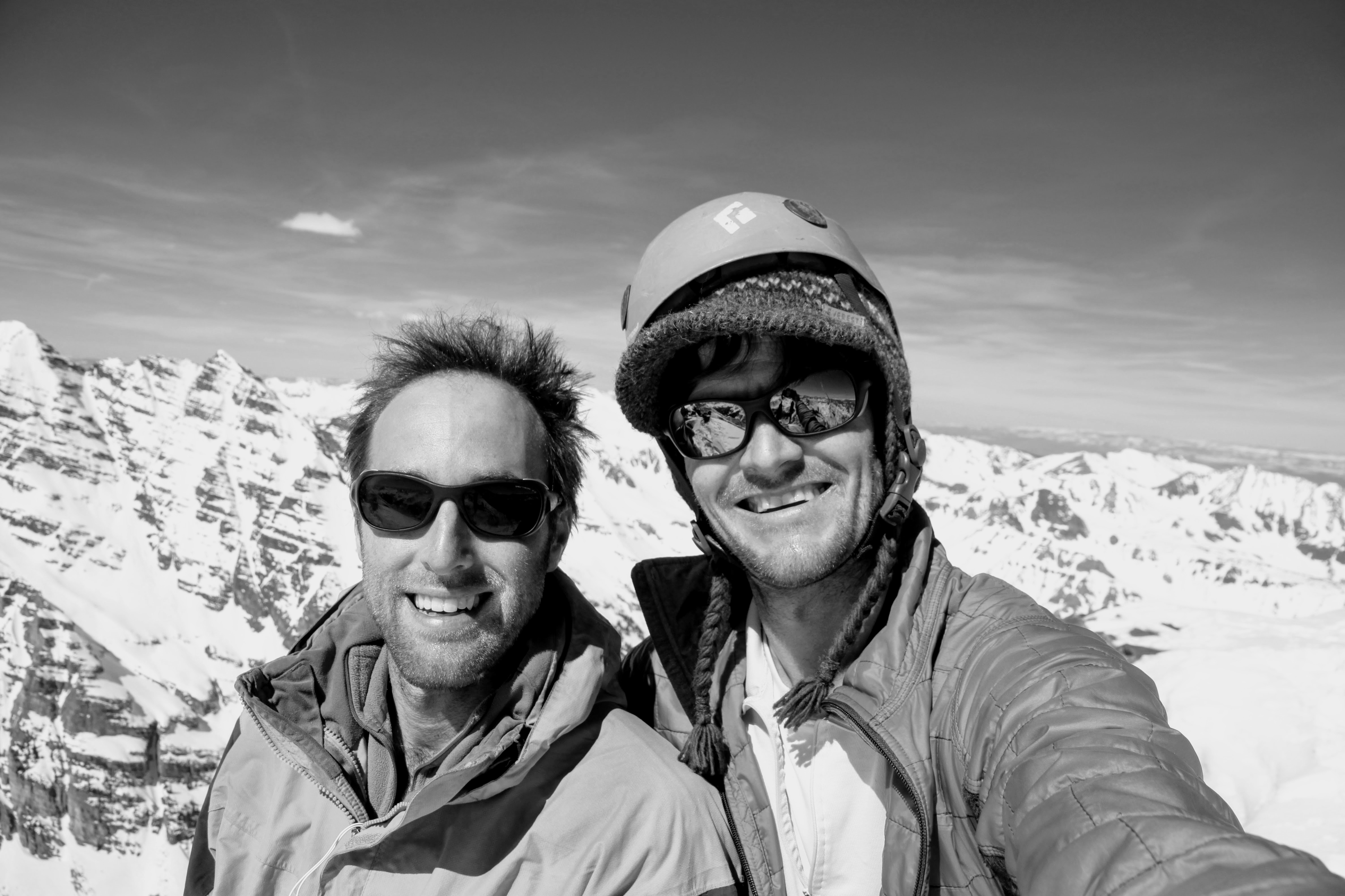
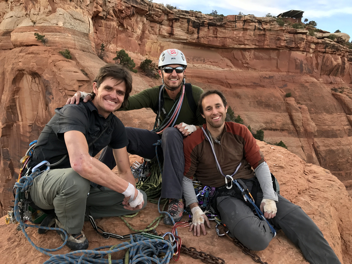
J and myself
The three of us on top of Pyramid
I hated to leave the summit, but I had a long way to go to be back in Edwards by 8pm. I think we started down by 12:45pm.
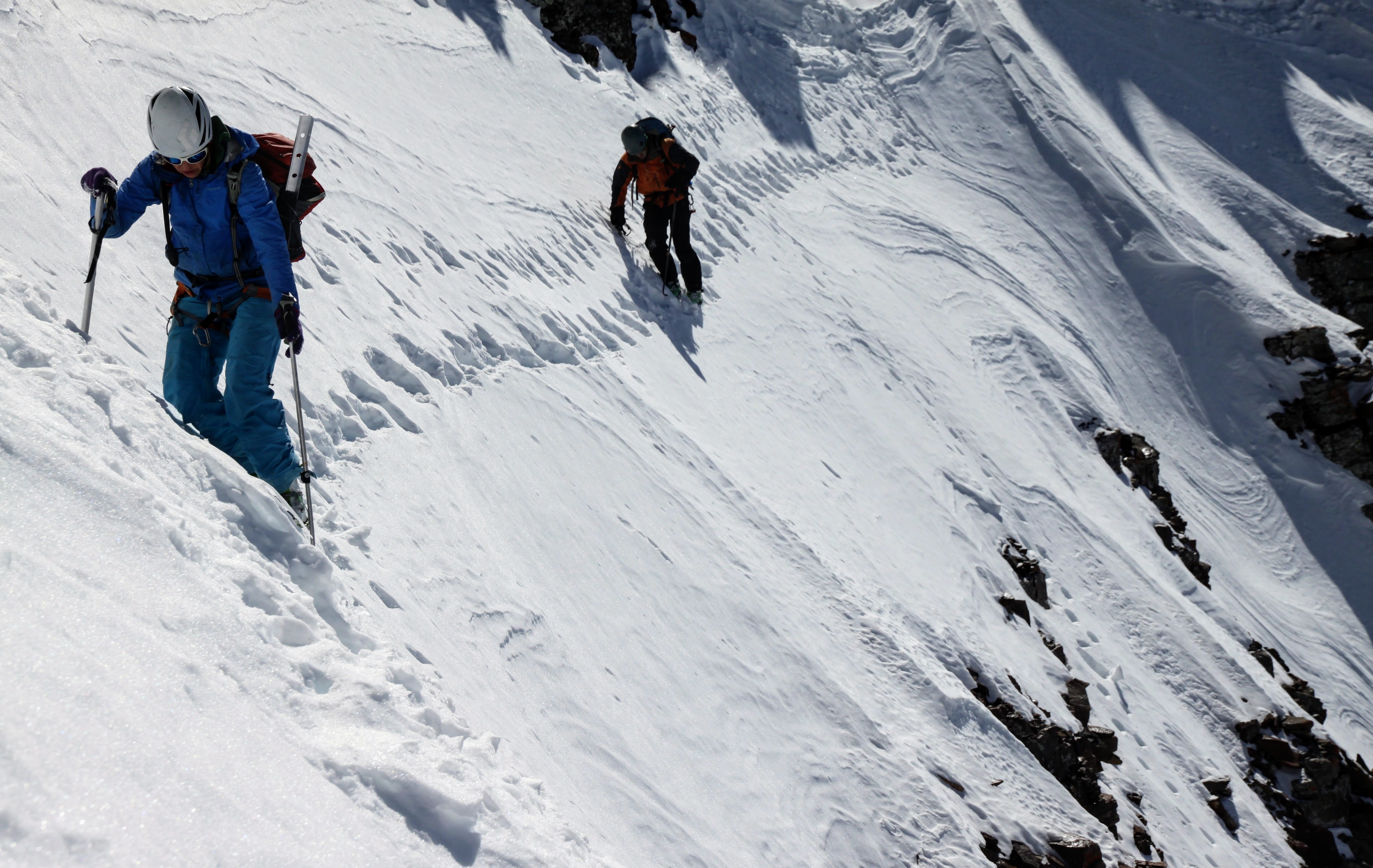
J and Natalie downclimbing the summit ridge.
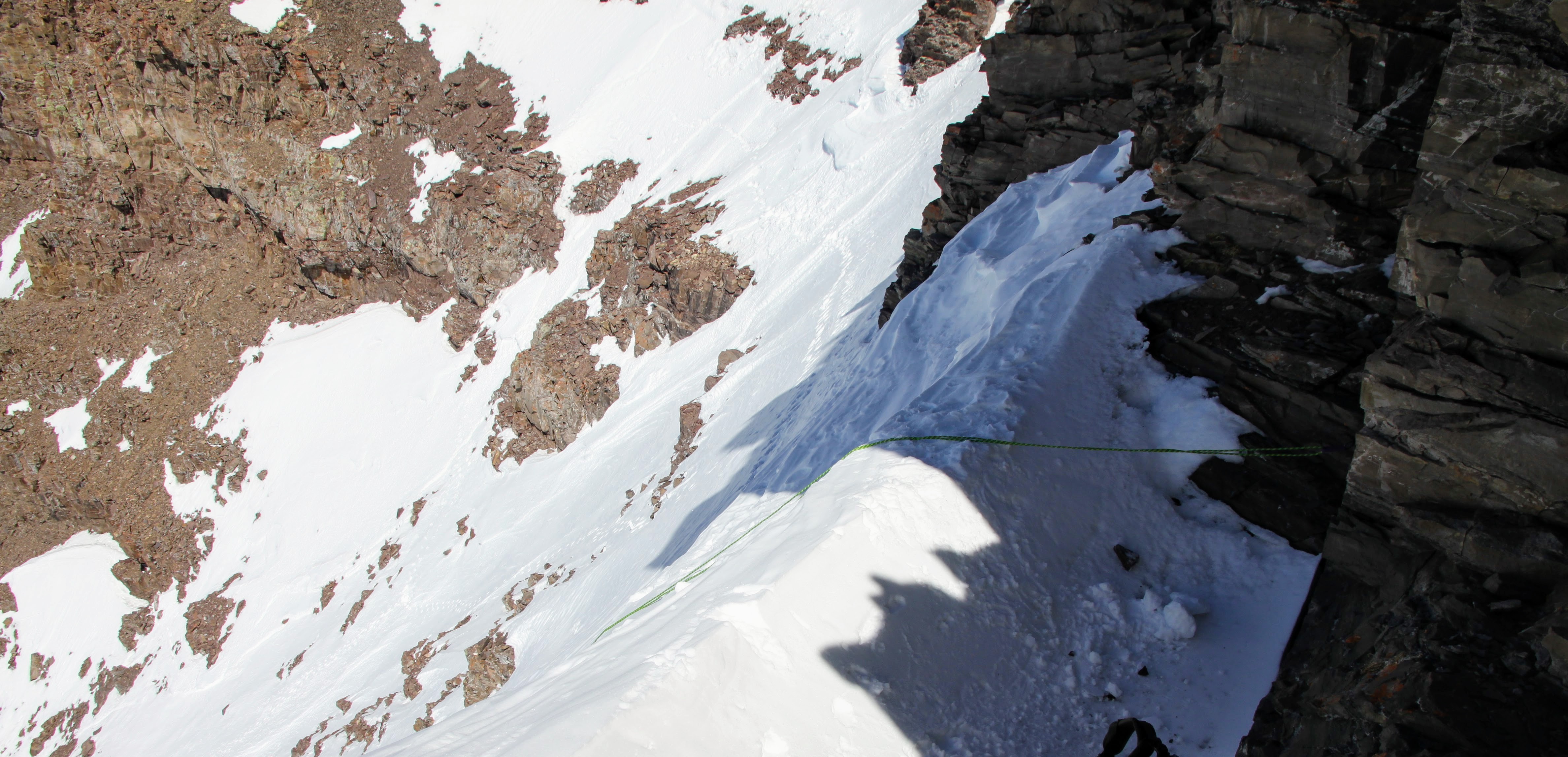
Once we got down to the bottom of the JP Sneak, the 10′ section of steep snow gave us a brief pause. I then just decided to throw the rope down for a handle as we downclimbed this section. It worked well. I joked with Natalie that this is grade A typical fixed rope Himalayan stuff here.
The rope over the steep snow section
Me lowering myself. Photo by Natalie
Natalie lowering herself over the steep part
Descending the horizontal traverse in the upper bowl
Careful stepping
And then some downclimbing to the dry ledge
Back on dry rock, we de-cramponed and made our way back down to the short class 4 headwall and had a nice rappel.
Leaving the upper bowl
At a nice perch looking at the awesome north face of Pyramid
And, that’s a rap
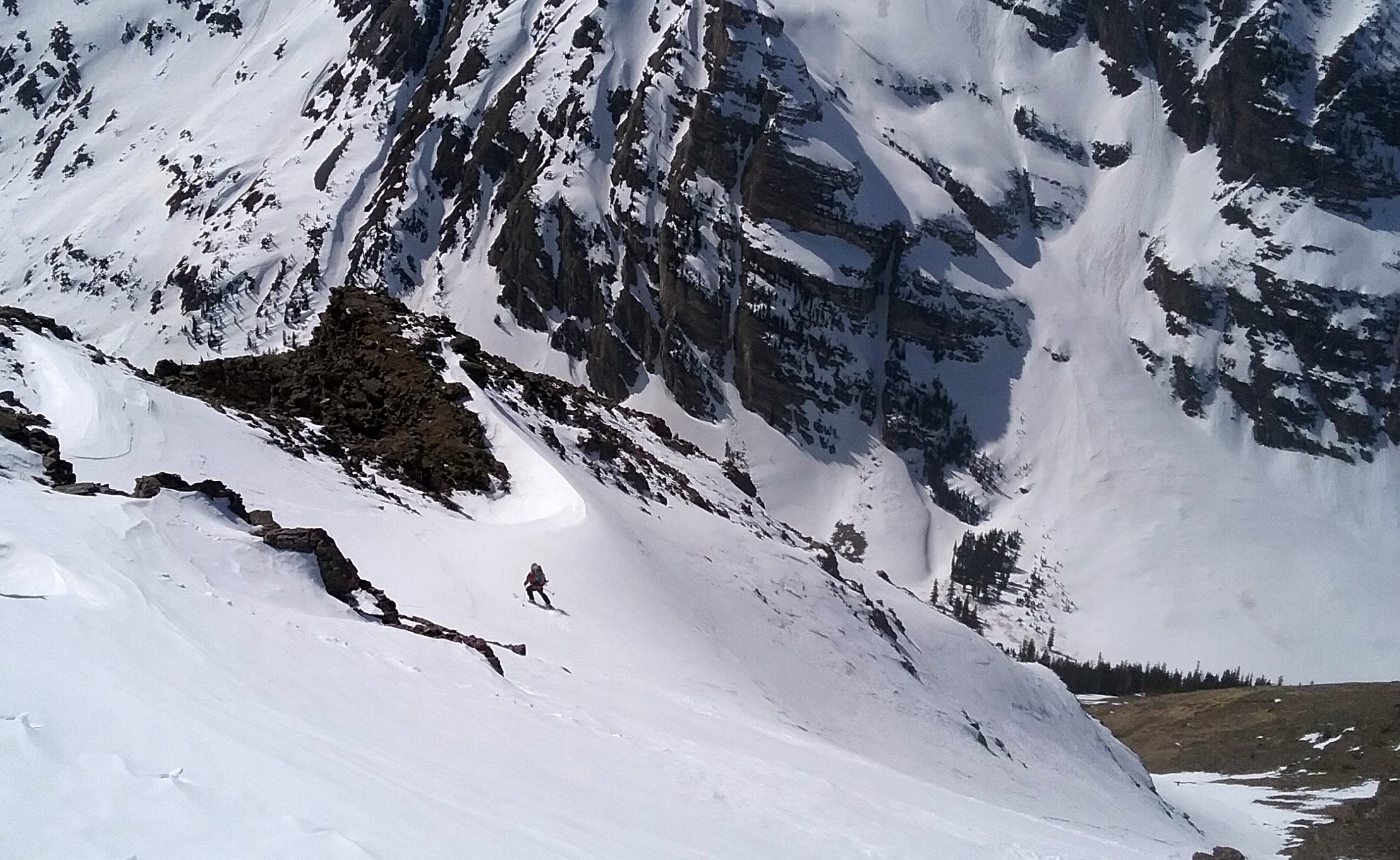
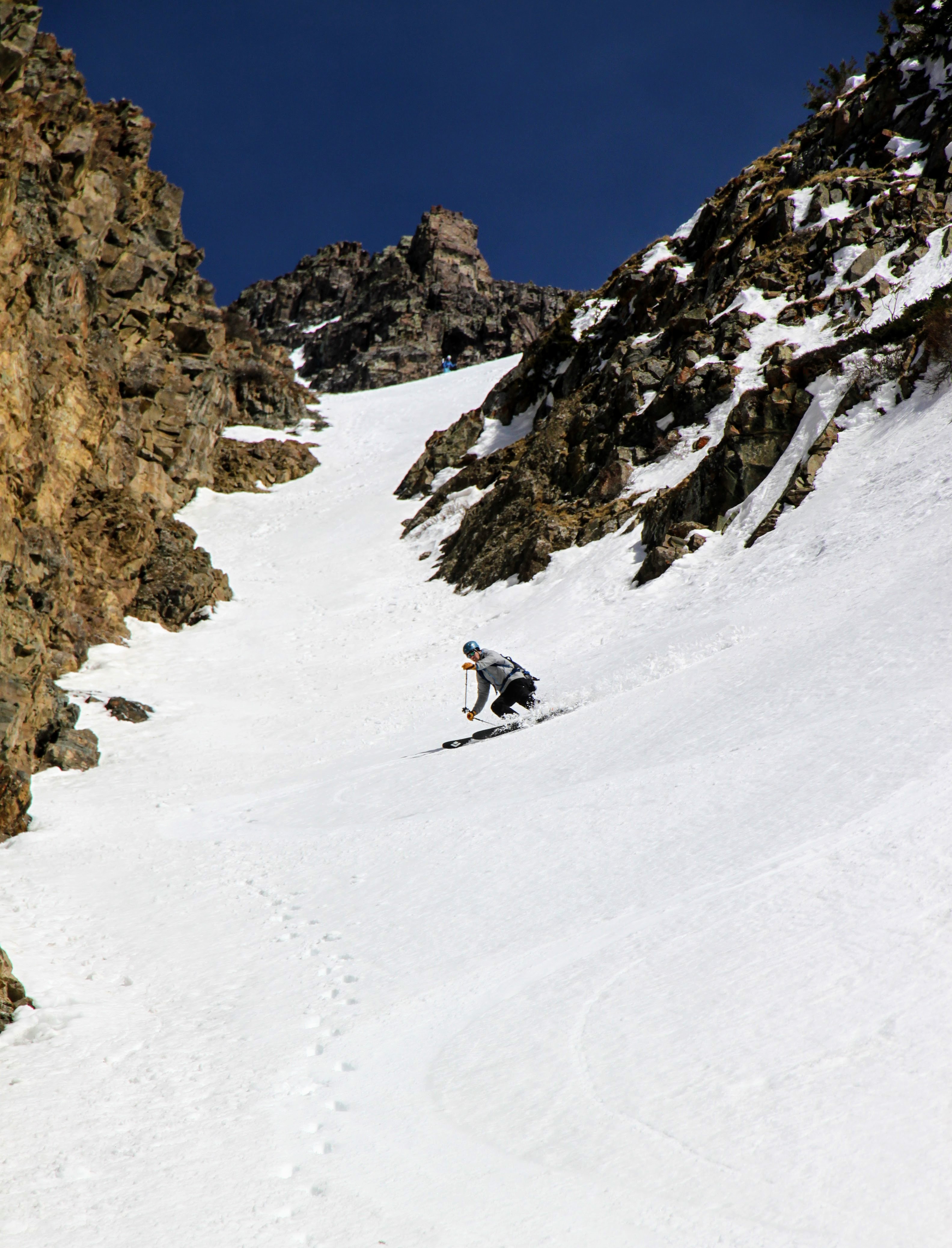
The Keyhole Couloir went fast and loose and we were back down at the top of the west couloir in no time. Much to our surprise, Dylan had showed up and was relaxing in the sun! I was so glad he rested and felt good enough to climb the 2,600′ couloir and brought his skis to boot! Now, he would get to enjoy the fantastic ski down. Since my awful silvretta/ski setup was down in the valley, I left to try and plunge step/couloir run down the couloir as fast as I could and stopped lower down to get some pics of the skiers.
J skiing the upper west couloir. Photo by Natalie
Dylan and J skiing the upper west couloir. Photo by Natalie
J slashing with Len Shoemaker Peak behind
Dylan
Dylan felt better at this point
And, of course, Natalie
Me doing my best to keep up on foot
I clicked into my ski setup and hobbled my way thru the trees back to Natalie’s camp. A tree well ate me for 5 minutes, but I managed to right myself and ski out. Back at the tent, we delayered, ate, drank, chatted for maybe 30 minute, and said our goodbyes to Natalie as she would stay another night and climb South Maroon Peak the next morning. It was now close to 4pm and we had 8 miles out. The descent to Maroon Lake was rough for me on my ancient setup, but once we got to Maroon Creek Road, things went faster and easier. We met up with three ski mountaineering dudes who we had seen off and on all day near Crater Lake and chatted. They had climbed South Maroon’s Y-couloir, skied South Maroon’s east face into the Bell Cord Couloir and wrapped around to climb North Maroon’s north face and ski it. They finished up as we were crossing Crater Lake. Nothing really surprises me anymore with folks in Colorado. Anything in the mountains seems possible. Super nice fellas and we chatted back at the cars for awhile as well.
J slowly skiing out the Maroon Creek Road with Pyramid in the distance
We packed up and actually got on the road a bit after 6pm for the drive back to Edwards. After a stop at Whole Foods and Starbucks, we cruised home rehashing the memories of the 15.5 hour day finally arriving at the house a few minutes after 8pm. Not bad timing. Sawyer had just gone to bed, Kristine and I saw each other for 15 minutes, and then she was off to Aspen to stay with the Mahons. We hated we saw each other so little all weekend, but hey its the last weekend of winter and the weather was unbelievably spectacular. We had to make the most of it. Kristine and Christy had a nice 6-7 hour day skinning and skiing the 13er Pearl Mountain at the head of Pearl Basin on Sunday.
Views of Castle’s east face and Cathedral from Pearl Mountain
Kristine booting
The gals on top
Kristine on top of Pearl Mountain
Kristine skiing
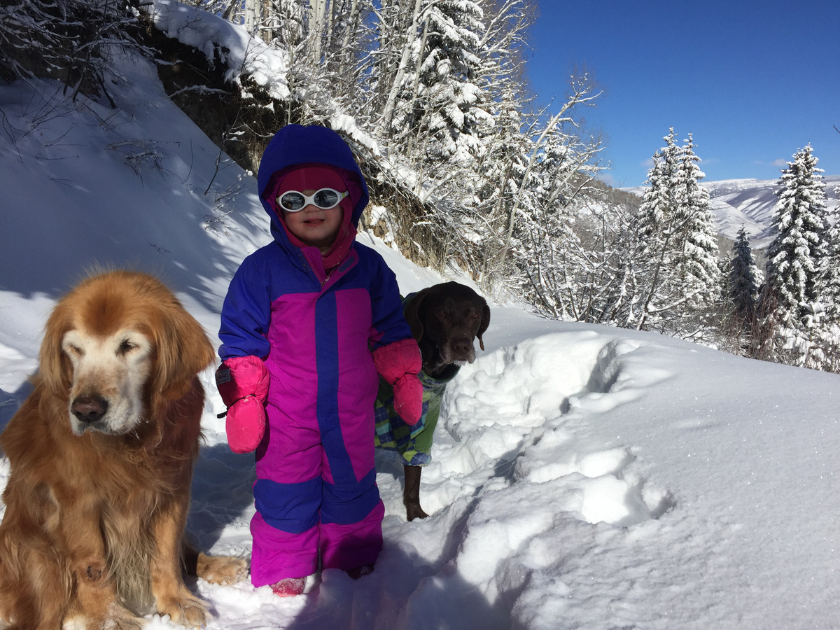
Sawyer, Rainie, & Kona, and myself relaxed most of the day watching March Madness off and on and going to the park. It was much needed for my almost 40 year old body after Pyramid on Saturday. A great way to cap off a nice winter for both Kristine and myself. We’re now so looking forward to spring ski-mountaineering and rock climbing. Bring on the warm weather!
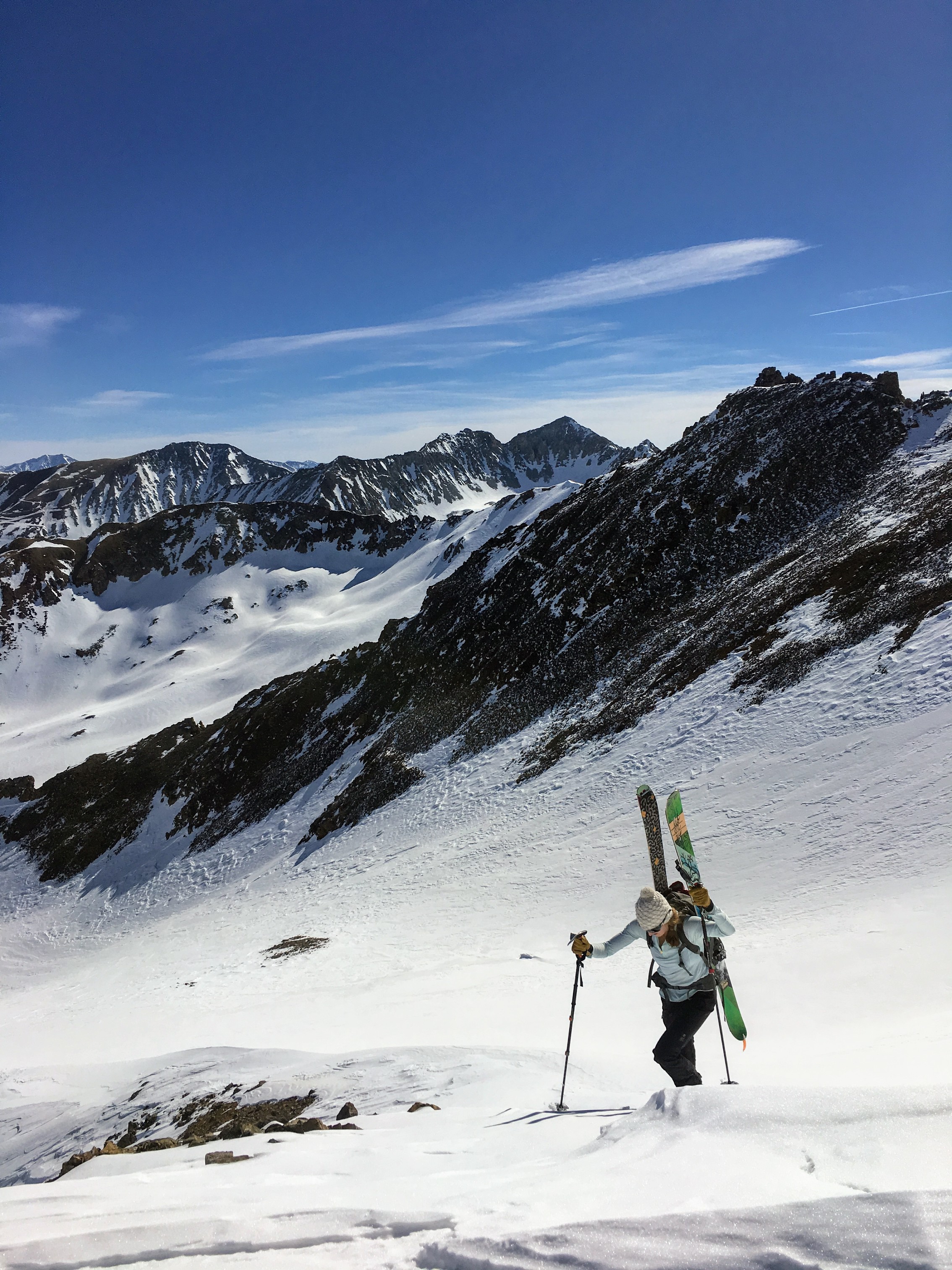
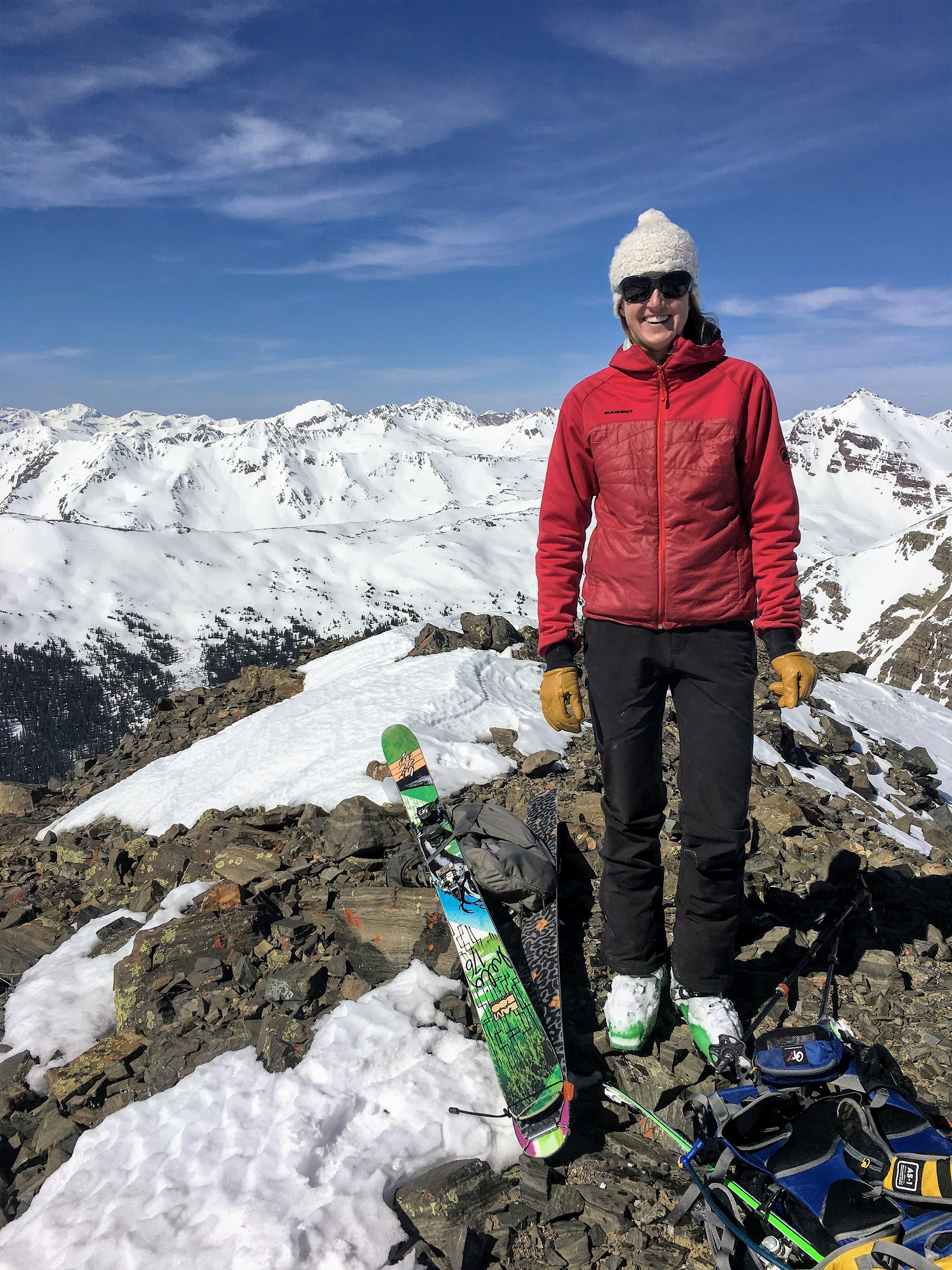
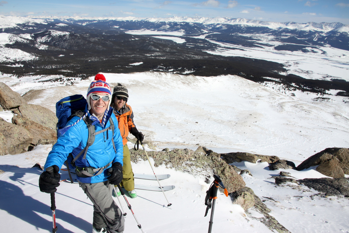
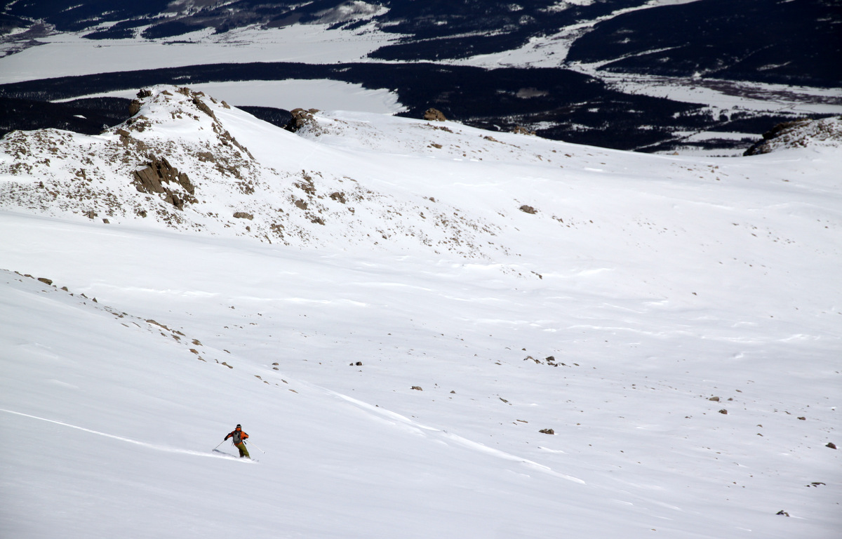
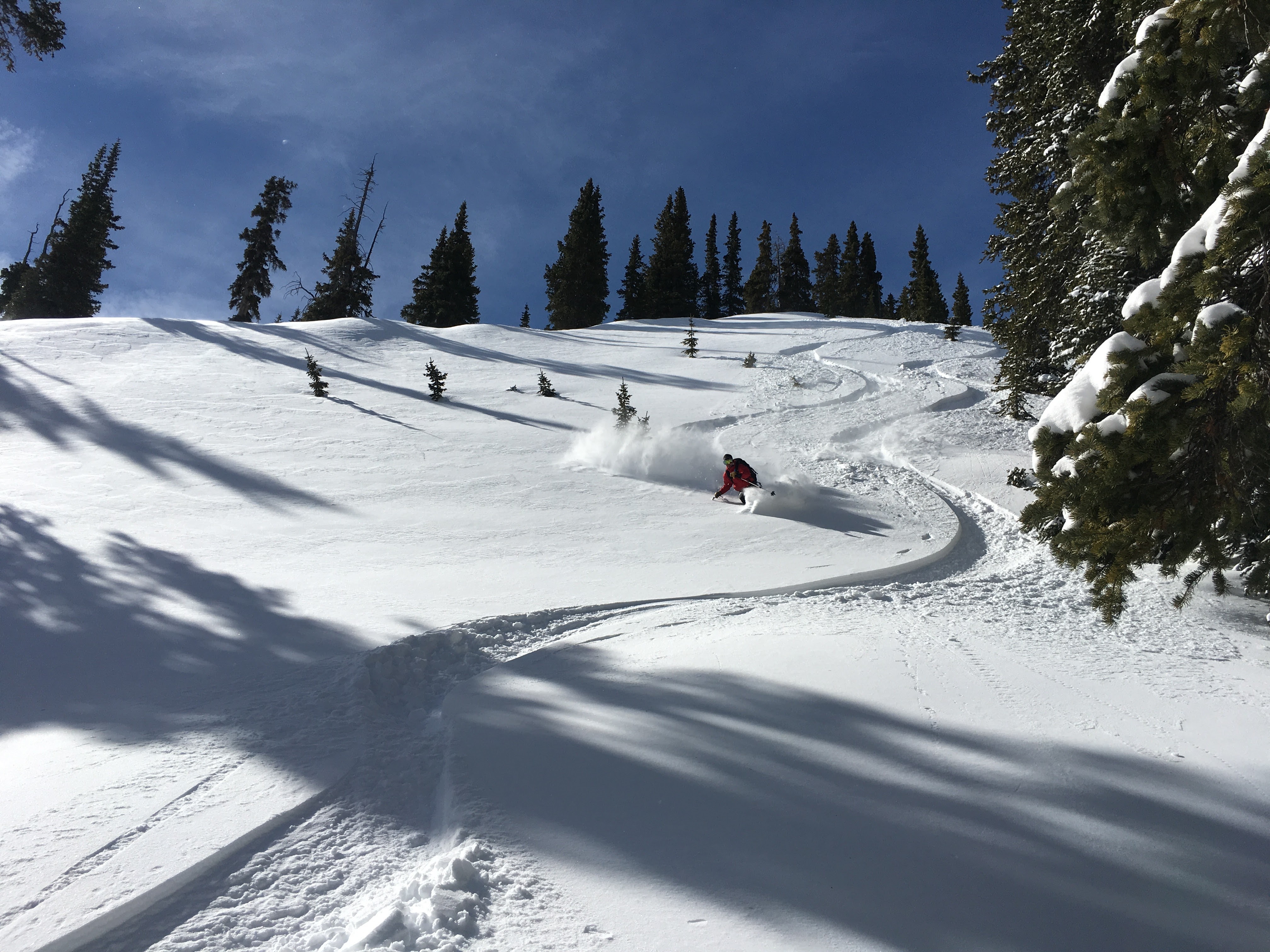
I at least wanted to get one winter 14er in this year and always had my eye on our 2nd tallest peak in Colorado, Mt. Massive (14,421′). It has a nice winter route up the east ridge at about 15 miles roundtrip and 5,000′ of vertical gain that has little avalanche danger. I had always thought the broad east face would be a nice ski descent after a climb of the east ridge, but honestly the chance of having skiable snow that is fun in the middle of winter on a 14er above treeline is not usually very high. The snow high up on 14ers in winter is typically hard, windblasted sastrugi to the point of being “break your leg” snow. I recruited Reid and J to go for an attempt on Superbowl Sunday, February 5. J and I met Reid at the Leadville Fish Hatchery trailhead around 7am and we were skinning by 7:30am. We had a great broken trail to follow really all the way to the Highline Trail / CO Trail intersection and then we followed a lone snowhshoer’s tracks for another 2 miles to the east ridge at treeline. The weather forecast had not called for much wind, but it sure was whipping by the time we reached treeline. We could tell it was getting stronger and more sustained as the day progressed. We skinned across the large plateau east of the significant false summit (13,500′) along the prominent east ridge. Reid and I left our skis at around 13,200′ as we felt it was pointless (at least for us) to carry them any further since the skiing would be pretty horrific on the way down. We all topped out on the false summit with still the east ridge to traverse and 900′ of elevation gain to the summit and we were almost literally getting blown over. It was not very pleasant especially with us trying to climb into the sustained west wind. We called it, turned around, and tried to somewhat enjoy a horrible ski back down to treeline.
Near our highpoint that Superbowl Sunday around 13,500′ along Massive’s east ridge
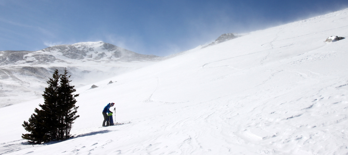
Reid on the descent into treeline. The wind can be seen blowing snow all around and above
Once we hit the trail system below, it was a “luge-type” ski out a few miles back to the trailhead. I was definitely a bit disappointed mainly because it was such a sunny day otherwise! But, a day in the hills beats just about anything else and it was good to get out. We were back in Edwards by 2:30pm.
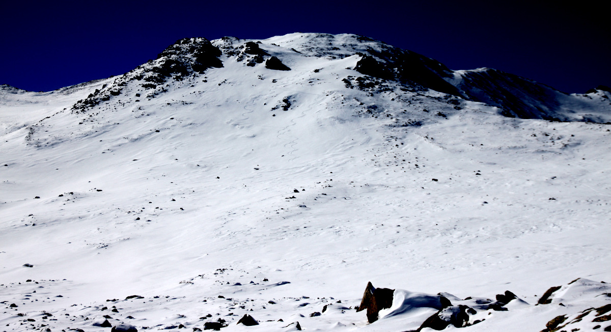
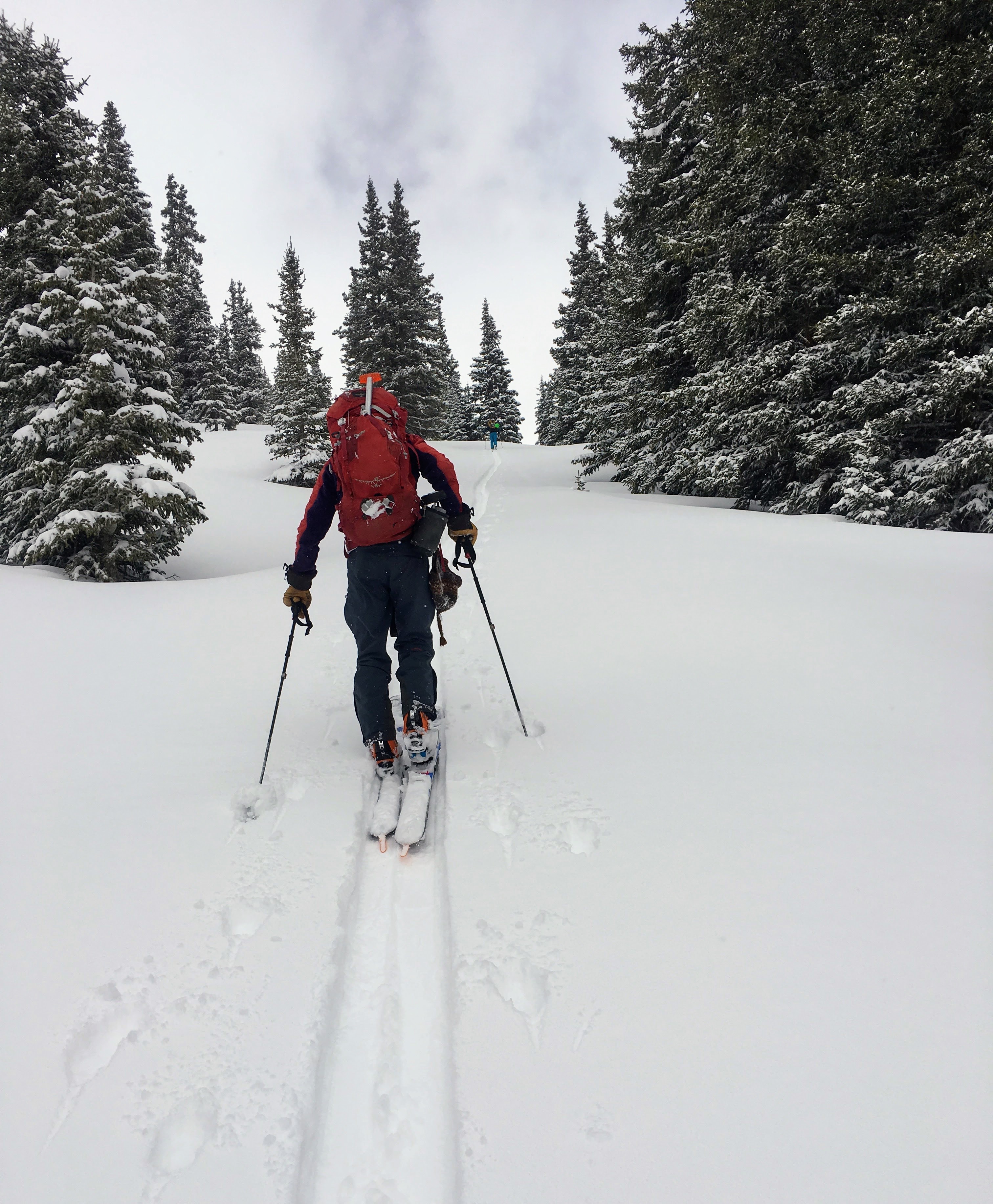
I bugged J to go back with me the following week (unfortunately, Reid, could not go) and with a bluebird spectacular day forecasted for February 15, I picked J up at 5am at the Active Energies office in Minturn and we beelined for the Fish Hatchery trailhead. Moving around 6:30am in about -5 F air temperature, we skinned along a snowshoe track for 3 miles to the Highline Trail / CO Trail intersection as before. From then on, we’d be breaking trail and navigating another few miles to treeline at the start of the east ridge because of the big storm the previous weekend. J and I moved pretty fast with me breaking trail to treeline and doing the best navigating I could do and we took more of a direct line off the Highline Trail straight to the east ridge proper. It was so nice to hear absolutely no wind and feel the sun’s radiance. It warmed up pretty fast and we were getting hot by the time we were skinning across the open plateau, which this time around was a pleasant skin in nice powder above all of the wind blown tundra below.
J skinning up above treeline
We skinned as far as we could to about 13,400′ and then put the skis on our packs and started booting up in the new snow. I broke trail up to a notch in the larger rock formation along the east ridge and then J took over.
J booting with our skin track visible on the large plateau below
J making progress up to the top of the 13,500′ false summit
Once we hit the now well-defined east ridge, we made our way up and over some minor bumps and then up the final 600′ headwall to the summit.
J along the well-defined east ridge with the summit ahead
J making the final steps to the summit
We topped out 10 minutes to noon and enjoyed a completely windless Colorado 14er winter summit. It was wonderful. We were now certainly glad we came back to do this peak this day for sure and not the previous week.
Mt. Massive summit (14,421′)
View east to the Elks (Maroon Bells and Pyramid Peak visible)
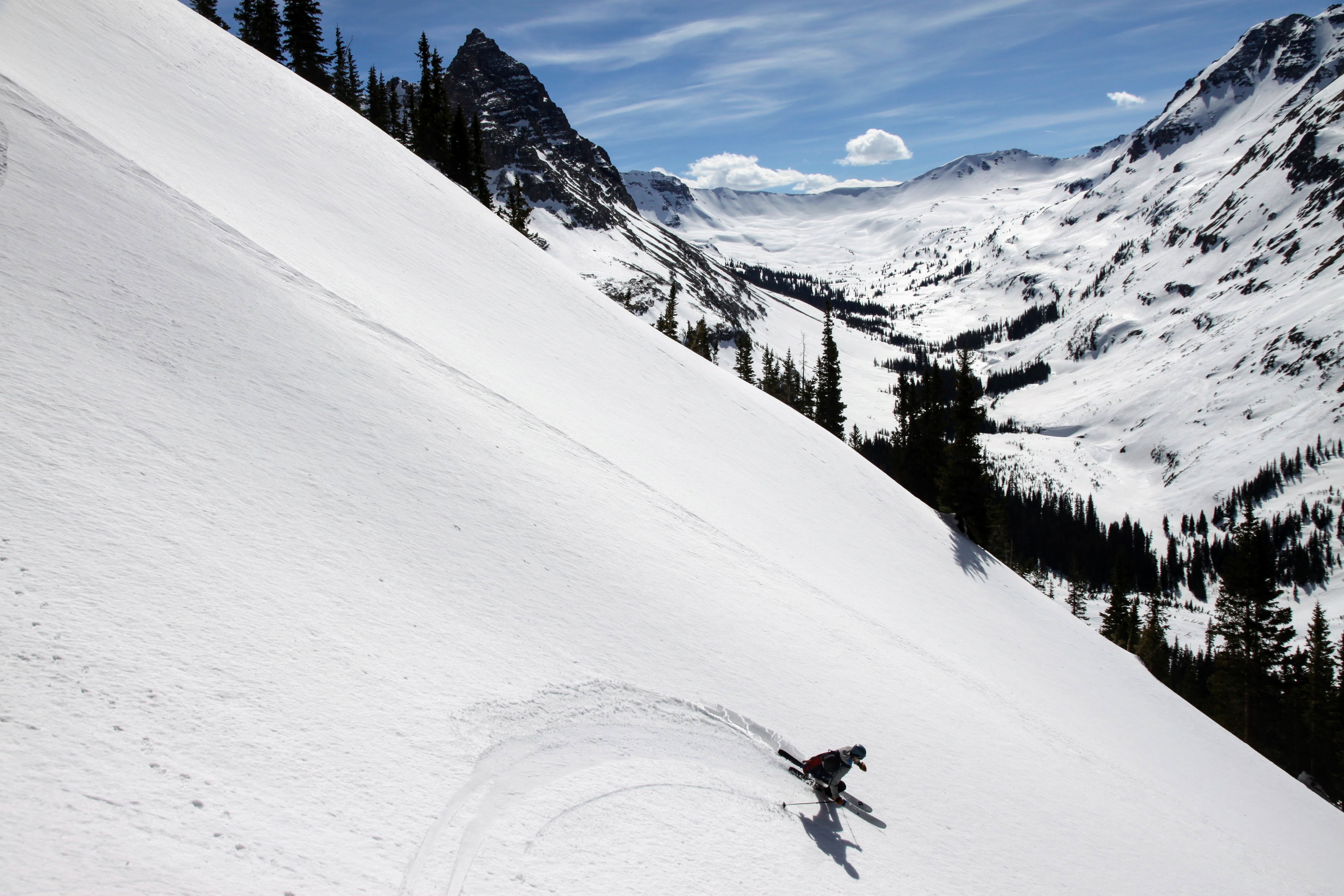
We stayed up top for 20 minutes or so and then decided to ski the east face directly from the summit as it looked pretty darn good. From a week and a half earlier, we knew it was a good 8″ of fun snow on top of hard, wind compacted glacier ice. After unthawing my NTN tele bindings on my skis so they would accept my boots, J took off and then me after him. They were some awesome turns. Best I’ve had on a 14er outside of spring ski season, but this time in powder!
J carving his first few turns
Me carving some tele turns on the wide open face. Photo by J
Our turns on the upper face from the summit
We traversed back over to the top of the false summit on the east ridge itself at 13,500′ and skied what J had skied a week and a half prior. Only then, what he skied was awful wind-affected ice. Now, it was powder.
J
J lower down on the east face heading onto the large plateau
Our tracks down from the 13,500′ false summit
Our turns lower down heading into treeline. Such great snow
We skied great snow back into treeline and then because of the warm snow down low combined with our very cold skis, the snow was sticking to the bottoms of our skis and we couldn’t move. J had wax and after we waxed the bottom of our skis, we glided along just fine. We were back at my car by 2pm for less than 2 hours down. What a great 7.5 hrs up on Massive it was.
J took a short video of me skiing the upper east face of Massive:
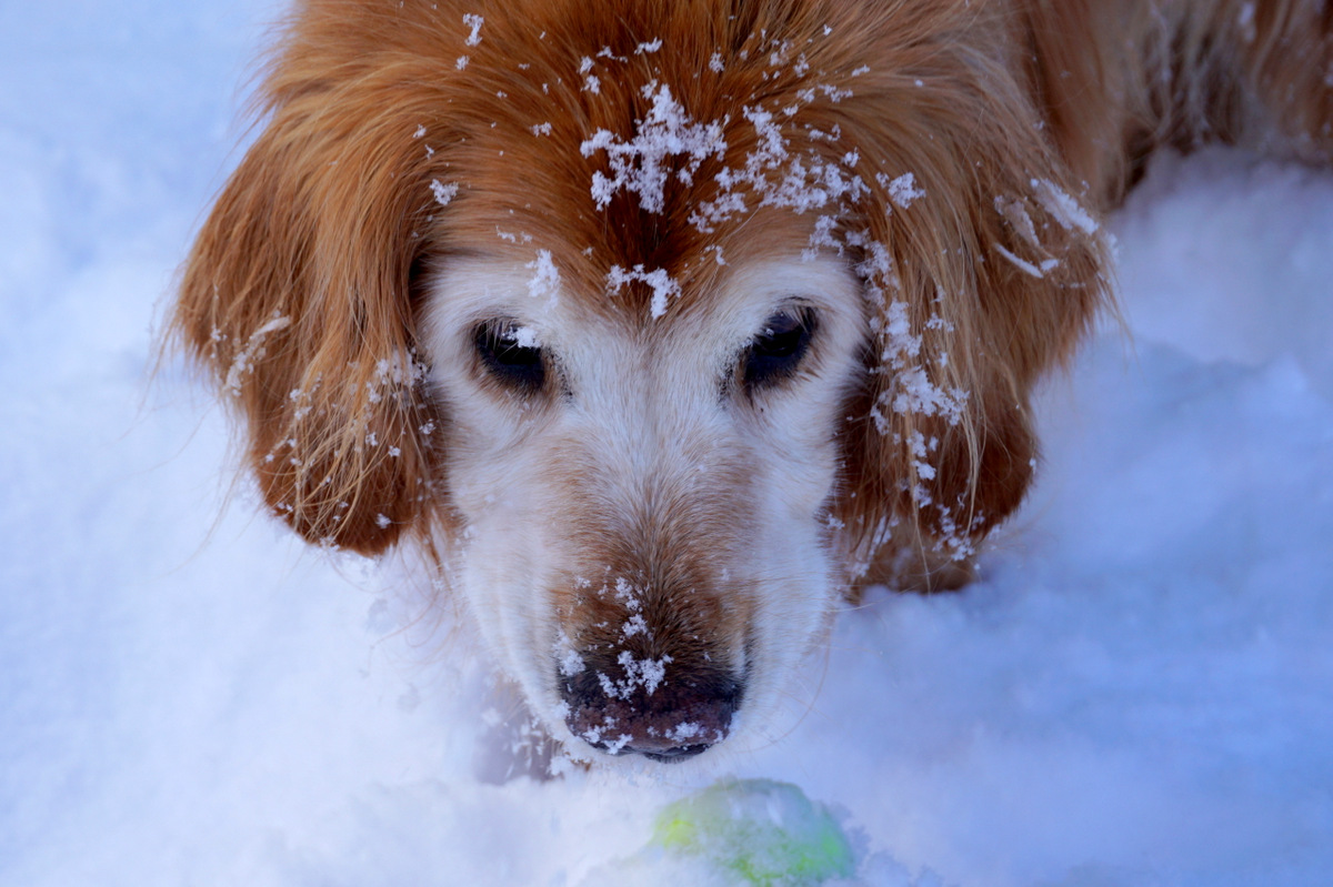
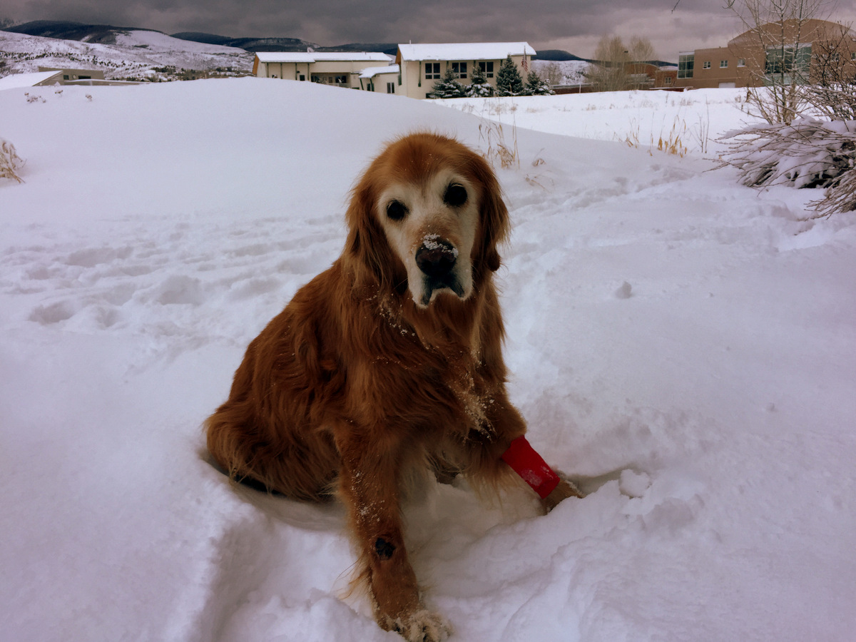
Considering the little scare Rainie gave us last week only 2 days before her 14th birthday, I was so relieved and happy to say happy birthday to Raindog last Wednesday, January 11. She was diagnosed with old dog vestibular disease and when you don’t know what that is, it sure is scary to see it happening to your pet. She spent a day at the vet under the care of our wonderful doc and friend, Charlie Meynier, as well as his awesome staff at Vail Valley Animal Hospital. She is getting better every day with medication and support from all of us. I have her old climbing harness that we have used to help her with stability in walking in the snow and going the bathroom. Hopefully, she will make a full recovery in a matter of weeks. She wasn’t feeling too good on her actual birthday, but J, Megan, & Raina all came over to hang with Rainie.
The whole gang (meaning the people who know her best) celebrating Rainie’s 14th
Rainie is still hanging in there and while she obviously doesn’t run or climb peaks with us anymore, she is just the sweetest thing ever and my best friend (and first love 🙂 ). She enjoys her walks with us to the park and laying in the snow with her tennis ball. Honestly, I couldn’t imagine life without Rainie by my side, but a week ago Monday sure prepared me for life without her. Fortunately, we got another chance to spend precious time together for however long it lasts. Kristine and I had long talks about losing Rainie and agreed that we need to provide her with the most comfortable and loving environment possible and enjoy our time together to the max. While a week ago Monday was one of my most stressful, emotional, and sad days yet, I see it as maybe a learning experience to hopefully let go of Rainie a bit easier than when that day finally does come. Nevertheless, no matter what, she has lived an amazing life.
Raindog and her ball. Photo by Dianne Oelberger
Hiking to cut down our Christmas tree
Recovering from her vestibular disease
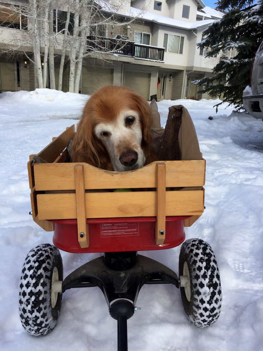
Kristine got this awesome 4wd Radio Flyer wagon for Rainie. She loves riding in it.
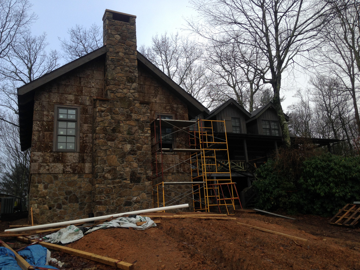
This year’s Thanksgiving was a special one as we headed back east to the mountains of North Carolina to spend 7 days at our mountain cabin, Chalk Hill. Sawyer had never been to Chalk Hill and Kristine and I had yet to see the finished addition of the large great/game room. The new addition is incredible and really adds to the livability of the cabin.
The new addition under construction as seen last December 2016
The driveway side front entry of the new addition as seen last December 2016
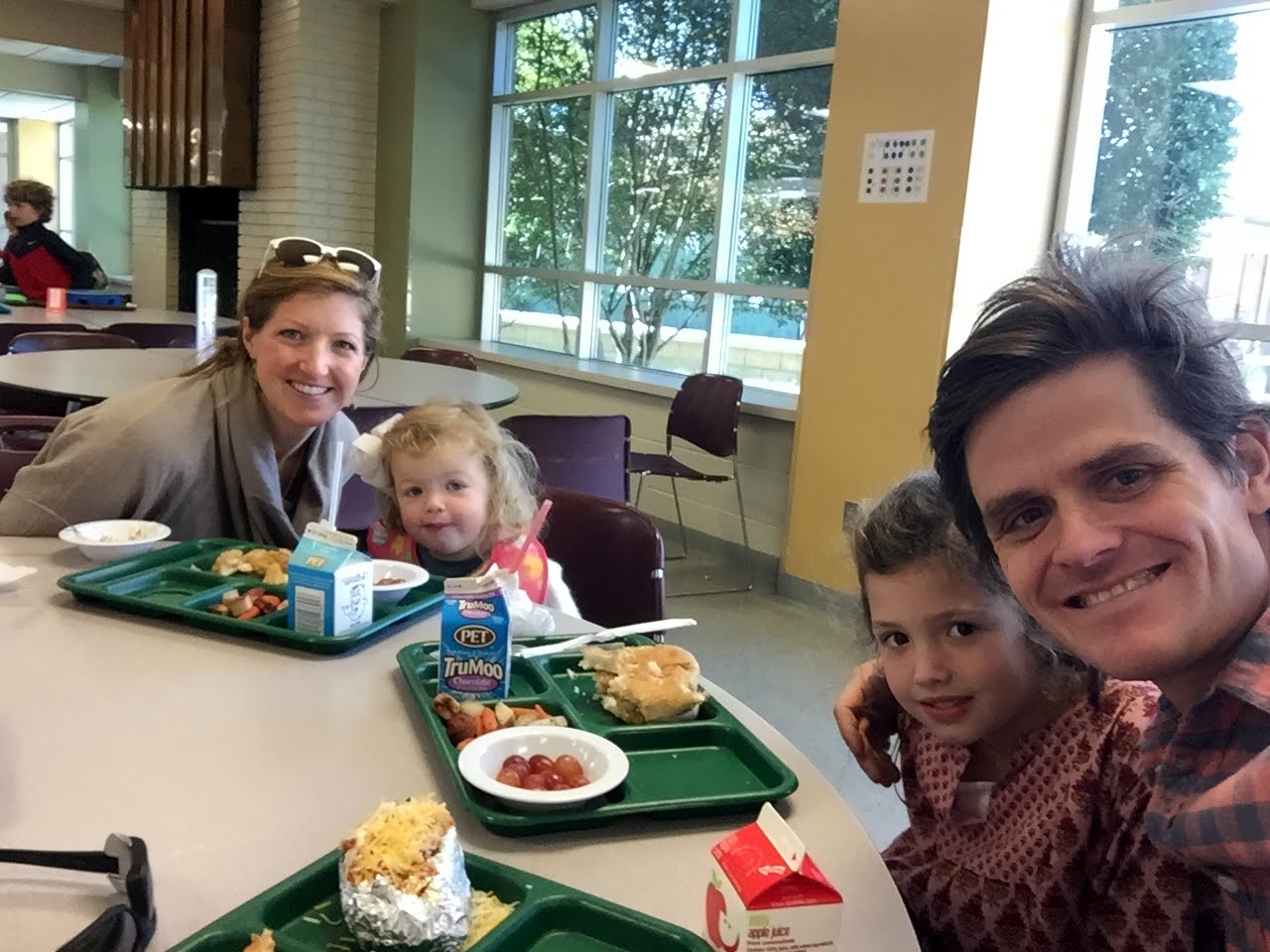
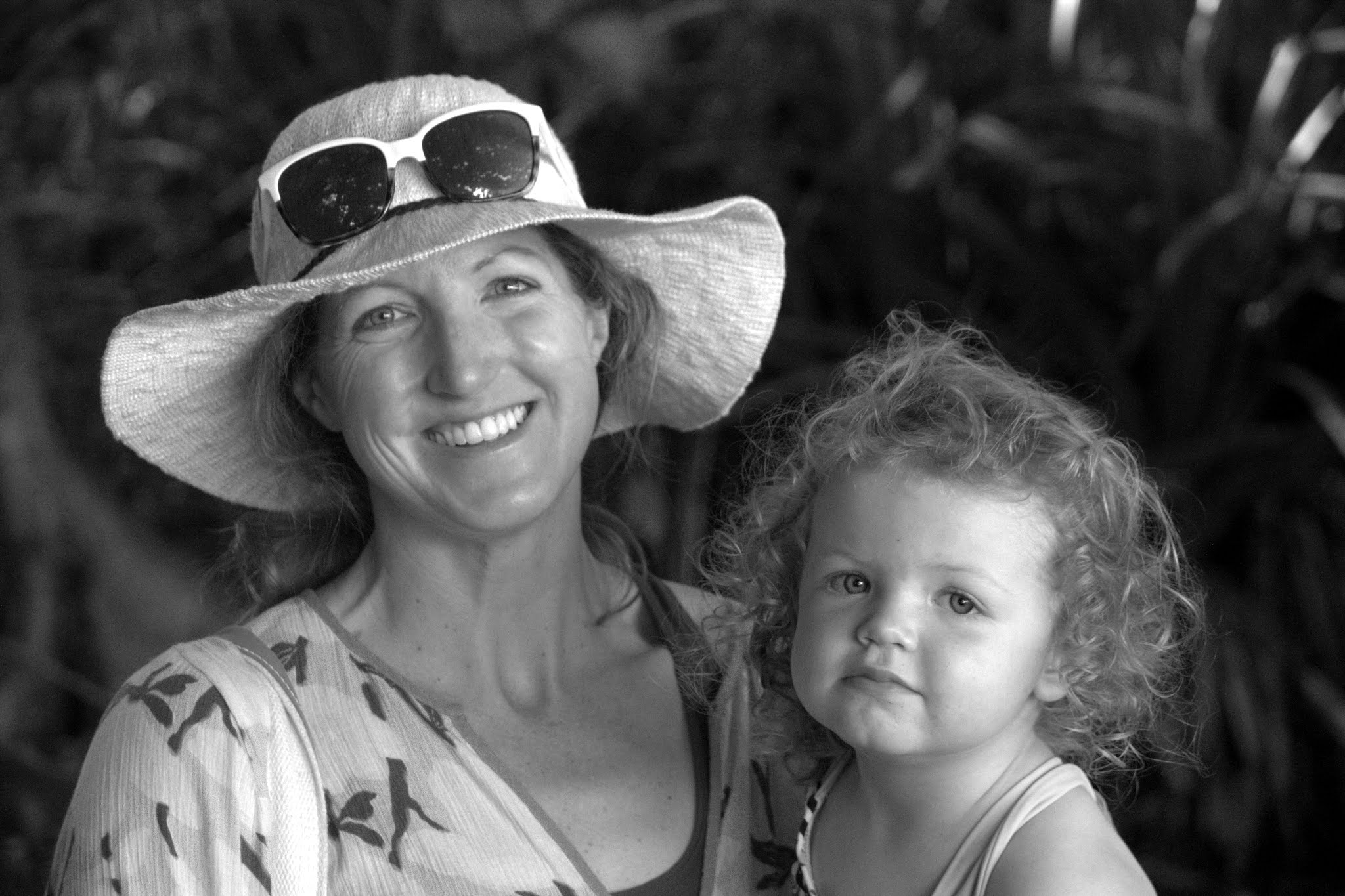
During the first 2.5 days in Charlotte, Kristine & I went to Charlotte Country Day School to have lunch with my niece, Harper, who is in kindergarten. My sister and I both attended CCDS and was so fun going back especially to see Harper. Gosh, last time I stepped foot on campus was when I gave the Cum Laude Induction Ceremony speech in February 2013.
Leaving Eagle for Charlotte
Sawyer & Harper at Brixx Pizza on a Sunday night
Lunch with Harper at CCDS
It was so fun being with Harper at school
Love this little lady
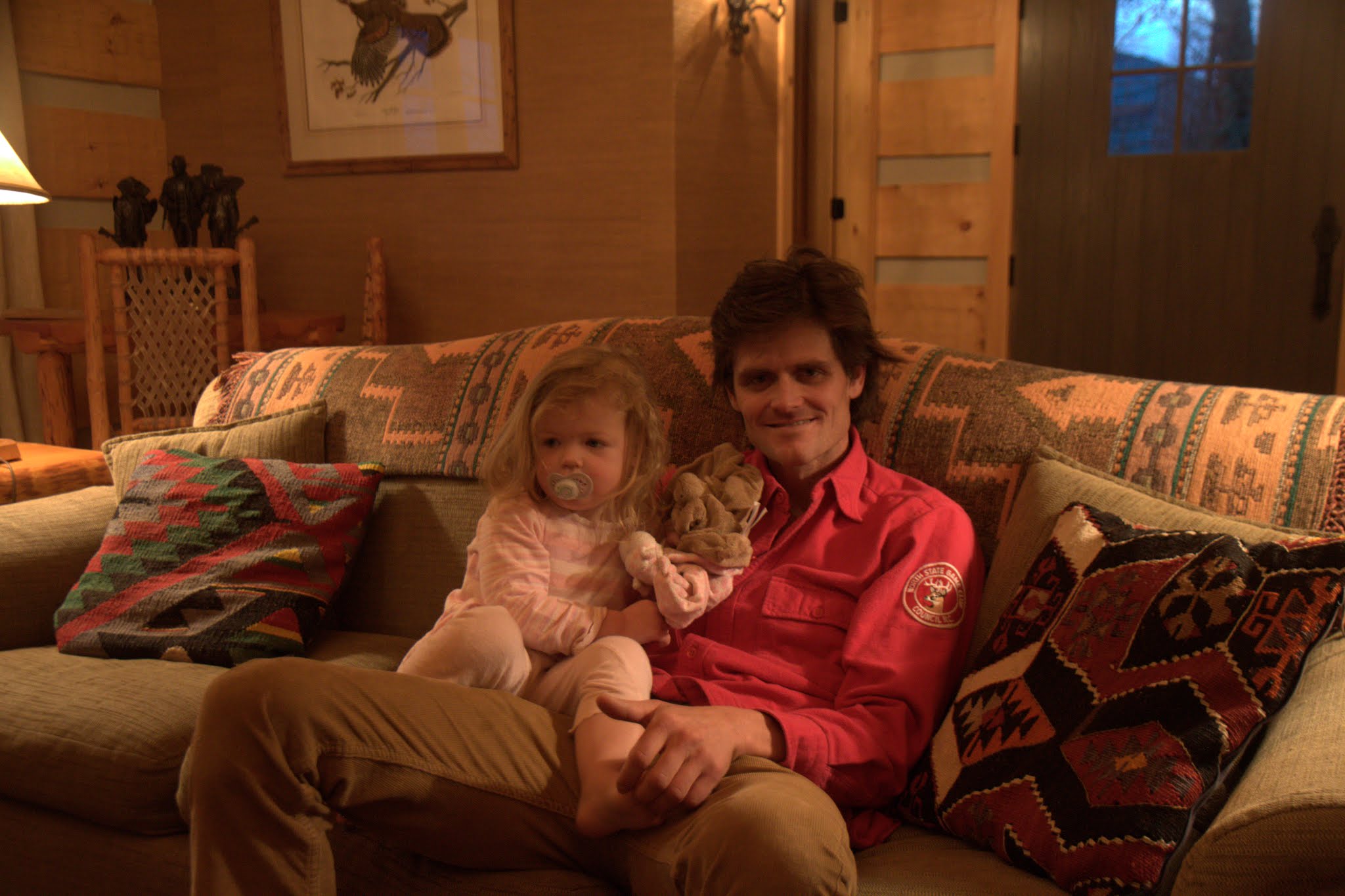
Sawyer was so excited to be with the big kids that she lined up with the kindergarten class
We then drove to Chalk Hill later that day. I always feel right at home at Chalk Hill with dad and everyone.
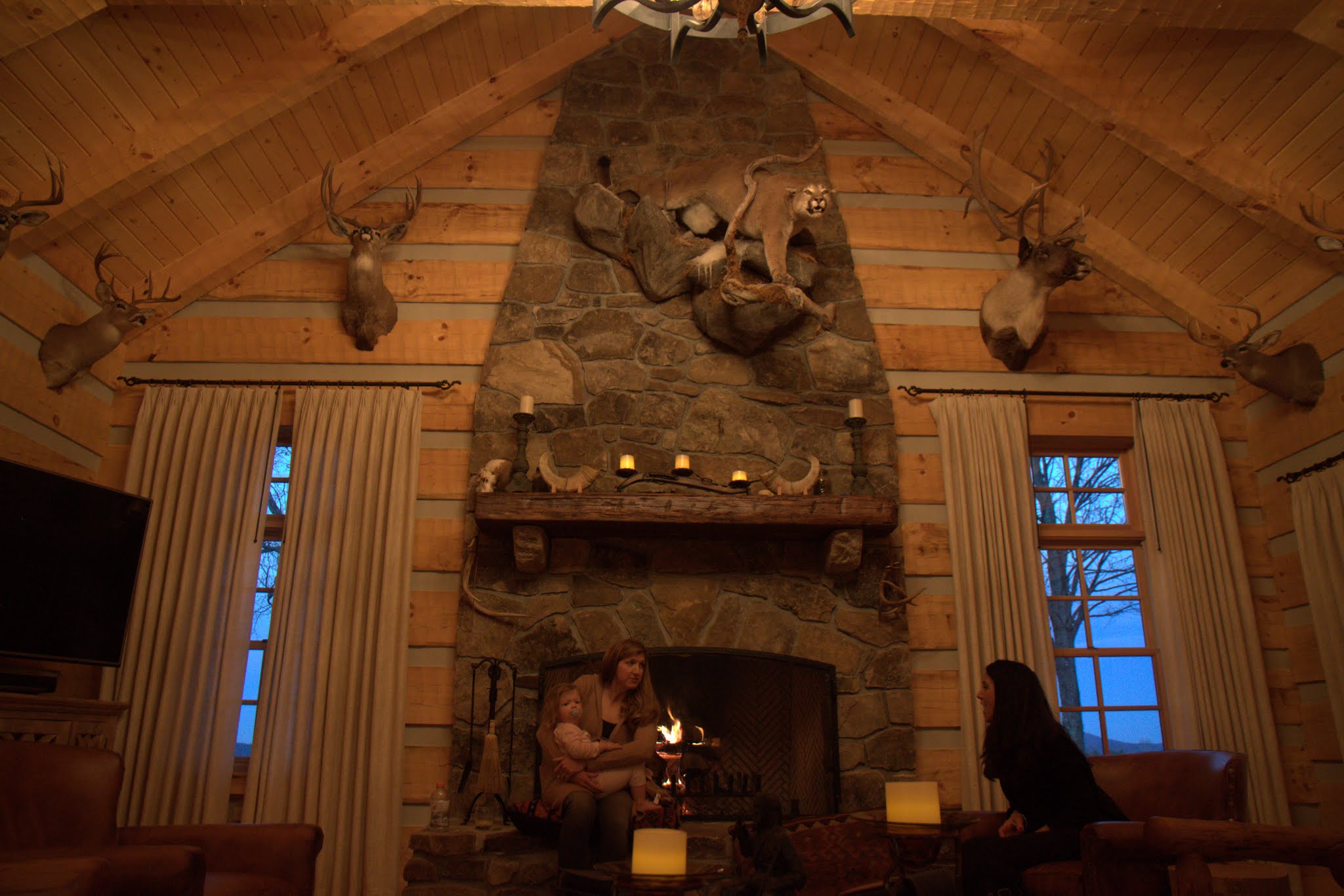
In the new living room
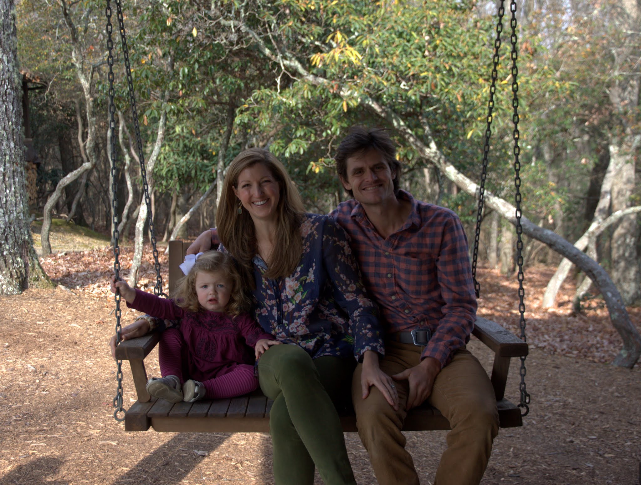
On the front porch swing
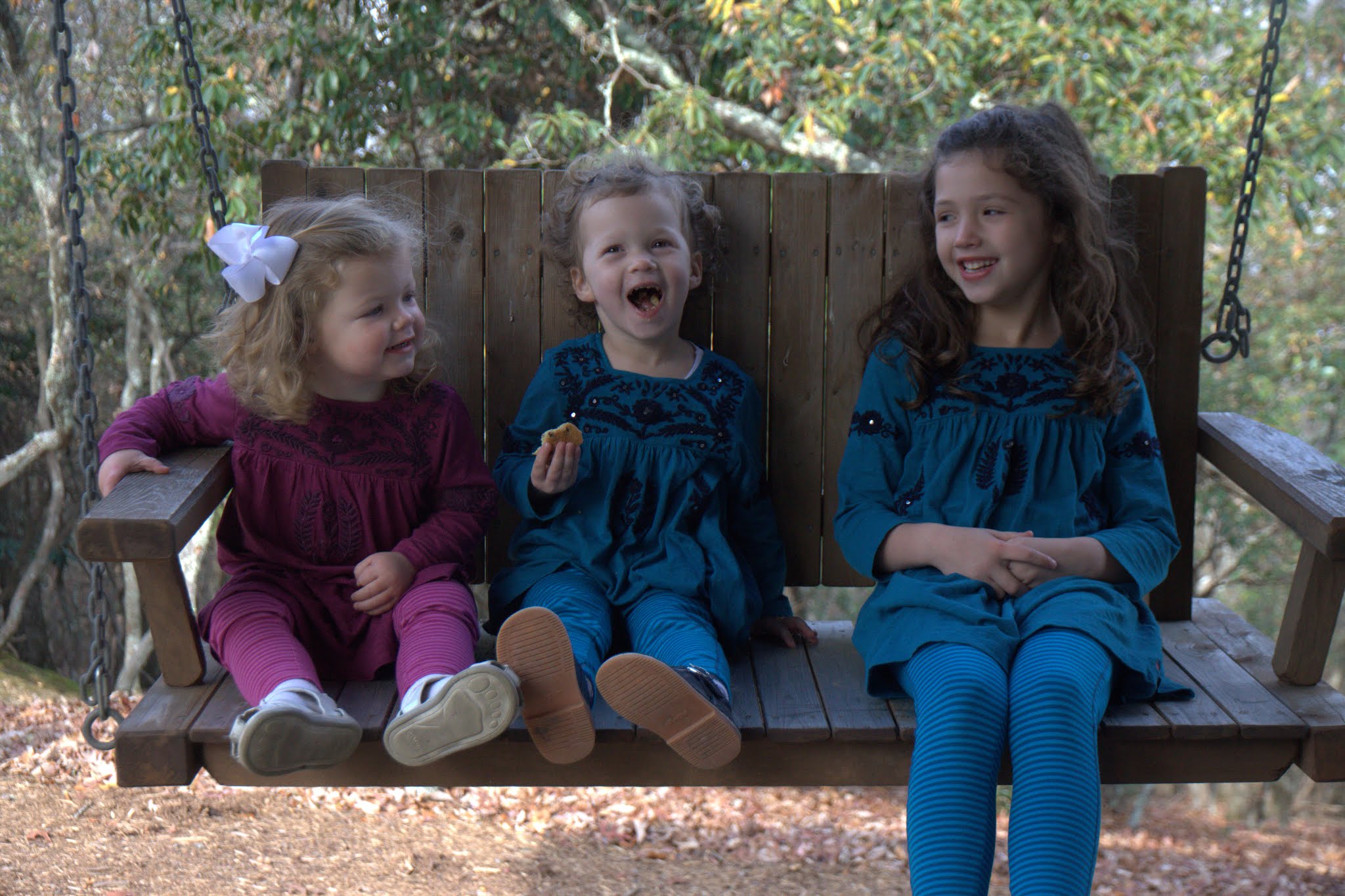
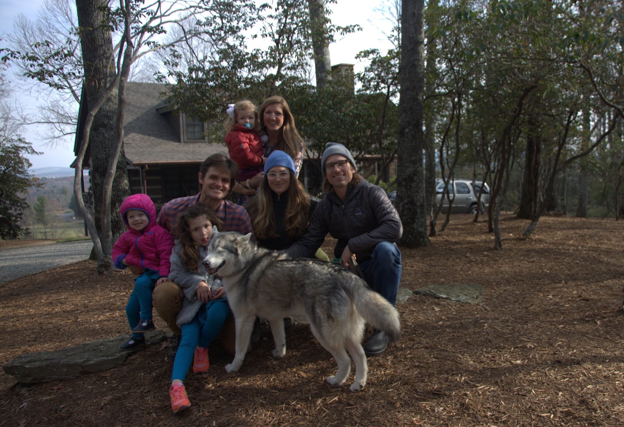
Cuzins
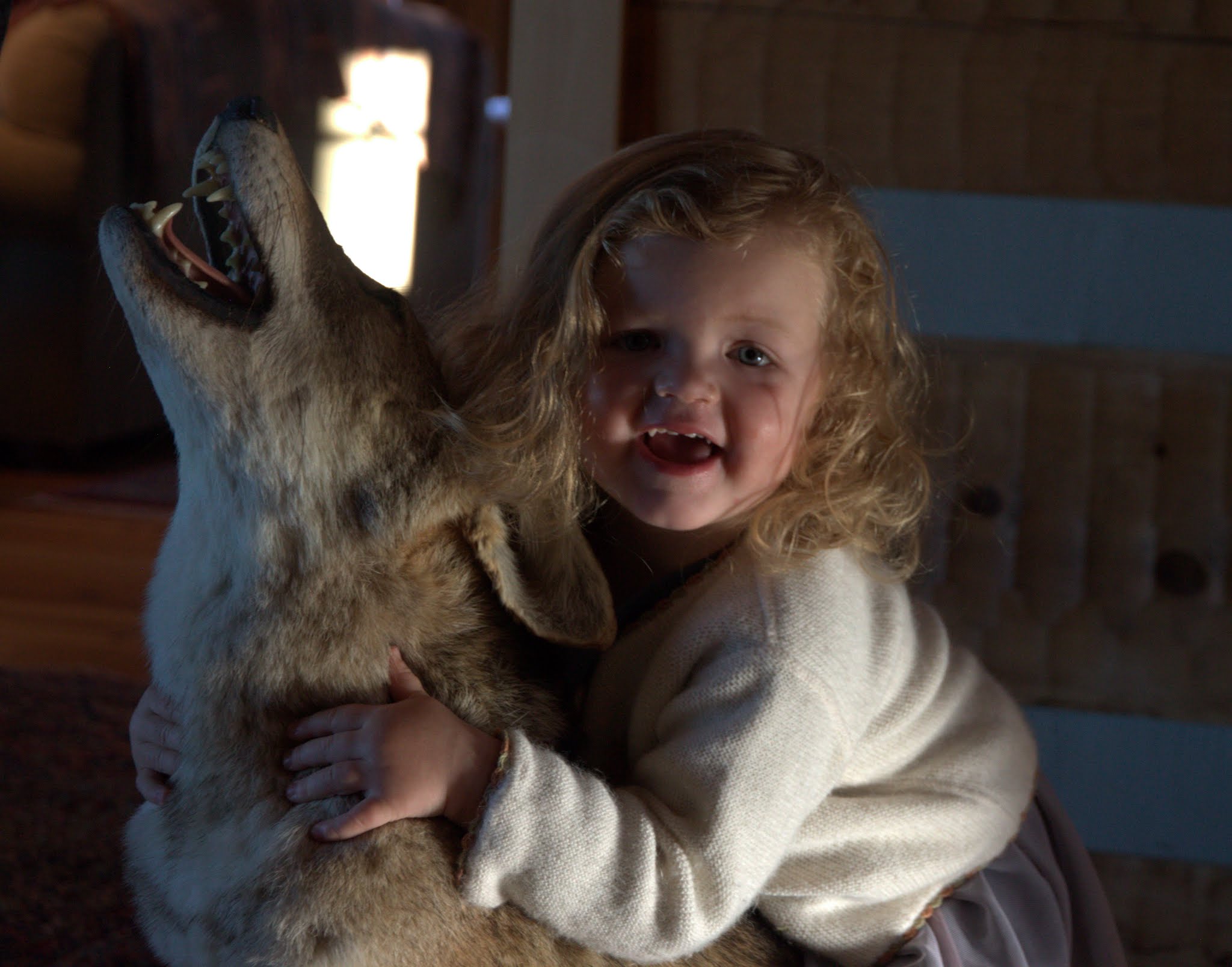
Sawyer and the coyote
Me & Sawyer
Me and my gals
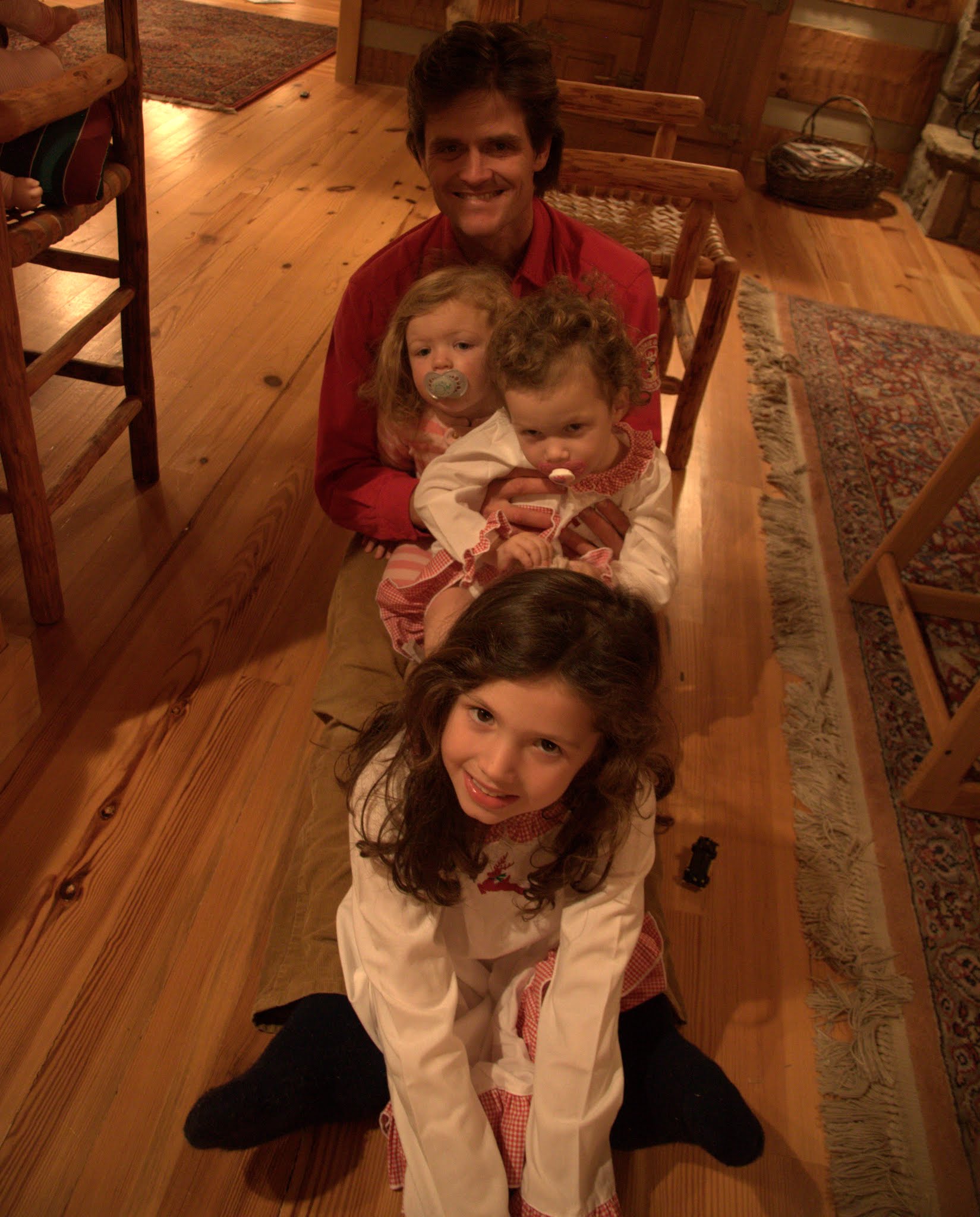
Me, Sawyer, Wesley, & Harper
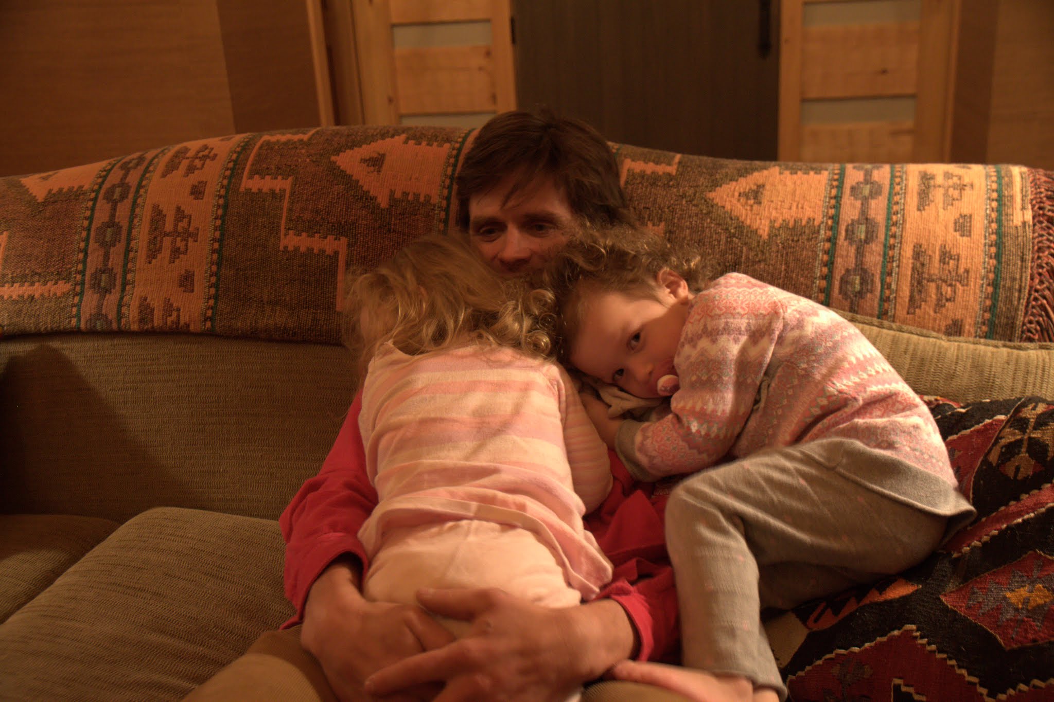
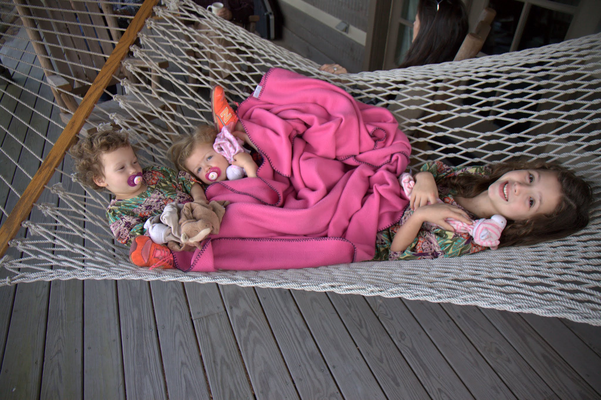
Cuzins lounging on the back porch hammock
If only we could get those pacifiers out of their mouths
Sawyer & Wesley
Sawyer & Aunt Evon
Kristine and the little cuzins
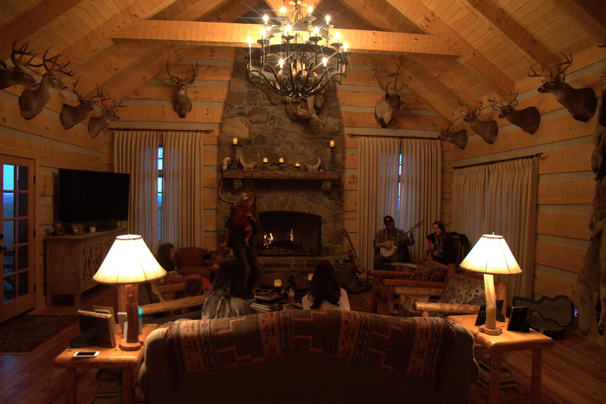
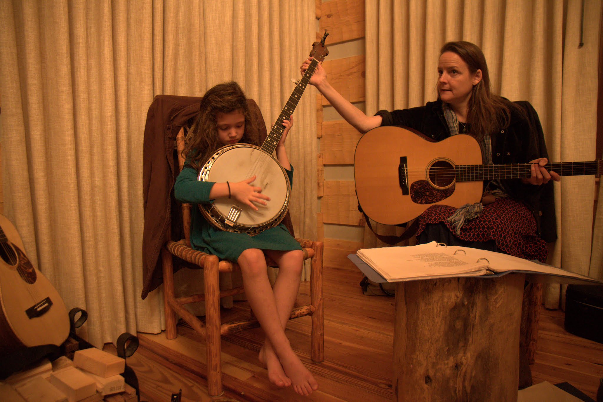
My mom organized a 2 person bluegrass band to come over for 2 hours one evening and it was so fun especially for all the little gals.
We’ve never really had a personal show where we are the entire audience before this evening
Harper got to try out the banjo
My oldest niece
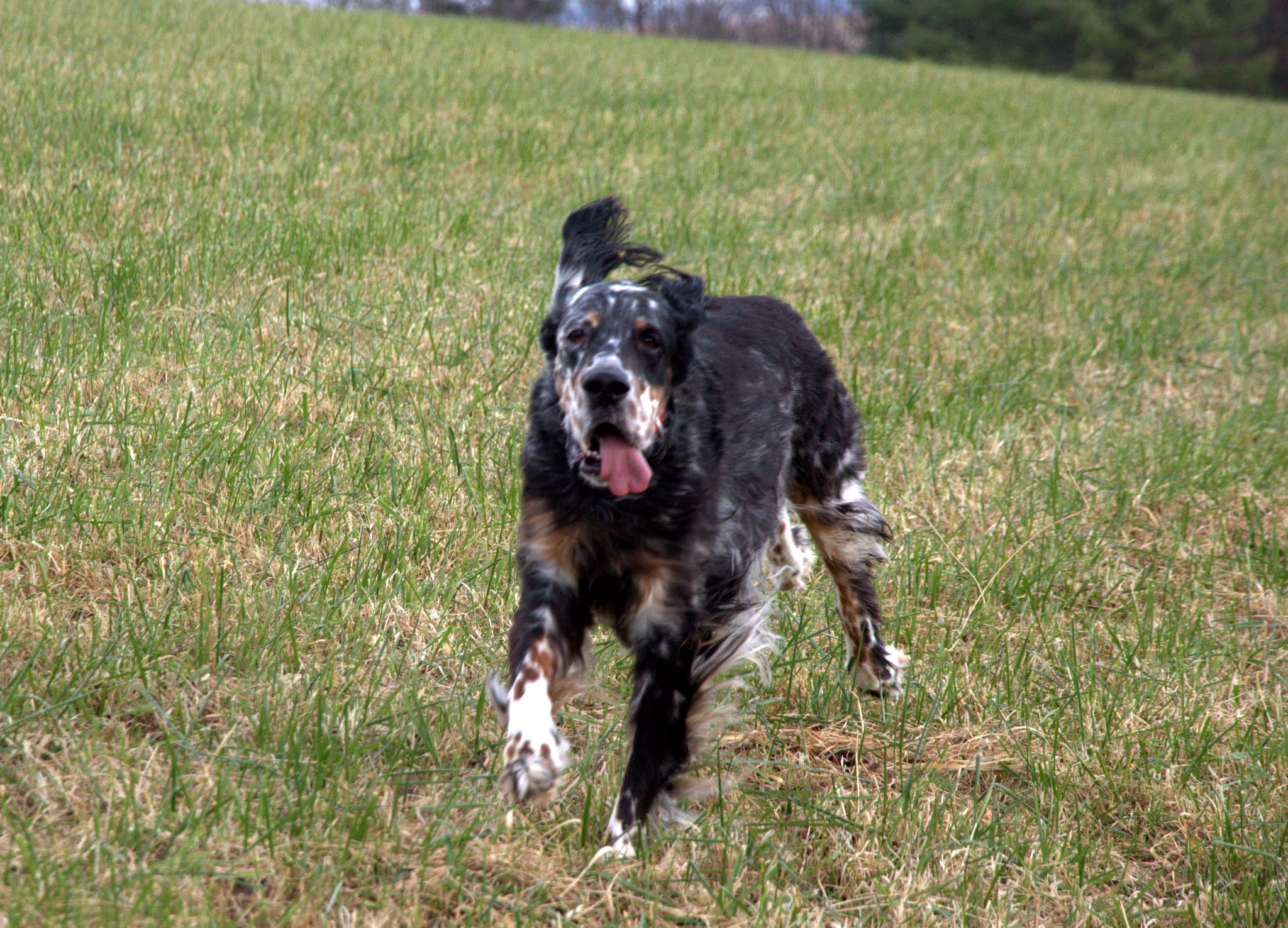
Kristine & I went on a few trail runs up my old favorite Bullhead Mountain, the highest mountain in Alleghany County (3,862′).
On top of Bullhead
Kristine running the road on Bullhead
Some of our best friends, Cashion & Eva, came up from Brevard for an evening to visit. It was absolutely wonderful to have them and everyone loved seeing them. Turns out Cashion & Eva have since moved to Carbondale, CO where Eva’s family is located. Again, it will be awesome to have them back in state and so close to us.
My dad, Maya, Cashion and their tenement on wheels, which always looks nice parked in the driveway 🙂
Wesley & Sawyer in the sprinter van
The crew with Cashion & Eva
Kristine & Maya
So awesome to have them up at Chalk Hill. Cashion originally helped dad and I clear hiking trails and camp on the land in the early 90s before the cabin was ever built
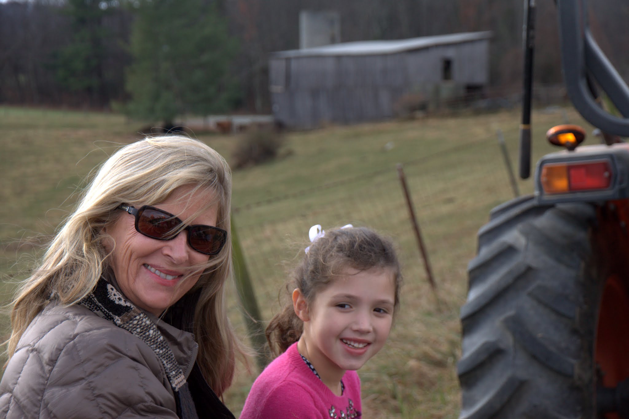
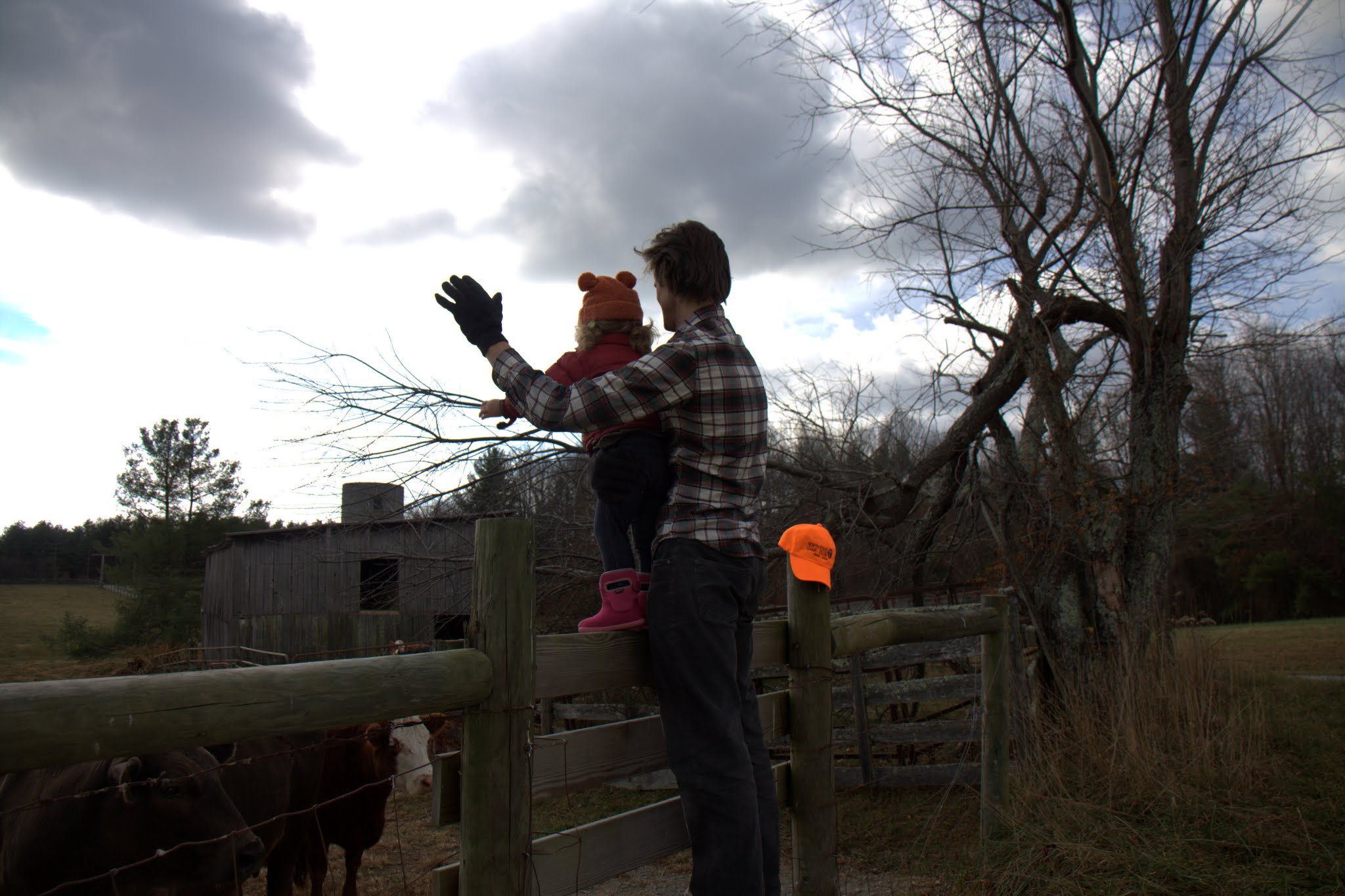
My dad and brother-in law, Ransome, organized another fun hayride as well all throughout our property. Everyone had a blast.
All aboard the trailer
Ransome was the captain driving the tractor, but Sawyer always seemed to find herself into the pics
Aunt Evon & Harper
The loving Foose dog, Finley
Sawyer loved seeing the cows, aka “moo-moos”
Moo-moos
Sawyer & Gigi
So fun having a picnic in the pasture with Bullhead Mountain in the background
Horsing around
Cap’n Ransome, Wesley, & Sawyer
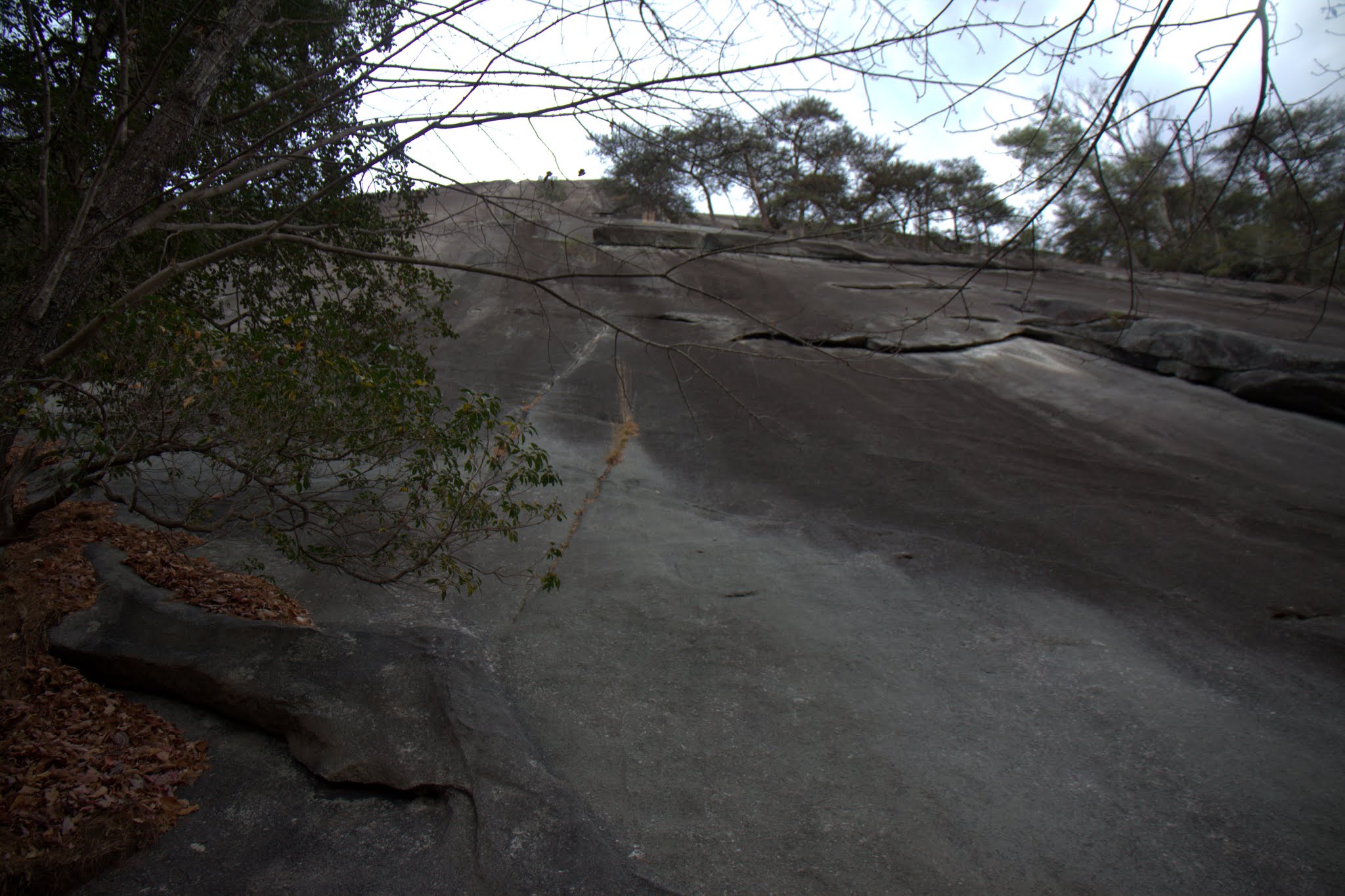
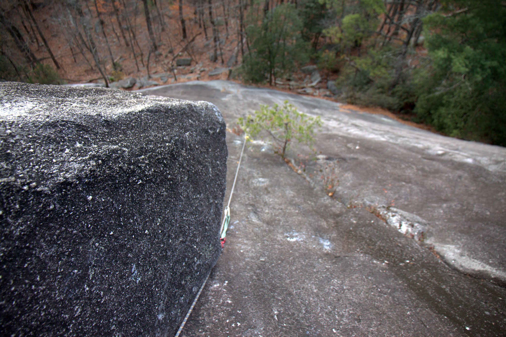
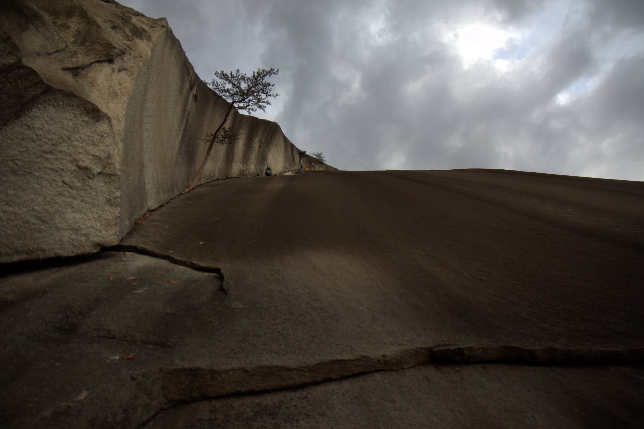
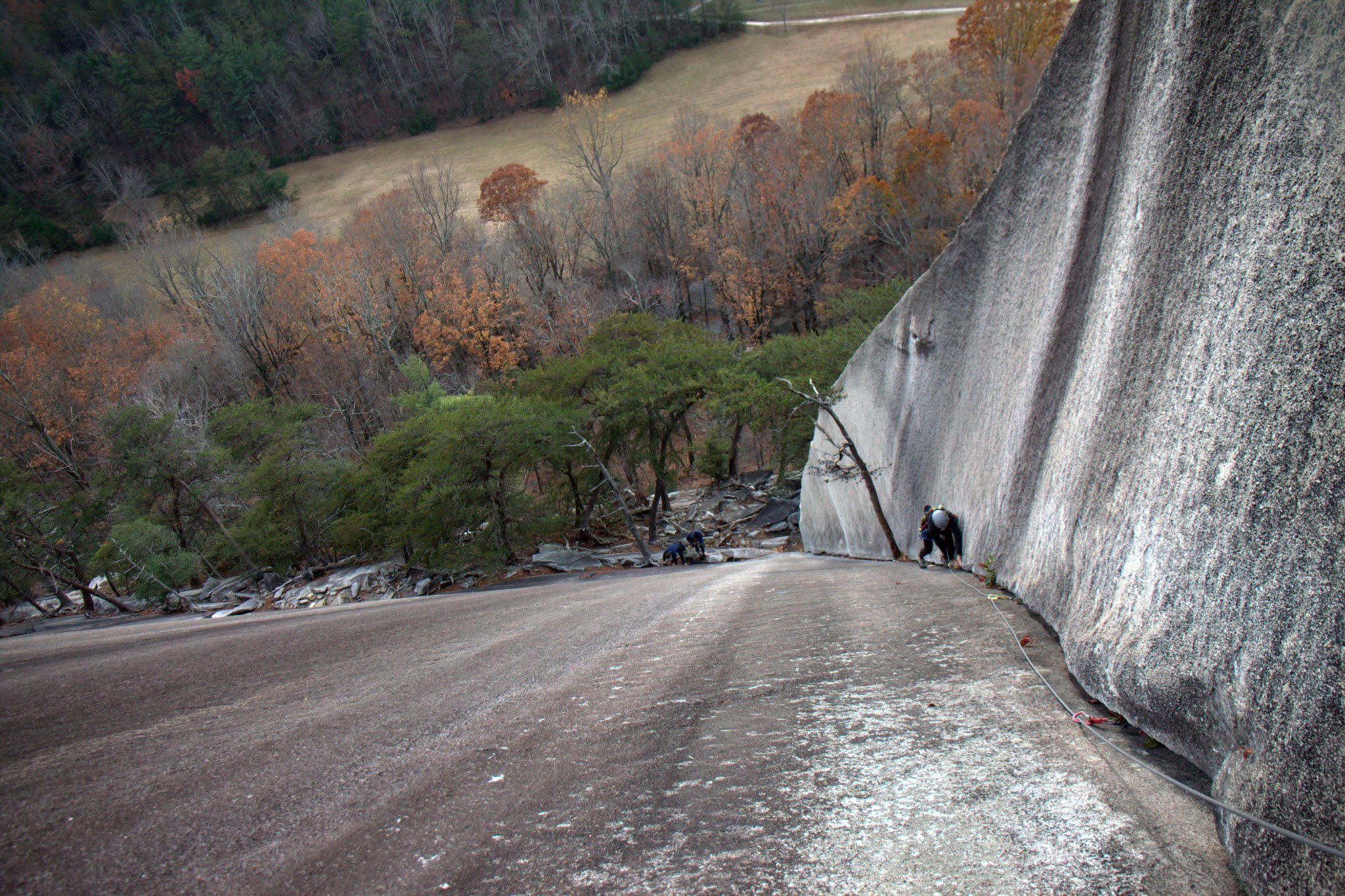
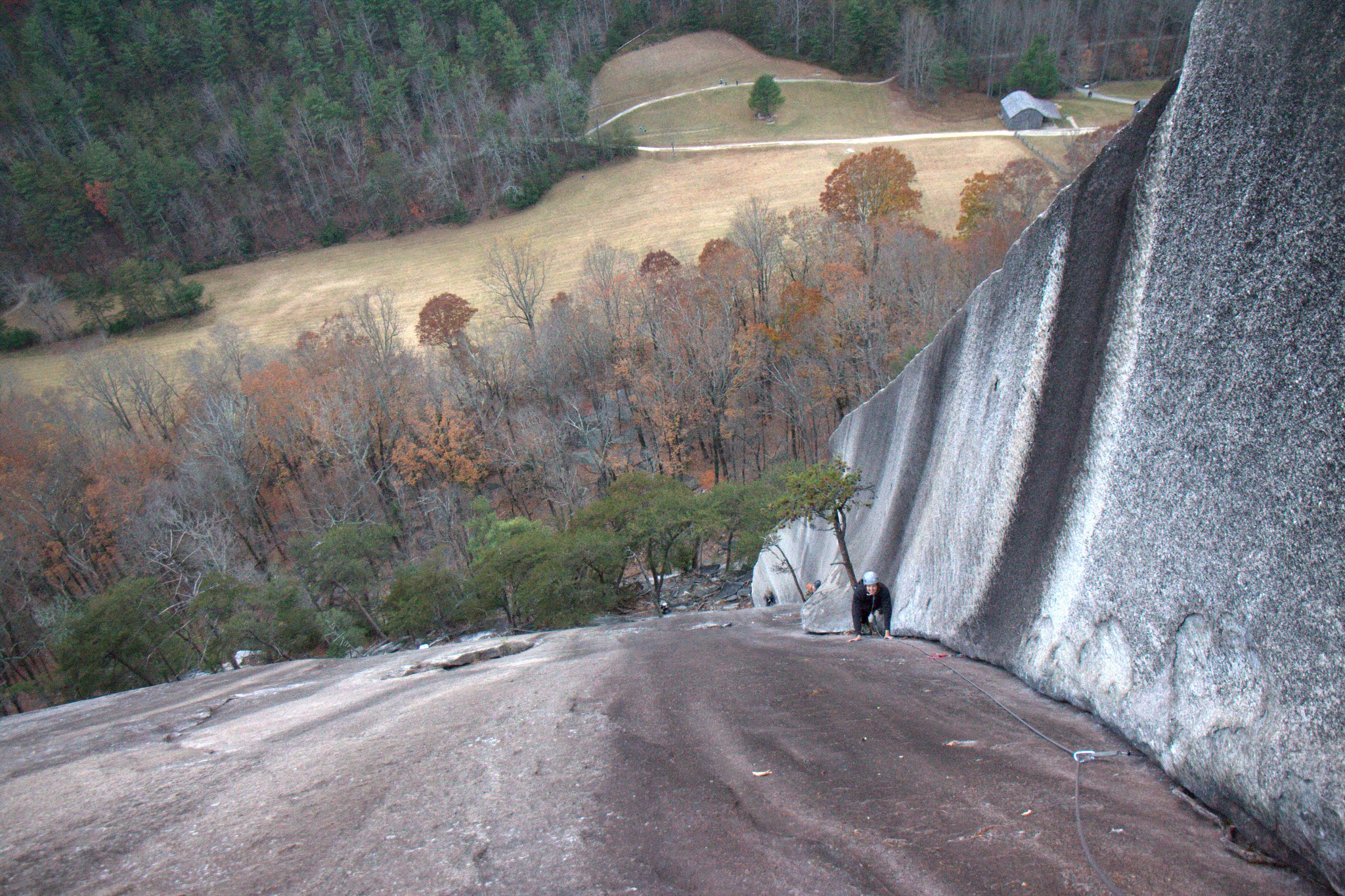
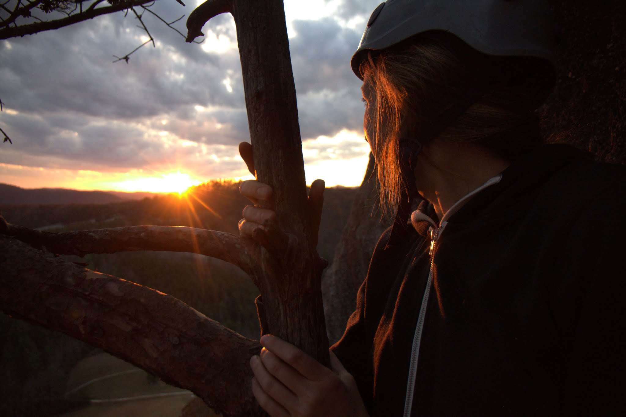
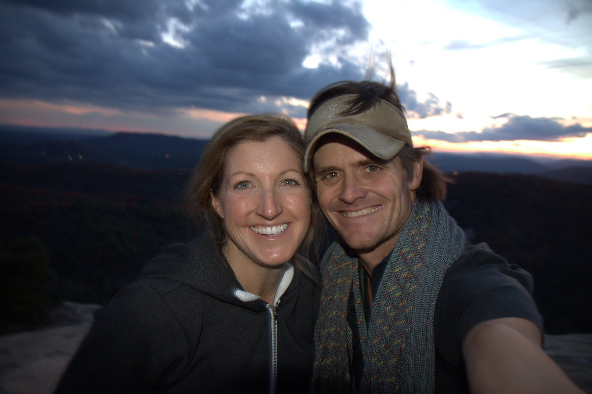
After the morning hayride, Kristine and I put Sawyer down for her nap and zipped down the mountain plateau to Stone Mountain State Park to do some rock climbing. Dad and I had hiked this beautiful granite slab of a mountain maybe 25 years ago, but I had never been back. Little did I know it has some of the best rock climbing in North Carolina. So, Kristine & I had brought our harnesses, shoes, rope, gear from Colorado hoping to get out for an afternoon on Stone Mountain. While Stone Mountain is notorious for its extremely run-out friction climbing on slightly less than vertical slabs, the most iconic route is The Great Arch right up the middle of the south face. I’ve heard its one of the best 5.5 routes in the county, which is funny considering we are talking 5.5. Nevertheless, we climbed a long 150′ 5.8 pitch called Block Route to get to Tree Ledge where we began the 3 pitch Great Arch climb to the top. It was a gorgeous afternoon and really warm. We got behind a party of 4 at Tree Ledge and waited for an hour until we could get going after them. We ended up passing them on pitch 2 as the sun was setting. Then, the party of 4 decided to bail off the route rather than continue to the top and their last climber, a gal named Lila, really just wanted to go to the top. We offered to just put her on our rope for the 3rd pitch and hike down with us, so she did and was very appreciative. We got to the top right at dusk around 5:30pm and hiked down in the dark for 30 minutes to the car to cap off a really fun afternoon together. I will always bring our rock gear from now on every time we go to Chalk Hill. Stone Mountain is so close and has great climbing.
Kristine approaching Stone Mountain’s south face. The Great Arch is the obvious dihedral up the center of the face
Block Route pitch (5.8) to get to Tree Ledge
Block Route pitch from above
Kristine balancing on the crux move of Block Route
The Great Arch from Tree Ledge
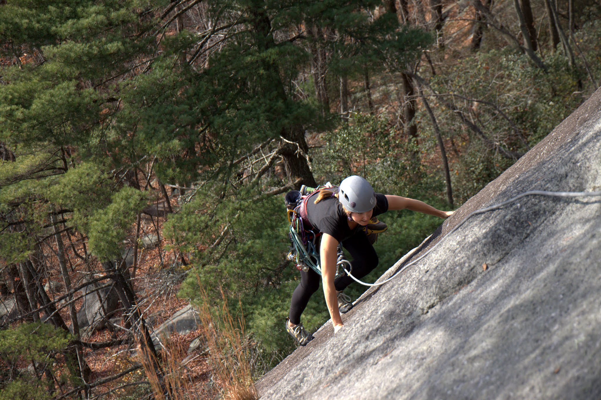
Kristine climbing pitch 1 of The Great Arch
Beautiful…climbing in the southeast on granite is pretty good
Kristine climbing pitch 2 of The Great Arch
Kristine taking in the beautiful sunset from the pitch 2 belay
It was a hundred or so vertical feet of easy slab scrambling after pitch 3 to the summit
Stone Mountain summit
Happy to be together
Beautiful NC mountains
It was a wonderful Thanksgiving together with my family.
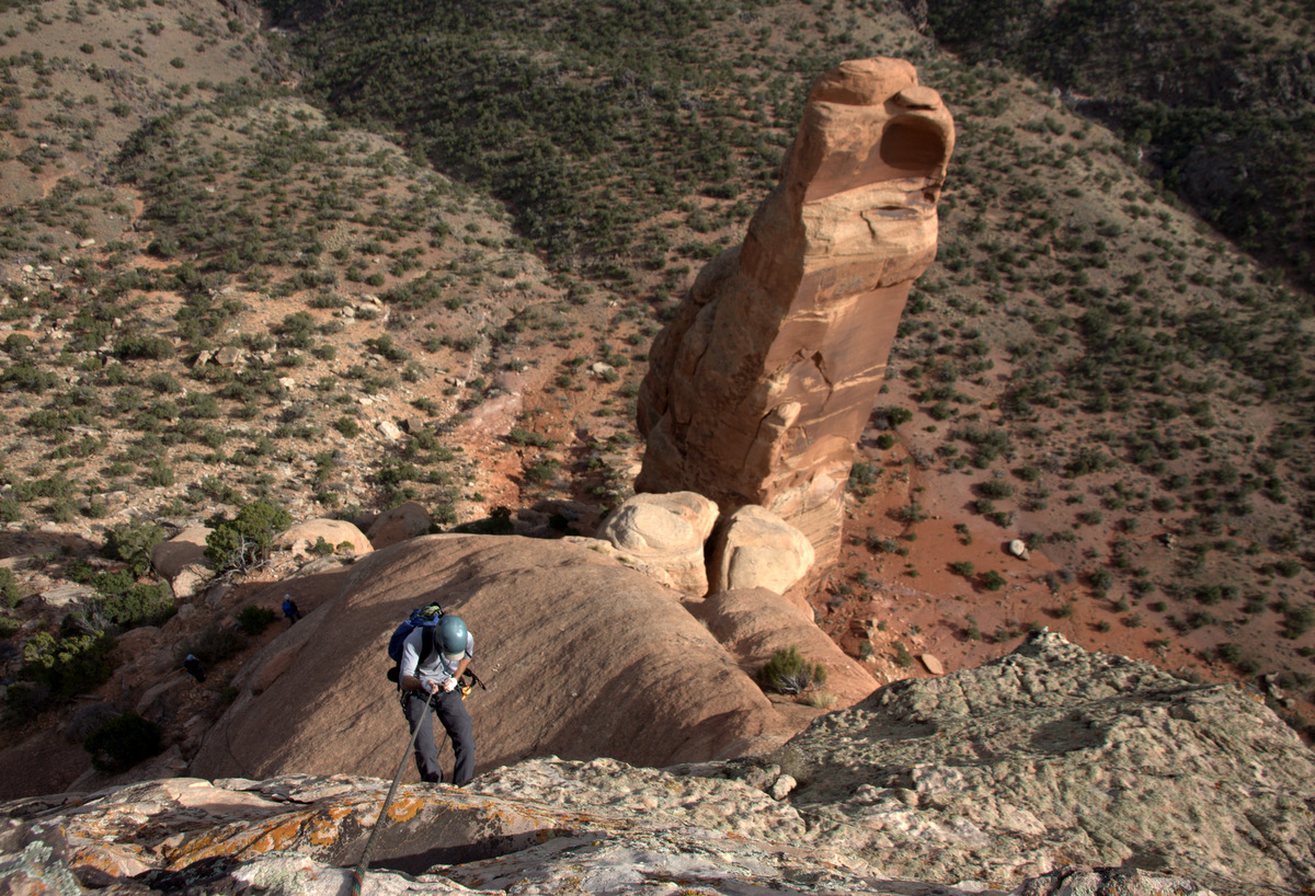
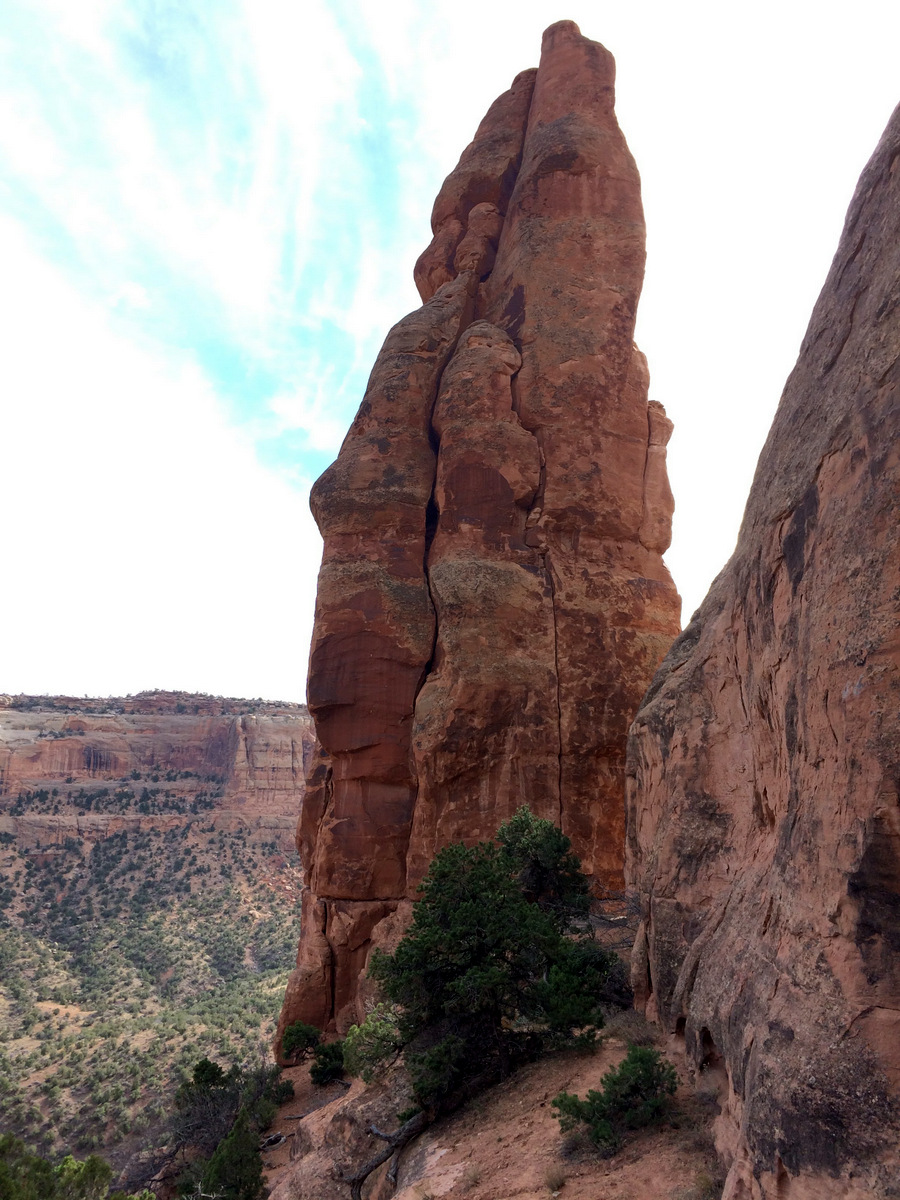
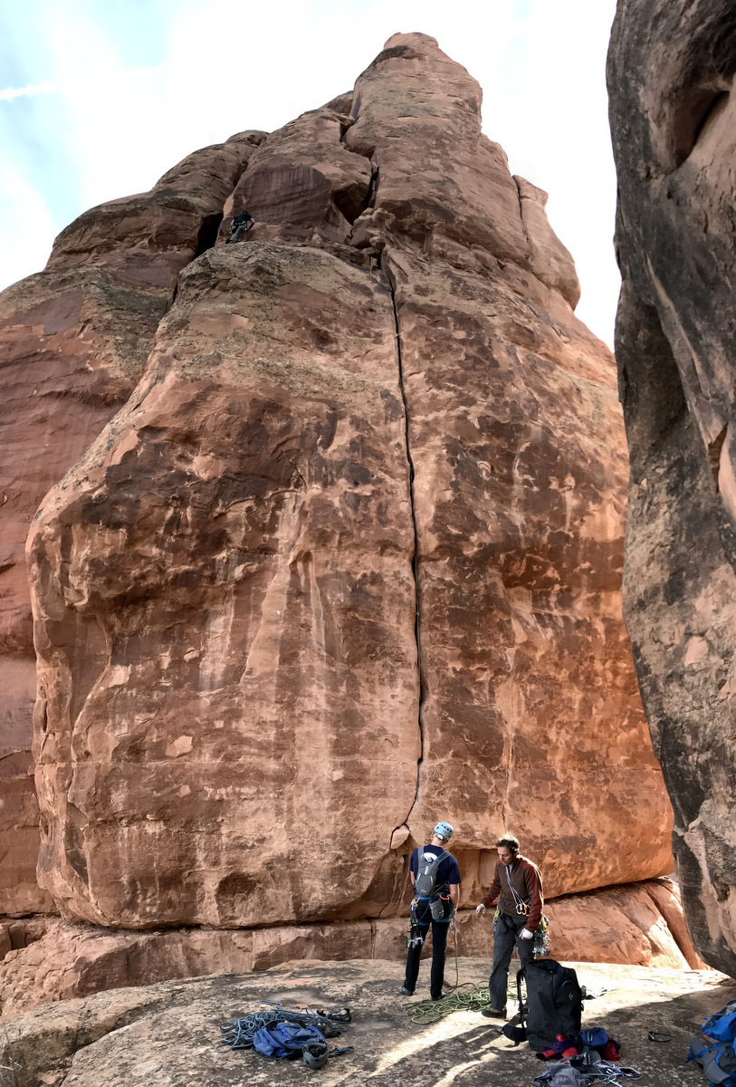
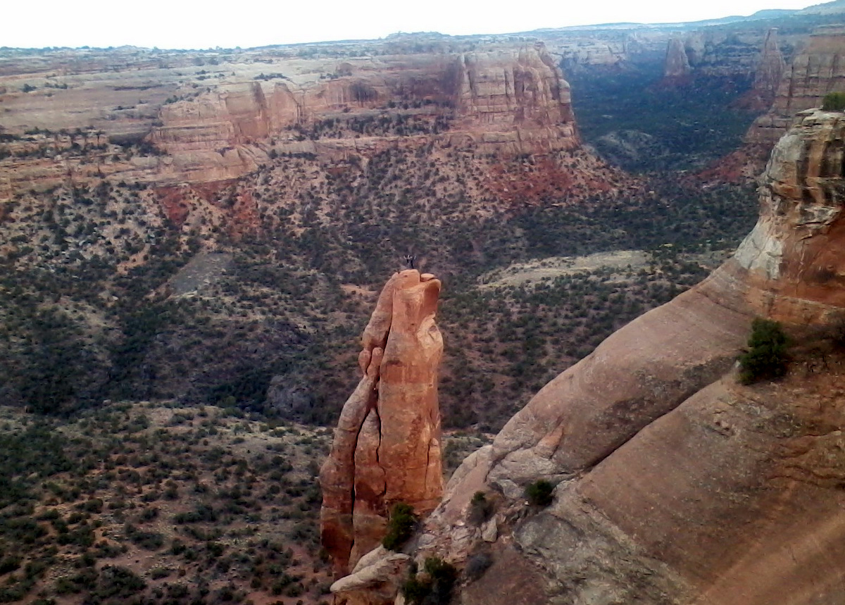
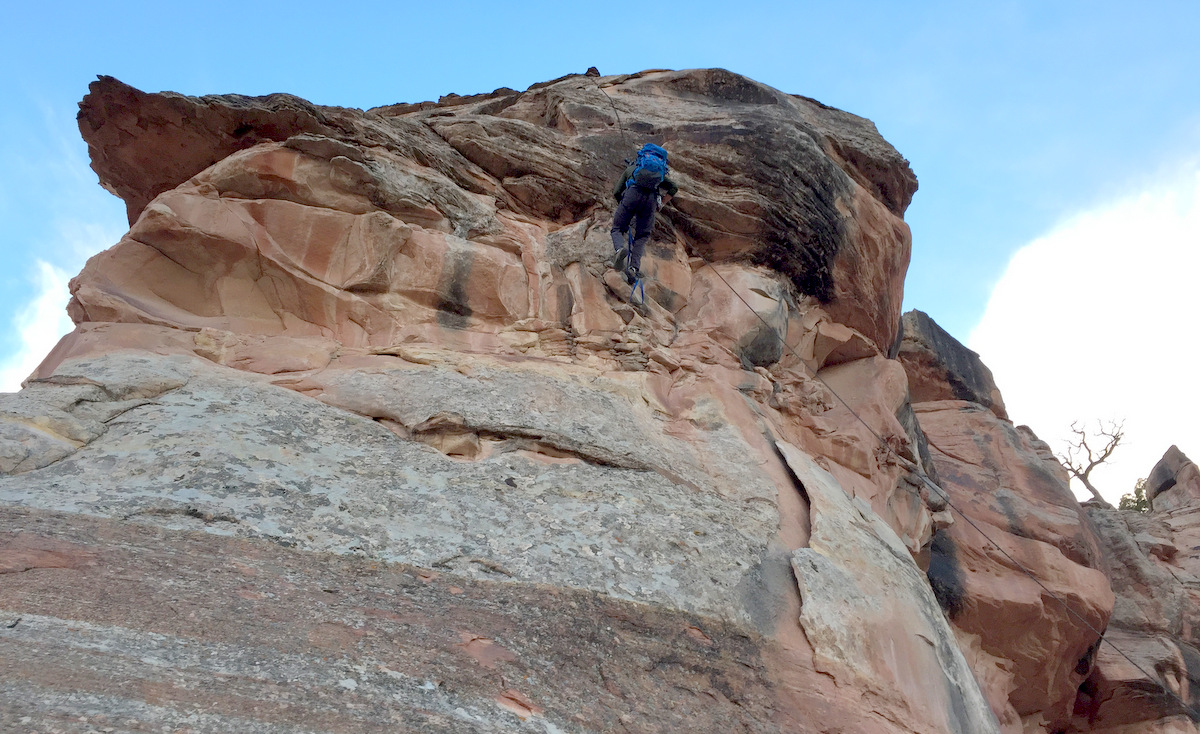
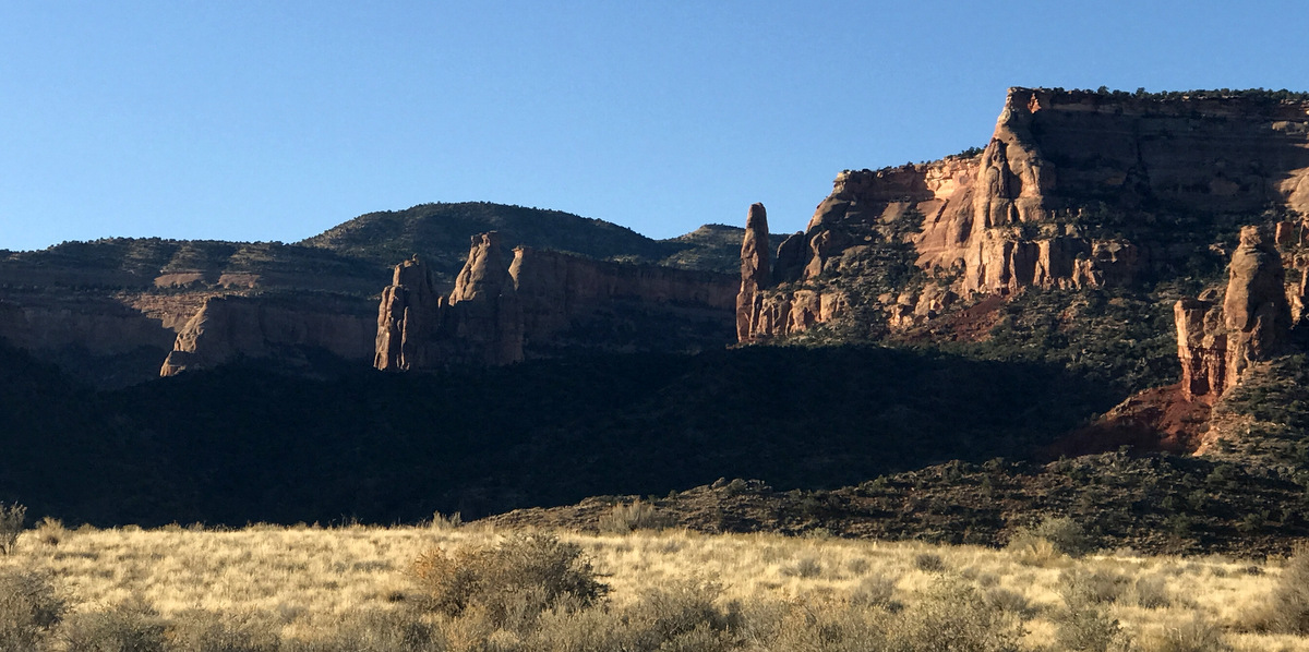
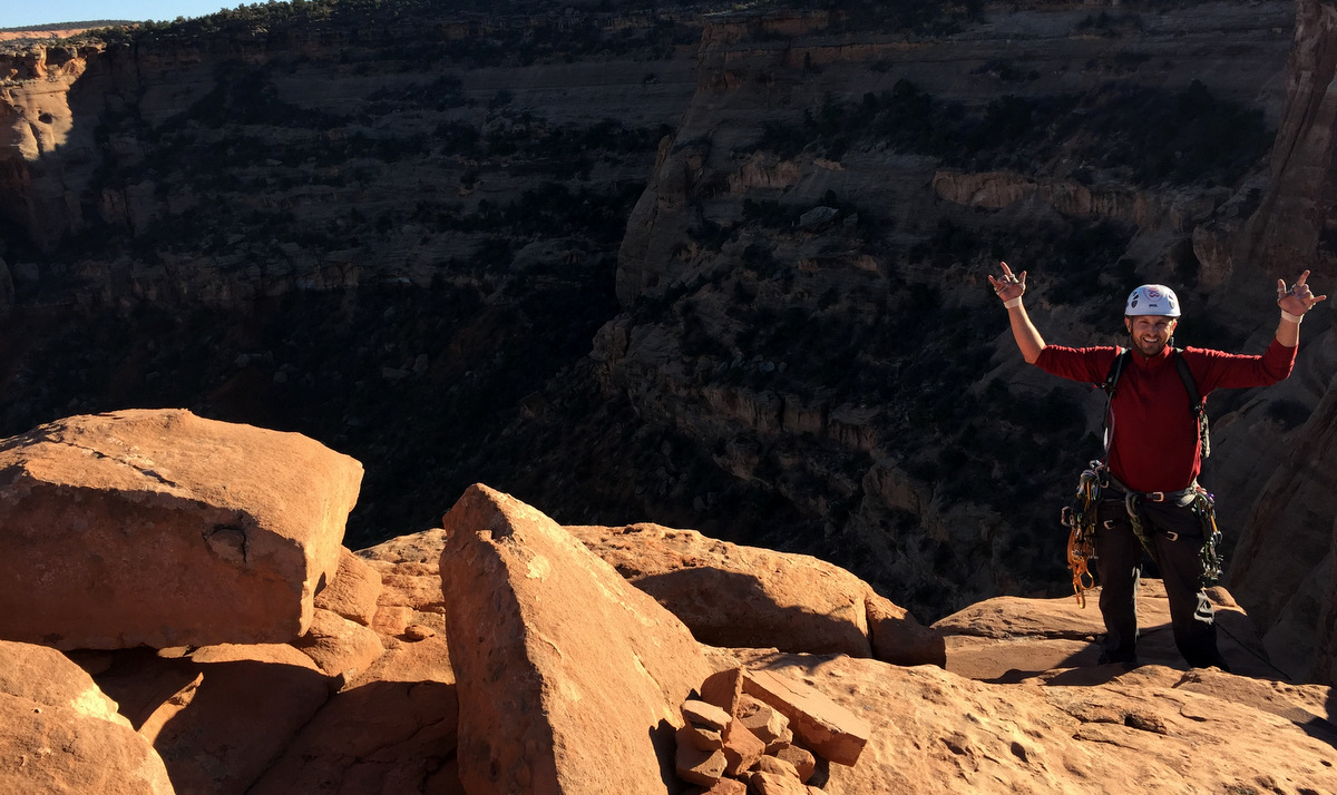
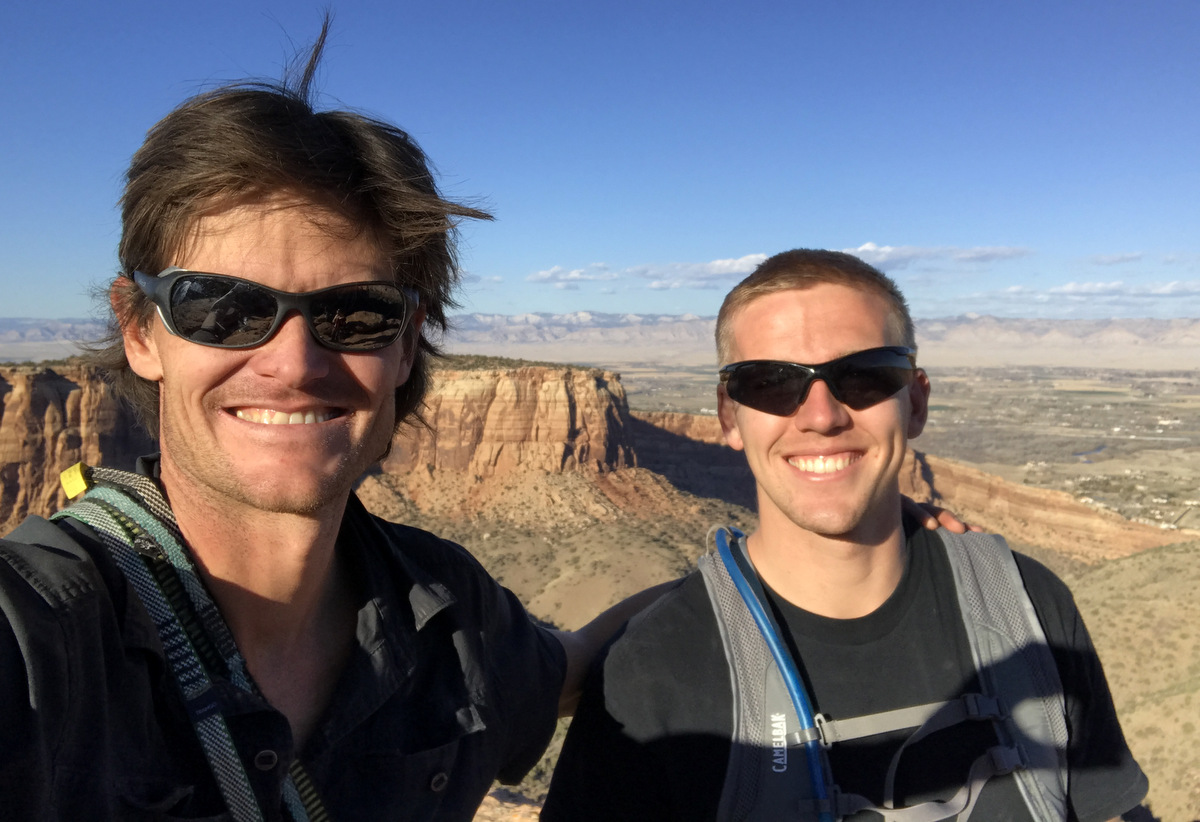
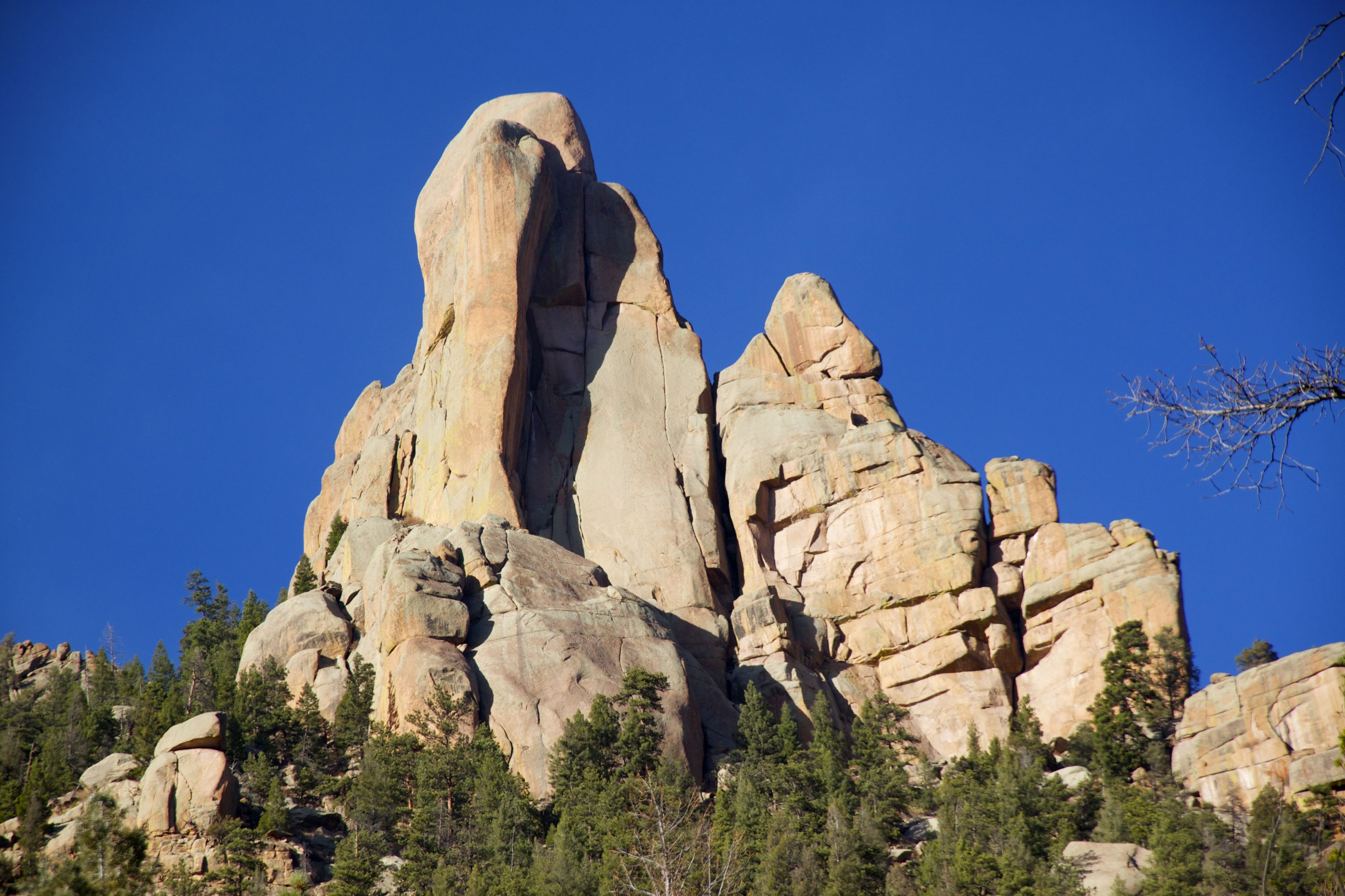
My good buddy Steve (Stevo) Cizik and I have started making a habit of getting in a desert tower climbing weekend once in the spring and one in the late fall. We went way too late last year (as in mid December) and it was some darn cold climbing. Fun, yes, but cold. This year, we planned it about a month earlier when our schedules coincided and we recruited J to come with us and our good friend Mikey. Mikey had to cancel due to family health issues, but I recruited my young friend/co-worker Dylan Friday to come with us. Our thoughts were with Mikey and his family all weekend for sure. Dylan had never climbed a multi-pitch route, but he was a strong guy whom I climbed with all summer and fall around the Vail Valley. I knew he would do well. I had two towers and two routes in mind in Colorado National Monument outside of Grand Junction: Fast Draw (5.10+) on Sentinel Spire and The Long Dong Wall (5.11) on the Kissing Couple Tower. I had researched the routes and had always wanted to climb them. Now in retrospect, I’d love to go climb them again. They were good.
We all rolled down in my Tahoe Saturday morning around 8am after dropping J’s 16 mo baby, Raina, off at Aunt Julie’s in Eagle. We decided to do Sentinel Spire first on that Saturday as it would require less time. The approach to Sentinel’s north face is exciting. By parking at the Book Cliffs Viewpoint near the Saddlehorn Campground, we walked down to the edge of Monument Canyon and fixed a rope to a tree and rappelled down about 100′ to a sloping ledge. We left my old rope fixed and scrambled down a few hundred feet to the base of Fast Draw (5.10+) and laid our eyes upon the intimidating tower.
Fixing my old rope to a steadfast tree
J rappelling off the canyon rim with Sentinel Spire behind
Sentinel Spire’s north face
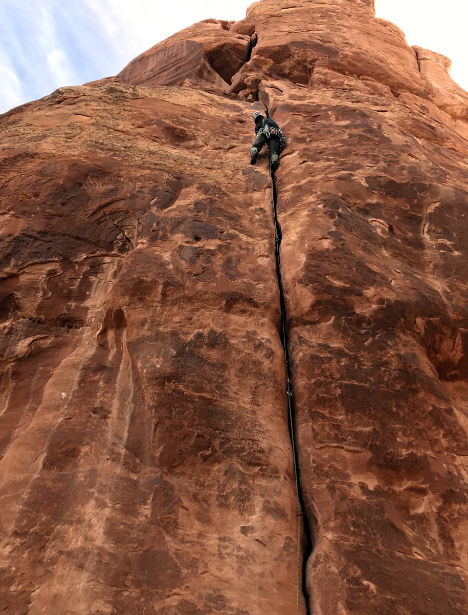
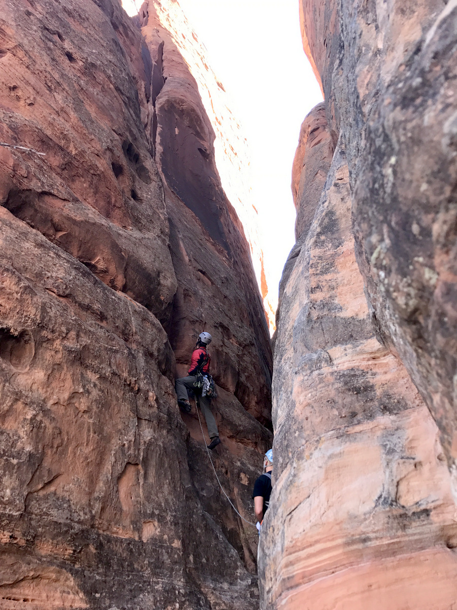
Scoping out the 1st pitch – a 5.10 handcrack with a 5.10+ crux off the ground to get into the handcrack
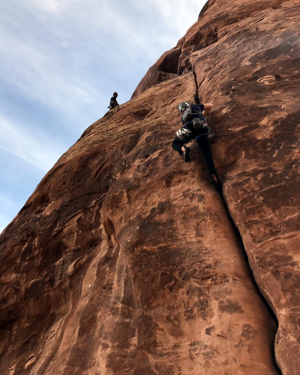
I took off up the crux leading for Dylan & myself and actually led the crux finger-layback clean, which was exciting. I enjoyed jam after jam of awesome climbing for 80′ to the airy pitch 1 traverse left to two old fixed pins. I set up my belay careful to not put all my bodyweight on the two pins. I just didn’t totally trust them – it was indeed an uncomfotable belay. Dylan then followed and cleaned my gear.
Me leading pitch 1 of Fast Draw. Photo by Steve
Dylan following. Photo by Steve
Dylan climbing pitch 1 of Fast Draw with the J/Stevo team below
J then led for his team and as I know J loves a good handcrack, I don’t think he was disappointed.
J on lead on pitch 1 of Fast Draw
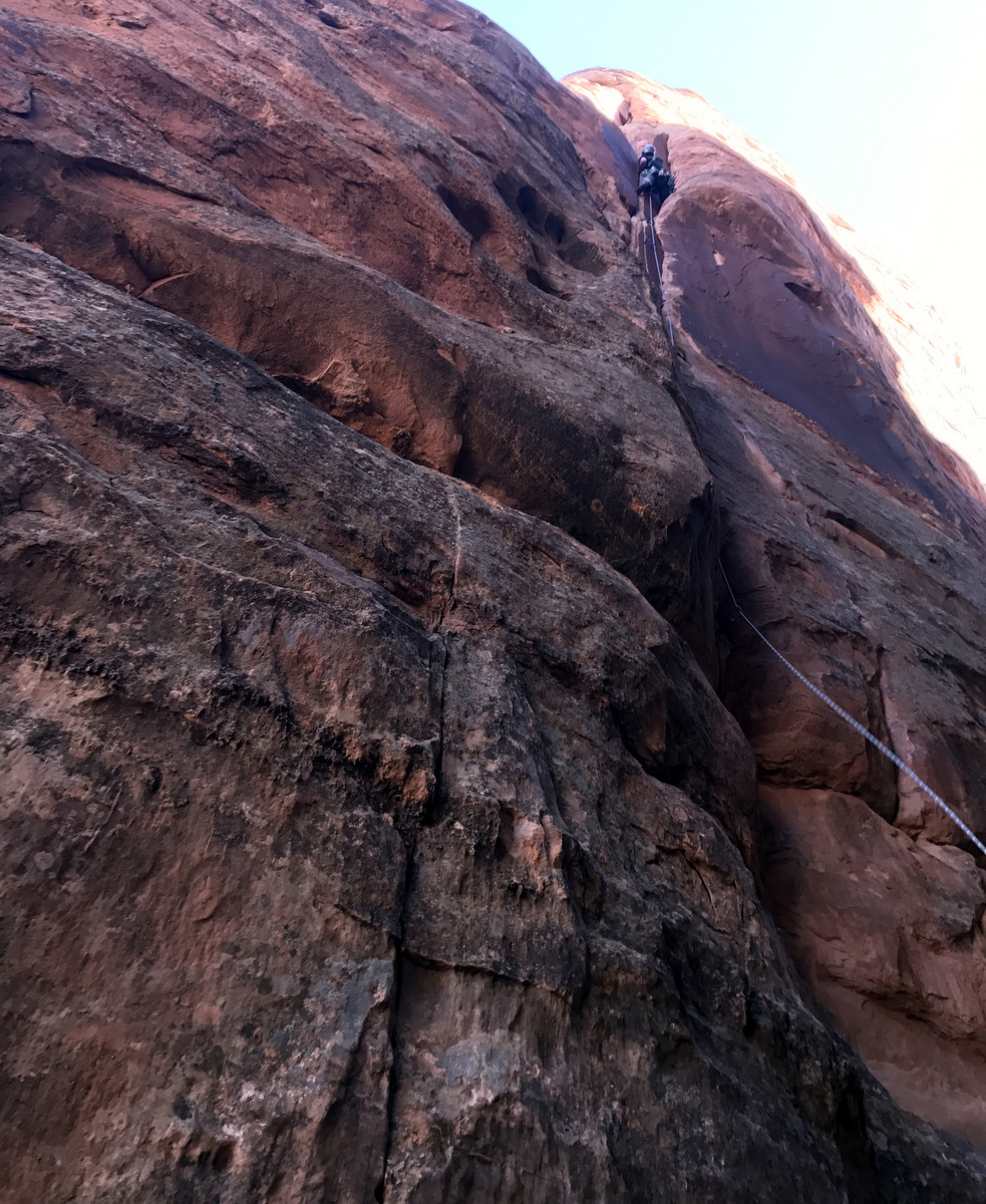
Pitch 2 was the offwidth pitch. I had bought a #6 camalot specifically for this pitch and it worked well. It will come in handy in the future I am sure. This was a fun pitch with some stemming involved and nothing over 5.10a in my opinion. The belay ledge at the top of pitch 2 was a paradise compared to pitch 1’s belay station.
Dylan climbing pitch 2 of Fast Draw
Pitch 3 looked like it would be a breeze from below, but gosh it reared its ugly face about halfway up and I thought one small section was pretty darn difficult during the bolted section. Nevertheless, I made it and belayed Dylan up to me.
Dylan climbing Pitch 3 of Fast Draw
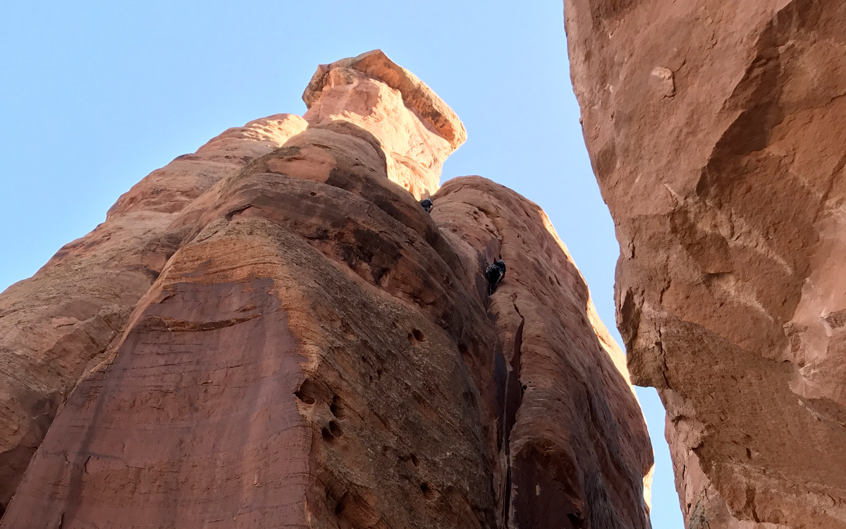
Dylan about to top out on Sentinel Spire
J leading pitch 3 clean and smooth
Dylan on top of Sentinel Spire with the canyon rim and where we rappelled from behind him
Me on the summit of Sentinel Spire with Independence Monument and Kissing Couple behind. Photo by Dylan
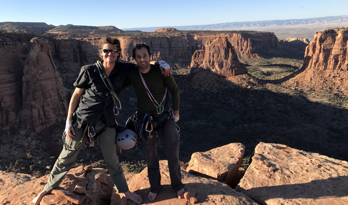
J then brought Stevo up and we had a ball on the summit for a good 20 minutes. Some nice folks on the canyon rim spotted us and took some phone pictures of us on the summit and sent them to me.
Stevo and his notorious summit “bolt”
Me, Stevo, & J on the summit of Sentinel Spire. Photo by Dylan
Picture of us on top of Sentinel Spire taken from the canyon rim
A close-up of me and Dylan on Sentinel’s summit and J belaying Stevo up the last pitch
What a great afternoon, but we still had a lengthy out to the car despite not being very far away (as the crow flies) at all. After a single rope and then a double rope rappel to the bottom of the north side of the tower, we scrambled back up to the fixed rope. Stevo brought his jumars and aid ladders and ascended the dynamic fixed rope up to the canyon rim in excellent fashion.
Scrambling out. Photo by Stevo
Getting dusk and at the sloping ledge at the bottom of the fixed rope. Photo by Stevo
Stevo jumaring out to the canyon rim
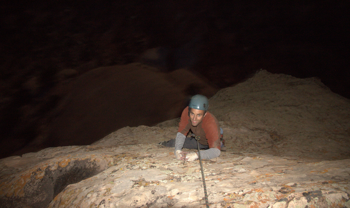
Feeling like the rest of us wouldn’t nearly be as efficient as Stevo ascending the rope, we decided to haul our heavy bags up one at a time after I tried to free climb the roof on belay from Stevo above. It was a tough climb and I should have put on my climbing shoes instead of wearing my approach shoes, but I didn’t. I finally pulled over the lip and we began hauling all three bags up to us from Dylan & J below. Dylan free climbed the pitch and then J was last as darkness really set in.
J climbing out to the canyon rim in the dark
We packed everything up and a room at the Super 8 motel in Fruita was in order. After some hot tubbing and swimming we hit up our favorite El Tapatio for generous heapings of Mexican food and giant blue margaritas. It was a good day with my boys.
After a warm and comfortable night at the Super 8 and an average continental breakfast, we found ourselves hiking up the familiar Monument Canyon trail for an hour and 15 minutes to the base of the Kissing Couple Tower.
Sentinel Spire from Highway 340 the next morning en route to Kissing Couple
It was warm on the way into the Kissing Couple. Photo of me and Indy Monument by Dylan
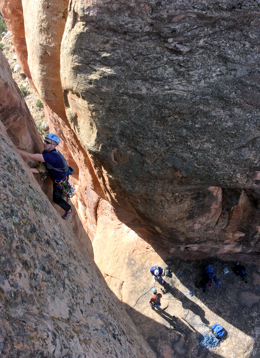
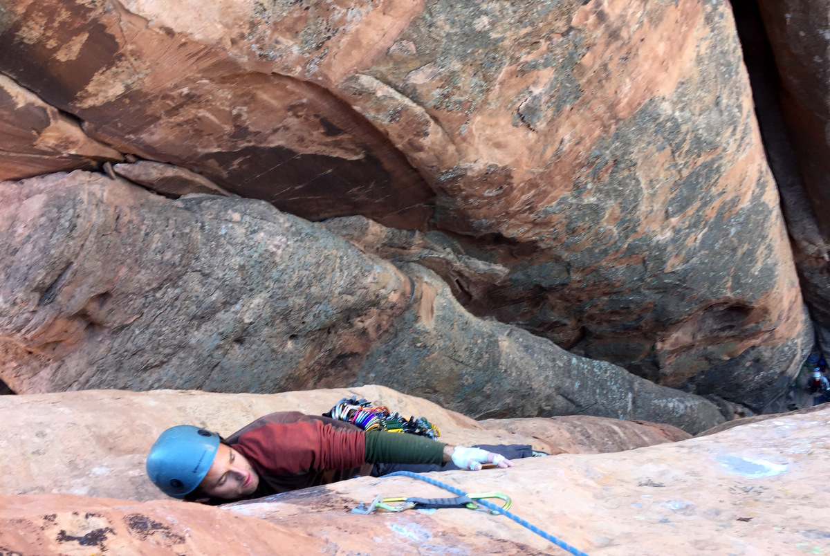
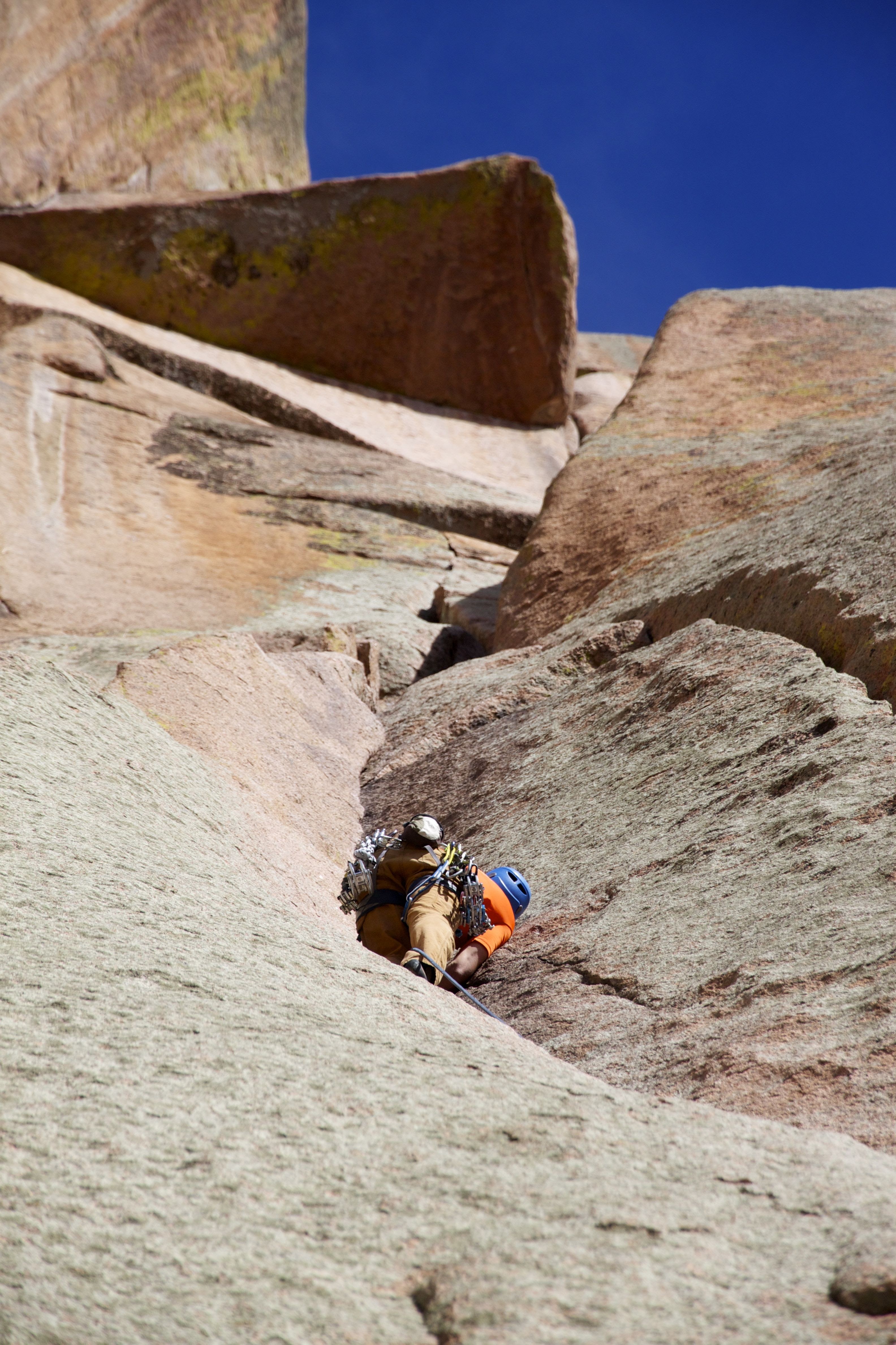
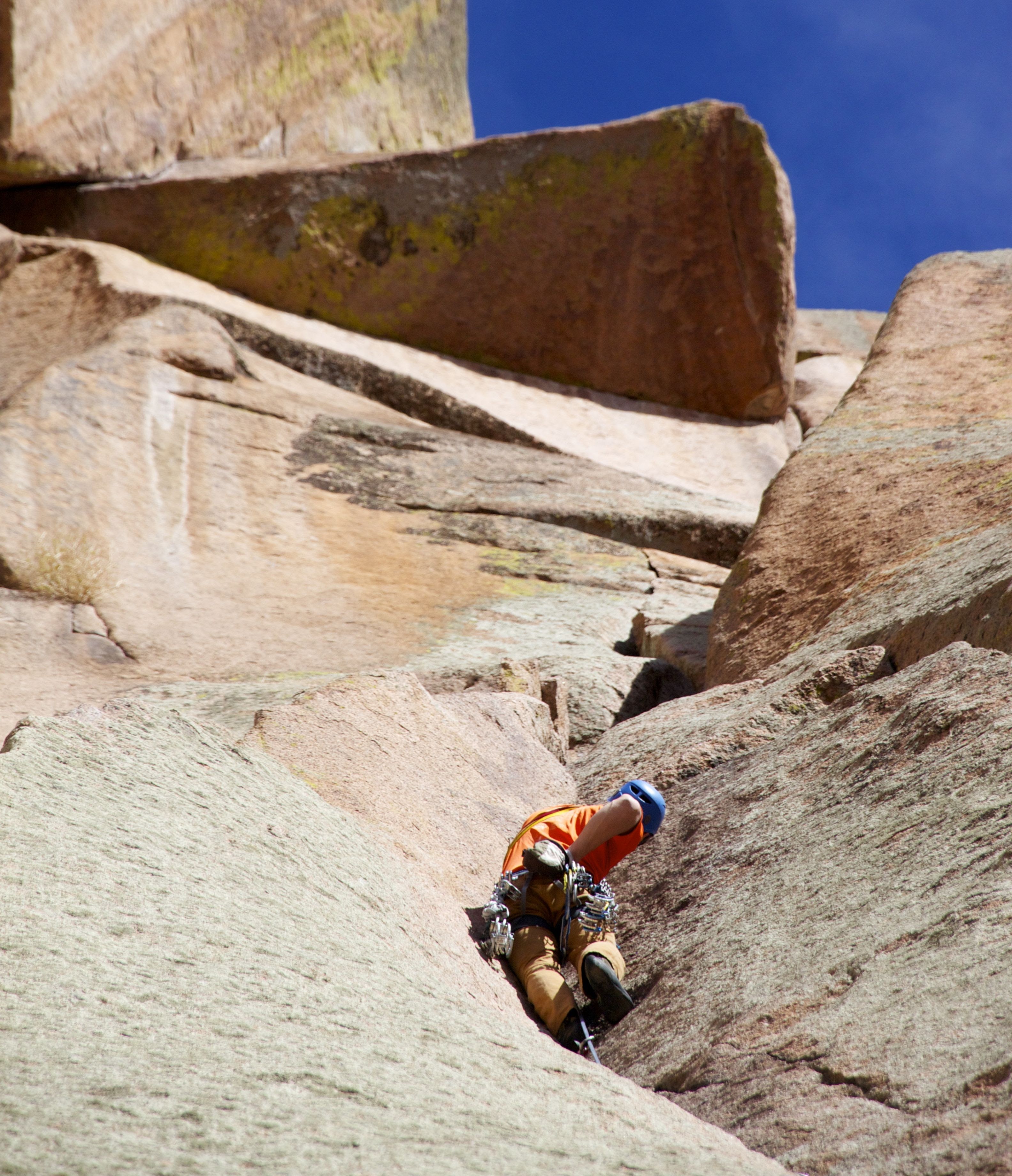
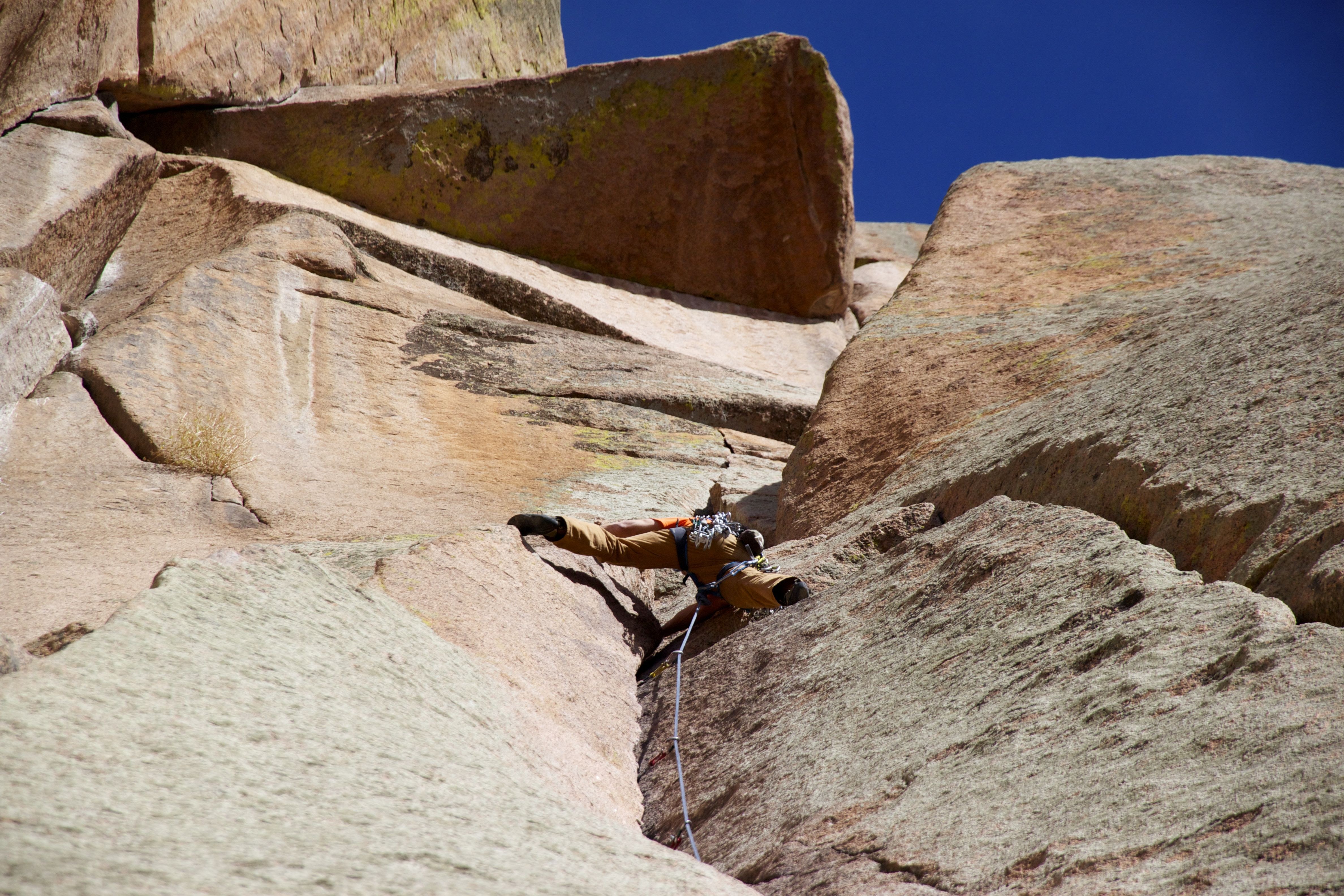
There was a bit of a boulder problem to get to the base of the Long Dong Wall route and we lifted each other’s packs up because it was too hard of a move with a 40 lb pack on! Finally, we were at the base of the route on the tower’s south side in the shade. It was chilly even though it was around 10am already. The first pitch was said to be the difficult crux pitch rated at 5.11a. However, I have heard because of the sandy and insecure footing and hands, it could feel more like 5.11+. I share that sentiment in retrospect. It was a tough pitch. I was sweating so much halfway through leading it, I had to throw down my jacket to the boys. The biggest challenge for me wasn’t so much the moves but the insecurity of the route with little to no footing and what footholds/edges there were sand completely covered them making them extra slick. Its a long pitch too – maybe 100+’. Once you got through the bottom half, the finger crack and hand crack went much smoother until you get to the top crux face move, which is protected by a bolt. Yep, I hung, but figured the move out without french-aiding on the bolt 🙂 I would definitely think because these moves were so slick, sandy, and smooth, the move felt much more like 5.11+ to me. I then set up and belayed Dylan up to me cleaning the route and trailing another rope so J and Stevo could just top rope the pitch. I would love to go back again to lead this pitch 1 better.
Me starting the lead up pitch 1 of Long Dong Wall. Photo by Stevo
Me high up in the handcrack portion of pitch 1. Photo by Stevo
Dylan on pitch 1
Good perspective pic by Stevo of me belaying Dylan up to me on pitch 1
J at the face crux move of pitch 1
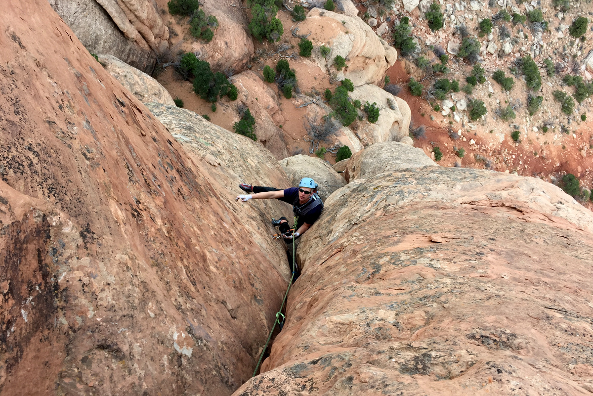
Pitch 2 went well with some easier 5.7 chimney moves up to a very runout stemming chimney (5.9ish-5.10?), which was a very exciting lead for me. However, there was no place for gear and its about a 30′ runout to where I could plug a #2 cam in a hole to make the final mantle move to the anchors.
Dylan stemming up the chimney on pitch 2
Again, we trailed a rope so J and Stevo could top rope this pitch to be more efficient. Next up was the no-pro class 4/low 5th scramble up to the base of pitch 4. Its easy to belay the follower if necessary from the pitch 3 belay anchors. Pitch 4 was a wonderful pitch. I’ve heard its the best 5.8 in the desert. I don’t know about that, but it sure was fun. J led this pitch for the J/Stevo team and loved it.
J a third of the way up Pitch 4 with Dylan higher up climbing up to me at the pitch 4 anchors
Dylan stemming up the final 20′ chimney to the top of pitch 4
Dylan topping out on pitch 4
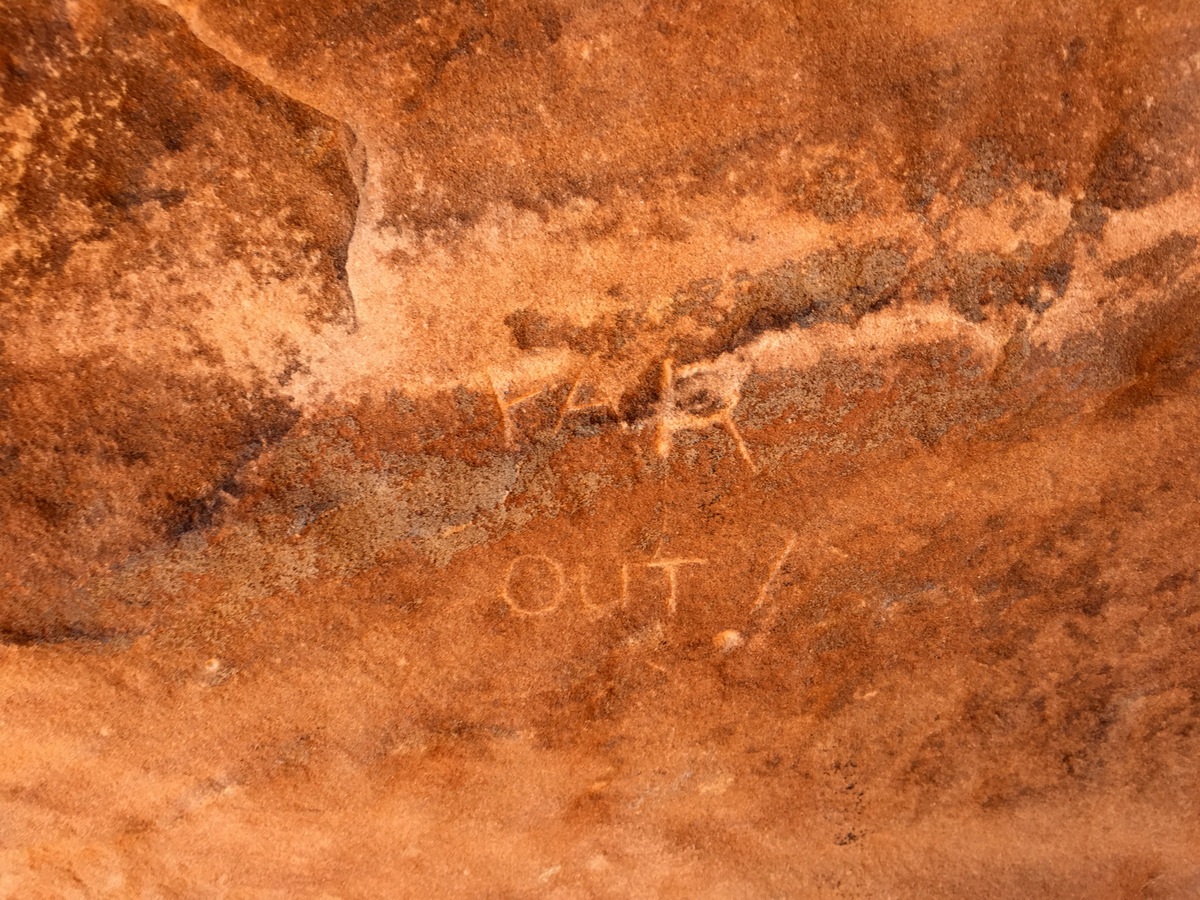
We were now in the center of the “belfry” between the two halves of the Kissing Couple that appear to be kissing if seen from a distance. It was a cool position. In fact, someone etched in the sandstone “Far Out!” at the belay. It was a fitting statement.
Pitch 4 anchors
The “belfry”
Looking out from the pitch 4 anchors
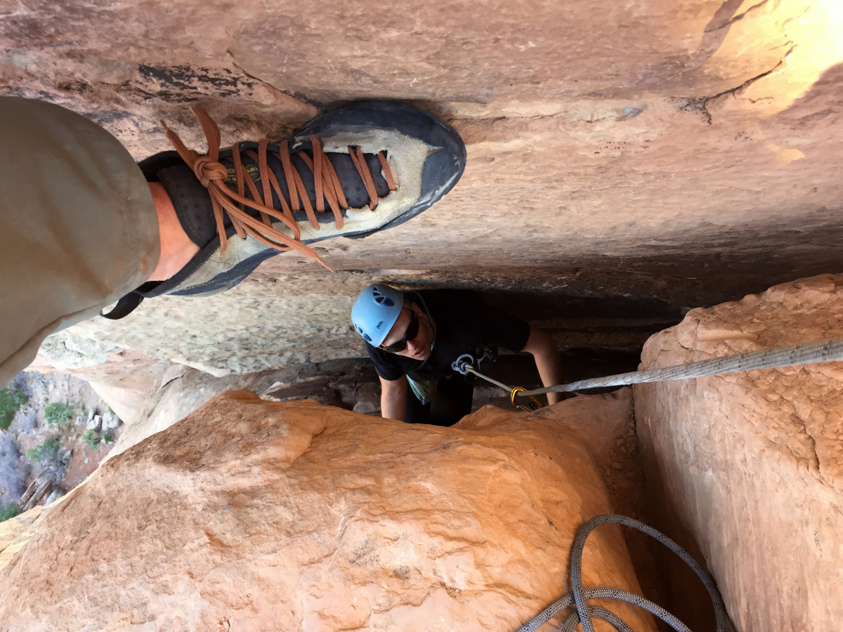
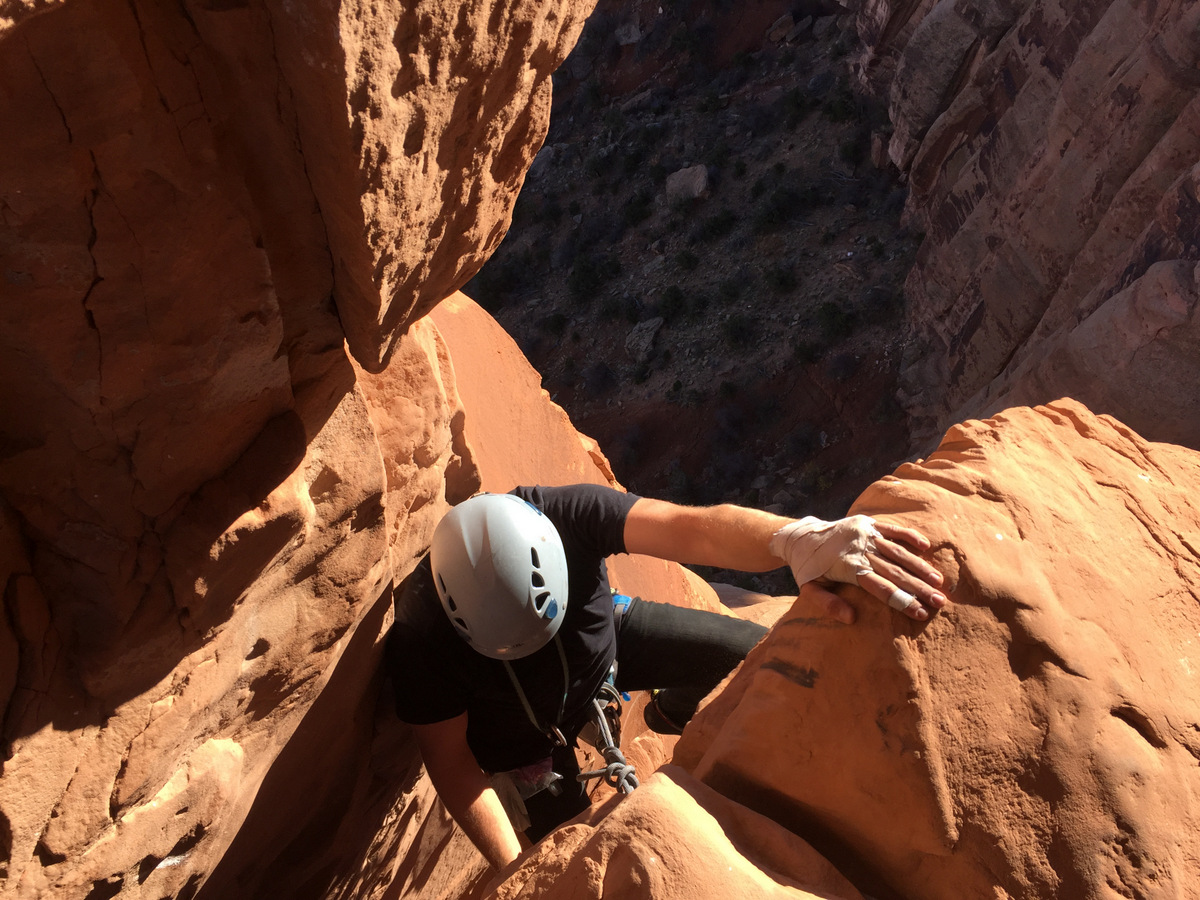
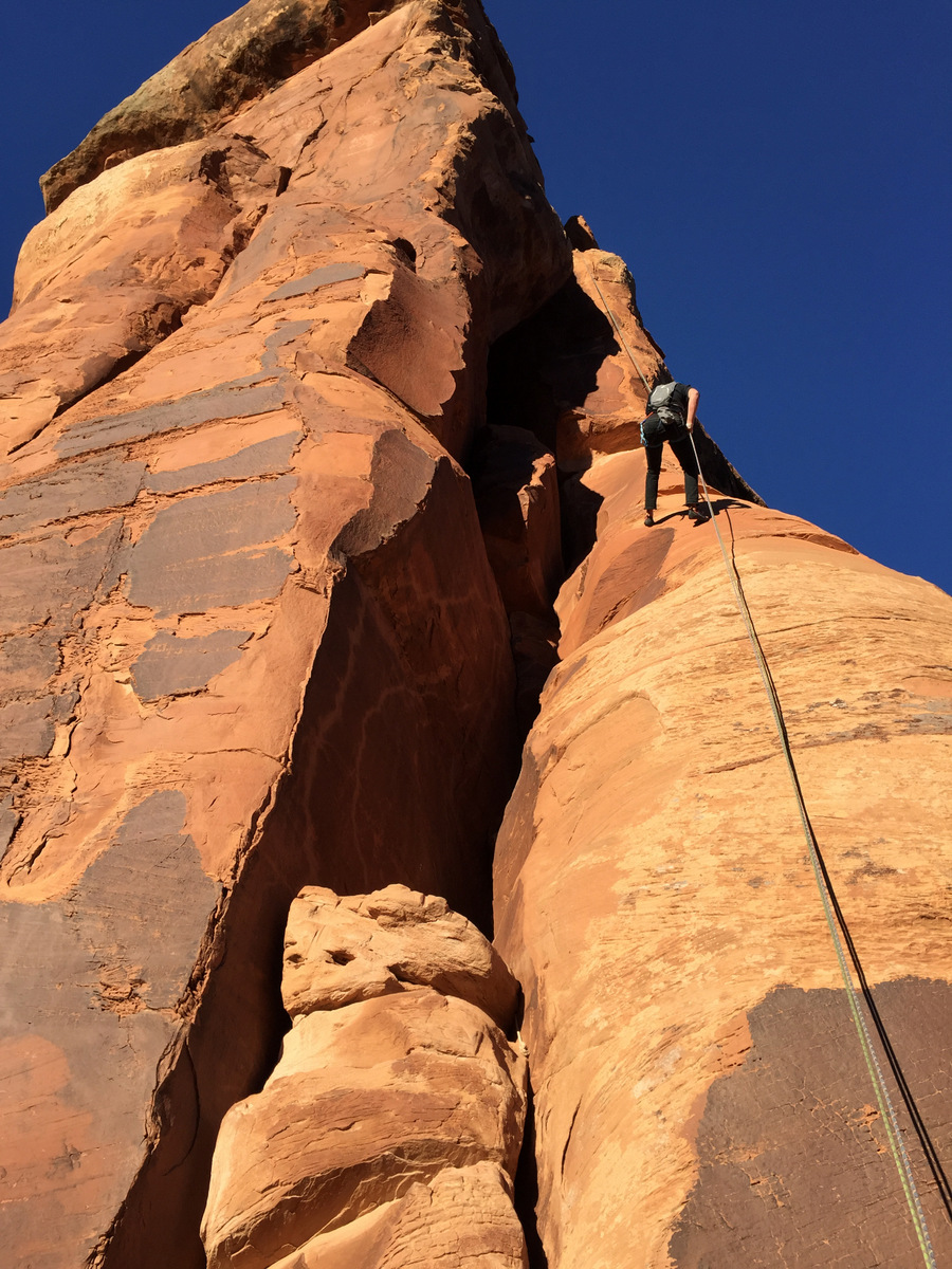
Pitch 5 was the coolest pitch of them all as you climb up between the two halves of the Kissing Couple inside the belfry, squeeze through a small whole, and “voila” you are at the pitch 5 anchors 5 feet below the summit cap. The first 15′ of pitch 5 is rated 5.10c and is protected by a piton, but you can get a piece of gear in after that. Climbing up the crack then to a roof and traversing left under the roof is just so cool.
Looking up pitch 5
Dylan following across the roof traverse
J leading pitch 5
J squeezing through the small hole
After a quick unroped 5′ move to the summit cap,, we took in the amazing views of Colorado National Monument from a new summit. I think it was around 2-3pm, but who knows. It was so warm and windless.
Stevo pumped to be on the summit
Me on the summit of the Kissing Couple. Photo by Stevo
J and I on top of the Kissing Couple. Photo by Stevo
Dylan’s first two towers – not too shabby, my young friend!
A panaorama of all of us on the summit of the Kissing Couple
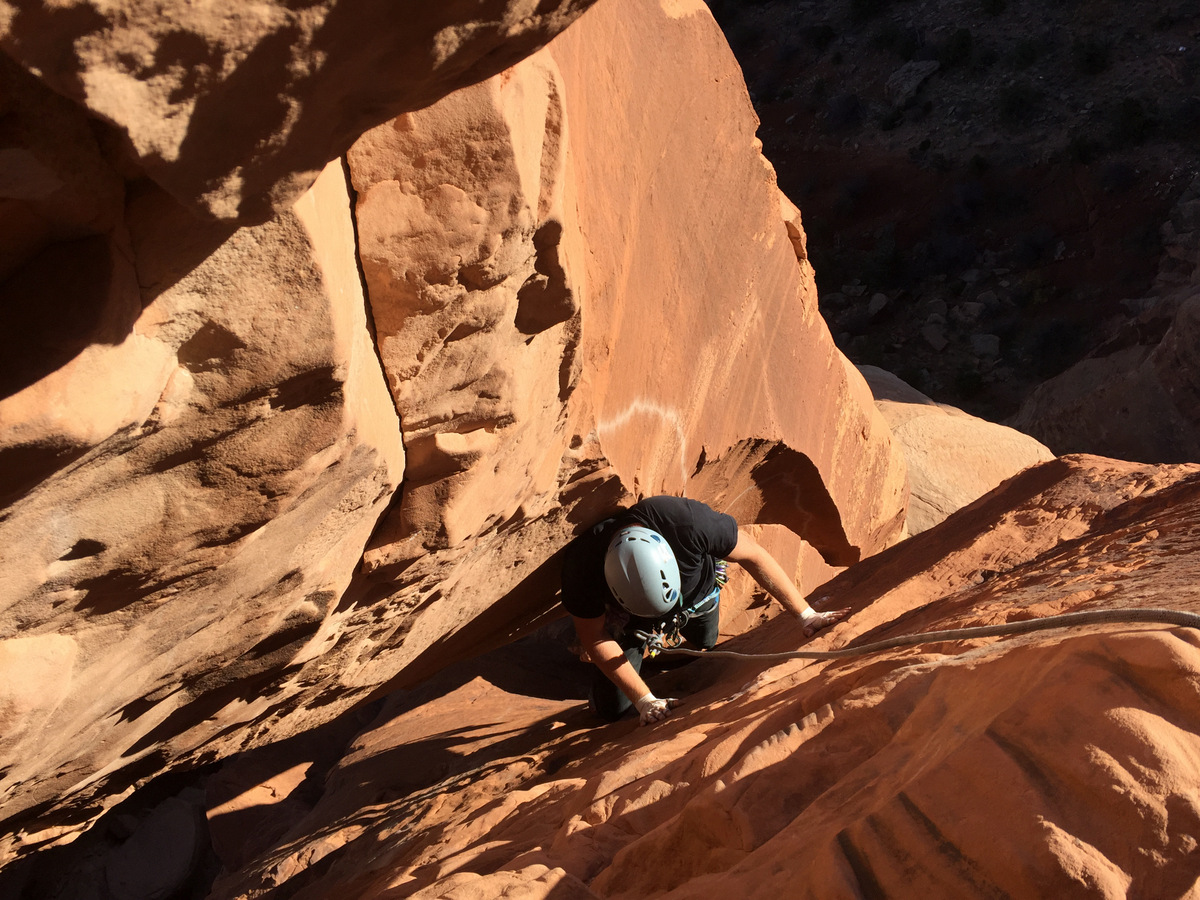
We then double rope rappelled from the pitch 5 anchors to the tower’s east side (not down through the belfry) to the top of pitch 3 and easily pulled the ropes down. We had heard horror stories of ropes getting stuck, but honestly I believe its only possible if you rappel all the way to the top of pitch 2 and try to pull them from that location.
Dylan’s 1st double rope rap
We then did a single rope rap from the pitch 3 anchors to the pitch 2 anchors and did a double rope rap all the way to the route’s base from the top of pitch 2.
Stevo on the easy single rope rappel down to the top of pitch 2
We hiked out at dusk and reached the trailhead right at dark. I love evening hikes out like this recounting the day’s fun and excitement and telling stories. What made the hike out even better was the full “supermoon” rising.
The Kissing Couple on the hike out
Beautiful
The supermoon and Independence Monument
After another awesome burger at Red Robin in Grand Junction and catching up on our NFL football, we made the roadtrip back home arriving back in Edwards by 11pm. What a fantastic weekend of desert climbing. My shirt even proves that a good time was had, especially during those stemming chimneys on pitches 2 & 4 of the Long Dong Wall.
The aftermath of my beloved Black Diamond tech shirt
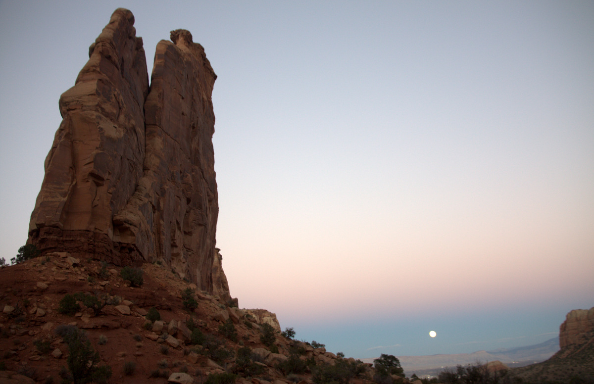
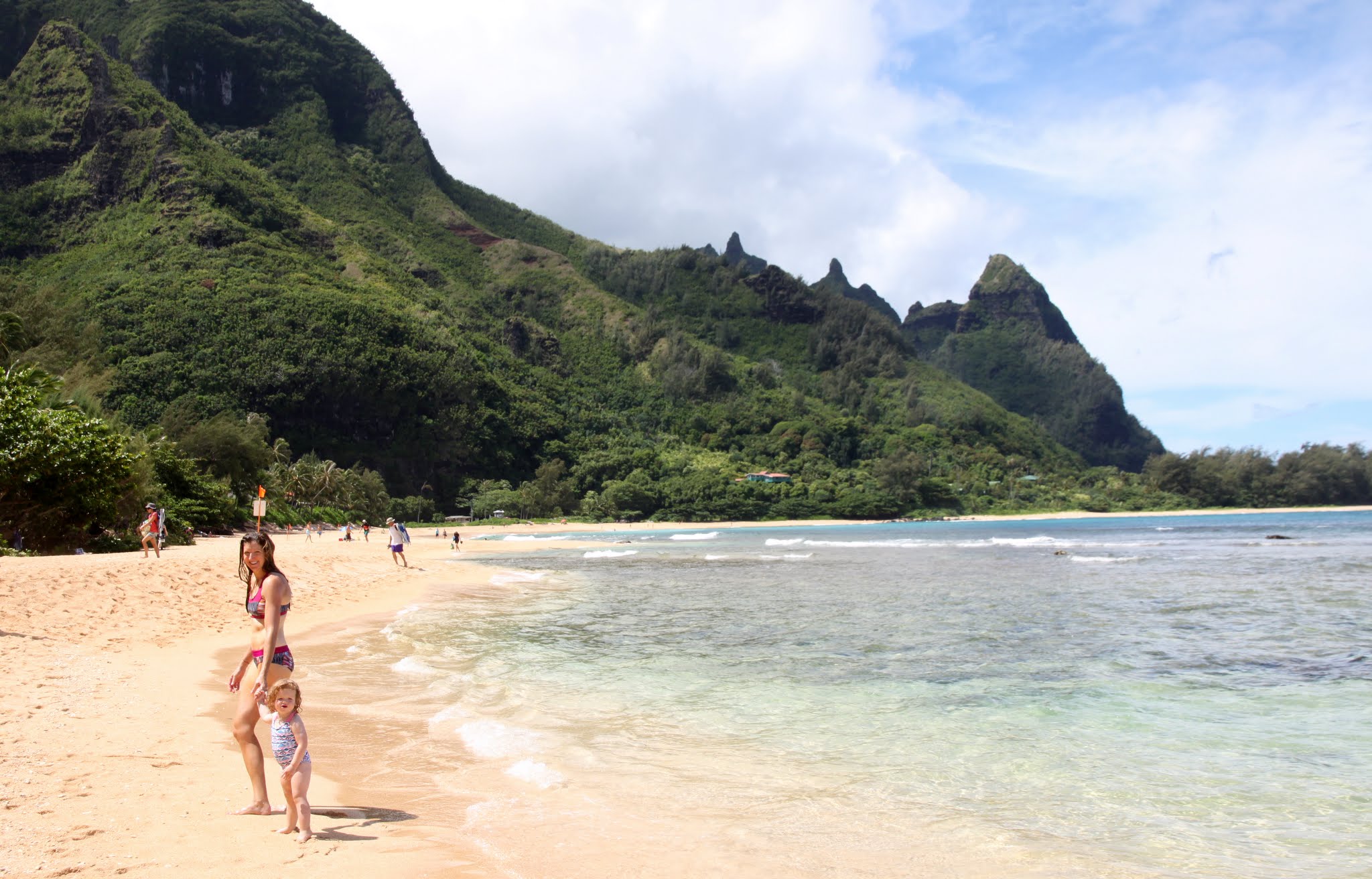
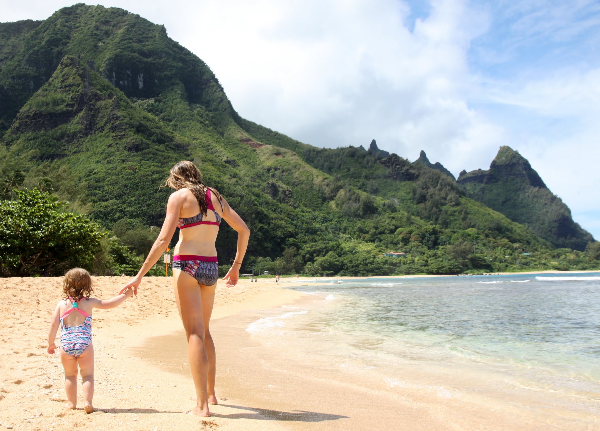
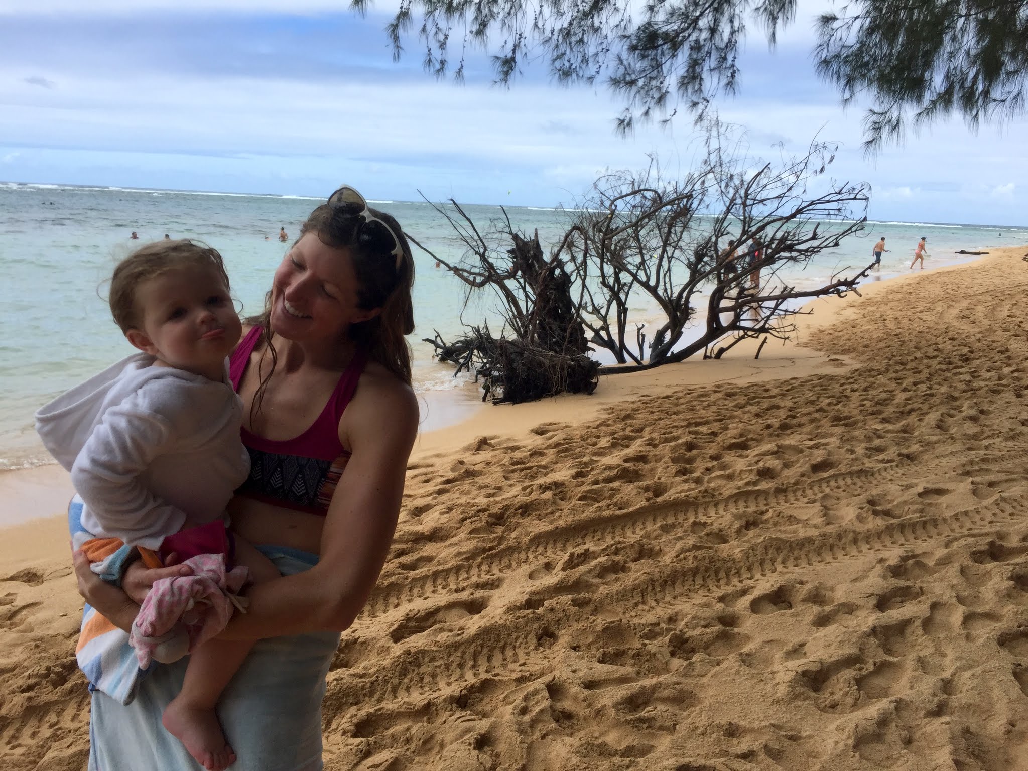
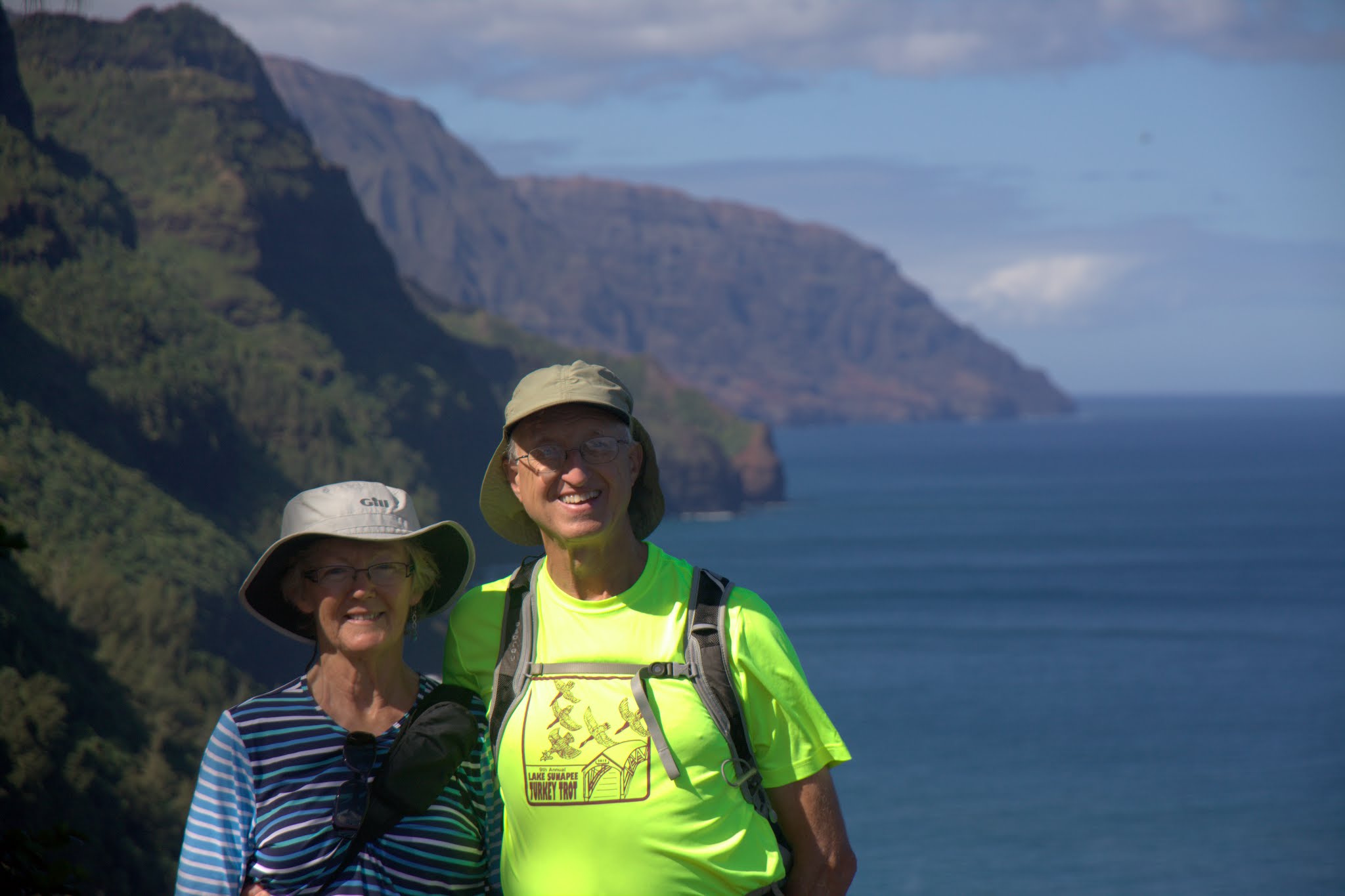
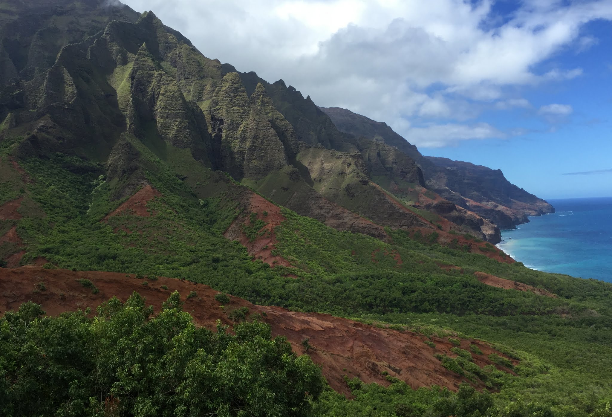
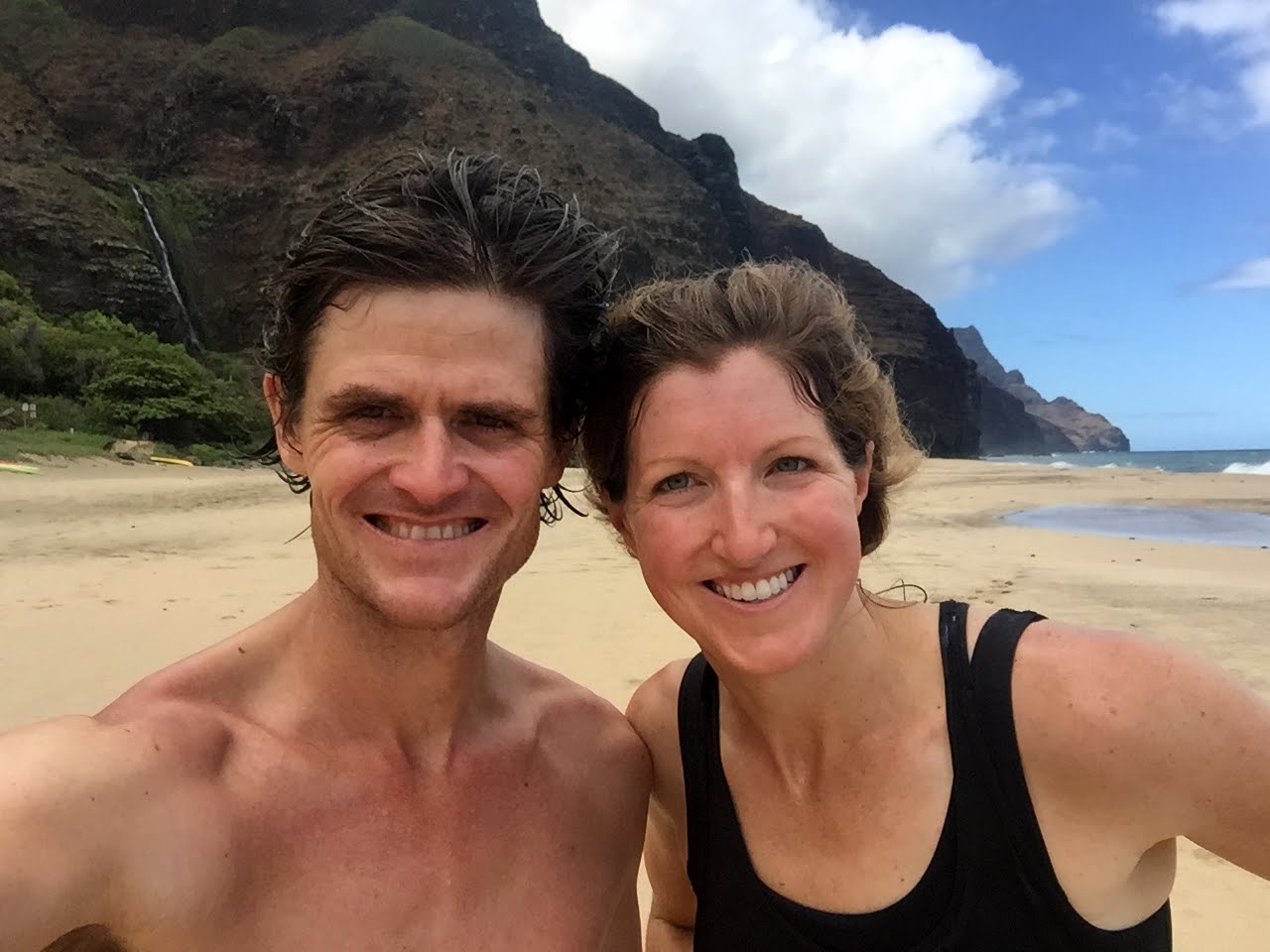
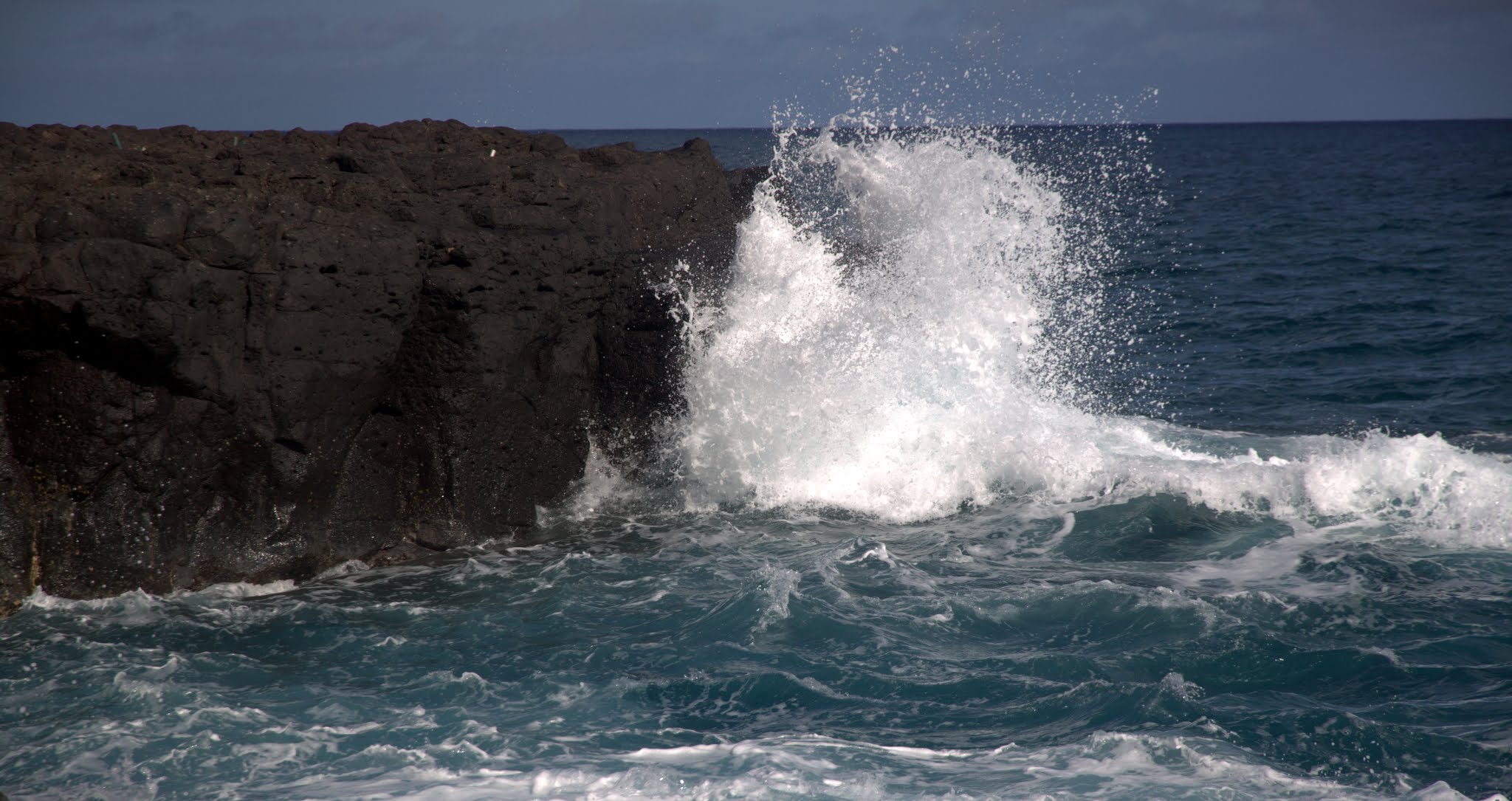
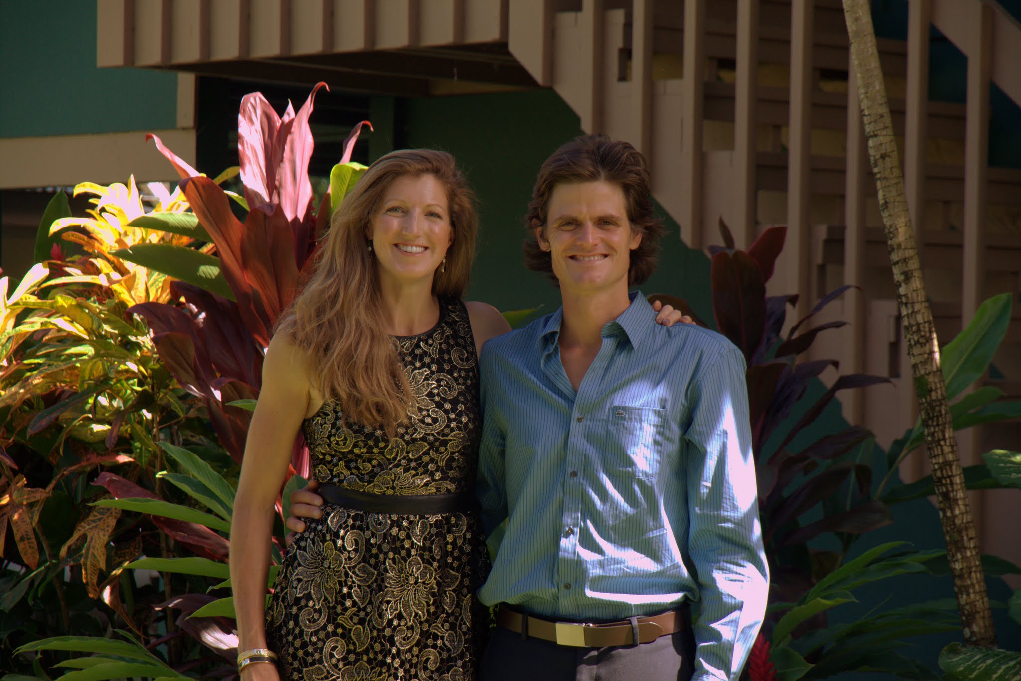
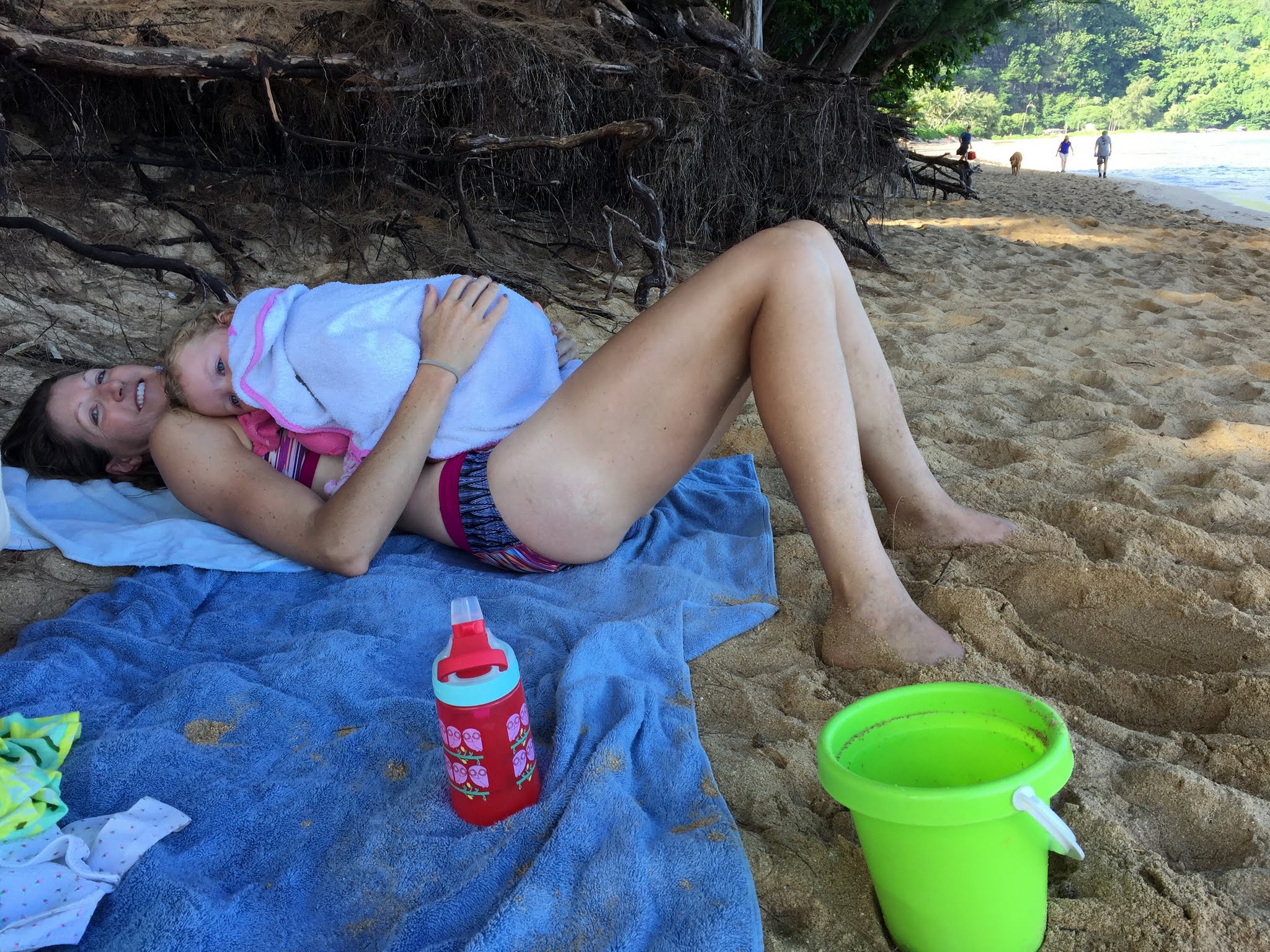
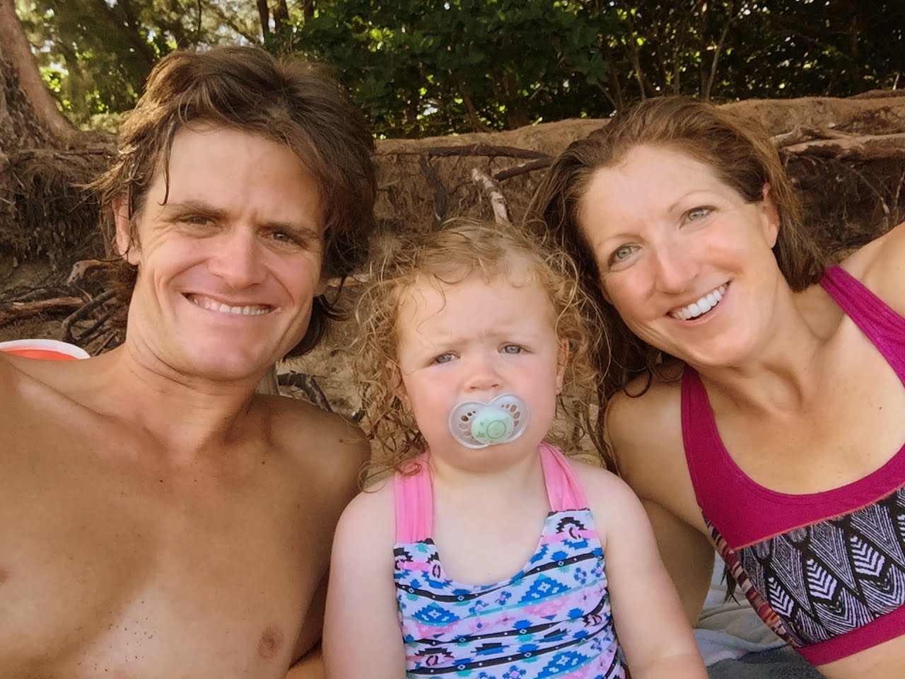
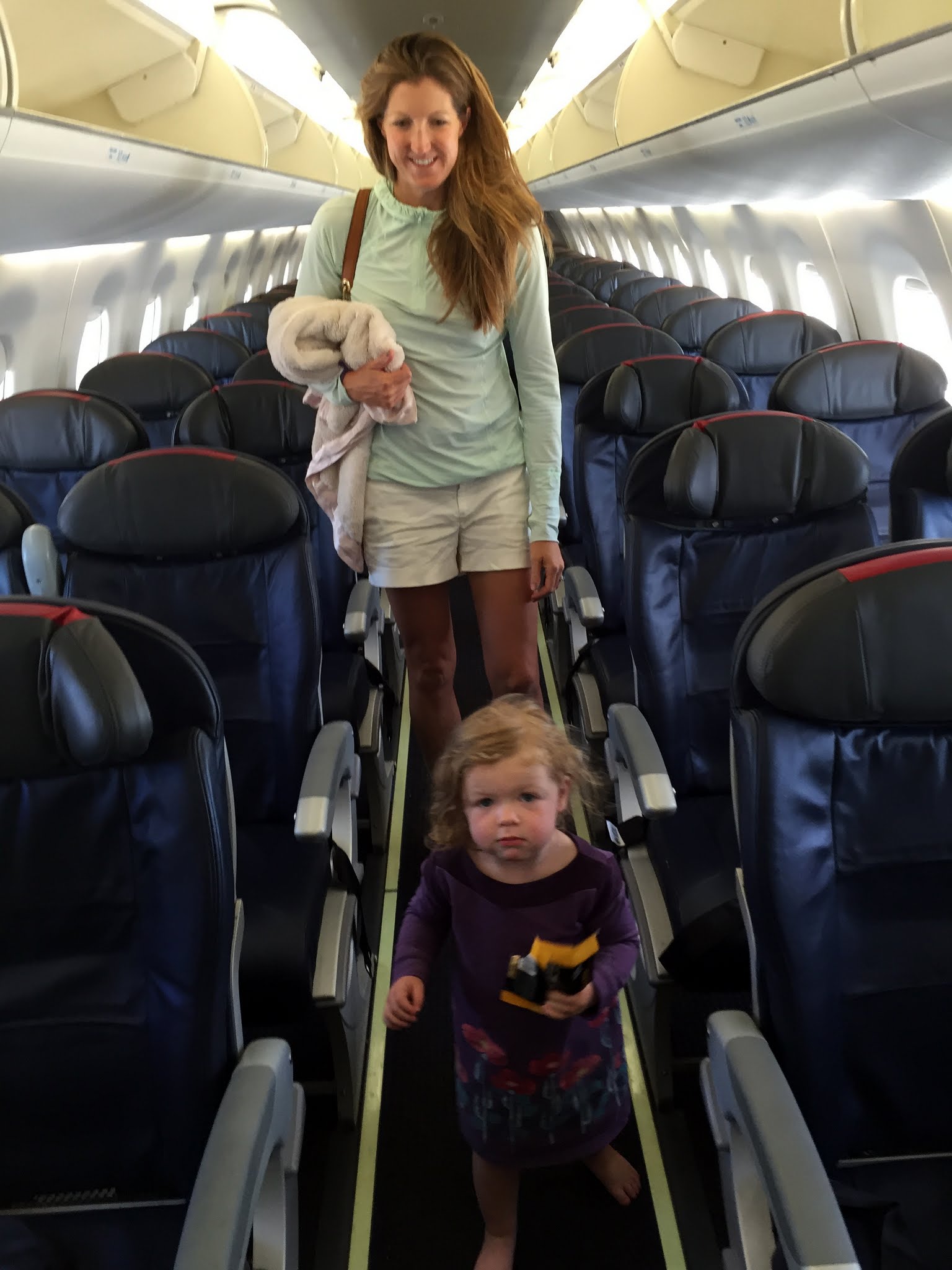
Our good friend Chase Lochmiller, whom we met in Antarctica on our Mt. Vinson trip almost three years ago, was getting married on the Hawaiian island of Kauai in late September 2016. Having never been to any Hawaiian island, Kristine & I decided to make this happen with Sawyer and immediately Ken & Dianne Oelberger were on board to come with us. And, from everyone we talked to, Kauai was the least developed, most mountainous, and exotic of all the islands, which sounded right up our alley. Also, our friends from London, Harry & Halla Koppel, whom we met on Mt. Vinson as well, were making the long trip over and so it would be a great opportunity to rekindle our fun friendship we had in Antarctica together. We were so excited to spend this vacation with Sawyer,Ken, and Dianne. Definitely a different kind of vacation for us, but it turned out to be so much fun and memorable. Kauai certainly did not disappoint. We rented a functional beach house in Wainiha on Kauai’s north shore between Hanalei Bay and the Kalalau trailhead. It was a perfect location and was a 5 minute walk to the famous Tunnels Beach, where we went about every day for swimming with Sawyer and snorkeling.
Sawyer en route to Hawaii!
We flew from Denver to LAX and met Ken & Dianne there for the big flight direct to Lihue Airport on Kauai. We rented a van when we arrived and drove the hour+ up to the north shore and our beach house. It was an extremely long day with Sawyer, but we finally made it to the house around 4pm in the hottest part of the day. I think it was because we were all so beat from the travel and very tired and likely because the house had been closed up until an hour or so before we arrived, but we all sort of lost it when we arrived into the house due to the extreme temperature inside the house. I know I for one was thinking how the heck I could stay here, especially sleep at night in this hot of a house with no AC. It was unbearable. Ken and I immediately took off our shirts as did Sawyer to try and cool down. The property manager, however, did show us the portable AC units in a closet we could try and hook up to the windows at least to cool 2 rooms down. So, Ken and I jimmy-rigged one of the units in Sawyer’s room and it worked pretty well really cooling down her room to 70 degrees or colder. We did a less-inspiring engineering installation in the master bedroom where Kristine and I stayed, but it worked pretty well. It did cool down at night and was much more manageable. Ken and Dianne were stronger than us (me) and did well in the 3rd bedroom without an AC unit. Still, though, shirts off for the boys and Sawyer were still a staple for the week. Despite the initial shock of the heat & humidity, we adjusted and had a fantastic week.
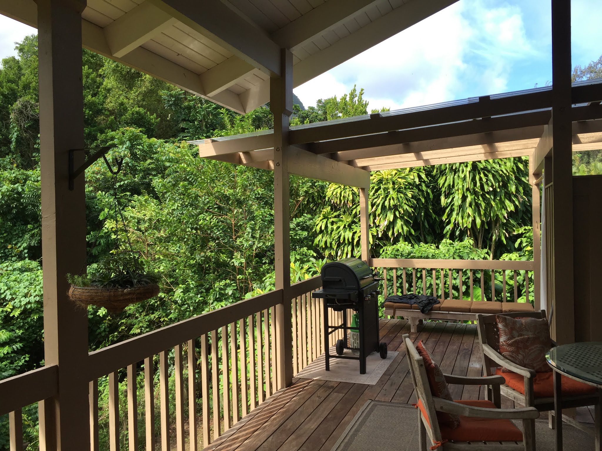
Our house’s back porch
The backyard
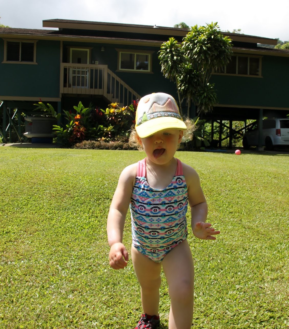
Sawyer & I adjusting to life in Hawaii
Sawyer on the way to Tunnels Beach with the front of our house behind
Walking to Tunnels
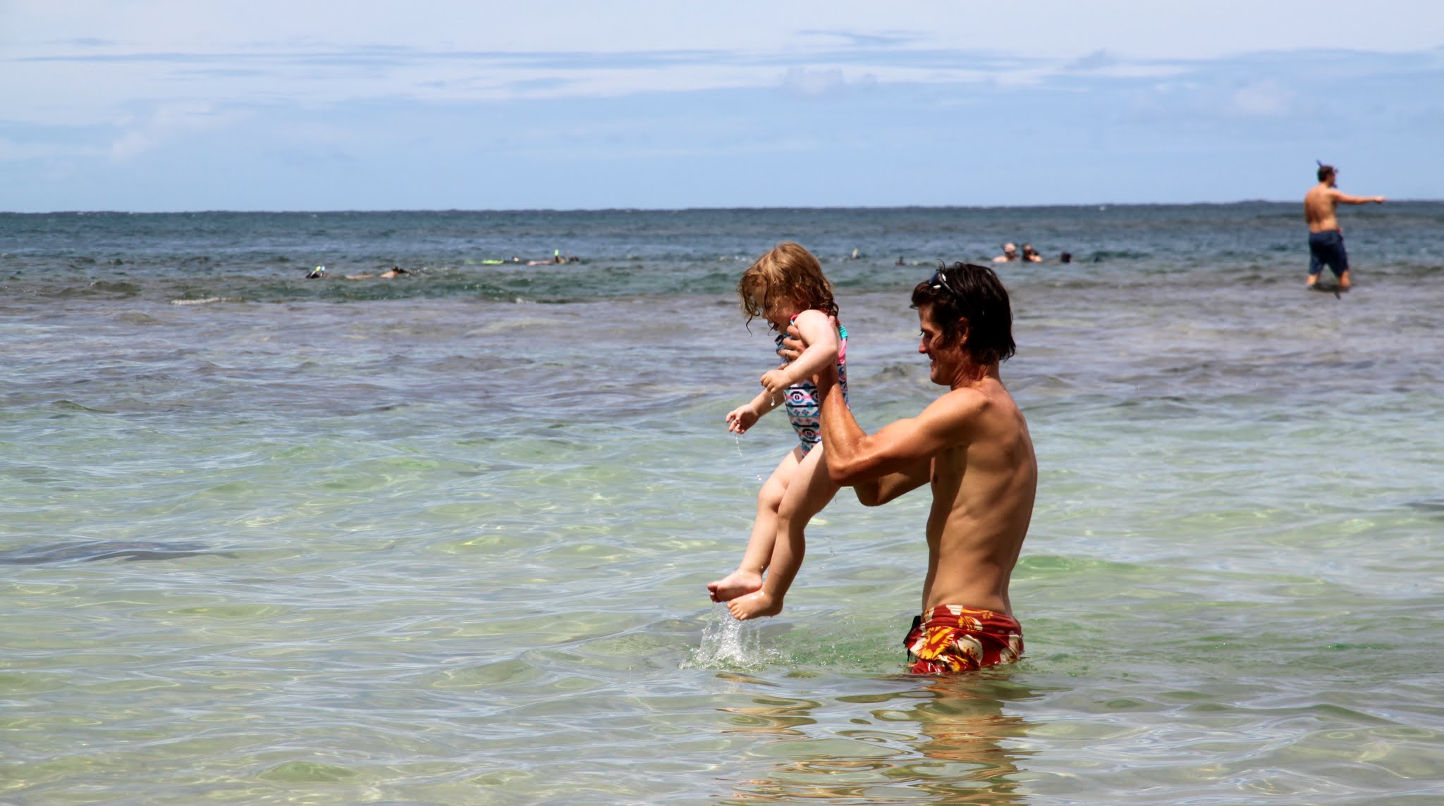
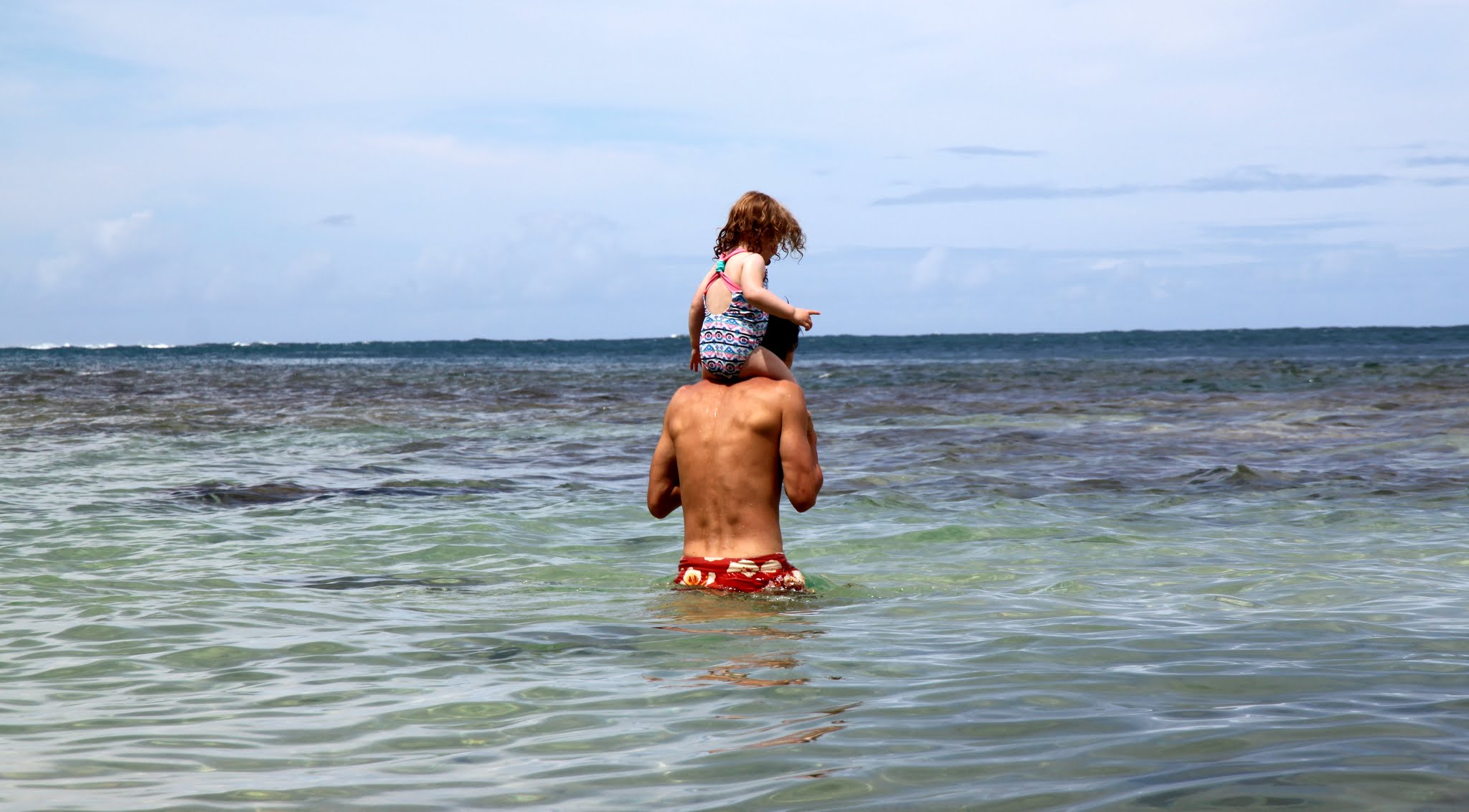
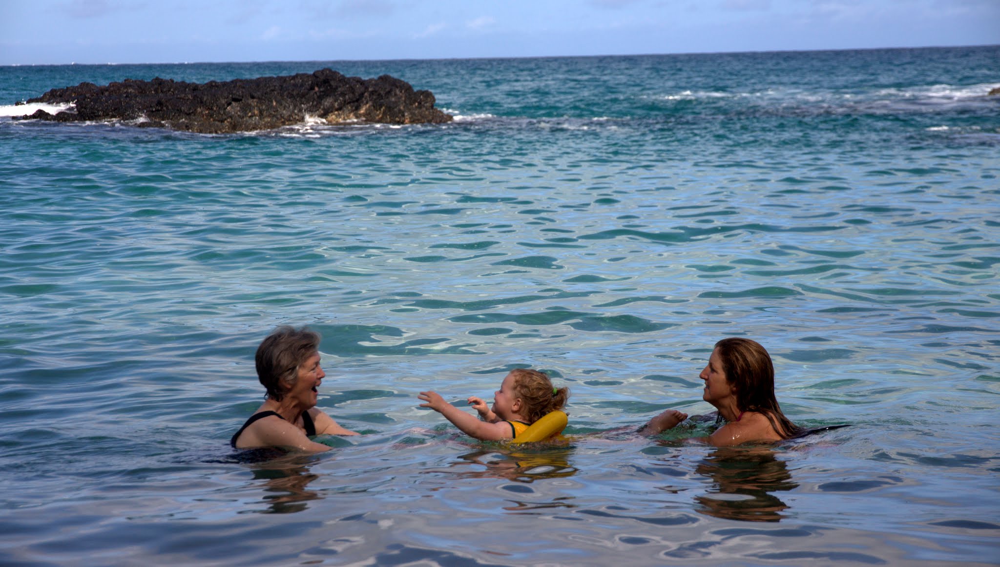
Awesome Tunnels Beach has a reef and is just perfect for swimming and snorkeling in calm waters
Sawyer loved it
Ken & Dianne so happy to be back on Kauai after 25 years or so
Sawyer & I at Tunnels
It was so much fun & special being with Sawyer here
Kristine & Sawyer at Tunnels
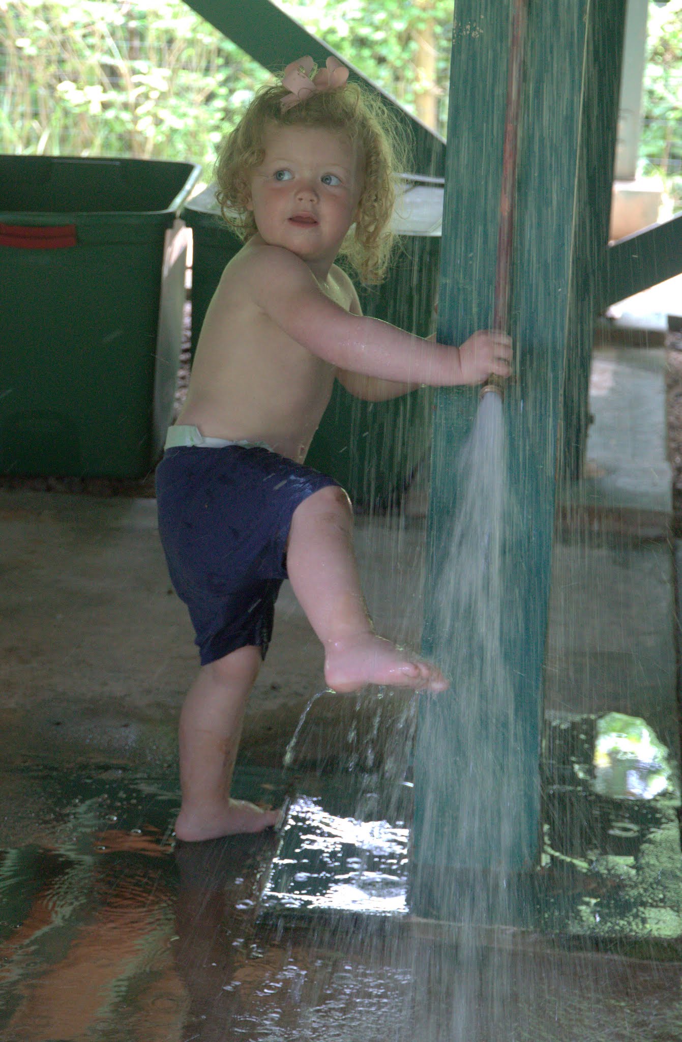
Rinsing off back at the house
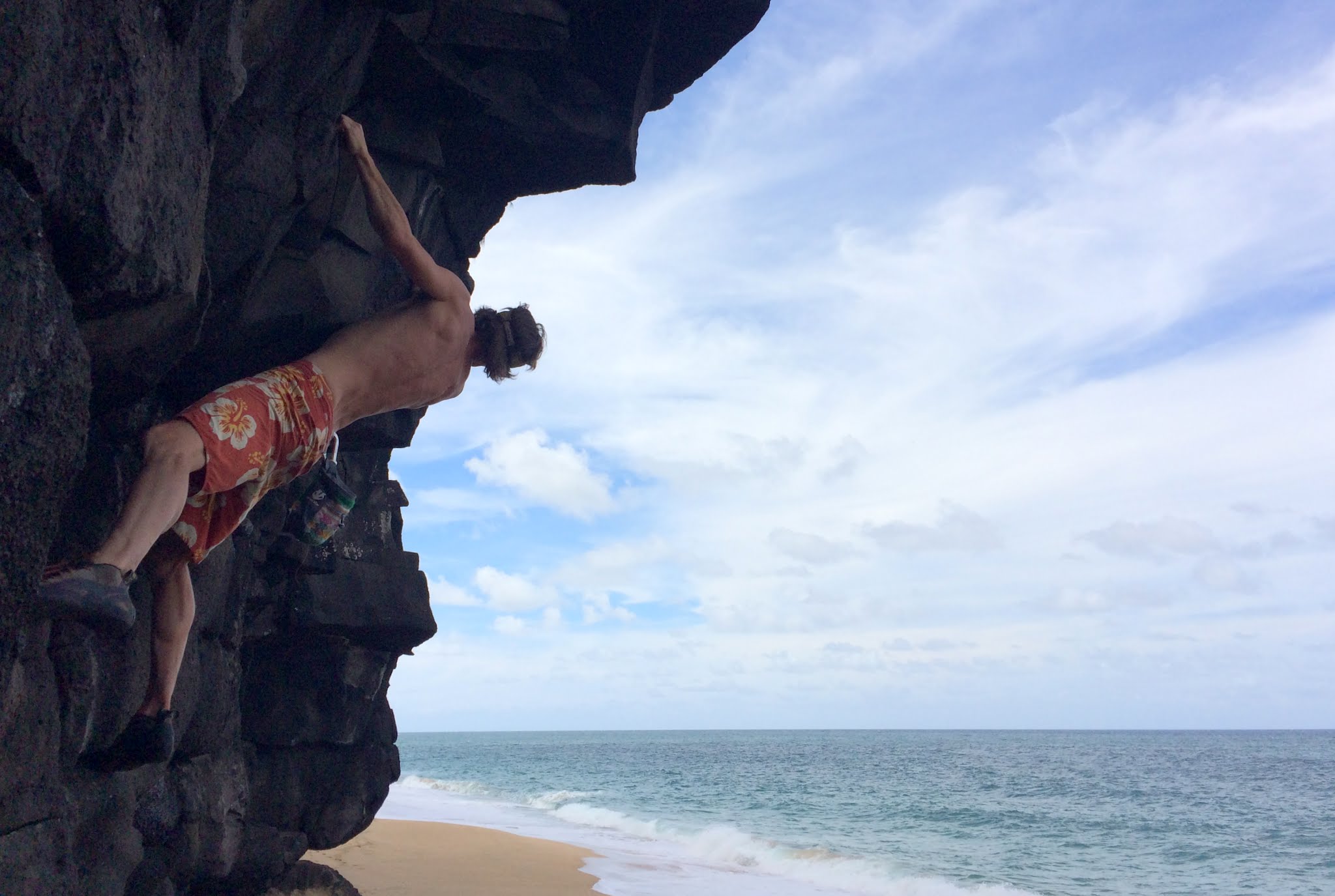
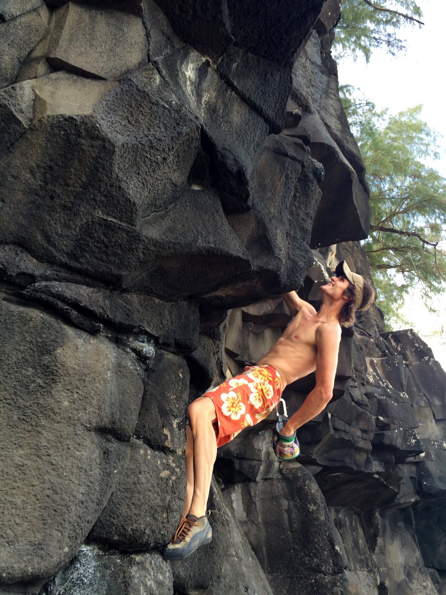
Despite not having full AC in the beach house, this place really had about everything else. Toys for Sawyer, beach chairs, snorkel gear, etc, a downstairs outdoor shower, a master bedroom outdoor tub and shower, great views into the jungle, very private, and a great location. We soon learned from Chase that most of these beach houses do not have AC, anyway. One of the first afternoons during Sawyer’s nap, Kristine and I drove a few miles east to Lumahai Beach to check out some bouldering I had researched on the beach. It turned out to be really fun bouldering on volcanic rock with the soft sandy beach as a crash pad. Kristine doesn’t boulder very much, but I was extremely happy she went with me. We had brought our rock shoes and chalk bags with us.
Very scenic bouldering
Though after a bit, the volcanic rock really takes a toll on your hands
Me on a line called Problem D
Kristine on a line called Problem G
Lumahai Beach (north) bouldering wall. Routes can be found on mountainproject
A good afternoon together
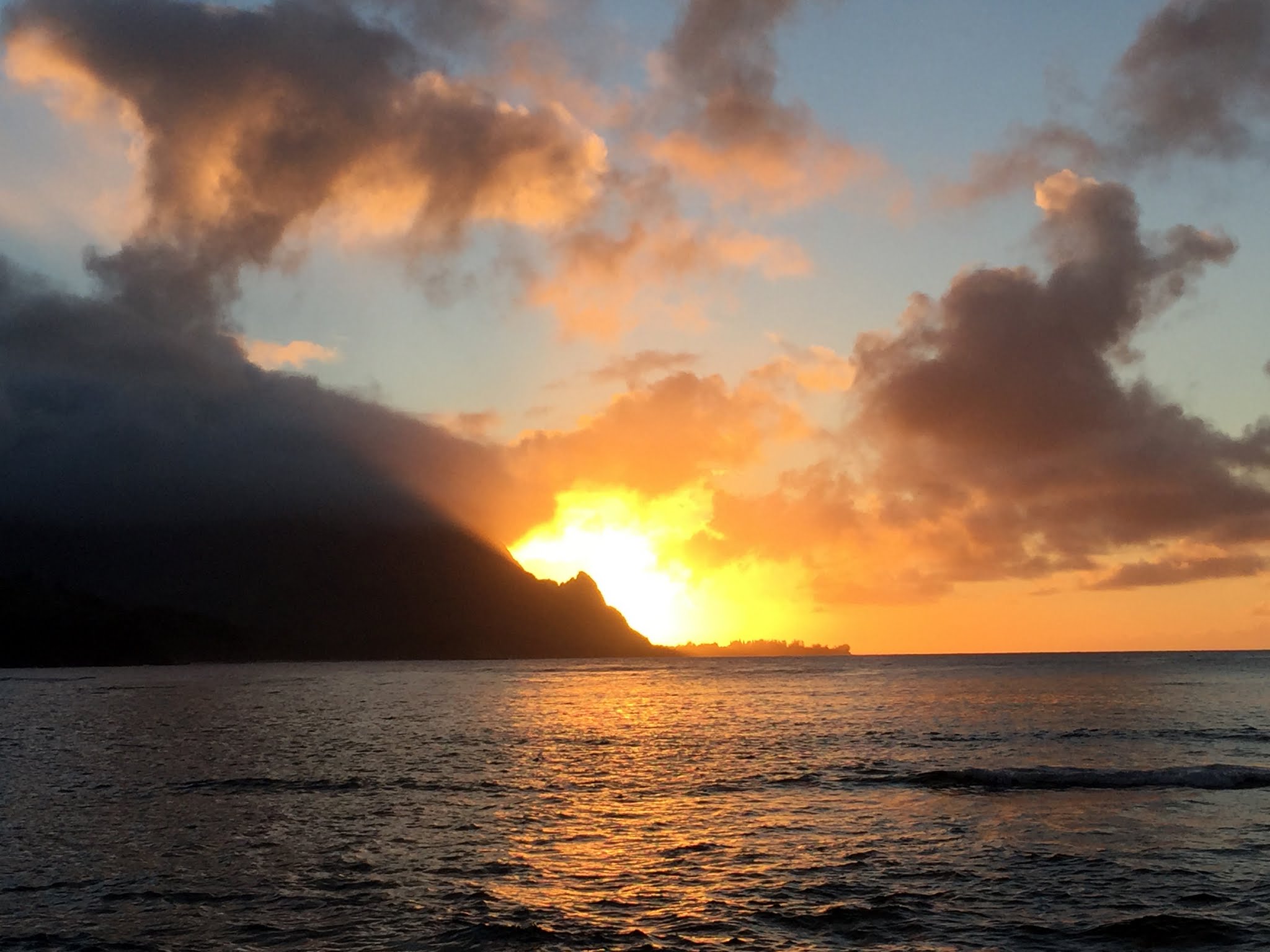
That evening we took a drive to the Kilauea Lighthouse, but it was closed. That’s ok because we had a ball chasing roosters and getting some nice pictures in the evening light.
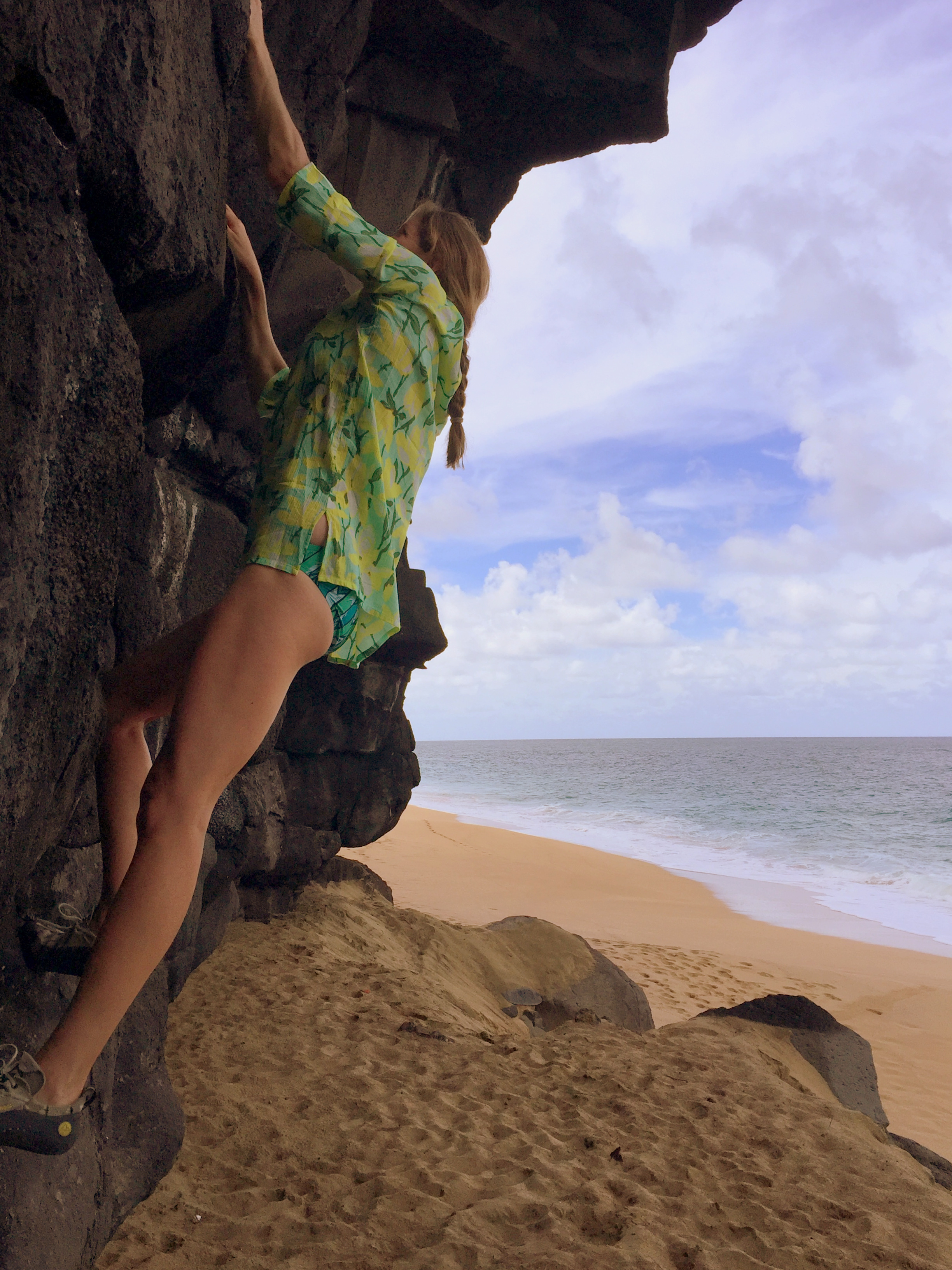
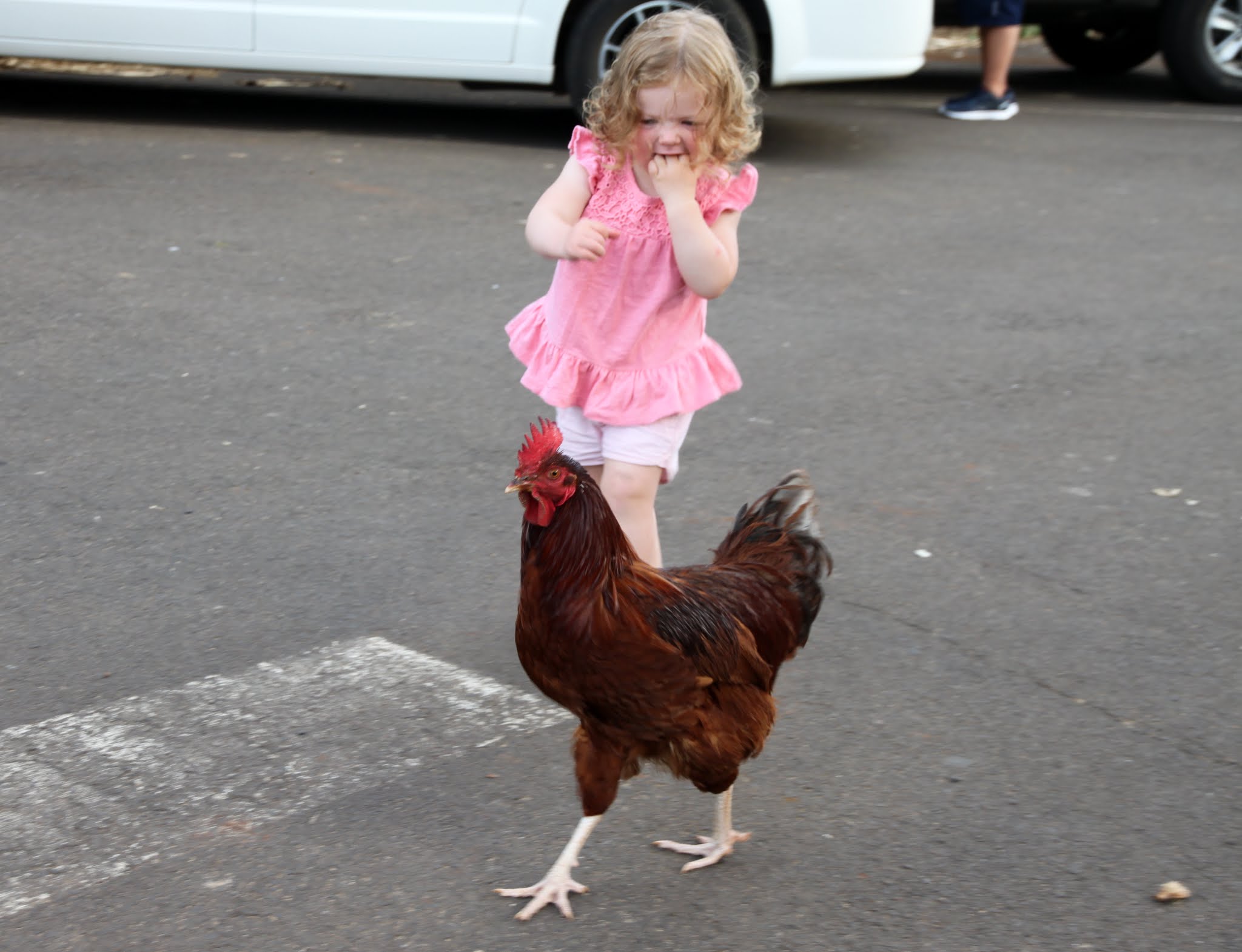
Sawyer chasing a rooster
Good family pic with the Kilauea Lighthouse behind
Cool shades, Sawyer
The sun going down on the drive back
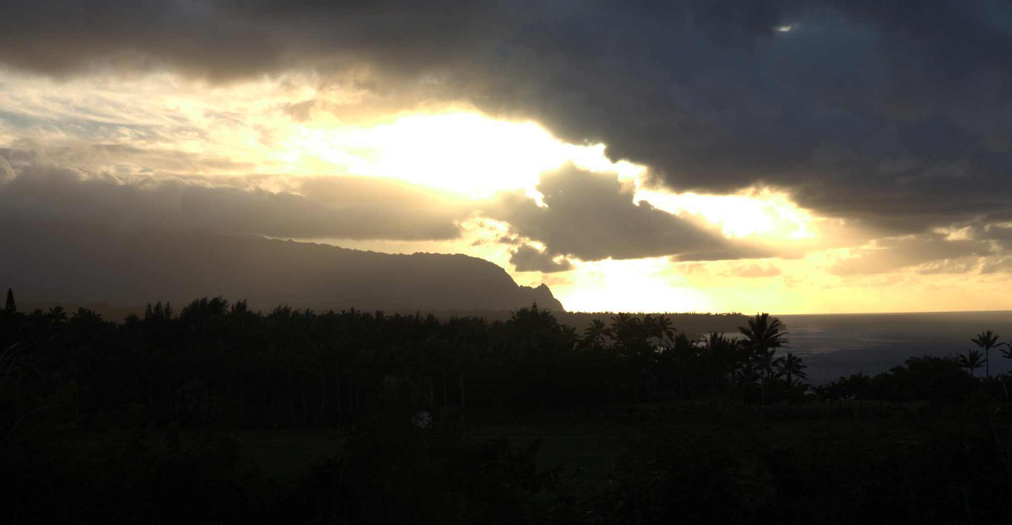
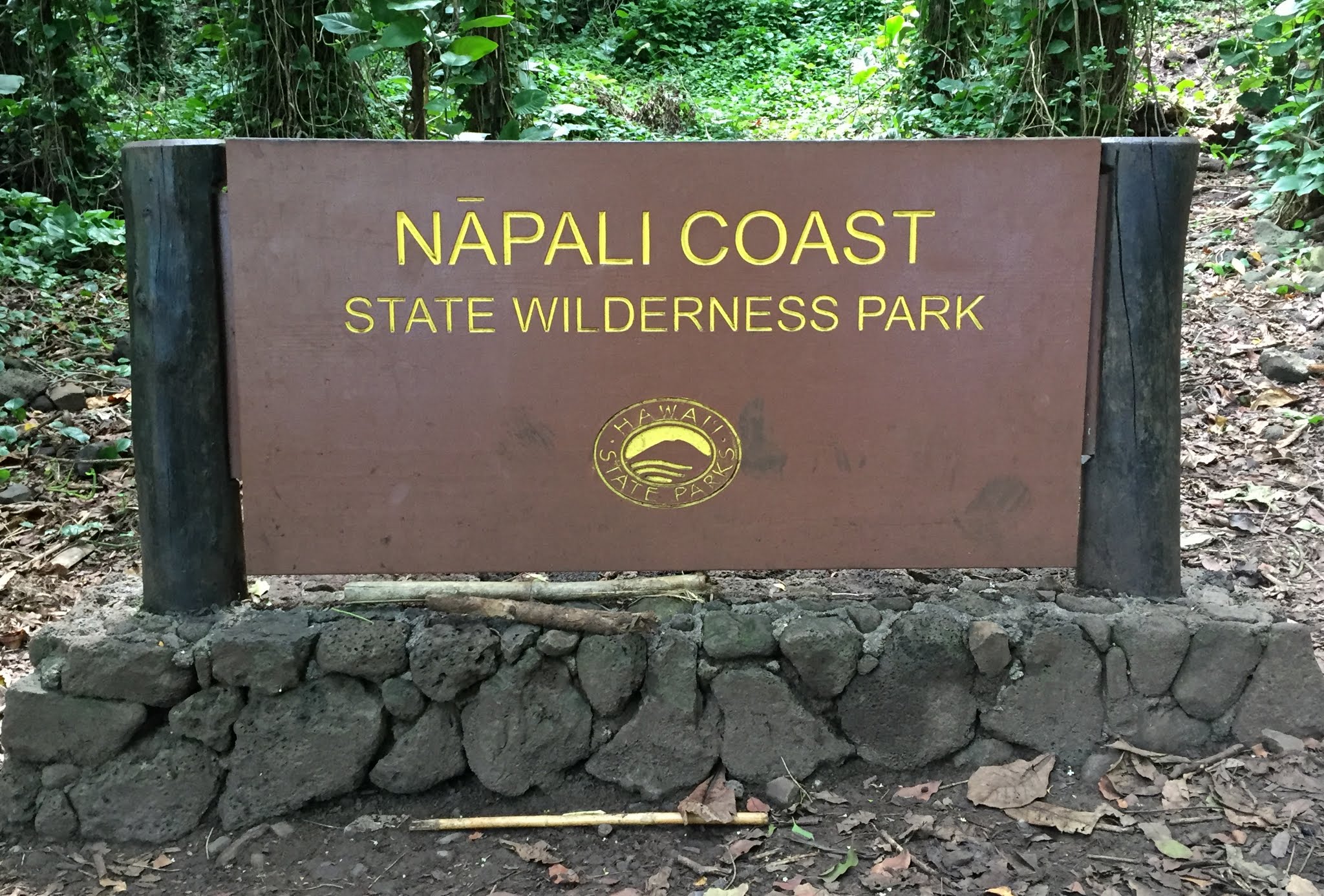
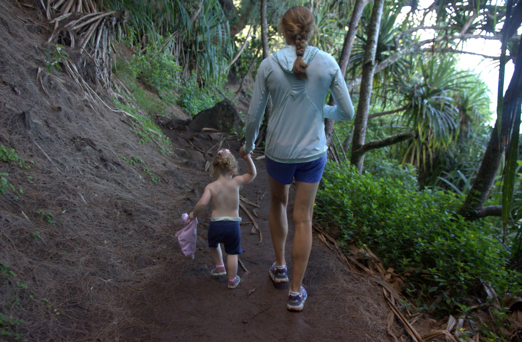
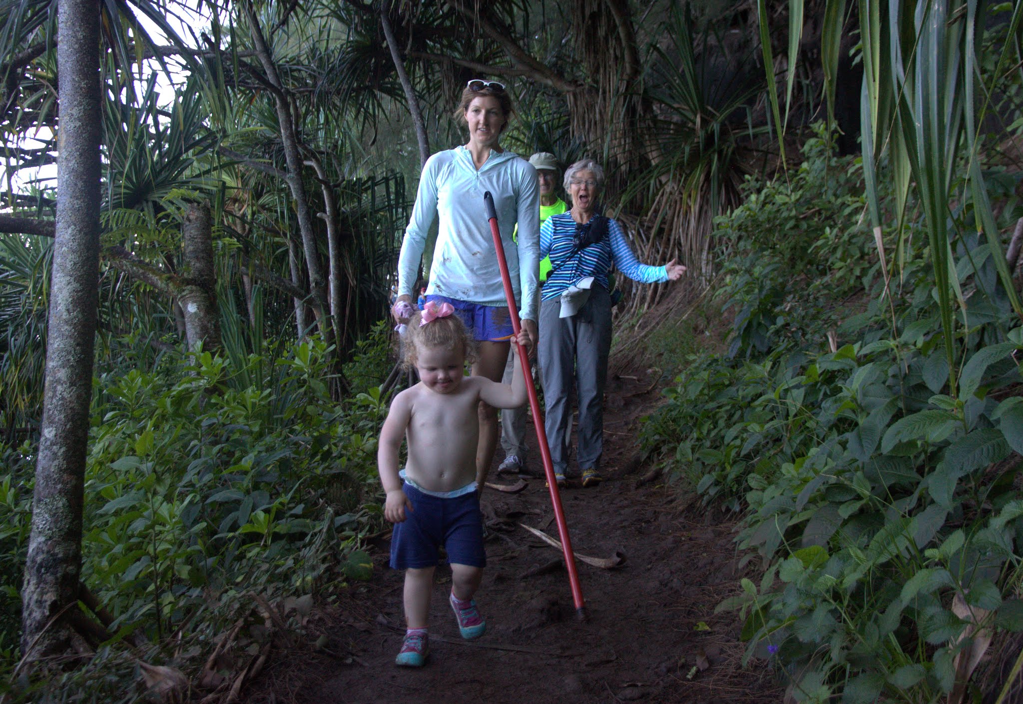
The next day we all decided to give the famous Kalalua Trail a try (at least the first mile or so) to get some views of the amazing Napali Coast. We actually made it just over a mile in depite how rocky and muddy and wet it was and Sawyer walked a decent portion of it. She was beat about halfway back and in the pack she went and fell asleep. However, it was gorgeous scenery.
Welcome
Sawyer & K hiking the Kalalau Trail
Dianne’s face says it all
Ken & Dianne and the Napali Coast
Kalalau Beach is the termination of the Kalalau Trail about 10 miles further down the Napali Coast
That evening we went over to Chase’s wedding party/friends house they rented in Hanalei Bay. Apparently, it was owned by the real life family depicted in the movie Descendants starring George Clooney. Also, the house in which the move was filmed on the beach was immediately across the street, which I definitely recognized. We had a great time catching up with Chase, meeting his fiance Devon, who grew up on Kauai, and checking out the home.
Sawyer walking around the home
The amazing home
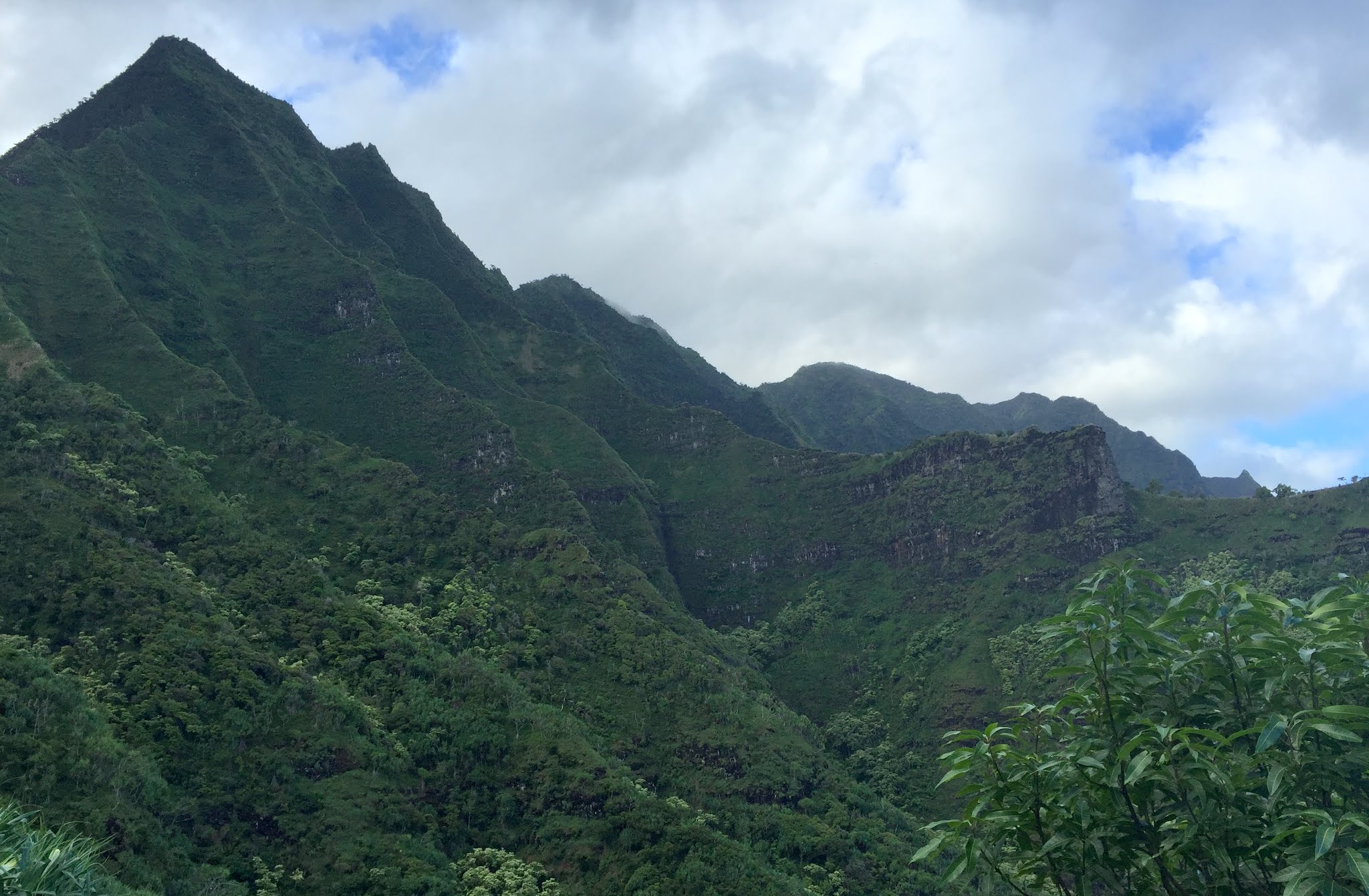
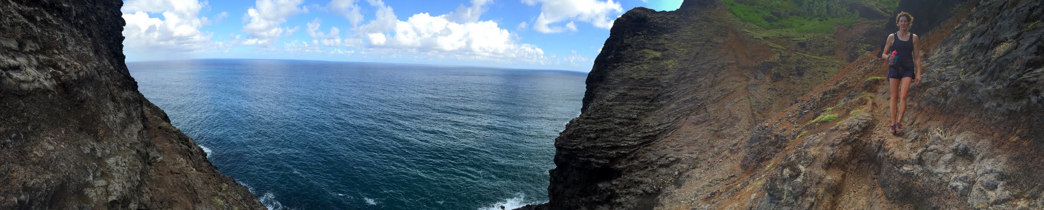
The Kalalau Trail (Napali Coast)
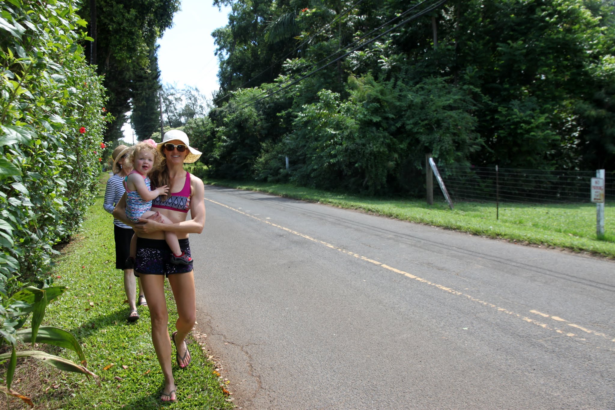
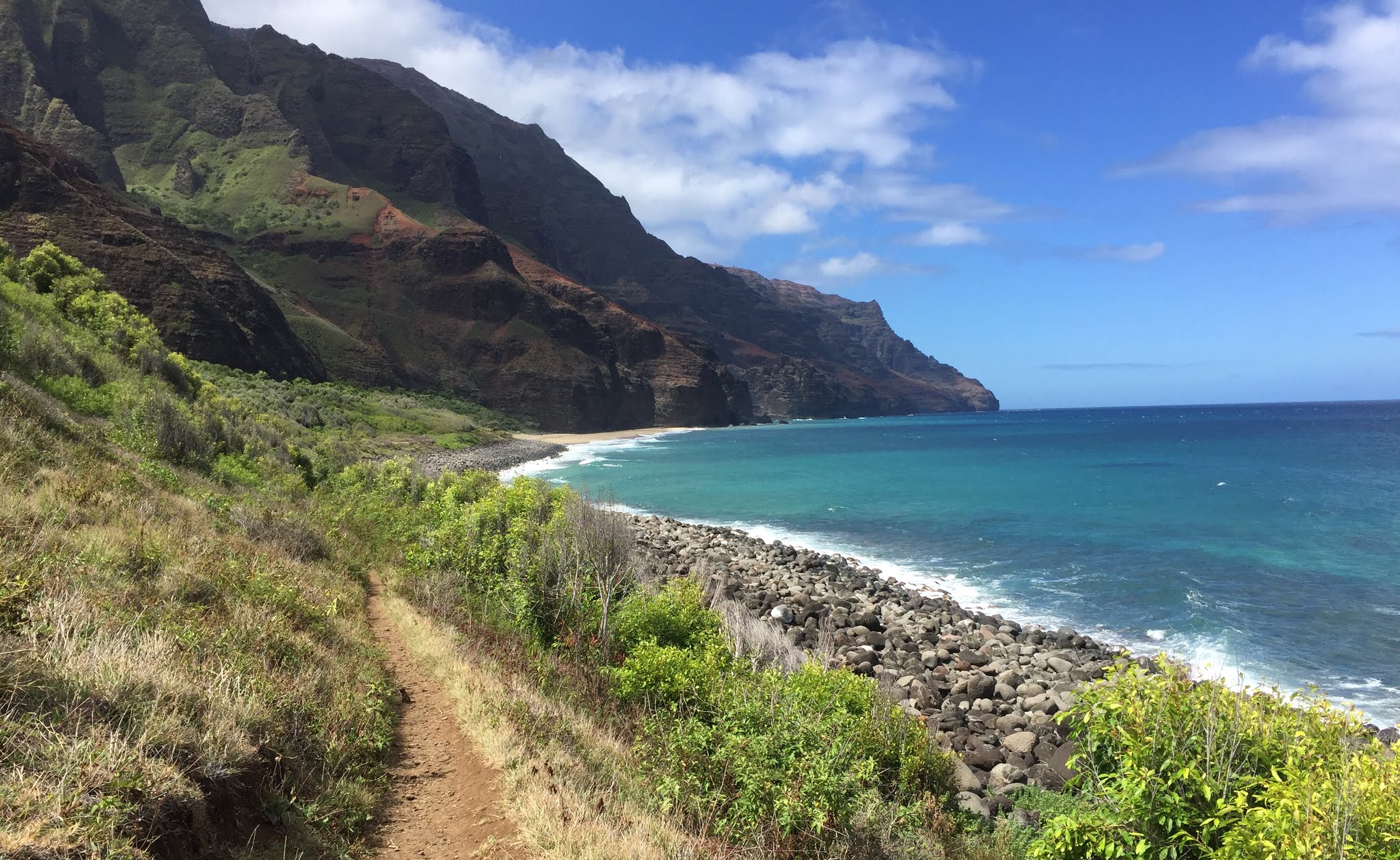
The next morning we all woke up around 6am and K and I got ready for our big adventure of the week: trail run/hike the Kalalau Trail to Kalalau Beach and back in a day, which turns out to be about 5,000′ vertical gain and 23 miles RT. Ken & Dianne were so nice to hang with Sawyer for the day and I think they had a really fun time together at Tunnels Beach. Ken dropped K and I off at the Kalalau trailhead around 7am (only 2 miles west of our house) and it seemed like we beat the majority of folks that morning to get on the trail. Armed with a water bottle, Gatorade bottle, a backpack water bladder, and trail bars/snacks in our pockets, we went light and fast. We brought iodine tablets to purify the stream water as we had to refill several times throughout the day.
The Kalalau Trail map along the Napali Coast. Click to enlarge
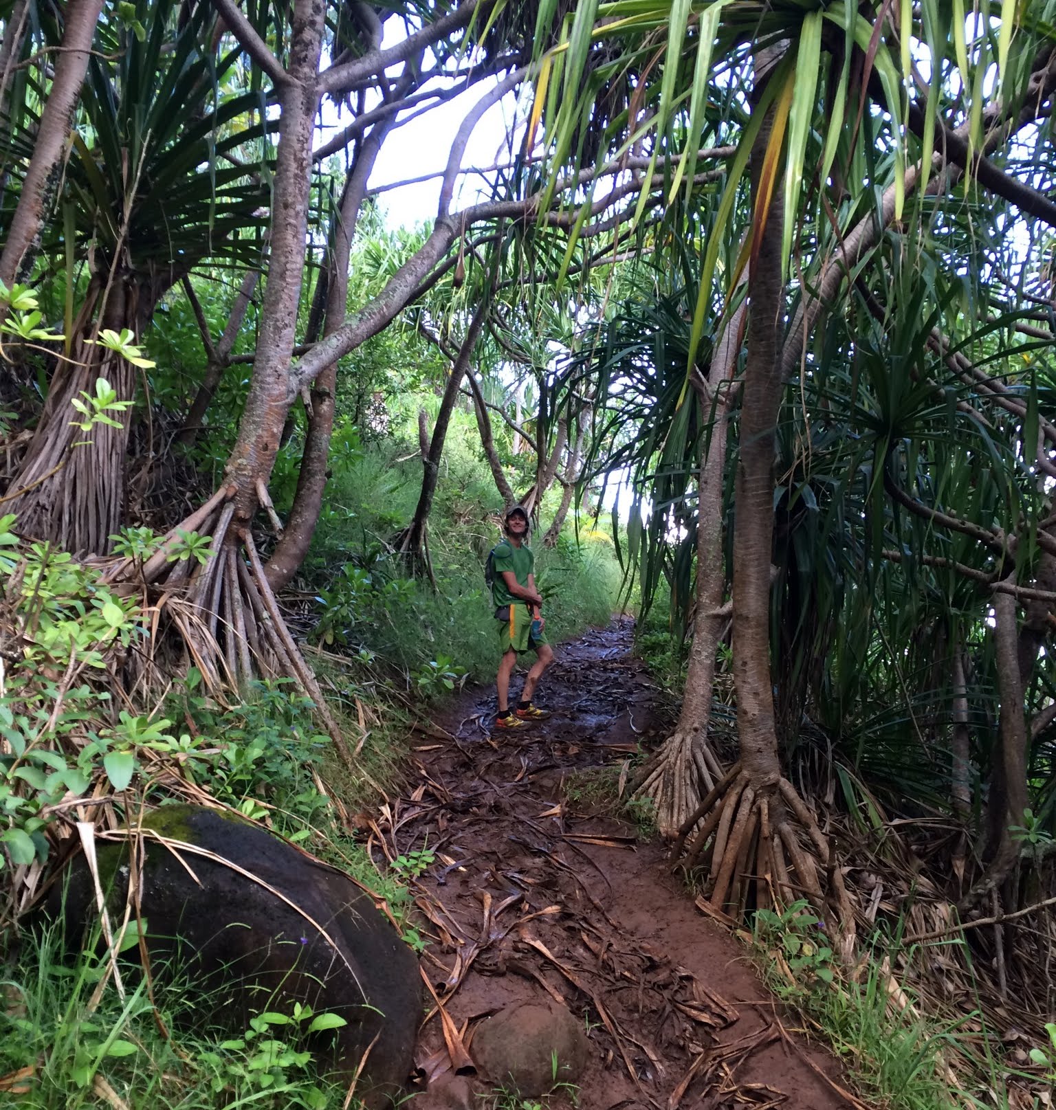
We tried to slowly run the first 4-5 miles of the trail, but much of it is so rough, rocky, muddy, and wet it was pretty dangerous to do so, especially on the down. Good thing is there were no people on the trail to try and get around. I had never sweated as much as I did on the Kalalau Trail with all of the humidity. I looked like I had already swam in the ocean. Anyway, the morning hours were relatively cool and in the shade as the sun had not come overhead yet.
Early morning mud
Kristine
Beautiful
Near the beginning of the trail
Crossing Hanakapi’ai Stream
2 miles and 30 minutes in we came upon Hanakapi’ai Beach
And leaving Hanakapi’ai Beach
One thing about this trail is it is A LOT of up and down. As soon as you get comfortable going up or down, the trail switches and you do the other mode. Miles 2-4 were some slow miles because of the overgrowth onto the trail and slick mud and rock. We came upon a lean-to shelter at mile 4 and I left my shirt hanging there as it was completely soaked with sweat. We chatted with a grizzled man at the lean-to laying on the bench from Oahu who had hiked this trail countless times in his 30 years of coming to Kauai.
Typical mountainous terrain along the Napali Coast
Kristine and a view. Kalalau Beach is still a good 5-6 miles out
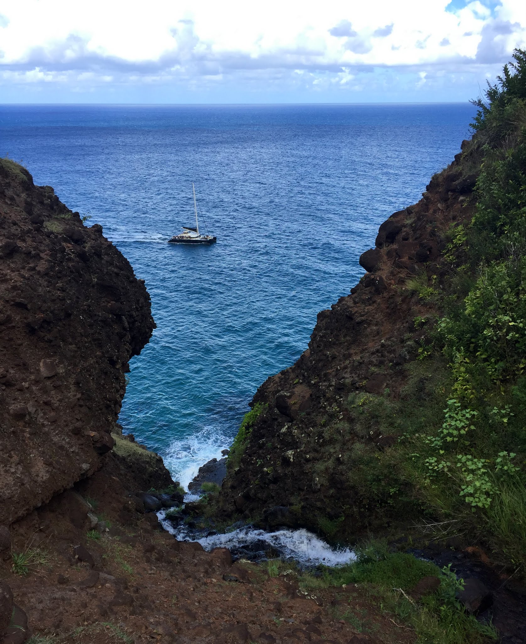
A boat en route back from Kalalau Beach
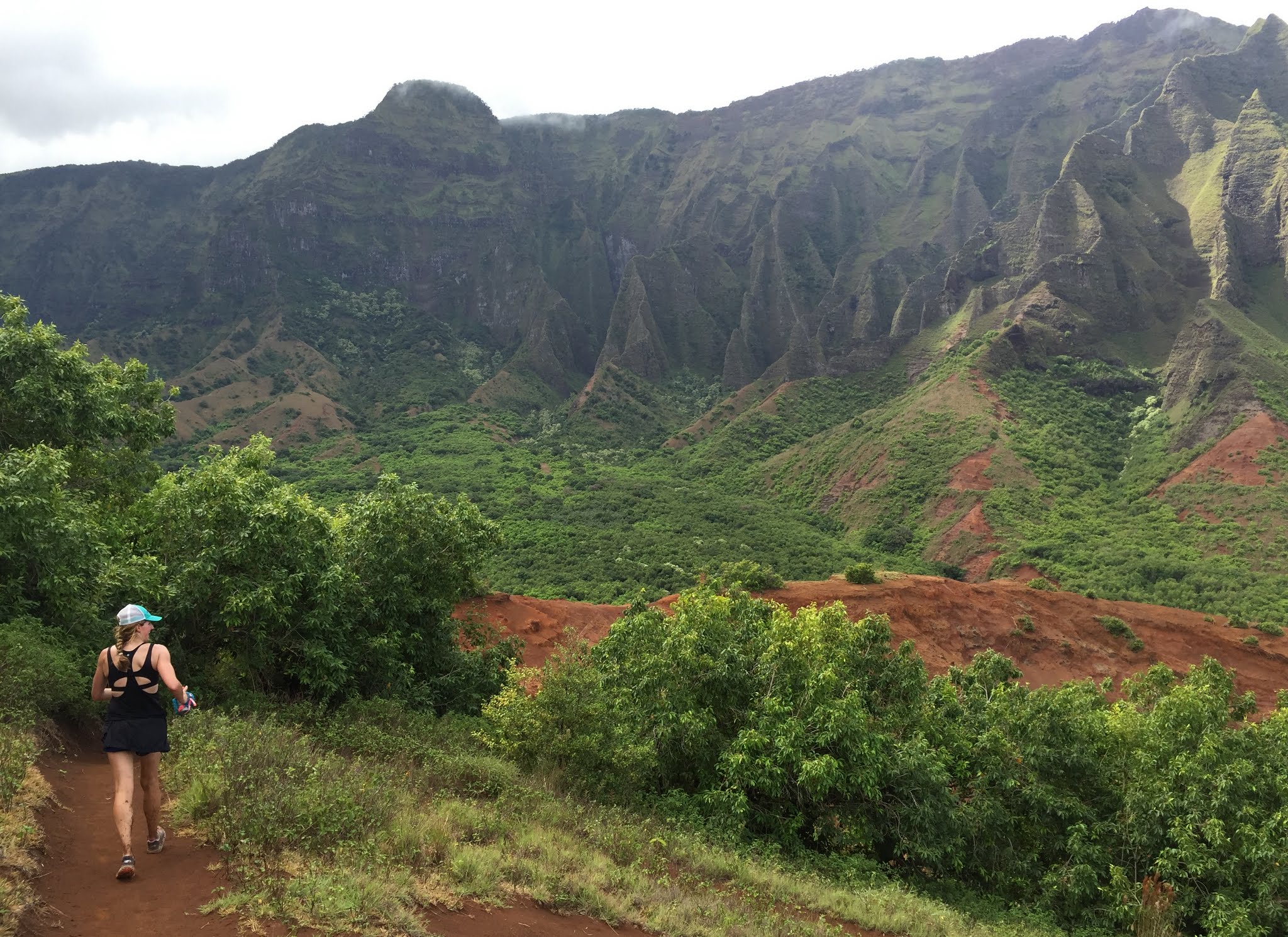
We reached Hanakoa Valley at mile 6 (halfway point) and after that the trail really opened up, became much more runnable, and the views opened up as well. It was great.
Hanakoa Valley
Me and the mountains
Cruising along and still all smiles
Kristine
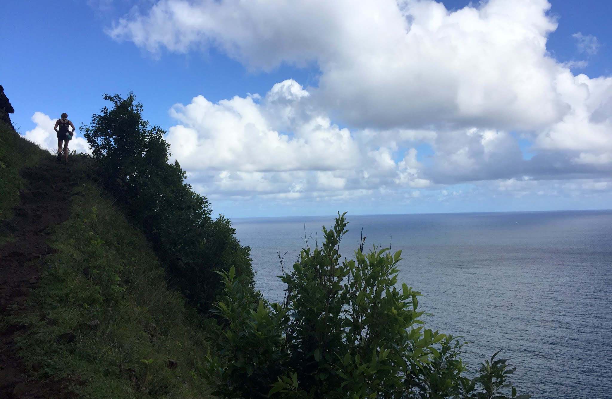
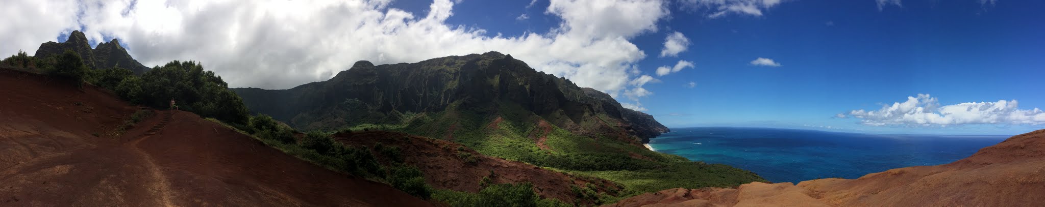
I think around mile 7 was the fun and interesting portion of the trail that was pretty exposed down to the raging surf several hundred feet below.
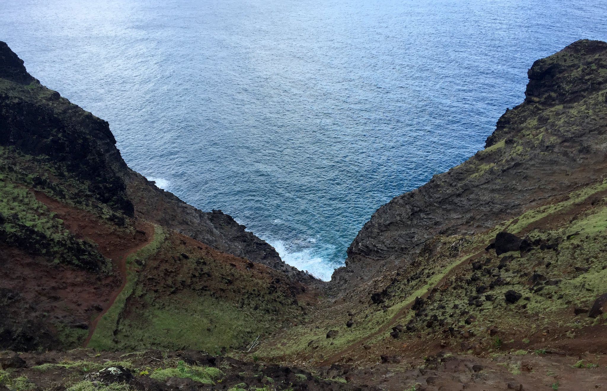
One of the more exposed portions of the trail
Kristine chugging along
A panorama of a neat section of trail
The trail opening up after mile 8
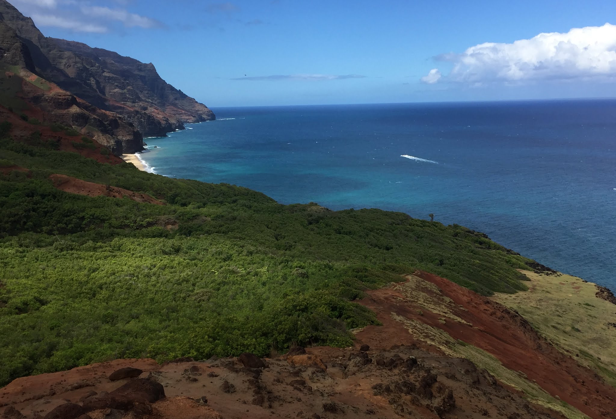
Getting close. Kalalau Beach can be seen right of center in the distance
I see you, Kalalau Beach!
Another one
Nice meadows close to Kalalau Beach
The home stretch
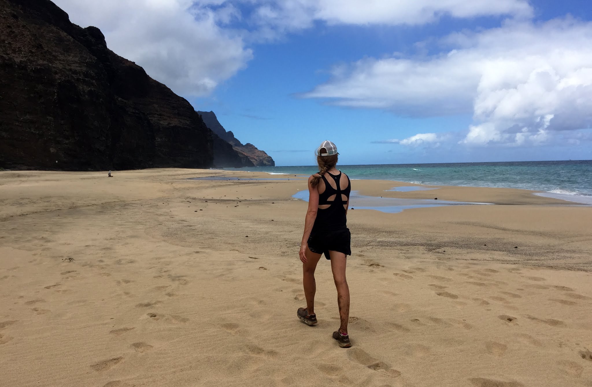
So, after about 4 hours on the trail, we reached Kalalau Beach. It was such a treat to be there. Many campers were camped in the trees just south of the beach and were beginning to come out to the beach. It reminded me of Leonardo DiCaprio and the island dwellers all going to the secret, remote beach in the older move The Beach. In fact, many folks were in the nude heading into the surf. We decided to not join the ranks of the nude.
Kristine and Kalalau Beach
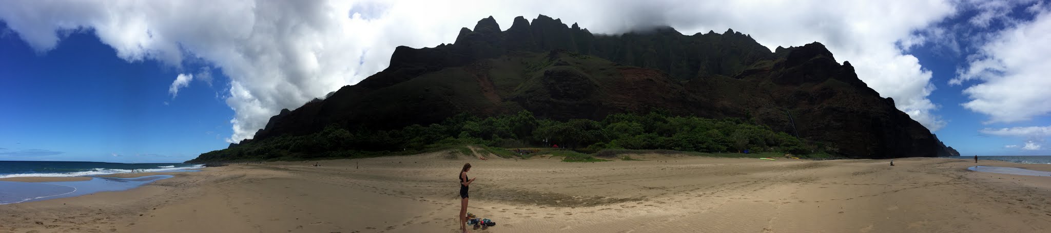
Panorama of Kalalau Beach
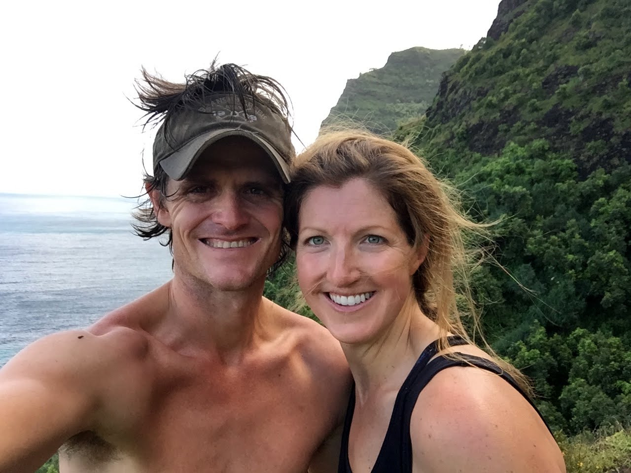
Happy to be here together. Someday, we’ll have to come back with Sawyer and camp a night
We ate one of our denser, larger snack bars we previously bought and rested for 20 minutes or so. We also gathered a few special coral pieces and rocks from the beach to remember it by. We said our goodbyes and began the slower return run/hike back the way we came.
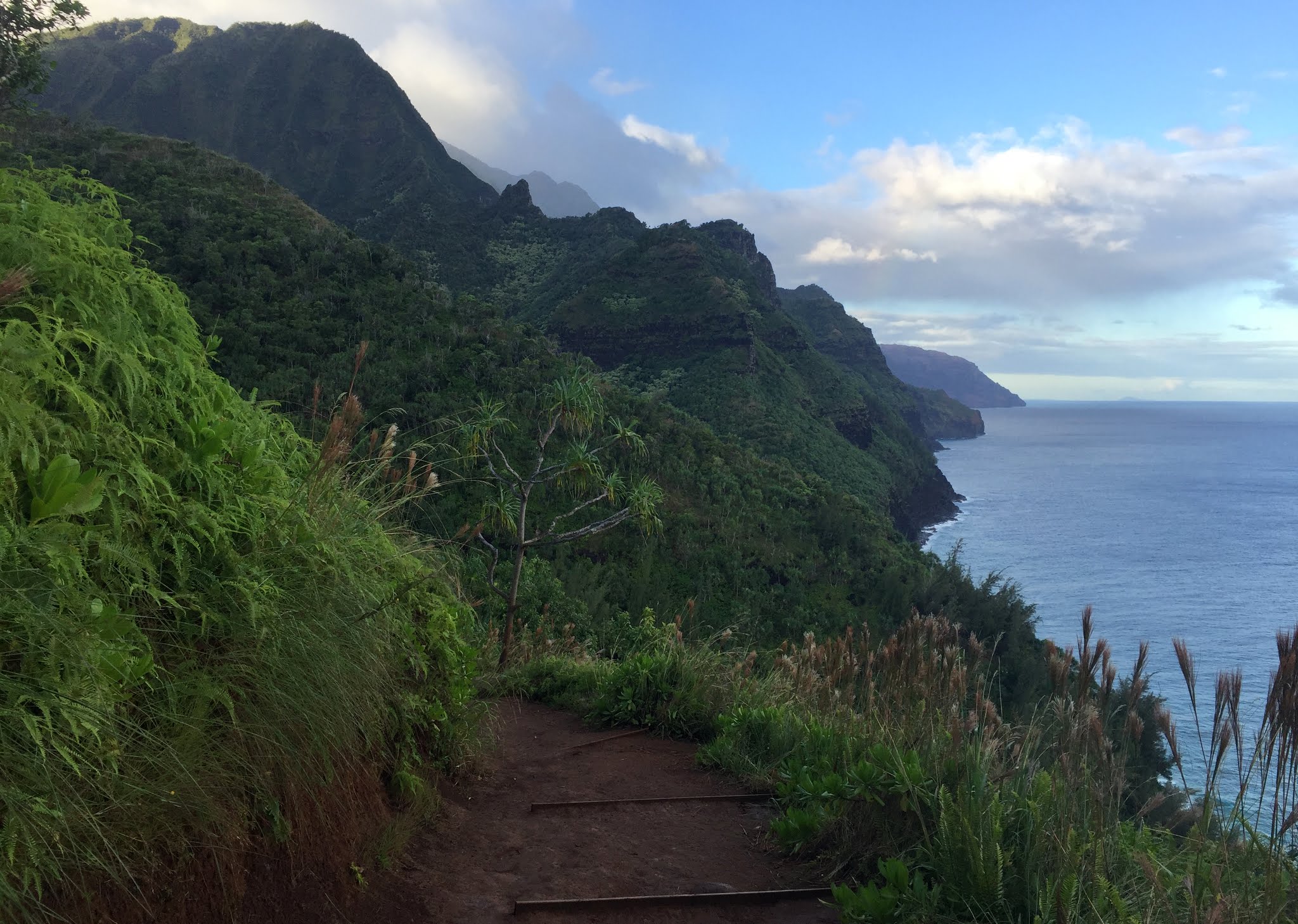
The long, but beautiful way home
Coming back along the fun, exposed portion of the trail
A quick little video of Kristine on the exposed portion of the trail:
On the return trip, we decided to take a detour and go check out Hanakoa Falls, which said only a half mile off the Kalalau Trail. However, it was a rough and slow trail consisting of some bushwhacking and we began to think if we’d ever see this waterfall. Finally, we reached the falls and I guess it was worth the detour.
Hanakoa Falls
The last few miles were slow and we were hiking by then. Lots of folks on the trail once we got back to mile 2, but fortunately the trail had dried out quite a bit so it was much less slick. We were back at the trail by about 4pm with tired legs and feet, but feeling good about our adventure. We walked the road back to our house trying to thumb and hitch a ride. We were finally picked up by some nice folks we met along the trail and drove us in the back of their pickup the rest of the way back arriving around 4:30pm just in time to see Sawyer waking up from her nap. I immediately went out to get us some much needed ginger beers and guava drinks from the Wainiha General Store as we (me) were craving these the last few miles.
The Remainder of the Week and Chase’s Wedding
We all did some more swimming and snorkeling on that Thursday and Kristine & I made it to Chase & Devon’s welcome part at the St. Regis in Princeville that evening.
Sunset over Hanalei Bay from the St. Regis
At the St. Regis
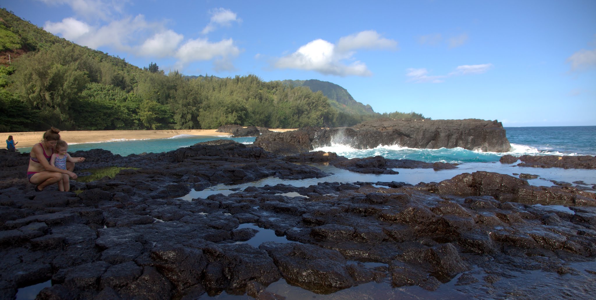
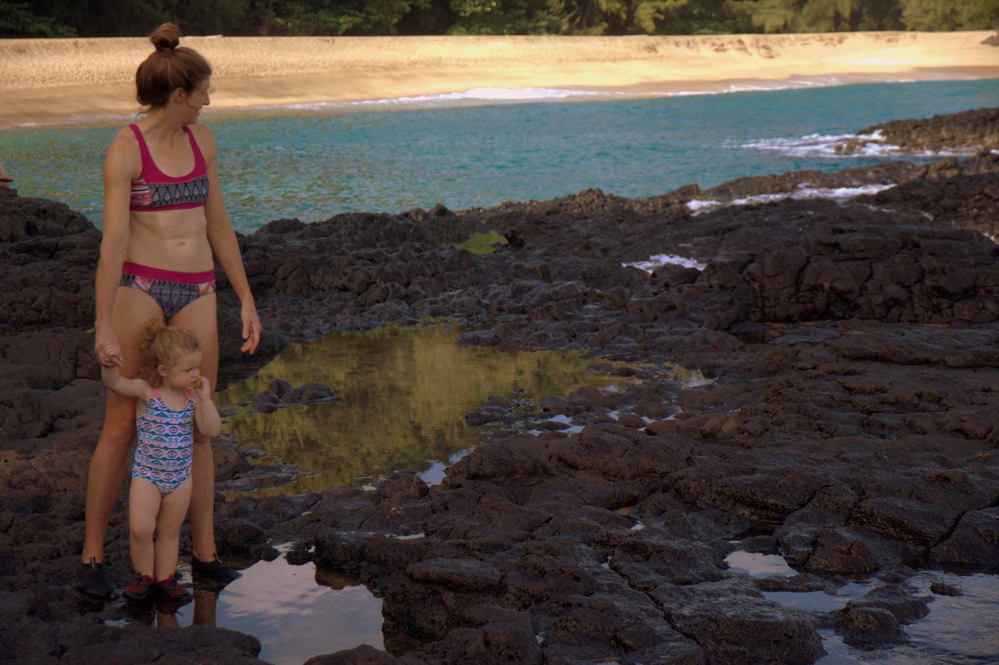
The next morning we all went to Lumahai Beach for some exploring and swimming.
Lumahai Beach
Sawyer scoping out the rocks and pools
Waves against the rocks
It was a good swimming hole
The gals loved it
Happy girls
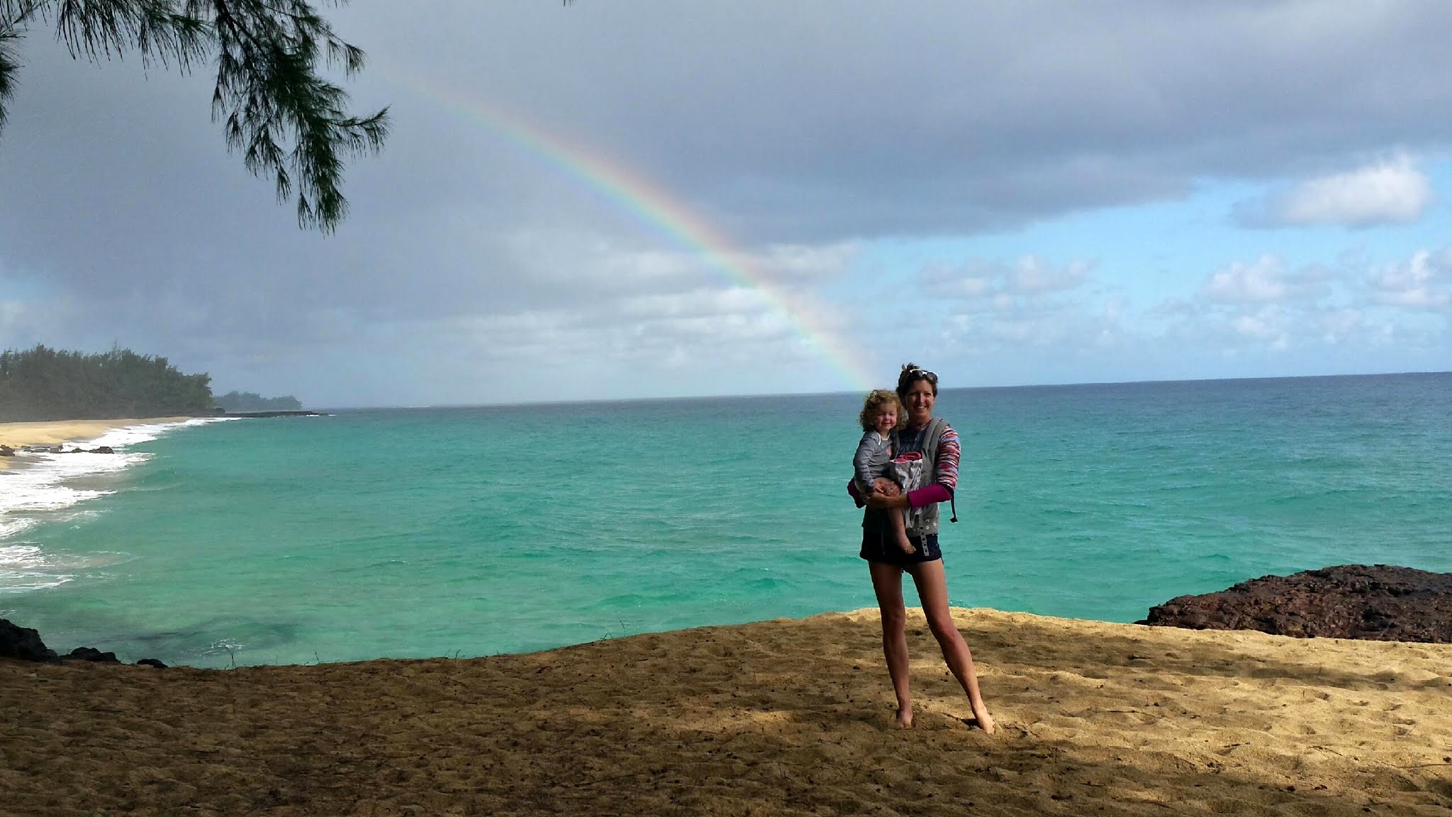
Not often do you get to stand at the end of the rainbow 🙂
Harry & Halla had arrived late Friday night and came over Saturday morning to visit. We all went to Tunnels Beach and swam and snorkeled. It was so great to see them again. Its almost like we all had never skipped a beat! We definitely need to get together with them and their year old daughter soon on another vacation.
All of us at Tunnels Beach
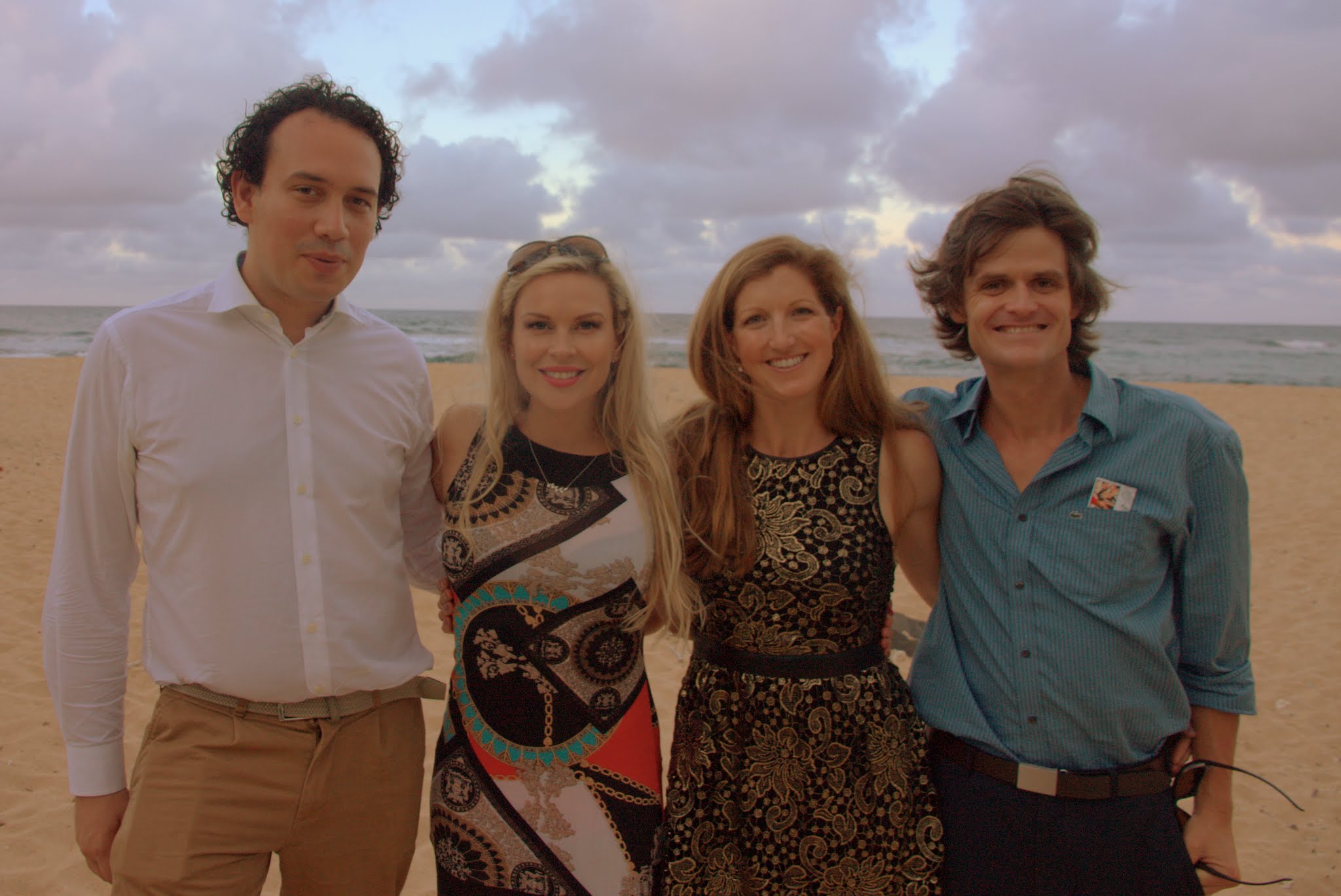
That evening we got ready for Chase & Devon’s wedding and drove ourselves to the Na Aina Kai Botanical Gardens for the wedding and reception. It was a great celebratory evening and was super fun to hang with Harry & Halla all night.
All dressed up as much as we ever do
Another
The ceremony
Chase & Devon
The reception
The four of us on the beach at the reception
We did one more quick Tunnels Beach trip early morning to say our goodbyes. Sawyer was a tired gal after a big week.
At Tunnels
One more of the three of us
After watching some early Sunday morning NFL games and a good Sawyer nap in my arms, we all loaded up the van and made our way to Lihue Airport. Little did we know that we were all in for a 2 day adventure to get back to Colorado. In a nutshell, due to limiting weight on the airplane because of turbulence, American decided to bump 20 folks off the plane. Kristine & I being two of them because we didn’t check-in the night before or early that morning. Ken & Dianne, however, did check-in the night before. So, after 6 hours at the airport that afternoon and a lot of tears and frustration, we were put up in the Marriott with food vouchers, we each got a $1,000 voucher on American, including Sawyer, and left the next day. We got home an entire day later on Tuesday evening. Ken & Dianne could have gone on without us and gotten home Monday evening, but we appreciated them so much hanging with us. Nevertheless, it was an adventure with a 2 year old, but really Sawyer did so very well. It was fun in retrospect to go through that adventure with her.
Sawyer loving her bus ride at LAX
And, finally, we landed at DIA
In conclusion, what a phenomenal family trip to a wonderful island. We would highly recommend this kind of trip and the island of Kauai to anyone looking to get away from the more developed islands. It was beyond special to share this trip with Ken & Dianne and especially to be able to bring Sawyer along and have so much fun with her.
Goodbye Kauai
Sawyer having a ball after eating at the Kilauea Fish Market
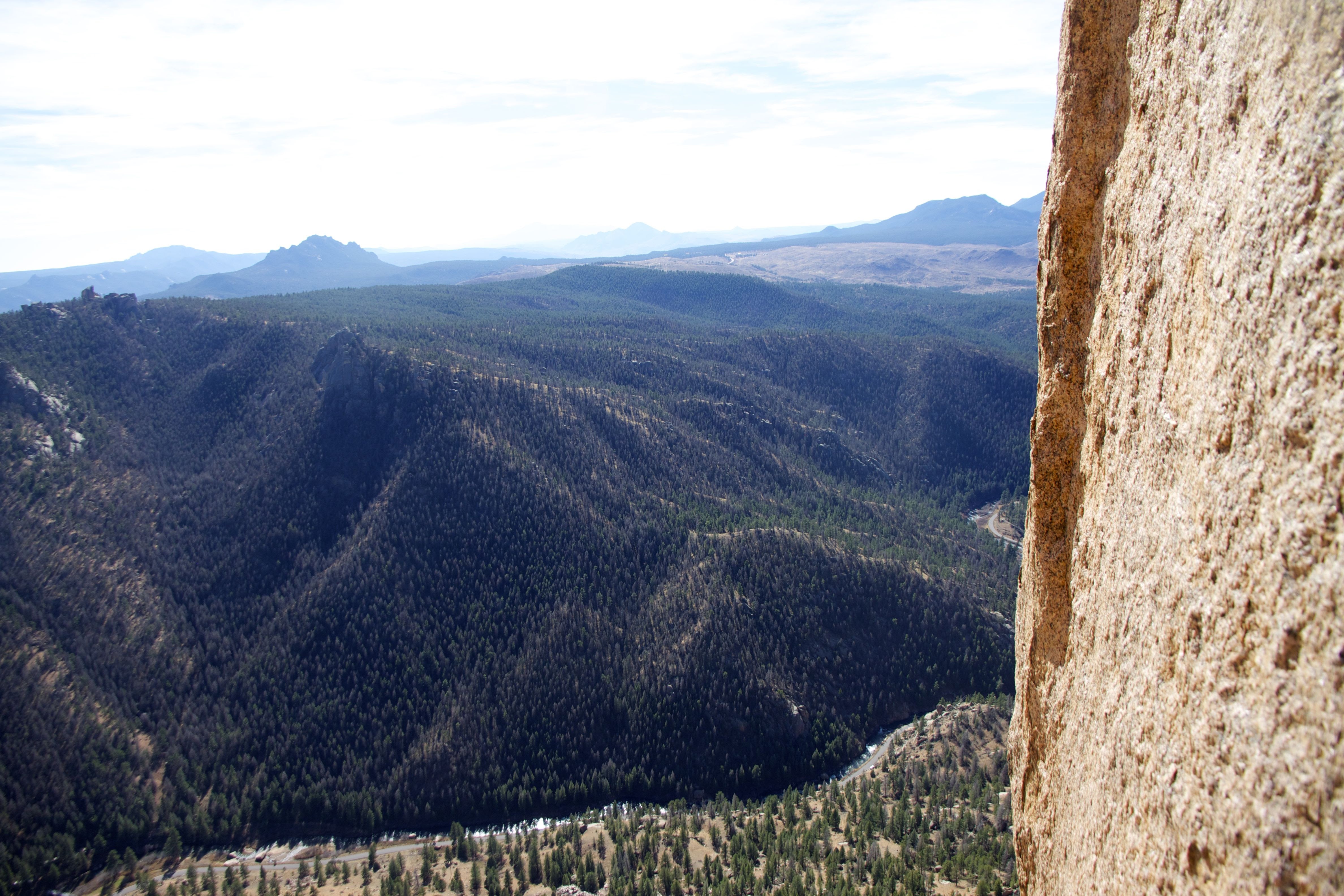
My good buddy Mikey has repeatedly urged me to come climb Center Route (5.9+) on Cynical Pinnacle with him in the South Platte over the last year. Well, he had good reason. Frequently regarded as one of the best, if not the best, crack routes in Colorado for its grade, I have to say I now agree. Its wonderful. Great crack climbing, great gear, steep, sustained, long pitches, and super fun. Even better, we were the only ones on the route all day. I would bet the 45 minute approach and 1,200′ vertical gain deters the crowds. Mikey took the 1st pitch (5.9) and then I took the crux 2nd pitch (5.9+) and the 3rd offwidth pitch (5.9+). I was happy to have led them both clean and can honestly say following on the 1st pitch with our 2nd rope on my back was tougher than leading the 2nd and 3rd pitches 🙂
Cynical Pinnacle on the approach. Center Route literally climbs the crack where the sun meets the shade in the center of the pic
Mikey leading pitch 1
Pitch 1
Mikey stemming on pitch 1
Looking out over the South Platte from the top of the 2nd pitch
Mikey on pitch 2…sustained 5.9+ for 125′
Just awesome crack climbing
Mikey having fun in the sun
Looking down at Mikey at the 2nd belay from a rest up pitch 3
Mikey high on the 3rd pitch
Finishing off Center Route
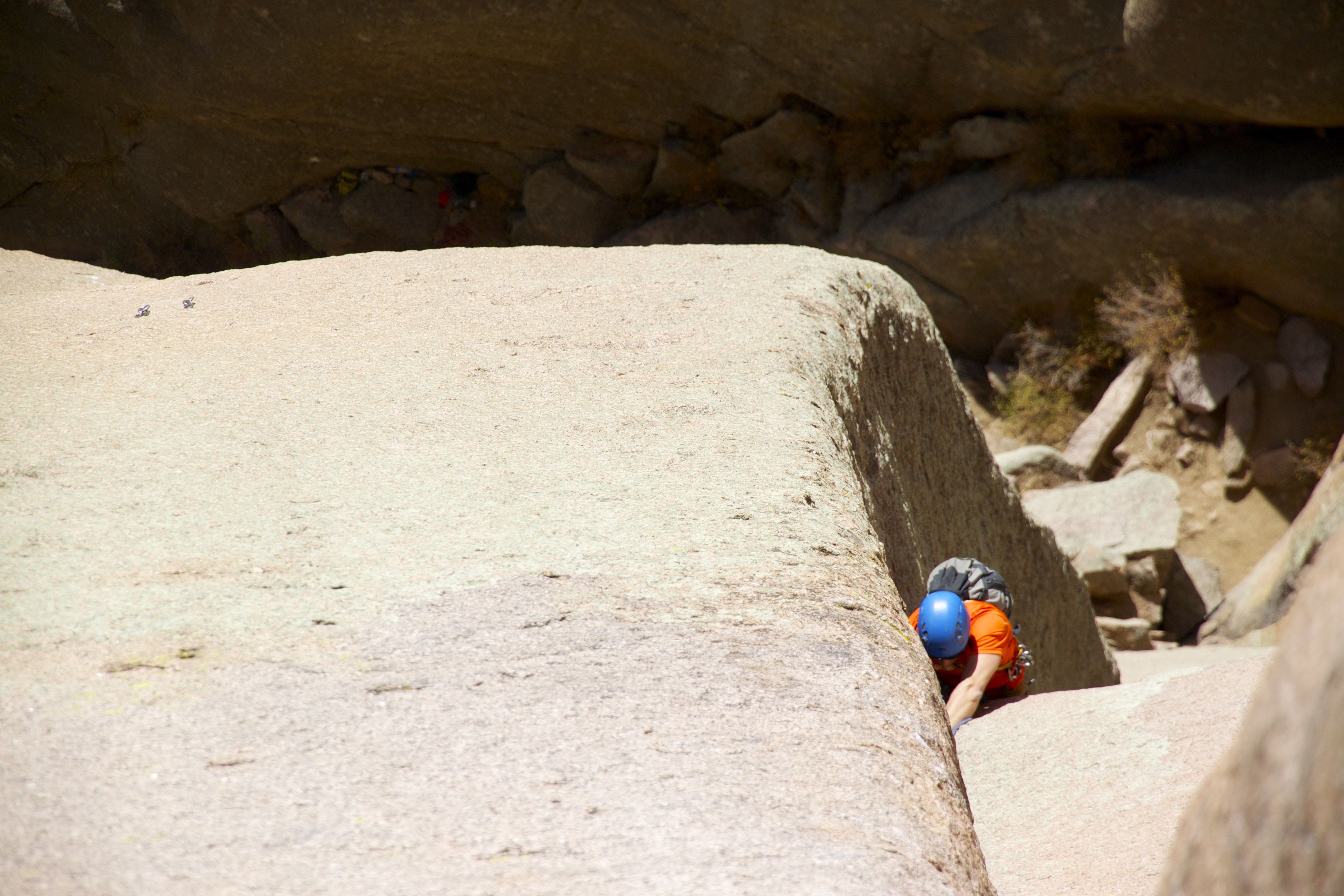
We topped out on Cynical Pinnacle’s false summit. There was still a 5.11b (old school rating) crack/sport climb to the actual summit of Cynical Pinnacle and I attempted to free climb this final pitch, but I could not get secure enough to climb to the 1st fixed piton and fell twice on my 0.4 camalot. It was hard. I could have pulled on gear and made it, but I decided to lower and forgo the summit pitch. C’est la vie. We came here for the crack climb (as the 3 pitch Center Route officially ends on the false summit) and decided to leave the goal of reaching the true summit for another time.
False summit of Cynical Pinnacle
We then double rope rappelled from the false summit to the hanging belay bolts and then did a 2nd double rope rap straight to our backpacks below.
Mikey on the 2nd double rope rap
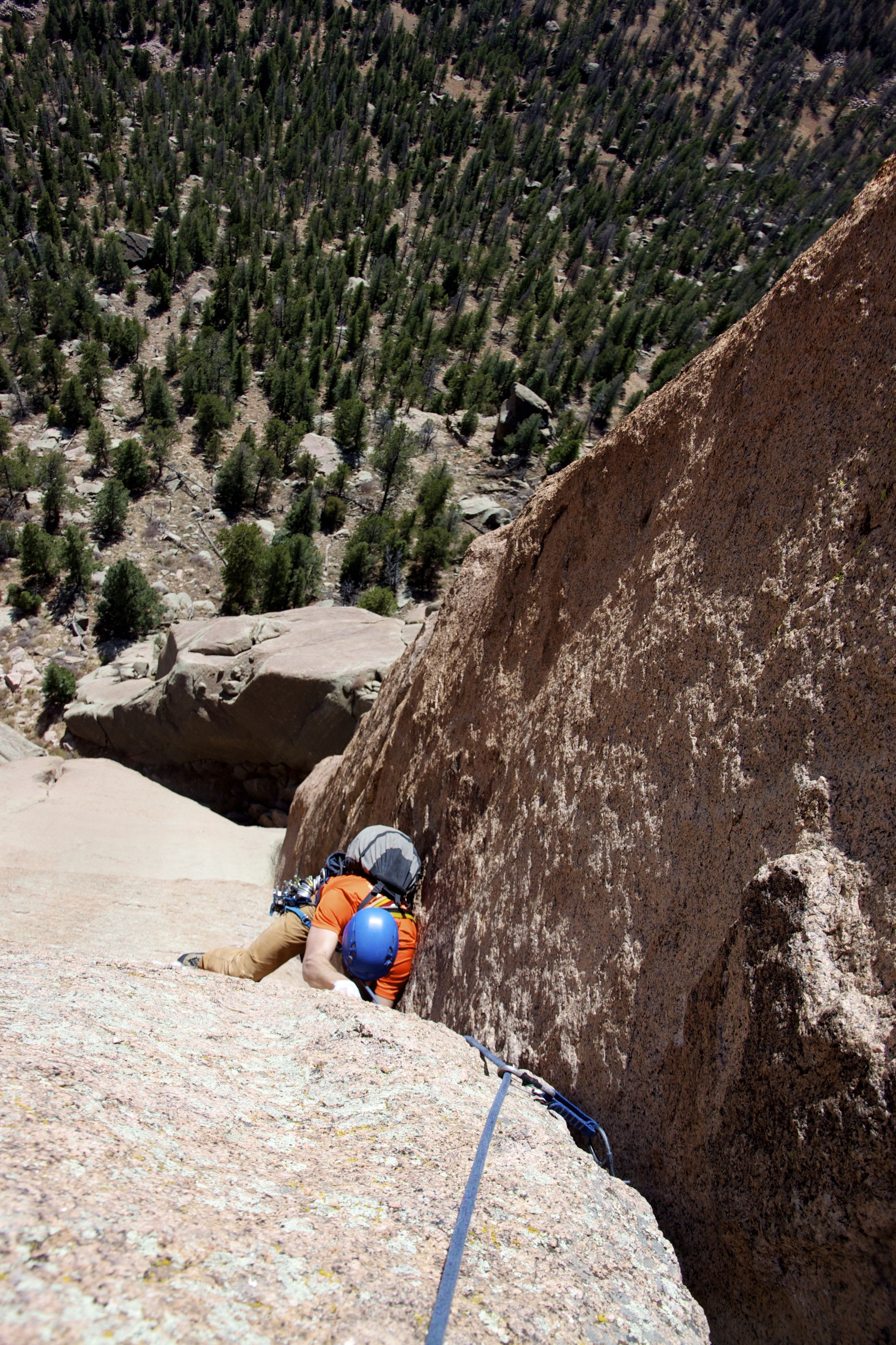
As some extra credit, we hiked around to the west side of Cynical Pinnacle and climbed the 100′ 5.9+ crack called Hand Job Direct to get one more long pitch in before we hiked down to the truck.
Hand Job Direct as seen from below. The 1 pitch climb tops out at about the midpoint of the picture
Mikey nearing the anchors on Hand Job Direct
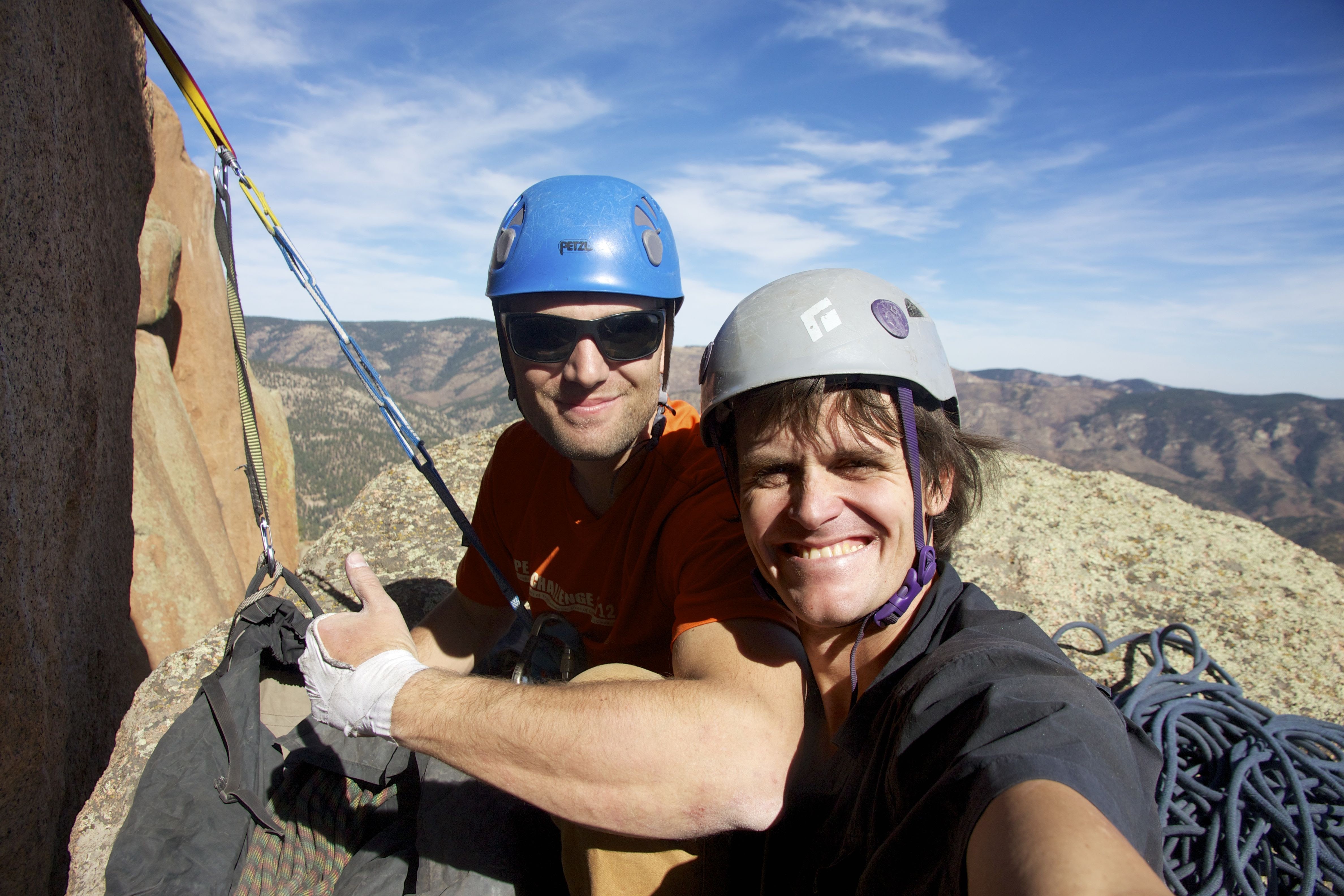
A super fun day with Mikey followed by some ice cream and me arriving back in Edwards by 7pm to see Kristine, Sawyer, and the dogs. Nice little Sunday.
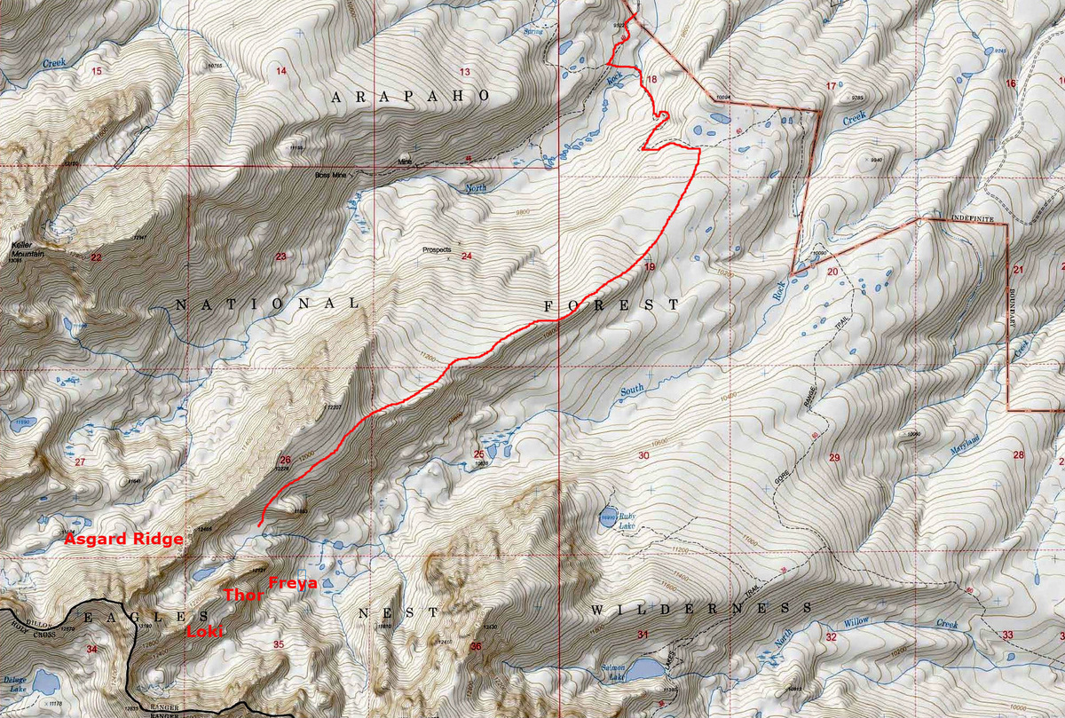
I’ve been a fan of Norse mythology for awhile now and everyone knows I’m a Gore fanatic. When J and I climbed the intimidating northern of the two east ridges called Asgard Ridge up Mt. Valhalla over two years ago, we always gazed upon the lower 12,000′ towers to our left while ascending Asgard. These towers are called Freya and Thor. There is a tower further on up the southern of the two east ridges of Valhalla called Loki, but honestly didn’t look nearly as interesting as Freya & Thor. I figure the next time we are up on Valhalla’s summit, we can go check Loki out. But, Freya & Thor looked like the real prizes in the basin in addition to the obvious Asgard Ridge. The veteran Gore hardman Stan Wagon from Silverthorne details his climb up Thor on his website and pioneered a one pitch 5.6 route up from the west col to Thor’s summit. Stan also details his west ridge climb/traverse up to Freya’s summit on his website as well. Stan gave me some approach beta on the simplest route to these towers via the Rock Creek TH north of Silverthorne. J and I approached Asgard Ridge via Boss Mine and some steep and pretty intense bushwhacking. I think the better approach to Asgard Ridge proper is to leave the Gore Range Trail and bushwhack south-southwest for a few miles outlined in the route marked below:
Approach to Asgard Meadows, Freya, & Thor
While Ryan, Mike, and I were targeting Capitol’s NW Buttress route on this spectacular fall day, 3 people on such a serious route with potential rockfall just didn’t seem like a good idea. So, I dug around in my mind for an alternate adventure and remembered these towers deep in the Gore at the head of South Rock Creek Basin. I was excited to get back in there for a visit. Mike needed a big day back in the mountains and it was a treat for Ryan and I to get out together in the Gore with a rack and a rope and see what we could do. We all met at the Rock Creek TH late Friday night and left the TH by 6:30am Saturday morning headed south on the Gore Range trail. We had Ryan’s 70m/8.4mm rope, an alpine rack, set of nuts, draws, and plenty of slings and biners. However, we did choose to leave behind the rock shoes in favor for just our approach shoes. I can tell you next time I will definitely be bringing rock shoes. It was not too bad bushwhacking at all for a few miles up to the grassy meadow slopes on the south side of Asgard Ridge. We descended a few hundred feet down loose rock into a small basin at 11,600′ called Asgard Meadows: a beautiful grassy/bouldery meadow-like basin with a creek running through it and granite towers rising above. It was perfect.
Ryan shooting me shooting South Rock Creek Basin and Freya & Thor Towers still a distance away on the far right in the picture. Photo by Ryan
Freya Tower is down low on the left. Thor Tower is in the center of the picture. Mt. Valhalla is the high summit
Asgard Meadows with Freya in the center and Thor on the upper right
Asgard Meadows with Thor at upper left and Asgard Ridge in the distance
Thor’s east face is mighty impressive
I do look forward to coming back to Asgard Meadows and setting up a basecamp to do a full day or two of alpine rock climbing. We were debating on what to attempt first as it was only 9:15am. I told Ryan & Mike Freya’s east ridge direct looked mighty tempting and that I’d like to give it a shot. Based on no prior information that I could find on the east ridge itself and in talking with Stan, we were not sure it had been climbed before. But, it looked doable even in approach shoes – we hoped.
Looking up Freya’s east ridge from the base
Getting set up
It looked like we could scramble up 50′ of 4th/low 5th class rock or so into a southeast facing dihedral, which seemed like it lent feasible passage up to perhaps a small ledge 80′ above.
Ryan on the initial scrambling
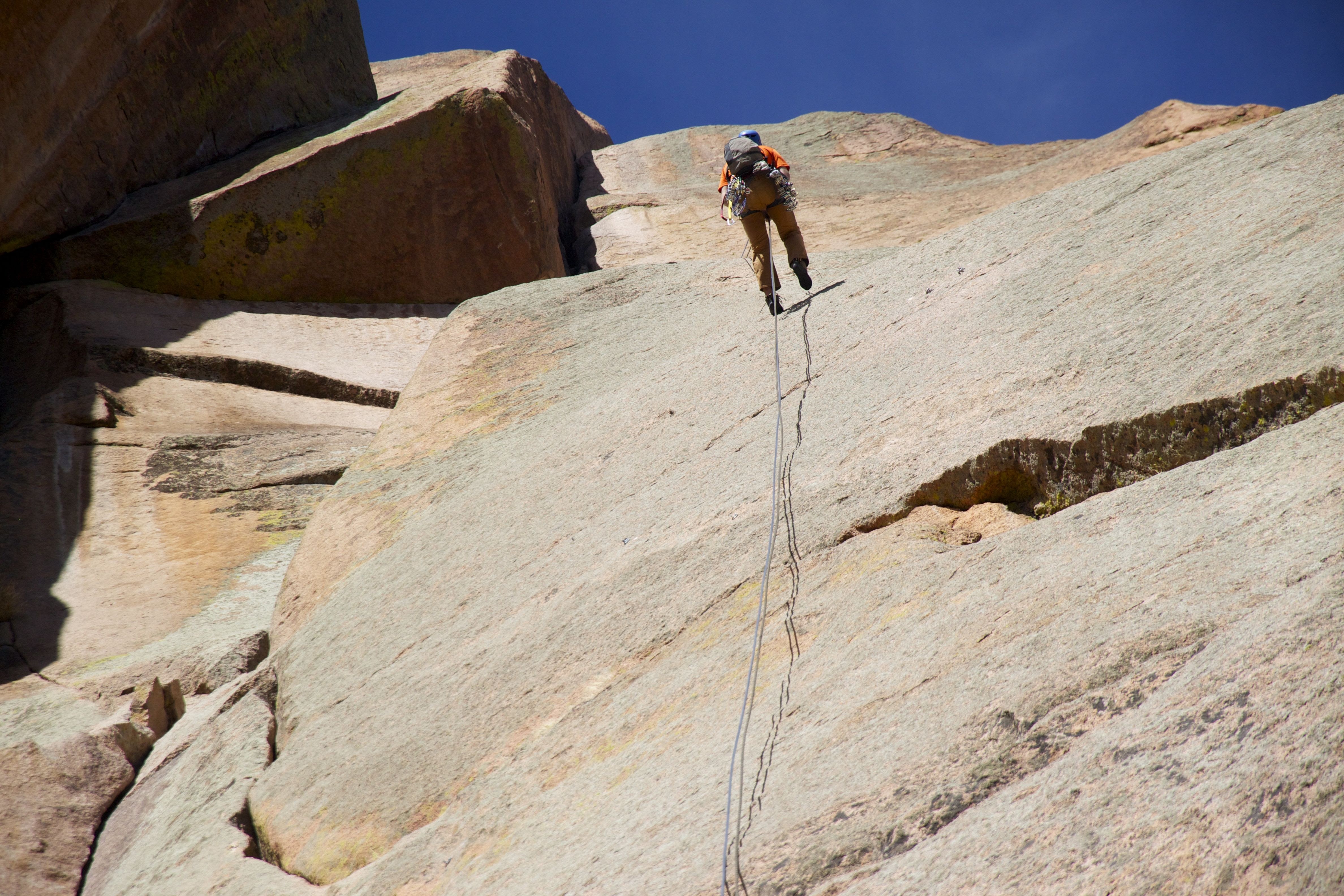
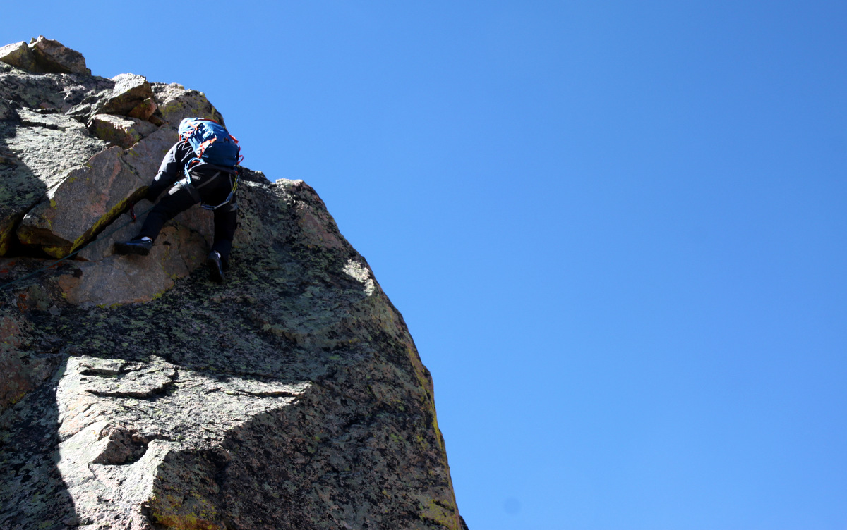
I started up a crack system on south-facing rock east of the dihedral and soon realized I would prefer the comfort of a rope especially with approach shoes. It was getting into mid-5th class with big exposure. I downclimbed 15′ back to a small ledge and we roped up. I took off up our 1st roped pitch. It was indeed a pretty awesome pitch and after a 5.8 move on the face I made my way into the dihedral and definitely pulled a 5.8 move or two up to the small grassy ledge. I placed mostly nuts but a cam at each of the two cruxes. I set up an anchor system at a convenient grass ledge and brought Mikey and Ryan up to me all the while I scoped out how pitch 2 would go above me.
Me into the dihedral on pitch 1. Photo by Ryan
Mikey and Ryan following pitch 1
Ryan took the lead on pitch 2 up a 5.8 corner to the right. I hoped in the back of my mind that it went somewhere because it looked to be our only option with some protection to be had. He did awesome and found a nice belay ledge at the base of another headwall above to belay us up.
Ryan setting off up pitch 2
I thought this was a cool picture: my head, Ryan’s feet. The grassy meadows on Asgard Ridge’s south side we used on the approach can be seen in the background
Ryan climbing the right-angling crack into the unknown
Mikey following
I took the 3rd pitch lead which began with a funky unprotected stemming chimney for 25′ to a small ledge. I then balanced my way onto a very small corner on the right and was able to get a small Alien into a small pocket, but it definitely wasn’t reassuring. However, there were no other options. I then made a committing face climb move or two to the left and got a good jug and stance in order to get a much better #1 cam into a solid crack. It was then fun 5.6 climbing up to the top of the headwall and I built an anchor to bring the fellas up.
Mikey climbing the headwall up to me on pitch 3. Photo by Ryan
Another view by Ryan. The stemming chimney is immediately behind the large slab of rock in the foreground
Mikey on pitch 3 with Ryan below
Young Ryan making quick work of pitch 3
A wider shot
I belayed Mikey around the small tower I sat upon for the pitch 3 belay to a very small col just west of me. I lowered Ryan down to this same col and then after gathering my anchor gear, I downclimbed the 15′ to the saddle. We all scrambled up another 100′ to the base of our pitch 4. It looked to be a nice angling hand crack and Ryan took the reins.
Ryan coiling the rope after pitch 3
The scramble up to pitch 4
Me belaying Ryan on pitch 4
Ryan getting into the meat of pitch 4
I think we agreed there were some 5.8 moves on this hand crack
Mikey making his way on the right-angling, slightly overhung hand crack
From the top of pitch 4, it was easy and fun class 3/4 scrambling to the 12,121′ summit of Freya.
Ryan almost to Freya’s summit
Mikey almost there. It had been awhile since Mikey had scrambled, so he was back in the game by this point
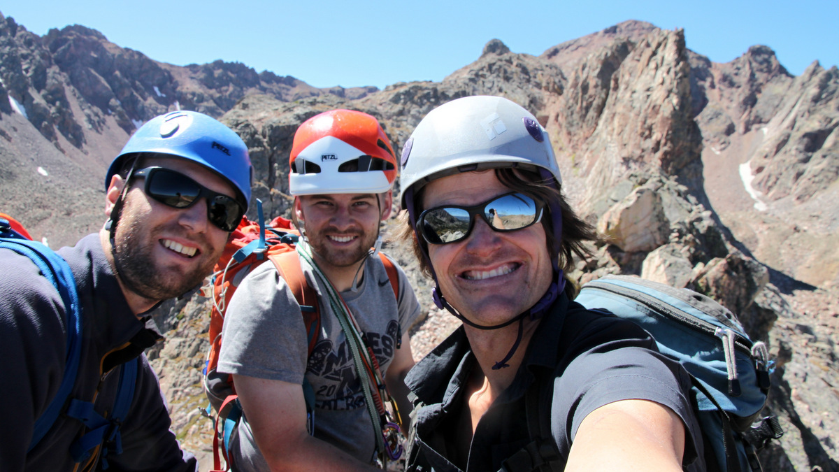
Summit of Freya (12,121′). Photo by Ryan
Looking due west from Freya’s summit down its “standard” west ridge to Thor
Summit of of Freya (12,161′). Man, what a day!
Looking down Freya’s east ridge from the summit
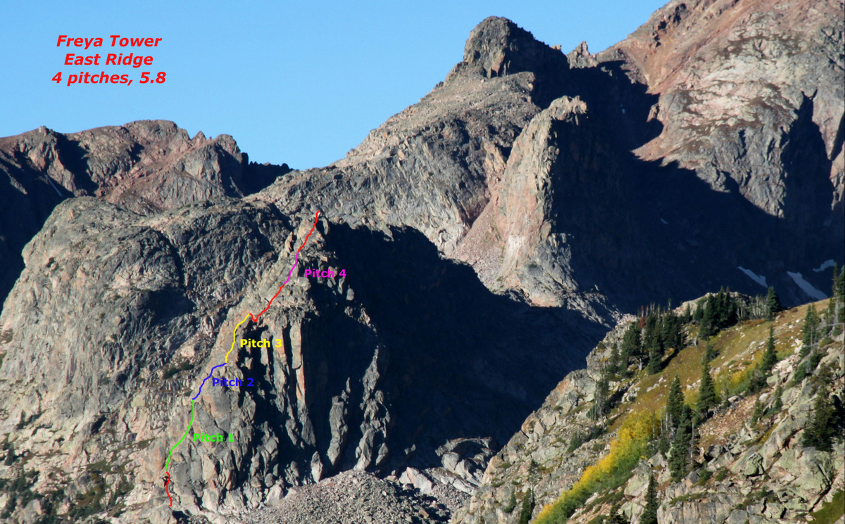
Well, whether someone had climbed the east ridge before or not, just not having any prior beta or even knowledge that it would go was exciting in itself. Plus, it was a solid 4 pitch alpine route on granite in a spectacular setting. Hard to beat. Here is a route overview of our route:
Freya East Ridge route. Red designates our unroped scrambling sections
What was almost equally as fun and exciting as our east ridge route up Freya was the descent down Freya’s standard “west ridge” to the Freya/Thor col. This is the route Stan Wagon and his partners climbed in 2010 rating the one crux move at 5.6. We didn’t rope up for this ridge, but it sure was some awesomely exposed scrambling. Makes Capitol’s standard knife-edge look like a catwalk and not very exciting. This was the best scrambling of the day by far.
Mikey heading off on Freya’s west ridge
Mike and I approaching the knife-edge portion. Photo by Ryan
Freya’s knife-edge. Photo by Ryan
Such a great ridge
Mike and Ryan on Freya’s west ridge
Mike on a very exposed downclimb
Ryan at the same spot
Easy walking
One final climb up on the west ridge
Finishing up Freya’s west ridge. Photo by Ryan
Looking back with Asgard Meadows down to the left
We took a well-earned break at the Freya/Thor col for a PB&J and some Gatorade. I am not sure what time it was, but maybe between 12-1pm. Anyway, we decided to go for Thor Tower as well. We took Stan’s route up the loose southeast-facing couloir to the saddle west of Thor’s summit. What really excited me about coming back to this area were some of the seemingly solid 300′ crack routes on Thor’s south face visible on our approach up the couloir. Rock shoes and a bigger rack are a must on the next trip.
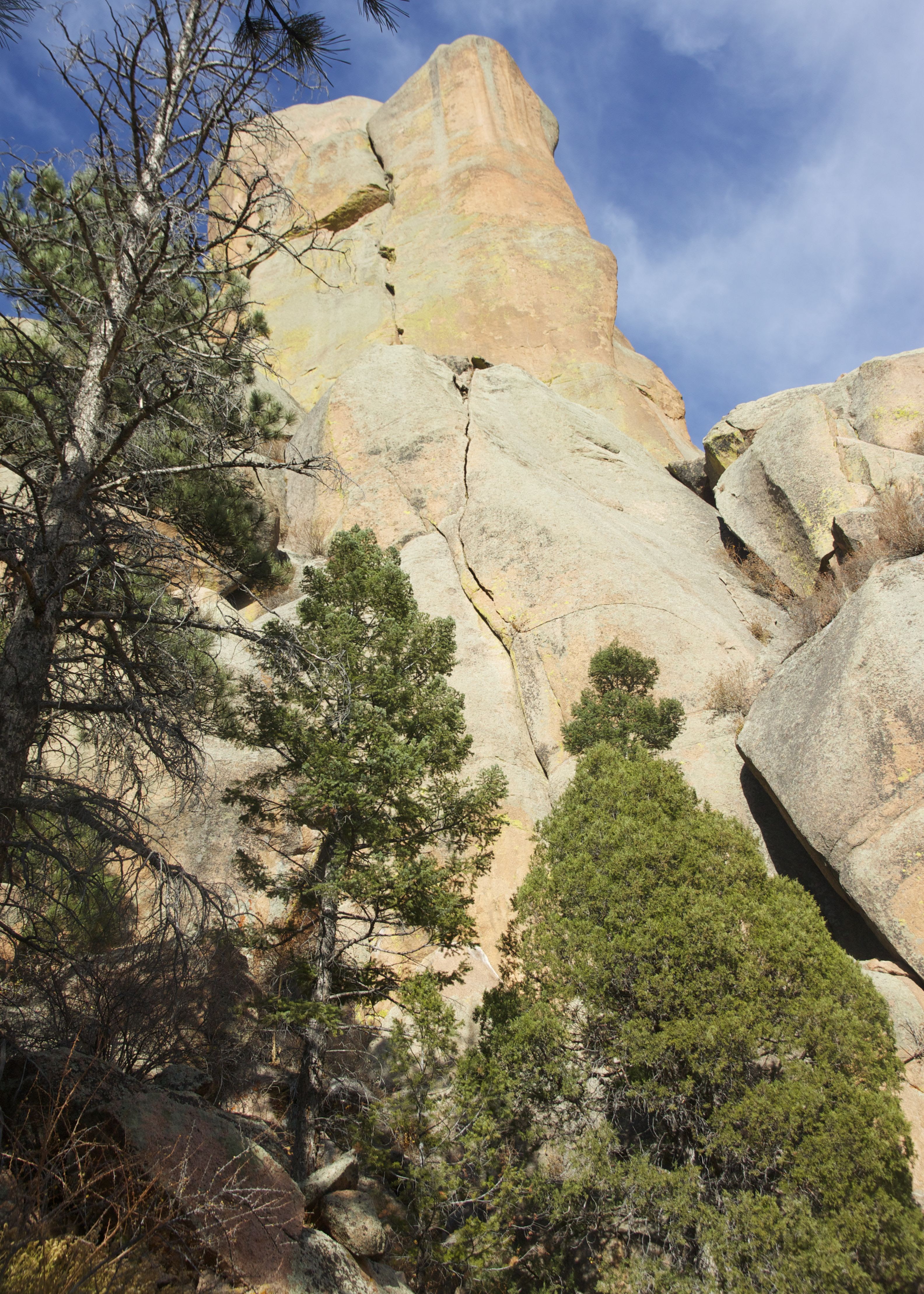
This large dihedral on Thor’s south face was especially interesting
Climbing up Thor’s southeast couloir. Freya’s west ridge can be seen behind
Then, we traversed north along ledges to Stan’s 5.6 crack route. Ryan decided to scope out a different route to the right (south) of Stan’s route and described it as an airy 5.4 pitch. I tagged the rope on my harness and climbed Stan’s 5.6 crack, found his old webbing and rap ring at the top, and belayed Mikey up to me.
Ryan on his airy route
Me climbing Stan’s 5.6 crack. Photo by Ryan
Me belaying Mike up. Photo by Ryan
Mike climbing Stan’s 5.6 crack up Thor Tower
Stan’s old webbing and rap ring. Ryan added another piece of webbing through the rap ring.
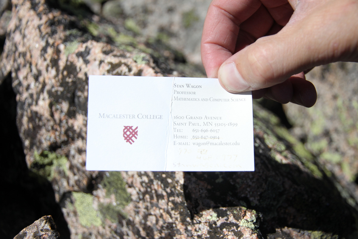
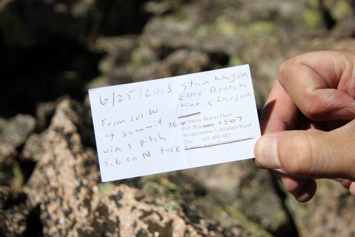
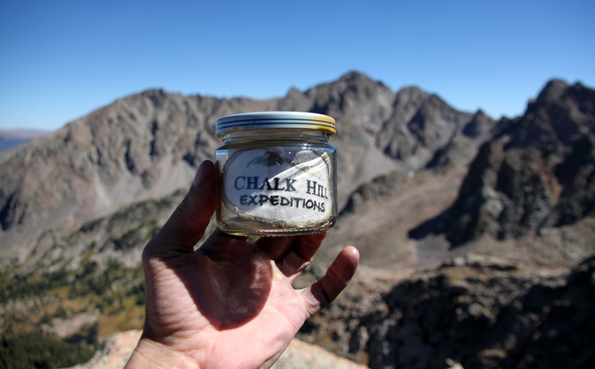
It was then easy scrambling to the summit where we saw Stan’s cairn and small glass jar with his card in it.
Stan’s card
Their summit register
As I didn’t have a pen, I added a patch off of my pack. Its a made-up “Expedition” name my dad thought up just for fun as our mountain cabin in NC is called Chalk Hill 🙂
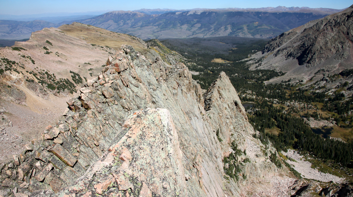
Looking down Thor’s east ridge to Freya’s west ridge below
The east amphitheater of Mt. Valhalla from Thor’s summit
The section of ridge between Valhalla & Hail Peak I have yet to scout
Summit of Thor (12,500′ or so)
We stayed on the summit for a good 20-30 minutes and enjoyed the wonderful views and weather.
Ryan rapping
Me rapping
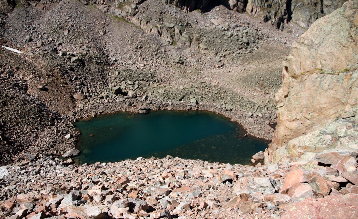
We descended down the other side of Thor’s west col towards the beautiful lake at about 11,900′. While loose in spots, it wasn’t too bad at all. Then, we continued to descend another 300′ of boulders back down into Asgard Meadows.
The small lake at 11,900′ between Asgard Ridge and Thor Tower
Back in Asgard Meadows
I so wish I had these mini-10′ walls in my backyard for Sawyer to learn on 🙂
Ryan spotted this northwest buttress on Rain Peak across the valley. Maybe a future climb
We refilled with water and relaxed for a bit. It was 3pm now and we (at least me) should be probably heading on out. We reascended 300′ or so back up the scree/boulder slopes to the grassy meadows along Asgard Ridge’s southern flanks and cruised on home arriving back to the trailhead by 5:30pm for an 11 hour RT day. Thanks to Ryan & Mike for helping to make this day one of my most memorable Gore adventures in a long time.
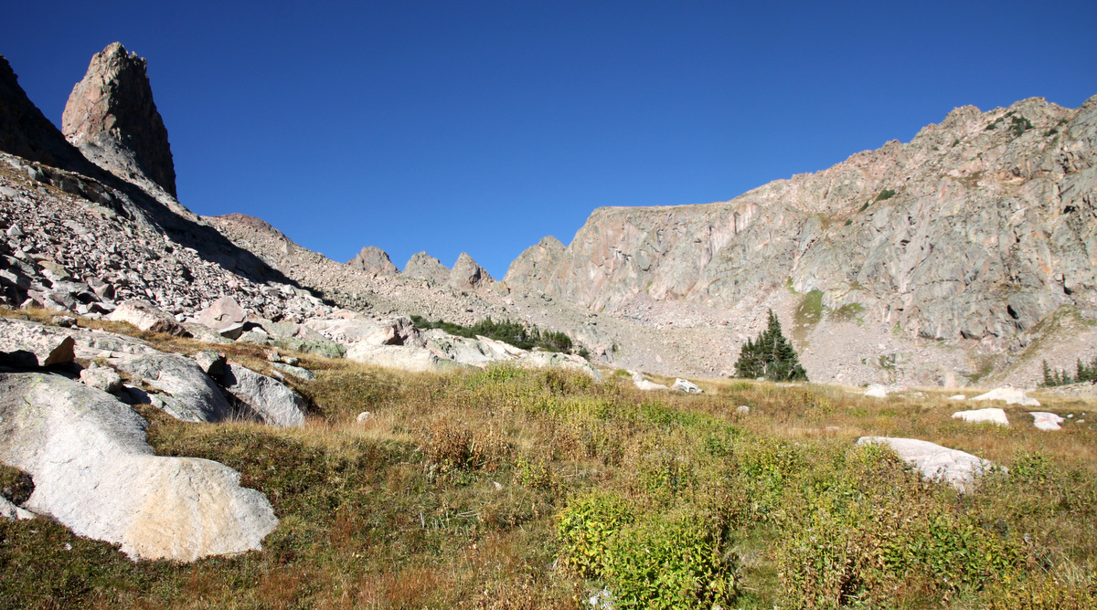
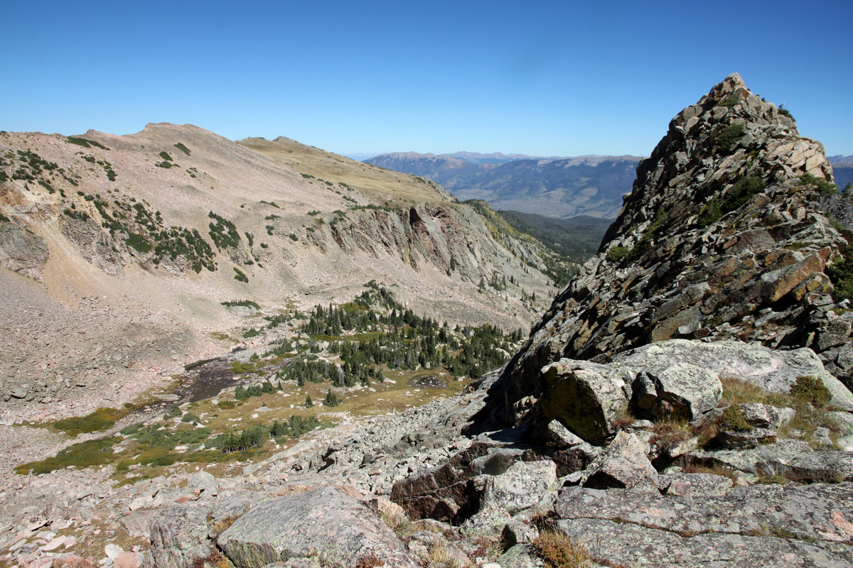
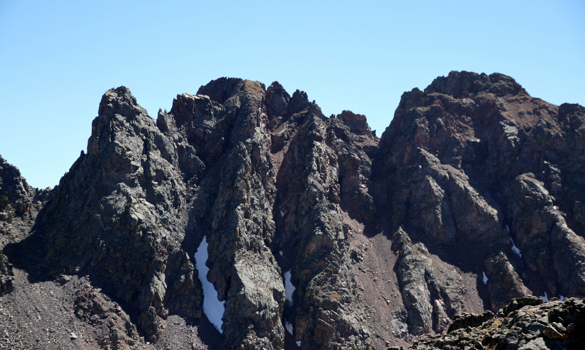
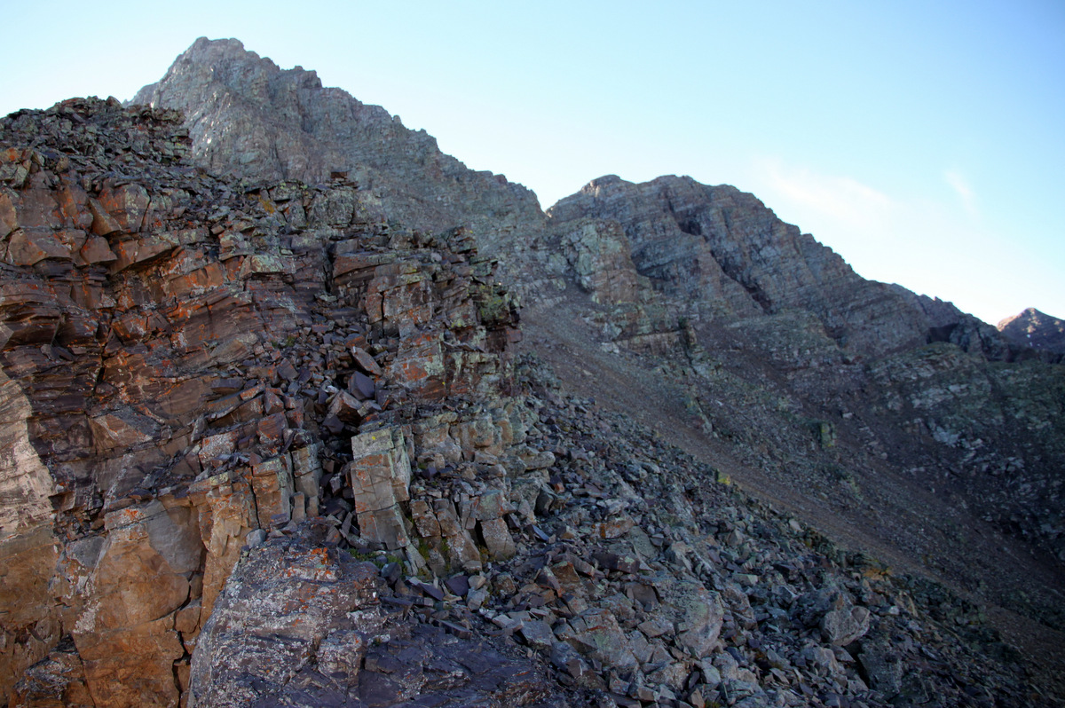
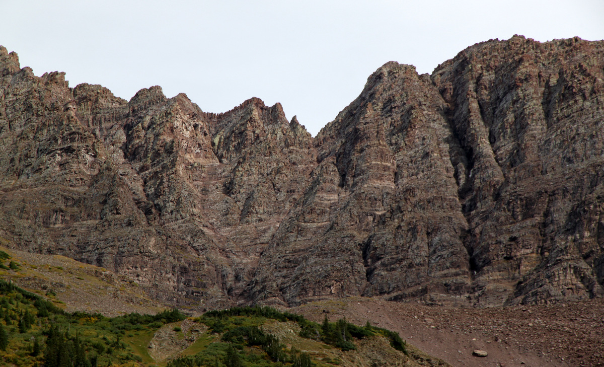
I have always had a few of the red, rugged, and rotten traverses in the Elks in the back of my mind to hopefully climb one day (other than the Maroon Bells Traverse, which I have done a few times) and when my friend Natalie suggested she wanted to do the Pyramidal Traverse, I was interested. A huge plus would also be to get into the Elk Range on a gorgeous fall day. But, mainly I just wanted a new ridge traverse. The Pyramidal Traverse traverses the 14er Pyramid Peak (14,018′), the centennial Thunder Pyramid (13,932′), and the bicentennial Lightning Pyramid (13,722′). Natalie wanted to scope out the non-standard northwest ridge route up Pyramid in preparation for a winter ascent. This sounded fun as well as I had never been up the NW ridge route. I had been up and down the standard NE ridge route 4 times in the past, the last one being with Rainier and Caleb & Jennie Wray in August 2009. While the loose rock of the Bells, Pyramid, and surrounding peaks is not my favorite rock to scramble on and doesn’t instill much comfort or confidence, it is still very unique rock and offers challenging scrambling even if only low 5th class, especially on the downclimbing aspects. Several climbing buddies had suggested we traverse south to north as we could climb up most of the low 5th class crux sections, but we wanted to climb Pyramid’s NW ridge route for a recon of the winter route, so it looked like we would be downclimbing all of the cruxes. And, it was a lot of downclimbing. I brought my 30m/8mm rope, webbing, harness, slings, biners, nuts, and a few cams in hopes to set up a rappel if needed, but it turned out everything just stayed in my pack. I always believe its better to have it and not use it than to not have it and need it. So, after Sawyer was in bed and Kristine & I had dinner, I zipped over in the Subaru to the Maroon Lake TH parking lot and got a few hours sleep in the back of the car with the tailgate open. Natalie showed up around 5am and we departed the TH around 5:30am. It was to be just about a perfect fall weather day except for the fairly stiff west wind that was supposed to subside by around 9am, which it fortunately did. We made quick work of the approach up into the amphitheater below Pyramid’s north face and then veered off south west on steep grassy slopes and loose scree to the northwest ridge at around 12,700′.
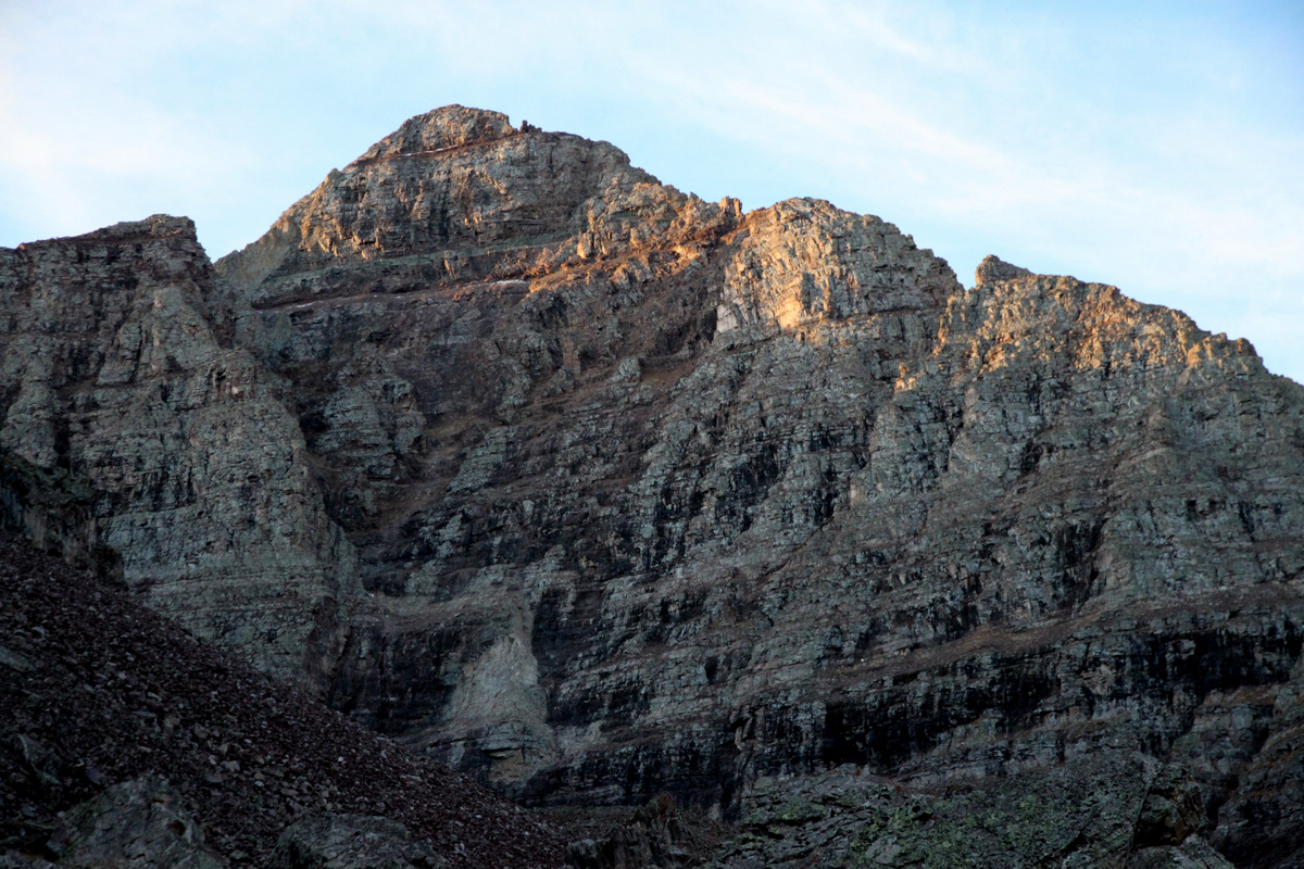
Pyramid’s north face
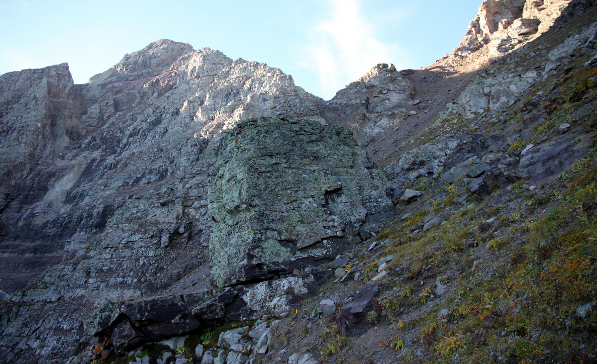
The steep slopes leading up to Pyramid’s NW ridge
First view of the Maroon Bells from the small col at 12,700′ on Pyramid’s NW ridge
Looking up Pyramid’s NW ridge from the small col at 12,700′
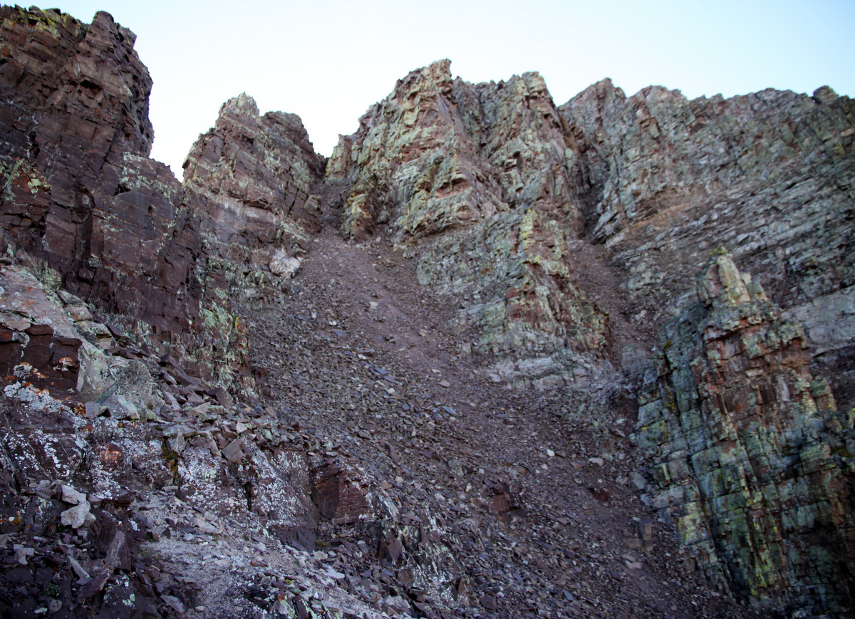
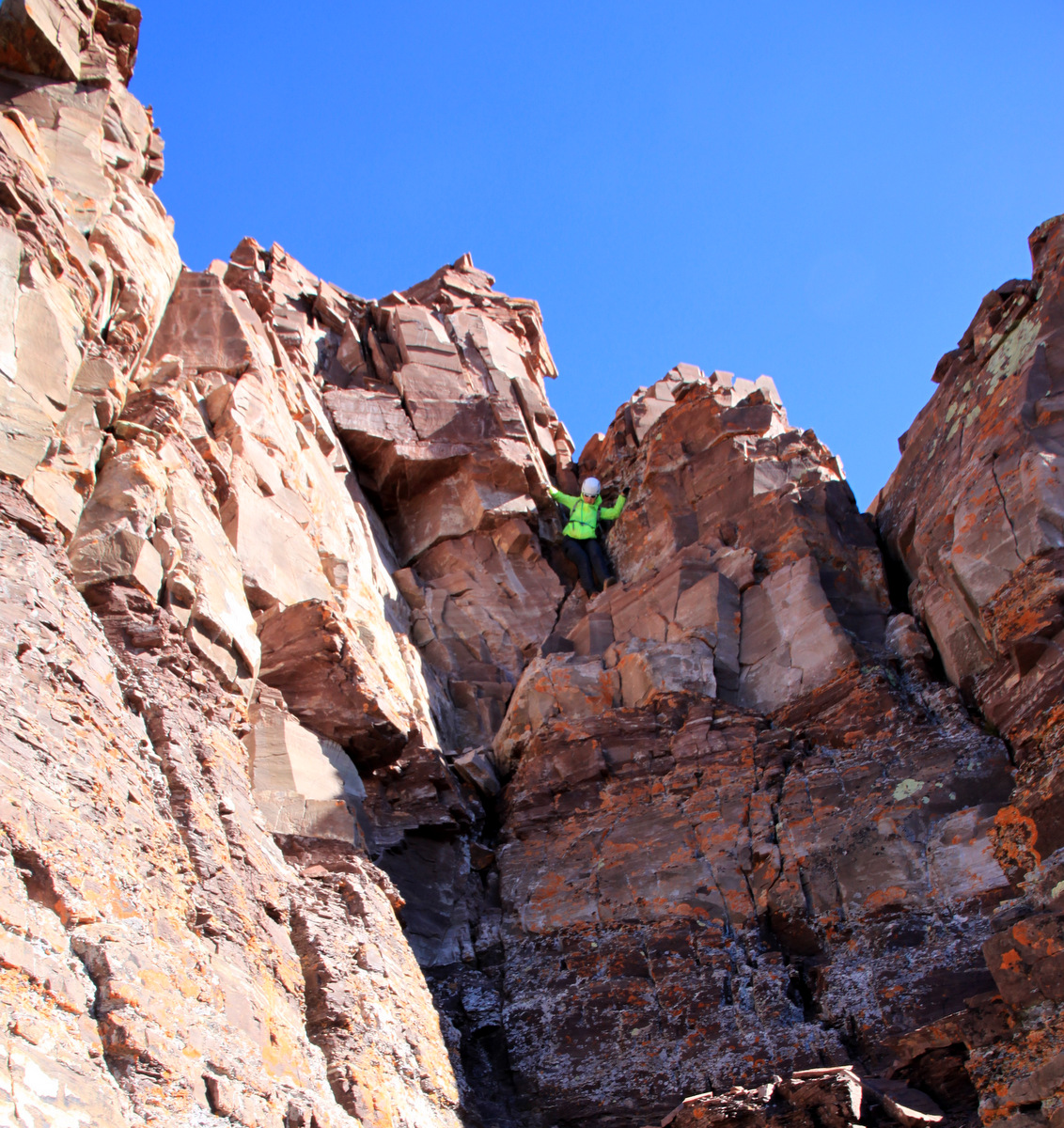
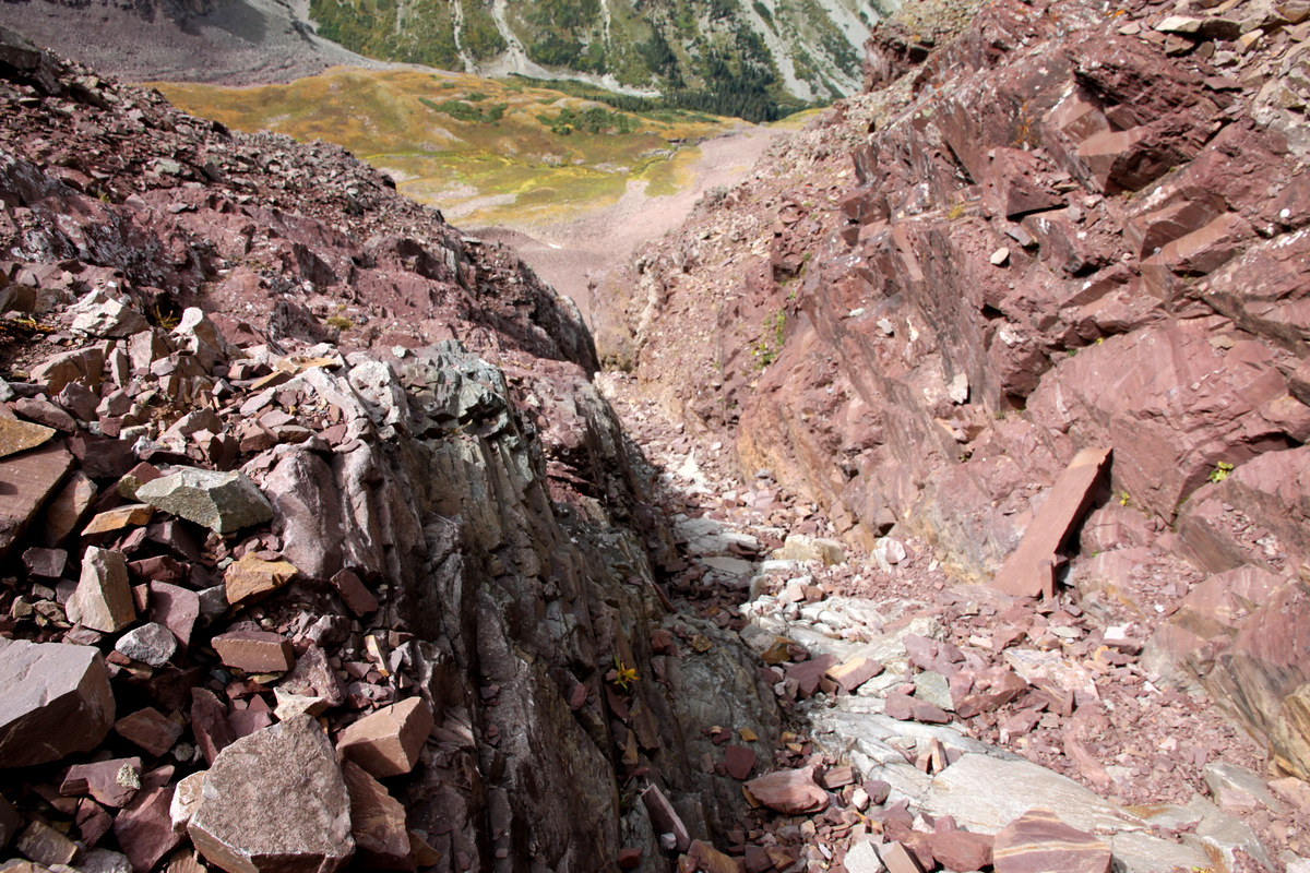
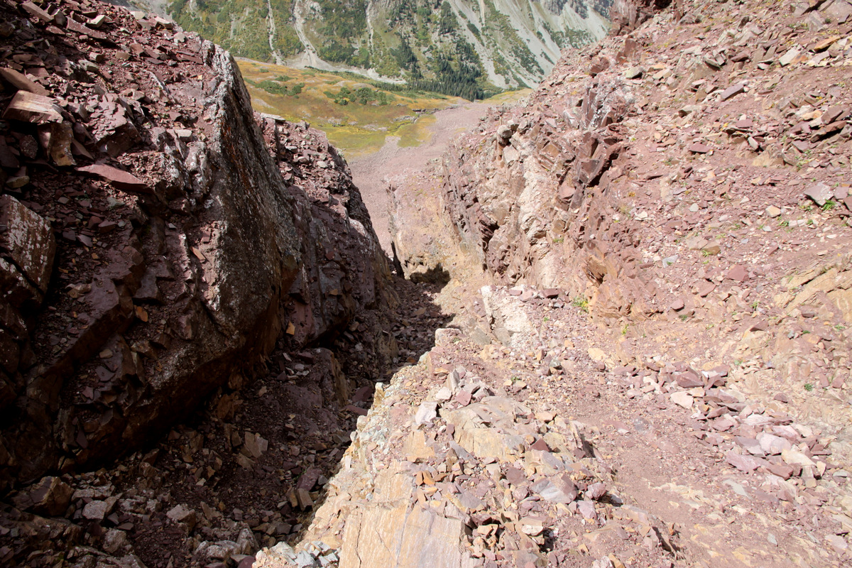
We followed the northwest ridge route pretty much “to a T” up through the Keyhole Couloir and then further up the fun class 4 slab/chimney above. It was a gorgeous morning except that we were climbing in the shade and the wind was pretty stiff. I was chilled as I normally get considering my hefty plethora of body fat 🙂
Natalie on the easy portion of the NW ridge
The Keyhole Couloir
Natalie climbing up the Keyhole Couloir
Natalie at the top of the Keyhole Couloir/base of the fun class 4 pitch
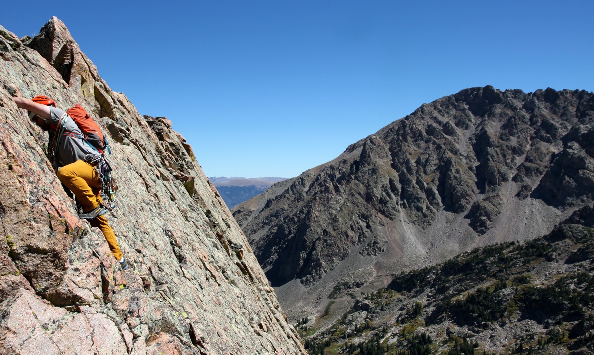
Me starting up the class 4 pitch. Photo by Natalie
I think I may have taken a stiffer variation up the class 4 pitch, but it was all good low 5th offwidth 🙂
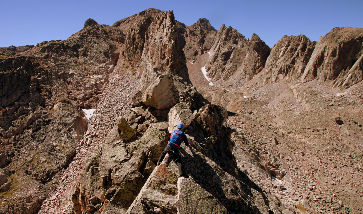
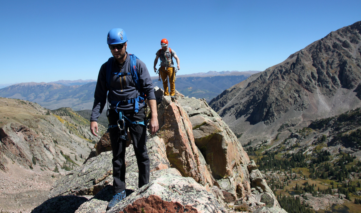
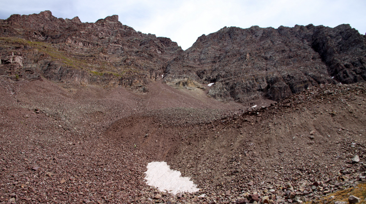
We then just sort of traversed ledges and slight aretes until we both found ourselves into the upper bowl/amphitheater below the summit block.
Into the upper bowl below the summit block
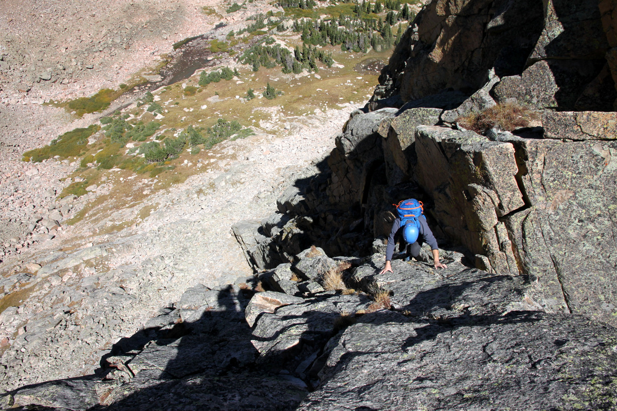
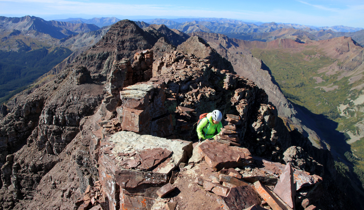
We climbed this fun little chimney which Natalie said was dubbed the “JP Sneak”
Natalie climbing the “JP Sneak”
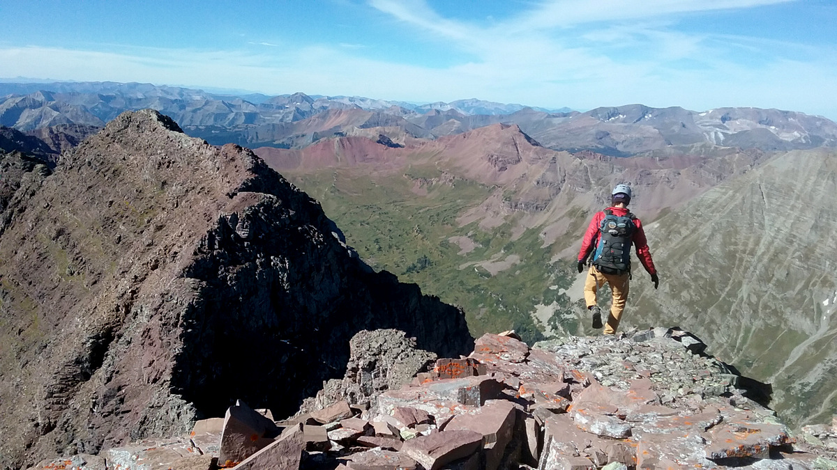
Once on the summit ridge, it was a short scramble to Pyramid’s summit arriving around 9:15am.
Natalie almost to Pyramid’s summit
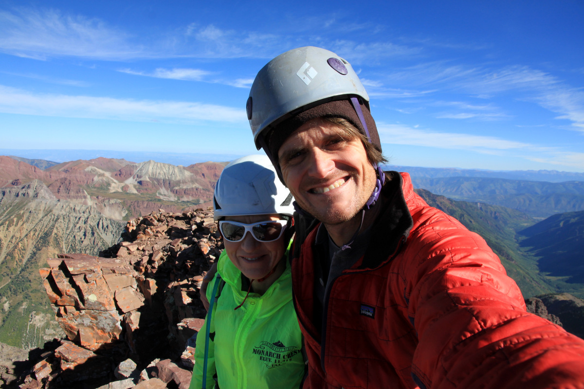
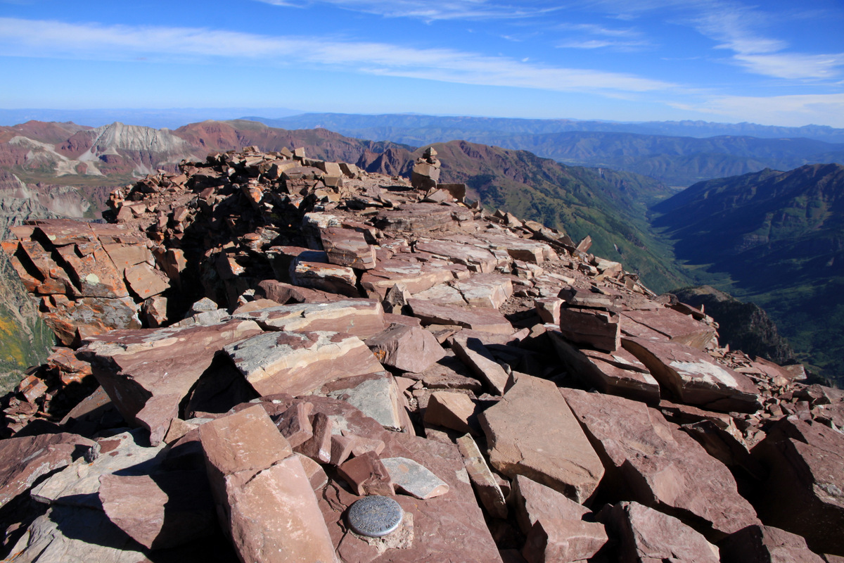
Pyramid Peak summit (14,018′)
A nice little morning and wonderful to finally be in the sun!
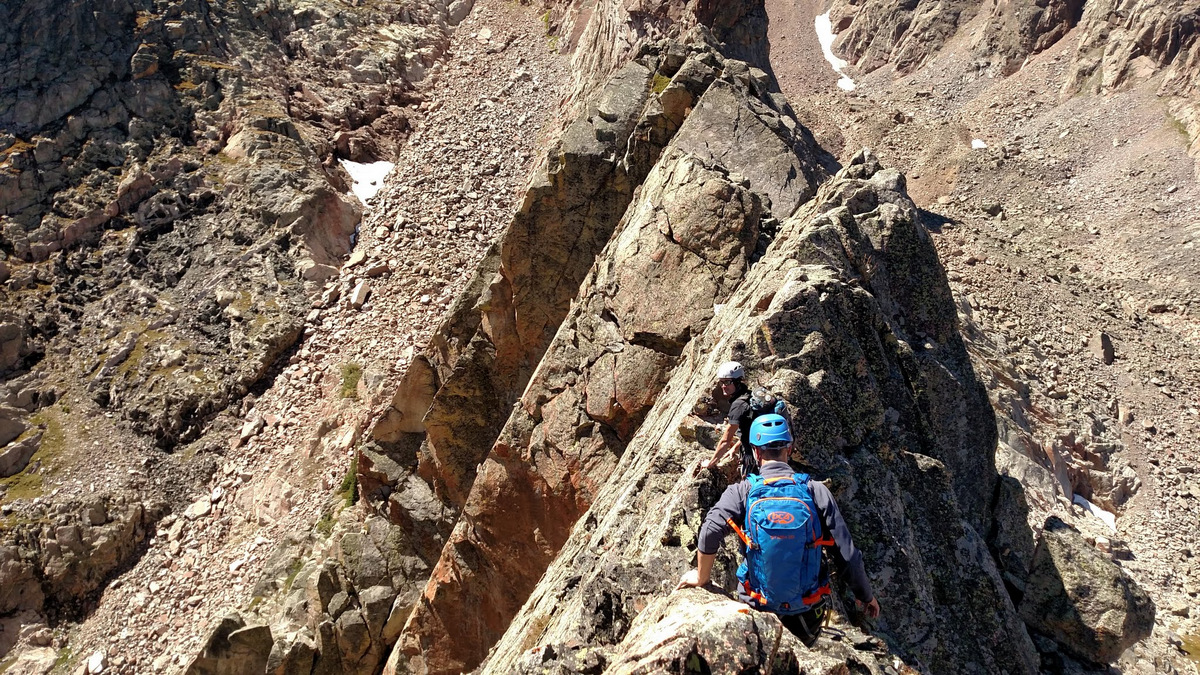
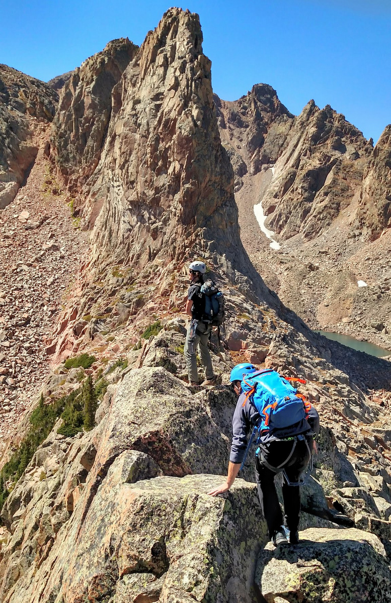
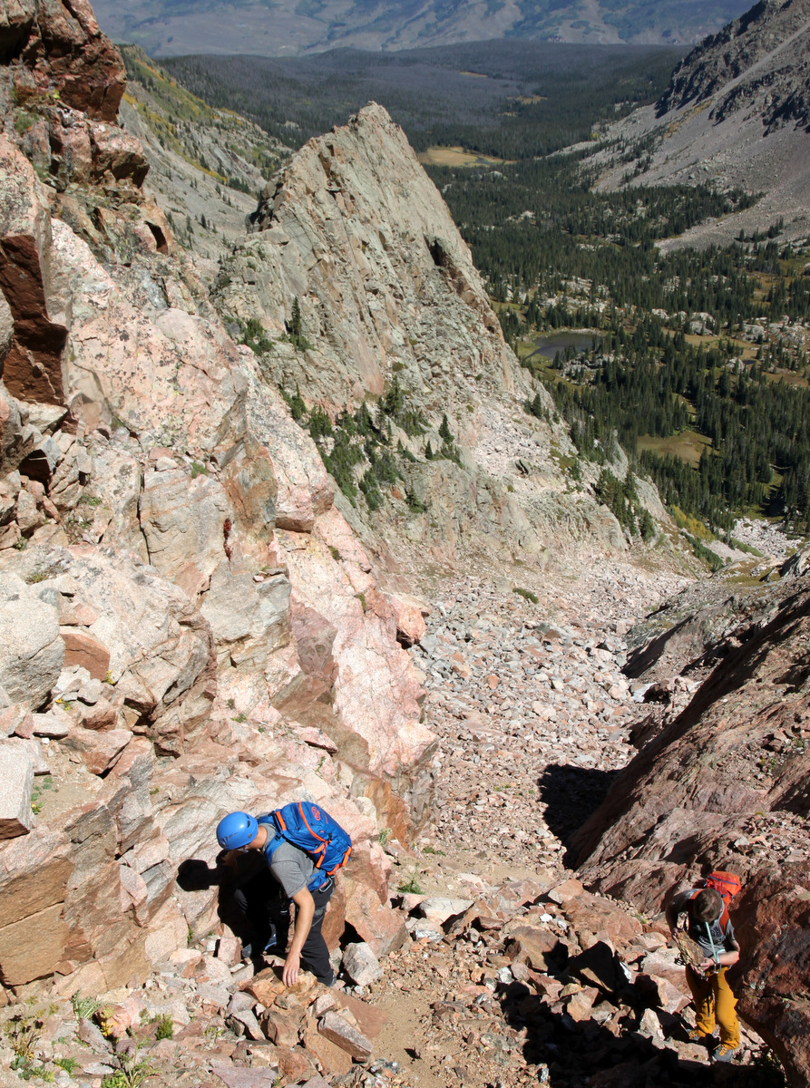
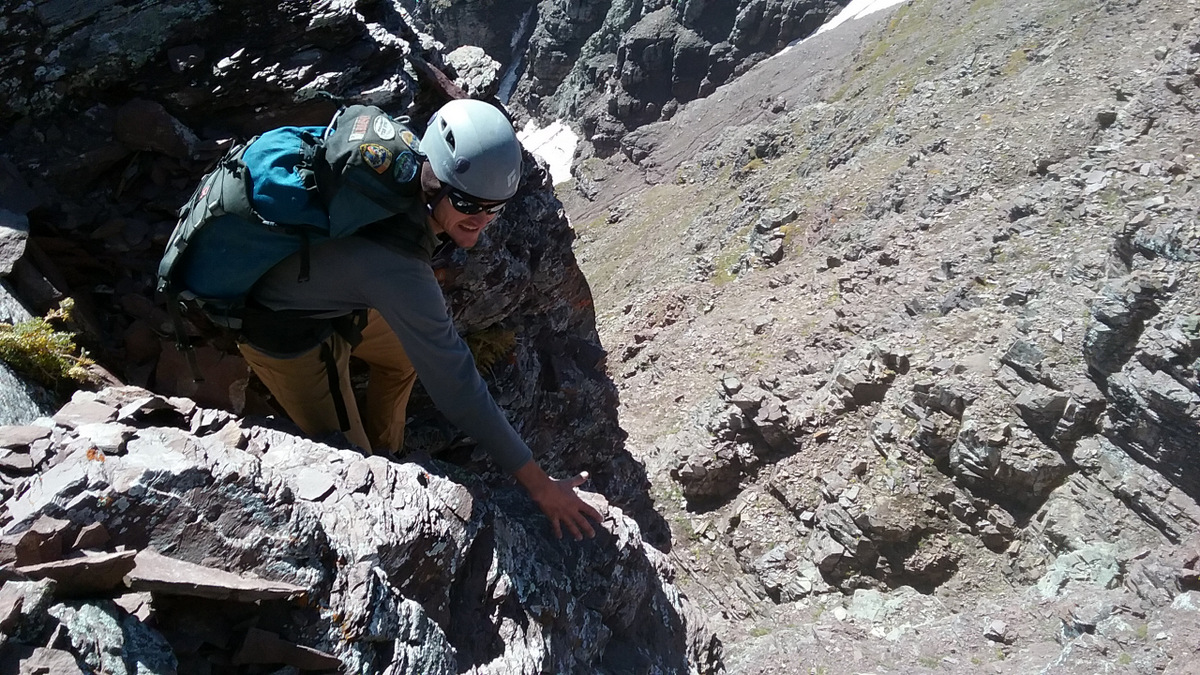
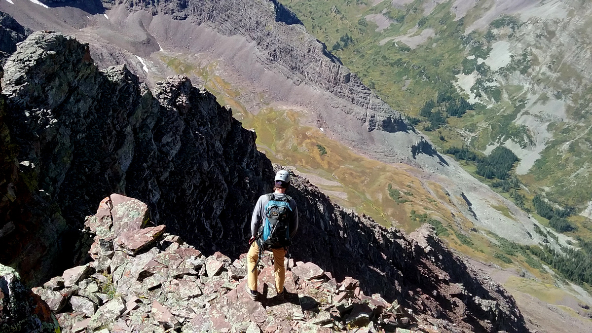
I was a little worried about my timing as I needed to be home by 7pm (back to car by 5pm), nut Natalie convinced me we would be ok with timing. So, we began the traverse south to the centennial Thunder Pyramid in what would be the “meat & potatoes” of the day. The downclimb of the class 4 pitch on Pyramid’s south ridge was lots of fun and then it was pretty cruiser class 2 walking for several hundred yards until we started doing some pretty mellow class3/4 downclimbing with not much exposure on the ridge crest.
Descending Pyramid’s south ridge
Me descending the class 4 dihedral on Pyramid’s south ridge. Photo by Natalie
Natalie on the same dihedral
Making our way down to the lowpoint between Pyramid & Thunder Pyramid. Photo by Natalie
Looking back at Pyramid on the traverse thus far
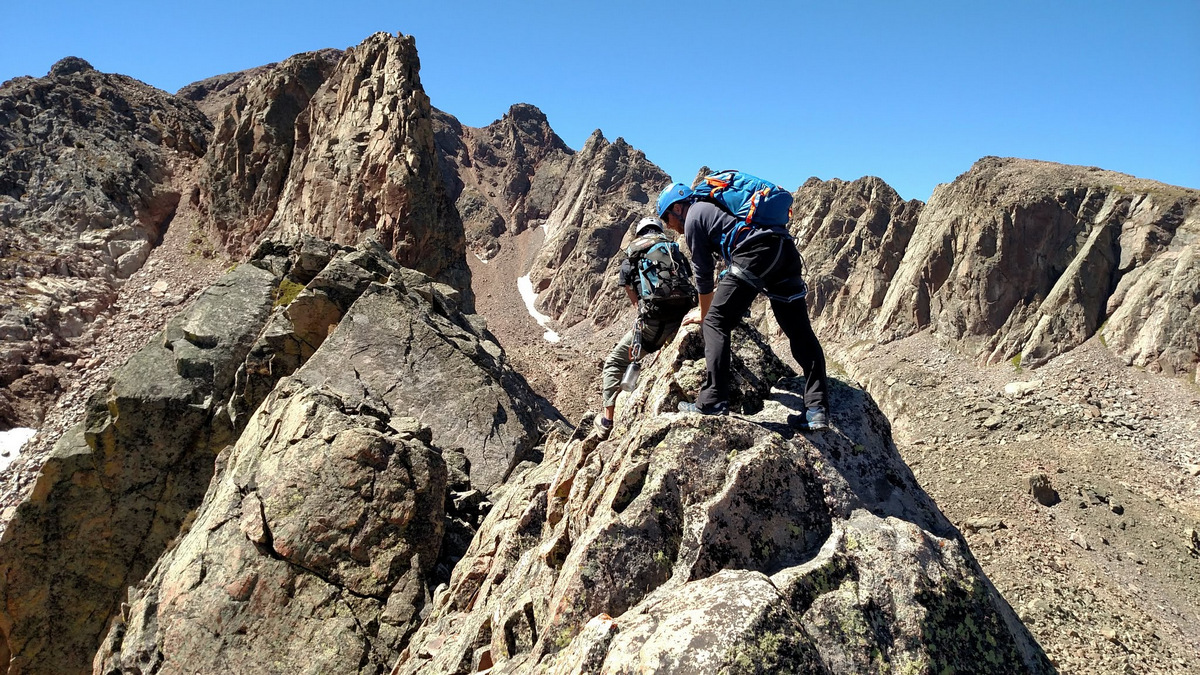
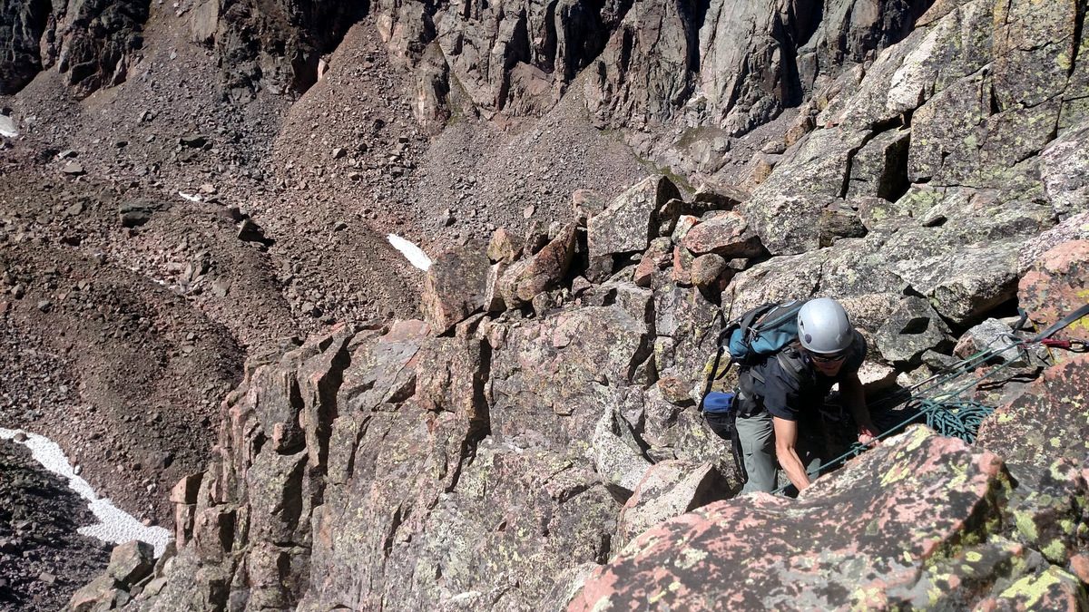
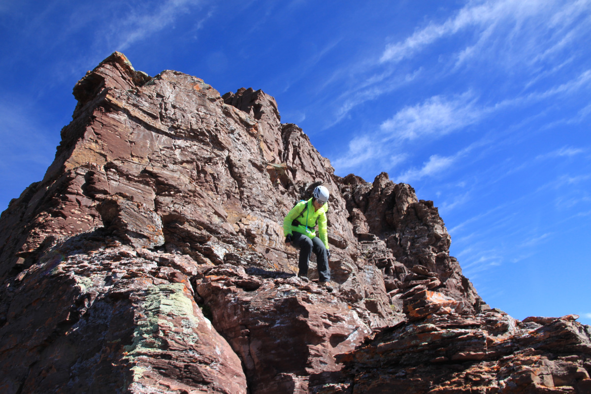
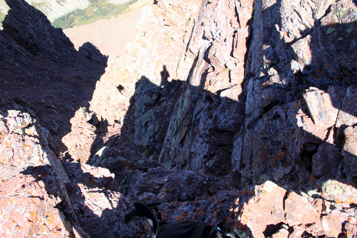
We tried the west side of the ridge to actually get down to the lowpoint several hundred feet below, but it didn’t go anywhere. We backtracked slightly and headed on the ridge top or just slightly east and found the top of the crux low 5th class downclimb with some big exposure that we had heard about. Well, there was only one way down. I was considering setting up a rappel, but there was just no good place to set up an anchor.
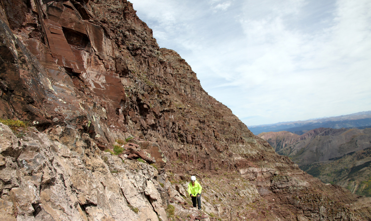
The crux downclimb to the lowpoint between Pyramid & Thunder Pyramid
Me beginning the downclimb. Photo by Natalie
Yep, a bit of exposure on loose rock. Photo by Natalie
On the climb down. Definitely, complete focus is a must on this crux section. Photo by Natalie
Natalie after the hairiest crux sections of the downclimb
The last bit down to the lowpoint
I had gotten down to the lowpoint and was scouting the next portion of the traverse when Natalie thought she could just drop her pack the remaining 10 ft down into the top of a steep, loose couloir down the west side. While it looked like the pack would just plop down and not roll from Natalie’s perspective, it indeed took off down the couloir. We both looked and thought it would stop, but just went over a steep crux and into oblivion. Natalie went down after it, but triggered a small rockslide, which didn’t make either of us very comfortable. She searched for a good 20-30min, but to no avail. She came back up to the lowpoint and we would both have to get by with my half nalgene of water and half liter of Gatorade for the rest of the traverse and the descent down to West Maroon Creek. I felt awful for Natalie as she had some valuable gear in there including her Delorme. I mean that pack could have been close to her lowpoint or rolled to the couloir’s bottom. Who knows. She would later get in touch with Delorme and they would track it to be resting at 13,300′ or just below her lowpoint. And, Natalie would go back 2 days later, ascend Thunder Pyamid via the standard White Gully, and traverse over to retrieve her pack. Very admirable and impressive determination, Natalie!
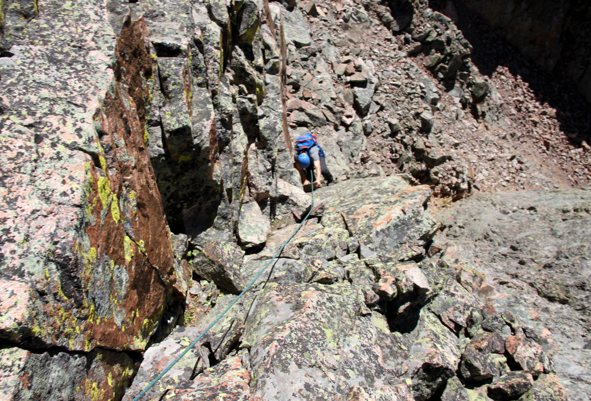
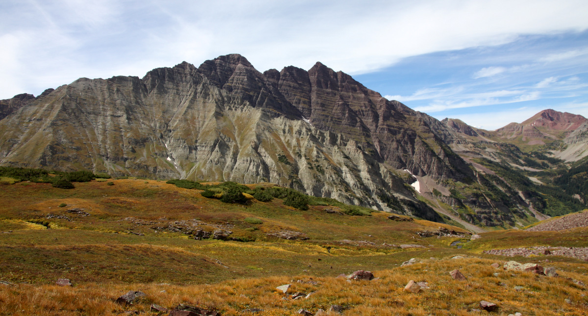
Anyway, we continued along the traverse south from the lowpoint, which was now significantly easier with some class 3/4 and nothing all that exposed.
The remaining traverse to Thunder Pyramid
Me on a nice perch with Len Shoemaker Ridge & Basin below. Photo by Natalie
Looking down the standard White Gully route up Thunder Pyramid
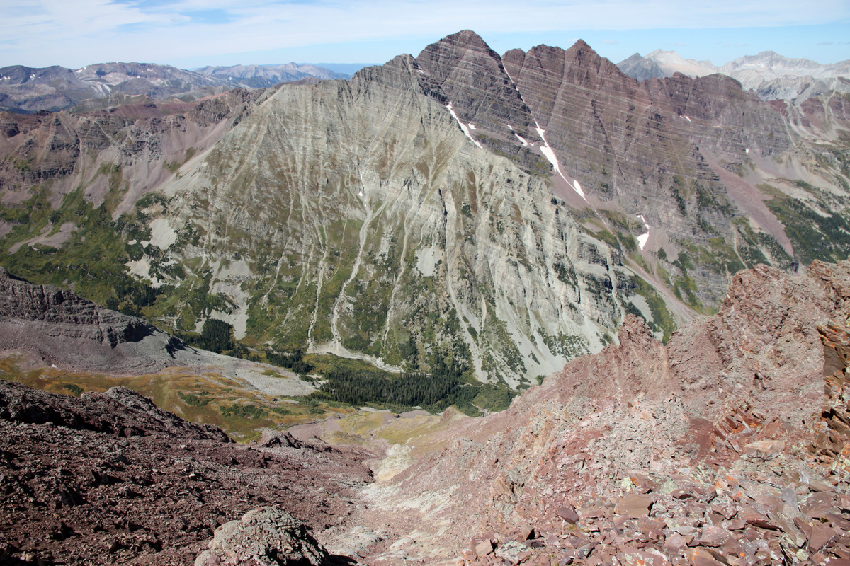
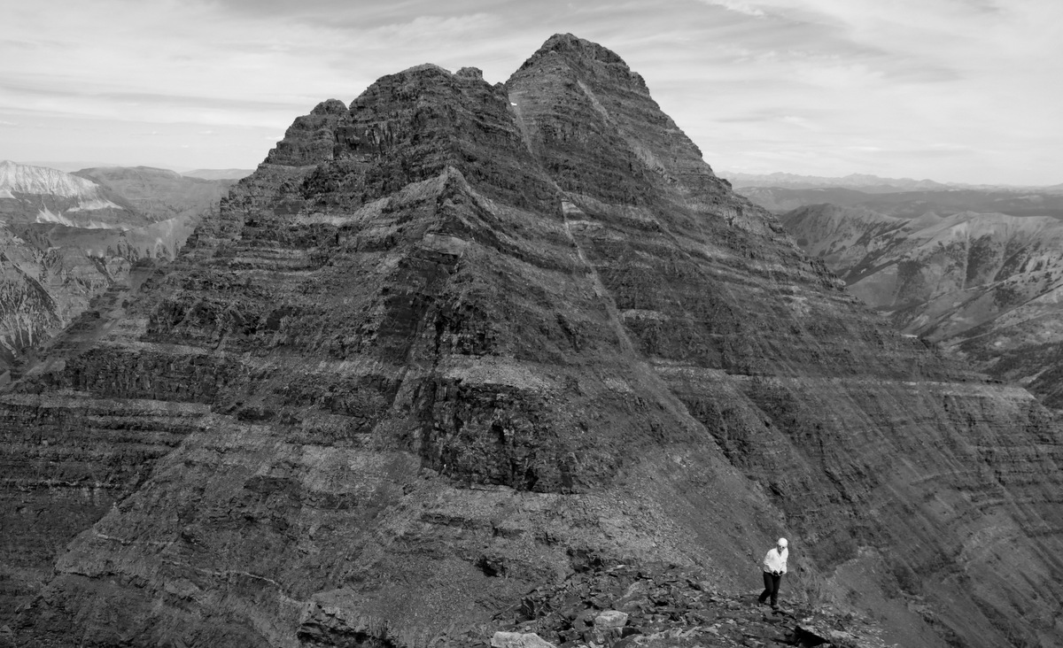
Even with the delay for the dropped pack, we still made the traverse in just under 2 hours. It was my first summit of Thunder Pyramid and another centennial for myself. It was a nice summit.
Looking back at the traverse to Pyramid from Thunder Pyramid’s summit
Thunder Pyramid summit (13,932′)
Soaking it in. Photo by Natalie
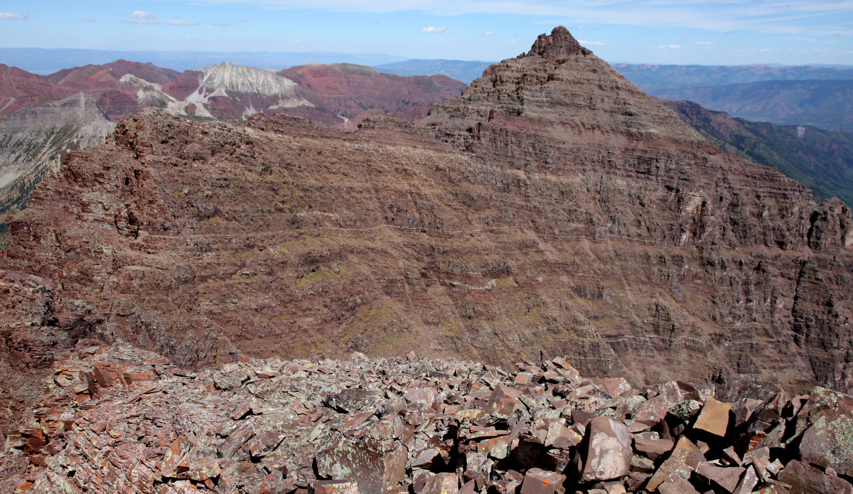
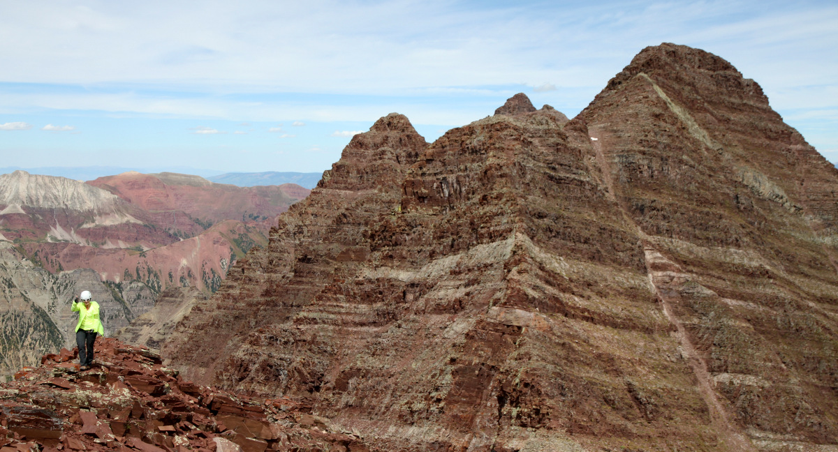
I believe it was around 12:15pm when we left Thunder Pyramid’s summit for Lightning Pyramid. Easy class 2+/3 downclimbing at first quickly yielded class 4 downclimbing to get down to the lowpoint between Thunder & Lightning Pyramid.
On the traverse south to Lightning Pyramid
Lightning Pyramid in the distance
We descended the ridge proper until a very airy downclimb when we elected to head east of the ridge proper and downclimb class 4 ledges to where we could get over to the lowpoint saddle
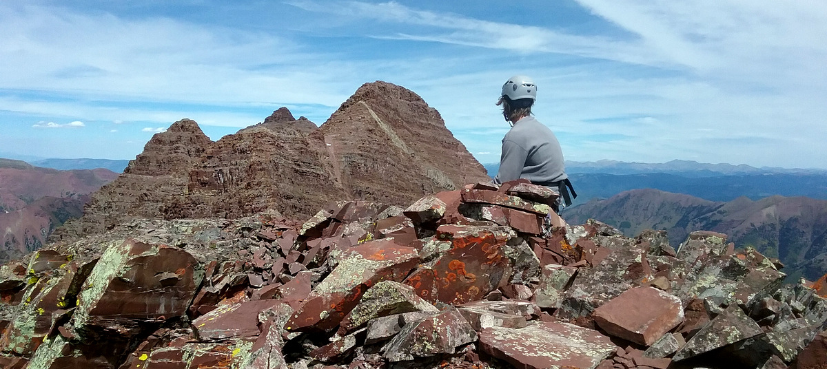
I dropped my pack with all the gear at the lowpoint saddle between Thunder & Lightning Pyramid and in 15 minutes over easy terrain we were on Lightning Pyramid’s summit at approximately 1pm.
Natalie hiking up Lightning Pyramid’s north ridge with Thunder Pyramid behind
Almost there
Lightning Pyramid summit (13,722′)
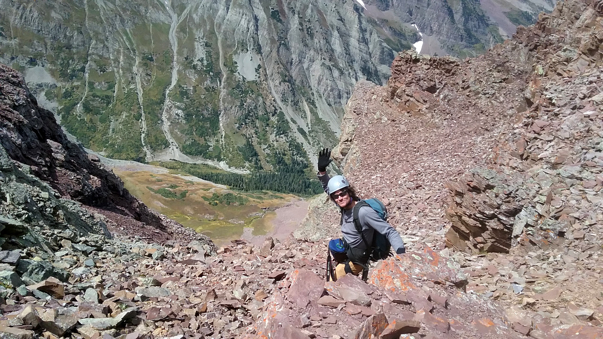
Our descent off this ridge was via the awfully steep and loose west side couloir between Thunder & Lightning Pyramid accessed from the lowpoint saddle. Not looking forward to it, we navigated it pretty well going one at a time for several pitches ensuring we don’t knock rocks down on one another. It could have been the worst couloir I’ve descended. I don’t know. However, I do know I will never touch it again.
Ready to descend. Photo by Natalie
The disgustingly narrower middle portion of the gully
More steep nastiness
Navigating some frozen snow which acted as nice hand holds
Light at the end of the tunnel – the apron
Natalie coming out of the gully
The steep gully and the large rock apron below
It was wonderful to get down into the grassy Len Shoemaker Basin and take a break and guzzle our remaining fluids. We then made our way on grassy ledges and rock gullies to get down another 1,200′ to the West Maroon Creek trail.
The gorgeous Maroon Bells from Len Shoemaker Basin
The standard White Gully route up Thunder Pyramid
We finally hit the West Maroon Creek trail, filled up with water and iodined our nalgenes, and cruised out the remaining few miles back to the Maroon Lake TH arriving just at 5pm. Natalie’s car keys were in her lost pack, so we hurried quickly down to 82 in the Subaru to get cell service so Natalie could call Geico and get some roadside assistance. After everything was settled, I was drove back to Edwards just in time to see Sawyer before bed, which was my goal all along. I later learned that Natalie’s spare keys were not in her locked car, so someone drove them up from Denver apparently and she finally got into her car later that night. But, my hat is certainly off to her for going back up Thunder and over to the couloir to retrieve her pack 24 hrs later. So happy it all worked out.
A zoomed-in pic from the West Maroon Creek trail of the steep couloir Natalie’s pack fell down in the center of the picture trending up and right to the lowpoint saddle between Pyramid & Thunder Pyramid
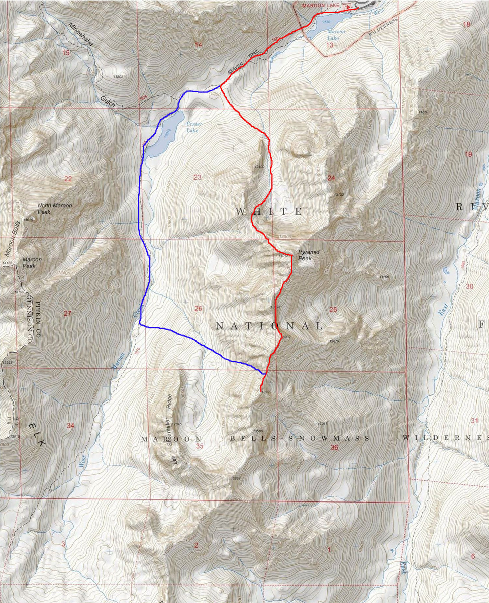
Lastly, thanks to Natalie for a great day and a solid idea for an Elks traverse in the fall. Its exactly what I needed having not been in the area in years. I don’t get on 14ers too often anymore, but Pyramid will always be one of my favorites. I guess total stats are something like 5,500′ vertical gain in 12.5 miles and 11.5 hrs RT. Our little Pyramid loop is shown below:
Pyramidal Traverse via Pyramid’s NW Ridge up and the Thunder/Lightning Pyramid west side couloir down


 Follow