Monolith Spire

Well, being under the weather with the flu makes for good time to catch up on a nice Grand Junction day out back in early November. I had always wanted to climb to the top of this tower within Colorado National Monument called Monolith Spire, but had only ever climbed its first lengthy pitch several times without continuing on upwards. The first pitch, called Dewar’s Dihedral, is a fantastic 5.10+ crack in its own right, but the real adventure comes in the 2nd & 3rd pitches. Good pals J, Ryan Marsters, & Mikey Santoro joined me for the daytrip from Edwards to climb this sucker – finally! We rolled down in my Tahoe to the familiar Monument Canyon Trailhead and made the hour hike into the base of the tower. It was chilly, but actually warmed up just enough. I led on up the familiar Dewer’s Dihedral and belayed Mikey up to me.

Me leading up Dewar’s Dihedral. Pic by Marsters

Mikey almost up to me at the top of the first 130′ pitch

Mikey was pretty exhausted and not feeling it this day, so we re-rigged things at the belay and I lowered him to the ground. J had started leading team J-Marsters and Mikey just lowered right behind him. It all worked well.

J leading Dewar’s Dihedral

J anchored off at the pitch 1 belay and we figured J would belay me up the unknown (to us) off width pitch 2 while Mikey would belay Marsters up pitch 1 on top rope from the ground. I led off horizontally east from the hanging belay and got a #0.75 in high to protect the unknown traverse. After studying where to go I figured one had to make a leap[ of faith and completely let go of the left hand and hope your right hand went into something solid. Fortunately, my right hand went into a perfect hand crack and I climbed my way up to the bottom of the obvious off width when seen from afar. I placed a #6 high in the off width and chimneyed my way up using my horrible off width techniques. It was tough for me  – a true battle. I mean 5.9 off width is tough enough for me, but 5.10 off width is another level. I was able to get in another #5 and then a #4 up high where I could fist instead of the awkward chicken winging and buttterfly hands I was doing below. After 40′ or so, I topped out and then did another 25′ of much easier 5.8 climbing to the belay ledge. After some radio calls with J and me ready to belay him up, J began climbing. He made the leap of faith traverse and then really climbed the of width well.

J beginning the traverse up and to the base of the off width. Pic by Marsters

J topping out on top of the off width

J cruised on up to be trailing the 2nd rope. I took J off belay and he set up to belay Marsters up the 2nd rope. After a lot of grunting and some choice words, we see Marsters emerge from the belly of the off width and make his way up to us. We told J he should lead the final 5.10d A0 bolted face/arete climb to the summit. He was excited. He led out onto the arete and clipped the first bolt. He actually climbed this pitch super well and didn’t rest on a bolt until the final 2 bolts.

J leading the final 3rd pitch

Marsters took this of J from the edge of the large belay ledge

J on the super tough upper portion of the 3rd pitch. This was much much harder than it looked from below! Pic by Marsters

After an aid move near the top, J topped out and set up to belay me up.

Me beginning the 3rd pitch. Pic by Marsters

So, all I got to say is that with the extremely sandy and slick crimps, this pitch has to be at least 5.11+ free. I definitely had a rest or two on the rope. However, I did dyno the move J aided at the top. Finally, I topped out with my dignity between my legs. Fortunately, Marsters thought it was just as tough.

Marsters on the upper portion of the final pitch

Marsters perfecting the chin hold

Me on top belaying Marsters up. Pic by J

J and Marsters on Monolith Spire’s summit

Gorgeous Colorado National Monument. Pic by Marsters

Group shot on top of Monolith Spire

Mikey took this pic of us on the summit of Monolith Spire from below

We then readied the rappel down to the big belay ledge at the top of pitch 2 with a single 60m rope.Back at the belay ledge we double rope rappelled down of the back side of the tower to the ground where Mikey was waiting for us. We wrapped around the base of the tower and sorted gear and ropes and packed up.

Monolith Spire from below with Dewar’s Dihedral is on the left side and the off width pitch is seen above the center of the picture

Out just before dark at the cars, we reflected on another adventurous day in the high desert. I just so love these winter days in the desert. Not only because there is never another soul around, but the colder temps always feel so good on the sunny sandstone.

One Last Fall Gore Traverse

Welp, I think we all knew the snow was coming, so in an attempt to get up in the Gores one last time without dealing with the snow, I wrangled together Dylan, Chris, & J for one last day. The one last area of the Gores I had really not visited was the Peaks X, Y, & Z area to the northwest of the North Boulder Creek drainage. There was also Peak W between Peak X and East Partner, but that would wait for another day.

Map of the approach up Pitkin Creek to access Peaks X, Y, Z, & friends

J, Dylan, & I had actually never ventured off the Pitkin Creek trail to the northeast to access Usable Pass, so this was all a real treat. Chris overslept his alarm and missed our departure at the TH, but I told him to just catch up as we were just steadily meandering up the trail (partially due to Dylan’s super late night of a substantial quantity of beer and Taco Bell – ah, 25 year olds). After a semi-close encounter with a black bear on the turn-off, we made our way up into the beautiful basin below East Partner’s east slopes and up to Usable Pass in the steadily increasing wind.

Looking up the basin to Usable Pass and Peak X’

The wind was whipping and chilly at Usable Pass, but the sun was warming things up and we pressed on up the southeast ridge of Peak X’.

Scrambling up the southeast ridge of Peak X’ with Vista Peak in the background

Dylan

We came up to the large south-facing slab up Peak X’ which looked amazing. However, with old Hokas on and no traction, we decided to skip this scramble (low 5th class?) and curve around to the right of it.

The south-facing slab of Peak X’ as seen on the descent later in the day

Nonetheless, I chose to climb this dihedral around the corner which was probably tougher than the slab itself. J and Dylan took a line further east of the dihedral.

The dihedral I climbed with the large south-facing slab to the left

Dylan took this of me half-way up the dihedral

After these completely unnecessary climbing lines, we scrambled our way to the fun little summit of Peak X’.

Dylan and J working their way to the summit of Peak X’ (12,710′)

We descended the much mellow class 3 terrain down the east ridge en route to Peak X. At this point, we looked back to Usable Pass and saw Chris! He had made it after all and was at Usable Pass. I motioned for him to just contour over to Peak X’s west ridge and skip X’ altogether. We meandered up Peak X and relaxed on the summit waiting for Chris to join us.

J and Peak X ahead

I descended a bit down Peak X’s northeast ridge to scope the traverse over to Peak Y and it looked fairly straightforward. By the time I came back up to the summit of X, speedy Chris Baldwin had arrived.

Peak X summit (13,085′)

Looking forward to Peak Z and Z’ to the east. Still some distance to cover

Poor Dylan was really feeling the activities of the previous night and wanted to get down. I told him to follow us a bit down to the low point with Peak Y and we can find him a gully to descend down to the basin below.

Descending Peak X’s northeast ridge

We did find a decent class 3/4 gully for young Dylan to descend and we said our farewells. Chris gave Dylan the keys to his car and he ended up rolling all the way back to the TH solo and getting on home. Chris, J, and I continued on to Peak Y.

J on a mini knife-edge

En route to Peak Y with Peak X behind

Peak X from the summit of Peak Y (12,939′)

J on the summit of Peak Y with Peaks Z and Z’ still yet to come

Staying on the ridge crest, we traversed east from Peak Y’s summit. Fairly mellow scrambling led to a drop-off down to a small col hundreds of feet down (would require a rappel). Darn! I guess we would have to descend to the south on steep ledges to bypass this notch. J remained low and contoured up to Peak Z’s west ridge. Baldwin and I ascended back to the small notch and scrambled the remaining ridge down to the low point saddle between Peaks Y & Z. Peak Z’s west ridge was simple enough and soon we were on Peak Z’s summit.

Peak Z summit (13,245′)

Peak Z’ from Peak Z’s summit

We relaxed for a bit and soaked in the views and made our way down to the very cool northwest ridge of Peak Z’.

Ridge to Peak Z’

Chris & J on the summit of Peak Z’ with Peak Z behind

Looking back to Peak X (right) and Usable Pass (center) from Peak Z’

We then reversed the northwest ridge of Peak Z’ and made our way down into the upper North Boulder Creek basin visiting several of the small lakes.

Looking up at Peak X (left) and the traverse to Peak Y from one of the high alpine North Boulder Creek lakes

After some liquids and a PB&J, we made our way uphill across minor cliffs and boulder fields back to Usable Pass.

Peak X’ again and its large south-facing slab en route to Usable Pass

Usable Pass from the east

Once at the pass again, we made our way further west into the basin below East Partner’s southeast face and admired a ski line we would like to try as well as potential rock climbing of its southeast buttress.

This couloir is now on our radar 🙂

And this buttress :)\

I think we made it back to the Pitkin Creek TH by 4pm and motored home considering J had a week old baby girl at home. Dylan was there and seemed to be doing better and was refraining from beer for the evening for obvious reasons. Fun to get another few Gore peaks in before the snow really started to fly. And, fly it did the very next week.

Capitol’s Northwest Buttress

Where to start with this one. This route has been on my radar for years. My good pal Jesse Hill and I attempted this route in late July 2015, but little did we realize what late afternoon downpours would do to the first 2 pitches the following day. We got shut down, but I salvaged the day by taking a run up neighboring 13er Mt. Daly. That whole account can be read here.

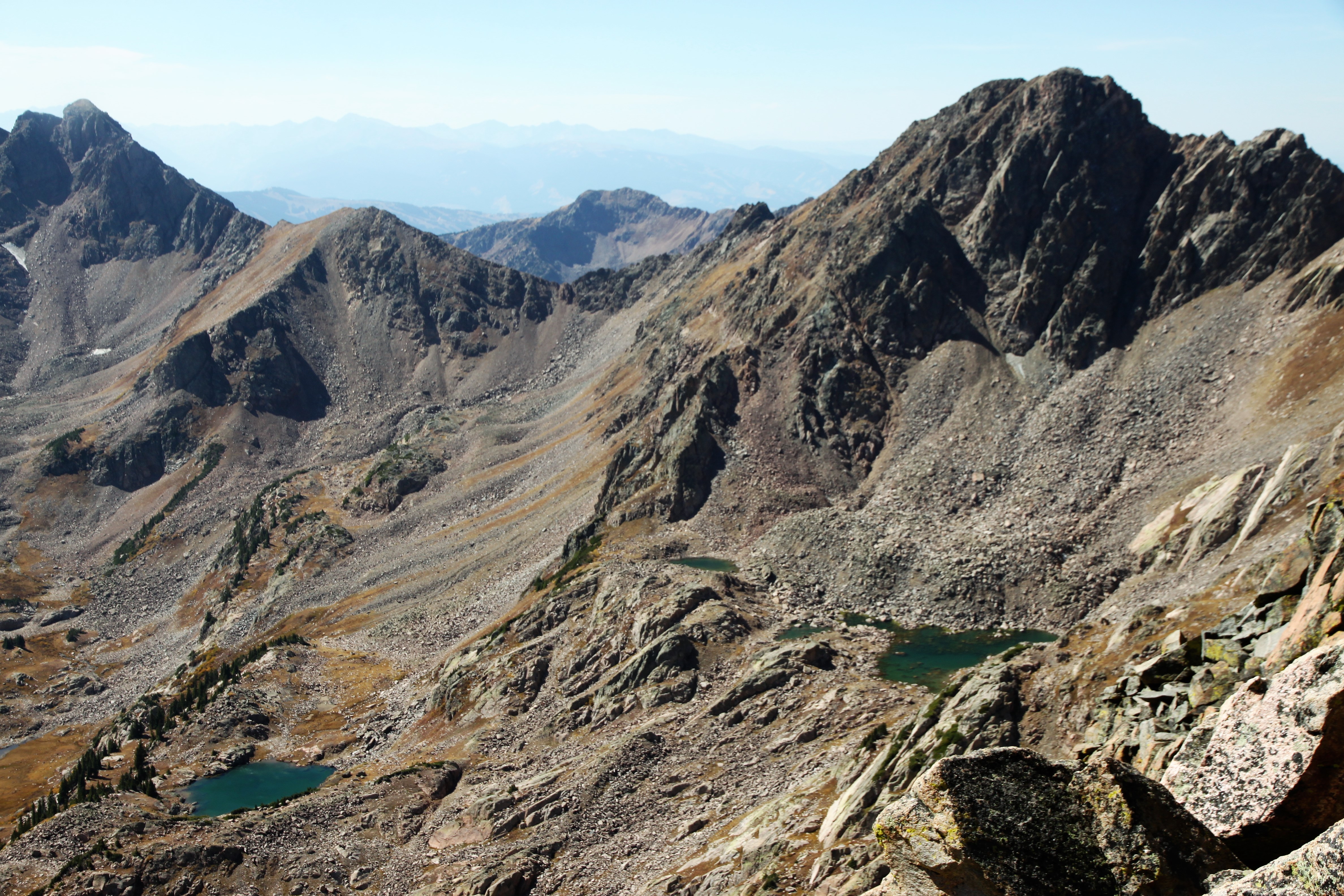
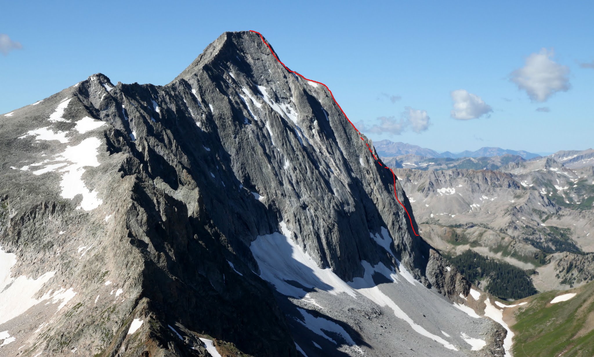
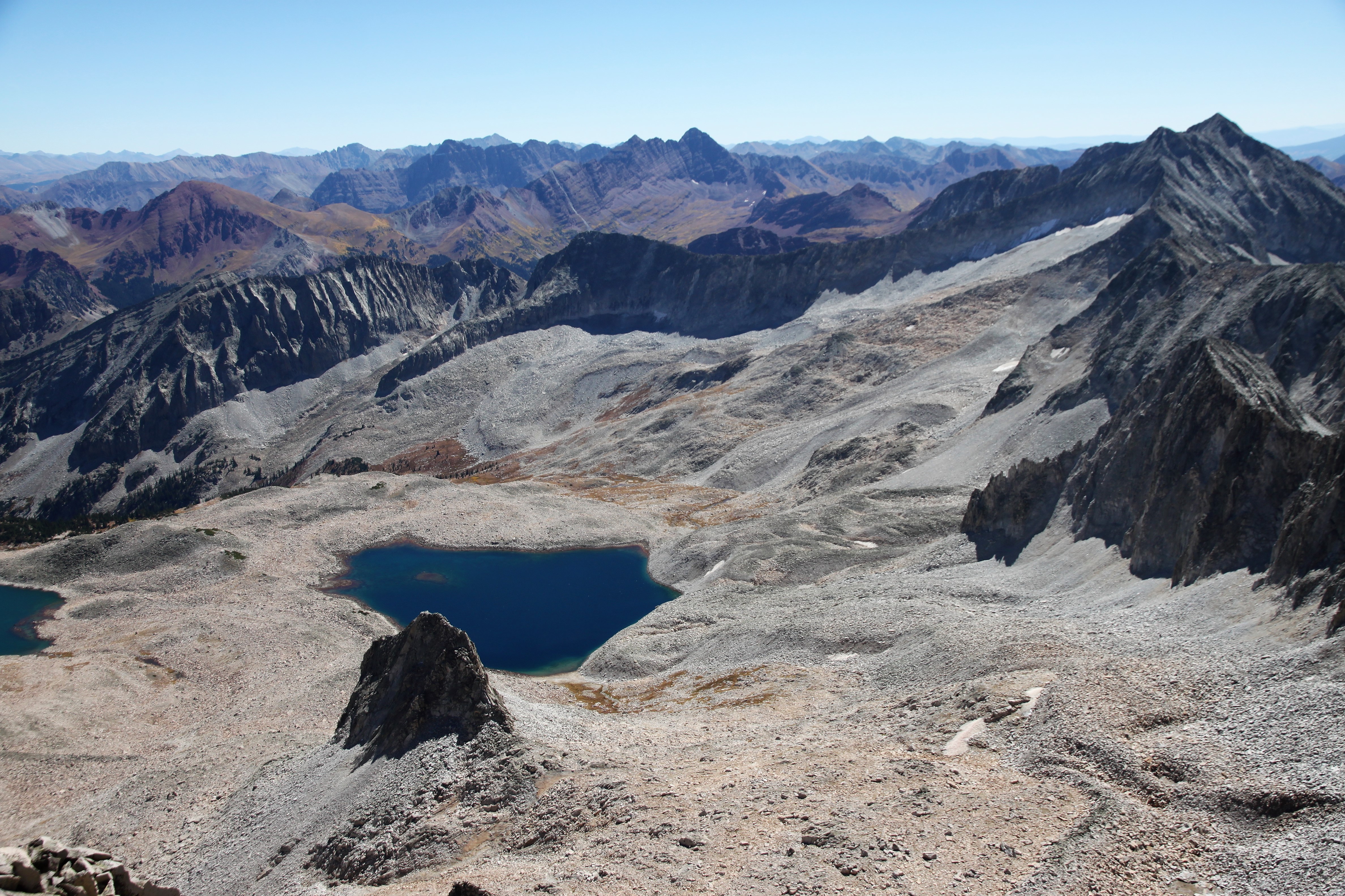
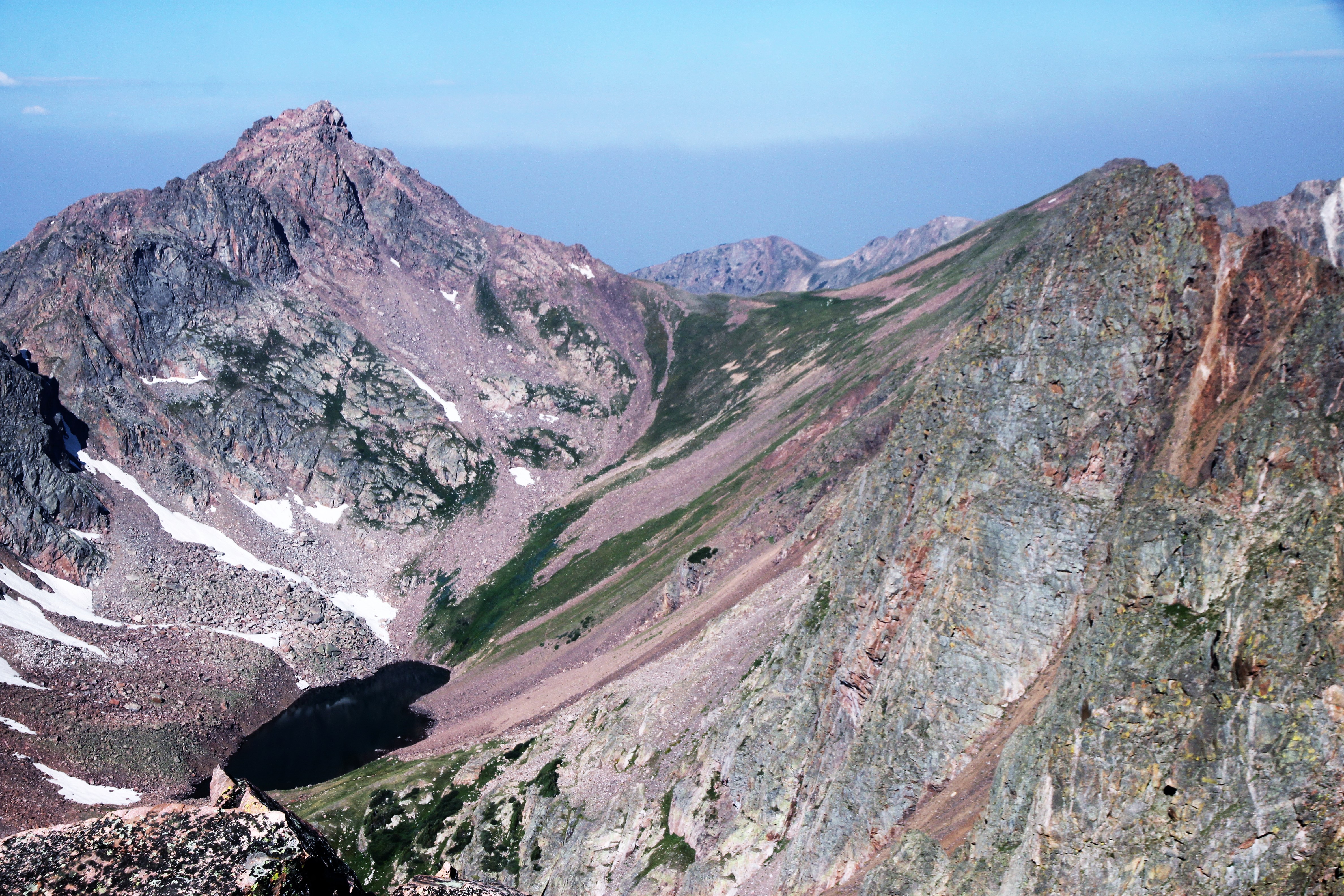
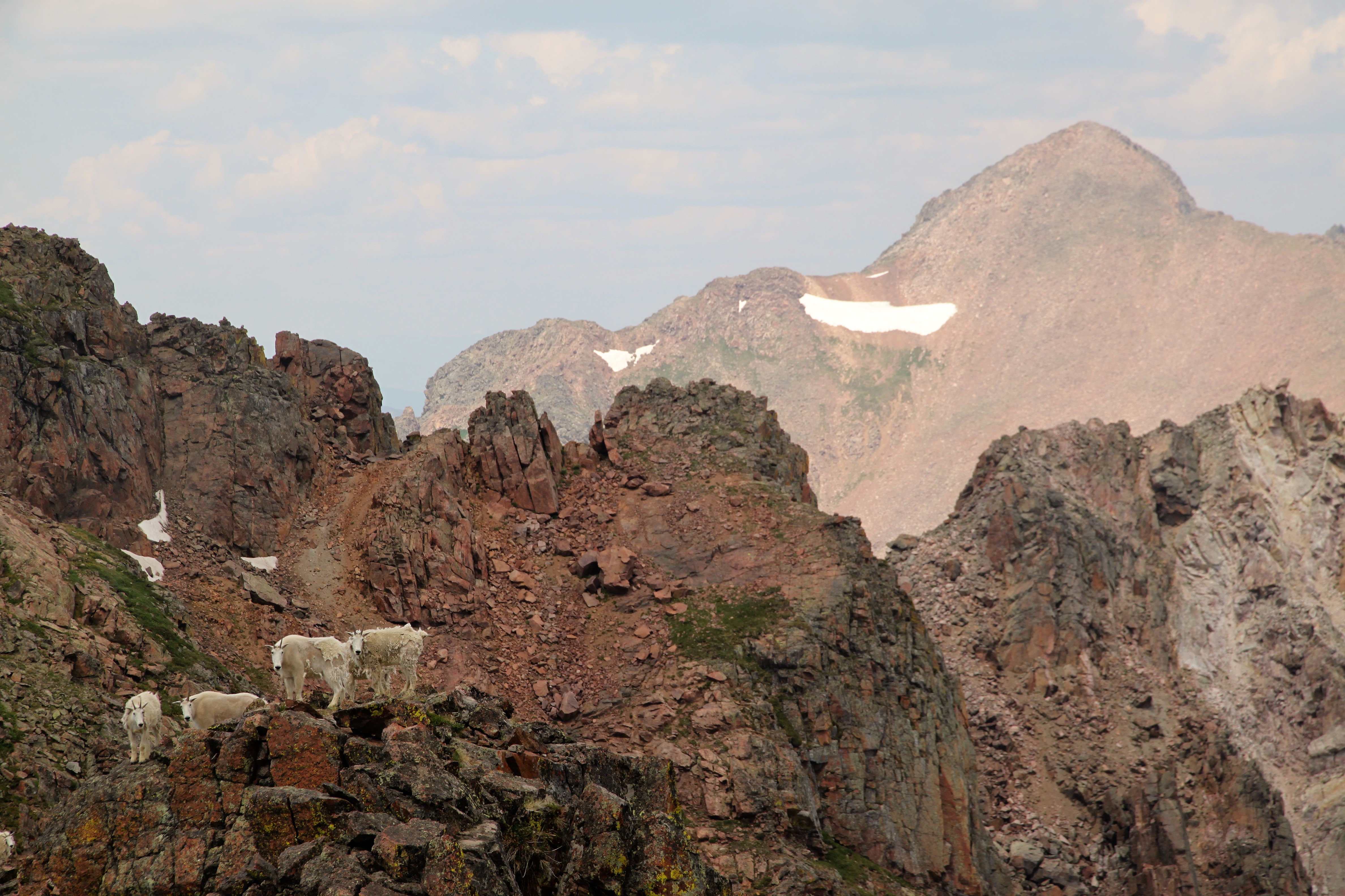
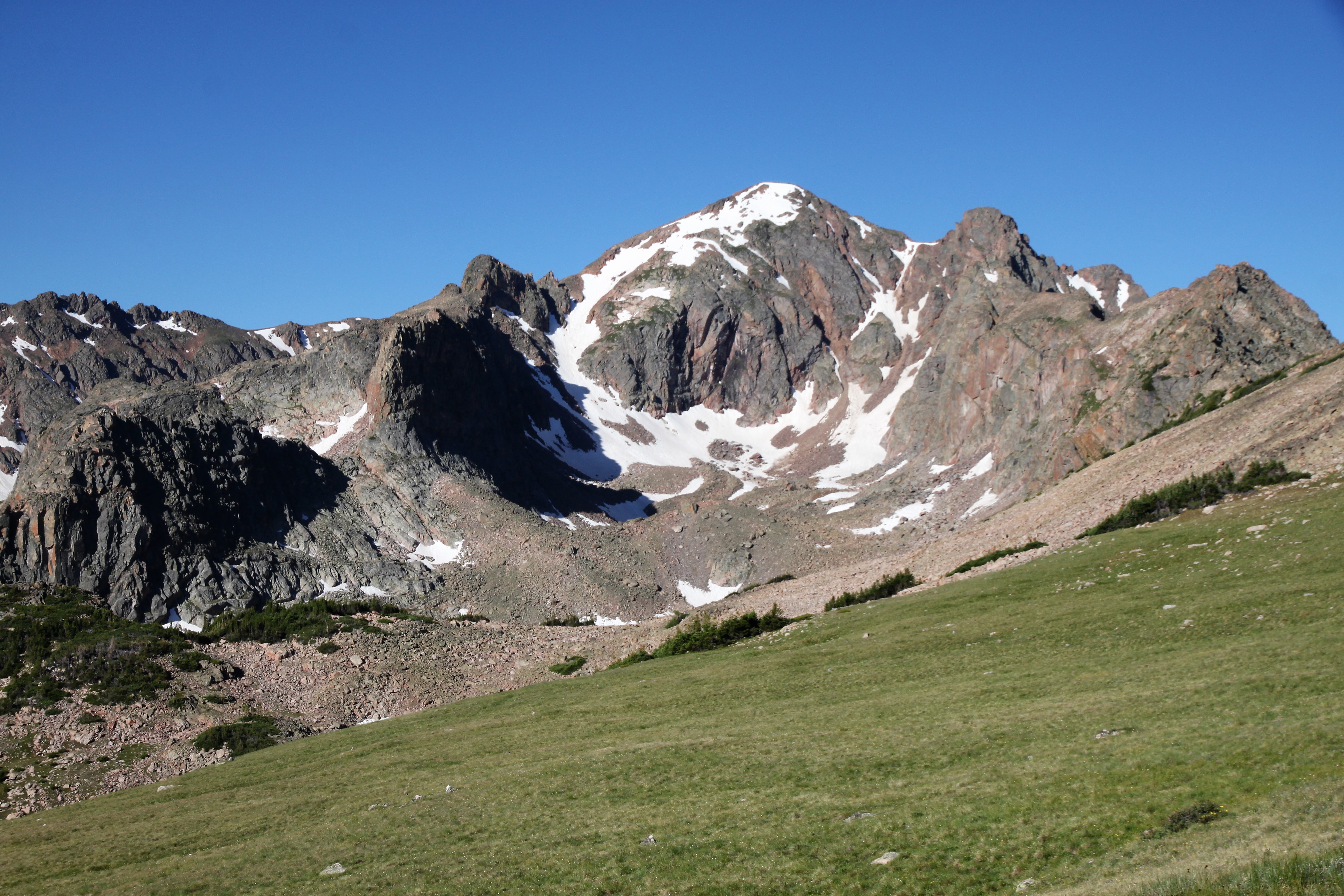
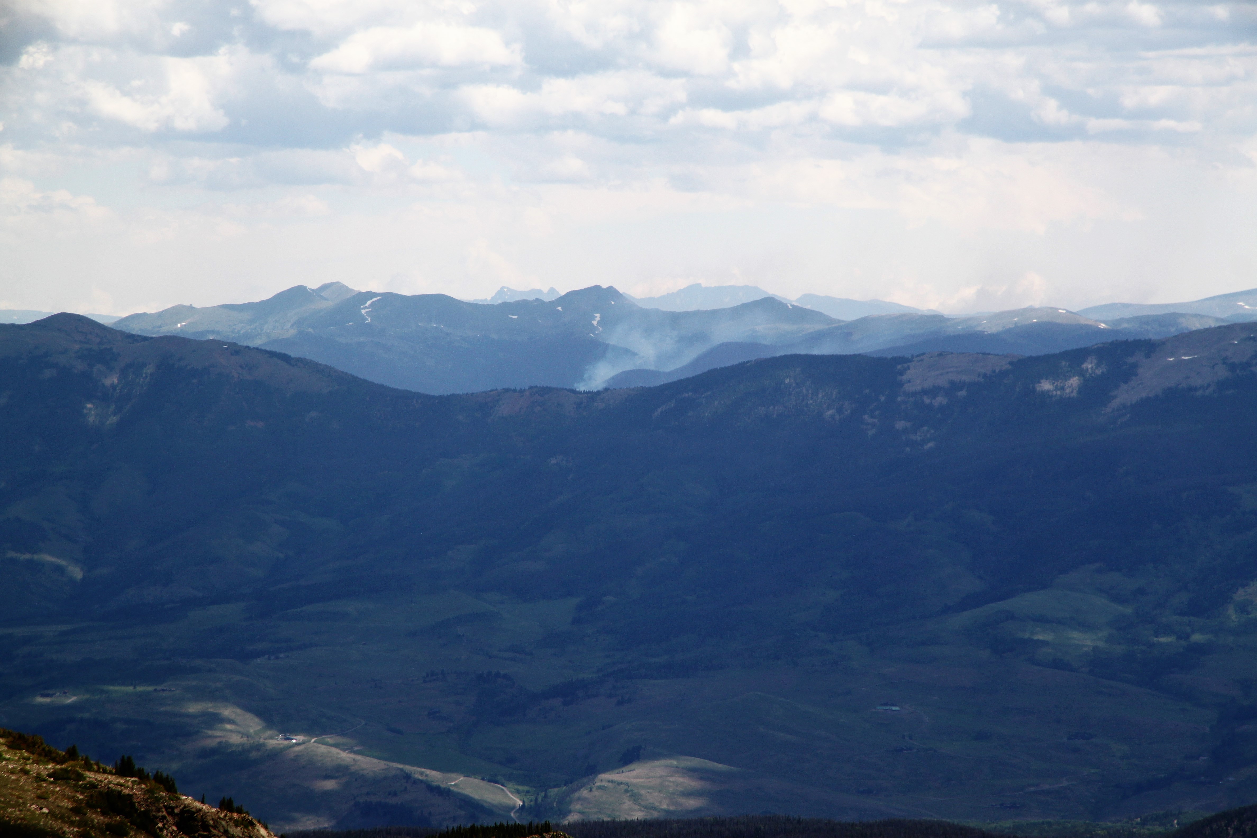
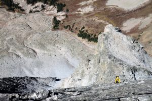
Capitol’s Northwest Buttress Route shown in red as seen from Mt. Daly’s south ridge in late July of 2015

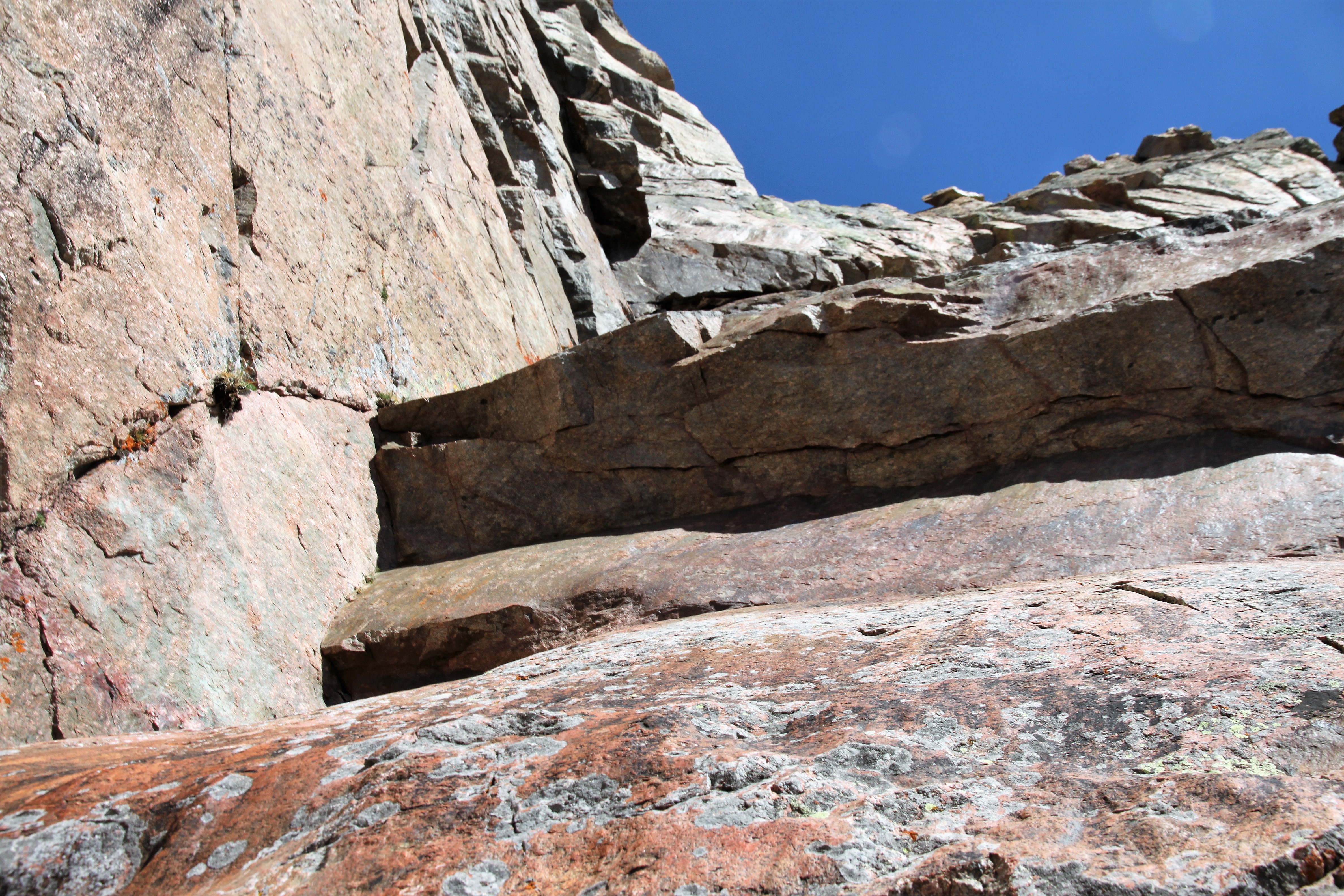
Anyway, I had heard the Northwest Buttress up Capitol was a bit “loose” and objectively dangerous because of rockfall, but honestly now having climbed it I can say only one small 100′ section gave me any pause with regard to loose rockfall potential. I think any climber who may think this a “death route” probably spends most of their time in climbing gyms, at crags, and not in the alpine. If you are a rock climber and regularly climb peaks, especially in the Elk Range, and are used to loose rock being just a part of climbing mountains, then this route likely wouldn’t feel too objectively dangerous. I extremely enjoyed this route and think it is potentially the best alpine adventure I have done. I would definitely do it again and plan to do the Early Times (5.10) initial headwall variation next time.

J and I were trying to make this happen all summer, but schedules and weather forecasts kept getting in the way. I knew we needed a great forecast within a dry spell so as to not repeat my previous mistake. I kept thinking we needed to wait until the fall and the bluebird days of September. However, this is when J and Megan were expecting their second daughter, so it may not work out timing-wise. Fortunately, good pal Chris Baldwin was taking on this whole climbing activity full-throttle like he did everything else and said he would love to go with me. I’m so happy Chris and my paths crossed earlier this summer as he has been a super friend and climbing buddy. I have so enjoyed “showing him the ropes” so to speak. Anyway, unfortunately for J, we targeted Friday, September 14, which was Megan’s due date. He understood, but was obviously bummed. However, I promised him we’d go back and do the 5.10 variation. Chris and I would attempt the original 5.9 Northwest Buttress.

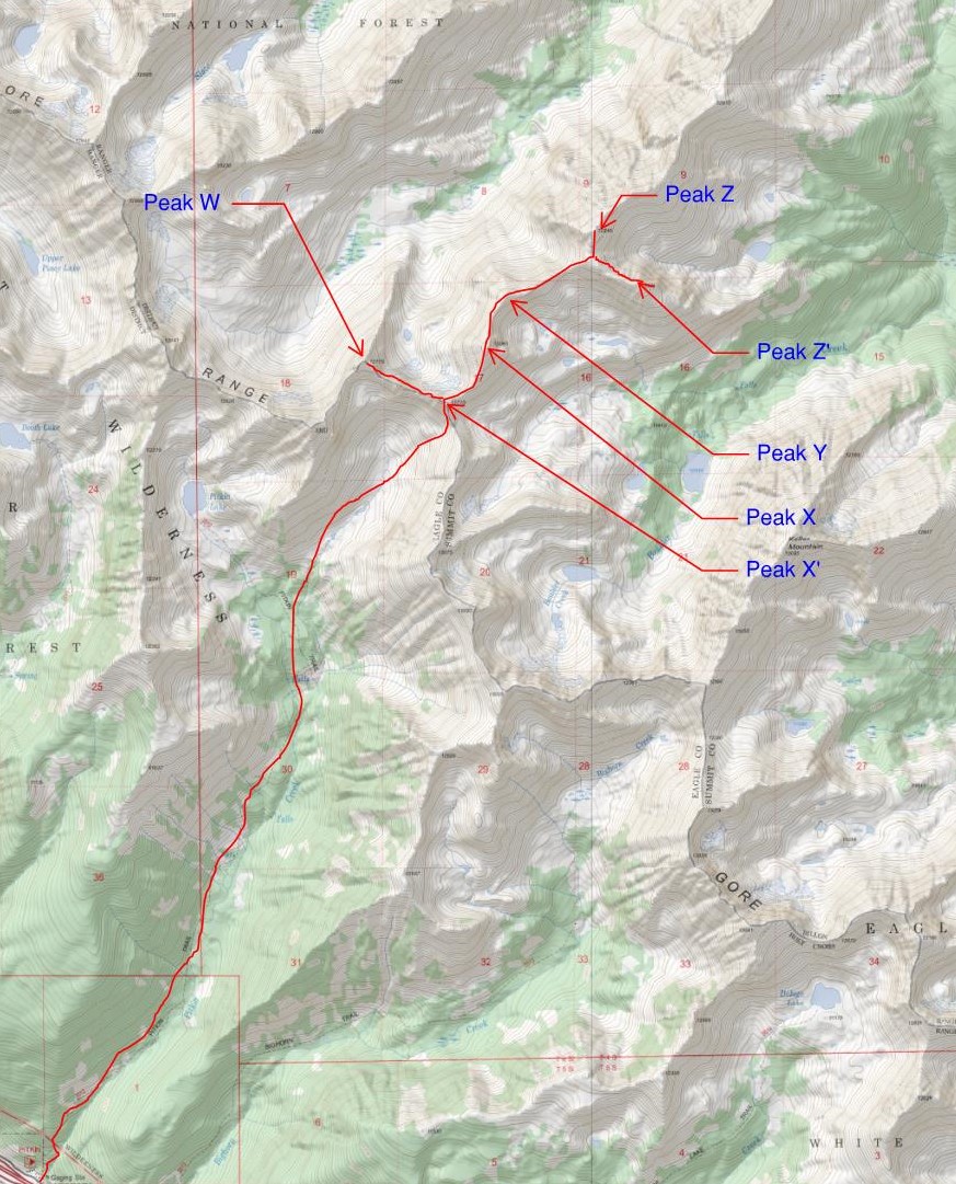
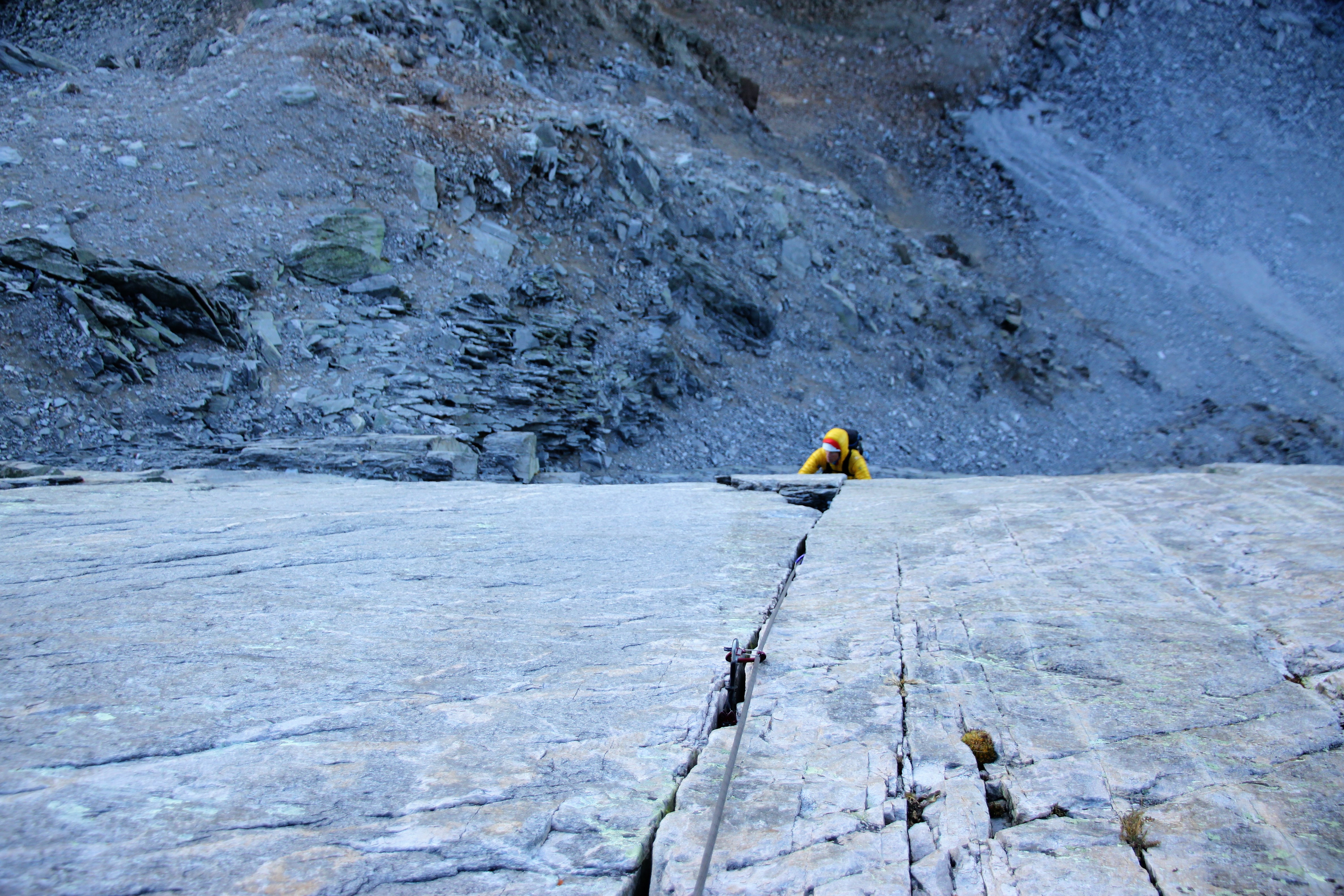
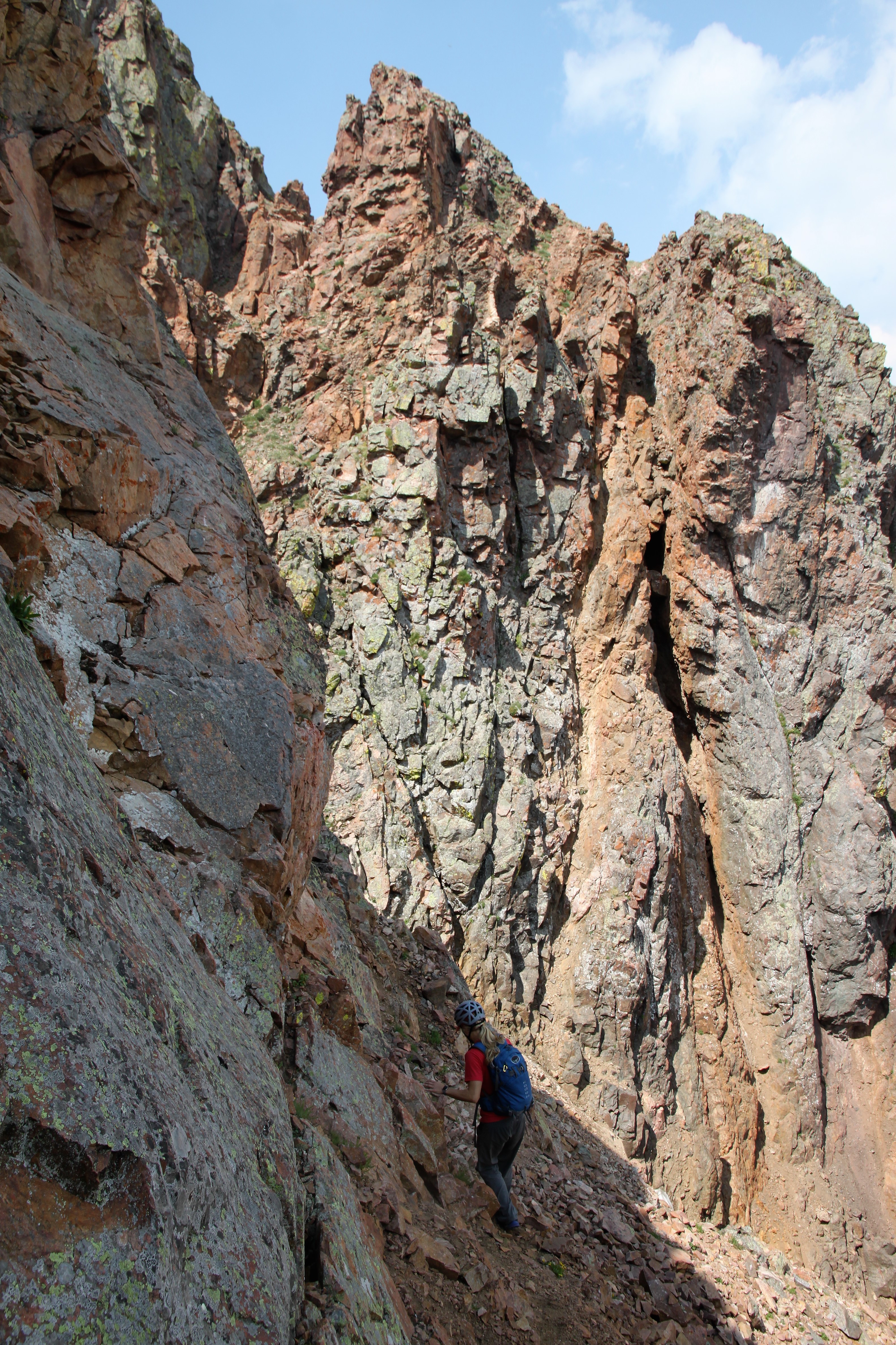
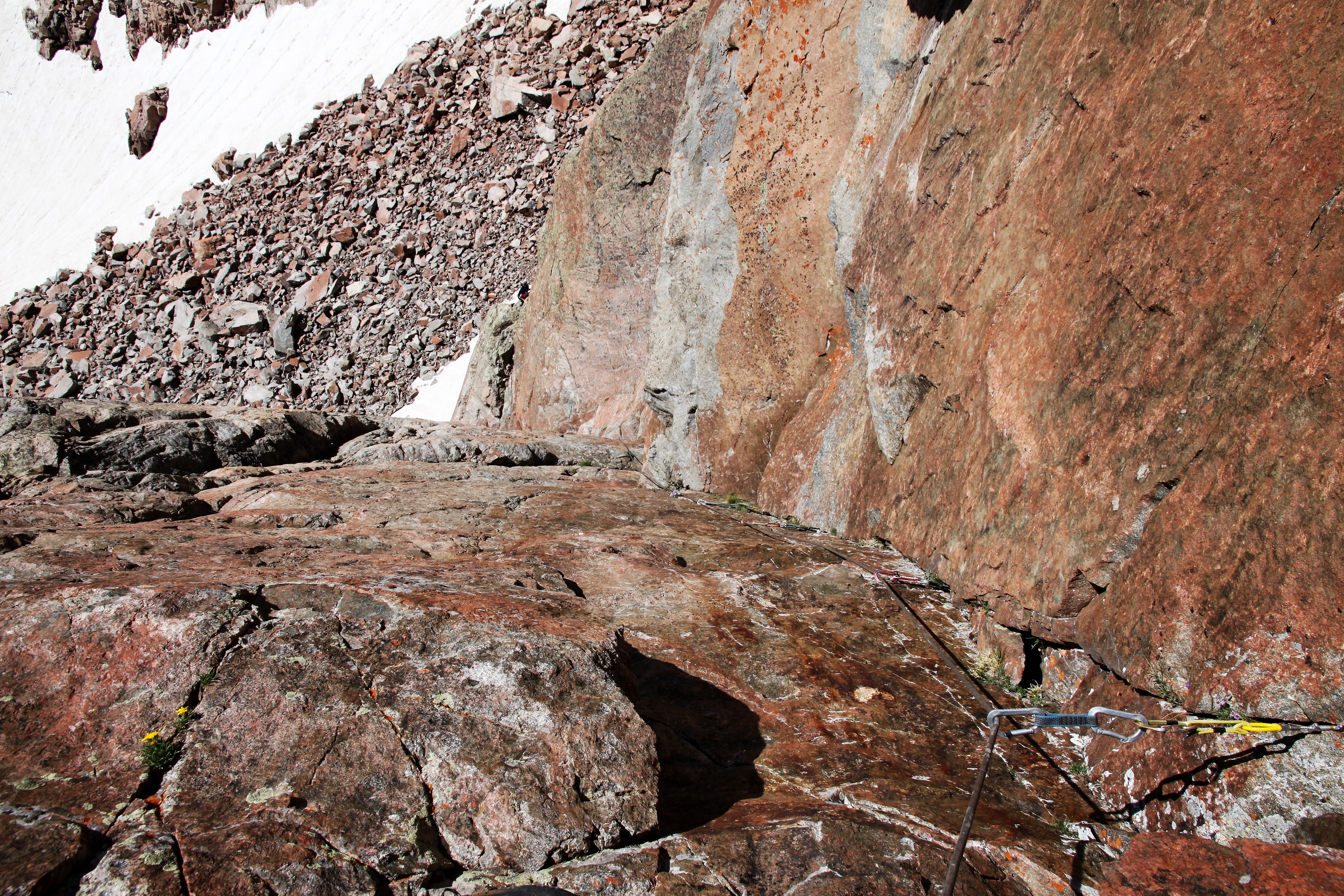
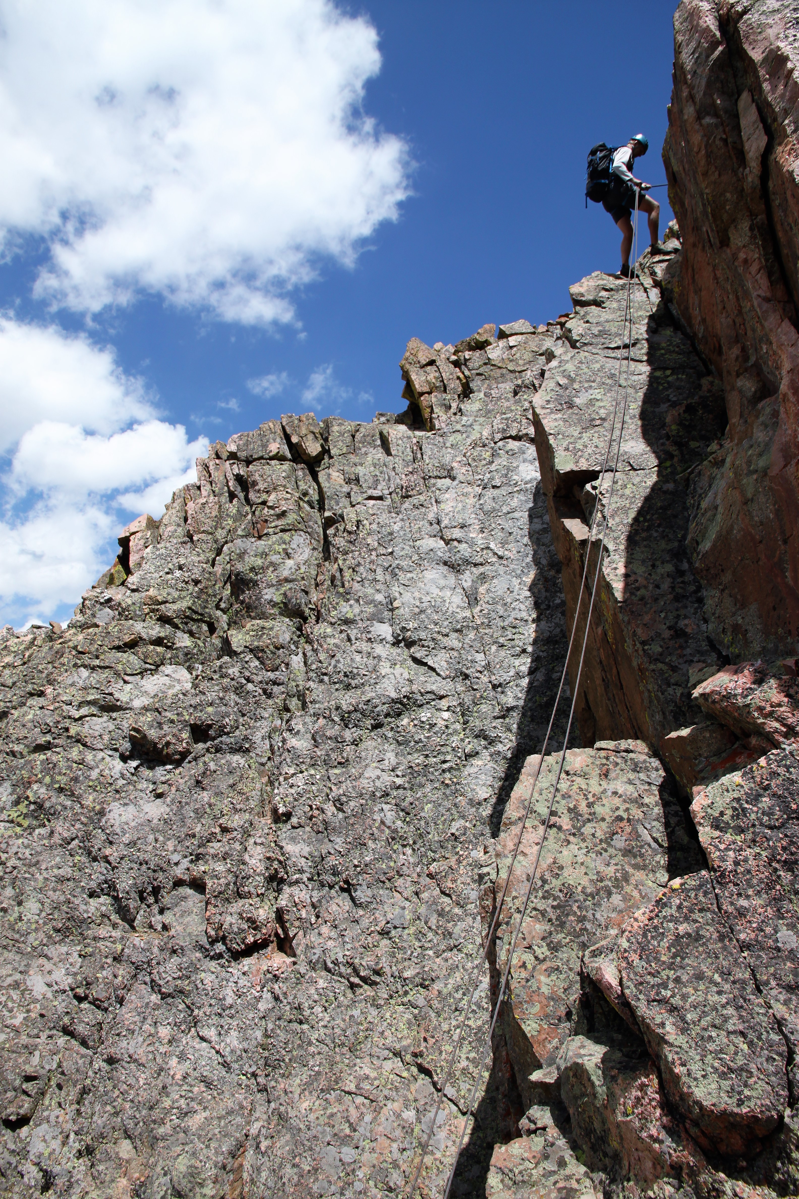
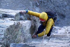
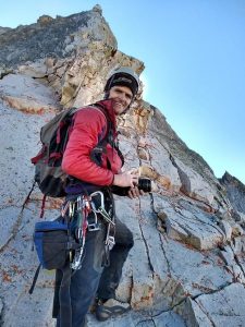
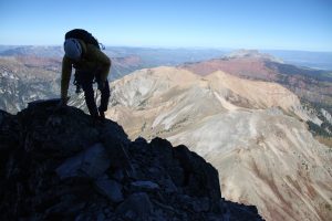
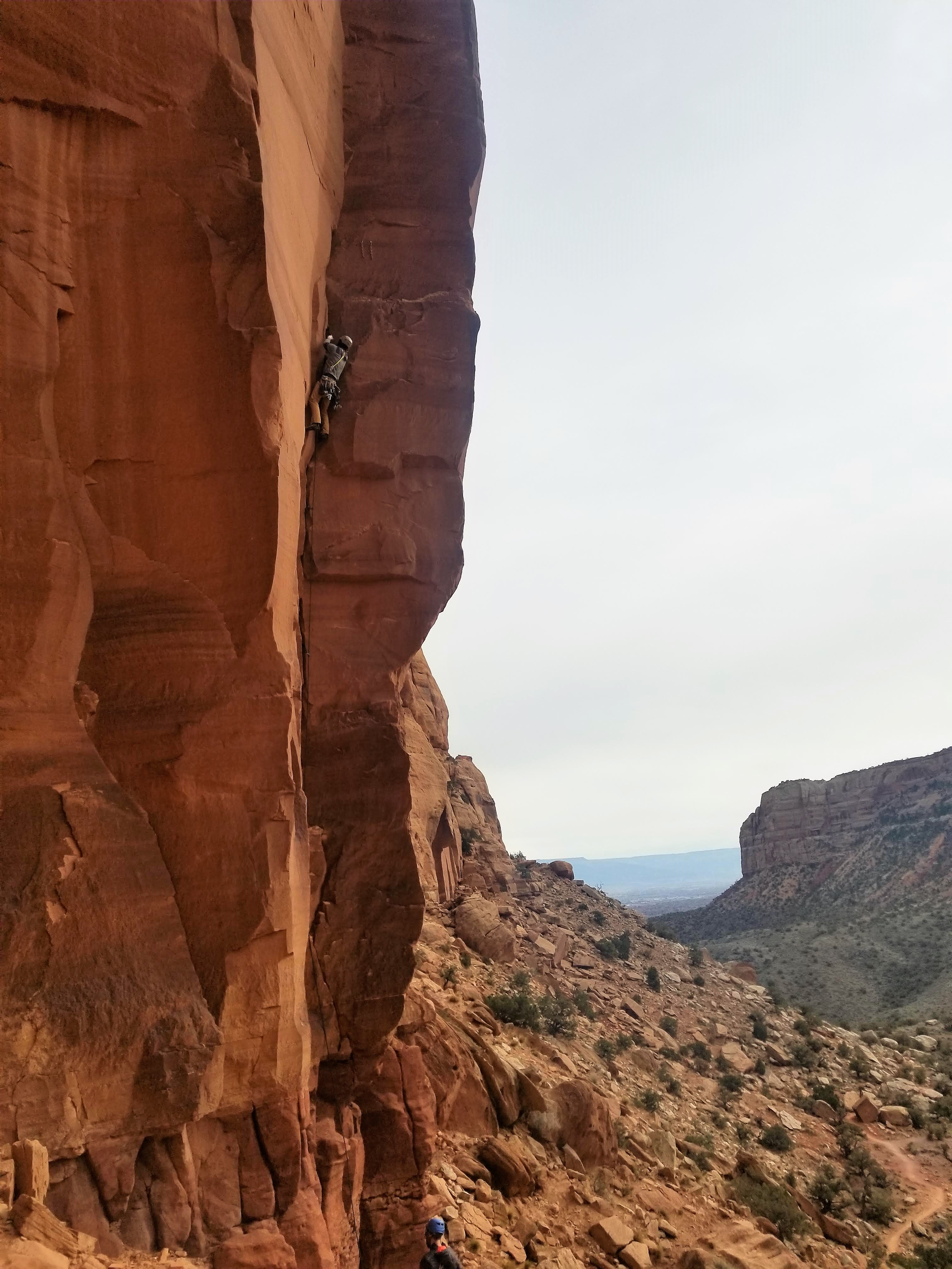
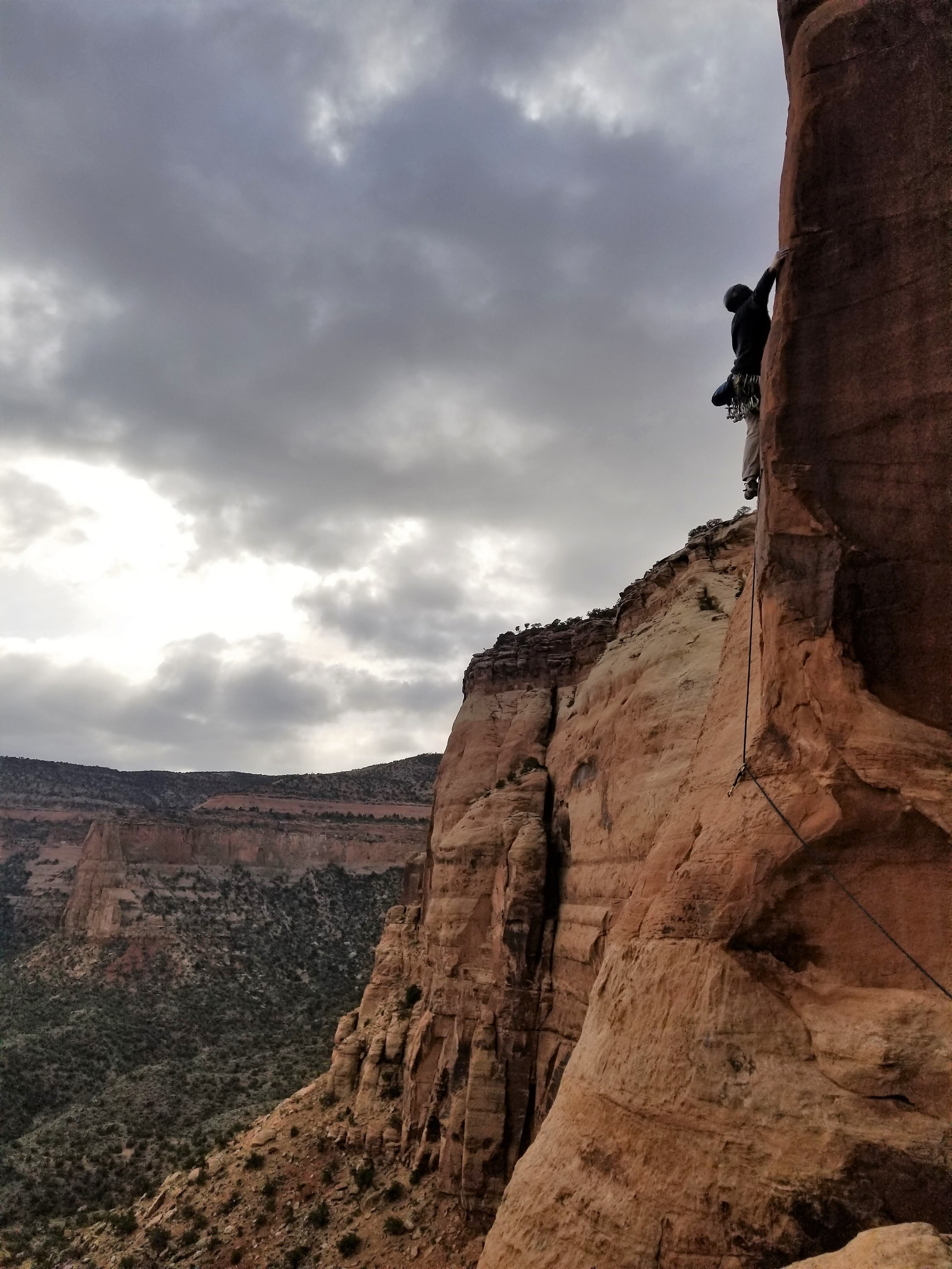
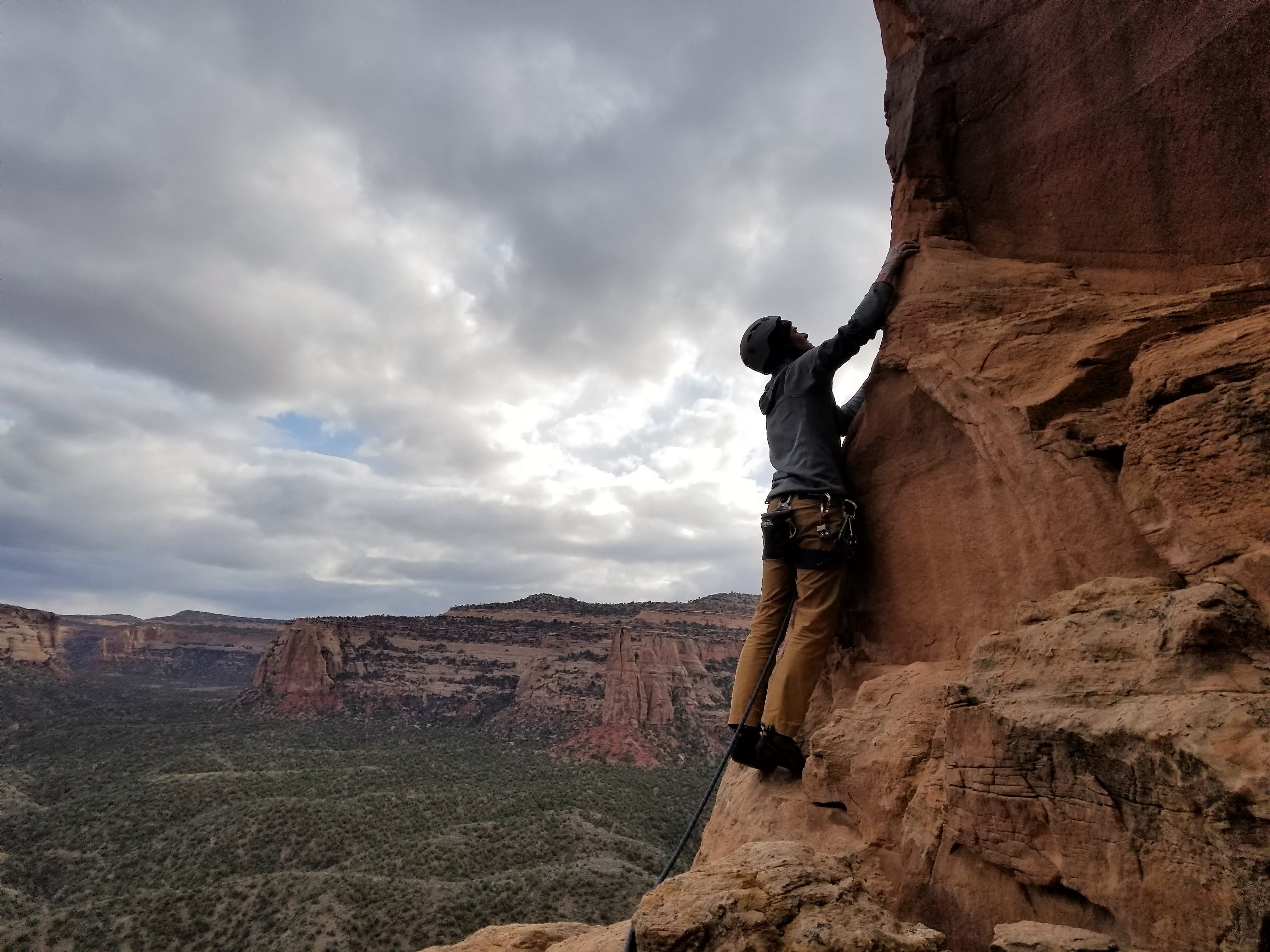
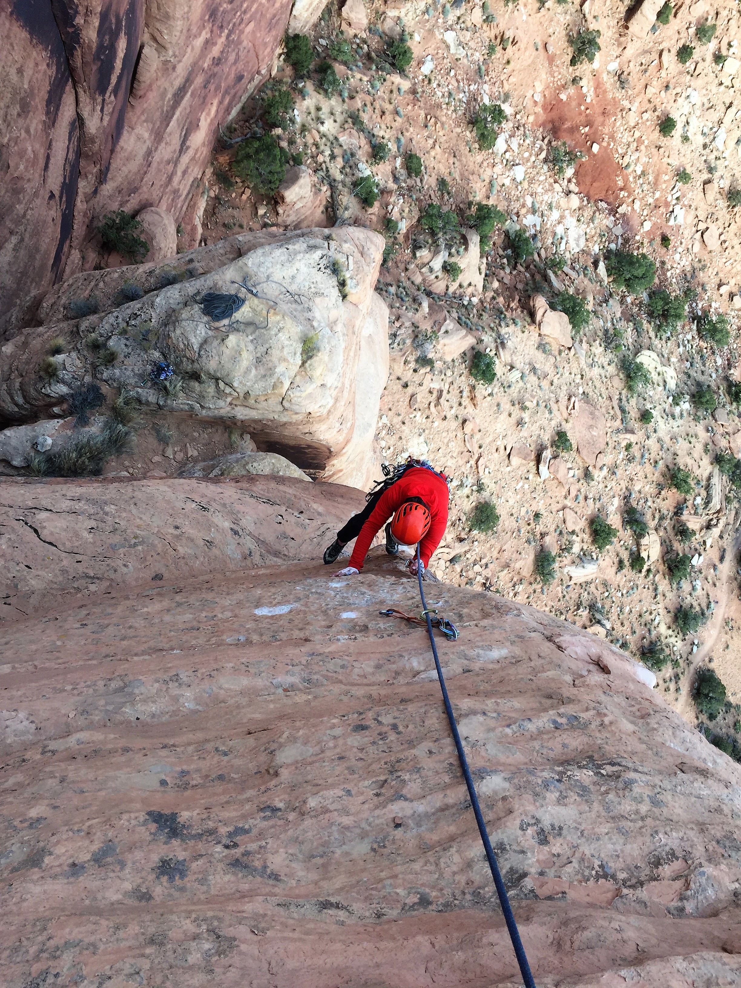
After a 4 year old birthday party at the park with Sawyer and a lost key incident in the Baldwin family, Chris and I were on our way in my Tahoe to the Capitol Creek TH late Thursday night. We arrived at the TH around 11pm and promptly got some shut-eye. Up at 2:50am, we had some awesome glazed croissants and Nescafe instant coffee courtesy of Mr. Baldwin and set out up the Capitol Ditch trail around 3:35am. I had my 60m/9.8mm rope in my pack while Chris had my alpine rack in his. We cruised to Capitol Lake in about 2 hours via headlamp under the still night sky. We took a pit stop at the shore of Capitol Lake en route up to Capitol Pass for a quick water refill and a bathroom break. It was chilly out for sure and a bit breezy, but we reached Capitol Pass maybe 7-7.5 miles in around 6:30am. The wind was really making things rather chilly and after scrambling up 400′ to the base of the initial headwall we took shelter on the leeward side among some rocks. We racked up, flaked the rope out, and had some PB&J again courtesy of Chris’s chef skills. We probably waited until 7:30am before we started climbing just to see if the wind would die down and for the outside air temperature to rise a few degrees. It was still chilly. We made our way out the ledge and I set off up the 1st pitch.

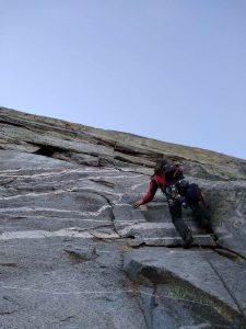
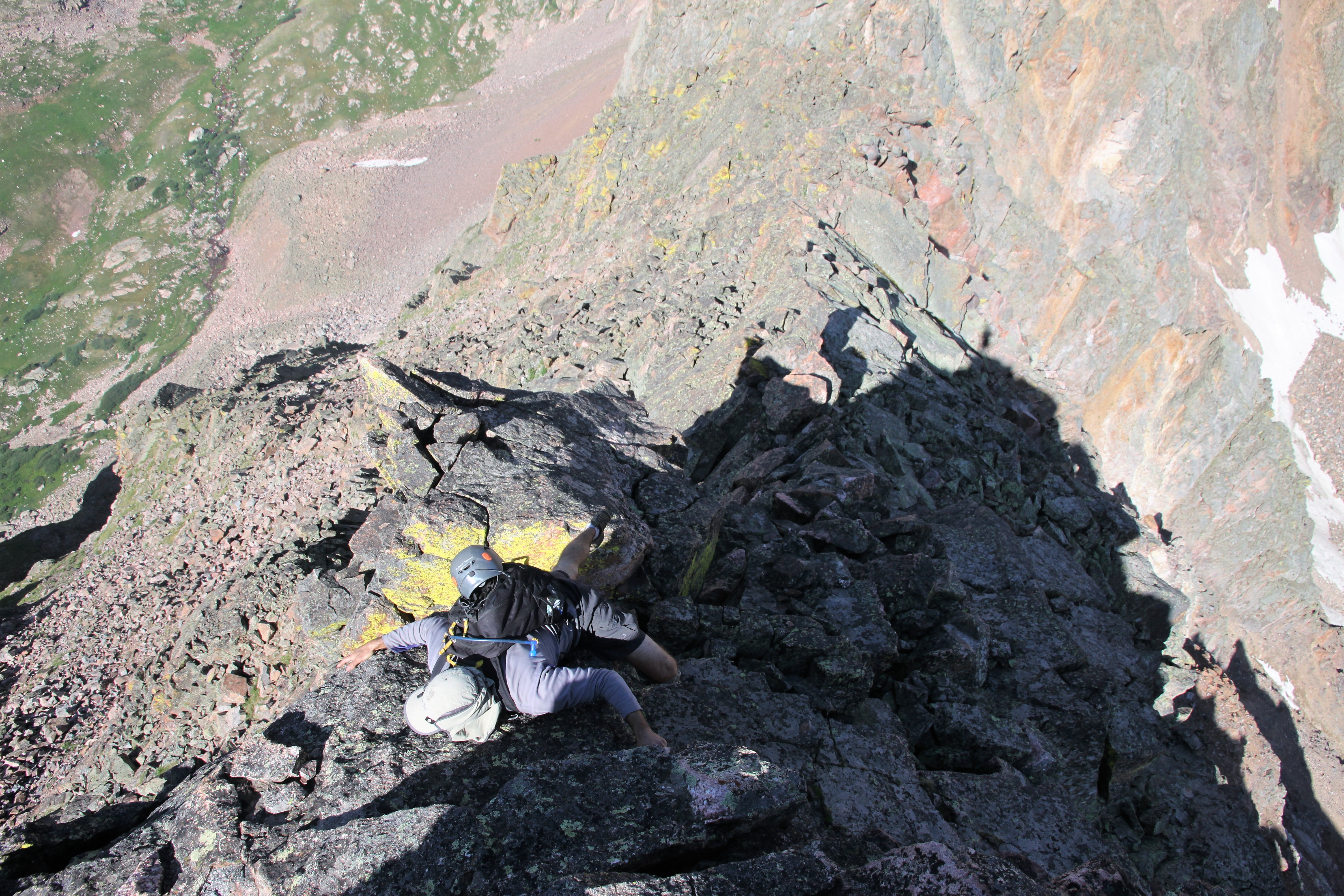
Me setting off up the 1st pitch. Photo by Chris

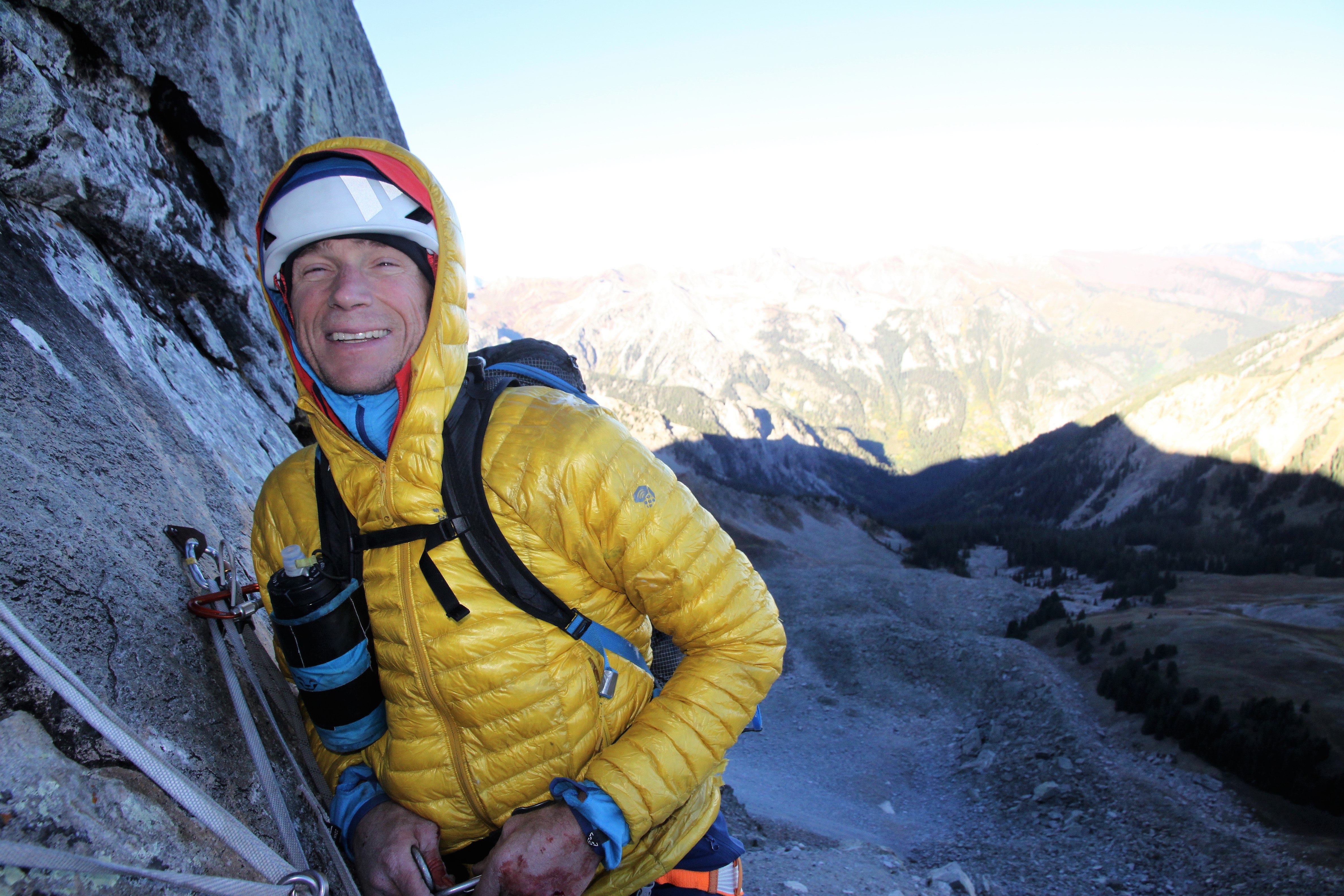
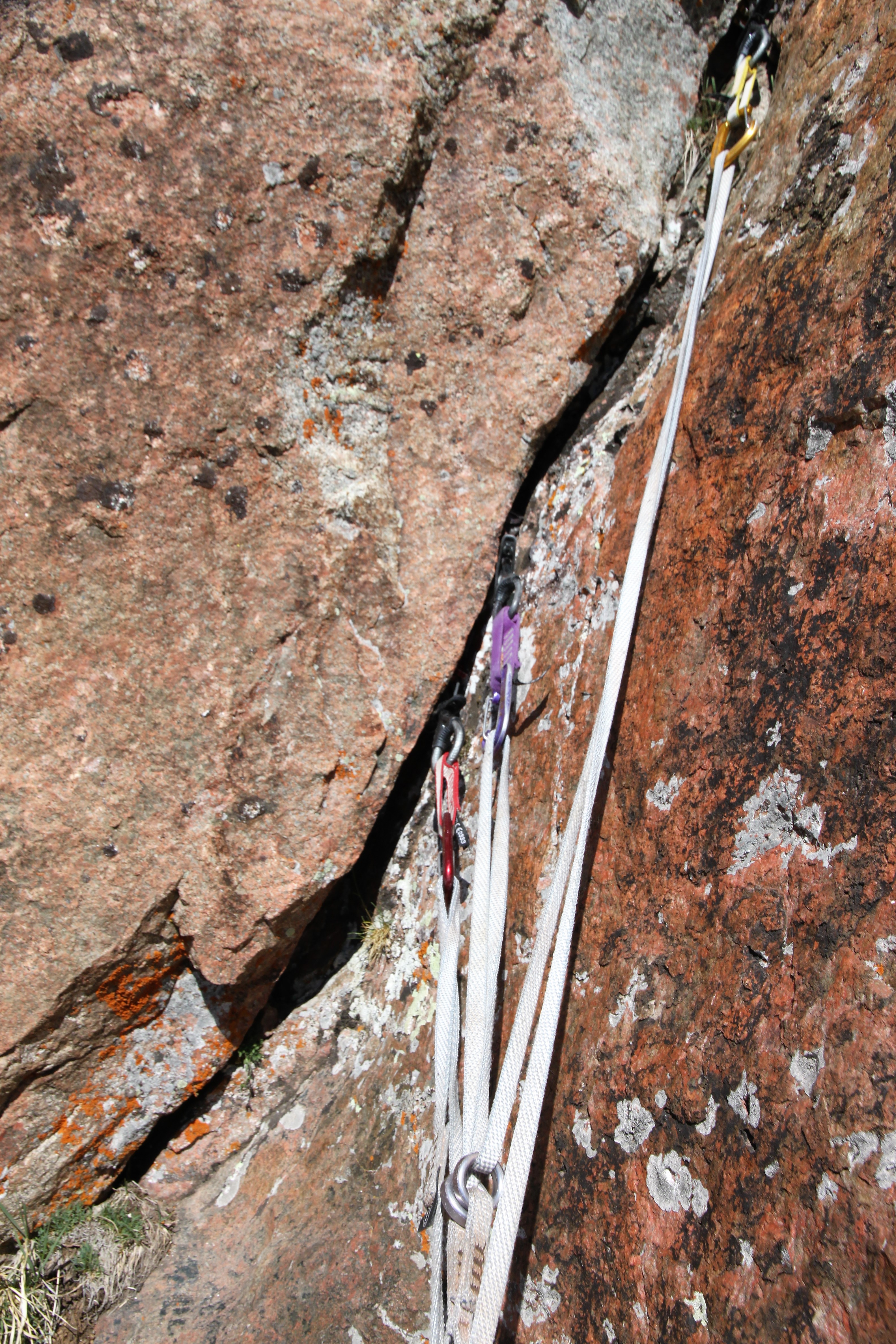
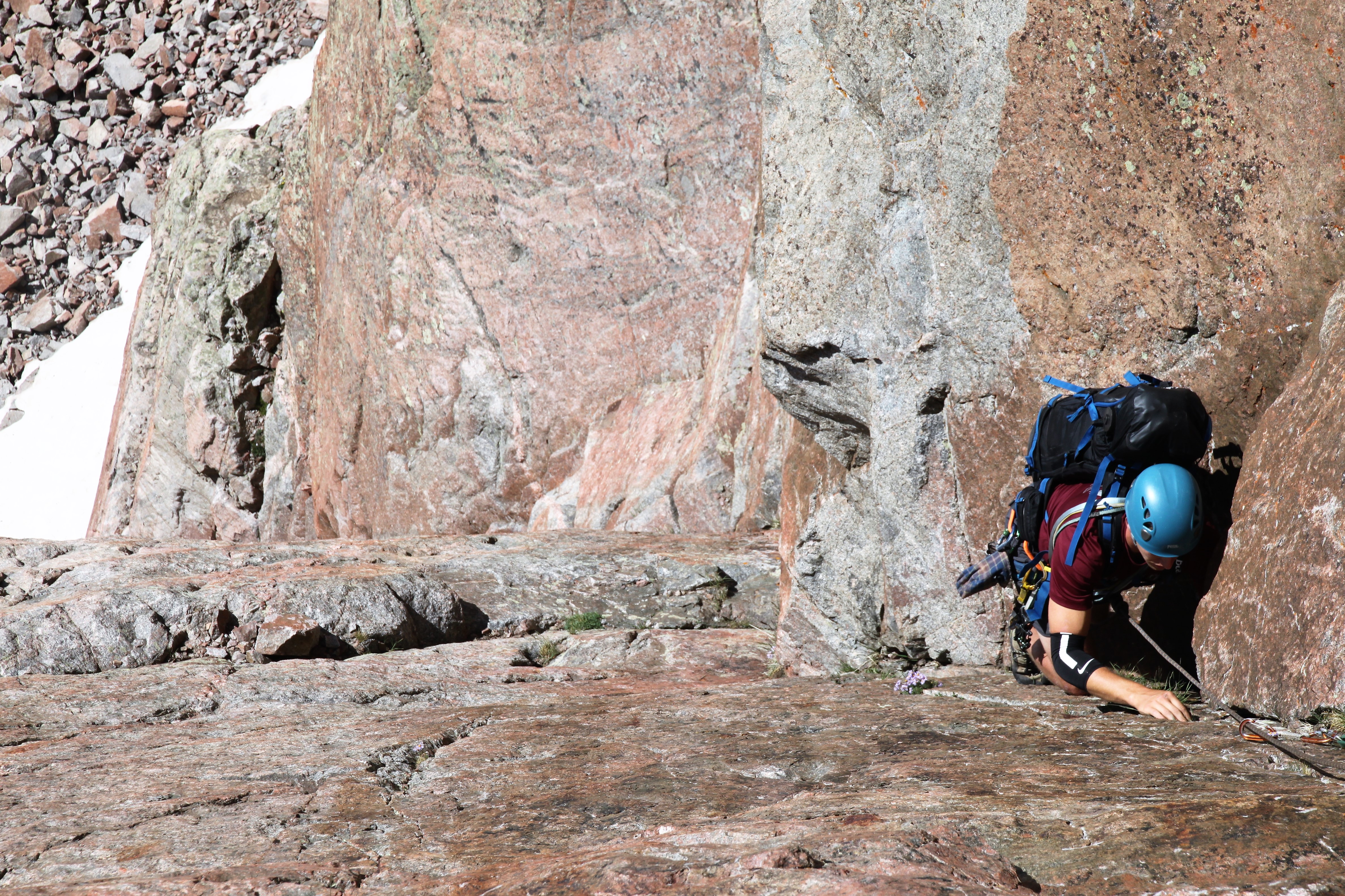
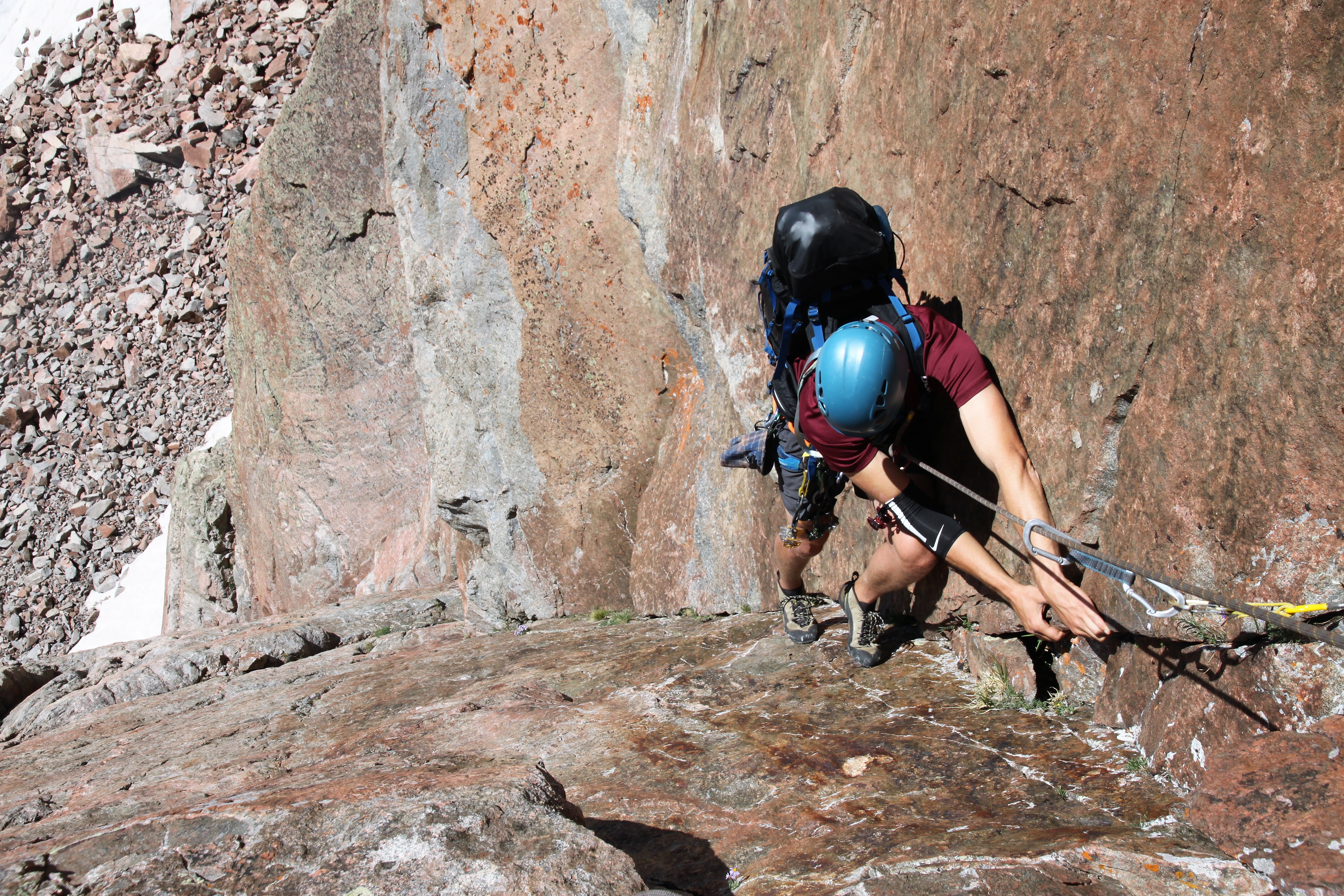
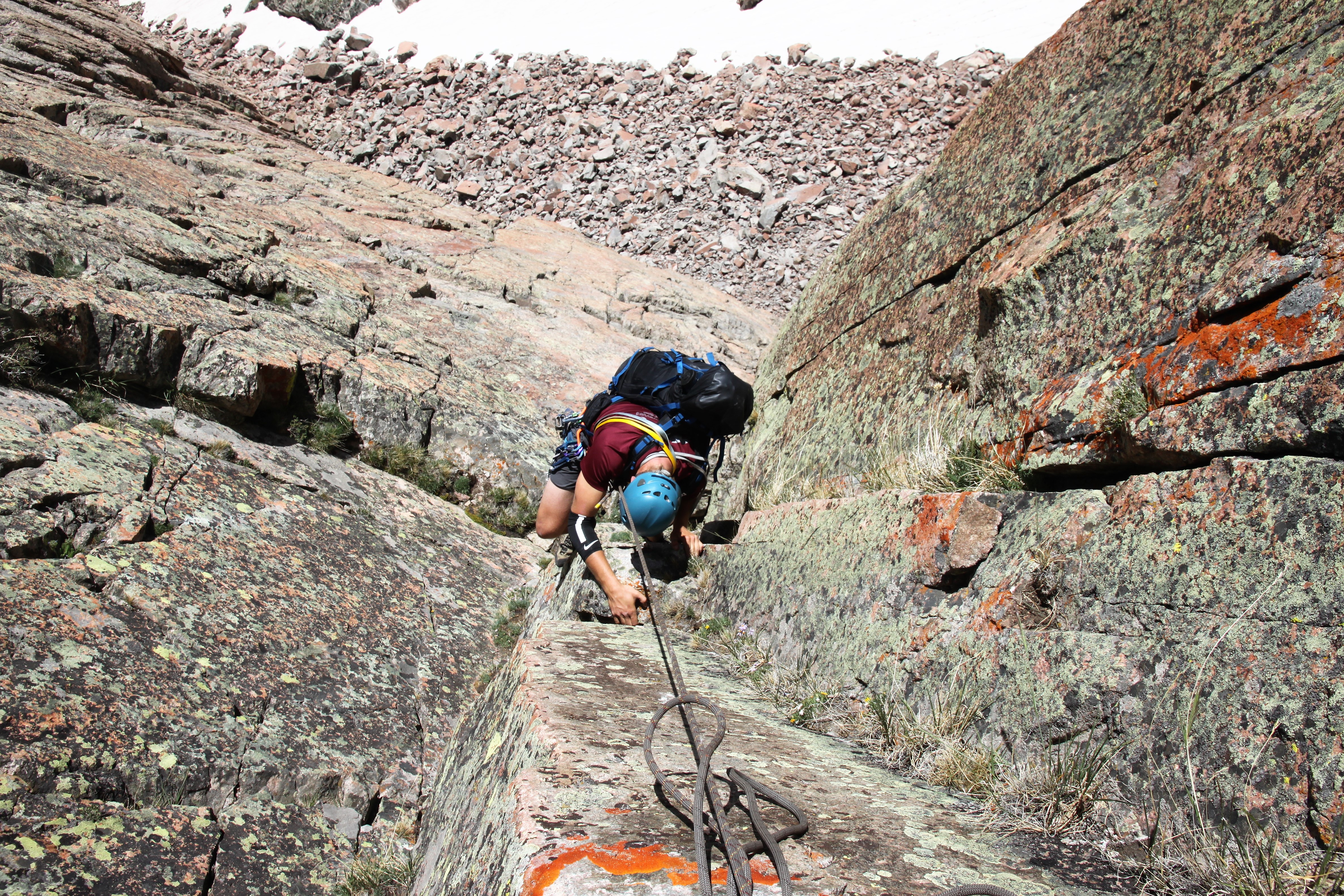
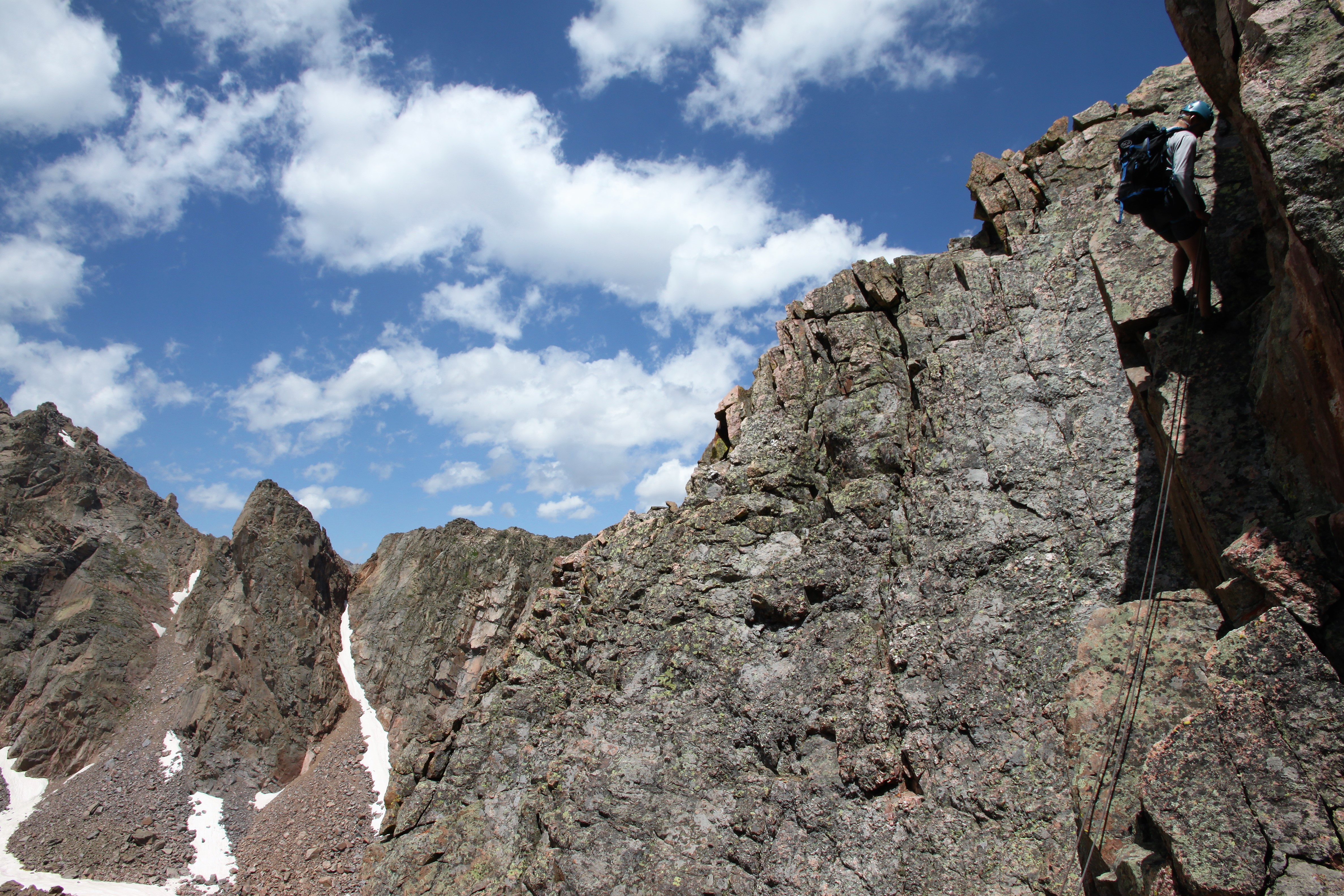
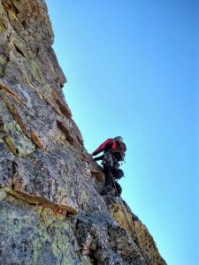
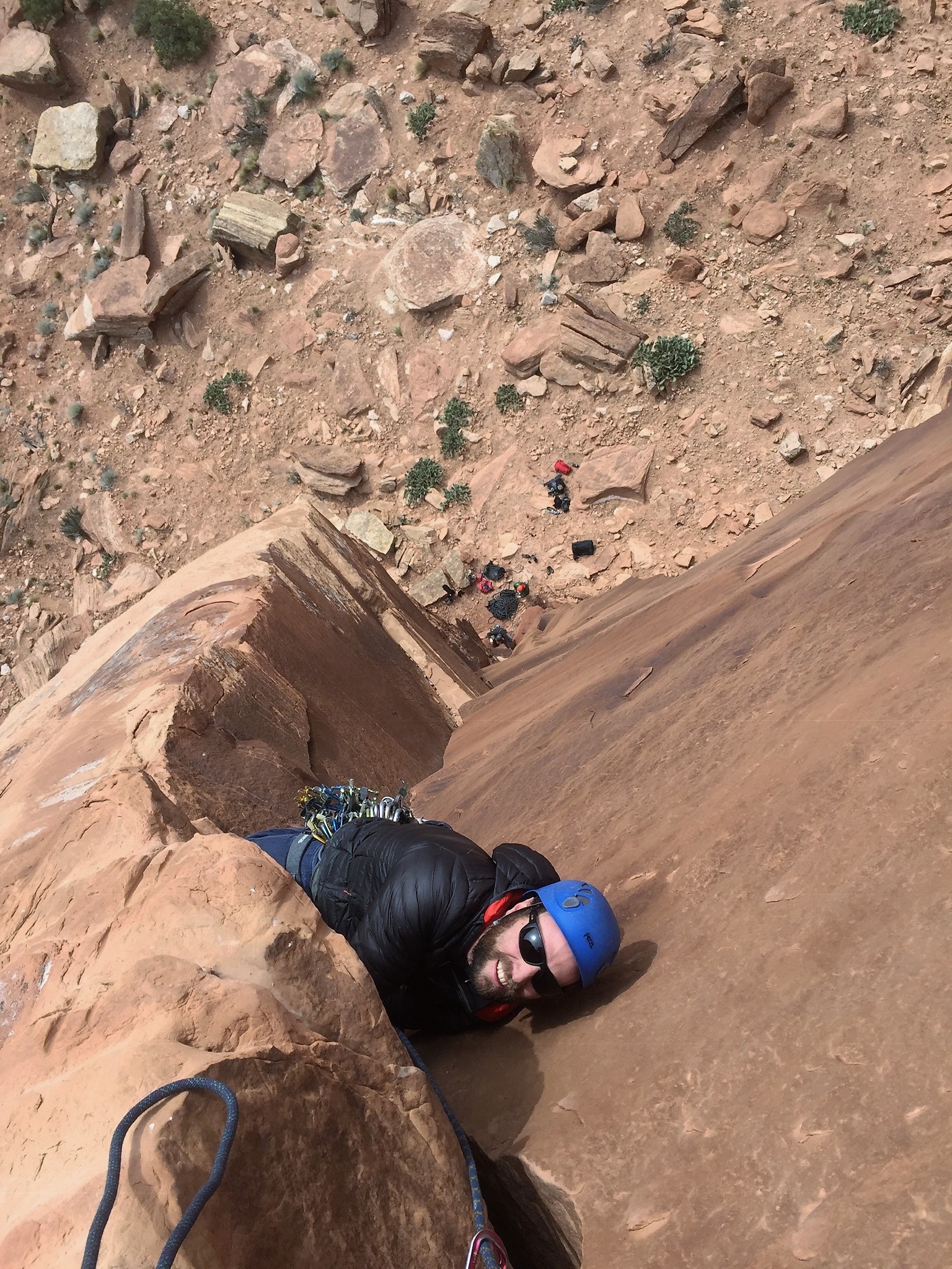
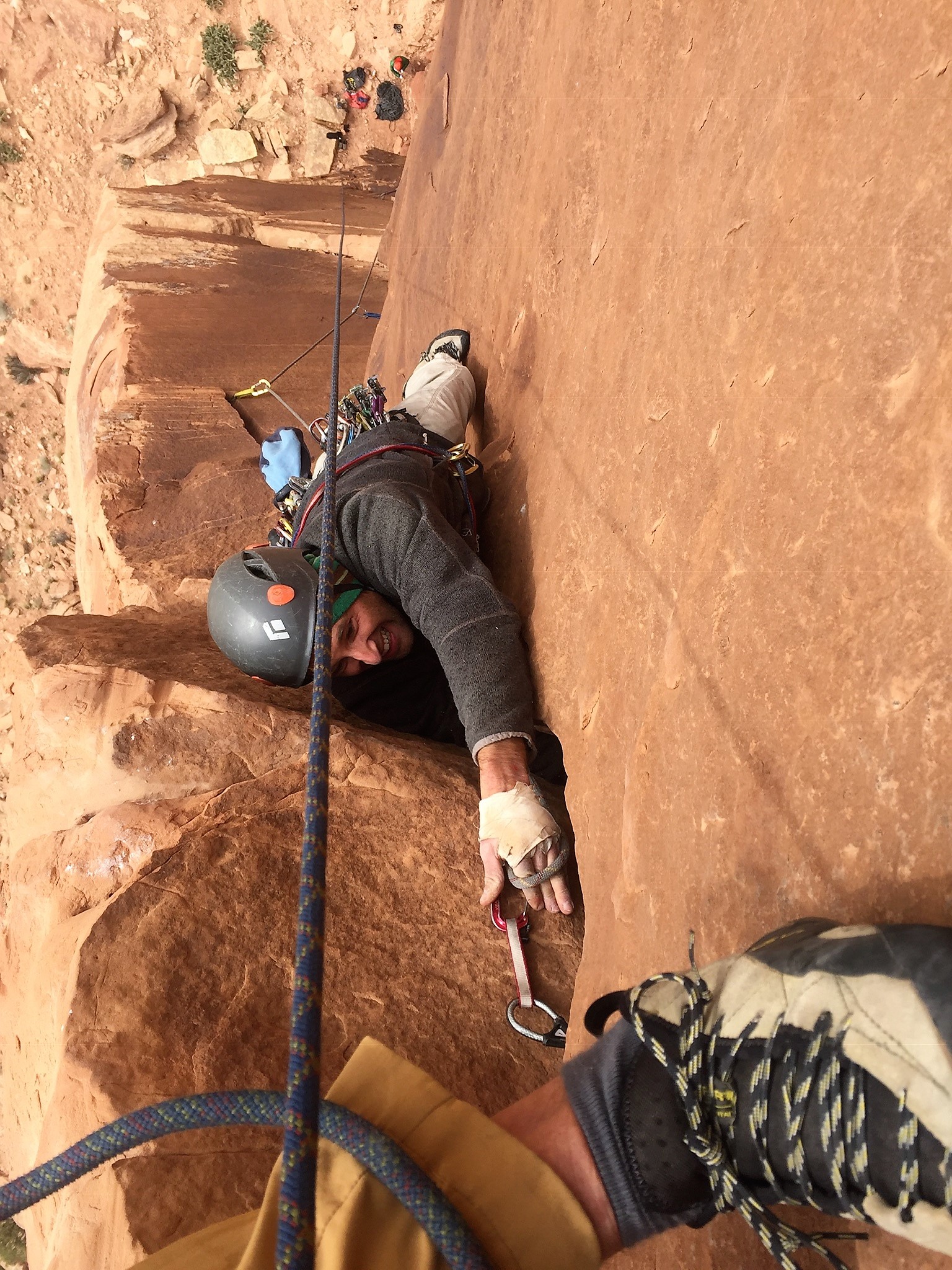
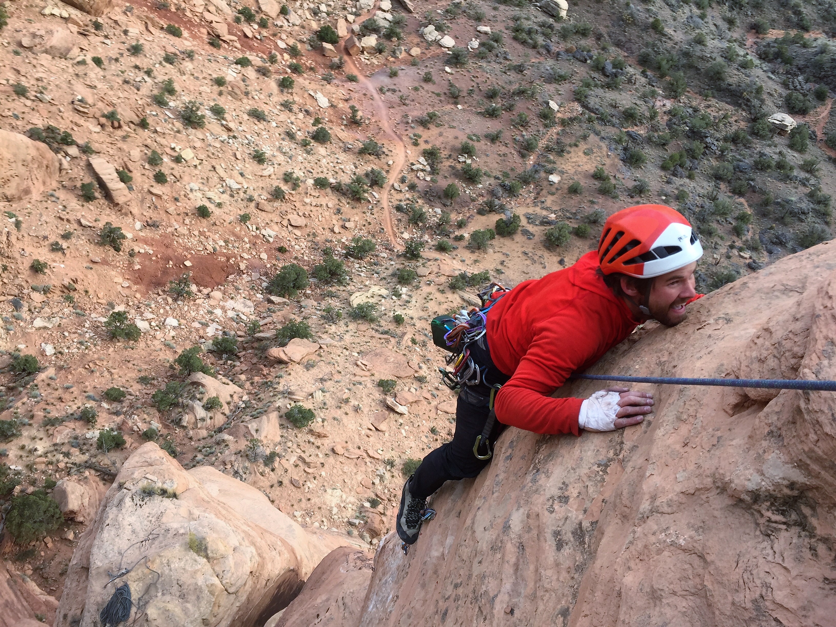
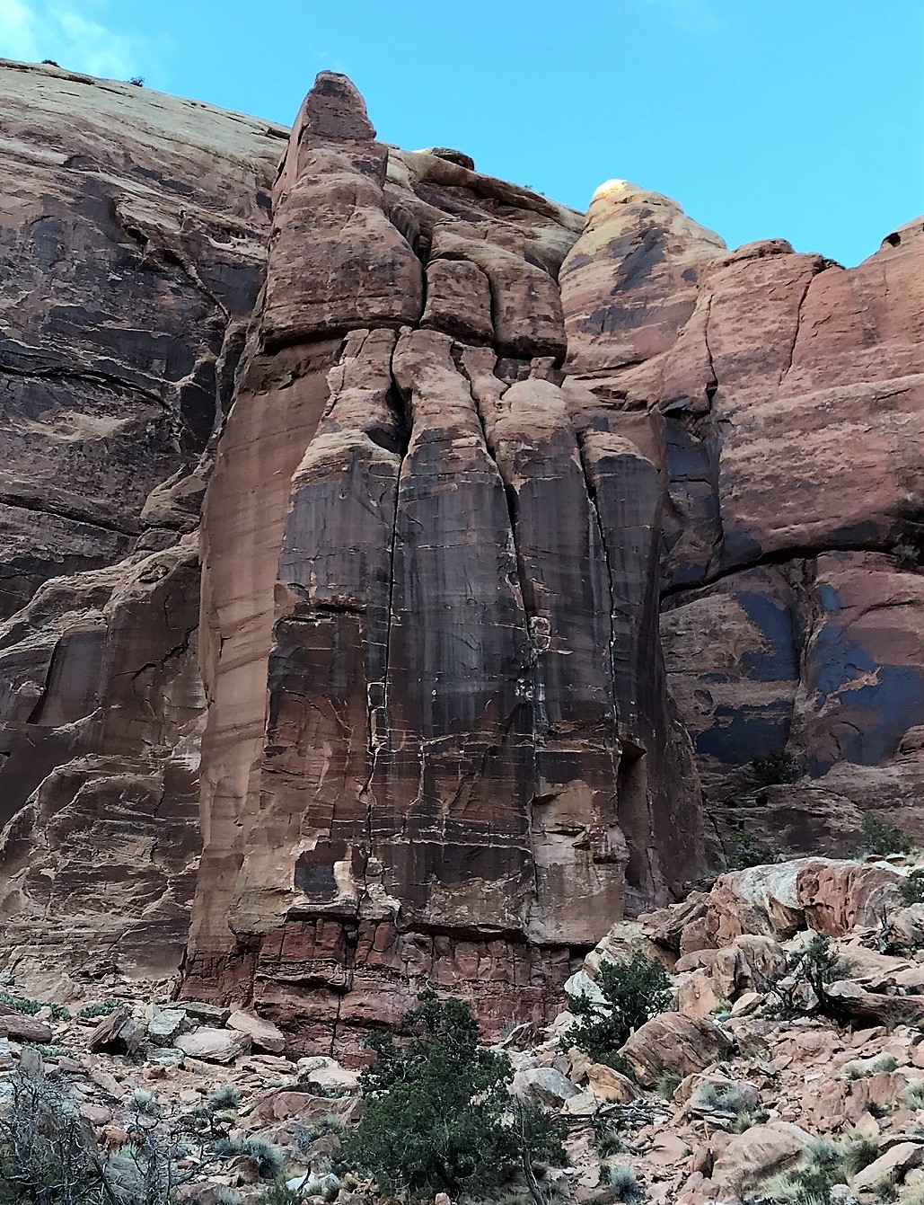
After 50′ of climbing I came to a nice stance on a ledge and the old pin I bailed off of 3 years ago when the route was essentially a waterfall. I slung the pin and moved off across the wide horizontal crack, which I basically laid back and really ran it out as the crack was too large for any gear I had with me. I then plugged a #3 cam and moved vertically into the crux “off-finger’ crack which went for 30′ to the anchors. This remaining crux felt harder than 5.9 to me. I’d give it a 5.9+. Usually, an “off-finger” crack is not 5.9 and the cold and wind only further sandbagged the rating. Nonetheless, there are a few facial features for the toes especially on the left side of the crack, which helped, but it was so slick given how chilly it was out. There is a small “thin hands” pod that is a nice hold, but other than that its poor face features for your feet and finger holds. I led it cleanly to the anchors (only one pin, really) and had a good stance where I set up my self-equalizing anchor with the help of two #2 cams. I shouted down to Chris and he was ready to climb. He really really did well having not much experience at this. The crux finger crack section gave him pause and a few issues, but he pulled the moved and made it to me just fine. He was a bit frustrated because he hung on the rope thinking he wasn’t ready for this, but I did my best to settle the good lad down by saying that the pitch was a lot tougher than the 5.9 rating.

Chris down low on the 1st 5.9 pitch

Chris making the tricky moves before the final rest stance below the finger crack

Chris in the thick of it!

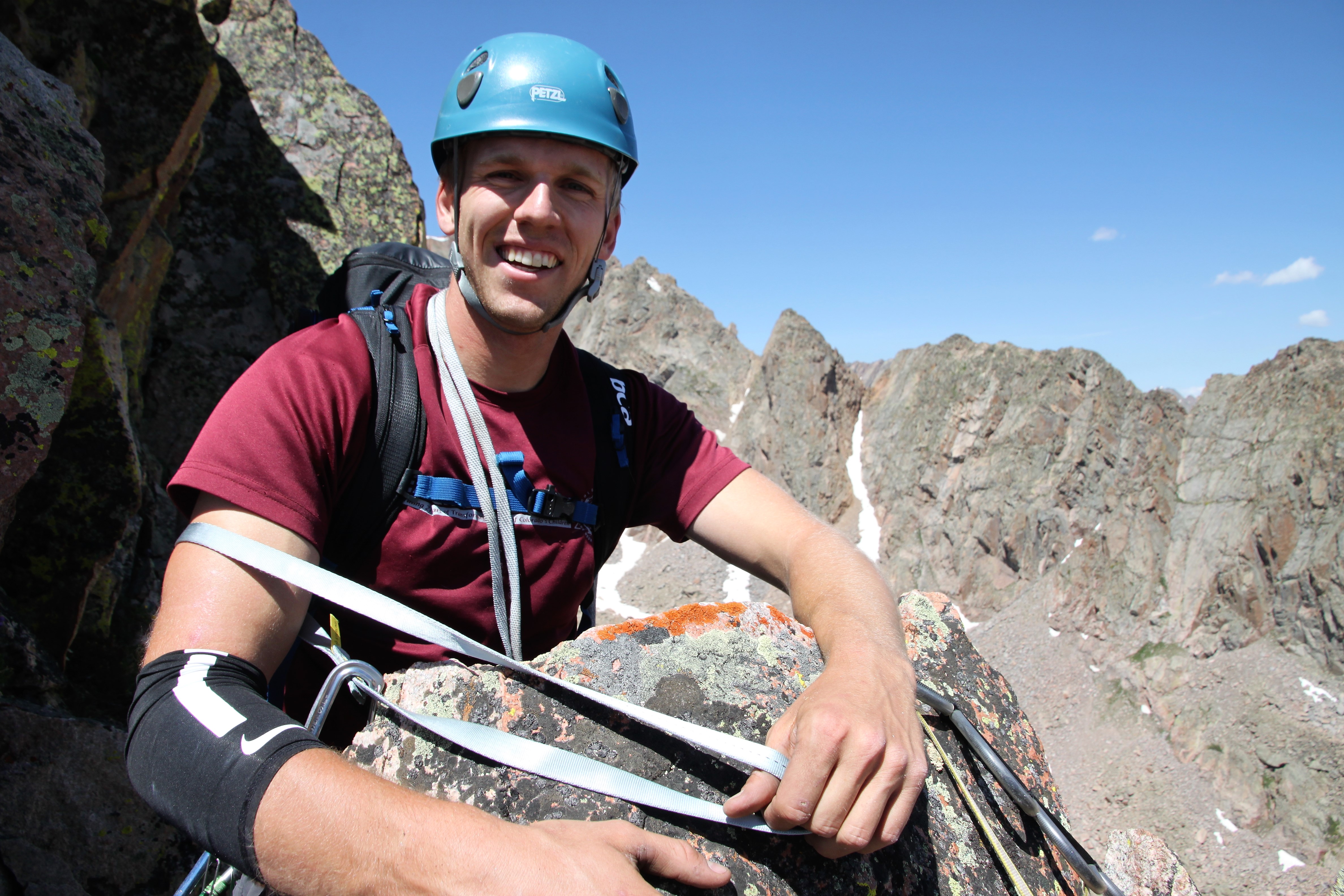
Chris stoked to be with me at the pitch 1 anchor

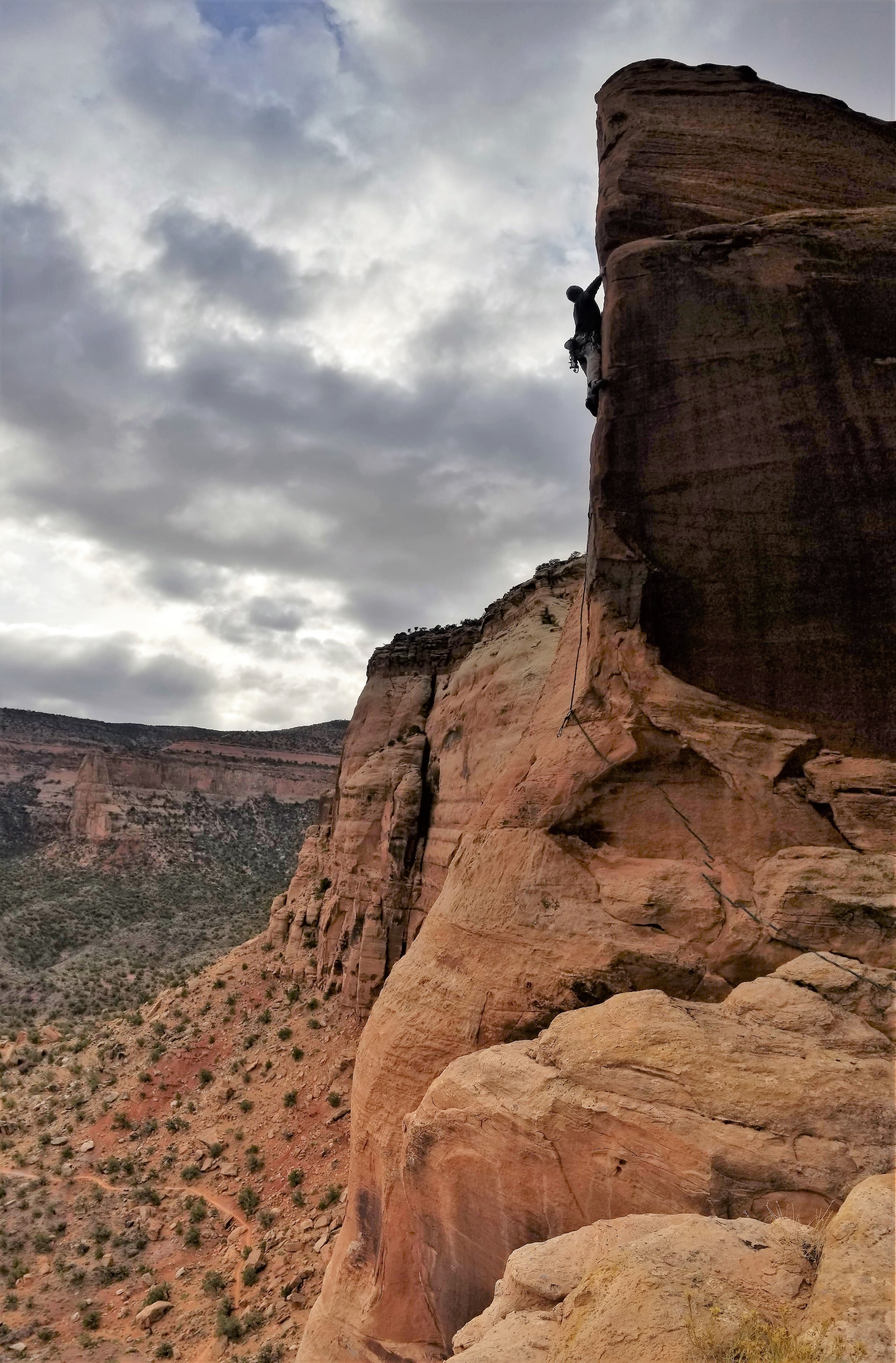
I gathered my gear and slings from Chris, he put me on belay, and I set off up pitch 2 (5.8). It was a fun 5.8 move to get into the chimney and then it was cruiser climbing for a good 90′ to where the angle eased off and I set up an anchor to bring Chris up.

Chris climbing pitch 2

Nearing the top

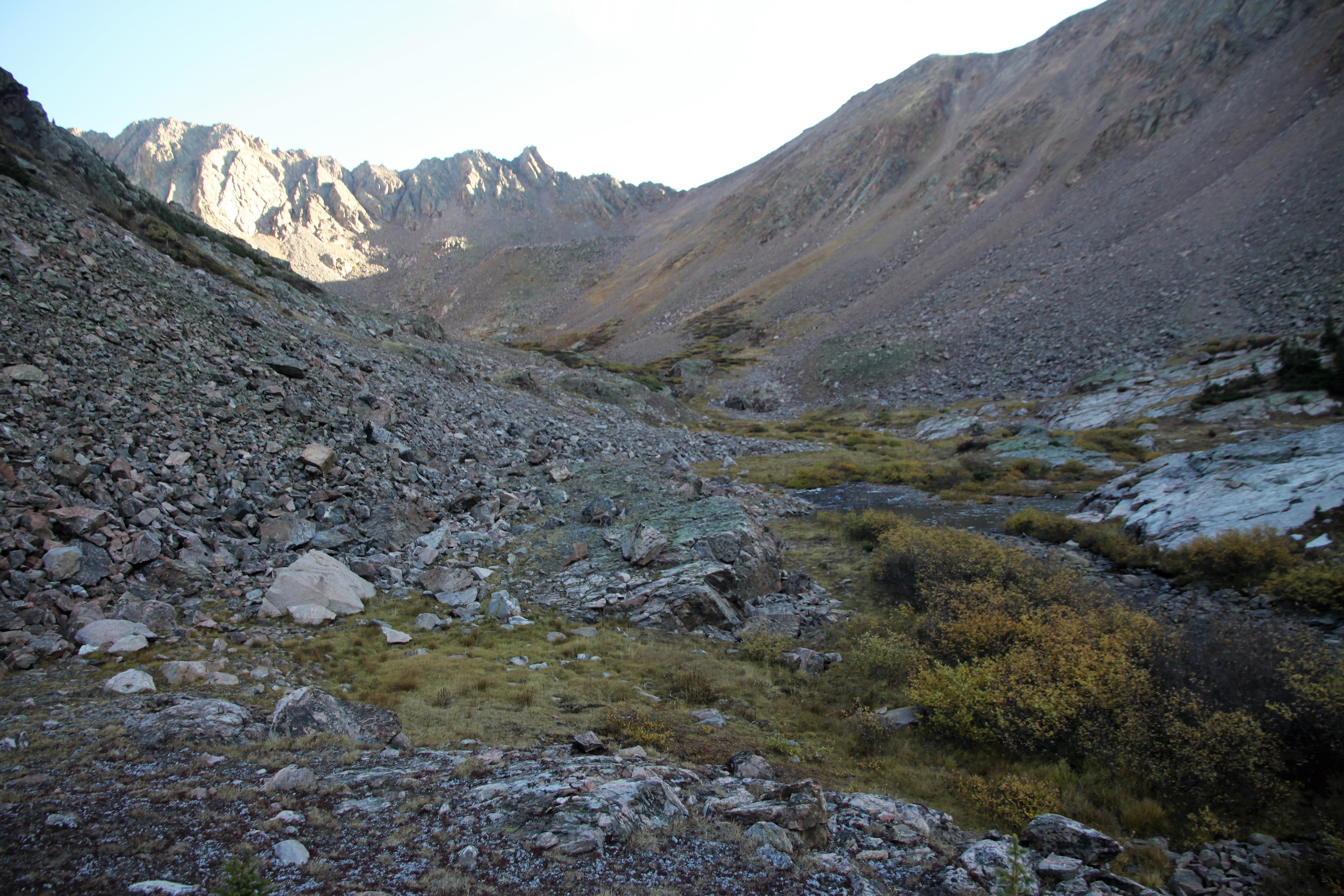
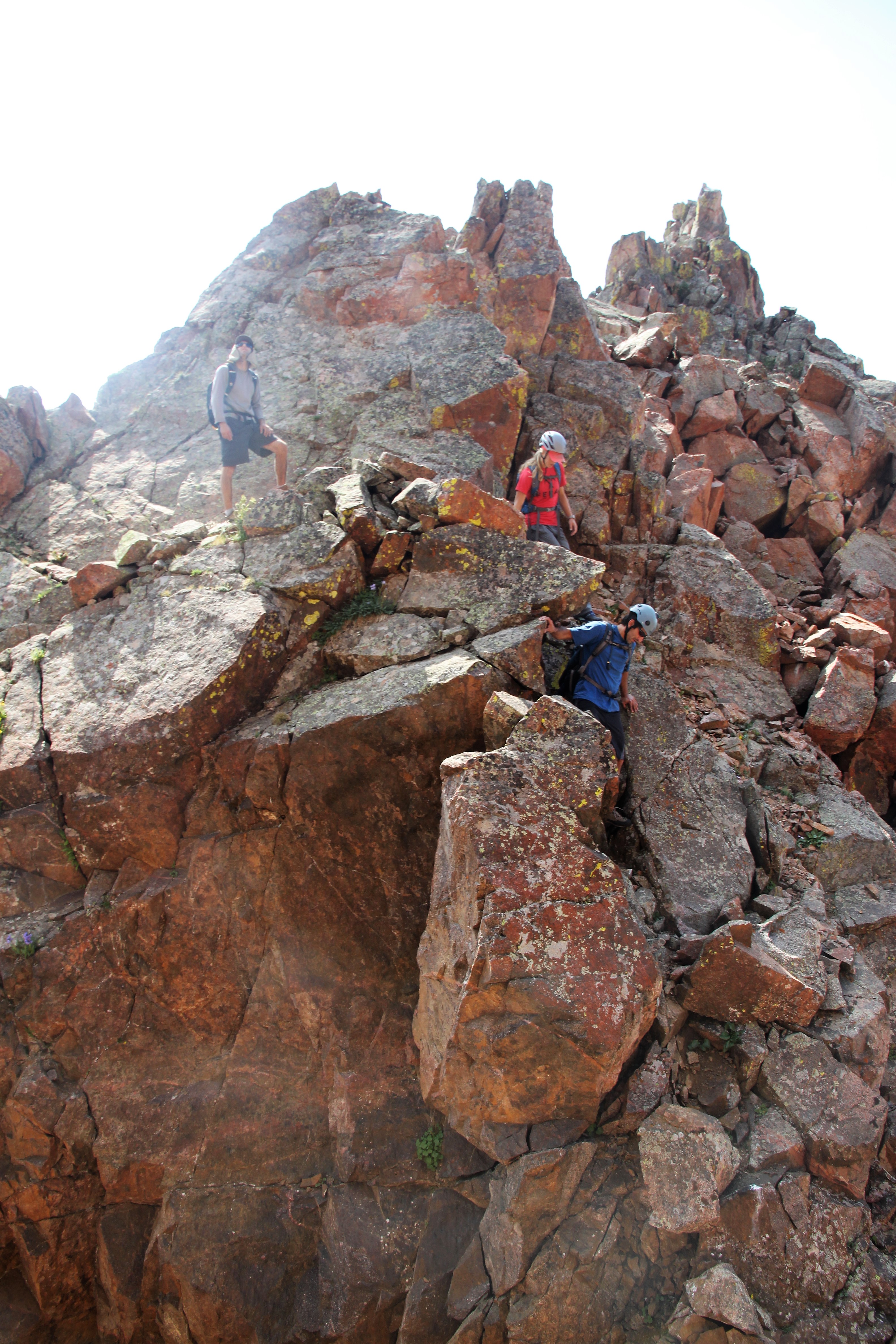
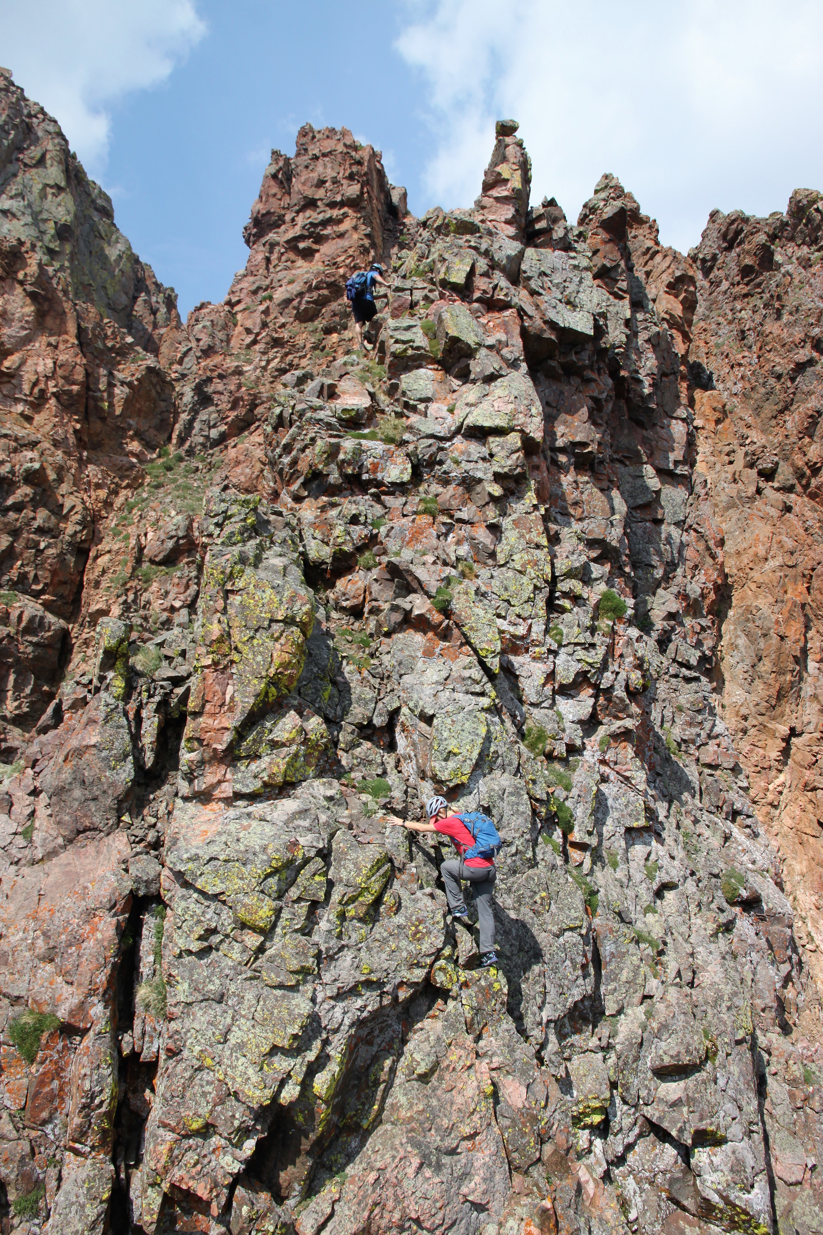
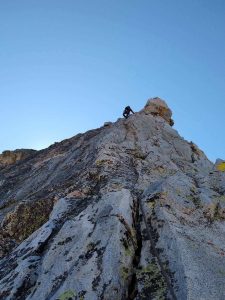
I think Chris felt much better about things after pitch 2. He goes “see Brandon, now that’s much more in my wheel-house.” He is a funny one. Anyway, we stowed the rope in Chris’ pack and set off up the super fun and enjoyable class 4 scrambling for 600′ up and around to the right of the base of Unicorn Spire.

Good scrambling!

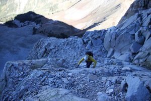
Me making my way on the 4th class rock. Photo by Chris

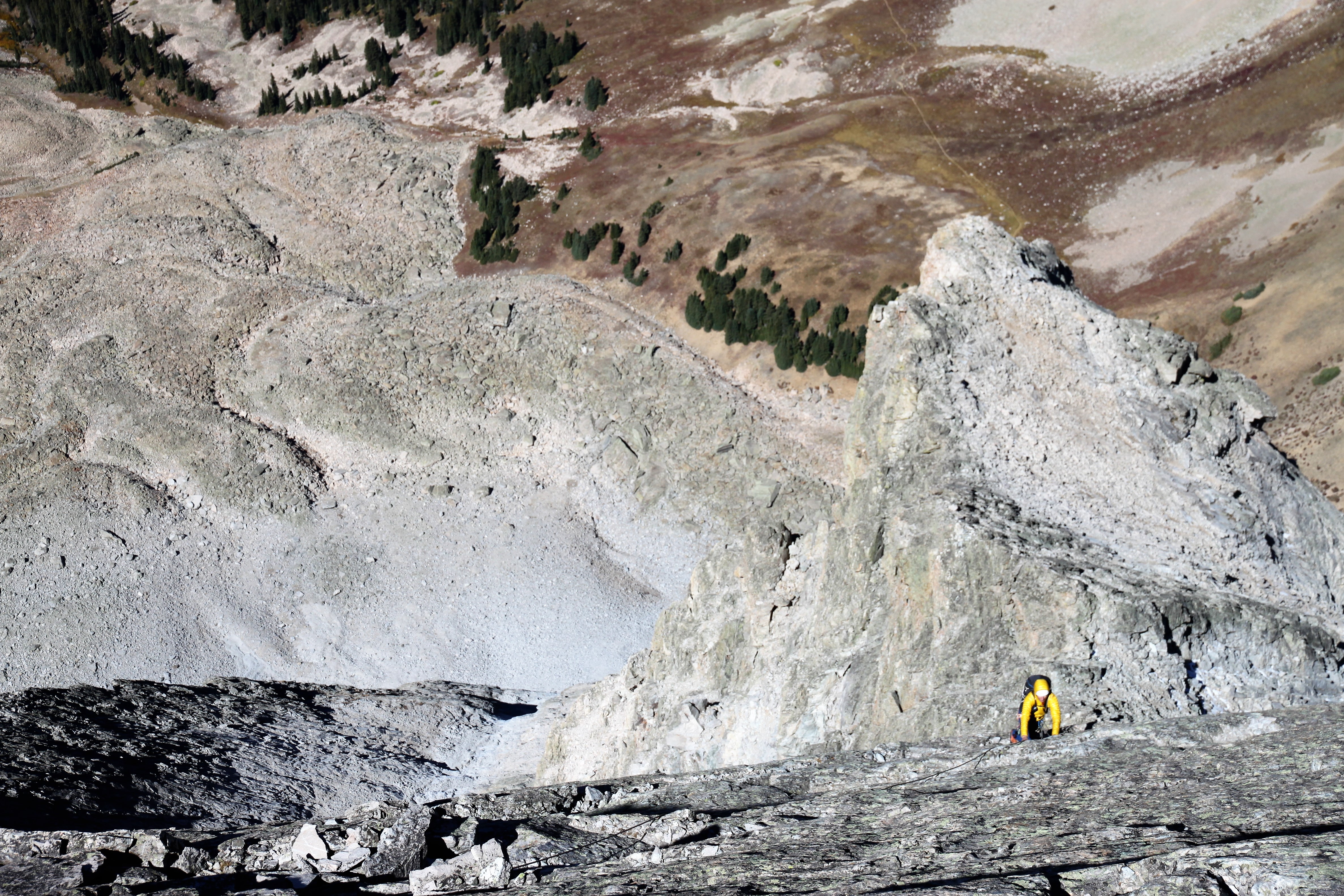
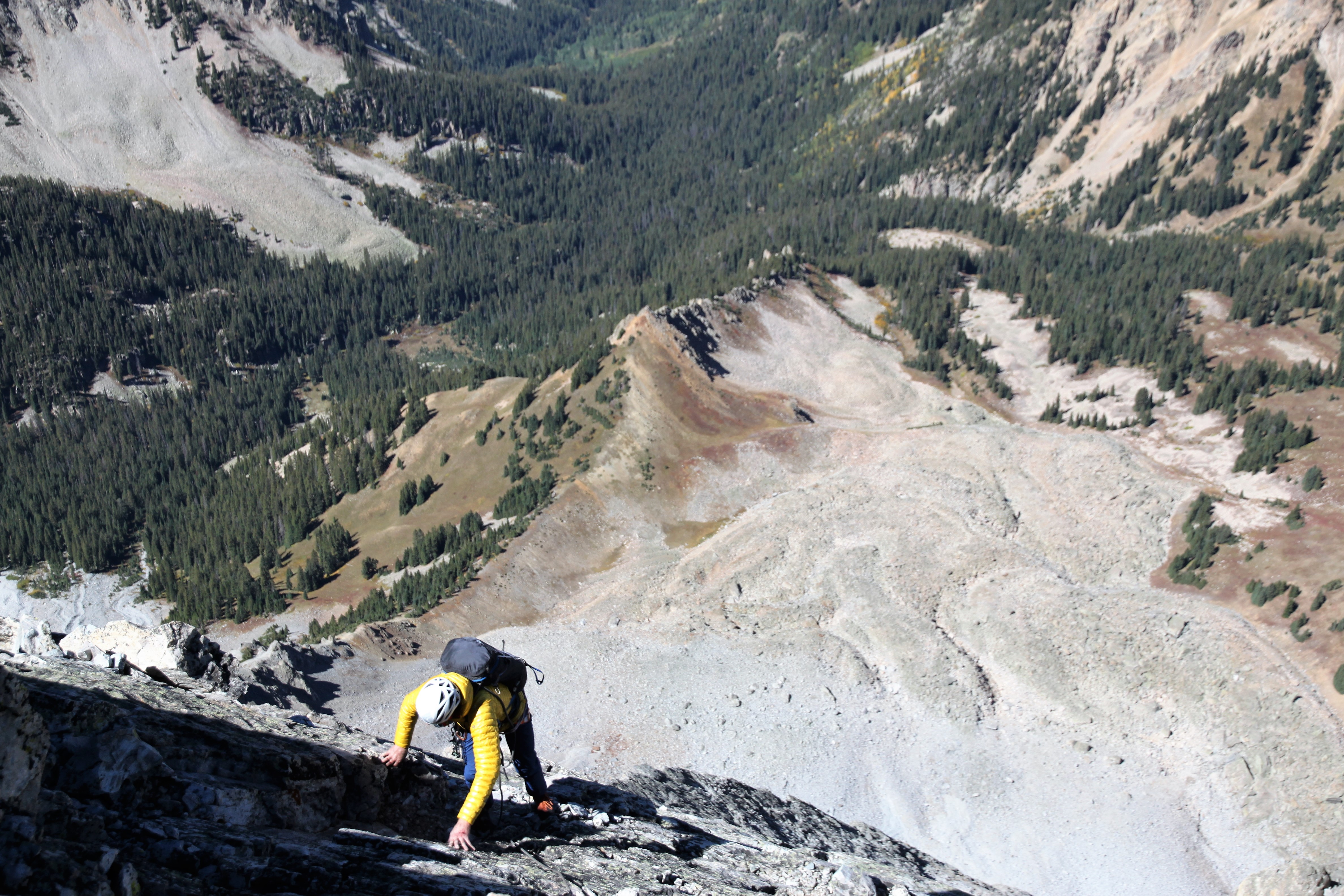
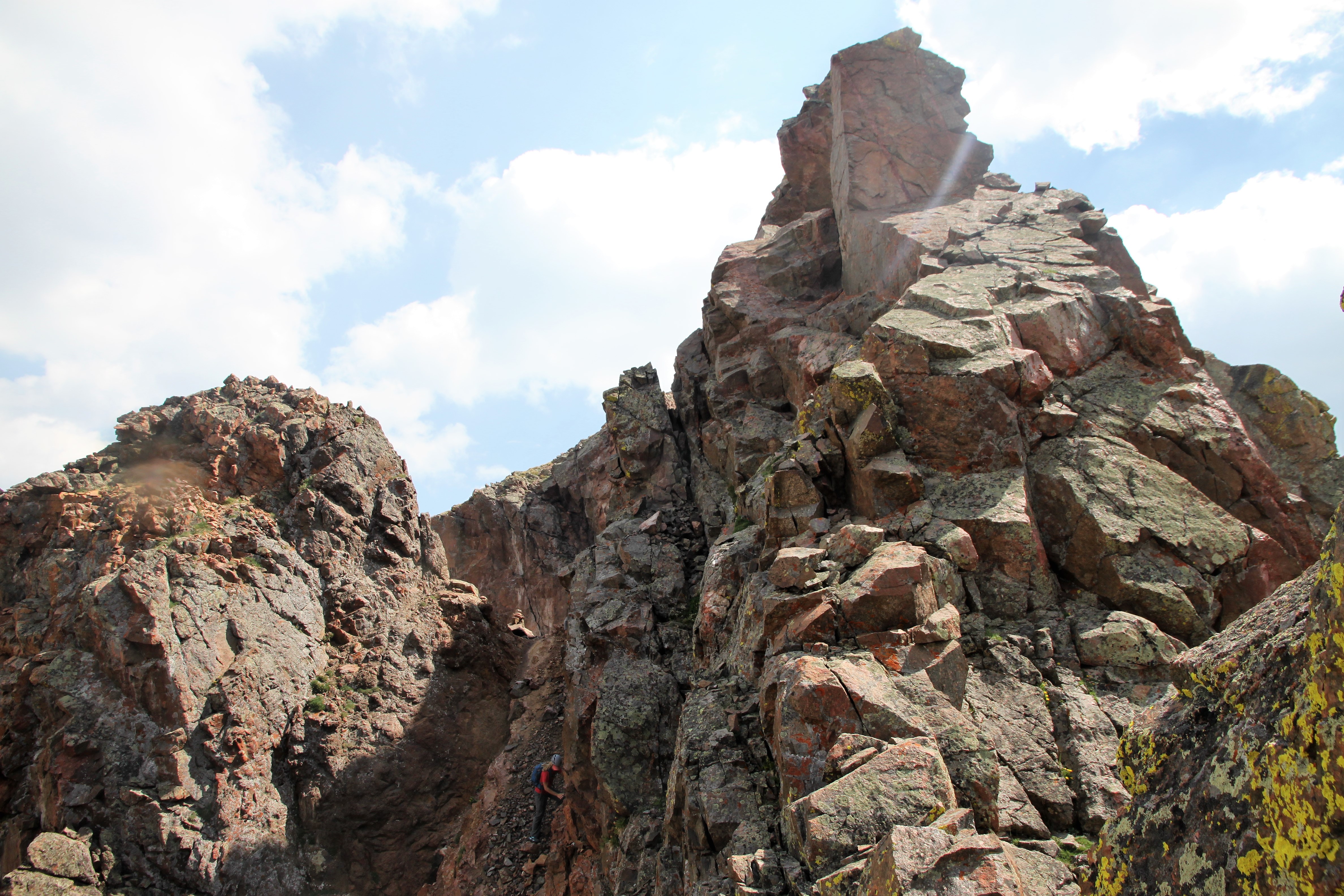
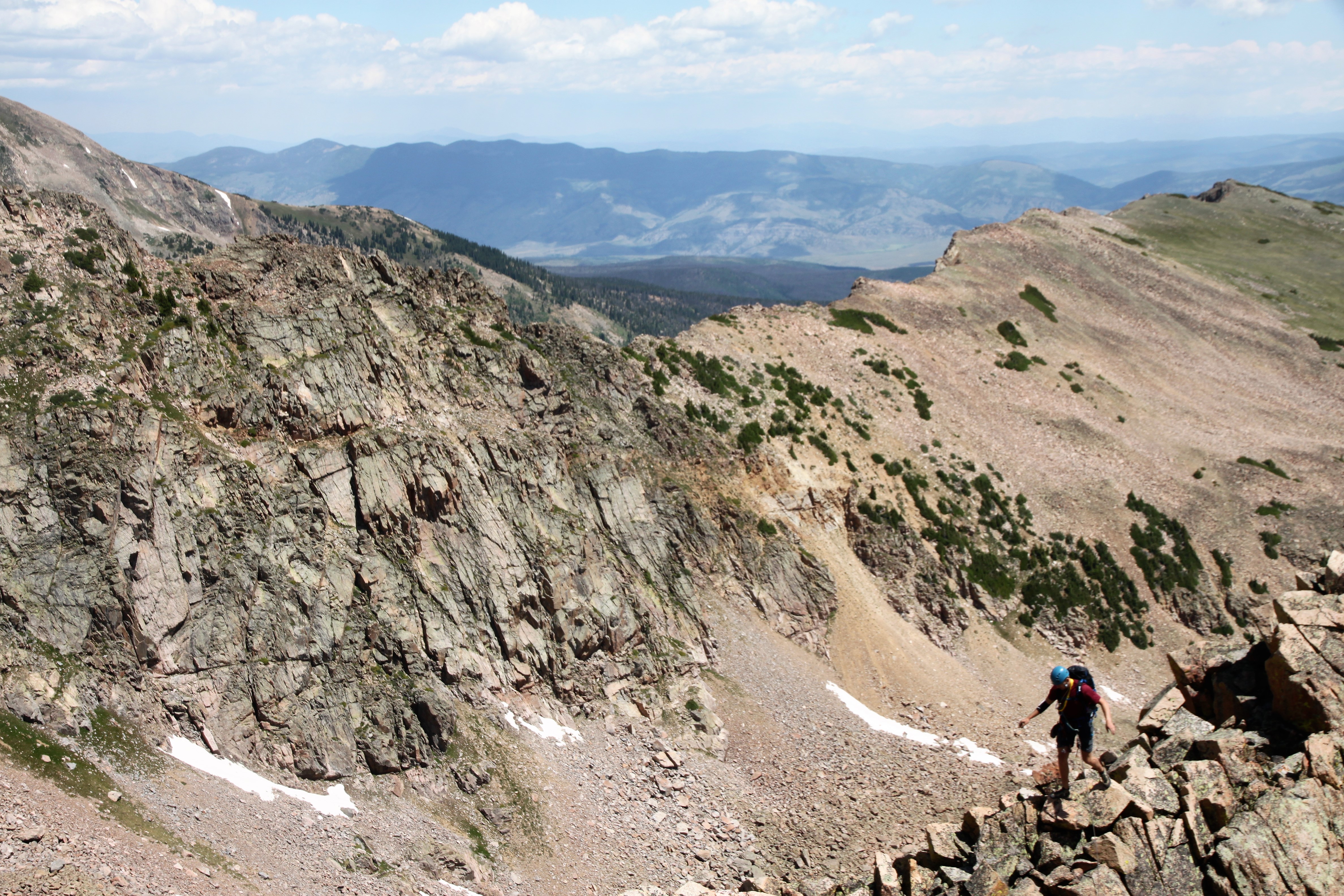
Chris moving around on looser rock to the right (west) of Unicorn Spire

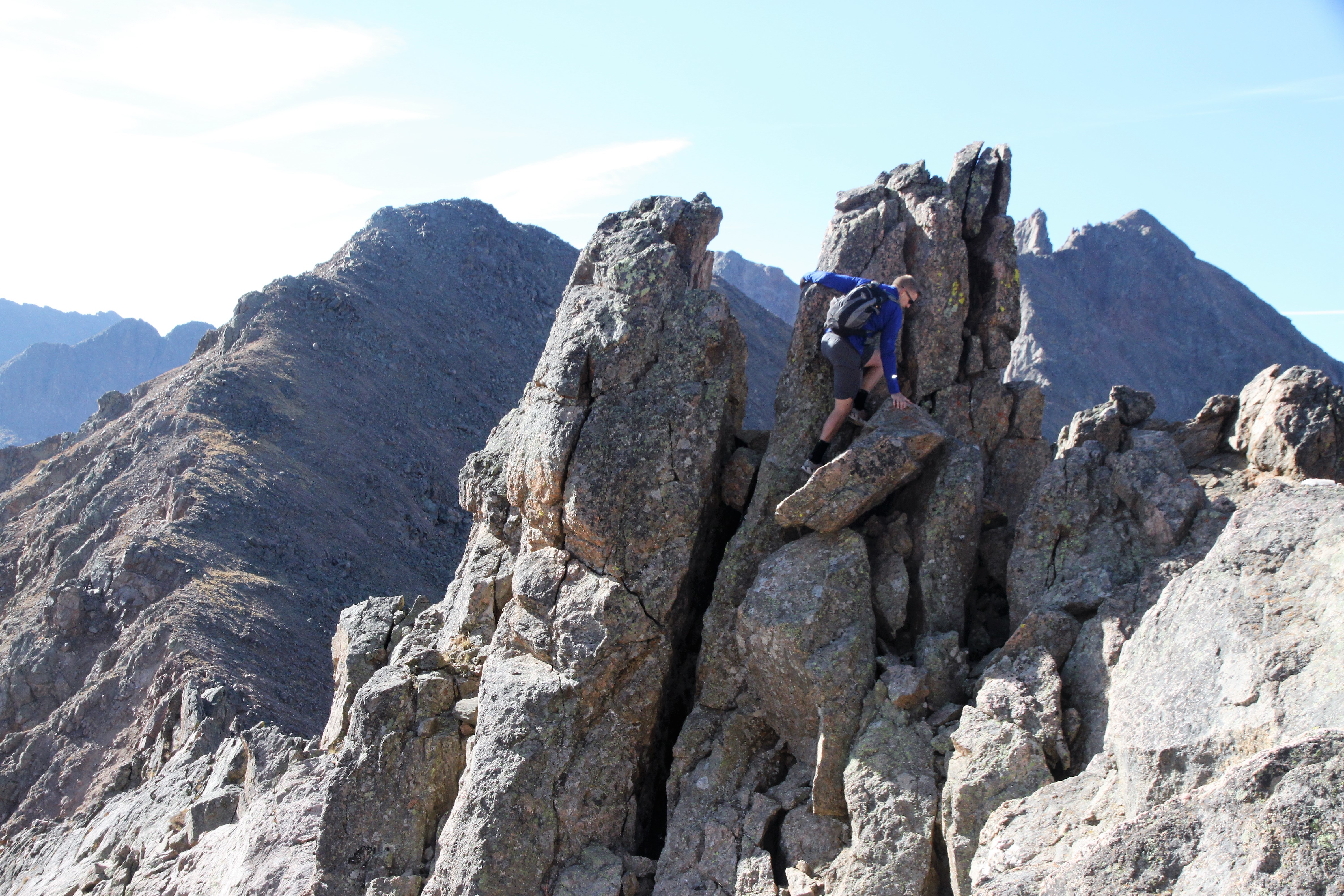
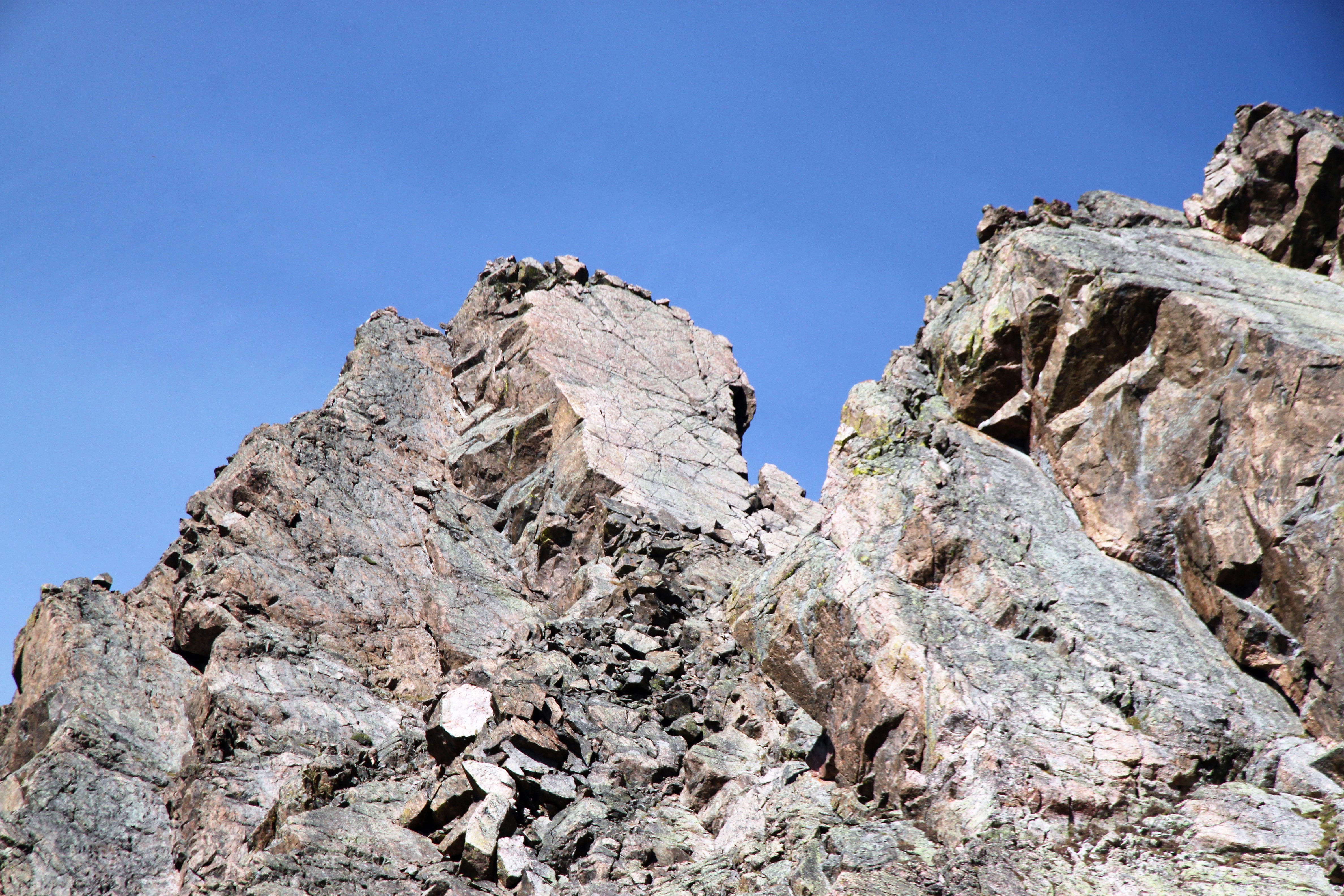
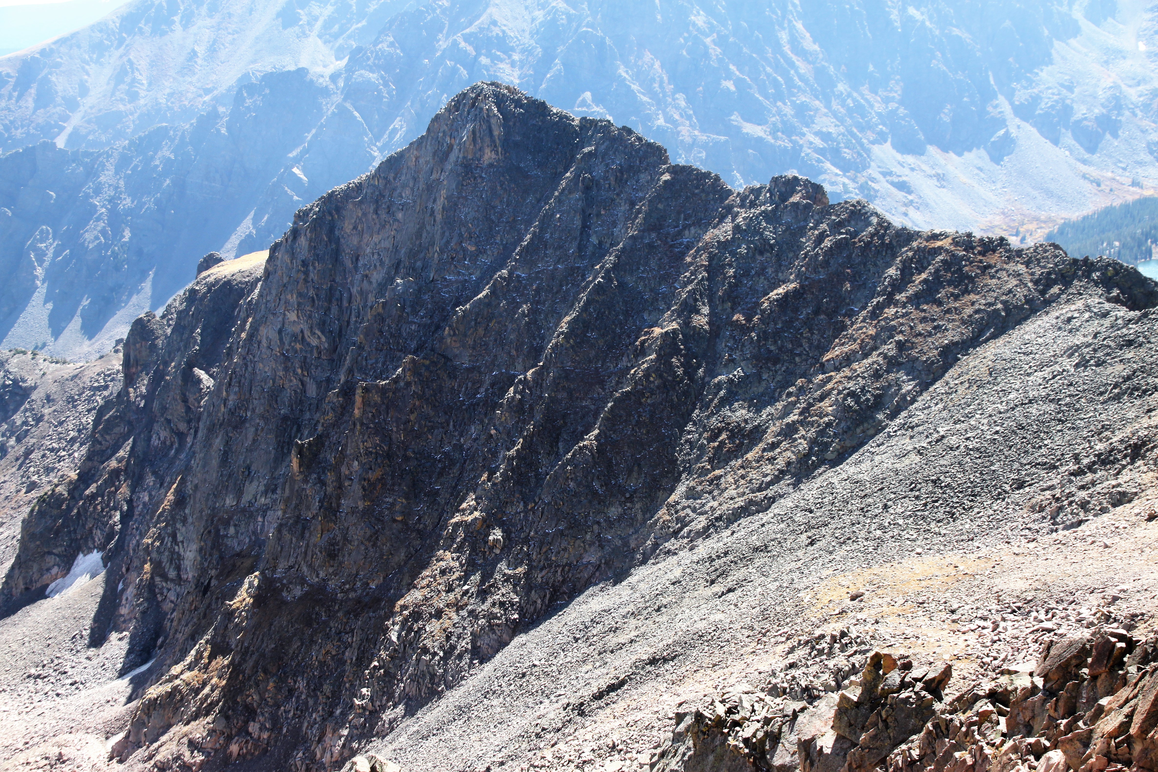
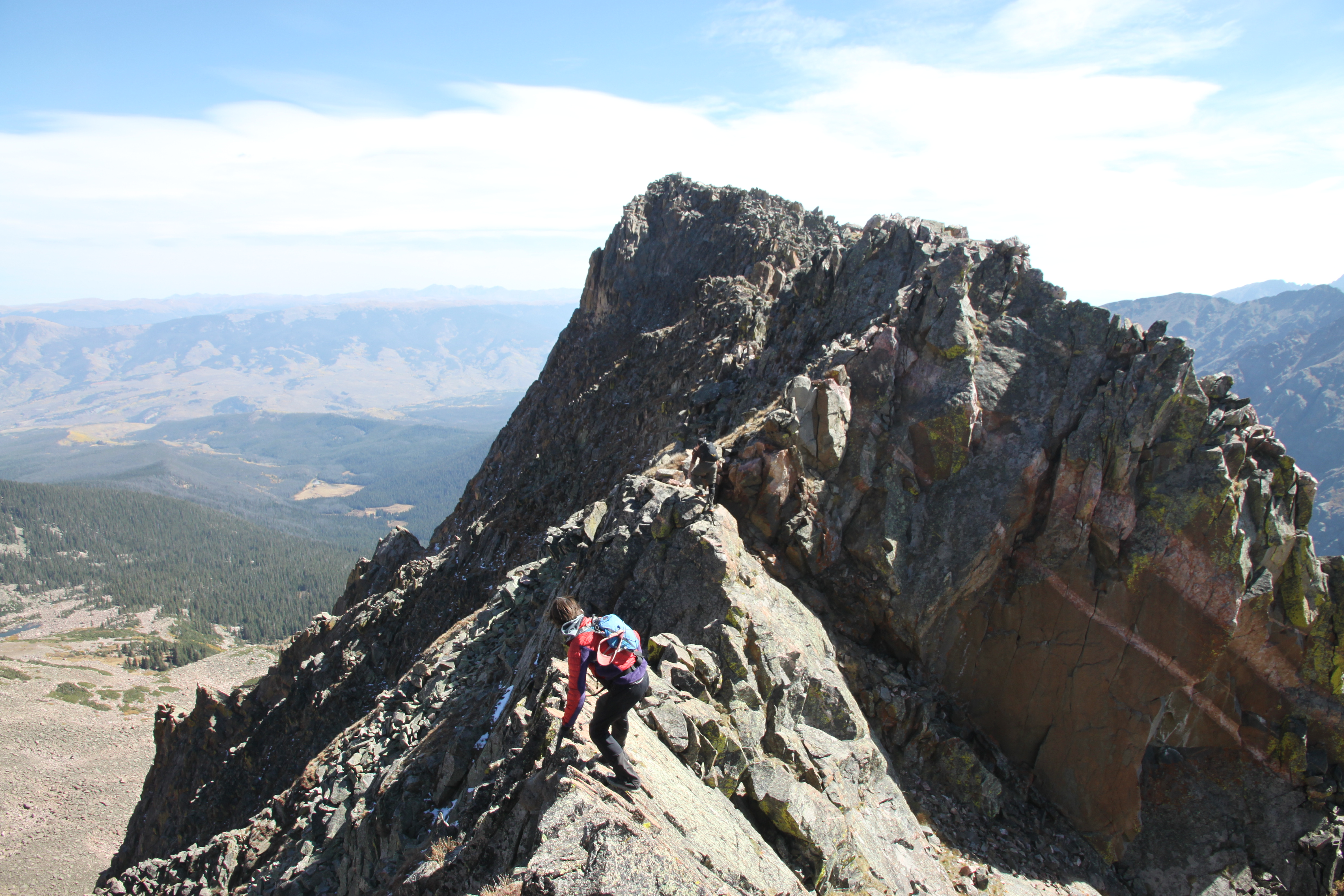
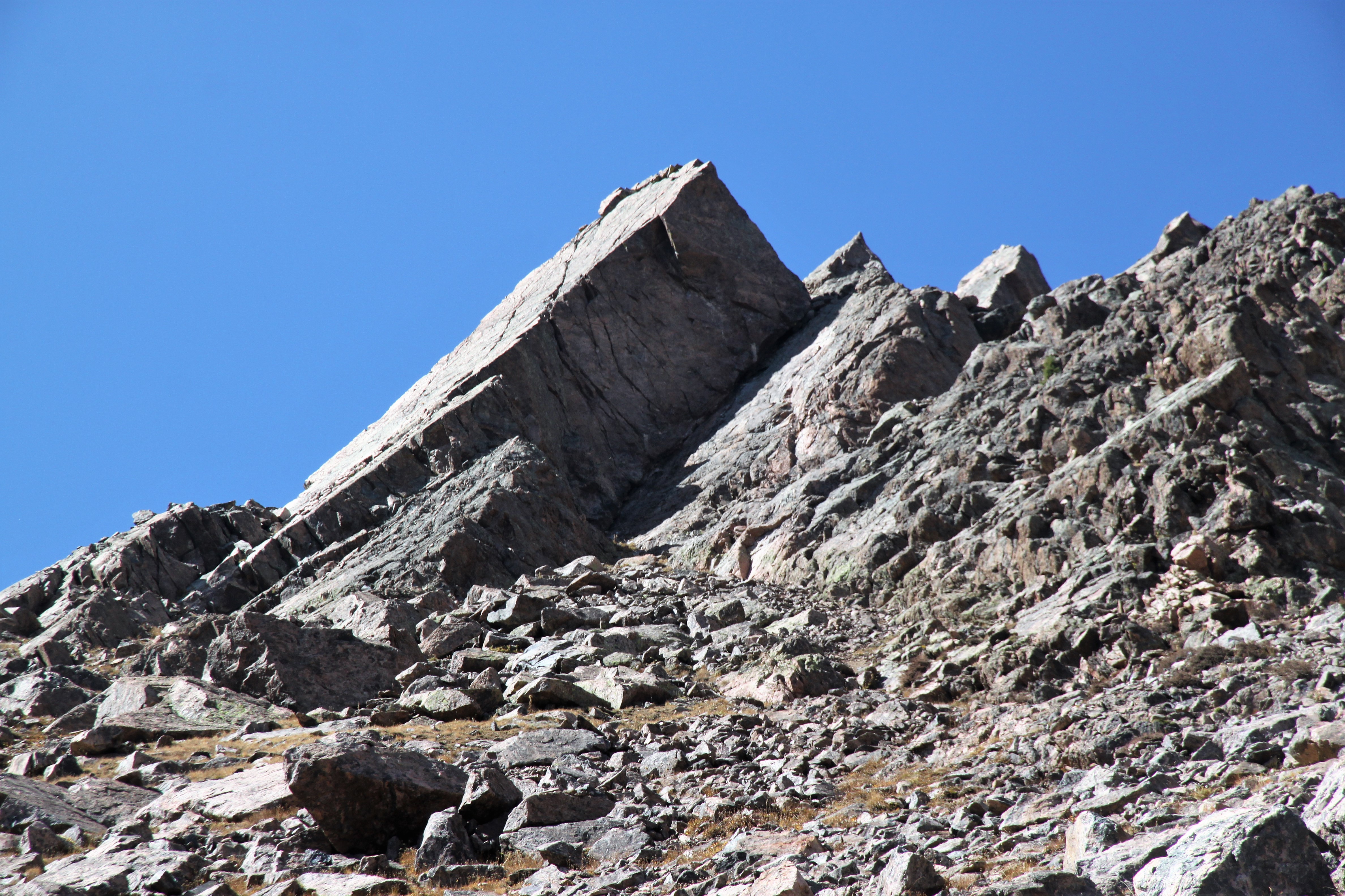
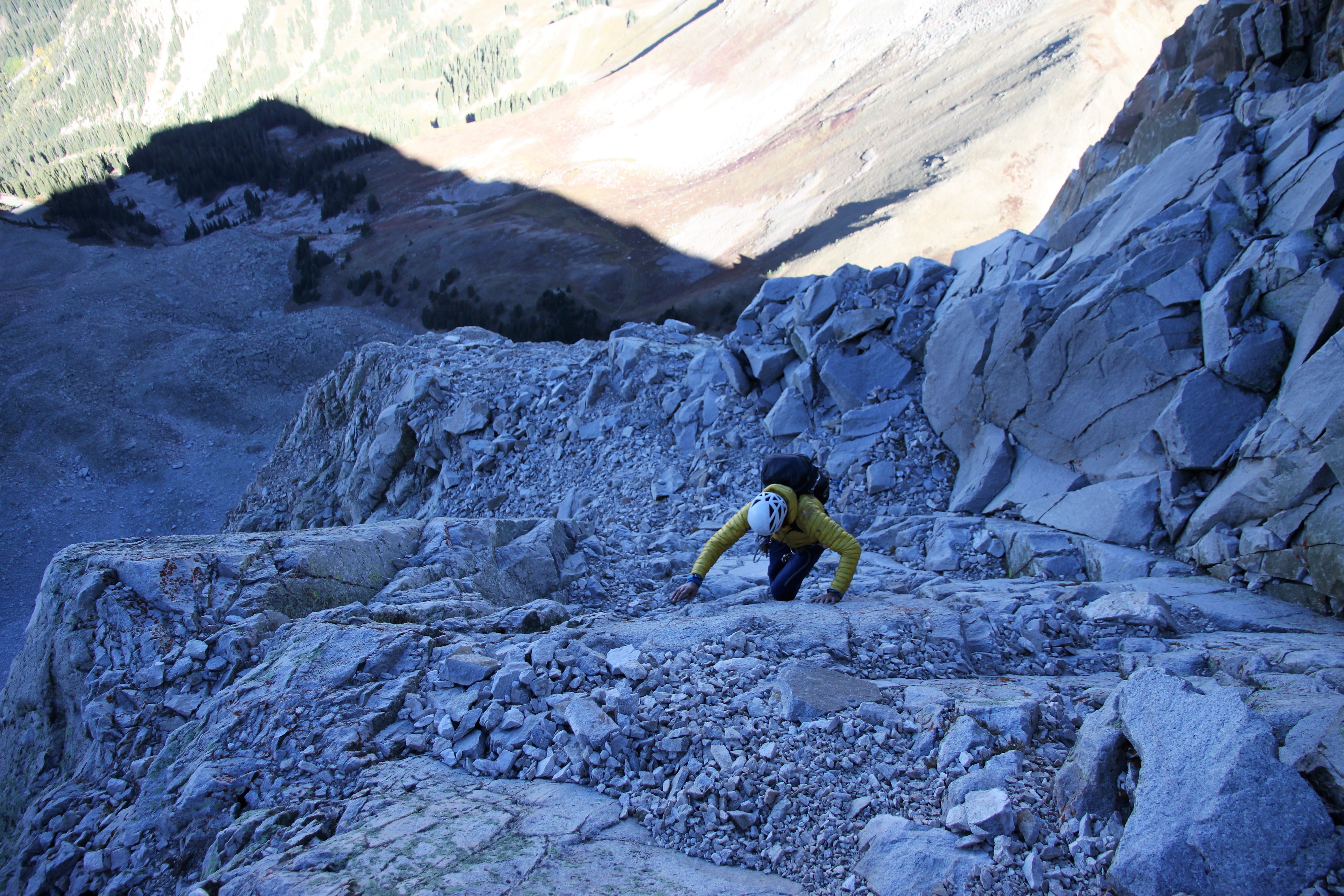
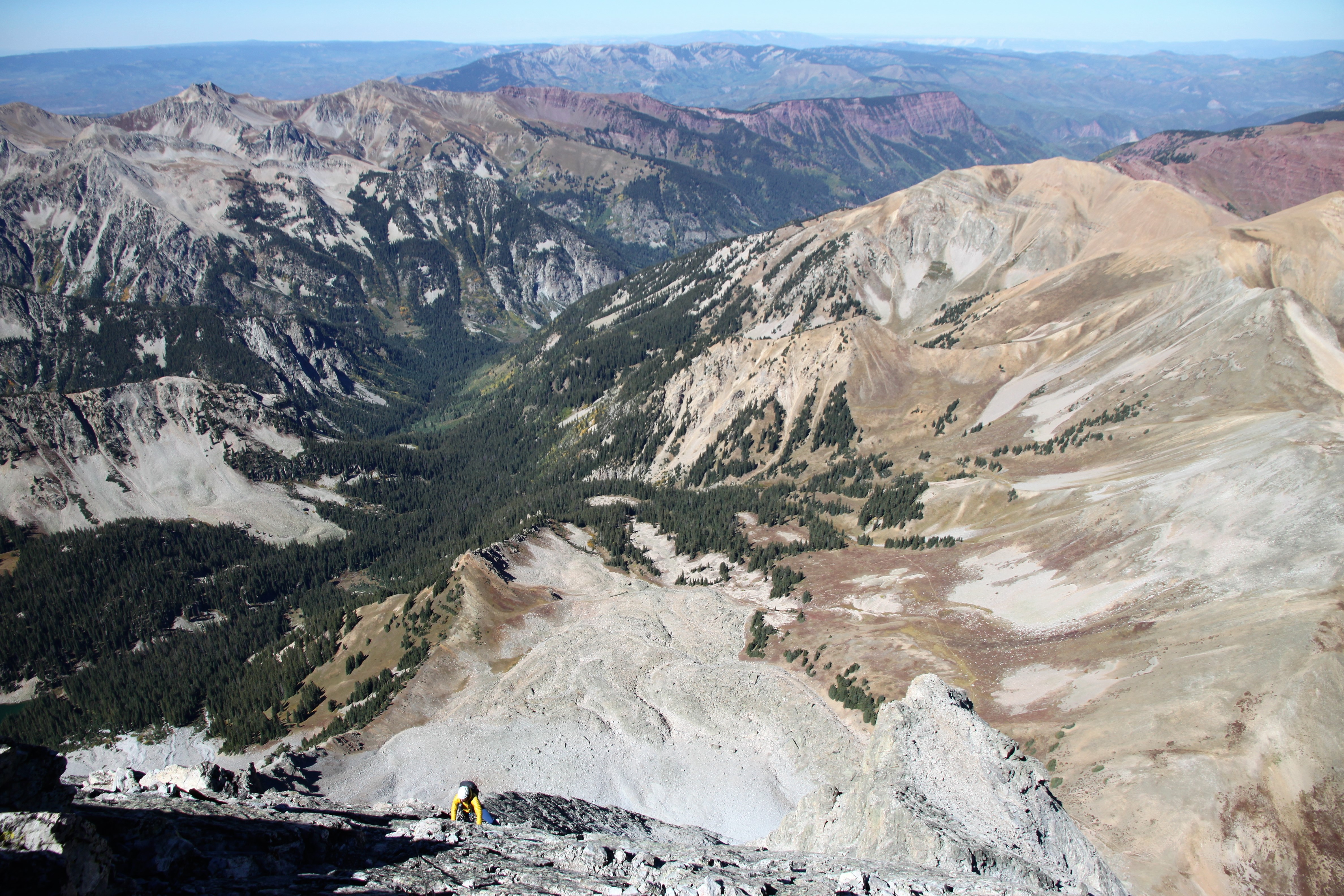
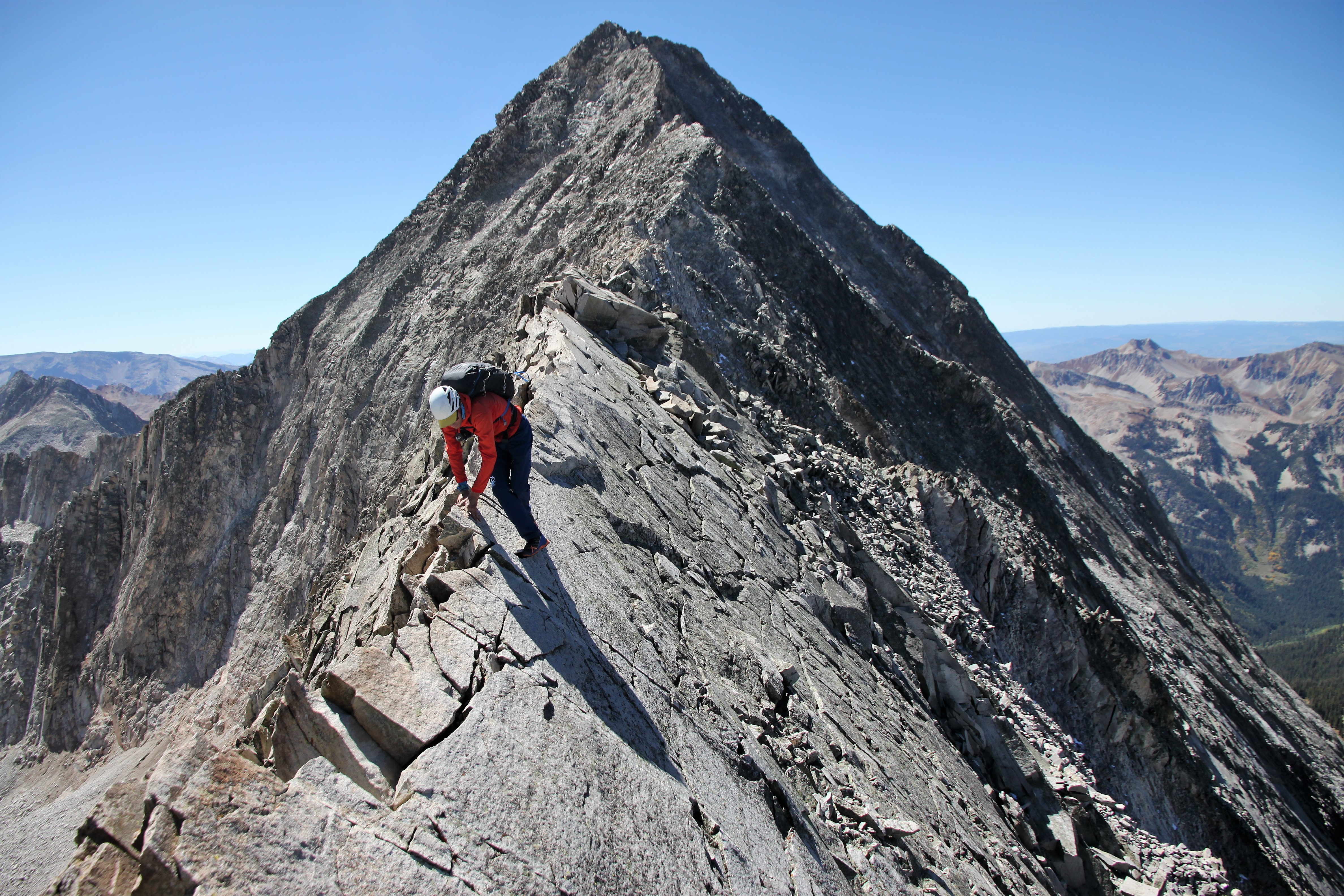
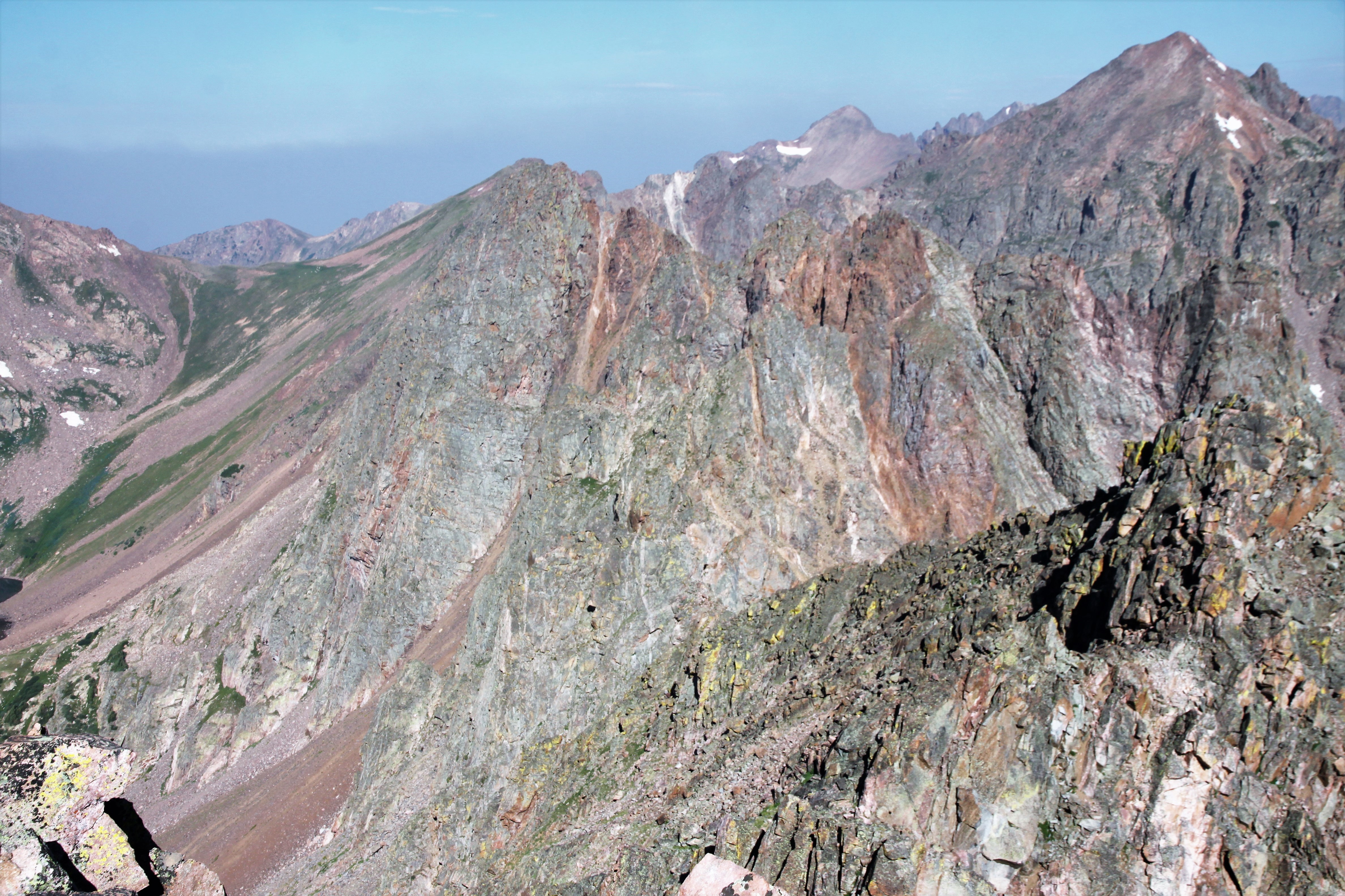
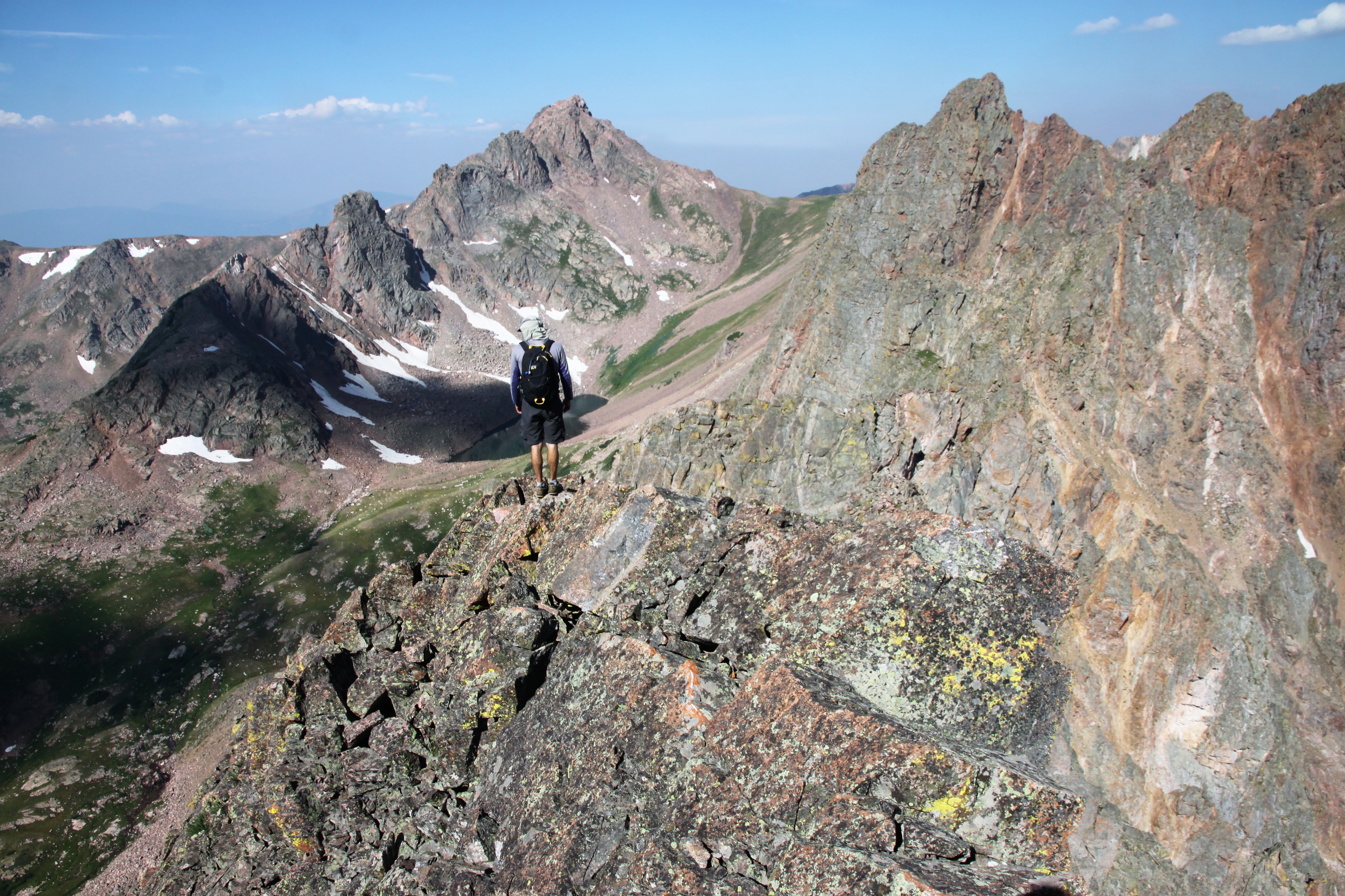
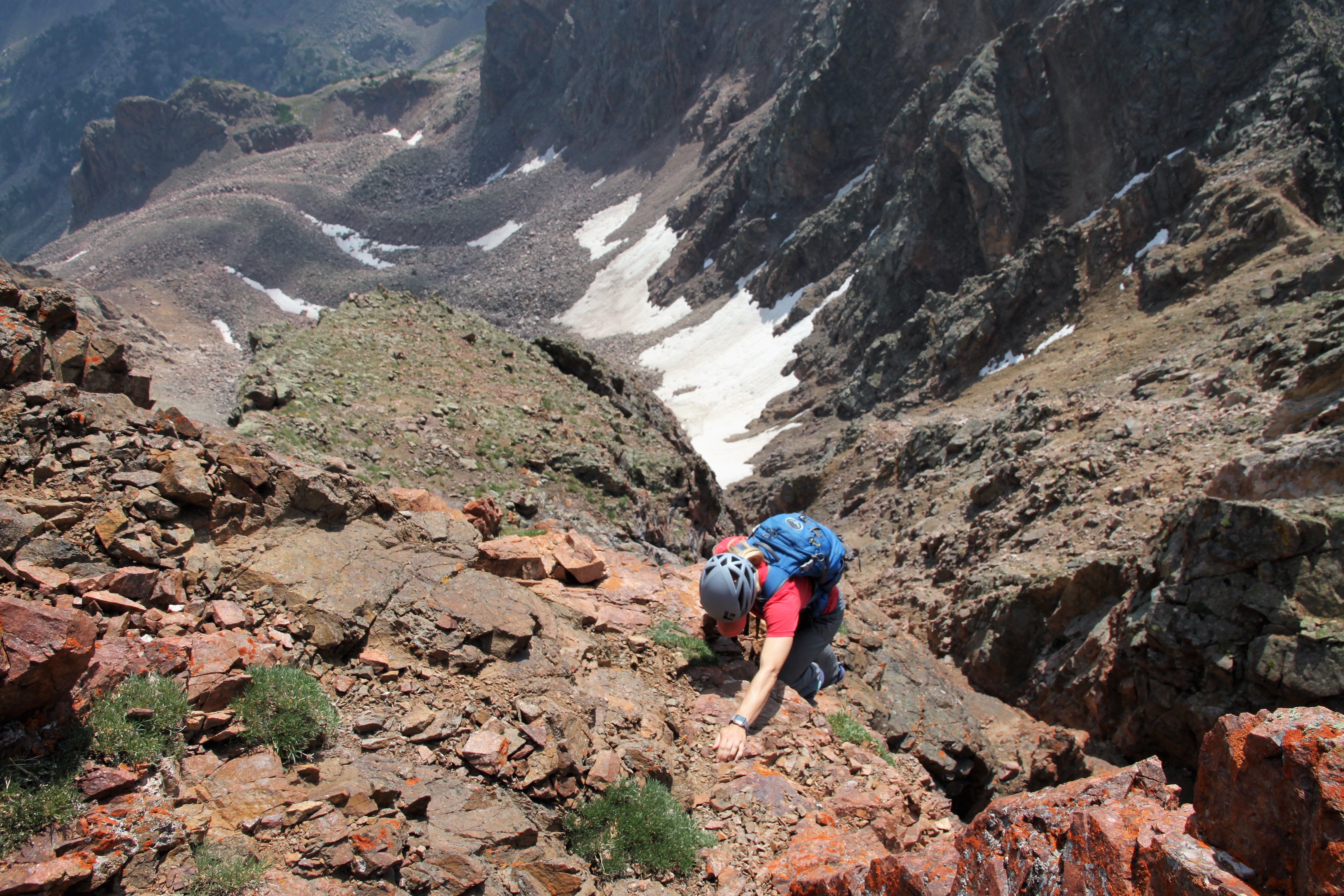
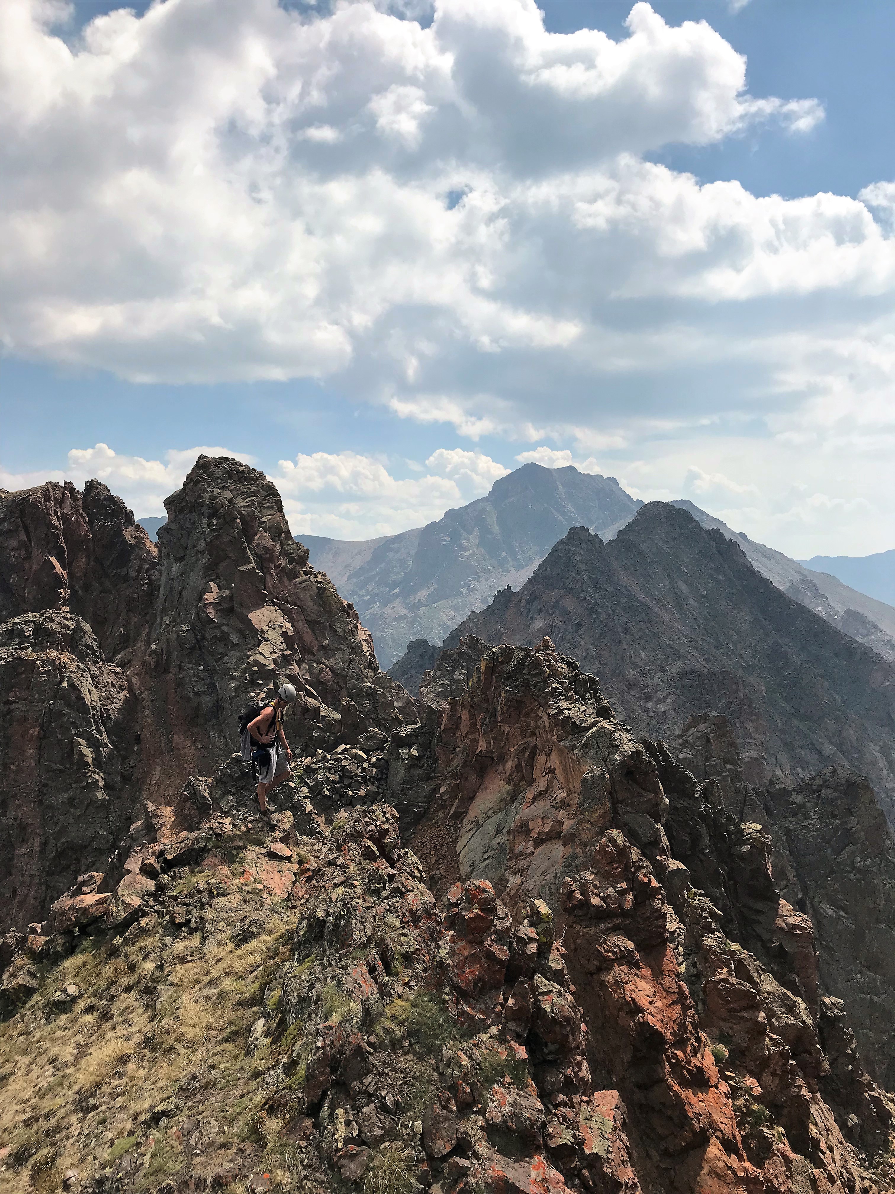
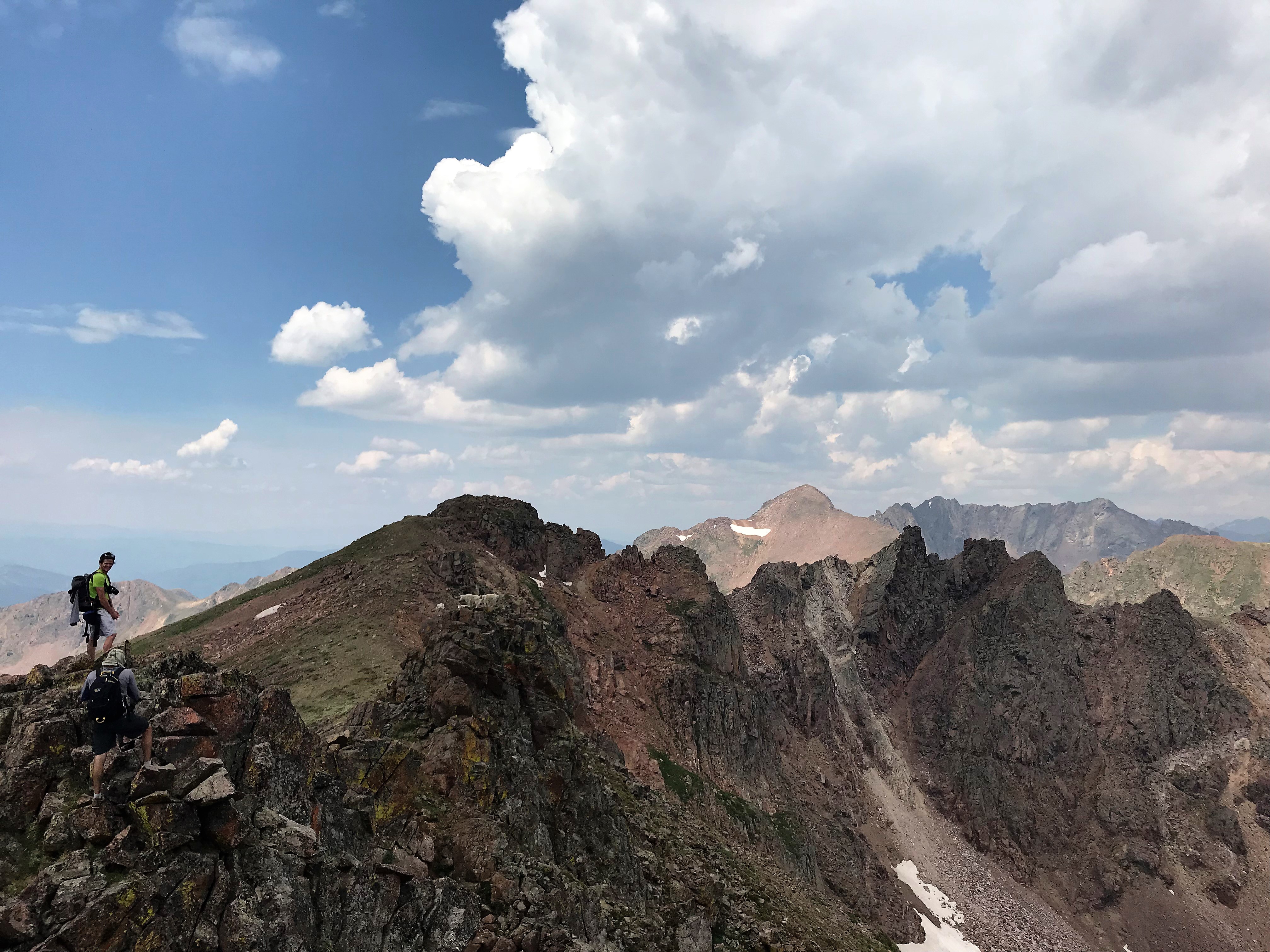
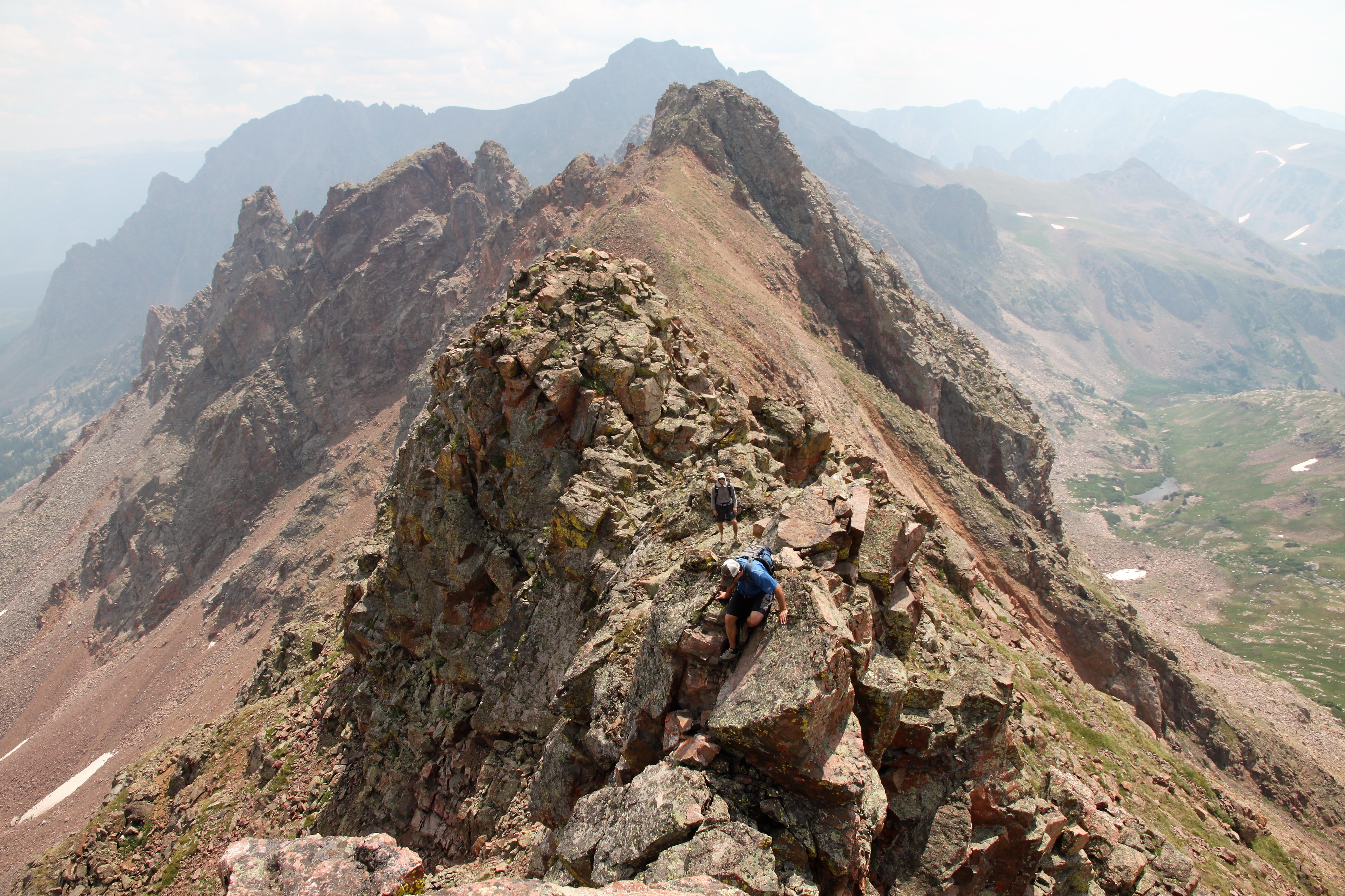
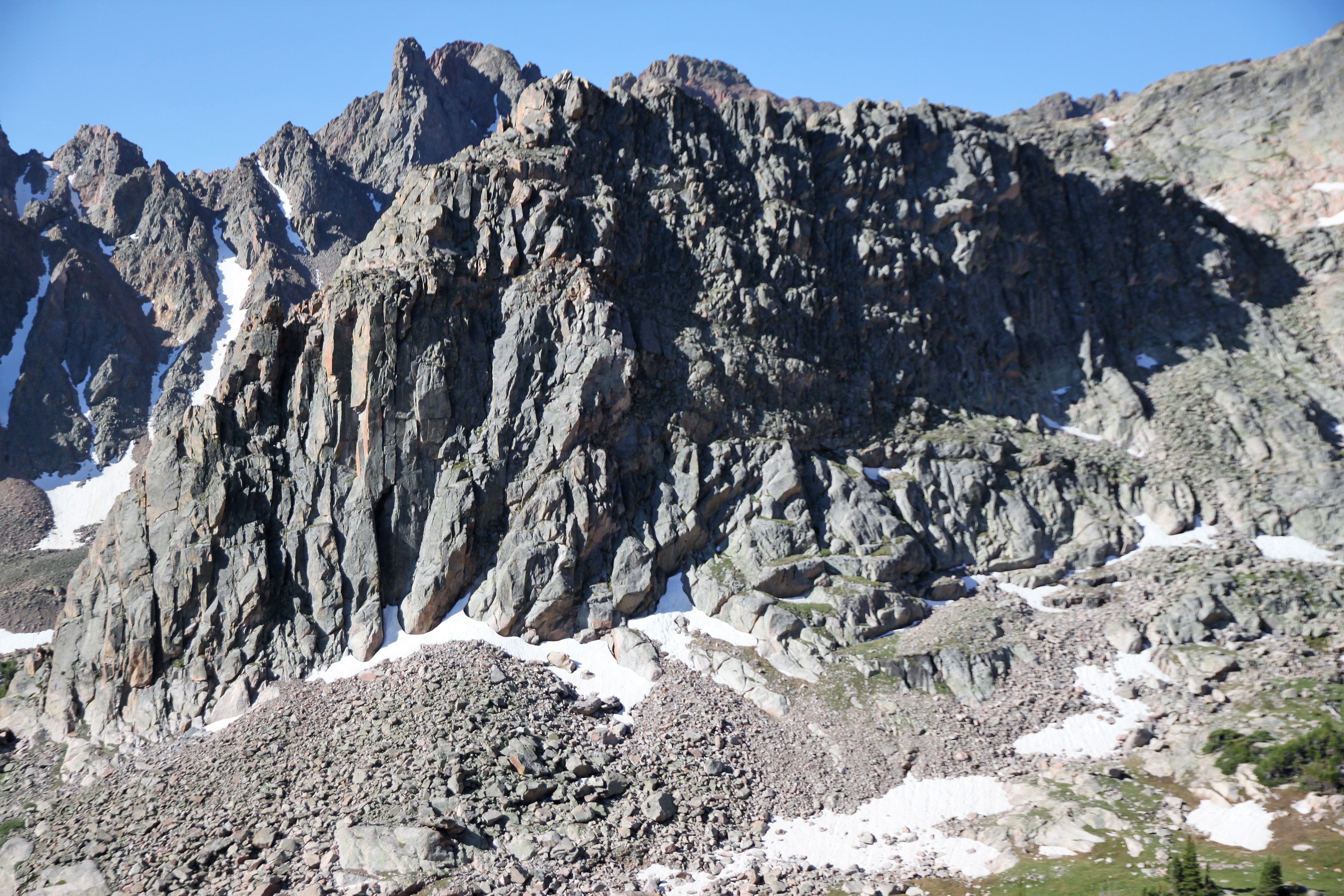
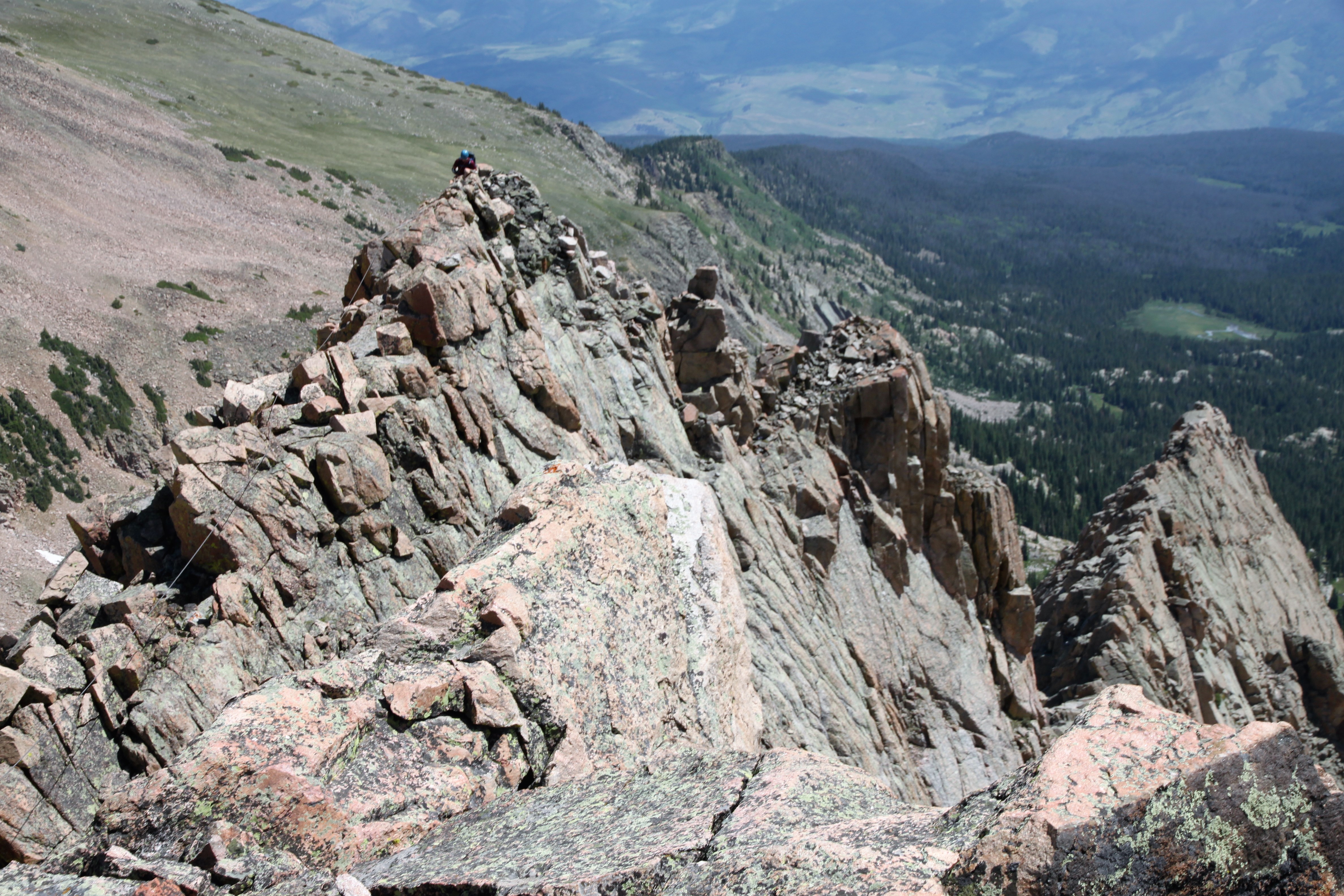
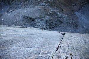
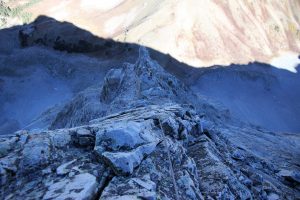
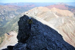
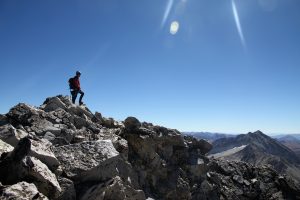
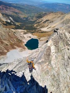
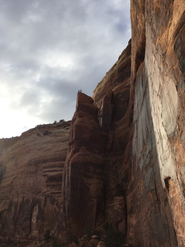
The nastiness of the route really only reared its head in the final 100′ or so of climbing to get to the ridge crest above Unicorn Spire from the west. It was definitely low 5th class climbing on boulders seemingly held to the mountain only by sand. Chris took one line and I took another. Each of us securely tested each hold and came out alright up top on the ridge proper. What lay before us was probably the best and most fun climbing of the entire route. About 700′ of 5.0-5.7 simul-climbing up an exhilarating and airy arete that can be seen from the Capitol Creek TH!

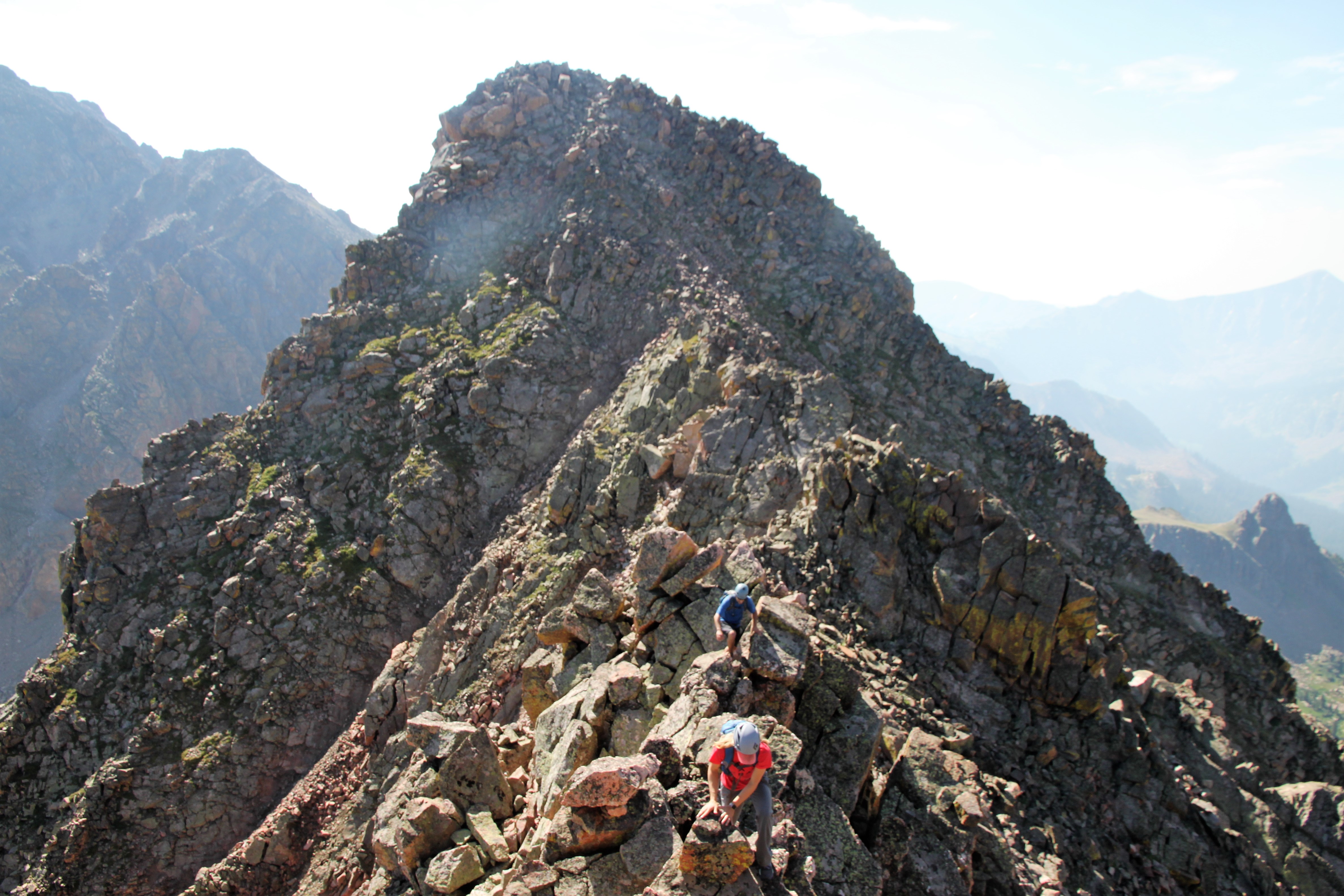
Ready to take-off up the arete! Photo by Chris

Making my way up. Photo by Chris

Airy exposure looking down

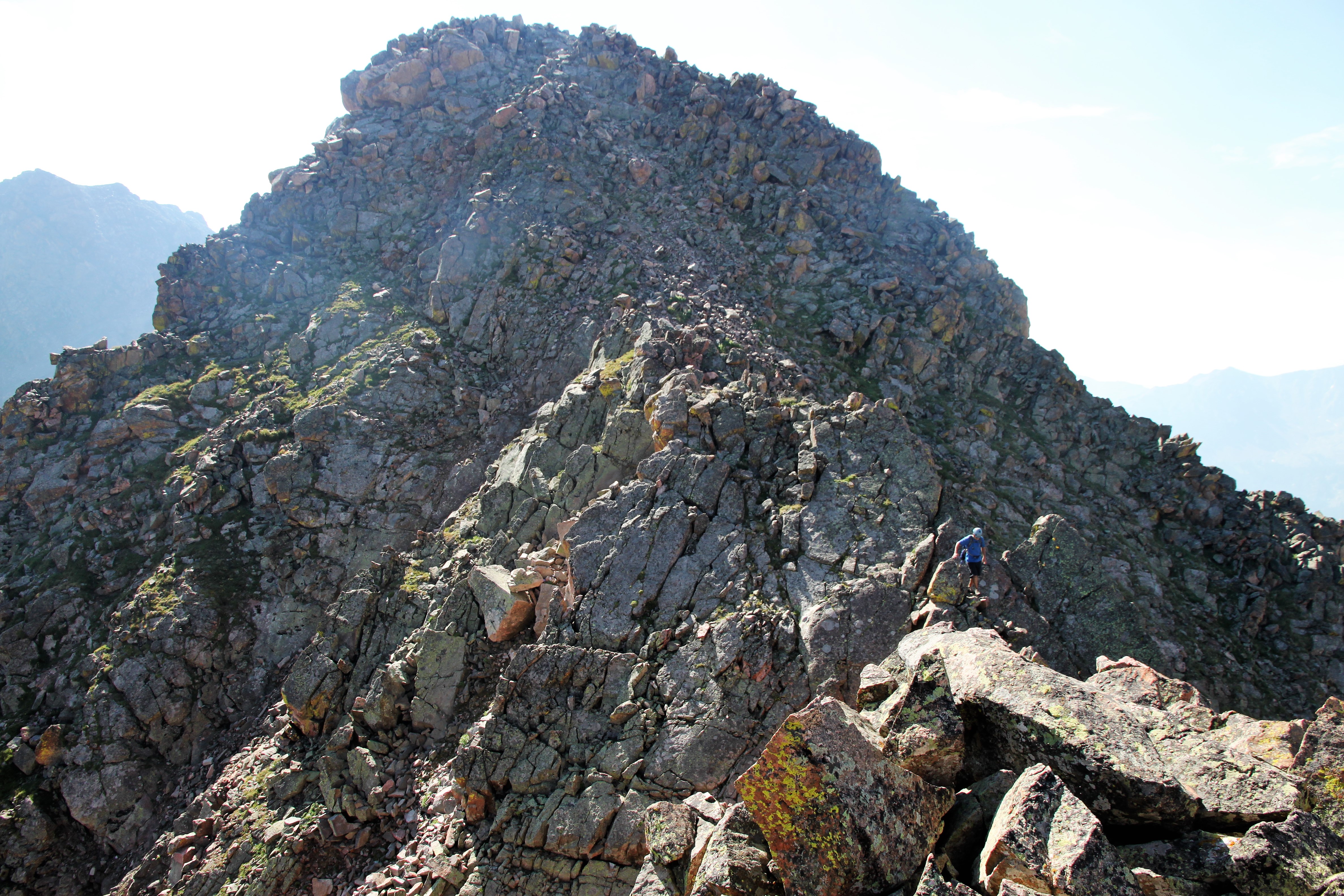
Chris doing his thing. What amazing climbing

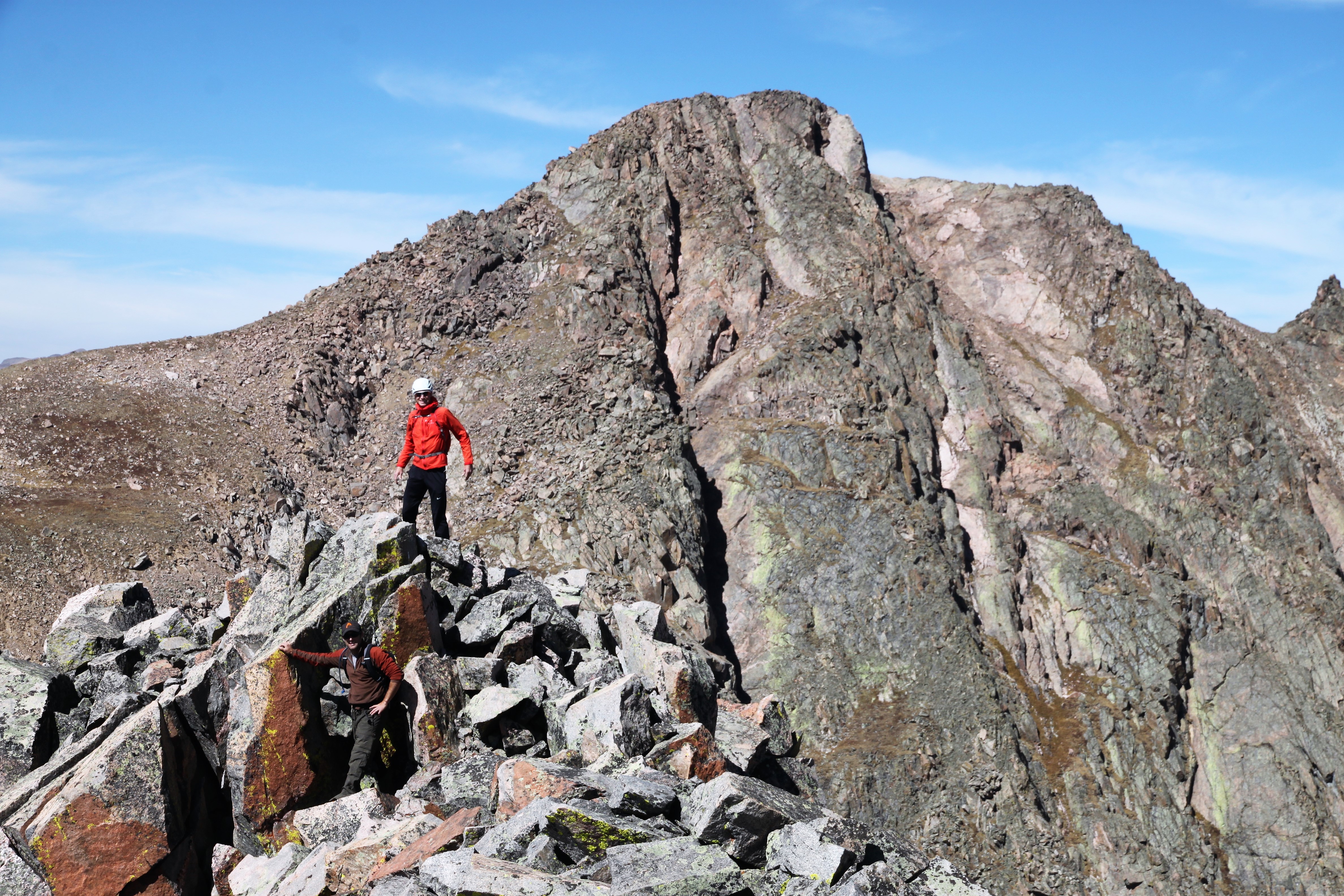
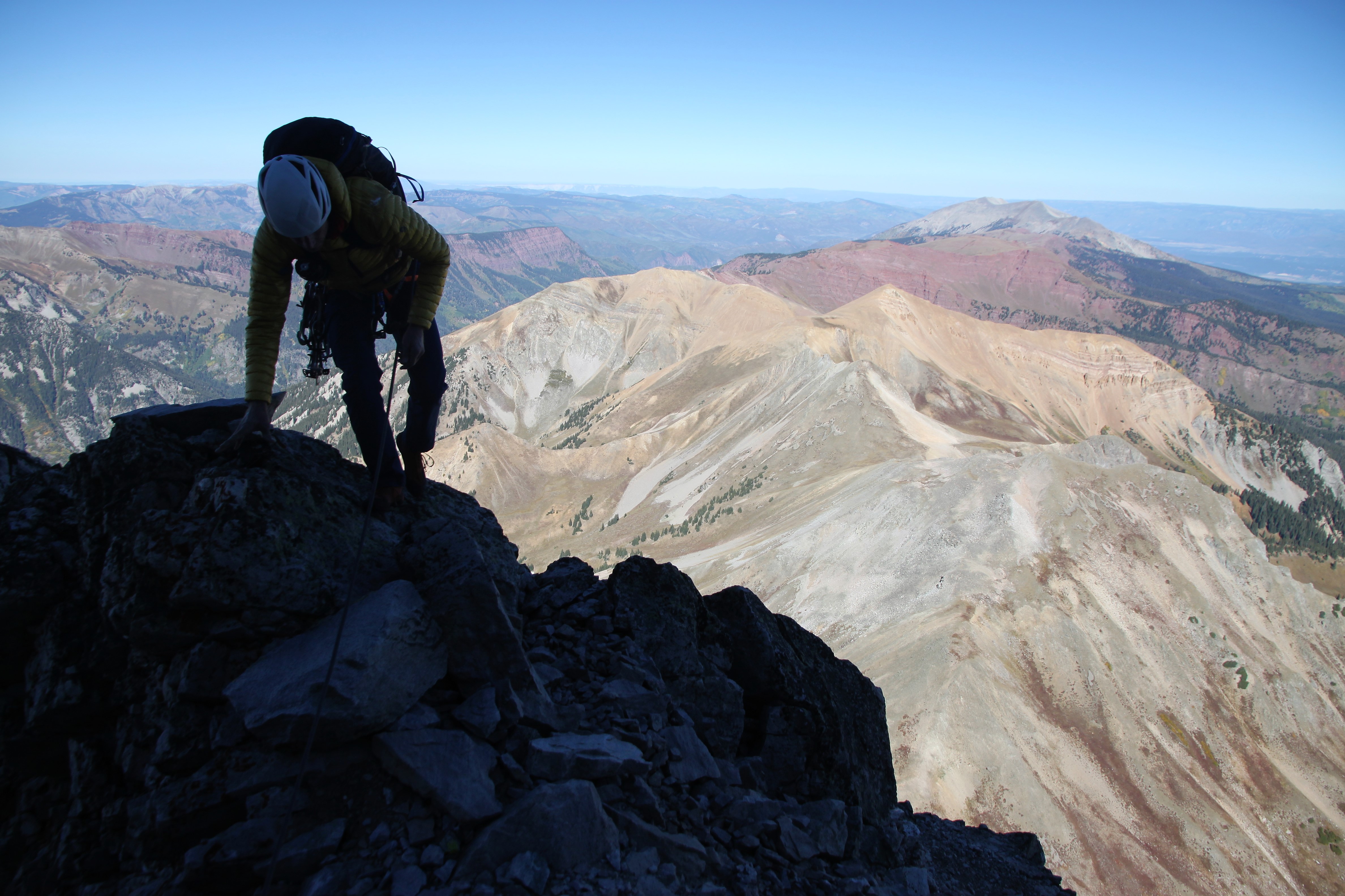
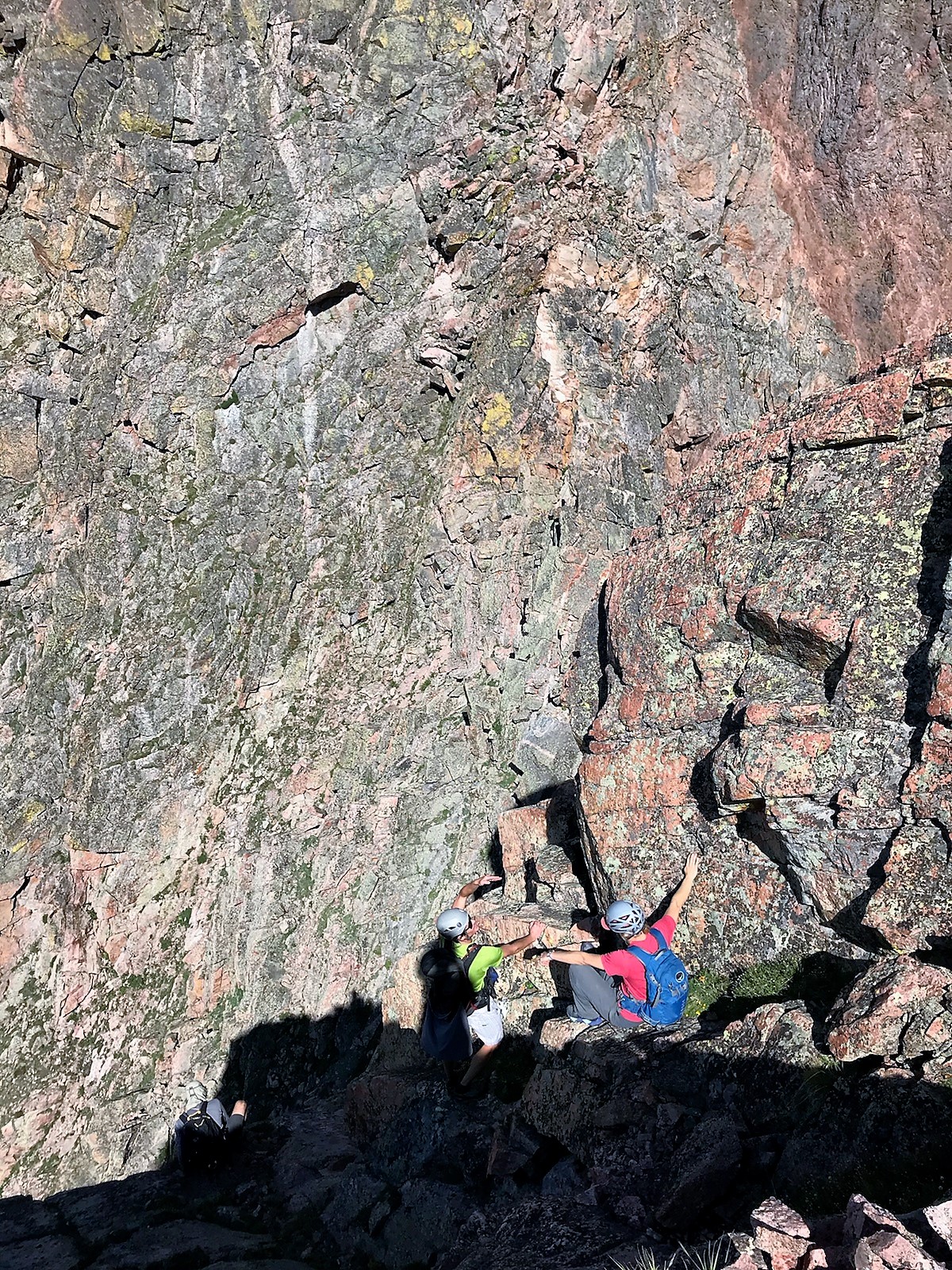
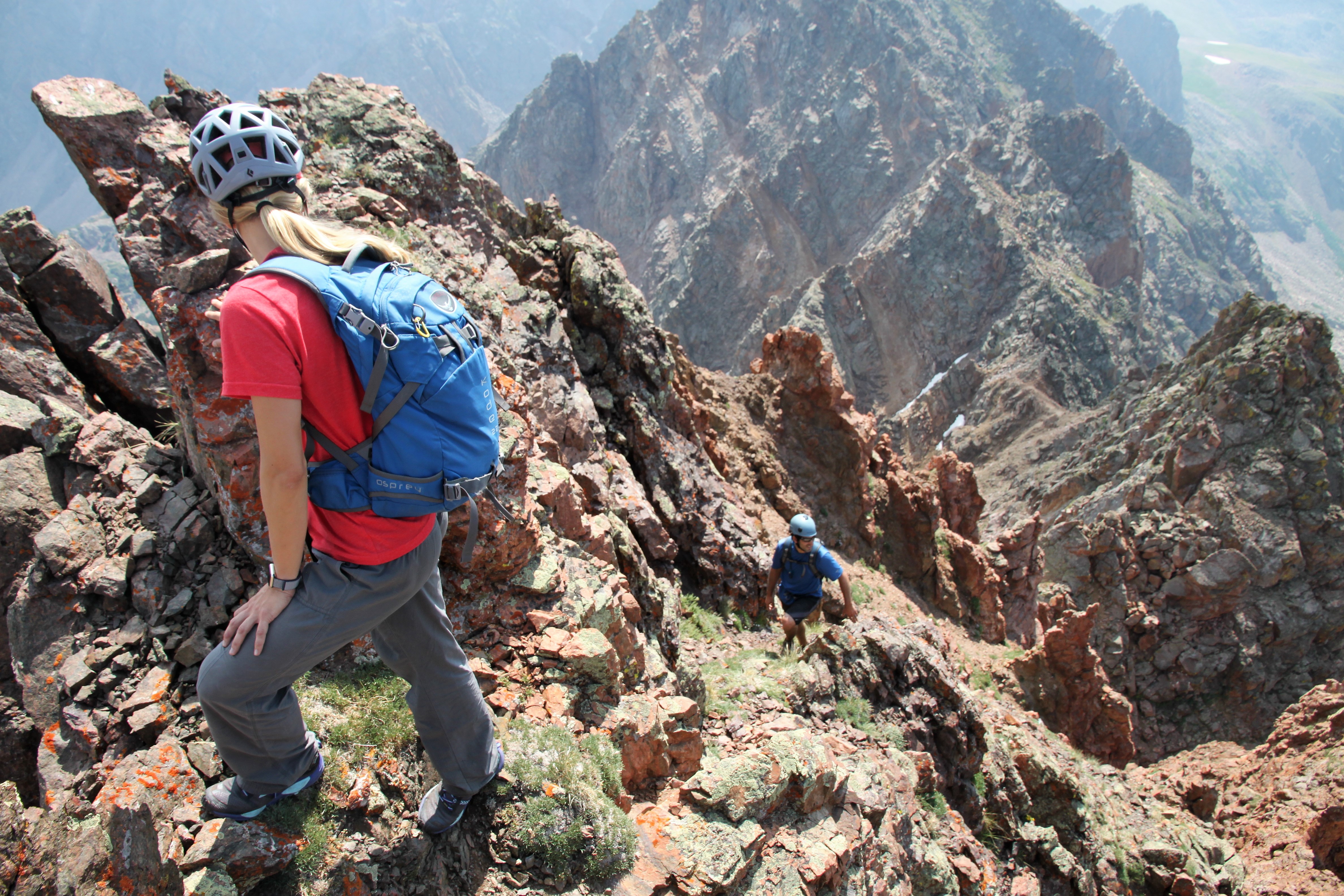
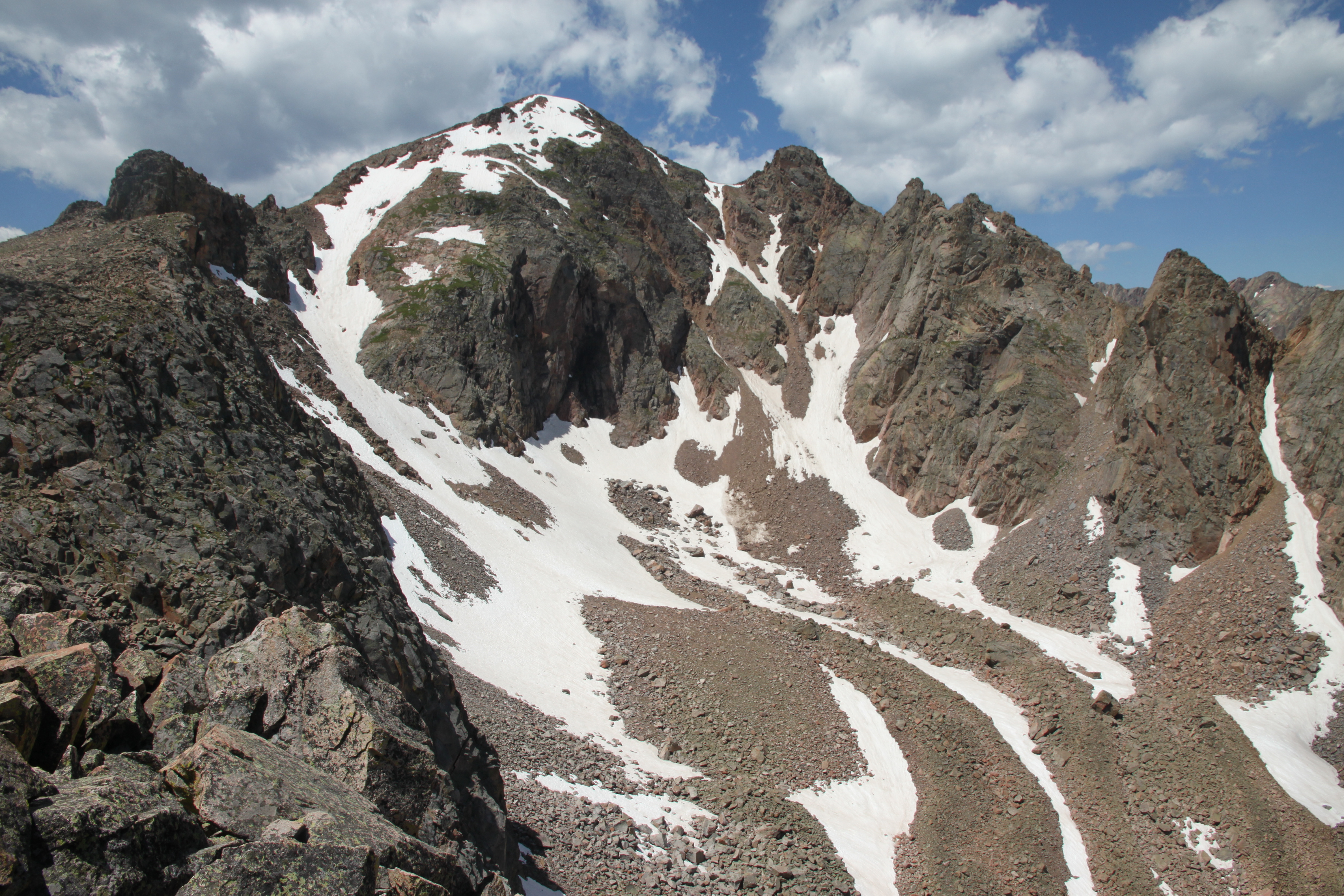
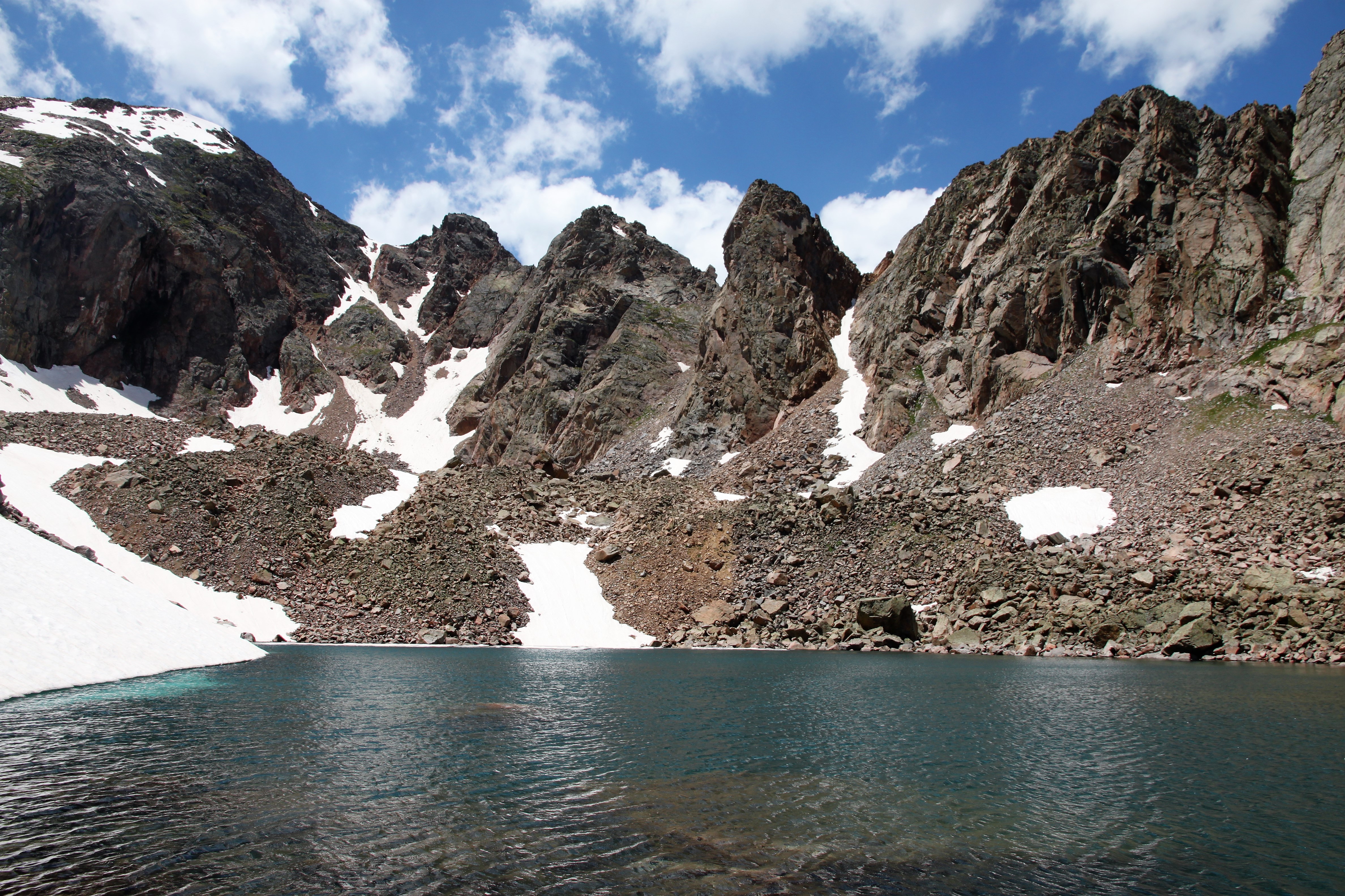
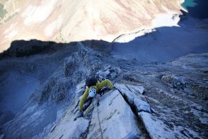
We reached the top of the 2nd tower and got our first sunshine of the day which felt oh so nice and rejuvenating. We de-roped and scrambled across the ridge above what was left of the heart-shaped snowfield over to the base of the 5.7 upper headwall pitch.

Chris on the 4th class ridge

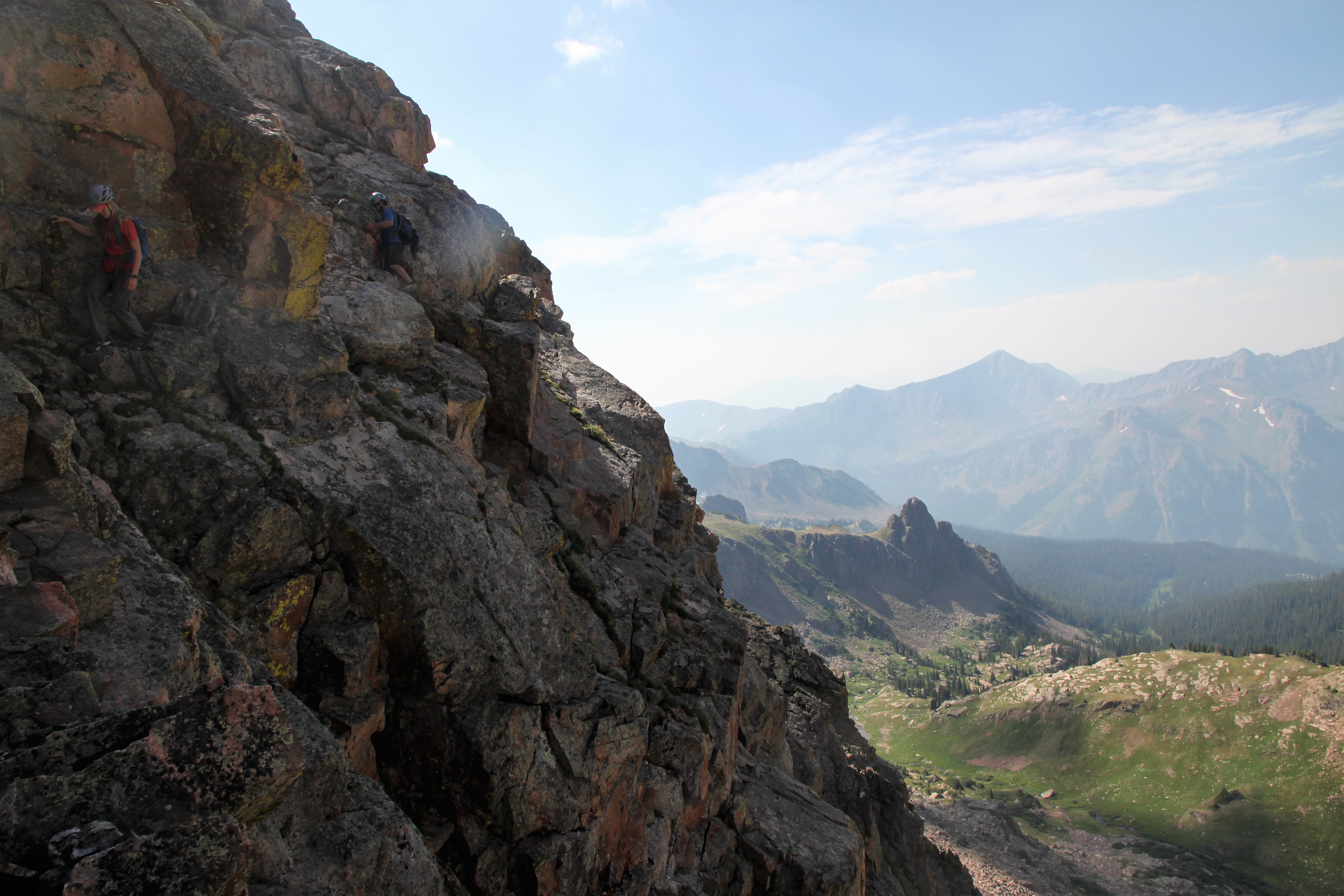
A short walk/scramble to the base of the final headwall

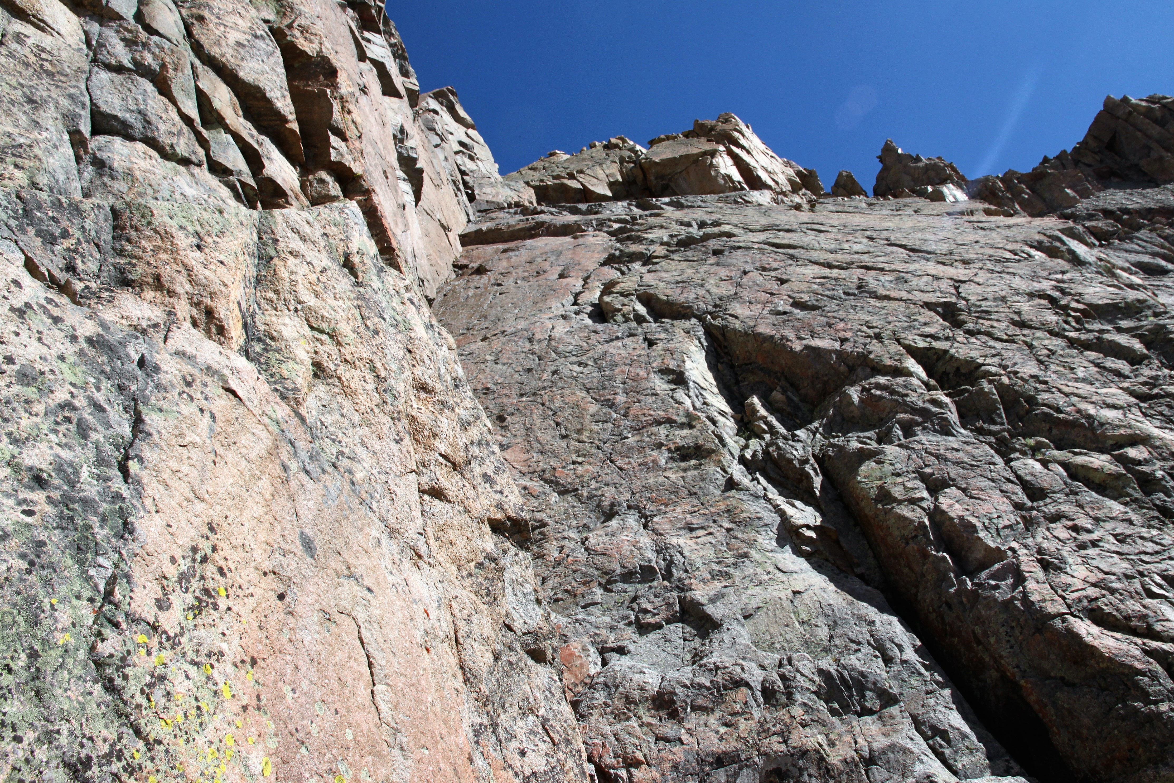
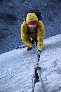
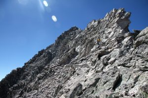
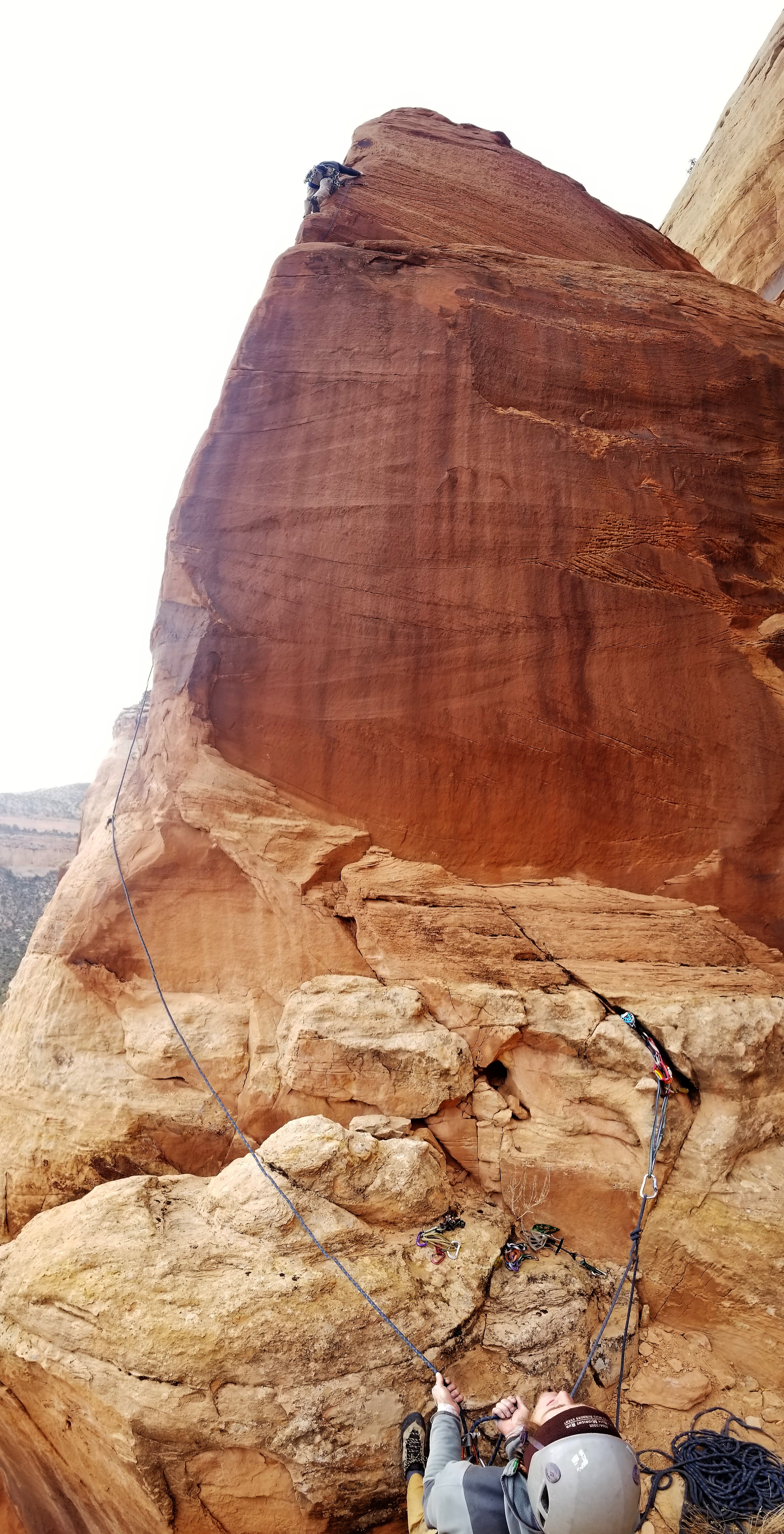
There was a pin at the base of the headwall likely to protect the belayer because the first 50′ of the pitch is pretty run-out with no gear. I believe I climbed the small roof more to the right (west) than other folks have noted in their pics, but it felt more solid to me. I set up a belay about 30′ above the roof where I could still see Chris.

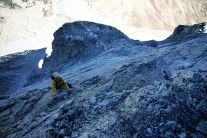
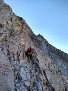
Chris on the upper headwall 5.7 pitch

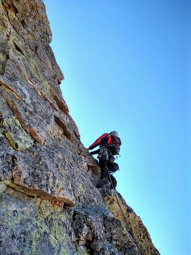
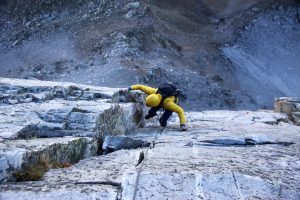
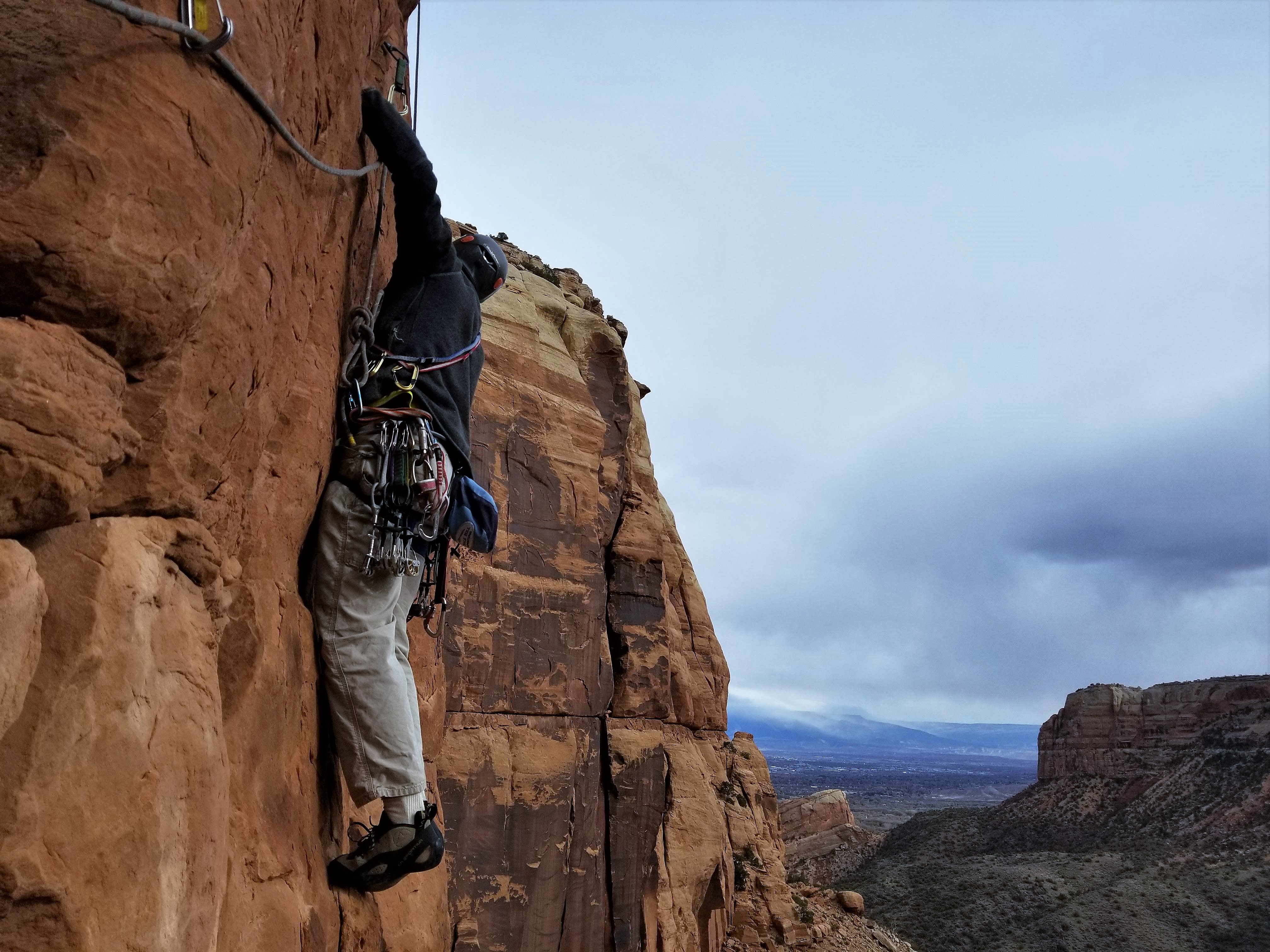
We then decided to simul-climb the rest of the headwall above us. I set off and finally got into the glorious sunshine again.

Setting off on our simul-climb of the remaining upper headwall. Photo by Chris

Chris simul-climbing the upper headwall on mostly solid rock

Its a long way down

Chris said he really loved this climbing

Chris almost to me on the ridge

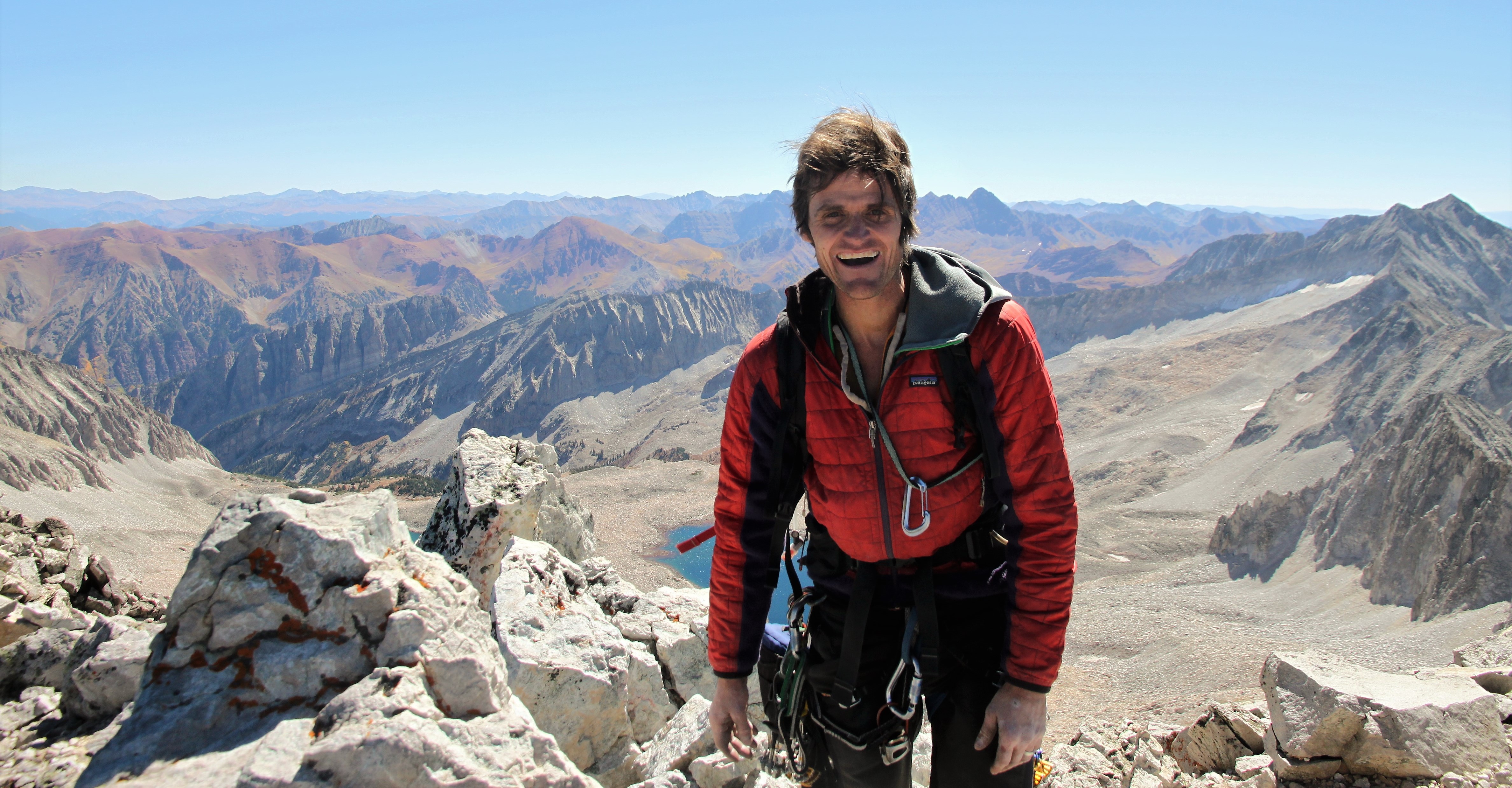
Chris reached me on the ridge and we literally only had 30′ to the summit. We were both pretty ecstatic with everything (the weather included) and we de-roped and scrambled the rest of the way to Cap’s summit.

Chris shot this of me on Capitol’s summit

So happy to have climbed the Northwest Buttress – finally!

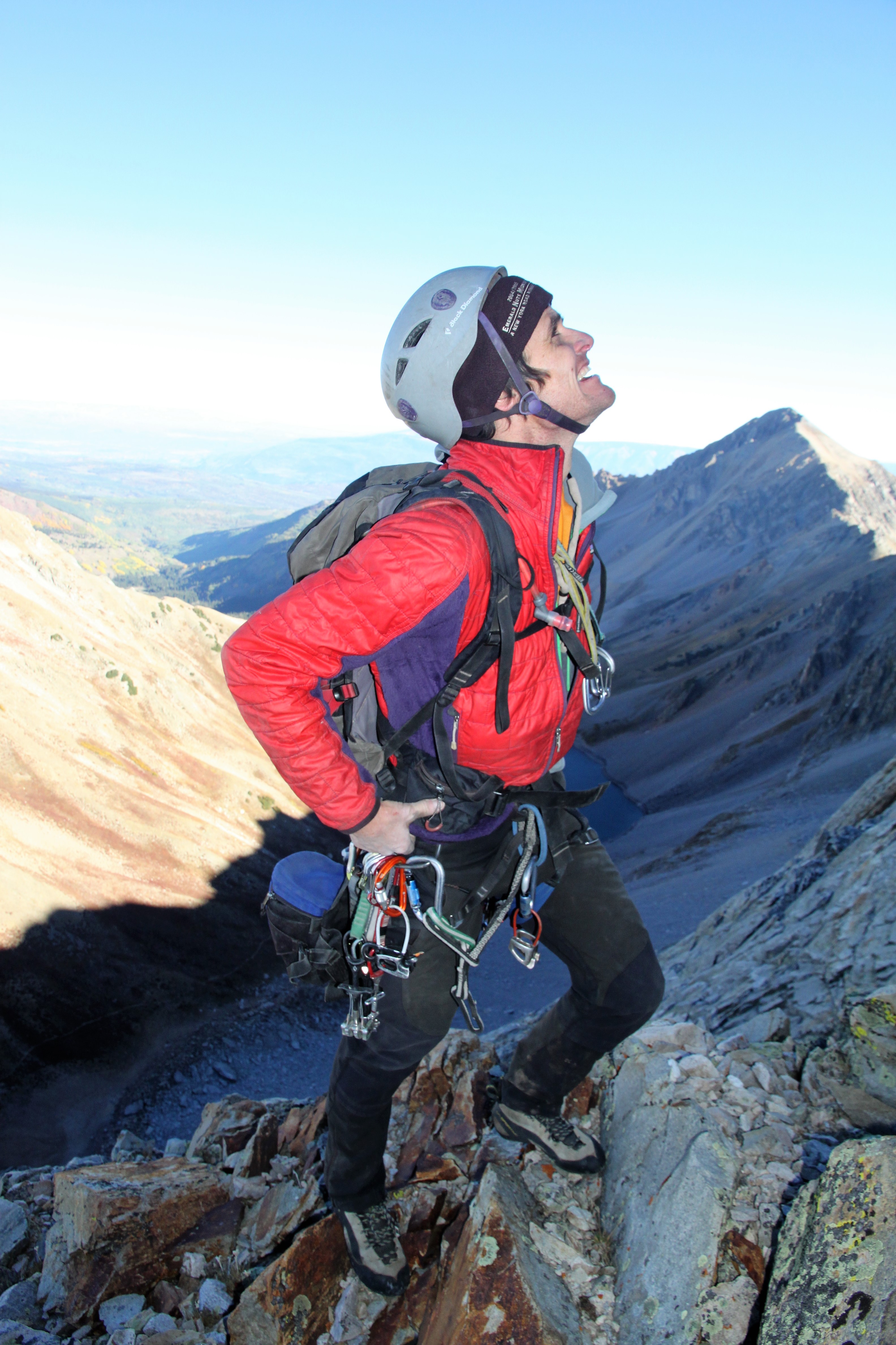
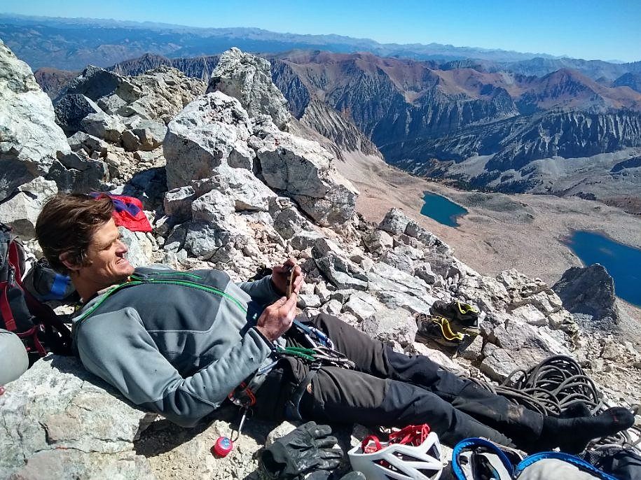
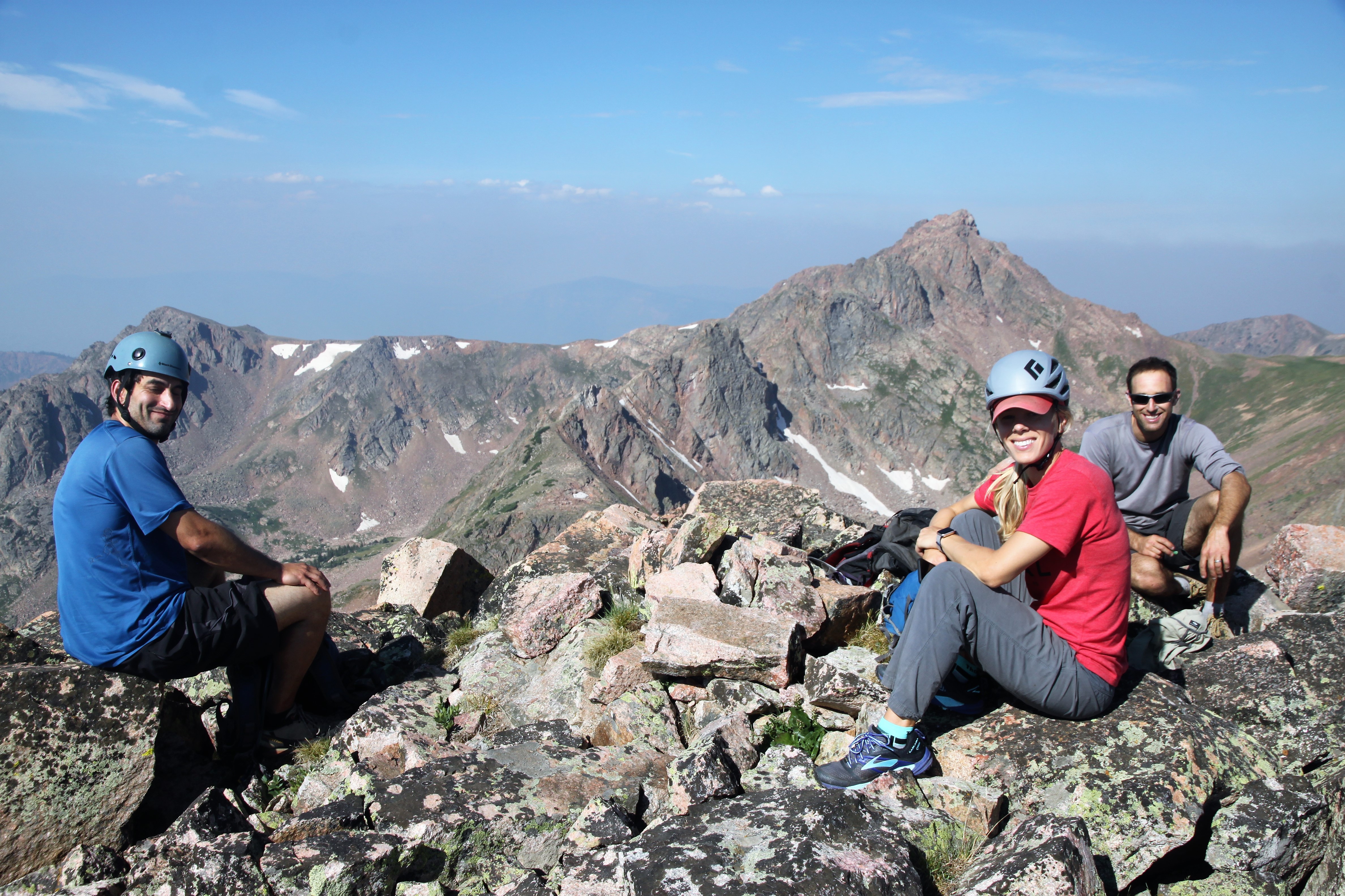
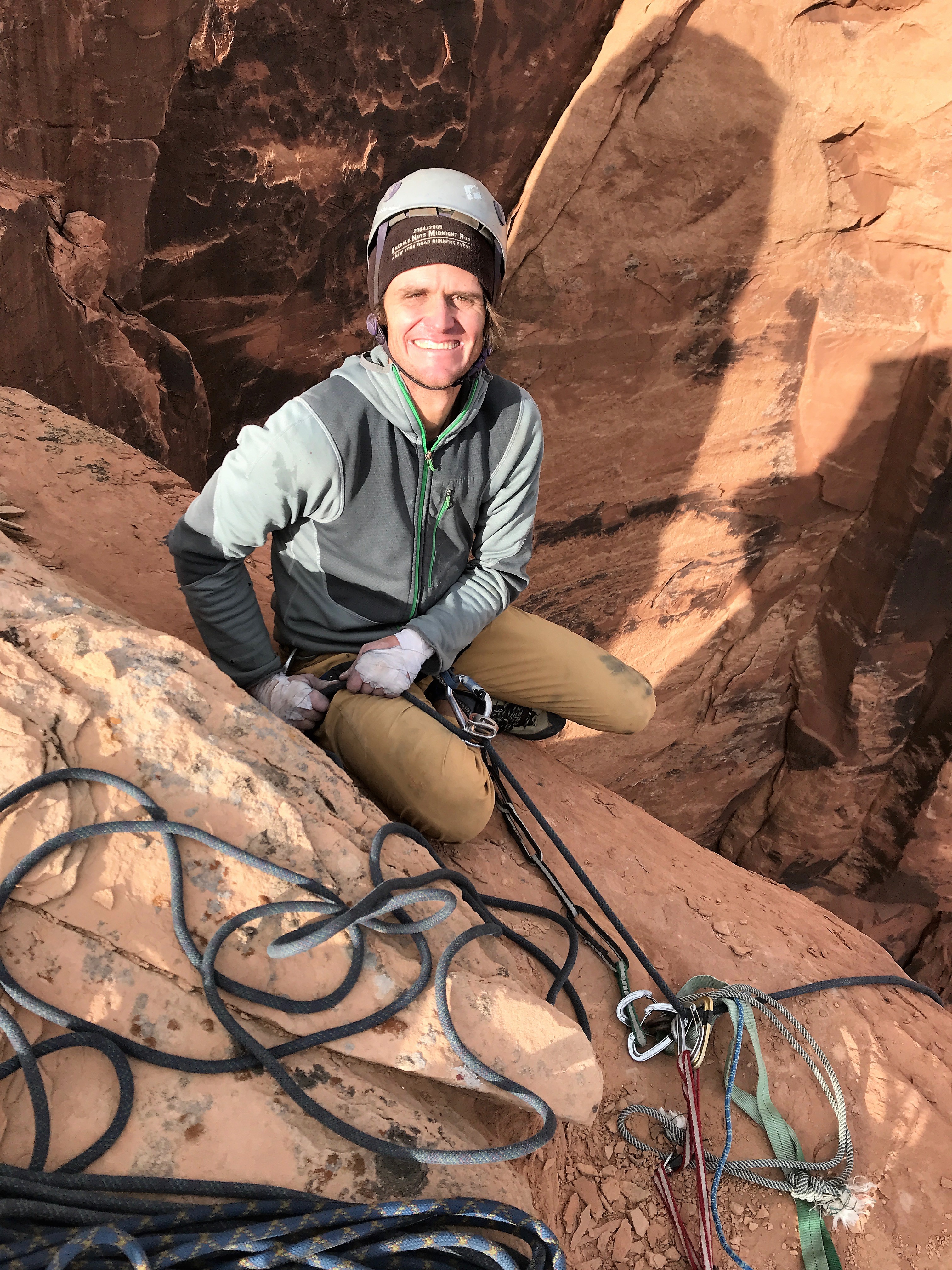
We summitted around 11:30am so it took us close to 4 hours to climb the route. We saw no one on the summit or for that matter on the entire mountain this day. Unbelievable to me, really. We spent close to an hour on the summit relaxing and taking in the sunshine and the moment.

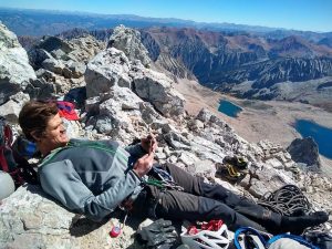
Relaxing and texting Kristine we are all good. Photo by Chris

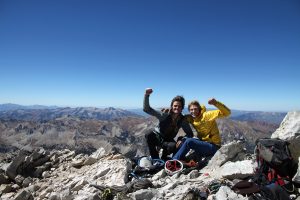
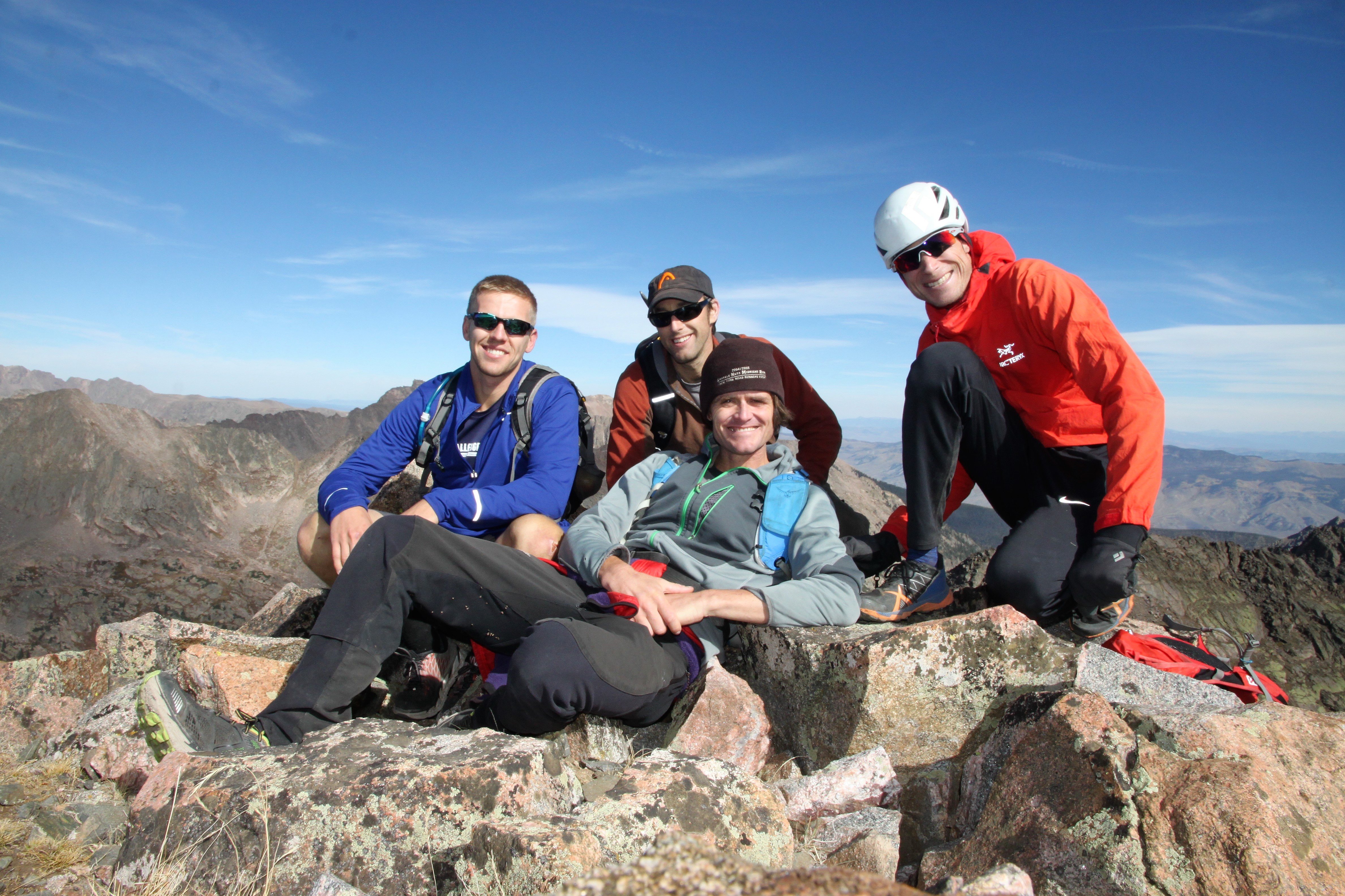
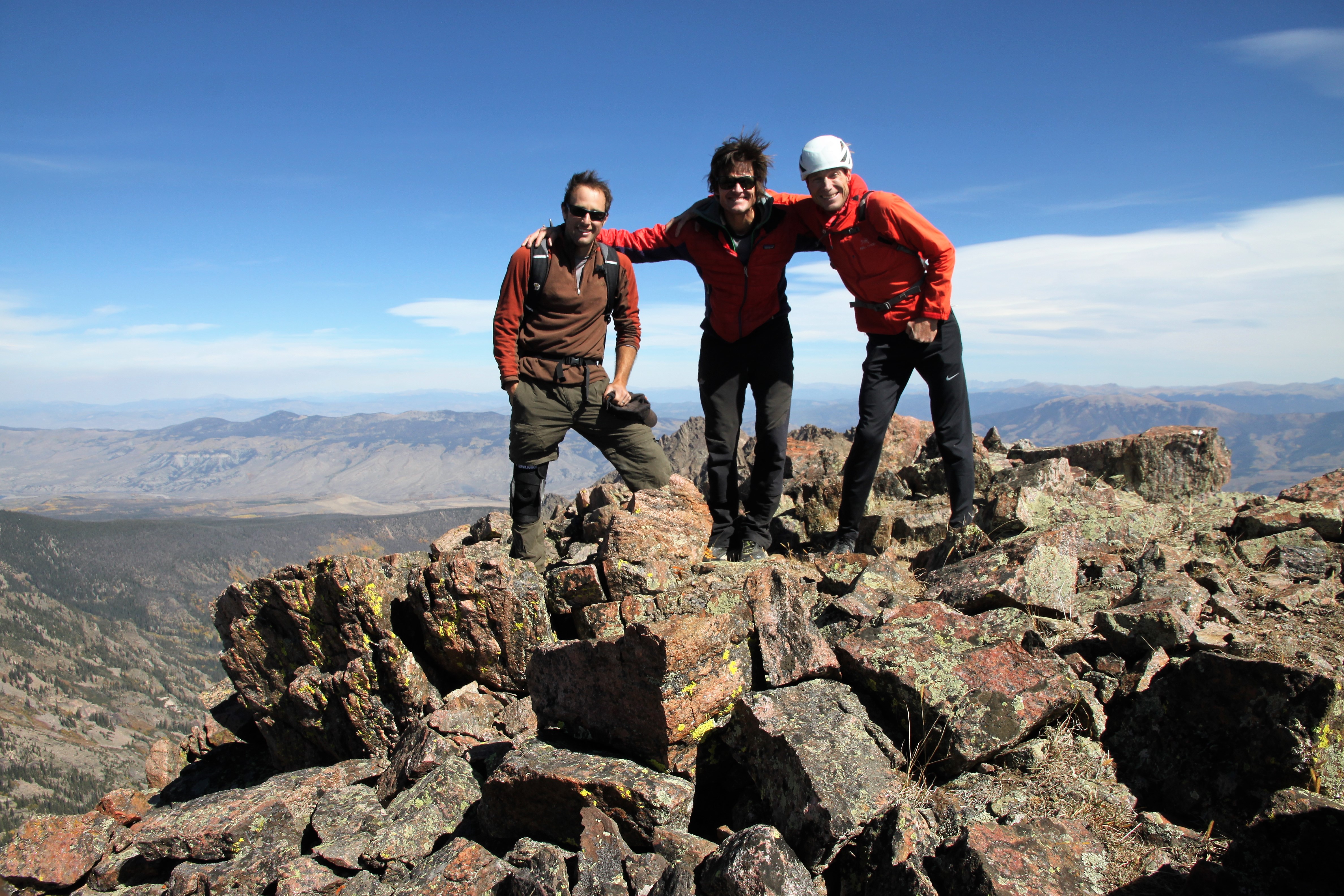
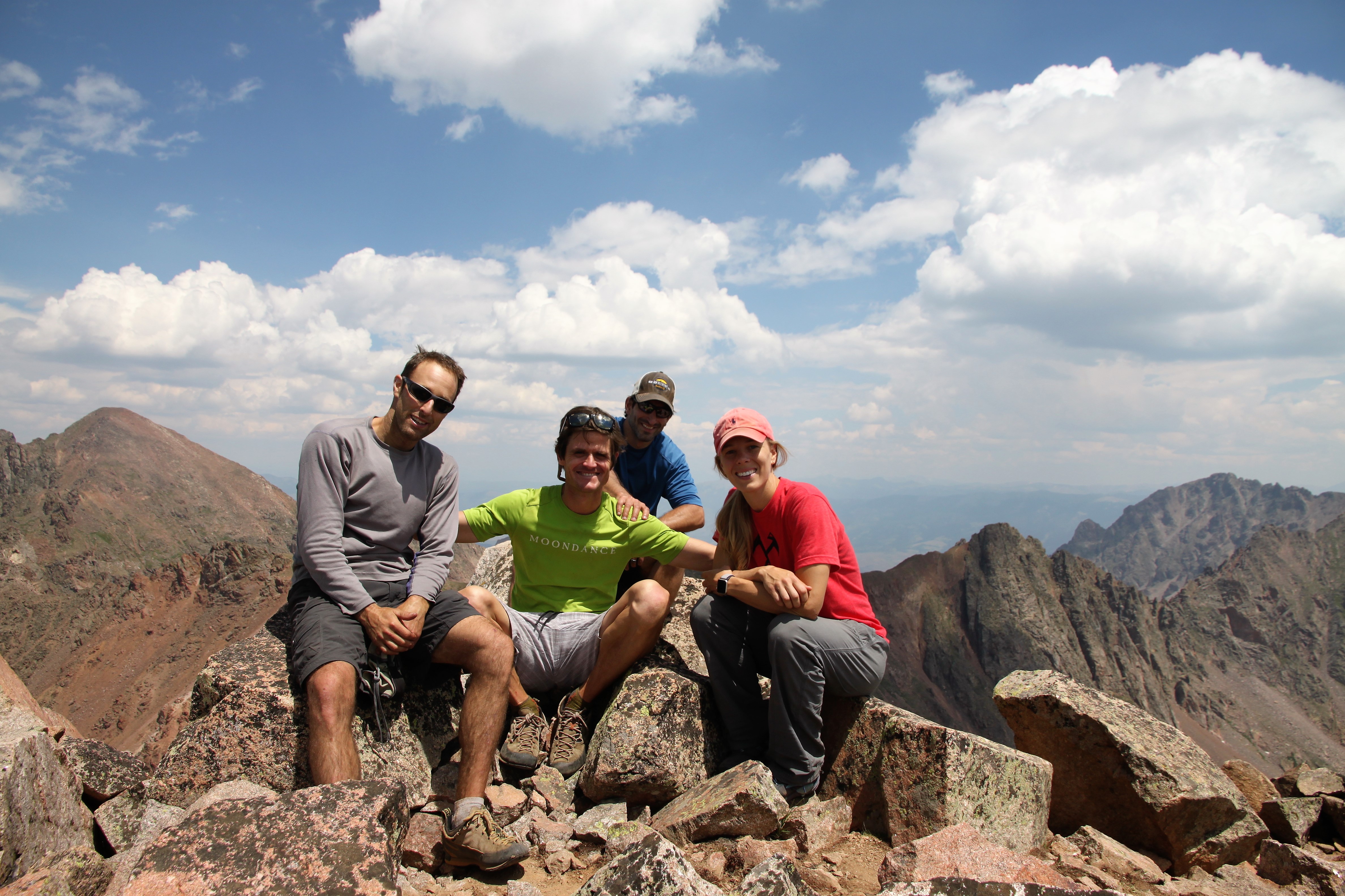
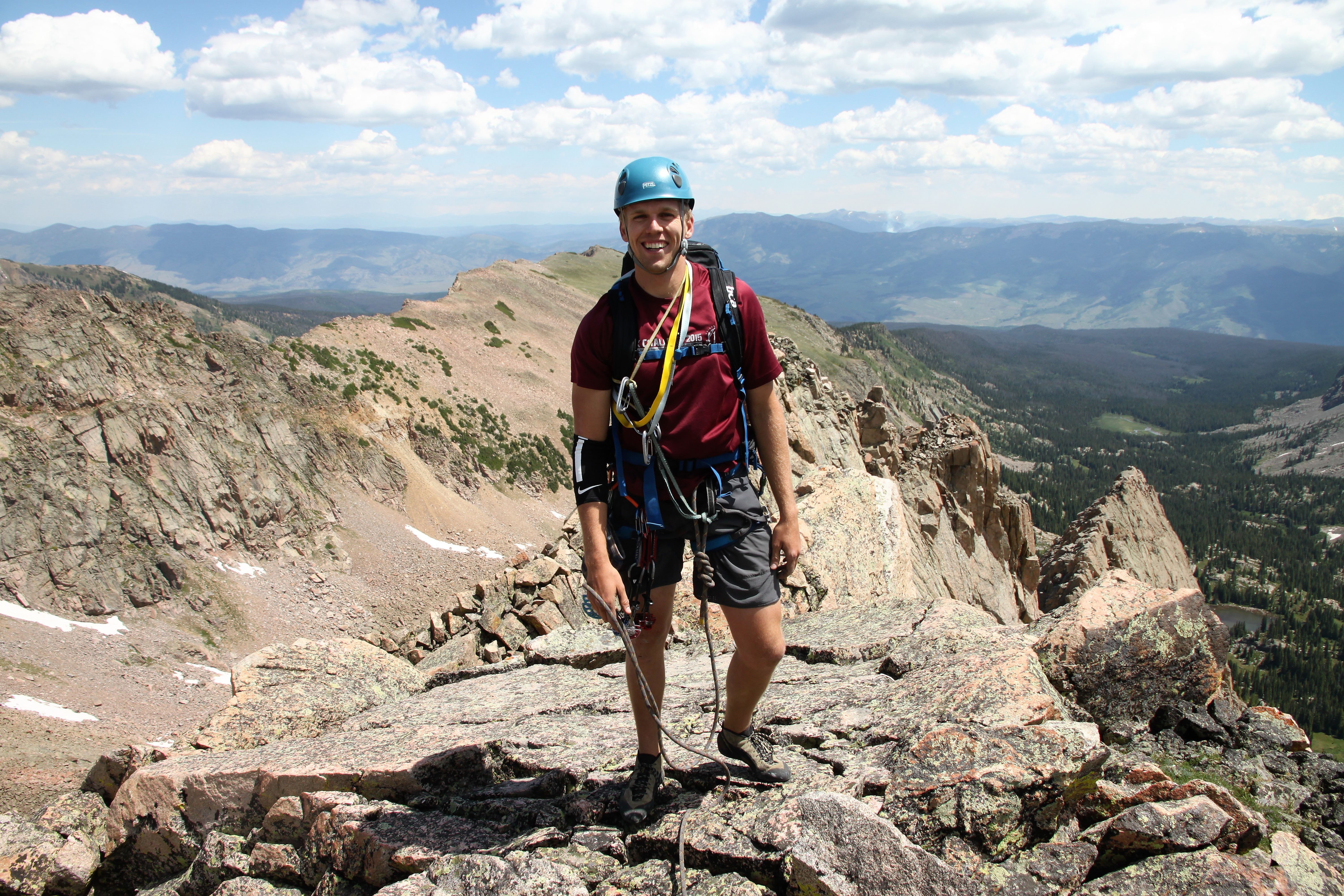
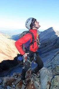
Capitol summit (14,130′)! This was Chris’ first time up Capitol, which was extra special

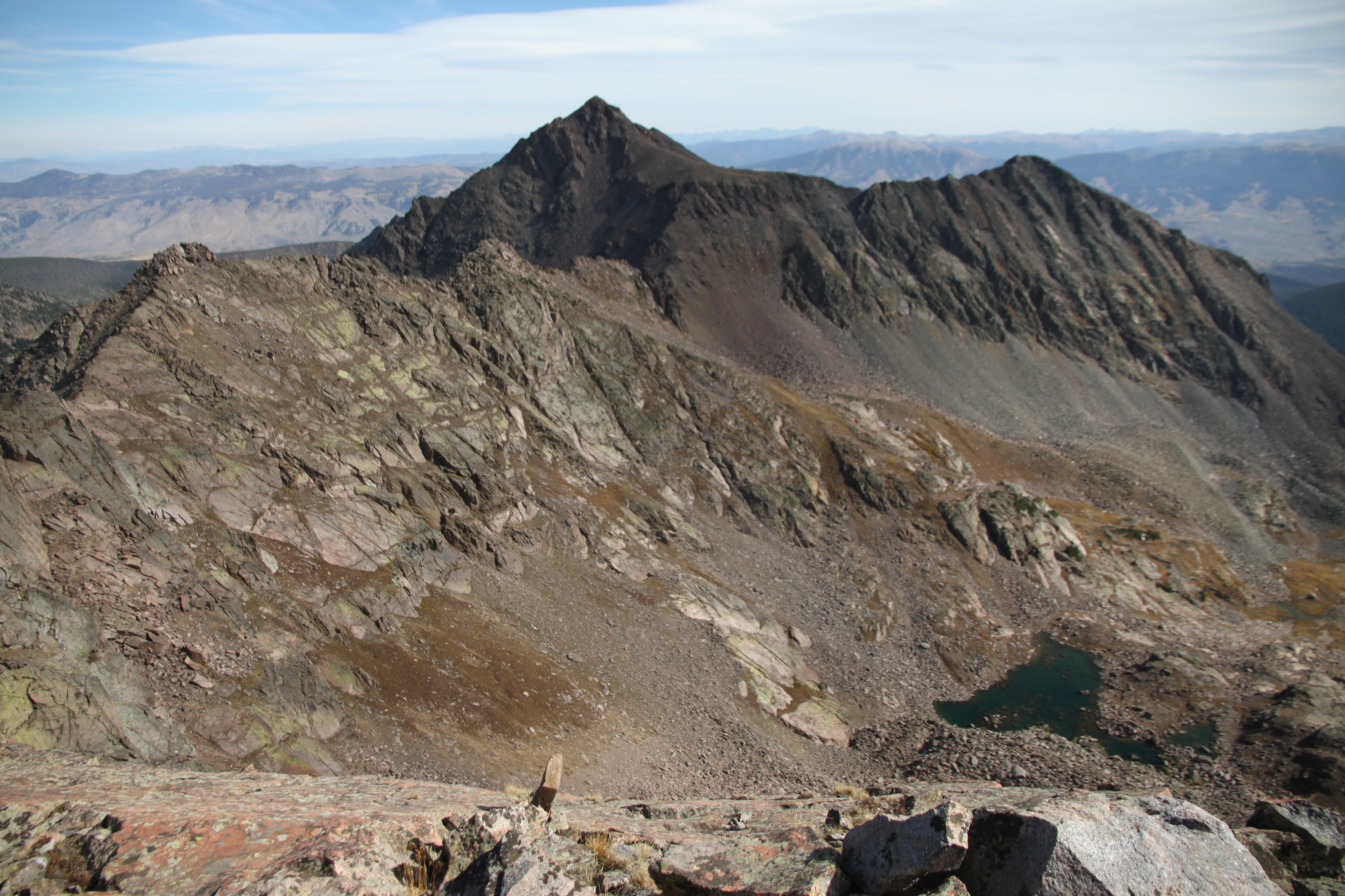
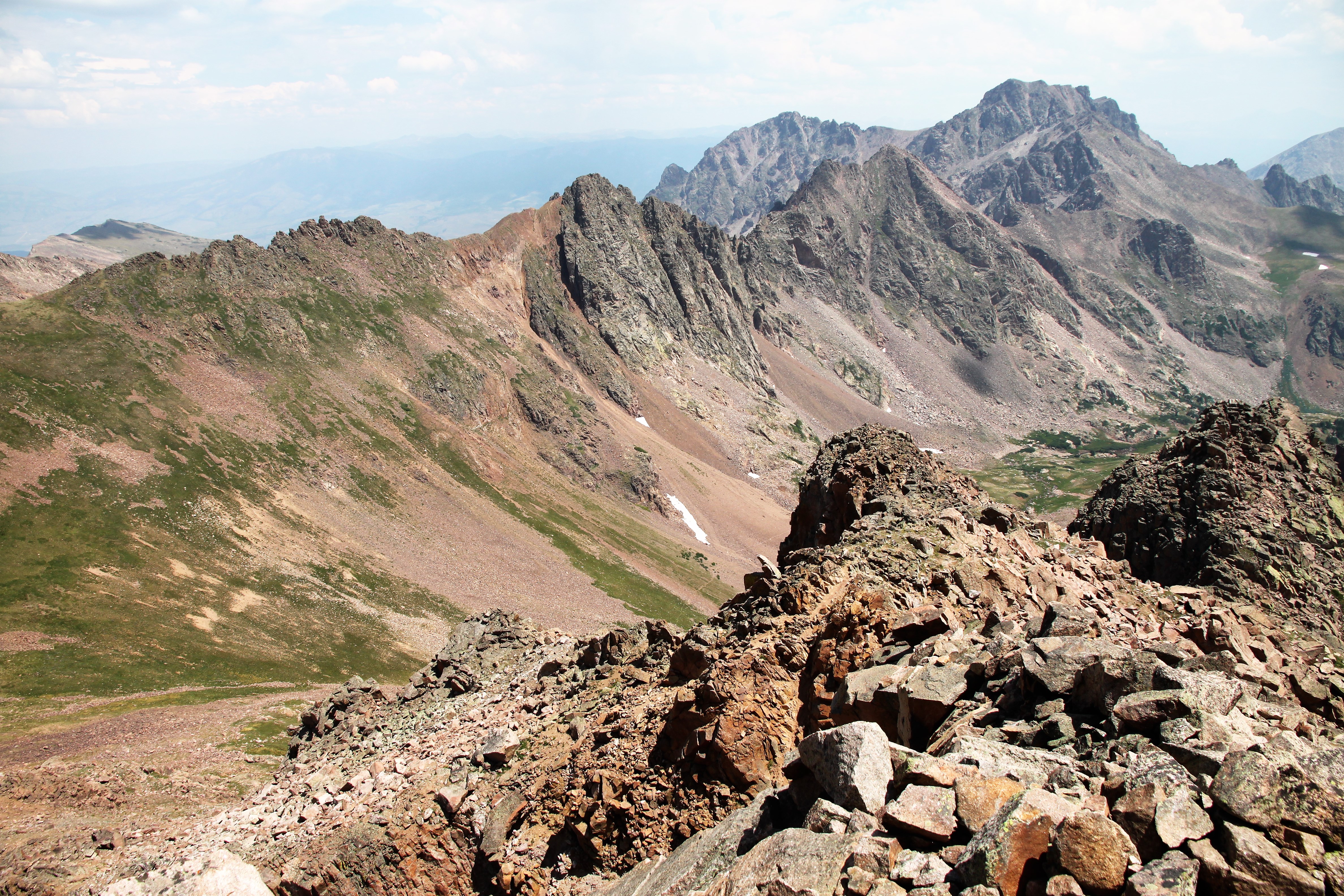
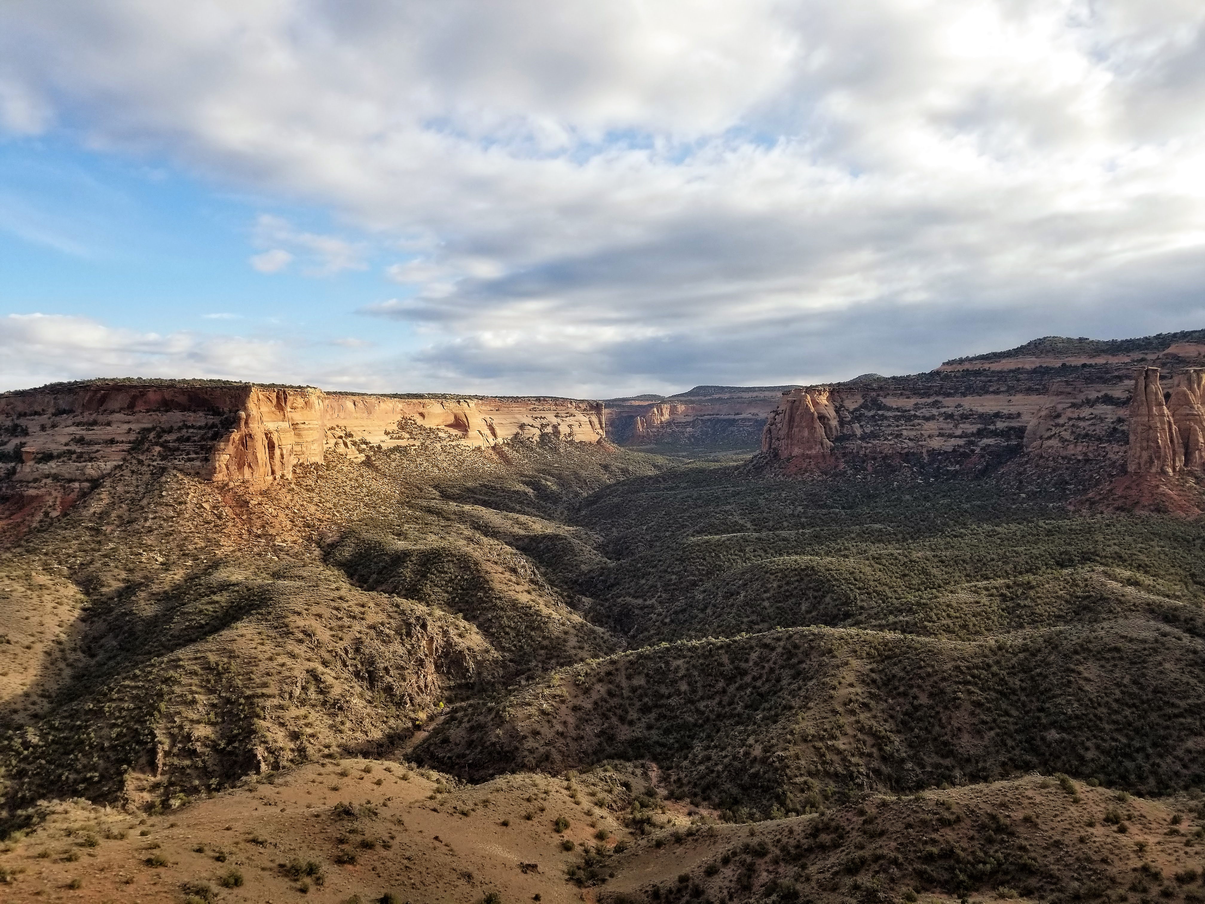
Looking out towards Snowmass Mountain, the Bells, and Pyramid

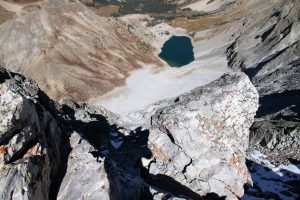
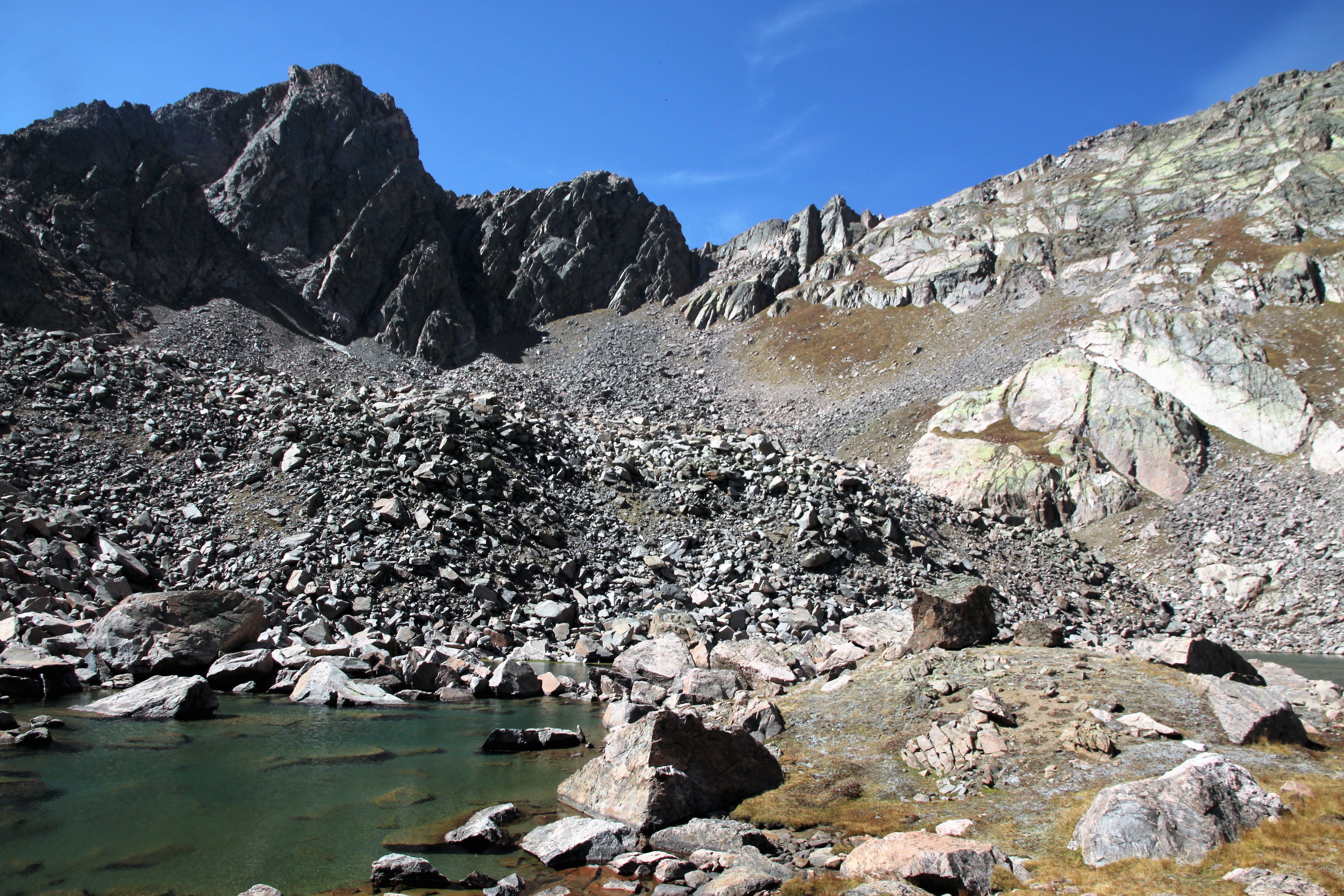
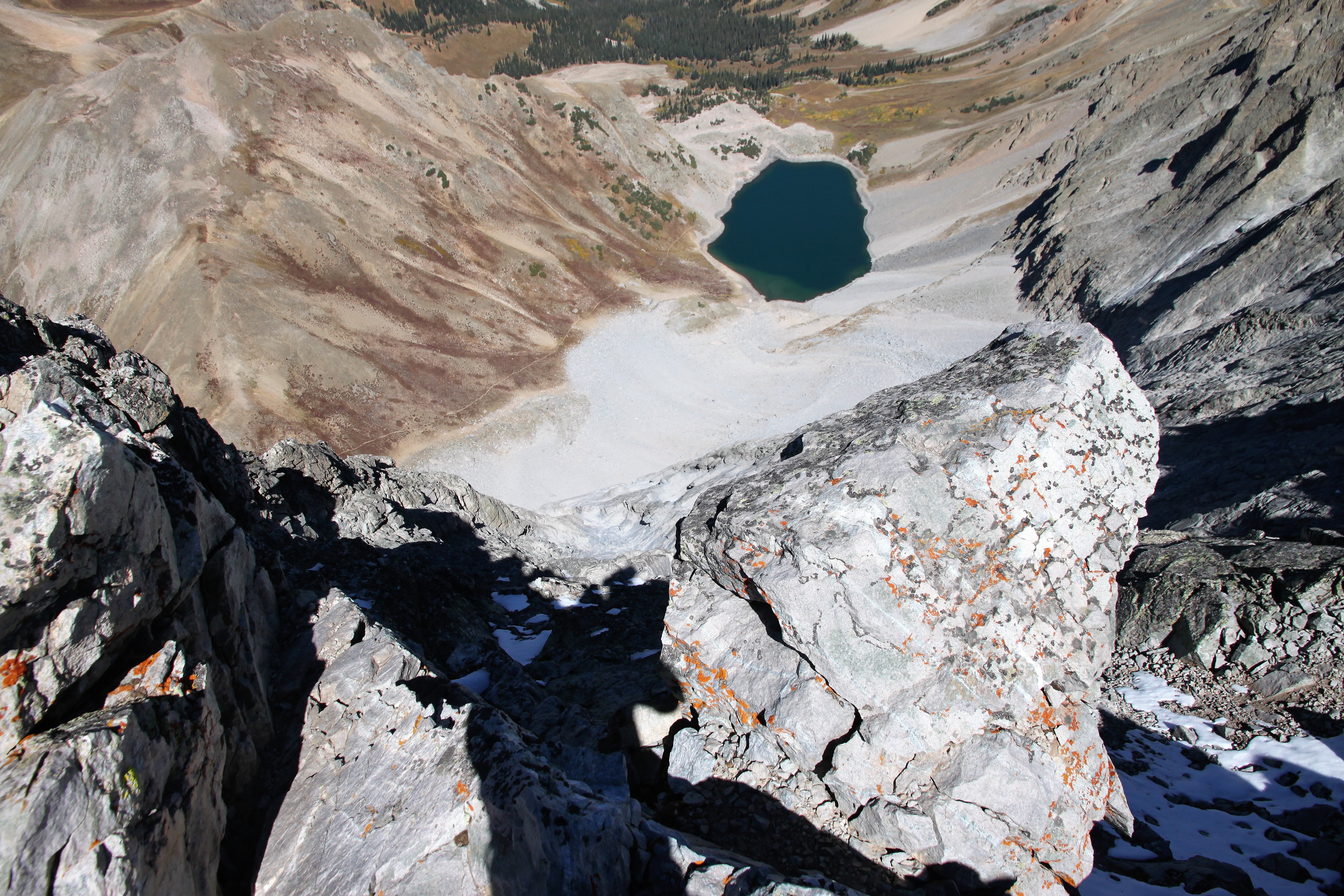
Capitol Lake about 2,500′ below

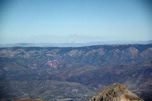
The fire north of us near Steamboat

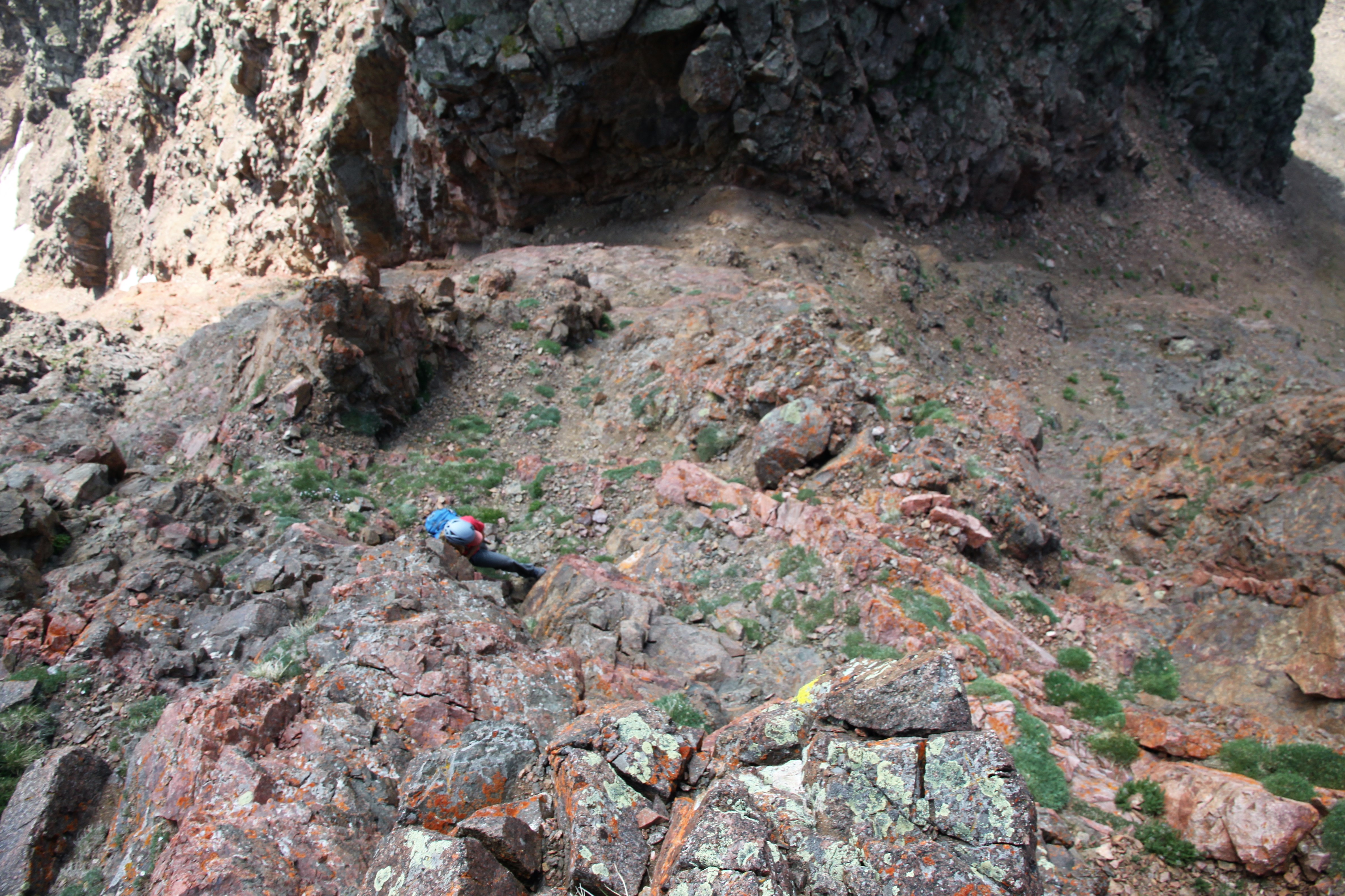
We figured it was time to roll around 12:30pm and so reluctantly we departed the summit down the familiar knife-edge standard route. It was super fun cruising down the standard route with no one else on the mountain.

Me taking the ridge-proper down the northeast ridge. Photo by Chris

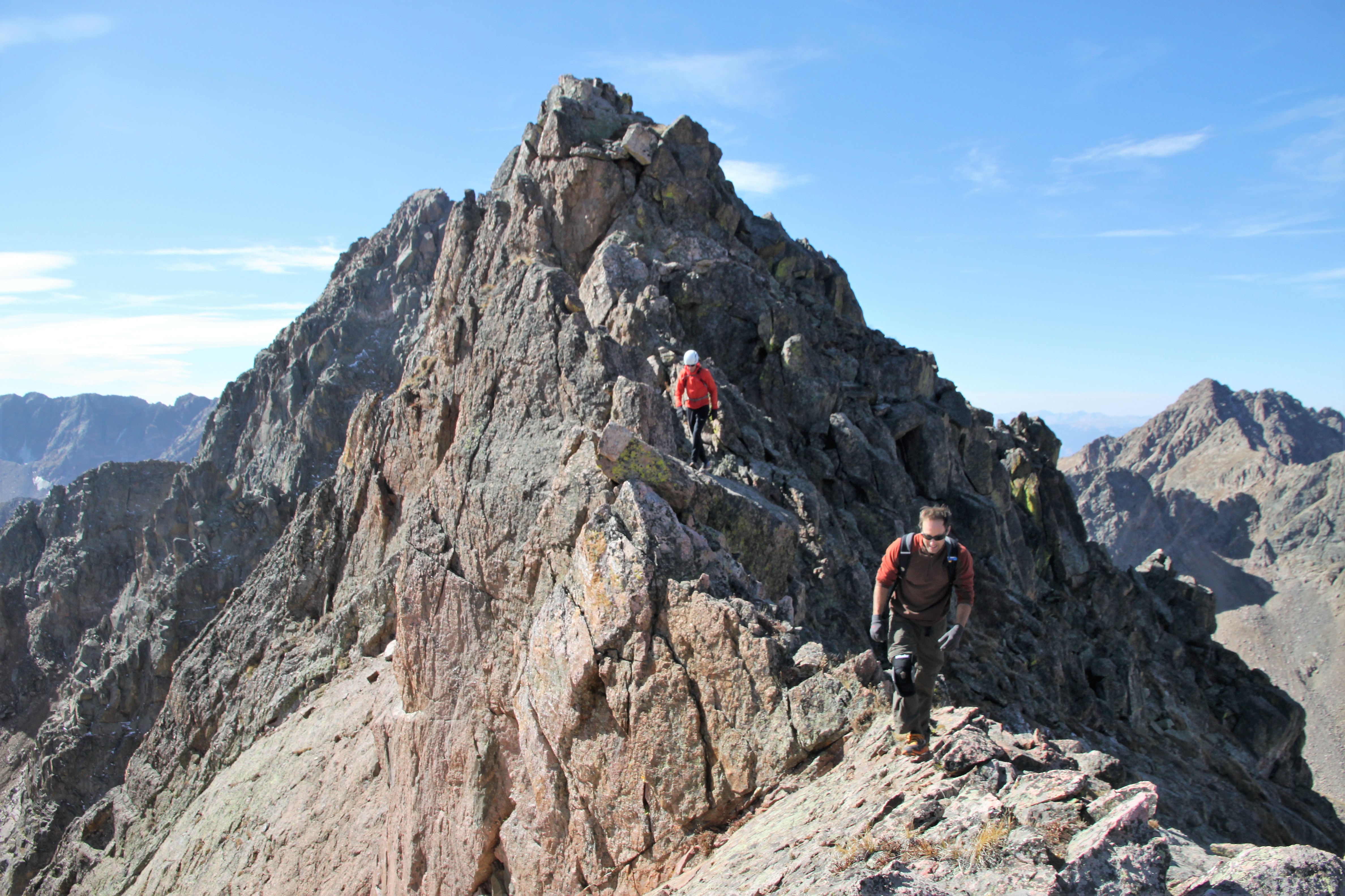
Chris descending the standard route

And out across the knife-edge. I think he really enjoyed the standard route as well as he wants to go back at some point

We took a sigh of relief on top of K2, stowed our helmets, and let Kristine and Kimberly know we just had the slog out now. We made our way down the never-ending boulder field that I hadn’t been on in years and over to the Capitol-Daly saddle to reach the most welcomed trail. After a refill of water and a snack/sandwich at Capitol Creek just below Capitol Lake in the warm sunshine, I guess we had to motivate to hike the 6 miles out. It was pretty darn hot and my Lowe Alpine pants were heavyweight. So, I decided to take em off and hike out in my boxers. I mean my Patagonia silkweight boxers look like shorts, right? Hopefully, I didn’t embarrass Chris, but this wasn’t my first rodeo in just my boxers. He just had to get used to it. We arrived back at Capitol Creek TH around 4:30pm for a total time of 14 hours, but we did take several breaks on the way down and a good hour on top. So, maybe not all that shabby. We packed up, stretched out our backs (we ain’t so spring chickens anymore, that’s for sure) and made the trip back to Edwards. We met up with Kimberly and the Baldwins’ friend Patrick as well as Kristine, Sawyer, & Kona at the Craftsman around 7pm in Edwards for some celebratory beers and dinner. This was a fun day.

All in all, I just plain loved this route. I can’t wait to go back with J and climb Early Times (5.10). Maybe next September. I’m just so glad it finally worked out before our second child (yep, Sawyer will have a baby brother) enters this world come Halloween. Thanks again to Chris for a fantastic climb.

Hail, Sleet, then Snow!

In an effort to get back to some blogging, here is one on a pretty cool and new traverse we did in the Gore a few Saturdays ago. Having done many of the ridge traverses down the central spine of the Gore Range, there was still one spicy section of ridge that I always wondered about. It was a gnarly looking section of seemingly rotten towers interspersed with some sections of good Gore granite between Hail Peak and a minor summit called “Sleet”, a name coined by Stan Wagon. I had gazed upon this small section of ridge for years from all different angles and wondered if it would go through. I inquired with Stan about possible  completed traverses of this section of ridge which he knew of none. Finally the weekend before, I decided to trail run the same loop in which I would attempt the ridge, but just remained in the small basin containing Snow Lake immediately to the south of the ridge. I did some decent recon on this ridge from below and from up higher on Snow Pass and Snow Peak all the while having a great run of a loop I’ve always wanted to run. I even met a Great Dane named Merlin on the summit of Snow Peak, quite the treat as I didn’t know 160lb+ dogs climbed obscure Gore 13ers. It made me miss my numerous Gore summits with Rainie and Kona.

Merlin and I atop Snow Peak with the Hail to Sleet Traverse above our heads in the picture

It turned out that J and good pal Marc Barella could join me. Also, Caroline Kurio, a friend of Marc, would also be joining us as I met her skiing Torreys Peak back in June. We departed the Gore Creek TH maybe around 5:45am and motored the almost 5 miles east up the Gore Creek Trail to the junction with the Gore Lake trail at the familiar Recen Brothers grave sites. We then set off north up the Gore Lake trail past the unmarked turnoff to what we call “Zodiac Pond” and eventually left the Gore Lake trail and bushwhacked up into the Snow Lake basin and up Hail Peak’s boulder-strewn southeast face. I had climbed Hail Peak before a few years ago with Reid Jennings running the trails and hiking the off-trail boulders, so I knew the ascent to Hail at least.

J and Marc on Hail’s southeast face with Snow Peak above J’s head in the picture

Caroline ascending the steep eastern ridge of Hail with me up above. Photo by Marc

Marc and Caroline doing some fun, but unnecessary scrambling up Hail towards the summit

Hail Peak summit (12,904′)

The Traverse to Sleet and then Snow Peak at far left as seen from Hail’s summit. Snow Lake is below

The traverse to Sleet with Mt. Vahalla in the background to the right

I believe we arrived on Hail’s summit around 9am or so. Only staying up top for maybe 15-20 minutes, long enough to get a snack and water, we descended Hail’s west ridge for some nice, moderate scrambling on pretty solid rock.

Descending Hail’s west ridge

More of the fun west ridge of Hail Peak

Caroline with Deming Mountain and West Deming in the distance

J on some nice, exposed downclimbing

A nice perch

We reached what appeared to be the last crux to get to the low point of the traverse. We sought out a few different downclimbs but wanted to keep the rope and webbing in my pack. We finally decided on a low 5th class, decently exposed downclimb which worked out quite nice.

Descending down to the crux downclimb. Photo by Marc

Marc descending the short, low 5th section with Caroline out left

Some nice scrambling ensured up and over a few towers and everything was going pretty smoothly.

Looking ahead to the seeminlgy cruxy, rotten towers

Easy downclimbing to a higher saddle before the final few towers

Caroline and I took a direct route up this rotten tower while J and Marc went to the right in this pic up a gully

Caroline topping out on the on the rotten rock

Marc coming up after the rottenness

Looking ahead at the top of the rotten tower

We saw a sliver of a ridge lead to the next tower and decided to take it. Otherwise, it would have been some nasty rappel into a deep slot.

Caroline almost to the top of the next tower on which we saw a cairn on top! Marc and J seen behind on the narrow ridge

I traversed on over to the summit of the next tower trying to find a downclimb, but it was a no-go. I backtracked and found a nice little bypass under the tower on the ridge’s north side.

Looking back at the non-downclimable north side of that tower

There was one more tower that I went up to and beyond to find a downclimb but again would have needed to rappel it. Instead of wasting webbing on a rap anchor, I just went back down and continued on the north side ledge traverse

Looking head to Caroline on the nice traverse over to the final upclimb out of this rotten tower/gully system

Caroline & Marc on the final upclimb

Me out of the cobwebs of the Hail to Sleet Traverse

We then hiked up to the ridge proper west of Sleet’s summit and then back east to the summit.

Sleet summit

We still had some distance to cover over to Snow Pass, so we got moving.

Setting off again to the west

Most of the remaining ridge over to Snow Pass was some pretty cool and very solid class 3/4 scrambling. Super fun.

Scrambling to the west on the west ridge of Sleet. The minor summit of Sleet is behind

One of the small downclimbs along this section of ridge

We had seen a herd of goats far off near Snow Pass earlier in the morning only to find them on the last tower of the scrambly portion of this ridge. This was such a treat.

Goats and Grand Traverse Peak

Zoomed-out to show the whole Grand Traverse

I always love running into these guys up high in the alpine

One more

We made it over to Snow Pass, dropped the packs and gear, and jetted up Snow Peak since Caroline and Marc had not been up it. It was a good way to finish up the day.

Snow Peak summit (13,024′)

Looking back at the ridge to Sleet and then onto Hail

A sunlit Zodiac View in the foreground, a shady Zodiac Ridge behind, and a sunlit East East Red to East Red and then Red Diamond Ridge in the back all as seen from Snow Pass

We quickly descended back to Snow Pass and then down to Deluge Lake for a nice dunk in the cold, refreshing water with a  sandy bottom for the toes. Man, that felt nice! the walk down from Deluge was hot and smoky, but we arrived at the Gore Creek TH by 3:15pm.

Our approach in red, traverse in blue, descent in green

It was a good day out with a great crew. Always feels good when you have no previous knowledge of a section of ridge yet it all goes through and works out nicely. There have been a few of these types of adventures for me over the last 15 years in the Gore and I do cherish them.

Book of Thor

Its been forever since I have posted something due to various reasons – buying and selling homes, moving, settling-in, work, no notable trips, and just life in general 🙂 However, I need and want to get back to some blogging. I need to play catch-up a bit. Last weekend I finally got back into my beloved Gore and climbed a line I had spied 2 years ago while deep in the remote South Rock Creek drainage below Valhalla Peak’s east face. This is the location of the beautiful Asgard Meadows flanked by Vahalla’s two eastern ridges: the north being the infamous Asgard Ridge and the southern being the locations of Loki, Thor, & Freya Towers.

Hiking along the southern flank of Asgard Ridge into Asgard Meadows with our destination being Thor Tower

I got a close-up of this guy and its web with a blurred Valhalla Peak and Thor Tower (with its shaded north face) in the background

I recruited my super strong, young, triathlete buddy, Dylan Friday to go with me and he was excited as well. Dylan hasn’t led anything in his life (yet), but he would follow me up anything and is a great partner. We left the North Rock Creek TH around 6:15am and did the normal approach via the southern flank of Asgard Ridge into Asgard Meadows in about 2-1/2 hours with loaded packs of climbing gear.

Looking down on Asgard Meadows

Profile of Freya Tower

Looking up at the mighty Thor Tower from Asgard Meadows

So, close to 2 years ago, after Ryan Marsters, Mike Santoro, & myself made the first ascent of Freya’s east ridge, we contoured around to the south of Thor Tower to head up and climb Stan Wagon’s western 5.6 route up Thor. Upon our contouring, I spied a nifty, clean-looking dihedral on Thor’s south face that grabbed my attention. I knew I had to go back and try and climb this line.

The dihedral

This picture is borrowed from Stan Wagon and is taken from Rain Peak to the south. It shows well the southern faces of the towers and our line up Thor is drawn in red

Dylan and I scrambled our way up to the Freya/Thor col and then scrambled around to the south to the base of the dihedral. The base of the dihedral was full of snow, so we decided to scramble up some 4th class/low 5th solid rock to the left to gain a small ledge 40′ up to begin the actual climbing.

Dylan climbing the fun 4th/low 5th rock to the left of the dihedral proper to avoid the snow at its base

We reached a small ledge and racked up. Dylan, being the strong ox he is, put my backpack in his backpack on his back to lighten my load significantly. I took off up our 1st pitch on some fun 5.7 climbing for the first 50′ or so placing two pieces. One thing I do look for in lines to climb is always the objective danger, i.e. falling rocks, and one of the alluring aspects of this dihedral was the apparent absence of potential rockfall. There were a few 5.8 moves and then a nice section of 20-30′ of 5.9 climbing towards the end of our first pitch involving some finger layback moves. I was running out of rope and looked up ahead, but there were no obvious belay spots with the upcoming roof crux. I wasn’t on a great ledge or anything, but figured it would do since I had a good crack to build my anchor to the left and at least a few tiny ledges to put my feet on.

Looking up the dihedral from our small belay ledge for pitch 1

Looking down our pitch 1

My anchor at the top of pitch 1

I put Dylan on belay and he followed up pitch 1 cleaning my gear. He really climbed well especially given his loaded backpack.

Dylan on pitch 1

Dylan on the 5.9 portion of pitch 1

Dylan reached me, swapped the cleaned gear back over to me, and he put me on belay for the seemingly harder pitch 2. I was hoping and pretty sure I could reach the ridge crest of Thor and set up a belay.

Looking up at the crux roof of pitch 2 above from the top of pitch 1

The first 30′ off the belay was some interesting and thought-provoking 5.10 climbing. Especially getting into the dihedral and stemming below the roof and pulling the roof into a super thin seam where I could only get a nut to protect the moves. The right face was slick, lichen-filled granite, which didn’t inspire confidence when laybacking. All in all, I did it clean and made my way onto easier climbing above and moved right to the base of a pillar. I placed a small 0.5 cam at the base of the pillar, slung it, and climbed up maybe 5.7 rock for a good 25′ feet before getting another cam in a solid crack to the left. I reached the ridge after another 10′ of climbing and set up a belay. Dylan climbed it well and reached me at the ridge.

Dylan on the final moves of pitch 2 below the ridge crest

Dylan excited to be at the ridge crest and close to the summit of the elusive Thor Tower

The terrain from the top of pitch 2 to the east looked a bit spicy, so I kept the rope on and led out and up to the east across some 5th class terrain. I didn’t place any gear, but soon reached much easier terrain on the ridge crest and belayed Dylan up to me. Just not wanting to de-rope and all I just continued onto the summit and Dylan followed me.

Dylan beginning the traverse over to the summit

Dylan ridge walking

Dylan on the summit of Thor! And via a new route at that!

Once on the summit, we took in the views and opened the small summit cannister where Stan’s business card and a patch from father’s and my made-up “Chalk Hill Expeditions”. I would highly doubt anyone had been up here in the 2 years since I was last here – at least there was no evidence that I could find.

Valhalla Peak from Thor Tower’s summit

Thor Tower summit (12,500′ or thereabouts)

One of the fires near Winter Park to the east was noticeable

We then descended a bit down to Stan’s rappel webbing and I threw our rope down to rappel.

Dylan on the short rap

Dylan rappelling with a portion of Asgard Ridge as a backdrop

We then stowed the rope and our climbing gear and traded our TC pros for Hokas. The descent down the north from the small col was loose as always but relatively short-lived until we reached what I have come to call “Asgard Lake”. Its a beautiful, completely clear, glacial blue lake.

Asgard Lake with Valhalla Peak on the far left and Asgard Ridge trending down to the right

Making our way down the boulderfields and back through Asgard Meadows was a treat and then we ascended back up to the southern flank of Asgard Ridge. We made it back to my car by 3:30pm for a roundtrip time of 9 hrs and 15 minutes. This was a great day and I’m so grateful that it worked out. Always nice when things come together. Special thanks to Dylan for partnering up with me for this adventure. On the way out, Dylan was asking me what a “dihedral’ really stood for and I explained essentially it was a rock feature in the shape of an “open book”. Then, he suggested “why don’t we call the route ‘Book of Thor’?” Perfect. Book of Thor (5.10) it is.