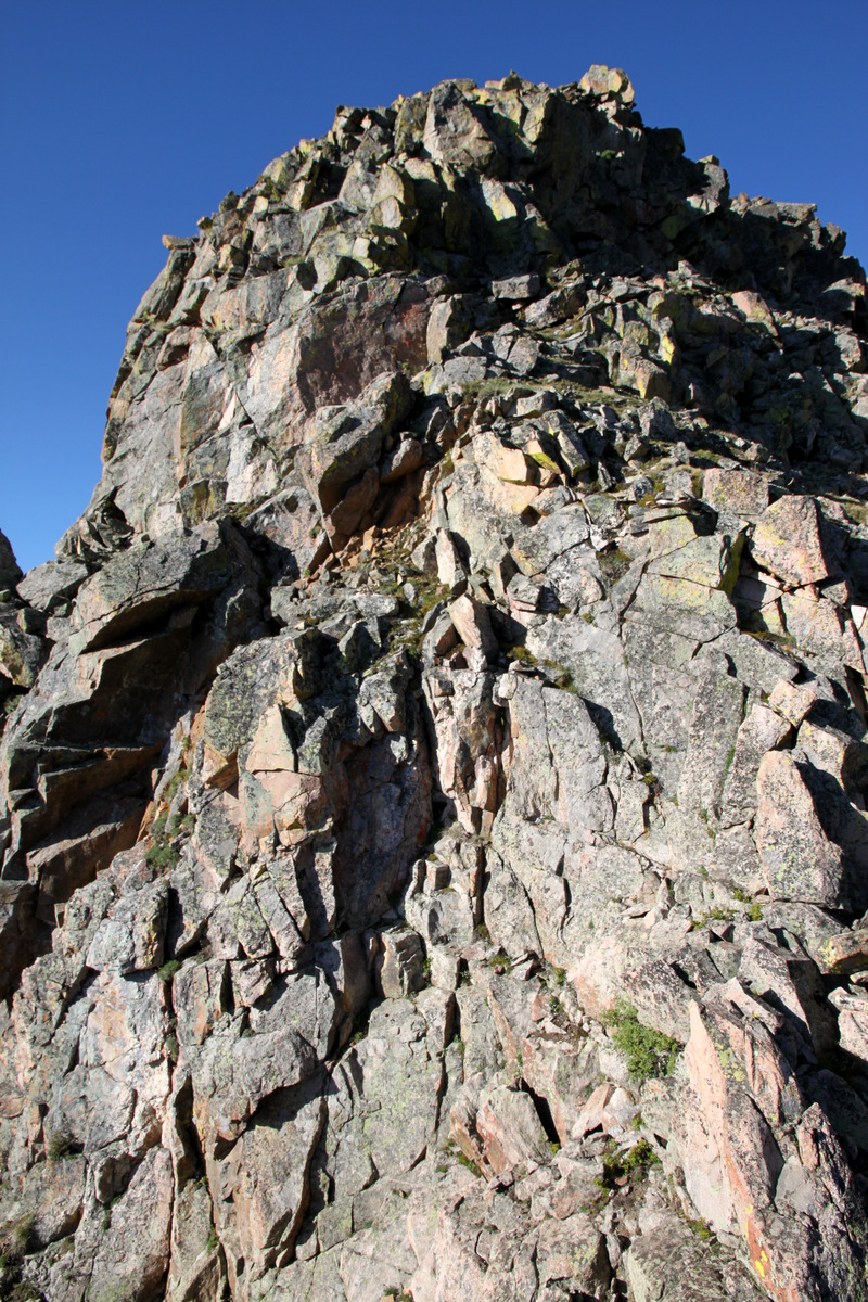
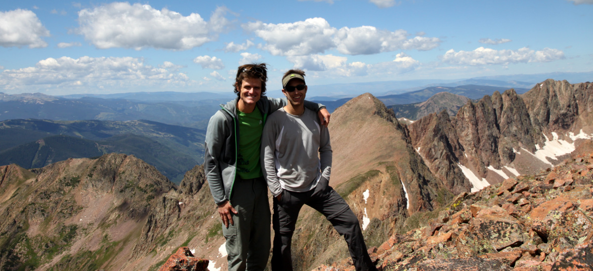
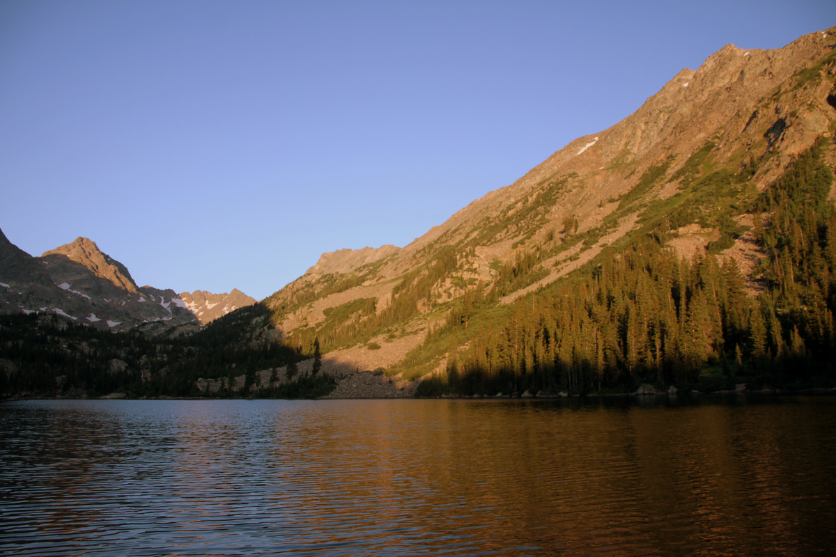
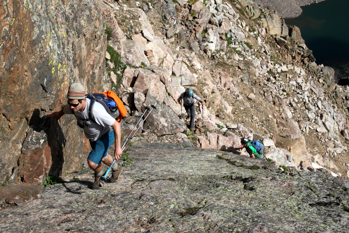
The day after J & I climbed up Asgard Ridge to the summit of Mt. Valhalla and descended to East Vail, Kristine, Rainie, Kona, & I headed over to the Fremont Pass area between Copper Mtn and Leadville in Summit County to check out a hike up the 12,017′ Chalk Mountain.
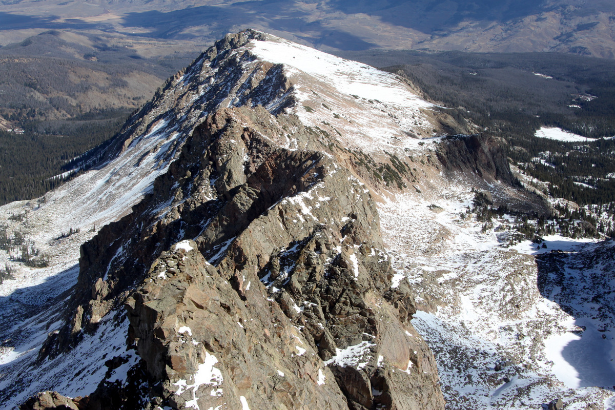
Chalk Mountain below as seen from the summit ridge of Mt. Arkansas (13,795′) on May 10, 2013
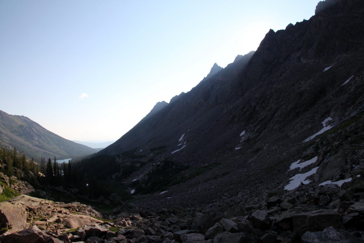
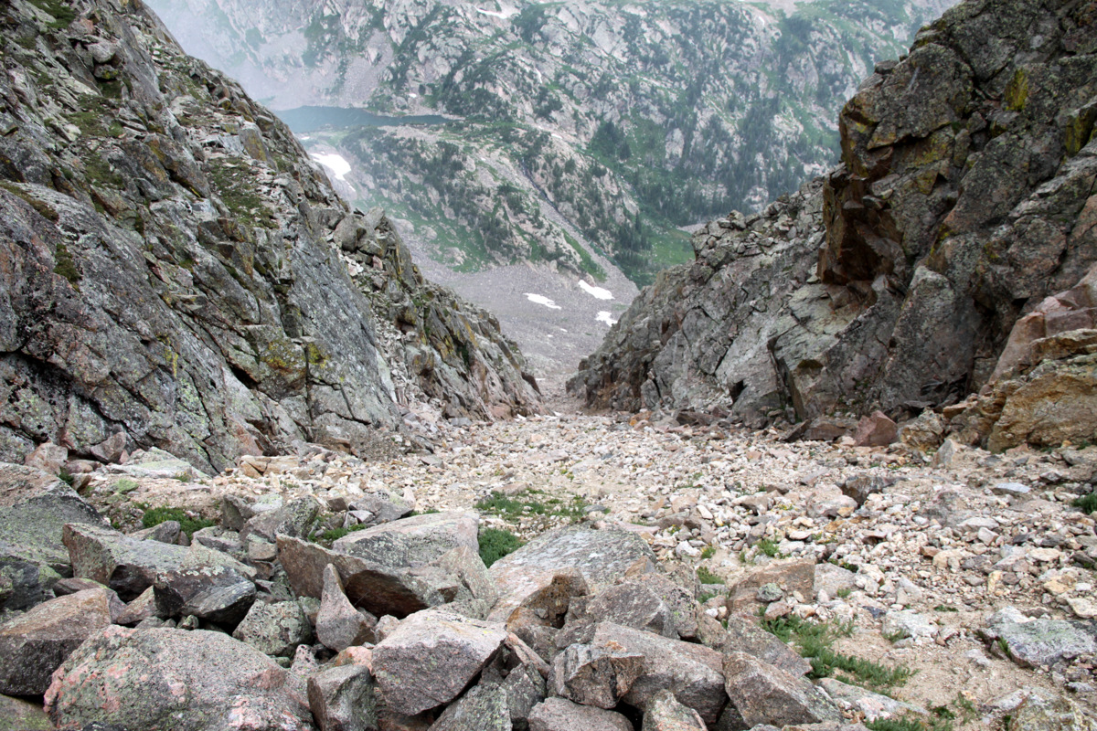
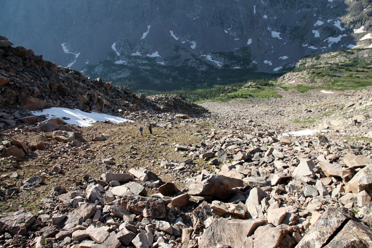
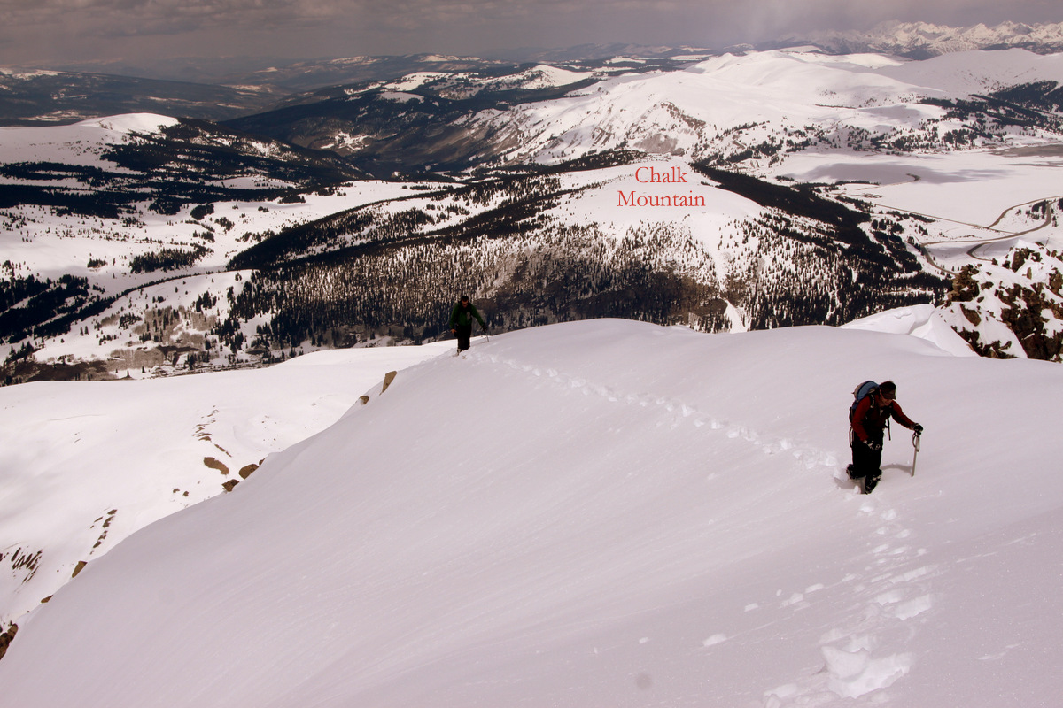
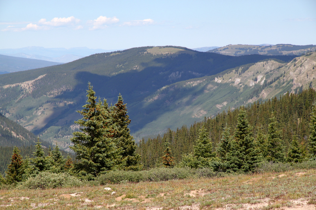
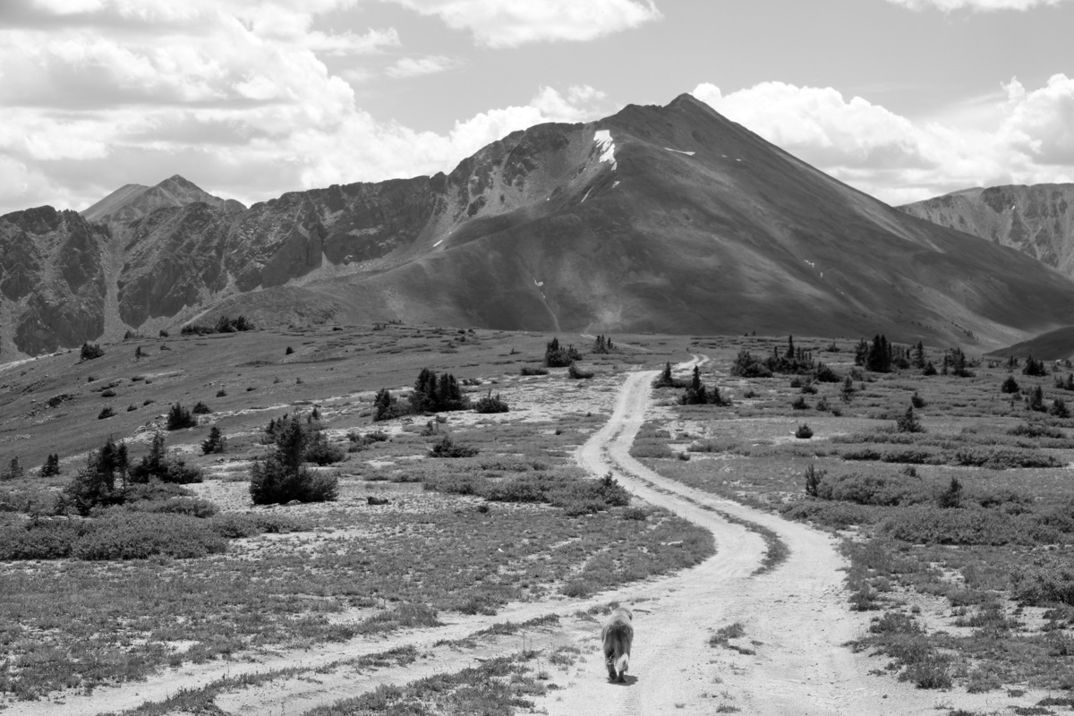
We had been wanting to scope this little mountain out solely because of its name, but it actually turned out to be a nice 4-5 mile hike roundtrip and really good for a 32 week pregnant Kristine. Rainie & Kona had a great time as well. Despite being surrounded by the lands of the notorious Climax Mine on all north, east, & west sides, the south side has a nice forest service road open to the public directly up to the summit plateau of Chalk Mountain. We parked just a few hundred yards off Highway 91 and began the nice stroll up Forest Service Road 134. We actually didn’t get going until maybe after 10am, but the weather was partly cloudy, nice, and cool. Kristine did wonderful and soon we were above treeline staring at the Jackal Hut in the distance.
Can you spot the Jackal Hut?
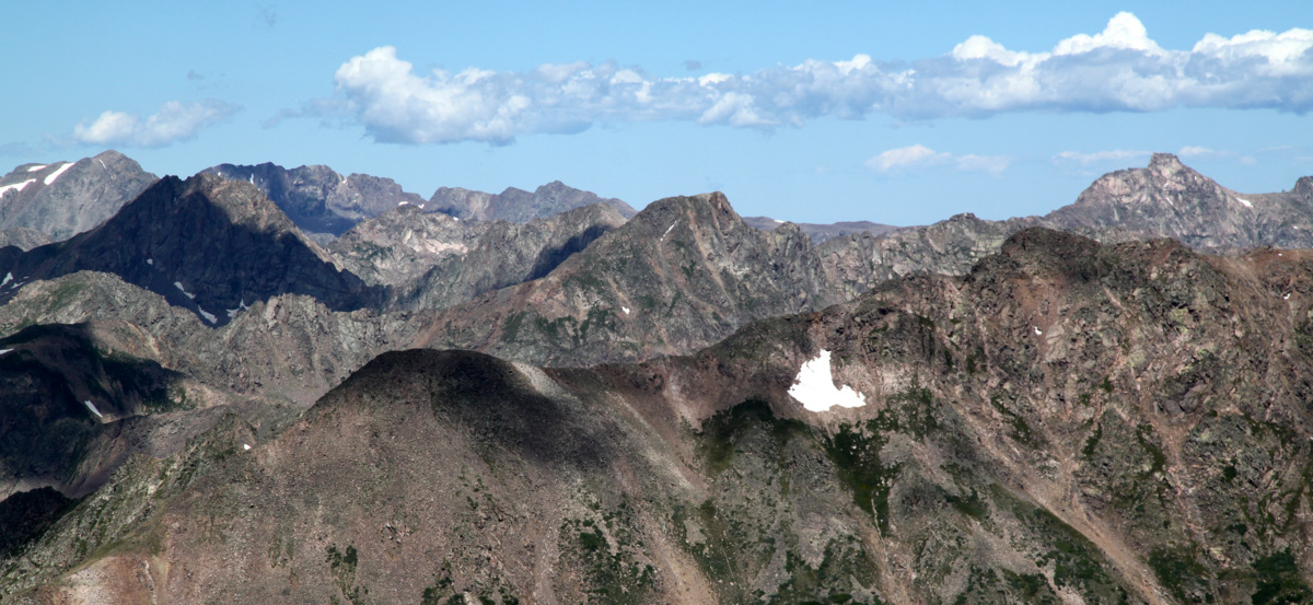
Chalk Mountain’s summit plateau was quite large extending for probably a half mile east to west. The views south to the Sawatch, west to Mt. of the Holy Cross, north to the Gores, and east to Mt. Arkansas were pretty spectacular.
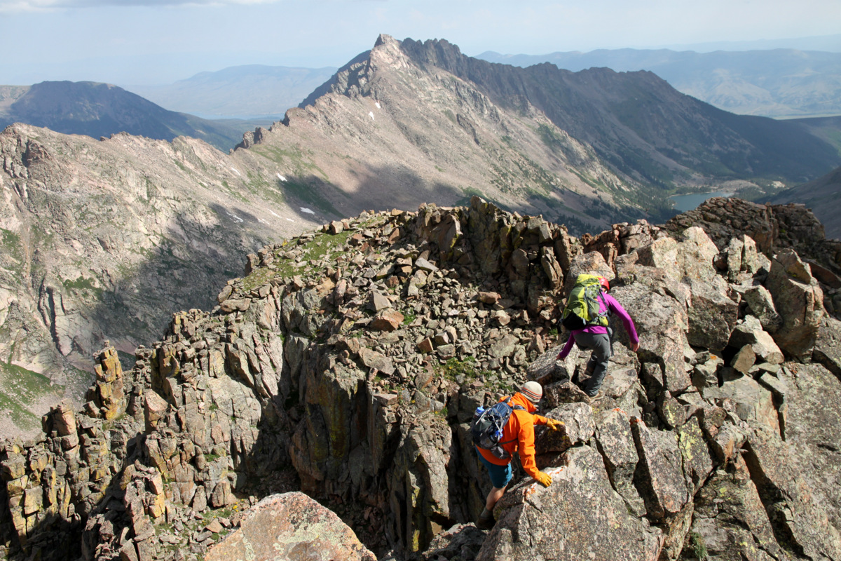
Rainie taking a stroll across the Chalk Mountain summit plateau with Mt. Arkansas towering above
Rainie & Kona heading to the nondistinct summit of Chalk Mountain. I had to use the GPS to find its exact summit of 12,017′
It was very enjoyable being up on the summit of Chalk Mountain with just the Chalks.
Chalk Mountain summit (12,017′)
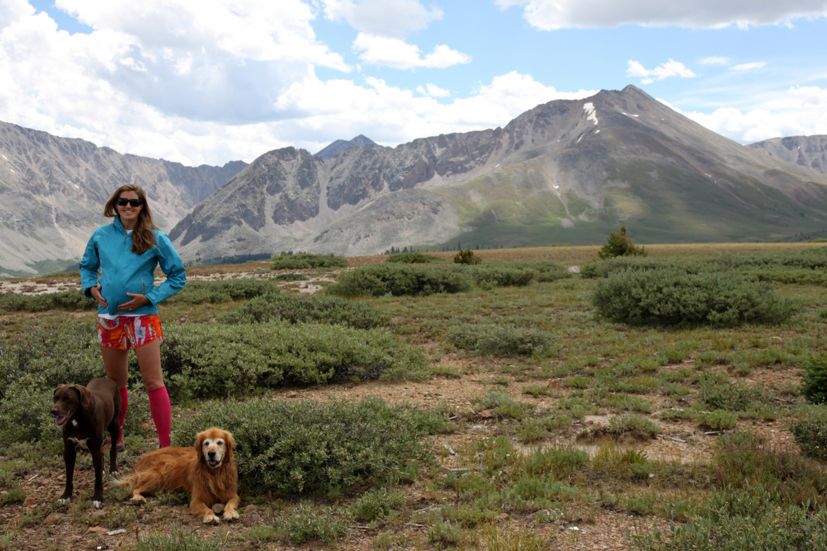
Kristine, the dogs, & our upcoming new addition
I like this one
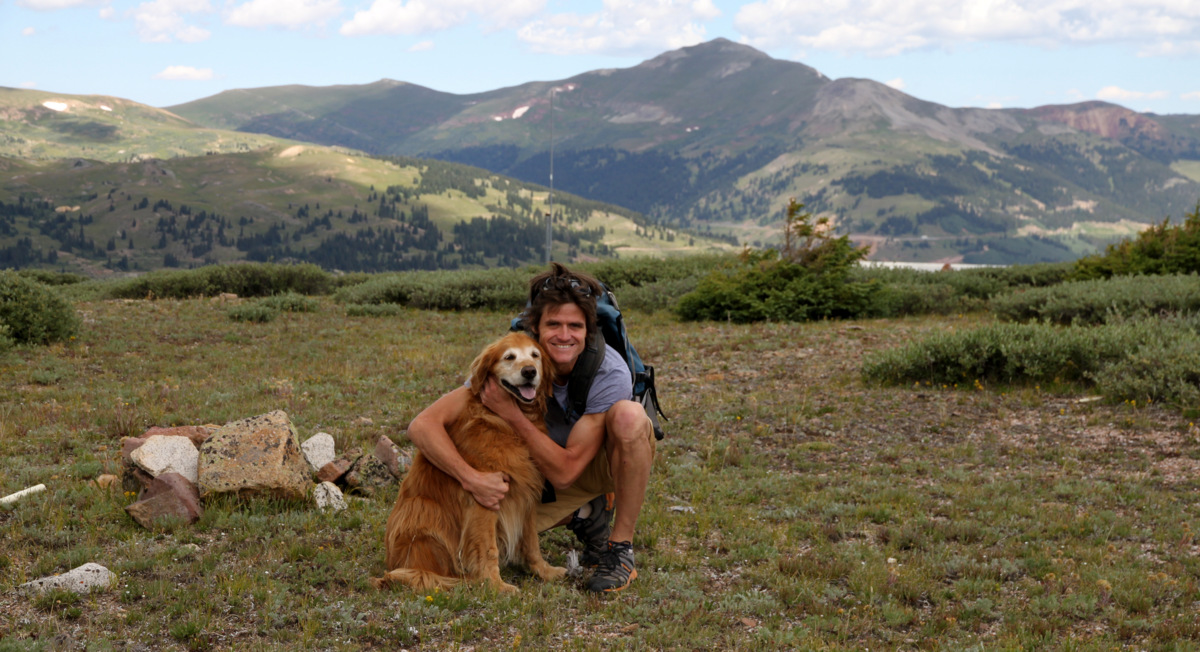
Rainie & I on the summit of Chalk Mountain with Jacque Peak behind
We ate a sandwich, spent 30 minutes on top,and then strolled down the road back to the car getting a little rain/hail on the way down. We then headed to Silverthorne, did a few errands, and picked up J’s truck at the North Rock Creek TH, which we had left in order to climb Asgard Ridge and do our traverse over the Gores. A great day with all my ladies!
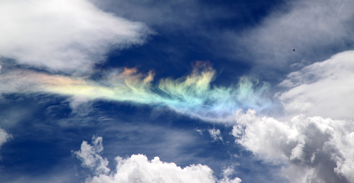
A rainbow cloud as seen walking down the forest service road on Chalk Mountain
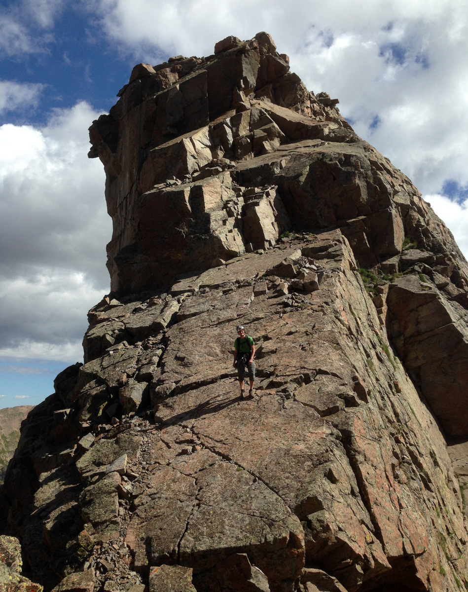
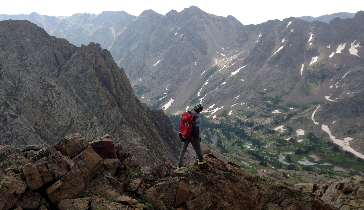
I’m a big fan of Norse mythology and an even bigger fan of the Gores, so when I found out a few years ago there was a ridge dubbed Asgard Ridge that led to the summit of one of the Gore’s prominent 13ers, Mt. Valhalla, I was hooked. What got me actually addicted to this ridge was the view from the summit of its western terminus, Palomino Point (13,060′), in late October 2013 when Kristine, myself, and a wonderful 14ers.com crew climbed Palomino Point & Mt. Valhalla from East Vail and Deluge Lake.
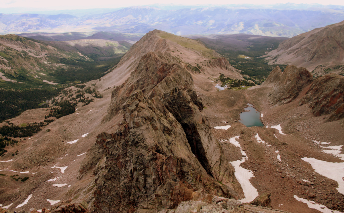
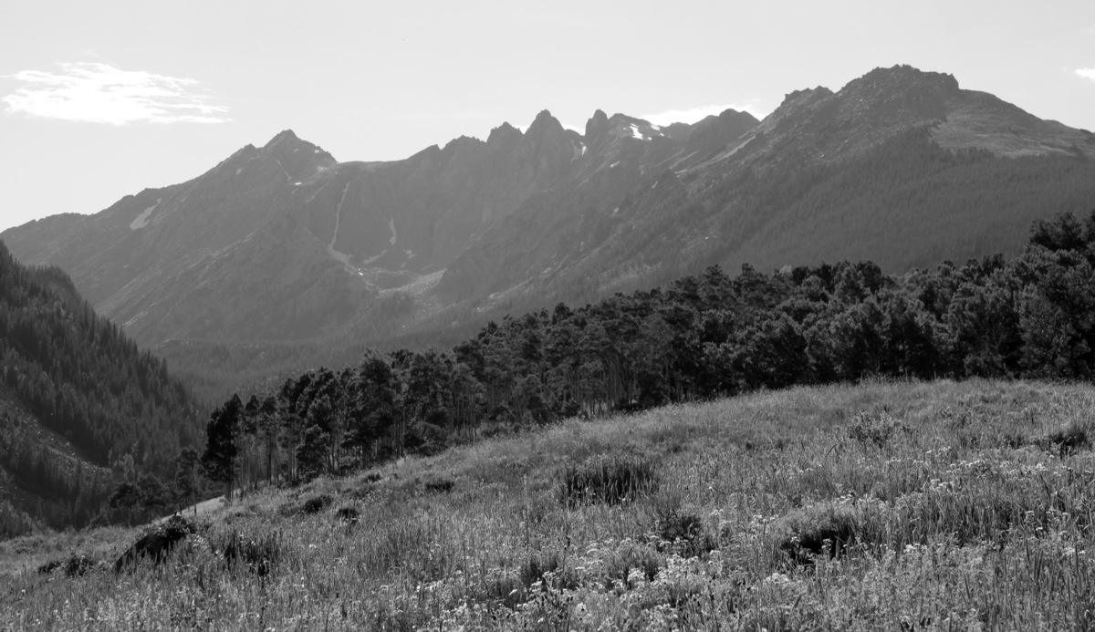
Asgard Ridge stretching out to the east down from the summit of Palomino Point (13,060′) as seen on October 26, 2013
Point Odin (far left), the last tower and major difficulty before the final ascent up Palomino Point’s east face. This picture was taken from Valhalla’s north ridge en route to its summit on October 26, 2013
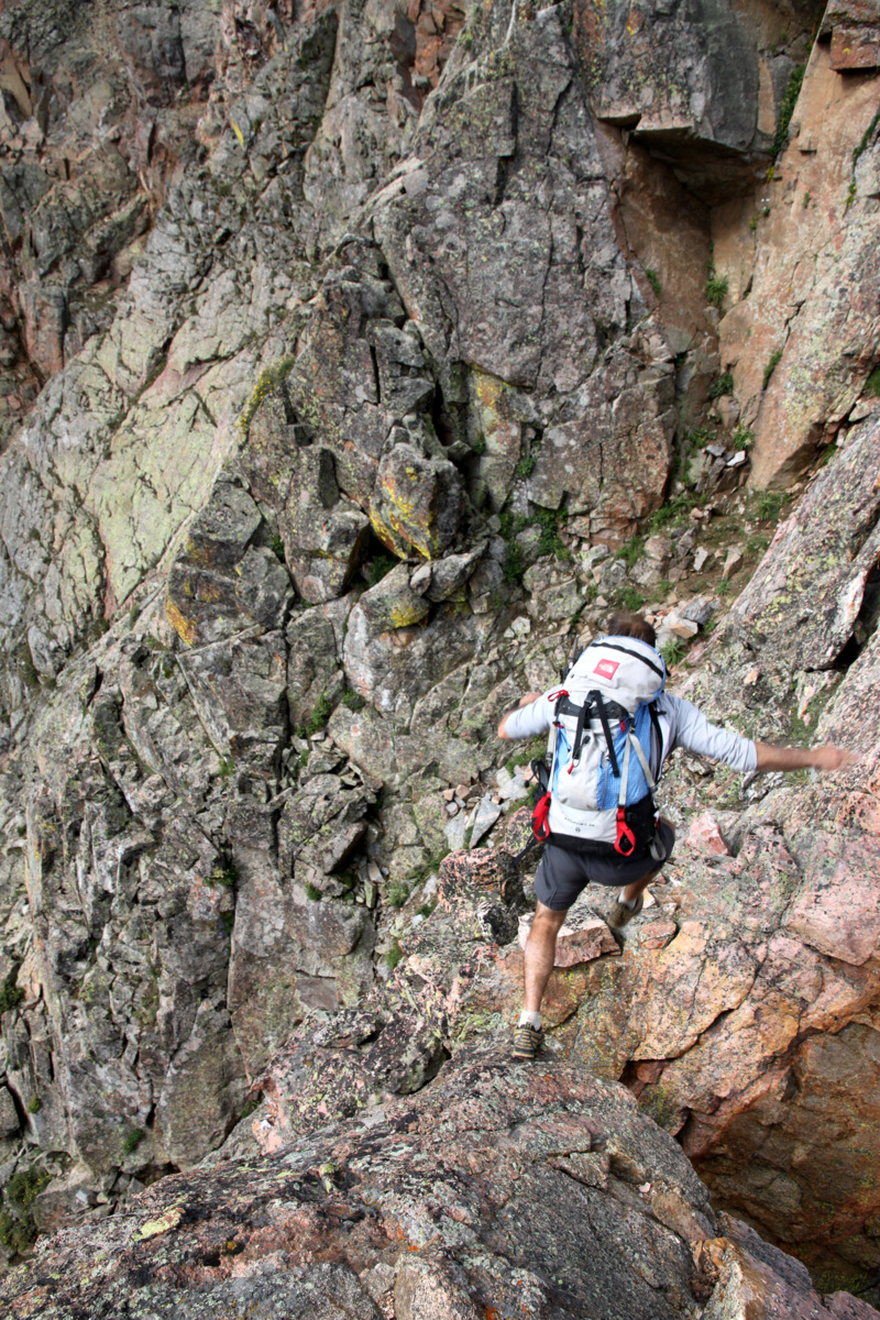
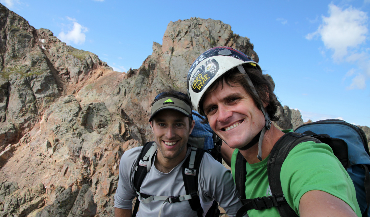
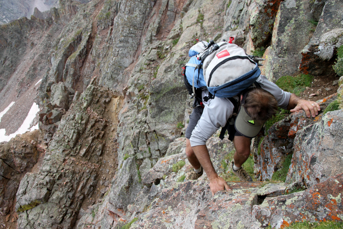
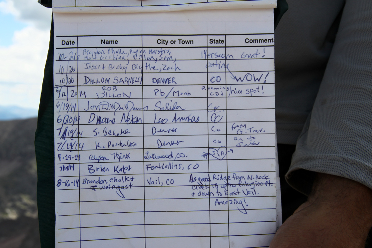
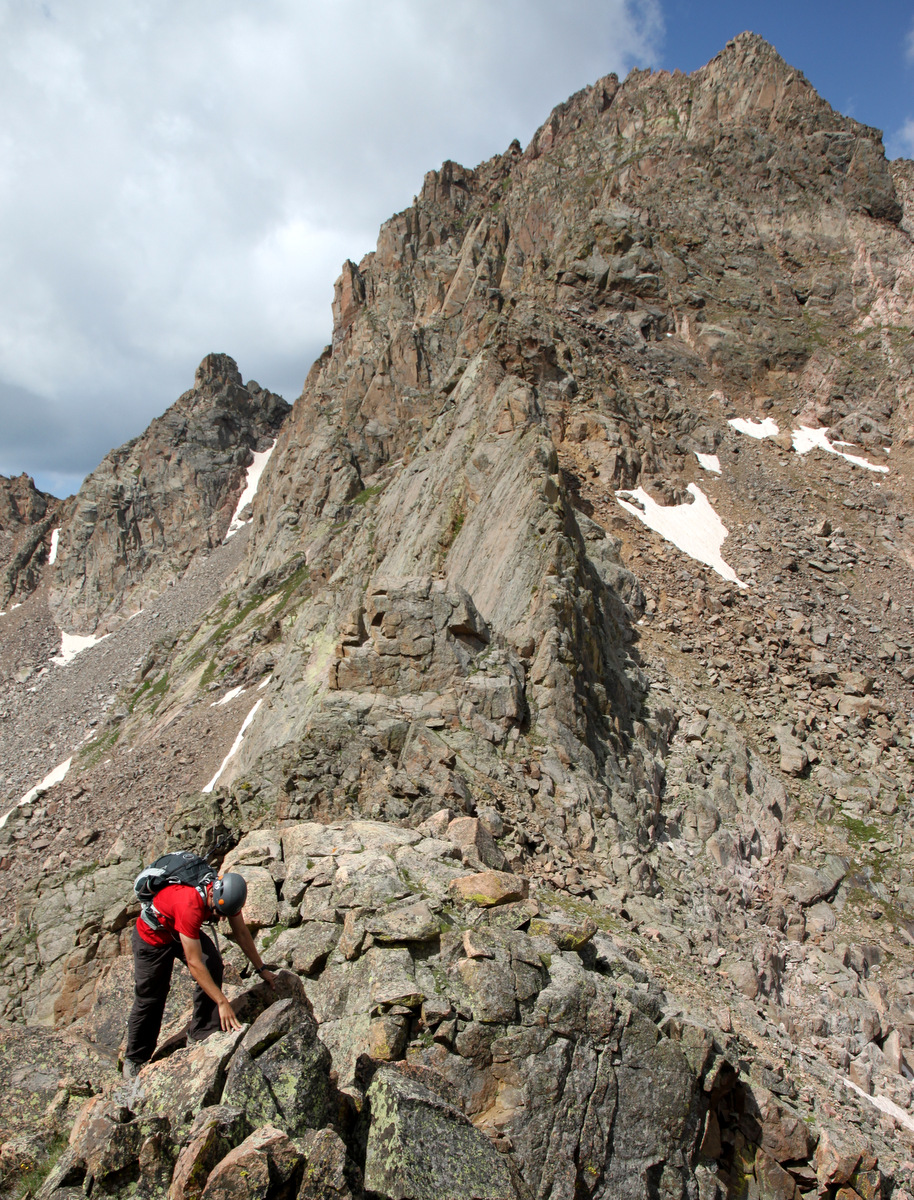
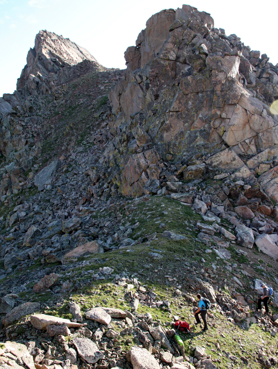
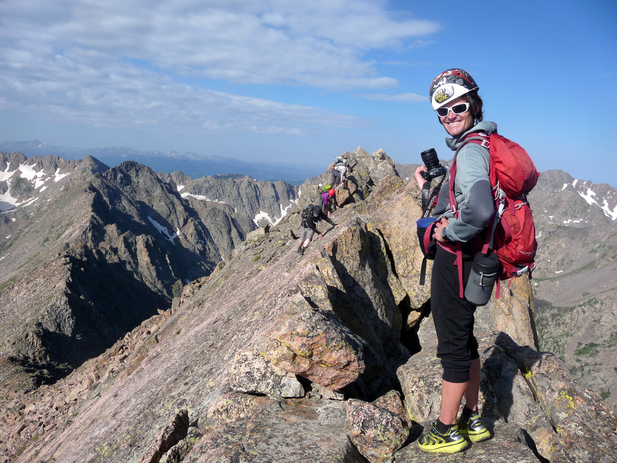
J had not actually climbed Valhalla and I thought this would be a great route to climb to the summit from the east and descend the class 2 normal route to Deluge Lake and out to East Vail. I also read that Stan Wagon & Joe Kramarsic had climbed Asgard Ridge to Valhalla’s summit and descended back to East Vail in July of 1997 per Stan Wagon’s website. The only beta those legendary Gore enthusiasts had written about (that I could find on Stan’s site) was that they used a rope. I am honestly not sure if there was an ascent prior to theirs or after, but perhaps at some point Joe’s encyclopedic knowledge of everything Gore can enlighten us all. Looking down on Asgard from Palomino Point & Mt. Valhalla the year before, it became evident that there were probably a few mandatory rappels. Maybe even a roped pitch or two, which would be wonderfully fun. So, J & I packed my two 30m/8mm alpine ropes, our harnesses & helmets, a light rack including 6-7 cams, a full set of nuts, and of course plenty of slings, biners, & webbing. We didn’t bother with our actual climbing shoes as we both feel pretty good up to 5.7/8 with our La Sportiva Boulder X approach shoes. I think the biggest attribute of gear we had when we traversed the Zodiac Spires in the Gores the year before was plenty of slings and webbing to set up the multiple rappels.
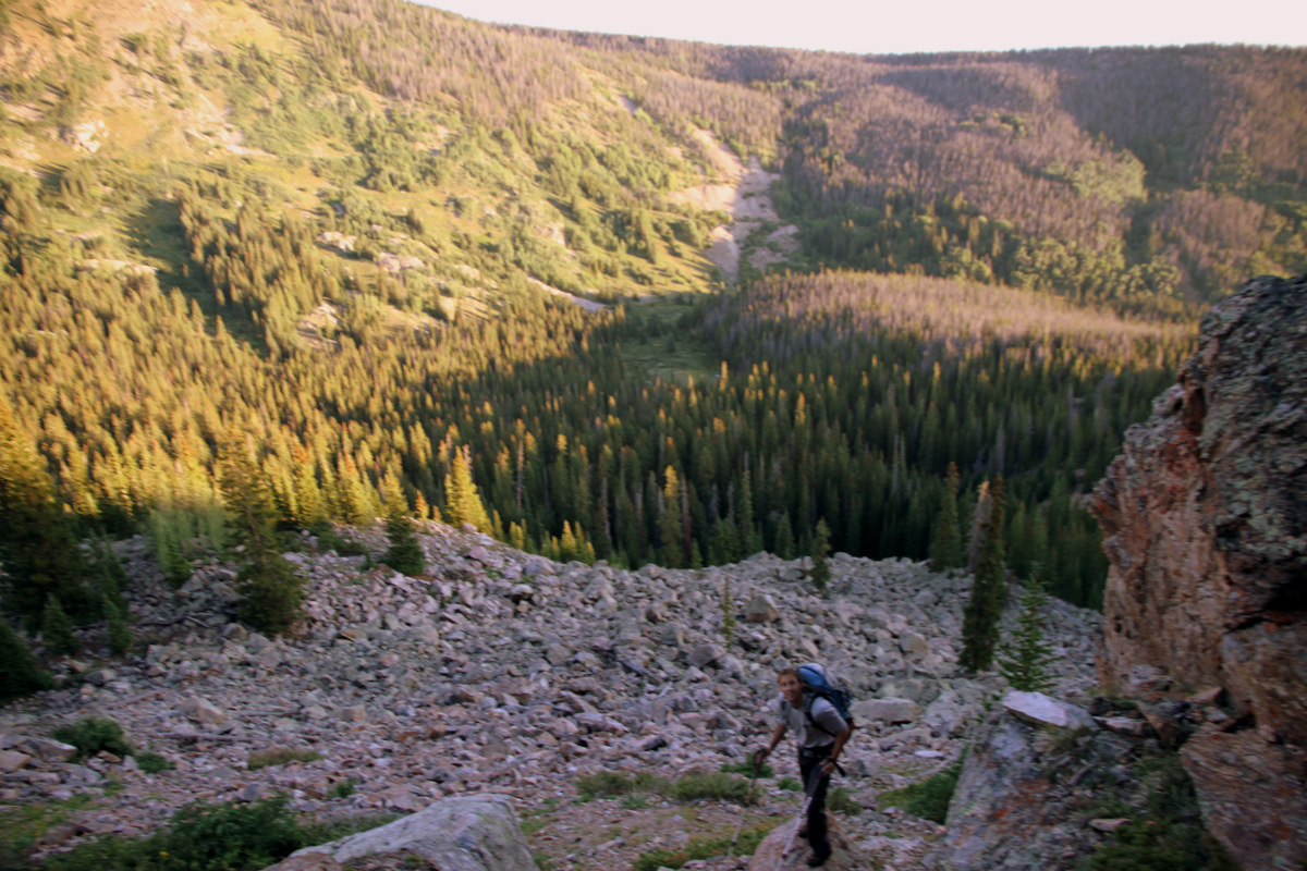
Friday night we dropped off my truck at the Deluge Lake/Gore Creek TH in East Vail and rallied over to the North Rock Creek TH north of Silverthorne arriving around 11pm. J had brought his cots and it was nice sleeping under a large moon albeit for only 4 hours. Up at 4am and after some oatmeal and coffee, we departed for the Boss Mine under clear and dark skies with semi-loaded packs. This is the standard trail, which leads to Keller Mountains’s very fun east ridge, which Kristine, friend Reid Jennings, and myself had climbed the year before as well. An hour later around 6am, we arrived at the old Boss Mine area, took a break and consulted our map. It was getting light out and we could turn off the headlamps. It looked like the cleanest route to attain the lower portion of Asgard Ridge was to cut across the marshy clearing, ford North Rock Creek, and make our way to a prominent boulder field from which it appeared we could climb steep slopes and hit the treed ridge crest. So, we dropped maybe 200′ down to the basin from the trail and literally about 100 yards away from North Rock Creek, J yelled at me “Stop! Back-up!”. A big bull moose was grazing and had J not said something I would have likely walked right into him. I was just minding my own business and watching my steps and not looking up. It definitely woke me up.
My morning coffee 🙂
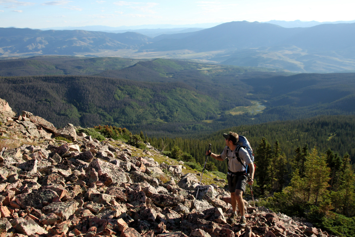
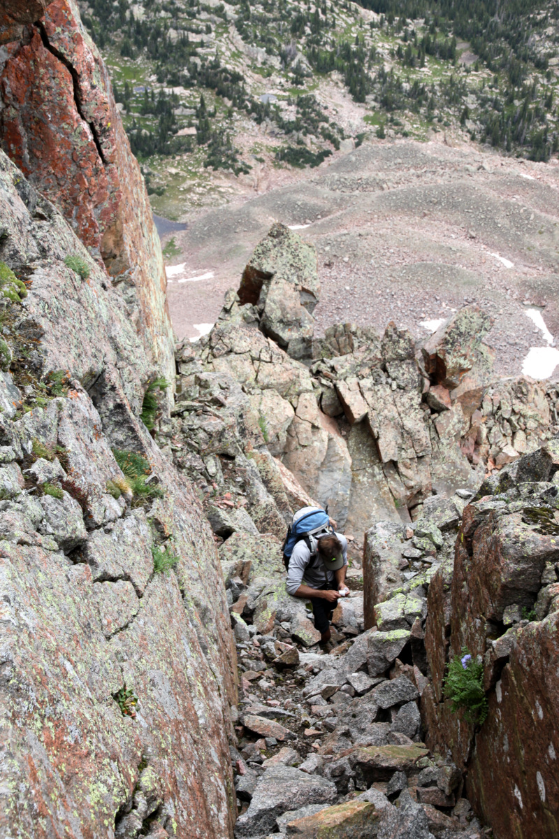
We were able to make our way around him and ford the creek a bit to the west by taking our shoes and socks off and braving the cold water. The routefinding really went about as smooth as we could have imagined and soon we were on the boulder field and scrambling up the lower flanks of Asgard Ridge to the ridge crest. This was where we gained a lot of our elevation – about 2,000′ from North Rock Creek to the first point along Asgard Ridge, Point 12,207′. However, the terrain was easy bushwhacking and nice hiking through forests after some initial class 3 scrambling to get up on the ridge crest.
J above the boulder field we spotted across the valley from the Boss Mine (mine tailings can be seen across the basin behind J)
J above treeline on gaining Asgard Ridge
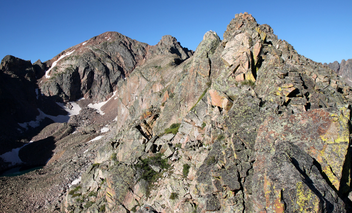
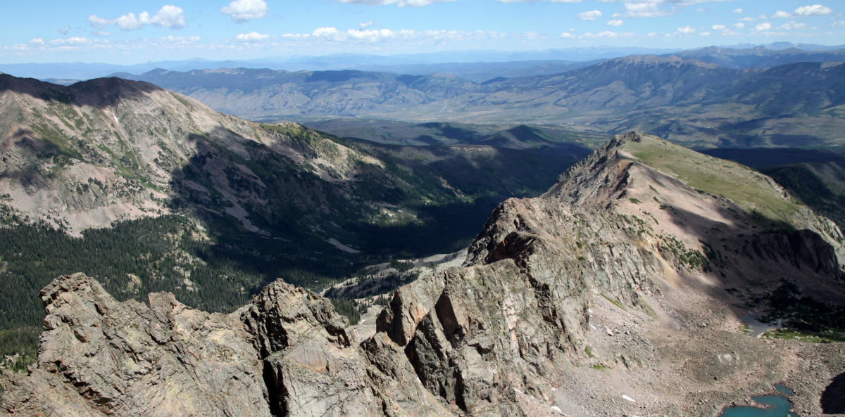
We could both definitely feel the heavier than normal weight of our daypacks – a necessary evil most definitely, especially on a ridge we knew very little about. We soon made it up easy terrain to Point 12,207′ with Asgard Ridge laid out before us. It was a wonderful sight. Asgard Meadows was down to our left and Valhalla’s other, southern east ridge reared up in earnest displaying its awesome Freya, Thor, & Loki Towers. Another day, I’d love to camp in Asgard Meadows and climb these awesome looking towers.
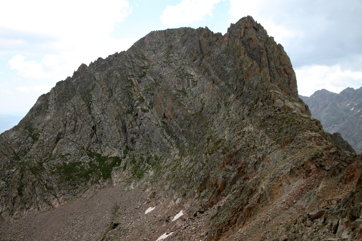
Asgard Ridge up to Palomino Point with Mt. Valhalla on the left (as seen from Point 12,207′)
Mt. Valhalla and its two east ridges with Asgard Meadows in between
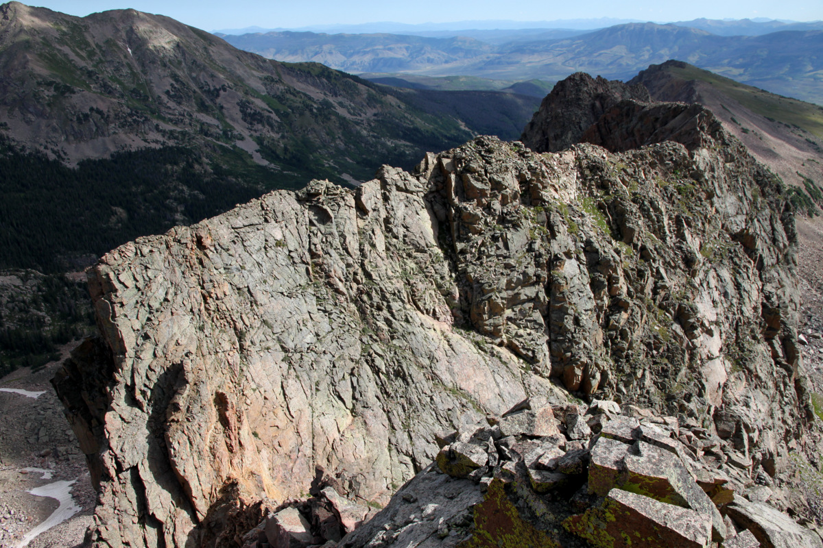
The view of Asgard was a bit intimidating, but looked manageable from this vantage point. But, as we would later find out, that’s only because the difficulties hid themselves well. We then made the easy ridge run across beautiful meadows to Point 12,226′ and got a better vantage point of Asgard. It sure looked fun and interesting and we were very excited. The views of Freya & Thor Towers across the basin were just plain awesome.
Freya Tower (left) and Thor Tower (right), as seen from Asgard Ridge, form the lower ramparts of Valhalla’s southern east ridge. Hail Peak (12,904′) is behind in the center of the picture
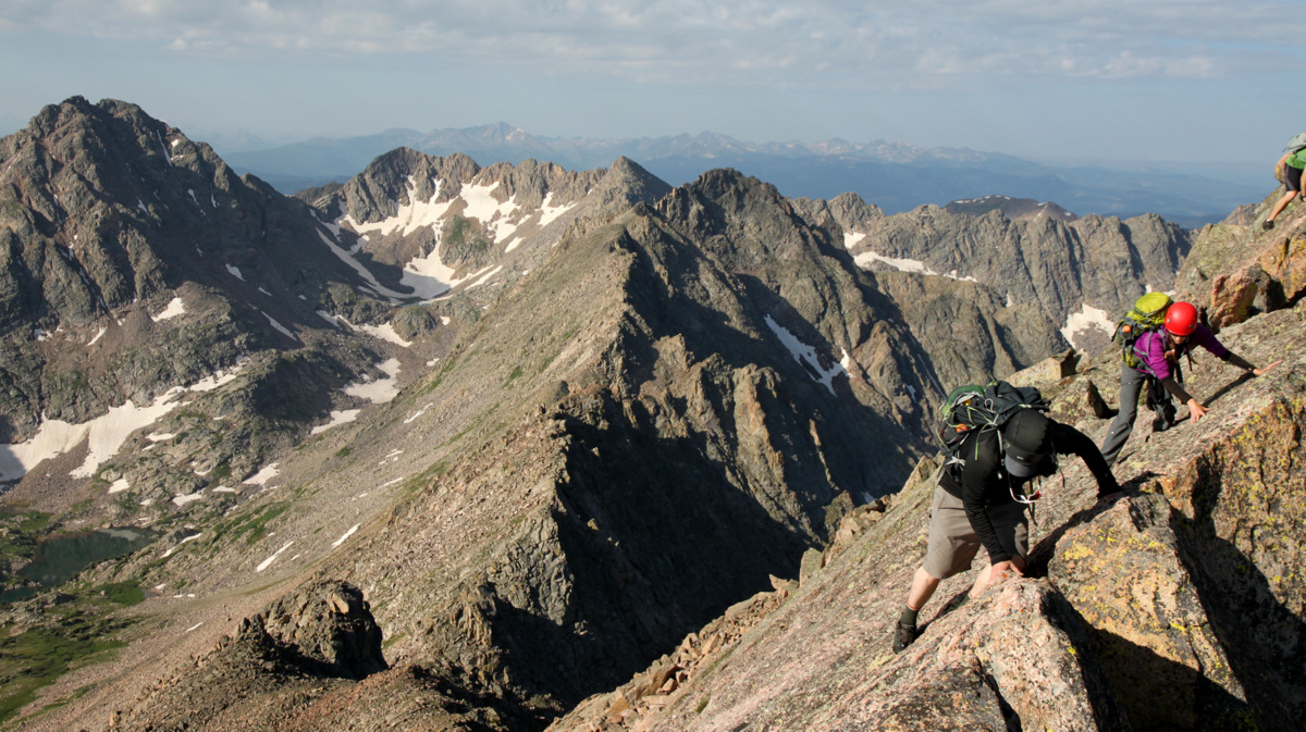
Some minor class 3 scrambling soon ensued and the fun we came for began.
The first class 3 tower
On the ridge proper with a view of Valhalla and Asgard Ridge
J on a nice catwalk
Fun early-on scrambling
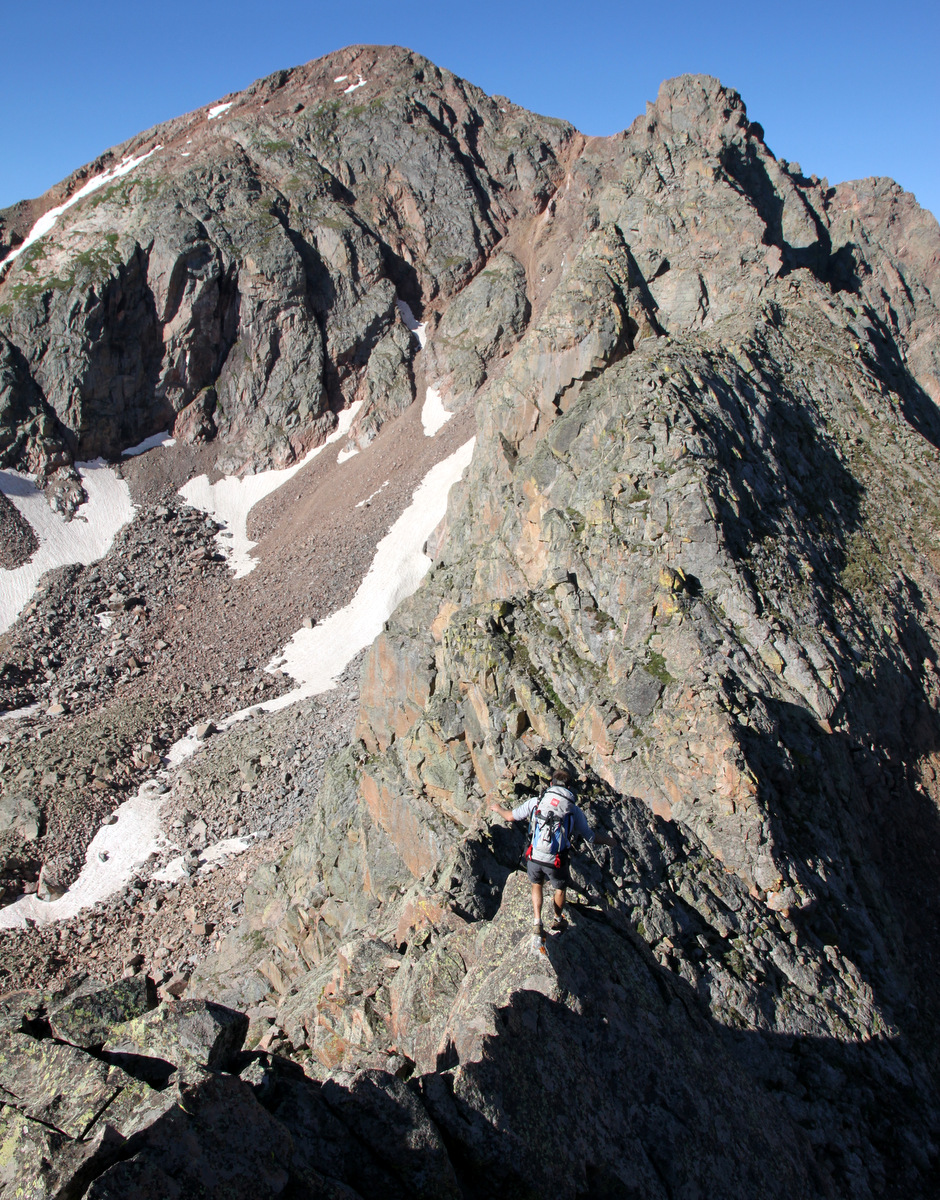
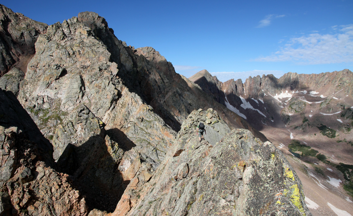
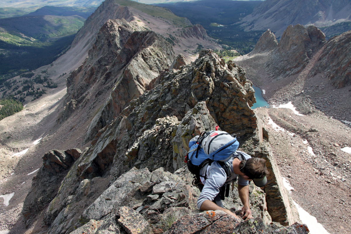
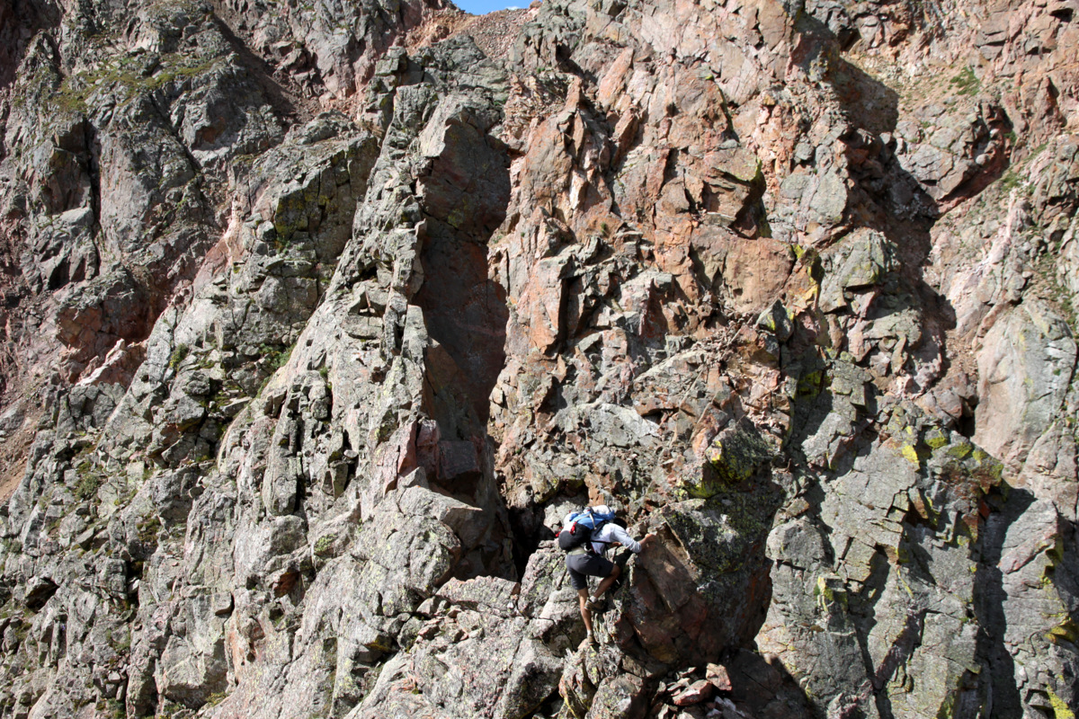
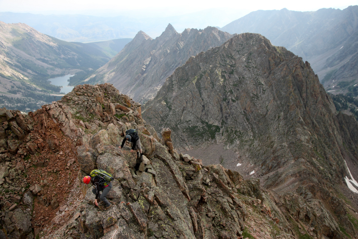
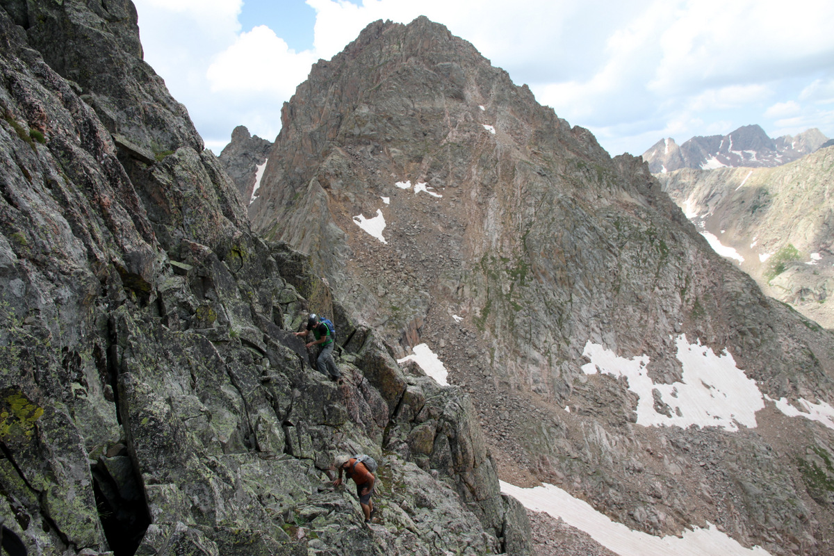
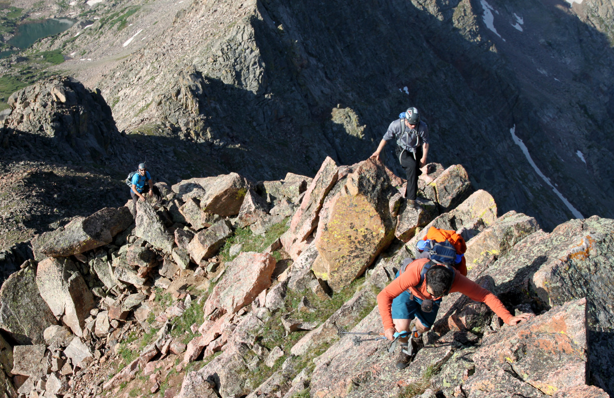
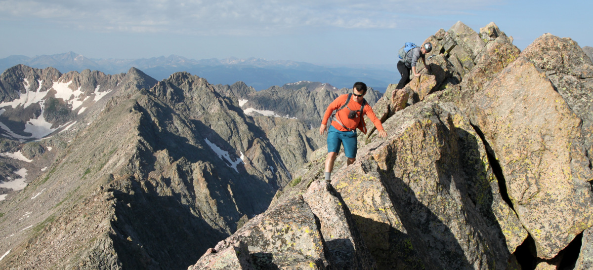
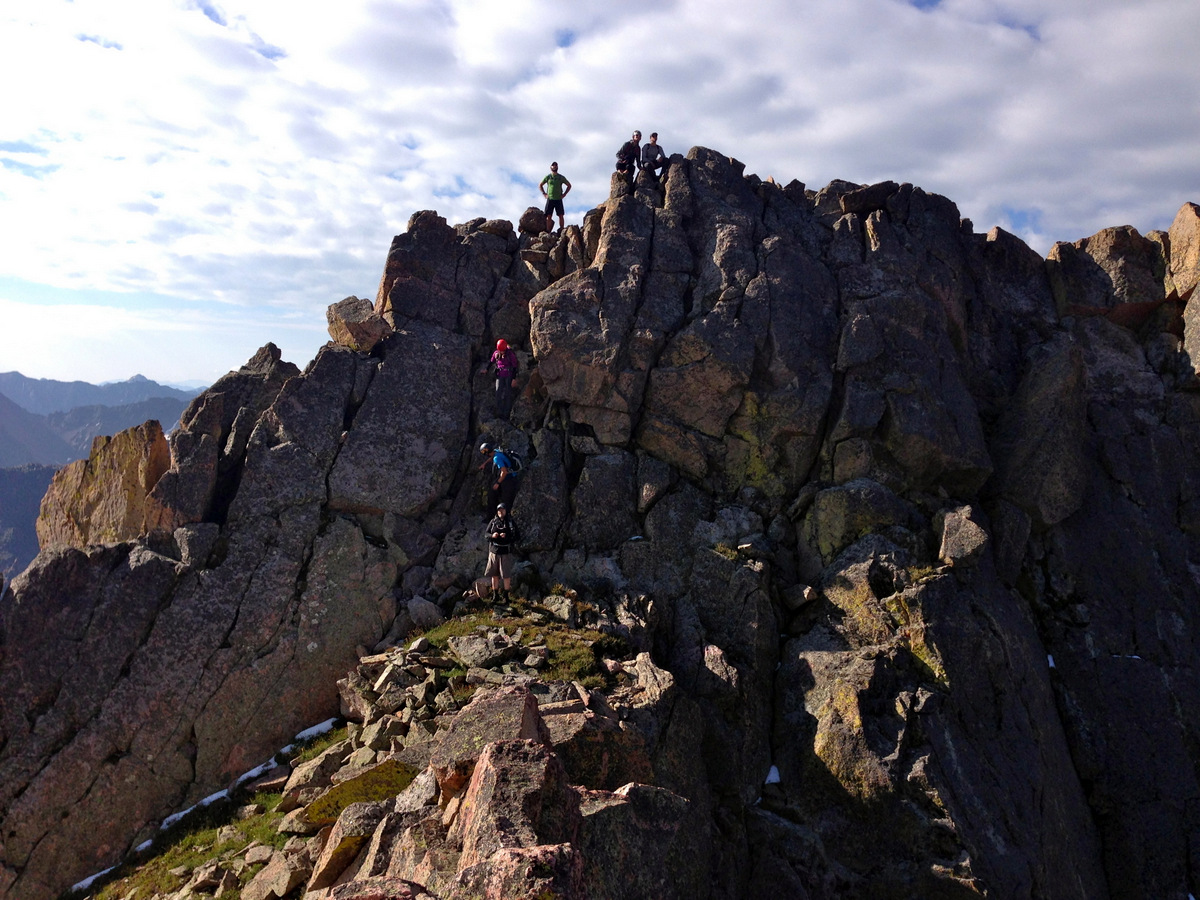
It was fairly mellow, smooth sailing class 3 (some class 4) scrambling for awhile on the ridge proper until we came to a deep notch and drop-off in which it got a bit spicy though very exciting downclimbing to the notch.
J down-walking across one of the many knife-edge ridges this day to access the deep notch
J descending the final headwall into the notch
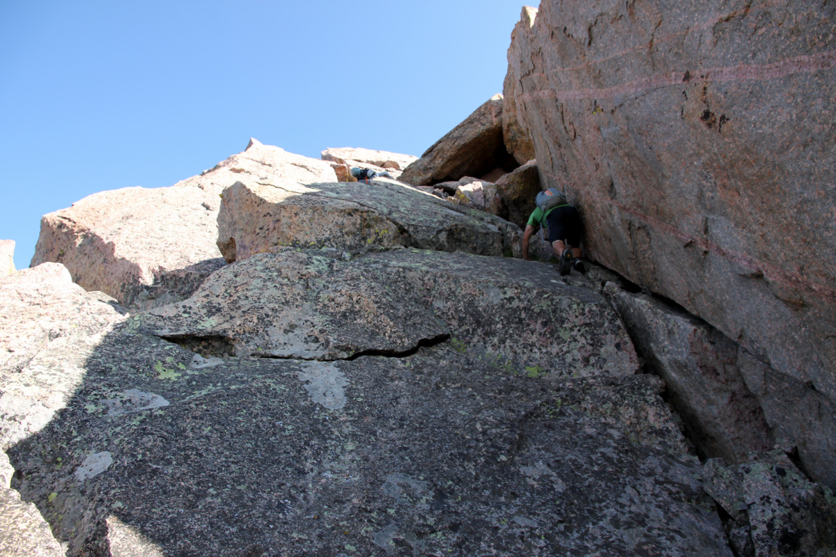
J climbing out of the notch
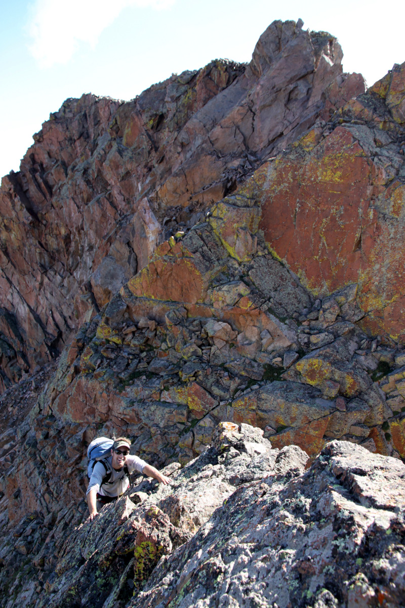
The reclimb was really good scrambling
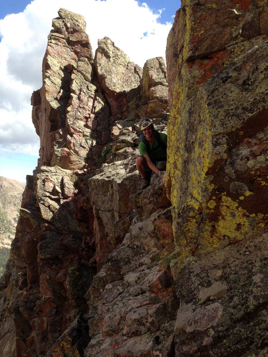
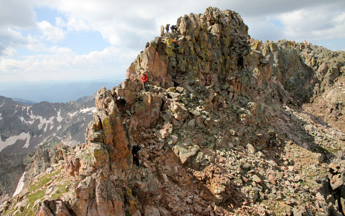
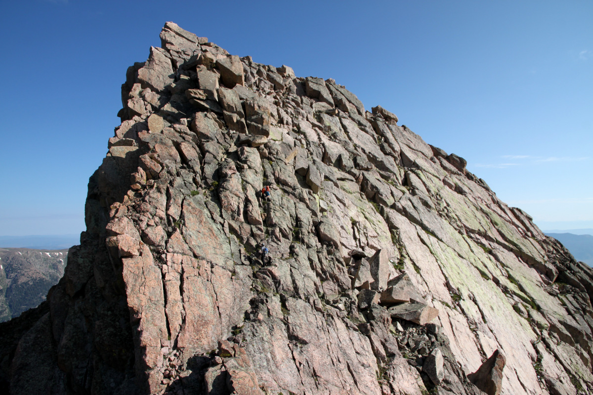
We made it down to the notch which had a cool reclimb of the same vertical lost up to a mellow, walkable ridge. This walkable ridge constricted down into a narrow knife-edge for hundreds of yards. This was the snake-like, S-shaped ridge I had seen that October day from the summit of Palomino Point. It looked amazing at the time and surely didn’t disappoint this day. J took the camera and got a few of me walking this line.
Me beginning the knife-edge
Making my way over a crux in the ridge. One thing you really had to be mindful of on this ridge was the rock. Since it really has seen very little traffic, you couldn’t just prance across a knife-edge as confidently as you would as, say, on Capitol’s knife-edge
Me on Asgard’s knife-edge
Skywalking
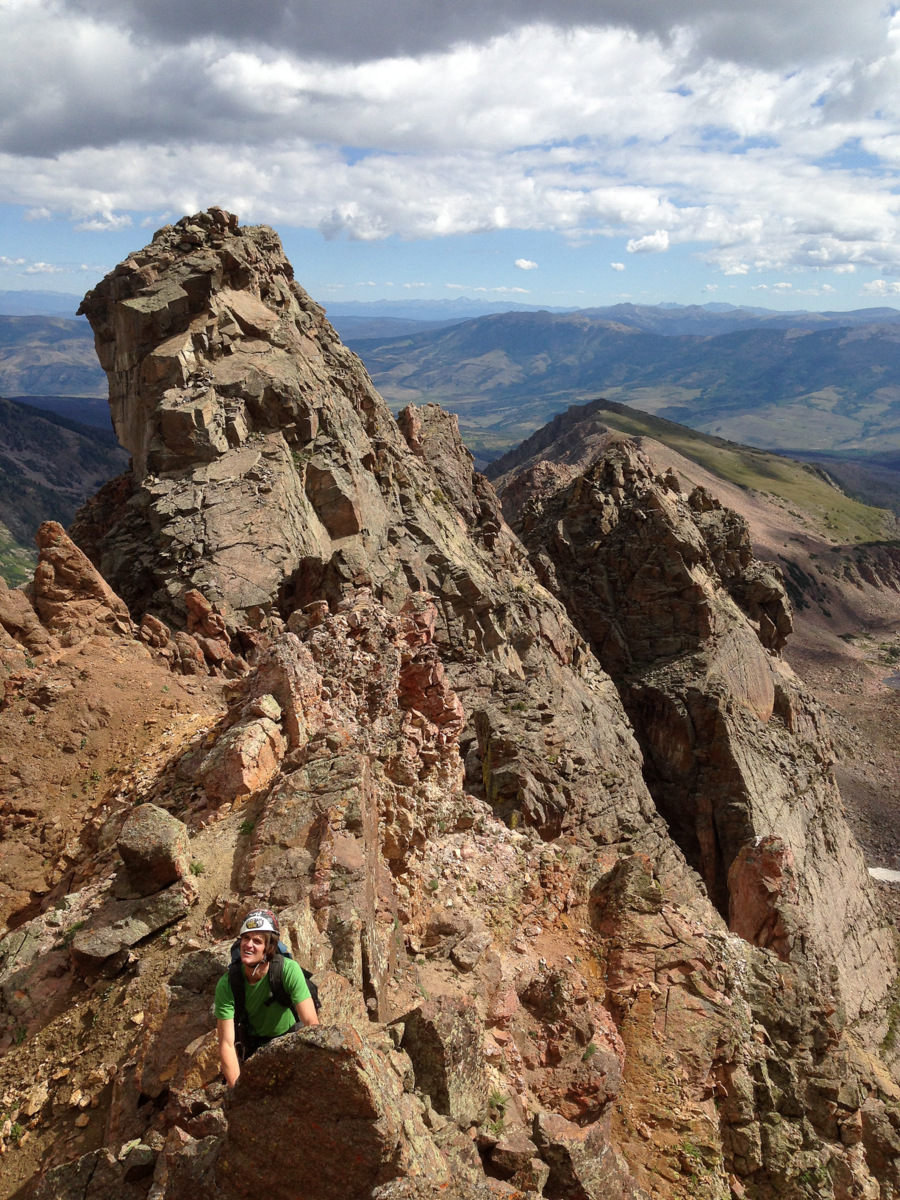
Me at the end of the knife-edge contemplating the descent. The Grand Traverse looms in the distance with Palomino Point, our end goal, at far left
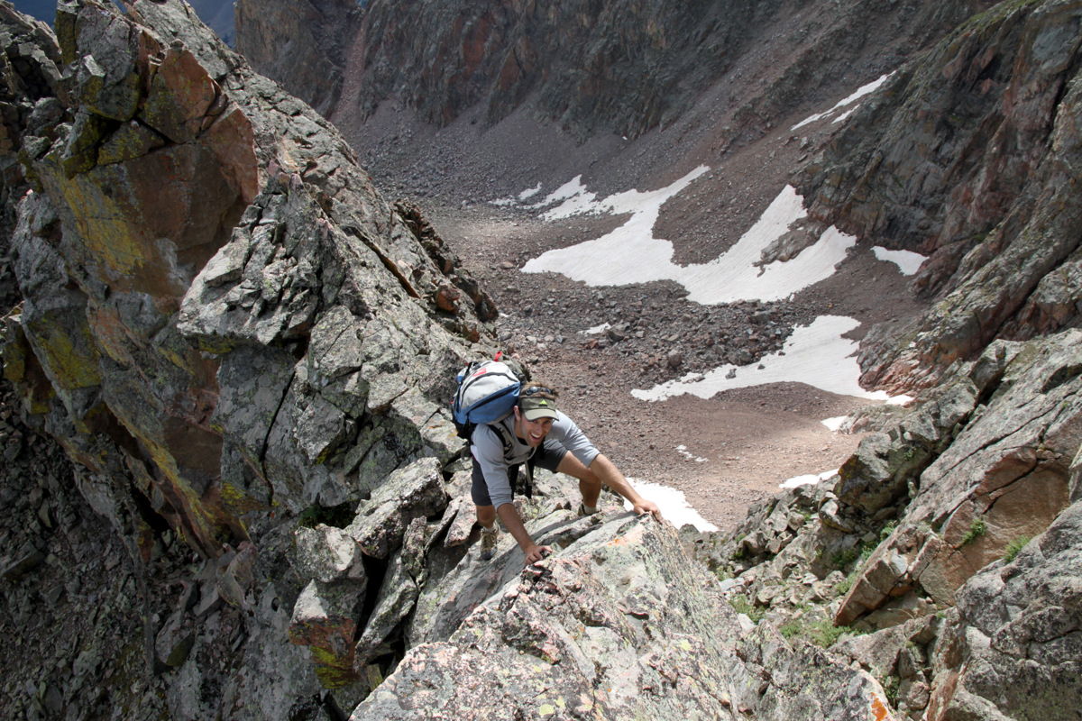
I came to the end of the knife-edge ridge to a serious drop-off: one that I remember seeing from my pictures and thinking we would need to rappel. I waited for J to join me and we agreed that this was downclimable. We took separate lines down to avoid kicking rocks on one another and joined up on a singular downclimable dihedral.
J downclimbing the dihedral with the knife-edge ridge’s terminus looming way above
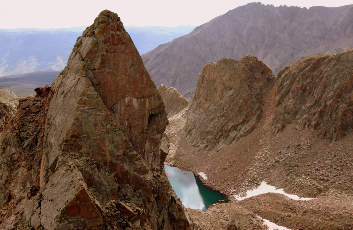
100′ later we were down in another notch. There was a striking tower that wasn’t exactly on the ridge proper. It was offset to the south a bit, but it looked like it had a cool climb up to its summit on its north side. So, we dropped the packs and climbed for maybe 200′ up to its summit.
J taking a 5th class line to the tower’s summit
Actually, it ended up being a nice preview of things to come. We discussed the route over the next bit and up to Point Odin, but because we looked at the ridge almost head-on, it was hard to see the difficulties.
J on the summit of the unnamed tower with the remaining portion of Asgard Ridge behind
Looking back at the snake-like, S-shaped knife-edge ridge. The drop-off is clearly visible at far left
J made a cairn on the tower’s summit and we were off scrambling down the tower to our bags. It was a relief to have the backpacks off, however brief it was. We gathered our packs and traversed a notch and over a small saddle.
The unnamed tower we climbed almost looks like a blade. We climbed the left skyline up to the tower’s summit. J’s cairn can barely be seen on its summit. Freya & Thor Towers can be seen on Valhalla’s southern east ridge behind above the small lake (Asgard Lake?)
We then began the fun class 3/4 upclimb of what we thought was Point Odin.
J scrambling upwards with Asgard Ridge beginning to spread out behind us
Me negotiating the low 5th class block
J topping out on the false summit
After some fun low 5th class moves up a block, we came not to the summit of Point Odin, but a measily false summit.
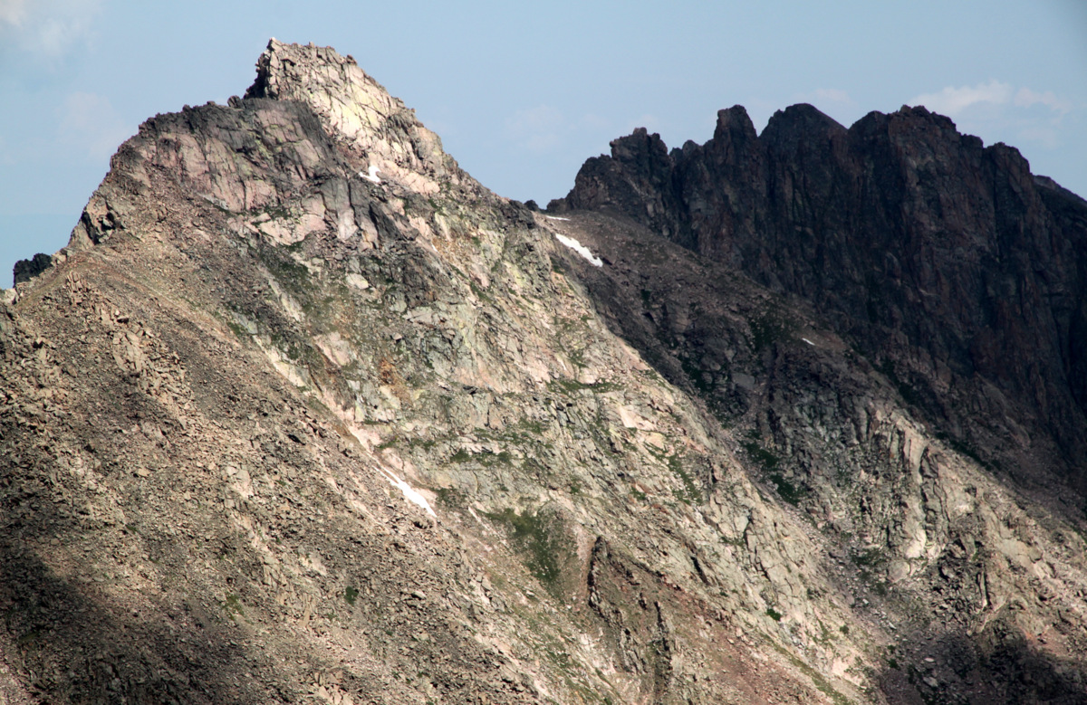
Left to right from the false summit: Valhalla, Palomino Point, & Point Odin
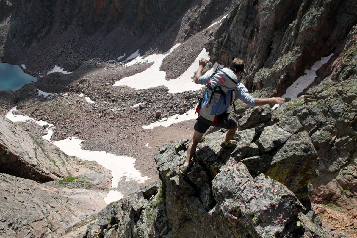
We had to descend to a notch over very exposed terrain only to climb back up on steep, angling slabs with big air on both sides.
J taking a breather on the sloping slabs up to Point Odin with the false summit behind
J on the fun sloping slabs
We then came to an unexpected deep gap in the ridge about 3′ wide. The only reasonable means of getting across was to jump across the gap, which turned out to be fairly adrenaline pumping move.
J jumping the gap
J took a quick video of me jumping the gap:
From the deep notch after the jump, it was a really fun class 4 arete with super exposure and a lot of air.
J on the exposed arete
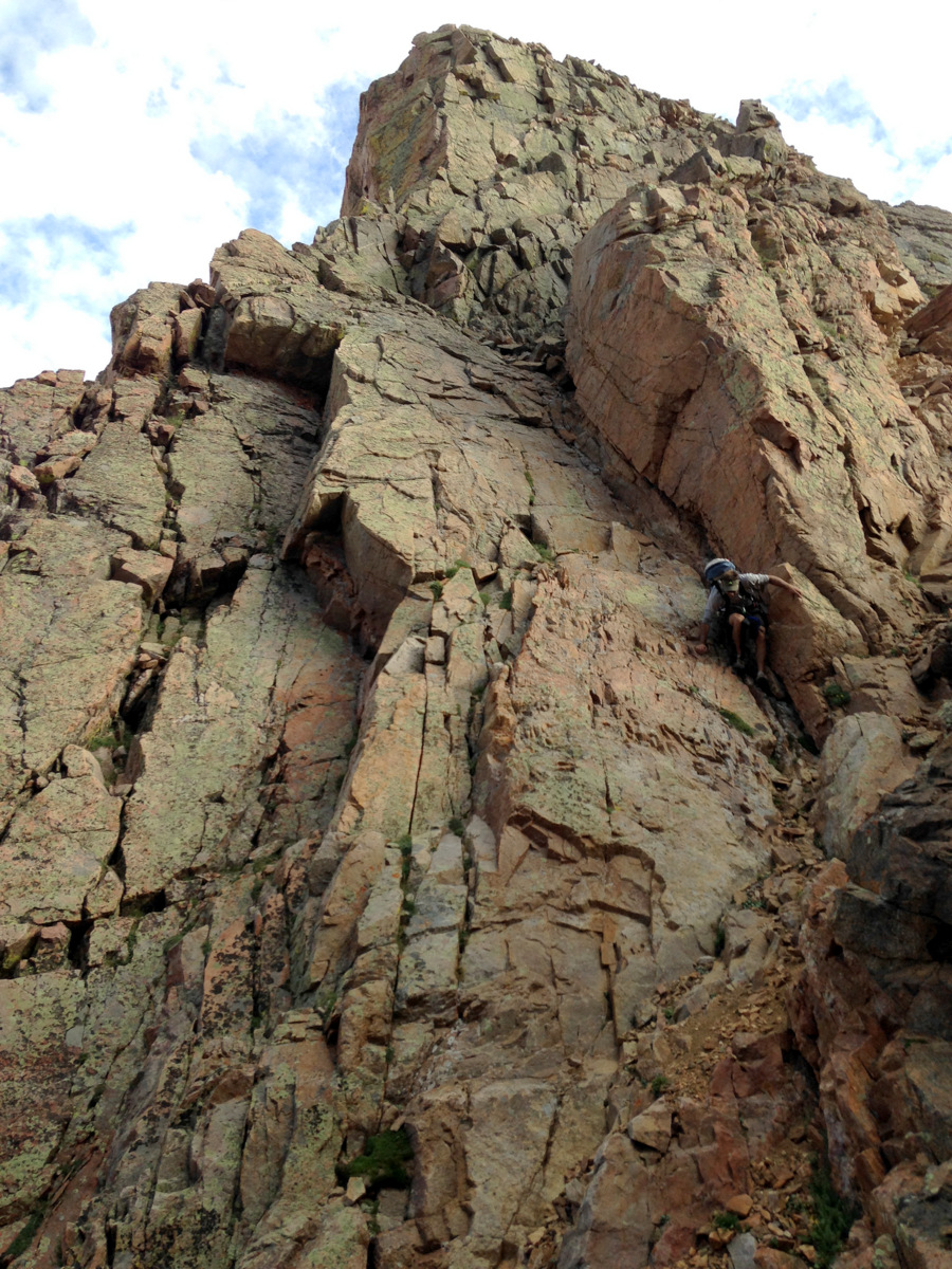
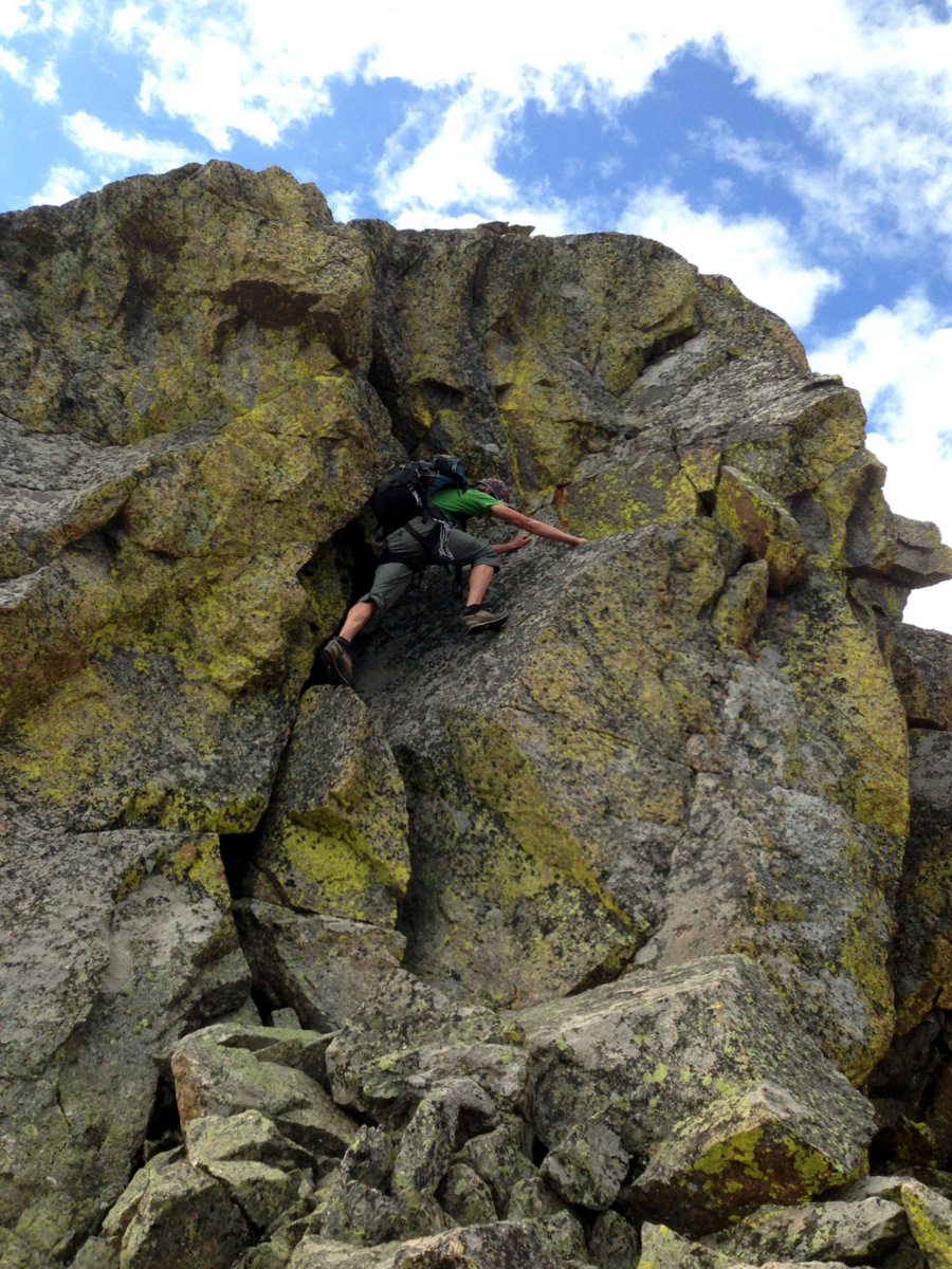
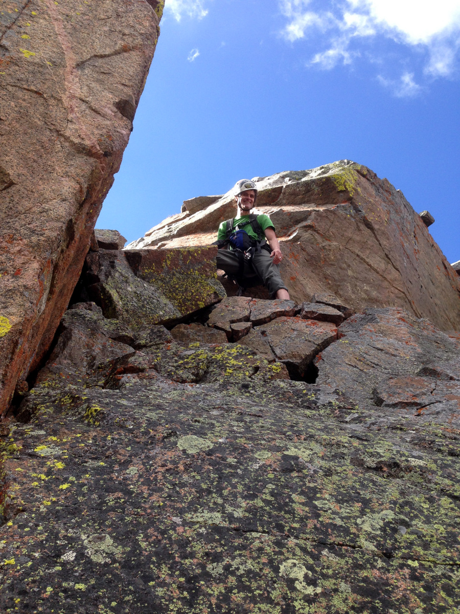
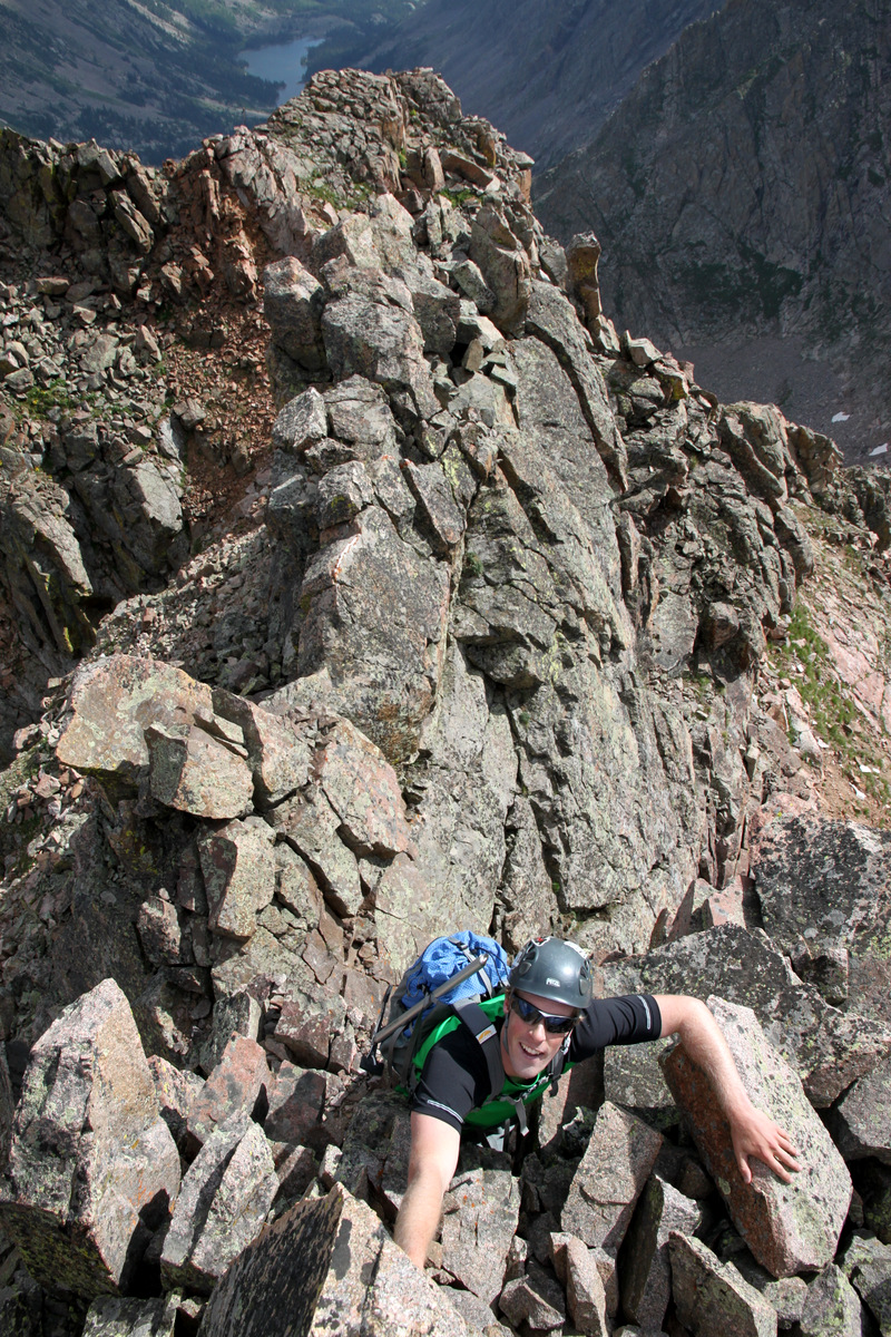
We then seemed to come at an impasse, but soon realized there was a 10′ hand crack weakness on the right (north) side of the arete proper. I climbed this using a few hand-jams and was soon on top of this crux. It was then a mantle-type move to top out on the summit of Point Odin.
Me at the top of the low 5th class hand-jam crux
J climbing the low 5th class hand-jam crux up to the summit of Point Odin
J topping out on Point Odin’s summit after the mantle move
I took a video of J on the hand-jam crux section as well:
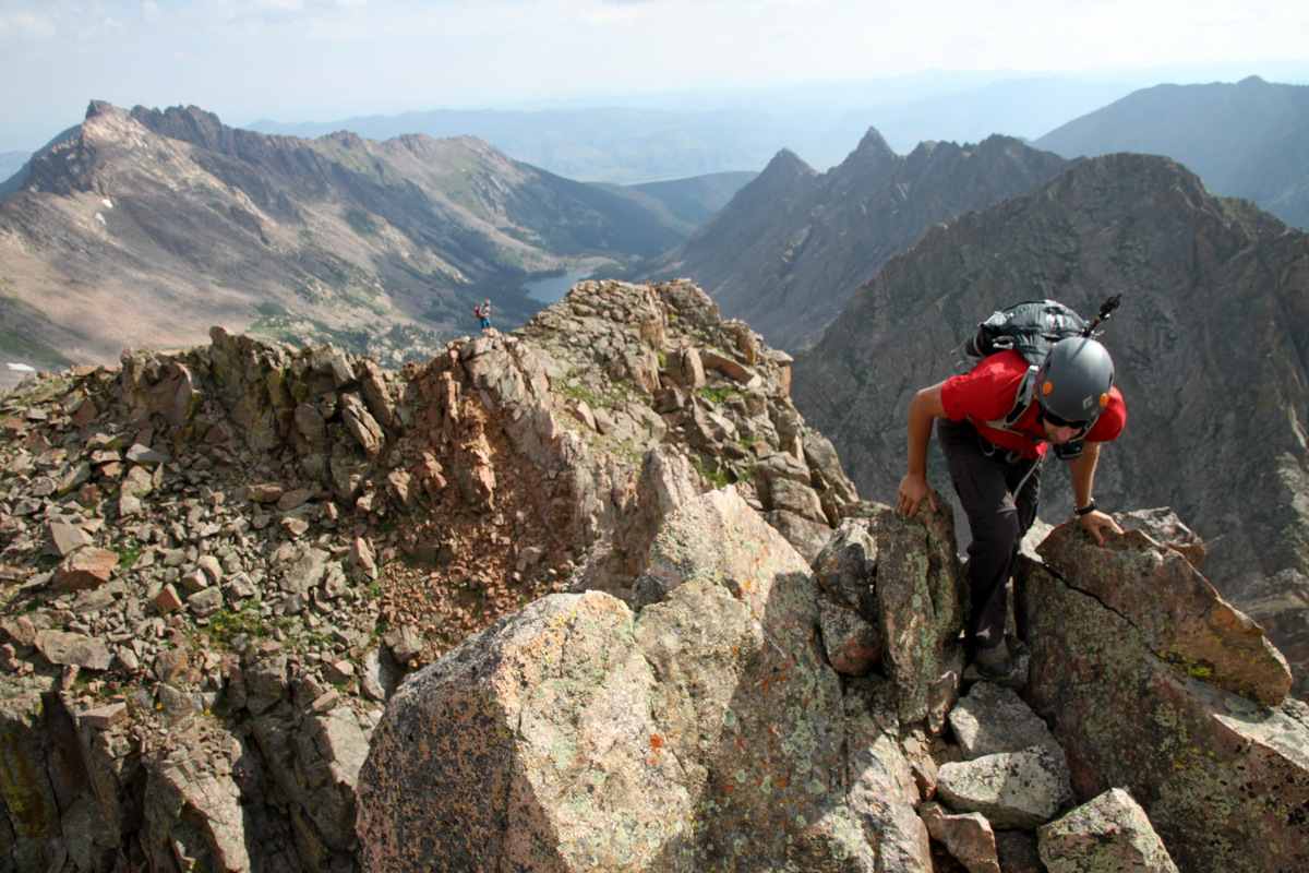
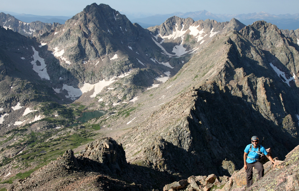
Ahhh, was good to be on this summit. We were now pretty close to Palomino Point, a whole lot closer than we were 2 hours ago.
Valhalla (left) and Palomino Point (right) from the summit of Point Odin
Summit of Point Odin
We could see the remaining climb up Palomino Point’s east face, but first we had to deal with getting down off Point Odin and some more knife-edge ridge. Again, this is where I envisioned us rappelling off Odin’s west ridge, but again we found a downclimable route. It was indeed exposed and very airy, but was downclimable for us. J went first and led us home.
J beginning the downclimb off of Odin’s summit. The crux chimney was immediately below him in attaining the angling slabs
J descending the angled slabs below Point Odin
And down another small drop to another angled slab
Me and our descent off Point Odin
The slabs leading off Odin’s west ridge weren’t nearly as steep as they looked from above over a year ago, but definite care & caution had to be taken on this descent, as with any descent. Again, a knife-edge ridge ensued to an interesting crab walk below the ridge proper over big air to the north.
J on another knife-edge ridge
Yet, the positions were pretty amazing
J
Yep, another small catwalk
And, finally, the crab walk traverse on the ridge’s north side
Me on that crab walk traverse
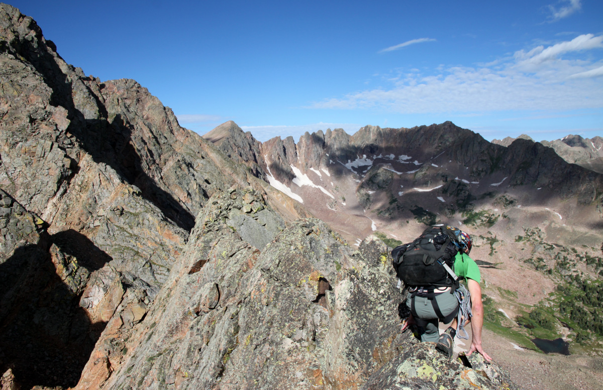
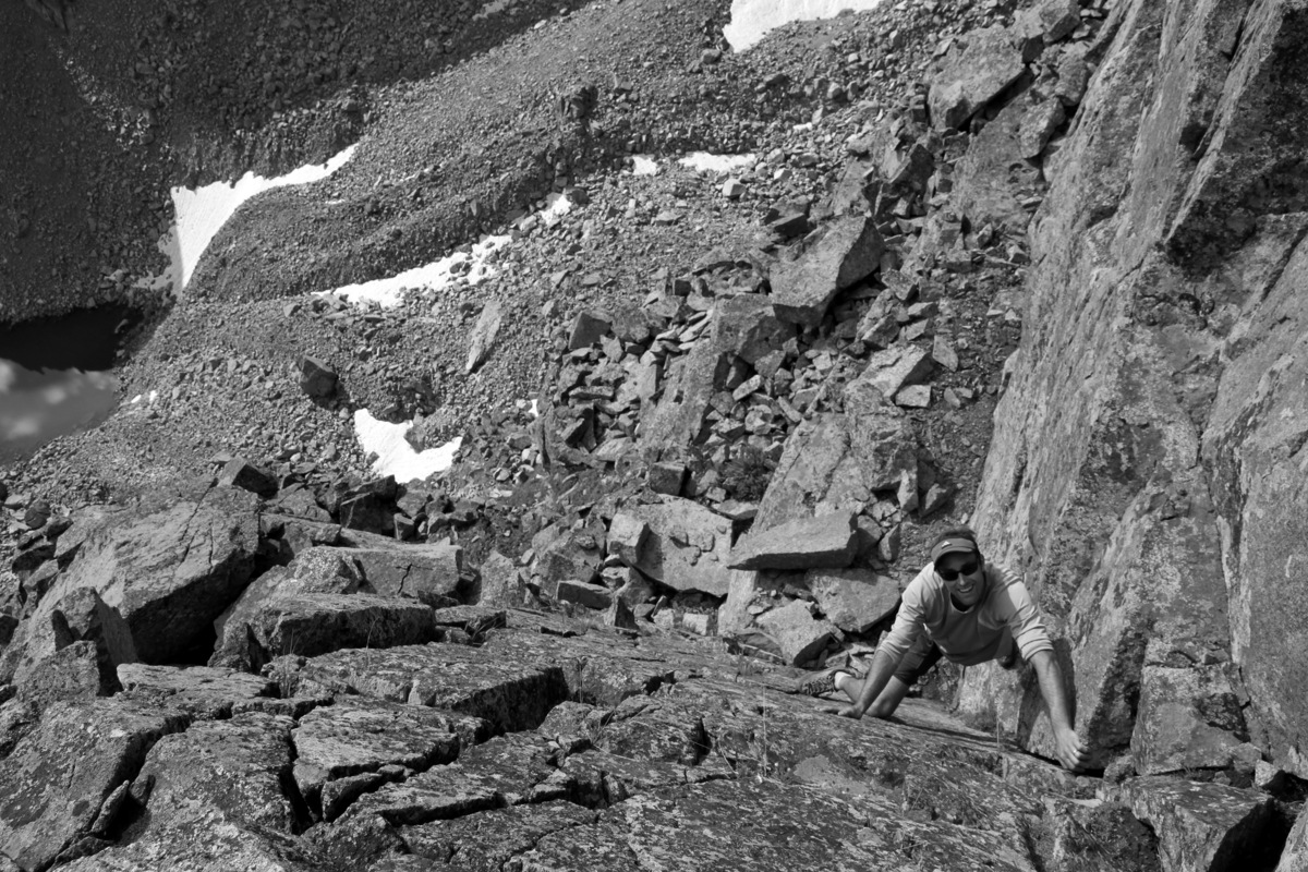
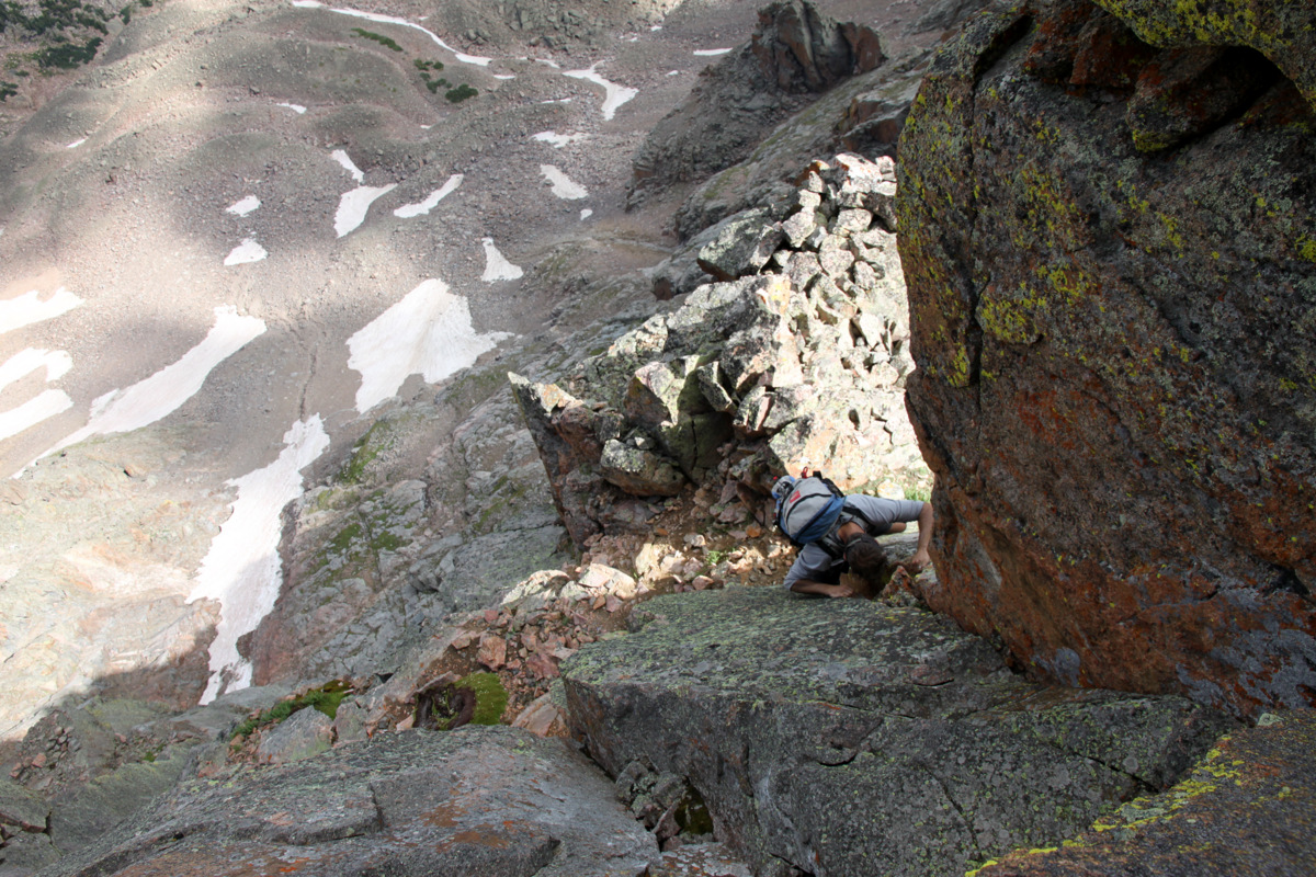
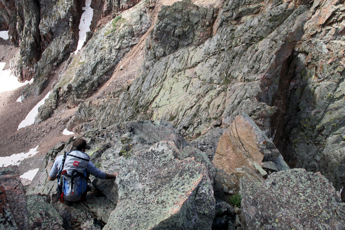
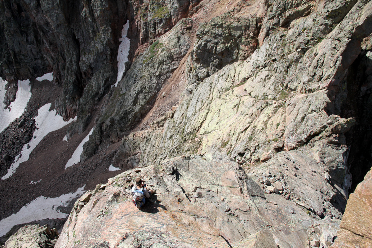
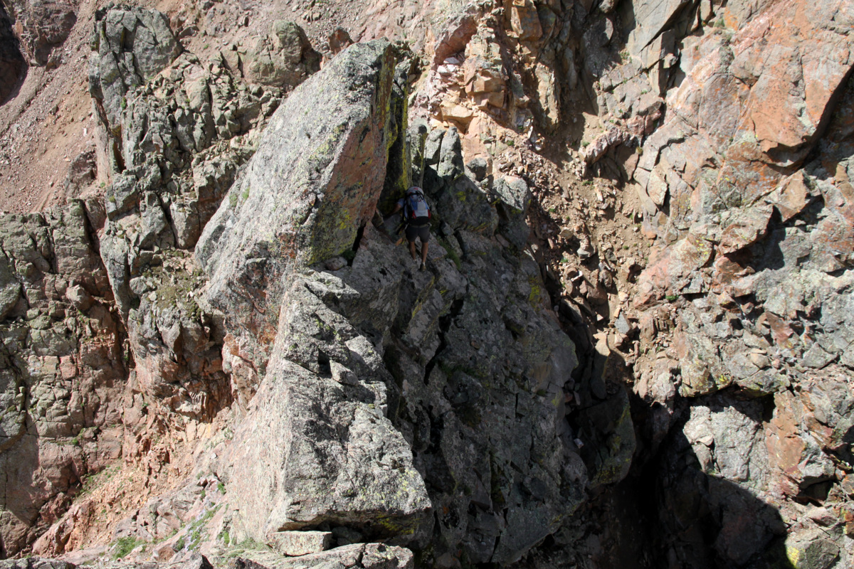
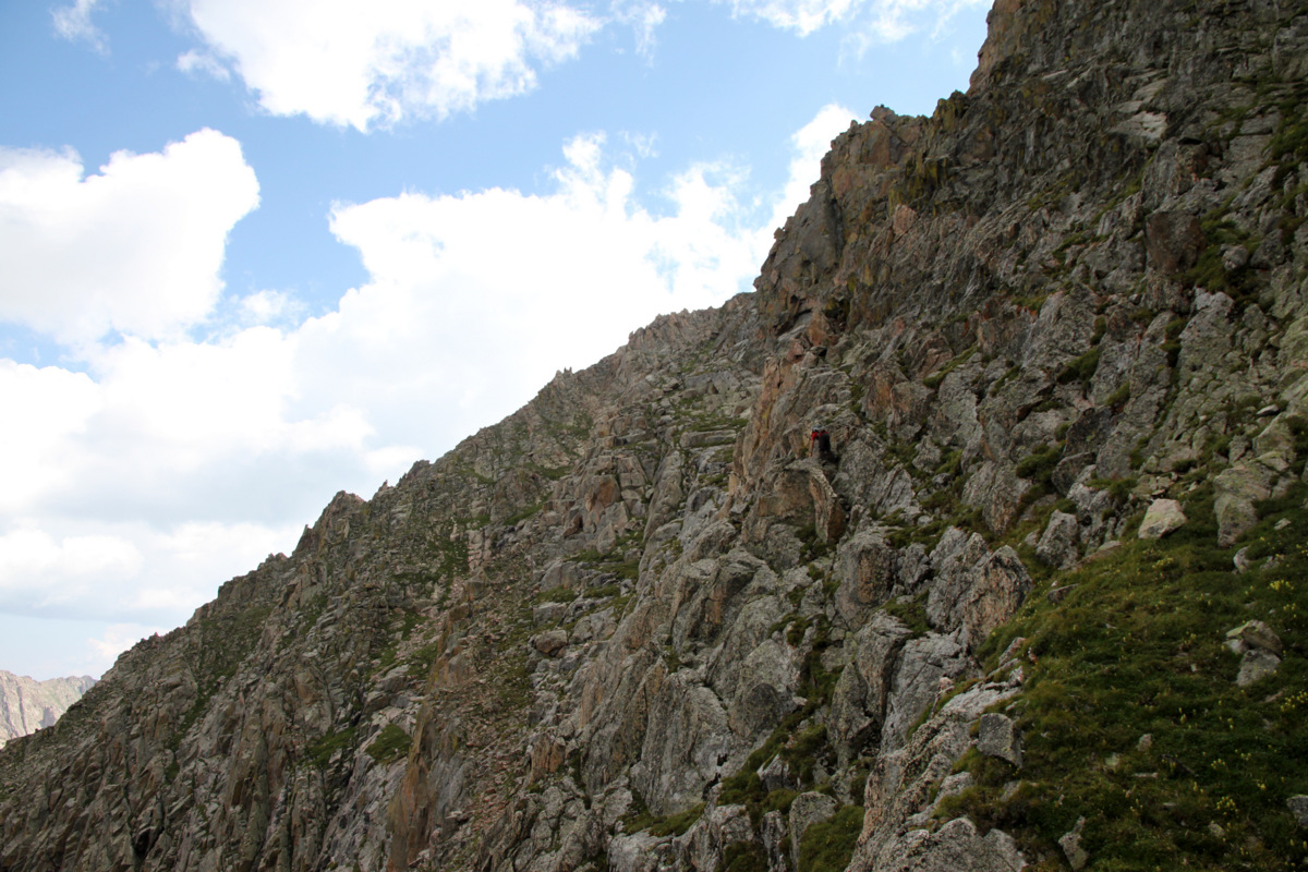
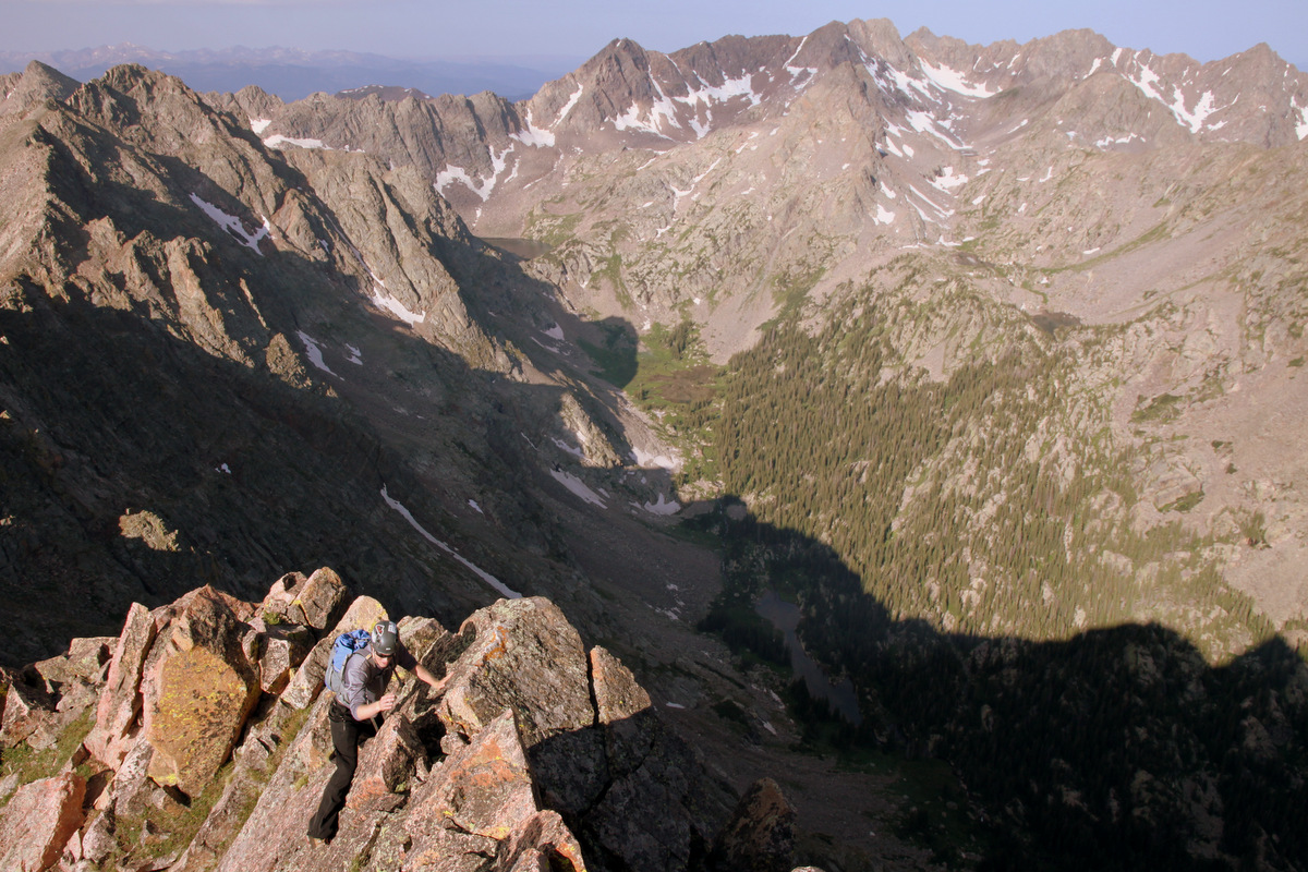
Finally, we were on easier yet looser terrain. We had noticed a grassy ledge system to access this deep slot angling up Palomino Point’s east face and so we went with that.
Off the difficult terrain and climbing up Palomino Point’s east face. Point Odin is behind
J on the grass ledge system crux
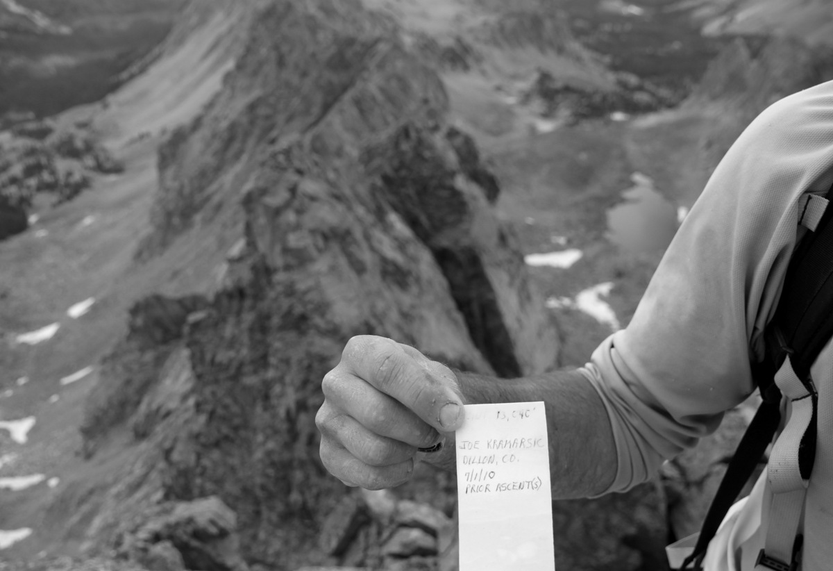
The grass ledge system was indeed exposed, but the holds were good and we were home free once we entered the deep slot leading towards Palomino’s summit. Once in the deeply inset slot, J found something very interesting – a 35mm camera film canister. He opened it up and what do ya know! It was a Palomino Point summit register by Joe Kramarsic himself. It must have blown/fallen off Palomino Point’s summit.
J dissecting the film canister in the slot
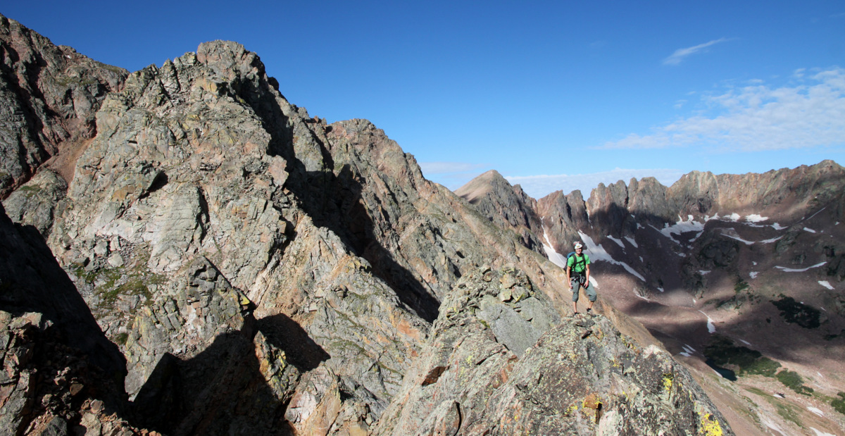
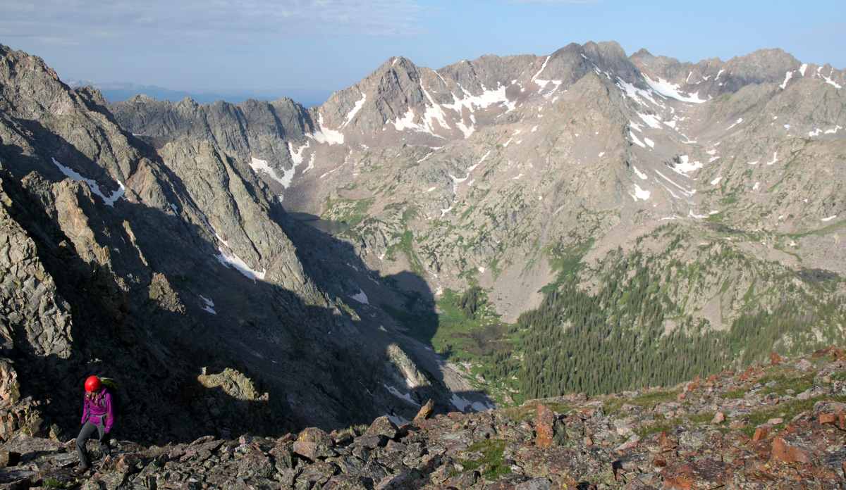
So, we carried it with us to the summit and left it where it belongs. The views from Palomino Point’s summit were indeed incredible especially looking at from where we had come.
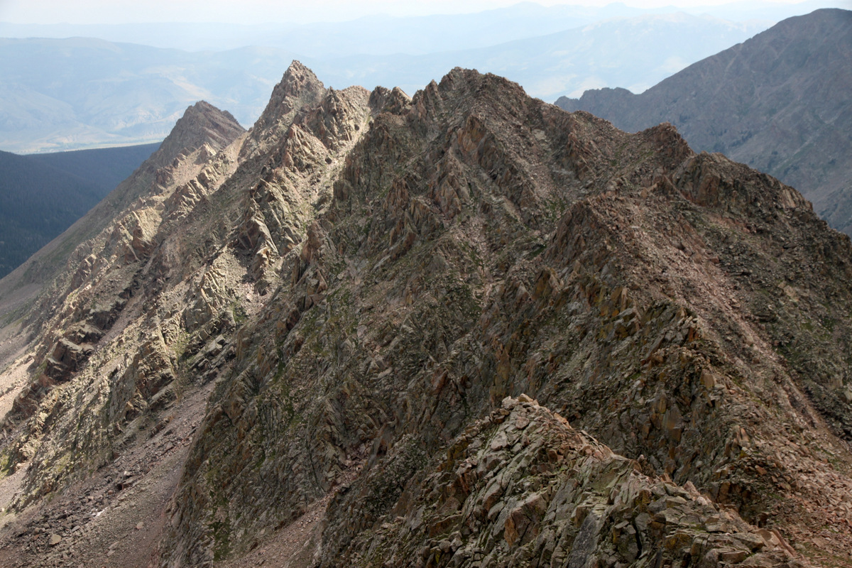
Asgard Ridge from the summit of Palomino Point
Joe’s summit register
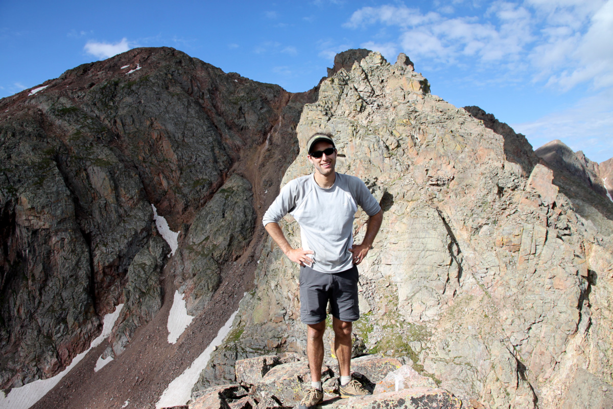
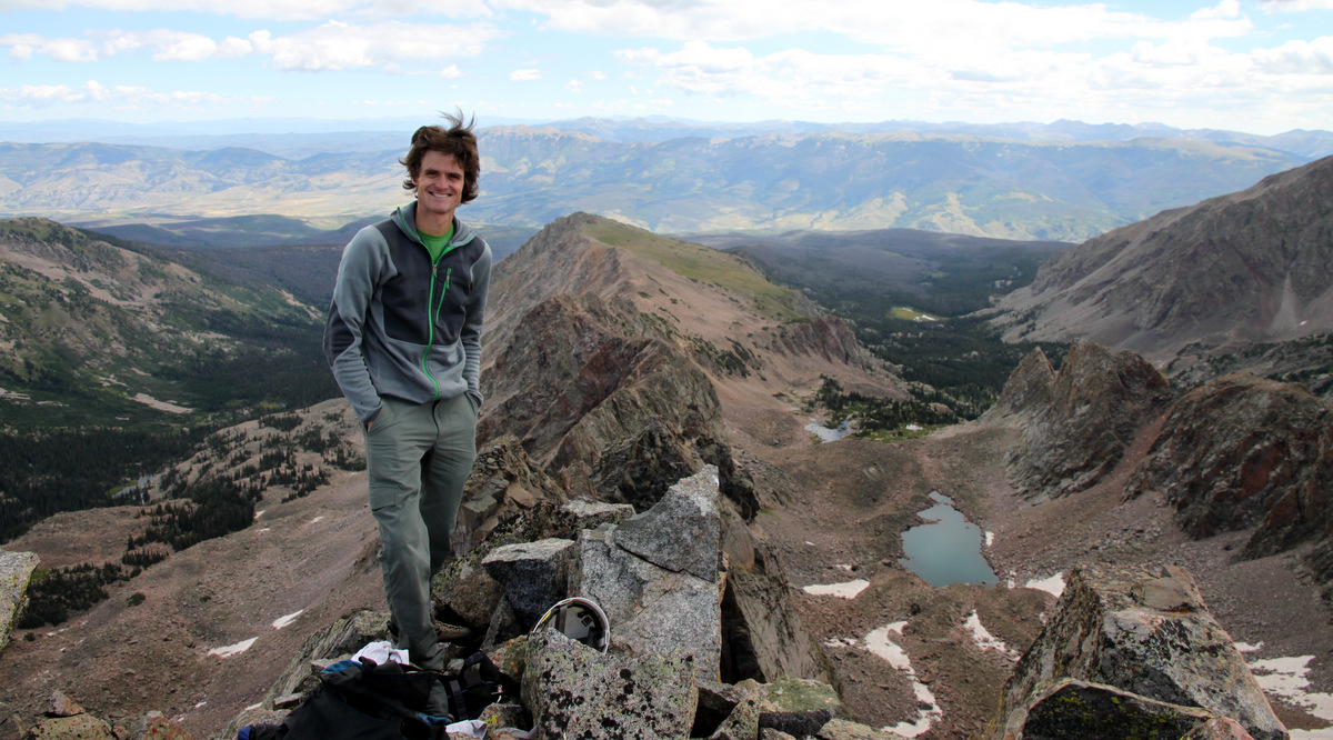
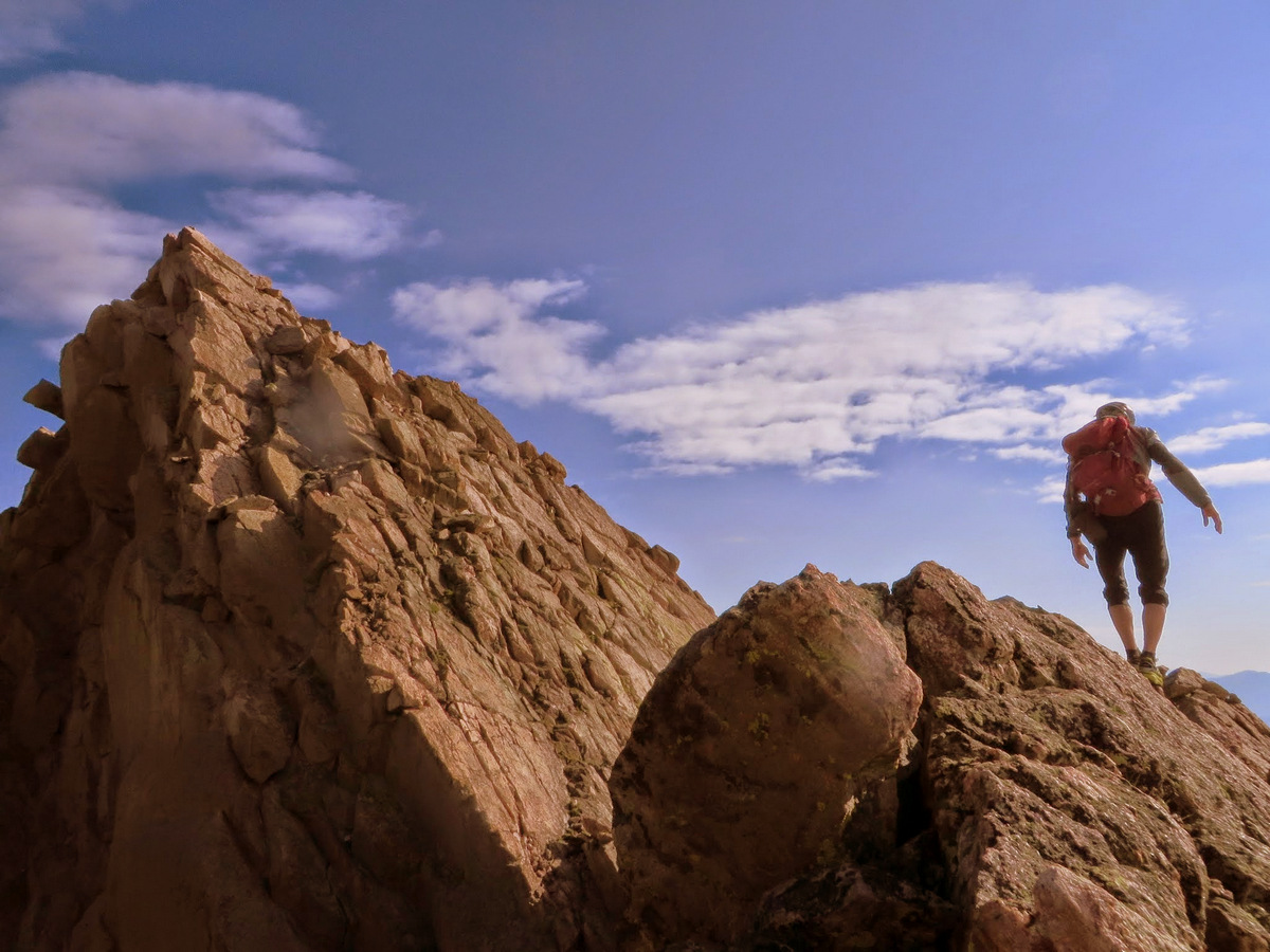
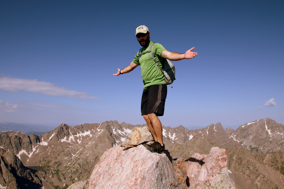
Summit of Palomino Point (13,060′): the western terminus of Asgard Ridge
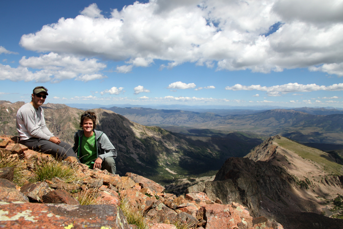
It was an enjoyable summit
Our good friends Joel Gratz, Lauren Alweis, Andrew Annunzio, Devon Scott, & K9 friend Maude had hiked to Deluge Lake this same day and spotted us from the lake on Palomino Point’s summit. We quickly descended to the notch between Palomino Point & Mt. Valhalla and booked it up Valhalla’s north ridge to enjoy our breakfast burritos (courtesy of Kristine) on Valhalla’s summit around 11:15am.
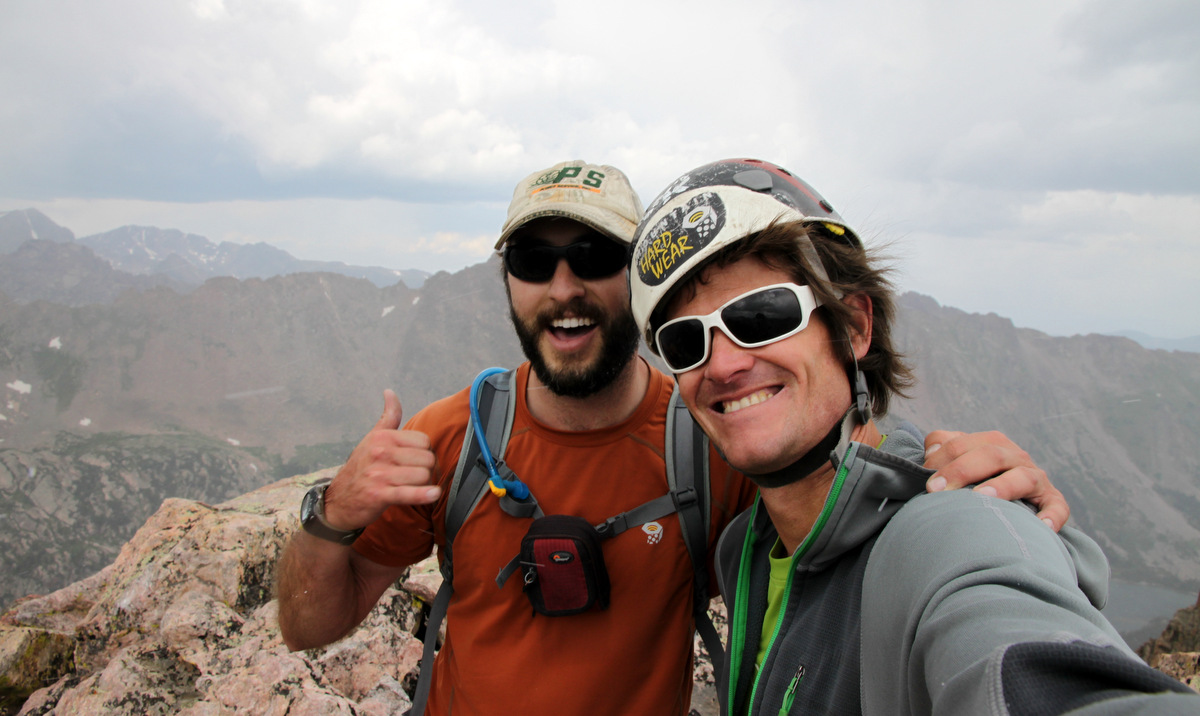
Summit of Mt. Valhalla (13,180′)
A beauty of a day with Grand Traverse Peak and The Grand Traverse behind us
Looking north to where we were just last weekend – the Upper Slate Lake Basin peaks
Asgard Ridge from the summit of Mt. Valhalla (13,180′)
Another one
Many familiar faces including myself 🙂
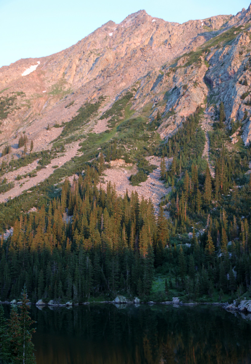
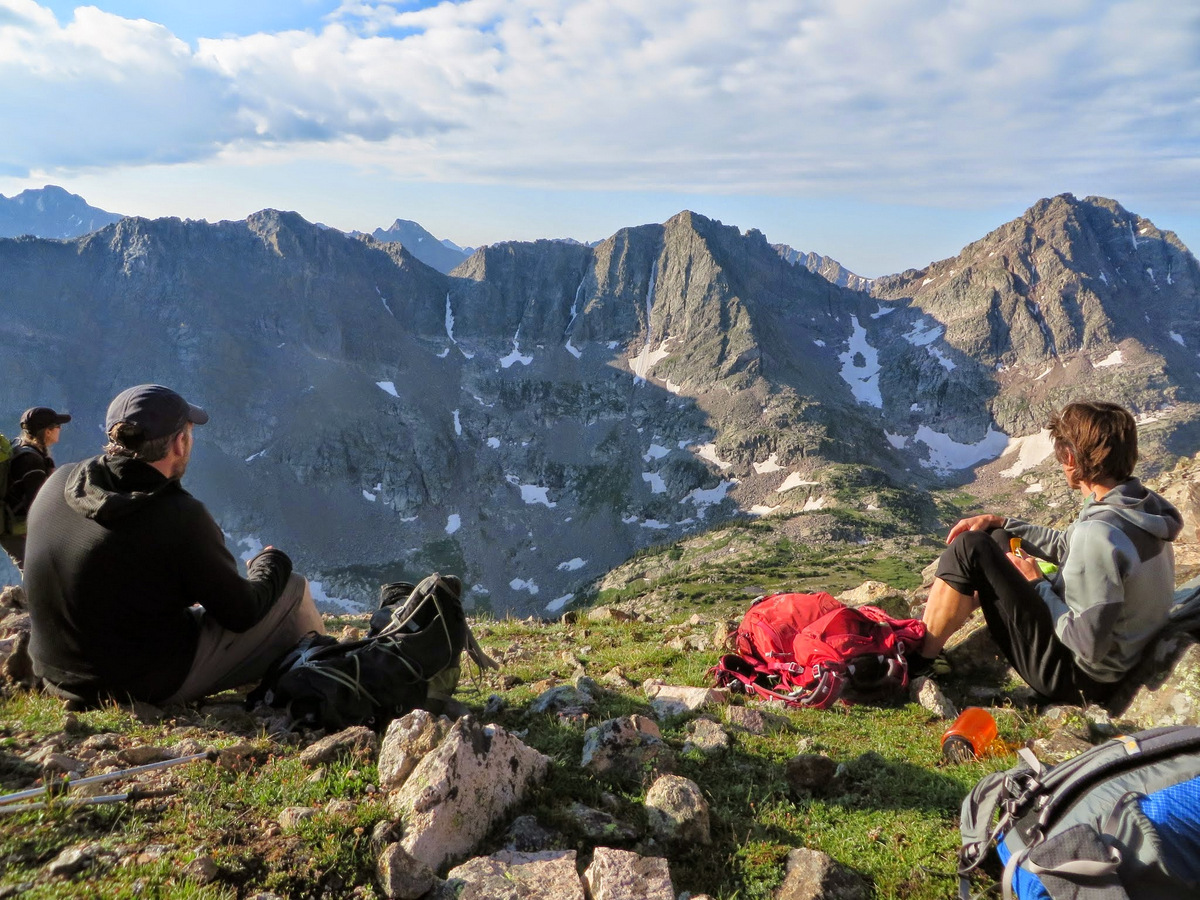
We lounged up top for a good 25 minutes and soon descended down Valhalla”s standard slopes back to Deluge Lake to meet up with Joel and crew. We arrived at Deluge Lake around 12:30pm and ate, drank, and relaxed with good friends for an hour at least. I just love Deluge Lake. The best lake on the west side of the Gores, in my opinion. It seems high enough in the alpine tundra where you don’t have the overgrown marshy plants & bugs that seem to go hand-in-hand with Pitkin Lake, Booth Lake, etc. Deluge Lake just seems cleaner and more pristine to me.
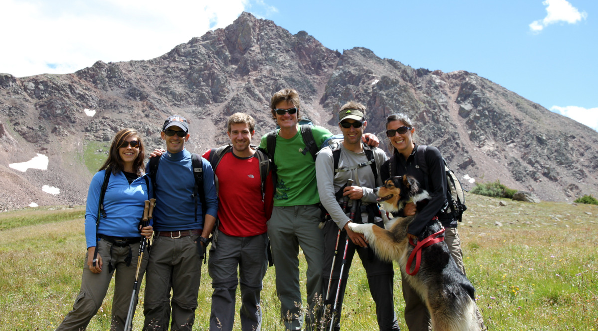
Our crew at Deluge Lake (11,700′). Grand Traverse Peak at top left in picture
Great friends & great surroundings. Snow Peak behind us
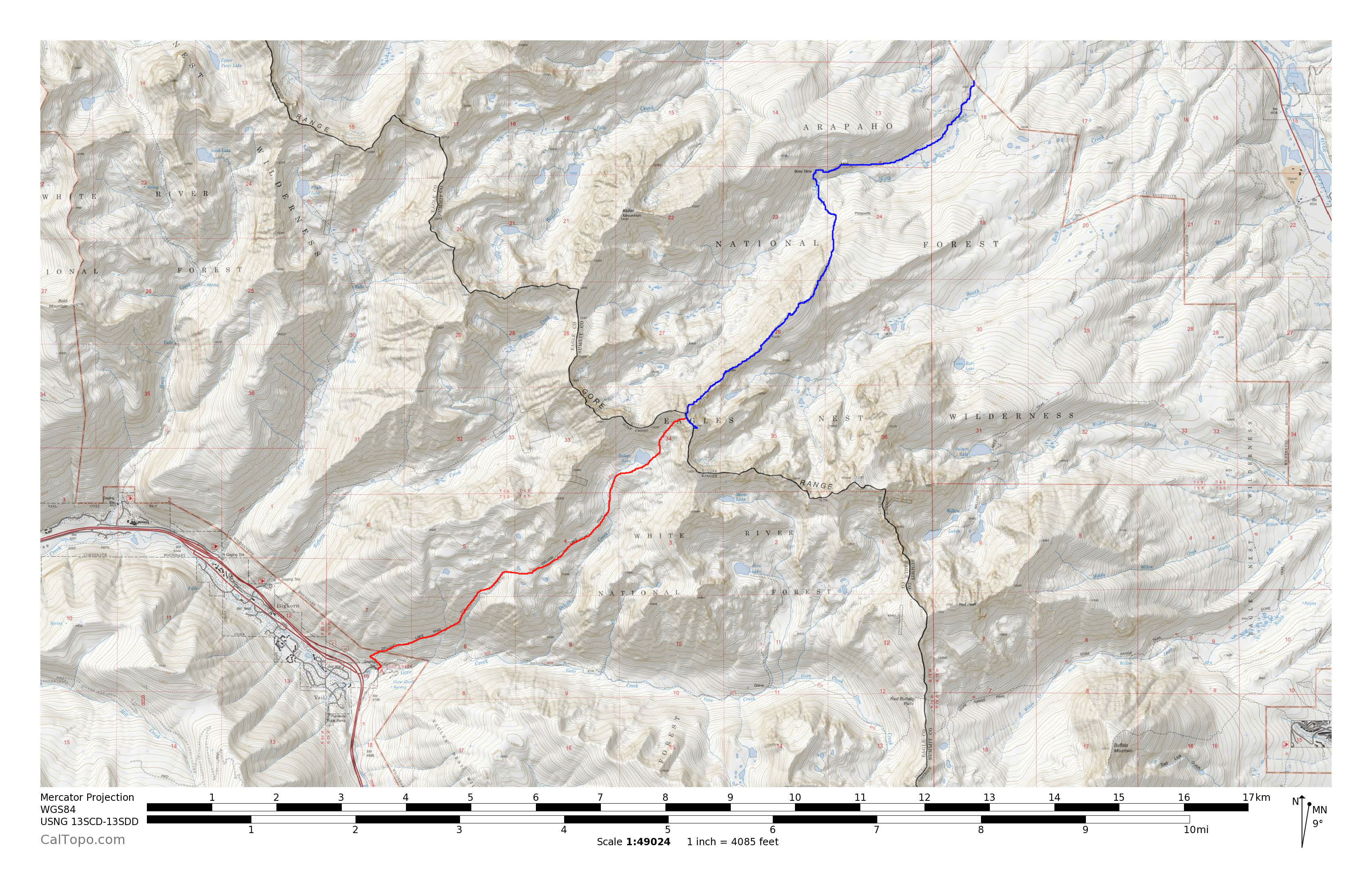
We then took off down the well-groomed Deluge Lake trail trading stories and having a good ole time with those guys finally arriving back at the Deluge Lake/Gore Creek TH around 4pm. Our route is outlined below:
Blue is our ascent from the North Rock Creek TH up Asgard Ridge and red is our descent to East Vail
This was a very fun and enjoyable traverse of the Gore range in the latitudinal direction. We got to climb the amazing Asgard Ridge and descend the mellow west side of Mt. Valhalla. Asgard was everything I hoped it would be – long, exciting, fun, quality-scrambling, knife-edge ridges, towers, exposure, and big air. I love it all. Asgard seemed to be a mix of the Little Bear-Blanca Ridge with some of the gnarlier Gore traverses such as Zodiac Ridge, Ripsaw, and the crux sections of the Partners Traverse. Even though we never broke out our gear for any climbing or rappelling on Asgard, that’s not to say some may prefer the comfort of a rope on certain sections. Its always good insurance to have the gear and not need it rather than need it and not have it. Stan & Joe certainly knew how to pick the good lines and adventures back in 1997 (and continue to do so) and it is truly an honor to follow in their footsteps.
It was so nice to spend a weekend deep in my favorite range in Colorado – the Gore Range. And, not only is it my favorite, its the favorite of several others in our little Gore group this past weekend. You are just bound to have a good time with a bunch of “Gore heads” coming together for some remote peaks deep in the Gores. I do say “Gore” a lot – I just like that word. Maybe a good baby name? Maybe for a dude. We’re having a gal, so we’re out of luck much to Kristine’s disappointment, I am sure 🙂
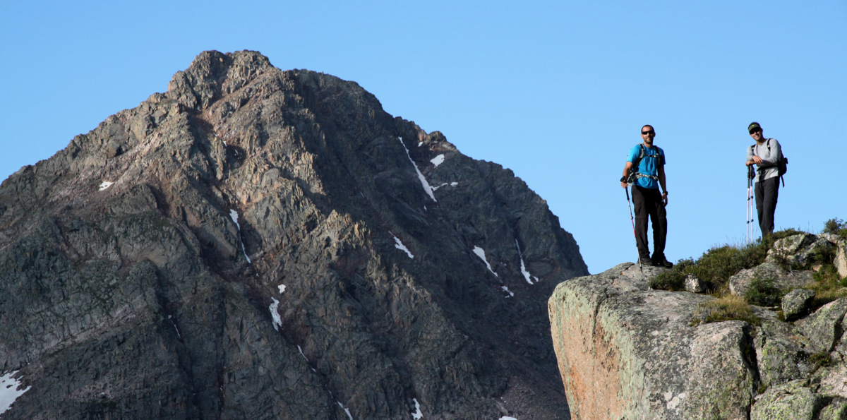
J and I teamed up with Brian Miller, David Yarian, Jason Blyth, Rick Thompson, Kevin Pustulka, & Sarah Behnke to lay seige to the awesome peaks surrounding the very remote and deep Upper Slate Lake in the Slate Creek Basin. This was Brian’s 3rd trip into Upper Slate Lake, but then again he is probably the biggest “Gore head” of them all. However, I learned he had not climbed Peaks R & S, so that made me feel better about him going back. I had longed to climb the peaks surrounding Upper Slate Lake but had never done so as they don’t exactly lend themselves to an easy outing from the Vail side. The approach to Upper Slate Lake is extremely lengthy and there is really no easy way to access these peaks as they lay deep the heart of the Gore Range with the dominating Peak Q being quite close to the geographic center of the Gores.
Peak L (far left) and Guyselman Mountain (far right) on the backpack into Slate Creek Basin
We decided to take the bit longer North Rock Creek TH approach rather than the shorter Brush Creek TH approach as it was just easier to coordinate and not everyone had 4WD vehicles for the Brush Creek 4WD road. Our approach ended up being almost 10 miles and 2,700′ in vertical gain. Not trivial. We did get to view Slate Lake on the approach, for which the basin and creek are named, and this lake alone is a worthy destination.
Slate Lake (9,900′)
Gorgeous waterfalls coming from Slate Lake reminded me of Last of the Mohicans
J and I packed in later Friday afternoon than the rest of the crew and arrived at camp around 7:15pm taking about 5 hours for the approach with our trimmed down backpacks. I started chatting with David and Jason in their tent and was sort of wondering why they were in their tent on a gorgeous evening and then it hit me. Well, they hit me – physically hit me. Mosquitos! They were some of the worst I’ve experienced with close seconds being other Gore lakes, King’s Peak in Utah, and the Wind River Range in Wyoming. However, how can you complain too much with views of these awesome remote peaks from Upper Slate Lake. There was a reason Brian kept coming back here.
J at Upper Slate Lake (10,900′) with Peak Q at center in the distance. Peak R is to the left of Peak Q in the foreground and then Peak S before R
Peak Q in the alpenglow
Peak L standing high above Upper Slate Lake at far right
I made it my mission to keep the already lit campfire going until bedtime and it helped somewhat to make it tolerable to be outside the tent. Nevertheless, it was a great night outside catching up with old friends and meeting Kevin & Sarah for the first time. J and I roasted and toasted our Qdoba burritos over the fire to perfection. Up at 5:30am on Saturday morning, we left camp around 7am to make the semi-bushwhack around the southern edge of Upper Slate Lake and then beyond into the upper portion of the Slate Creek Basin. We eventually crested the 11,500′ small lake dubbed “South American Lake” because it closely resembles the shape of South America.
A stiff start to the morning (this is 20 yards away from camp)
Morning light starts to shine through to the Upper Slate Creek Basin
Jason, J, myself and South American Lake with Peak K standing tall above
Navigating this basin definitely eats up time whether you are off the climber’s trail, stuck in a boggy marsh, cursing your way through willows, or climbing up slabs of rock. We made our way into the north basin between Peaks Q & R and picked our respective lines up Q’s east/northeast faces.
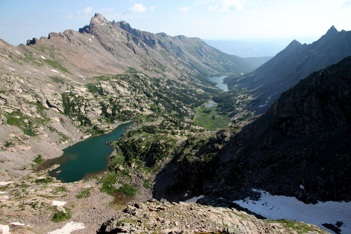
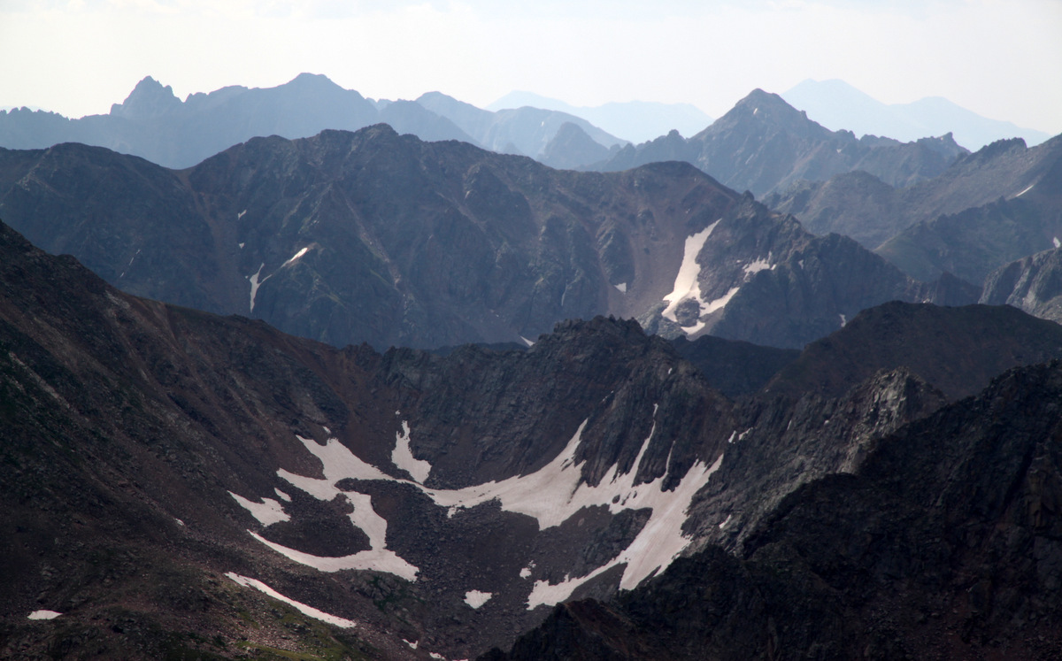
Upper Slate Creek Basin from about 12,500′ on Peak Q. Peak L is the magnificent peak on the left and South American Lake is the closest lake below. Peak T is the spire-like summit on the far right. Upper Slate Lake is in the distance down the basin
J, Brian, and I took a more direct line on some steep ledges while the rest of the crew took more or less the east face route outlined in David Cooper’s Colorado Scrambles. We all met up at around 12,500′, took a cool looking line up a mellow dihedral, and then found a cairn which led us to a small ledge and then a gully spitting us out at the base of the airy summit ridge.
Brian in the “walkable” dihedral
Jason high on Peak Q with East Partner Peak in the distance
Me looking down on the boys high on Peak Q
It was all really fun scrambling and Peak Q surely didn’t disappoint. Peak Q’s summit ridge looked exciting enough and after some airy scrambling on a narrow ridge and a short, exposed 8′ chimney climb, we were all on the summit of Peak Q deep in the heart of the Gore Range.
Jason on Q’s summit ridge
Jason & J on the short 8′ chimney climb on Q’s summit ridge
Brian on the summit ridge
Brian topping out on the short 8′ chimney climb
Zambo!
Kevin & Sarah on Q’s summit ridge with our next goal, Peak R, behind
We actually met a nice fellow named Laars who was leading a month long Outward Bound group in the Gores. He had the morning to get away from camp as the students were out on their solo mission and decided to head up Q. It was fun meeting another person outside of our own party on this remote peak.
J on the summit of Peak Q with East & West Partner Peaks behind and the Partner Traverse
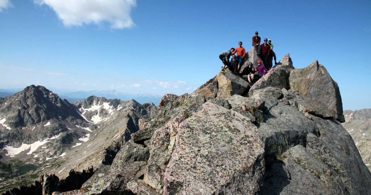
Peak Q summit (13,230′). Is this a record for number of folks on Q’s summit at one time?
Beautiful Gores. Left to Right in distance: East Thorn, Mt. Silverthorne, Red Peak, Hail Peak, Mt. Valhalla
At around 10:30am, we boogied down the “standard” east face of Peak Q and made our way to the Peak Q/R saddle.
Brian and Sarah descending Q’s summit ridge
Peak Q’s summit block and ridge
Peak R from Peak’s Q’s east face on the descent. Our route up R would access the upward trending grass ledges to the ridge’s left side
We said our goodbyes to Laars and he headed south from the saddle into the next drainage over back down to his Outward Bound camp. Jason & I scoped out the ledge system and found a pretty nifty ledge route with steep, blocky scrambling to gain the grassy, upward trending gullies to Peak R’s summit.
Jason beginning the scramble up Peak R with Peak Q dominating the landscape behind
Jason on the exposed ledge system to reach the grassy gullies ahead
Zambo & Rick scrambling up Peak R’s northeast face ledge system
Peak R summit (12,995′). Another record?
Peal L basking in the sun across the basin
Looking at our next objective, Peak S, from Peak R’s summit. Peak T is beyond Peak S further down the ridge
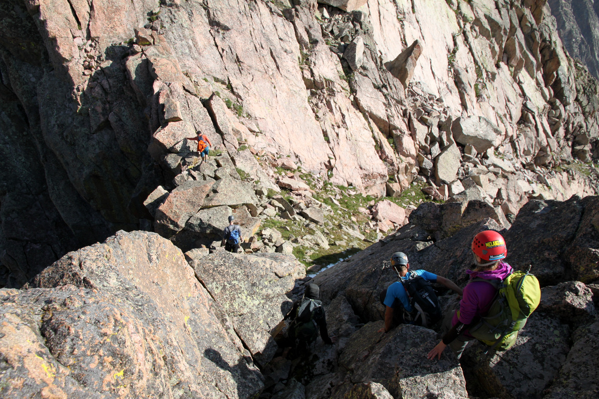
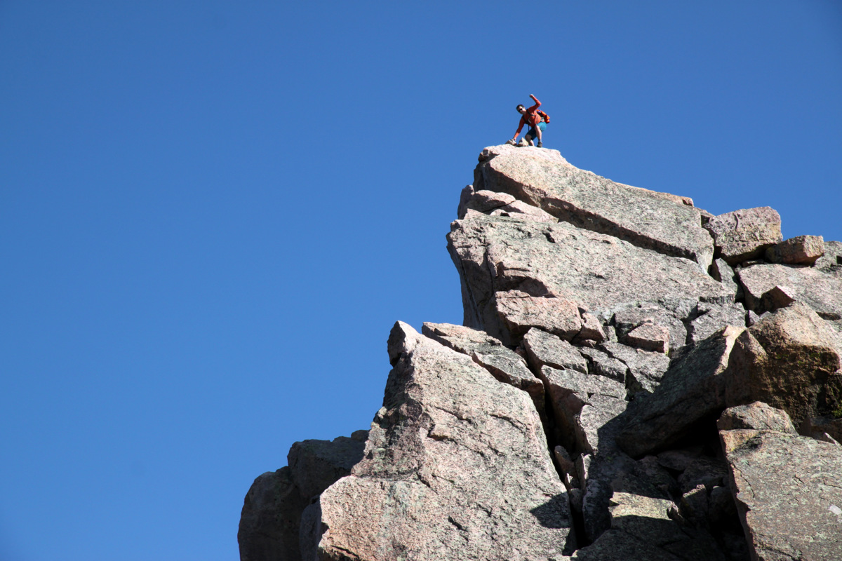
We topped out on Peak R right at about noon and the weather was indeed building. We scampered down the boulder fields of Peak R’s east face and had two choices. Continue on the ridge proper, which would have been pretty spicy and fun if the weather had not been building and we didn’t have such a large group, or drop down to bout 12,400′ on the ridge’s south side via class 3/4 scrambling to a grass ledge system that led over to the low point between Peaks R & S. At this point in seeing the downclimb to the 12,400′ grass ledge system, I think Kevin & Sarah had had enough and decided to return back to the summit of Peak R and head down the way we had all come up from the Peak Q/R saddle.The skies were getting dark but no audible thunder yet, so we kept pushing. We all finally reached the low point between Peaks R & S and realized we still had some climbing to do. We reached another saddle after a few hundred feet of scrambling further east and made a the “go/no-go call”. The skies were getting angry. We only had a few hundred feet of easy terrain to the summit of Peak S and so we all went for it. We left the packs just below the saddle in the easternmost north-facing couloir on the Peak R/S ridge and scrambled fast up to Peak S’s summit. It was borderline trail running. As soon as I stepped on the summit of Peak S, a crack of thunder let loose above me. I motioned for Rick, who was only 10 seconds behind me, to get next to me while I snapped a picture.
Zambo & J scrambling up Peak S’s summit ridge with Peak R to the right and Peak Q further to the right behind R
Rick & I on the summit of Peak S (12,857′)
We got a picture and were off passing Zambo & J, then Jason, and Brian on the descent as they were on their way up. I was literally on the summit for 12 seconds – my shortest amount of time on a summit ever.
J and Zambo on the summit of Peak S below angry skies
It was fairly terrifying, though we descended fast back to our packs within the confines of the couloir. We spread out a bit and descended fast down this couloir.
Our descent couloir
At one point, Brian knocked a refrigerator-size boulder loose, which Rick and I saw heading straight towards us. We sprung to the sides of the couloir walls with our “cat-like” reflexes and hid in small dihedrals. Fortunately, the boulder came to a stop, but would have had to take a hard left turn to get us in our positions. Without any more incidents, we all made it to the valley floor 2,000′ below with the crackling of thunder continuously overhead, but fortunately no lightning. We made it to treeline just before the heavens unleashed a monster hail storm on us. We were able to remain dry, though our thoughts lay with Kevin & Sarah descending Peak R. We sure hoped they were both OK and were able to take shelter somewhere. We made it back to camp around 3:45pm for almost a 9 hour day. We tried to go relax out on the peninsula in the breeze to get away from the mosquitos, but the rain soon started again and we retired to our tents and snoozed for a few hours. However, our concern was always on the whereabouts of Kevin & Sarah up on Peak R. Once 6pm rolled around and they had yet to return to camp, we started discussing our options and sending a few of us back up Peak R was definitely in the cards. Thankfully, Zambo & Jason spotted them descending the valley and they arrived back at camp around 6:45pm. I think we all could rest a lot easier knowing they were safe. Kevin & Sarah relayed their story of descending Peak R’s ledges covered in graupel, much of which sounded very spicy to say the least. Nevertheless, they are experienced folks and returned to camp just fine.
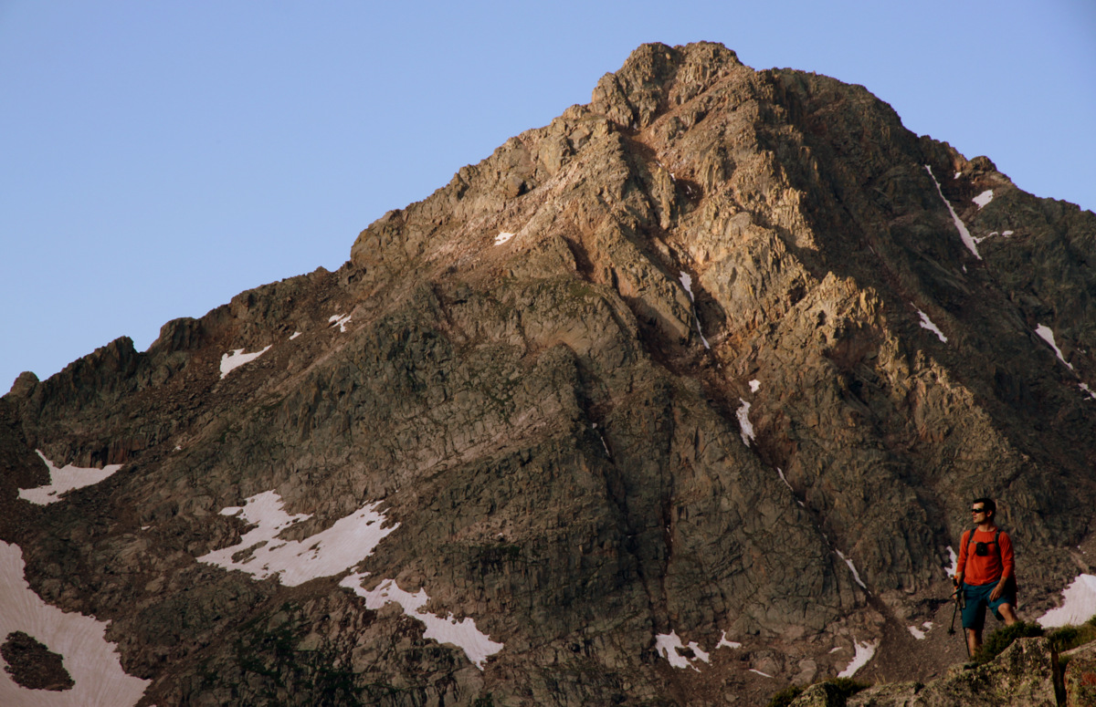
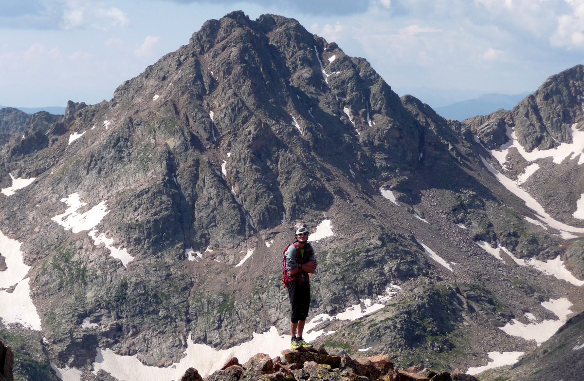
Sunday dawned a new day and Peak L was to be a peak remembered for a long time.
Peak L rising 2,500′ above Upper Slate Lake on Sunday morning
I can now see why Peak L is the favorite among Gore peaks for many Gore enthusiasts. The route starts out the same as for accessing South American Lake and Peak Q by hugging the southern shoreline of Upper Slate Lake. Once you hit the waterfall area where the terrain steepens, make a hard right and cross Slate Creek where feasible. Its then a routefinding maze on the path of least resistance through meadows, over rock slabs, and up steep grass gullies to treeline. The grass gullies give way to boulder fields, which lead up to the ridge, 500′ below the summit of Peak L.
Jason & J with Peak Q on the ascent of Peak L’s southern slopes
Brian and Peak Q, aka “Prisoner Peak”
The scramble up to the ridge
David & Jason at the small saddle with Peak L’s knife-edge ridge in the distance. The summit block is behind the knife-edge ridge and cannot be seen here
A break with a view to the south. Photo by Brian
The views of the Peak Q/R/S massif to the south were unreal. Once we all regrouped at the small saddle, we had a nice food and water break taking in the views to the north of the Black Lake drainage, Ripsaw Ridge, and east-facing ski lines off Mt. Powell and Eagle’s Nest. We made our way around a small tower and scrambled up the ridge to Peak L’s knife-edge ridge.
Sarah with the southern portion of Ripsaw Ridge (right to left: Peaks E, F, G & H) behind
Ripsaw Ridge: Peak C (far right) to Peak H (far left)
The boys scrambling up to the knife-edge ridge
Zambo
Jason in an amazing setting
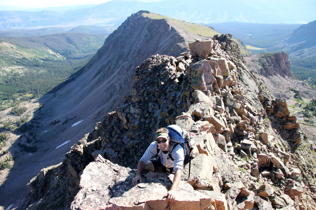
This knife-edge ridge was a highlight of the scramble – airy and fun, though almost to short for my liking. Beggers can’t be choosers, though.
Me heading across the knife-edge. Photo by Brian
Brian walking the line
Kevin & Sarah hanging it out there
I actually took a video of everyone crossing this knife-edge ridge, which can be viewed below (be sure to turn on the 1080 HD in the settings):
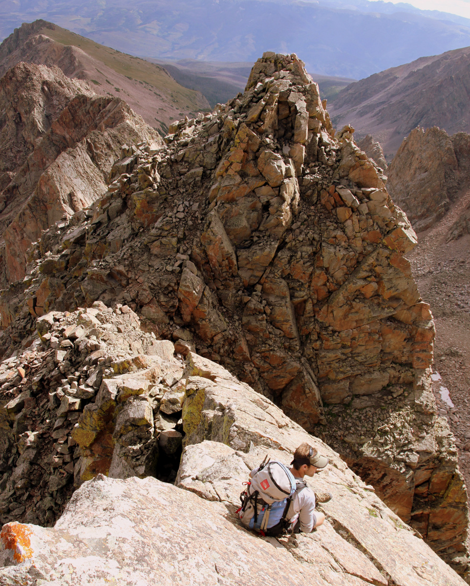
Everyone did fantastic and we soon descended into the notch between the knife-edge ridge and the 250′ summit headwall.
Me videotaping the team on the knife-edge. Photo by Jason
Descending to the notch
Another look at the small downclimb. Photo by Brian
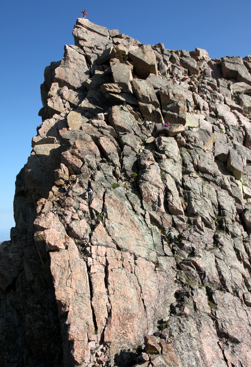
J and I enjoyed our little perch at the end of the knife-edge ridge and watched the 6 others ascend the class 3/4/5 headwall depending upon your route. It was a treat to watch everybody do their thing. J then started up and I got some pics of all 7 of them with Brian on the summit block. Cool stuff.
Climbing the summit headwall as seen from the end of the knife-edge ridge
Can you spot all 7 climbers?
Brian on the summit of Peak L
I then followed Rick and J and we all took perhaps more of a low 5th class route towards the western edge of the headwall.
Rick & J on the low 5th class route
Rick gets vertical
Me taking a more direct approach to the summit block. Photo by Brian
J and Rick leading me home. Photo by Jason
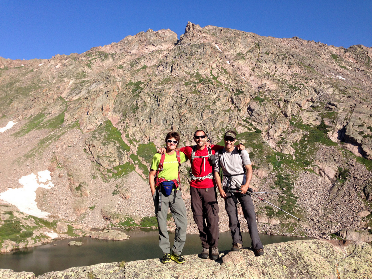
We soon were all on the summit area of Peak L. The actual summit is a 6′ tall boulder that can really only accommodate two folks standing.
J and I on the summit of Peak L (13,213′)
Rick on the summit of Peak L (13,213′)
Looking south to Peaks Q, R, & S from the summit of Peak L
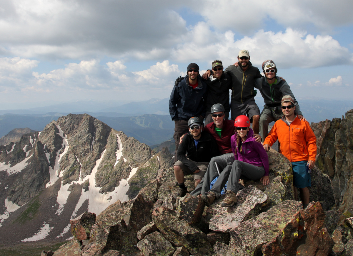
Group shot on top of Peak L. Another summit record? I really had to boogie to get in this shot from my camera. Needed my remote control
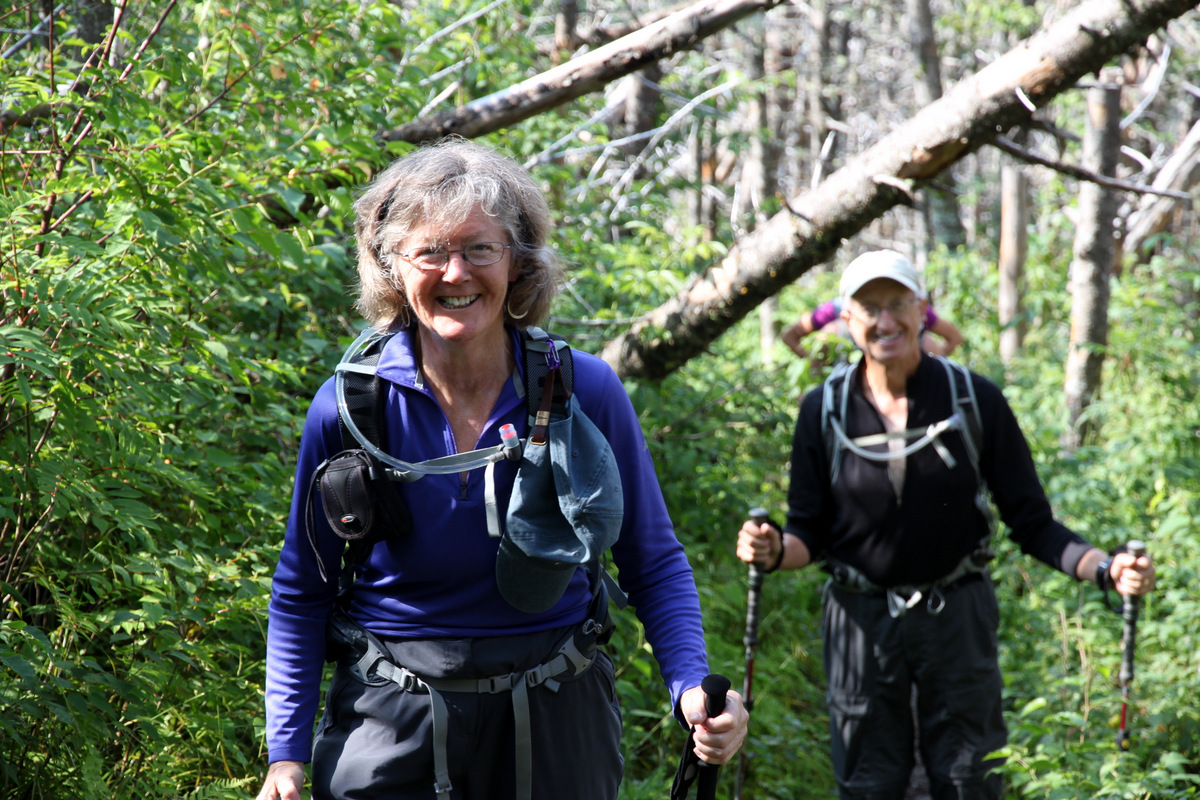
We all lounged for a bit as it was still only maybe 9:30am and ate, drank, and told stories. We then descended safely all the way back to our camp at Upper Slate Lake reflecting on a wonderful weekend deep in the heart of the Gores. Upon arriving back at camp just before noon, we hurried to pack up camp as the mosquitos were, yet again, out in full force. Zambo & Jason left just before J and I did around 12:30pm. Brian, Rick, Kevin, & Sarah left a bit after us. We were all just ready to get out of the mosquitos. I had enough bites on me for sure. J and I took a long break and ate our sandwiches once we were a few miles down the trail below Slate Lake and out of mosquito territory. The backpack out was beautiful, but there definitely seemed like more up then down especially once you turned south on the Gore Range Trail from the Slate Creek Trail. The body was a bit sore once we arrived at the North Rock Creek TH around 5:45pm. As Brian, Rick, Kevin, & Sarah had not arrived yet, J and I said our goodbyes to Zambo and Jason and headed out as we had a bachelor party that evening at Jay’s Hut on Vail Pass. The fun never ends it seems. That’s a good thing, right?
After some reflection, I feel privileged to have spent 2-1/2 days with this crew on the deepest of Gore peaks. It was a wonderful outing and very special to share similar interests with fellow Gore enthusiasts. Now, to go back in there in a few years for Peak T and Guyselman Mountain 🙂 The view of Peak Q will always be embedded in my memory forever
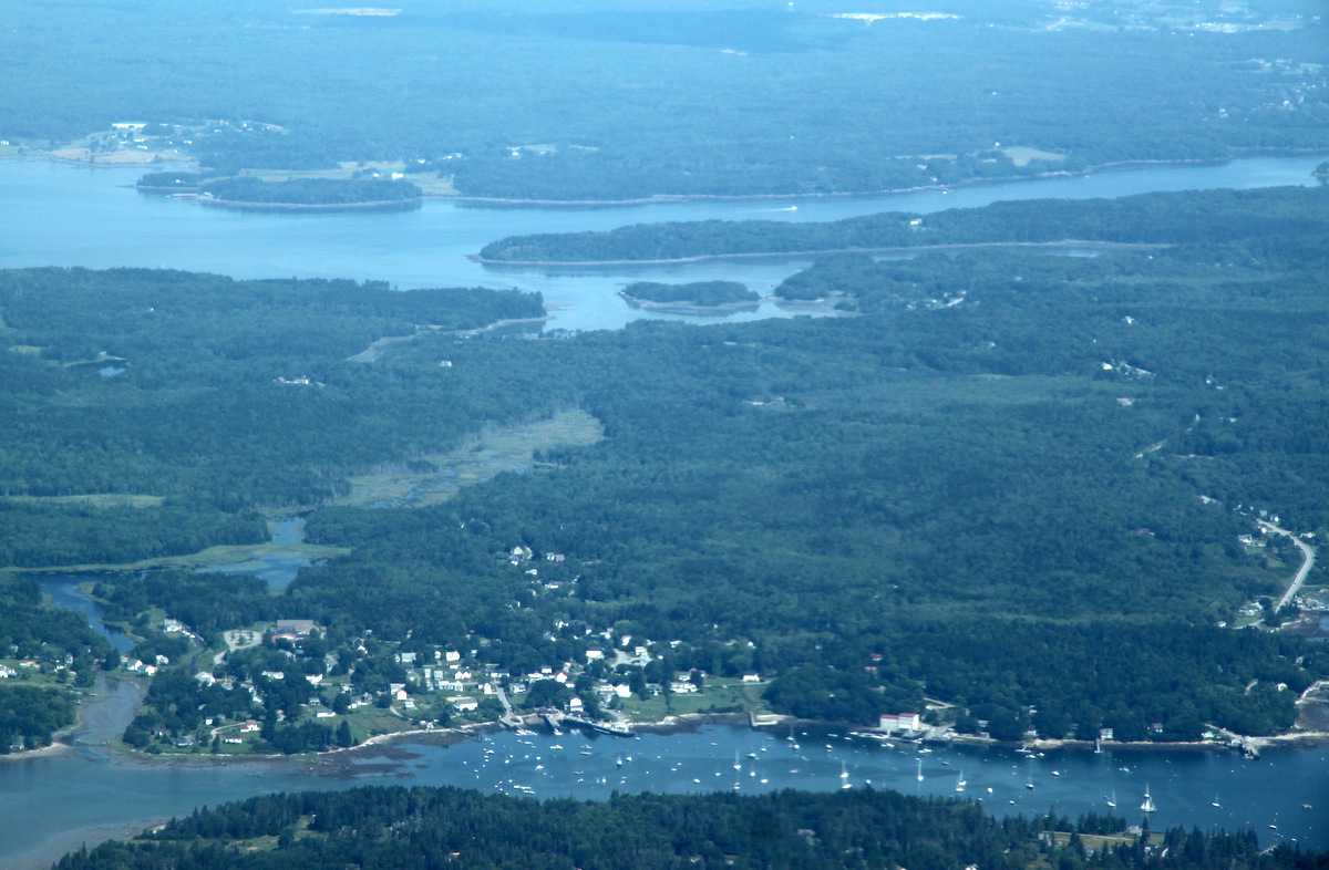
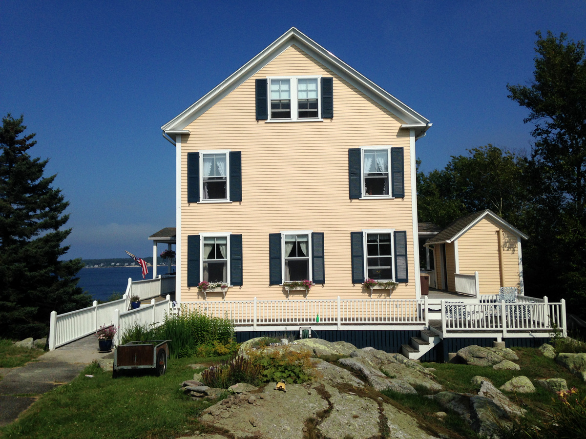
Kristine & I recently returned from a wonderful 6 days on the coast of Maine and in the White Mountains of New Hampshire with the Oelbergers and good friends. We try and do an annual trip to New England every summer and each time it seems this trip gets better and better. This time around we took a 1 hour, 10 seat puddle jumper on Cape Air from Boston to Rockland, Maine, which is only 10 minutes from the Oelbergers house on the coast. This flight sure beat a 4+ hour drive from Boston, a bus to Portland with an additional 1-1/2 hour drive, or some combination of the two as we have done in the past. Its always so much fun and so relaxing to be at Ken & Dianne’s home on the water of the St. George River, which feeds into the Atlantic Ocean.
The Oelbergers home is on the peninsula just above picture center. The town of Tenant’s Harbor is bottom center. Picture taken from the Cape Air flight back to Boston
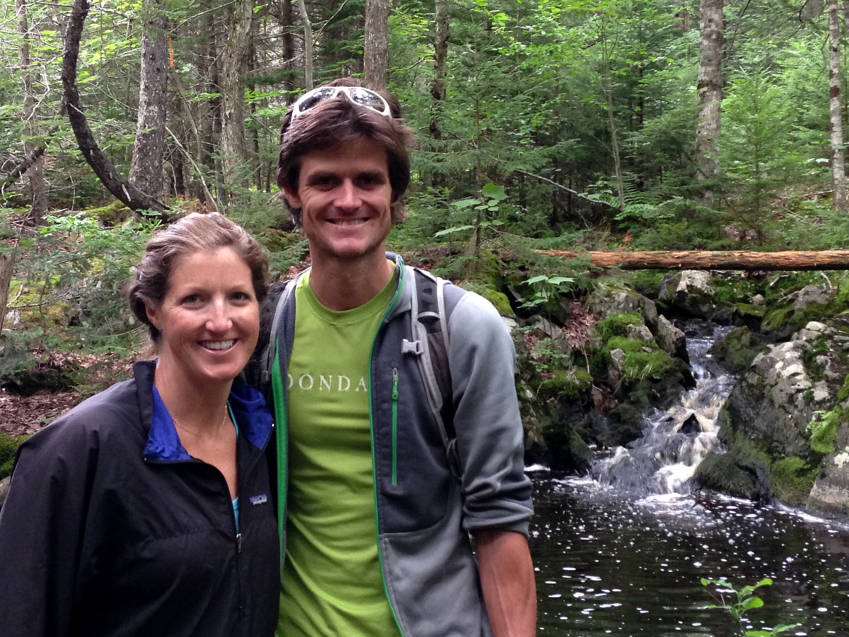
On our first full day in Maine, we took a 4 mile hike on some new trails that Ken & Dianne worked on and were recently completed. Despite the mosquitos, it was great to stretch the legs with the family.
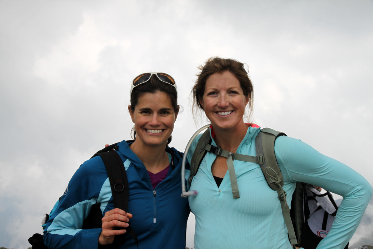
Kristine & I on the wooded trail
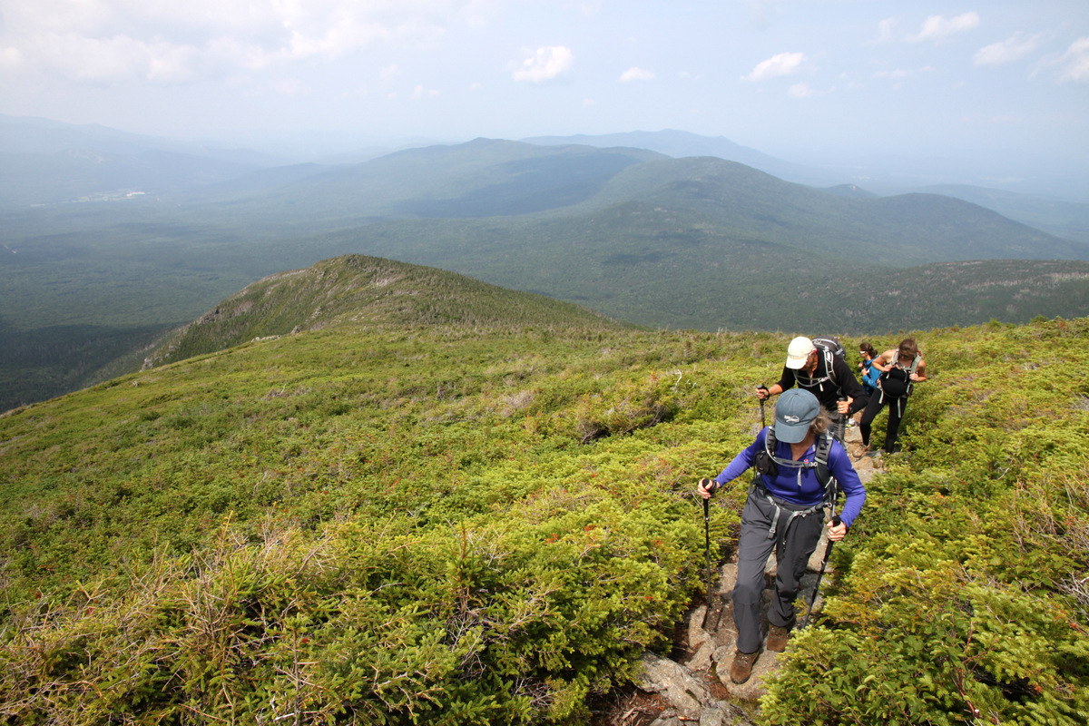
The next day, we road-tripped to the White Mountains of New Hampshire with Ken & Dianne via back roads and towns as there is no direct east-west interstates in that part of the country. We rolled into the White Mountain School near Littleton 5+ hours later to visit our great friends Ryan “Baba” & Lizzie Aldrich, their two youngins, Avery & Colden, and golden retriever, Khumbu. They live in a old farmhouse right off campus and Ryan built a fire pit out back. I had never been to the White Mountains, but I was truly blown away by what this area has to offer. Its like a smaller version of what we have available here in Colorado: the small town country feel, trail running, mountain biking, skiing (inbounds and backcountry) and rock climbing all within a stone’s throw of their house. We spent two wonderful nights with the Aldriches and had a jam-packed full day of fun and adventure with everyone. While Baba & Kristine had been up Mt. Washington, New Hampshire’s highest peak at 6,288′, a few times, the rest of us had not, and so hiking up this state highpoint was on the agenda for all of us. After summitting Mt. Katahdin in Maine last year, the Oelbergers and Chalks are on a conquest of New England’s state highpoints together. Up at 6am at the Aldrich homestead and out the door around 7:30am, we all met at the base station for the Cog railway at 2,700′ on the mountain’s west side. Kristine & the Oelbergers started up the Jewell Trail as I waiting just a bit for Baba & Lizzie as they had to take Avery & Colden to daycare. There are numerous trails up and down Mt. Washington, but we all agreed upon the Jewell Trail, as it was reported the least rockiest. Yes, the mountains in Colorado are much steeper and higher, but I have to say that the trails in New England are much more hardcore. Tree roots combined with the boulders and rocks that seem to have a density of at last two large rocks for every square foot of trail make these trails tough and slower going. Trail running on these trails doesn’t come as easy as it does on the nice smooth dirt trails of Colorado. I can’t imagine being a trail runner in New Hampshire and never spraining/breaking your ankle. Nevertheless, Baba, Lizzie, Khumbu, and I caught up with Kristine, Ken, and Dianne, and enjoyed hiking all together up the nice Jewell Trail.
Kristine, Baba, & Lizzie
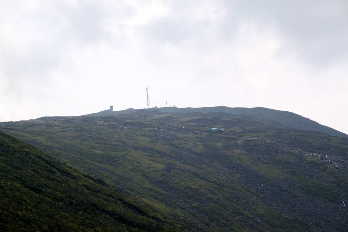
The Cog railway huffin’ & puffin’s its way up Mt. Washington one ridge over
Dianne & Ken
Beautiful Mt. Washington forests
I think Rainier helped Khumbu learn the ways of the “trail dog”. She sure can hike and scramble, that’s for certain
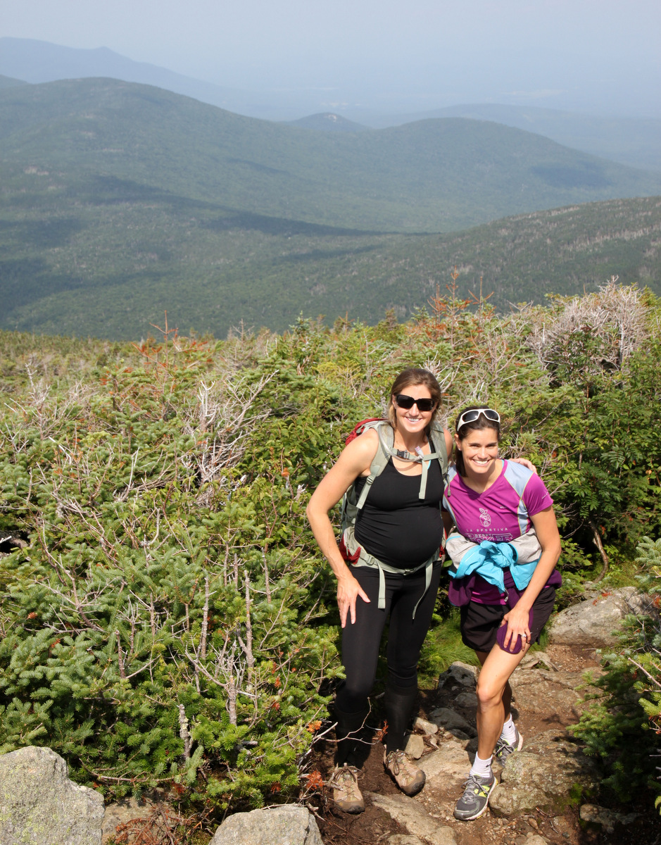
Kristine, despite being now 30 weeks pregnant with our little lady, did so extremely well. We eventually broke through treeline and the valleys opened up around us.
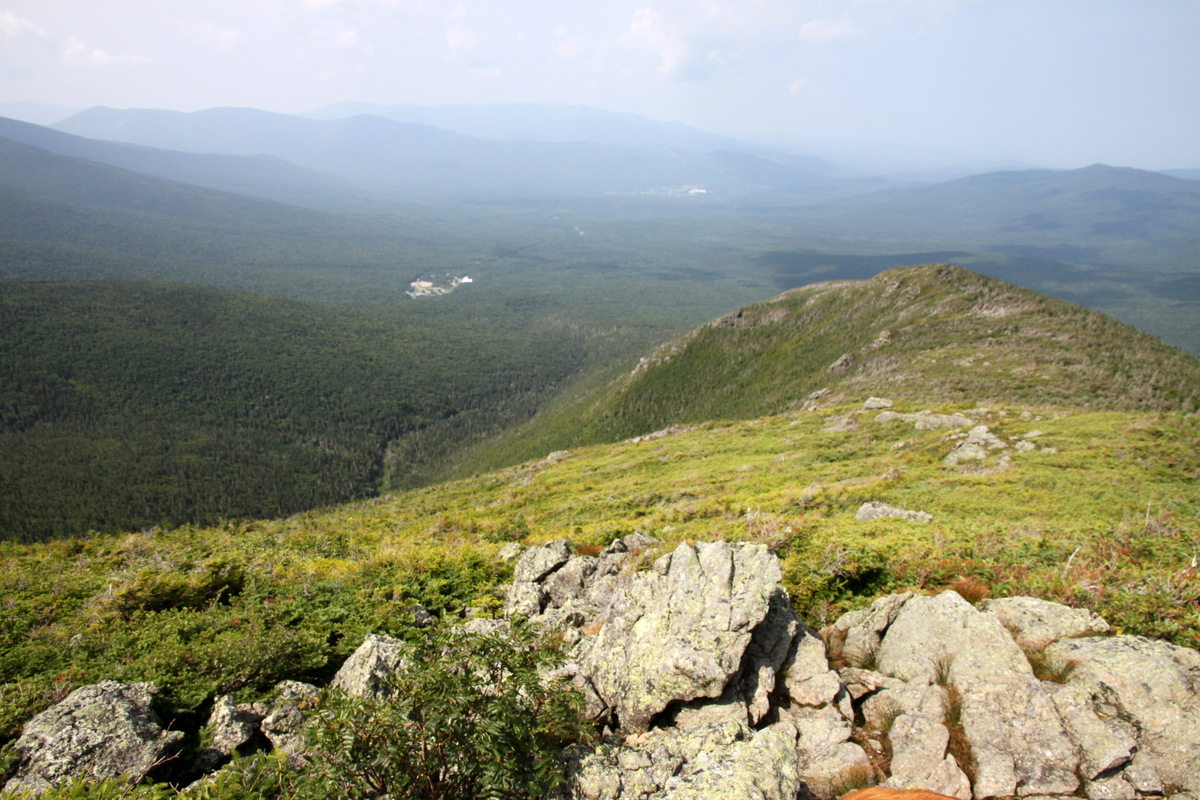
Above treeline looking west. Our starting point, the Cog railroad station, can be seen left of center
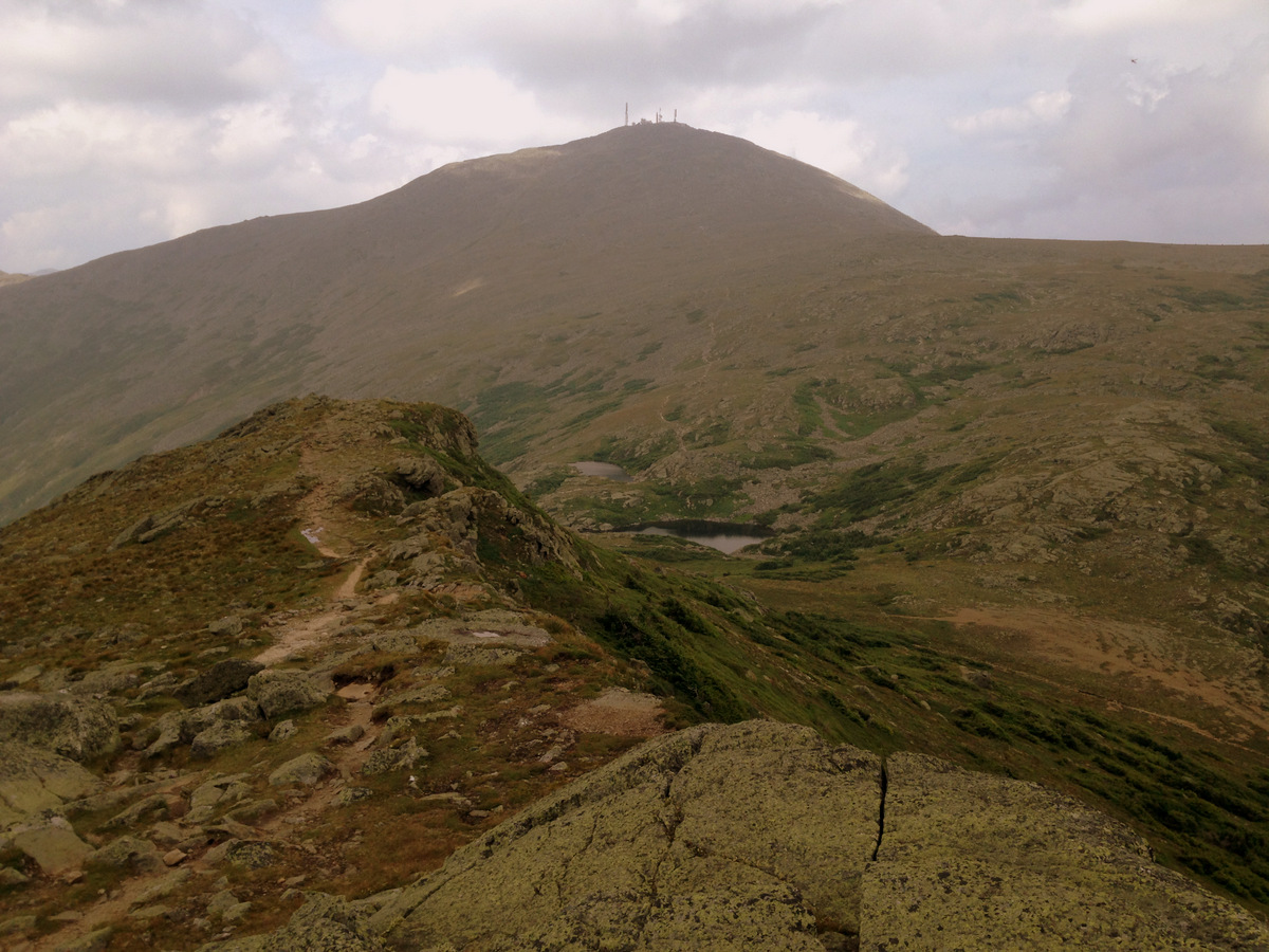
The summit of Mt. Washington 1,500′ above
Kristine & Lizzie
Baba & Lizzie
Kristine & I on a nice perch above treeline
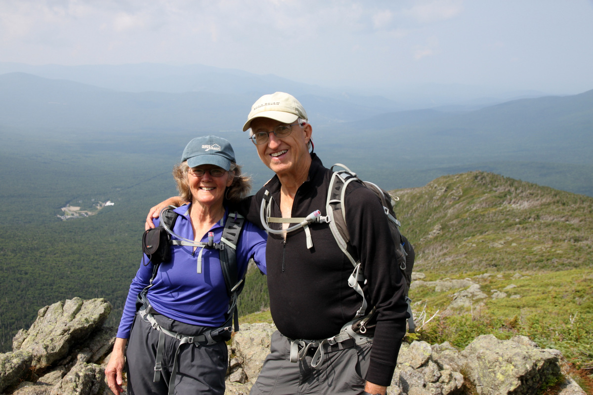
Ken & Dianne
And on we go…
The Cog railway on a bridge with Mt. Monroe and the Lakes of the Clouds Hut behind. Baba, Khumbu, & I would descend by this hut on the Ammonoosuc Ravine Trail
Baba & Khumbu
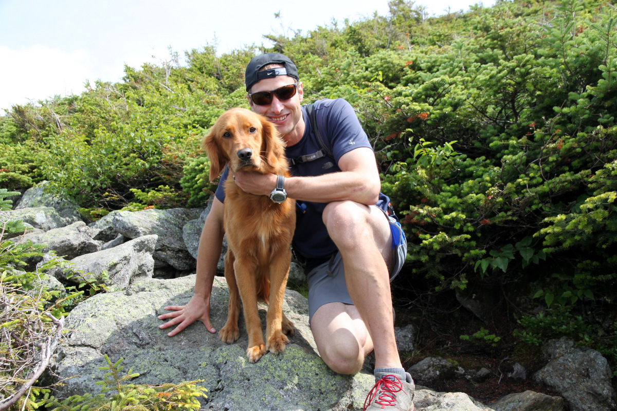
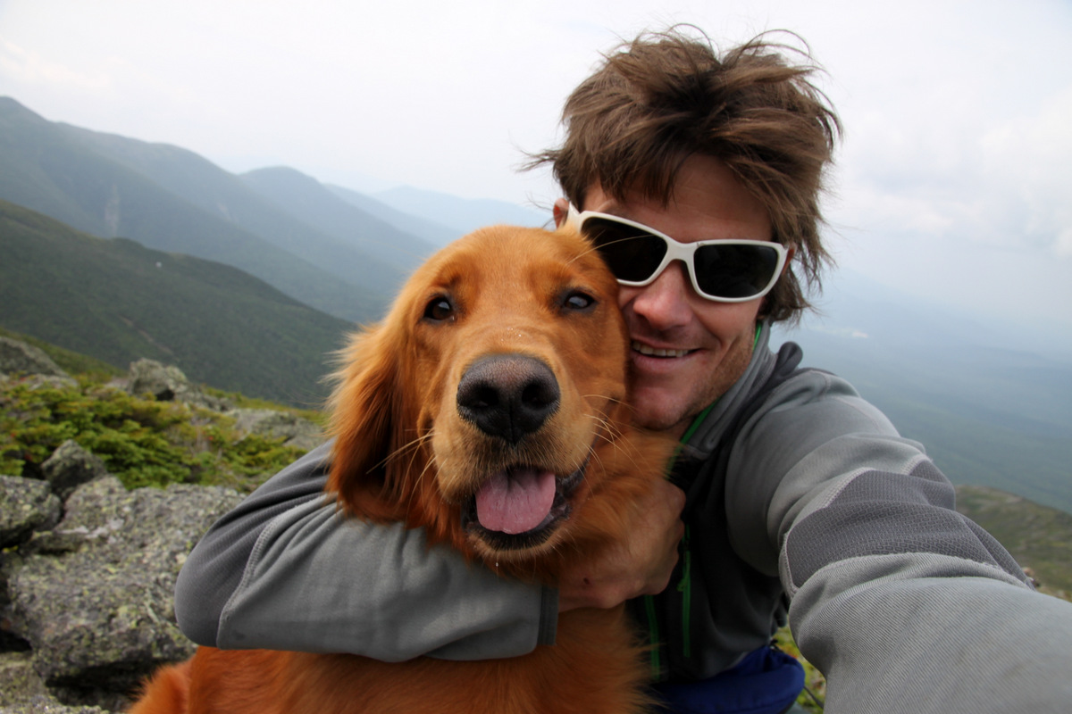
The Jewell Trail climbs maybe 2,700′ in 3.7 miles before it intersects the Gulfside Trail above treeline below Mt. Clay and then heads south to the summit of Mt. Washington. Having Khumbu with us made Kristine and I feel much better about not having Rainie & Kona with us. Khumbu is the best golden retriever I have ever spent time with (except for Rainie of course), a well-trained and wonderfully tempered dog, and not to mention such a lover.
Khumbu & I
Khumbu standing guard
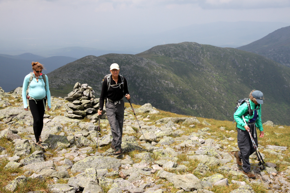
We picked our way up the Gulfside Trail and the views just got better and better of the surrounding Presidential Range and valleys.
Dianne with the northern Presidential Range peaks behind
Lizzie & Kristine
On the upper slopes on Mt. Washington
Kristine looking and doing great
The Cog railway track
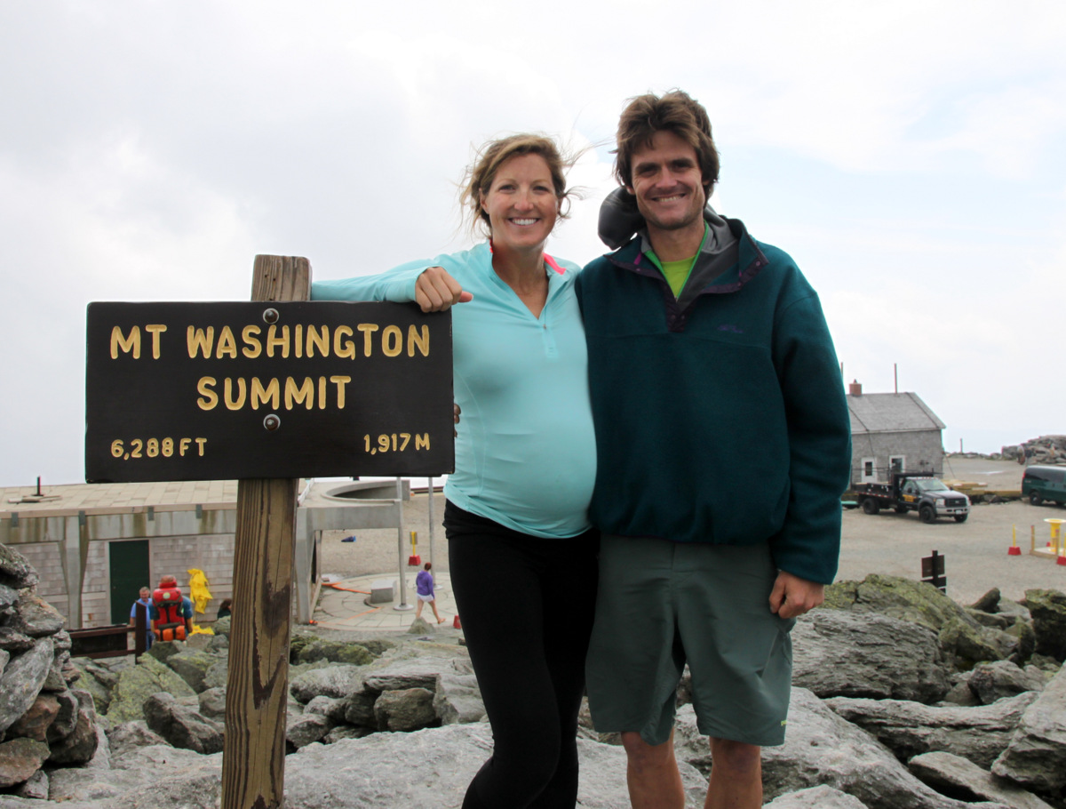
Kristine topping out on Mt. Washington at 30 weeks pregnant
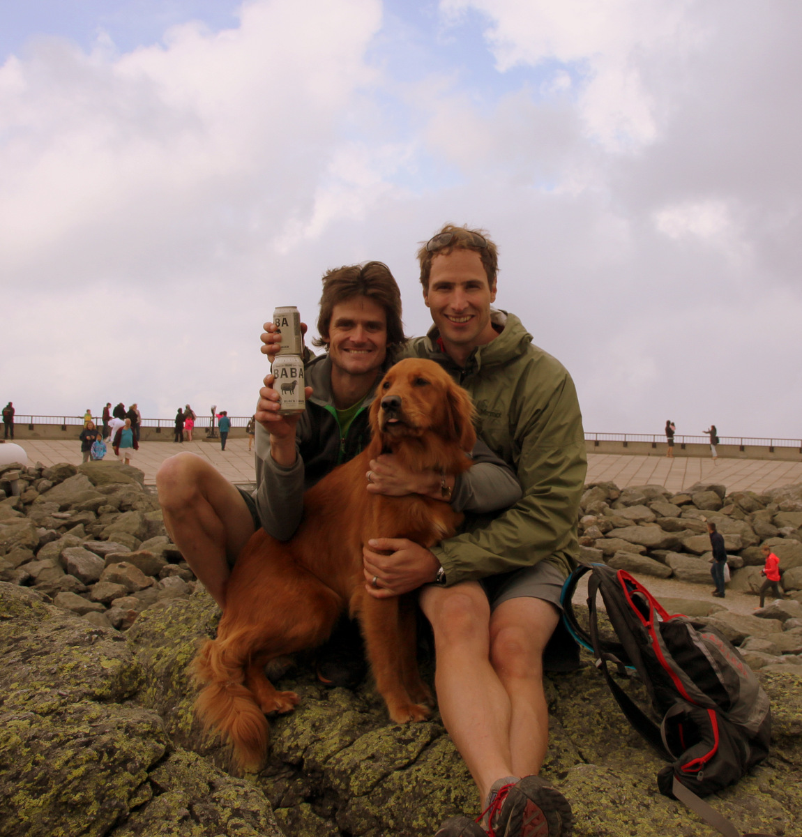
Lizzie scooted ahead to try and buy a ticket and make the 1:30pm Cog railway down the mountain in order to pick the kids up by 3pm or so. We were able to see her off on the Cog and shortly afterwards Ken & Dianne arrived on the top of New Hampshire. We were all so proud of Ken & Dianne for their second New England state highpoint in as many years. The crowds on top of Washington were quite extensive due to the fact most folks take the Cog up or just drive up to the summit. We even had to wait in line to take a picture at the true summit with the Mt. Washington sign. Baba had brought up some “Baba Beer”, which we all enjoyed. Its the best black lager I’ve ever had. Dianne took a liking to it as well.
Kristine & Lizzie before Lizzie took the 1:30 Cog down the mountain
Baba & Lizzie
Me, Baba, & Khumbu with our “Baba Beer” on the summit of Mt. Washington
Despite being a lighter beer guy, Ken even enjoyed some “Baba Beer”
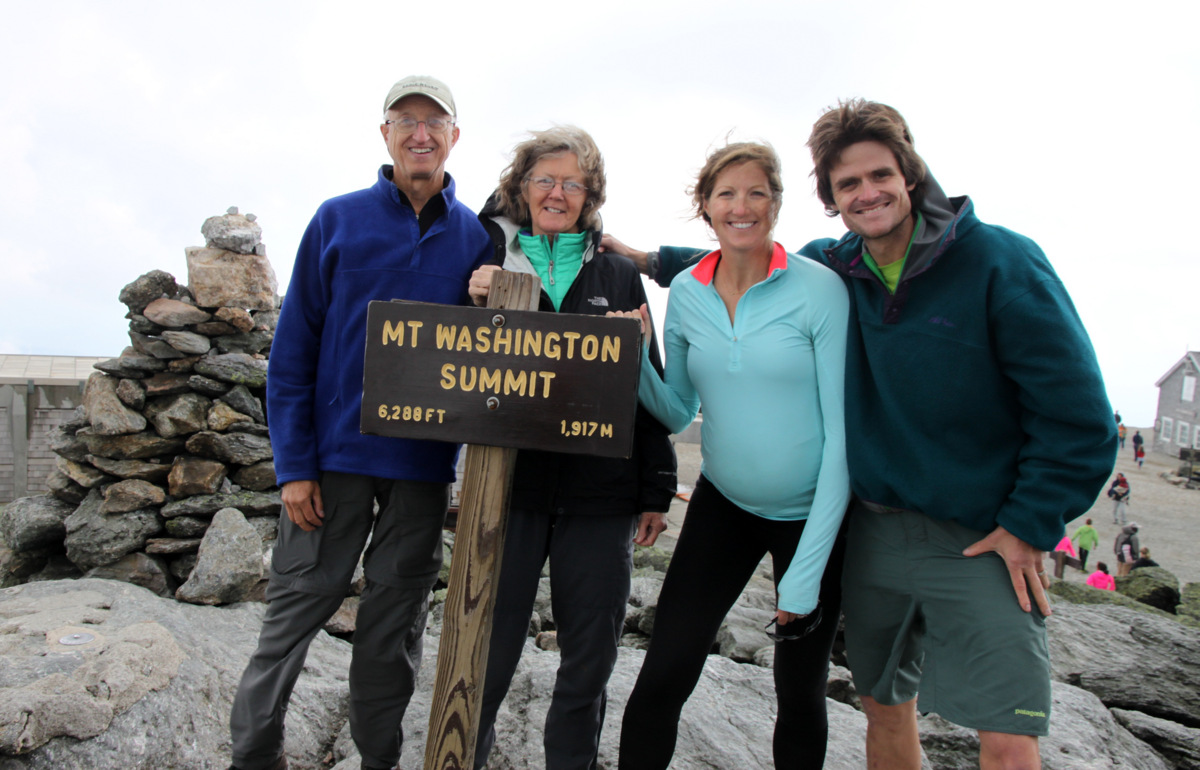
Summit of Mt. Washington, NH (6,288′)
The whole crew on the summit of Mt. Washington, NH (6,288′) minus Lizzie, who was with us in spirit. At least she made the 1:30pm Cog down the mountain
All three Chalks on top of New Hampshire
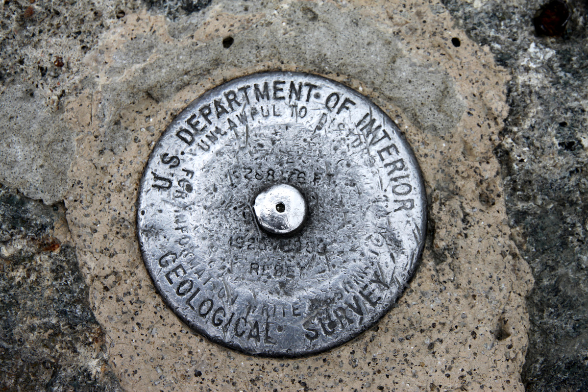
Mt. Washington USGS summit marker
We spent a good hour on the summit before Baba, Khumbu and I started our trail run descent down a different route – the Gulfside Trail to the Ammonoosuc Ravine Trail, which leads back to the base of the Cog railway. Ken, Dianne, and Kristine would hang around the summit for a bit and catch the 3:30pm Cog down the mountain hopefully giving Baba, Khumbu & I enough time to get down. Baba & Khumbu relaxed at the Lakes of the Clouds Hut while I did a short run up to the summit of Mt. Monroe (5,372′), which afforded more spectacular views.
Looking north to Mt. Washington from Mt. Monroe’s summit
Looking at the southern Presidential Range from Mt. Monroe’s summit
After some steeper scrambling down the Ammonoosuc Ravine Trail for 3 miles, we arrived back at the base of the Cog around 4pm. It was some solid trail time with Baba after a good year hiatus from hiking together.
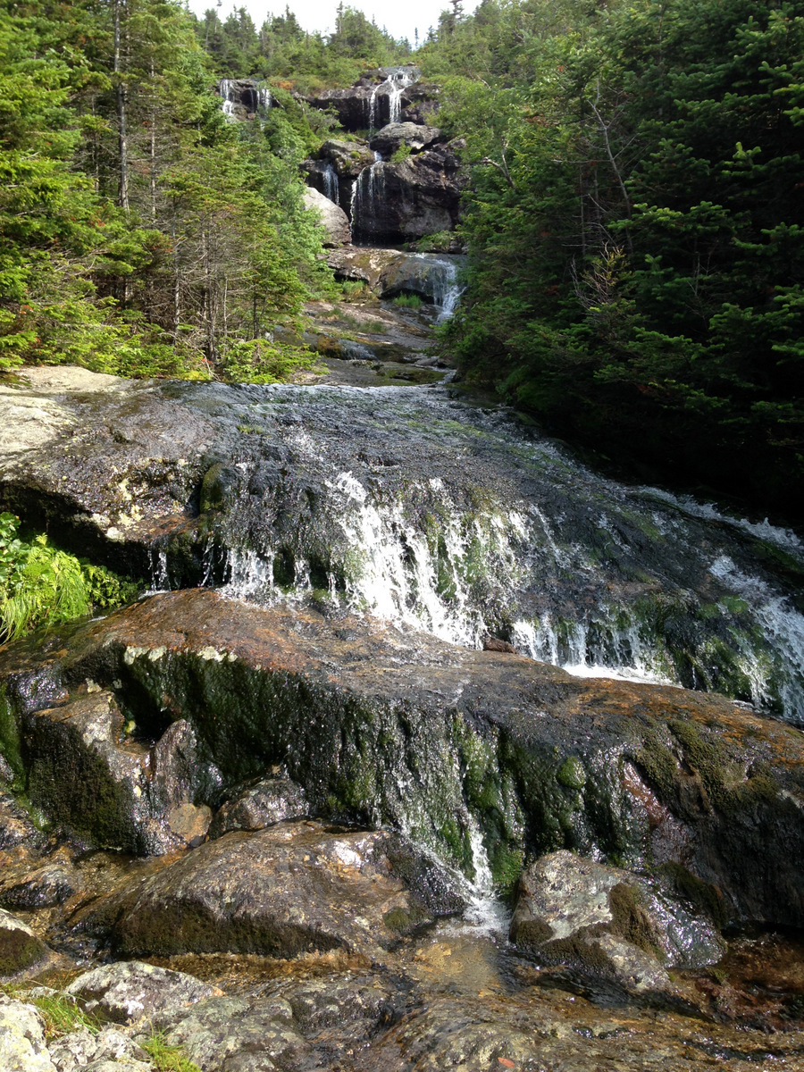
Beautiful waterfalls coming down the Ammonoosuc Ravine Trail
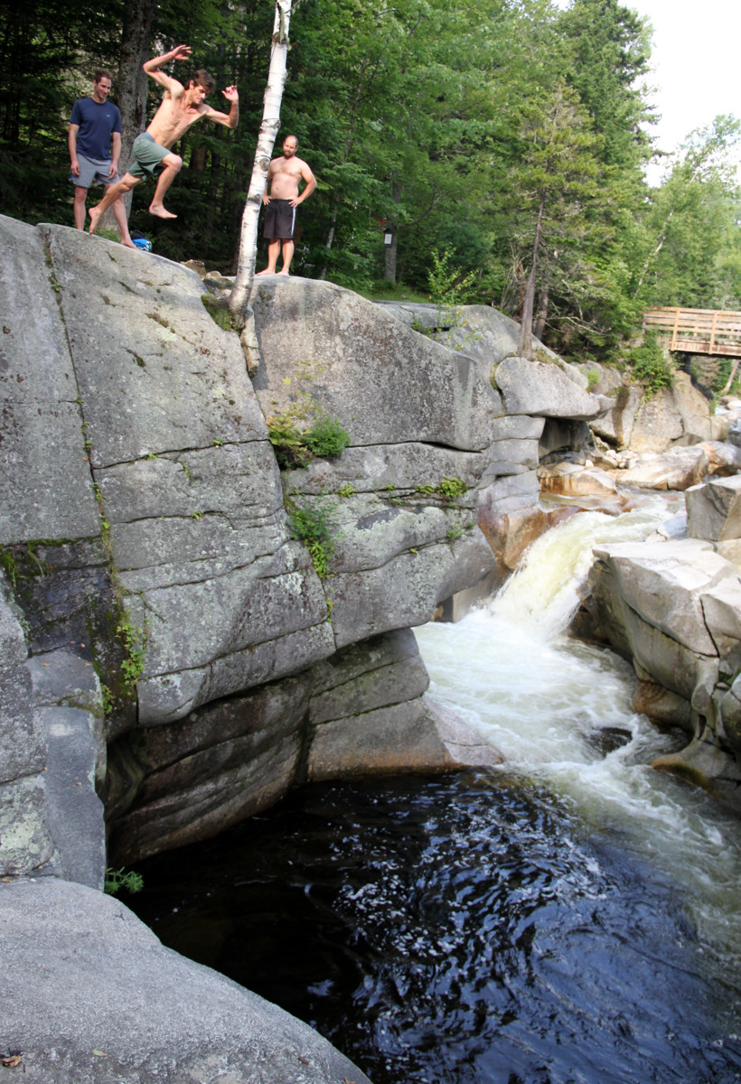
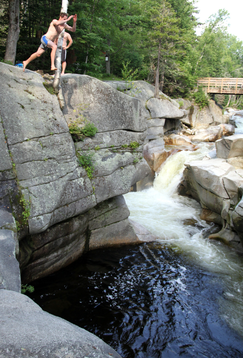
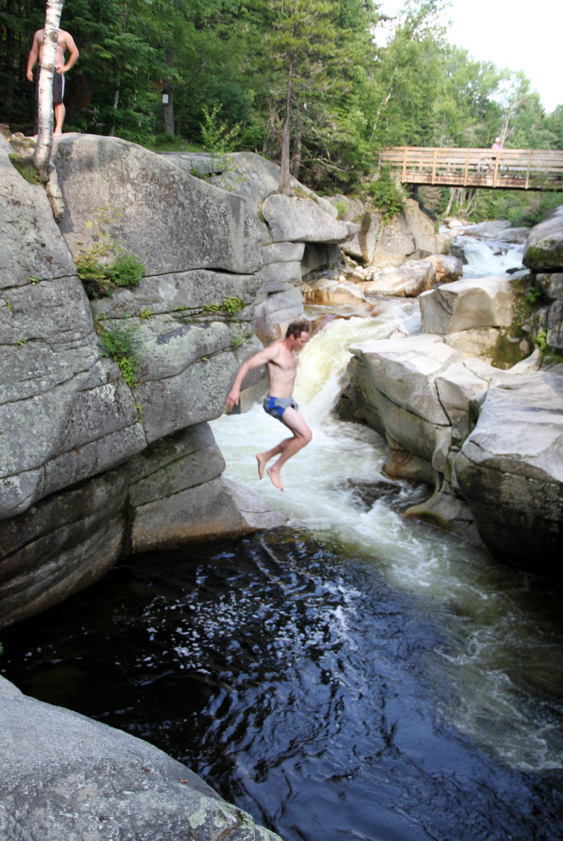
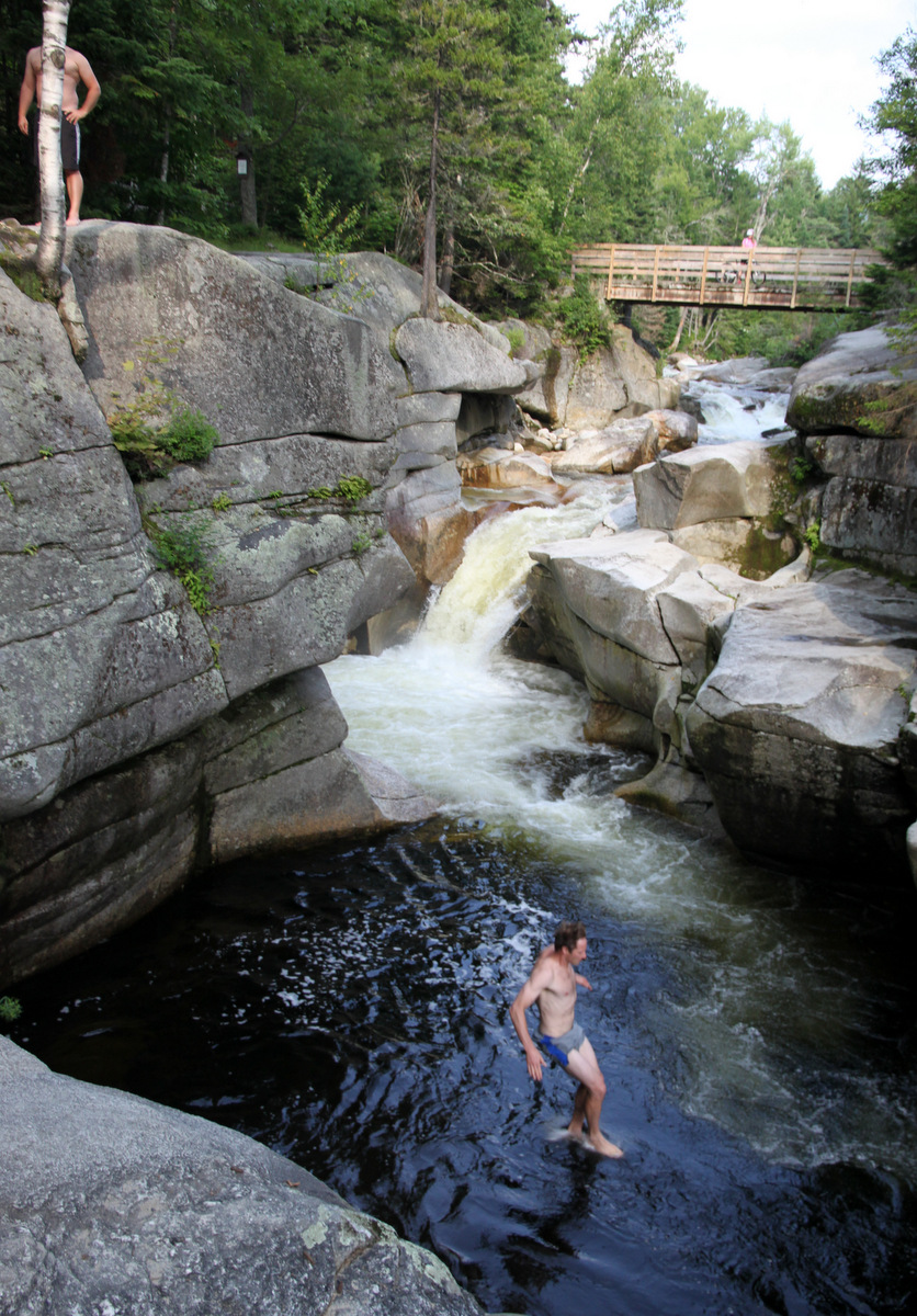
We arrived at the base only to learn that the 3:30pm trail was delayed due to mechanical issues. It was soon fixed and Kristine, Ken, & Dianne arrived at the base around 4:45pm. Apparently, Kristine overheard a group on Washington’s summit talking about some pregnant lady hiking up Washington. We all thought that was funny. Baba then took us to an awesome river spot for some cliff jumping. The cliff itself was likely only 25′ high, but boy was the water cold. I don’t think Baba had done this jump before so I was glad to do it with him.
Me dropping the cliff. Such a cool swimming/cliff jumping spot
Baba launches
Baba mid-air
Baba walking on water
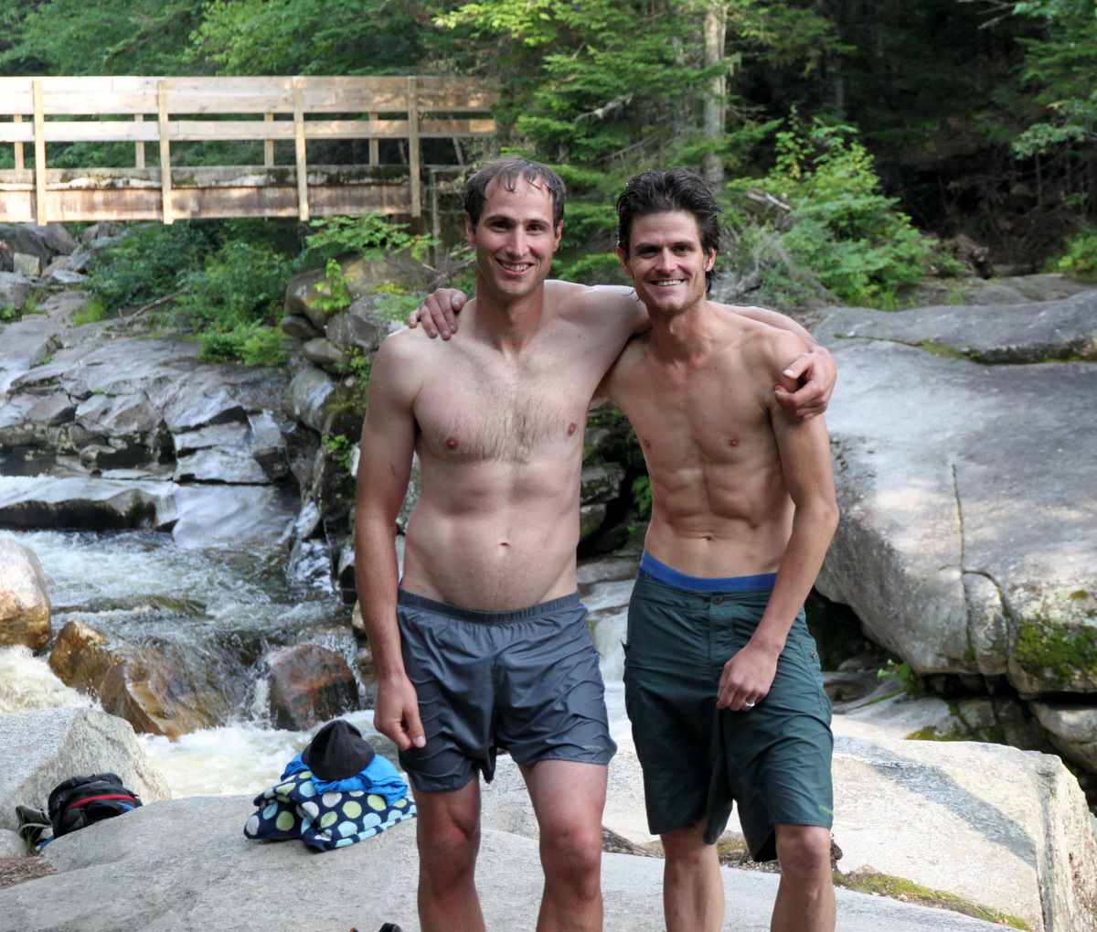
Good buddies
The next day (Saturday) Lizzie competed in and placed 2nd in her age division in the local Top Notch Triathalon! She really did extremely well and was very impressive. As I cannot bike or swim well at all, I asked her if she wanted me to run along with her up Cannon Ski Mountain as the third and final leg of the triathalon. Lizzie thought that would be a great idea and that she would love for me to be alongside her for support and motivation. So, that’s what I did. I held her water bottle and some energy gels and ran with her up the 2,000′ of vertical gain to the finish line at the ski mountain’s summit. It was an honor to be with her and was very fun. I hope me being there beside her helped her to go a bit faster. She didn’t need me at all. It was just fun to be with her. As we didn’t really know if a “pacer” was legit with the triathalon’s rules, I ditched out before the finish line and met her up top. Baba, Kristine, and the kids took the tram up to the summit and we all congratulated Lizzie. We even ran into the really good friends of the Oelbergers, the Muchards, at the race as their daughter and son-in-law were competing as well.
After saying our goodbyes to our really good friends, we left for Maine and the Oelberger Residence arriving at around 8pm that Saturday evening. Sunday was a relaxation day and we had a great cornhole tournament with Ken, Dianne, and three of their good friends in the afternoon. On our last day in Maine, Kristine & I got up early and drove an hour to Booth Bay Harbor to catch a ferry to Squirrel Island and visit our great friends Chris & Kate Danforth. Chris & Kate spend their summers at the Danforth house with their kids Harper & Afton. Harper is now 8 years old and is a climbing monkey. I had never been to Squirrel and visiting this fairly private and secluded island was a special treat. Kristine had visited Kate here before. There are only about 100 homes on the island, a small post office, ice cream store, a library, a few tennis courts, and a church. That’s about it. The island is pretty small with a perimeter of about 2.5 miles around the shoreline that resembles the body shape of a squirrel facing west. Pretty much everyone walks everywhere and everyone seems to know everyone. It was the kind of small community I just love. Houses rarely come on the market and they are passed down generation to generation. I believe there is only one lot for sale too. Chris’s parents actually met on Squirrel Island as both of their families had homes on the island. It is really a special place.
The beautiful Danforth homestead on Squirrel
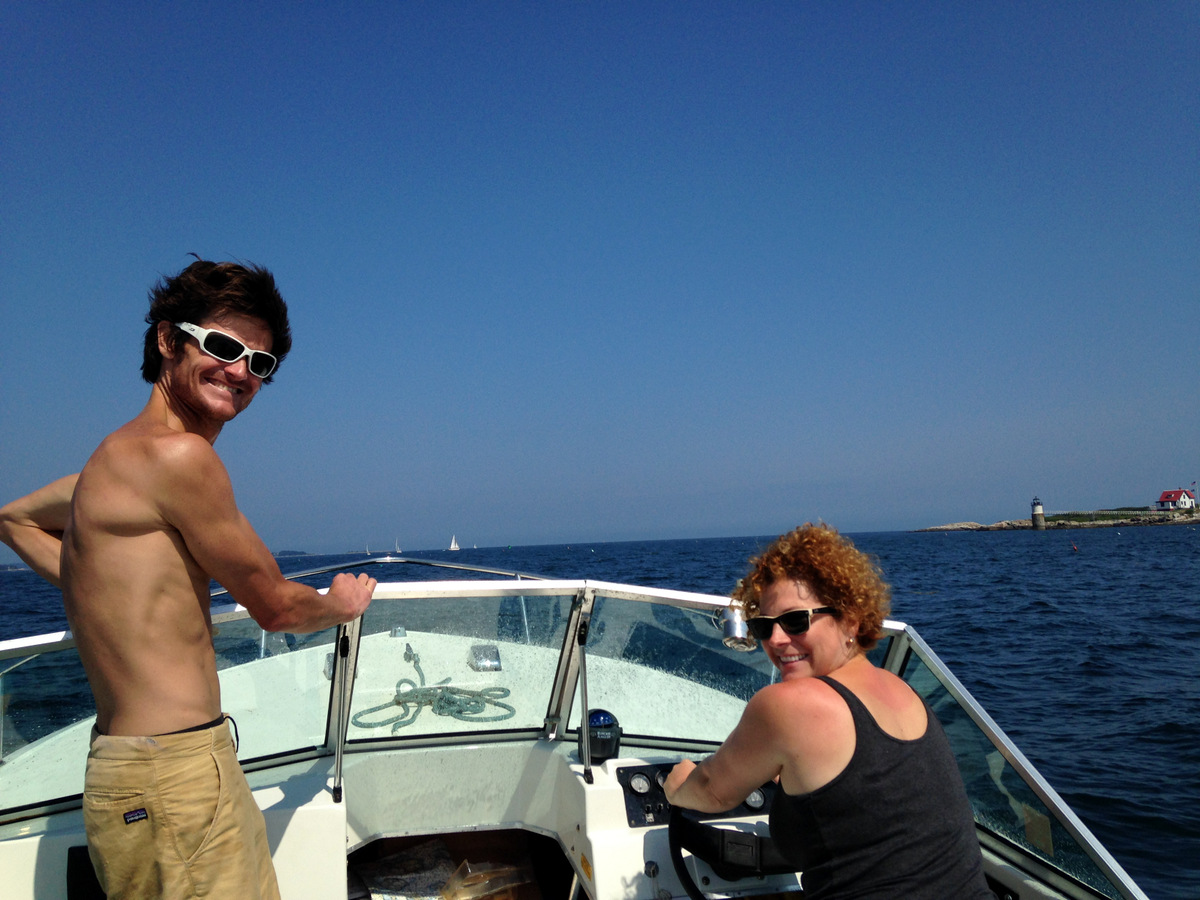
Chris took me on his daily ritual – his island “rock hop” run around the rocky/slabby coastline of Squirrel. It was so much fun following Chris on this awesome run. Its basically a combo of trail running and scrambling over rocks for 2.5 miles. I think we did it just shy of 30 minutes, which was a decent time considering we were moving pretty fast yet still chatting and he showed me a few cool spots including a cliff jump along the way. After building a good sweat, we met Kate, Kristine, Harper, and Afton on the beach area and went for a much needed swim. Its too bad Chris and I live across the country from each other. I think we all feel like the two of us are like peas and carrots. Its great. Chris & Kate cooked us an awesome lunch of BBQ chicken and caprese salad. Yum. We then went on a boat ride with Captain Kate at the helm and then walked over to the cliff jump.
Boat ride
Kate, Kristine, & Afton
Apparently there was a dead seal near the cliff jump, but we didn’t see it. Anyway, Chris and I jumped while the ladies and Afton watched. It was a great jump into the ocean. Two videos of Chris and I jumping below:
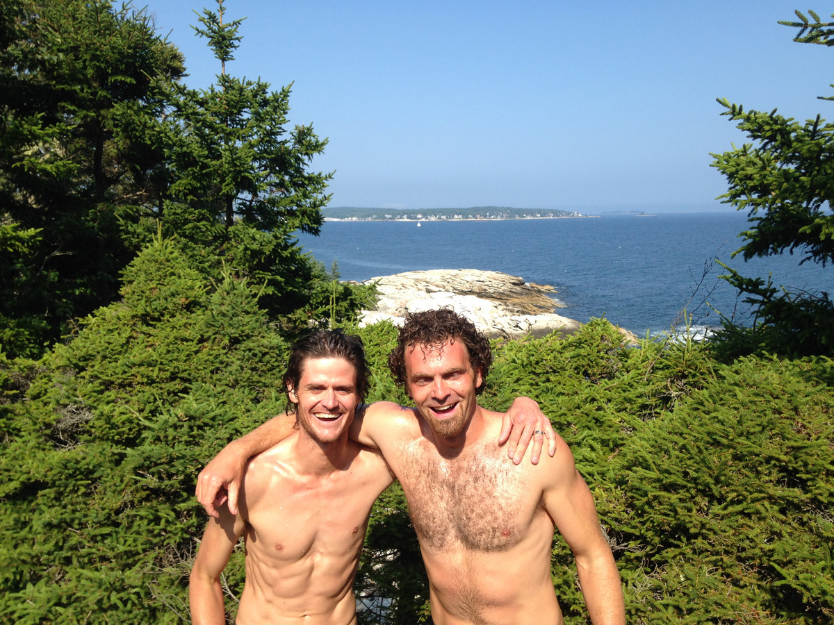
Chris and I after the cliff jump
Later on that day, Chris and Afton took the boat around the island to the cliff and saw the seal carcass. It was literally 10 ft from where we jumped in. Glad we didn’t see it at the time! After some more beach time, we showered up and caught the 5:40pm ferry back to Booth Bay harbor. Again, it was sad to leave our good friends and such an amazing place, but feel fortunate we were all able to spend a great day together. We look forward to future adventures and time together with Chris & Kate and their awesome kids.
All in all, one of the best trips back to New England we have done. Seeing family, reuniting with great friends, and experiencing great places all helped to make this a special trip.
The much anticipated video of our December 2013 Vinson climb, filmed and edited by Ed Horne, was finally released a few days ago. Ed was hired by our logistical guide service, Antarctic Network International or ANI, to be a part of our “V3” expedition to climb Mt. Vinson. Ed is an extraordinary photographer, videographer, and all-around super guy. We all felt honored to have him along on our climb and as a result all became good friends. In a nutshell, our 11 day climb up and down Mt. Vinson was documented by Ed and this awesome video is the result. Its a lengthy video at over 17 minutes, but brings back so many happy memories for all of us that I hope you enjoy as well. Hopefully, this will give folks a great snapshot of what it is like to climb to the top of the bottom of the world with the phenomenal services provided by ANI. The logistics, guides, food, and support of ANI are really first class and unmatched in the mountain guiding industry. Several of us “client” climbers are featured in this video including myself, Kristine, Chase Lochmiller, Kevin Vann, Dan Healy, Luis Alvarez, and Vilborg Arna Gissurardottir. Guides featured are Scott Woolums, David Hamilton, Lhakpa Gelu Sherpa, Namyga Sherpa, and Josh Hoeschen. Unfortunately for Kristine, Kevin, David, and myself, there is no footage of us on summit day (except for leaving high camp) because we ascended the north bowl/west ridge and descended the standard east ridge. We passed Ed and the rest of the ANI crew on the east ridge on our descent as they were all heading for the summit. I so wish we had been up there with them all, but its great seeing all of the happiness, elation, and excitement of Chase, Villa, Harry, Halla, Dan, Luis, Lhakpa, Andy, and Namyga on Vinson’s summit. We all feel very fortunate to have had Ed with us on our Vinson climb and for this video to relive those days in Antarctica for the rest of our lives. Enjoy!
Lastly, Ed shot and edited this little 1 minute promotional video for ANI based on footage from our Vinson climb if you would like to check it out:


 Follow