It was so nice to spend a weekend deep in my favorite range in Colorado – the Gore Range. And, not only is it my favorite, its the favorite of several others in our little Gore group this past weekend. You are just bound to have a good time with a bunch of “Gore heads” coming together for some remote peaks deep in the Gores. I do say “Gore” a lot – I just like that word. Maybe a good baby name? Maybe for a dude. We’re having a gal, so we’re out of luck much to Kristine’s disappointment, I am sure 🙂
J and I teamed up with Brian Miller, David Yarian, Jason Blyth, Rick Thompson, Kevin Pustulka, & Sarah Behnke to lay seige to the awesome peaks surrounding the very remote and deep Upper Slate Lake in the Slate Creek Basin. This was Brian’s 3rd trip into Upper Slate Lake, but then again he is probably the biggest “Gore head” of them all. However, I learned he had not climbed Peaks R & S, so that made me feel better about him going back. I had longed to climb the peaks surrounding Upper Slate Lake but had never done so as they don’t exactly lend themselves to an easy outing from the Vail side. The approach to Upper Slate Lake is extremely lengthy and there is really no easy way to access these peaks as they lay deep the heart of the Gore Range with the dominating Peak Q being quite close to the geographic center of the Gores.
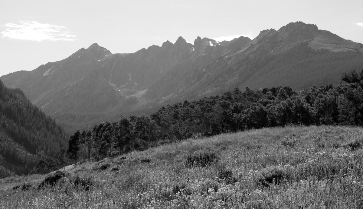
Peak L (far left) and Guyselman Mountain (far right) on the backpack into Slate Creek Basin
We decided to take the bit longer North Rock Creek TH approach rather than the shorter Brush Creek TH approach as it was just easier to coordinate and not everyone had 4WD vehicles for the Brush Creek 4WD road. Our approach ended up being almost 10 miles and 2,700′ in vertical gain. Not trivial. We did get to view Slate Lake on the approach, for which the basin and creek are named, and this lake alone is a worthy destination.
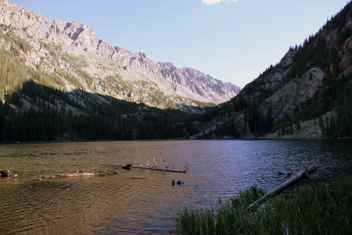
Slate Lake (9,900′)
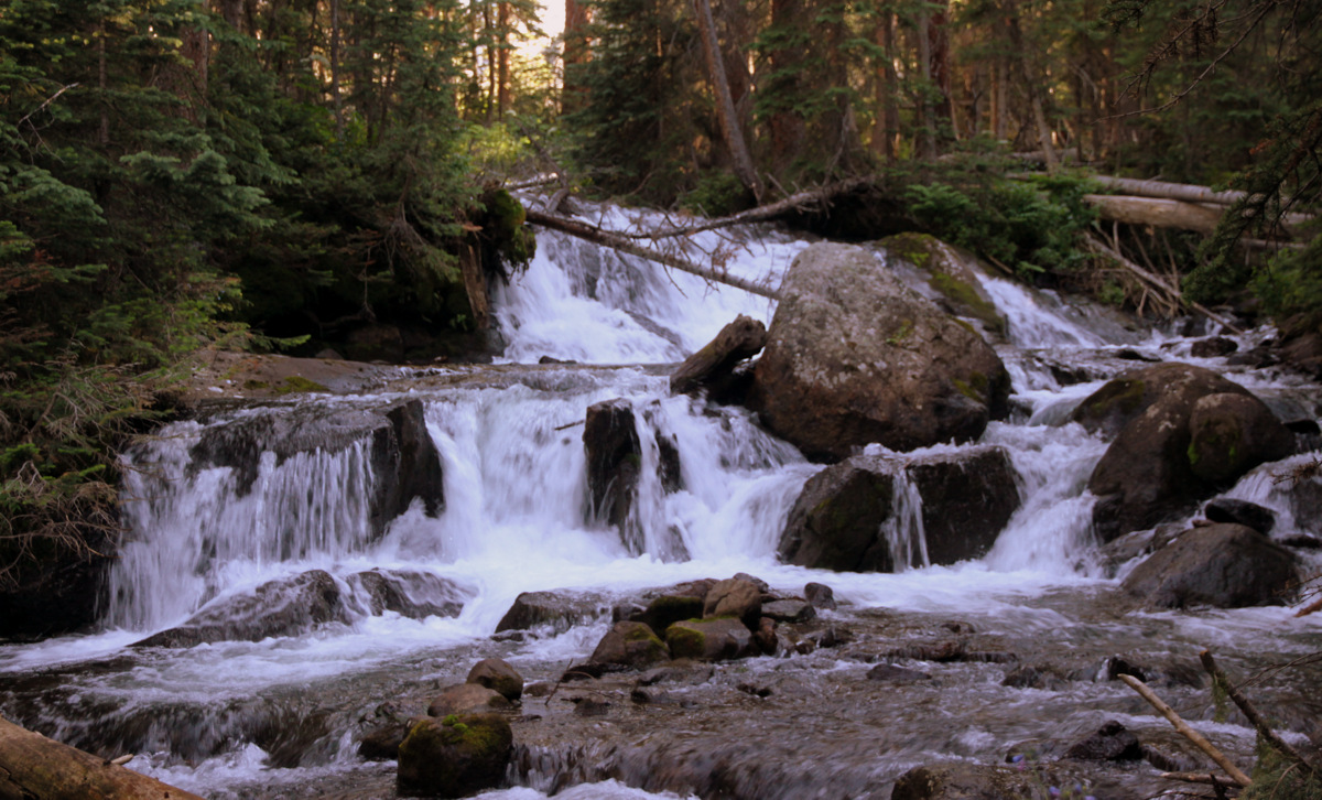
Gorgeous waterfalls coming from Slate Lake reminded me of Last of the Mohicans
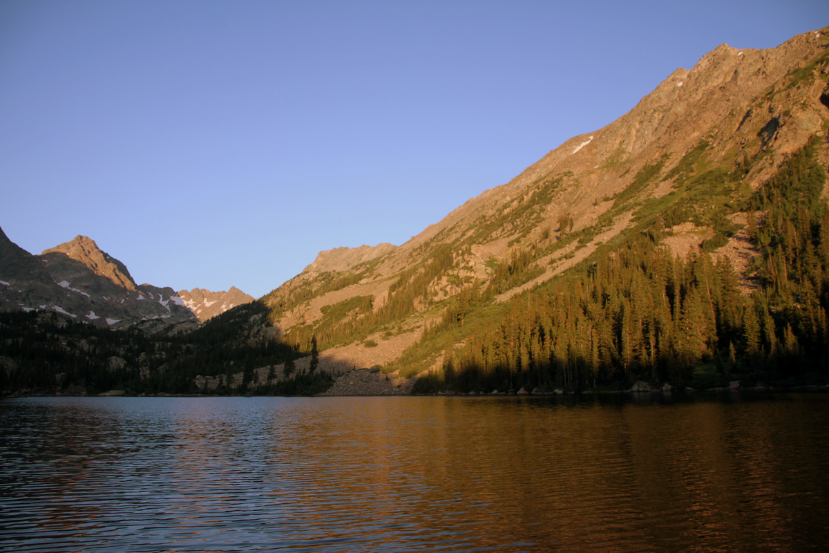
J and I packed in later Friday afternoon than the rest of the crew and arrived at camp around 7:15pm taking about 5 hours for the approach with our trimmed down backpacks. I started chatting with David and Jason in their tent and was sort of wondering why they were in their tent on a gorgeous evening and then it hit me. Well, they hit me – physically hit me. Mosquitos! They were some of the worst I’ve experienced with close seconds being other Gore lakes, King’s Peak in Utah, and the Wind River Range in Wyoming. However, how can you complain too much with views of these awesome remote peaks from Upper Slate Lake. There was a reason Brian kept coming back here.
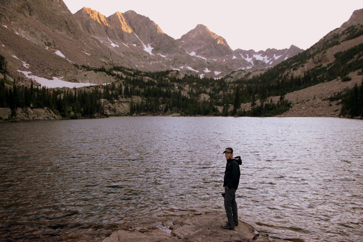
J at Upper Slate Lake (10,900′) with Peak Q at center in the distance. Peak R is to the left of Peak Q in the foreground and then Peak S before R
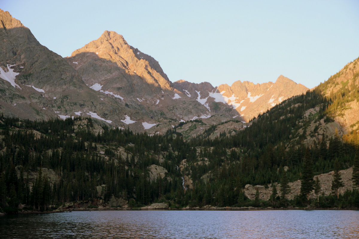
Peak Q in the alpenglow
Peak L standing high above Upper Slate Lake at far right
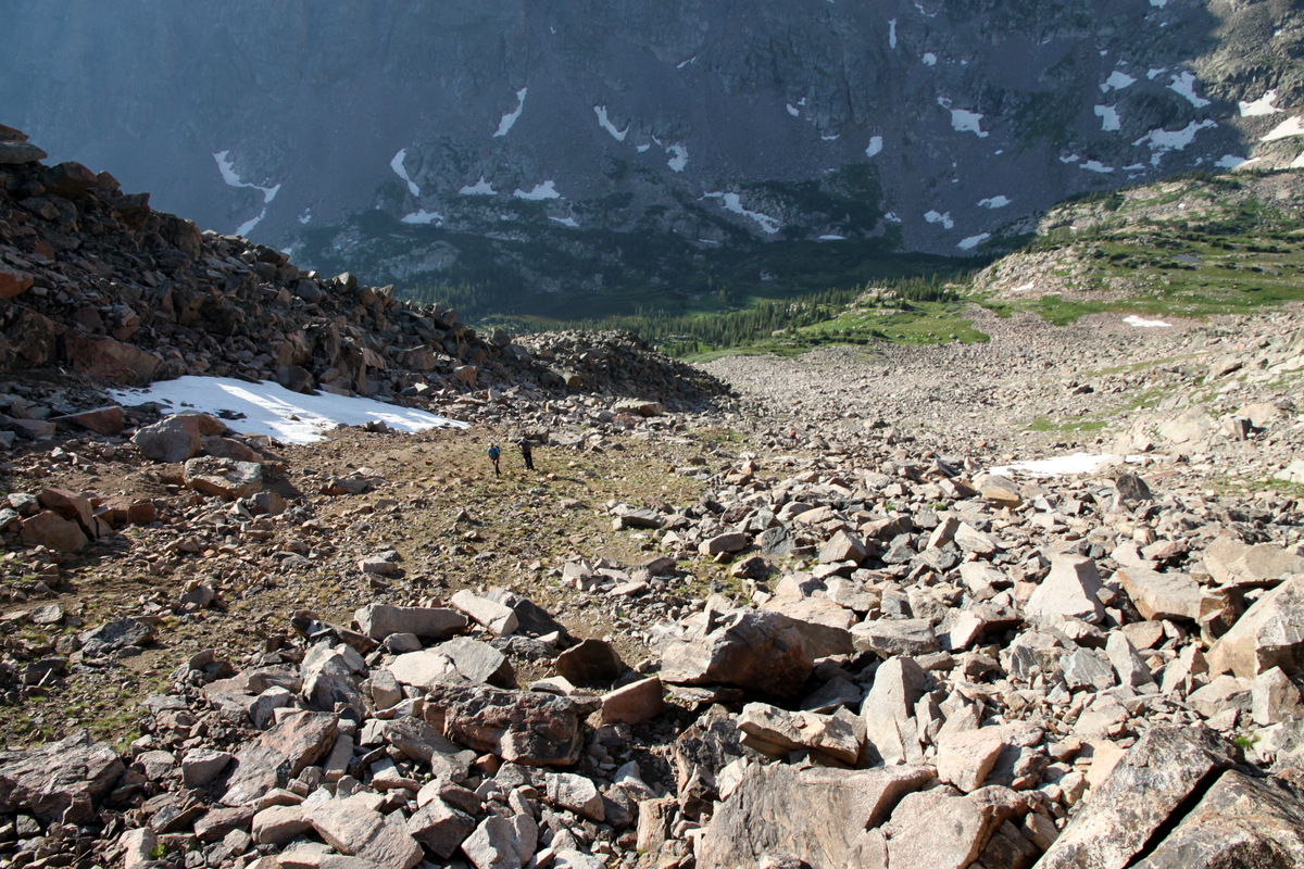
I made it my mission to keep the already lit campfire going until bedtime and it helped somewhat to make it tolerable to be outside the tent. Nevertheless, it was a great night outside catching up with old friends and meeting Kevin & Sarah for the first time. J and I roasted and toasted our Qdoba burritos over the fire to perfection. Up at 5:30am on Saturday morning, we left camp around 7am to make the semi-bushwhack around the southern edge of Upper Slate Lake and then beyond into the upper portion of the Slate Creek Basin. We eventually crested the 11,500′ small lake dubbed “South American Lake” because it closely resembles the shape of South America.

A stiff start to the morning (this is 20 yards away from camp)
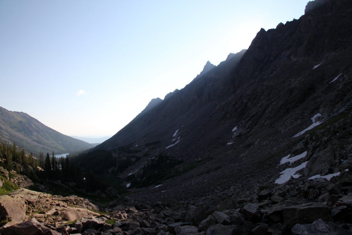
Morning light starts to shine through to the Upper Slate Creek Basin
Jason, J, myself and South American Lake with Peak K standing tall above
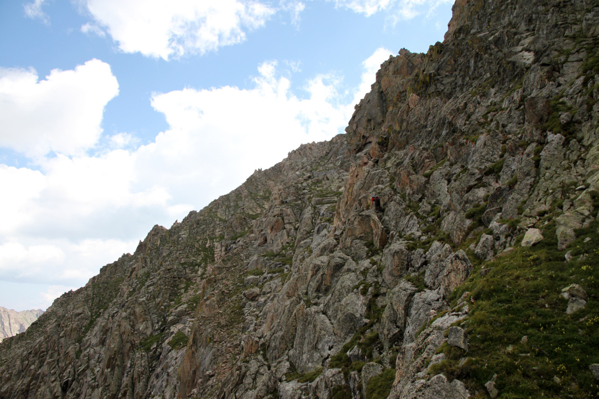
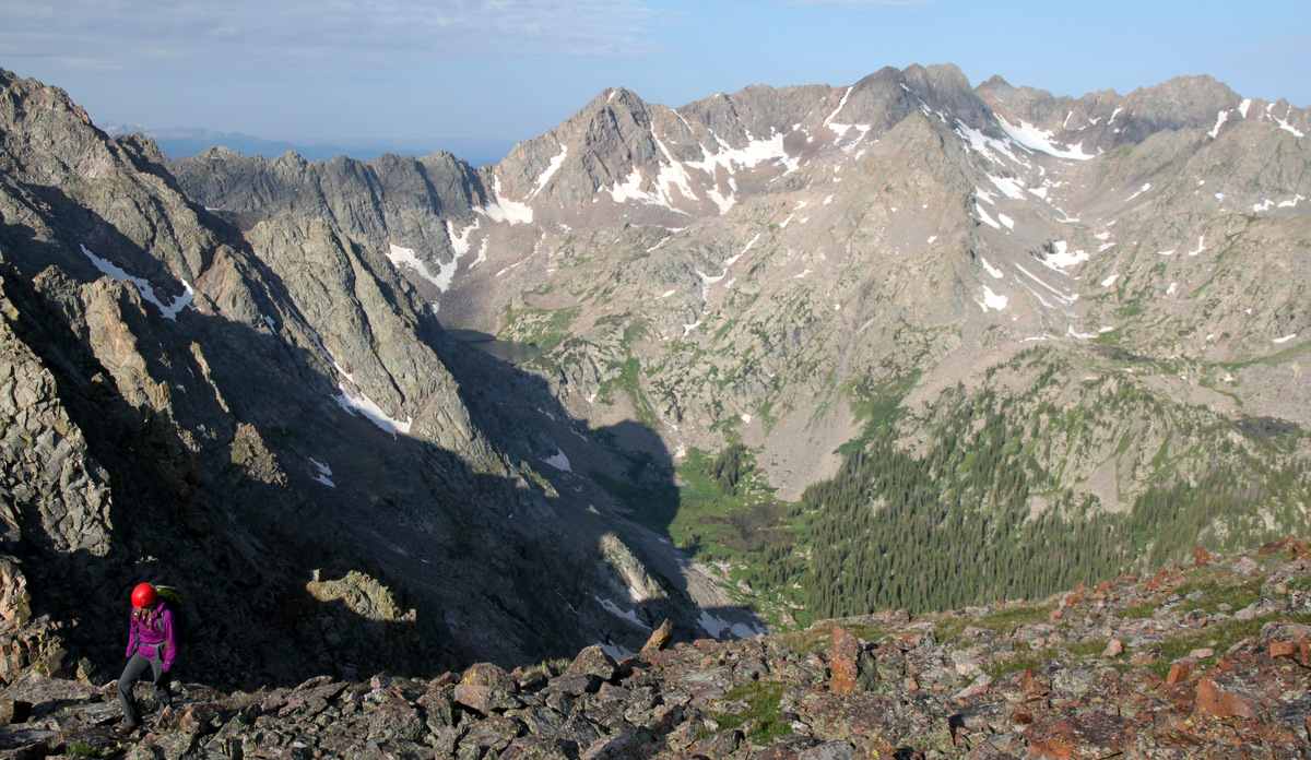
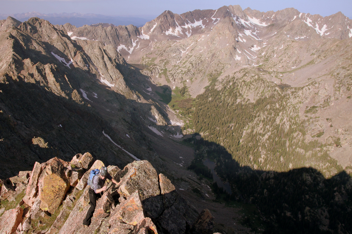
Navigating this basin definitely eats up time whether you are off the climber’s trail, stuck in a boggy marsh, cursing your way through willows, or climbing up slabs of rock. We made our way into the north basin between Peaks Q & R and picked our respective lines up Q’s east/northeast faces.
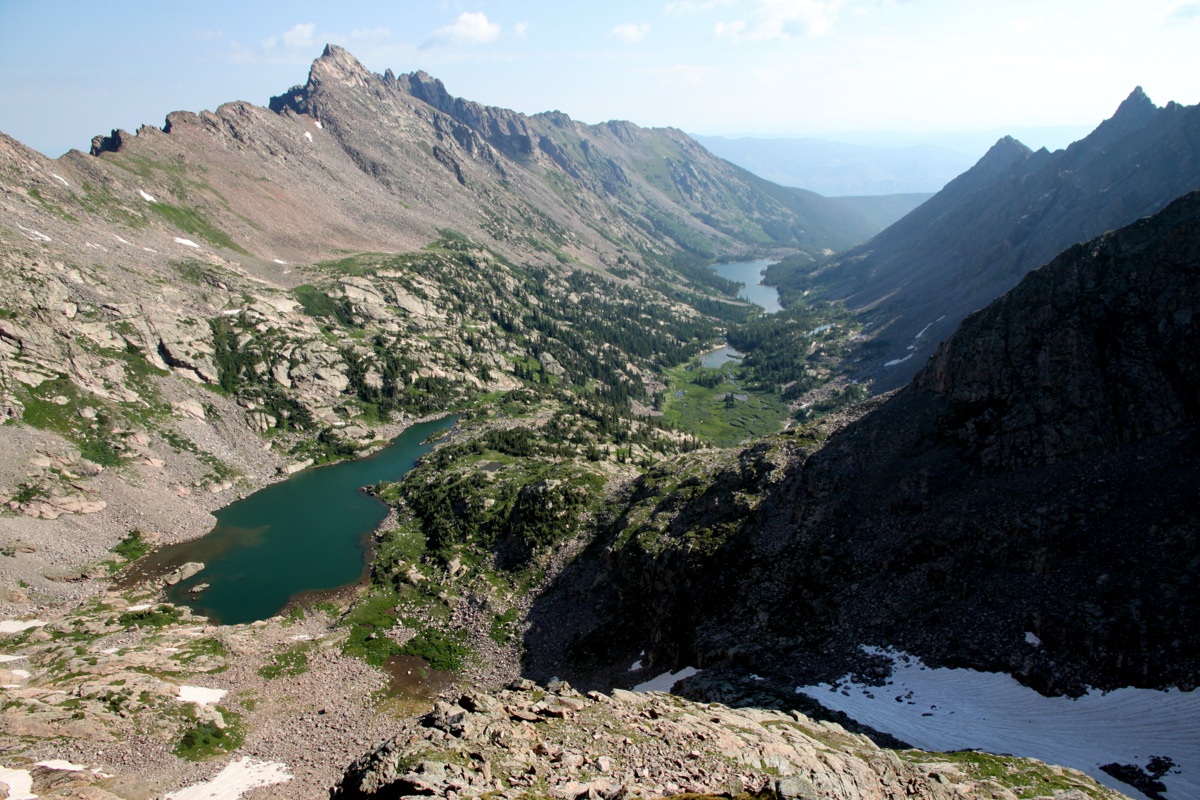
Upper Slate Creek Basin from about 12,500′ on Peak Q. Peak L is the magnificent peak on the left and South American Lake is the closest lake below. Peak T is the spire-like summit on the far right. Upper Slate Lake is in the distance down the basin
J, Brian, and I took a more direct line on some steep ledges while the rest of the crew took more or less the east face route outlined in David Cooper’s Colorado Scrambles. We all met up at around 12,500′, took a cool looking line up a mellow dihedral, and then found a cairn which led us to a small ledge and then a gully spitting us out at the base of the airy summit ridge.
Brian in the “walkable” dihedral

Jason high on Peak Q with East Partner Peak in the distance
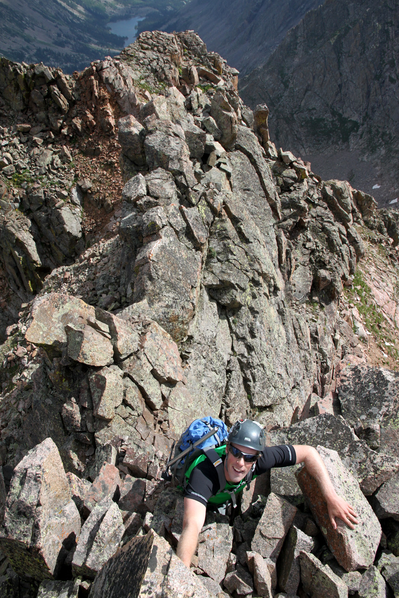
Me looking down on the boys high on Peak Q
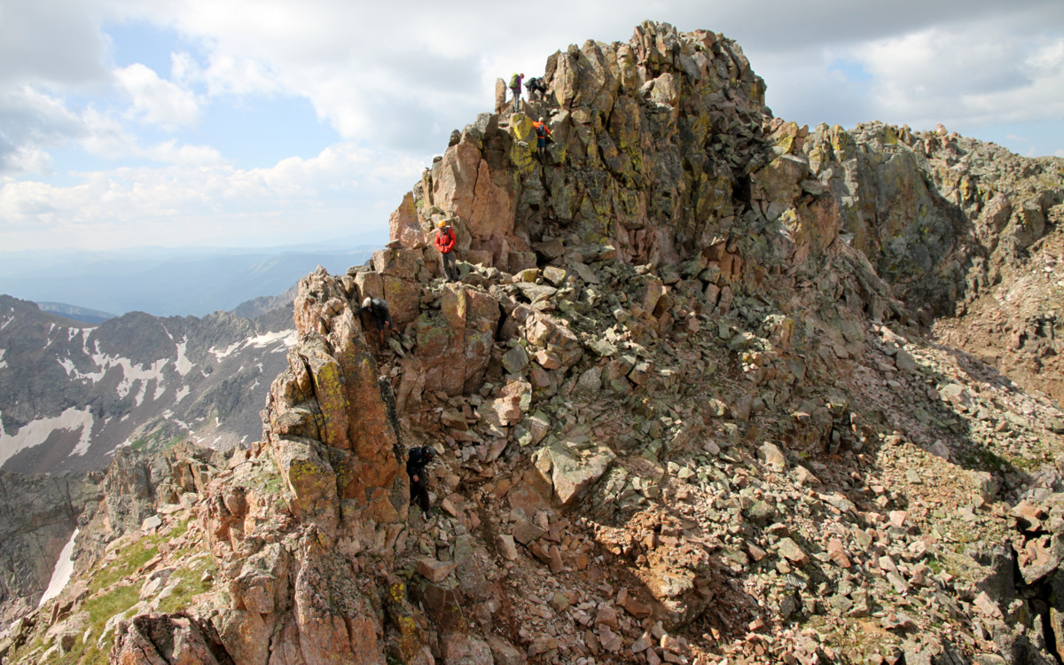
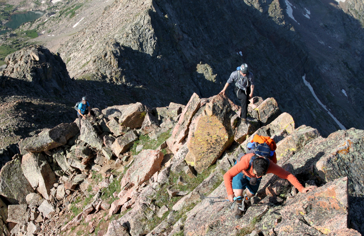
It was all really fun scrambling and Peak Q surely didn’t disappoint. Peak Q’s summit ridge looked exciting enough and after some airy scrambling on a narrow ridge and a short, exposed 8′ chimney climb, we were all on the summit of Peak Q deep in the heart of the Gore Range.
Jason on Q’s summit ridge

Jason & J on the short 8′ chimney climb on Q’s summit ridge

Brian on the summit ridge

Brian topping out on the short 8′ chimney climb
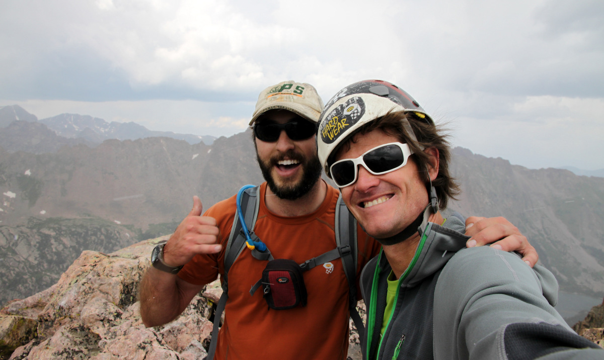
Zambo!
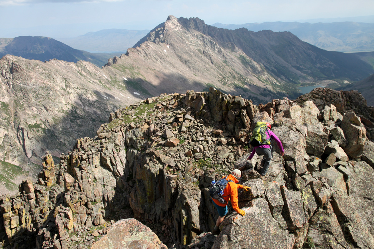
Kevin & Sarah on Q’s summit ridge with our next goal, Peak R, behind
We actually met a nice fellow named Laars who was leading a month long Outward Bound group in the Gores. He had the morning to get away from camp as the students were out on their solo mission and decided to head up Q. It was fun meeting another person outside of our own party on this remote peak.

J on the summit of Peak Q with East & West Partner Peaks behind and the Partner Traverse
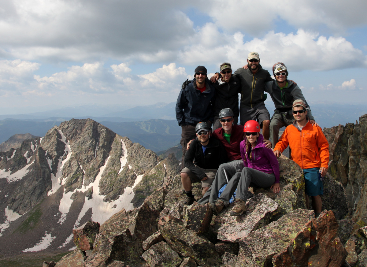
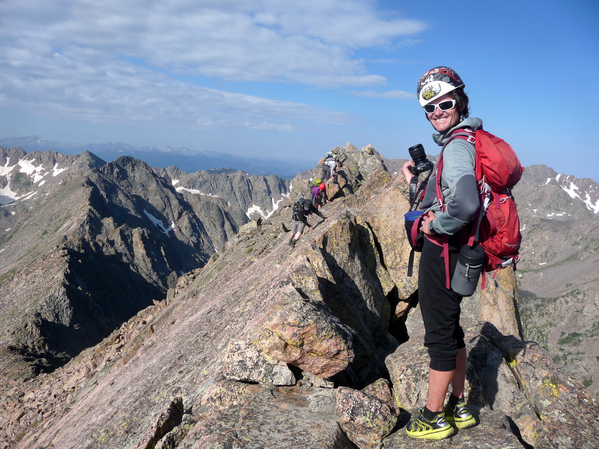
Peak Q summit (13,230′). Is this a record for number of folks on Q’s summit at one time?
Beautiful Gores. Left to Right in distance: East Thorn, Mt. Silverthorne, Red Peak, Hail Peak, Mt. Valhalla
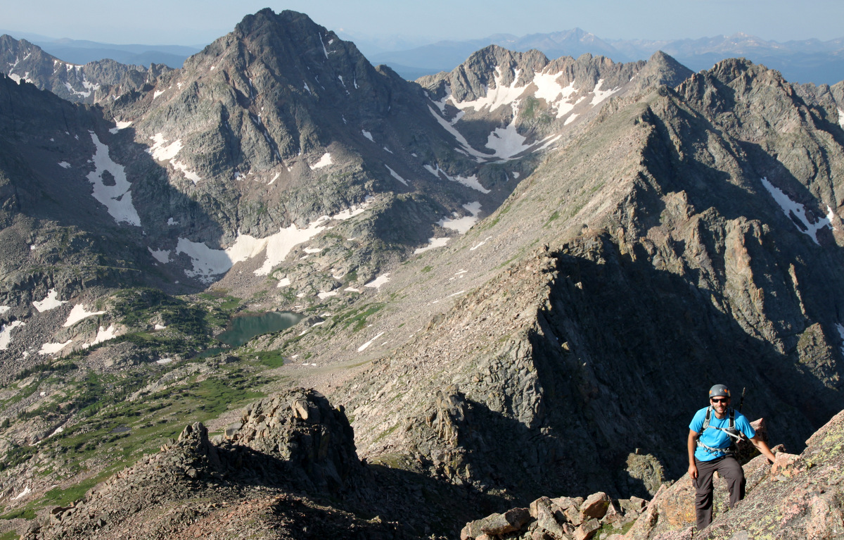
At around 10:30am, we boogied down the “standard” east face of Peak Q and made our way to the Peak Q/R saddle.
Brian and Sarah descending Q’s summit ridge
Peak Q’s summit block and ridge
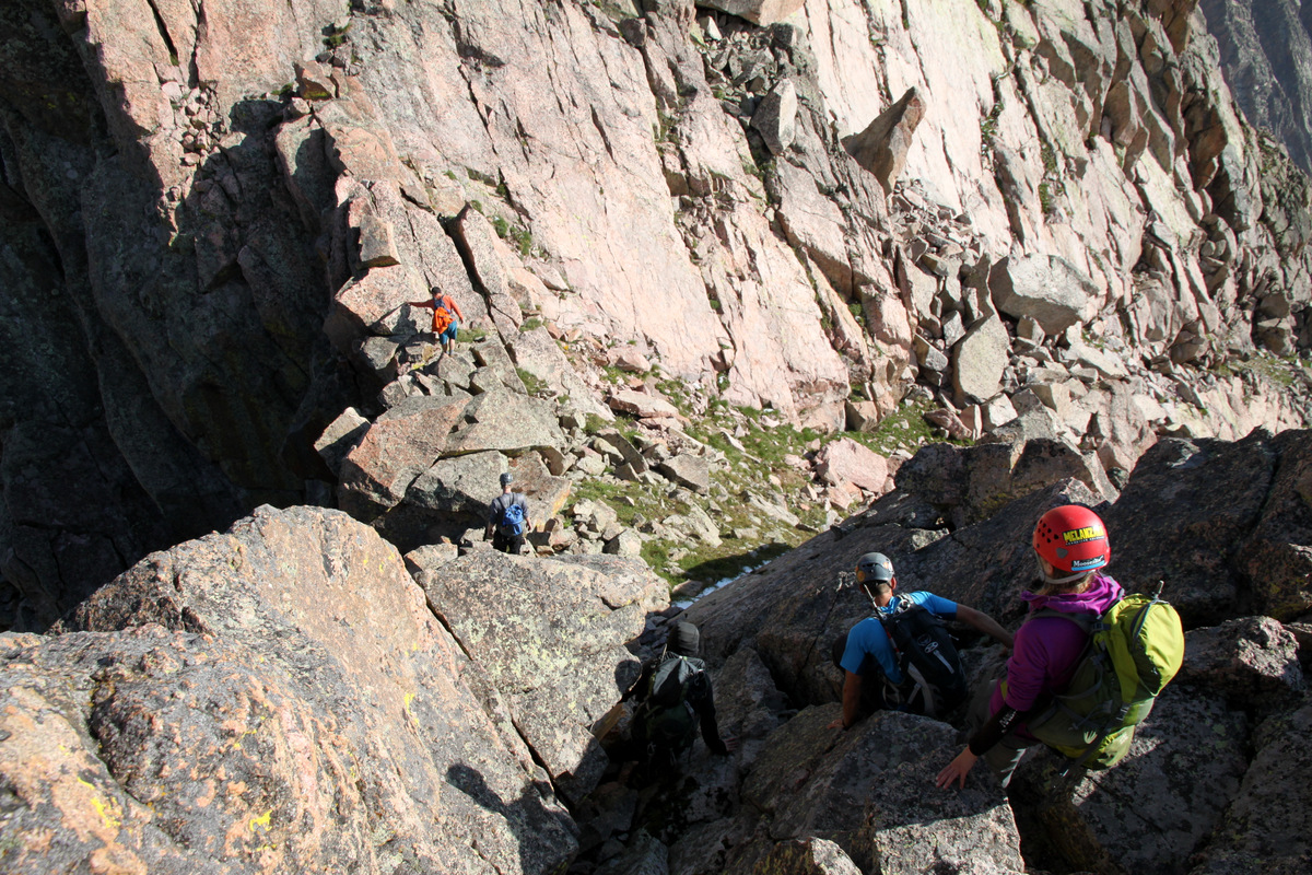
Peak R from Peak’s Q’s east face on the descent. Our route up R would access the upward trending grass ledges to the ridge’s left side
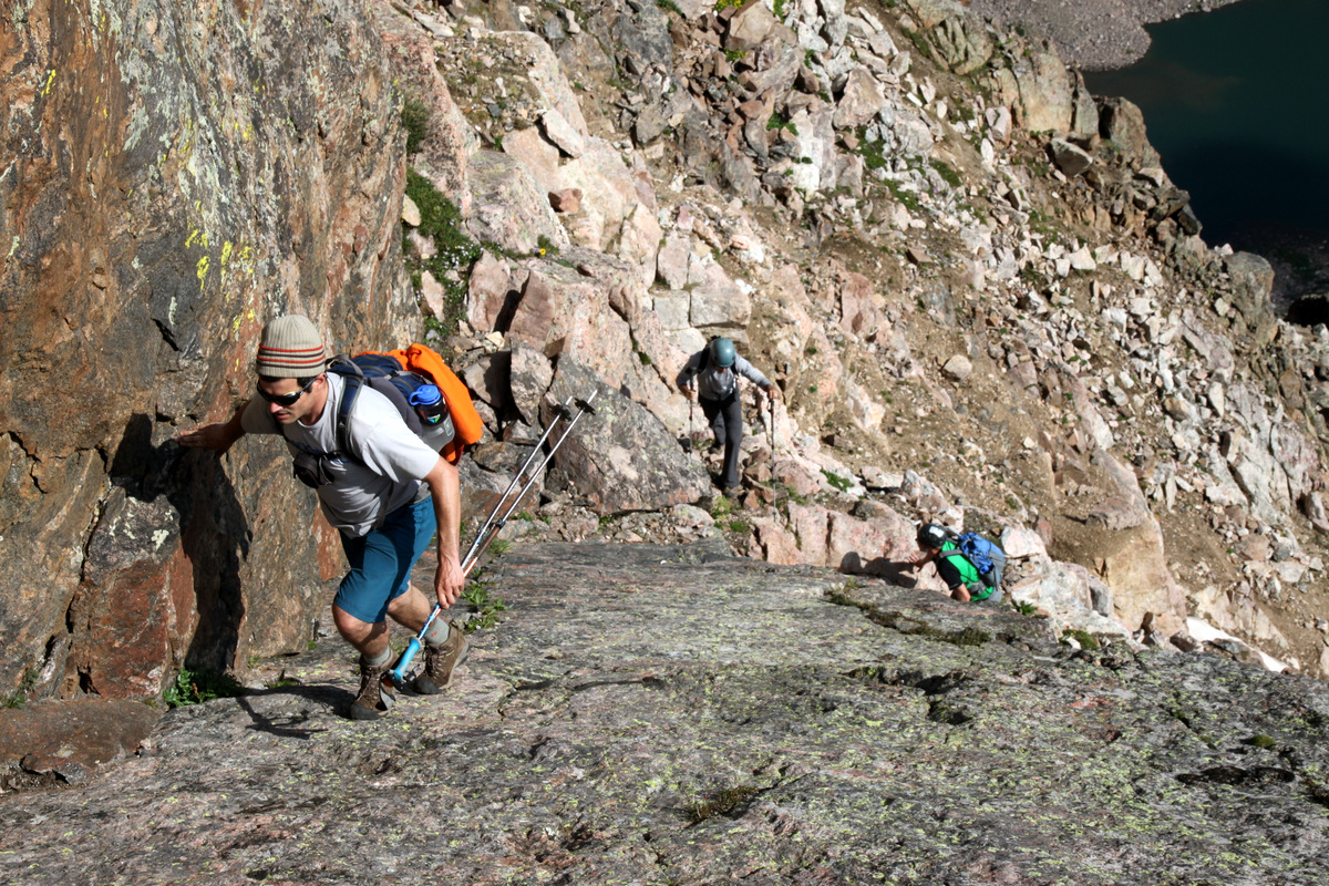
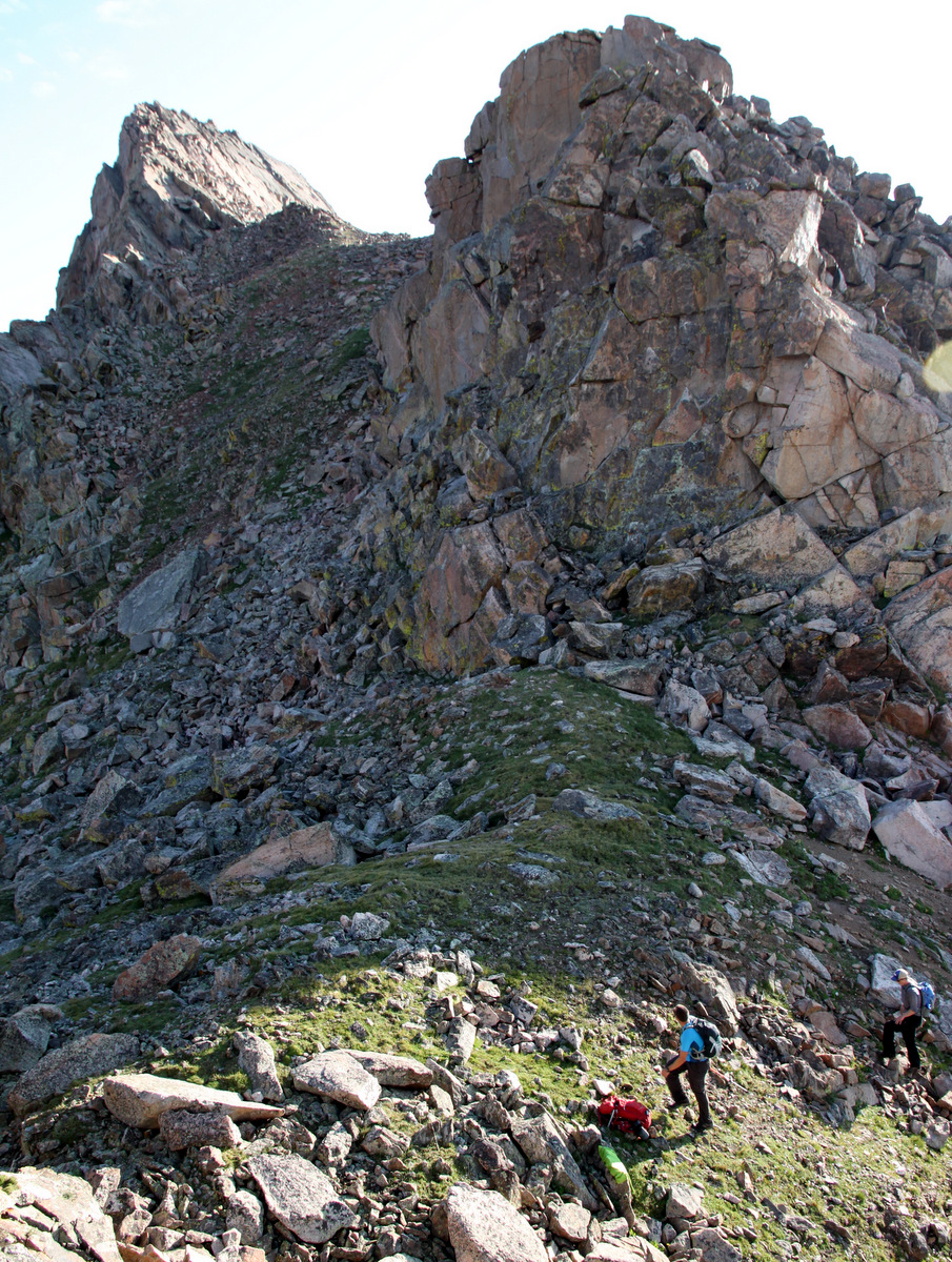
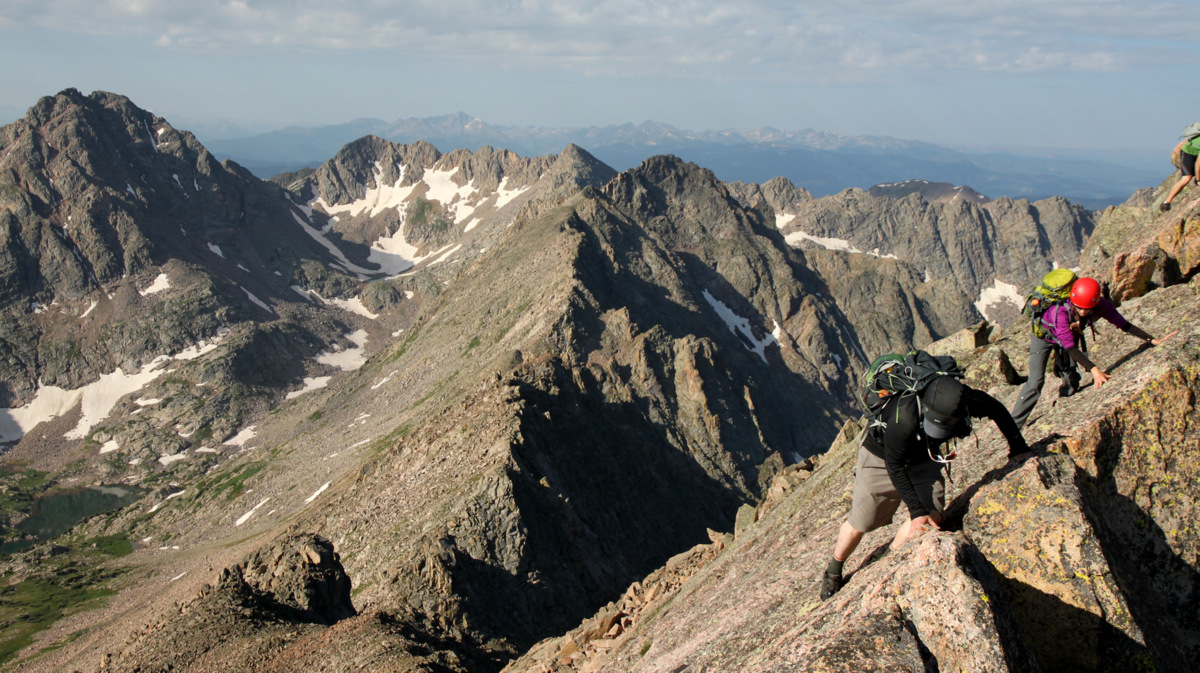
We said our goodbyes to Laars and he headed south from the saddle into the next drainage over back down to his Outward Bound camp. Jason & I scoped out the ledge system and found a pretty nifty ledge route with steep, blocky scrambling to gain the grassy, upward trending gullies to Peak R’s summit.
Jason beginning the scramble up Peak R with Peak Q dominating the landscape behind
Jason on the exposed ledge system to reach the grassy gullies ahead
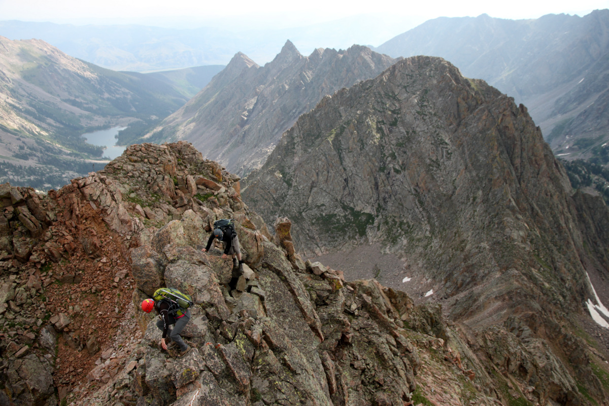
Zambo & Rick scrambling up Peak R’s northeast face ledge system

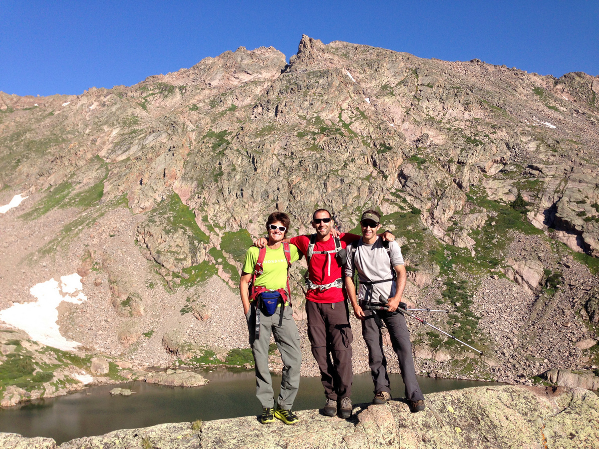
Peak R summit (12,995′). Another record?
Peal L basking in the sun across the basin
Looking at our next objective, Peak S, from Peak R’s summit. Peak T is beyond Peak S further down the ridge
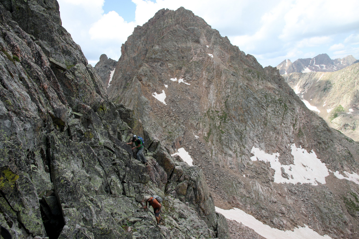
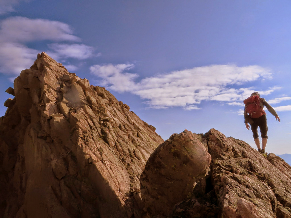
We topped out on Peak R right at about noon and the weather was indeed building. We scampered down the boulder fields of Peak R’s east face and had two choices. Continue on the ridge proper, which would have been pretty spicy and fun if the weather had not been building and we didn’t have such a large group, or drop down to bout 12,400′ on the ridge’s south side via class 3/4 scrambling to a grass ledge system that led over to the low point between Peaks R & S. At this point in seeing the downclimb to the 12,400′ grass ledge system, I think Kevin & Sarah had had enough and decided to return back to the summit of Peak R and head down the way we had all come up from the Peak Q/R saddle.The skies were getting dark but no audible thunder yet, so we kept pushing. We all finally reached the low point between Peaks R & S and realized we still had some climbing to do. We reached another saddle after a few hundred feet of scrambling further east and made a the “go/no-go call”. The skies were getting angry. We only had a few hundred feet of easy terrain to the summit of Peak S and so we all went for it. We left the packs just below the saddle in the easternmost north-facing couloir on the Peak R/S ridge and scrambled fast up to Peak S’s summit. It was borderline trail running. As soon as I stepped on the summit of Peak S, a crack of thunder let loose above me. I motioned for Rick, who was only 10 seconds behind me, to get next to me while I snapped a picture.

Zambo & J scrambling up Peak S’s summit ridge with Peak R to the right and Peak Q further to the right behind R
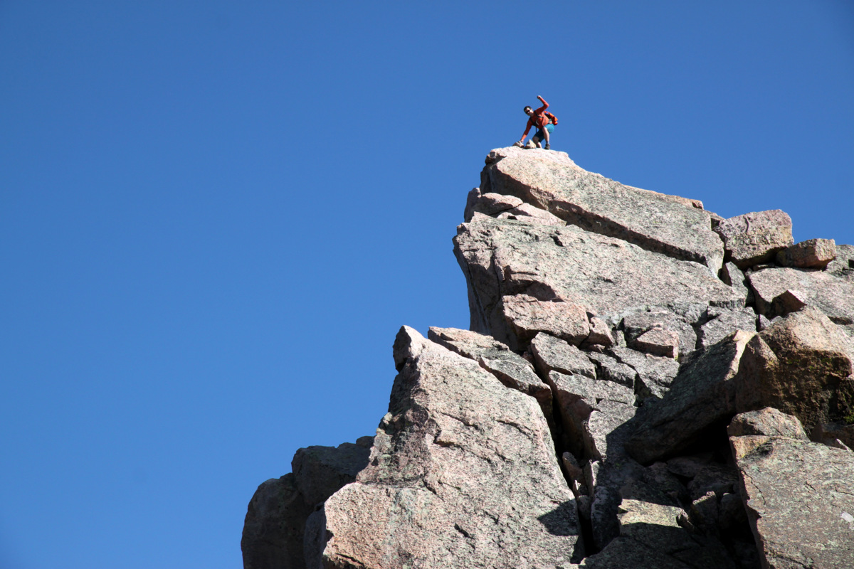
Rick & I on the summit of Peak S (12,857′)
We got a picture and were off passing Zambo & J, then Jason, and Brian on the descent as they were on their way up. I was literally on the summit for 12 seconds – my shortest amount of time on a summit ever.

J and Zambo on the summit of Peak S below angry skies
It was fairly terrifying, though we descended fast back to our packs within the confines of the couloir. We spread out a bit and descended fast down this couloir.
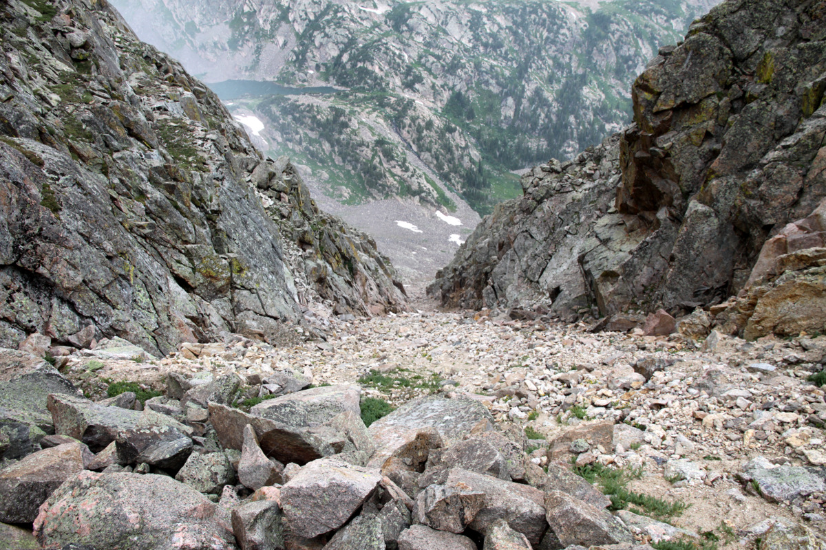
Our descent couloir
At one point, Brian knocked a refrigerator-size boulder loose, which Rick and I saw heading straight towards us. We sprung to the sides of the couloir walls with our “cat-like” reflexes and hid in small dihedrals. Fortunately, the boulder came to a stop, but would have had to take a hard left turn to get us in our positions. Without any more incidents, we all made it to the valley floor 2,000′ below with the crackling of thunder continuously overhead, but fortunately no lightning. We made it to treeline just before the heavens unleashed a monster hail storm on us. We were able to remain dry, though our thoughts lay with Kevin & Sarah descending Peak R. We sure hoped they were both OK and were able to take shelter somewhere. We made it back to camp around 3:45pm for almost a 9 hour day. We tried to go relax out on the peninsula in the breeze to get away from the mosquitos, but the rain soon started again and we retired to our tents and snoozed for a few hours. However, our concern was always on the whereabouts of Kevin & Sarah up on Peak R. Once 6pm rolled around and they had yet to return to camp, we started discussing our options and sending a few of us back up Peak R was definitely in the cards. Thankfully, Zambo & Jason spotted them descending the valley and they arrived back at camp around 6:45pm. I think we all could rest a lot easier knowing they were safe. Kevin & Sarah relayed their story of descending Peak R’s ledges covered in graupel, much of which sounded very spicy to say the least. Nevertheless, they are experienced folks and returned to camp just fine.
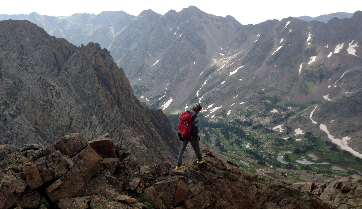
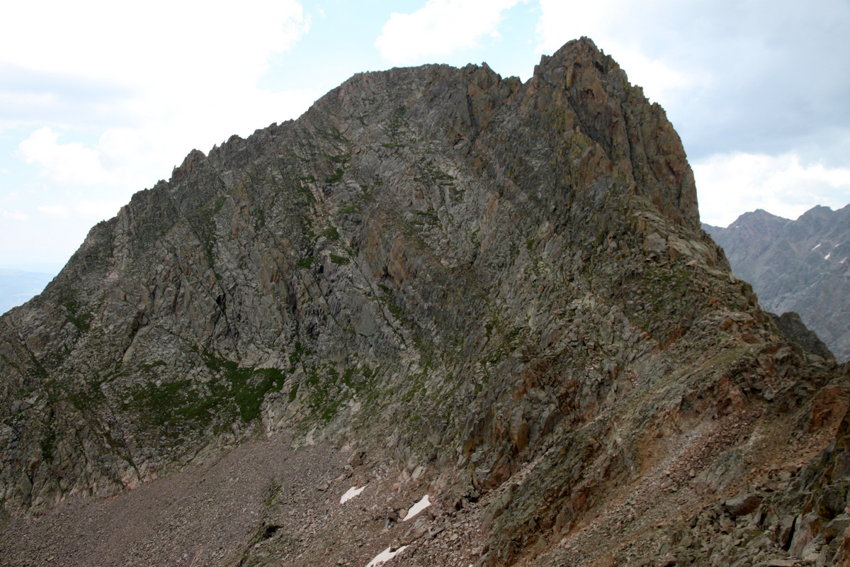
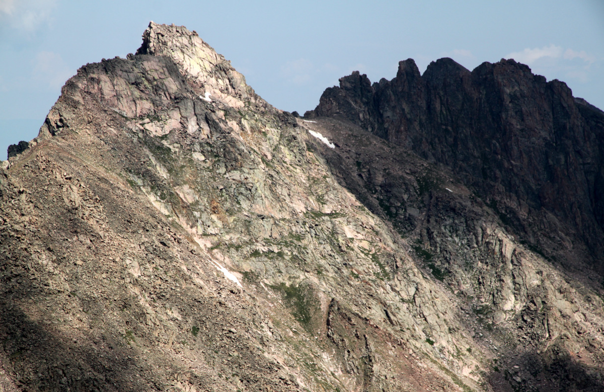
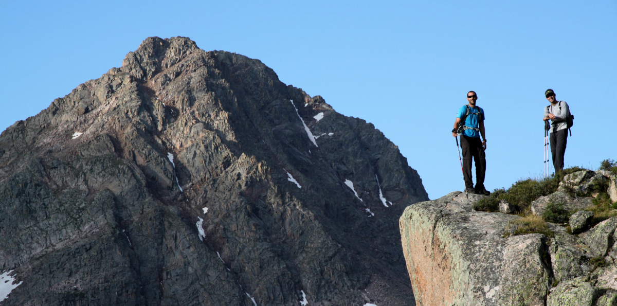
Sunday dawned a new day and Peak L was to be a peak remembered for a long time.
Peak L rising 2,500′ above Upper Slate Lake on Sunday morning
I can now see why Peak L is the favorite among Gore peaks for many Gore enthusiasts. The route starts out the same as for accessing South American Lake and Peak Q by hugging the southern shoreline of Upper Slate Lake. Once you hit the waterfall area where the terrain steepens, make a hard right and cross Slate Creek where feasible. Its then a routefinding maze on the path of least resistance through meadows, over rock slabs, and up steep grass gullies to treeline. The grass gullies give way to boulder fields, which lead up to the ridge, 500′ below the summit of Peak L.
Jason & J with Peak Q on the ascent of Peak L’s southern slopes
Brian and Peak Q, aka “Prisoner Peak”
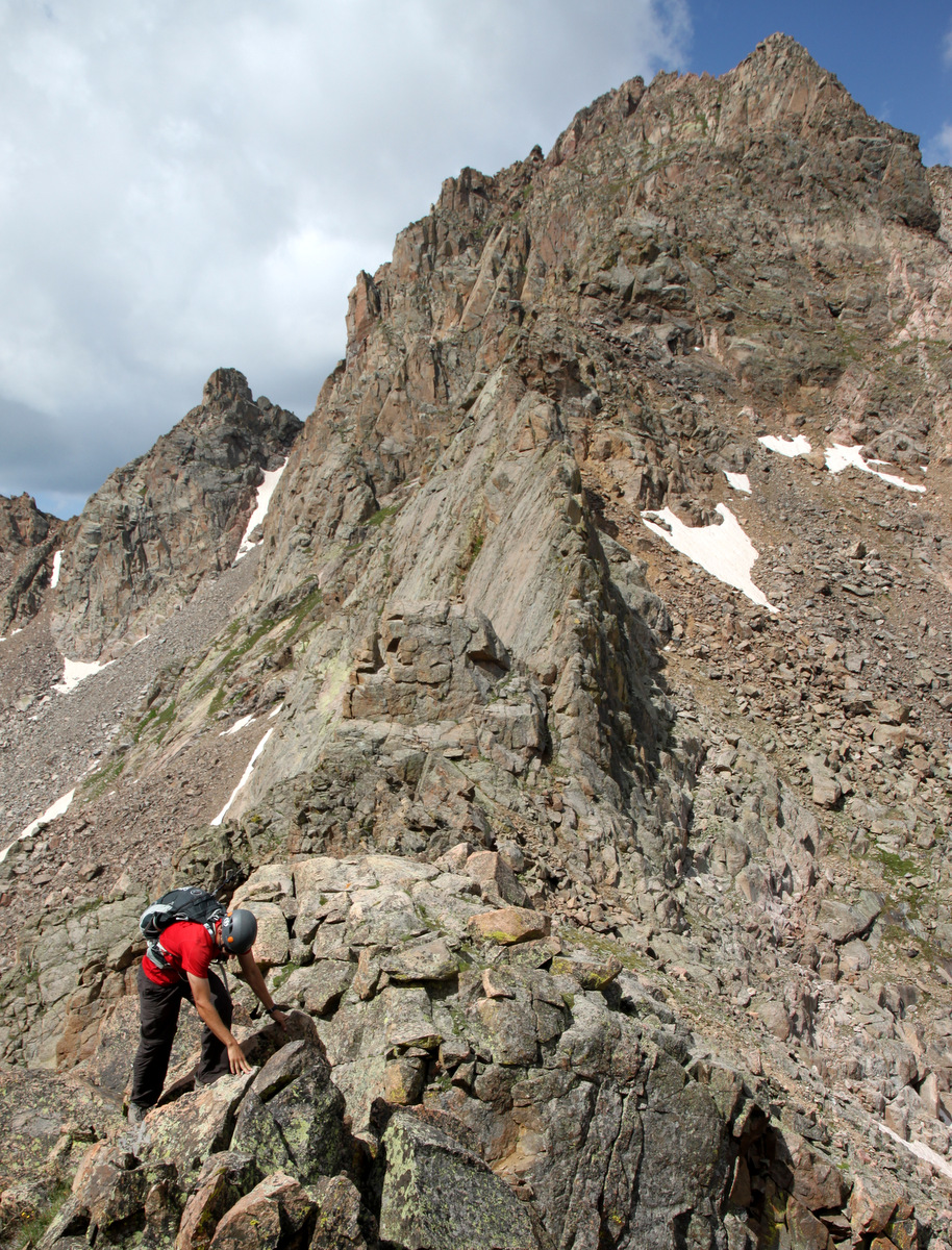
The scramble up to the ridge
David & Jason at the small saddle with Peak L’s knife-edge ridge in the distance. The summit block is behind the knife-edge ridge and cannot be seen here
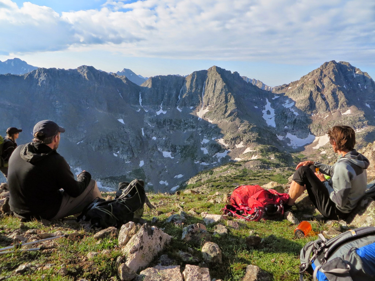
A break with a view to the south. Photo by Brian
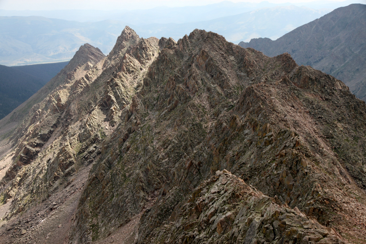
The views of the Peak Q/R/S massif to the south were unreal. Once we all regrouped at the small saddle, we had a nice food and water break taking in the views to the north of the Black Lake drainage, Ripsaw Ridge, and east-facing ski lines off Mt. Powell and Eagle’s Nest. We made our way around a small tower and scrambled up the ridge to Peak L’s knife-edge ridge.
Sarah with the southern portion of Ripsaw Ridge (right to left: Peaks E, F, G & H) behind

Ripsaw Ridge: Peak C (far right) to Peak H (far left)
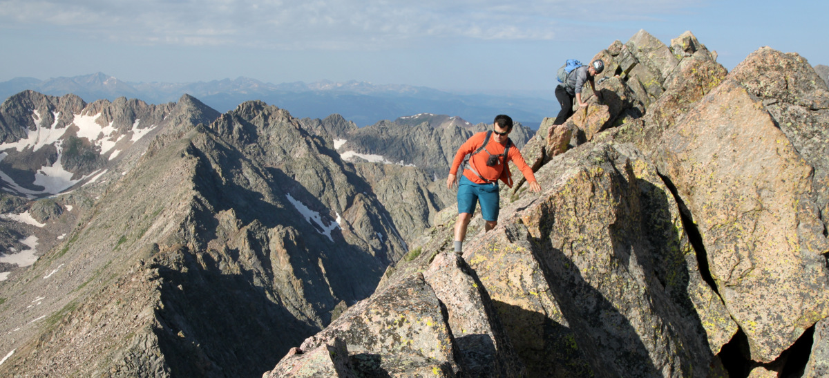
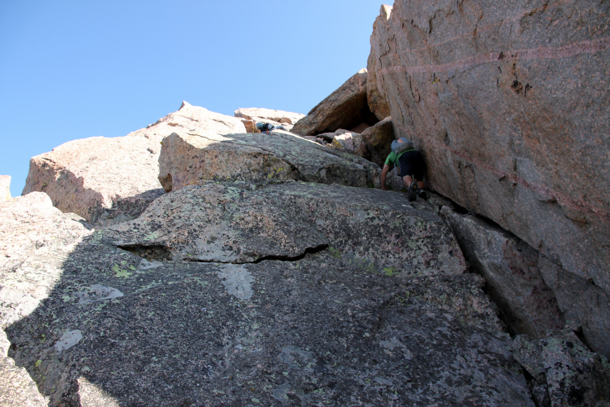
The boys scrambling up to the knife-edge ridge
Zambo
Jason in an amazing setting
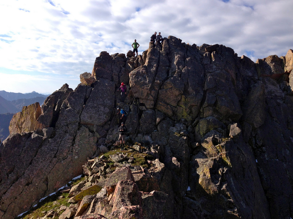
This knife-edge ridge was a highlight of the scramble – airy and fun, though almost to short for my liking. Beggers can’t be choosers, though.
Me heading across the knife-edge. Photo by Brian
Brian walking the line
Kevin & Sarah hanging it out there
I actually took a video of everyone crossing this knife-edge ridge, which can be viewed below (be sure to turn on the 1080 HD in the settings):
Everyone did fantastic and we soon descended into the notch between the knife-edge ridge and the 250′ summit headwall.
Me videotaping the team on the knife-edge. Photo by Jason
Descending to the notch
Another look at the small downclimb. Photo by Brian
J and I enjoyed our little perch at the end of the knife-edge ridge and watched the 6 others ascend the class 3/4/5 headwall depending upon your route. It was a treat to watch everybody do their thing. J then started up and I got some pics of all 7 of them with Brian on the summit block. Cool stuff.
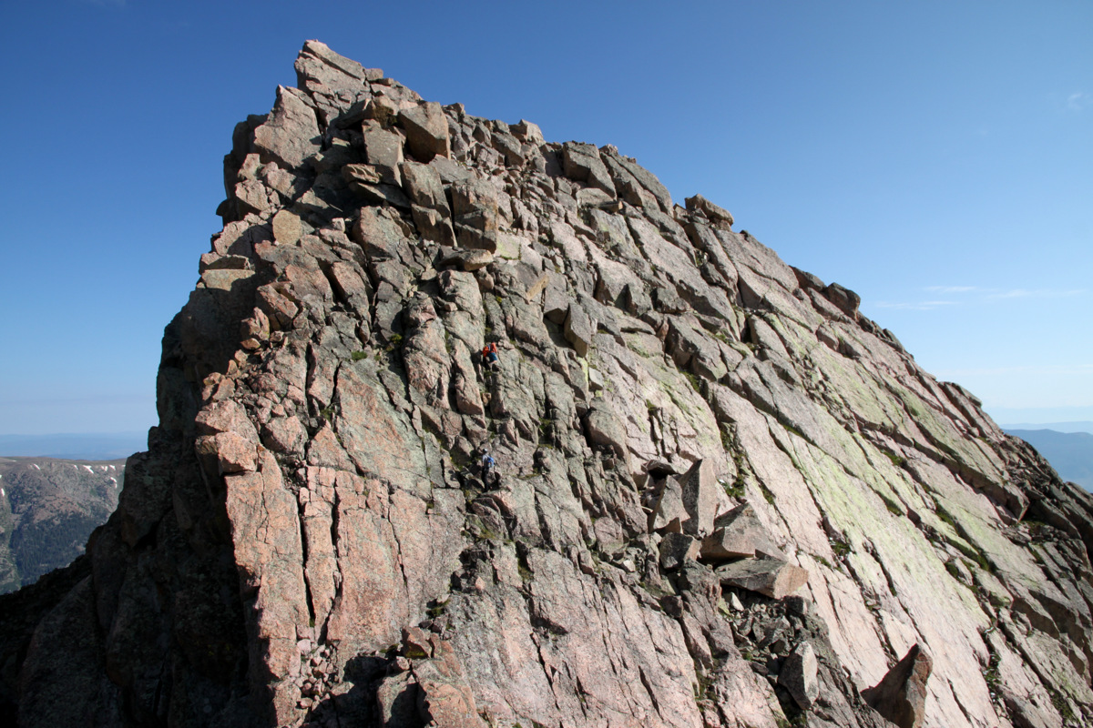
Climbing the summit headwall as seen from the end of the knife-edge ridge
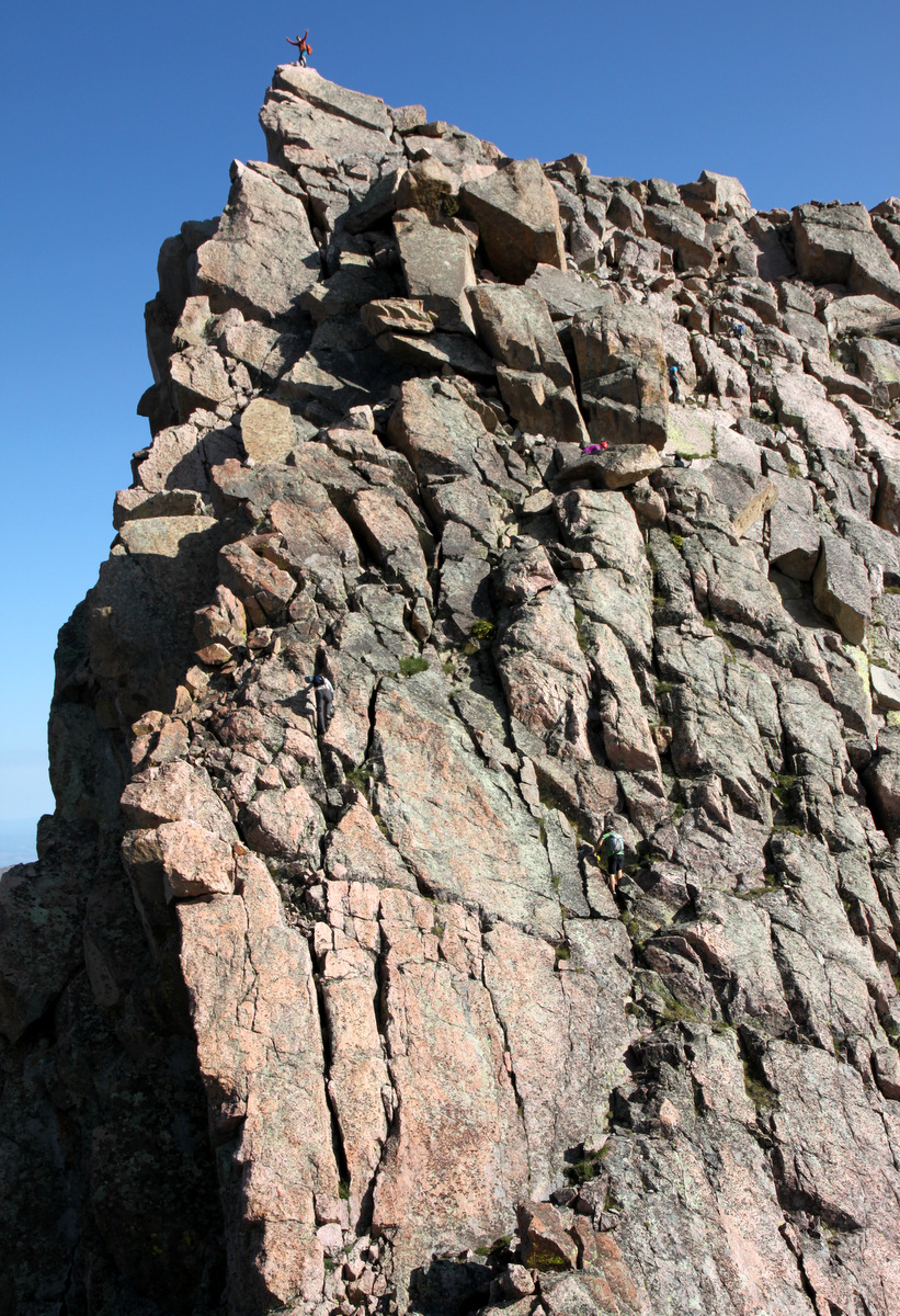
Can you spot all 7 climbers?
Brian on the summit of Peak L
I then followed Rick and J and we all took perhaps more of a low 5th class route towards the western edge of the headwall.
Rick & J on the low 5th class route

Rick gets vertical

Me taking a more direct approach to the summit block. Photo by Brian

J and Rick leading me home. Photo by Jason
We soon were all on the summit area of Peak L. The actual summit is a 6′ tall boulder that can really only accommodate two folks standing.

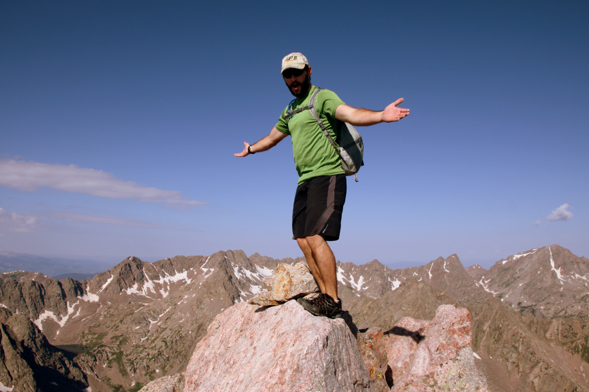
J and I on the summit of Peak L (13,213′)
Rick on the summit of Peak L (13,213′)

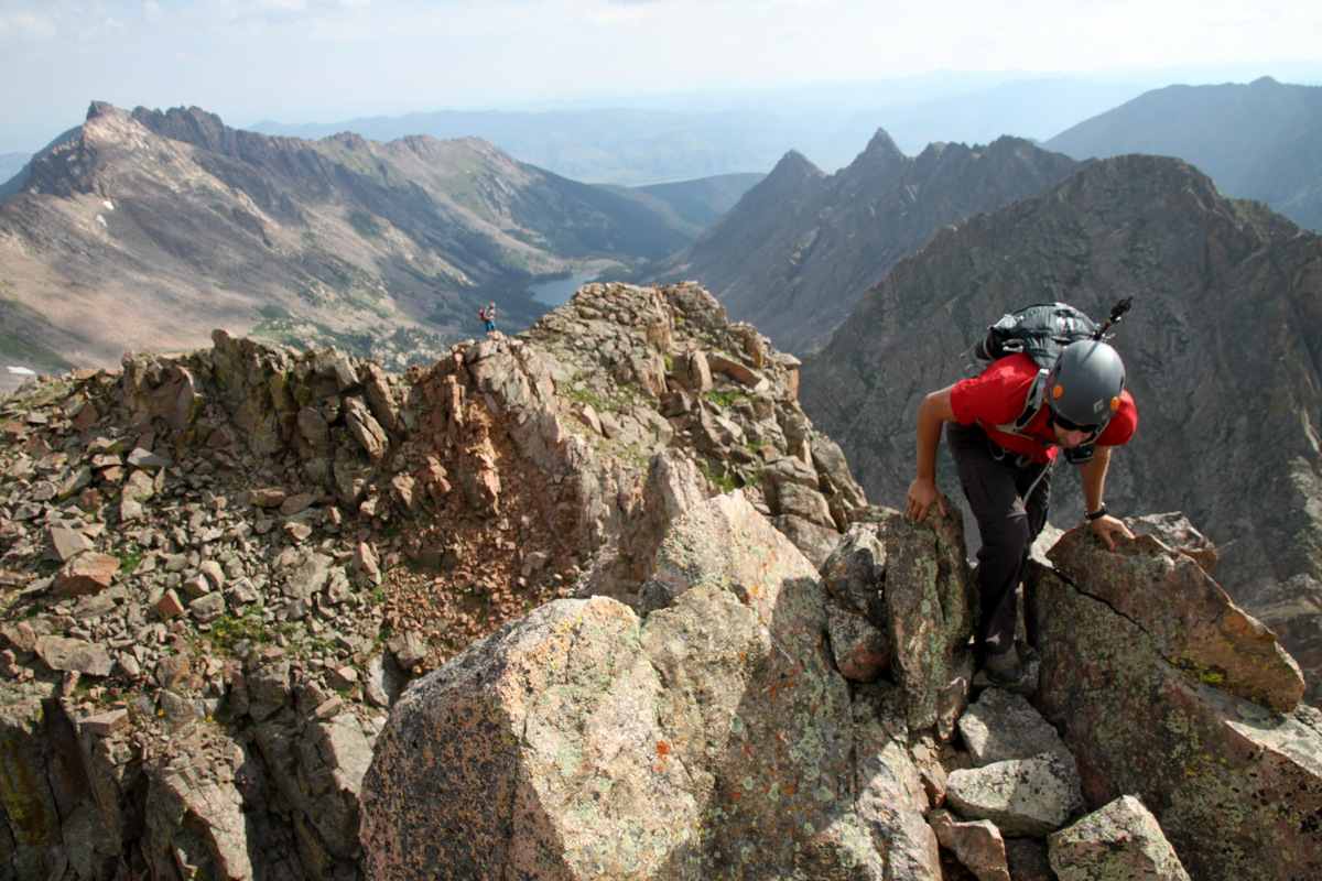
Looking south to Peaks Q, R, & S from the summit of Peak L
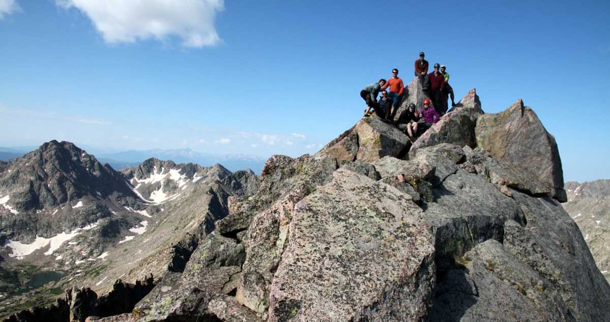
Group shot on top of Peak L. Another summit record? I really had to boogie to get in this shot from my camera. Needed my remote control
We all lounged for a bit as it was still only maybe 9:30am and ate, drank, and told stories. We then descended safely all the way back to our camp at Upper Slate Lake reflecting on a wonderful weekend deep in the heart of the Gores. Upon arriving back at camp just before noon, we hurried to pack up camp as the mosquitos were, yet again, out in full force. Zambo & Jason left just before J and I did around 12:30pm. Brian, Rick, Kevin, & Sarah left a bit after us. We were all just ready to get out of the mosquitos. I had enough bites on me for sure. J and I took a long break and ate our sandwiches once we were a few miles down the trail below Slate Lake and out of mosquito territory. The backpack out was beautiful, but there definitely seemed like more up then down especially once you turned south on the Gore Range Trail from the Slate Creek Trail. The body was a bit sore once we arrived at the North Rock Creek TH around 5:45pm. As Brian, Rick, Kevin, & Sarah had not arrived yet, J and I said our goodbyes to Zambo and Jason and headed out as we had a bachelor party that evening at Jay’s Hut on Vail Pass. The fun never ends it seems. That’s a good thing, right?
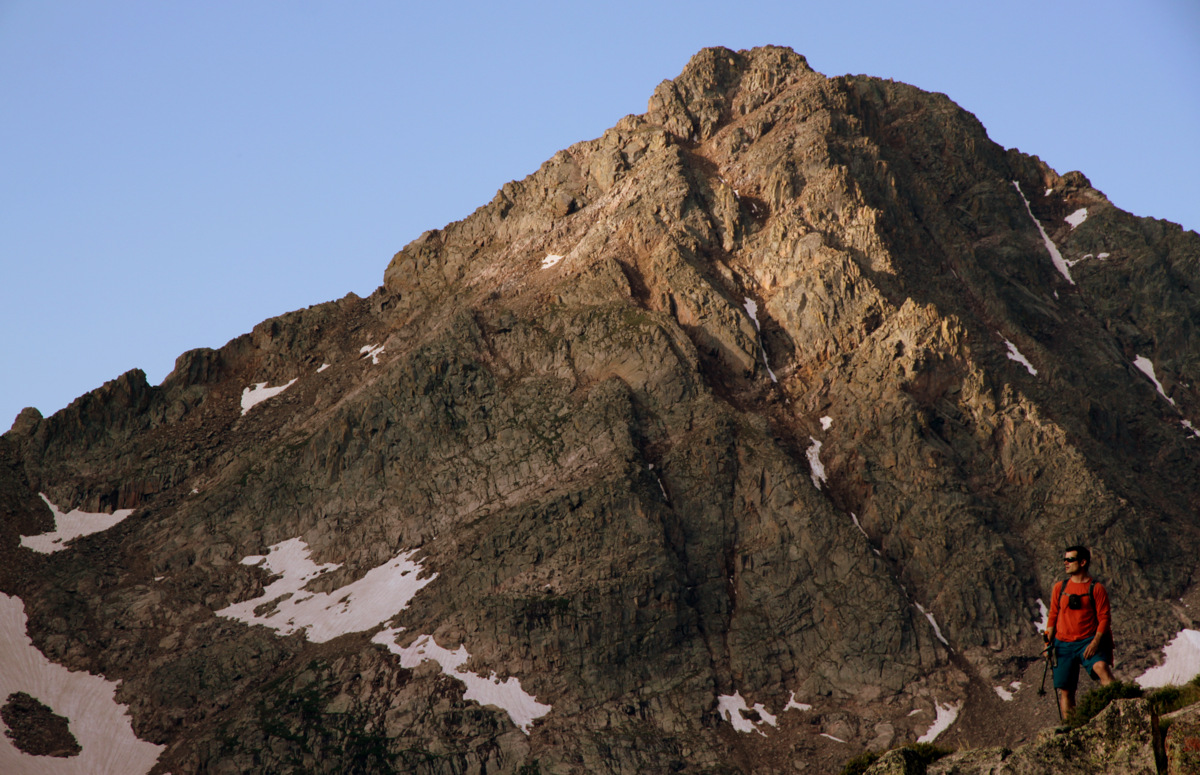
After some reflection, I feel privileged to have spent 2-1/2 days with this crew on the deepest of Gore peaks. It was a wonderful outing and very special to share similar interests with fellow Gore enthusiasts. Now, to go back in there in a few years for Peak T and Guyselman Mountain 🙂 The view of Peak Q will always be embedded in my memory forever
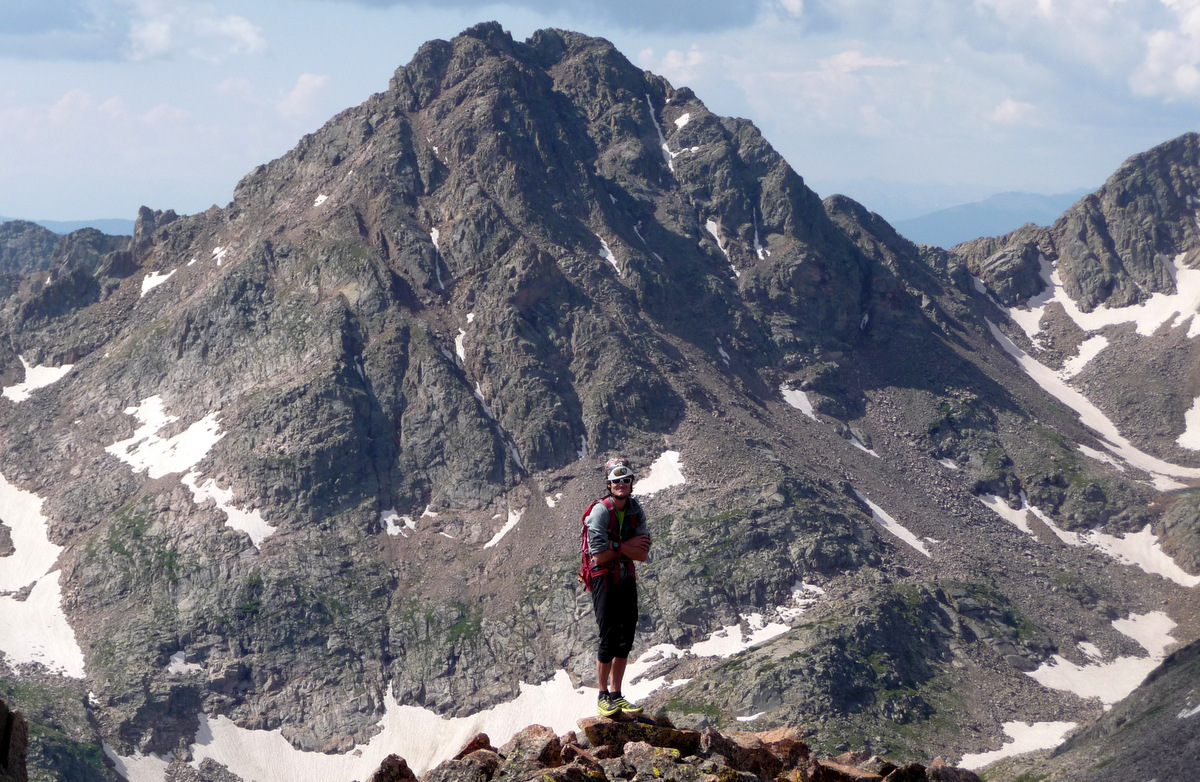
Me and Peak Q. Photo by Jason
 Follow


Awesome, awesome stuff Brandon. Hats off to the entire crew (and an awesome crew at that)! So glad the weather worked out for you guys and everyone enjoyed the Slate Lake summits. OK, it’s official, I’m heading in there next summer :).
Much appreciated, Ben. We missed you and Sarnelli for sure. You definitely need to put this one your list for next summer, buddy.
Great TR, buddy! What an awesome weekend with incredible people. Both days were great, but Peak L is something special. Can’t wait for the next trip. PS – Those skeeters were brutal!
Peak L is very special, buddy. Thanks for the comment. Skeeters were horrendous!