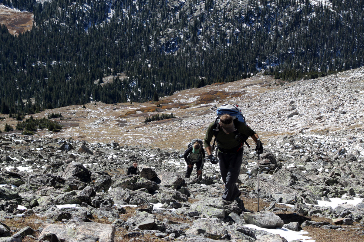
The 2nd highest peak in the world is K2 in the Karakorum Range of Pakistan and is otherwise known as the “Mountaineer’s Mountain” or the “Savage Mountain”. Well, we have our own “Savage Mountain” here in Colorado called Savage Peak and it lies in the Holy Cross Wilderness about a 45 minute drive from our house. While not 28,000′ and not having a summit fatality rate of 25%, i.e. one in four climbers who successfully summit die on the mountain, our little local Savage Peak is a beautiful 13er in a terrific setting and has a much much higher summit fatality rate – maybe closer to 100% 🙂 Savage Peak has a very aesthetic route on its north face called the “Savage Couloir”. I was wanting to scope this couloir out and maybe climb it in order to get some good recon for a spring climb/ski. J & Mike joined Kristine & myself for the adventure this past Saturday. The mountains had just received a good fresh coat of white about 24 hours earlier and we knew there would be snow, but boy did we underestimate just how much, especially since the slopes we would be climbing are north-facing. Not making the smart decision, we decided to leave the snowshoes in my truck. That turned out to be a mistake, but cest la vie, it yielded just a better workout for the day. It was a frigid 10 degrees at the Missouri Lakes trailhead even though it was 9am and we set off breaking trail in anywhere between 6-12″ of snow on the Missouri Lakes trail around 9:30am. The skies were brilliant blue and the day promised to be sunny and dry. After 2.5 miles or so we left the semi-comfort of the Missouri Lakes trail and veered southwest across the basin and broke trail through some waist deep snow through the trees to treeline below Savage’s east ridge. It was some tough trail breaking and we couldn’t believe how much snow there was. We still had a ways to even get to the base of the Savage Couloir, but considering the north-facing slopes we had just broken trail through, we knew the snow was going to be deep in the deeply inset couloir. Because of the deeply loaded snow within the couloir, my concern for potential avalanches in the couloir heightened considerably. I honestly was not expecting so much snow. I had climbed couloirs in fall before before the snow got to be too much a of a danger, but this October has seen a lot of snow – more than I remember in recent years. I voiced my concern for avalanche potential and we then decided to take the east ridge and save the couloir for spring. It was still a grueling trail break up to the east ridge proper, but no doubt very fun all the same.
Kristine & Mike climbing in deep snow up to the east ridge with the frozen Missouri Lakes behind
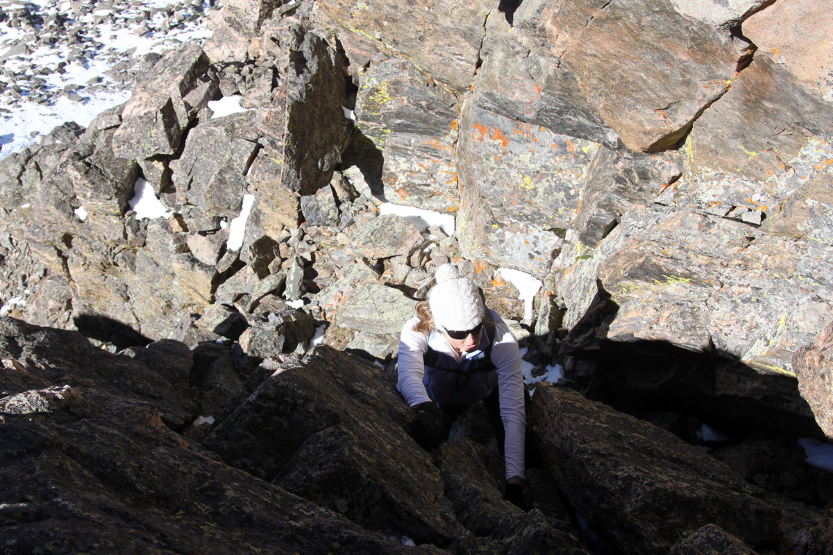
We still saw deep post-holing until we got on the east ridge proper and were able to stay on some rocks as well and only break trail through a few inches of fresh snow.
Finally on the east ridge, the post-holing in deep snow didn’t let up
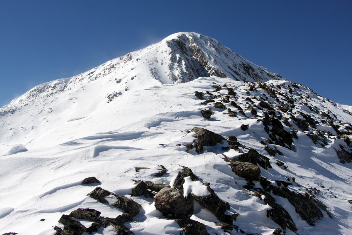
Savage Peak comes into view
Kristine & Mike on the east ridge
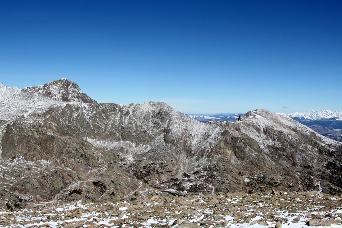
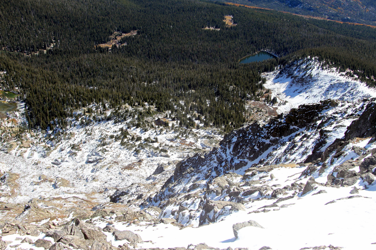
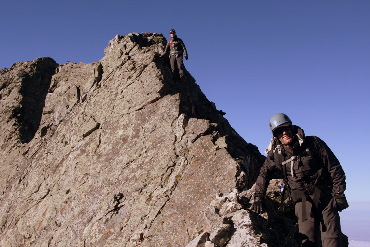
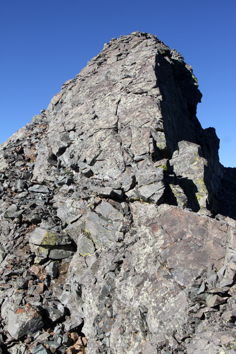
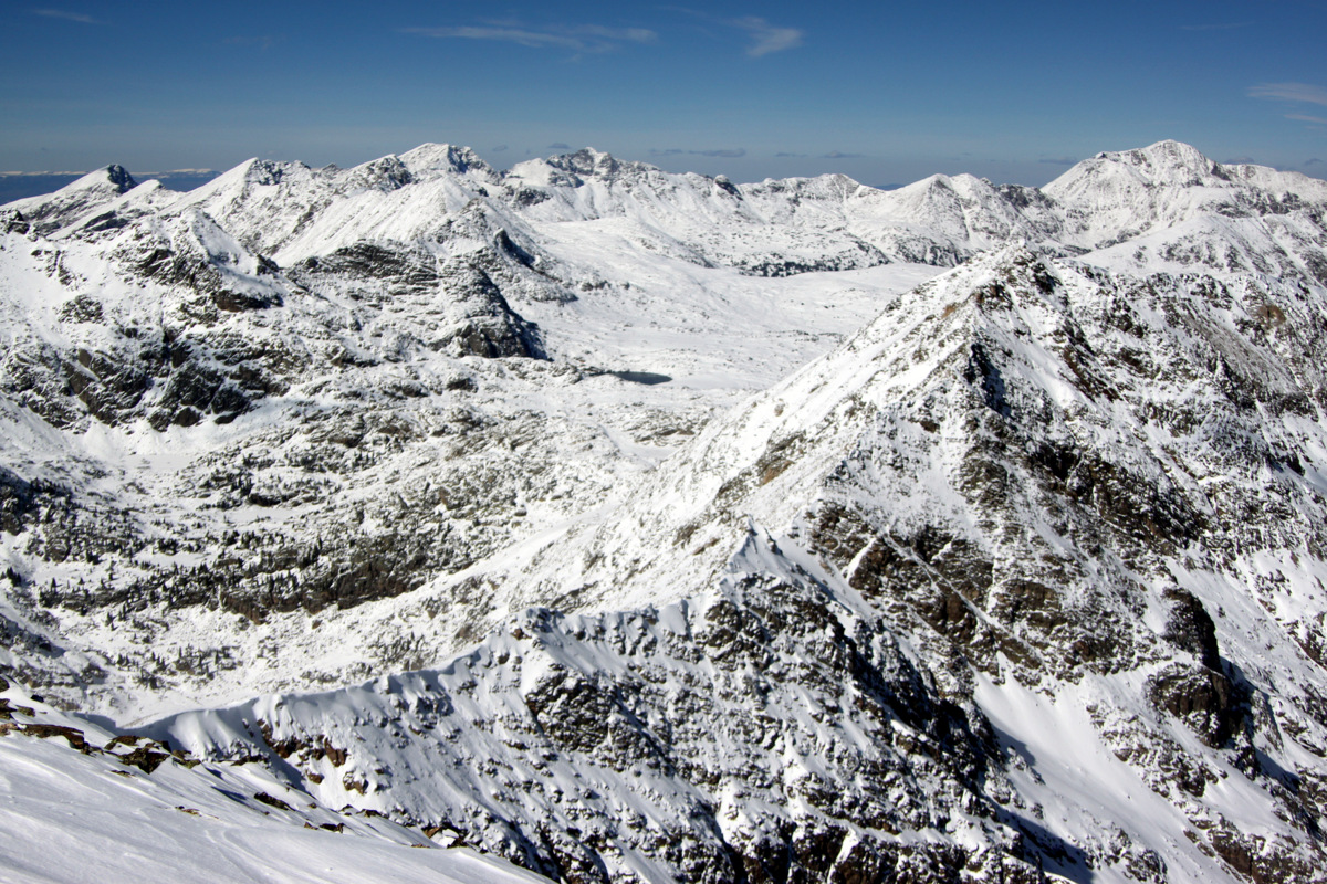
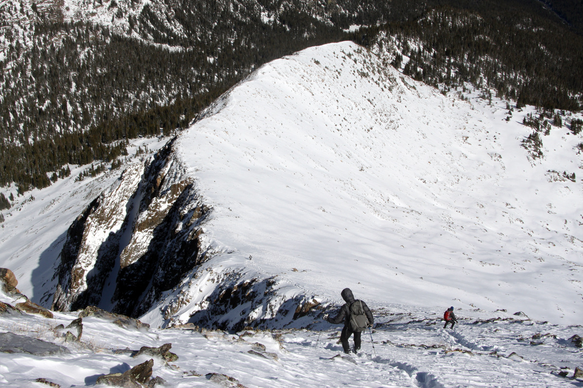
The ridge was spectacular and made for some great views of the Holy Cross Wilderness and the awesome Savage Couloir.
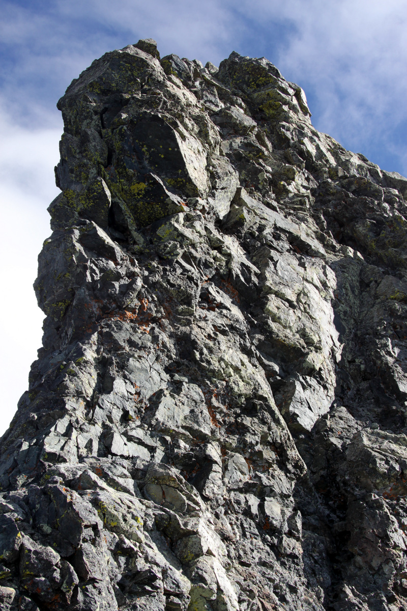
The remaining route up the east ridge with the Savage Couloir visible
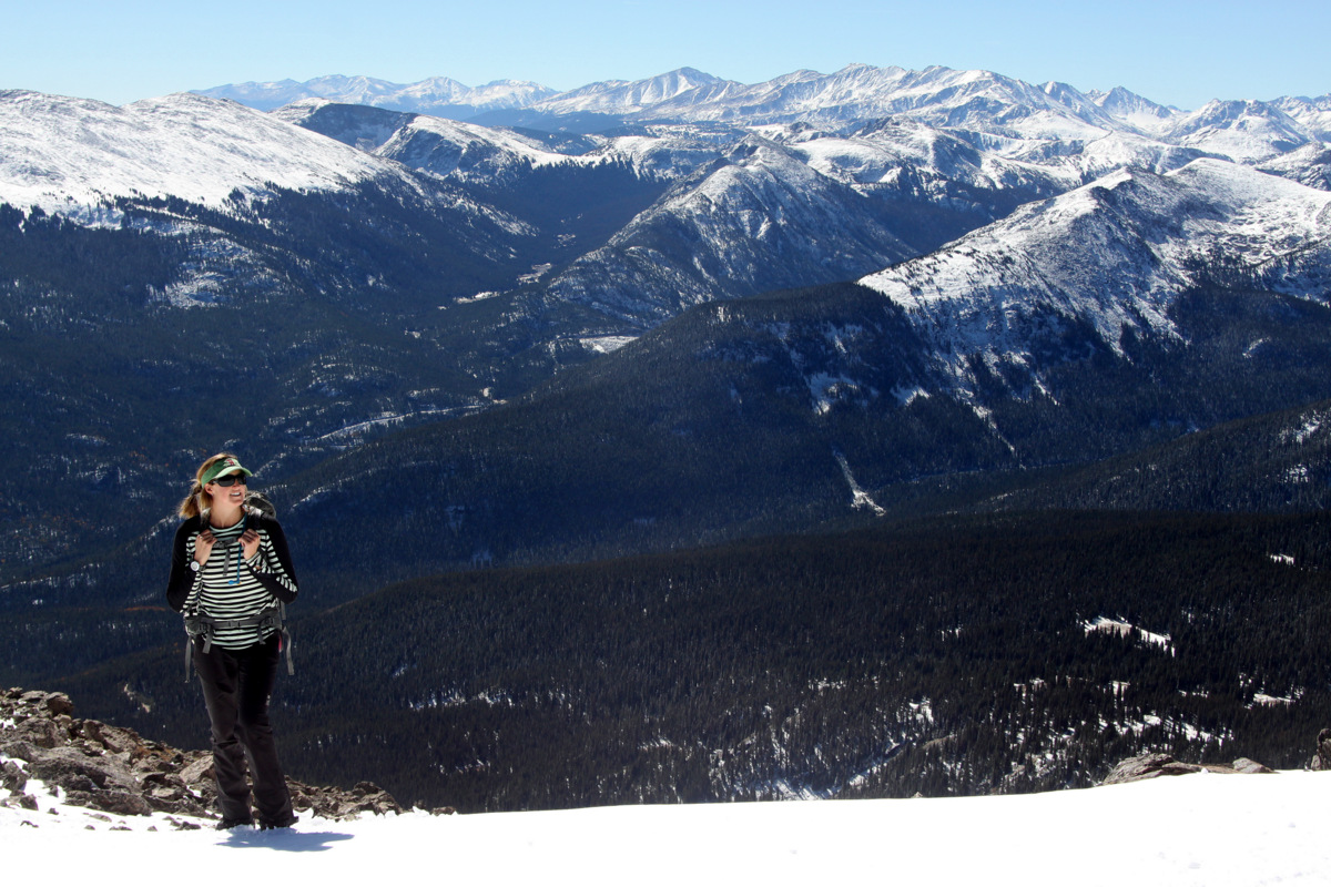
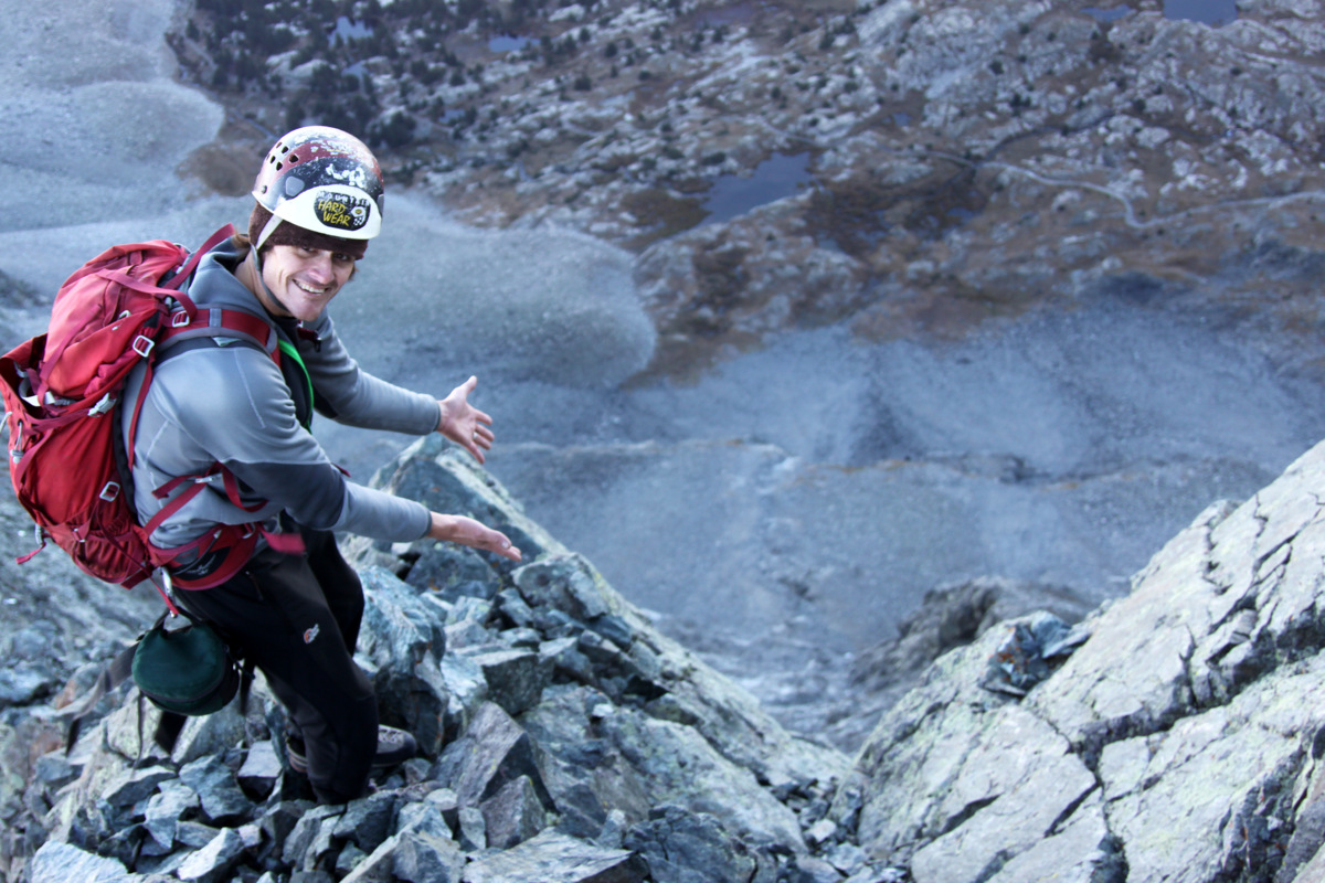
Kristine on a fine fall day
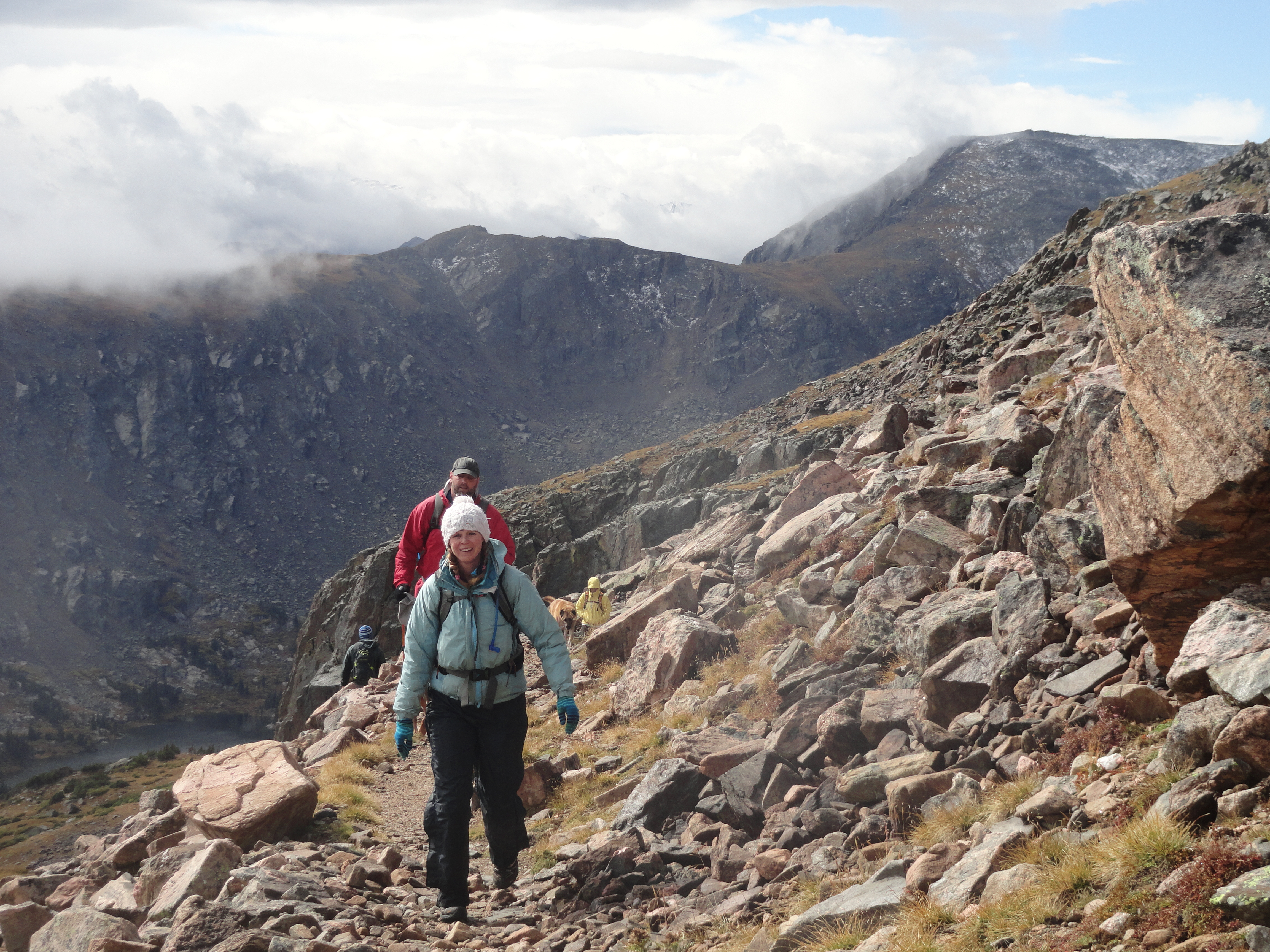
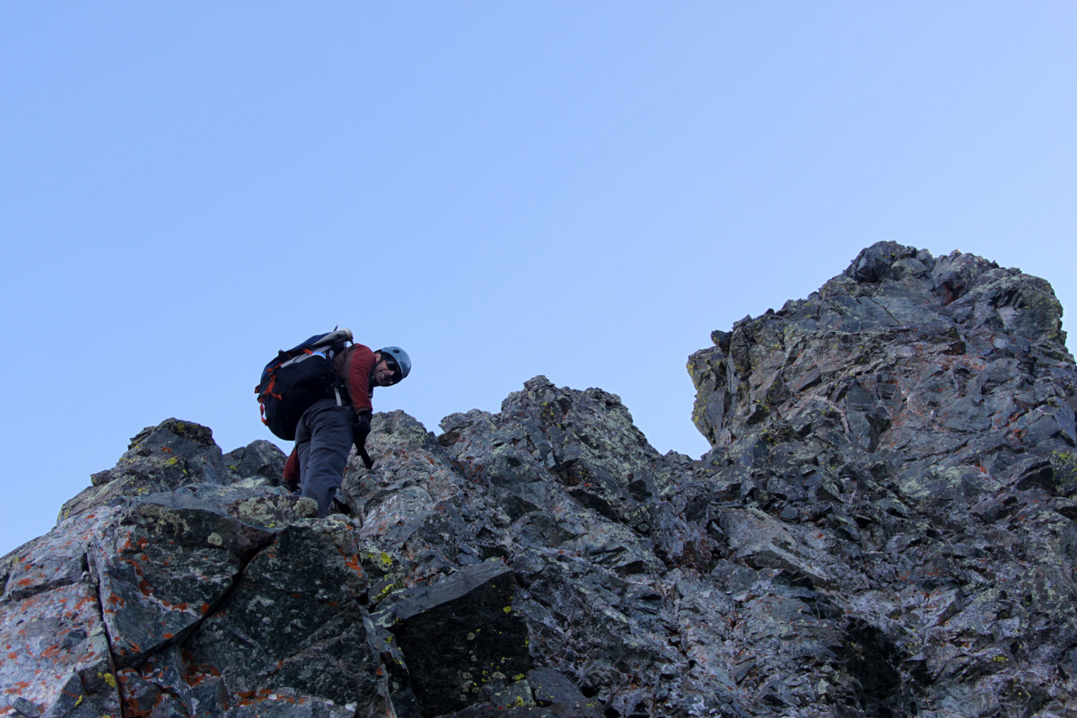
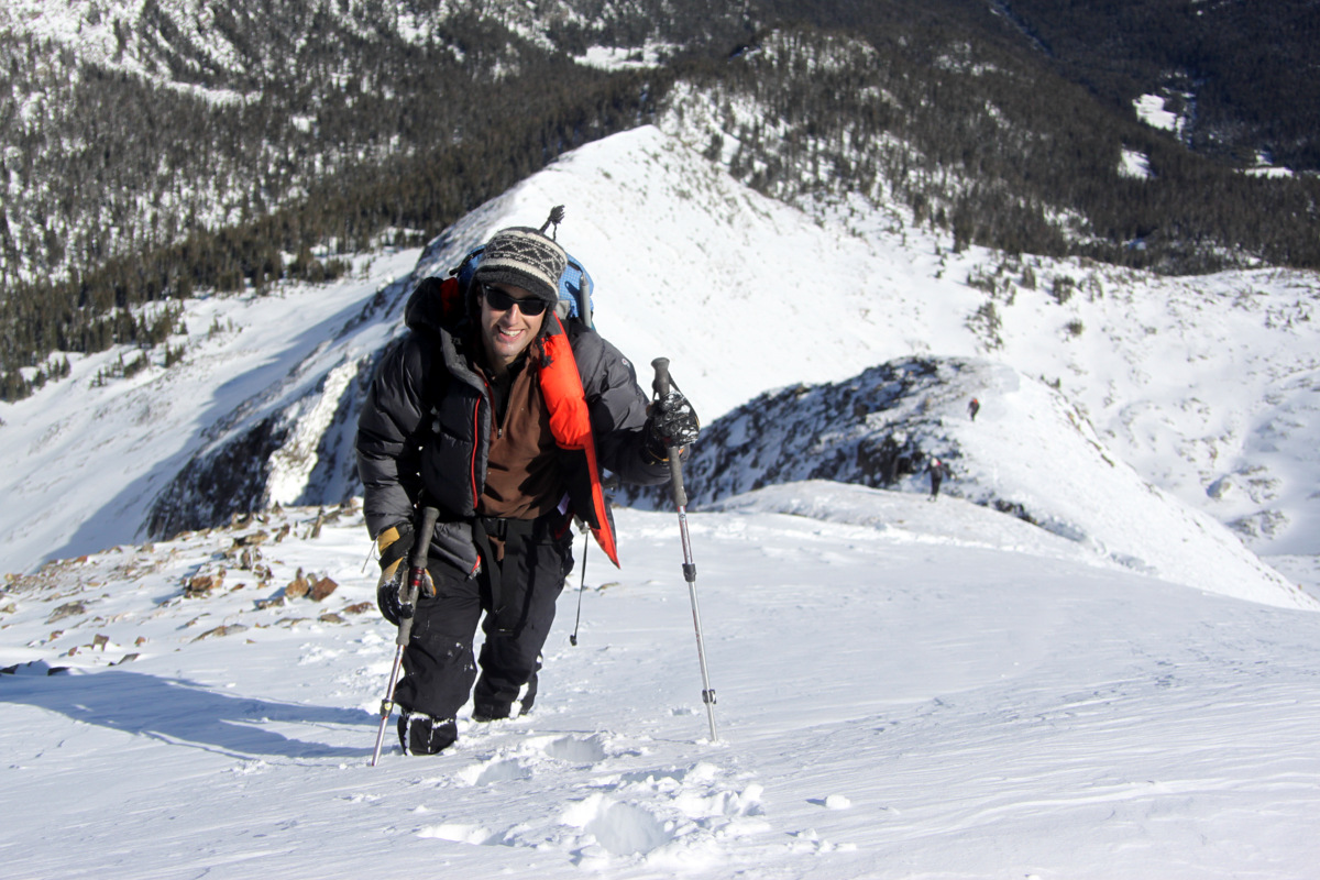
J climbing the east ridge
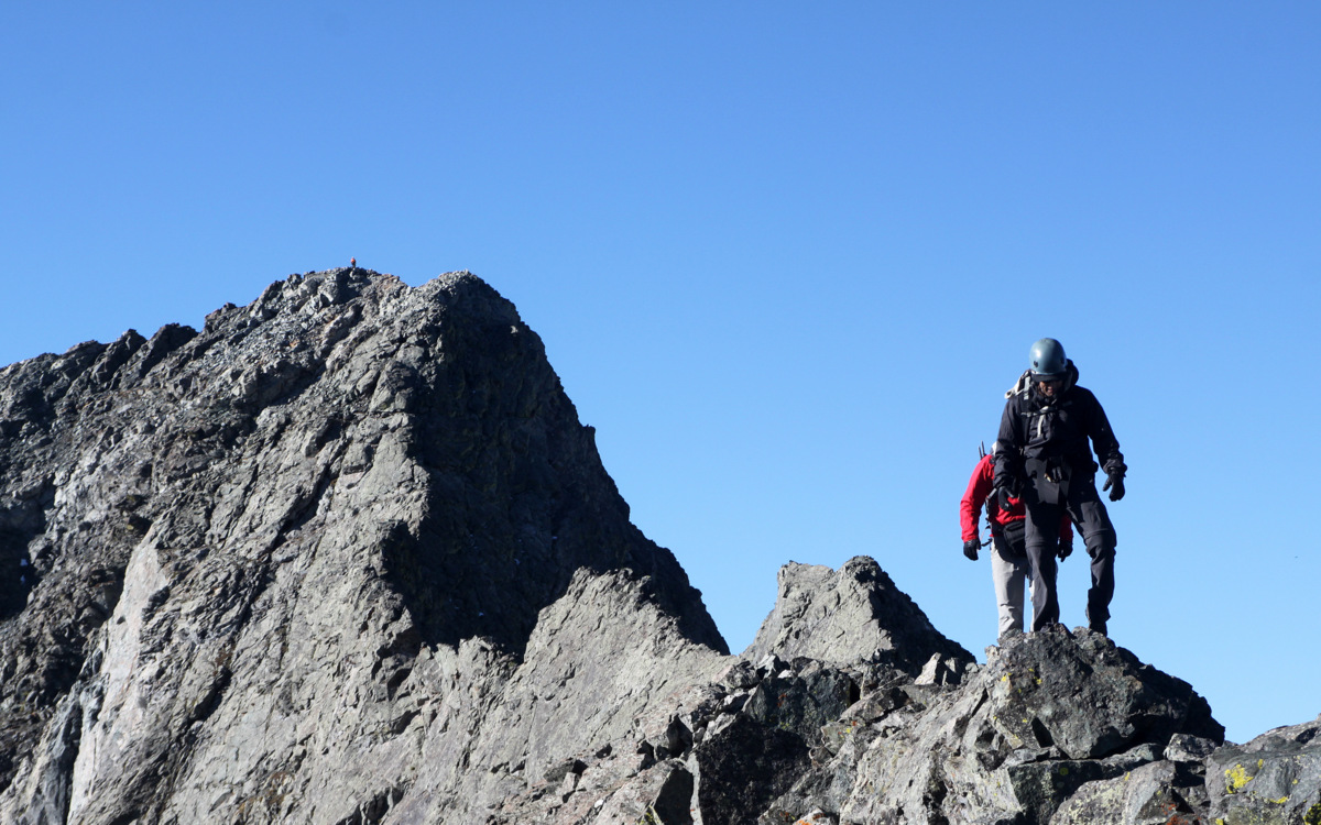
Kristine & Mike on the east ridge
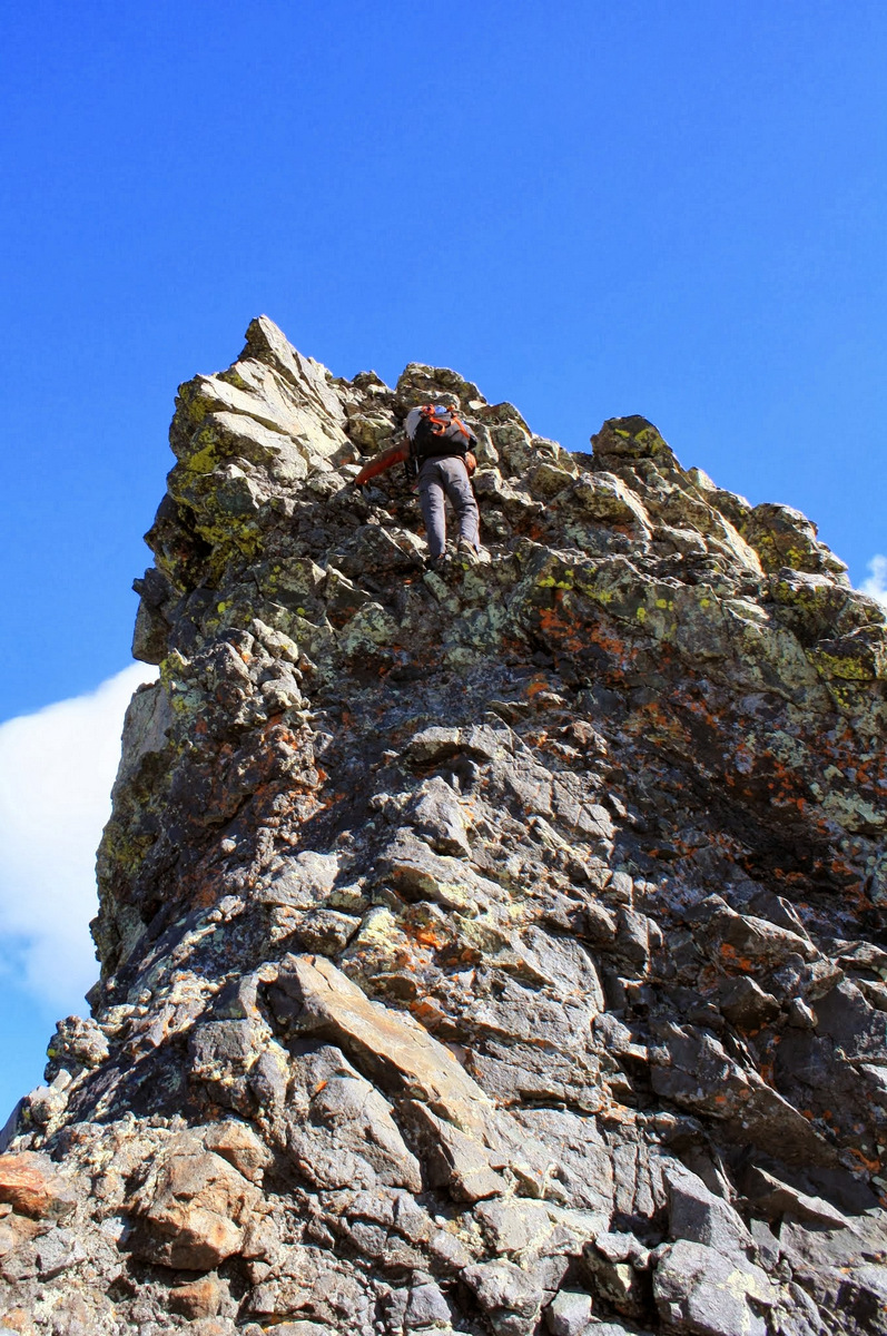
J and the final bit to Savage’s summit
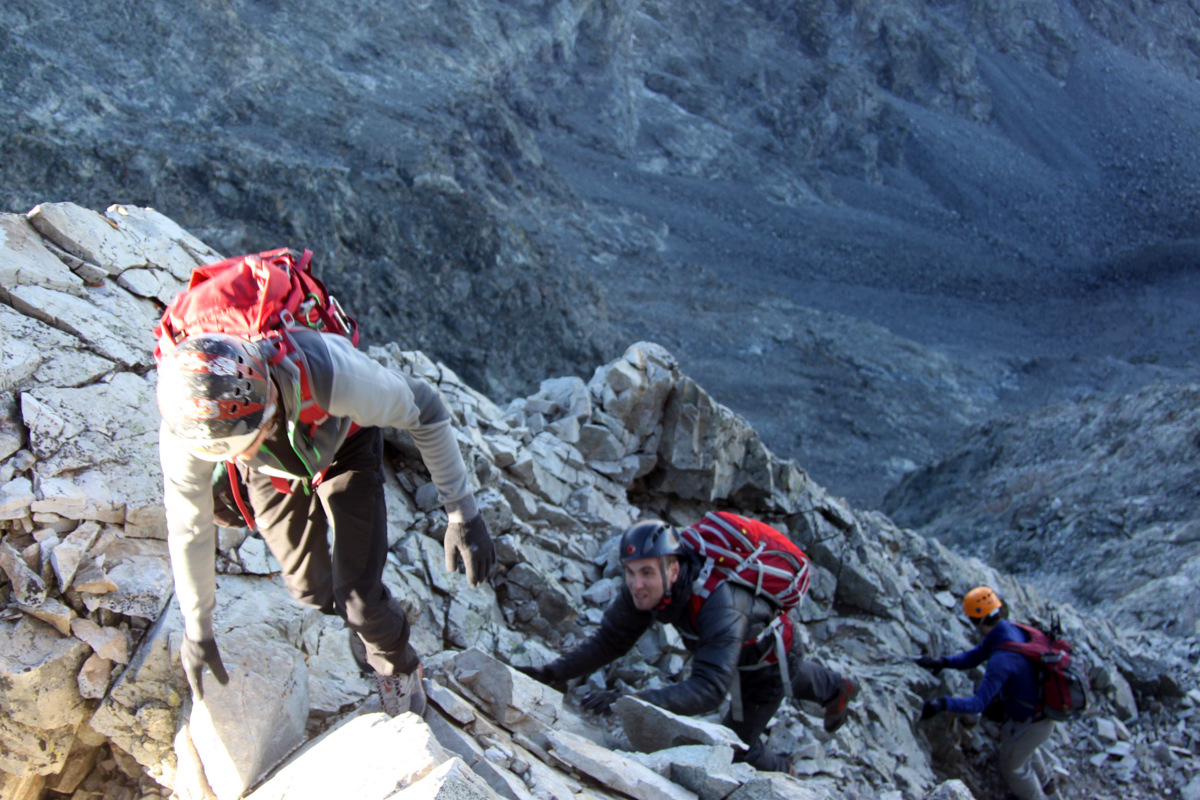
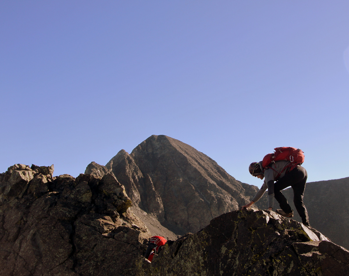
J almost to Savage’s summit with Kristine & Mike following closely behind
Mike loving being high on a 13er in winter-like conditions
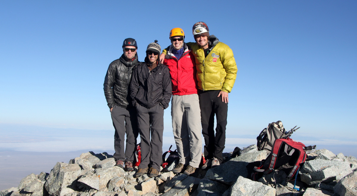
As we got higher on the ridge, the wind increased and made for some chilly climbing. We all topped out on Savage Peak’s summit around 2pm and were greeted with a very stiff and cold west wind. We took a few pics and did not stay very long – my fingers about froze trying to handle the camera. All in the name of good training for Antarctica, I guess.
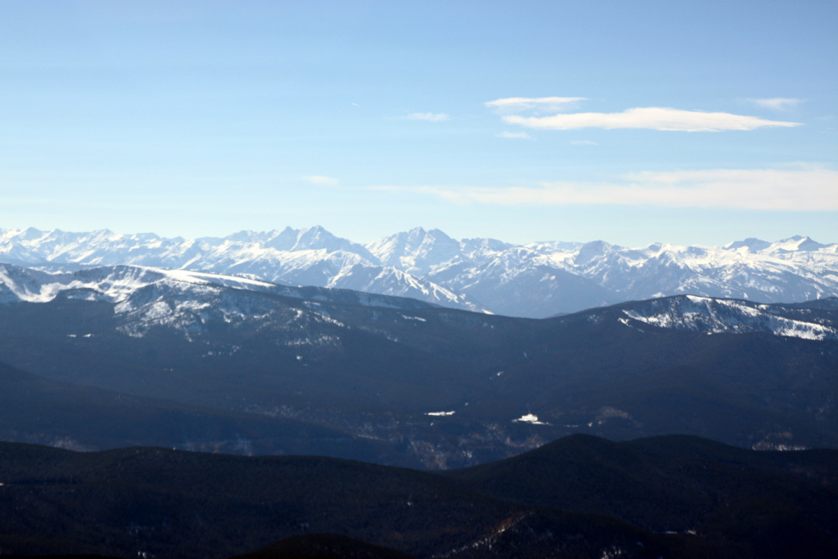
Northern Sawatch from Savage Peak’s summit
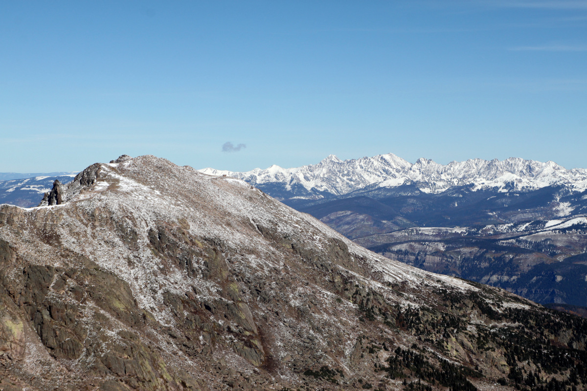
Pyramid Peak & the Maroon Bells to the southwest from Savage Peak’s summit
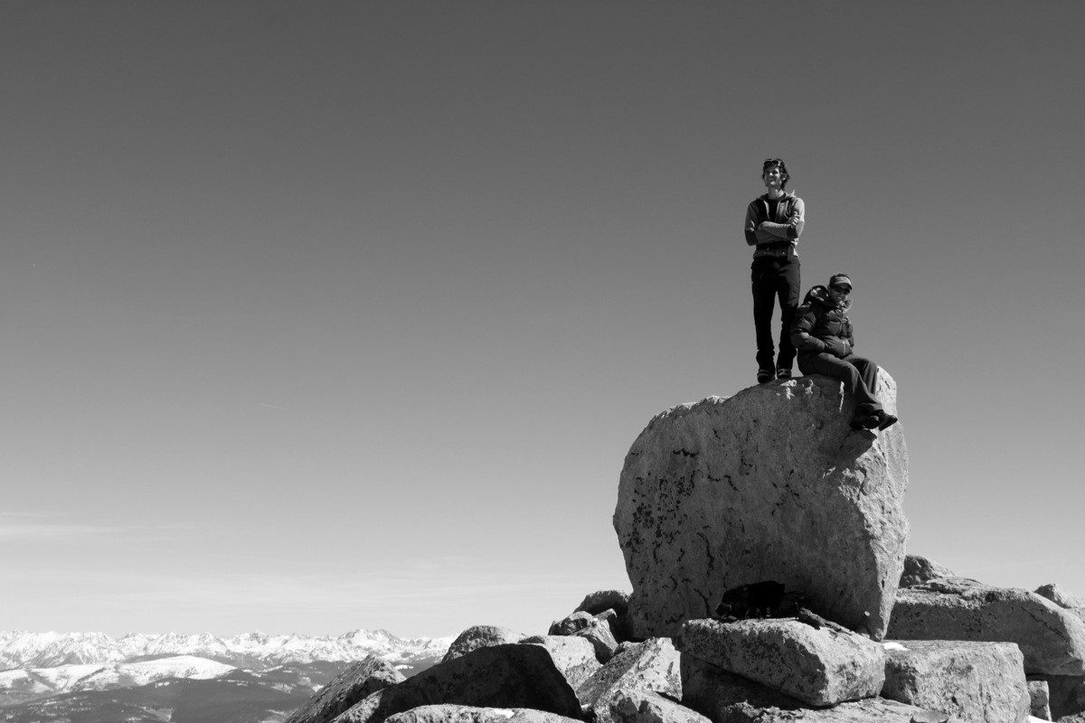
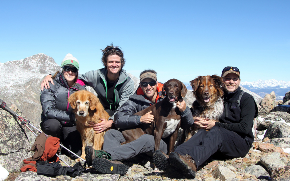
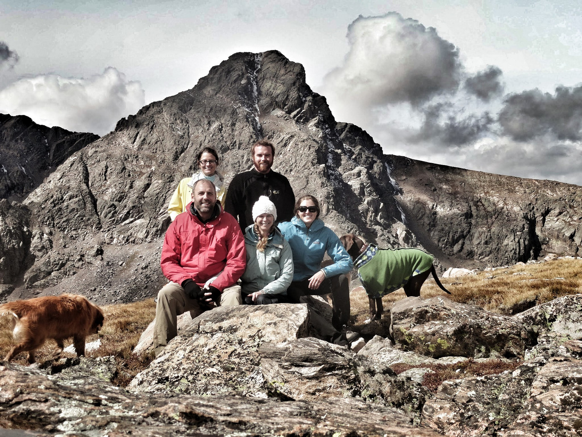
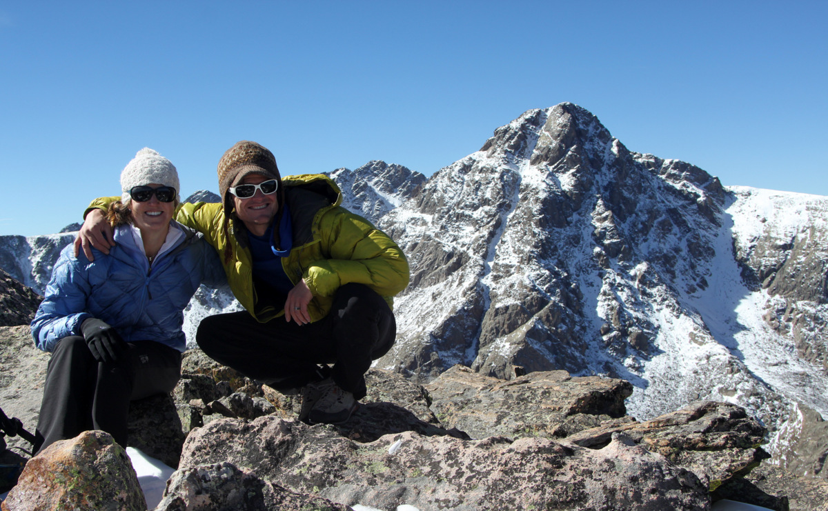
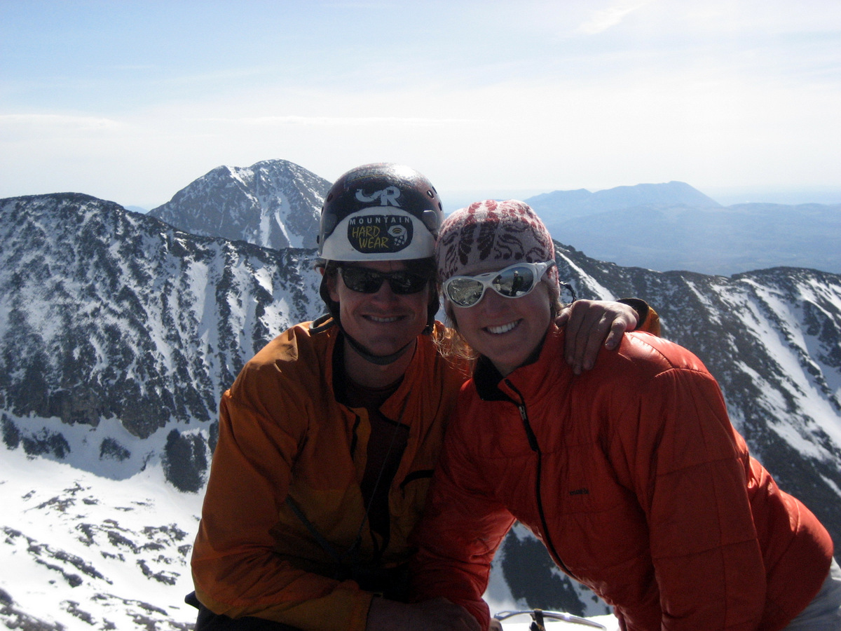
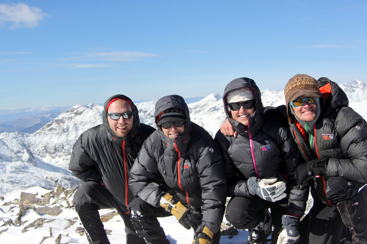
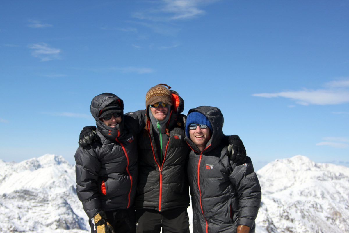
The four of us on the Savage Peak summit (13,139′)
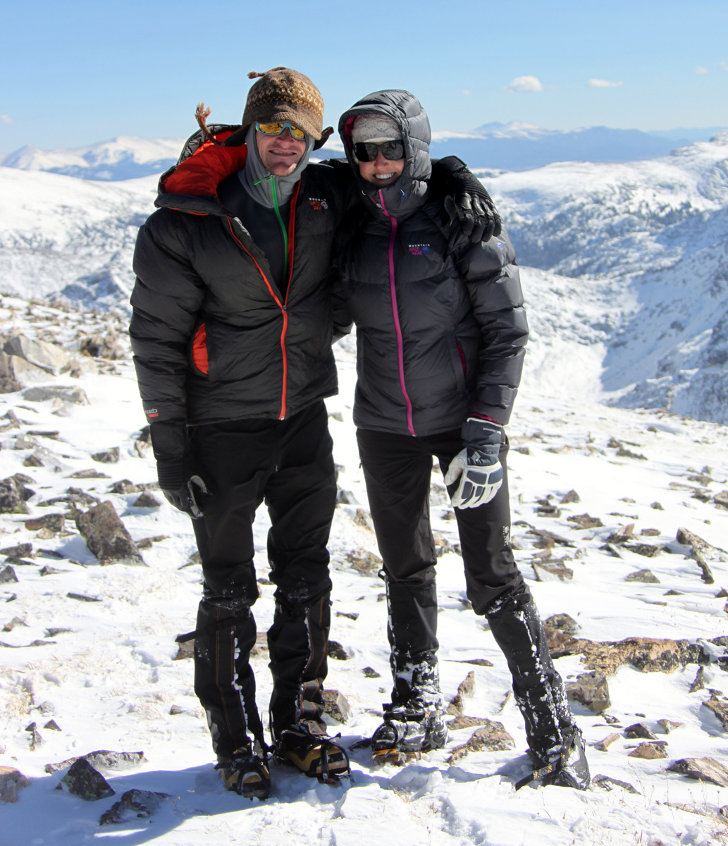
Kristine & I on Savage’s cold summit
The boys on Savage’s summit
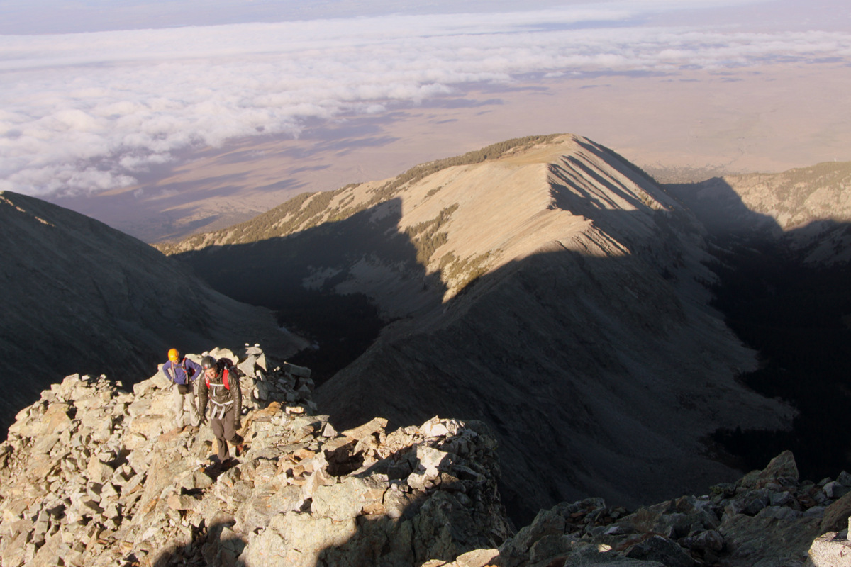
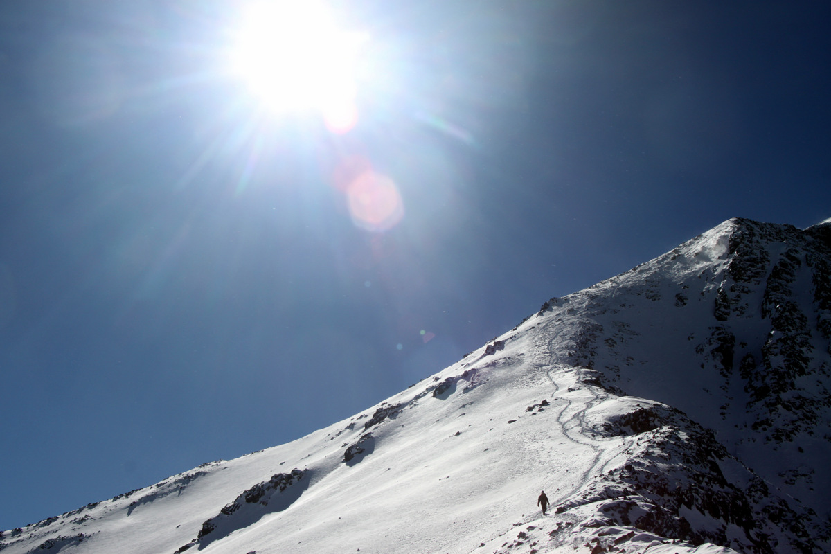
As soon as we were a few hundred feet down the east ridge, the wind subsided and it turned out to be a great afternoon to be up high on a mountain.
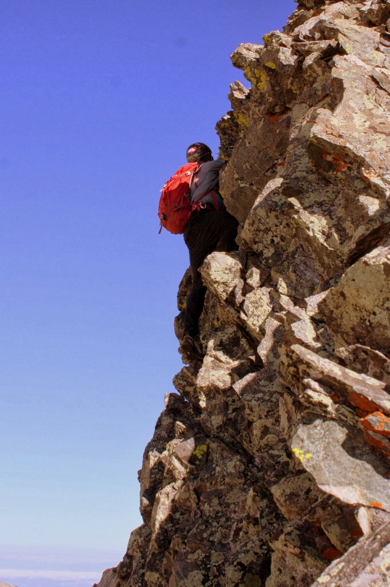
Descending the east ridge
A gorgeous afternoon
Mike & Savage Peak
Another hour of retracing our post-hole steps brought us back down to the Missouri Lakes trail and another hour brought us back to my truck shortly before 4:30pm. While its no K2, Savage was a really fun winter-like climb in the heart of the Northern Sawatch literally only 15 miles southeast of our house as the crow flies. I think we all look forward to going back in May to climb/ski the awesome Savage Couloir.
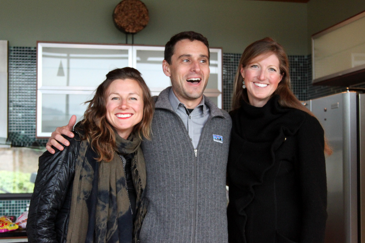
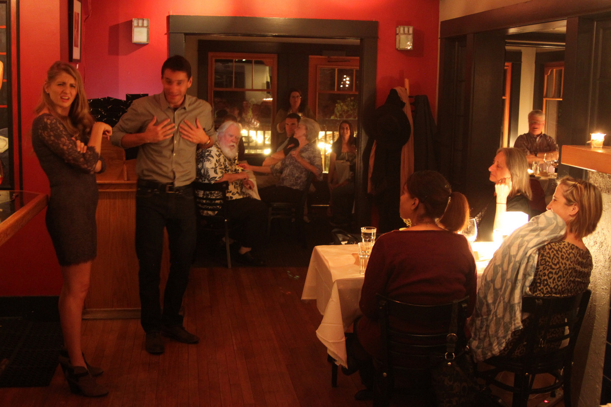
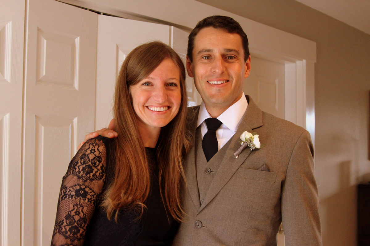
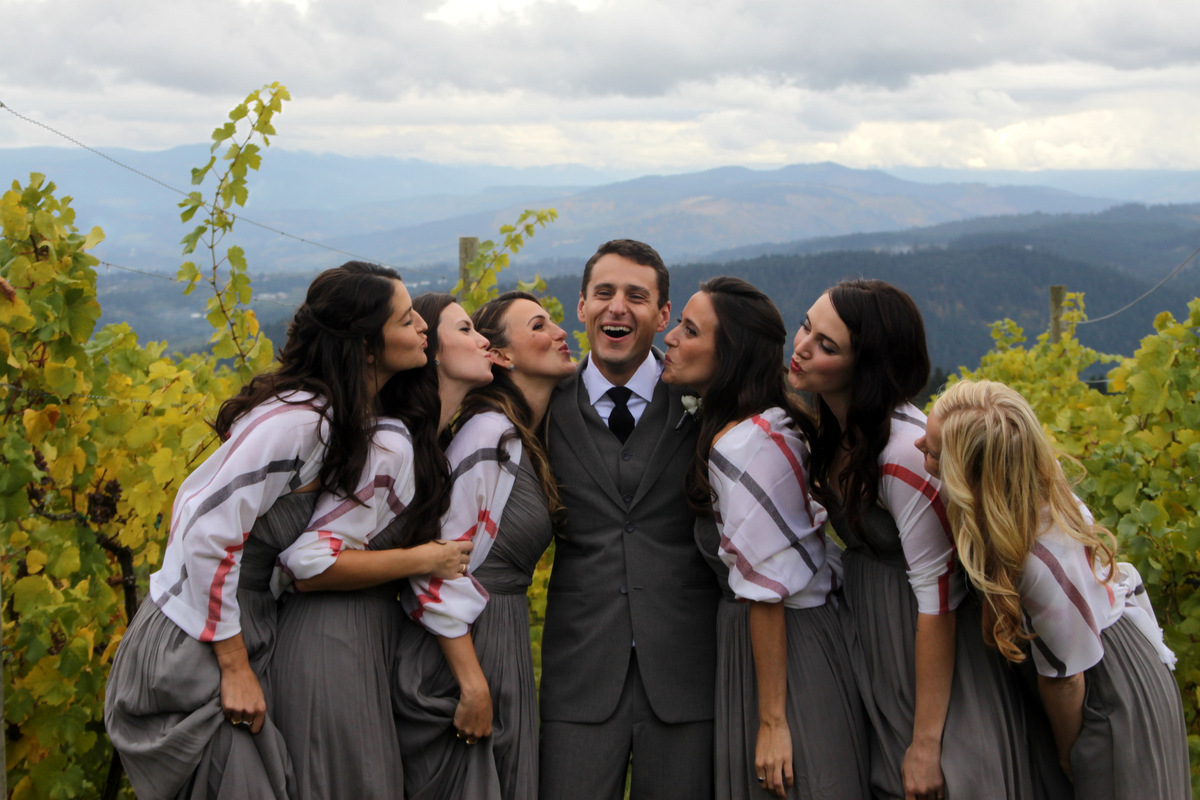
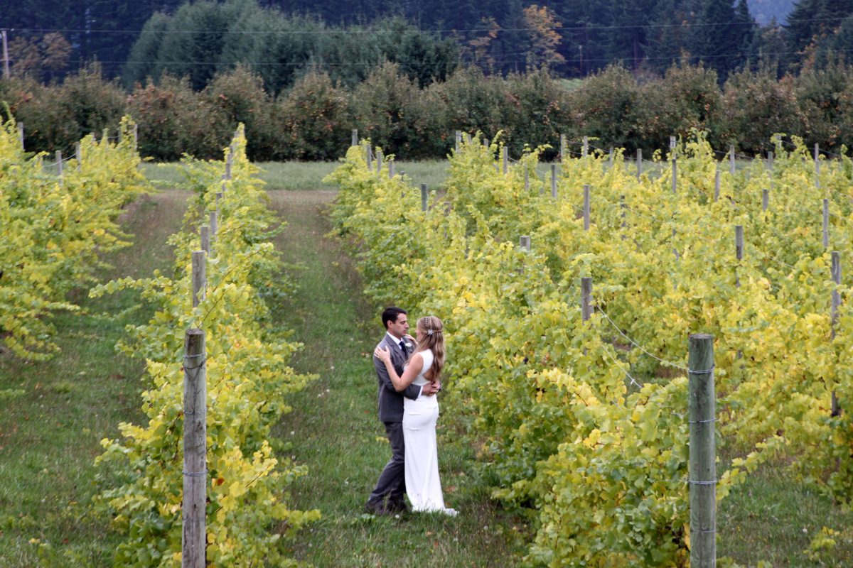
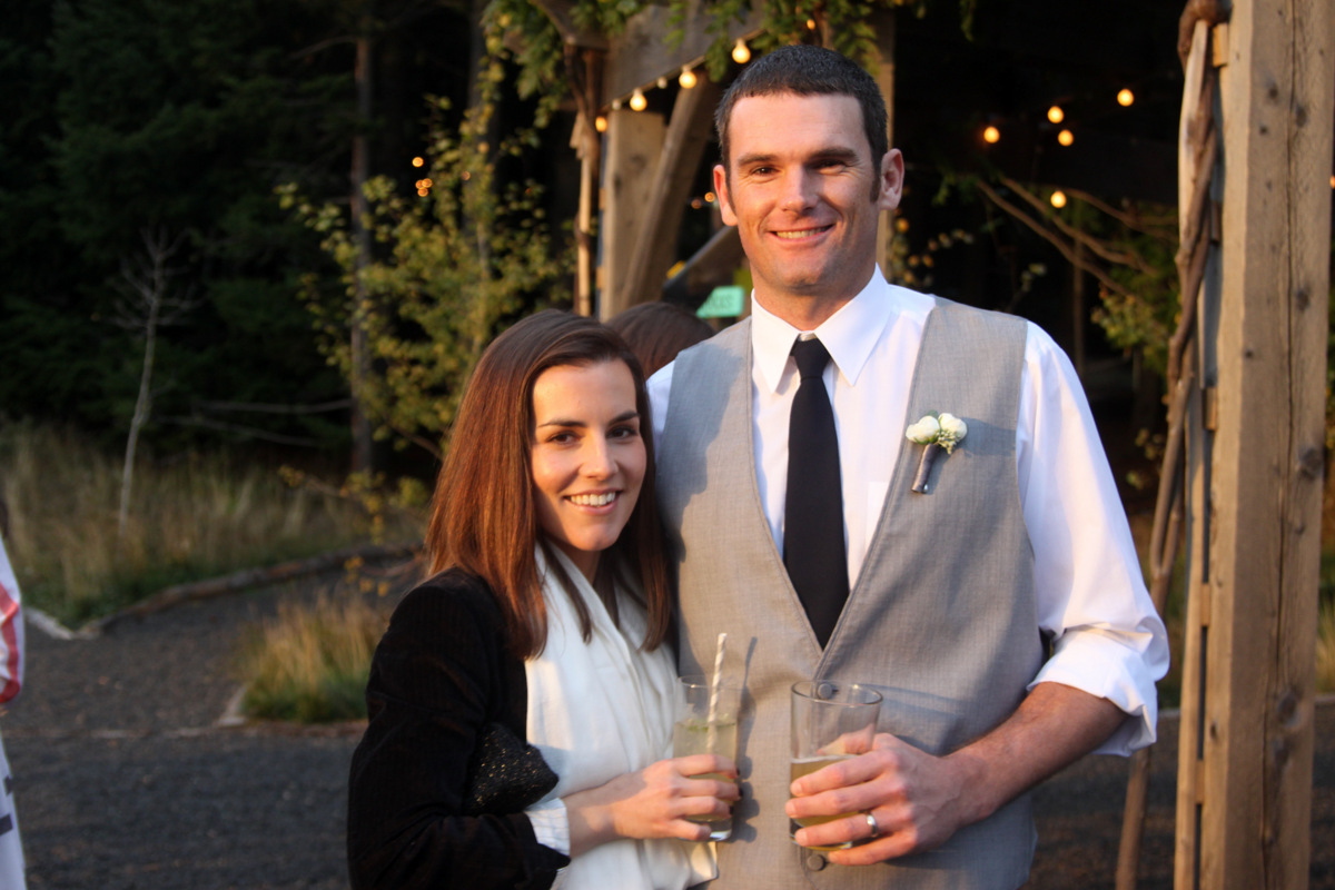
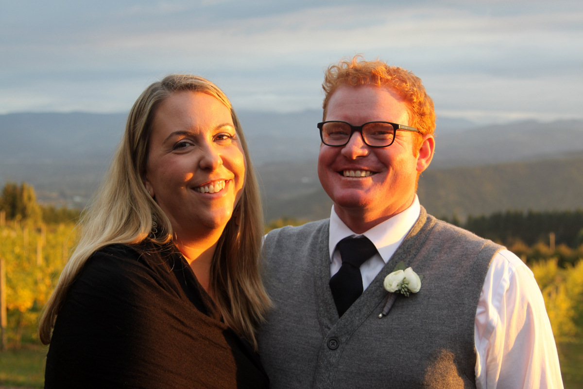
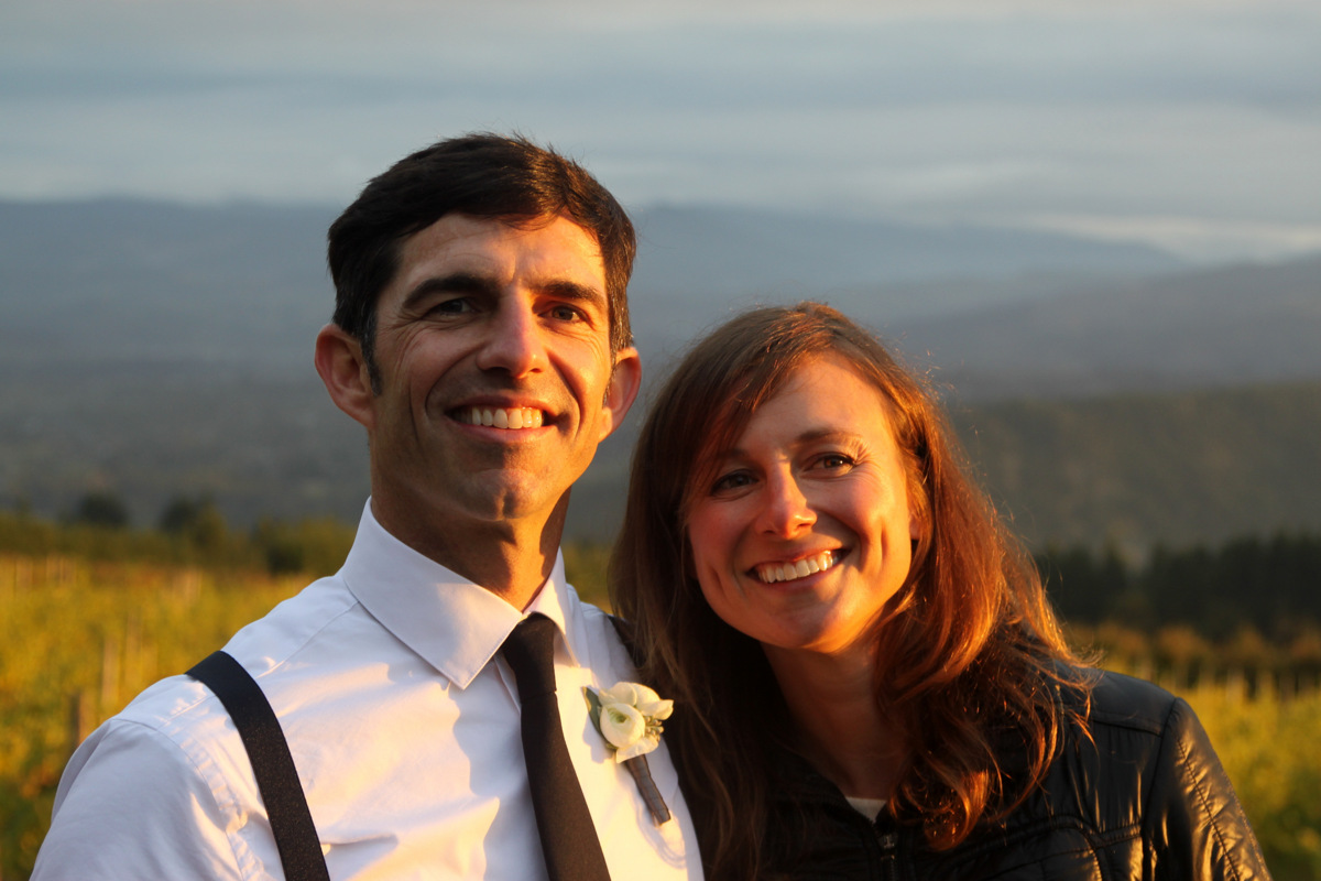
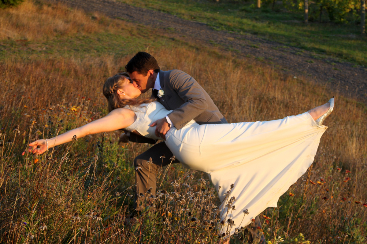
Kristine & I are back from the wedding celebration of our good friends Rob Schnare & Hanna Boone. The festivities took place in Hood River, OR and up at the Gorge Crest Vineyards on the Washington State side of the Columbia River. It was an awesome weekend of great friends, gorgeous scenery, and maybe one too many Dark & Stormy’s all in the names of Rob & Hanna. The Schnares & Boones sure put on an amazing weekend for us all and for that we are so appreciative & grateful to be included. Rob & Hanna leave for Europe tomorrow for their honeymoon and then back to Portland, OR to continue their rockstar lives as a married couple. Rob is a longtime best friend of Kristine & myself who I met almost a decade ago through work and has since been on many amazing trips with us such as Aconcagua in 2006 & Mt. Elbrus in 2008. Hanna is an amazing gal who turns out to be a distant relative of mine with her being a direct descendant of Daniel Boone and me being a direct descendant of Daniel Boone’s wife, Rebecca Bryan. Some pictures I took of the wonderful weekend are as follows:
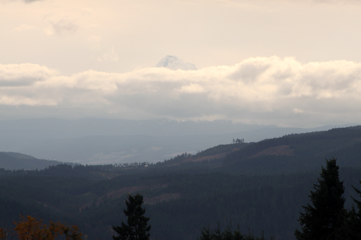
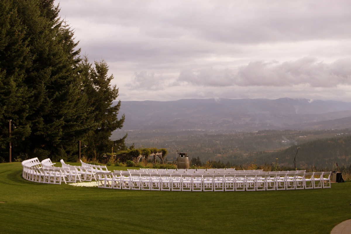
Mt. Hood (Oregon’s highest peak at 11,249′) looming above all else as seen from the wedding site
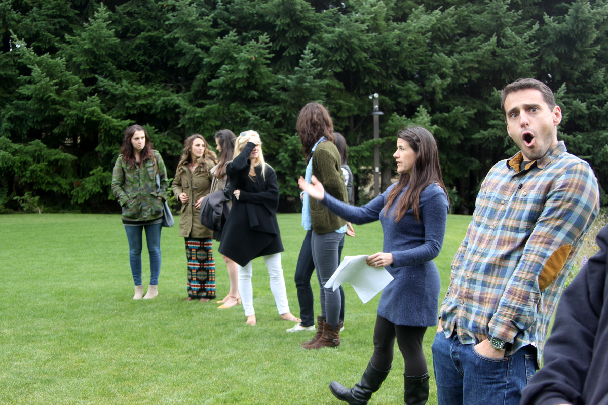
Rob and the rehearsal party
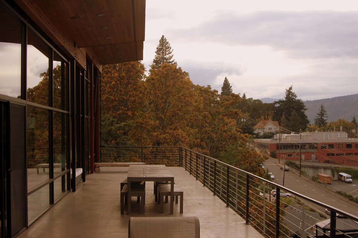
Our awesome groomsmen accomodations
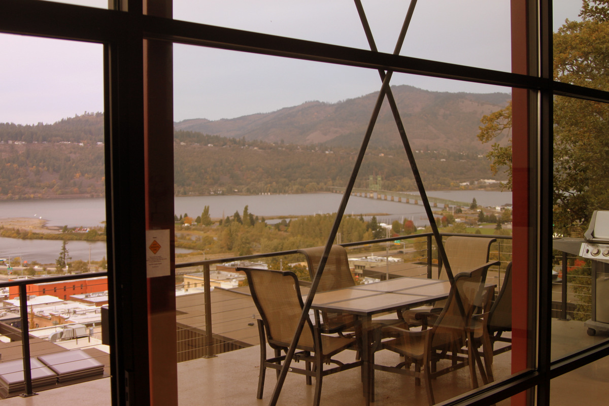
Hood River & the Columbia River from our groomsmen pad
Mary, Rob, & Kristine at the groomsmen pad
Hanna & Kristine at the rehearsal dinner cocktail party
Rehearsal dinner in Hood River
Brother & sister on wedding day
Rob & his ladies
Rob & Hanna among the vineyards
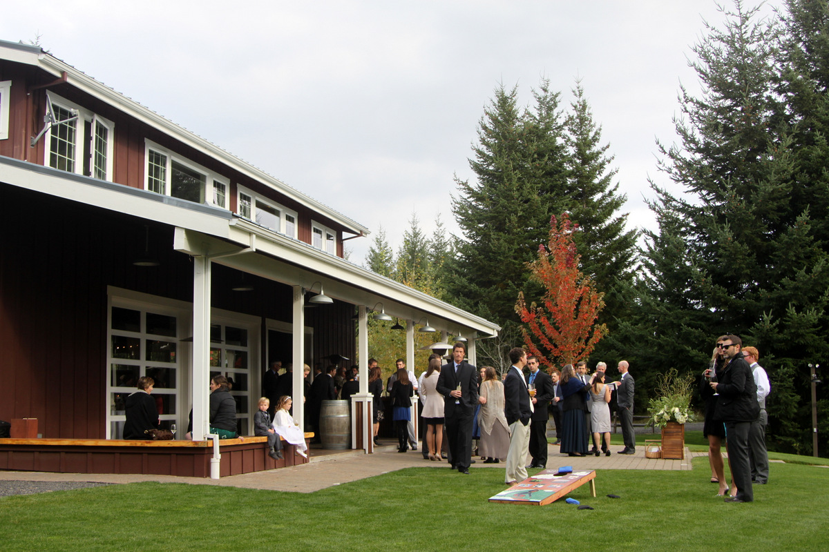
Cornhole before the wedding ceremony – thank you, Mr. Tyler Holland
Not too shabby of a wedding site
The Chalks
Roberto and me
The Scribners, the Woodys, and Roberto
Suspencer & Lindsey
The Chalks
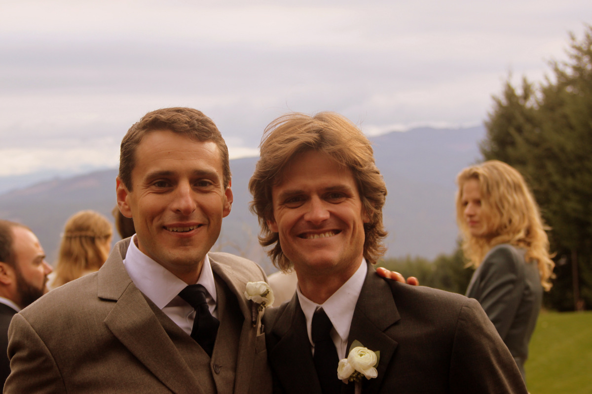
Best man, Evan, & Melissa
Bozeman, MT, rockstars Travis & Mary
Robbie dipping the bride
Evan & Chad
The Horst family – Mike, Cathy, & Cassidy
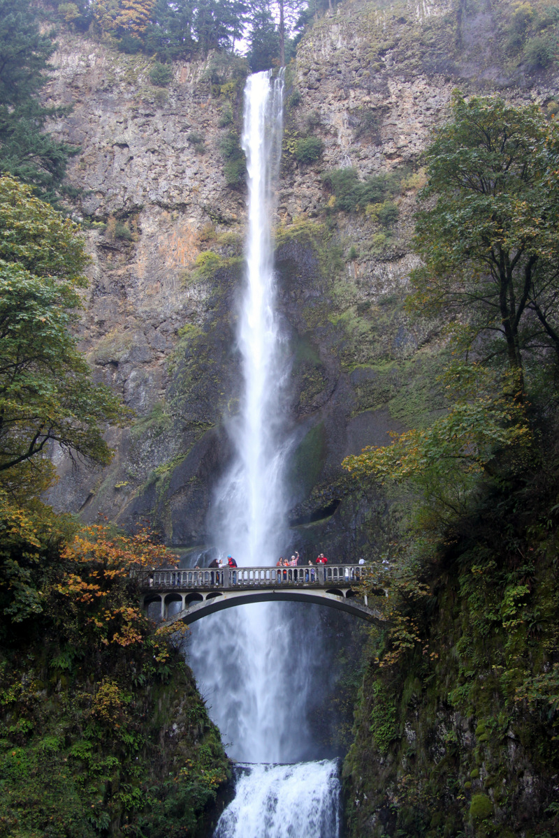
Kristine & I stopped at Multnomah Falls on the way back to Portland to stretch the legs and do a quick hike
Looking down from the top of the falls
Oregon sure does have some awsome natural wonders. It was good to get back here after a few years
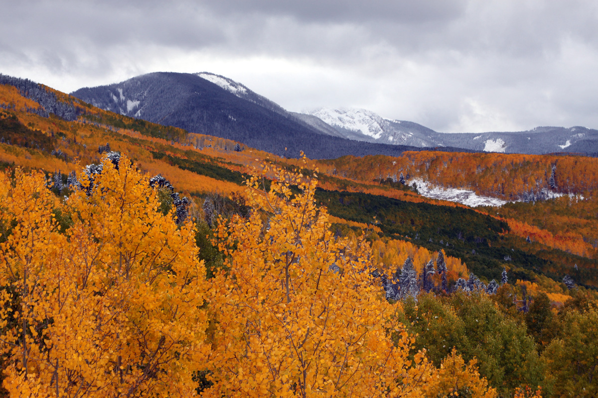
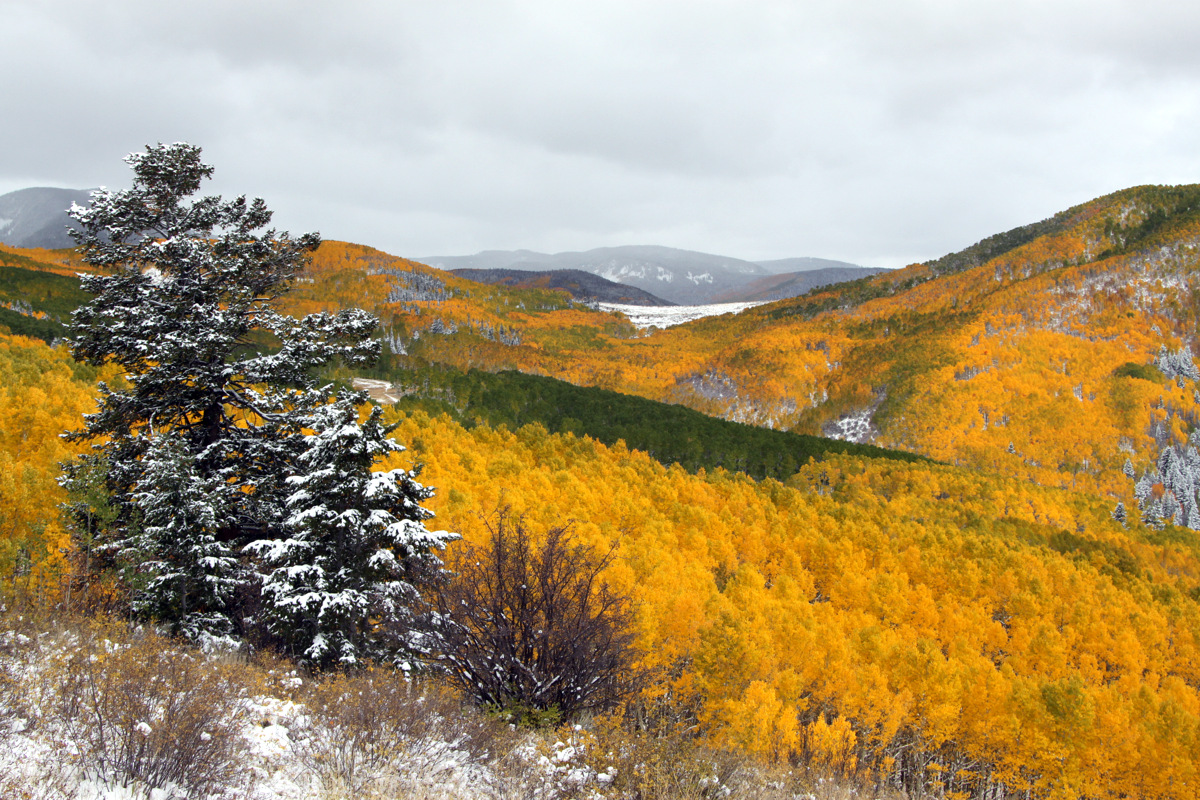
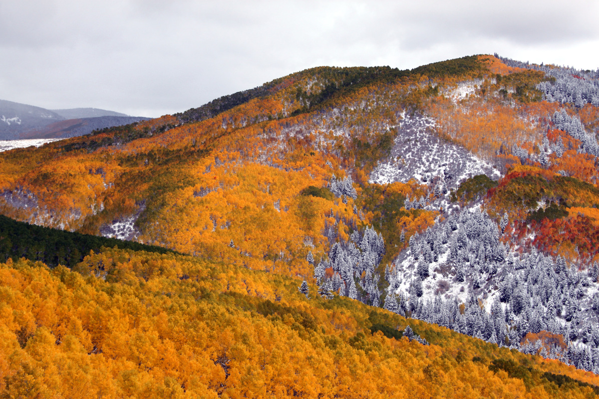
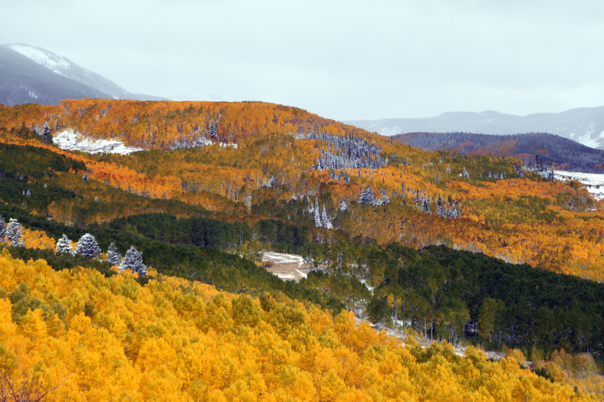
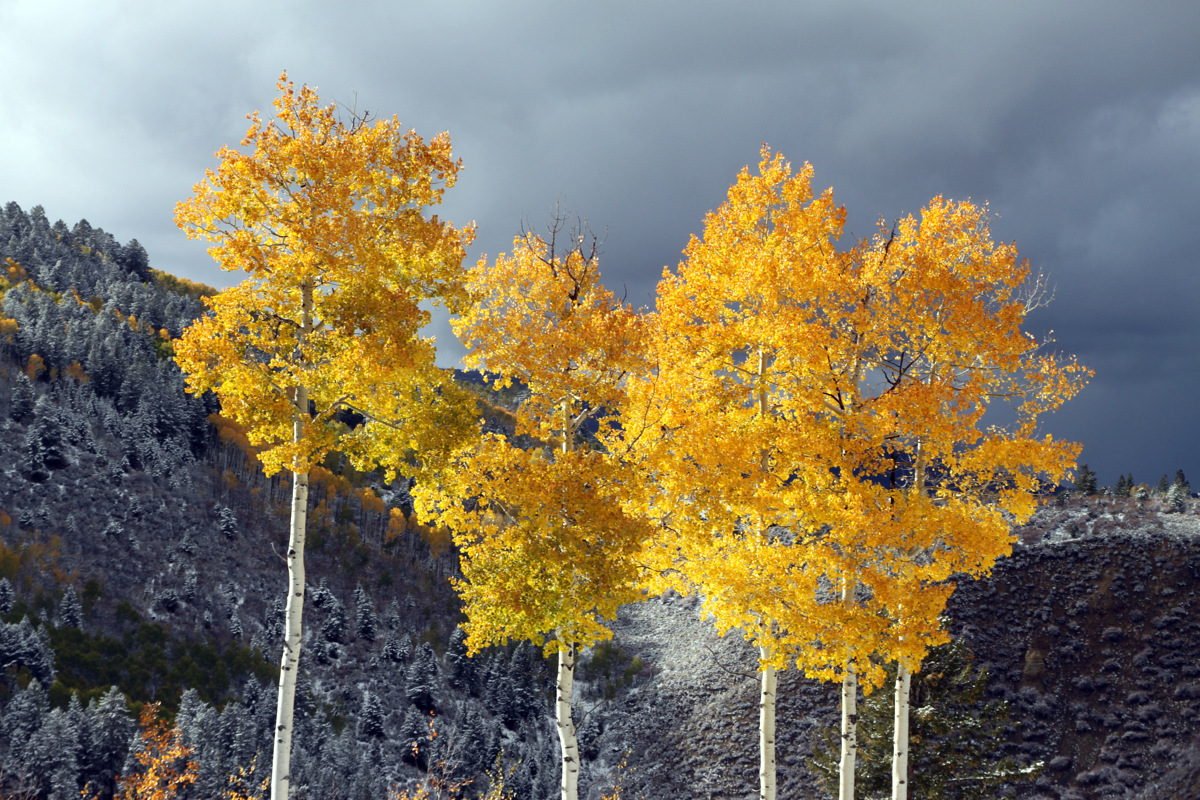
Last Thursday/Friday, Colorado received its first big snow storm of the fall. Steamboat reported 14″ at mid-mountain, but a friend of ours who lives in Steamboat hiked up and skied a good 2 feet at the top of the resort. Quite impressive especially for October 4. I don’t remember the snow falling so much so early in the 10 years I’ve been in the Vail Valley. While I absolutely love Indian summers and late fall climbing/scrambling, maybe this all points to a good winter. We shall see. With the Aspens peaking in their brilliant gold colors last week and the new snow on the ground and on the spruce trees, the combination of these colors was absolutely amazing on Friday driving to work. So, the dogs and I hiked up Arrowhead in the late afternoon and got some pictures of the Lake Creek Valley landscape and our favorite A10 trail aspen trees.
Amazing colors looking back into the Lake Creek Valley & A10 trail
On Sunday we all decided to take advantage of the wonderful fall weather and hike up the relatively short and dog-friendly 13er Whitney Peak in the Holy Cross Wilderness very near Notch Mountain, which Kristine & I had traversed the previous Sunday. After passing the Missouri Lakes & Fancy Lake trailheads, we drove to around 10,320′ and parked at the French Creek trailhead right before the gnarly Holy Cross City Road, one of Colorado’s toughest 4WD roads. J joined Kristine, Rainier, Kona, & myself as well as Billy Larson and his dog, Buddy. We hiked up the Holy Cross City 4WD road about a mile or so and then took off east bushwhacking through the forest, across a boulder field, and up the steep grassy slopes to Whitney Peak’s mellow south ridge.
Very dry south-facing meadows on Whitney Peak’s south ridge
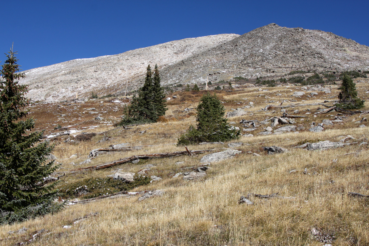
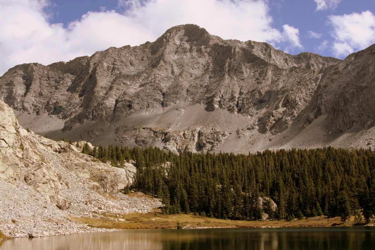
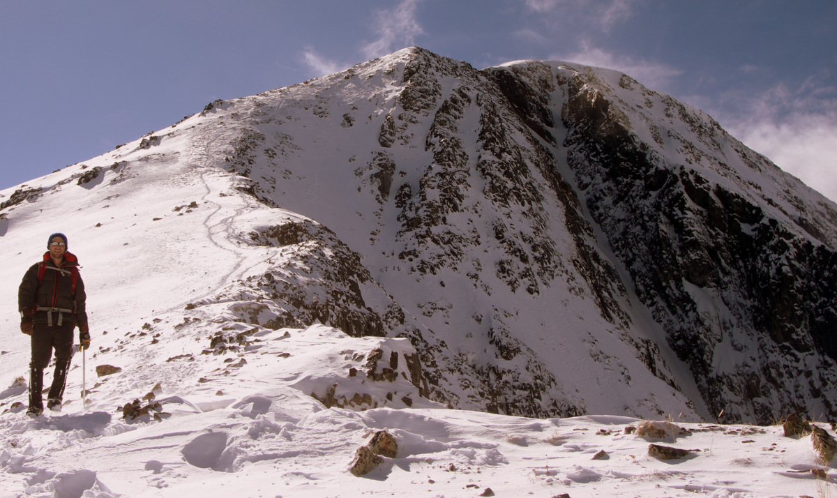
Savage Peak (13,139′)
I had noticed from pictures and the map that there seemed to be a shallow southwestern facing gully mostly filled in with grass and some rocks. I’m always looking for grassy routes for ole Rainier as the boulder hopping really give her legs a hard time these days. Turns out this gully was just what the doctor ordered and was mostly grass up until the last few hundred vertical feet before the ridge.
J, Kristine, & Billy on the ascent up the southwestern gully
Buddy having so much fun
Kristine enjoying this gorgeous fall day up high
There was a bit of snow at the top of the ridge, but we all veered left and within 10 minutes we were at the summit boulder of Whitney Peak. Now, Whitney Peak’s summit plateau is very large and long. There are actually two highpoints along this plateau and we could see the other highpoint on the far western end of the plateau. The Whitney Peak USGS benchmark (13,271′) is indeed on this western highpoint, but the large 5 ft tall summit boulder on the eastern highpoint where we stood is the highest point on the mountain at 13,276′. So, we called this summit boulder our summit as it is the true summit of Whitney Peak. In fact, surmounting the summit boulder requires a 5.6 move or two which was pretty fun.
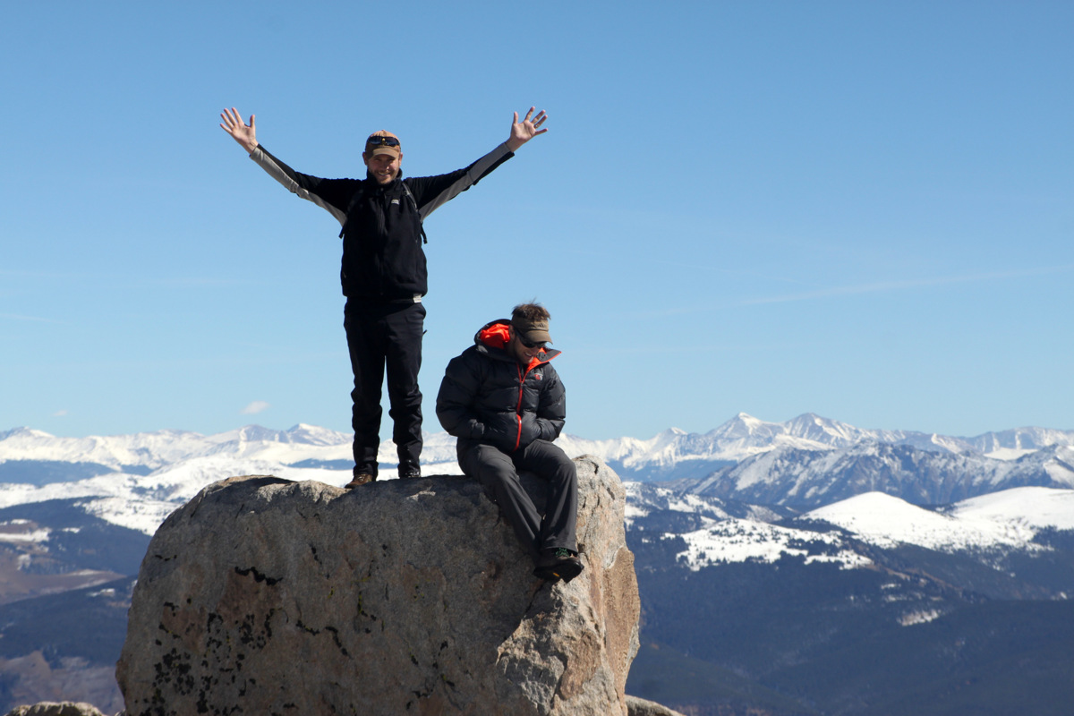
J & I on top of Whitney Peak’s summit boulder (13,276′)
Billy & J on Whitney Peak’s summit boulder (13,276′)
The eastern highpoint of Whitney Peak
Whitney Peak summit (13,271′)
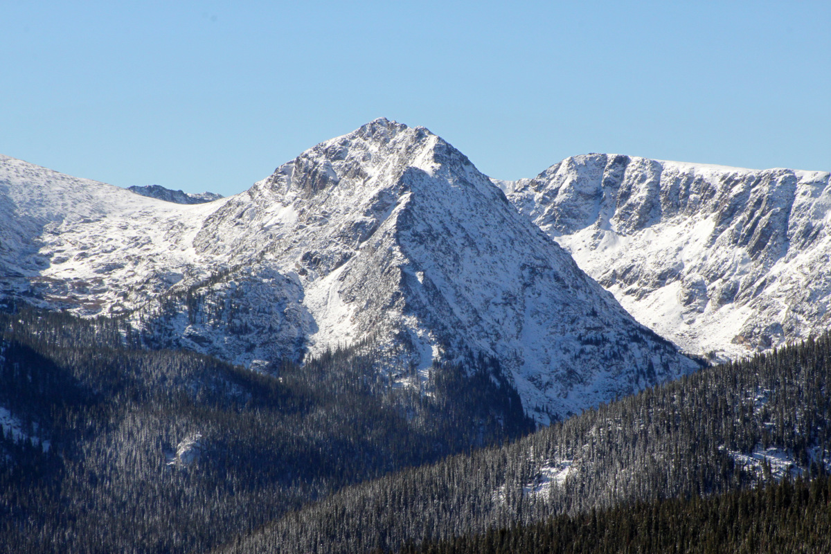
Mt. of the Holy Cross (14,005′) at left and Notch Mountain (13,237′) at right
Notch Mountain (13,237′) at left with the Gore Range behind. Can you spot the Notch Mountain Shelter on Notch Mountain’s right shoulder?
Pyramid Peak and the Maroon Bells to the southwest
Looking down Whitney Peak’s steep east face to Whitney Lake below
We then took a group photo just below the summit boulder, took in the views of the Northern Sawatch Range and local 14er Mt. of the Holy Cross, and then headed down arriving back at the cars around 2pm for a roundtrip time of about 4 1/2 hours. We sped back to Sarah & Keith’s house in Edwards to try and make the beginning of the Denver Broncos game. It was a fun-filled afternoon of friends, burgers, beer, and the Broncos squeaking out a victory against the Dallas Cowboys to go to 5-0. You just can’t beat the Broncos nor can you beat bluebird fall days in the Colorado highcountry.
Kristine here – A few weekends ago I was home with the dogs and decided that Notch Mountain would make a nice day climb for everyone, especially since I’d never done it. I recruited a few others, but early in the morning as we were about to depart the weather was not looking promising. We arrived at the Half Moon Trailhead (10,300′) and started off on the Fall Creek Trail in a cold drizzle. When we reached treeline, it began to sleet / snow and the wind picked up. Luckily, just as we were a the point of calling it, the sun broke through and we decided to push on.
Sarah and Keith bundled up on their way up the Notch Mountain Trail switchbacks as the blue sky pokes through
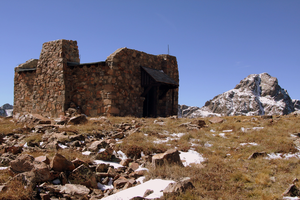
We were all glad we didn’t turn as we made it to the Notch Mountain Shelter (13,077′) with relatively good weather and an excellent view of our local 14er Mt. of the Holy Cross.
The crew with Holy Cross in the background
Me, Kona, and Rainier
Notch Mountain Hut, Rainier, and Kona (sporting her fleece jacket)
With 5 dogs and threatening clouds in the distance we were satisfied with the hut as our destination. We made it back to the car just as the skies opened up and it began to pour. Overall, a great way to spend a fall day with less than stellar weather.
A week later, Brandon and I decided to go back without the dogs to traverse the “Notch” on Notch Mountain. This time we began on the Half Moon Pass Trail. In just one week, conditions had changed and we ascended in a mixture of rock and snow up to Point 12,743′.
Brandon at Point 12,743′
From there we were able to do a bit of rock-hopping to stay mostly on dry rock across the ridge to the true summit of Notch Mountain at 13,237′.
Brandon and I on the summit of Notch Mountain (13,237′)
Notch Mountain’s southern summit & the Notch Mountain Shelter from the northern true summit
We then descended a bit to the east and entered the “Notch” through a snowy couloir. At this point we were glad we didn’t have the dogs with us as we navigated some blocky 3rd/4th class scrambling up to Notch Mountain’s south summit at 13,224′.
Snow-filled couloir approaching the “Notch”
Rocky scramble up to Notch Mountain’s south summit
Final class 4 moves back to the ridge
The snow definitely made the scramble more challenging as I was not entirely trusting my shoes and trying to avoid the wet patches. After that, it was an easy cruise down to the Notch Mountain Shelter where I was just a week earlier.
Notch Mountain Shelter & Holy Cross
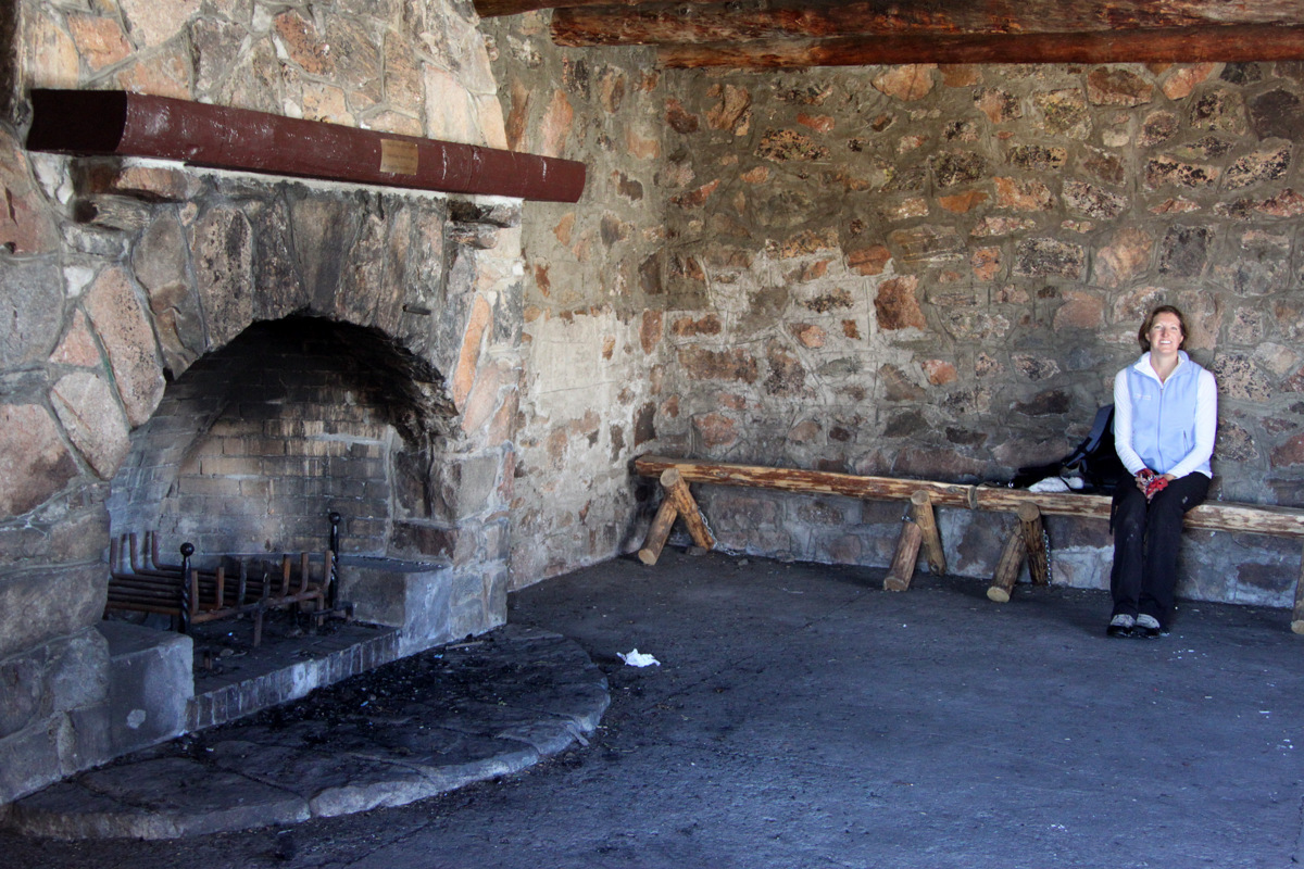
Great stone fireplace inside the hut
We were kind of wishing we could spend the night – the hut is really cool, and much better maintained than any of the abandoned mining huts we have visited. It was fun to see how much snow had accumulated in just a week both on Holy Cross and looking out into the Gores.
Brandon and I with Mt. of the Holy Cross and its Cross Couloir in the background
We descended the Notch Mountain Trail back to the Fall Creek Trail. I read that there are 36 switchbacks along this route, but it felt like much more 🙂 Both ways of climbing Notch Mountain were really fun. The first climb up to the shelter was a great day with friends and dogs, and doing the loop was a nice way to add in some rock scrambling.
There are generally considered four great Colorado 14er traverses, i.e. ridge traverses between two 14,000’+ summits in Colorado. Now, there are many ridges connecting numerous 14ers in our state, but most of them are simple hikes or scrambles. What makes there be four greatones is the exposure of the ridge, at least 4th class scrambling, sometimes length of ridge and time required to complete the ridge, and especially the commitment level. The other three great Colorado 14er traverses are the Mt. Wilson – El Diente Peak Traverse, the Crestone Traverse linking Crestone Peak to Crestone Needle, and the Bells Traverse linking South Maroon Peak to North Maroon Peak. Having completed the Crestone Traverse earlier this summer on my 2nd try, that left me with only the biggest and baddest of all the great 14er traverses: the Little Bear Peak to Blanca Peak Traverse. Still not being able to really rock climb due to my ongoing forearm tendonitis, its been a summer of scrambling high on our beloved peaks and to do some of the traverses that have been on my list for some time. I had completed the Bells Traverse three times in the past and the Mt. Wilson – El Diente Peak Traverse twice, but now having traversed the ridge from Little Bear Peak to Blanca Peak I can truly say it lived up to its reputation and puts the other ridges to shame in just about every aspect: length, exposure, 4th class/low 5th class scrambling, and especially commitment. There is truly no way off the ridge if something should happen, i.e. storms, lightning, fatigue, etc. You either complete it or turn around. At the low point of the ridge, one could scramble down into the Blanca Basin in case of emergency (as in to escape lightning), but this puts the climber in the wrong basin from Lake Como. The Little Bear – Blanca Traverse is truly one of my favorites to date and it was just so much fun and continually challenging and exciting. My good friend J Weingast and I have done a lot of ridge traverses in Colorado and I think we are both in agreement that this one was one of our favorites. This traverse would be the last of the four great Colorado 14er traverses for J, Derek Drechsel, & myself. Also, Derek & I would have done all the traverses together, which was pretty special.
Rewind about 7 1/2 years to a late October 2006 attempt at these peaks for our first visit to the Blanca Group. We didn’t know what we were in for and my buddy Lee Hoffman’s jeep almost took a nose dive between Jaws 1 & 2 into a creek bed. Fortunately, the Alamosa 4WD club came to our rescue the next day after we camped out on the road. That morning, several of us and Rainier attempted at least one of these peaks, but witha decent amount of snow and no snowshoes/skis, we didn’t get very far past Blue Lakes in the Lake Como basin. So, not much (if anything) went our way that first attempt at these peaks. Live and learn.
Now, rewinding to Memorial Day Weekend 2007 before J, Kristine, & I left for Denali puts us back in this Blanca Group camped at Lake Como for two nights with all our good climbing buddies and furry K9 friends. It was the first time any of us had been to these three peaks (Little Bear Peak, Blanca Peak, & Ellingwood Point) and we had a truly incredible weekend climbing them snow-covered with our ice axes and crampons. Rainier was with us as well and was able to summit both Blanca & Ellingwood. Not only did she summit these peaks, she ran laps around the rest of us. I guess we were all in our youth back in those days. The climb up the standard “Hourglass Couloir” on Little Bear was exciting and made for a great, steep snow climb. Its a very dangerous place to be in summer or dry conditions due to rockfall and this is precisely what makes Little Bear to be considered the most dangerous 14er by its easiest route. So, we all vowed to never climb the “Hourglass” without snow. A little blast from the past:
Rainier & I on the summit of Blanca Peak in May 2007 with the connecting ridge to Little Bear behind us
Rainier & I looking off at Ellingwood Point & the northern Sangres from the summit of Blanca Peak. This is one of my favorite photos
Our Denali team (J, Kristine, me) on the summit of Blanca Peak
Kristine & I on the summit of Ellingwood Point in May 2007 with the northwest face of Little Bear Peak behind
The “sun’s out guns out” pose by the boys on Ellingwood Point over Memorial Day Weekend 2007
Kristine leading the charge up the “Hourglass Couloir” on Little Bear Peak in May 2007
Kristine & I on the summit of Little Bear Peak In late May 2007
Unfortunately, our good friend Reid Jennings was unable to make the climb and so that left Mike Santoro, J, & I driving down in my Tahoe from Vail and meeting Derek Drechsel at the lower Lake Como trailhead on his way back to Denver from Albuquerque for work around dark on Friday night.
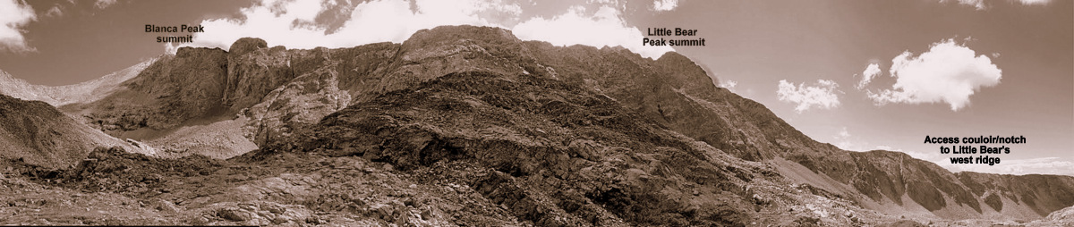
Little Bear Peak from the 8,000′ level at the start of the Lake Como Road. The start of this rough 4WD road can be seen on the left of this picture
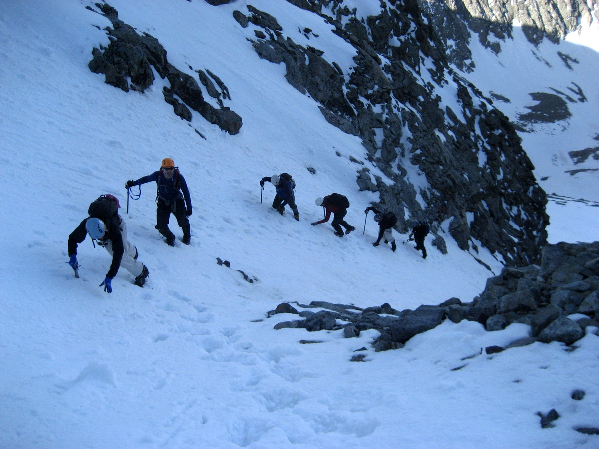
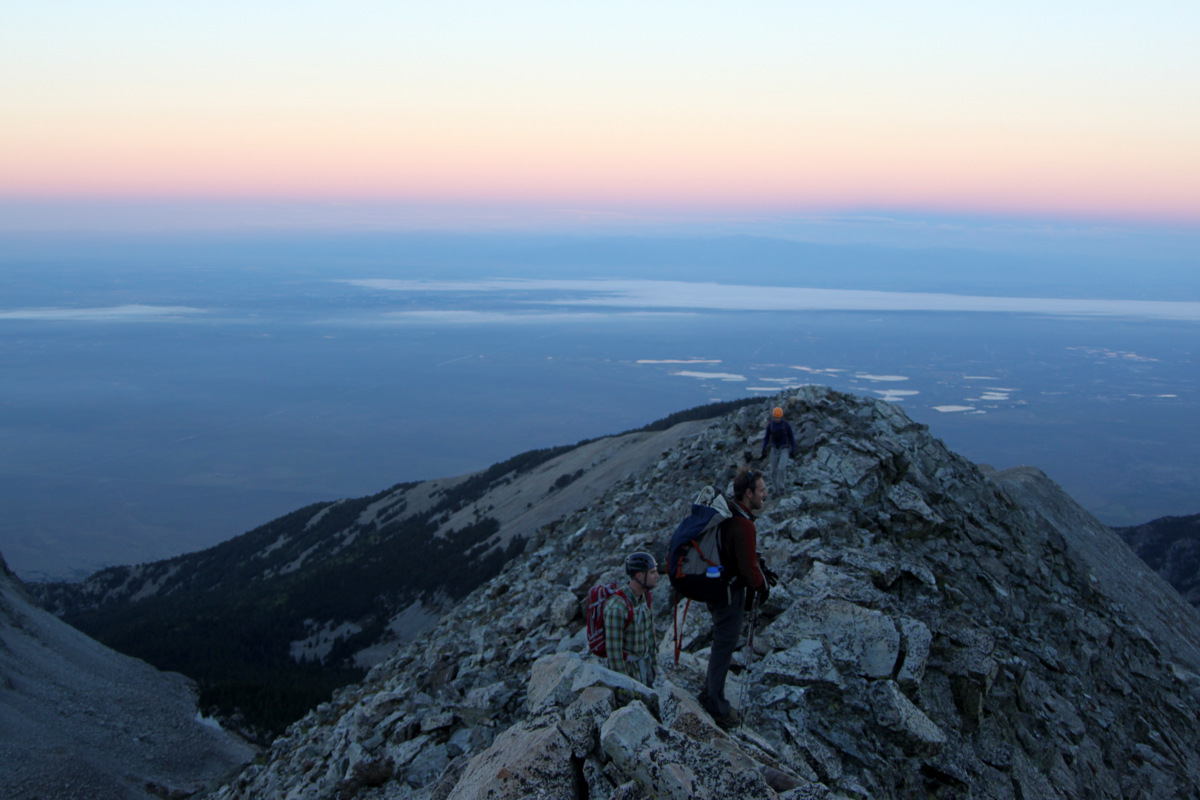
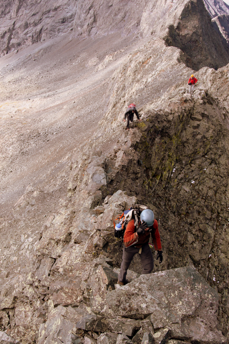
We all piled into my Tahoe with all the gear and started for my truck’s third time up one of the roughest 4WD roads in Colorado though I always parked at around the 10,000′ level before the really nasty 4WD sections dubbed Jaws 1, 2, & 3. The sections over Jaws 1,2, & 3 shouldn’t even be in the 4WD category – one needs a certified rock crawler for these sections. So, after driving around 2.5 miles up the road very slowly and over some tough sections in the dark, we reached where I always remembered parking and set up camp. Mike & I slept in the back of my truck while J & Derek shared the tent.The alarm went off at 3:30am and after some coffee & oatmeal we were on the road by 4:30am. The moon was bright as it was almost a full moon. After what seems like a few weeks of torrential monsoonal flow, we would finally get our bluebird Fall day. We hiked by headlamp the 2.5 miles up to Lake Como at 11,750′ in about an hour marveling at the Jaws 1, 2, & 3 sections and how these rock crawlers are able to navigate such serious terrain. Other climbers who had camped at Lake Como were stirring and headlamps were visible. We continued up the Lake Como road to above the lake turning south across a creek and made our way through the forests to the base of the northern access couloir to Little Bear’s west ridge. The last time we climbed this couloir was in snow, which was definitely easier than the scree-filled 35 degree couloir presenting itself to us today. However, we made really good time to the top of this couloir and the start of the west ridge.
Early morning on the start of Little Bear’s west ridge direct
Heading towards the meat & potatoes of the west ridge
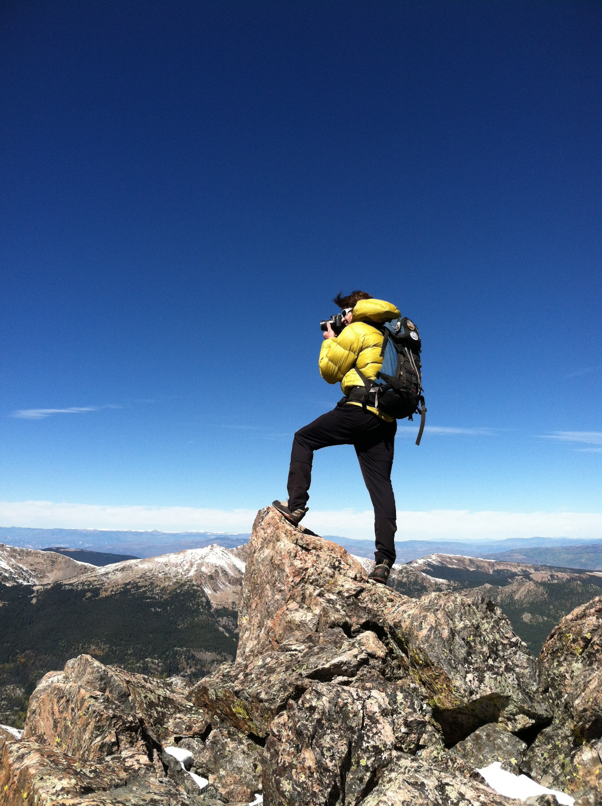
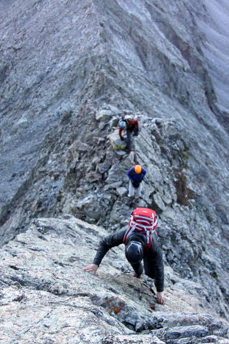
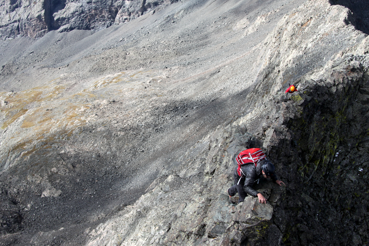
I had been wanting to try the rarely climbed west ridge direct up Little Bear after seeing Alan Arnette’s blog entry & video on his team’s ascent up the route earlier this summer. It just looked so good and I figured would be a good warm-up for the traverse to Blanca. And, the west ridge direct surely didn’t disappoint. Great 4th class/easy 5th scrambling on a super exposed arete hit us right off the bat above the “Baby Thunder” couloir.
J getting into the scrambling of the west ridge direct
Mike on an exposed 4th class arete
A really fun slab portion of the arete. There was a piece of webbing slung around a rock at the top of this slab
J on the upper west ridge direct
The terrain mellowed out to class 3 about halfway up the ridge, but then more 4th class fun was to be had. J & I made a few seriously exposed low 5th class moves out over the northwest face to avoid a overhang on the ridge proper, moves which could have been avoided by traversing south as Mike & Derek did, but it was fun and exciting all the same.
Me displaying this short low 5th class yet exposed section
Almost to the summit of Little Bear Peak via the west ridge direct
Me on an airy perch
Northern Sangre de Cristos with Crestone Peak & Crestone Needle visible above the Great Sand Dunes
The boys coming up to Little Bear’s summit with the beautiful San Luis Valley far below
We all reached Little Bear’s summit by about 8am for a time of about 3 1/2 hrs from the truck.
J on the summit of Little Bear for the 2nd time
Little Bear Peak summit (14,037′)
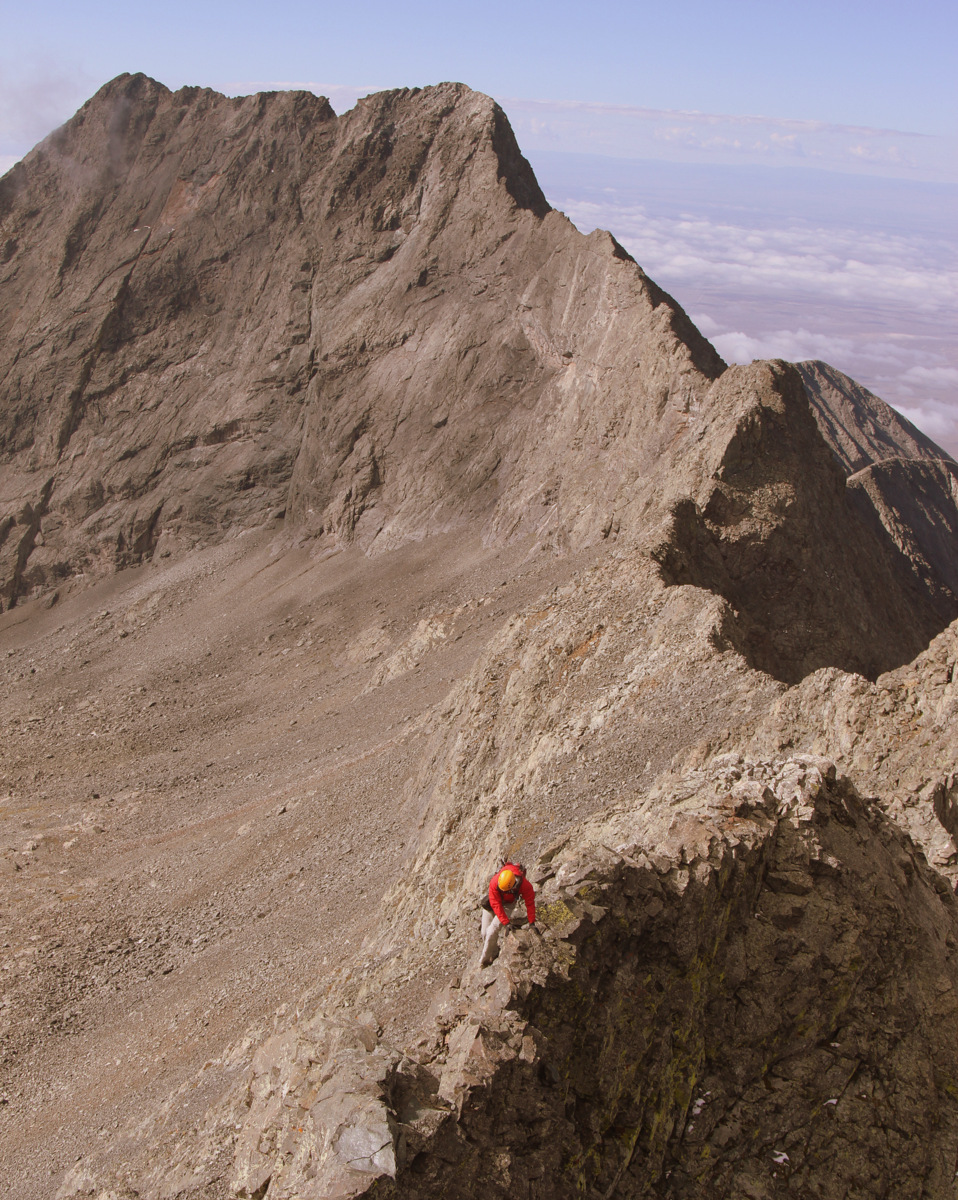
The west ridge direct definitely goes down as one of my all-time favorite routes up a 14er. Highly recommended for folks who enjoy that sort of thing. I would think the ridge is even downclimable with maybe a rappel or two in there if used as a descent route. It was a gorgeous morning though a bit windy. The stiff breeze continued with us the entire traverse to Blanca so we accepted it as our climbing companion. We made our way down the northeast ridge of Little Bear from the summit to start the traverse around 8:30am. The downclimb off of Little Bear’s summit to the ridge proper is one of the traverse’s cruxes because of the exposed 4th class downclimbing.
Mike & I heading down Little Bear’s northeast ridge to start the traverse
Mike & Derek on the downclimb off Little Bear to start the traverse to Blanca
The boys downclimbing off Little Bear’s northeast ridge
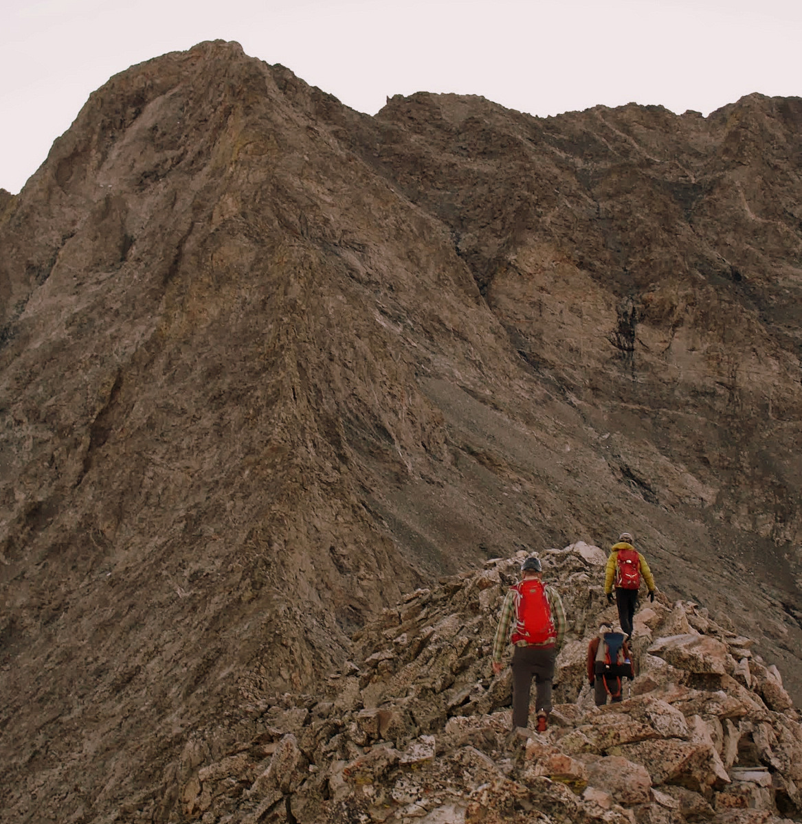
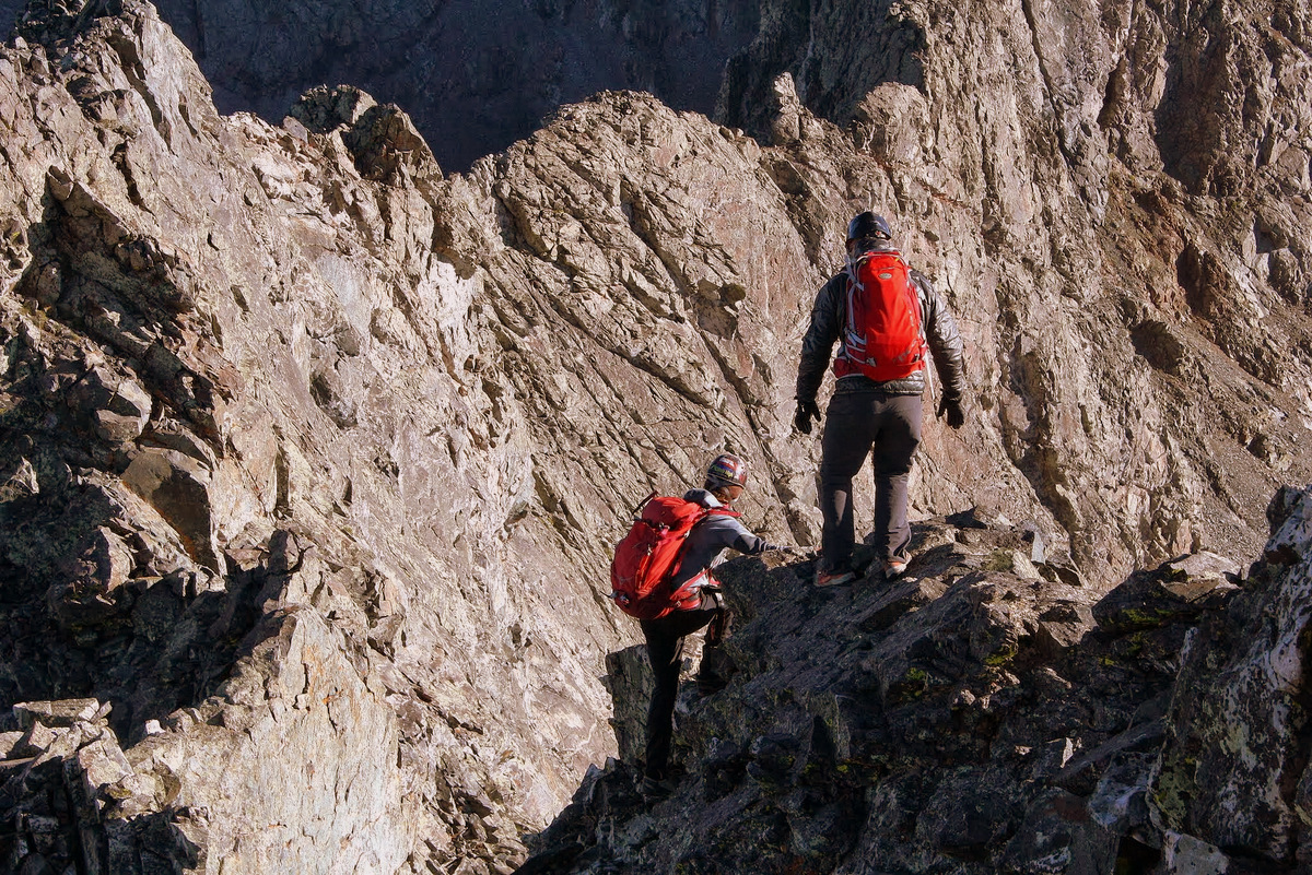
We made it down to a small notch and continued on to the northeast up and over several towers and knife-edges on great rock all making for an incredible traverse. The sustained “airiness” and exposure was so exciting. We saw two climbers ascending Little Bear’s northwest face below us and we made sure not to kick anything down on them from the ridge proper. These northwest face climbers turned out to be Tyler, aka MountainMedic, from 14ers.com and a friend.
Climbers below us ascending the northwest face route of Little Bear
Derek on an airy move with Little Bear Peak behind
The climbing never really exceeded low 5th class, but it felt like more in places because of the exposure.
J & Mike on the traverse
Derek heading down to another notch in the ridge
Me on a knife-edge of sorts with Blanca Peak in the distance
A climber can be seen on the summit of Little Bear Peak behind J & Derek
Mike and some air below him
Traversing around to the north of a small tower – I think this is the tower dubbed “Captain Bivwacko” tower, but who knows. There are so many towers
J & I had to climb it though
J downclimbing a knife-edge ridge of another tower
The knife-egde we downclimbed
I believe this was the low point of the traverse – around 13,600′
A nifty and fun little chimney
Me having some fun
The first half of the traverse definitely was harder and more airy than the second half of the traverse up to Blanca though the 750′ vertical gain up and over three major towers and an exposed “catwalk” to Blanca from the traverse’s low point was a whole different kind of challenge. The middle section of the ridge was essentially class 2-3 talus walking and we made good time on this part until the 1st tower up to Blanca reared itself up in earnest.
Mike on the “walking” portion halfway across the ridge
Derek with a tower on the right and Little Bear Peak behind him to the left with climbers on its summit
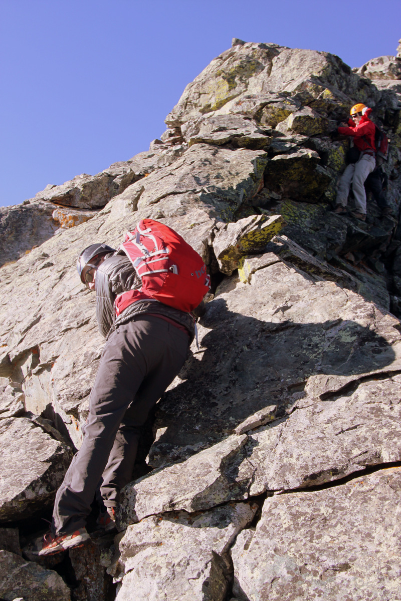
Typically, folks traverse to the right (south) of the 1st tower, but J & I decided to find a way up and over as we always love the “ridge proper” method. We found a weakness in the tower at the right up a dihedral and to a left-ascending traverse. It was about 100′ in total of low-mid 5th class climbing.
Our line up the 1st tower went up the obvious dihedral right of center and then back left to the summit
J stoked to have climbed the 1st tower head on
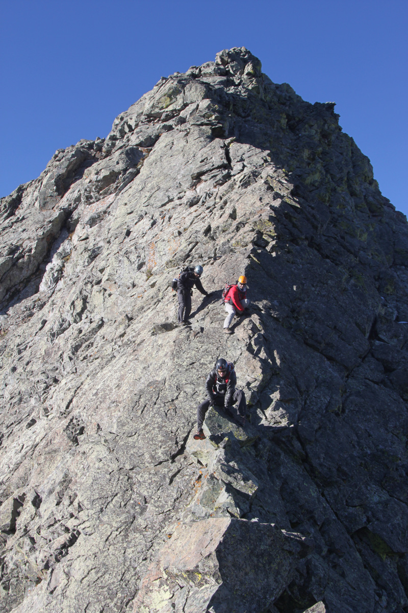
We met Derek & Mike around at the base of the notch after the 1st tower’s summit ridge. It was then a short scramble up to the infamous “catwalk” portion: a very narrow (1-2 ft) wide ledge system with serious exposure on both sides. It made for great pictures.
Climbing along the ridge to the “catwalk” and the 2nd tower
Along the “catwalk”
Mike & Derek traversing the “catwalk”
Derek on the “catwalk” with Little Bear getting further & further away in the distance
After a short scramble up to the summit ridge of the 2nd tower, it was a short downclimb to the notch and the base of the 3rd tower. The ascent up the 3rd tower was easy enough considering what we had already traversed and we were soon on top of Blanca Peak around 10:40am for a traverse time of just over 2 hrs.
Derek on the summit ridge of the 3rd tower with the San Luis Valley over 7,000′ below
The Little Bear-Blanca traverse from Blanca’s summit
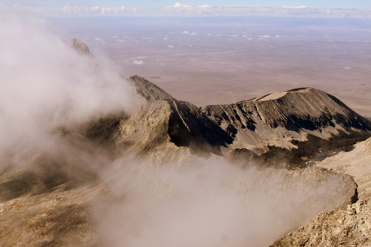
Looking north from Blanca’s summit
Blanca Peak summit (14,345′)
Its a bit lengthy, but here is a video of the boys reaching Blanca’s summit after the traverse:
I really felt great to have completed this traverse and we were all very pleased with how well it went. I would definitely come back and do this traverse again despite the effort in getting here – it was that good. The wind was still whipping pretty good and it was getting cold. We departed the summit around 11:15am or so and descended Blanca’s standard northwest ridge. I had thoughts of continuing onto Ellingwood Point with J, but my throat was really starting to get sore from the stiff wind we had been enduring for hours, I believe. I thought it best to get down and save my throat, though we definitely had the energy to continue on. Another time. It was a bit disappointing though because besides Ellingwood Point the only other 14er I need to have climbed all the Colorado 14ers twice is my original finisher, San Luis Peak. C’est la vie. Nevertheless, I’m glad we continued down to get out of the wind and we still had a long descent back to my truck. The hike down to Lake Como was beautiful and we stopped several times to refill water and take in our surroundings. Once back at Lake Como we chatted with Tyler and his friend who had descended down the “Hourglass Couloir” and were packing up camp. It was good to meet those guys. We got some good looks at the ridge we had completed as well the entire hike out.
Little Bear Peak from Lake Como. The west ridge direct follows the right skyline in the foreground and then the traverse to Blanca follows the left skyline
Derek’s panorama of the entire 3.5 mile ridge line we traversed from the notch in Little Bear’s west ridge (far right) to Blanca’s summit (far left)
We finally reached the truck around 2:30pm for a 10 hour day including many stops and rests on the way down. It was a great day out in the highcountry with my good friends. We feel lucky to have had such a nice day for a ridge like this. We packed up the truck and it took an hour or more to drive the few miles down the extremely rough (for a stock 4WD) Lake Como Road. After dropping Derek off at his car, we all headed north for some awesome burgers at the Steel Horse Grill in Villa Grove. Derek then headed back to Denver while Mike, J, & I found a cool car camping spot up the Marshall Pass Road off Poncha Pass and had a nice campfire under the stars. I helped them shuttle cars the next morning so they could ride the famous Monarch Crest mountain biking trail and then I headed back in my truck to Vail. My truck sure has been through the ringer with over a decade’s worth of 14er trailheads (many more than once), but the Lake Como Road continually proves to be the roughest ride we’ve been on together. The Little Bear – Blanca ridge was certainly all that it was advertised to be. I hope to go back there with Kristine someday to try it with her.


 Follow