Having always heard of this somewhat hidden 13er near Breckenridge called Mt. Guyot, I wanted to pay it a visit and thought it would make a fairly nice winter-ish climb. Guyot lies behind (to the east of) the larger and much more massive Bald Mountain (13,684′), which obscures Guyot from Breckenridge and the Tenmile Range peaks. Rainier & I had climbed Bald Mountain via its long north ridge with friends back in February of 2008.

A younger Rainier and a younger me on Bald Mountain’s summit (13,684′) with Mt. Guyot behind
Mike Santoro & Reid Jennings joined Rainier, Kona, & I this past weekend for an attempt on Guyot’s northwest ridge. On our ascent that day, we walked the French Creek Road for a mile and a half until we veered southeast into the Little French Creek drainage to make our way up to the northwest ridge. While Mike was still skinning up to the northwest ridge in the trees from the Little French Creek Drainage, Reid, the dogs, & I were at a small notch on the northwest ridge proper right at treeline when a crew of local skiers set off what turned out to be a sizable avalanche on the northeast facing slopes. We were on the ridge above the avalanche and Mike was a few hundred yards a way in the trees, so we were all safe. Fortunately, the avalanche did not occur directly below or at the skier’s location. Instead a crack propagated 20 yards to his right and the slab avalanche ensued and ran about 500′ down to the drainage. All of the skiers were ok and no one was caught in the avalanche. Reid, the dogs, & I continued up the northwest ridge for 20 minutes or so, but due to extremely low visibility (though the winds were very low and temperatures fairly warm) we turned around on the northwest ridge at about 12,200′.
Fast forward just two days and I find myself crashing Kristine and Lauren’s peak-bagging girl party. I even convinced them to head back to Guyot, which was very nice of them to do. The weather forecast looked much clearer though much colder and more windy (forecast called for 30+mph winds with a wind chill temp of around -8 degrees at 12,400′). We made our way to the French Creek Trailhead and started hiking down the road at about 9:15am. Guyot was in the clouds which was a little concerning and it was pretty darn cold out. However, the sun came out a bit and after we overshot the turn off into the Little French Creek drainage (my fault), we made our way up through the drainage and at the base of the avalanche slide path that occurred 2 days before.

Skier-triggered avalanche from 2 days before on the northeast facing slopes of Guyot’s northwest ridge
Its always good to check out these avalanche paths to gain some perspective on avalanches and how they are able to propagate so far even on 30 degree slopes. We then made our way up to the northwest ridge proper and to treeline where the wind picked up substantially.
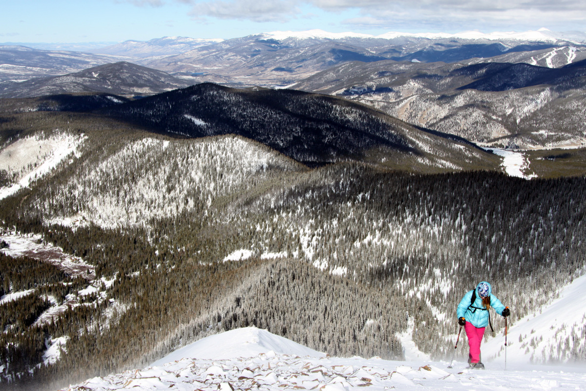
Kristine at treeline on the northwest ridge with the Tenmile Range behind in the distance
Rainie on the northwest ridge

Kristine & Lauren on the lower portion of Guyot’s northwest ridge
We made it up to the small cairn where Reid, the dogs, and I had turned around 2 days prior and then climbed the steepening ridge up to a large plateau at 12,400′. The wind was really kicking on this plateau.
Lauren coming up to the 12,400′ plateau on Guyot’s northwest ridge
We left our snowshoes here anchored down by rocks and made our way to the upper northwest ridge for the final 1,000′ climb to the summit ridge.

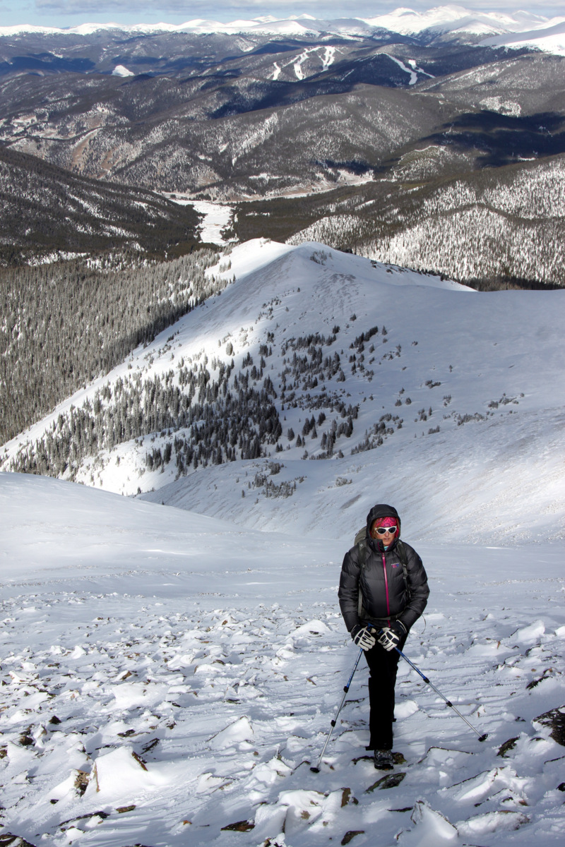
The remaining 1,000′ up Guyot’s northwest ridge
It was pretty tough going with the wind and cold on tough terrain (loose slabby rocks covered by about a foot of powder snow in most places). Rainier is such a trooper especially for being almost 11 years old. She is a determined lady and just keeps plugging away right behind me the entire way.
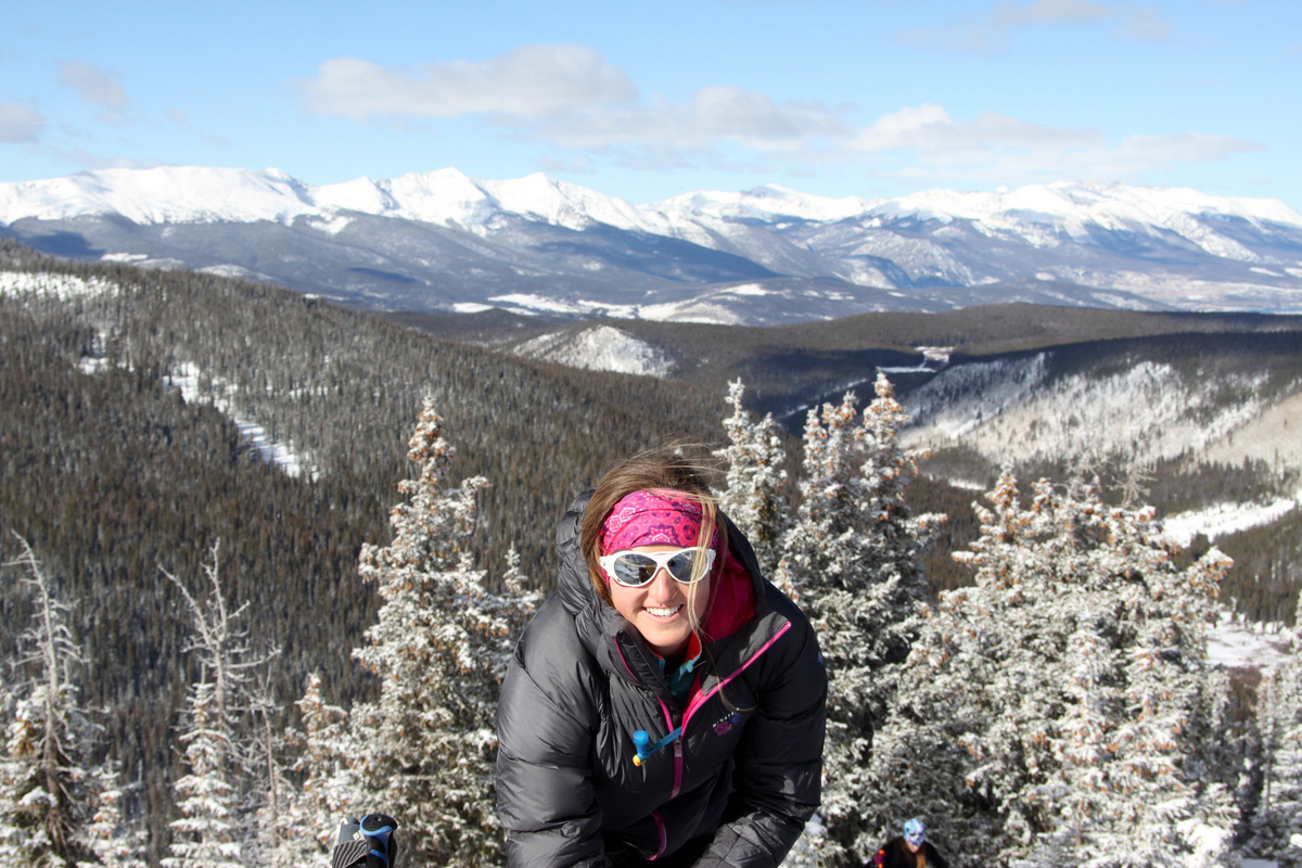
Kristine on the upper northwest ridge
Once we hit the summit ridge itself, the wind and cold were really intense. Much more intense than anything I remember as of recent. Nevertheless, we trenched away on the summit ridge and made the summit. It was extremely cold and windy on the summit and we took a few pics and only stayed for 10 minutes or so.

Breckenridge & the Tenmile Range from Guyot’s summit
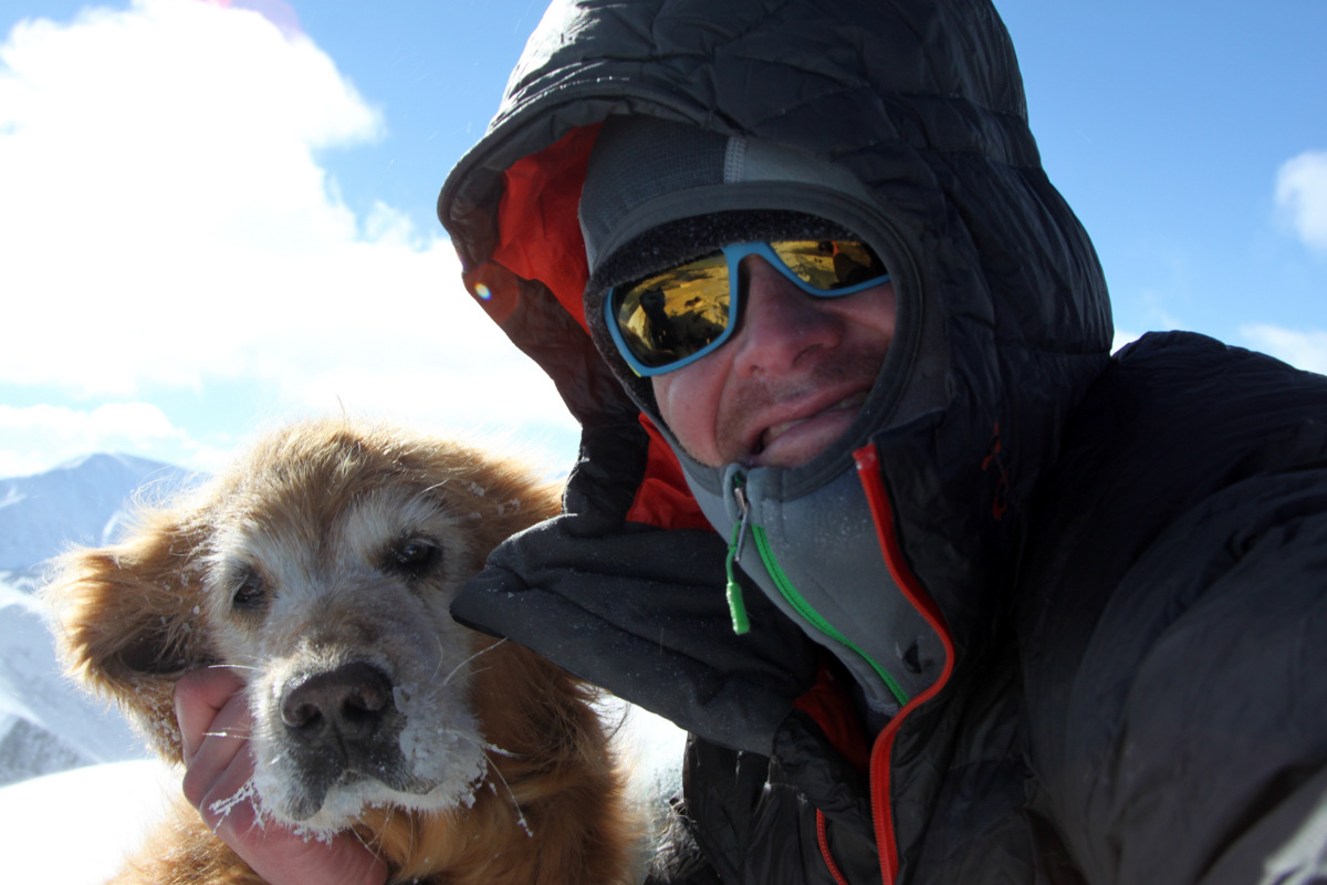
Rainie & I on Mt. Guyot’s summit (13,370′). It was extremely cold and windy on the summit ridge – well below zero with wind chill

Mt. Guyot USGS summit marker

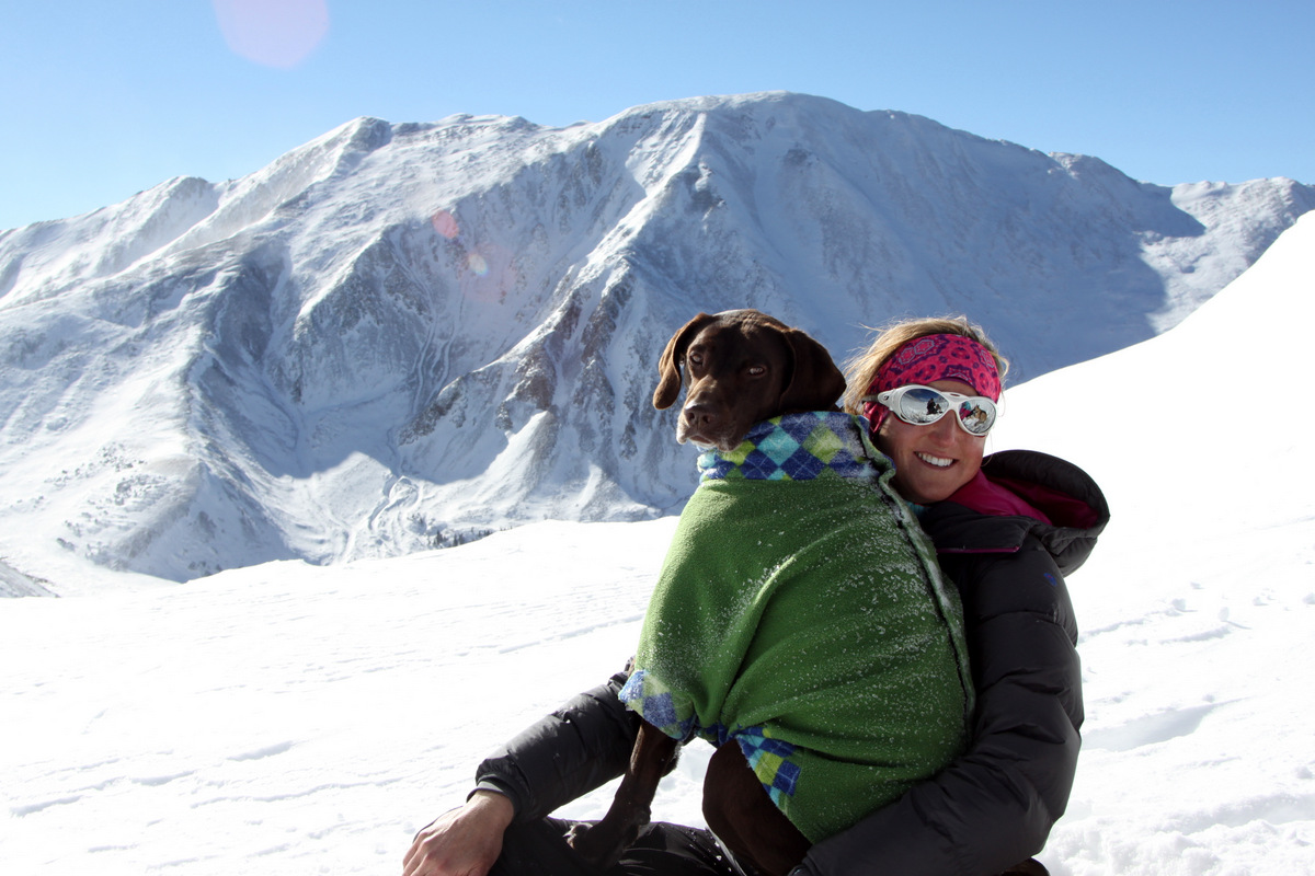
Kristine & Kona on Guyot’s summit
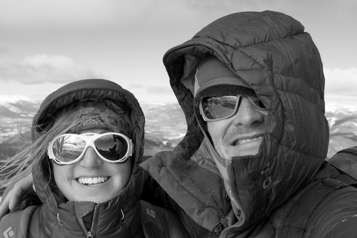
Kristine & I on Guyot’s summit – good Antarctica training
Lauren had turned around at about 12,800′ and made a good decision. She just wasn’t feeling it especially on the terrain and in such brutal wind and cold. Kristine, the dogs, and I quickly descended back to the 12,400′ plateau.

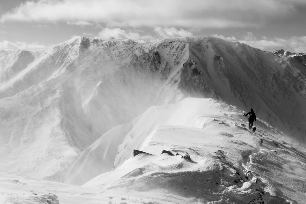
Looking back down Guyot’s northwest ridge and French Gulch from where we came
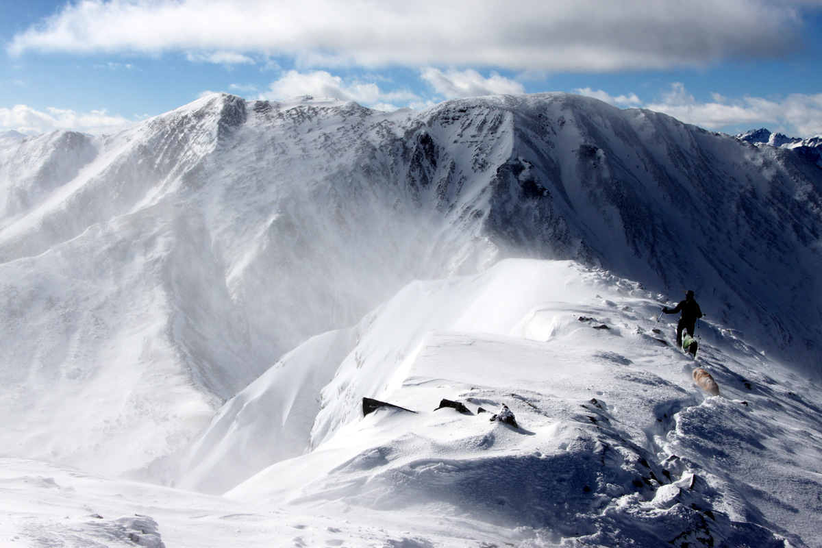
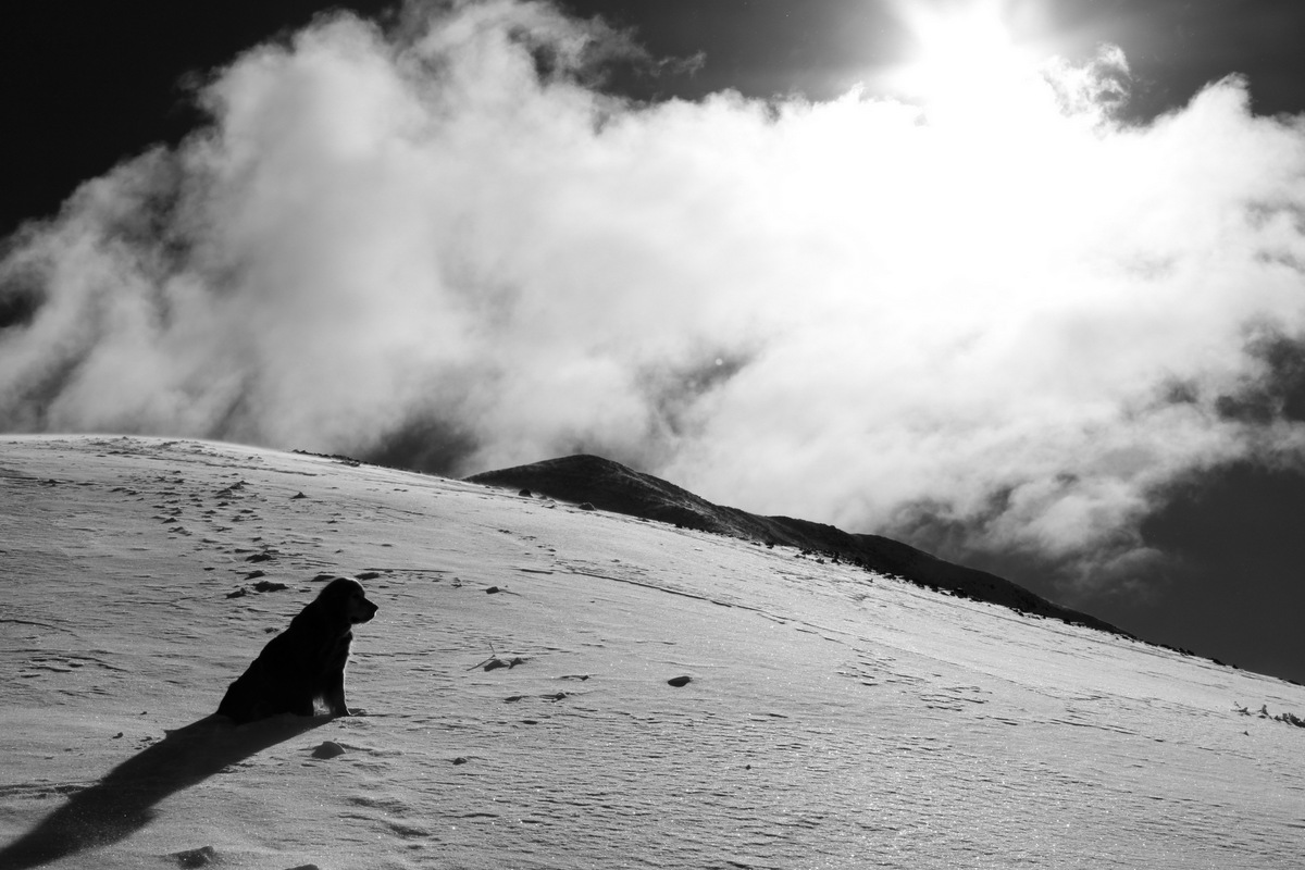
Kristine and the dogs descending the summit ridge with the wind ripping the snowy ridge to the south (left in picture)
I usually like looking at snowy plumes as a result of strong winds from a distance, but being in the middle of them is a different story
We soon enough met up with Lauren at the plateau and had a snack in the relative warmth of the lower altitude.
Kristine & Kona back in the warmth of the 12,400′ plateau with Bald Mountain behind (13,684′)
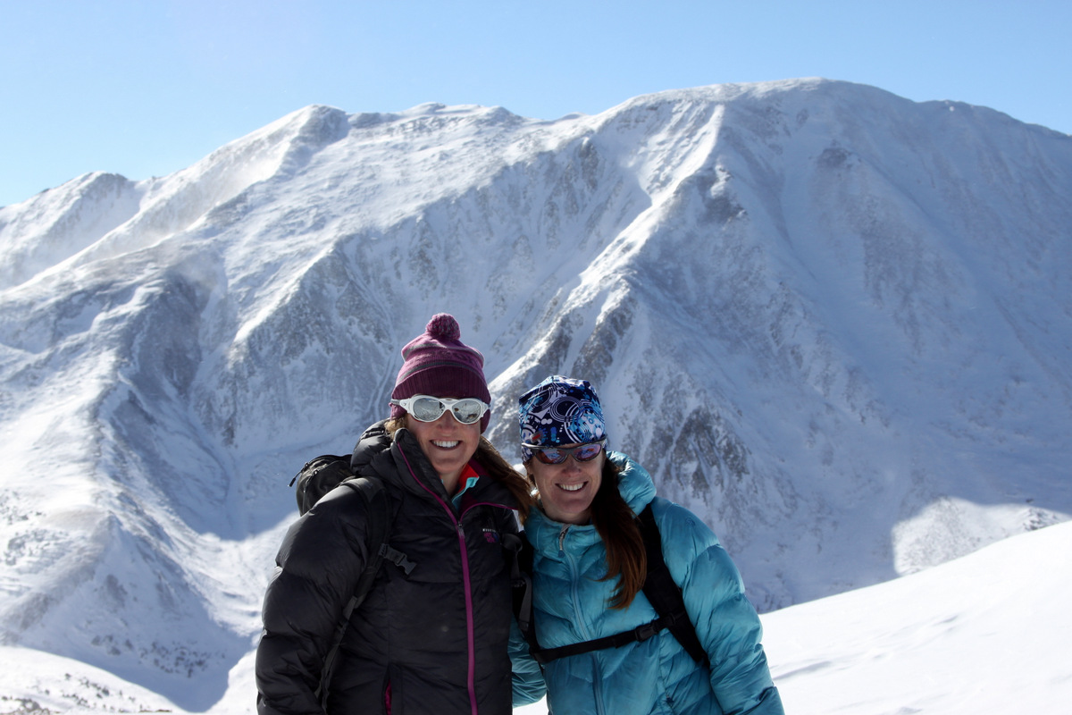
Kristine & Lauren
We then all made our way back down our ascent route and reached my truck at around 2:45pm for a 7.5 mile roundtrip day in about 5 1/2 hours with 3,100′ of elevation gain. It was a very fun outing and we all enjoyed being out in the elements. Kona may beg to differ there 🙂

Mt. Guyot from the north on the French Creek Road during our hike out with the northwest ridge in profile. The plumes of snow can be seen on the summit ridge as a result of the strong winds
 Follow


