Mt. Katahdin
On the to-do list for some time now for the Chalks & Oelbergers has been to climb the highest peak in Maine together, Mt. Katahdin. At 5,267′, Katahdin dominates the surrounding terrain and is actually the northern terminus of the 2,000+ mile Appalachian Trail (AT). Thanks to Ken Oelberger and his fantastic expedition organizing skills in securing parking passes and doing the route research. As Ken & Dianne Oelberger have retired to their beautiful home on the ocean in Maine and thus becoming true “Mainers”, it was only fitting that they climb the highest peak in Maine. Kristine flew back to Maine on a Wednesday while I did so the following Friday. We all went sailing that Saturday, which was so much fun. Ken even let me handle the “rutter” of his pride & joy sailboat, which Thomas & I think he should name. Every sailboat needs a good name. I guess he trusted me somewhat even though I had absolutely zero sailing knowledge before I stepped aboard his boat. After some good quality time with all the Oelbergers (including Kristine’s sister, Carrie, her husband, Thomas, and 2 year old son, Kai), Ken, Dianne, Kristine, & myself packed up at the Oelberger residence on a Sunday and headed out for northern Maine and Mt. Katahdin. We took two cars as Kristine & I would continue on into Canada and Quebec City for a few days to visit our great friend, Rob Casserley, and his wife, Marie-Kristelle Ross. Rob & Marie-Kristelle (MK) met us at the Big Moose Inn in the small town of Millinocket at the base of Katahdin on Sunday evening. Rob & MK took the road less traveled from Highway 201, which comes down due south from Quebec City into Maine, on about 50 miles of dirt roads, but in the end they found their way to Millinocket. It was so fantastic to catch up with Rob & MK. It had been awhile since we had all seen each other. Ken & Dianne stayed at the Big Moose Inn while the rest of us camped at the campground just next door. We had a big campfire and cooked our homemade Kristine burritos on the fire and had a good ole evening.
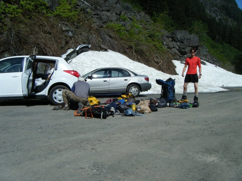
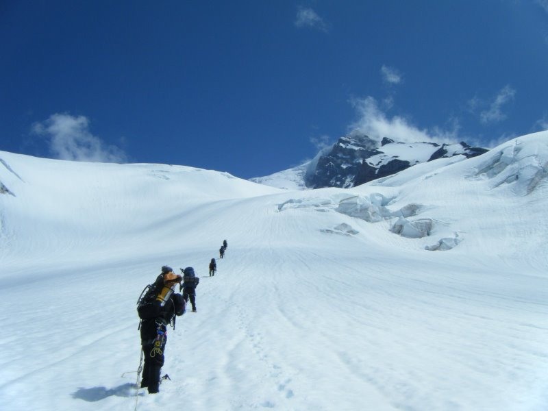
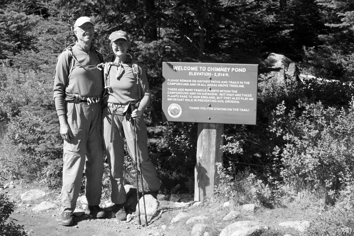
The alarm sounded at 5am and we met Ken & Dianne at the Big Moose around 6am. It was a dreary day and started to rain a bit on the way into the Baxter State Park gate entrance and the Roaring Brook trailhead. The rain and cold definitely didn’t inspire a lot of confidence. Nonetheless, we headed out up the trail in the dismal rain and fog. We had an inkling that the skies could clear once we got to treeline due to the 40% chance of rain today for the area. However, once we reached Chimney Pond, 3.3 miles up the trail, the wind and rain picked up and the visibility was next to nothing.

Ken, Dianne, & MK posing with Katahdin in the clouds
There were lots of folks on the trail standing around at the shelter at Chimney Pond snacking and trying to get out of the rain and cold. We all decided to turn around and head down and to try again the next day (Tuesday) which promised a much better weather forecast. Now the trails in the northeast are significantly different than the trails out here in Colorado. They are not just your smooth dirt trails. They comprise boulders and rocks at about every step and are tough on the legs and joints. Some sections are so “bouldery” that I would be hesitant at all to trail run these trails. The slick nature of these boulders with the rain really added to the difficulty and considering what we climbed the next day beyond Chimney Pond, I am so glad we turned around this first day.
Rob, MK, & Kristine in good spirits on the hike out to the car despite the rain and cold
We made it back to the car around lunchtime and headed into Millinocket for come coffee and meandering around. We went to a cool little upstairs cafe for a few hours and ran into some folks who had just completed a thruhike of the AT in a little under 5 months. We were all very impressed by the thruhike achievement and when you think about it, it truly is so amazing. I have heard most people who set out to thruhike usually end up dropping out for one reason or another. Even Rob having 8 Everest summits under his belt and numerous other 8000ers and mountains around the world seemed very impressed. Rob, MK, Kristine, & I were later talking about how cool it would be to attempt an AT thruhike someday, but we wondered if we would get bored or if our joints would hold up for that. Who knows. I guess we’d never know until we tried.
We then headed back to the Big Moose Inn, watched Rob slither into his wetsuit and swim 2 miles in the lake next door in prepartrion for his upcoming ironman triathalon in Canada, and then had a nice dinner at the tavern adjacent the Inn.
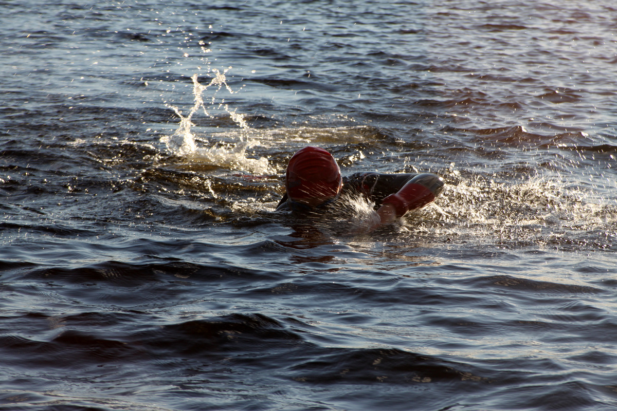
The man, the myth, the legend – Rob Casserley looking good for his upcoming triathalon
MK & Kristine on the dock watching Rob swim
Ken & Dianne retired to their cozy room at the Inn while the kids walked back over to the campsite to have a brief campfire with some crazy Canadian mega marshmellow roasting before retiring to our respective tents. 5am came way to early once again and we were quick to get on the road back up to the trailhead for round 2. Despite our strong percolated coffee, I think MK and I were definitely falling sleep in the back of Ken’s car on the way to the trailhead. We just couldn’t wake up. However, once we all got moving in the nice early morning weather, we all felt more energetic.
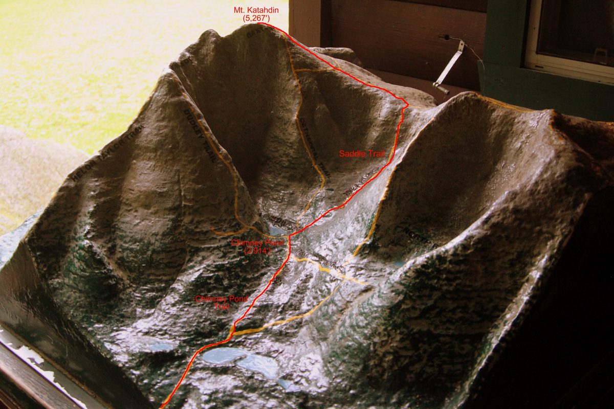
Mt. Katahdin model map showing the various routes from Chimney Pond. Our route up the Saddle Trail is shown in red
This day’s weather was a complete 180 from the previous day’s weather. Moderate temperatures and sun had replaced the miserable rain, cold, and wind. It was great.
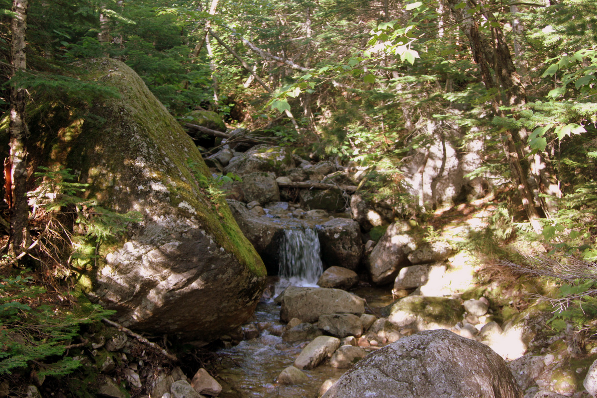
Gorgeous Maine streams and forests

On the trail to Chimney Pond

Newly constructed log bridges
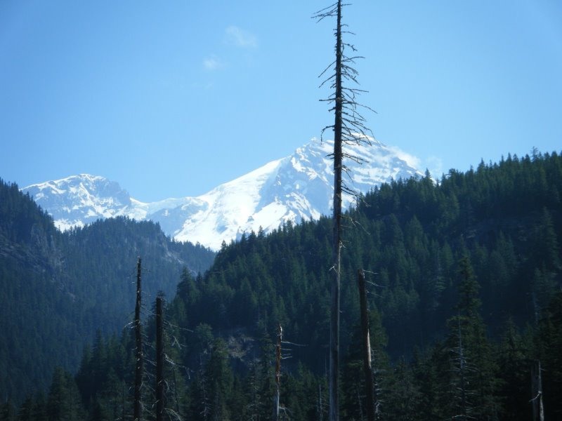
Mt. Katahdin from Chimney Pond was such a sight to see, one we did not have the previous day due to the socked in clouds and fog. For the east coast, Katahdin sure is a steep mountain on many sides. I’ve climbed many of the southern states highpoints (Mt. Mitchel in NC, Clingman’s Dome in TN, Brasstown Bald in GA, and Mt. Rogers in VA), but Katahdin really is so much more gnarly and thus exciting. I am sure there are some technical rock and ice routes up this peak. It would be fun to come back at some point and attempt a technical route on this awesome peak.

Baxter Peak on Mt. Katahdin from Chimney Pond
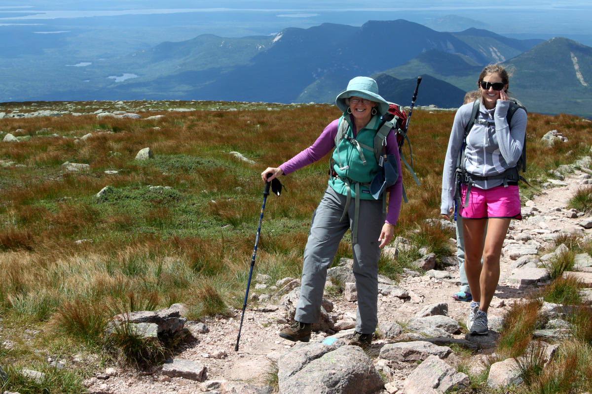
There were lots of folks on the trail this day due to the good weather and we noticed the hike to Chimney Pond was popular among families with kids. However, we saw several kids make it to the summit, which was great to witness.

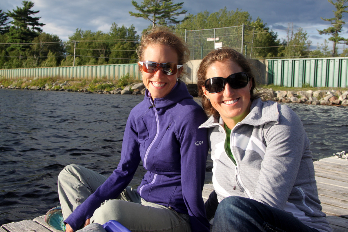
The young gals at Chimney Pond
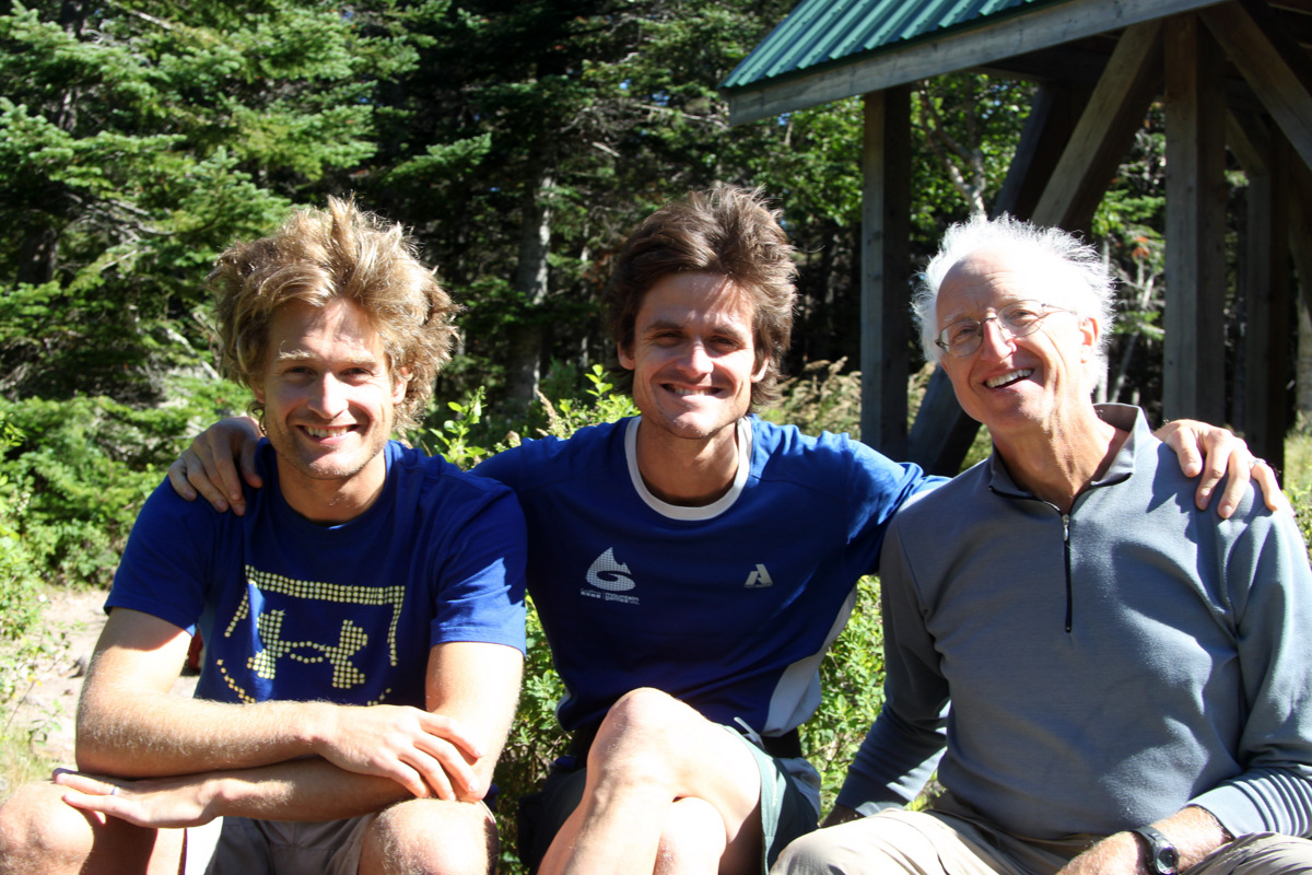
The boys at Chimney Pond
Ken & Dianne at Chimney Pond
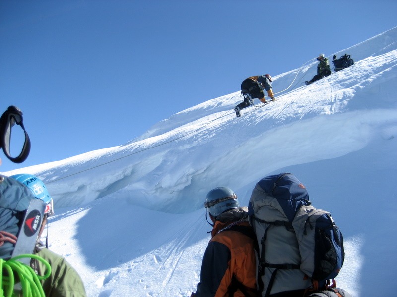
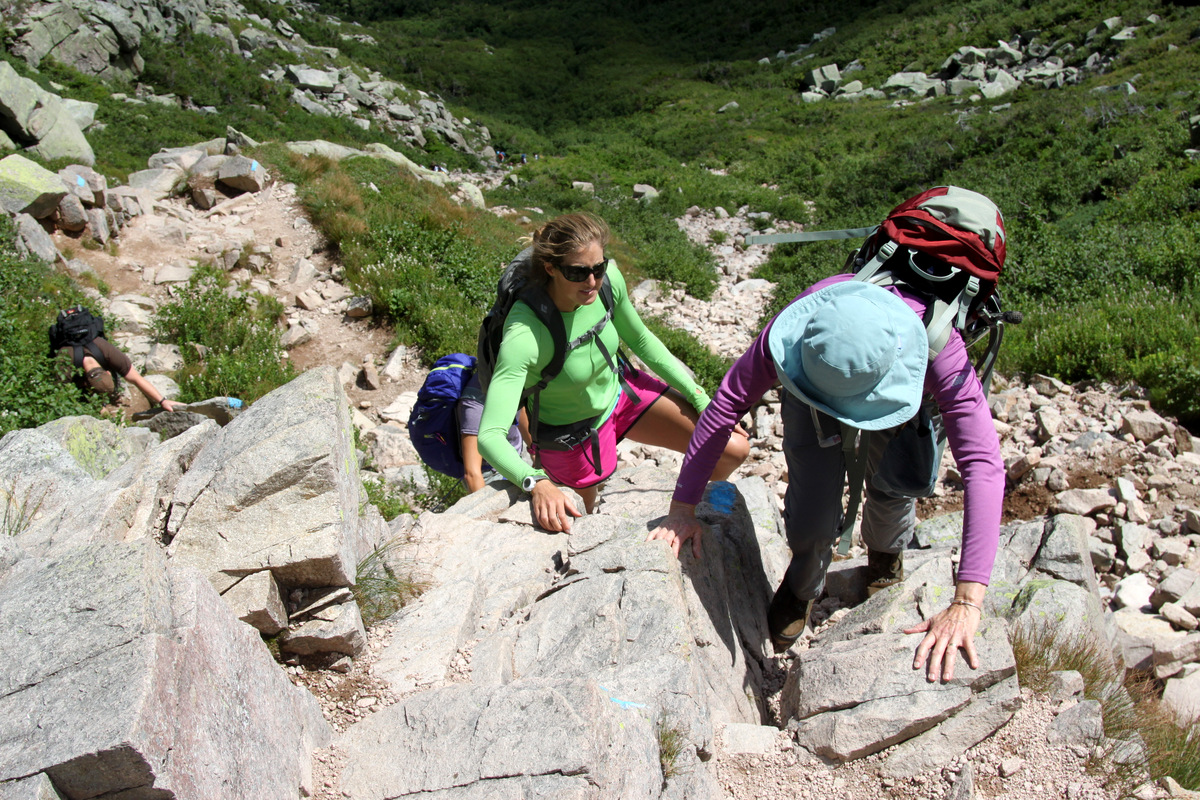
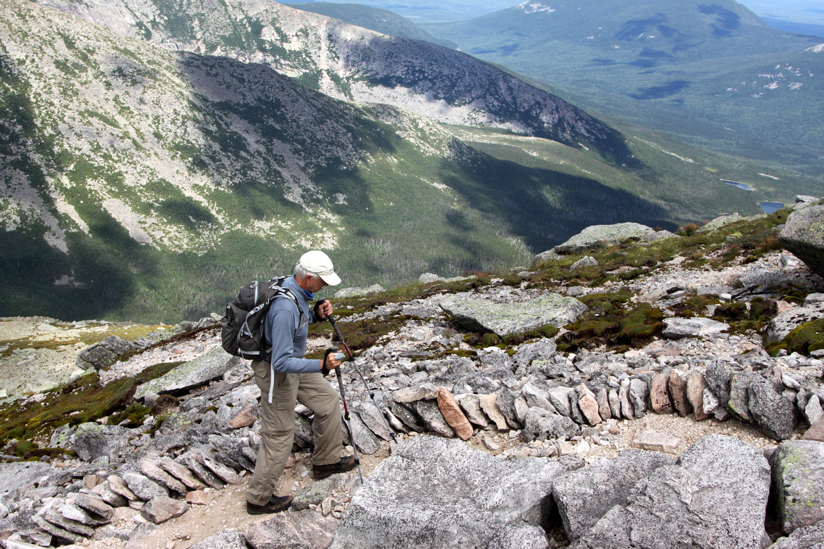
After a nice break at Chimney Pond, we signed the ranger’s register and continued on up the Saddle Trail which took us up to the ridge and saddle between Baxter Peak (the highpoint of Mt. Katahdin at 5,267′) and Hamlin Peak (4,751′) to the north. The trail was very very “bouldery” and there were small sections of class 3 scrambling, i.e. using your hands for upwards progress. Ken & Dianne did wonderful on this scrambling despite having never been accustomed to this type of “hiking” at all in their lives. No doubt Rob, MK, Kristine and I were all so very happy to be here with Ken & Dianne. It took awhile to get up to the saddle, but we all did and took a nice break.

Dianne & Ken taking a break on the steep Saddle Trail with a gorgeous backdrop
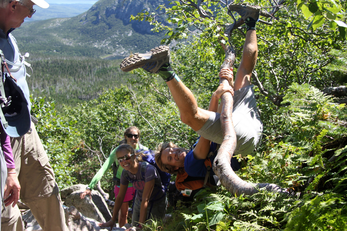
Rob “monkeying” around

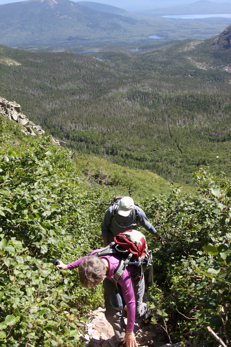
Beautiful Maine scenery from the Saddle Trail
Dianne working the steep Saddle Trail
Scenic shots abound
Dianne in good form on a class 3 section
The ladies

The gals finish off the scrambling to the saddle
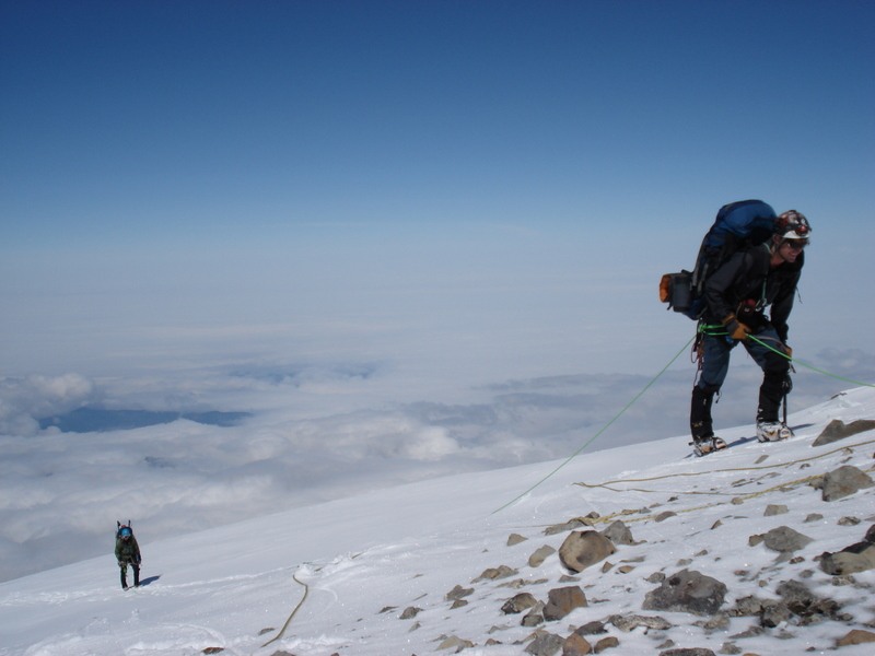
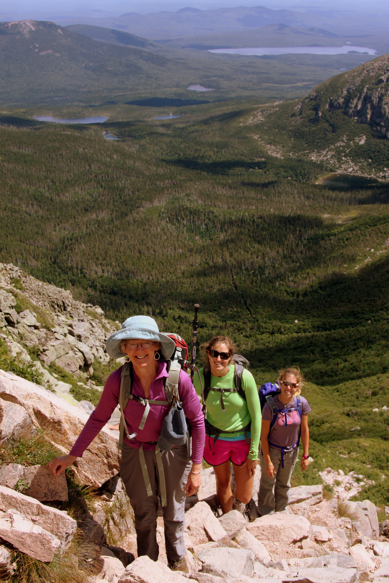
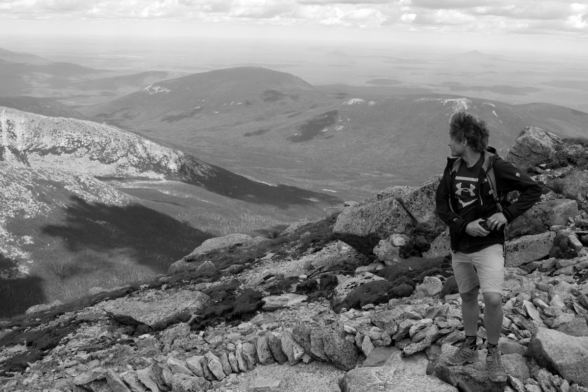
We then continued the remaining 1 mile up Baxter Peak’s north ridge on a good trail, albeit “bouldery”, to the summit. The views along the ridge were phenomenal and we reached the summit around 1:30pm.
The crew heading up Katahdin’s north ridge
The Oelbergers are excited!
Ken making his way
Rob about 24,000′ below his “normal” hiking altitude
It was very exciting for me to watch Ken & Dianne top out on the top of Maine. They were very proud of themselves as they should be.
Dianne is so excited she seems to be levitating

Mother & daughter on Maine’s highest peak
The gals just before Katahdin’s summit
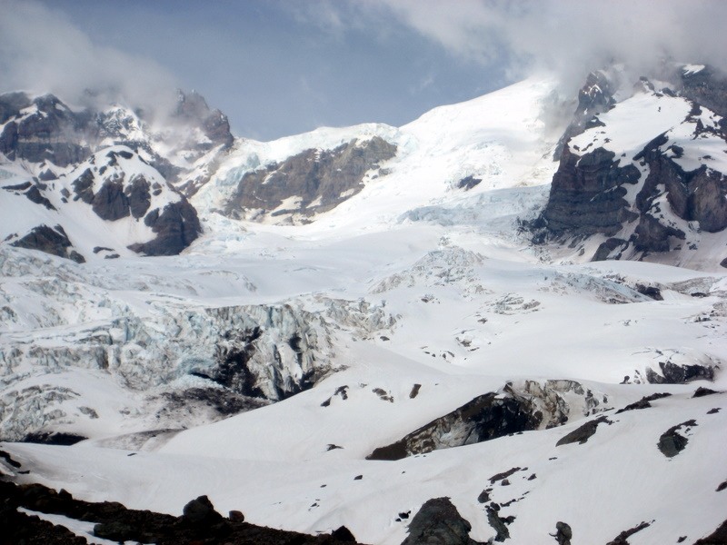
The views down Katahdin’s north-northeast face were awesome all the way down to Chimney Pond.
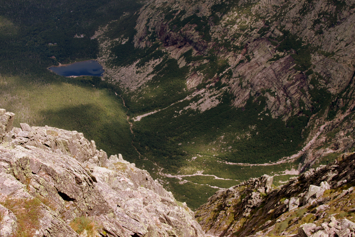
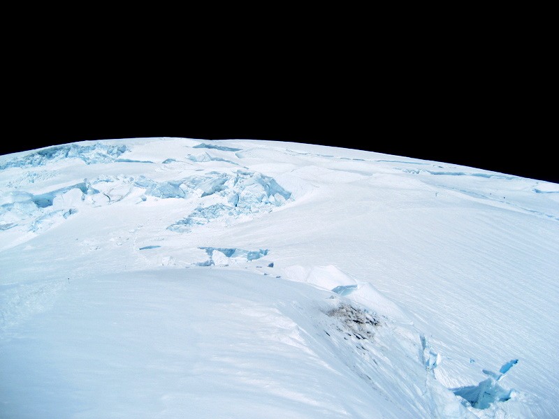
Looking down at Chimney Pond from the summit

Chimney Pond zoomed in from the summit
We could see climbers on the so-called “knife-edge” over to Pamola Peak (4,902′), a sub-summit of Baxter Peak. We were thinking of descending the knife-edge ridge over to Pamola Peak and down the Dudley Trail to Chimney Pond while Ken & Dianne retraced their steps down the Saddle Trail. However, we absolutely decided not to do this after experiencing the steep, complex, and scrambly nature of the Saddle Trail on the way up. I don’t think any of us were about to let Ken & Dianne descend that trail on their own. The knife-edge ridge and Pamola Peak can definitely wait another day in another year in the future.
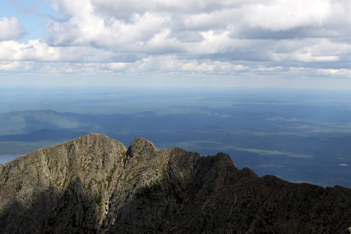
People on the knife-edge ridge over to Pamola Peak. Another day in another year for sure
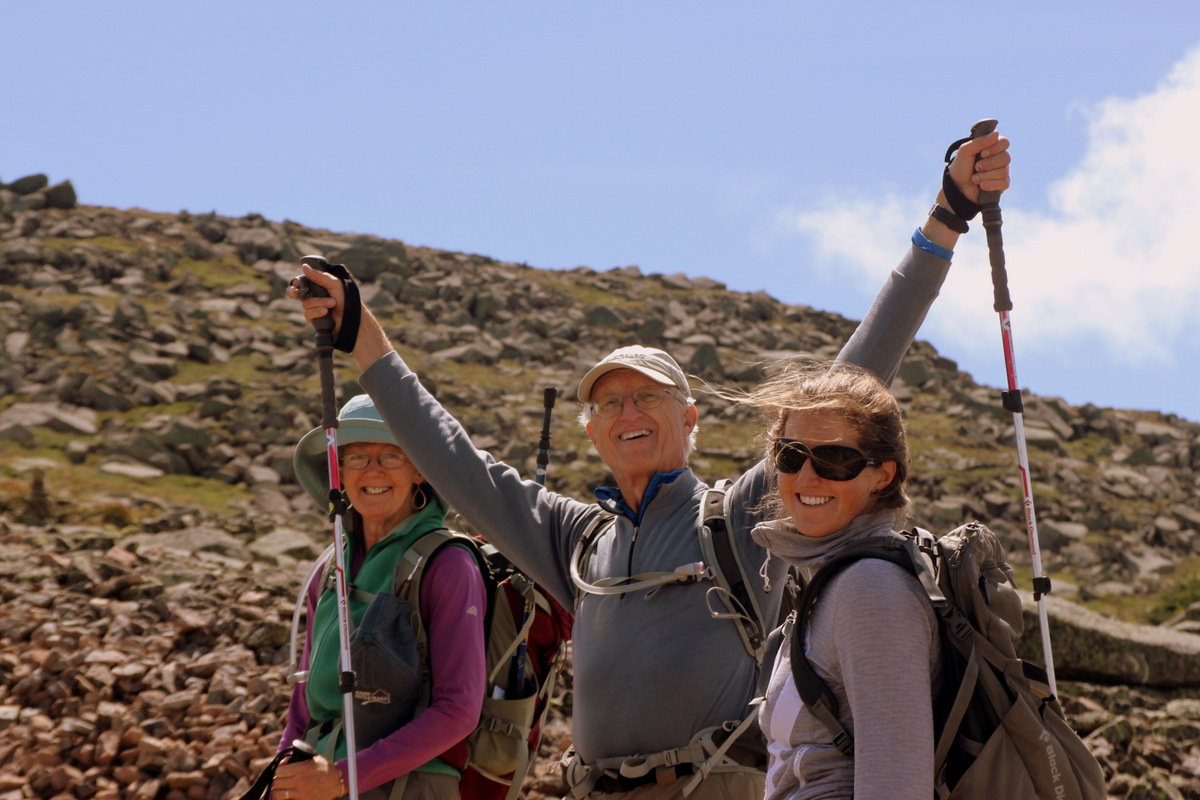
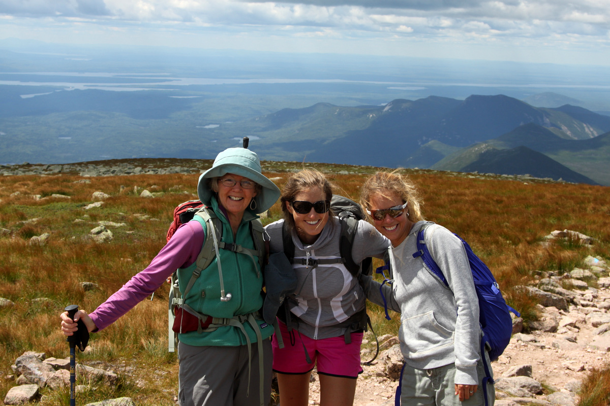
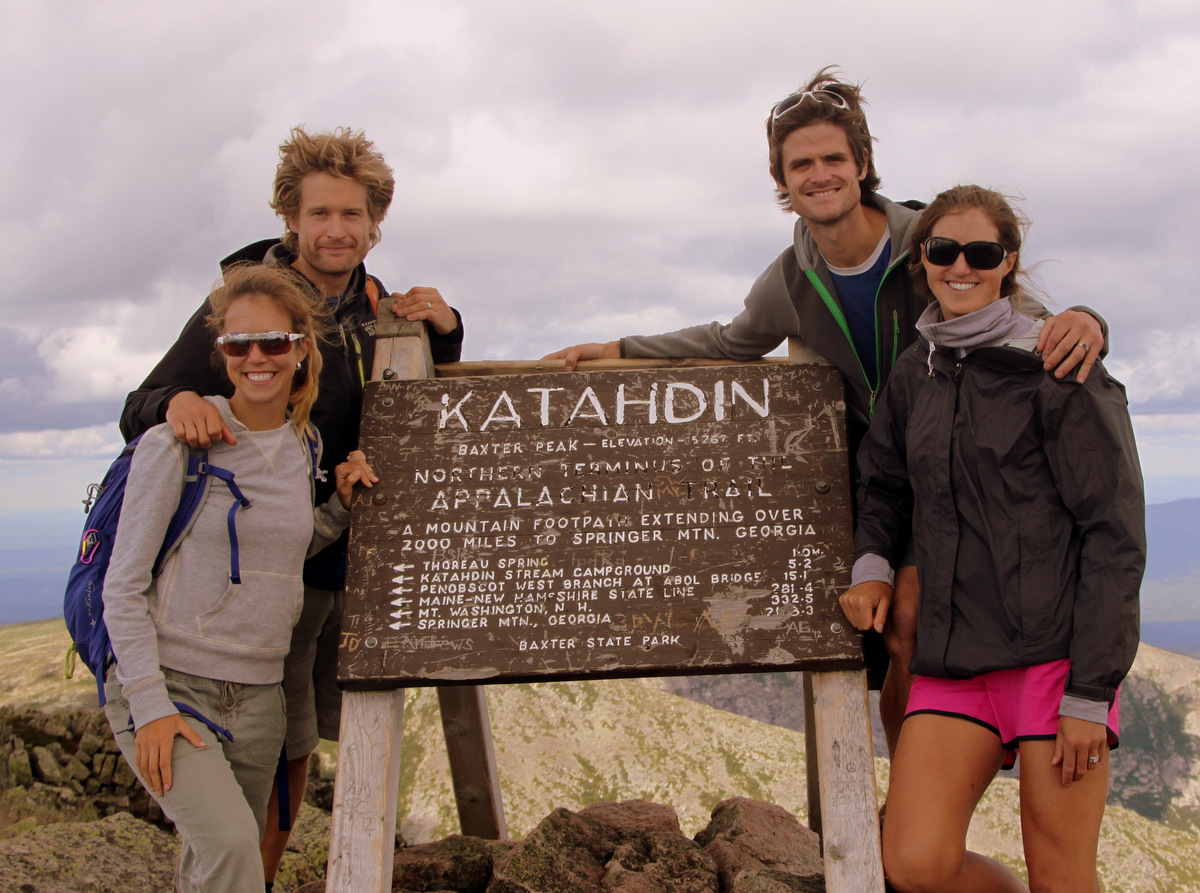
We spent around 30 minutes up top enjoying the views of beautiful Maine with all its dense forests and countless lakes. We took several pictures with the famous Mt. Katahdin summit sign as well. I grabbed a summit rock for us and one for Ken & Dianne as well. It was also so fun and memorable to share another summit with Rob & MK.
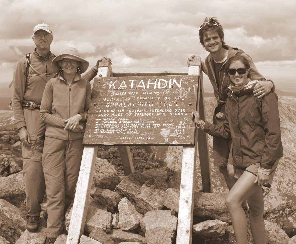
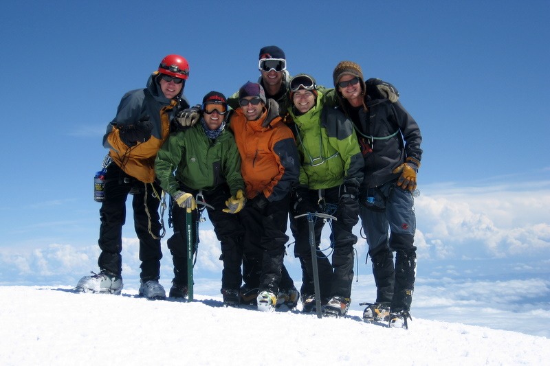
The Oelbergers & Chalks on the summit of Mt. Katahdin
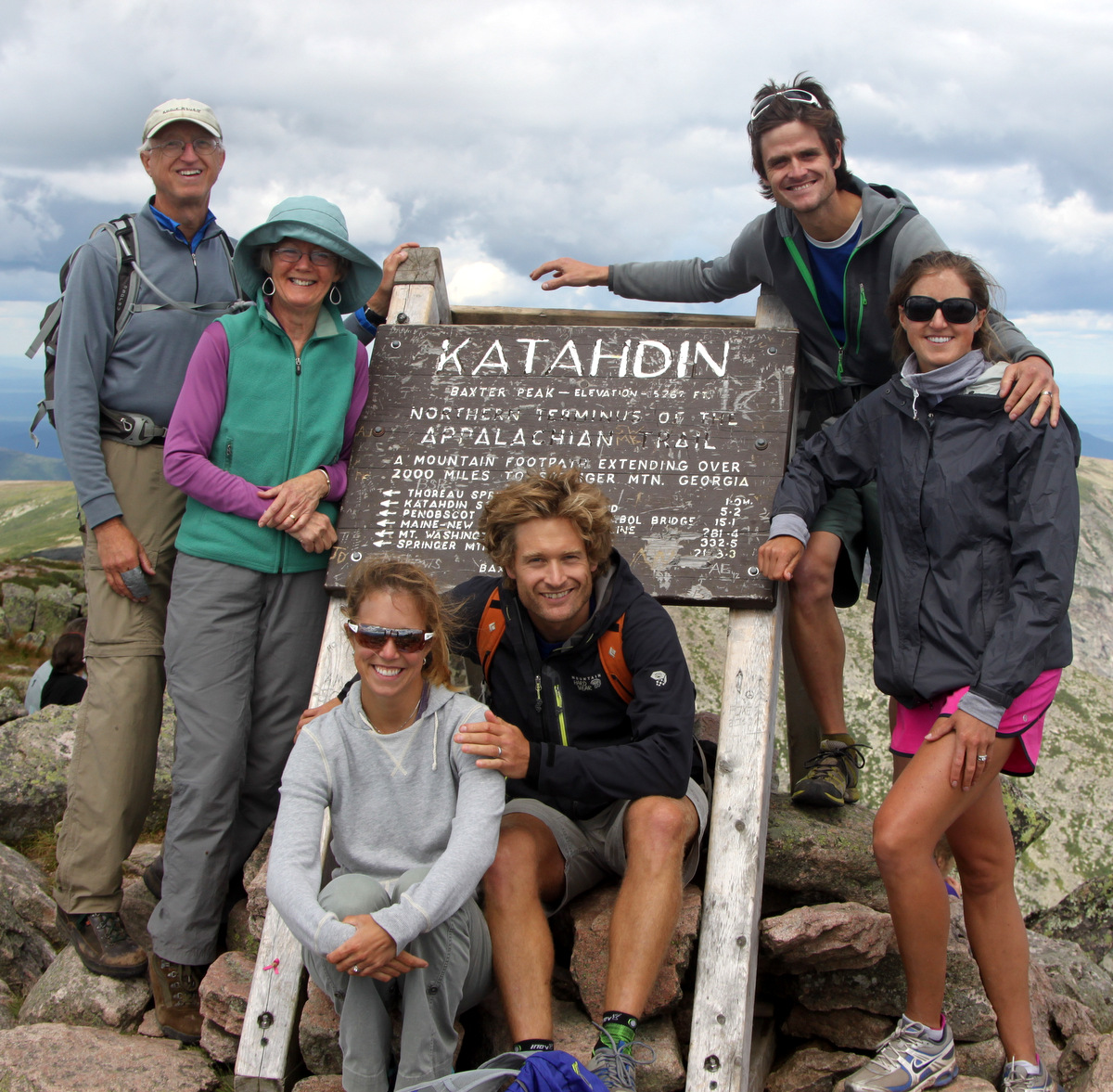
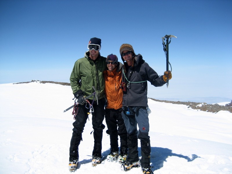
The whole crew on the summit of Mt. Katahdin
Rob, MK, Kristine, & me on the summit of Maine
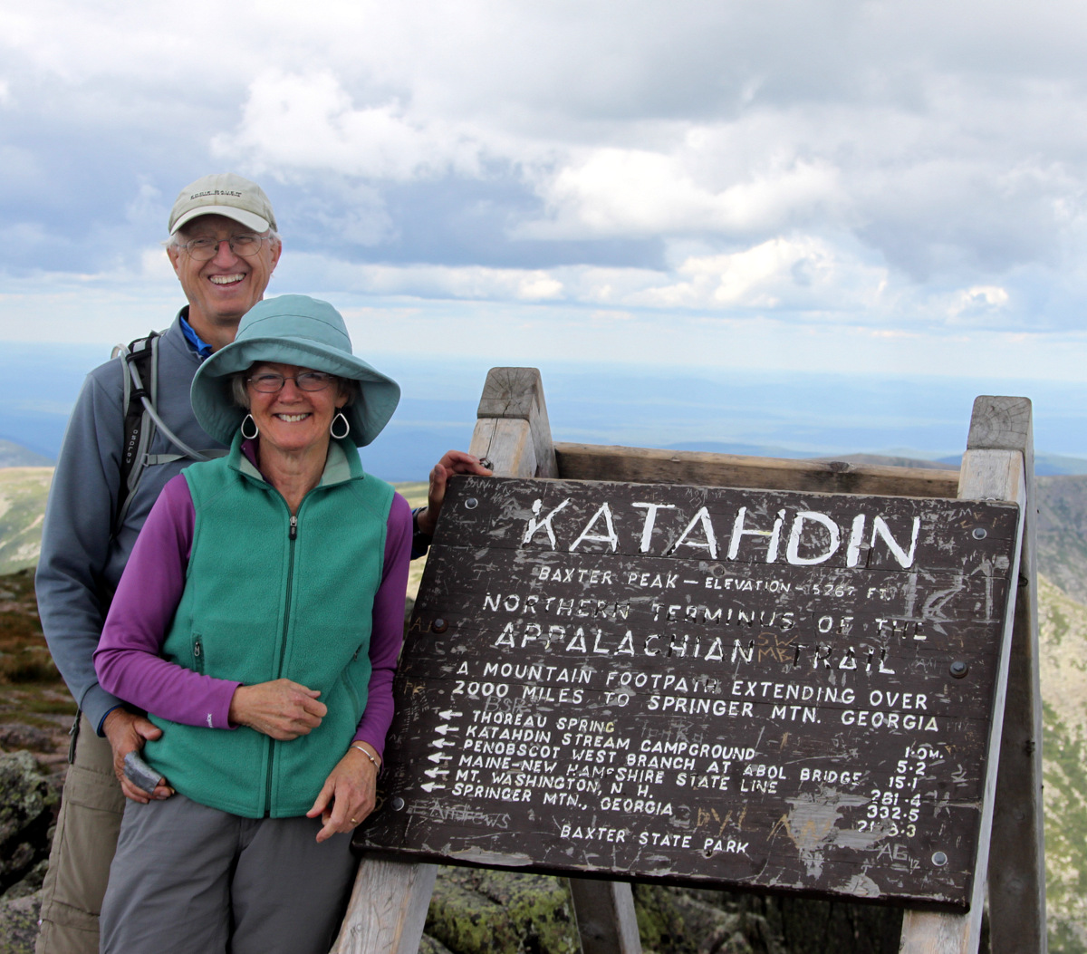
Ken & Dianne on top of Maine

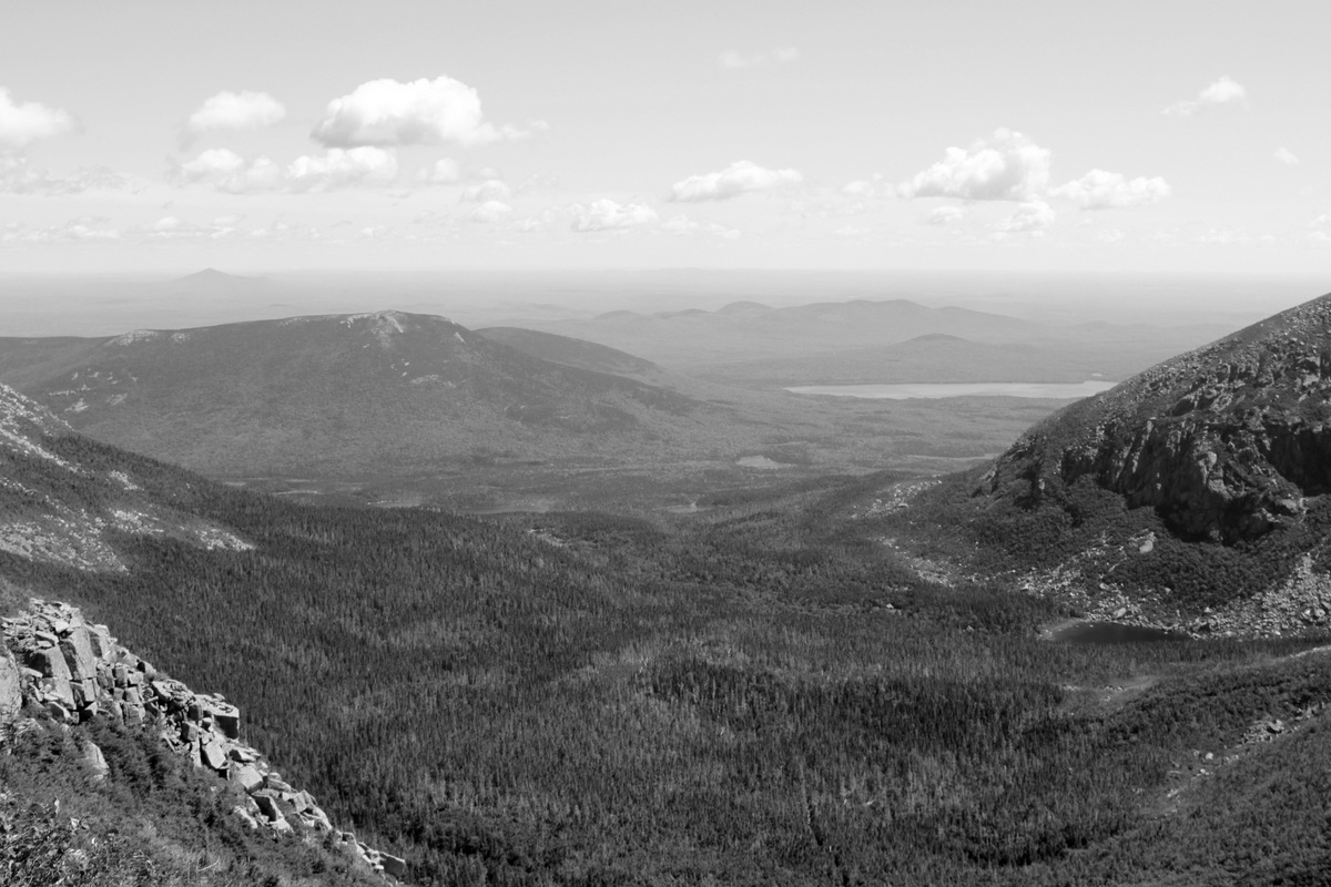
Scenic summit shot of the countless lakes and dense forests of Maine
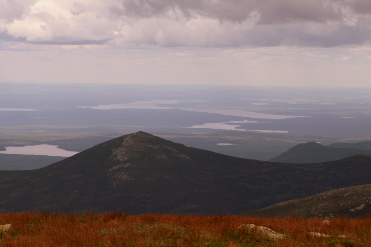
Beautiful terrain
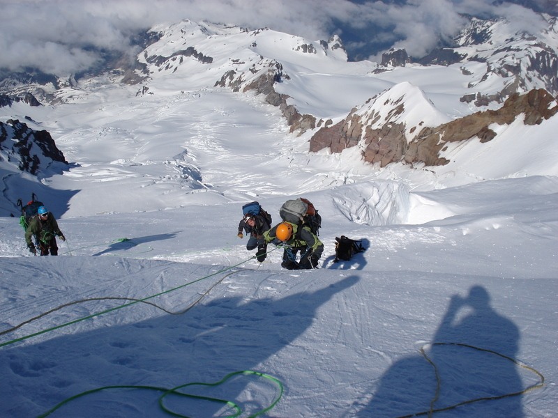
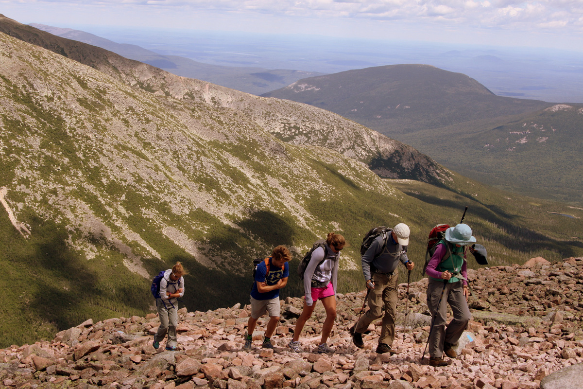
I think we all knew the descent could take some time, so we got going. Ken & Dianne did extremely well on the steep descent down to Chimney Pond from the saddle. Rob, MK, Kristine, & I were not going to let anything happen to these two stellar mountaineers.

Coming down the Saddle Trail close to Chimney Pond
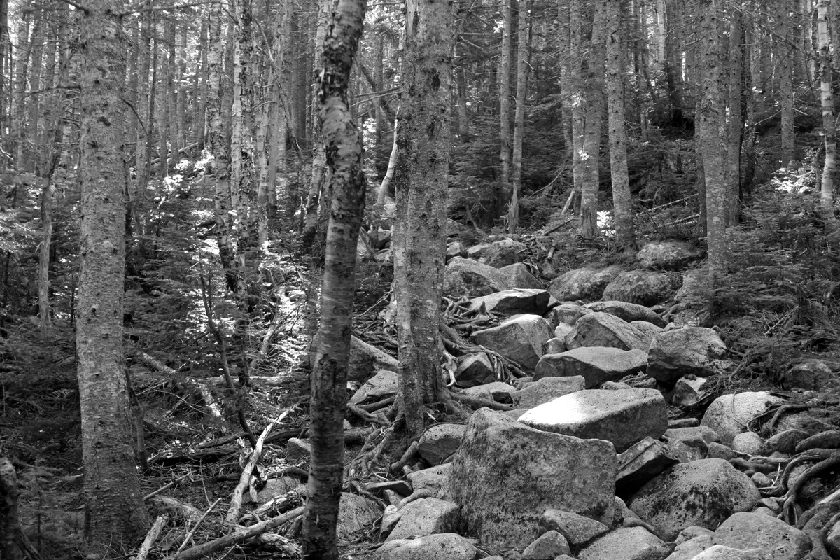
Typical trail terrain
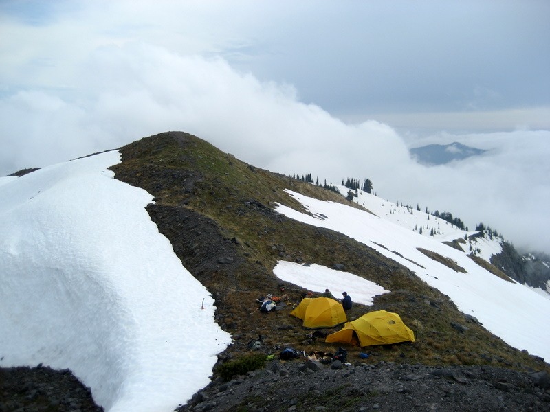
We all took a long break at Chimney Pond looking back up at Katahdin and then continued on down the Chimney Pond trail. When we passed the Basin Pond, I saw a good outlet through the thicket to the water’s edge and decided to take a dunk. Dianne wanted to check out the cold bath I was about to take and was nice enough to take a few pictures of me. Burr. It was a cold one. It took my breath away, but definitely was rejuvenating. Its always as if I just drank a pot of coffee. That’s how energized I feel.
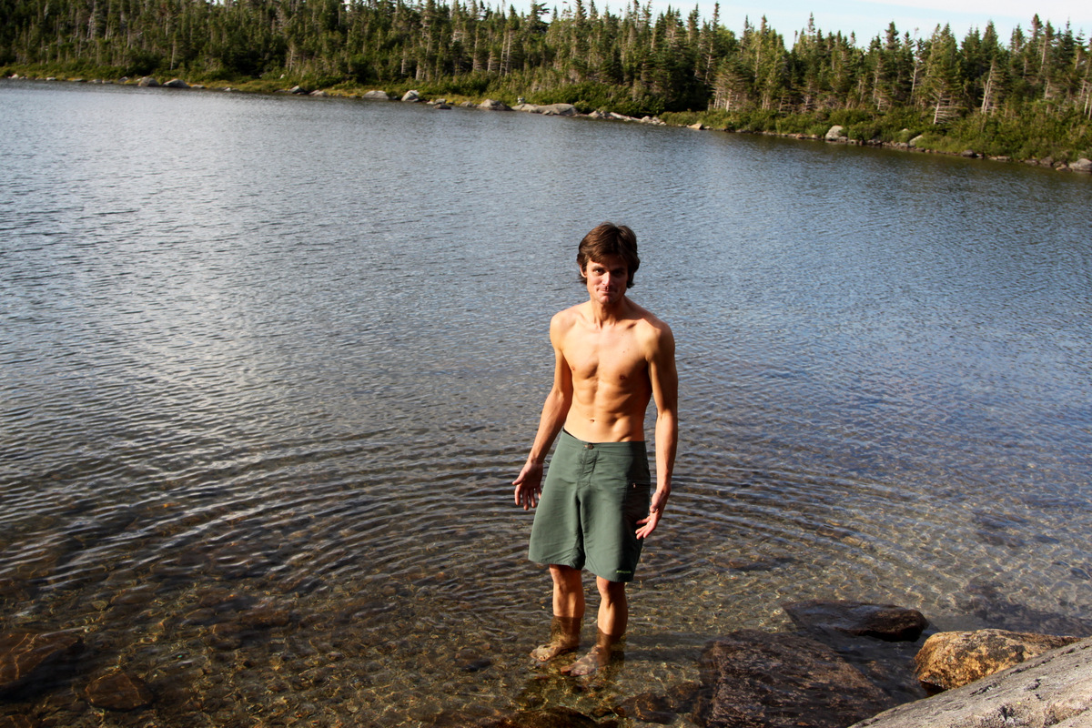
Lake dunk in Basin Pond on the hike out. I’m always nervous at this point
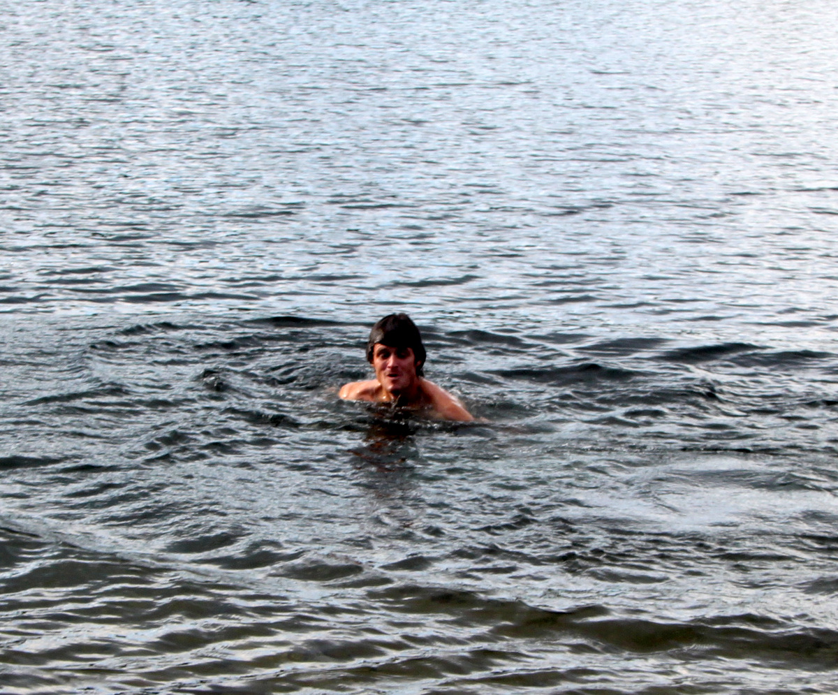
Burrr…..
We eventually made it back to the car around 7pm for an 11 mile and 12 hour roundtrip day with approximately 4,000′ of elevation gain. I know Ken & Dianne’s feet were hurting, as mine were, after such a long day on difficult terrain, but they had made it. We quickly departed the trailhead and headed back to the Big Moose Inn. We needed to get on the road to Quebec City as quickly as possible so we packed up camp, grabbed some coffee, and headed out around 8:30pm. I was sort of envious of Ken & Dianne’s relaxing evening of showering, a good beer, eating a nice meal at the Inn, and hitting the sack early. However, we wanted to get to Quebec with Rob & MK to maximize our time with them as we were to return to Maine on Friday.
After making it through border control, we finally arrived at Rob & MK’s wonderful new home on the south side of downtown Quebec City and the St. Lawrence River around 2:30am. Rob was so excited to have us there, he immediately got to baking a new loaf of bread until 3am. We had a great time in Quebec with Rob & MK. From biking around the downtown area, seeing the Ross family flat in the city where MK lived while attending university, visiting & hiking the awesome Montmorency Falls outside the city, going on an adventure run with Rob through cross-country trails and backroads while the ladies went to hot yoga, it was all good fun and quality time together.
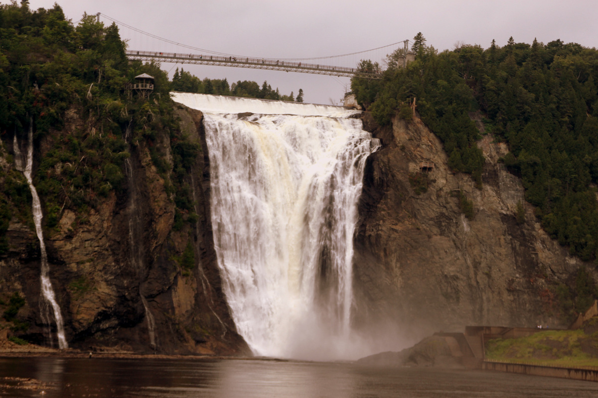
The 275 ft high Montmorency Falls outside Quebec City
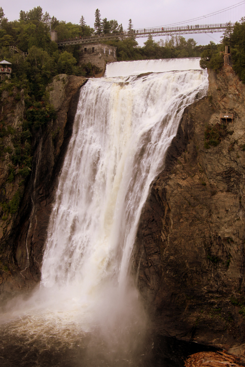
Montmorency Falls
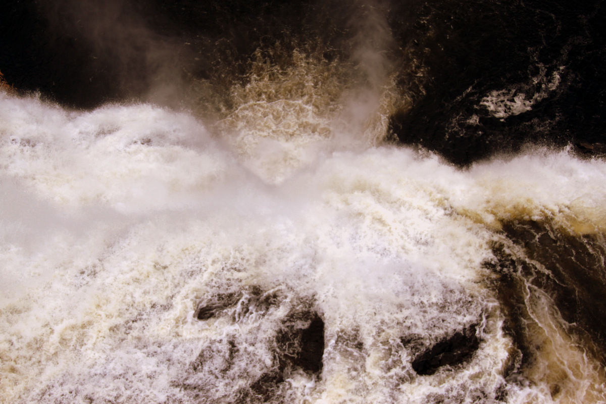
Looking down Montmorency Falls from the suspended bridge above

Kristine, MK, & Rob on the suspended bridge

Rob & MK
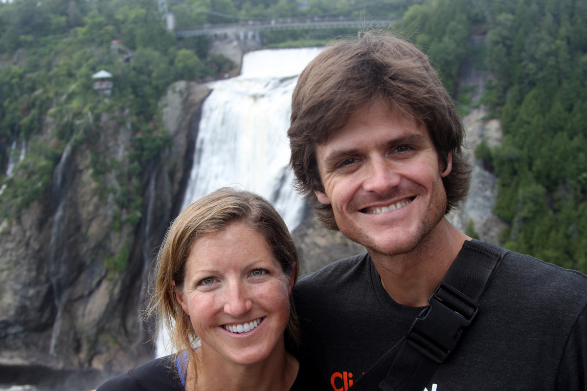
Kristine & me
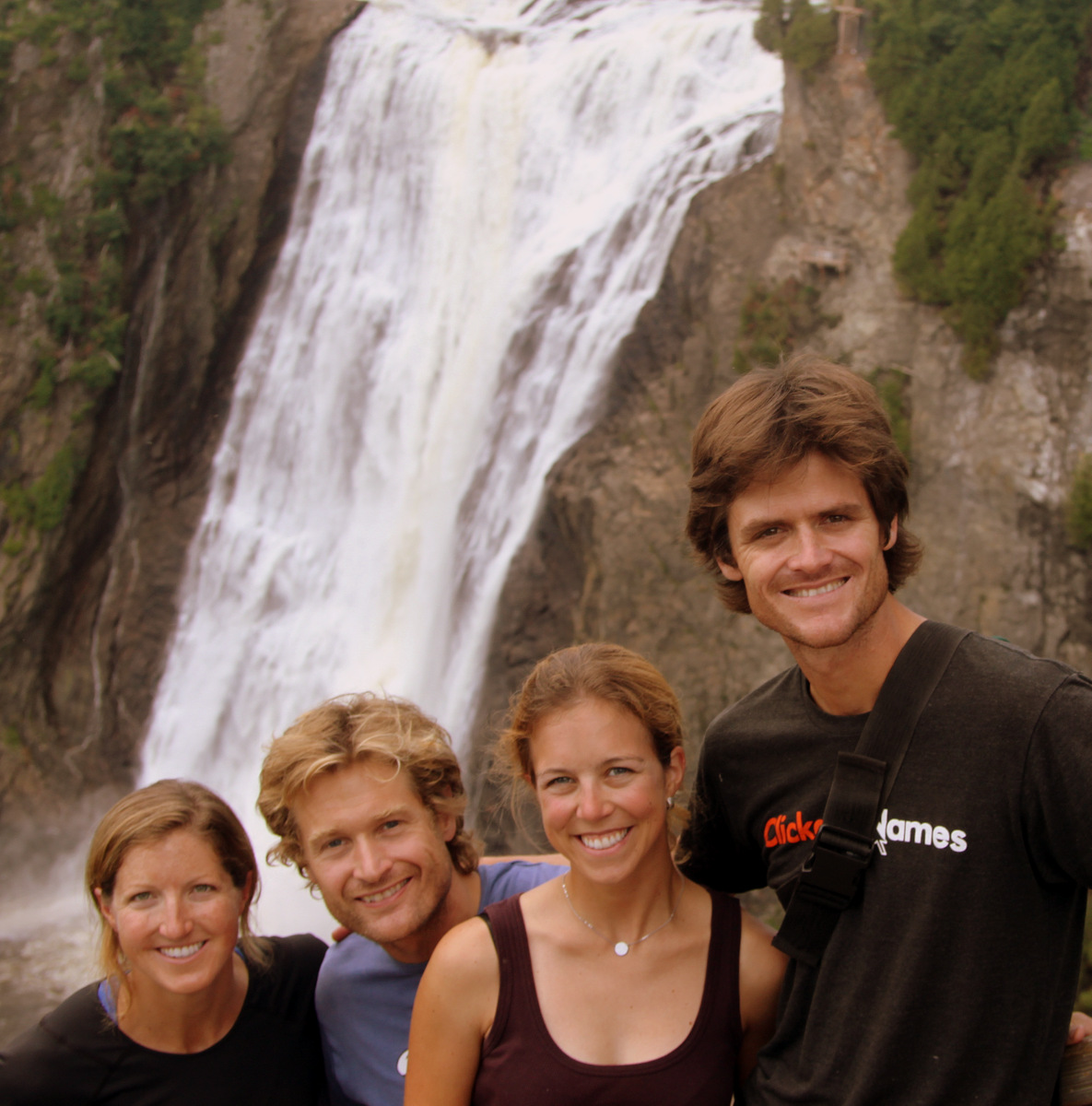
Parting shot of the four of us
We then left Quebec City and Rob & MK around lunchtime on Friday and made the 6 hour drive back into Maine and the USA and to the Oelberger Residence. Kristine & I then flew home to Colorado on Sunday after spending two more nights and a day with Ken, Dianne, Carrie, Thomas, & Kai filled with cornhole and lobster/crab roll sandwiches. Yum. All in all, a wonderful trip back to Maine & a new adventure for me at least up to Quebec to visit great friends. Maybe in the future we can join Ken, Dianne, Rob, & MK on more hikes and summits in New England.
 Follow