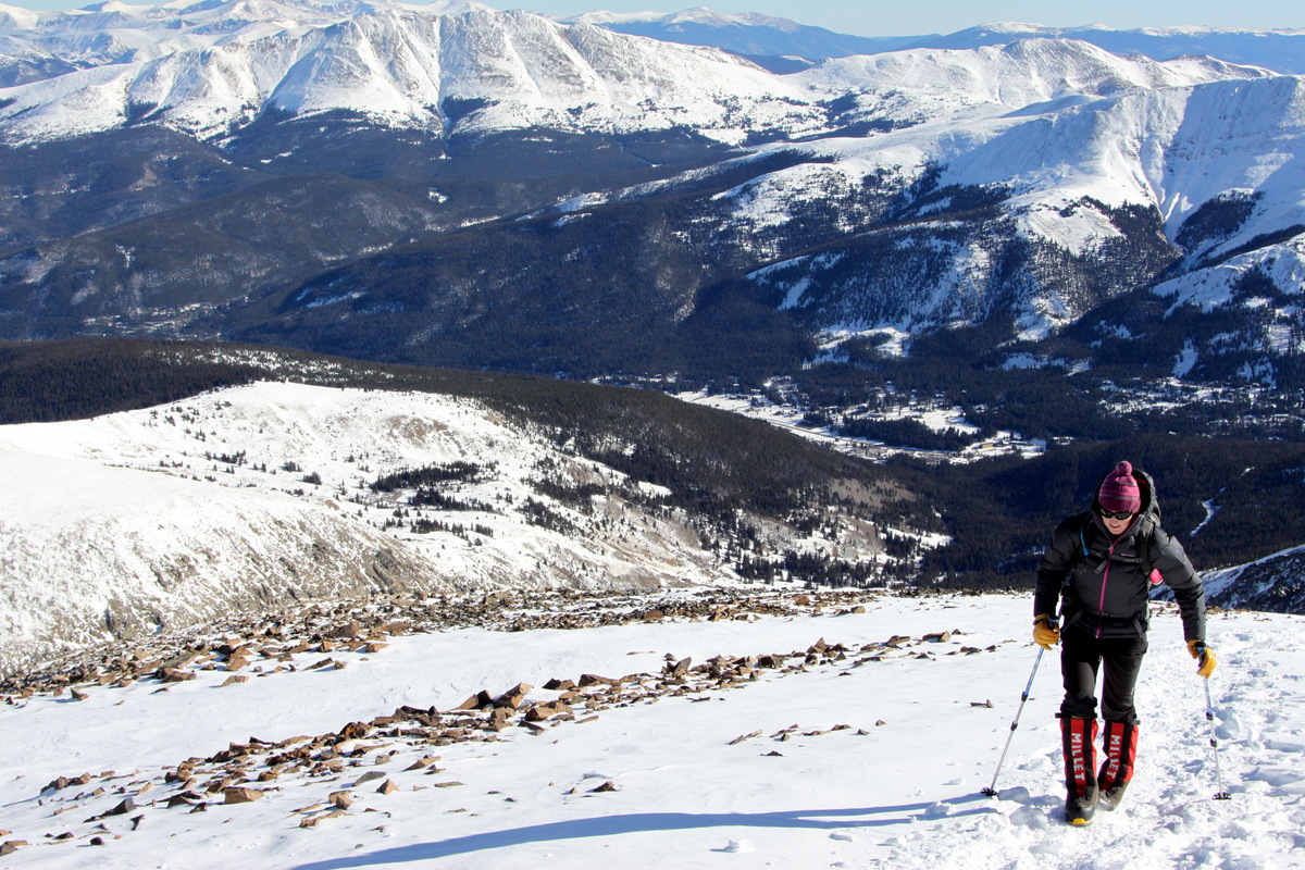
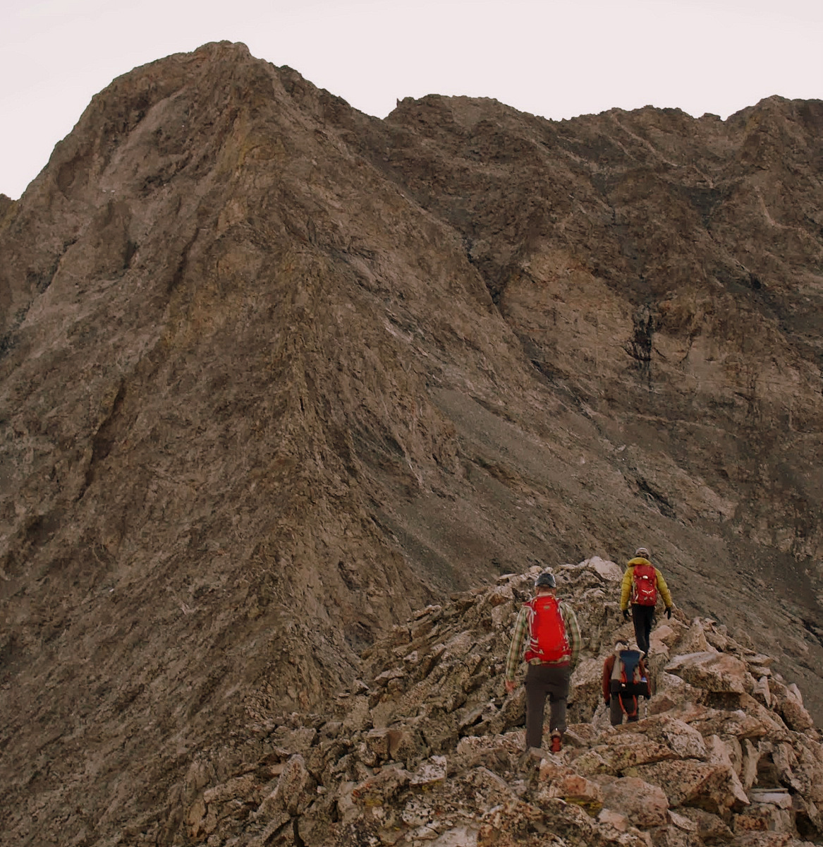
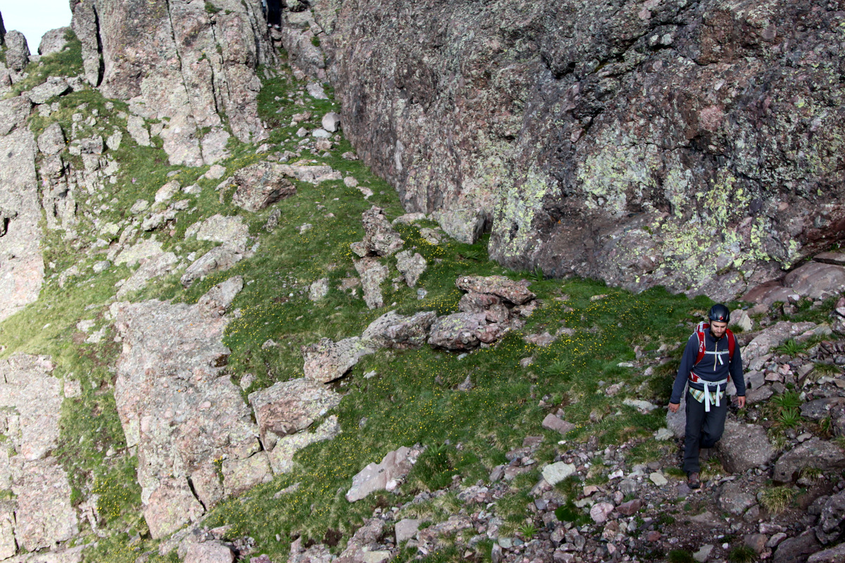
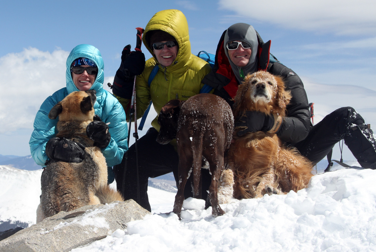
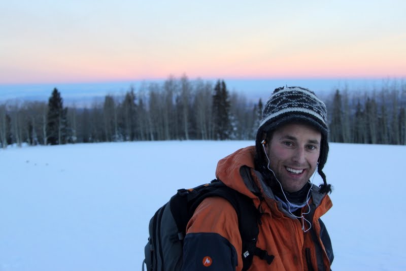
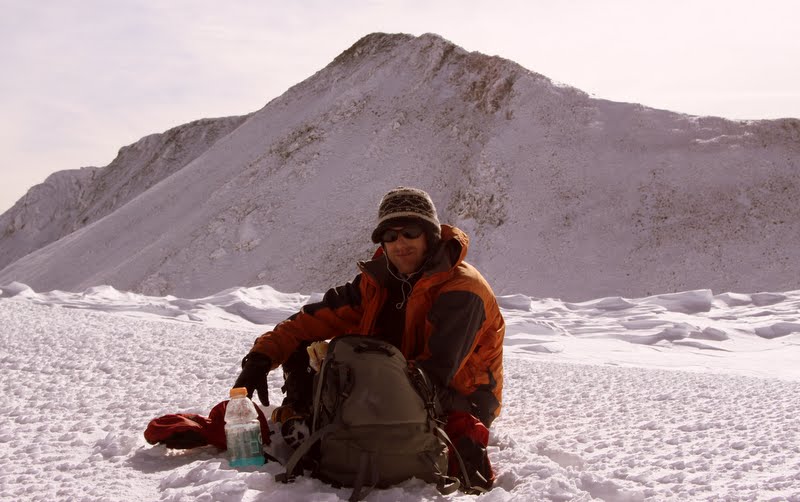
In an effort to get back to over 14,000′ and test out our old Millet Everest boots again before we wear them for days on end in Antarctica, we took a jaunt up the fun 14er near Breckenridge, Quandary Peak (14,265′).
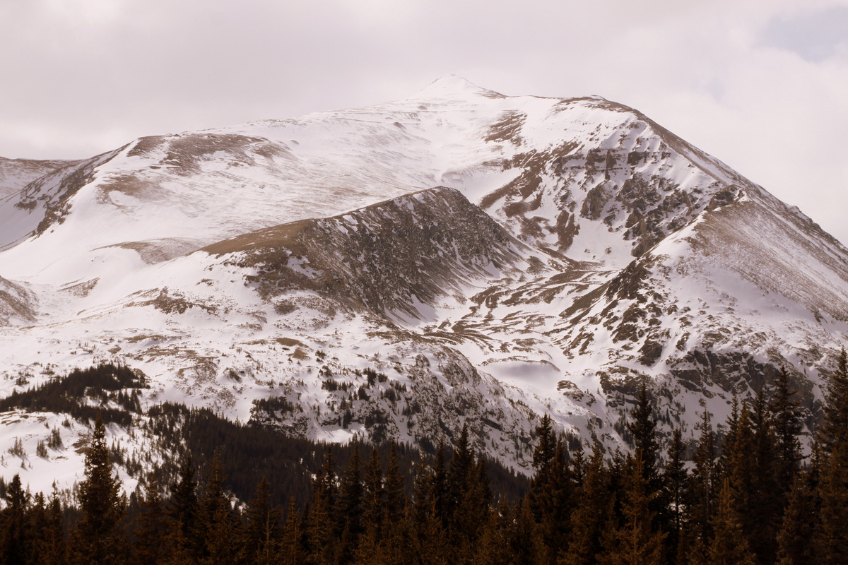
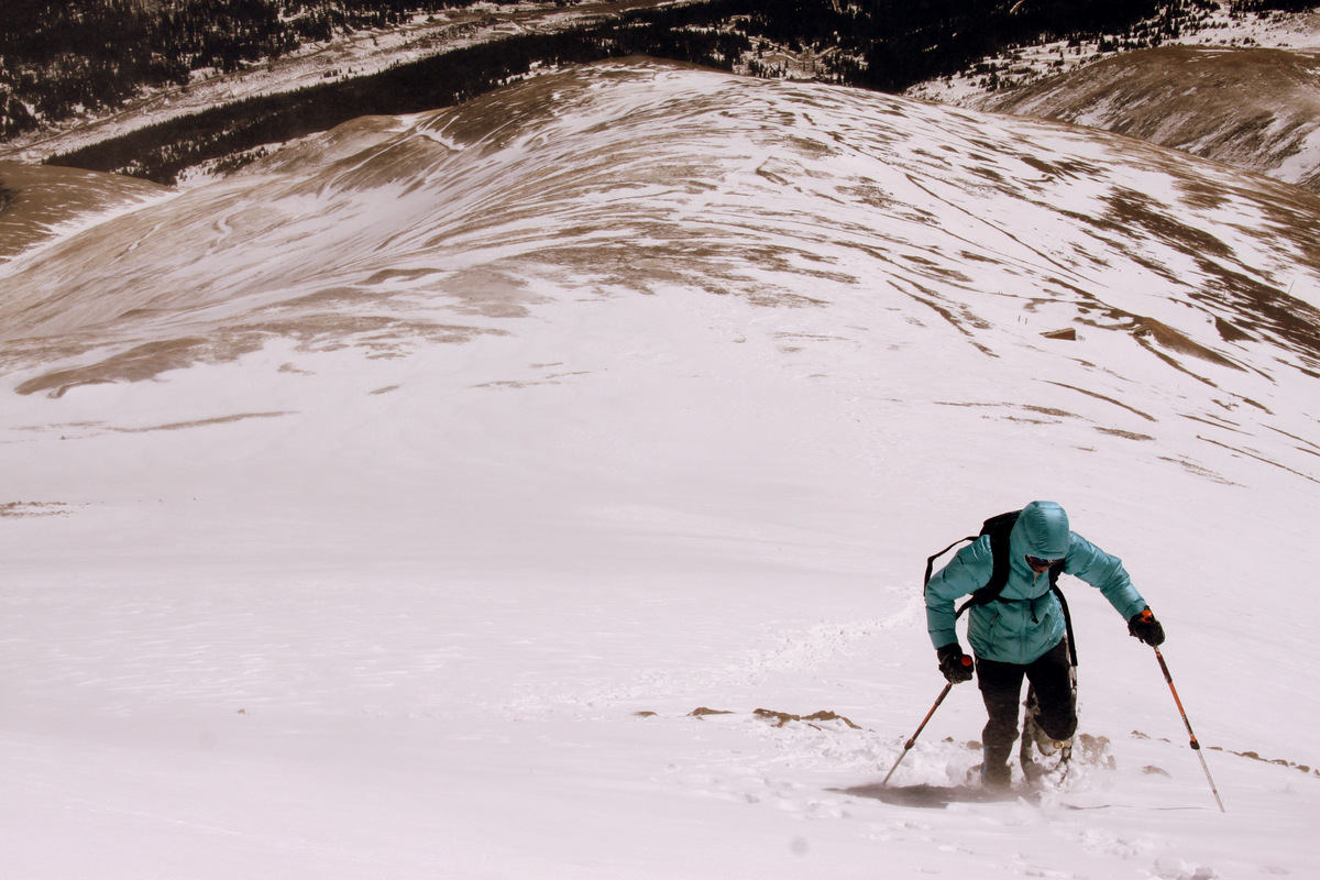
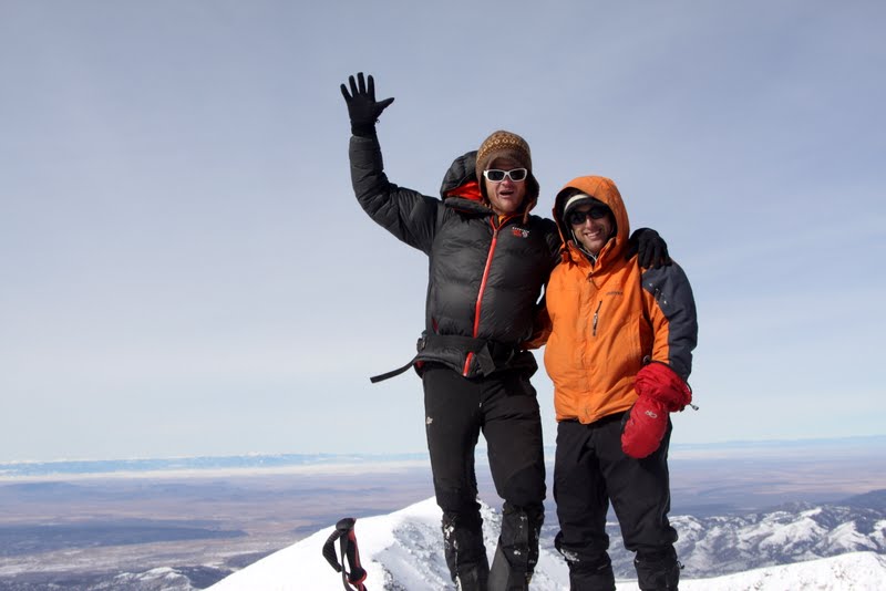
Kristine reaching 14,000′ on Quandary’s east ridge with Bald Mountain (13,684′) in the background
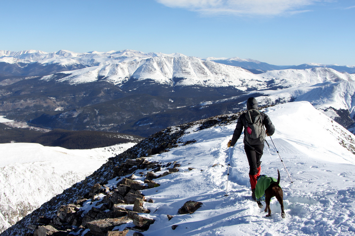
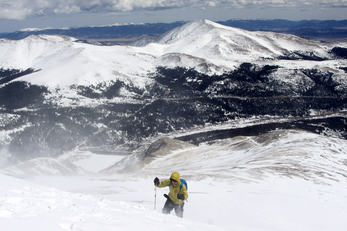
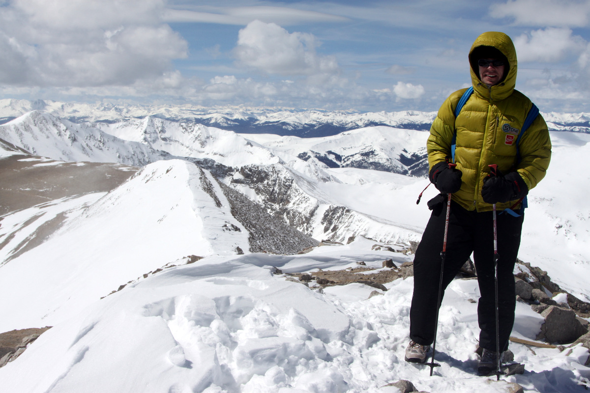
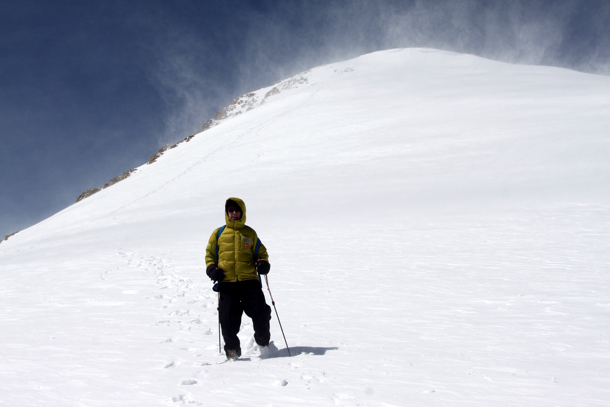
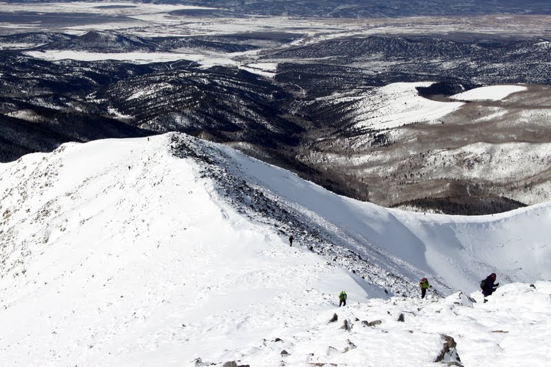
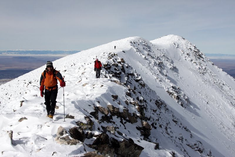
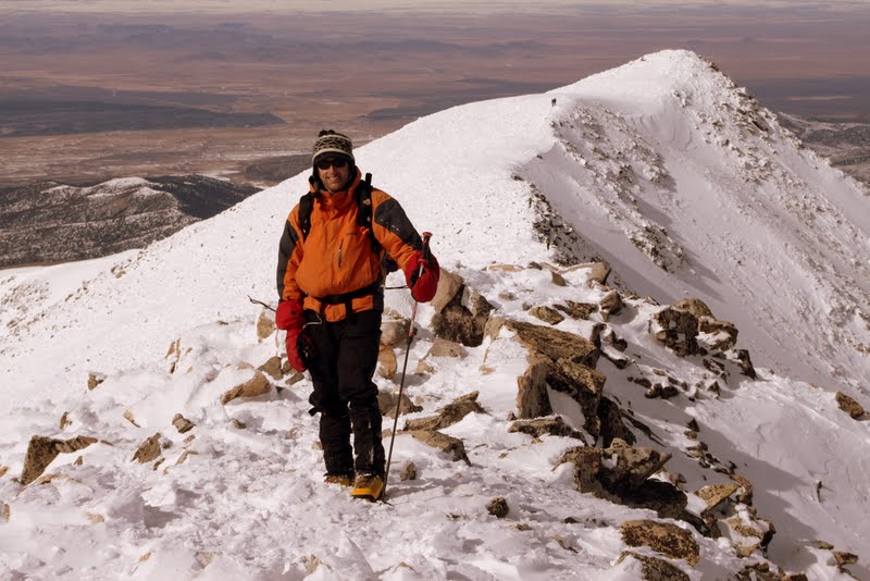
Now, we have all been up this peak so many times we have lost count, but its close, convenient, relatively short, great winter access, and gets us to altitude. Its a favorite for sure. It had been over three years since we had worn our Millet Everest boots and Quandary’s snow-packed trail up standard east ridge route was a good test for these boots once again. In just about 2.75 miles one-way to the summit, the trail climbs 3,400′ and is a nice workout. It was a gorgeous Colorado bluebird day and except for the summit ridge and summit, which the extreme west winds were just hammering, the winds were relatively marginal.
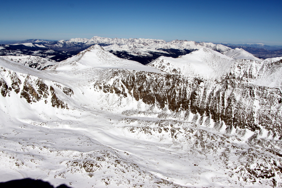
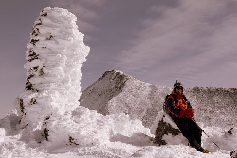
Looking southeast to Mt. Silverheels in the foreground and Pikes Peak in the far distance from Quandary’s summit ridge
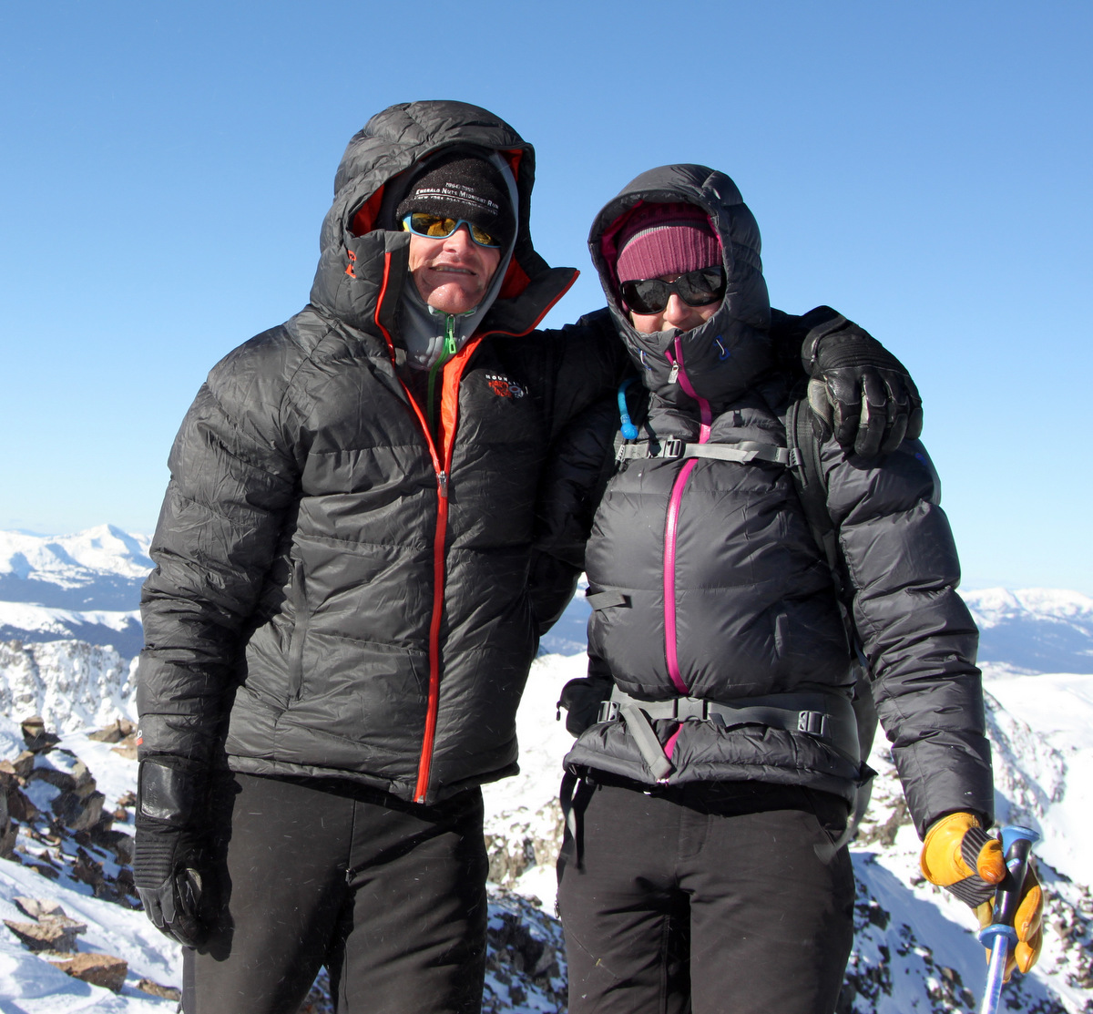
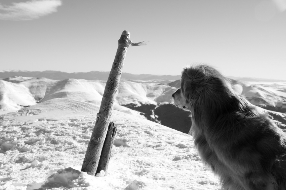
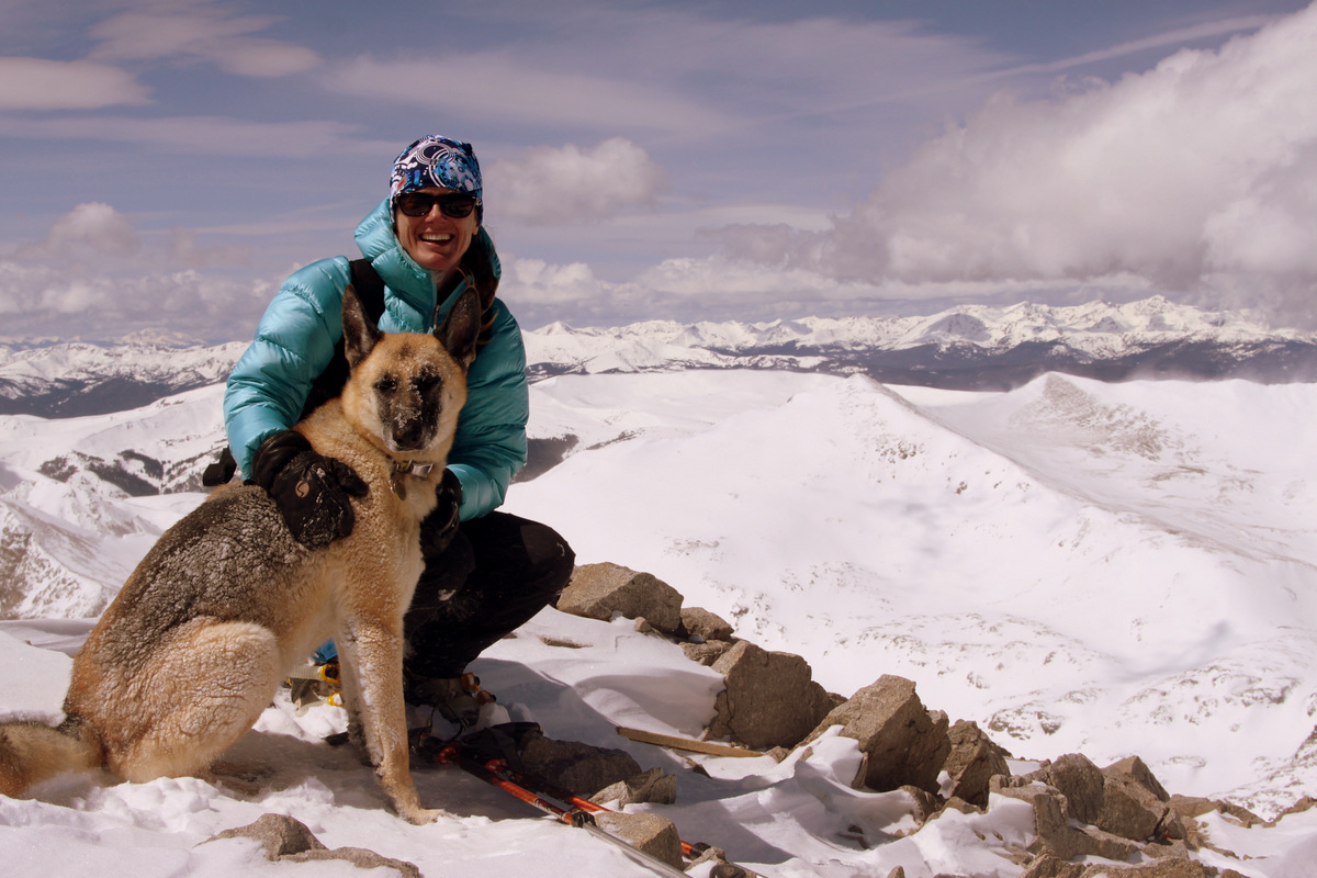
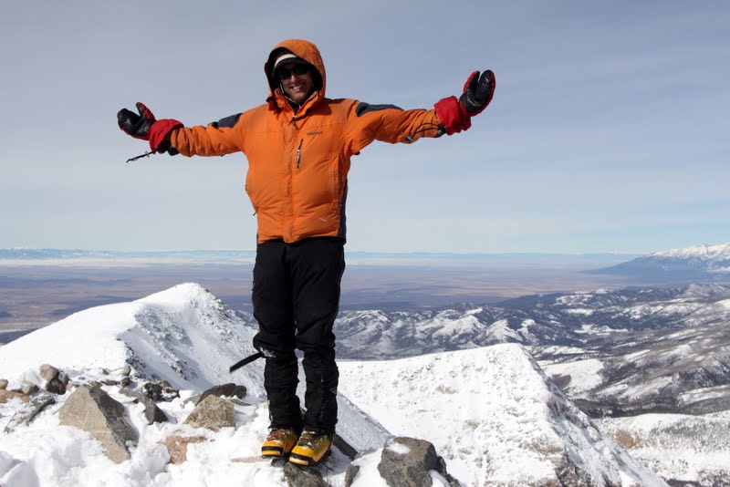
A blustery & cold Quandary Peak summit (14,265′)
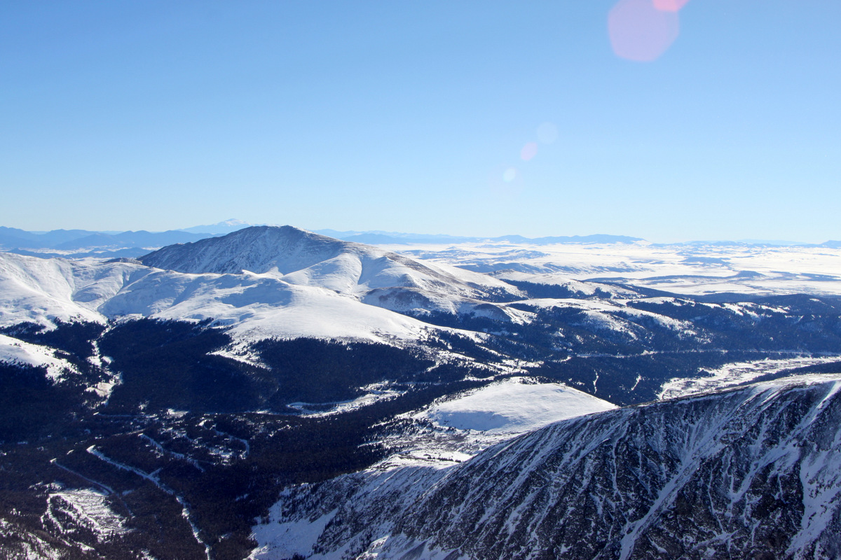
Looking north to Pacific Peak, Crystal Peak, and the Gore Range from Quandary’s summit
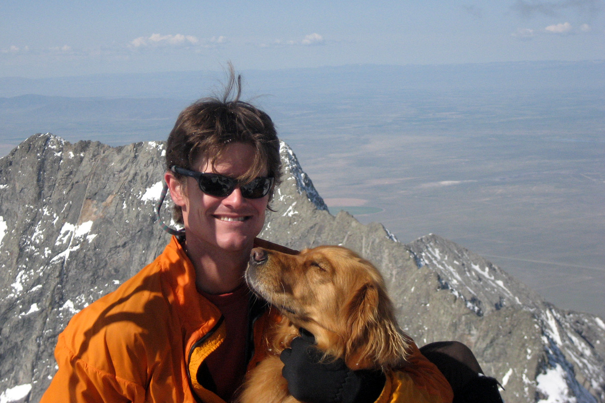
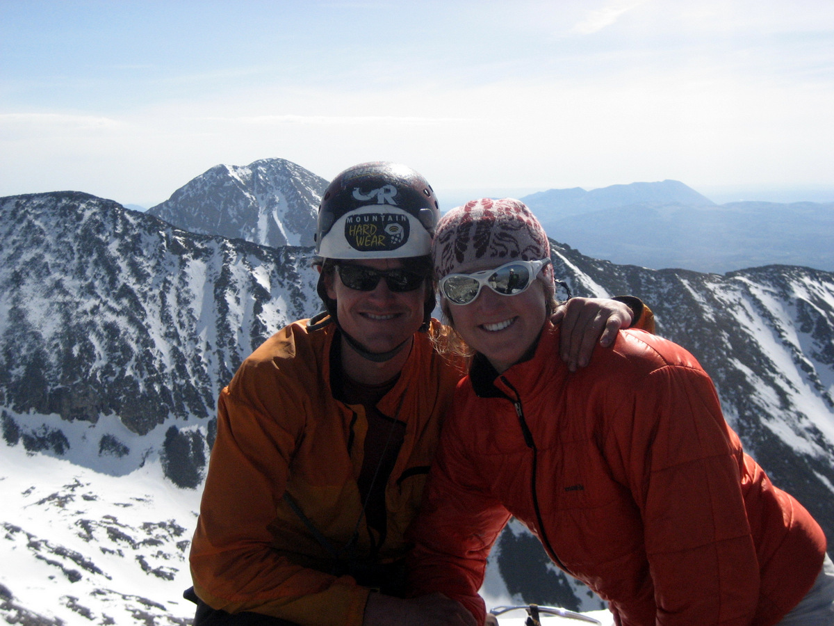
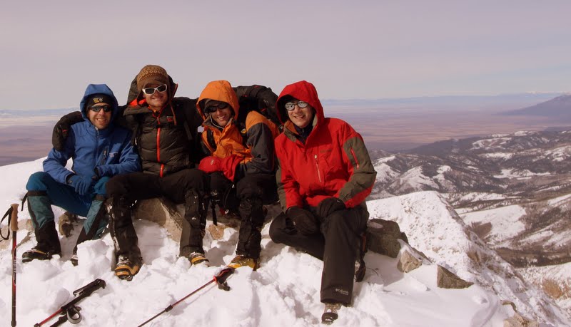
Rainier & I on Quandary’s summit
I think Rainier was actually cold on Quandary’s summit – could be a first
The boots did fairly well, though we couldn’t remember quite what socks and sock layers we had used three years ago on Everest. As a result, we could feel the hot spots on the final 1,000′ and unfortunately received a few minor blisters. However, now we remember what we did in terms of which socks and liners and we’ll try these boots out again before we leave.
Heading down for lunch with friends
It was a fun morning and only took us about 3 hours and 15 minutes roundtrip just in time to meet our good friends from Jackson Hole, Brett & Carrie Richer, for lunch at the Breckenridge Brewery.
There are generally considered four great Colorado 14er traverses, i.e. ridge traverses between two 14,000’+ summits in Colorado. Now, there are many ridges connecting numerous 14ers in our state, but most of them are simple hikes or scrambles. What makes there be four greatones is the exposure of the ridge, at least 4th class scrambling, sometimes length of ridge and time required to complete the ridge, and especially the commitment level. The other three great Colorado 14er traverses are the Mt. Wilson – El Diente Peak Traverse, the Crestone Traverse linking Crestone Peak to Crestone Needle, and the Bells Traverse linking South Maroon Peak to North Maroon Peak. Having completed the Crestone Traverse earlier this summer on my 2nd try, that left me with only the biggest and baddest of all the great 14er traverses: the Little Bear Peak to Blanca Peak Traverse. Still not being able to really rock climb due to my ongoing forearm tendonitis, its been a summer of scrambling high on our beloved peaks and to do some of the traverses that have been on my list for some time. I had completed the Bells Traverse three times in the past and the Mt. Wilson – El Diente Peak Traverse twice, but now having traversed the ridge from Little Bear Peak to Blanca Peak I can truly say it lived up to its reputation and puts the other ridges to shame in just about every aspect: length, exposure, 4th class/low 5th class scrambling, and especially commitment. There is truly no way off the ridge if something should happen, i.e. storms, lightning, fatigue, etc. You either complete it or turn around. At the low point of the ridge, one could scramble down into the Blanca Basin in case of emergency (as in to escape lightning), but this puts the climber in the wrong basin from Lake Como. The Little Bear – Blanca Traverse is truly one of my favorites to date and it was just so much fun and continually challenging and exciting. My good friend J Weingast and I have done a lot of ridge traverses in Colorado and I think we are both in agreement that this one was one of our favorites. This traverse would be the last of the four great Colorado 14er traverses for J, Derek Drechsel, & myself. Also, Derek & I would have done all the traverses together, which was pretty special.
Rewind about 7 1/2 years to a late October 2006 attempt at these peaks for our first visit to the Blanca Group. We didn’t know what we were in for and my buddy Lee Hoffman’s jeep almost took a nose dive between Jaws 1 & 2 into a creek bed. Fortunately, the Alamosa 4WD club came to our rescue the next day after we camped out on the road. That morning, several of us and Rainier attempted at least one of these peaks, but witha decent amount of snow and no snowshoes/skis, we didn’t get very far past Blue Lakes in the Lake Como basin. So, not much (if anything) went our way that first attempt at these peaks. Live and learn.
Now, rewinding to Memorial Day Weekend 2007 before J, Kristine, & I left for Denali puts us back in this Blanca Group camped at Lake Como for two nights with all our good climbing buddies and furry K9 friends. It was the first time any of us had been to these three peaks (Little Bear Peak, Blanca Peak, & Ellingwood Point) and we had a truly incredible weekend climbing them snow-covered with our ice axes and crampons. Rainier was with us as well and was able to summit both Blanca & Ellingwood. Not only did she summit these peaks, she ran laps around the rest of us. I guess we were all in our youth back in those days. The climb up the standard “Hourglass Couloir” on Little Bear was exciting and made for a great, steep snow climb. Its a very dangerous place to be in summer or dry conditions due to rockfall and this is precisely what makes Little Bear to be considered the most dangerous 14er by its easiest route. So, we all vowed to never climb the “Hourglass” without snow. A little blast from the past:
Rainier & I on the summit of Blanca Peak in May 2007 with the connecting ridge to Little Bear behind us
Rainier & I looking off at Ellingwood Point & the northern Sangres from the summit of Blanca Peak. This is one of my favorite photos
Our Denali team (J, Kristine, me) on the summit of Blanca Peak
Kristine & I on the summit of Ellingwood Point in May 2007 with the northwest face of Little Bear Peak behind
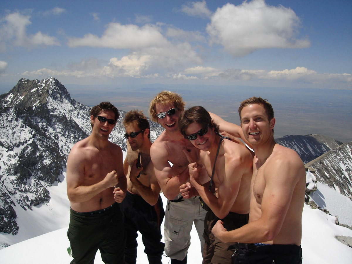
The “sun’s out guns out” pose by the boys on Ellingwood Point over Memorial Day Weekend 2007
Kristine leading the charge up the “Hourglass Couloir” on Little Bear Peak in May 2007
Kristine & I on the summit of Little Bear Peak In late May 2007
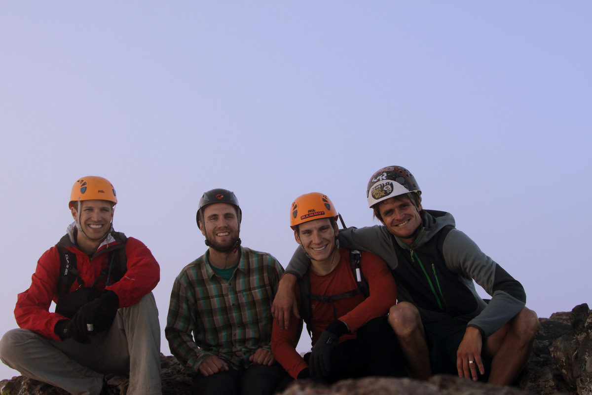
Unfortunately, our good friend Reid Jennings was unable to make the climb and so that left Mike Santoro, J, & I driving down in my Tahoe from Vail and meeting Derek Drechsel at the lower Lake Como trailhead on his way back to Denver from Albuquerque for work around dark on Friday night.
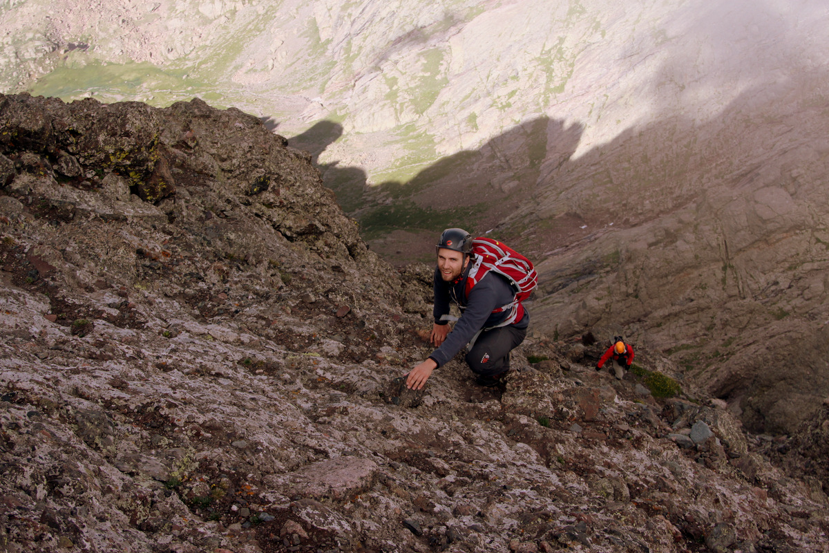
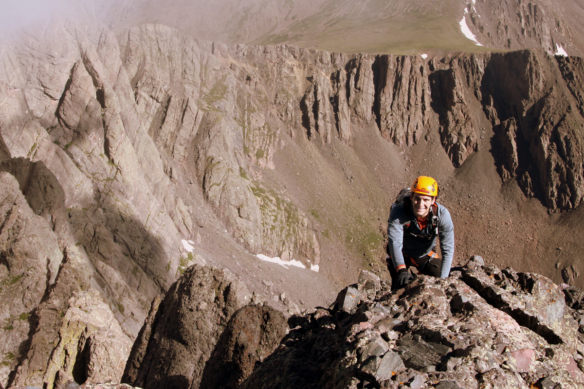
Little Bear Peak from the 8,000′ level at the start of the Lake Como Road. The start of this rough 4WD road can be seen on the left of this picture
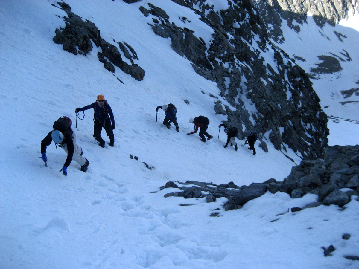
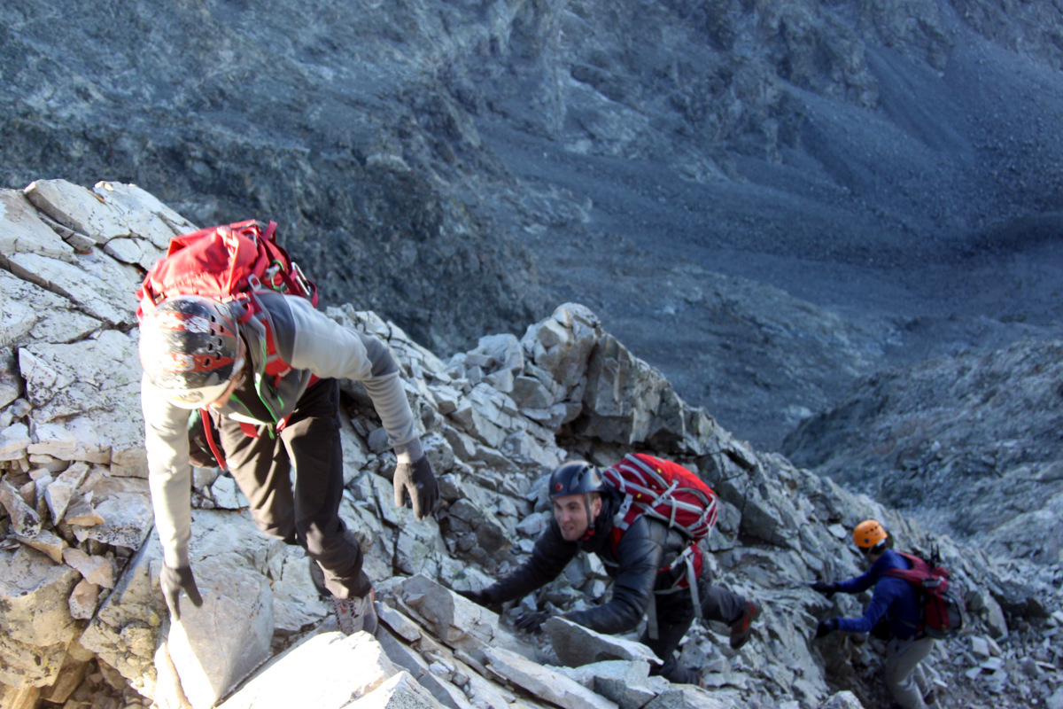
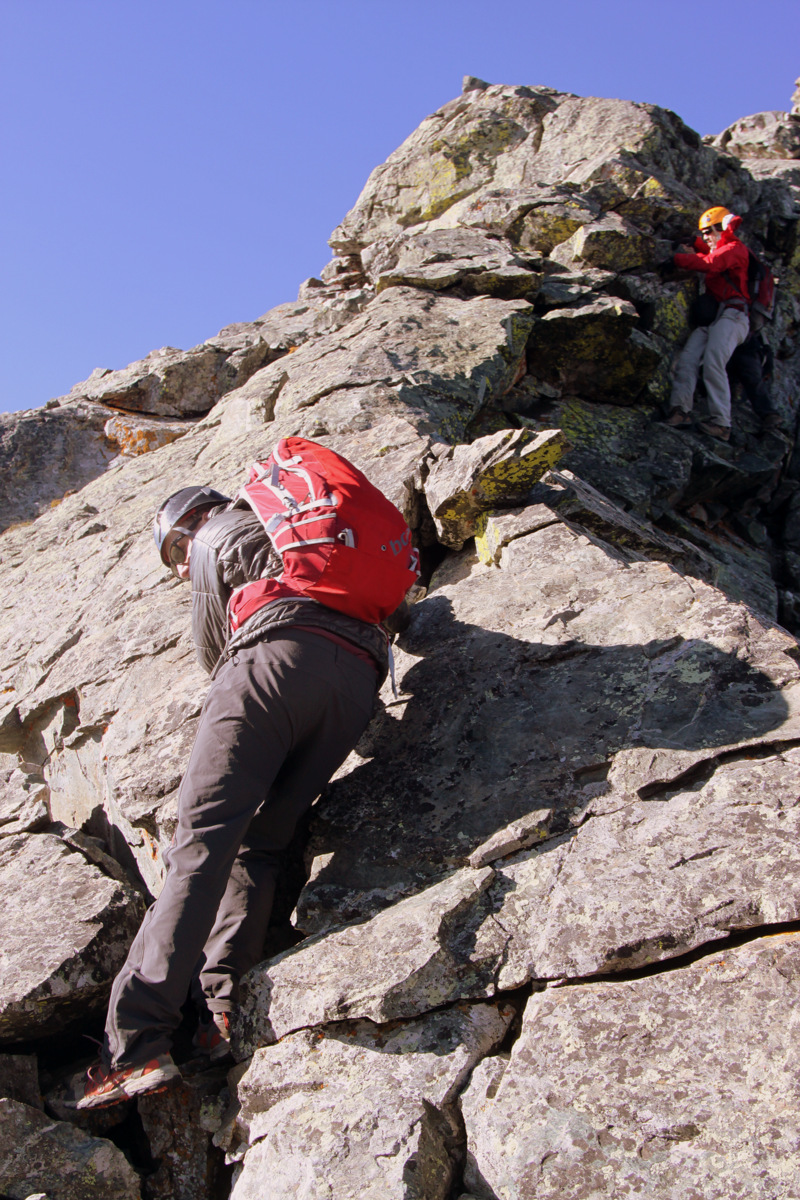
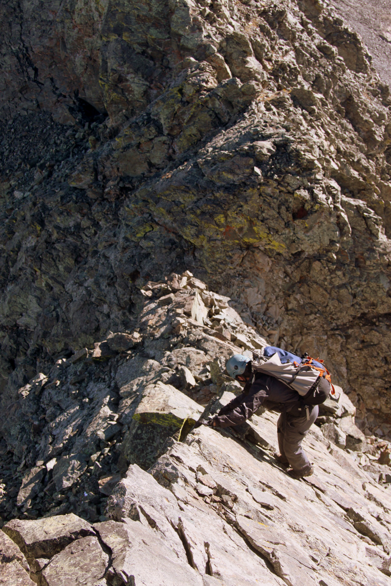
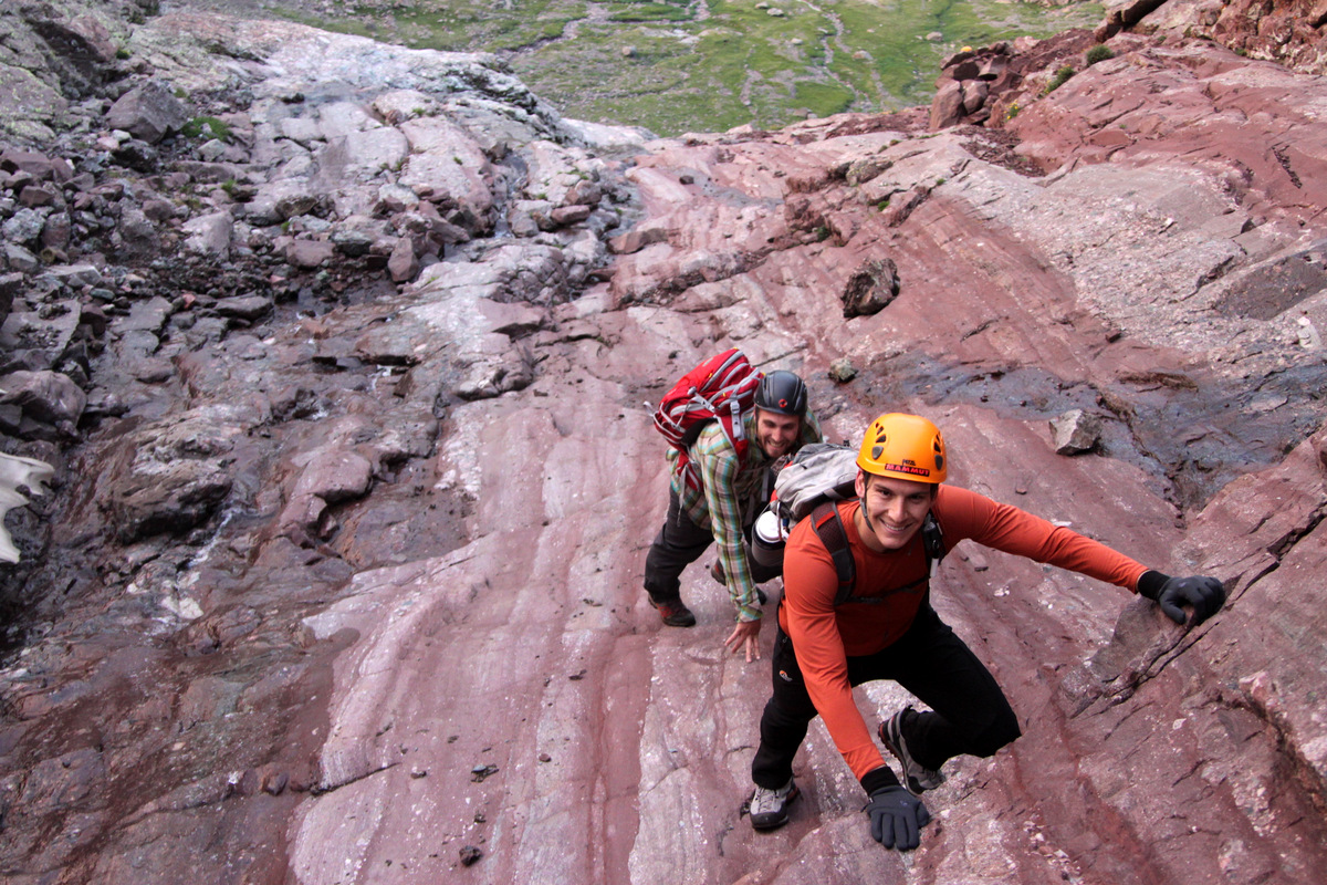
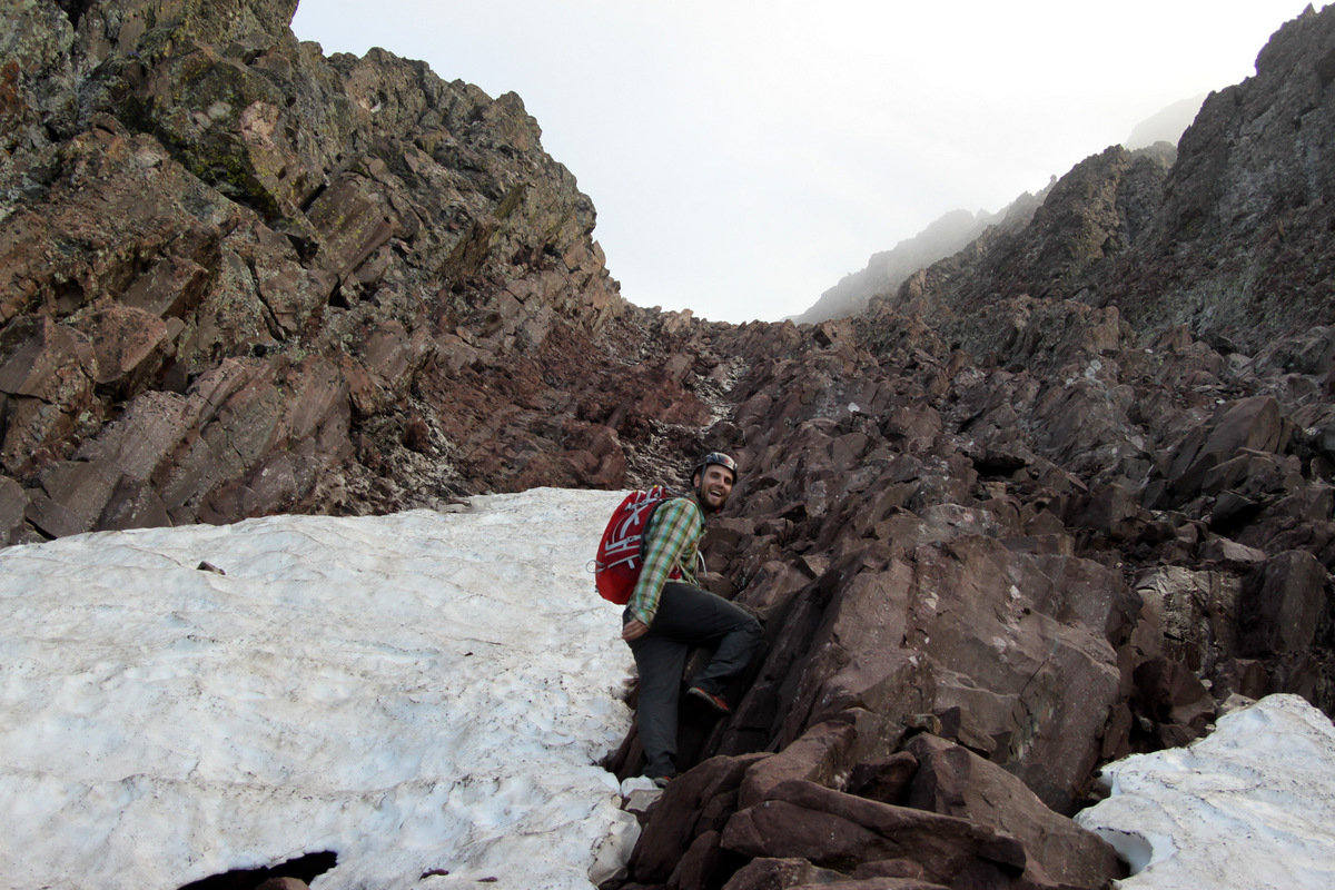
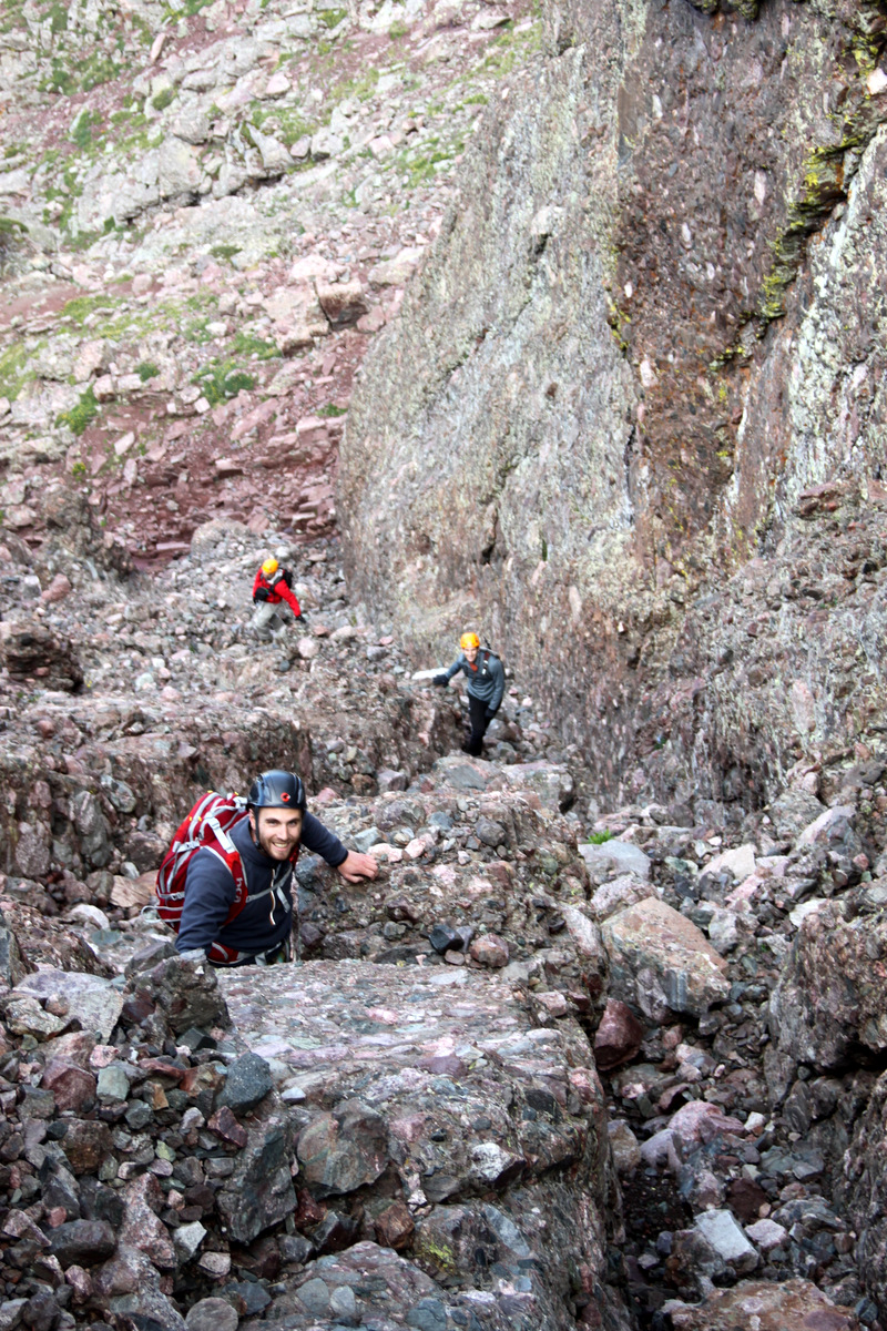
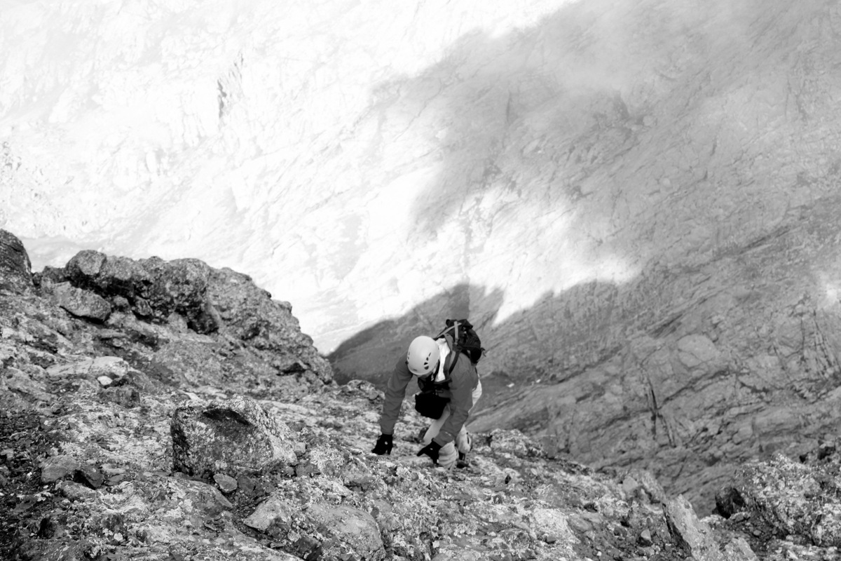
We all piled into my Tahoe with all the gear and started for my truck’s third time up one of the roughest 4WD roads in Colorado though I always parked at around the 10,000′ level before the really nasty 4WD sections dubbed Jaws 1, 2, & 3. The sections over Jaws 1,2, & 3 shouldn’t even be in the 4WD category – one needs a certified rock crawler for these sections. So, after driving around 2.5 miles up the road very slowly and over some tough sections in the dark, we reached where I always remembered parking and set up camp. Mike & I slept in the back of my truck while J & Derek shared the tent.The alarm went off at 3:30am and after some coffee & oatmeal we were on the road by 4:30am. The moon was bright as it was almost a full moon. After what seems like a few weeks of torrential monsoonal flow, we would finally get our bluebird Fall day. We hiked by headlamp the 2.5 miles up to Lake Como at 11,750′ in about an hour marveling at the Jaws 1, 2, & 3 sections and how these rock crawlers are able to navigate such serious terrain. Other climbers who had camped at Lake Como were stirring and headlamps were visible. We continued up the Lake Como road to above the lake turning south across a creek and made our way through the forests to the base of the northern access couloir to Little Bear’s west ridge. The last time we climbed this couloir was in snow, which was definitely easier than the scree-filled 35 degree couloir presenting itself to us today. However, we made really good time to the top of this couloir and the start of the west ridge.
Early morning on the start of Little Bear’s west ridge direct
Heading towards the meat & potatoes of the west ridge
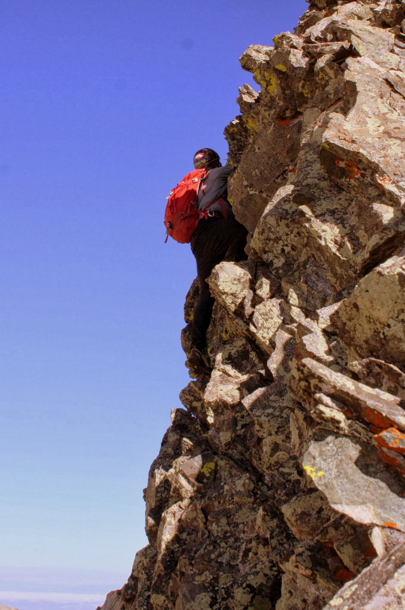
I had been wanting to try the rarely climbed west ridge direct up Little Bear after seeing Alan Arnette’s blog entry & video on his team’s ascent up the route earlier this summer. It just looked so good and I figured would be a good warm-up for the traverse to Blanca. And, the west ridge direct surely didn’t disappoint. Great 4th class/easy 5th scrambling on a super exposed arete hit us right off the bat above the “Baby Thunder” couloir.
J getting into the scrambling of the west ridge direct
Mike on an exposed 4th class arete
A really fun slab portion of the arete. There was a piece of webbing slung around a rock at the top of this slab
J on the upper west ridge direct
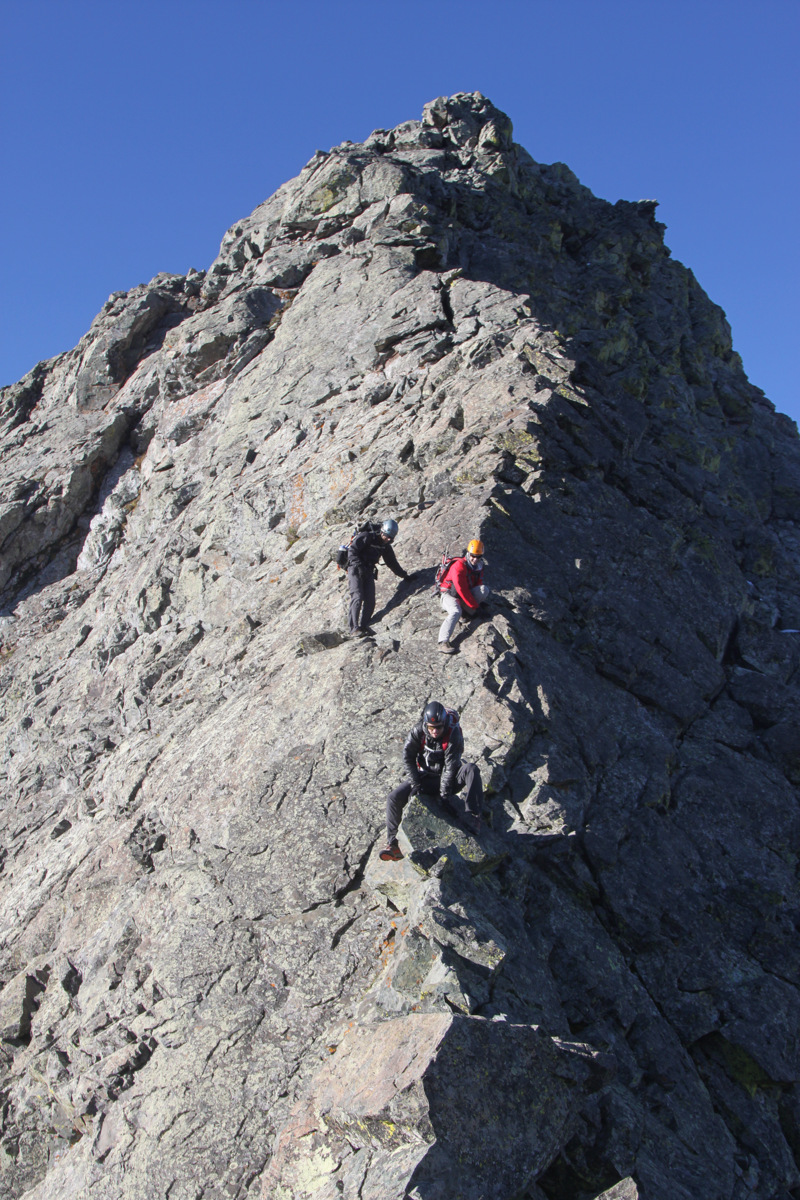
The terrain mellowed out to class 3 about halfway up the ridge, but then more 4th class fun was to be had. J & I made a few seriously exposed low 5th class moves out over the northwest face to avoid a overhang on the ridge proper, moves which could have been avoided by traversing south as Mike & Derek did, but it was fun and exciting all the same.
Me displaying this short low 5th class yet exposed section
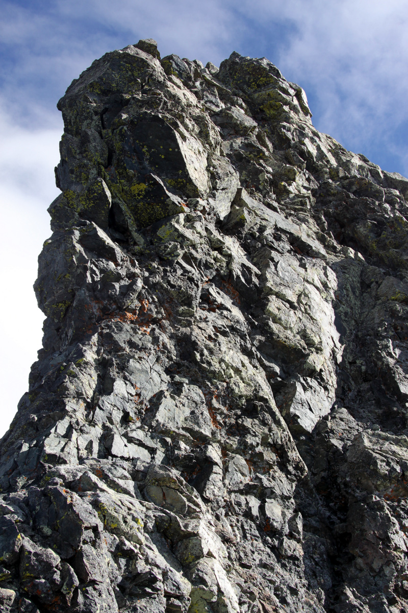
Almost to the summit of Little Bear Peak via the west ridge direct
Me on an airy perch
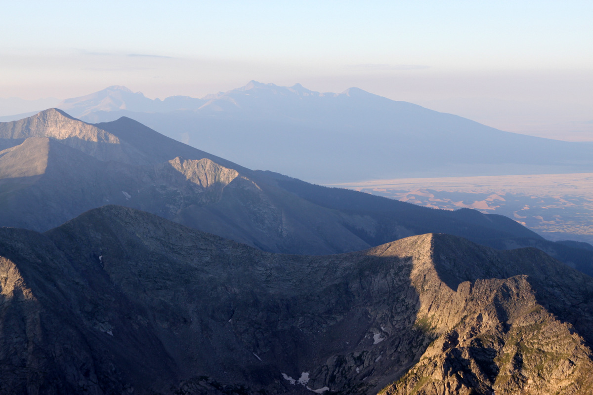
Northern Sangre de Cristos with Crestone Peak & Crestone Needle visible above the Great Sand Dunes
The boys coming up to Little Bear’s summit with the beautiful San Luis Valley far below
We all reached Little Bear’s summit by about 8am for a time of about 3 1/2 hrs from the truck.
J on the summit of Little Bear for the 2nd time
Little Bear Peak summit (14,037′)
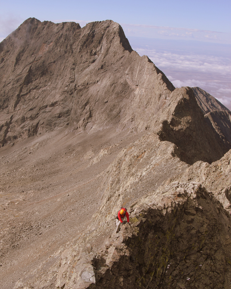
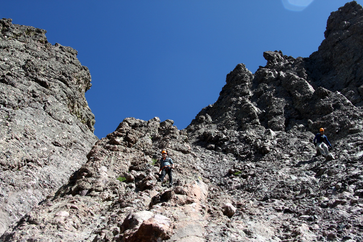
The west ridge direct definitely goes down as one of my all-time favorite routes up a 14er. Highly recommended for folks who enjoy that sort of thing. I would think the ridge is even downclimable with maybe a rappel or two in there if used as a descent route. It was a gorgeous morning though a bit windy. The stiff breeze continued with us the entire traverse to Blanca so we accepted it as our climbing companion. We made our way down the northeast ridge of Little Bear from the summit to start the traverse around 8:30am. The downclimb off of Little Bear’s summit to the ridge proper is one of the traverse’s cruxes because of the exposed 4th class downclimbing.
Mike & I heading down Little Bear’s northeast ridge to start the traverse
Mike & Derek on the downclimb off Little Bear to start the traverse to Blanca
The boys downclimbing off Little Bear’s northeast ridge
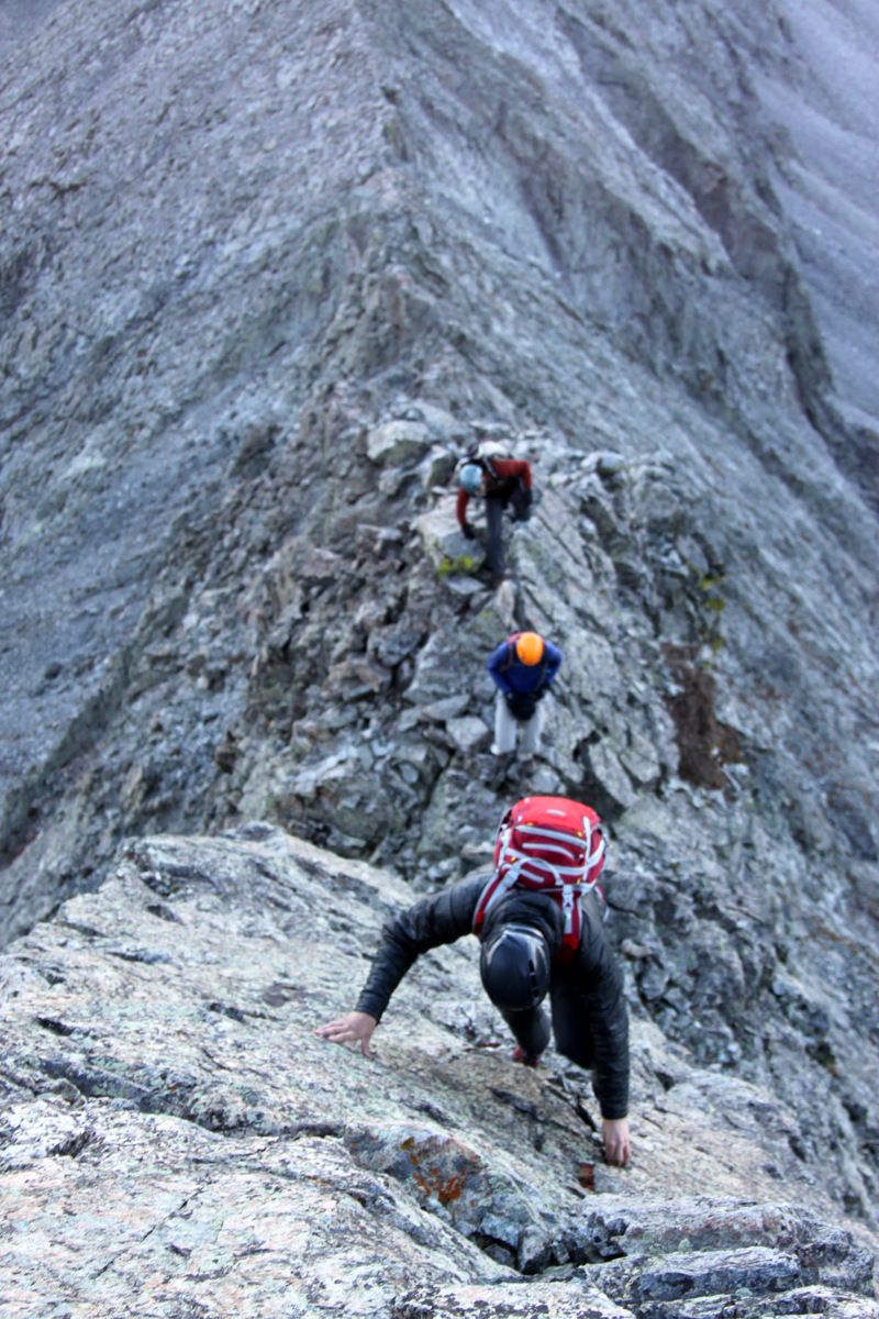
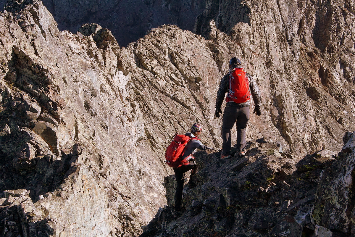
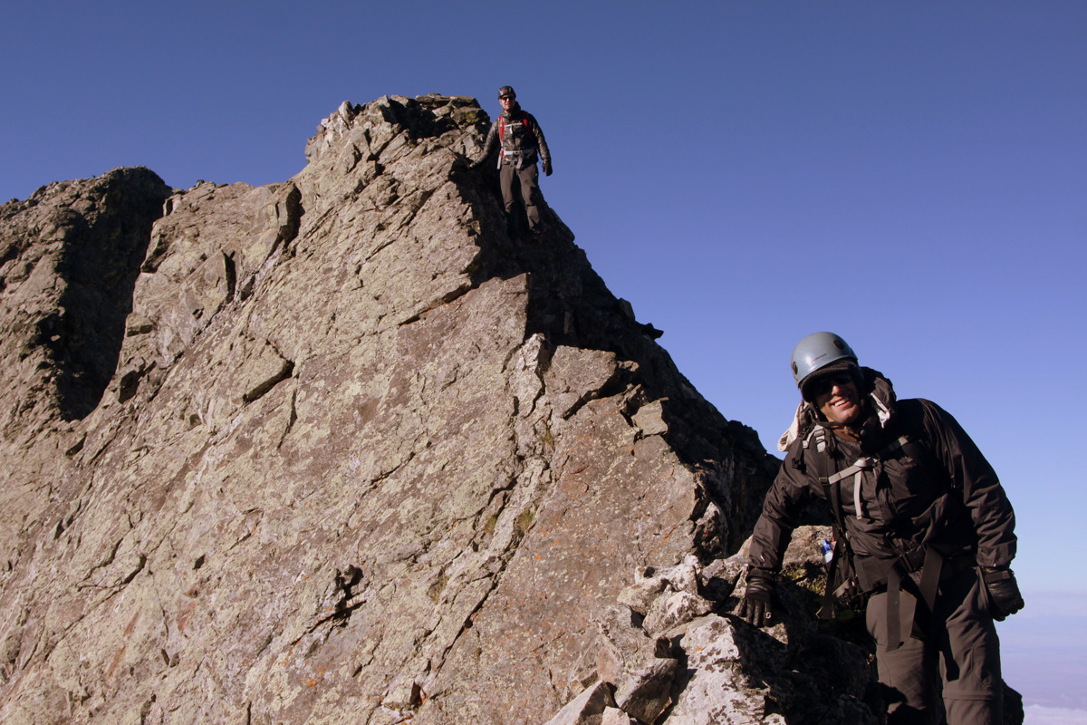
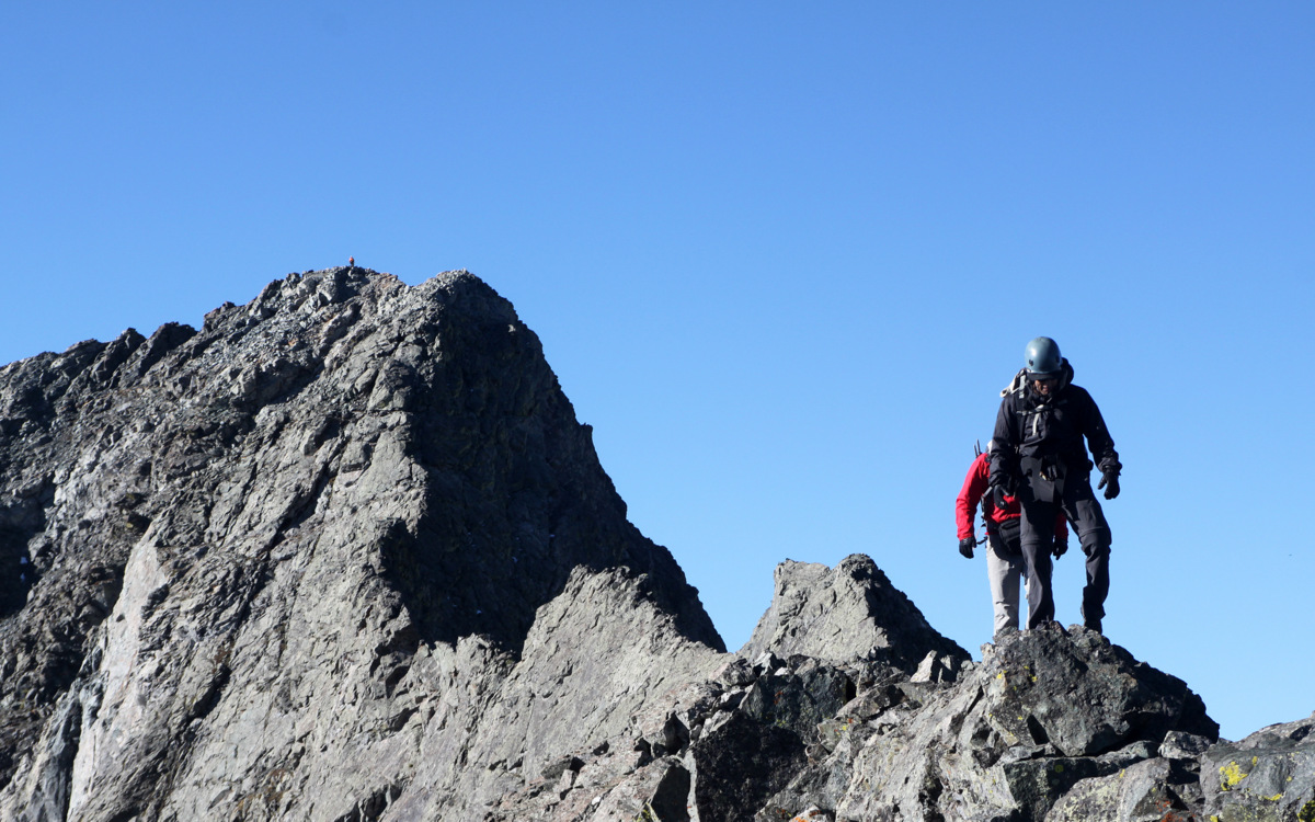
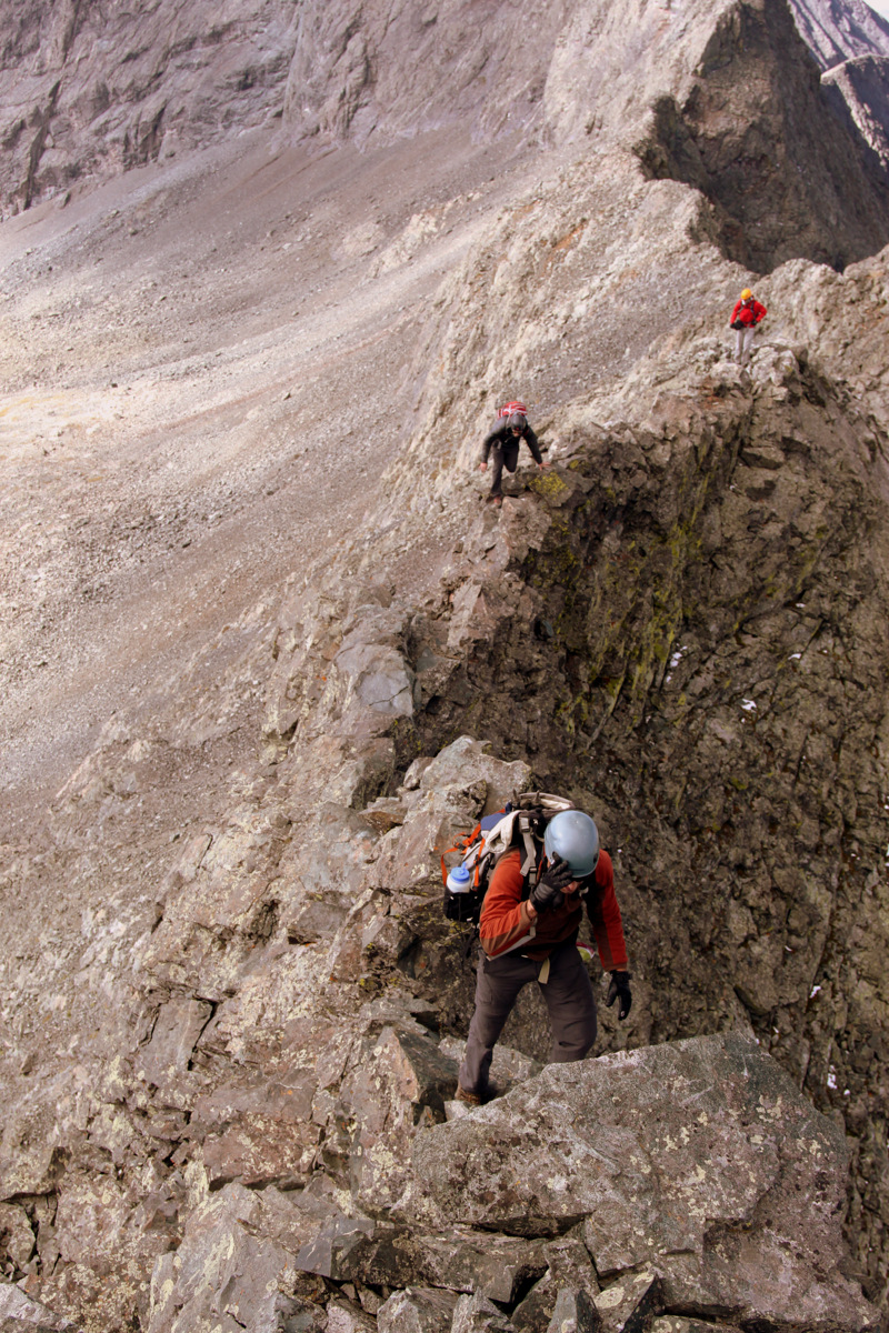
We made it down to a small notch and continued on to the northeast up and over several towers and knife-edges on great rock all making for an incredible traverse. The sustained “airiness” and exposure was so exciting. We saw two climbers ascending Little Bear’s northwest face below us and we made sure not to kick anything down on them from the ridge proper. These northwest face climbers turned out to be Tyler, aka MountainMedic, from 14ers.com and a friend.
Climbers below us ascending the northwest face route of Little Bear
Derek on an airy move with Little Bear Peak behind
The climbing never really exceeded low 5th class, but it felt like more in places because of the exposure.
J & Mike on the traverse
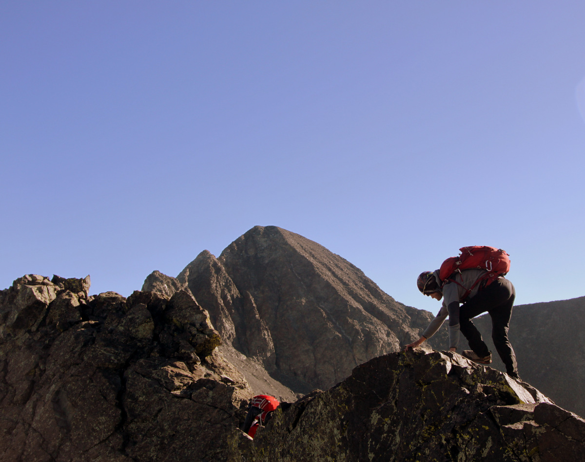
Derek heading down to another notch in the ridge
Me on a knife-edge of sorts with Blanca Peak in the distance
A climber can be seen on the summit of Little Bear Peak behind J & Derek
Mike and some air below him
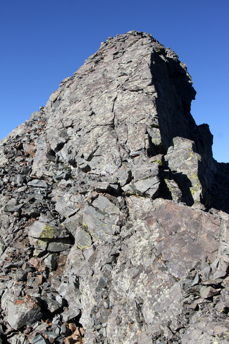
Traversing around to the north of a small tower – I think this is the tower dubbed “Captain Bivwacko” tower, but who knows. There are so many towers
J & I had to climb it though
J downclimbing a knife-edge ridge of another tower
The knife-egde we downclimbed
I believe this was the low point of the traverse – around 13,600′
A nifty and fun little chimney
Me having some fun
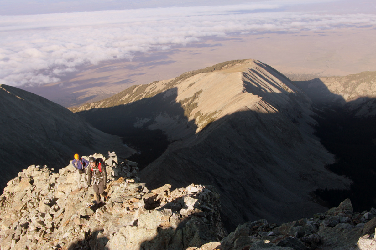
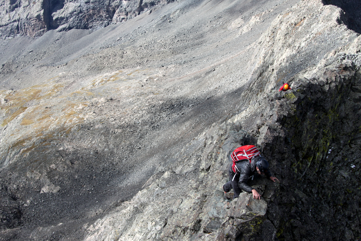
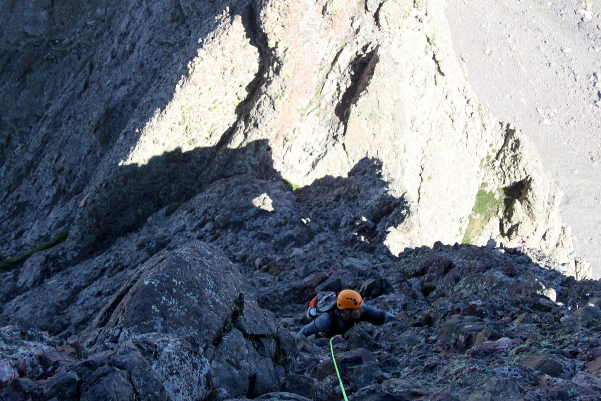
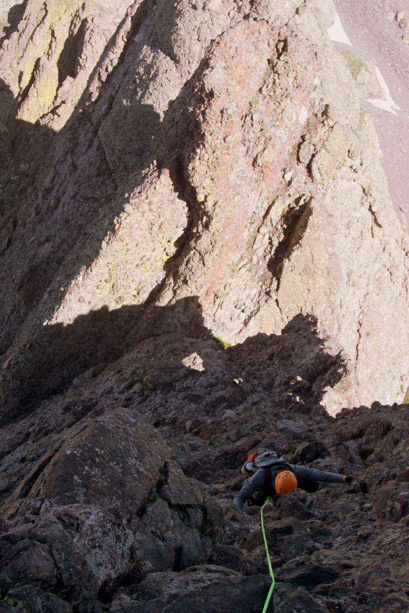
The first half of the traverse definitely was harder and more airy than the second half of the traverse up to Blanca though the 750′ vertical gain up and over three major towers and an exposed “catwalk” to Blanca from the traverse’s low point was a whole different kind of challenge. The middle section of the ridge was essentially class 2-3 talus walking and we made good time on this part until the 1st tower up to Blanca reared itself up in earnest.
Mike on the “walking” portion halfway across the ridge
Derek with a tower on the right and Little Bear Peak behind him to the left with climbers on its summit
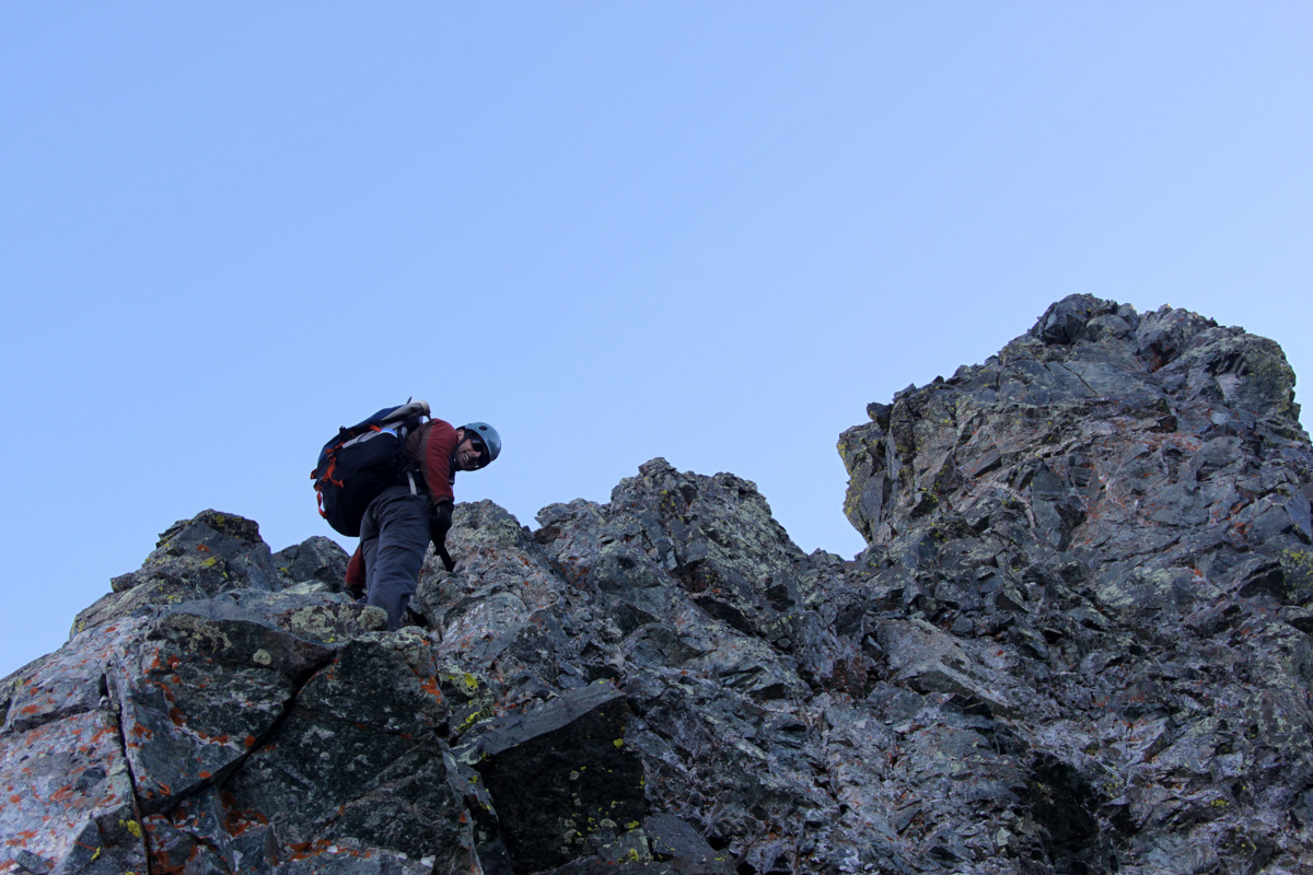
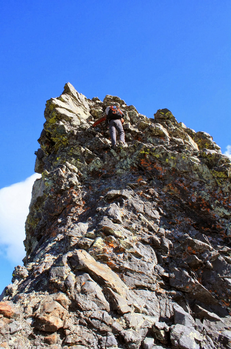
Typically, folks traverse to the right (south) of the 1st tower, but J & I decided to find a way up and over as we always love the “ridge proper” method. We found a weakness in the tower at the right up a dihedral and to a left-ascending traverse. It was about 100′ in total of low-mid 5th class climbing.
Our line up the 1st tower went up the obvious dihedral right of center and then back left to the summit
J stoked to have climbed the 1st tower head on
We met Derek & Mike around at the base of the notch after the 1st tower’s summit ridge. It was then a short scramble up to the infamous “catwalk” portion: a very narrow (1-2 ft) wide ledge system with serious exposure on both sides. It made for great pictures.
Climbing along the ridge to the “catwalk” and the 2nd tower
Along the “catwalk”
Mike & Derek traversing the “catwalk”
Derek on the “catwalk” with Little Bear getting further & further away in the distance
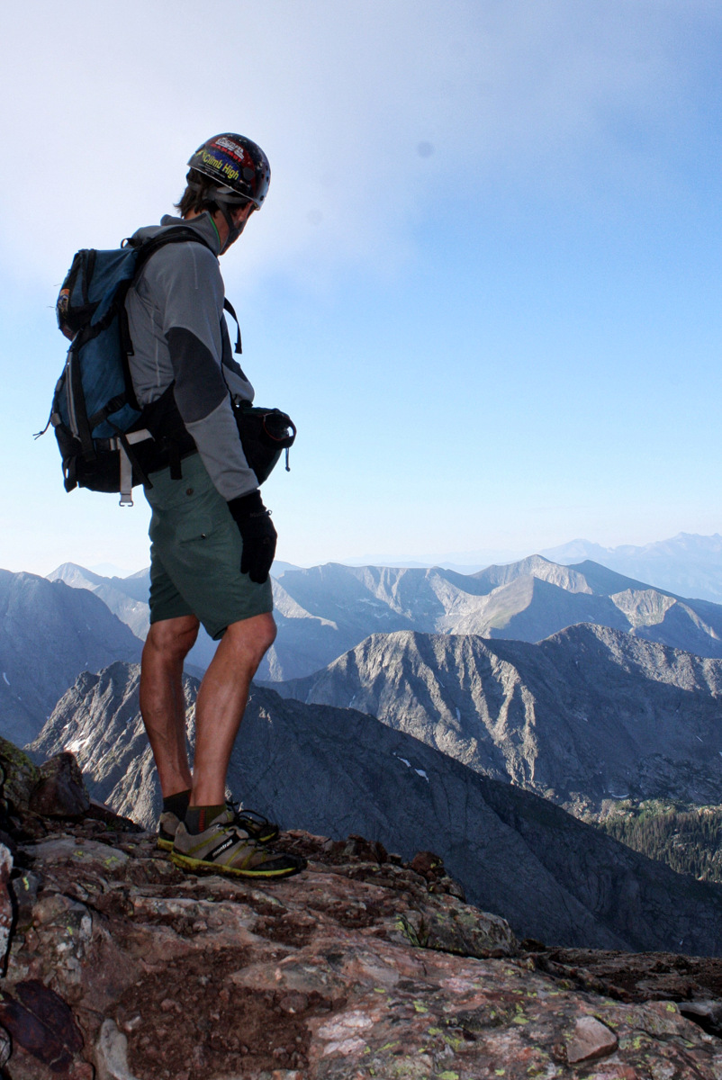
After a short scramble up to the summit ridge of the 2nd tower, it was a short downclimb to the notch and the base of the 3rd tower. The ascent up the 3rd tower was easy enough considering what we had already traversed and we were soon on top of Blanca Peak around 10:40am for a traverse time of just over 2 hrs.
Derek on the summit ridge of the 3rd tower with the San Luis Valley over 7,000′ below
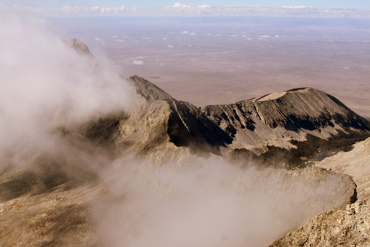
The Little Bear-Blanca traverse from Blanca’s summit
Looking north from Blanca’s summit
Blanca Peak summit (14,345′)
Its a bit lengthy, but here is a video of the boys reaching Blanca’s summit after the traverse:
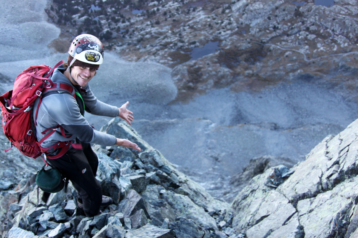
I really felt great to have completed this traverse and we were all very pleased with how well it went. I would definitely come back and do this traverse again despite the effort in getting here – it was that good. The wind was still whipping pretty good and it was getting cold. We departed the summit around 11:15am or so and descended Blanca’s standard northwest ridge. I had thoughts of continuing onto Ellingwood Point with J, but my throat was really starting to get sore from the stiff wind we had been enduring for hours, I believe. I thought it best to get down and save my throat, though we definitely had the energy to continue on. Another time. It was a bit disappointing though because besides Ellingwood Point the only other 14er I need to have climbed all the Colorado 14ers twice is my original finisher, San Luis Peak. C’est la vie. Nevertheless, I’m glad we continued down to get out of the wind and we still had a long descent back to my truck. The hike down to Lake Como was beautiful and we stopped several times to refill water and take in our surroundings. Once back at Lake Como we chatted with Tyler and his friend who had descended down the “Hourglass Couloir” and were packing up camp. It was good to meet those guys. We got some good looks at the ridge we had completed as well the entire hike out.
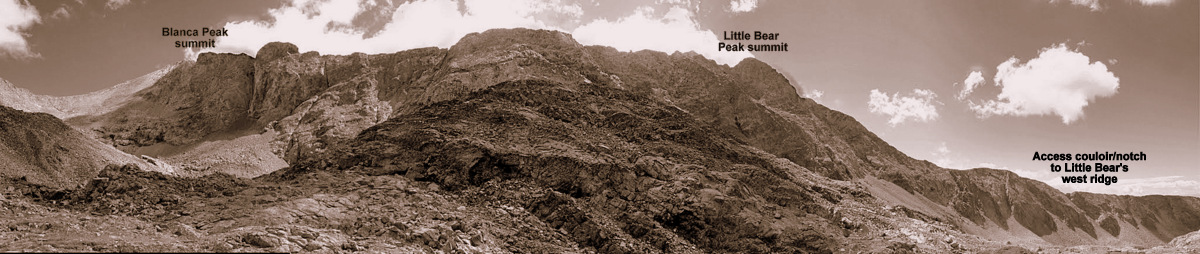
Little Bear Peak from Lake Como. The west ridge direct follows the right skyline in the foreground and then the traverse to Blanca follows the left skyline
Derek’s panorama of the entire 3.5 mile ridge line we traversed from the notch in Little Bear’s west ridge (far right) to Blanca’s summit (far left)
We finally reached the truck around 2:30pm for a 10 hour day including many stops and rests on the way down. It was a great day out in the highcountry with my good friends. We feel lucky to have had such a nice day for a ridge like this. We packed up the truck and it took an hour or more to drive the few miles down the extremely rough (for a stock 4WD) Lake Como Road. After dropping Derek off at his car, we all headed north for some awesome burgers at the Steel Horse Grill in Villa Grove. Derek then headed back to Denver while Mike, J, & I found a cool car camping spot up the Marshall Pass Road off Poncha Pass and had a nice campfire under the stars. I helped them shuttle cars the next morning so they could ride the famous Monarch Crest mountain biking trail and then I headed back in my truck to Vail. My truck sure has been through the ringer with over a decade’s worth of 14er trailheads (many more than once), but the Lake Como Road continually proves to be the roughest ride we’ve been on together. The Little Bear – Blanca ridge was certainly all that it was advertised to be. I hope to go back there with Kristine someday to try it with her.
The famous Crestone Traverse, one of Colorado’s 4 great fourteener traverses, is truly a celebrated classic scramble. Its even described in David Cooper’s Colorado Scrambles book. This traverse links the two famous and more difficult 14ers, Crestone Needle & Crestone Peak, down in the Sangre de Cristo Range. However, the traverse stays primarily on the west side of the ridge and does not follow the ridge proper for good reason. Following the ridge proper would entail serious class 5 climbing and likely many rappels. And, this traverse is supposed to be a scramble.
Crestone Needle (left) & Crestone Peak (right) as seen from Humboldt Peak back in 2009
Despite having climbed Crestone Needle & Crestone Peak each twice over the years and attempted the traverse once back in October 2007, I have always wanted to get back and finish it. That cold October day back in 2007 was full of routefinding issues not to mention a high fever I was running thus all contributing to us bailing off the traverse down a rocky couloir to the west.
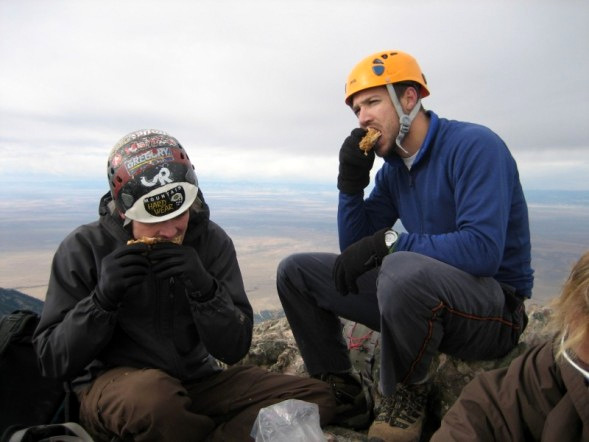
Derek & I on the summit of Crestone Peak eating KFC in late October 2007 before our failed attempt on the traverse
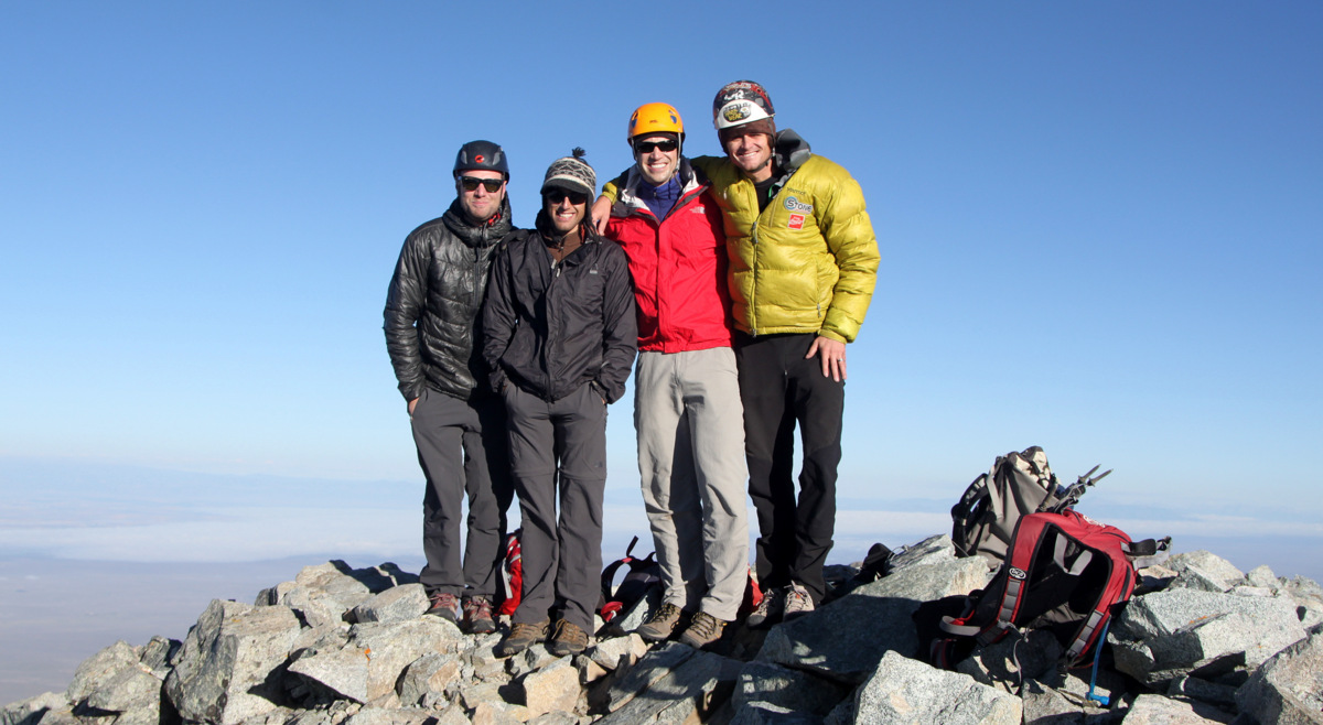
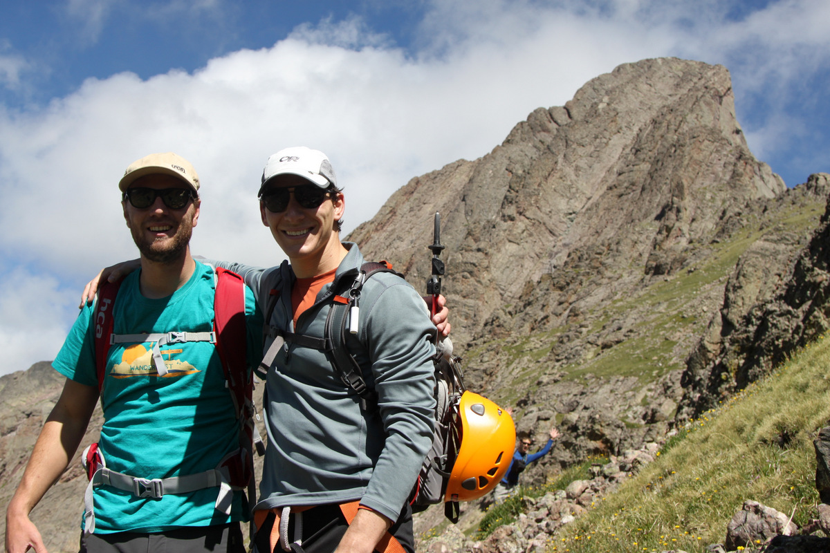
My good friend Reid Jennings had been asking me to go with him down to the Crestones and do the traverse as he had not climbed these peaks. I was definitely in as I wanted to finish the traverse as well as help Reid fulfill his 14er goals. Good friend Derek Drechsel, who was with me on the original traverse attempt and who has since finished climbing all of Colorado’s 14ers, wanted to go back. Lastly, Mike Santoro joined us as he is an avid rock climber with me and wants to really get into the 14er frenzy, especially the more scrambly ones. Mike & I drove down from Vail and met Reid & Derek at the new South Colony Trailhead around 10:45pm Friday night as they were coming from Denver. Since Derek & I were last in the Crestones for Ryan “Baba” Aldrich’s 14er finale on Humboldt Peak in July 2009, the forest service had closed the upper half of the 5 mile long 4wd South Colony Lakes Road and installed a new trailhead and gated the road adding an extra 2.6 miles each way for the climb.
Ryan “Baba” Aldrich’s 14er finale extravaganza on the summit of Humboldt Peak in July 2009
Due to the extra mileage and the strong chance for thunderstorms brewing before noon, I suggested we leave the cars around 2:30am and that’s exactly what we did despite only having gotten an hour or two of solid sleep. We made good time to the upper trailhead where we had parked all those times before covering the 2.6 miles and 1000′ vertical gain in just less than an hour. We made good time in the dark to the vicinity of Lower South Colony Lake and made the turn off for Broken Hand Pass. The moderate class 3 scrambling up to Broken Hand Pass (12,850′) was easy enough in the dark. The issue with going up Broken Hand Pass is that you then have to descend over 500′ down to Cottonwood Lake before starting up the Red Couloir of Crestone Peak. It started getting light enough once we reached Cottonwood Lake to see our ascent route ahead up the fun class 3 Red Couloir.
Reid & Mike in good form climbing the Red Couloir on Crestone Peak
The Blanca Group with the Sand Dunes at lower right
Mikey have a ball in the Red Couloir
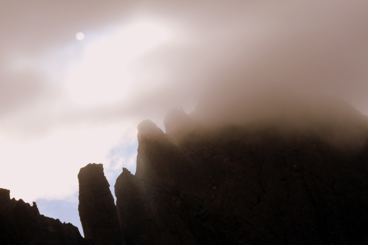
We reached the top of Crestone Peak just after 7am, which I believe was the earliest in the day I have ever stood atop a 14er. The early morning misty clouds engulfed the final few hundred feet of Crestone Peak, which definitely gave an eerie yet magical feel to the summit. Everyone was excited, especially Reid & Mike, for whom this was a new 14er summit.
Crestone Peak summit (14,294′)
The San Luis Valley 6,000′ below
We didn’t dabble too long on the summit as we had to descend back down the Red Couloir a few hundred feet to find the exit for the traverse. Derek & I had spotted the cairned exit on the ascent and so we begin the fun walking on exposed grass ledges interspersed with some scrambling to start the traverse.
Me checking out the exit in the Red Couloir to start the traverse
The easy first half of the traverse across grass ledges and short gullies
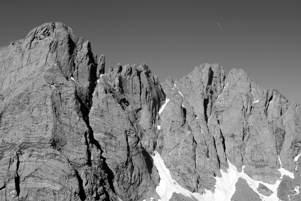
Crestone Needle and its north ridge comprising several gendarmes looking ominous through the clouds
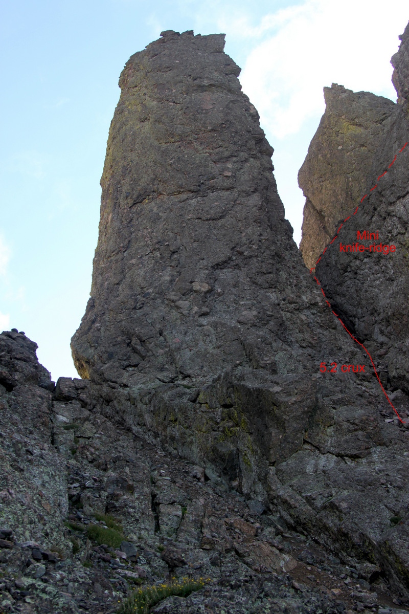
The weather so far was on our side and we made good time up the class 3 rock gully to the mid point of the traverse at the base of the ominous Black Gendarme – a 200’+ tower of crestone rock.
The fun class 3 gully that leads to the base of the monstrous Black Gendarme
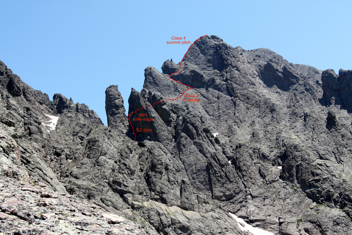
This is where Derek, me, and our crew got all turned around 6 years ago. However, I knew the route now much better and the climbing from here on out went like clockwork. We ascended a short (maybe 10′) 5.2 crux to enter the steep gully immediately to the south of the Black Gendarme. After some class 3 climbing up the gully to the notch where we could peer 2,500′ down to Upper South Colony Lake, we hopped on an exposed but short knife-edge ridge to access the class 3 Z-ledges (named so because of the zig-zag nature) which eventually led up to the final class 4 summit pitch. These ledges consisted of pretty fun scrambling and were definitely much mellower than they appear from down below the Black Gendarme. Everyone was doing extemely well and all making good time.
The Black Gendarme which begins Crestone Needle’s north ridge. The 5.2 technical crux is shown to the Black Gendarme’s right (south) followed by a class 3 climb up the gully to a mini knife-ridge
The final 500′ up to Crestone Needle on the Crestone Traverse (picture taken back in July 2009)
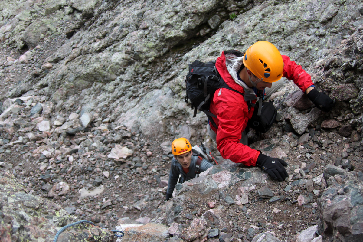
Mike ascending the 5.2 technical crux of the traverse just to the south of the Black Gendarme
Though low 5th class, this crux is only about 10 ft
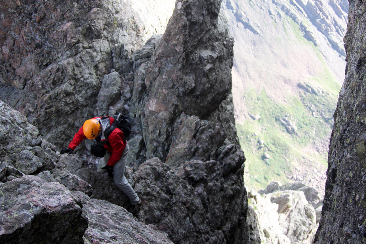
Derek showing us how its done on the mini knife-ridge
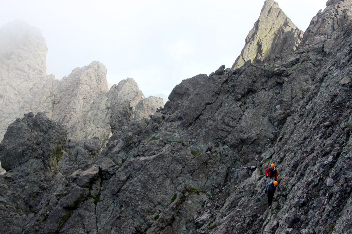
The class 3 Z-ledges
The Z-ledges are really fun class 3 climbing which spit you out at the base of the final class 4 headwall up to Crestone Needle’s summit via the north ridge
Mike loving the crestone conglomerate holds
Derek enjoying the scrambling
The final class 4 summit pitch up Crestone Needle’s north ridge is what this traverse is all about. Good climbing on solid crestone conglomerate rock up a steep 100′ pitch with some awesome exposure and alot of air under your feet all help to make this a memorable scramble. The airy position of this summit pitch definitely adds to the intensity and excitement. I said for Mikey to start up first as he reached my position at the base of the summit pitch shortly followed by Derek.
Derek & Mike climbing the class 4 summit pitch up to Crestone Needle
I knew Reid and/or others may want to be belayed on this pitch, so I brought my 30m/8mm rope, harness, a selection of cams and slings just in case, which I am always more than happy to do. I want my buddies to feel comfortable climbing these pitches and if it helps ease their minds so they can climb well, I am all for that. I knew Reid may want a belay for this pitch as it is very exposed. He definitely agreed and so we harnessed up and I climbed the pitch with one end of the rope tied to my harness.
Me almost to the fixed webbing atop the class 4 summit pitch on Crestone Needle
I anchored myself into the webbing which was in place slung around a rock and belayed Reid up the pitch. It was fun for me watching him climb up the class 4 rock with the incredible air beneath his feet.
Reid climbing the class 4 summit pitch
This pitch is so awesome. Classic crestone conglomerate climbing in a very airy position
I was getting pretty cold with the wind and 14,000′ air temperature with just my shorts on (not all that smart, I know), but Reid topped out in no time and I took him off belay. We then stowed the gear in our packs and scrambled up the final easy ridge to the summit where we joined Mike & Derek.
Reid on the short scramble to the summit of Crestone Needle
It was a celebratory summit for all, but we didn’t stay too long because of the wind and cold. The Crestone Traverse had taken us about 2 hrs summit to summit.
Crestone Needle summit (14,197′)
We then descended the class 3/4 east gully on Crestone Needle’s south face the entire way down to the trail leading back to Broken Hand Pass to complete the full loop. I had forgotten how fun this Crestone Needle east gully climbing really was – even going down.
Descending the east gully of Crestone Needle on its south face
Mike & Reid almost back to Broken Hand Pass with Crestone Needle’s east gully behind
We all eventually made it back to Lower South Colony Lake around 11am and soaked our feet for half an hour. We arrived back at the cars around 1:30pm for an approximate 13 mile roundtrip day with 6,000′ of vertical gain. After an awesome deli sandwich in Westcliffe, we said our goodbyes and congrats and went on our respective ways back to Vail & Denver. The next day Kristine was planning a hike with our good friend Lauren McKeone and all the dogs up the familiar Villa Ridge on the high 13er Drift Peak (13,900′), so I joined them on the fun hike. We started hiking around 8am or so and returned to the car around 12:30pm for a wonderful half day hike with all the ladies – 2 humans and 4 dogs. I am a lucky guy. It was all of their first summit of Drift Peak which made it extra special.
Kristine & Lauren climbing above the clouds on Drift Peak’s Villa Ridge
The clouds seeping through the notches in the Drift Peak-Wheeler Mtn ridge
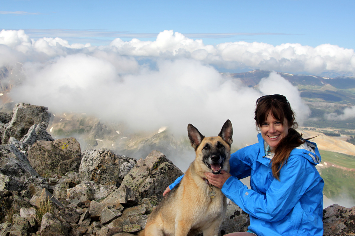
Scout & Lauren on the summit of Drift Peak (13,900′)
Our good friends Jamie Buckley & Eileen Clerig came to visit us this past weekend from Chicago. It was an absolute treat for Kristine & I to host these two and its always a special bonus when you find couples that you so enjoy hanging out and adventuring with both halves of the couple. Jamie is a fraternity brother and pledge brother of mine from W&L and has been a long time great friend. Jamie also climbed Kilimanjaro with Kristine, myself, and others in 2011 and I believe has a newfound interest in this whole mountain climbing bit. Jamie had climbed a few Colorado 14ers in preparation for the climb of Kilimanjaro and he definitely wanted to attempt another one on this short but sweet trip back to Colorado. As always, Kristine & I are up for any kind of adventure and I thought the nearby Mt. Lincoln would be a good 14er for all of us to attempt as it is relatively short (5 miles or so roundtrip with less than 3,000′ vertical gain). We have come to know Eileen well over the past two years and we absolutely love this gal! She is so upbeat and positive and has a glowing personality. She and Buckley make a wonderful couple – so wonderful in fact that they are engaged and are getting married in Florida this June 15! I truly cannot wait to attend the festivities and I believe most of my fraternity brothers feel the same way.
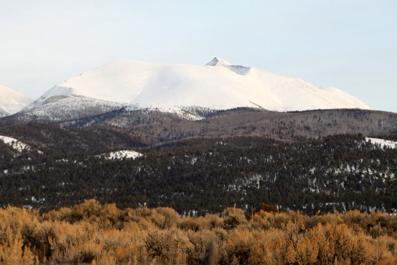
Mt. Lincoln (14,286′) from Colorado Highway 9
My only other Colorado fraternity & pledge brother, Chris Sutton, who is a good friend and lawyer in Colorado Springs joined us as well with his girlfriend, Alison. Additionally, our good friend and partner in crime, Lauren McKeone, who teaches with Kristine in Vail, expressed interest in coming along with her German Shepherd, Scout. Last but not least, of course, Rainie & Kona rounded out the crew.
Kristine, Rainie, Kona, & I had been up Lincoln a few times and its always good to go back. This time we started the climb from the eastern Quartzville trailhead as the more standard and higher (in elevation) Kite Lake trailhead from the west was likely not accessible via car because of the snowpack. The last half mile to the Quartzville 4WD trailhead parking was deep snow so we had to park on the road, which added a bit more length to the hike but completely manageable. Kristine & I went sans snowshoes and besides the initial half mile up the road, there was very little post-holing as most of the east ridge route was firm snow or barren rock/grass. The weather forecast, however, was far from ideal. With a 40% chance of snow, I honestly didn’t know what to expect. But, with only one day for a 14er attempt for Buckley & Eileen, we had to at least give it an attempt. The snow really never came, which was absolutely fine with us. But what did come was the wind and lots of it! The forecast had only called for 15-20mph winds, but I estimated the winds were likely 40mph up higher on the east ridge with gusts perhaps at even higher wind speeds. Fortunately, the air temperature was fairly warm, which made the wind chill temperature manageable.
Lauren & Scout in good form at about 12,800′ on the east ridge
Definitely a scewed picture I took here of Lauren & Scout, but sort of cool in a strange way
We really didn’t start snowshoeing/hiking until about 9:45am because of the slow drive over from Vail on icy/snowy roads. The sun kept poking through the intermittent clouds, which was definitely a reprieve from the high winds. Eileen let all of us know early on that she was really just wanting to have a nice, leisurely day in the Colorado high country but she knew that Buckley really wanted to summit if at all possible. Kristine then remained with Eileen and they both proceeded at Eileen’s pace and enjoyed the day. It actually worked out for the best as Kristine & Eileen got to have some great “gal time” together. Sutton & Alison made it to about 13,000’ on the east ridge before turning around due to the high winds. At that point, Buckley, Lauren, the dogs, & I had reached the base of the final summit cone at about 13,800’. Now, I never want to push my friends to do anything they are uncomfortable with or do not want to do. I kept turning around and asking Lauren & Buckley if they would like to continue. Their perseverance & resolve were incredible. They always wanted to forge ahead despite the very taxing high winds. We were never in a dangerous situation, though I know it likely felt a bit dangerous to them because of the high winds. I then broke trail up the final summit cone in hopes that the footsteps would help Buckley & Lauren.
Lauren & Scout climbing the final summit cone to Lincoln’s summit
It was a hard fought battle, but Bucks persevered
Buckley reaching Lincoln’s summit
I like this one of Buckley reaching Lincoln’s summit
We all topped out around 1pm, I believe, and enjoyed a good 20 minutes on the summit taking in the views and snapping pictures. Amazingly, the winds up top were not nearly as strong as the winds hammering us pretty much the entire ascent. My hat is off to Buckley on really staying strong to the end, as he normally does, and pushing through to the summit, especially since he had just come from Chicago (elevation 579’) two days before! He’s one tough son of a gun. And, Lauren did so fantastic in putting aside any doubt and disbelief to make a successful 14er ascent in tough conditions. Lauren has really been getting out with Kristine & myself on our backcountry and mountain climbing excursions and her efforts are really paying off! Chalk up another 14er summit for Buckley & Lauren and a new one at that!
Lauren & Scout on Mt. Lincoln’s summit (14,286′)
Me, Rainie, & Kona on Lincoln’s summit
Jamie Buckley on Mt. Lincoln’s summit (14,286′)
Pikes on another summit together
Group summit shot on Mt. Lincoln (14,286′)
I cleaned the ice and snow out of the dogs’ paws, but they were really cold, especially Kona with blowing ice freezing to her fur, so we descended pretty fast.
The almost Buckleys back at the car with Mt. Lincoln behind to top off an awesome day in the Colorado high country
We eventually made it back down to the basin far below and met up with Kristine & Eileen. We had learned that they had made it all the way to 13,500’ on the east ridge where they could see us climbing up the final snow summit cone. Eileen did such a stellar job and I think she really felt good about herself. Kristine is amazing at coaching friends along and setting minor goals along the way. They had had a great few hours together, which is what it was all about anyway. Sutton & Alison had descended back down to their car and the rest of us made it back down to the cars at around 3pm but not without some good ole spring post-holing on the half mile stretch of road down from the 4WD trailhead parking. But, what’s a spring 14er climb without some post-holing, right? We all headed to the Breckenridge Brewery for some beers, food, and NCAA Final Four basketball and toasted to a great day up on the mountain. I think Buckley & Eileen had a great visit back to Colorado, however short it was, and a wonderful breath of fresh air before heading back to the Windy City. Kristine & I truly loved having them. I think Eileen said it best when she said, “Ya Know, even though it was a short visit, I feel it was very rich & hearty with friendship and good times.” I couldn’t agree more.
Well, its in the books. My great friend & climbing partner, J Weingast, completed his quest to climb all 55 of Colorado’s 14,000′ peaks this past Saturday, February 2, with a winter summit of Culebra Peak (14,047′) down in the southern Culebra Range near the town of San Luis, CO. Culebra Peak is the only 14er in Colorado that completely sits on private land and requires permission and a fee from the ranch in order to hike/climb it. I had climbed Culebra in summer years ago with Kristine and others, but always had the desire to come back in winter for the extra challenge and especially to come back with J if he ever wanted to officially complete the 14er list.
Culebra Peak (14,047′) as seen from the San Luis Valley
So, a post on 14ers.com about organizing likely the only winter climb up Culebra this year permitted by the ranch owners sparked my interest and immediately J & I were on board. Coordinating with our buddy Mike from Avon, who has climbed an amazing 350 of the 584 13,000′ peaks in Colorado, and Sarah, who is a Vail ski patroller, we all had dinner at our favorite Casa del Sol in Buena Vista and headed on down south to the ranch gate entrance arriving at about 11:30pm. I was looking forward to meeting Sarah’s boyfriend, Matt, from Denver since we had been corresponding via email for awhile now as well as Jason Blyth, whom Kristine & I had met on Fletcher Mountain a year ago in December. There would be several other 14ers.com members that we would meet on the hike and a few familiar faces for me. J and I threw down the Bibler and the -40 deg sleeping bags in the parking lot where several other cars and tents were already located and hit the sack for the 4:30am wake-up call. The alarm went off way too early, but we got up in the 5 degree pre-dawn air, packed up the tent, sleeping bags, & pads, got dressed and ate breakfast in the front seats of J’s prius with the heat on trying to warm up. The new ranch foreman, Sam, arrived promptly at 5am and let us in the gate and we all proceeded to drive to the ranch headquarters where we paid our fee and turned in our liability waivers. The ranch usually packs a snowmobile track 3.5 miles up the dirt road to an intersection called Fourway at 11,200′, but there was significant recent snow the last week in the Culebra Range (and around the state) which made trailbreaking a necessity. The crew left the ranch headquarters at 5:30am, which is just shy of 9,000′, and proceeded breaking trail in 6-8″ of fresh snow on top of the snowmobile track. J & I got a bit later start at 5:45am in getting our gear sorted. The morning was cold and still and J & I were quickly trying to catch up to other folks while trying not to sweat at the same time – me on my snowshoes and J on his favorite Koflach boot/Silvretta binding AT setup.
First light hits the Blanca Group to the north
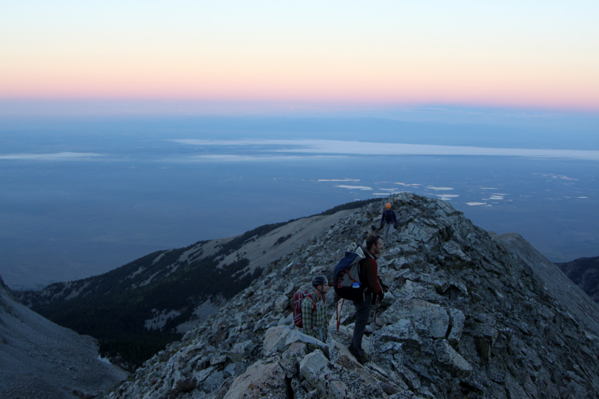
J in the early morning light
We reached Fourway after about 2 hrs where we could turn our headlamps off. A 14ers.com fellow, Tony, who is soon going to attempt Orizaba in Mexico as his first high-altitude climb, had done a majority of the trailbreaking thus far and we thanked him profusely. Time for J and I and others to take our turn. The snow after Fourway was very deep and untouched. The snowmobile had not gone any further in recent weeks and thus there was no packed surface underneath the fresh 24″ of snow. J was able to stay on top of the snow more than the snowshoers so he plowed ahead packing down the surface snow for us which helped a bit. After an hour of laborious trailbreaking in deep snow, me switching leads with 2 others, we reached J and treeline and the gorgeous, untouched basin where we actually started the hike in the summer years ago! My is it a different beast in the winter, especially with fresh snow.
An untouched winter wonderland beyond treeline
Mark takes his turn at the extensive trailbreaking
We then aimed for the line of minimal avalanche danger towards the steeper northwest slope, which was bare of deep powder snow and would be easier going on the windblown snow and rock. The wind started to pick up and the long slog up the northwest slopes to the 13,000′ ridge was strenuous. However, we were getting close.
J skinning high above the San Luis Valley
J taking a break on the 13,000′ ridge with Culebra’s false summit behind
J left his skis at this ridge and we proceeded to lose some elevation to the saddle while regaining it up Culebra’s long northwest ridge. I stashed my snowshoes after looking at the rocky, windblown, snowy ridge. Mistakingly, I led a few of the climbers on a traverse on the ridge’s south side through deep, unstable snow high up across a steep couloir. This was not a good idea and we regained the ridge as soon as possible after the couloir. I aplogized to the crew as I honestly thought the ridge itself would be more miserable than the face with its rime snow-covered boulders. However, I was absolutely wrong on that account! Sorry guys! Nevertheless, we all proceeded onto the much easier northwest ridge proper and made our way up to Culebra’s false summit.
Culebra’s northwest ridge
We were getting really close now. I was so excited for J. Reaching the false summit you get a glimpse of the true summit still a good distance away, which is a bit defeating. Yet, we continued on and I got up to the summit first to take pictures and video J’s final steps to the summit of his final of the Colorado 14,000′ peaks.
J making his way from the false summit to Culebra’s true summit
J takes his final steps to Culebra’s summit
Here is a short video of J’s summit of Culebra Peak:
It was a special moment. I was so honored to share J’s last 14er summit with him. I honestly have no idea how many mountains we have climbed together – hundreds and hundreds. Everything from CO 14ers, 13ers, & 12ers to Denali to Castleton Tower. I was so happy for J, as I know he was, that he decided to knock off Culebra and finish climbing all of Colorado’s 14ers. It was even more fitting that he climbed this peak in winter. It was definitely no cakewalk as it is in summer. He earned this summit.
J & I on the summit of Culebra Peak (14,047′). J has now climbed all of Colorado’s 14,000′ mountains
J on the summit of Culebra Peak (14,047′), Februrary 2, 2013 – his final of the CO 14er summits
Matt, Me, J, & Mike on Culebra’s summit
We celebrated on top for a good 30-45 minutes welcoming other members of the crew to the summit and savored the moment. I collected a summit rock for J as a memento of the occasion. It had taken us 6 hrs to climb the 7.5 miles and 5,400′ up to Culebra’s summit topping out at around 11:45am. It was pretty chilly and breezy up top and on the ridge (likely below zero with windchill), so we headed on down the ridge, collected our snowhsoes & skis, and made our way down the northwest slopes with Mike.
J & the large cairn frame Culebra’s false summit on the descent
As the cherry on the cake, J got to ski pretty darn good snow down the northwest slopes back to our trench
My snowhsoes were on their last leg all day and that morning they had broke while I was trying to break trail in the deep snow. I had temporarily fixed the snowshoe with some shoestring I always carry, but on this descent they were breaking all over again. I took them off and plunge-stepped down the broken trench in my Koflachs. Thankfully, the trench’s bottom surface was very supportive and I didn’t sink in all that much. J made some wonderful turns down the northwest gully in buttery, smooth snow. It was great to see and I know it was icing on the cake for him on a terrific day. J skied all the way down to the ranch headquarters in no time while Mike & I plunge-stepped our way down the road for an hour arriving back at the car at 3:45pm. The ranch foreman, Sam, was so nice to offer us gatorade, granola bars, and bananas. It was a special treat.
The long road home after a 10 hr, 15 mile roundtrip day with 5,400′ of vertical gain
J & I joined Mike, Sarah, and Matt in Fort Garland for a post-climb dinner celebration and then we were all off on our separate ways back home. It was a long drive home but the trip was so worth it to be with J up on another summit, especially for his 14er finale.
My hat is off to J for completing all of Colorado’s 14ers and doing it in style. This was my first winter 14er finale, and while there was not 30 of our closest friends, buckets of KFC, PBR, and blaring 80s music from Steve’s boombox, this one was extra special in that it was just J & I (and obviously the other members of the crew) doing it together. J has been my #2 climbing partner and best friend for years now (behind my wife, of course, on both accounts) and I’m so proud of him and honored to have him in my life. Congratulations again, J, for you have earned it! Here’s to infinitely more mountains & adventures together to last a lifetime!
Early Saturday morning I headed down in a packed up Tahoe to Canon City to meet my good bud Jesse Hill for some climbing at Shelf Road. I had never climbed at Shelf and this place was absolutely overwhelming (in a good way) with the quantity of high-quality established sport routes. It literally seemed like there were endless miles of awesome limestone cliffs in every direction. I think Jesse told me there is close to 900 routes at Shelf so if you average say 12 bolts (including anchors) per route, then that’s something like 10,800 bolts that have been drilled and set at Shelf. That’s alot of bolts. Anyway, we climbed for about 5-6 hours in gorgeous weather and, though somewhat crowded, these routes are of very high quality. We climbed routes in the 5.10 range all day with me struggling up a 5.11 on my 5th route of the day. While I topped out, it sure wasn’t pretty and sure wasn’t without some serious resting. Maybe I should have attempted the 5.11 on my 2nd route of the day. Maybe I would have done better. Maybe not. Enough talk, here are some Shelf climbing pics:
Jesse leading an awesome 5.10b dihedral
Jesse getting in deep on a 5.10d that I led
Jesse leading another 5.10a
Me contemplating the final 5.10a hand jambs on our last route of the day having completely pumped my forearms and fingers
The Cactus Cliff where we climbed at Shelf Road
After a full mexican dinner with Jesse in Canon City, I drove an hour to Westcliffe and slept in the back of my Tahoe in a motel parking lot in preparation for meeting my friends Reid & Tara Jennings as well as Brett Wamsley at the Mt. Lindsey trailhead the following Sunday morning. This was the first time I had used my -40 degree Marmot Cwm sleeping bag in a long time and boy did I fall in love with it all over again. It was a chilly 15 degrees in my car when I woke up at 6am, but I was nice and toasty in my -40 degree bag. I had climbed Mt. Lindsey (14,042′) in the southern Sangre de Cristos years ago with my golden retriever, Rainier, as well as other friends in my company’s annual Peak Challenge via the standard class 2+ north face gully route. However, I am always up for going back with good friends. Plus, there was the class 4 northwest ridge direct route that looked enticing which I wanted to try. After a cup of joe via the jetboil, I drove another hour to the trailhead where I had another cup and some oatmeal. The Jennings, Brett, and the dogs showed up around 8:45am and we were off on the Lily Lake trail by 9am.
The north faces of 14ers Blanca Peak (left) and Ellingwood Point (right) form one of the most dramatic mountain walls in terms of vertical relief in Colorado. Photo taken on the drive into the Lily Lake trailhead
The Iron Nipple (left) and Mt. Lindsey (right) come into view
Lindsey’s class 4 northwest ridge (right) and class 2+ north face gully (left). Tara remained at this saddle, I took the ridge, and Reid, Brett, and the dogs took the gully
We reached the 13,000′ saddle where Tara remained and we were off on our respective routes to the summit – me up the NW ridge and Reid, Brett, & the dogs up the north face gully. The NW ridge was really a fun route and, in my opinion, much safer than the standard class 2+ north face gully route in terms of objective danger though technically harder and more exposed. There are several ways up the class 4 headwall of the NW ridge, but the chimney I climbed was really fun and had some good moves with good exposure. I’ll let the pictures do the talking.
Looking down the initial easy portion of the northwest ridge. Tara can be seen as the dark spec at the top of the picture
My route up the class 4 headwall on the northwest ridge
Although unnecessary, I went up and over this gendarme on very solid rock to reach the bottom of the class 4 headwall
Looking down my chimney route up the headwall from just below the top – pretty fun class 4 scrambling
I can be seen below the headwall on the right side of this picture while Reid, Brett, & the dogs can be seen on the left in the gully. Photo taken by Tara at the 13,000′ saddle
I can be seen on the northwest ridge at the top of the headwall against the skyline while Reid, Brett, & the dogs can be seen in the gully on the left side of the picture. Photo taken by Tara at the 13,000′ saddle
Reid coming up the north face gully route
Brett on the summit of Mt. Lindsey with Blanca Peak & Ellingwood Point behind
Mt. Lindsey summit (14,042′) on a cold and breezy November day
I chose to descend the standard class 2+ north face gully route with my buds and dogs. It was definitely a little loose and sketchy with the hard snow in spots, but we all made it back down to Tara at the saddle in one piece. For those interested in climbing Lindsey, I’d almost recommend the harder but much more solid NW ridge over the standard north face gully. If you are somewhat experienced in scrambling, then I honestly believe it to be much safer. Anyway, it was a great day with my good buds on a 14er in the southern Sange de Cristos. We made it back to the trailhead by 3pm for a 6 hour and 8.25 mile roundtrip climb with 3,400′ of vertical gain.
Reid descending the loose and fairly dangerous class 2+ north face gully route
Looking back at Lindsey’s class 4 northwest ridge(right) and class 2+ north face gully (left) from the saddle
And the long road back to the trailhead followed by an even longer drive home

 Follow


 and 14er Mt. Lindsey comes into view on the right")


 on a cold and windy November day")

 and class 2+ north face gully (left)")


