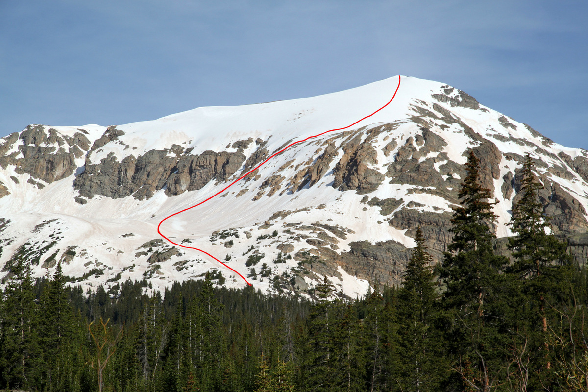
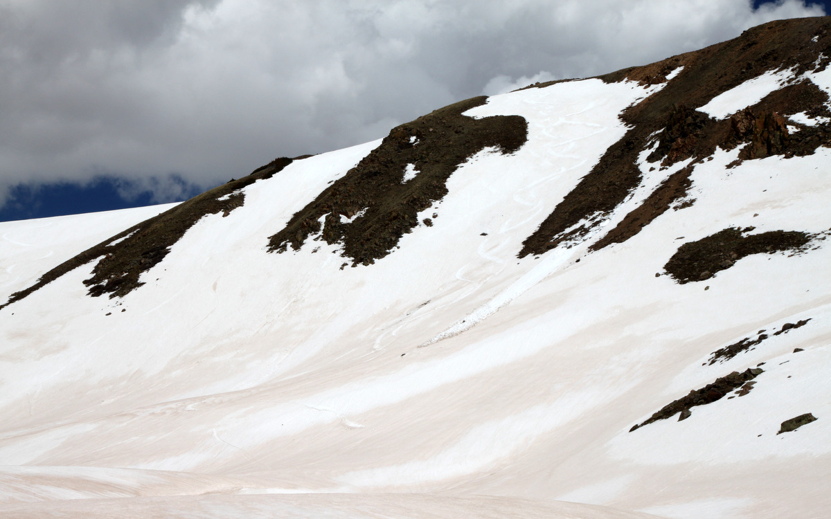
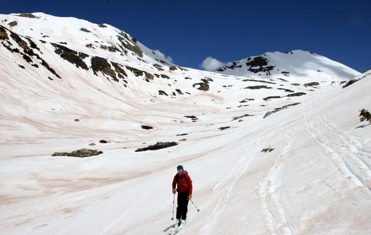
Well, Kristine is still going strong even at 24 weeks pregnant with our little girl! As I had never actually driven over Loveland Pass before and there were some easier hikes accessible from the pass itself, we decided to make a pit stop at Loveland Pass for some en route to Denver for our good friend Jesse Hill’s 13th annual summer solstice extravaganza this past Saturday. We joined the tourist trap by parking on the pass and hiking up the mellow east/northeast ridge to 13er Mt. Sniktau’s summit.
Kristine topping out on Mt. Sniktau
We didn’t get hiking until maybe 11:30am and returned to our car at around 1:30pm.
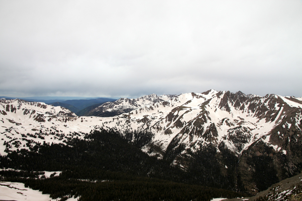
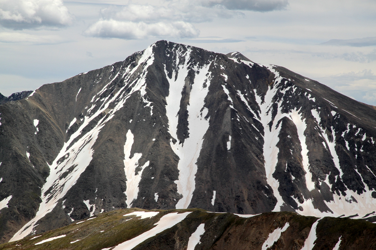
The Tuning Fork Couloir on 14er Torreys Peak looking pretty good for late June. Our friend Brian Miller actually skied this line this same morning
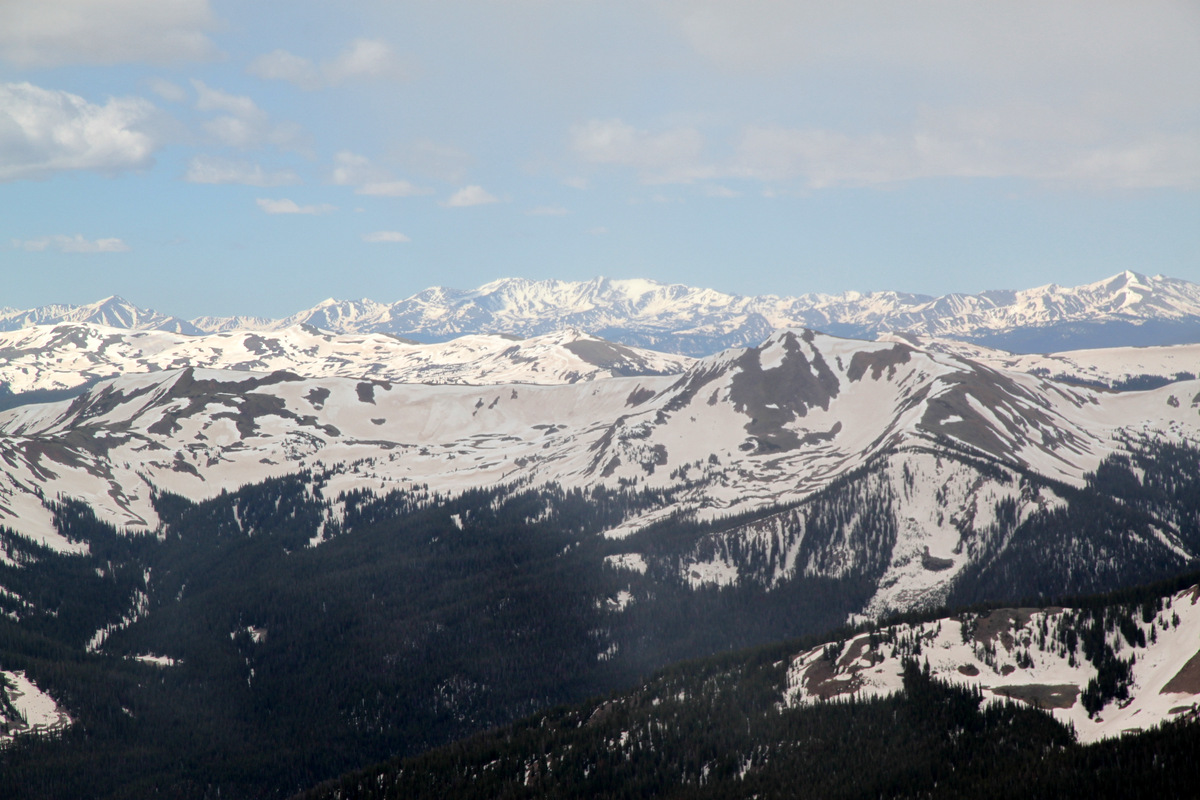
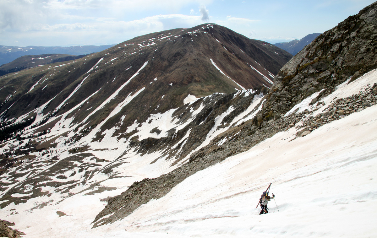
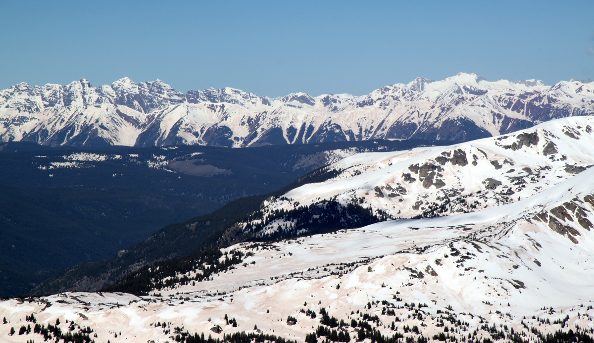
The mellow rigde over to Grizzly Peak D and eventually Torreys Peak from Sniktau’s summit
Left to right: Hagar Mtn, The Citadel, and Pettingell Peak to the north from Sniktau’s summit
Eisenhower Tunnel and Interstate 70 from Sniktau’s summit
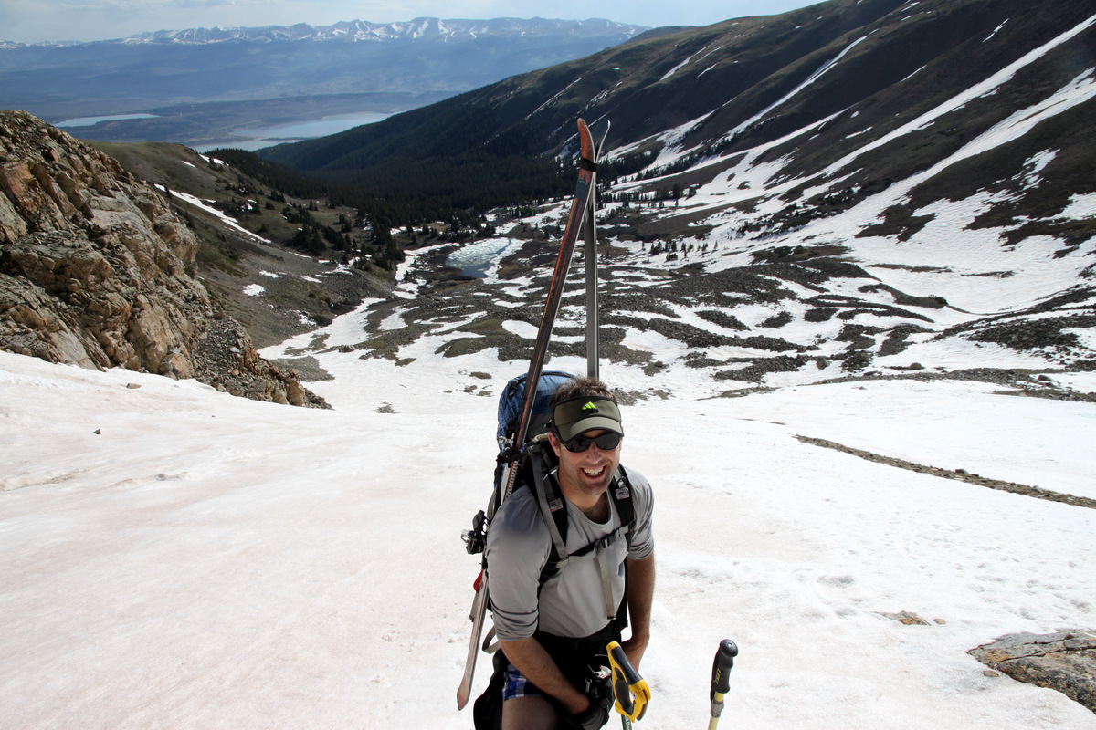
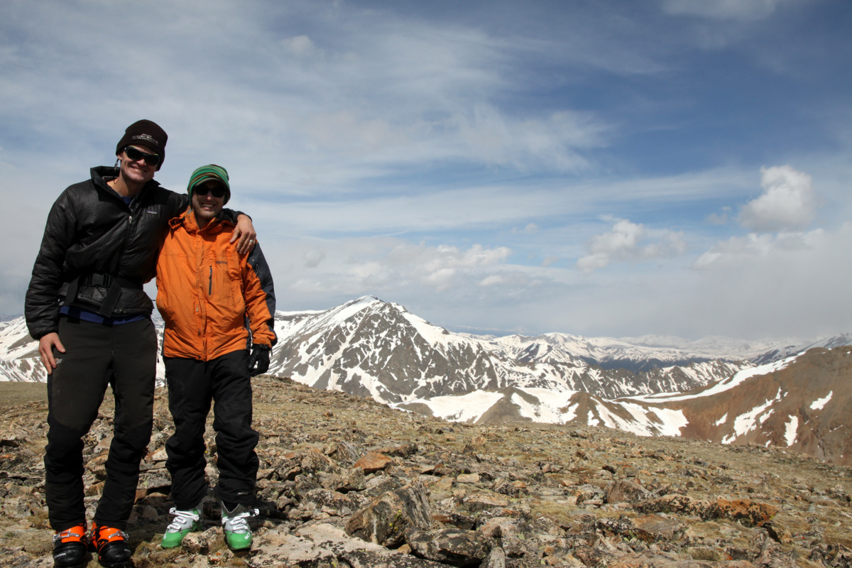
Rainie and Kristine
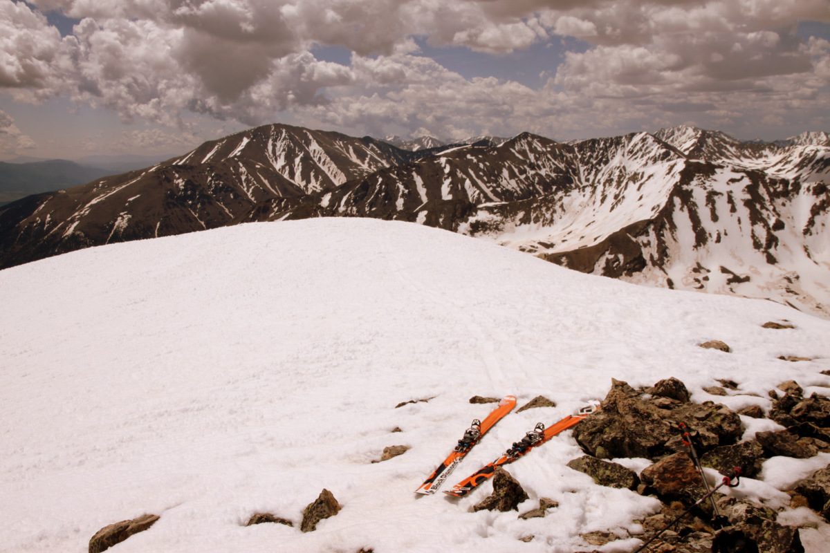
Mt. Sniktau summit (13,234′)
Kristine did excellent and it was a fun little Chalk family outing before an afternoon and evening filled with beer, brisket, 87 lbs of pork straight from a whole pig, and late night taco bar all courtesy of Jesse’s extraordinary generosity.
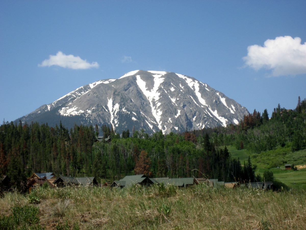
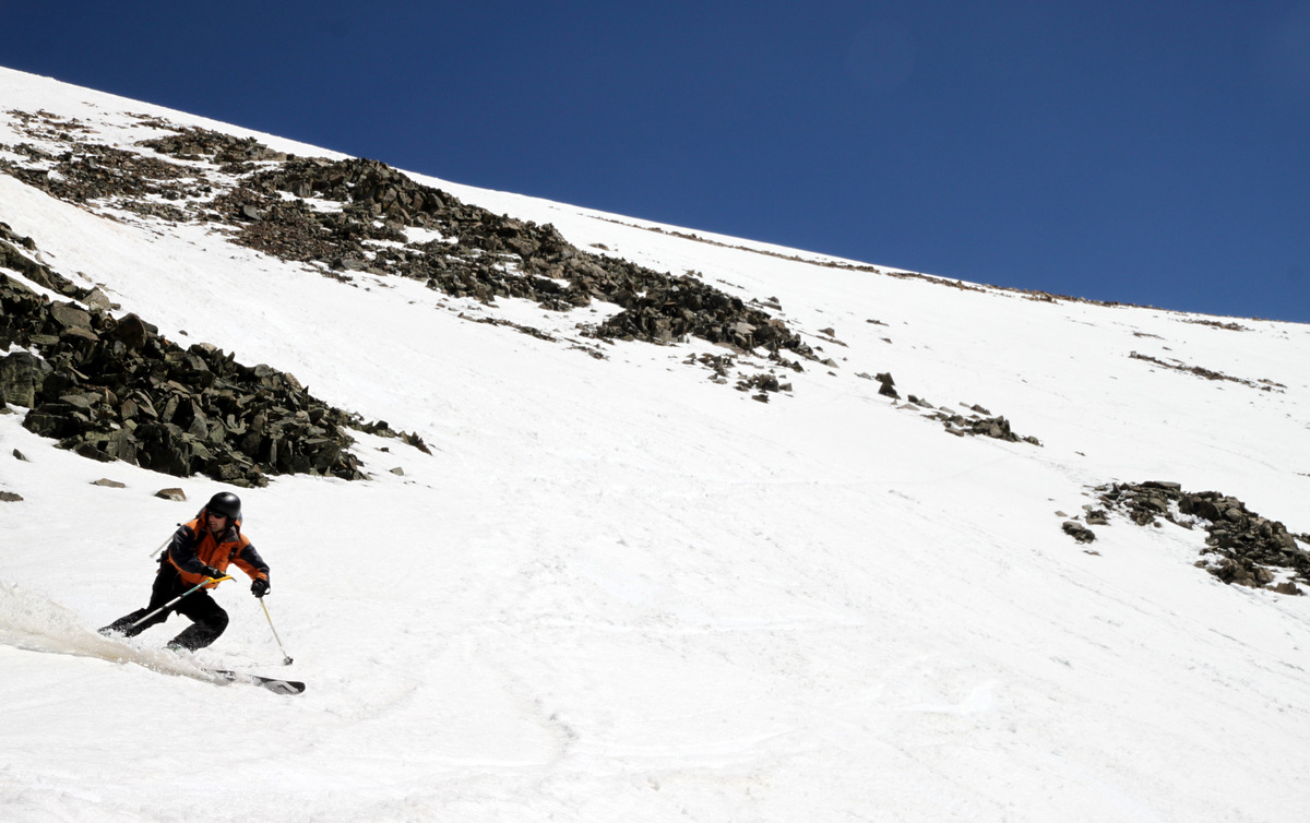
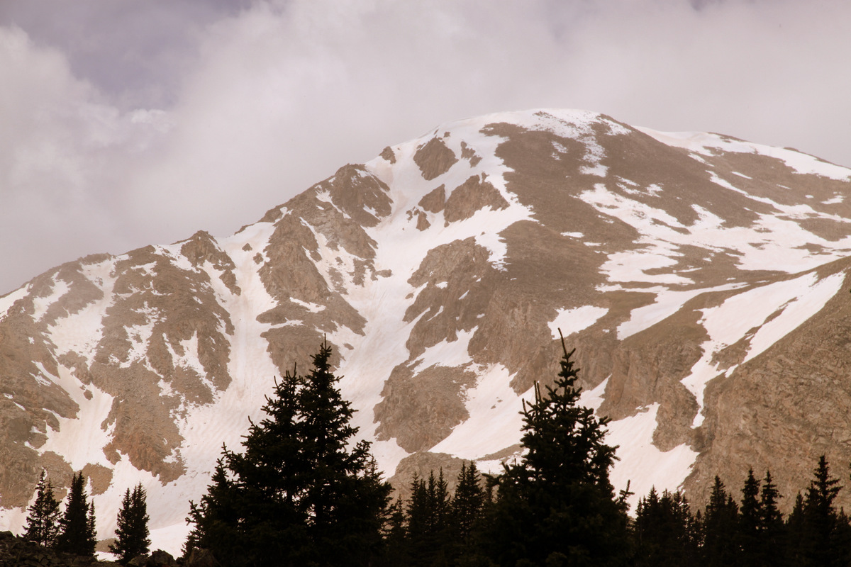
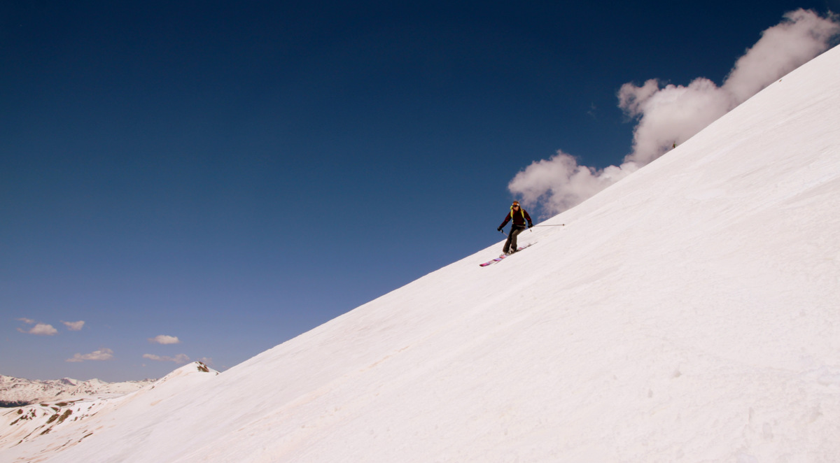
Buffalo Mountain is that big behemoth of a hill most of us have viewed a hundred times when driving west bound on Interstate 70 down from the Eisenhower Tunnel. Located in the southern end of the Gore Range and though only 12,777′ in elevation, Buffalo has one of the most spectacular ski lines called the Silver Couloir on its steep northeast face. This 3,000′ couloir tops out at around 40 degrees in steepness with most sections in the mid-30 degree range. It is even featured in the big coffee-table book Fifty Classic Ski Descents of North America by Chris Davenport, Art Burrows, and Penn Newhard and in the new guidebook Climbing and Skiing Colorado’s Mountains: Fifty Select Ski Descents by our friends Brian Miller and Ben Conners. Its easy access, mellow approach to its summit, and great skiing make this a classic and I don’t know of too many other ski lines where you can get as much “bang for your buck” in terms of effort involved for great skiing.
I’ve been fortunate to climb and ski Buffalo now three times and each has been a great outing. My first experience was by myself with Rainier & Kona on a very late season July 3, 2008. I had just heard about this line and decided to go check it out with the pups and being July 3 I think it was relatively safe in terms of avalanche hazard 🙂 We had a great day and most of the Silver Couloir was amazingly skiable!
The Silver Couloir on July 3, 2008 as viewed from Highway 9 north of Silverthorne
A younger me, Rainier, & Kona on Buffalo Mountain’s summit (12,777′)
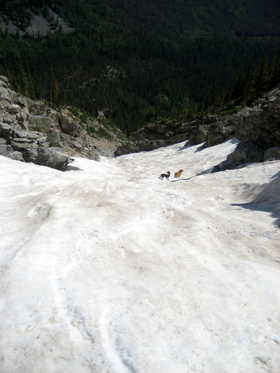
The dogs halfway down the Silver Couloir that hot July day back in 2008
My second outing up and down Buffalo was on March 21, 2009 was with a large crew of great friends, my girlfriend at the time (yes, Kristine), and Rainier & Kona, once again. This trip had more of a winter feel to it considering the colder temperatures and larger snowpack up Buffalo’s standard route and down the couloir.
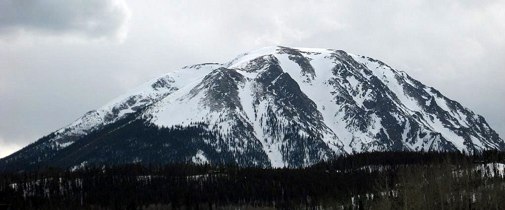
Buffalo Mountain and its much more filled-in Silver Couloir on March 21, 2009
The conditions in the couloir, however, were not so much fun powder as they were harder recycled powder with a breakable crust in certain sections. I learned a valuable lesson this day and that was to not charge down a couloir, especially not knowing the conditions. During this particular time of day half of the couloir was in the sun and half was in the shade. I charged in the steepest section and laid out a tele turn skidding into the shaded part and hit some icy hardpack and took a tumble. I slid head first for maybe 200 ft before grabbing a rock in the middle of the couloir thereby flipping myself around and stopping myself. I broke a tele leash in the process and my sunglasses slid another 1,500′ down the couloir to the apron below. Quite a rush and nerve-wracking for sure, but I learned so many valuable lessons – another of which was to always ski steeper slopes/couloirs with an ice axe or whippet (ski pole/axe combination). I was definitely much younger, naive, and inexperienced back then and have since learned a lot and gained valuable knowledge with regards to this whole ski-mountaineering activity. And, yes, I ski with a whippet these days.
Ryan “Baba” Aldrich, me, Andy Dionne climbing Buffalo that late March day back in 2009
Caleb & Jennie Wray on Buffalo’s summit
Chris Carlsen dropping a knee in the upper portion of the Silver Couloir
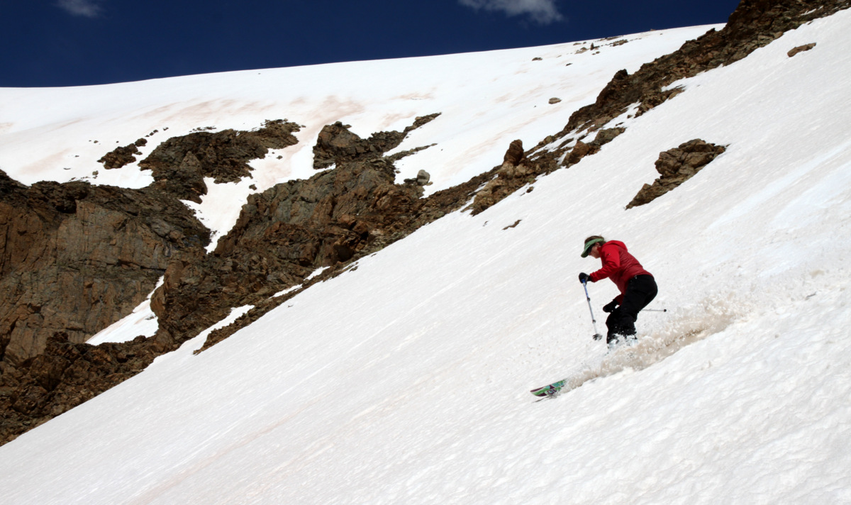
Kristine telemarking down the Silver
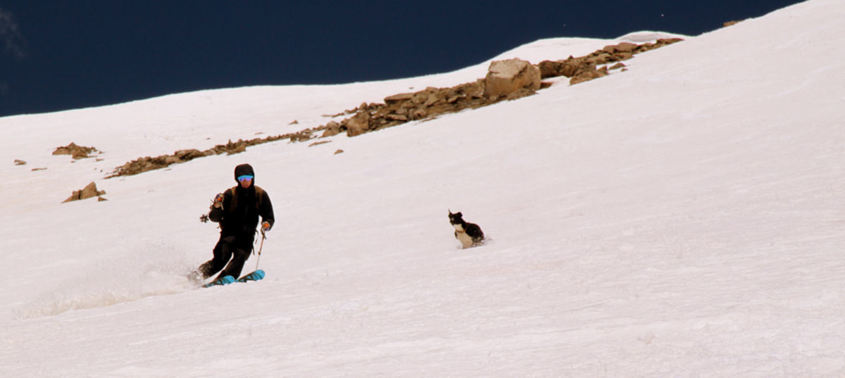
Kona and Derek Drechsel in the lower portion of the Silver
Jennie Wray
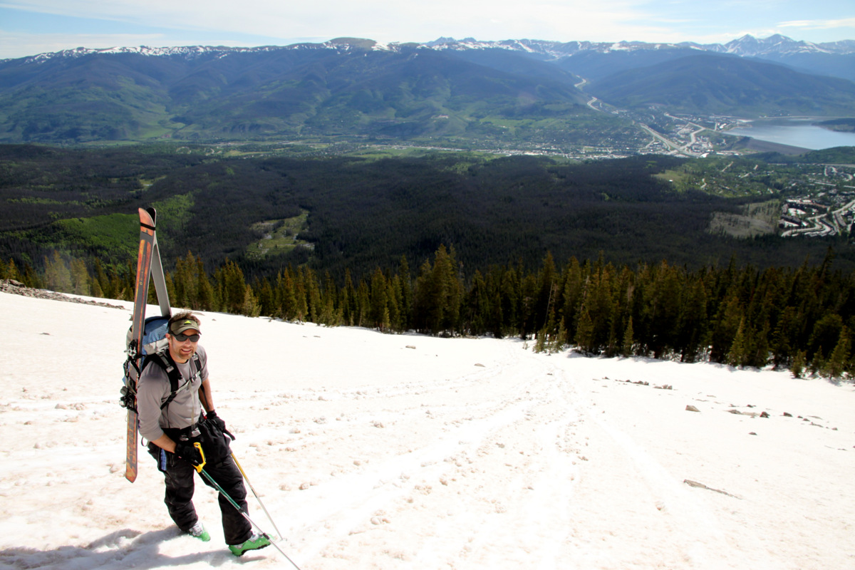
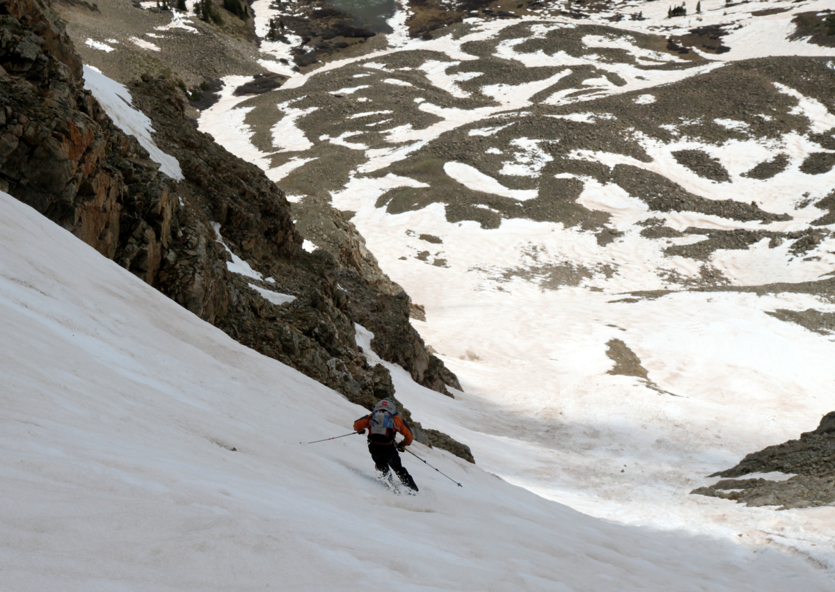
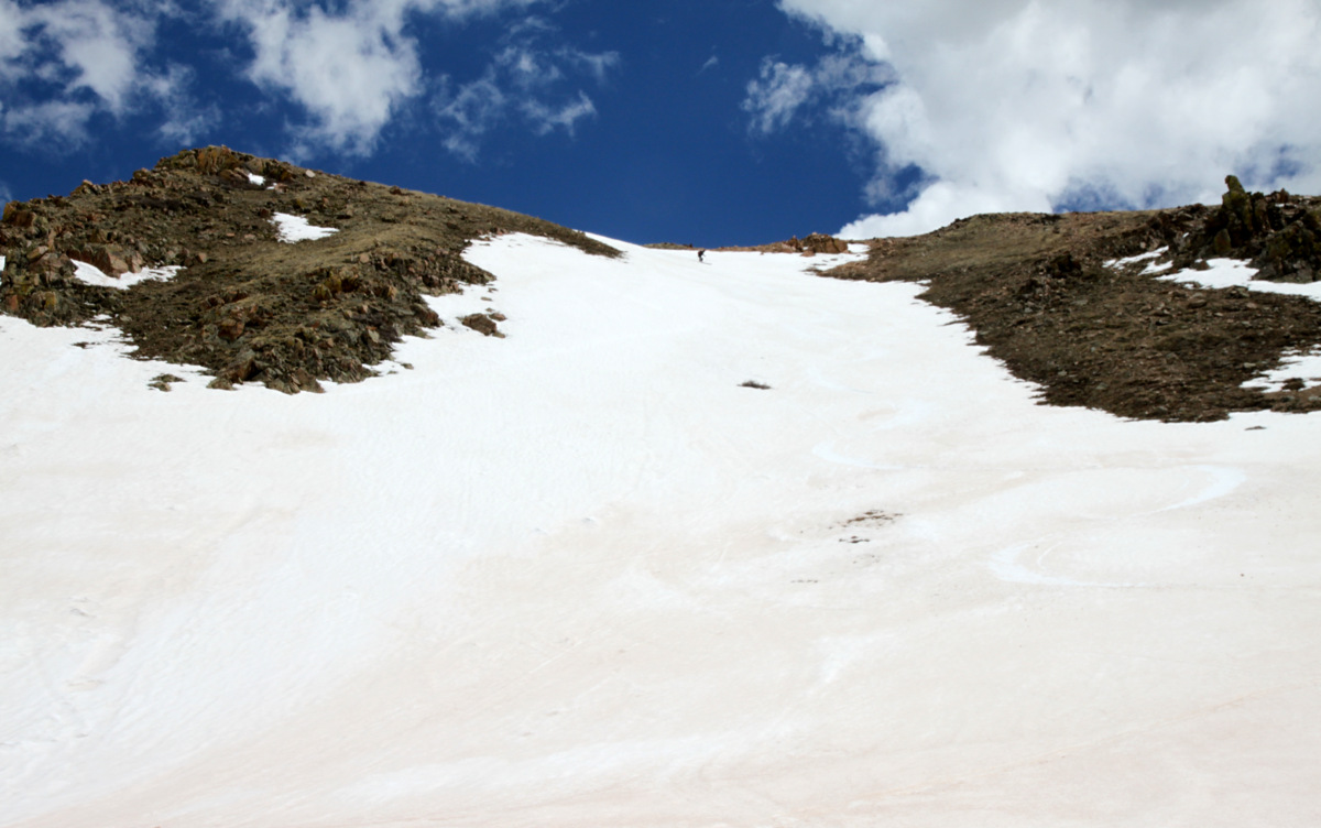
My third time on Buffalo was just yesterday with great friend J Weingast. As he had yet to climb and ski this mountain, the Silver was towards the top of his hit list for the spring and so we went and got it in what may be one of the last weekends of the season it could really be in or for that matter skiable at all. After a cold night and a 7:30am start at the Ryan Gulch trailhead, we took a leisurely pace up the standard Buffalo Cabin trail until we hit snowline at about 10,700′. After my last fumble in the Silver, I definitely wanted to make sure the couloir was properly warmed up enough to allow for soft spring snow conditions and not hardpack ice. We put the skis on our back and booted the rest of the way to Buffalo’s summit up the broad east face.
J on the way up Buffalo’s standard route
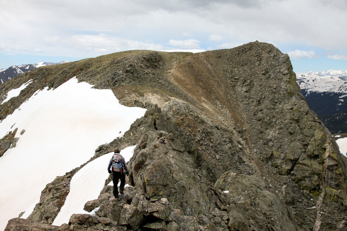
After topping out around 10am, the clouds really started to move in over the Gores yet the Tenmile and Sawatch ranges remained sunny to our south. Go figure. Still wanting to wait a bit for the Silver to soften up even more now that the sun was behind whispy clouds, J and I decided to take a fun jaunt over to Buffalo’s southern subsummit dubbed “Sacred Buffalo”. Twenty minutes and a fun little class 3 scramble later we were on Sacred Buffalo. There were definitely snow showers pelting Red Peak to our north and the wind had picked up. This was not the weather I had anticipated nor had been forecasted.
J on his way to Sacred Buffalo
Hmmm….why is there sun over the Sawatch and clouds and snow flurries over us in the Gores 🙂
Clouds to the west with Red Buffalo Pass (center) and Red Peak (right) visible
The connecting ridge between Buffalo’s true northern summit and the southern Sacred Buffalo subsummit as seen from Sacred Buffalo
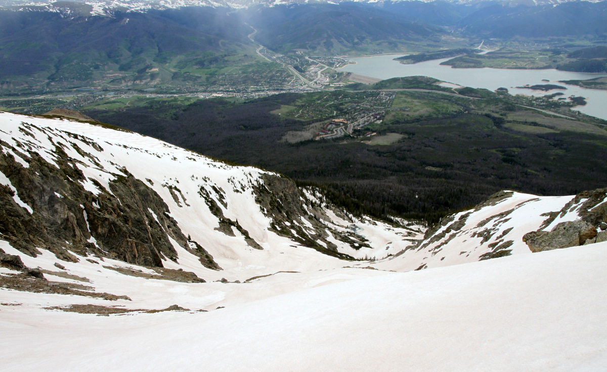
Looking down into the Salt Lick Cirque with Silverthorne and Lake Dillon below
Buffalo Mountain summit (12,777′)
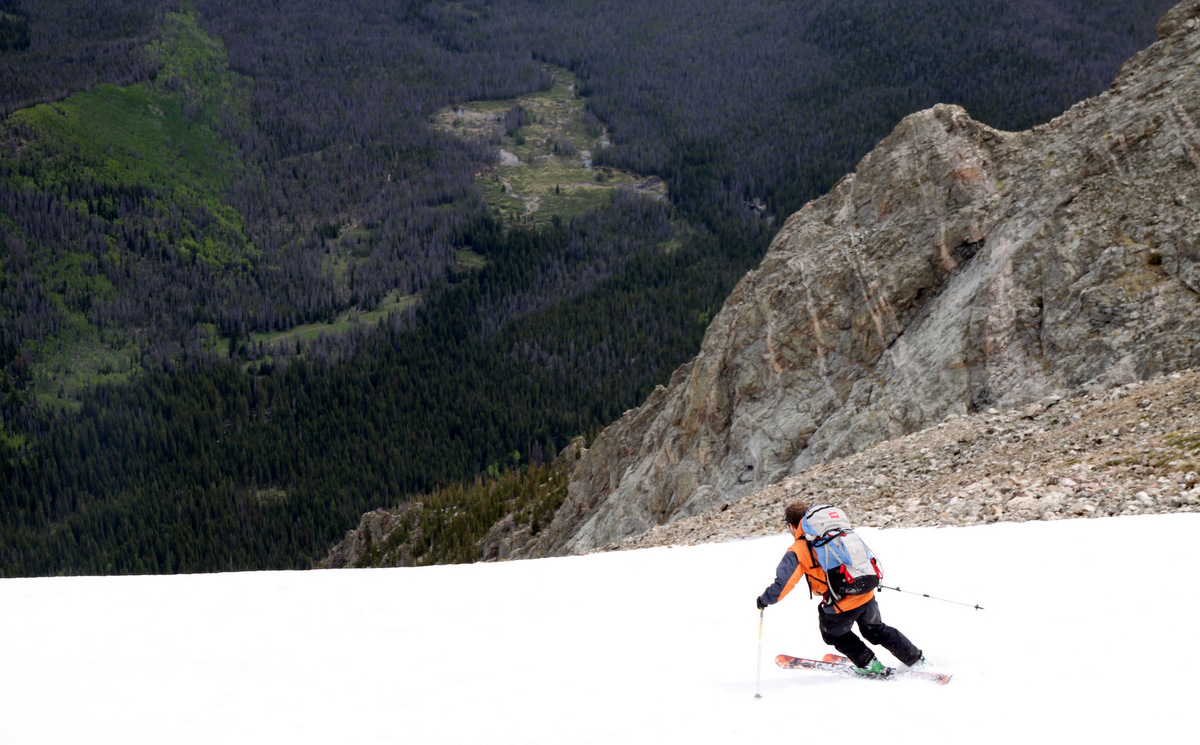
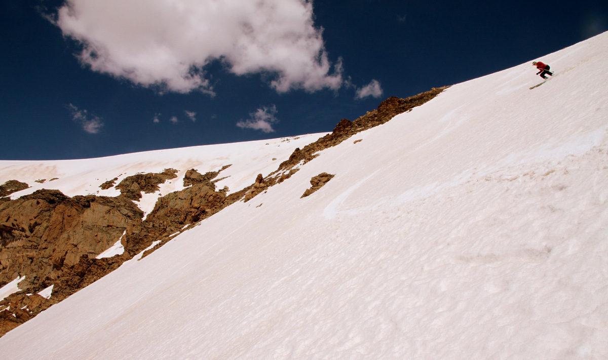
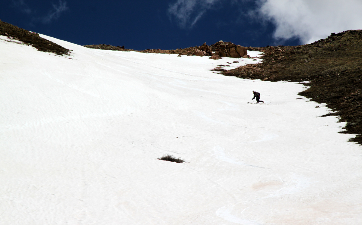
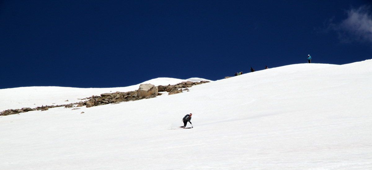
Nevertheless, we scrambled back to Buffalo’s true northern summit and decided to go ahead and ski the couloir. Not really wanting to wait around all day for sunny weather, we just decided to go for it and hoped those few hours of early morning direct sunshine warmed the snow up enough for our liking and to make things safe. The top hundred feet of the couloir were pretty firm and I was thinking if the rest of the couloir was like this I would be in trouble. J would be fine because like many of my friends, this guy can ski anything, anytime, anywhere. As if our wish was granted, the snow softened up soon after and good turns ensued for approximately 1,500′ down the couloir.
J beginning the descent of the Silver Couloir
And, he is off to the races…
J in soft snow
Always having a good time
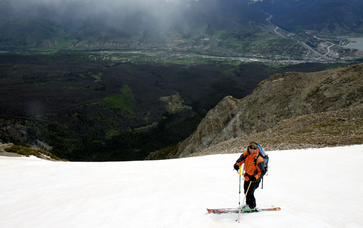
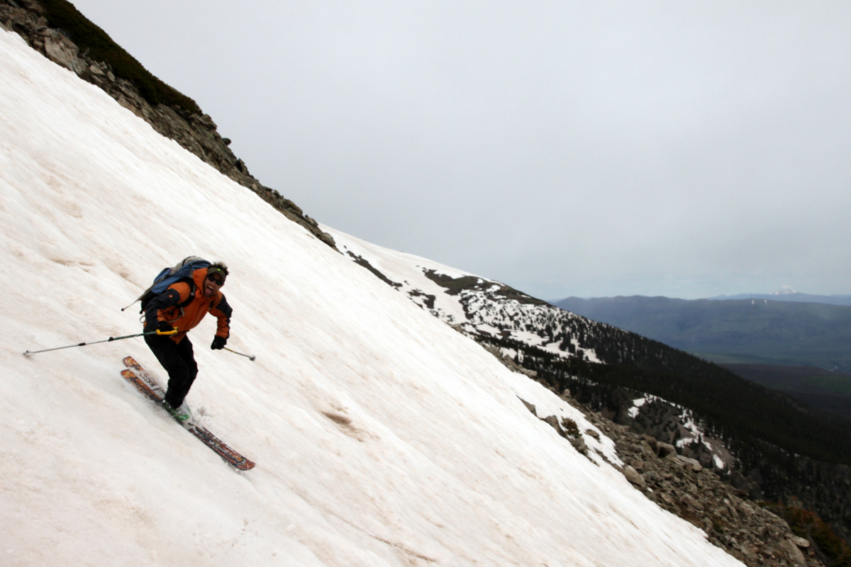
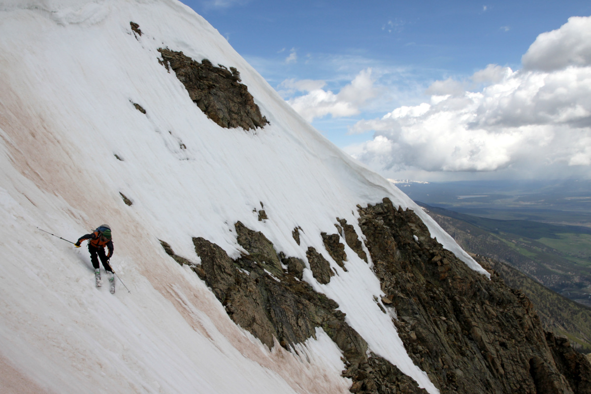
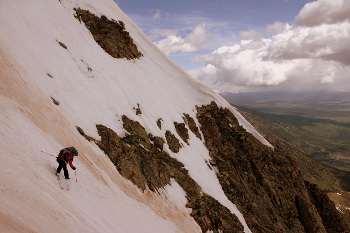
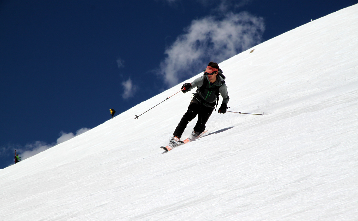
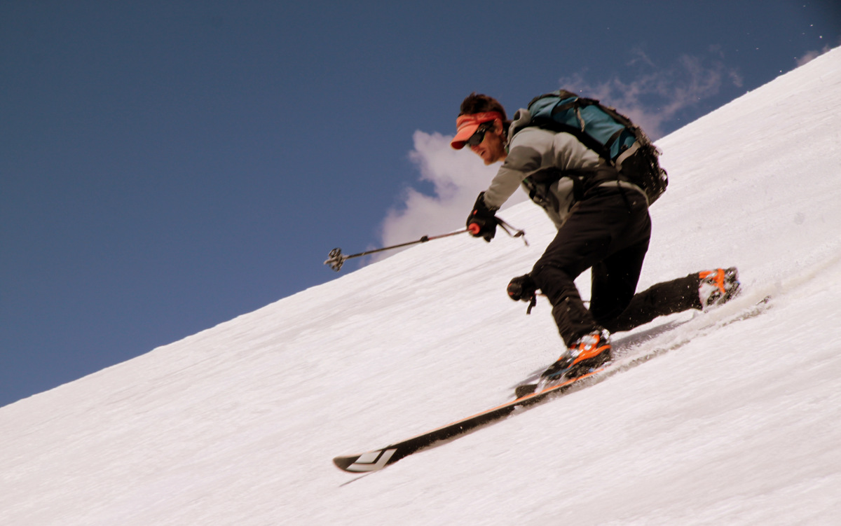
Me in the upper portion of the Silver Couloir
Me having fun in the Silver Couloir amid a scenic backdrop
The bottom 1,000′ weren’t the best snow conditions – bumpy, dirty, sun-affected, and a few rocks thrown in the mix to dodge around. And, then the couloir’s apron itself was just plain horrible. However, the apron didn’t last long and soon enough we swapped skis and boots for our trail shoes and made our way back to the South Willow Creek trail and then eventually back to my truck at the trailhead around 12:30pm. A fun 5 hours up on Buffalo with J. Its been a fun ride up and down this mountain over the years learning important lessons along the way. If I’m lucky and my timing is right, I do hope to ski the Silver Couloir in powder conditions at some point.
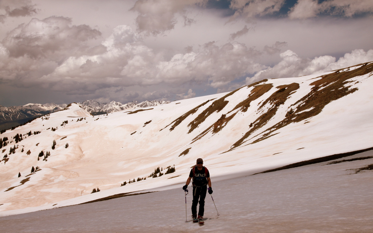
Well, both Kristine and myself as well as most of our ski-mountaineering buddies have learned by now to never say “never” when it comes to hanging up the planks for good signaling the end of our spring ski season. Just when you think you are done with ski season, you end up going out again just as Kristine did today on Quandary Peak’s Cristo Couloir with J and the Active Energies group after saying she was done after our ski of Mt. Oklahoma this past Saturday.
The last few days have treated us well with regards to wonderful ski-mountaineering adventures in our hills. A line I try to do every year is 14er Quandary Peak’s South Gully, aka the Cristo Couloir. Its a fantastic 2,500′ line in only a mile topping out at around 40 degrees in steepness. My good friend Mikey was leaving our engineering firm here in the mountains and moving to Denver and wanted to do the Cristo again before he moved to the big city. J joined us as well and in a short and sweet 2 hours we were on top of Quandary basking in the sun and waiting for the sun to soften the Cristo to perfect corn. We waited over an hour on the summit and then dropped in about 10:30am and had an exhilarating ride back down to the Blue Lakes dam hiking back out about 1/4 mile to our cars. Pics of the morning are as follows:
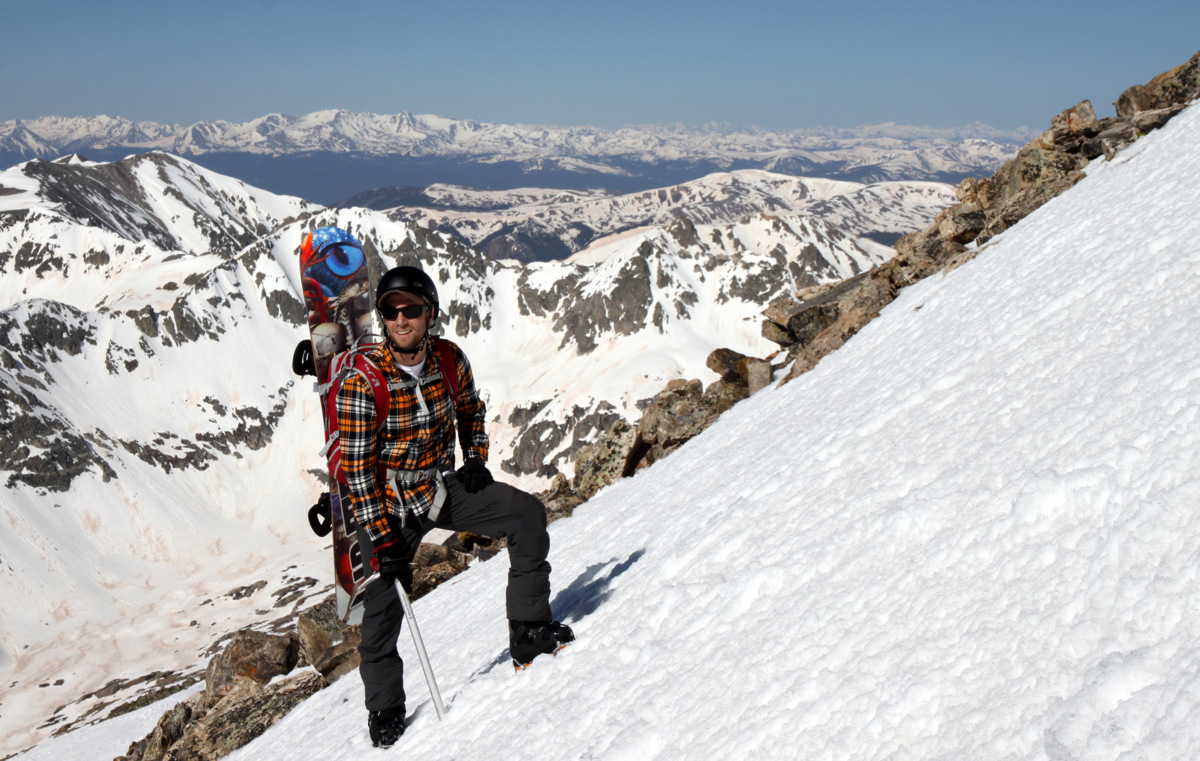
Mikey climbing the Cristo in his new crampon compatible snowboard boots
Mikey high in the Cristo
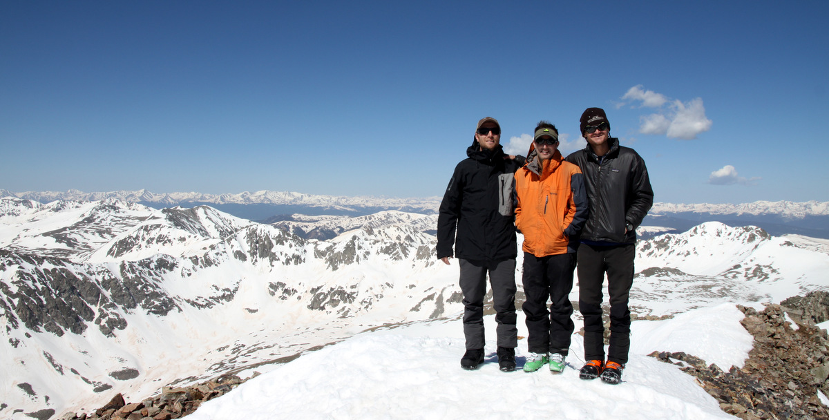
Mikey, J, and I on the summit of Quandary enjoying the nice morning
Mikey ripping the upper couloir
J high in the Cristo
No matter how many times we go up and down Quandary, its always a pleasure
J halfway down the gully not really looking at where he is going
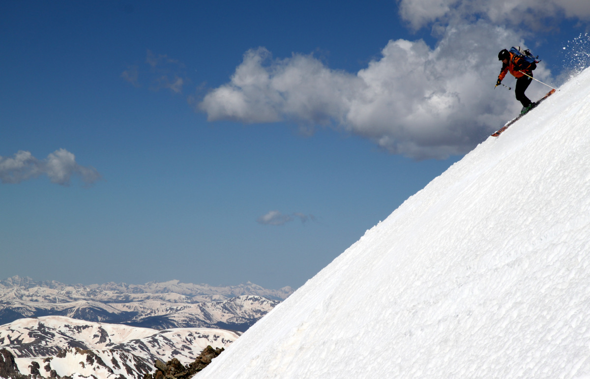
Me enjoying my tele turns. Photo by J
J lower down with Wheeler Mountain in the distance
Mikey
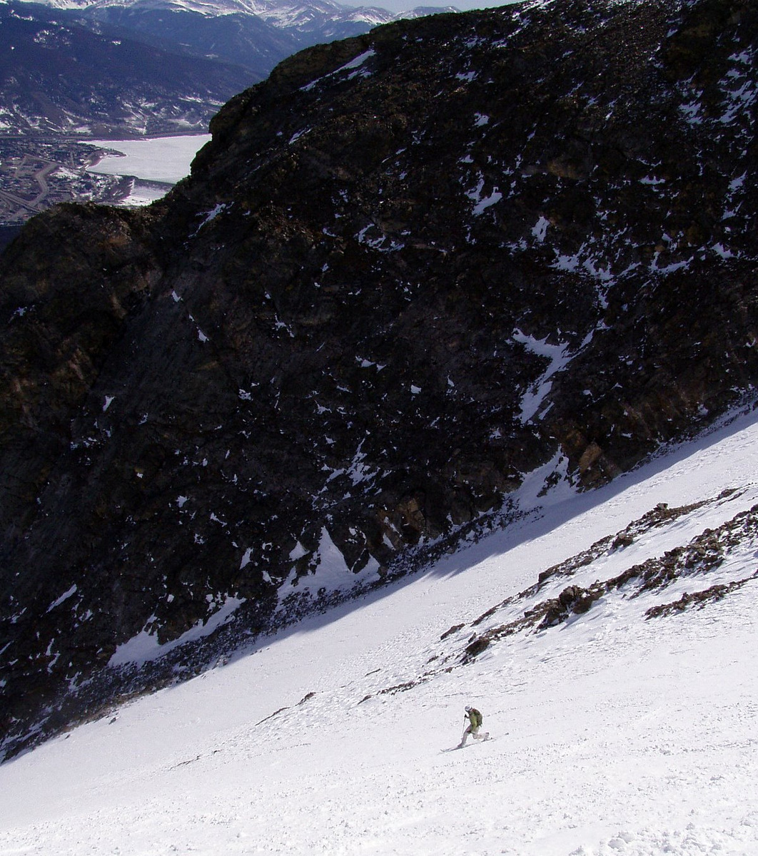
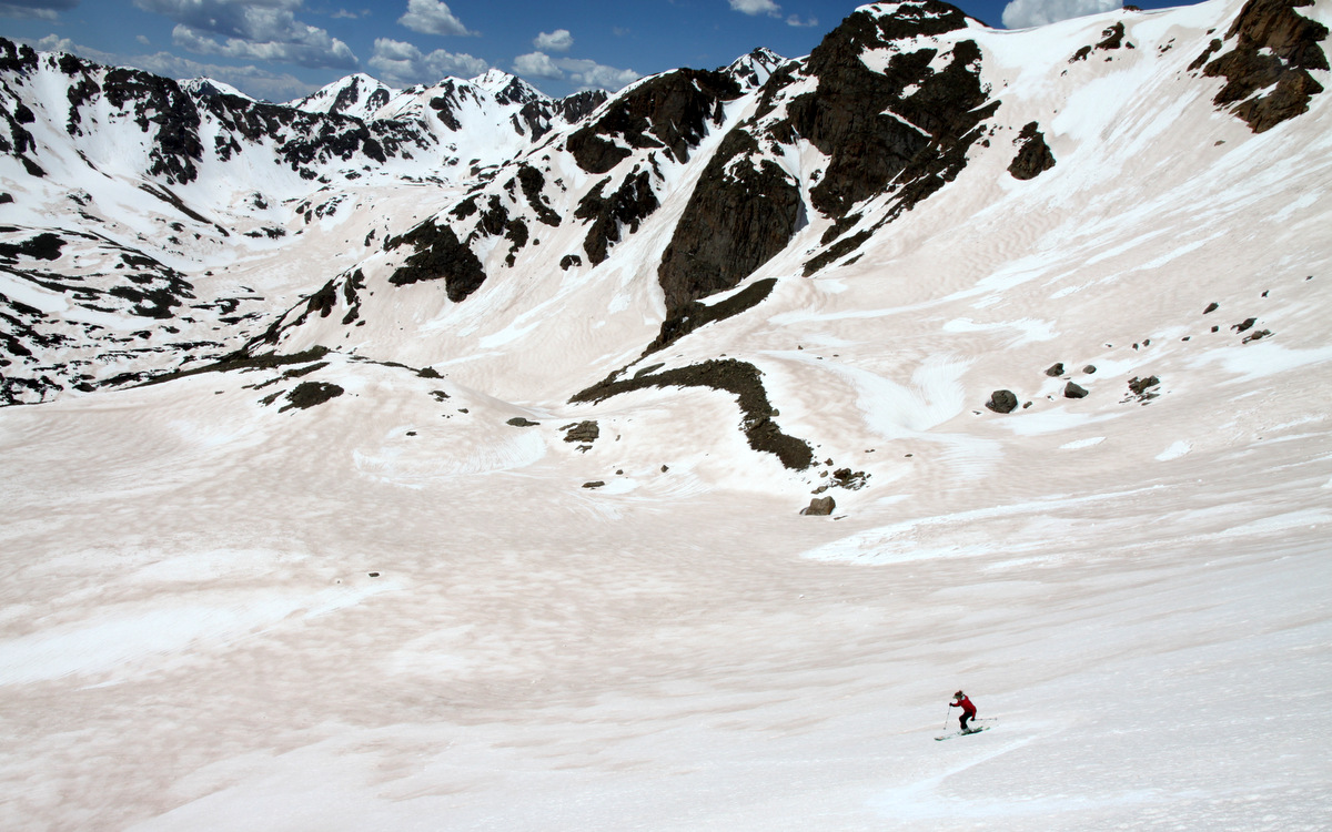
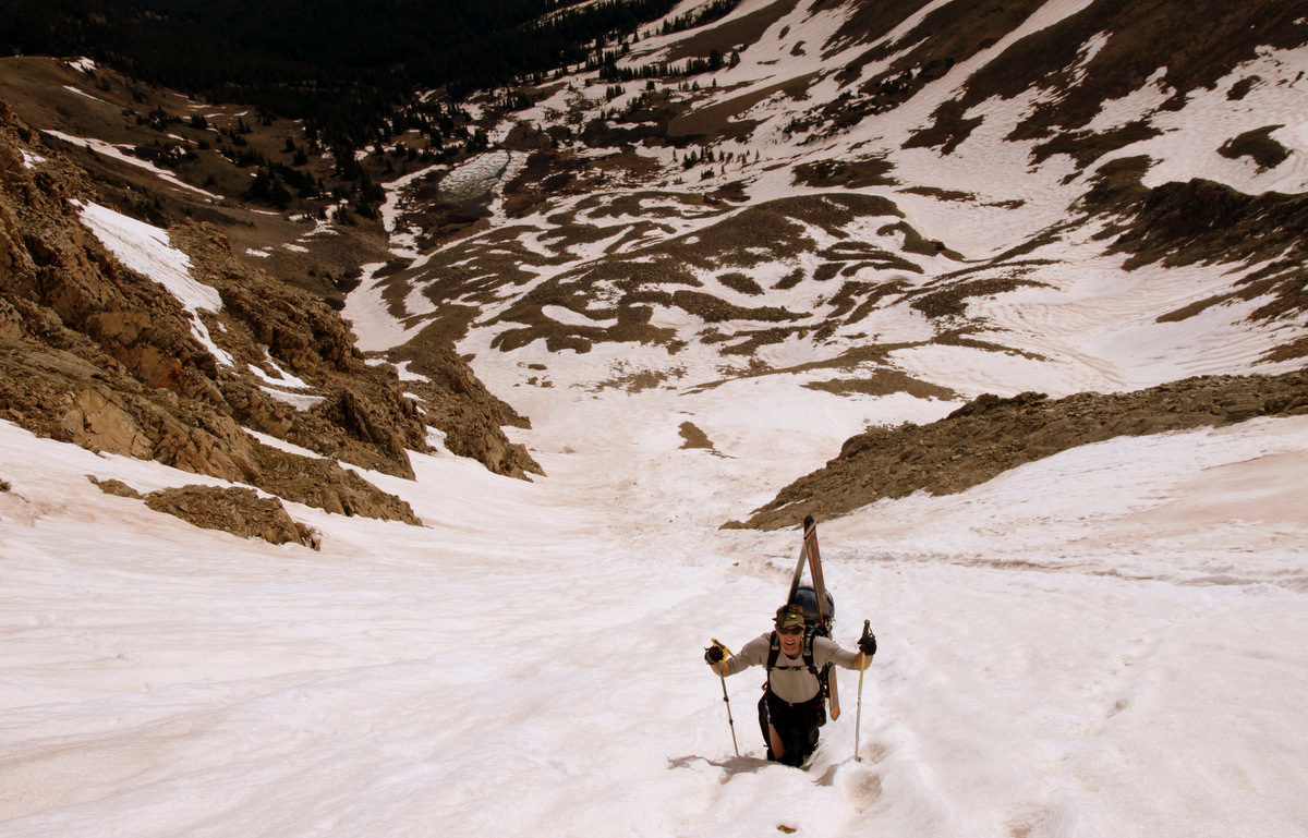
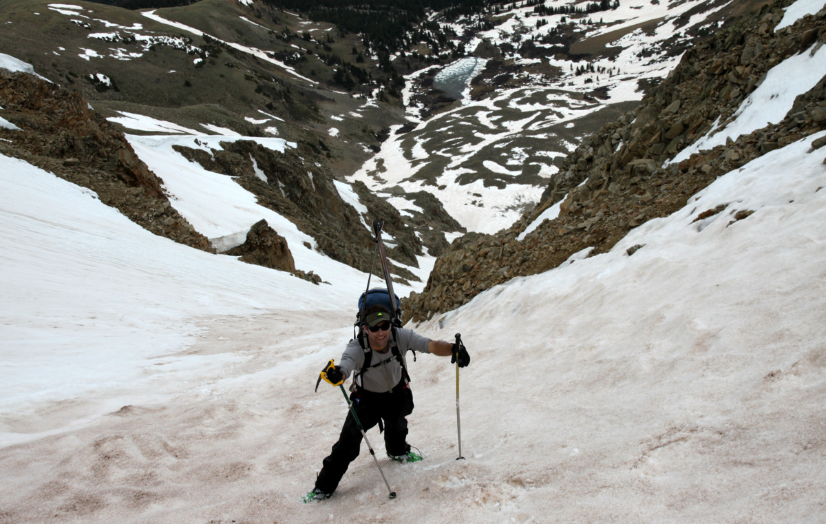
Next up Kristine & I left Edwards around 5:30am this past Saturday for the North Halfmoon Creek trailhead behind 14er Mt. Massive arriving at 7am and hiking up the trail to the high centennial 13er Mt. Oklahoma by 7:30am. Despite being a relatively short 7.5 mile roundtrip jaunt up the 3,400′ to Oklahoma’s summit, routefinding and navigational skills were put to the test a bit. Kristine did so well now being 22 weeks pregnant and I am so proud of her. The carrying of ski gear on our backs, river crossings, and bushwhacking definitely got her a bit tired but she persevered on to about 13,100′ until she thought she should go no further not pushing the envelope too much with fatigue and her pregnancy. Despite a 40% chance of thunderstorms in the weather forecast, we had a beautiful morning. I skied down from the summit at about 11am and the snow was just perfect. Kristine was at a rock outcrop at about 13,100′ above the snow-covered headwall and we skied down together from there. It was a great day out together and we were back at the car at about 2pm for a 6 1/2 hour day. Pics of the day are below:
Ski line down the centennial 13er Mt. Oklahoma from the North Halfmoon Creek trail on the way in
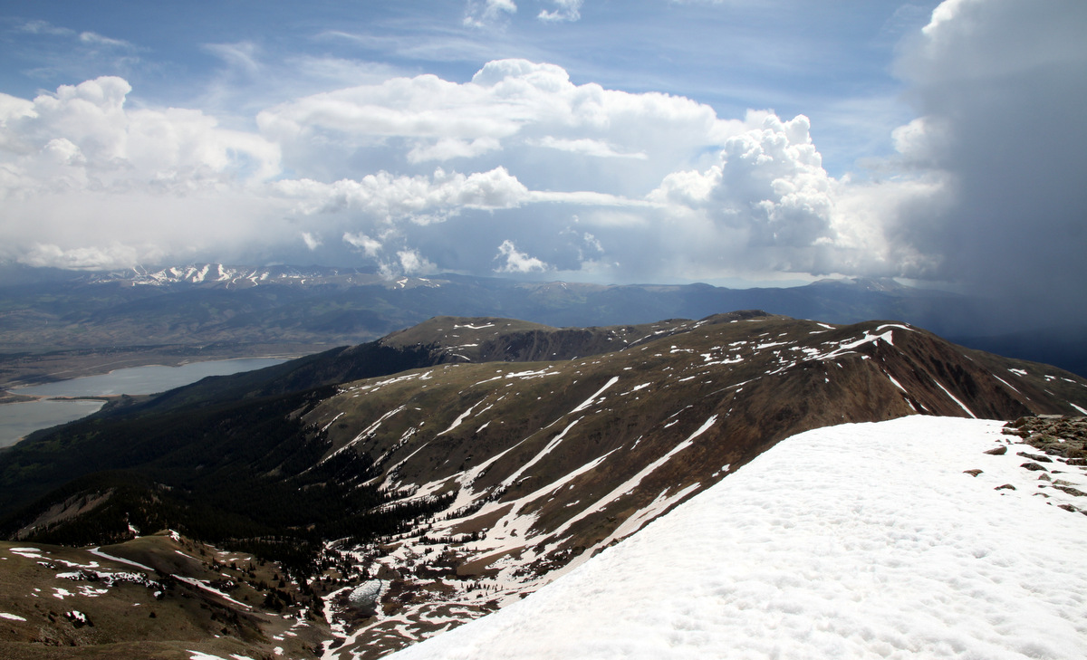
Summit view to the west
Close-up of Grizzly’s North Couloir from Oklahoma’s summit, which we hope to climb/ski in 2 weeks or so
Our beloved Gores in the distance
Mt. Oklahoma summit (13,845′)
Time to ski
My tracks down the awesome low-angle upper 800′ of Oklahoma from the summit
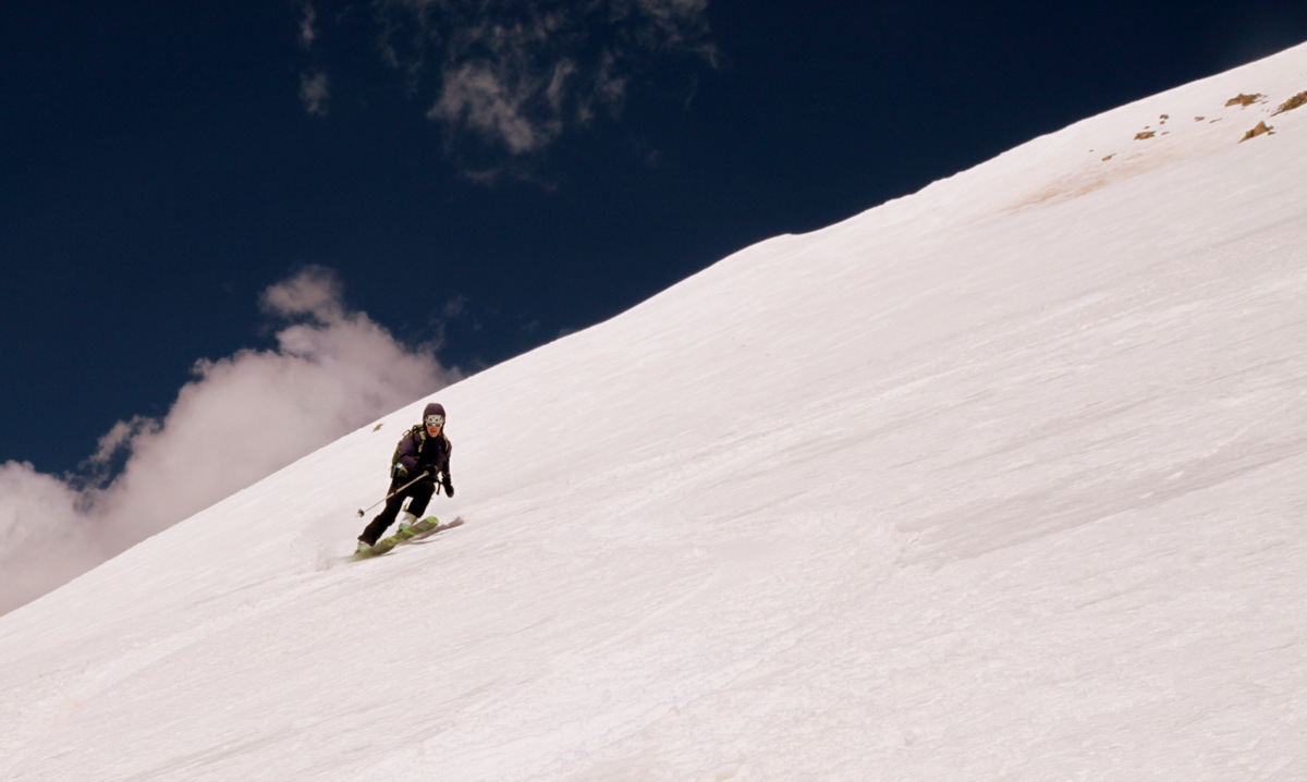
Kristine in great form on the steeper headwall
Kristine enjoying the turns
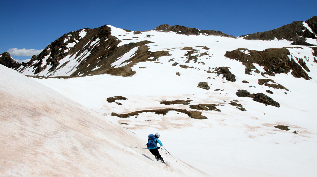
Skiing into the high basin
Our turns down from 13,100′ to the high basin
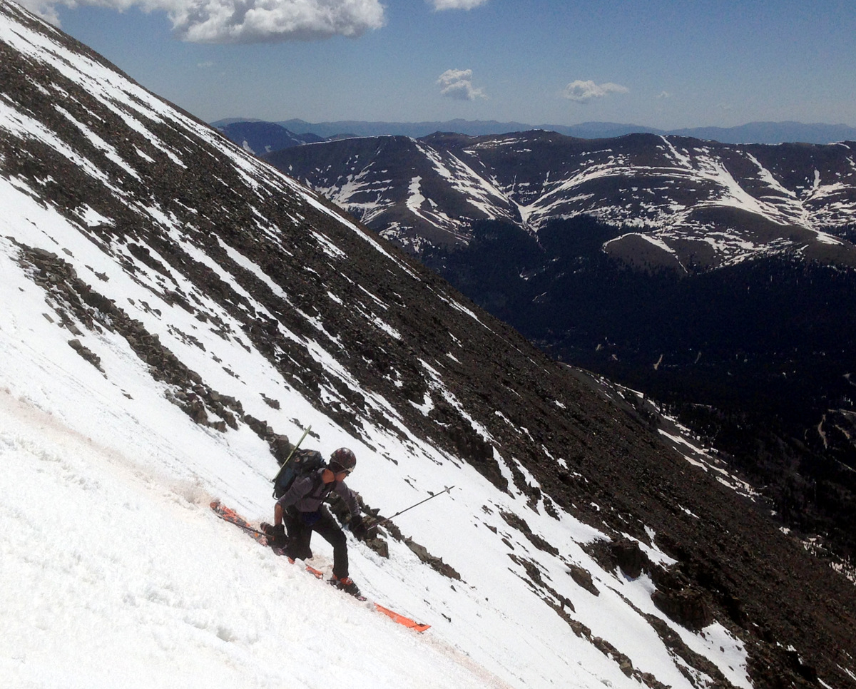
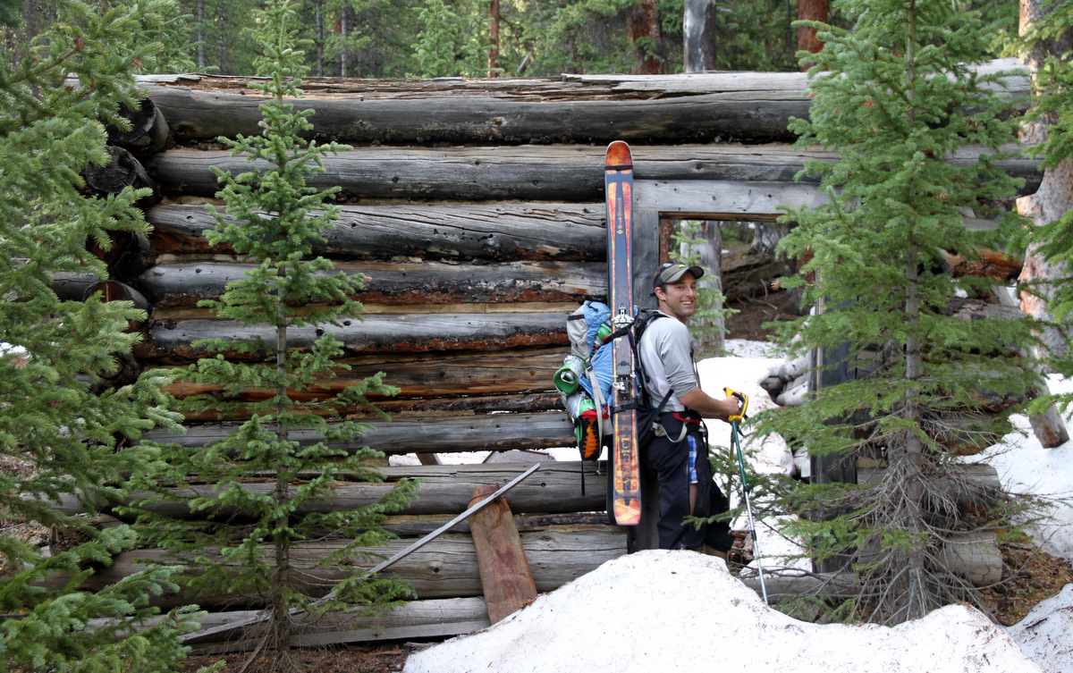
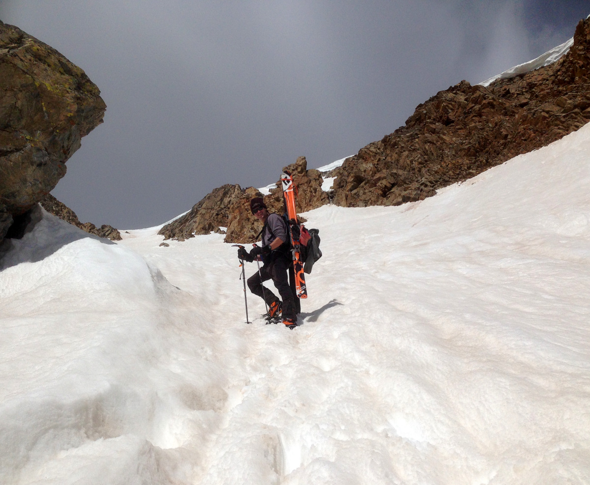
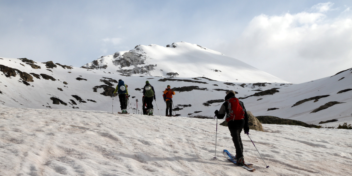
About 7 hours after Kristine and I returned home to Edwards, J and I left for the Leadville area again not really certain on which peak we wanted to hit. We were thinking about Grizzly Peak’s North Couloir, but the Lincoln Creek road was not open yet making for a 12 mile RT day with 5,200′ of elevation gain all above treeline from Independence Pass. With the imposing 50% chance of thunderstorms and snow showers all day, this was probably not a smart idea nor would be all that much fun. Also, my friend Natalie was now going for Oklahoma as they had had a big day up on Castle Peak and wanted something a bit shorter. We were trying to think of a car-camping place on the east side of Independence Pass along Highway 82 when I suggested the Willis Gulch trailhead which leads to the high centennial 13er Mt. Hope. Voila! We will go for the classic Hopeful Couloir on Mt. Hope. This sounded like a better plan as it allowed us to much more easily escape to the cover of treeline should weather roll in. Nevertheless, it was still almost the same stats as Grizzly from Independence Pass at about 11.5 miles RT with 4,700′ of elevation gain. After one of the best night’s sleep I have had in the back of my truck with the tailgate down and the roaring waters of Lake Creek 15 yards away, J and I were off trucking up the Willis Gulch trail around 5:45am in our trail shoes with all our ski gear on our packs. Not knowing where snowline may occur in this north facing gulch, we were prepared to be carrying our gear for a long ways.
On the approach up Willis Gulch to Mt. Hope. J loves old mining cabins
The miles and vertical went fast though and we were at the base of the Hopeful Couloir at about 11,800′ in about 2.5 hours.The Willis Gulch and then Little Willis Gulch trails are good trails and easy to follow until we got into upper Little Willis Gulch where a few snow drifts prompted some route-finding.
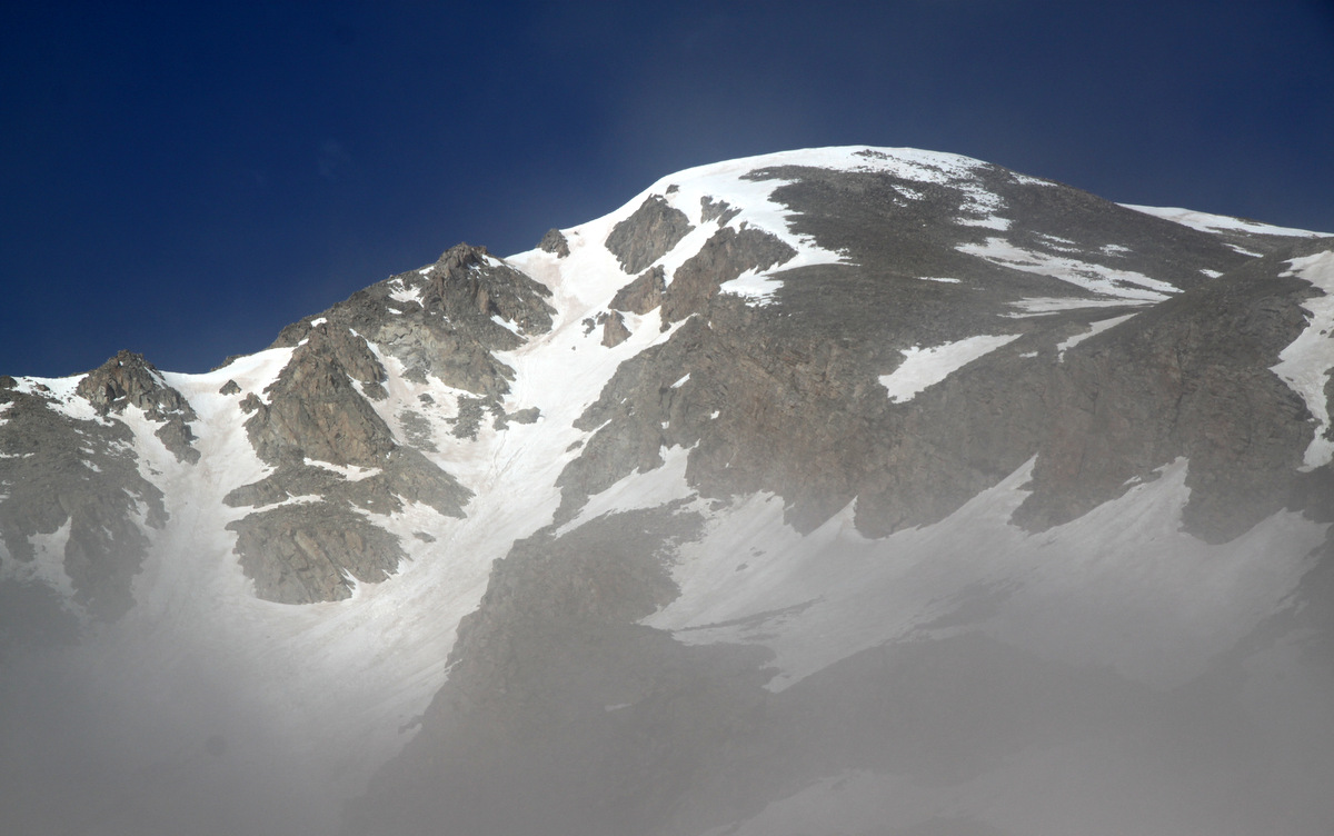
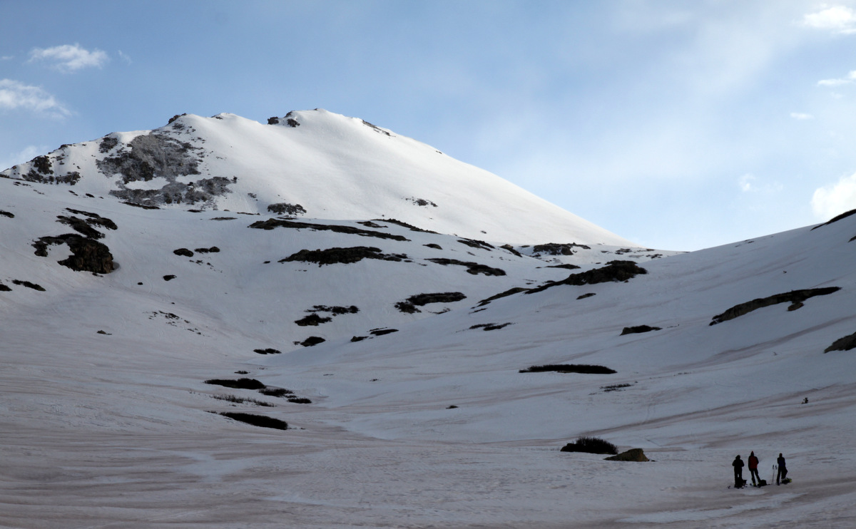
The Hopeful Couloir on Mt. Hope in the morning fog
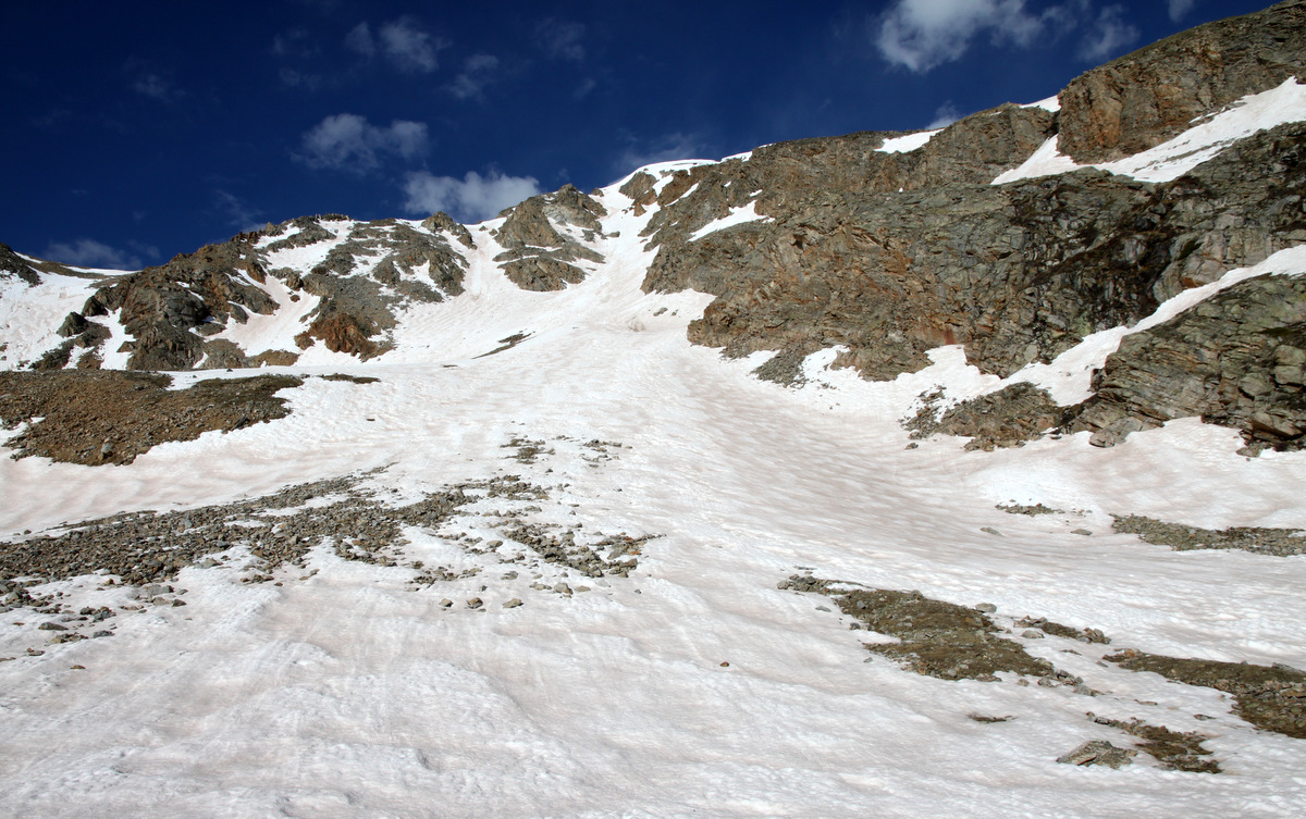
The Hopeful Couloir from 11,800′ at its base
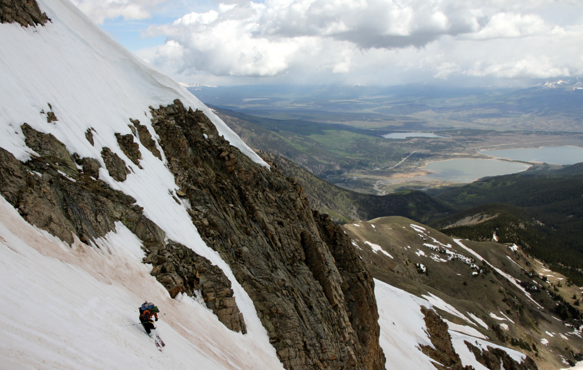
Never donning our skins on our skis, at the base of the couloir we switched trail shoes for ski boots and crampons and away we went booting straight up the Hopeful Couloir. It was a fun climb, a little mushy here and there, but overall good kick-stepping in decent snow. The 2,000′ couloir angle averages around 36 degrees but tops out closer to 50 degrees near the top.
J showing some leg 🙂
In the middle of the Hopeful
J climbing the Hopeful
Steepening a bit
Fun climbing and the weather was holding for the time being
Me climbing up and up
J in the upper section of the couloir
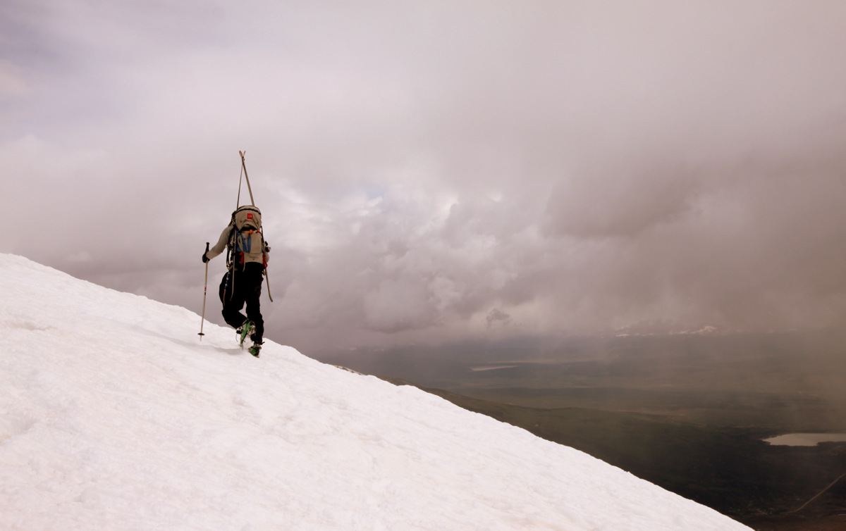
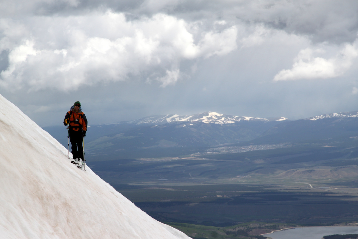
From about 13,800′ at the top of the couloir, we stayed in our crampons and hiked the remaining vertical and distance to Hope’s true summit arriving around 10am.
J on Mt. Hope’s summit ridge with some nasty looking weather behind over Twin Lakes to the north
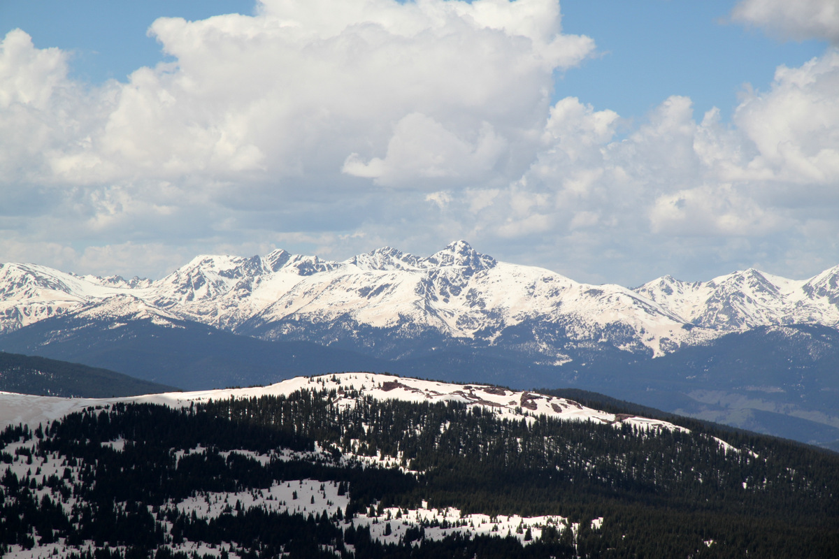
Mt. Elbert to the north from Hope’s summit
Summit of Mt. Hope (13,933′)
Storms over the Belford Group to the south
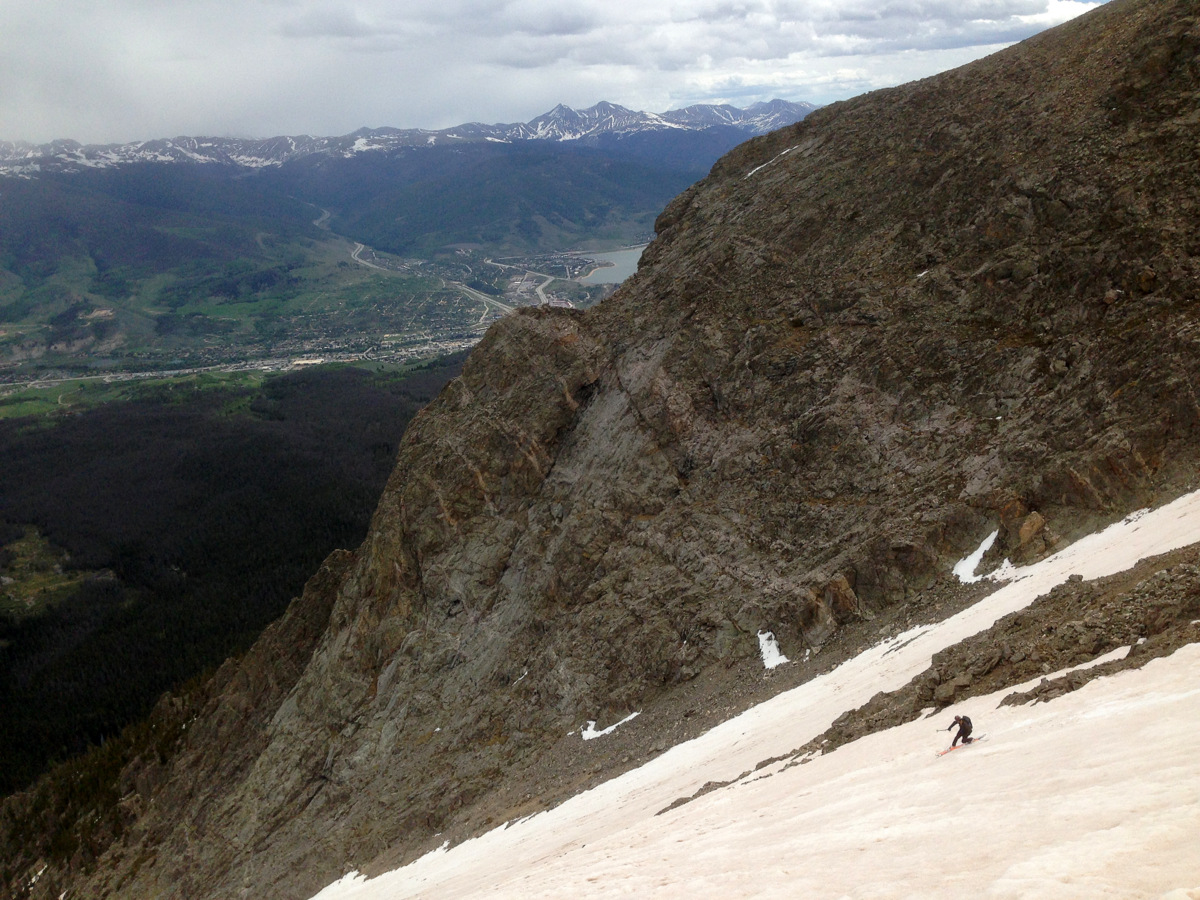
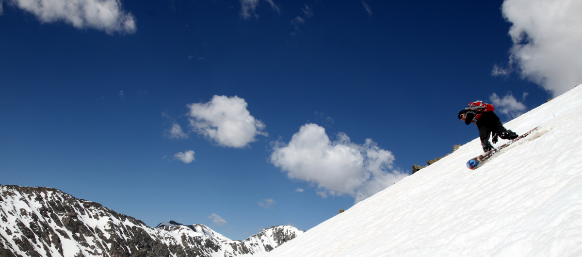
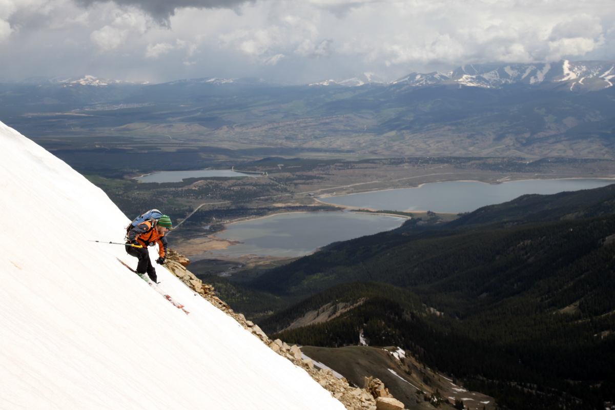
Weather was really building all around us, but Hope’s summit remained clear, sunny, and nice. We only stayed up on the summit for 15 minutes or so and man I am sure glad we did. If we had stayed up there 10 or even 5 minutes longer, we would have gotten thundered and graupeled on while skiing the couloir. We skied down the summit ridge to the steeper Hopeful Couloir descent option (skier’s left) and dropped in on 50 degree terrain only for 100 ft or so (thank goodness!).
Skiing down the summit ridge to the top of the Hopeful Couloir
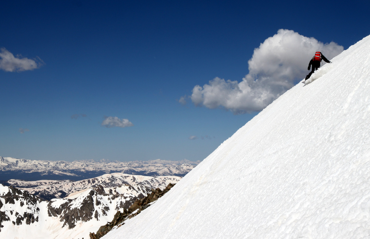
J dropping in
J ripping turns…
…with a gorgeous backdrop
The ski down really was fun on mostly creamy corn snow
I like this one of J
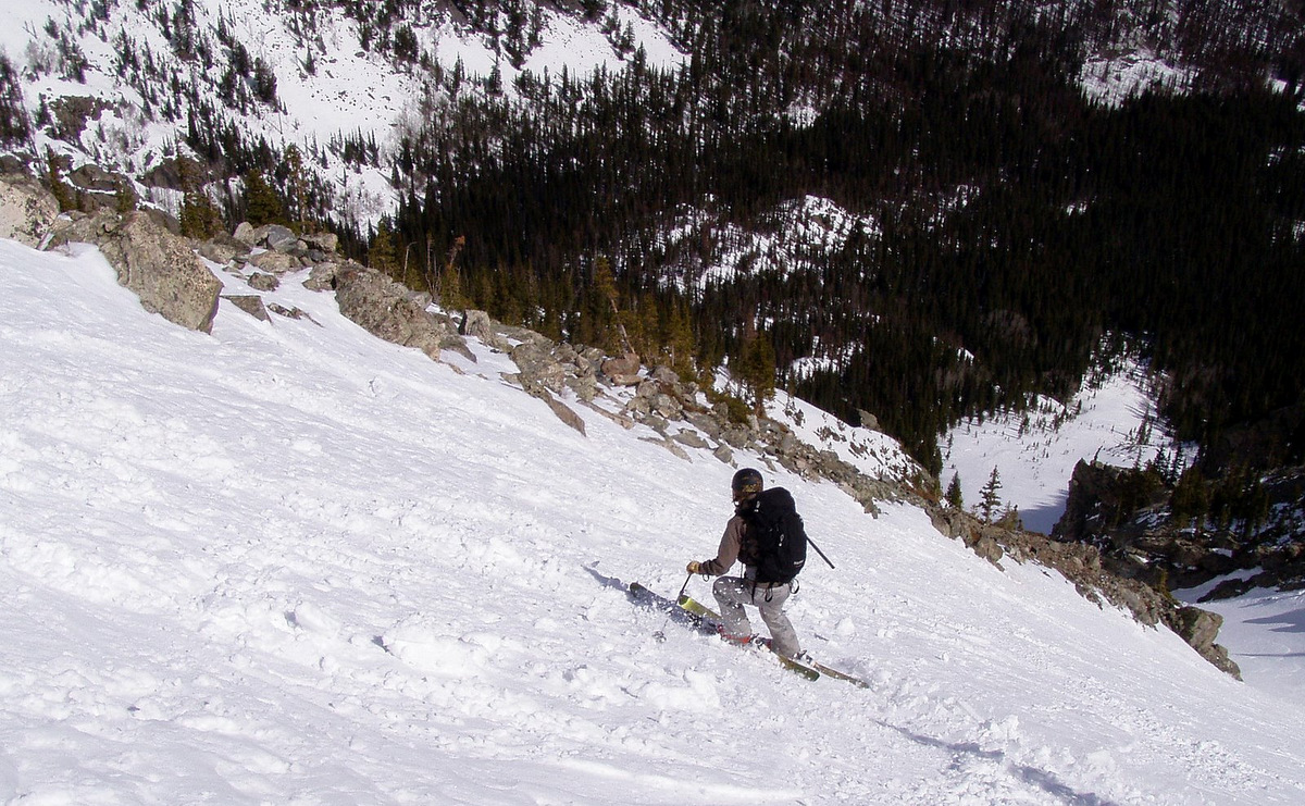
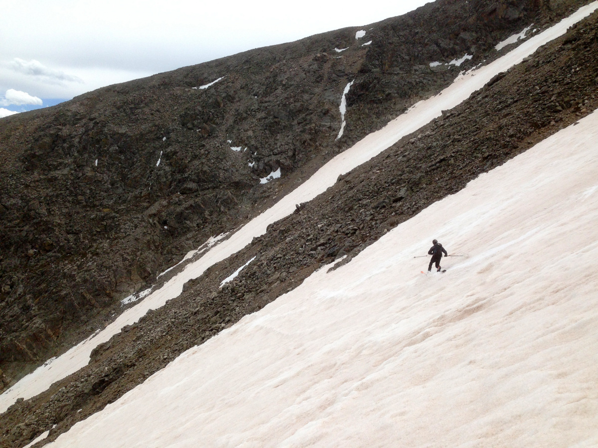
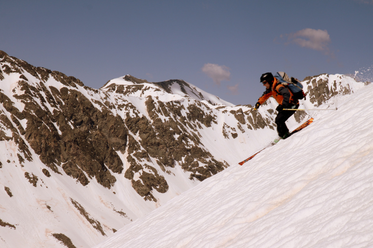
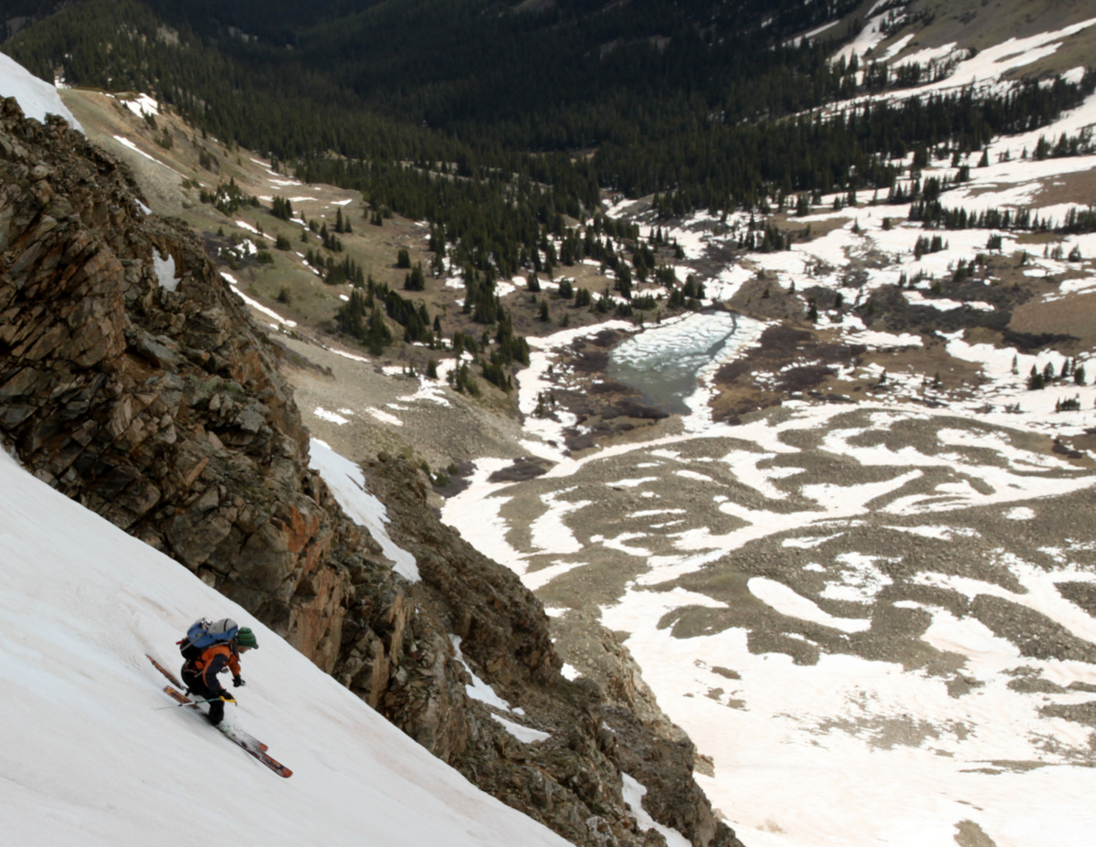
The couloir’s slope angle mellowed out to the 40s and then eventually higher 30s further down. J ripped every turn as usual while I did my best of my teles – I think I did alright. I felt pretty good about it. The snow got a little chunkier towards the bottom from the avalanche debris but overall we timed this ski descent pretty spot on as the snow was nice and soft the entire way down.
J skiing Hopeful with Twin Lakes beyond
So scenic
Looking down on J skiing
A nice perch, buddy
J lower down in the couloir
And out…
Thanks to J’s GoPro footage on his descent of the Hopeful, I put together a fun little video to the tune of my favorite song called Promentory from the soundtrack to Last of the Mohicans (be sure to turn the 1080p HD on):
Just as we skied down below Hope Lake and beyond to treeline, the god of thunder let us know just how insignificant we all are and graupel fell from the heavens at an alarming rate. It actually felt pretty good as long as it didn’t hail and we felt safer now that we were not so high on the mountain and at treeline. Again, the skis and boots went on our packs and we cruised on out of there down Little Willis Gulch in our trail runners.
Mt. Hope and the Hopeful Couloir on the way out
We got a little wet on the hike out, but arrived safe and sound back at my truck around 1:45pm for a wonderful 7 hour day up on Hope.
The Hopeful Couloir shown here in red from Twin Lakes. Mt. Hope’s summit is clouded over
This spring ski-mountaineering thing sure does allow for some awesome days in the hills. I will be sad when the snow recedes to the point of it not being worthwhile at all to bring ski gear anymore. But, that just means the transition to full-on summer with scrambling in our Gores, rock climbing, and trail running. Not bad at all. However, I just have a hunch that the 2014 spring ski-mountaineering season isn’t quite over. But, that’s just me.
I just love spring skiing. Even with the amount of snow we have had this season up to about two weeks ago, the warm temps all last week have put a serious hurting on our snowpack. However, I still think we have a few weekends left yet for some decent lines and spring ski tours.The temps this past weekend were very warm as well not even allowing the snowpack to freeze at night. This typical nightly freeze allows for a safer spring freeze-thaw corn cycle during the morning hours when one would want to ski steeper lines and couloirs.
Having been under the weather all week, I still felt like getting out for a shorter ski tour. So, on Saturday my good bud Mikey and I went and checked out the snowpack on the familiar terrain up on Uneva Peak north of Vail Pass. Any time we can skin from the car is worth it in my eyes. We ended up skiing a steeper gully off Uneva’s south side into the western of the two Uneva bowls, one we rarely venture to during the winter because of the steeper slopes and greater chance for avalanche activity.
Looking down our little gully line into Uneva’s western bowl
Mikey starting down the gully
Skiing the gully
It was a fun albeit short gully down to the dirt-ridden bowl from which we skinned back up to the ridge and skied down the mellower eastern Uneva bowl, which we typically ski several times a year.
Our tracks down the gully
Our line shown in red down the gully to the western Uneva bowl
Mikey skinning back to the ridge
Storm over the Tenmile Range
View west to Mt. of the Holy Cross and its Cross Couloir, which good friends J, Derek, & Brett were skiing the next day. Wish I could have joined them, but being sick all week definitely didn’t put me in prime form for a 30 mile roundtrip expedition. Hopefully, I can get it in a few weeks when Tigiwon Road opens
And, the very mellow eastern Uneva bowl we skied out
We were initially thinking of skiing down the north side of the peak, but there was so much avalanche debris and fairly significant cornices, it didn’t look all that safe nor all that fun. A nice 3 hour roundtrip tour up on Uneva was just what the doctor ordered and I felt a lot better afterwards.
A few hour later Kristine, Mikey, and I headed down south of Leadville to camp along County Road 390 at a 14ers.com spring gathering in hopes of skiing the Hopeful Couloir on the high centennial 13er Mt. Hope on Sunday. We found our friends Shawn, Jenn, & canine Fitzy in the dark and met up with friend Natalie who wanted to ski Hope with us the next day. However, after learning of the recent Hopeful Couloir beta (runnels and avalanche debris) and the non-freezing nature of the snowpack at night, we decided to turn our efforts to Independence Pass and the two 13ers, East & West Geissler Peaks, were at the top of the list. This ski tour of the Geisslers is a local Aspen favorite and is featured in my friends’ Ben & Brian’s new book Climbing and Skiing Colorado’s Mountains: 50 Select Ski Descents. Upon leaving camp around 6am the next morning, we drove up to the top of Indy Pass and down to the Highway 82 pull-off 1.8 miles west of the top of the pass. The weather was really not what was forecasted (sunny and bluebird). It was lightly snowing, the wind was blowing, and extremely overcast. There was even the occasional group that was coming back to the cars after having skinned up the valley for 20 minutes who said they were going for a bike ride instead. Nevertheless, we’ve hardly ever experienced a day in Colorado that is forecasted to be beautiful but never turns bluebird and sunny. As fortune would have it, the sun came out and the clouds parted about 45 minutes later much to all of our relief.
Skinning up the gulch towards Independence Lake. East Geissler’s south face looms above
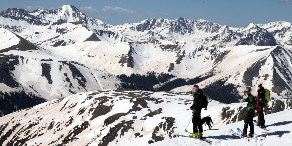
Shawn, Jenn, & Mike with East Geissler
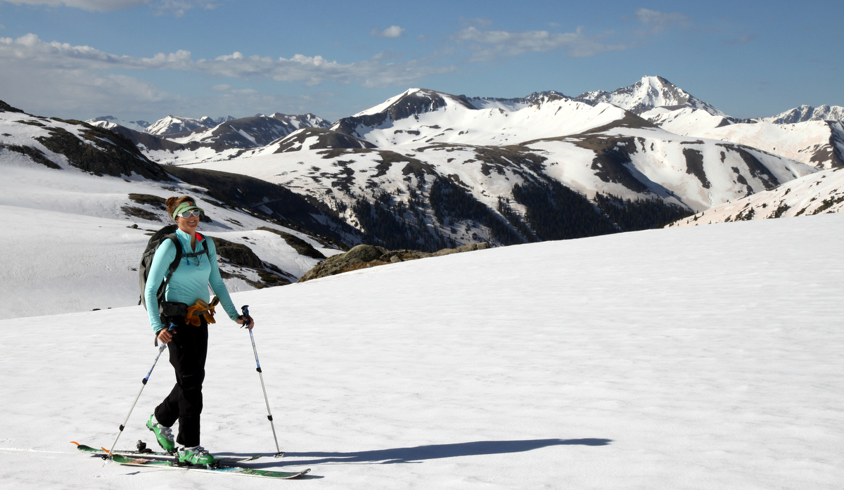
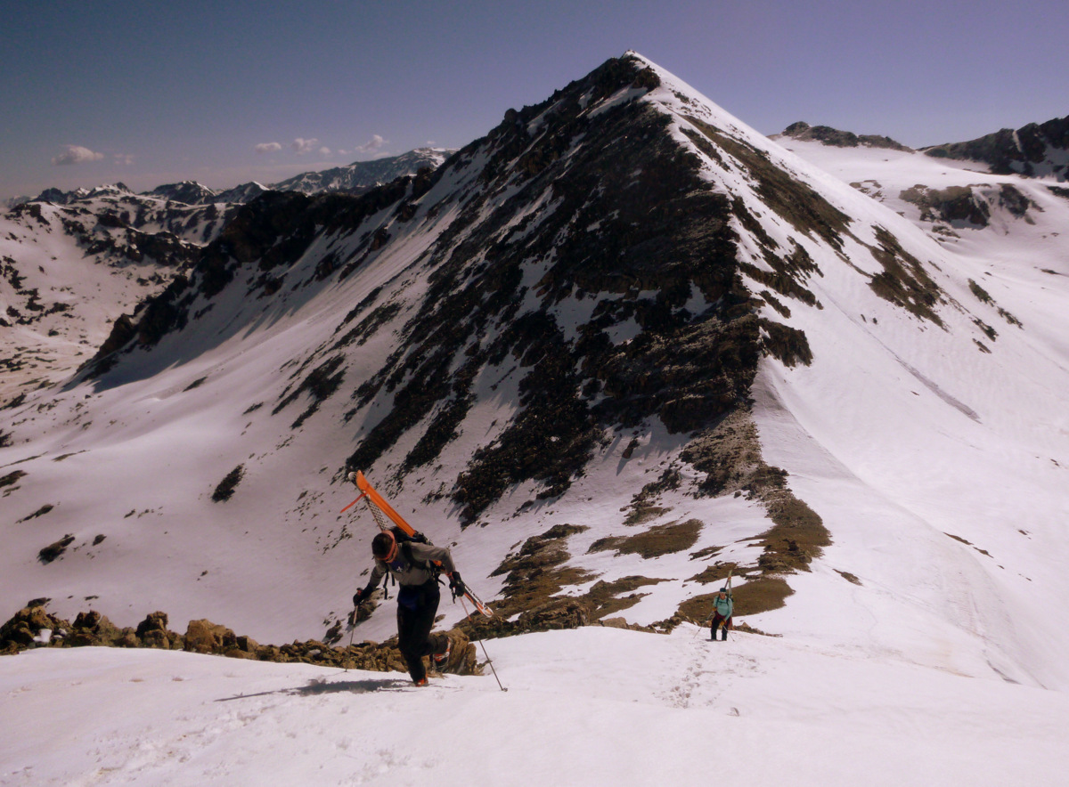
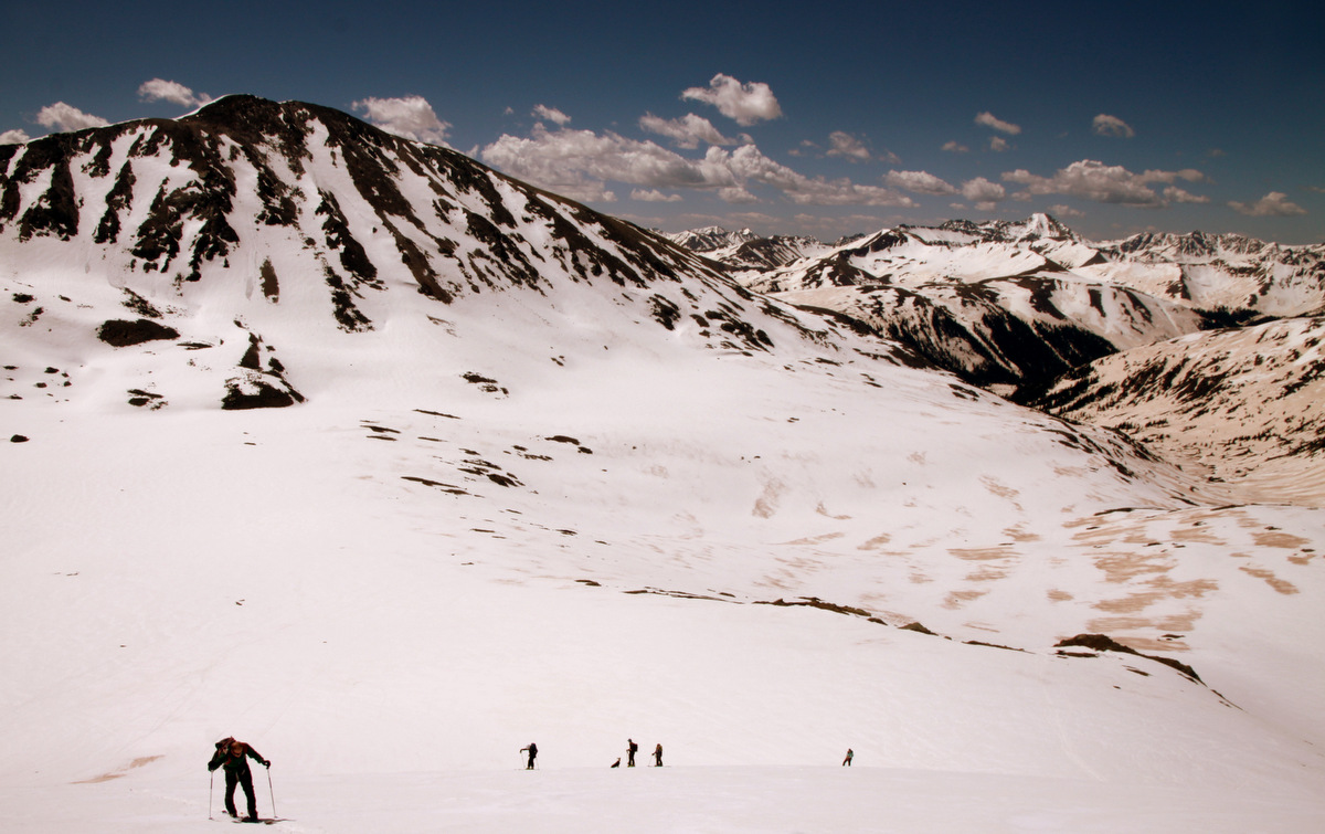
These peaks really are “skier” peaks. So very accessible (when Independence Pass is open) and plenty of skiing can be had from steeper lines to more manageable 35 degree terrain. We decided to go for West Geissler first as the line we would ski is more east facing and would likely soften up first with the morning rays of sun. Kristine, being about 5 months pregnant now, did absolutely amazing and is such a trooper. Everyone was in awe that she was able to climb and ski two 13ers this day. Kudos to her for still wanting to get out and do these kinds of trips all the while growing another human being inside her belly. Amazing, really.
Kristine skinning along with Grizzly Peak A’s north couloir in the distance
Kristine climbing West Geissler’s east ridge with East Geissler, our next objective, behind
Kristine
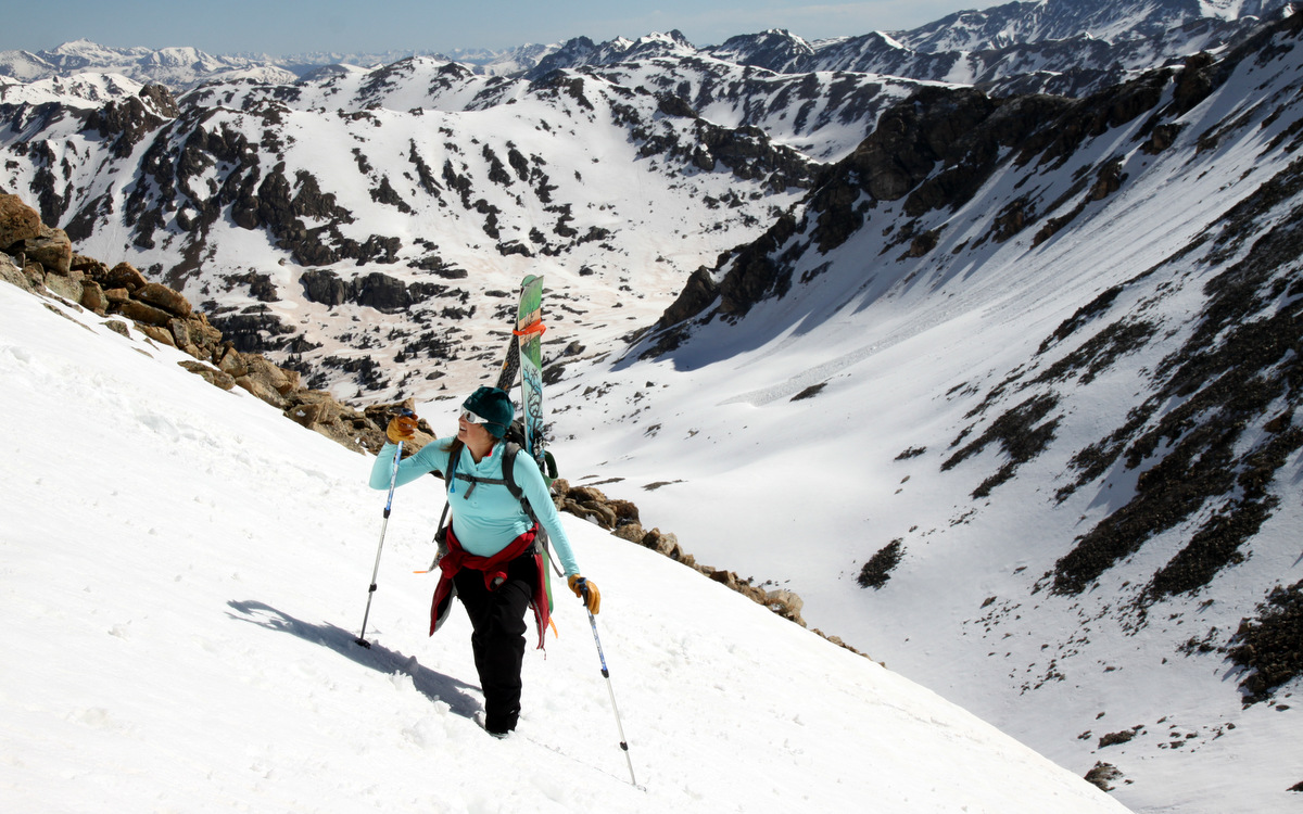
Kristine & I booting up West Geissler. Photo by Natalie
West Geissler summit ridge
It was a nice morning skin to the saddle between the two Geisslers and then a straightforward bootpack up West Geissler’s east ridge to its summit. It really turned out to be a gorgeous day.
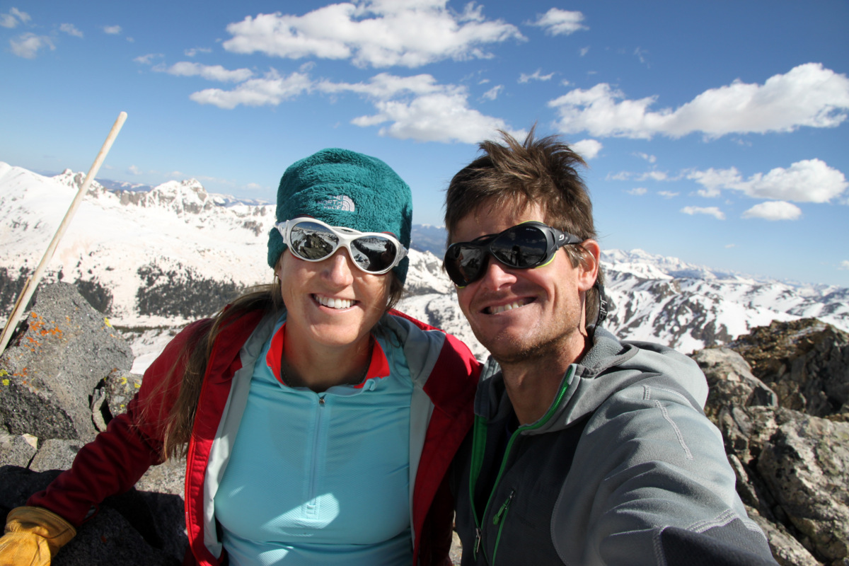
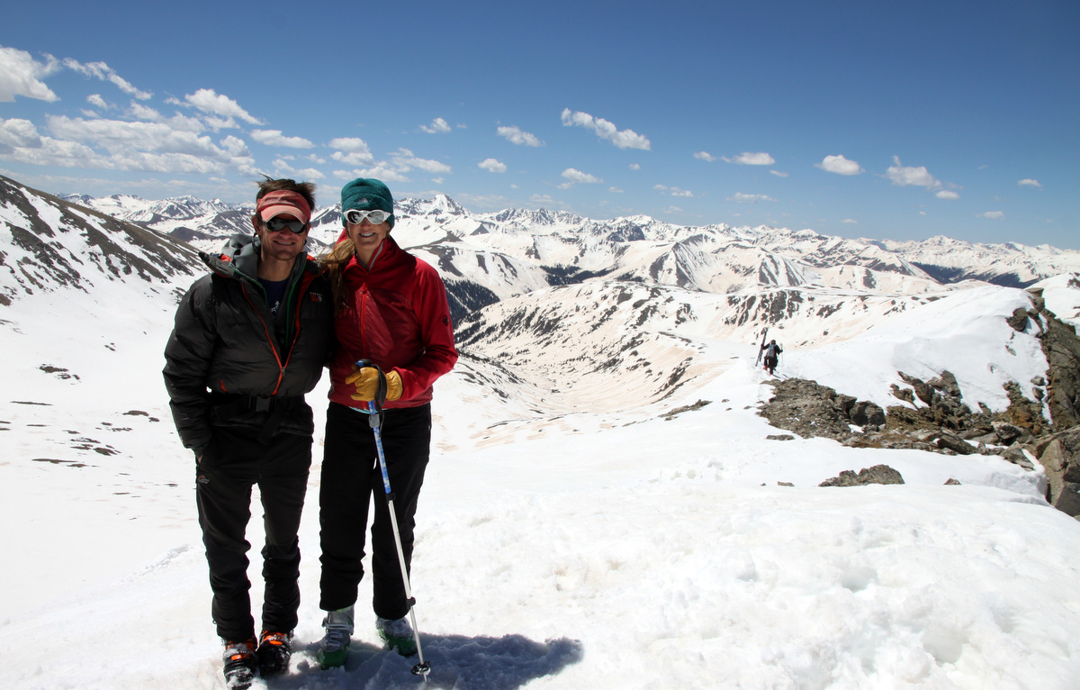
Kristine & I on the summit of West Geissler Peak (13,301′)
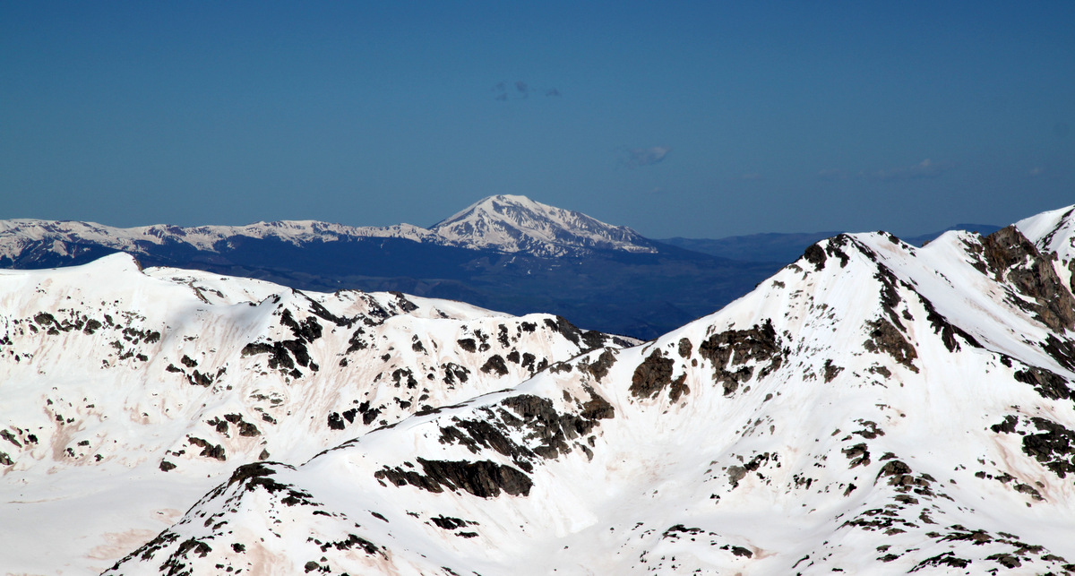
Mt. Sopris
The Elk Range
Lookin’ good!
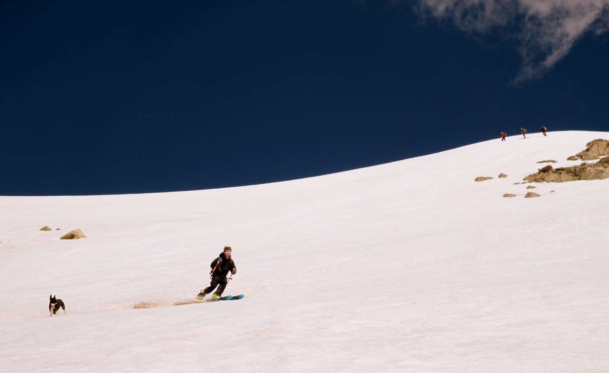
Natalie and new acquaintance Otina decided to ski the much steeper 50+ degree line directly off the summit while the rest of us (having not brought helmets or whippets and my wife being 5 months pregnant) elected to ski the mellower sub 40 degree east-facing slopes after a short ski traverse. It was a fun ski line and the snow was pretty good and soft after a few turns down.
Shawn, Jenn, Mike, & Fitzy at the top of our ski line
Shawn & Fitzy skiing West Geissler’s east face
Kristine enjoying the fun day
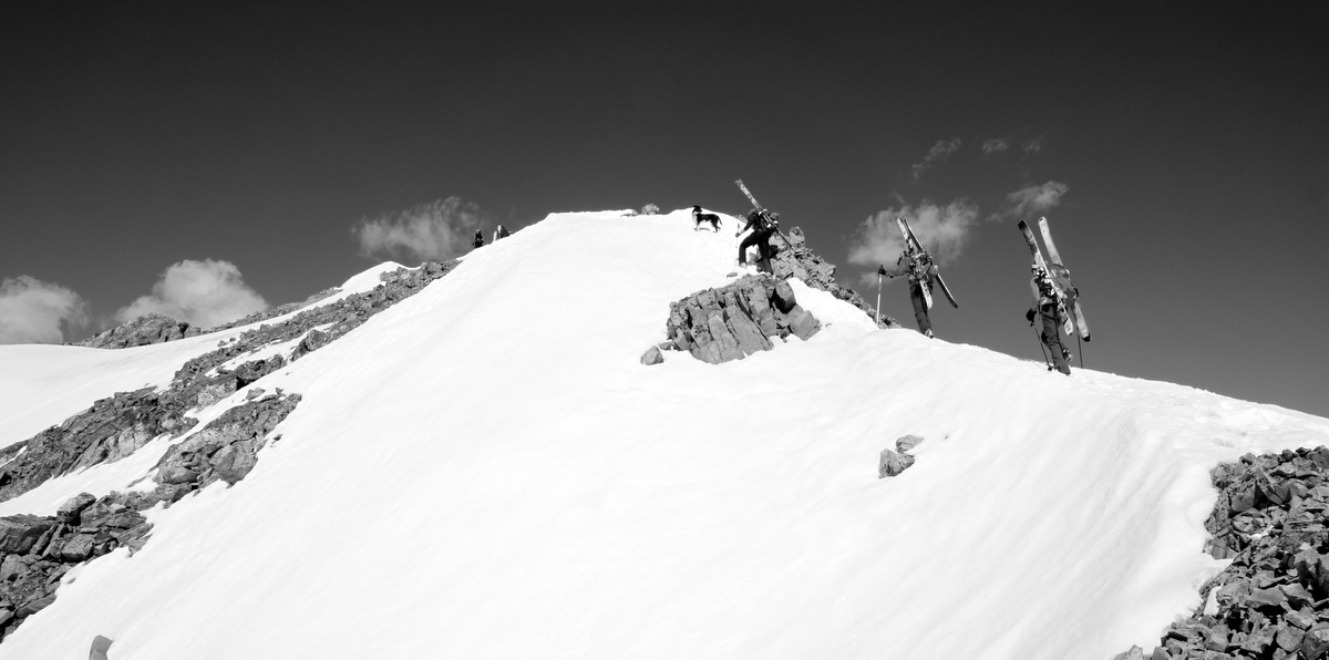
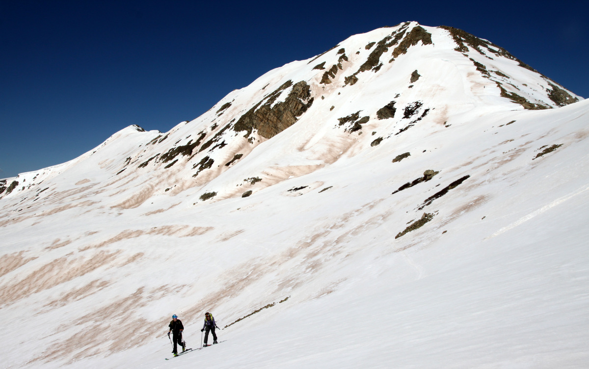
We quickly skied over to the base of East Geissler and began laying down a skin track up its mid 30 degree south face. By this time, the crowds certainly started showing up and I bet at one time there was 20-30 people climbing & skiing East Geissler.
Shawn & Jenn traversing over from West Geissler (behind) to begin the skin up East Geissler
The crew skinning up the south face of East Geissler
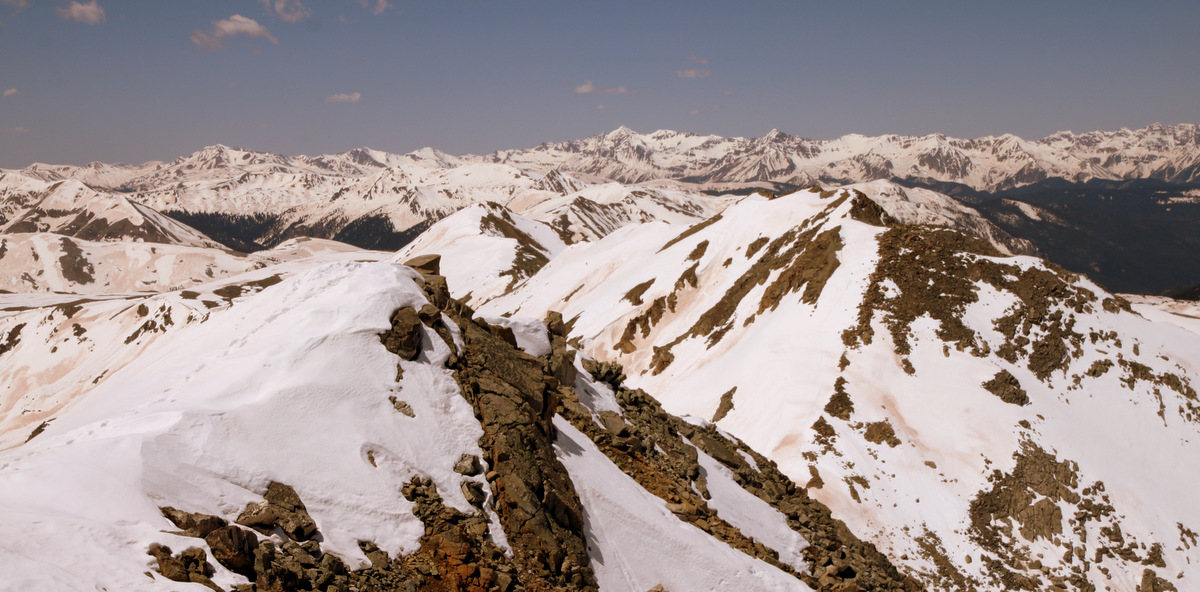
We topped out maybe around 11am and enjoyed the sunshine and views despite a semi-stiff breeze.
View to West Geissler from East Geissler’s summit
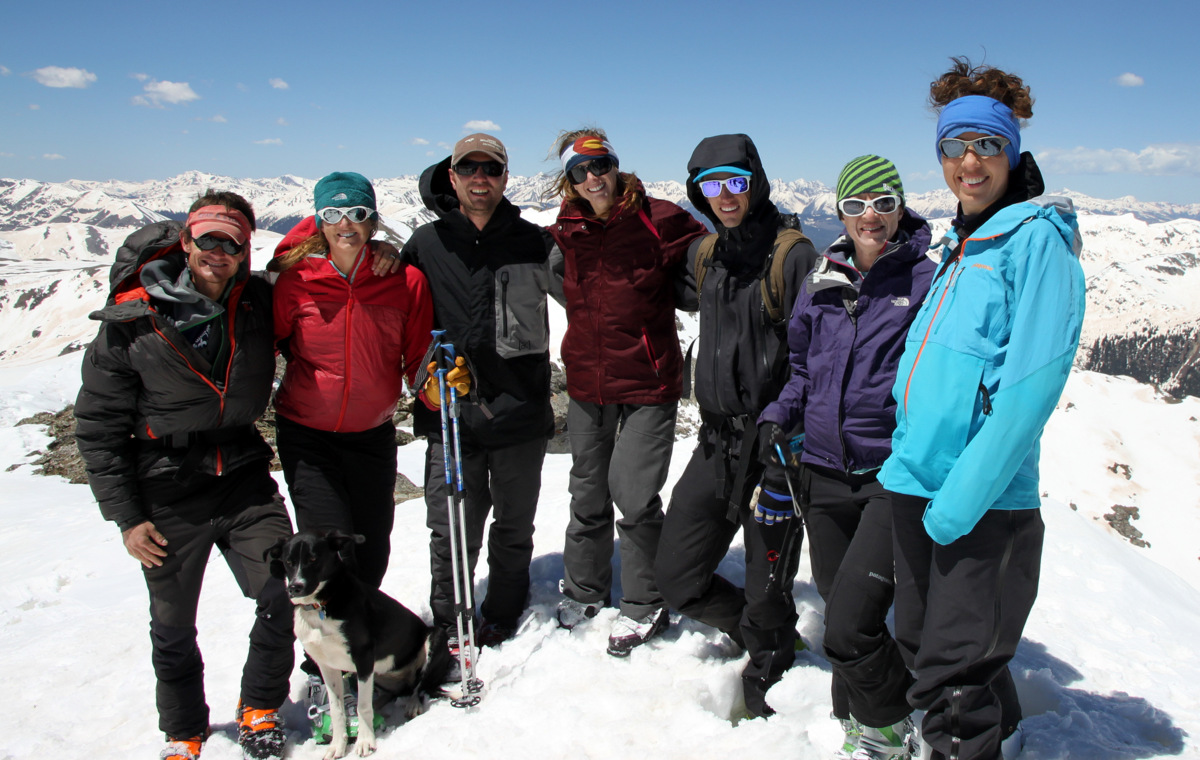
Summit of East Geissler Peak (13,380′)
Chalks on East Geissler
After a few photos we strapped in and skied far skier’s left down the south face of East Geissler where there were no previous ski tracks that day.
Looking down our line off East Geissler. Photo by Natalie
Me skiing down the face. Thanks to Kristine for the pics
So fun
Loving life!
Sorry, one more of me 🙂
Natalie
Jenn
Shawn & Fitzy
Otina
East Geissler’s south face
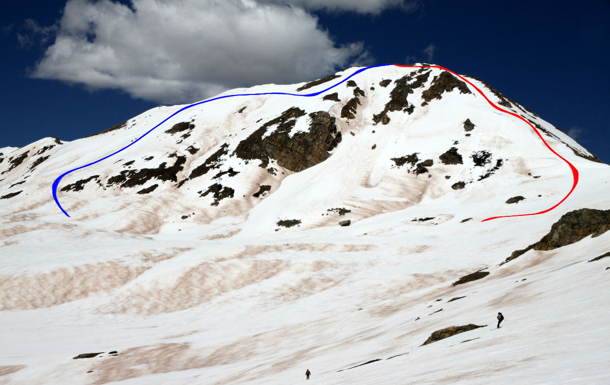
On the ski out the gulch our ascent line shown in red and ski descent in blue could be seen on West Geissler
This was really just plain fun skiing and we all skied about 1,200′ down to Independence Lake from where we skied out the gulch back to the cars. The dirt layer was pretty significant in the basin and on several aspects, but we were able to avoid it for the most part on the actual skis themselves.
Kristine on the ski out with the Geisslers behind
Back at the cars around 12:30pm, we packed up and headed back home to grab the dogs from our friend Kathryn. A great morning out for us on some new terrain with a good crew. I, for one, am so proud of Kristine and feel so fortunate to be able to do what we love together even while pregnant. Here’s a to a few more weeks of spring ski-mountaineering season!


 Follow